there are 2 types: i. az/alt. -the horizontal coordinate system is a celestial coordinate system...
TRANSCRIPT
Astronomical Coordinate Systems
Coordinate Systems
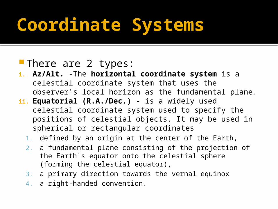
There are 2 types:i. Az/Alt. -The horizontal coordinate system is a
celestial coordinate system that uses the observer's local horizon as the fundamental plane.
ii. Equatorial (R.A./Dec.) - is a widely used celestial coordinate system used to specify the positions of celestial objects. It may be used in spherical or rectangular coordinates
1. defined by an origin at the center of the Earth, 2. a fundamental plane consisting of the projection of the
Earth's equator onto the celestial sphere (forming the celestial equator),
3. a primary direction towards the vernal equinox 4. a right-handed convention.
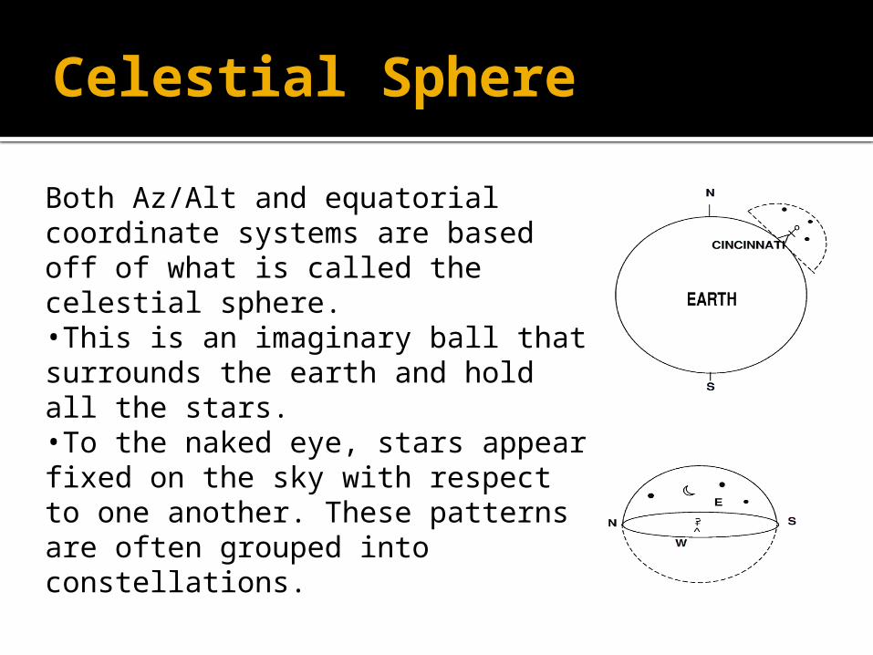
Celestial Sphere
Both Az/Alt and equatorial coordinate systems are based off of what is called the celestial sphere. •This is an imaginary ball that surrounds the earth and hold all the stars.•To the naked eye, stars appear fixed on the sky with respect to one another. These patterns are often grouped into constellations.
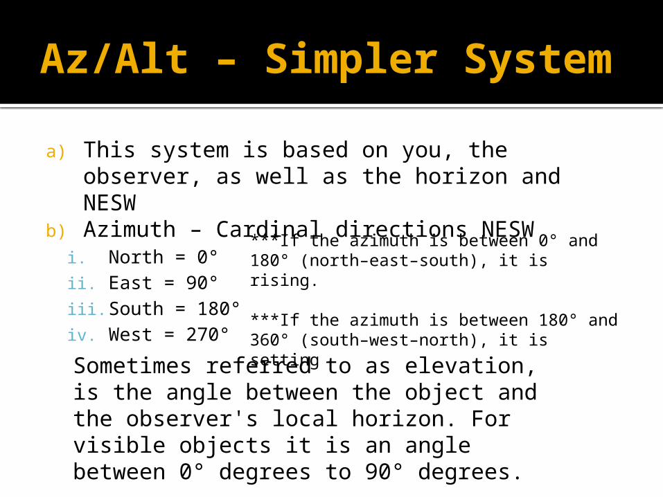
Az/Alt – Simpler System
a) This system is based on you, the observer, as well as the horizon and NESW
b) Azimuth – Cardinal directions NESWi. North = 0°ii. East = 90°iii. South = 180°iv. West = 270°
Sometimes referred to as elevation, is the angle between the object and the observer's local horizon. For visible objects it is an angle between 0° degrees to 90° degrees.
***If the azimuth is between 0° and 180° (north–east–south), it is rising.
***If the azimuth is between 180° and 360° (south–west–north), it is setting
Az/Alt – Simpler System
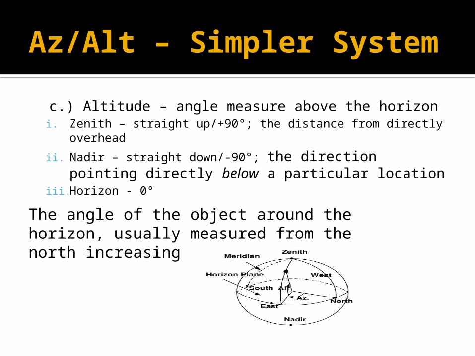
c.) Altitude – angle measure above the horizoni. Zenith – straight up/+90°; the distance from directly
overhead
ii. Nadir – straight down/-90°; the direction pointing directly below a particular location
iii. Horizon - 0°The angle of the object around the horizon, usually measured from the north increasing towards the east.
Problems
Coordinates change as your change locations
Coordinates of stars change as they move across the night sky
Requires time and location for other people to determine the stars you were looking at
Bell Ringer #6
What are the 2 components that make up the horizontal coordinate system?
Which component of the horizontal coordinate system measure from 0°
to 360°? Which component from the horizontal
coordinate system measures from -90° to +90°?
Name all the cardinal directions used in the horizontal coordinate system.
Azimuth and Altitude Azimuth Altitude NESW
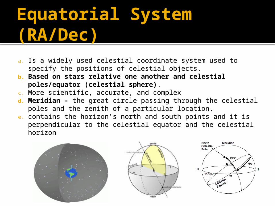
Equatorial System (RA/Dec)a. Is a widely used celestial coordinate system used to specify
the positions of celestial objects.b. Based on stars relative one another and celestial
poles/equator (celestial sphere).c. More scientific, accurate, and complexd. Meridian - the great circle passing through the celestial
poles and the zenith of a particular location. e. contains the horizon's north and south points and it is
perpendicular to the celestial equator and the celestial horizon
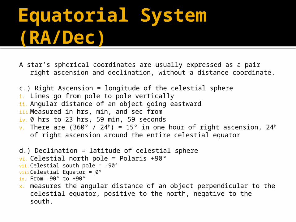
Equatorial System (RA/Dec)A star’s spherical coordinates are usually expressed as a pair right
ascension and declination, without a distance coordinate.
c.) Right Ascension = longitude of the celestial spherei. Lines go from pole to pole verticallyii. Angular distance of an object going eastwardiii. Measured in hrs, min, and sec fromiv. 0 hrs to 23 hrs, 59 min, 59 secondsv. There are (360° / 24h) = 15° in one hour of right ascension, 24h of
right ascension around the entire celestial equator
d.) Declination = latitude of celestial spherevi. Celestial north pole = Polaris +90°vii. Celestial south pole = -90°viii. Celestial Equator = 0°ix. From -90° to +90°x. measures the angular distance of an object perpendicular to the
celestial equator, positive to the north, negative to the south.
Problems
More complex Requires a star or two for star taking
data
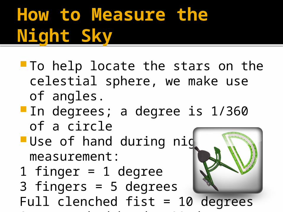
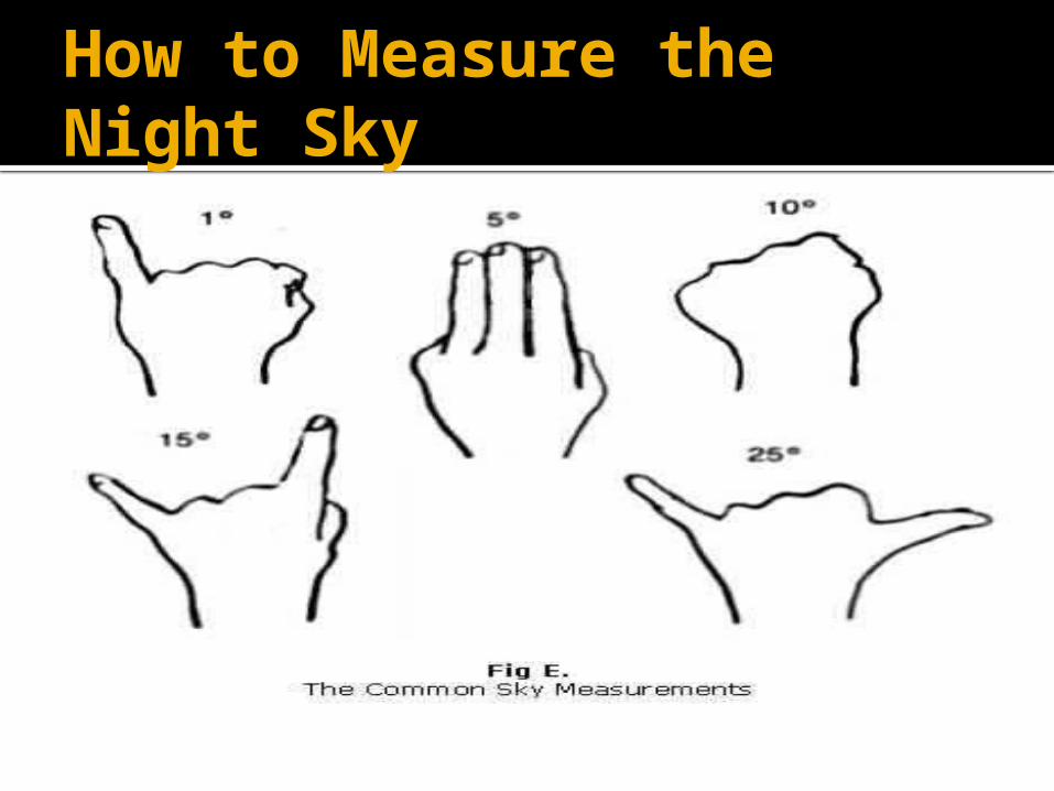
How to Measure the Night Sky
To help locate the stars on the celestial sphere, we make use of angles.
In degrees; a degree is 1/360 of a circle
Use of hand during night sky measurement:
1 finger = 1 degree3 fingers = 5 degreesFull clenched fist = 10 degreesOutstretched hand = 20 degrees
How to Measure the Night Sky
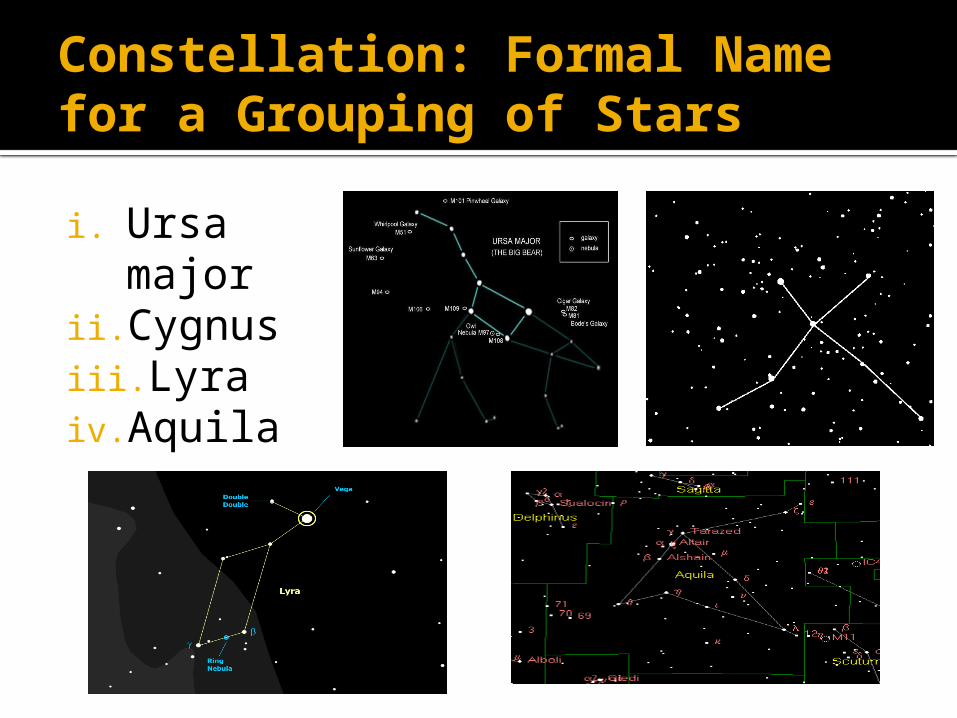
Constellation: Formal Name for a Grouping of Stars
i. Ursa major
ii. Cygnusiii. Lyraiv. Aquila
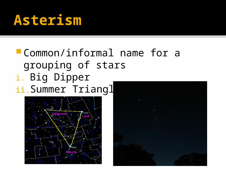
Asterism
Common/informal name for a grouping of stars
i. Big Dipperii. Summer Triangle