€¦ · web viewa few fast food establishments such as jollibee, ... the gates are called either...
TRANSCRIPT
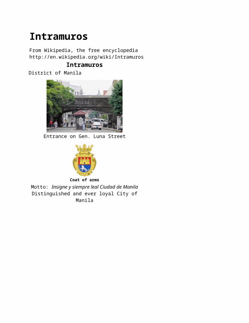
IntramurosFrom Wikipedia, the free encyclopediahttp://en.wikipedia.org/wiki/Intramuros
IntramurosDistrict of Manila
Entrance on Gen. Luna Street
Coat of armsMotto: Insigne y siempre leal Ciudad de Manila
Distinguished and ever loyal City of Manila
Map of the present territory of the City of Manila, with Intramuros highlighted in yellow
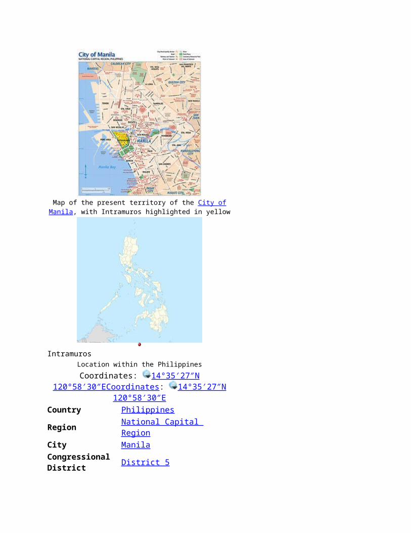
IntramurosLocation within the Philippines
Coordinates: 14°35′27″N 120°58′30″E Coordinates : 14°35′27″N 120°58′30″E
Country PhilippinesRegion National Capital RegionCity ManilaCongressional District District 5
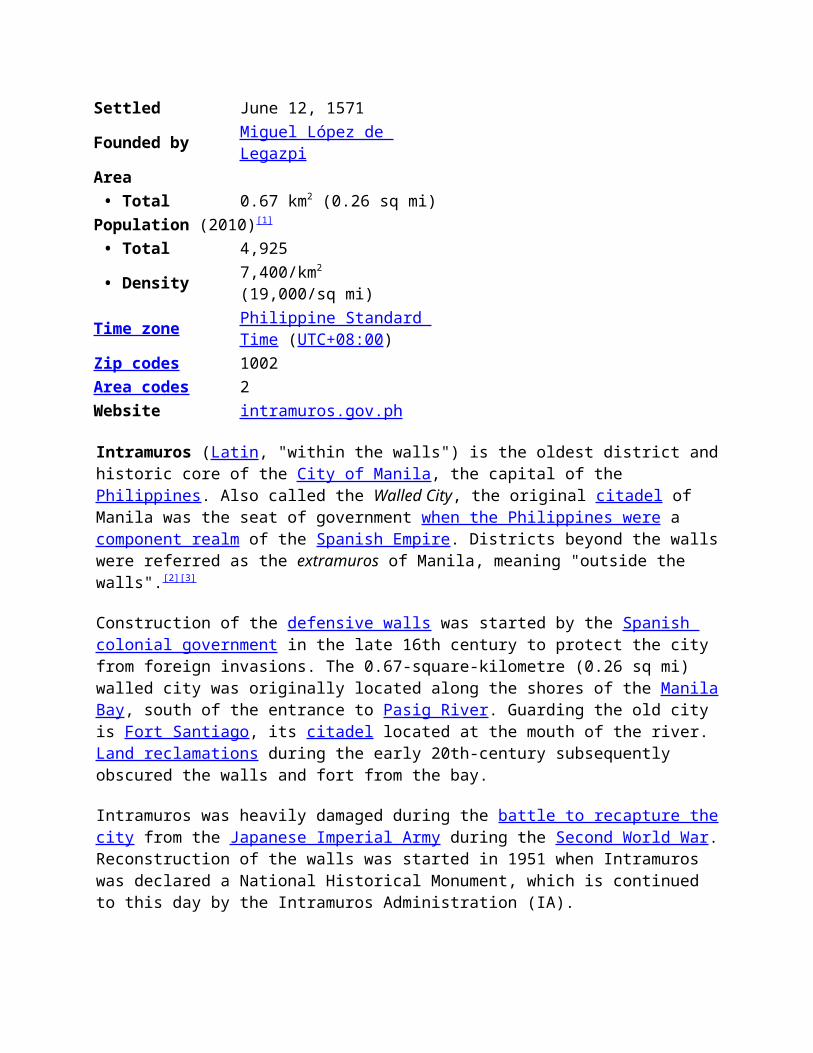
Settled June 12, 1571Founded by Miguel López de LegazpiArea • Total 0.67 km2 (0.26 sq mi)Population (2010)[1]
• Total 4,925 • Density 7,400/km2 (19,000/sq mi)
Time zone Philippine Standard Time (UTC+08:00)
Zip codes 1002Area codes 2Website intramuros.gov.ph
Intramuros (Latin, "within the walls") is the oldest district and historic core of the City of Manila, the capital of the Philippines. Also called the Walled City, the original citadel of Manila was the seat of government when the Philippines were a component realm of the Spanish Empire. Districts beyond the walls were referred as the extramuros of Manila, meaning "outside the walls".[2][3]
Construction of the defensive walls was started by the Spanish colonial government in the late 16th century to protect the city from foreign invasions. The 0.67-square-kilometre (0.26 sq mi)
walled city was originally located along the shores of the Manila Bay, south of the entrance to Pasig River. Guarding the old city is Fort Santiago, its citadel located at the mouth of the river. Land reclamations during the early 20th-century subsequently obscured the walls and fort from the bay.
Intramuros was heavily damaged during the battle to recapture the city from the Japanese Imperial Army during the Second World War. Reconstruction of the walls was started in 1951 when Intramuros was declared a National Historical Monument, which is continued to this day by the Intramuros Administration (IA).
The Global Heritage Fund identified Intramuros as one of the 12 worldwide sites "on the verge" of irreparable loss and destruction on its 2010 report titled Saving Our Vanishing Heritage,[4] citing its insufficient management and development pressures.[5]
Contents 1 History
o 1.1 Pre-Hispanic period
o 1.2 Spanish colonial period
1.2.1 Spanish conquest of Manila
1.2.2 Construction of the wall
1.2.3 Inside colonial Intramuros
1.2.4 Physical features of the wall
1.2.5 Defense structures
1.2.6 Gates of Intramuros
o 1.3 American colonization
o 1.4 World War II
o 1.5 Rehabilitation and the Intramuros Administration
2 Present day Intramuros
o 2.1 Educational institutions
o 2.2 Churches
3 Structures before and after World War II
o 3.1 Churches
o 3.2 Schools and convents
o 3.3 Other buildings
4 Political subdivision
5 Gallery
6 See also
7 References
8 Sources
9 External links
History
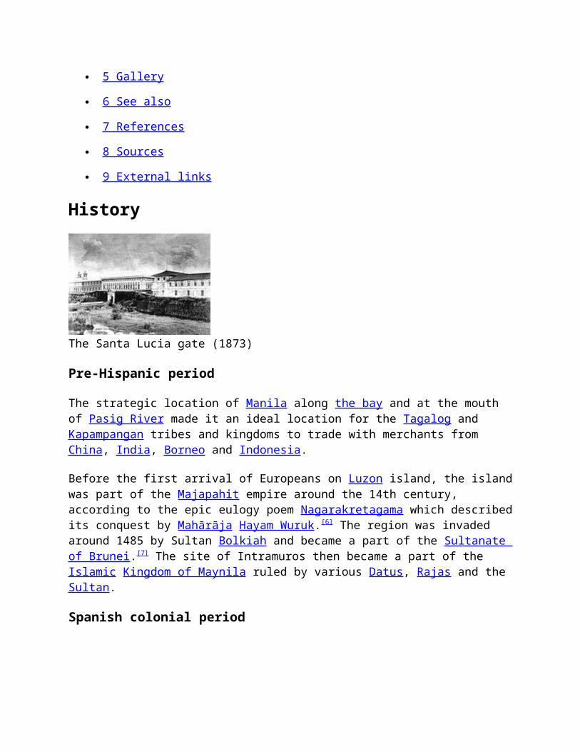
The Santa Lucia gate (1873)
Pre-Hispanic period
The strategic location of Manila along the bay and at the mouth of Pasig River made it an ideal location for the Tagalog and Kapampangan tribes and kingdoms to trade with merchants from China, India, Borneo and Indonesia.
Before the first arrival of Europeans on Luzon island, the island was part of the Majapahit empire around the 14th century, according to the epic eulogy poem Nagarakretagama which described its conquest by Mahārāja Hayam Wuruk.[6] The region was invaded around 1485 by Sultan Bolkiah and became a part of the Sultanate of Brunei.[7] The site of Intramuros then became a part of the Islamic Kingdom of Maynila ruled by various Datus, Rajas and the Sultan.
Spanish colonial period
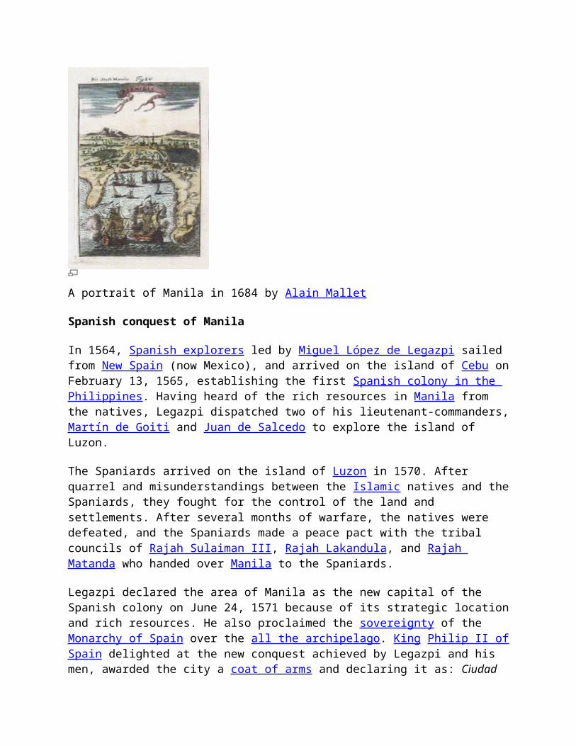
A portrait of Manila in 1684 by Alain Mallet
Spanish conquest of Manila
In 1564, Spanish explorers led by Miguel López de Legazpi sailed from New Spain (now Mexico), and arrived on the island of Cebu on February 13, 1565, establishing the first Spanish colony in the Philippines. Having heard of the rich resources in Manila from the natives, Legazpi dispatched two of his lieutenant-commanders, Martín de Goiti and Juan de Salcedo to explore the island of Luzon.
The Spaniards arrived on the island of Luzon in 1570. After quarrel and misunderstandings between the Islamic natives and the Spaniards, they fought for the control of the land and settlements. After several months of warfare, the natives were defeated, and the Spaniards made a peace pact with the tribal councils of Rajah Sulaiman III, Rajah Lakandula, and Rajah Matanda who handed over Manila to the Spaniards.
Legazpi declared the area of Manila as the new capital of the Spanish colony on June 24, 1571 because of its strategic location and rich resources. He also proclaimed the sovereignty of the Monarchy of Spain over the all the archipelago. King Philip II of Spain delighted at the new conquest achieved by Legazpi and his men, awarded the city a coat of arms and declaring it as: Ciudad Insigne y Siempre Leal (English: "Distinguished and Ever Loyal City"). Intramuros was settled and became the political, military and religious center of the Spanish Empire in Asia.
Construction of the wall
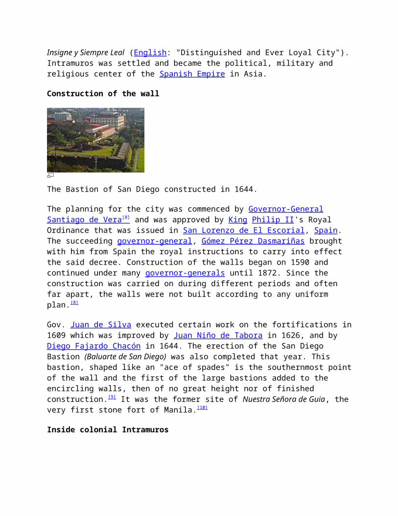
The Bastion of San Diego constructed in 1644.
The planning for the city was commenced by Governor-General Santiago de Vera [8] and was approved by King Philip II's Royal Ordinance that was issued in San Lorenzo de El Escorial, Spain. The succeeding governor-general, Gómez Pérez Dasmariñas brought with him from Spain the royal instructions to carry into effect the said decree. Construction of the walls began on 1590 and continued under many governor-generals until 1872. Since the construction was carried on during different periods and often far apart, the walls were not built according to any uniform plan.[8]
Gov. Juan de Silva executed certain work on the fortifications in 1609 which was improved by Juan Niño de Tabora in 1626, and by Diego Fajardo Chacón in 1644. The erection of the San Diego Bastion (Baluarte de San Diego) was also completed that year. This bastion, shaped like an "ace of spades" is the southernmost point of the wall and the first of the large bastions added to the encircling walls, then of no great height nor of finished construction.[9] It was the former site of Nuestra Señora de Guia, the very first stone fort of Manila.[10]
Inside colonial Intramuros
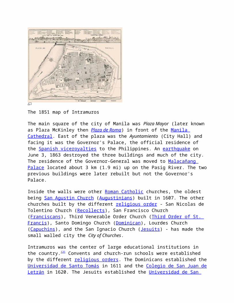
The 1851 map of Intramuros
The main square of the city of Manila was Plaza Mayor (later known as Plaza McKinley then Plaza de Roma) in front of the Manila Cathedral. East of the plaza was the Ayuntamiento (City
Hall) and facing it was the Governor's Palace, the official residence of the Spanish viceroyalties to the Philippines. An earthquake on June 3, 1863 destroyed the three buildings and much of the city. The residence of the Governor-General was moved to Malacañang Palace located about 3 km (1.9 mi) up on the Pasig River. The two previous buildings were later rebuilt but not the Governor's Palace.
Inside the walls were other Roman Catholic churches, the oldest being San Agustin Church (Augustinians) built in 1607. The other churches built by the different religious order - San Nicolas de Tolentino Church (Recollects), San Francisco Church (Franciscans), Third Venerable Order Church (Third Order of St. Francis), Santo Domingo Church (Dominican), Lourdes Church (Capuchins), and the San Ignacio Church (Jesuits) - has made the small walled city the City of Churches.
Intramuros was the center of large educational institutions in the country.[2] Convents and church-run schools were established by the different religious orders. The Dominicans established the Universidad de Santo Tomás in 1611 and the Colegio de San Juan de Letrán in 1620. The Jesuits established the Universidad de San Ignacio in 1590, the first university in the country, but closed in 1768 following the expulsion of the Jesuits in the country. After the Jesuits were allowed to return to the Philippines, they established the Ateneo Municipal de Manila in 1859.[11]
Physical features of the wall
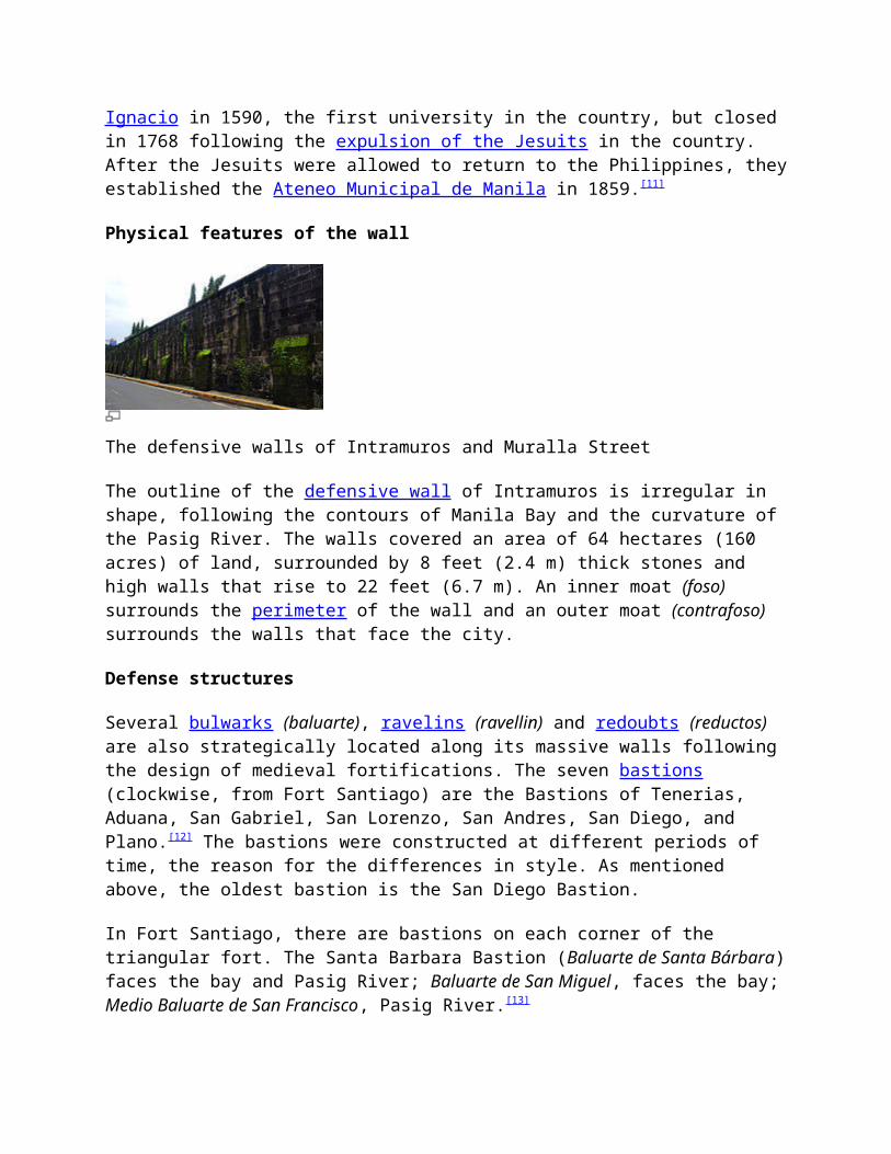
The defensive walls of Intramuros and Muralla Street
The outline of the defensive wall of Intramuros is irregular in shape, following the contours of Manila Bay and the curvature of the Pasig River. The walls covered an area of 64 hectares (160 acres) of land, surrounded by 8 feet (2.4 m) thick stones and high walls that rise to 22 feet (6.7 m). An inner moat (foso) surrounds the perimeter of the wall and an outer moat (contrafoso) surrounds the walls that face the city.
Defense structures
Several bulwarks (baluarte), ravelins (ravellin) and redoubts (reductos) are also strategically located along its massive walls following the design of medieval fortifications. The seven bastions (clockwise, from Fort Santiago) are the Bastions of Tenerias, Aduana, San Gabriel, San Lorenzo, San Andres, San Diego, and Plano.[12] The bastions were constructed at different periods of time, the reason for the differences in style. As mentioned above, the oldest bastion is the San Diego Bastion.
In Fort Santiago, there are bastions on each corner of the triangular fort. The Santa Barbara Bastion (Baluarte de Santa Bárbara) faces the bay and Pasig River; Baluarte de San Miguel, faces the bay; Medio Baluarte de San Francisco, Pasig River.[13]
Gates of Intramuros
Main article: Gates of Intramuros
Before the American Era, entrance to the city was through eight gates or Puertas namely (clockwise, from Fort Santiago) Puerta Almacenes, Puerta de la Aduana, Puerta de Santo Domingo, Puerta Isabel II, Puerta del Parian, Puerta Real, Puerta Sta. Lucia, and Puerta del Postigo.[14] Formerly, drawbridges were raised and the city was closed and under sentinels from 11:00 pm till 4:00 am. It continued so until 1852, when, in consequence of the earthquake of that year, it was decreed that the gates should thenceforth remain open night and day.[12]
American colonization
After the end of the Spanish–American War, Spain surrendered the Philippines and several other territories to the United States as part of the terms of the Treaty of Paris for $20 million. The American flag was raised at Fort Santiago on August 13, 1898 indicating the start of American rule over the city. The Ayuntamiento became the seat of the Philippine Commission of the United States in 1901 while Fort Santiago became the headquarters of the Philippine Division of the United States Army.
The Americans made drastic changes to the city, such as in 1903, when the walls from the Santo Domingo Gate up to the Almacenes Gate were removed as the wharf on the southern bank of the Pasig River was improved. The stones removed were used for other construction happening around the city. The walls were also breached in four areas to ease access to the city: the southwestern end of Calle Aduana (now Andres Soriano Jr. Ave.); the eastern end of Calle Anda; the northeastern end of Calle Victoria (previously known as Calle de la Escuela); and the southeastern end of Calle Palacio (now General Luna Street). The double moats that surrounded Intramuros were deemed unsanitary and were filled in with mud dredged from Manila Bay where the present Port of Manila is now located. The moats were transformed into a municipal golf course by the city.
Reclamations for the construction of the Port of Manila, the Manila Hotel, and Rizal Park obscured the old walls and skyline of the city from the Manila Bay.[15] The Americans also founded the first school under the new government, the Manila High School, on June 11, 1906 along Victoria Street.[16]
Destruction of the city during the Battle of Manila (1945)
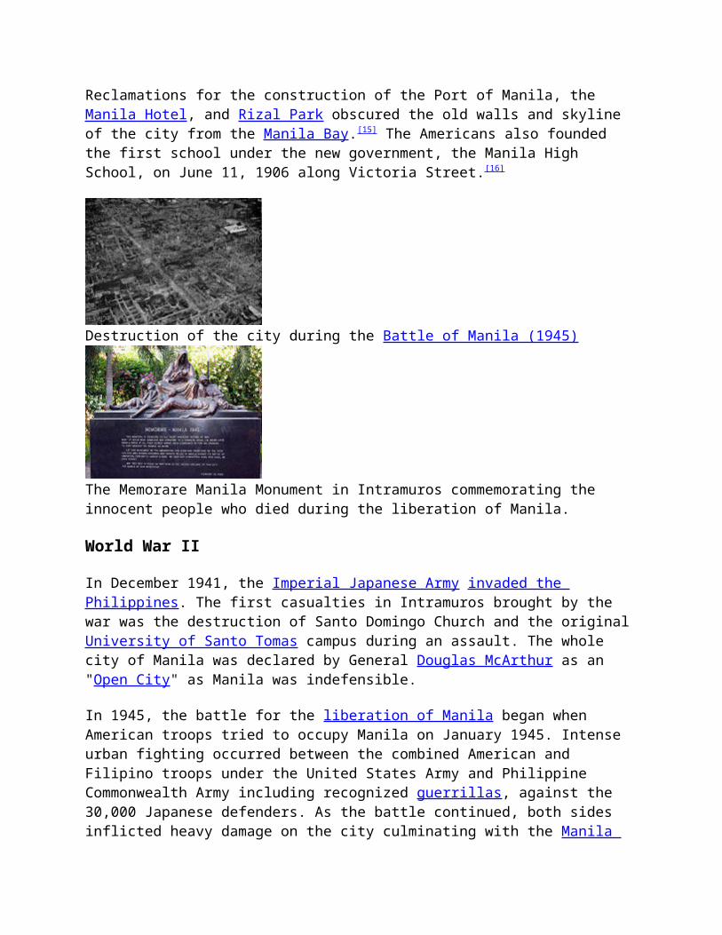
The Memorare Manila Monument in Intramuros commemorating the innocent people who died during the liberation of Manila.
World War II
In December 1941, the Imperial Japanese Army invaded the Philippines. The first casualties in Intramuros brought by the war was the destruction of Santo Domingo Church and the original University of Santo Tomas campus during an assault. The whole city of Manila was declared by General Douglas McArthur as an "Open City" as Manila was indefensible.
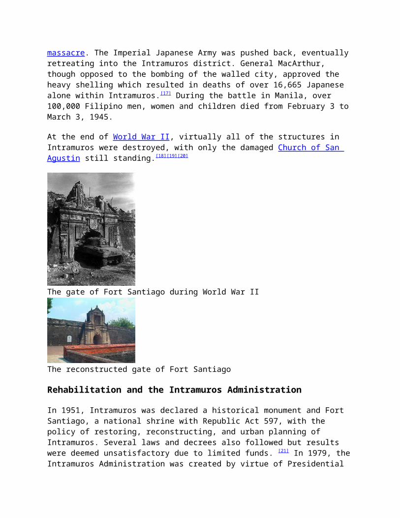
In 1945, the battle for the liberation of Manila began when American troops tried to occupy Manila on January 1945. Intense urban fighting occurred between the combined American and Filipino troops under the United States Army and Philippine Commonwealth Army including recognized guerrillas, against the 30,000 Japanese defenders. As the battle continued, both sides inflicted heavy damage on the city culminating with the Manila massacre. The Imperial Japanese Army was pushed back, eventually retreating into the Intramuros district. General MacArthur, though opposed to the bombing of the walled city, approved the heavy shelling which resulted in deaths of over 16,665 Japanese alone within Intramuros.[17] During the battle in Manila, over 100,000 Filipino men, women and children died from February 3 to March 3, 1945.
At the end of World War II, virtually all of the structures in Intramuros were destroyed, with only the damaged Church of San Agustin still standing.[18][19][20]
The gate of Fort Santiago during World War II
The reconstructed gate of Fort Santiago
Rehabilitation and the Intramuros Administration
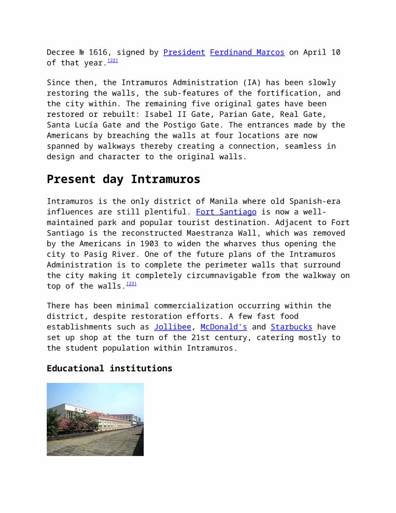
In 1951, Intramuros was declared a historical monument and Fort Santiago, a national shrine with Republic Act 597, with the policy of restoring, reconstructing, and urban planning of Intramuros. Several laws and decrees also followed but results were deemed unsatisfactory due to limited funds. [21] In 1979, the Intramuros Administration was created by virtue of Presidential Decree № 1616, signed by President Ferdinand Marcos on April 10 of that year.[22]
Since then, the Intramuros Administration (IA) has been slowly restoring the walls, the sub-features of the fortification, and the city within. The remaining five original gates have been restored or rebuilt: Isabel II Gate, Parian Gate, Real Gate, Santa Lucía Gate and the Postigo Gate. The entrances made by the Americans by breaching the walls at four locations are now spanned by walkways thereby creating a connection, seamless in design and character to the original walls.
Present day IntramurosIntramuros is the only district of Manila where old Spanish-era influences are still plentiful. Fort Santiago is now a well-maintained park and popular tourist destination. Adjacent to Fort Santiago is the reconstructed Maestranza Wall, which was removed by the Americans in 1903 to widen the wharves thus opening the city to Pasig River. One of the future plans of the Intramuros Administration is to complete the perimeter walls that surround the city making it completely circumnavigable from the walkway on top of the walls.[23]
There has been minimal commercialization occurring within the district, despite restoration efforts. A few fast food establishments such as Jollibee, McDonald's and Starbucks have set up shop at the turn of the 21st century, catering mostly to the student population within Intramuros.
Educational institutions
The University of the City of Manila
Intramuros is still home to one of the oldest educational institutions in the Philippines, the Colegio de San Juan de Letran founded in (1620), rebuilding its campus in the same location after its destruction during the war. The Colegio de Santa Rosa and the Manila High School also rebuilt from their previous locations. The University of Santo Tomas (UST) transferred most of its student to a much larger campus in Sampaloc, Manila in 1927 because of its growing student population, retaining only the Civil Law and Medicine courses in Intramuros. After the war, the school did not rebuild inside the walled city. Ateneo de Manila moved to Ermita, Manila after a fire in 1932 burned down the school. It is now called Ateneo de Manila University, located in Loyola Heights, Quezon City since 1952, after the war also destroyed the Ermita campus, totally moving to the new campus in 1976.[11] The Colegio de Sta. Isabel transferred to a new campus in Ermita just outside the walls of Intramuros after the war.
New non-sectarian schools were established and built over the ruins of the city. The Pamantasan ng Lungsod ng Maynila was established in 1965 by the city government of Manila at the Old Cuartel España (Spanish Barracks). The Lyceum of the Philippines University is a private university founded in 1952 and built over the lot of San Juan de Dios Hospital, which moved out to Roxas Boulevard. The Mapúa Institute of Technology was founded in 1925 in Quiapo, Manila but moved to Intramuros before the war. The new campus moved to the location of the destroyed San Francisco Church and the Third Venerable Order Church at the corner of San Francisco and Solana Streets. The above three schools and the Colegio de San Juan de Letran formed an academic cooperation called Intramuros Consortium to take advantage of the schools' resources.
Churches
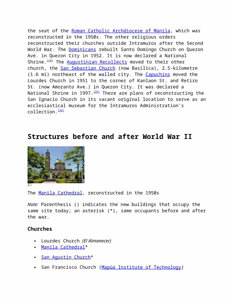
Of the eight churches that were located within its walls, only two remained: San Agustin Church, the oldest building in existence in Manila completed in 1607, and the Manila Cathedral, the seat of the Roman Catholic Archdiocese of Manila, which was reconstructed in the 1950s. The other religious orders reconstructed their churches outside Intramuros after the Second World War. The Dominicans rebuilt Santo Domingo Church on Quezon Ave. in Quezon City in 1952. It is now declared a National Shrine.[24] The Augustinian Recollects moved to their other church, the
San Sebastian Church (now Basilica), 2.5-kilometre (1.6 mi) northeast of the walled city. The Capuchins moved the Lourdes Church in 1951 to the corner of Kanlaon St. and Retiro St. (now Amoranto Ave.) in Quezon City. It was declared a National Shrine in 1997.[25] There are plans of reconstructing the San Ignacio Church in its vacant original location to serve as an ecclesiastical museum for the Intramuros Administration's collection.[26]
Structures before and after World War II
The Manila Cathedral, reconstructed in the 1950s
Note: Parenthesis () indicates the new buildings that occupy the same site today; an asterisk (*), same occupants before and after the war.
Churches
Lourdes Church (El Almanecer) Manila Cathedral *
San Agustin Church *
San Francisco Church (Mapúa Institute of Technology)
San Ignacio Church (In reconstruction as the new Intramuros Ecclesiastical Museum)[27]
San Nicolas de Tolentino Church (Manila Bulletin)
Santo Domingo Church (Bank of the Philippine Islands) (the Church was the moved to Quezon City)
Third Venerable Order Church (Mapúa Chapel)
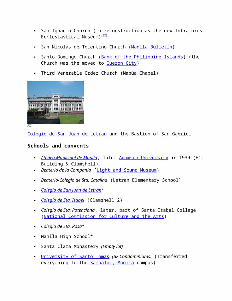
Colegio de San Juan de Letran and the Bastion of San Gabriel
Schools and convents
Ateneo Municipal de Manila , later Adamson University in 1939 (ECJ Building & Clamshell).
Beaterio de la Compania (Light and Sound Museum)
Beaterio-Colegio de Sta. Catalina (Letran Elementary School)
Colegio de San Juan de Letrán *
Colegio de Sta. Isabel (Clamshell 2)
Colegio de Sta. Potenciana, later, part of Santa Isabel College (National Commission for Culture and the Arts)
Colegio de Sta. Rosa*
Manila High School*
Santa Clara Monastery (Empty lot)
University of Santo Tomas (BF Condominiums) (Transferred everything to the Sampaloc, Manila campus)
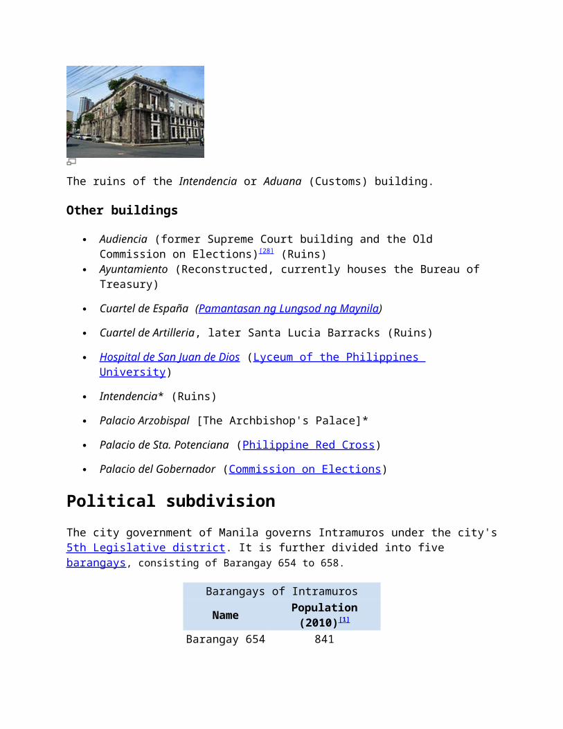
The ruins of the Intendencia or Aduana (Customs) building.
Other buildings
Audiencia (former Supreme Court building and the Old Commission on Elections)[28] (Ruins)
Ayuntamiento (Reconstructed, currently houses the Bureau of Treasury)
Cuartel de España (Pamantasan ng Lungsod ng Maynila)
Cuartel de Artilleria, later Santa Lucia Barracks (Ruins)
Hospital de San Juan de Dios (Lyceum of the Philippines University)
Intendencia* (Ruins)
Palacio Arzobispal [The Archbishop's Palace]*
Palacio de Sta. Potenciana (Philippine Red Cross)
Palacio del Gobernador (Commission on Elections)
Political subdivisionThe city government of Manila governs Intramuros under the city's 5th Legislative district. It is further divided into five barangays, consisting of Barangay 654 to 658.
Barangays of IntramurosName Population (2010)[1]
Barangay 654 841Barangay 655 1,789Barangay 656 242Barangay 657 281Barangay 658 1,772
Gallery
Casa Manila, a museum of lifestyles during the Spanish Colonial Era
The southern entrance of Intramuros on Gen. Luna St.
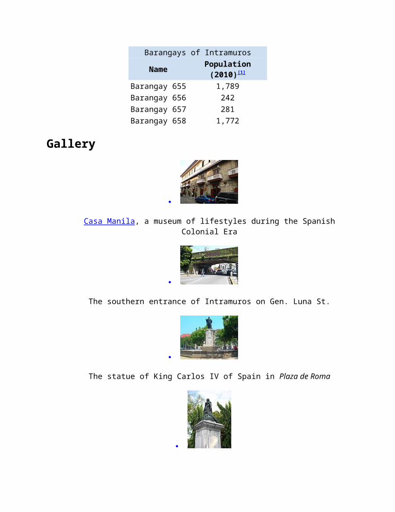
The statue of King Carlos IV of Spain in Plaza de Roma
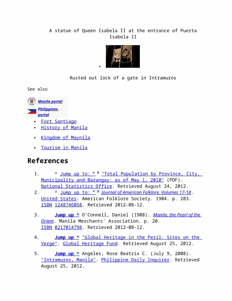
A statue of Queen Isabela II at the entrance of Puerta Isabela II
Rusted out lock of a gate in Intramuros
See also
Manila portal
Philippines portal Fort Santiago History of Manila
Kingdom of Maynila
Tourism in Manila
References1. ^ Jump up to: a b "Total Population by Province, City, Municipality and Barangay:
as of May 1, 2010" (PDF). National Statistics Office. Retrieved August 24, 2012.2. ^ Jump up to: a b Journal of American Folklore, Volumes 17-18. United States:
American Folklore Society. 1904. p. 283. ISBN 1248746058. Retrieved 2012-08-12.
3. Jump up ^ O'Connell, Daniel (1908). Manila, the Pearl of the Orient. Manila Merchants' Association. p. 20. ISBN 0217014798. Retrieved 2012-08-12.
4. Jump up ^ "Global Heritage in the Peril: Sites on the Verge". Global Heritage Fund. Retrieved August 25, 2012.
5. Jump up ^ Angeles, Rose Beatrix C. (July 9, 2008). "Intramuros, Manila". Philippine Daily Inquirer. Retrieved August 25, 2012.
6. Jump up ^ Gerini, G.E. (1905). "The Nagarakretagama List of Countries on the Indo-Chinese Mainland (Circâ 1380 A.D.)". The Journal of the Royal Asiatic Society of Great Britain and Ireland (Royal Asiatic Society of Great Britain and Ireland) (July 1905): 485–511. JSTOR 25210168.
7. Jump up ^ "Pusat Sejarah Brunei" (in Malay). Government of Brunei Darussalam. Retrieved March 4, 2010.
8. ^ Jump up to: a b U.S. War Department 1903, p. 435.
9. Jump up ^ U.S. War Department 1903, p. 436.
10. Jump up ^ "Baluarte de San Diego". Intramuros, the Walled City. Retrieved on 2011-11-13.
11. ^ Jump up to: a b "History". Ateneo de Manila University. Retrieved on 2012-10-11.
12. ^ Jump up to: a b U.S. War Department 1903, p.443.
13. Jump up ^ "Intramuros Walkthrough". Intramuros, the Walled City. Retrieved on 2011-10-01.
14. Jump up ^ "IA Trivia - Eight main gates of Intramuros". Intramuros, the Walled City. Retrieved on 2011-09-14.
15. Jump up ^ City of Manila. "Annual Report of the City of Manila, 1905", p.71. Manila Bureau of Printing.
16. Jump up ^ "Manila High School". The Historical Marker Database. Retrieved on 2012-10-11.
17. Jump up ^ Ramsey, Russell Wilcox (1993). "On Law & Country", pg. 41. Braden Publishing Company, Boston.
18. Jump up ^ Bernad, Miguel A. "Genocide in Manila". California, USA: Philippine American Literary House (palhbooks.com). PALH Book. Archived from the original on 2010-08-07. Retrieved 2010-08-07.
19. Jump up ^ Quezon III, Manuel L. (2007-02-07). "The Warsaw of Asia: How Manila was Flattened in WWII". Jeddah, Saudi Arabia: Arab News Online
(archive.arabnews.com). Opinion. Archived from the original on 2010-08-07. Retrieved 2010-08-07.
20. Jump up ^ "The Sack of Manila". The Battling Bastards of Bataan (battlingbastardsbataan.com). Archived from the original on 2010-08-07. Retrieved 2010-08-07.
21. Jump up ^ "History of Intramuros". Intramuros, the Walled City. Retrieved on 2011-09-14.
22. Jump up ^ "Presidential Decree no. 1616". The LawPhil Project. Retrieved on 2012-04-04.
23. Jump up ^ philstarcom (2010-06-18). "Maestranza Wall Restoration". YouTube.com. Retrieved on 2011-09-18.
24. Jump up ^ admin (2006-07-29). "Santo Domingo Church (Quezon City)". Heritage Conservation Society. Retrieved on 2013-03-07.
25. Jump up ^ Joann (2012-12-05). "National Shrine of Our Lady of Lourdes". Joann's Corner. Retrieved on 2013-03-06.
26. Jump up ^ "San Ignacio Church". Intramuros, the Walled City. Retrieved on 2011-09-14.
27. Jump up ^ "List of Intramuros proposed projects for 2013- 2015". Intramuros, the Walled City. Retrieved on 2013-06-24.
28. Jump up ^ (2007-03-11). "Fire hits Comelec headquarters". Inquirer.net.
Sources U.S. War Department (1903). "Annual Reports of the War Department, 1903 Vol. III".
Washington Government Printing Office, 1901.
External links
Wikimedia Commons has media related to Intramuros.
Wikivoyage has a travel guide for Intramuros.
Intramuros Manila Asia Intramuros, Historic Walled City of Manila .
Gates of IntramurosFrom Wikipedia, the free encyclopedia
http://en.wikipedia.org/wiki/Gates_of_Intramuros
Gates_of_Intramuros
Main entrance gate on General Luna Street
The Gates of Intramuros refer to the original gates of the Walled City of Intramuros in Manila, built during the Spanish Colonial Era in the Philippines. The gates are called either in the original Spanish word for "gate", Puerta (plural: Puertas), or English, Gate.
Contents 1 Gates facing the west
o 1.1 Puerta de Banderas
o 1.2 Puerta de Postigo
o 1.3 Puerta de Sta. Lucia
2 Gate facing the south
o 2.1 Puerta Real
3 Gate facing the east
o 3.1 Puerta de Parian
4 Gates facing the north
o 4.1 Puerta de Almacenes
o 4.2 Puerta de Santo Domingo/Puerta de Aduana
o 4.3 Puerta de Isabel II
5 External links
Gates facing the west
Puerta de Banderas
This gate was built in 1662 as the Governor-General's gate when the first Governor's palace was still located in Fort Santiago. It was destroyed during an earthquake and was never rebuilt.
Puerta de Postigo
The gate which lead to the palaces of Governor-General and Archbishop of Manila was built in 1662. The original gate was located several meters to the left. It was enovated in 1782. The national hero of the Philippines Jose Rizal passed through this gate from Fort Santiago to his execution at Bagumbayan field on December 30, 1896. It was damaged during the Battle of Manila in 1945 and restored in 1968.
Puerta de Sta. Lucia
This is one of the original entrances to the Walled City when it was built in 1603. It underwent improvements in the late 18th century and became favored as an entry point to Malecon Drive, a promenade area along the shore of Manila Bay. The gate was destroyed during the Battle of Manila in 1945 to allow the entry of American and Philippine Commonwealth tanks into the city. It was restored in 1982.
Gate facing the south
Puerta Real
Puerta Real
The original Real Gate (Royal Gate) was built in 1663 at the end of Calle Real de Palacio (now General Luna St.) and was used exclusively by the Governor-General for state occasions. It was located west of Baluarte de San Andres and faced the old village of Bagumbayan. It was destroyed during the British invasion of 1762 along with the removal of the village. The Puerta Real was rebuilt in 1780 and moved further west to its present location. During the Battle of Manila, the gate was damaged. It was restored in 1969 with additional work made in 1989.
Gate facing the east
Puerta de Parian
Puerta de Parian
The gate was named after the "Parian de Arroceros" across the city where Chinese merchants lived. Built in 1593, it is one of the earliest entrances to Intramuros. It became the official entrance of the Governor-General in 1764, following the destruction of Puerta Real during the British invasion. It was damaged during the Battle of Manila in 1945. Restoration was begun in 1967 and completed in 1982.
Gates facing the north
Puerta de Almacenes
It was built in 1690 for trading with the other side of the river and continually renovated until its completion in 1739. The gate Lasted until 1903 when American military engineers demolished the walls for widening the river wharves along Intramuros.
Puerta de Santo Domingo/Puerta de Aduana
This gate named after the nearby Santo Domingo Church, was built in the 18th century during the renovation of the riverside defenses. It opened to the river wharves, but the American engineers tore down the gate & fortification in 1903 to open a road to Intramuros from Magallanes Drive.