1. introduction - savannah, ga
TRANSCRIPT

City of Savannah Stormwater Management Local Design Manual
4/22/2015----1 | P a g e
1. INTRODUCTION
The City of Savannah Stormwater Management Local Design Manual (LDM) has been
developed to serve as a comprehensive guide to implementing stormwater management
facilities, controls and systems in the City of Savannah. Additionally, the City of Savannah
LDM has been developed to supplement the technical guidance information contained in the
Georgia Stormwater Management Manual (GSMM) first Edition (August 2001) and the
Coastal Stormwater Supplement (CSS) to the GSMM, latest edition. The City’s MS-4 permit
requires that the City adopt a local design manual that implements the use of either the
Georgia Stormwater Management Manual or an equivalent local design manual, and that, as
a part of Chatham County, that the adopted manual should include the Coastal Supplement.
Therefore, the Local Design Manual serves as the required manual, and the GSMM and the
CSS serve as technical reference guidance for the design, construction, and maintenance of
stormwater management systems within the City. Any conflicts or issues that may arise
pertaining to information contained in the GSMM and the CSS should be addressed at the
onset of the project through correspondence with the appropriate City Staff.
1.1 Stormwater Management Compliance Process
The following outlines the step by step process for complying with the applicable provisions
of the City of Savannah Stormwater Management LDM and the City of Savannah
Stormwater Management Ordinance. All projects differ with regard to the pertinent site-
specific design and construction related issues and details. To that end, the step by step
process outlined herein should be used as a general guide with the understanding that some
variation to the process may be necessary to successfully complete a particular project.
1.1.1 Stormwater Management Site Planning and Design Criteria Process
Concept Design Phase
Step 1: Review applicable local, state, and federal requirements and guidelines
Step 2: Schedule and attend a Site Plan Review (SPR) meeting with the City
Step 3: Conduct natural resources inventory.
Step 4: Assess potential application of green infrastructure practices
Step 4A: Apply post-construction stormwater management criteria
• Criteria #1: Stormwater runoff reduction

City of Savannah Stormwater Management Local Design Manual
4/22/2015----2 | P a g e
• Criteria #2: Stormwater quality protection
• Criteria #3: Aquatic resource protection
• Criteria #4: Overbank flood protection
• Criteria #5: Extreme flood protection
Step 4B: For redevelopment projects seeking off-site post-development stormwater
management credit, complete and submit application, Appendix H. Credit for
off-site stormwater management is only available within city right-of-way or
city-owned property.
Step #5: Prepare a stormwater management concept plan and submit to City for review
and approval.
Step #6: Schedule and attend concept plan and consultation meeting with City Staff to
review concept plan.
Step #6A: Revise concept plan (if necessary)
(Projects of less than 1.0 acre in size may request a waiver of concept plan submittal. In lieu
of the concept submittal, the items become due with the Detailed Stormwater Management
Design Phase submittal below. Attendance at the SPR meeting is encouraged in lieu of the
submittal.
Detailed Stormwater Management Design Phase
Step 7: Prepare stormwater management design plan
Step 7A: Perform downstream hydrologic analysis
Step 7B: Prepare stormwater management system inspection and maintenance plan (A
copy of the agreement is attached as Appendix A)
Step 7C: Prepare erosion and sedimentation control plan and planting plan
Step 8: Submit plans to City with engineer’s certification (copy attached as Appendix
E) and completed Stormwater Checklist (copy attached as Appendix F.)
Step 9: Address City comments and re-submit for approval.
Step 10: Where off-site stormwater management within city right-of-way or city-owned
property credit is to be purchased for redevelopment projects, submit payment
and provide documentation of payment prior to project’s final inspection.
Step 11: Upon acceptance of Stormwater Management Design Plan by the City Owner
executes and submits stormwater inspection and maintenance plan.

City of Savannah Stormwater Management Local Design Manual
4/22/2015----3 | P a g e
Construction Phase
Step 11: Obtain land disturbance activity (LDA) permit from City Development Services
Step 12: Obtain site development permit
Step 13: Attend Site Development administered pre-construction meeting on project
site
Step 14: Install and maintain site erosion and sedimentation controls
Step 15: Commence site construction activities
Step 16: Coordinate field inspections with City staff
Step 17: Complete final site inspection and project completion. Before the issuance of
a certificate of occupancy, the applicant is responsible for certifying that the
project has been completed in accordance with the approved stormwater
management design plan (certification statement is attached as Appendix B)
and for submitting the engineer’s certification of completeness by a Georgia
licensed professional engineer (engineer’s certification statement is attached as
Appendix C). A final inspection shall be conducted by the staff or
representatives of the City of Savannah to confirm the accuracy of the as built
plans. A final inspection is required before any performance bond or other
guarantee can be released.
Post-Construction Phase
Step 18: Show all stormwater management units in private and common areas on the
final plat. Include notations that such units will be maintained in accordance
with Article B of the Stormwater Management Ordinance.
Step 19: Record the stormwater management inspection and maintenance agreement.
(A copy of the agreement is attached as Appendix A.)
Step 20: Post maintenance bond, letter of credit (LOC), escrow amount or certified
check for the period required. Bonded items shall include 100% of the
construction cost of the project until as-builts are provided; 150% of any items
not 100% complete at the time of C. O.; 150% bonding for any stormwater
system and green infrastructure system subject to construction sediment due
to uncompleted site stabilization to plans; and 150% bonding for any surface
improvement constructed above any underground bonded structure, along
with reasonable construction limits necessary for access.
Step 21: Secure certificate of occupancy (CO)/final plat

City of Savannah Stormwater Management Local Design Manual
4/22/2015----4 | P a g e
Step 22: Prepare as-built survey and as-built design certification.
2. Post-Construction Stormwater Management and Site Planning and Design Criteria The following post-construction stormwater management and site planning and design criteria shall be applied to all new development and redevelopment activities that are subject to the provisions of this ordinance. The criteria have been designed to protect valuable local natural resources from the negative impacts of the land development process. If local natural resource protection and stormwater management goals and objectives warrant greater protection than that provided by the post-construction stormwater management and site planning and design criteria outlined below, the City of Savannah may impose additional requirements on new development and redevelopment activities that it has determined are necessary to protect local aquatic and terrestrial resources from the negative impacts of the land development process.
2.1 Natural Resources Inventory Prior to the start of any land disturbing activities, including any clearing and grading activities, the SAGIS land cover maps, acceptable site reconnaissance, and biological and traditional land surveying techniques should be used to complete a thorough assessment of the natural resources, both terrestrial and aquatic, found on a development site. The natural resources inventory shall be completed in general accordance with Section 4.3.1 and Table 4.2 of the CSS to the GSSM, or using a comparable methodology as approved by the Stormwater Director. The preservation and/or restoration of the natural resources found on a development site, may, at the discretion of the City of Savannah be assigned quantifiable stormwater management “credits”. Credits can be used to meet the post-construction stormwater management criteria outlined in the applicable sections of the City of Savannah Stormwater Management Ordinance. The green infrastructure practices provided in the latest edition of the CSS to the GSSM can be used as well to satisfy stormwater management criteria outlined in the City of Savannah Stormwater Management Ordinance. 2.2 Use of Green Infrastructure Practices Green infrastructure/Low Impact Development (GI/LID) practices shall be used to the maximum extent practical during the creation of a stormwater management concept plan for a proposed development project. Green infrastructure practices can be used to not only help protect local terrestrial and aquatic resources from the direct impacts of the land development process, but also to help maintain pre-development site hydrology and reduce post-construction stormwater runoff rates, volumes and pollutant loads.

City of Savannah Stormwater Management Local Design Manual
4/22/2015----5 | P a g e
All GI/LID practices shall be selected, designed, constructed, and maintained in general accordance with the information presented in the latest edition of the CSS to the GSMM and the LDM. Applicants are referred to the latest edition of CSS to the GSMM, and the LDM, for guidance on selecting GI/LID practices that can be used to satisfy the post–construction stormwater management criteria outlined in the applicable sections of the City of Savannah Stormwater Management Ordinance. For (GI/LID) practices that are not included in the CSS to the GSMM, or for which pollutant and runoff reduction rates have not been provided, the effectiveness of the GI/LID must be documented through prior studies, literature reviews or other means, and receive approval from the Stormwater Director, or his designee, before being included in a stormwater management system. 2.3 Stormwater Runoff Reduction 2.3.1 Development Criteria The stormwater runoff volume generated by the first 1.2” of rainfall is called the runoff reduction storm event (RRv), in Section 4.4.1 of the latest edition of the CSS to the GSMM. The RRv shall be captured on-site. A stormwater management system is presumed to comply with these criteria if, according to the following criteria: (1) It includes green infrastructure practices that provide for the interception, evapotranspiration, infiltration or capture and reuse of stormwater runoff, that have been selected, designed, constructed and maintained in accordance with the information presented in the latest edition of the CSS to the GSMM and the LDM; and, (2) It is designed to provide the amount of stormwater runoff reduction specified in the latest edition of the CSS to the GSMM. The Stormwater Director or his designee may reduce the amount of stormwater runoff reduction needed to satisfy the RRv on development sites that are considered to be stormwater hotspots, or that have site characteristics or constraints, such as high groundwater, impermeable soils, contaminated soils or confined groundwater aquifer recharge areas, that prevent the use of GI/LID. When seeking a reduction in RRv , applicants shall provide adequate documentation to the City of Savannah to show that GI/LID practices have been used on the development site to the maximum extent practicable. 2.4 Stormwater Quality Management and Protection In order to protect local aquatic resources from water quality degradation, post-construction stormwater runoff shall be adequately treated before it is discharged from a development site. Applicants can satisfy this criterion by satisfying the stormwater runoff reduction

City of Savannah Stormwater Management Local Design Manual
4/22/2015----6 | P a g e
criteria. However, if any of the stormwater runoff volume generated by the runoff reduction storm event, as defined in the latest edition of the CSS to the GSMM, cannot be reduced on the development site, due to site characteristics or constraints, it shall be intercepted and treated in one or more stormwater management practices that provide at least an 80 percent reduction in total suspended solids loads and that reduce nitrogen and bacteria loads to the maximum extent practical. When seeking to satisfy this criteria through the use of one or more stormwater management practices, applicants shall: (1) Intercept and treat stormwater runoff in stormwater management practices that have been selected, designed, constructed and maintained in accordance with the information presented in the latest edition of the CSS to the GSMM and the LDM; and, (2) Provide adequate documentation to the Stormwater Director or his designee to show that total suspended solids, nitrogen and bacteria removal were considered during the selection of the stormwater management practices that will be used to intercept and treat stormwater runoff on the development site. 2.5 Aquatic Resource Protection and Energy Dissipation In order to protect local aquatic resources from several other negative impacts of the land development process, including complete loss or destruction, stream channel enlargement and increased salinity fluctuations, applicants shall provide aquatic resource protection in accordance with the with the information provided in the latest edition of the Coastal Stormwater Supplement to the Georgia Stormwater Management Manual. 2.5.1 Primary Conservation Areas The following drainage areas are considered primary conservation areas for the aquatic resource protection criteria in Savannah:
Salt Creek Hayners Creek Hoover Creek Little Ogeechee River Vernon River Wilmington River, and All marsh buffers,
Applicants for stormwater discharges to these drainage basins shall submit a demonstration of use of better site planning techniques as presented in the latest edition of the CSS to the GSMM. Direct discharges to primary conservation areas as defined above shall require aquatic resource protection as described in the CSS of the GSMM. 2.5.2 Energy dissipation

City of Savannah Stormwater Management Local Design Manual
4/22/2015----7 | P a g e
Velocity control and energy dissipation measures shall be installed at all stormwater outfalls
in accordance with the criteria and guidance provided in Section 4.5 of the GSMM (Volume
2) and the applicable sections of the CSS.
2.6 Overbank Flood Protection All stormwater management systems shall be designed, constructed, and maintained to control the peak discharge generated by the overbank flood protection storm event, as defined in the latest edition of the Coastal Stormwater Supplement to the Georgia Stormwater Management Manual, to prevent an increase in the duration, frequency and magnitude of downstream overbank flooding. A stormwater management system is presumed to comply with this criterion if it is designed to assure that the peak flow rate for the one year frequency 24 hour duration, 5 year 24 hour, 10 year 24 hour, and 25 year 24 hour storms do not exceed their pre development conditions. The design shall assure that the peak flows do not exceed pre development flows for construction conditions. The Stormwater Director or his designee may modify or waive this criteria on development sites where both the on-site and downstream stormwater conveyance systems are designed to safely convey the peak discharge generated by the overbank flood protection storm event to a receiving stream, tidal creek or other aquatic resource without causing additional downstream flooding or other environmental impacts, such as stream channel enlargement or degradation of habitat. 2.7. Extreme Flood Protection All stormwater management systems shall be designed, constructed, and maintained to control the peak discharge generated by the extreme flood protection storm event, as defined in the latest edition of the Coastal Stormwater Supplement to the Georgia Stormwater Management Manual, to prevent an increase in the duration, frequency and magnitude of downstream extreme flooding and protect public health and safety. Development sites shall be designed, constructed, and maintained such that all GI/LID practices that impound stormwater runoff can safely pass the 100-year storm without overtopping or creating damaging or dangerous downstream conditions. Demonstration of safe passage of the 100 year 24 hour storm shall include a stage storage analysis of the system, an inflow/outflow comparison of the system, and construction of a table showing peak stage elevations in comparison to safe freeboards to structures of the system and adjacent buildings/structures/infrastructure. Flood mitigation capacity in accordance with City Code Part 8 Article D must come from below the flood elevation determined from the latest FEMA maps for the project site. Such capacity is to be determined separate from overbank flood or aquatic resource protection detention capacity.

City of Savannah Stormwater Management Local Design Manual
4/22/2015----8 | P a g e
The Stormwater Director may modify or waive this criteria on development sites where both the on-site and downstream stormwater conveyance systems are designed to safely convey the peak discharge generated by the extreme flood protection storm event to a receiving stream, tidal creek or other aquatic resource without causing additional downstream flooding or other environmental impacts, such as stream channel enlargement or degradation of habitat.
2.8 Redevelopment Criteria
Redevelopment activities that are not exempt from Stormwater Management for
Development Activities requirements shall meet at least one of the following criteria to meet
the runoff reduction volume and the Stormwater Quality Protection criteria of the
Stormwater Management Ordinance:
1. Reduce Impervious Cover: Reduce existing site impervious cover by at least
20%, unless otherwise approved by the Stormwater Director or his designee.
2. Provide Post-Development Stormwater Management: Manage the
stormwater runoff from the site’s existing impervious cover and any new impervious
cover in accordance with the post-development stormwater management criteria
outlined in the applicable sections of the City of Savannah Stormwater Management
Ordinance. The green infrastructure and stormwater management practices used to
comply with the these criteria shall be selected, designed, constructed and maintained
in accordance with the information presented in the latest edition of the CSS to the
GSMM and the LDM.
3. Provide Off-Site Stormwater Management: Provide, through the use of off-site
stormwater management practices, a level of stormwater quality and quantity control
that is equal to or greater than that which would be provided by satisfying the post-
construction stormwater management criteria outlined in the applicable sections of
the City of Savannah Stormwater Management Ordinance.
4. Provide Off-Site Stormwater Management Within City Right-Of-Way Or
City-Owned Property Where GI/LID Structural Practices are in Place at
Completion of Redevelopment: When GI/LID is provided within the City ROW
or property owned by the City in the same drainage basin as the redevelopment,
equivalent runoff reduction volume (RRv) can be applied as credit to meet the
redevelopment criteria. Application for this credit must be made through use of the
form in Appendix H.
5. Combination of Measures: Any combination of (1) through (4) above that is
acceptable to the City of Savannah.
Redevelopment activities shall meet the Aquatic Resource Protection, Overbank Flood
Protection, and Extreme Flood Protection criteria of the CSS of the GSMM.

City of Savannah Stormwater Management Local Design Manual
4/22/2015----9 | P a g e
3. APPROVED HYDROLOGIC & HYDRAULIC METHODS
3.1. Hydrologic Methods
3.1.1 Rational method
The rational method may be used with the approval of the Stormwater Director or his
designee to develop peak runoff flows for culverts or stormwater drainage systems with
contributing drainage areas that are less than 10 acres in size and that are described by a
single runoff coefficient. No prorating of runoff coefficients shall be acceptable. Rational
method shall not be used for estimating runoff for detention sizing. All rational method
calculations shall be made in accordance Appendix A-3 of the GSMM (Volume 2 Appendix
A-3) and applicable sections of the CSS.
The use of the rational method, or any other method than the TR-55 method, described
below, requires prior approval by the Stormwater Director or his designee. Plans submitted
without prior approval may not be reviewed until calculations are confirmed by the
permittee utilizing approved methods. (Please note that Sections 4 and 5 of Volume 2
(Appendix A-1) of the GSMM are not part of Section 3.1.2 below.)
3.1.2 SCS TR-55 Method
The Soil Conservation Service (SCS) method is the accepted runoff method of the City and
must be utilized to size detention. All computations shall be in accordance with Section 2 of
the GSMM, (Volume 2-Appendix A-1). Rainfall intensities shall be derived from Table A2-
10 to A2-13 (Savannah) of Appendix A-2 of the GSMM (Volume 2). Please note that
intensities vary by location within Chatham County. A peaking factor of 323 is acceptable
for the Savannah area. Type III storms should be used east of I-95. Type II storms must be
used west of I-95.
Time of concentration methods shall be according to pages 3-1 thru 3-4 of Volume 2
(Appendix A-1) of the GSMM. Triangular shaped hydrographs are not acceptable. Time of
concentration must be calculated taking into account the condition of the site soil. If
roughened by tire ruts, local depressions, poor drainage, or silvicultural practice, adjust
roughness values accordingly. Maximum length of any sheet flow calculation shall be 300
feet.
3.1.3 Other methods
Prior approval by the Stormwater Management Director is required for use of any other
runoff calculation method, (i.e., TR-20, XP-SWMM, etc.) The determination as to whether
another method may be approved is determined by both the method’s ability to accurately

City of Savannah Stormwater Management Local Design Manual
4/22/2015----10 | P a g e
determine information required, and to be able to be checked by the Department. Use of
ICPR, XP-SWMM, or other dynamic model must include adequate documentation of input
parameters, to afford checking of the calculation.
4. CONVEYANCE LEVEL OF SERVICE (LOS) STANDARDS
4.1 General
The designer shall endeavor to meet the applicable stormwater management design criteria
outlined herein to the maximum extent possible for each design project. Successful
incorporation of these criteria into the overall design process should: (1) help maintain pre
development site hydrology; (2) protect natural resources; and (3) minimize the impacts of
post construction stormwater runoff.
4.2 Stormwater Runoff Detention and Discharge Rate Requirements
Chapter 3.0 of the GSMM and the applicable sections of the CSS should be consulted with
regard to the design of stormwater runoff detention and discharge rate requirements for new
development and redevelopment projects.
4.2.1 Discharge Rates for New Development and Redevelopment Projects
Development plans including site grading and drainage plans should be developed to mimic
existing site conditions, and to minimize disruption of natural site infiltration, retention and
drainage patterns. Additionally, no increases in stormwater runoff rates shall be allowed at
any discharge point from the site unless approved by the City. The baseline or pre-
developed site is defined as the hydrologic conditions that exist on a development site prior
to the commencement of any land disturbing activities and at the time that plans for the
land development project are approved by the local development review authority, and shall
model any depression storage and/or detention storage. The development shall be analyzed
for the following storm events at a minimum:
• 1-year return frequency, 24 hour duration design storm
• 5-year return frequency, 24 hour duration design storm
• 10-year return frequency, 24 hour duration design storm
• 25-year return frequency, 24 hour duration design storm
• 50-year return frequency, 24 hour duration design storm
• 100-year return frequency, 24 hour duration design storm
Where downstream conditions indicate that the conveyance and/or storage capacity of
existing infrastructure could be impacted by the post development conditions, a more
stringent standard may be required. For example, if the project site drains into an existing

City of Savannah Stormwater Management Local Design Manual
4/22/2015----11 | P a g e
detention pond within the study area, then the designer will be required to demonstrate that
the discharge rates from the proposed development will still allow the detention pond to
operate at a level commensurate with the site in an undeveloped state. Detention facilities
should be designed upon the basis of known or projected developments (proposed by the
developer) for the contributing drainage basin. Although, the developer is only required to
construct the facility with sufficient volume to provide detention for the proposed
development, a design shall be provided to the City demonstrating the ultimate
configuration of the proposed detention facility at full site build-out. Additionally, the
proposed site plan should have sufficient land around the facility reserved to construct the
ultimate configuration without significant demolition.
If a proposed development activity discharges stormwater runoff into a substandard
stormwater conveyance system that is a part of the City of Savannah municipal storm sewer
system (MS4), the submittal must demonstrate at least one of the following options:
• No increase in the development site’s peak rate and total volume discharged to the
substandard system; and
• The site stormwater management plan should provide other engineering solutions
that are designed to mitigate adverse impacts on the conveyance system. The
proposed solutions must be submitted for review and approval by the City prior to
implementation.
When the development site’s stormwater peak and/or total volume discharge has increased
to an adjacent property, written approval of the neighboring property owner shall be
provided. The private stormwater easement and agreement shall be provided for
neighboring property.
4.3 Drainage Stormwater Conveyance Practices
Stormwater conveyance practices, which may include, but are not limited to, storm drain
pipes, culverts, catch basins, drop inlets, junction boxes, headwalls, gutters, ditches, open
channels, swales and energy dissipaters, shall be provided when necessary to convey post-
construction stormwater runoff and protect private properties adjoining development sites
and/or public rights-of-way. Stormwater conveyance practices that are used to convey post-
construction stormwater runoff on development sites shall meet the following requirements:
1. Methods used to calculate stormwater runoff rates and volumes shall be in
accordance with the information presented in the latest edition of the GSMM, the CSS
and the City of Savannah LDM;
2. All culverts, pipes systems, and open channel flow systems shall be sized in
accordance with the information presented in the latest edition of the GSMM, the
CSS, and the City of Savannah LDM; and

City of Savannah Stormwater Management Local Design Manual
4/22/2015----12 | P a g e
3. Planning and design of stormwater conveyance practices shall be completed in
accordance with the information presented in the latest edition of the GSMM, the
CSS, and the City of Savannah LDM.
4. Adequate easements or right-of-ways for maintenance access shall be provided and
recorded with required public documents.
4.3.1 Bridges
All bridges that will serve as an evacuation route shall be designed to accommodate the 100
year 24 hour storm with no overtopping of the roadway/street. A bridge that serves as
ingress/egress to a critical facility as described in the City’s Flood Protection Ordinance shall
be designed to accommodate the 500 year 24 hour storm with no overtopping of the
roadway/street.
4.3.2 Streets
All streets must be built at a centerline elevation so that the registered professional engineer
demonstrates to the stormwater management director, or his/her designated
representative's satisfaction that the water surface elevation will not exceed the height of the
curb for the 50-year, 24-hour storm event. In all cases, all streets shall have a minimum
street centerline elevation of 6.5 (NAVD88)
4.3.3 Culverts and Pipe Systems
Table 2: Culvert & Pipe LOS Criteria Roadway Classification/Use Minimum Allowable Design LOS Arterial/Emergency Evacuation Route 25-year Collector Roads 25-year Neighborhood Roads 10-year Roads with no other outlet 25-year Parking lots/material storage
areas/landscape areas
10-year
Culverts with contributing drainage areas greater than 10 acres shall be designed using the
SCS TR-55; 24-hour storm. If a proposed culvert system will connect to an existing culvert
system that does not achieve the design storm event LOS depicted in the Table 2 above, then
the proposed system shall be designed with an equivalent LOS to the existing system, but the
LOS shall not be less than the minimum allowable shown in Table 2 unless approved by the
Stormwater Director, or his designee. In situations where emergency evacuation issues arise
during the Concept Design Phase, the City may require that the conveyance LOS for both the
proposed culvert system and the existing culvert system be increased. The designer should
consult with the City during the Concept Design Phase of the project to ascertain the
applicable design and LOS requirements.

City of Savannah Stormwater Management Local Design Manual
4/22/2015----13 | P a g e
4.3.4 Inlets (Catch basins, yard inlets, drop inlets, hooded grate inlets, and flumes)
Inlets collecting stormwater runoff from street surfaces and area inlets shall be sized to
capture the storm event specified for the pipe system to which it drains and a maximum
depth as determined by the following table:
Table 3 Roadway Classification/Use Allowable Flooding LOS Arterial/Emergency Evacuation Route One Lane Width Open Collector Roads One Lane Width Open Neighborhood Roads 8.0 Ft Lane Width Open Roads with No Other Outlet One Lane Width Open Parking Lots Maximum 0.5 ft Depth Detention areas utilized for other purposes (i.e., parking lot detention, etc. ) with flood warning sign
Maximum 1.5 ft Depth
Material Storage Areas/Landscape Areas Maximum 2.0 ft Depth Note: The Stormwater Director or his designee can modify these requirements if the designer demonstrates
that an alternate design criteria is acceptable.
Inlets and grading adjacent to habitable structures shall be designed to prevent stormwater
runoff from entering the structure during the 100-year design storm.
4.3.5 Inlets (Headwalls, Flared End Sections, Etc.)
Inlets that utilize the opening for the pipe as the inlet, (i.e., headwalls, flared end sections,
etc.) shall be sized to capture the storm event specific for the pipe system to which it drains
and a maximum flooded depth that will not result in bypass of the inlet or cause structural
flooding. The headwater conditions induced by the inlet should minimize impacts to any
upstream drainage structures. The designer should consult the City during the Concept
Phase to determine if any unacceptable flooding will occur and if such a condition is
acceptable/allowable.
4.3.6 Roadside Ditches
Roads constructed without curb and gutter shall incorporate ditches that are designed to the
specific design storms as shown in the following table:
Table 4: Roadside Ditch LOS Criteria Roadway Classification/Use Minimum Allowable Design LOS Arterial/Emergency Evacuation Route 25-year Collector Roads 25-year Neighborhood Roads 10-year Roads with No Other Outlet 25-year Note 1: Drainage structures internal to the proposed land development activity will be designed for no less
than the 10-year, 24 hour storm event.

City of Savannah Stormwater Management Local Design Manual
4/22/2015----14 | P a g e
Note 2: The Stormwater Director, or his designee, can modify these requirements if the designer
demonstrates that an alternate design criterion is acceptable.
If a proposed roadside ditch system will connect to an existing drainage system (i.e., open
ditch, pipe, etc.) that does not achieve the design storm LOS depicted in Table 4 above, then
the proposed ditch system may be designed with an equivalent LOS to the existing system to
which it will connect, but the LOS shall not be less than the minimum allowable shown in
Table 4 unless approved by the Stormwater Director, or his designee. In situations where
emergency evaluation issues arise during the Concept Design Phase, the City may require
that the conveyance LOS of both the proposed ditch system and the existing culvert system
be improved. This may require that the conveyance capacity of the proposed ditch system be
increased to provide storage of rainfall to minimize flooding. Or the existing pipe system
conveyance LOS may need to be increased or a combination of these stormwater runoff
management measures may be required. The designer should consult with the City during
the Concept Design Phase of the project to ascertain the applicable design requirements.
4.3.7 Drainage Canals
For a proposed drainage channel designed to convey stormwater runoff either from or to an
existing culvert system, the proposed channel should be designed to the LOS established for
the existing pipe system, unless directed otherwise by the City.
4.3.8 Easements and Right-of-Ways
Minimum Right-of-Way and Easement widths for stormwater ditches, swales, canals, etc. shall be
determined as follows:
A. For ditches 1-5 ft, the easement/right-of-way width shall be 20-ft. plus top width of
the ditch. The 20-ft. access maintenance shall be provided on one side of the ditch
within the easement//R-O-W.
B. For ditches 5-25 ft., the easement/right-of-way width shall be 10-ft on one side and
20-ft on the other side of the ditch plus the top width of the ditch.
C. For ditches greater than 25-ft., the easement/right-of-way width shall be 20-ft. on
both sides of the ditch plus top width.
D. If any building foundation(s) exist, 5 feet additional right of way or easement width
shall be provided on the building side of the ditch.
Minimum Right-of-Way and Easement widths for underground stormwater sewers shall be
determined as follows:

City of Savannah Stormwater Management Local Design Manual
4/22/2015----15 | P a g e
A. For pipe depths 5.0 feet and less from pipe invert to proposed finished grade, the
easement or right-of-way width is to be 10 feet on each side from the edge of the pipe
to the edge of the right of way or easement.
B. For pipe depths between 5.1 feet and 10.0 feet from pipe invert to proposed finished
grade, the easement or right-of-way is to be 12.5 feet on each side from the edge of the
pipe to the edge of the right of way or easement.
C. For pipe depths 10.1 feet and greater from pipe invert to proposed finished grade, the
easement width is to be 15 feet on each side from the edge of the pipe to the edge of
the right of way or easement.
D. If any building foundation(s) exist, 5 feet additional right of way or easement width
shall be provided on the building side of the pipe.
Drainage easements may be used for other easements with the written approval of the City Engineer
and Stormwater Management Director and with consent of the easement holders. Nothing shall be
constructed which prohibits the use of drainage easements for access to various properties and other
compatible uses without the written authorization of the Stormwater Management Director and City
Engineer.
All stormwater drainage easements shall be recorded in the Chatham County Courthouse and two (2)
copies shall be submitted to the City Engineer and one (1) copy to the Stormwater Management
Director. Copies shall be chronoflex mylar.
A developer may be required to provide adequate easements downstream from his proposed
discharge if adequate public or private facilities do not exist to carry the proposed discharge.
4.3.9 Flood Elevation Impacts
All design work should be performed in strict conformance with applicable local, state, and
federal government agency requirements pertaining to floodplain management. All
development activity shall be designed to maintain the flooding capacity of the flood hazard
area, unless:
1. It can be demonstrated that there is no increase, either upstream or downstream in
the base flood elevation after the proposed improvement; and,
2. Compensating storage is provided for all flood volume displaced by the proposed
development or redevelopment activities below the base flood elevation.
It is the policy of the City of Savannah that raising the flood water elevation on an adjacent
property is not acceptable. As such, the LOS standards outlined in the City of Savannah
LDM shall be considered minimum standards. Where flood elevation(s) on an adjacent
property will increase due to the development and/or construction of a drainage system, the
LOS may be increased by the City in an effort to minimize impacts to the adjacent property.

City of Savannah Stormwater Management Local Design Manual
4/22/2015----16 | P a g e
This requirement may be waived at the City’s discretion if the adjacent property owner
provides a permanent drainage easement between the two property owners. The easement
shall provide that the owner of the impacted property acknowledges that an increase in flood
elevations will occur on their property as a result of the proposed development.
Additionally, the easement shall include at a minimum a map showing the extent of the pre-
development and post-development 100-year floodplains the party responsible for causing
the impacts to the floodplain shall address any applicable FEMA or other regulatory
requirements as part of the design and permitting effort.
Finally, the easement must be recorded with the City as an attachment to the affected
property’s land deed and shall be binding on all future property owners. Long term
maintenance of the easement shall be the responsibility of the private property owners in
accordance with the provisions outlined in the easement.
5 CONSTRUCTION MATERIALS
5.1 Conveyance Structures
5.1.1 Pipes under Roads and Pavement
All pipes under roadways, parking lots and other surfaces designed for vehicular traffic shall
be constructed of reinforced concrete pipe (RCP) meeting Georgia Department of
Transportation (GDOT) standards. Joints shall be wrapped with a double layer of non-
woven geotextile with a minimum weight of 16 ounces per yard. Installation shall follow
manufacturer’s standards, or the City of Savannah Stormwater Specification 02400,
whichever is more stringent.
5.1.2 Pipes Not Under Roads and Pavement
Pipes not under roadways, parking lots and other surfaces meant for vehicular traffic shall
be constructed of RCP or high density polyethylene (HDPE) pipe meeting GDOT standards.
HDPE pipe, if selected, must be approved by the Stormwater Director, or his designee, and
be installed in accordance with manufacturer’s standards. HDPE pipes shall be installed
with a minimum of one pipe diameter of cover over the crown of the pipe.
5.1.3 Channels
All channels must be protected from erosion through the use of rip-rap, concrete, erosion
control matting or similar method acceptable to the Stormwater Director or his designee.
All channel side slopes shall have a 3 foot horizontal to 1 foot vertical (3:1) slope, or less,
unless otherwise approved by the Stormwater Director, or his designee.
5.1.4 Inlets

City of Savannah Stormwater Management Local Design Manual
4/22/2015----17 | P a g e
All inlets shall be constructed of materials and methods approved the by the Georgia
Department of Transportation (GDOT) and designs pre-approved by the Stormwater
Director, or designee.
5.2 Detention Ponds
All stormwater management and detention facilities constructed in accordance with the
requirements of the LDM shall be constructed on subdivided parcels deeded to the property
owner (for non-residential parcels) or the homeowners association (for residential parcels).
No stormwater management or detention facility for residential subdivisions shall be
constructed in whole or part on a parcel intended for future sale or use as a residential
property.
Detention ponds built to serve residential subdivisions with public rights-of-ways shall have
City access easements to all pond inlets and outlets. A flow through easement shall be
dedicated to the City for all detention ponds, granting the City access to all outlet structures.
The post developed peak rate of runoff cannot exceed the pre-developed rate of runoff for
the 1-year, 5-year, 10-year, or 25-year, 24 hour storms. The principal spillway system/outlet
must be capable of discharging the calculated peak flow rate without use of the emergency
overflow spillway. The emergency overflow spillway should be designed to safely handle the
100-year, 24 hour storm event. In no case will stormwater stored in road/street rights of
way or on residential lots be counted toward the required storage volume of the detention
facility unless right-of-way storage is part of the project’s CSS design criteria.
5.2.1 Dry Earthen Detention Ponds
Dry detention ponds shall be designed to provide for positive drainage to the outlet of the
pond. Side slopes shall be designed to be no steeper than 3-feet horizontal to 1-foot vertical
(3:1) slopes. If the 100-year maximum water surface depth is equal to or greater than four
feet, then a standard four foot high chain link fence shall be constructed around the
detention pond with a 20 foot gate provided to allow access. A chain link fence may not be
required when the site in which the pond is to be constructed is zoned non-residential and is
a sufficient and safe distance from properties zoned residential or publicly owned property
(excluding right-of-way). The city should be consulted on any waiver regarding erection of
fence around the detention pond.
Acceptable backfill and fill materials shall consist of suitable soils for earthen embankment
construction. The material shall be free of rock or gravel larger than three inches in any
dimension, debris, waste, vegetation, and other deleterious matter. Backfill and fill
materials shall not be placed in layers thicker than 8 inches in loose depth for material
compacted by heavy compaction equipment, and not more than 4 inches in loose depth for
material compacted by hand-operated tampers. Each layer should be uniformly moistened

City of Savannah Stormwater Management Local Design Manual
4/22/2015----18 | P a g e
or aerated before compaction to achieve optimum moisture and density per ASTM D698.
All backfill and fill materials should be placed evenly to required elevations, and uniformly
along the full length of the embankment. Additionally, soils should be compacted to at least
95% maximum dry unit weight per ASTM D698.
5.2.2 Dry Underground Stormwater Detention
No underground detention ponds shall be constructed on residential development projects.
Underground detention ponds may be considered on non-residential development projects
after the designer has sufficiently demonstrated to the Stormwater Director, or his designee
that above ground detention is not feasible.
5.2.3 Wet Detention Ponds
Wet detention ponds may be constructed if the facilities are designed to the criteria outlined
in Section 3.2.1.5 of the GSMM (volume 2) and Section 8.0 of the CSS. Ponds with
submerged inlet or outlet piping shall be provided with a means of isolating all submerged
pipes individually for maintenance.
5.3 Water Quality Best Management Practices (BMP’s)
5.3.1 Green Infrastructure Practices
The designer is encouraged to review and consult the information contained in Section 7.0
of the CSS and the Green Growth Guidelines
(http://www.coastalgadnr.org/cm/green/guide) regarding the recommended green
infrastructure practices.
5.3.2 Recommended Stormwater Management Practices
The designer is encouraged to review and consult Section 8.0 of the CSS for guidance
regarding the recommended stormwater management practices and selection of appropriate
stormwater management practices.
5.3.3 Proprietary Stormwater Management Practices
The Stormwater Director or his designee may at their discretion allow proprietary
stormwater management controls. Prior to specification of such a device, the designer shall
consult the Stormwater Director or his designee to determine whether the control will be
acceptable. Proof of performance history including active references is expected.
5.3.4 Infiltration Practices
Infiltration BMPs must demonstrate compliance through a certified test according to the
Soil Infiltration Testing Protocol in Appendix I.

City of Savannah Stormwater Management Local Design Manual
4/22/2015----19 | P a g e
6 CRITICAL WATER RESOURCE AREAS
The City Manager or his designee may establish special design criteria for select areas based
on the findings of watershed assessments, hydrologic and hydraulic reports, known flooding
issues, geographic-specific service delivery considerations or State 303(d) water quality
impairment listings. The designer should consult with the Stormwater Director or his
designee to determine if any special drainage districts exist within the City of Savannah.
At this time, the only special districts are those which drain to a Section 3o5(b)/Section
303(d) “not supporting designated uses” impaired waters as follows:
Casey Canal from headwaters to Vernon River
Harmon Canal from headwaters to Hayners Creek
Chippewa Canal from headwaters to Hayners Creek
Salt Creek from headwaters to Hardin Canal
Pipemakers Canal, from unnamed tributary upstream of Dean Forest Road to Savannah
River.
Savannah Harbor, from Hwy 25 Bridge (old Hwy 17) to Elba Island Cut
7 PROCEDURES AND REQUIREMENTS
7.1 Engineering Controls – Design Standards
All hydraulic calculations shall be made in accordance with good engineering practice.
All reports shall include adequate narrative to describe the design theory, basis, inputs, and
results in comparison to standards. Raw computer generated data outputs without
adequate description will not be reviewed. Assure that reports of computer inputs are
adequately described relating to design standards. Similarly, assure that computer outputs
are adequately described and compared to standards to prove compliance with design
requirements.
All culverts, pipe systems, and open channel flow systems shall be sized in accordance with
the information presented in the latest edition of the GSMM, the CSS and the City of
Savannah LDM. Assure that reports of computer inputs are adequately described relating to
design standards. Similarly, assure that computer outputs are adequately described and
compared to standards to prove compliance with design requirements.

City of Savannah Stormwater Management Local Design Manual
4/22/2015----20 | P a g e
Planning and design of stormwater conveyance practices shall be completed in accordance
with the latest edition of the GSMM, the CSS and the City of Savannah LDM.
All bridges that will serve as an evacuation route shall be designed to accommodate the 100
year 24 hour storm with no overtopping of the roadway/street. A bridge that serves as
ingress/egress to a critical facility as described in the City’s Flood Protection Ordinance shall
be designed to accommodate the 500 year 24 hour storm with no overtopping of the
roadway/street.
Culverts and pipe systems serving contributing drainage areas greater than 10 acres shall be
designed using the SCS TR 55, 24 hour storm. Culverts shall be sized such that minimum
conveyance level of service (LOS) standards are maintained during the 25-yr, 24-hr storm.
Utilize a tailwater hydrograph for analysis of flow. Sources of tailwater conditions include
FEMA FIS, U S Army COE basin studies, or other engineering study. Describe the tailwater
evaluation in a narrative, citing sources and assumptions. If a tailwater cannot be
determined, calculate the project utilizing alternate worst case scenarios: 1) with no
tailwater throughout the evaluation, assure no increase in peak runoff rates for the 1 thru
100 year 24 hour storms; then, 2) assume the FEMA FIRM BFE tailwater condition, or some
greater value based upon conditions between the outfall and the nearest FEMA FIRM BFE
throughout the model run, checking peak hydraulic grade lines conditions against adjacent
structures and infrastructure; and, then design for the worst conditions in each scenario.
In a situation where pre and post evaluations may be performed downstream from the
project limit, evaluate all conveyance between the project and the evaluation point, using
adherence to the overbank flood protection and extreme flood protection criteria, and
determine if additional infrastructure work is required. If so, include the additional
infrastructure work in the design.
The detention facilities required for overbank flood protection shall be designed such that
they drain no more than ½ the 25-yr, 24-hr storm design volume in 24 hours .
The detention facilities required for extreme flood protection shall be designed such that
they are ready for another design storm (100 year frequency 24 hour duration) within 60
hours following the end of a design storm.
7.2 Engineering Report Deliverable Requirements
The Engineering Report shall provide a demonstration of the use of Better Site Planning
Techniques and Better Site Design Techniques as described in the CSS of the GSMM.
If a computer program is used for site hydrology design, assure that key input parameters
are provided. These parameters include tailwater condition, beginning water levels, friction
coefficients, and if overbank situations are encountered, the topographic and friction

City of Savannah Stormwater Management Local Design Manual
4/22/2015----21 | P a g e
parameters for the overbank area. If standard computer output does not provide adequate
clarity, annotations may be applied to increase identify required data. Provide the tailwater
hydrograph for the outfall.
Similarly, assure that output parameters are provided. Provide hydraulic grade lines for the
25 year and the 100 year storms on pipe or ditch profiles. If a spreadsheet is used, identify
peak elevations, alarm levels, and how they pertain to nearby structures. If standard
computer output does not provide adequate clarity, annotations may be applied to increase
identification of required data. Assure that reports of computer inputs are adequately
described relating to design standards. Similarly, assure that computer outputs are
adequately described and compared to standards to prove compliance with design
requirements.
Summarize calculations with narratives and tables. Reference tables with calculation
locations. Provide well planned and communicated information in order to facilitate
efficient and timely review. Assure that reports of computer inputs are adequately described
relating to design standards. Similarly, assure that computer outputs are adequately
described and compared to standards to prove compliance with design requirements.
Provide stage area storage analysis of detention pond performance for the required storm
passage. Utilize inflow/outflow analysis to compute peak elevations and discharge flows.
Clearly denote the freeboard of the bank, and describe freeboard to nearby structures
(adjacent buildings or infrastructure) that may be adjacent or downstream.
Tables showing predevelopment peak flows, total quantities, and peak discharge elevations
for each outfall and in total shall be compared to post development flows, total quantities,
and peak discharge for each outfall and in total.
8 Green Infrastructure and Stormwater Management Practices All GI/LID practices shall be selected, designed, constructed and maintained in accordance
with the information presented in the latest edition of the Coastal Stormwater Supplement
to the Georgia Stormwater Management Manual and any relevant local addenda.
Applicants are referred to the latest edition of the Coastal Stormwater Supplement to the
Georgia Stormwater Management Manual, and any relevant local addenda, for guidance
on selecting GI/LID practices that can be used to satisfy the post-construction stormwater
management criteria outlined in Section 4 of this ordinance.
For green infrastructure or stormwater management practices that are not included in the
Coastal Stormwater Supplement to the Georgia Stormwater Management Manual, or for
which pollutant removal and runoff reduction rates have not been provided, the
effectiveness of the green infrastructure or stormwater management practice must be

City of Savannah Stormwater Management Local Design Manual
4/22/2015----22 | P a g e
documented through prior studies, literature reviews or other means, and receive approval
from the Stormwater Management Director before being included in a stormwater
management system.
9 Stormwater Conveyance Practices
Stormwater conveyance practices, which may include, but are not limited to, storm drain
pipes, culverts, catch basins, drop inlets, junction boxes, headwalls, gutters, ditches, open
channels, swales and energy dissipaters, shall be provided when necessary to convey post-
construction stormwater runoff and protect private properties adjoining development sites
and/or public rights-of-way. Stormwater conveyance practices that are used to convey post-
construction stormwater runoff on development sites shall meet the following requirements:
1) Methods used to calculate stormwater runoff rates and volumes shall be in accordance
with the information presented in the latest edition of the Georgia Stormwater
Management Manual and any relevant local addenda;
(2) All culverts, pipe systems and open channel flow systems shall be sized in accordance
with the information presented in the latest edition of the Georgia Stormwater
Management Manual and any relevant local addenda; and,
(3) Planning and design of stormwater conveyance practices shall be completed in
accordance with the information presented in the latest edition of the Georgia Stormwater
Management Manual and any relevant local addenda.
10 Stormwater Hot Spots
The Concept Design Phase of development plans for parking garages, vehicle storage lots,
vehicle fueling areas and gas stations, auto repairs shops, golf courses, marinas and
transportation equipment repair facilities are required to submit plans with best
management practices for stormwater hotspots. Fuel and vehicle maintenances areas must
provide oil/water separators for stormwater that comes into contact with these operations.
The stormwater inspection and maintenance plan must specifically address maintenance
and inspection of oil/water separators or other devices used for hotspots.
11 As-built Documentation and Plat
Within 60 days of issuance of the Certificate of Occupancy, the applicant is responsible for
submitting as built plans for all green infrastructure and stormwater management practices

City of Savannah Stormwater Management Local Design Manual
4/22/2015----23 | P a g e
shown on the approved stormwater management design plan. The as built plans must show
the following items:
• the final design specifications for all green infrastructure and stormwater
management practices,
• the final stormwater system elevations based on the North American Vertical Datum
1988,
• the final stormwater system volumes where they were provided as a part of the
system design, and
• the as-built elevations at elevation breaks, along curbing, and at changes in grade for
pavement, at top and bottom of ditch banks, top and bottom of pond slopes, and each
orifice or opening on pond discharge structures.
As-built survey field work shall collect adequate numbers of spot shots to mirror design info
given on the approved paving grading and drainage drawing.
As-built drawings shall illustrate the difference between design and as-built by marking
though the design elevation (leaving the result legible).
As built information for stormwater management systems shall be supplied for both design
and as-built for verification on both drawings and the Record Drawing Stormwater
Management Inventory Data sheet (see Appendix F).

City of Savannah Stormwater Management Local Design Manual
4/22/2015----24 | P a g e
Definitions “Applicant” means a property owner or agent of a property owner who has submitted an application for a post-construction stormwater management permit.
“Aquatic Buffer” means an area of land located around or near a stream, wetland, or waterbody that has intrinsic value due to the ecological services it provides, including pollutant removal, erosion control and conveyance and temporary storage of flood flows.
“Aquatic Resource Protection” means measures taken to protect aquatic resources from several negative impacts of the land development process, including complete loss or destruction, stream channel enlargement and increased salinity fluctuations.
“Better Site Design Techniques” means site design techniques that can be used during the site planning and design process to minimize land disturbance and the creation of new impervious and disturbed pervious cover. Better site design techniques include reducing clearing and grading limits, reducing roadway lengths and widths and reducing parking lot and building footprints.
“Better Site Planning Techniques” means site planning techniques that can be used during the site planning and design process to protect valuable aquatic and terrestrial resources from the direct impacts of the land development process. Better site planning techniques include protecting primary and secondary conservation areas.
“Building” means any structure, either temporary or permanent, having walls and a roof, designed for the shelter of any person, animal or property and occupying more than 100 square feet of area.
“Channel” means a natural or artificial watercourse with a definite bed and banks that conducts continuously or periodically flowing water.
“Conservation Areas” means permanently protected areas of a site that are preserved, in perpetuity, in an undisturbed, natural state.
“Conservation Easement” means a legal agreement between a land owner and a local, state or federal government agency or land trust that permanently protects conservation areas on the owner’s land by limiting the amount and type of development that can take place within them but continues to leave the conservation areas in private ownership.
“Dedication” means the deliberate appropriation of property by its owner for general public use.
“Detention” means the temporary storage of stormwater runoff in a stormwater management practice for the purpose of controlling the peak discharge rates and providing gravitational settling of pollutants.
“Developer” means a person who undertakes a land development project.
“Development Project” means a new development or redevelopment project.

City of Savannah Stormwater Management Local Design Manual
4/22/2015----25 | P a g e
“Development Site” means a parcel of land where land disturbing activities have been or will be initiated to complete a land development project.
“Drainage Easement” means a legal right granted by a land owner to a grantee allowing the grantee to convey, treat or manage stormwater runoff on the private land subject to the drainage easement.
“Easement” means a legal right granted by a land owner to a grantee allowing the use of private land for conveyance, treatment and management of stormwater runoff and access to green infrastructure and stormwater practices.
“Erosion and Sediment Control Plan” means a plan that is designed to minimize and control the accelerated erosion and increased sediment loads that occur at a site during land disturbing activities.
“Evapotranspiration” means the loss of water to the atmosphere through both evaporation and transpiration, which is the evaporation of water from the aerial parts of plants.
“Existing Site Conditions” means site building footprint and impervious surface area in place no earlier than five years prior to the date of development application.
“Extended Detention” means the temporary storage of stormwater runoff in a stormwater management practice for an extended period of time, typically 24 hours or greater.
“Extreme Flood Protection” means measures taken to protect downstream properties from dangerous extreme flooding events and help maintain the boundaries of the existing 100-year floodplain.
“Fee in Lieu Contribution” means a payment of money in place of meeting all or part of the stormwater management criteria required by a post-construction stormwater management ordinance.
“Flooding” means a volume of stormwater runoff that is too great to be confined within the banks of a stream, river or other aquatic resource or walls of a stormwater conveyance feature and that overflows onto adjacent lands.
“Green Infrastructure Practices” means a strategically planned and managed network of natural lands, working landscapes, and other open spaces that conserves ecosystem values and functions and provides associated benefits to human populations.
In the context of the LDM, they are a combination of better site planning, design techniques and low impact development practices that are used to protect valuable terrestrial and aquatic resources from the direct impacts of the land development process, maintain pre-development site hydrology and reduce post-construction stormwater runoff rates, volumes and pollutant loads.
“Hotspot” shall mean the same as Stormwater Hotspot, described elsewhere in these definitions.

City of Savannah Stormwater Management Local Design Manual
4/22/2015----26 | P a g e
“Hydrologic Soil Group (HSG)” means a Natural Resource Conservation Service classification system in which soils are categorized into four runoff potential groups. The groups range from group A soils, with high permeability and little runoff produced, to group D soils, which have low permeability rates and produce much more runoff.
“Impaired Waters” means those streams, rivers, lakes, estuaries and other water bodies that currently do not meet their designated use classification and associated water quality standards under the Clean Water Act.
“Impervious Cover” means a surface composed of any material that greatly impedes or prevents the natural infiltration of water into the underlying native soils. Impervious surfaces include, but are not limited to, rooftops, buildings, sidewalks, driveways, streets and roads. Any pavement material and compacted soil used for driveways, roads and parking lots are considered impervious cover.
“Industrial Stormwater Permit” means a National Pollutant Discharge Elimination System (NPDES) permit issued to an industry or group of industries that regulates the pollutant levels associated with industrial stormwater discharges or specifies on-site pollution control strategies.
“Infill Development” means land development that occurs within designated areas based on local land use, watershed and/or utility plans where the surrounding area is generally developed, and where the site or area is either vacant or has previously been used for another purpose.
“Infiltration” means the process of allowing stormwater runoff to percolate into the underlying native soils.
“Infiltration Practice” means a green infrastructure or stormwater management practice designed to provide infiltration of stormwater runoff into the underlying native soils. These stormwater management practices may be above or below grade.
“Inspection and Maintenance Agreement and Plan” means a written agreement and plan providing for the long-term inspection and maintenance of all green infrastructure practices, stormwater management practices, stormwater conveyance features and stormwater drain infrastructure on a development site.
“Jurisdictional Wetland” means an area that is inundated or saturated by surface water or groundwater at a frequency and duration sufficient to support a prevalence of vegetation typically adapted for life in saturated soil conditions, commonly known as hydrophytic vegetation.
“Land Development” means any project undertaken to change or improve a site that involves one or more land disturbing activities.
“Land Disturbing Activity” means any activity that changes stormwater runoff rates, volumes and pollutant loads on a site. These activities include, but are not limited to, the grading, digging, cutting, scraping, or excavating of soil, the placement of fill materials,

City of Savannah Stormwater Management Local Design Manual
4/22/2015----27 | P a g e
paving, construction, substantial removal of vegetation and any activity that bares soil or rock or involves the diversion or piping of any natural or man-made watercourse.
“Land Owner” means the legal or beneficial owner of land, including those holding the right to purchase or lease the land, or any other person holding proprietary rights in the land. “Low Impact Development Practice” means small-scale stormwater management practices that are used to disconnect impervious and disturbed pervious surfaces from the storm drain system and reduce post-construction stormwater runoff rates, volumes and pollutant loads. Low impact development practices include soil restoration, site reforestation/revegetation, green roofs, vegetated filter strips and rain gardens.
“National Pollutant Discharge Elimination System (NPDES) Stormwater Discharge Permit” means a permit issued by the EPA, or by a State under authority delegated pursuant to 33 USC § 1342(b), that authorizes the discharge of pollutants to waters of the State, whether the permit is applicable on an individual, group, or general area-wide basis.
“New Development” means a land development project undertaken on a previously undeveloped or unimproved site.
“Nonpoint Source Pollution” means pollution from any source other than from a discernible, confined and discrete conveyance, such as a wastewater treatment plant or industrial discharge. Sources of nonpoint source pollution include, but are not limited to, agricultural, silvicultural, mining and construction activities, subsurface disposal and urban stormwater runoff.
“Nonstructural Stormwater Management Practice” means any natural resource protection or stormwater management practice or technique that uses natural processes and natural systems to intercept, convey, treat and/or manage stormwater runoff. Nonstructural stormwater management practices include, but are not limited to, protecting primary and secondary conservation areas, reducing clearing and grading limits, reducing roadway lengths and widths, reducing parking lot and building footprints, soil restoration, site reforestation/revegetation, green roofs, vegetated filter strips and rain gardens.
“Off-Site Stormwater Management Practice” means a green infrastructure or stormwater management practice located outside the boundaries of a development site.
“On-Site Stormwater Management Practice” means a green infrastructure or stormwater management practice located within the boundaries of a development site.
“Overbank Flood Protection” means measures taken to protect downstream properties from damaging overbank flooding events.
“Owner” means the legal or beneficial owner of a piece of land, including, but not limited to, a mortgagee or vendee in possession, receiver, executor, trustee, lessee or other person, firm, or corporation in control of the site.
“Permanent Stormwater Management Practice” means a green infrastructure or stormwater management practice that will be operational after the land disturbing activities

City of Savannah Stormwater Management Local Design Manual
4/22/2015----28 | P a g e
are complete and that is designed to become a permanent part of the site for the purposes of managing post-construction stormwater runoff.
“Permit” means the permit issued by a local development review authority to an applicant, which is required for undertaking any land development project or land disturbing activities.
“Person” means any individual, partnership, firm, association, joint venture, public or private corporation, trust, estate, commission, board, public or private institution, utility, cooperative, city, county or other political subdivision, any interstate body, or any other legal entity.
“Post-Development Hydrology” refers to the set of hydrologic conditions that may reasonably be expected to exist on a development site, after the completion of all land disturbing and construction activities.
“Pre-Development Hydrology” refers to the set of hydrologic conditions that exist on a development site prior to the commencement of any land disturbing activities and at the time that plans for the land development project are approved by the local development review authority.
“Receiving Stream” or “Receiving Aquatic Resource” means the body of water or conveyance into which stormwater runoff is discharged.
“Recharge” means the replenishment of groundwater aquifers.
“Redevelopment” means a change to previously existing, improved property, including but not limited to the demolition or building of structures, filling, grading, paving, or excavating, but excluding ordinary maintenance activities, remodeling of buildings on the existing footprint, resurfacing of paved areas and exterior changes or improvements that do not materially increase or concentrate stormwater runoff or cause additional nonpoint source pollution.
“Regional Stormwater Management Practice” means a stormwater management practice designed to control stormwater runoff from multiple properties, where the owners or developers of the individual properties may participate in providing land, financing, design services, construction services and/or maintenance services for the practice.
“Responsible Party” means any individual, partnership, co-partnership, firm, company, corporation, association, joint stock company, trust, estate, governmental entity, or any other legal entity; or their legal representatives, agents, or assigns that is named on a stormwater inspection and maintenance agreement and plan as responsible for the long-term operation and maintenance of one or more green infrastructure or stormwater management practices.
“Site” means development site.
"Stop Work Order" means an order issued that requires that all land disturbing activity on a site be stopped.

City of Savannah Stormwater Management Local Design Manual
4/22/2015----29 | P a g e
“Stormwater Hotspot” means an area where land use or pollution generating activities have the potential to generate highly contaminated runoff, with concentrations of pollutants in excess of those typically found in stormwater runoff. Stormwater hotspots include, but are not limited to, fueling stations (including temporary fueling stations during construction), golf courses, public works yards and marinas.
“Stormwater Management” means the interception, conveyance, treatment and management of stormwater runoff in a manner that is intended to prevent increased flood damage, channel erosion, habitat degradation and water quality degradation and to enhance and promote the public health, safety and general welfare.
“Stormwater Management Plan” means a written document that details how stormwater runoff will be managed on a development site and that shows how the stormwater management criteria that apply to the development project have been met.
“Stormwater Management Practice” means a practice or technique, either structural or nonstructural that is used to intercept stormwater runoff and change the characteristics of that runoff. Stormwater management practices are used to control post-construction stormwater runoff rates, volumes and pollutant loads to prevent increased flood damage, channel erosion, habitat degradation and water quality degradation.
“Stormwater Management System” means the entire suite of green infrastructure and stormwater management practices and stormwater conveyance features that are used to intercept, convey, treat and manage stormwater runoff on a development site.
“Stormwater Retrofit” means a green infrastructure or stormwater management practice designed for an existing development site that previously had no green infrastructure or stormwater management practice in place or had a practice that was not meeting local stormwater management criteria.
“Stormwater Runoff” means surface water resulting from precipitation.
“Stormwater Runoff Reduction” means providing for the interception, evapotranspiration, infiltration, or capture and reuse of stormwater runoff to help maintain pre-development site hydrology and help protect aquatic resources from several indirect impacts of the land development process, including decreased groundwater recharge, decreased baseflow and degraded water quality.
“Subdivision” means the division of a parcel of land to create one or more new lots or development sites for the purpose, whether immediately or in the future, of sale, transfer of ownership, or land development, and includes divisions of land resulting from or made in connection with the layout or construction of a new street or roadway or a change in the layout of an existing street or roadway.
“Watercourse” means a permanent or intermittent stream or other body of water, either natural or man-made, which gathers or carries surface water.
“Watershed Management Plan” or “Subwatershed Management Plan” means a document, usually developed cooperatively by government agencies and other stakeholders,

City of Savannah Stormwater Management Local Design Manual
4/22/2015----30 | P a g e
to protect, restore and/or otherwise manage the water resources found within a particular watershed or subwatershed. Watershed or subwatershed management plans commonly identify threats, sources of impairment, institutional issues and technical and programmatic solutions or projects to protect and/or restore water resources.
“Water Quality Protection” means adequately treating stormwater runoff before it is discharged from a development site to help protect downstream aquatic resources from water quality degradation.
“Wetland Hydroperiod” means the pattern of fluctuating water levels within a wetland caused by the complex interaction of surface water, groundwater, topography, soils and geology within a wetland.

City of Savannah Stormwater Management Local Design Manual
4/22/2015----31 | P a g e
APPENDICES
A Stormwater Facility Inspection & Maintenance Agreement
B Applicant completion certification
C Engineer’s project completion certification
D Engineer’s as built certification
E Designer’s Certification Statement
F Stormwater Checklist
G Record Drawing Stormwater Management Inventory Data
H Application for Redevelopment Runoff Reduction Volume Credit
I Soil Infiltration Testing Protocol

City of Savannah Stormwater Management Local Design Manual
4/22/2015----32 | P a g e
Appendix A: Stormwater Facility Inspection & Maintenance Agreement
This AGREEMENT, made and entered into this ___ day of ____________________, 20_____, by
and between ____________________, his/her successors and assigns, including but not limited
to any homeowners association, commercial developer, holder of any portion of the below
described property, and/or similar (hereinafter called the "Landowner"), and the City of
Savannah, Georgia; hereinafter called the "City", as required by state and local regulation
and ordinances.
WITNESSETH, that WHEREAS, the Landowner is the owner of certain real property described
as ________ and recorded by deed in the land records of Chatham County, Georgia, Deed
Book ____Page ___, hereinafter called the "Property".
WHEREAS, the Landowner is proceeding to develop the property and/or build upon the
property; and
WHEREAS, the Stormwater Management and Operations and Maintenance (O&M) Plan;
hereinafter called “the Plan", which is expressly made a part hereof, as approved or to be
approved by the City, provides for management of stormwater runoff for the property; and
WHEREAS, the Landowner, its successors and assigns, agree that the health, safety, and
welfare of the residents of Savannah, Georgia, require that stormwater management
facilities be constructed and maintained on the Property and in accordance with the Plan;
and
WHEREAS, the City requires that stormwater management facilities as shown within the Plan
be constructed and adequately maintained by the Landowner, its successors and assigns.
NOW, THEREFORE, in consideration of the foregoing premises, the mutual covenants
contained herein, and the following terms and conditions, the parties hereto agree as
follows:
1. The stormwater management facilities shall be constructed and/or upgraded as well
as maintained by the Landowner, its successors and assigns, in accordance with the
specifications identified in the Plan.
2. The Landowner, its successors and assigns, shall adequately maintain the stormwater
management facilities and perform the work necessary to keep those facilities in
good working order at all times, as described in the Plan. This includes all pipes,
channels or other conveyances built to convey stormwater to the facility, as well as
all structures, improvements, and vegetation provided to control the quantity and
quality of the stormwater runoff. Adequate maintenance is herein defined as good
working condition so that these facilities are performing their approved design
functions.

City of Savannah Stormwater Management Local Design Manual
4/22/2015----33 | P a g e
3. The Landowner, its successors and assigns, shall inspect the stormwater management
facility annually and maintain an inspection report on site that will be available for
review by the City. The purpose of the inspection is to ensure safe and proper
functioning of the stipulated facilities. The inspection shall cover all applicable
stormwater management facilities, including but not limited to, conveyance
measures, berms, outlet structures, pond areas, etc. Deficiencies shall be noted in the
inspection report along with a schedule for repair. The inspection procedures,
frequency and report shall follow the procedures established and approved in the
Plan.
4. The Landowner, its successors and assigns, hereby grant permission to the City, its
authorized agents and employees, to enter upon the Property and to inspect the
stormwater management facilities whenever the City deems necessary and with
reasonable notice having been given to the Landowner. The City shall provide the
Landowner, its successors and assigns, copies of the inspection findings and a
directive to commence with the repairs if necessary.
5. In the event the Landowner, its successors and assigns, fails to maintain the
stormwater management facilities in good working condition acceptable to the City,
the City may issue citations to the Landowner for resulting, continuing ordinance
violations (as set forth in the Savannah City Code of Ordinances), until such time as
the issues are satisfactorily resolved. Additionally, the City may enter upon the
Property and implement the necessary measures to correct deficiencies identified in
the inspection report and to recover the costs of such repairs from the Landowner, its
successors and assigns through the appropriate means. This provision shall not be
construed to allow the City to erect any structure of permanent nature on the land
of the Landowner outside of the easement for the stormwater management facilities.
It is expressly understood and agreed that the City is under no obligation to routinely
maintain or repair said facilities, and in no event shall this AGREEMENT be construed
to impose any such obligation on the City.
6. Landowner, its successors and assigns, will perform the work necessary to keep these
facilities in good working order as appropriate. In the event a maintenance schedule
for the stormwater management facilities (including sediment removal) is outlined on
the approved plan, the schedule will be followed.
7. In the event the City, pursuant to this AGREEMENT, performs work of any nature, or
expends any funds in performance of said work for labor, use of equipment, supplies,
materials, and the like, the Landowner, its successors and assigns, shall reimburse the
City upon demand, within thirty (30) days of receipt thereof for all actual costs
incurred by the City hereunder. Work will not commence without written notice from
the City to the owner.
8. This Agreement imposes no liability of any kind whatsoever on the City and the
Landowner agrees to hold the City harmless from any liability in the event the
stormwater management facilities fail to operate properly.

City of Savannah Stormwater Management Local Design Manual
4/22/2015----34 | P a g e
9. This AGREEMENT shall constitute a covenant running with the land, and shall be
binding on the Landowner, its administrators, executors, assigns, heirs and any other
successors in interests, including any homeowners association.
CERTIFICATION
OWNER:
WITNESS the following signatures and seals:
_____________________________________________
Company/Corporation/Partnership Name (Seal)
By: __________________________________________
_____________________________________________
(Type Name and Title)
The foregoing AGREEMENT was acknowledged before me this ____ day of ____________, 20___, by
____________________________________________.
_______________________________________
NOTARY PUBLIC
My Commission Expires: ____________

City of Savannah Stormwater Management Local Design Manual
4/22/2015----35 | P a g e
Appendix B Applicant completion certification
I, ____________________________________________(print name here)
am the Owner, Applicant, or ____________(circle appropriate title or print in blank)
of the site devel0pment known as __________________________(fill name of development)
located at _____________________________(fill in street address) __________________Savannah
(fill in post office city or circle Savannah)
Georgia, zip code __________(fill in the blank)
Under the laws of the state of Georgia pursuant to water quality, flood management,
stormwater management, erosion, sediment and pollution control, and City ordinances that
may apply to this development, the construction of this development has progressed to the
point of completion as measured by accomplishing completion of all of the required
components of the approved site development plans. Further, the site will be operated
and maintained throughout its life according to the Stormwater Maintenance and
Operations Plan as approved for the facility and required by the executed Stormwater
Inspection and Maintenance Agreement on file for the facility. I understand that failure to
follow, undertake and complete tasks stipulated by the Inspection and Maintenance
Agreement on file for the facility may cause others to be assigned to complete the required
tasks at my cost, as per the terms detailed in the City’s Stormwater Management Ordinance
and the approved Stormwater Inspection and Maintanence Agreement for the facility.
I understand my responsibilities and faithfully agree to carry out the responsibilities as
required.
Signature______________________________
Name_________________________________
Address_______________________________
City, State, Zip___________________________
Provide mailing address to which you wish permanent legal correspondence to be
addressed
Daytime Telephone Number_________________
Email Address___________________________
Cell Phone Number _______________________

City of Savannah Stormwater Management Local Design Manual
4/22/2015----36 | P a g e
Appendix C Engineer’s project completion certification
I, ____________________________________________(print name here)
am a professional engineer registered in the State of Georgia, and am familiar with the
requirements of the City of Savannah Stormwater Management Ordinance, the City of
Savannah Local Design Manual, hydraulic engineering principles, and the approved design
plans for the site devel0pment known as _________________________(fill name of
development) located at _____________________________(fill in street address)
__________________Savannah (fill in post office city or circle Savannah)
Georgia, zip code __________(fill in the blank)
I have personally compared the approved design plans entitled:___________
____________________________________dated: ______________
for which a pre construction meeting / plan approval issuance date was _______
to the conditions of the completed site and make the following certification:
Based upon my personal inspection of the condition of the constructed site in comparison
to the approved plans, I find that the site is constructed in substantial compliance with the
approved plans.
Name_______________________________
Address______________________________
City, State, Zip__________________________
Daytime Telephone Number_________________
Email Address___________________________
Cell Phone Number _______________________
______________________________________(signature)
Date_____________ Seal

City of Savannah Stormwater Management Local Design Manual
4/22/2015----37 | P a g e
Appendix D Engineer’s as built certification
I, ____________________________________________(print name here)
am a professional engineer registered in the State of Georgia, and am familiar with the
requirements of the City of Savannah Stormwater Management Ordinance, the City of
Savannah Local Design Manual, hydraulic engineering principles, the approved Operations
Maintenance Plan, and the approved design plans for the site devel0pment known as
_________________________(fill name of development) located at
_____________________________(fill in street address) __________________Savannah (fill in post
office city or circle Savannah)
Georgia, zip code ____________(fill in the blank)
I have personally compared the approved design plans entitled:____________
_____________________________________dated: ______________
for which a pre-construction meeting / plan approval issuance date was ________
to the as built survey undertaken on __________(fill in date) and make the following
certification:
Based upon my personal inspection of the condition of the constructed site and the
surveyed results of construction materials, locations, elevations, and capacities of the
constructed site in comparison to the approved plans, I find that the site is constructed in
compliance with the approved plans, and will function in compliance with the City’s
Stormwater Management Ordinance, provided requirements of the Stormwater Operations
and Maintenance Plan are implemented.
Name_______________________________
Address______________________________
City, State, Zip__________________________
Daytime Telephone Number_________________
Email Address___________________________
Cell Phone Number _______________________
______________________________________(signature)
Date ____________ Seal

City of Savannah Stormwater Management Local Design Manual
4/22/2015----38 | P a g e
Appendix E Designer’s certification statement
I, ____________________________________________(print name here)
am a professional engineer registered in the State of Georgia, and am familiar with the
requirements of the City of Savannah Stormwater Management Ordinance, the City of
Savannah Local Design Manual, the City Flood Protection Ordinance, the City Subdivision
Ordinance, the City Erosion and Sediment Control Ordinance, hydraulic engineering
principles, and low impact design/green infrastructure design practices.
The attached design plans, Stormwater Management Report, and Stormwater
Management Operations and Maintenance Plan for the site devel0pment known as
_________________________(fill name of development) located at
_____________________________(fill in street address) __________________Savannah (fill in post
office city or circle Savannah)
Georgia, zip code __________(fill in the blank) are designed in compliance with the Local
Design Manual of the City of Savannah, the City of Savannah Stormwater Management
Ordinance, the City of Savannah Local Design Manual, the City Flood Protection
Ordinance, the City Subdivision Ordinance, and the City Erosion and Sediment Control
Ordinance. Further, when constructed according to the design plans, and operated
according to the facility Stormwater Operations and Maintenance Plan, the facility will
function in compliance with the Local Design Manual of the City of Savannah, the City of
Savannah Stormwater Management Ordinance, the City of Savannah Local Design
Manual, the City Flood Protection Ordinance, the City Subdivision Ordinance, and the City
Erosion and Sediment Control Ordinance.
Name_______________________________
Address______________________________
City, State, Zip__________________________
Daytime Telephone Number_________________
Email Address___________________________
Cell Phone Number _______________________
______________________________________(signature)
Date_____________ Seal

City of Savannah Stormwater Management Local Design Manual
4/22/2015----39 | P a g e
Appendix F
Stormwater Checklist

City of Savannah Stormwater Management Local Design Manual
4/22/2015----40 | P a g e
STORMWATER MANAGEMENT SITE DEVELOPMENT PLAN REVIEW CHECKLIST
This checklist must be completed, signed, and submitted by the Consultant with the design phase
submittal. The purpose of this checklist is not only to facilitate an efficient review, but also to
assist the Consultant in planning their site design work flow, to aid in QA/QC of complete
submittal packages, and ultimately to assist in achieving faster permitting. To complete the form,
circle the appropriate response, "Y, N, or N/A", for each item, to designate if performed, and
documentation included in submittal. Under "note", include location within submittal package
(sheet number, and location or detail number, or page number and paragraph of report, etc.) for Y
items. Alternately, include why N or N/A is acceptable for the site, based upon the Stormwater
Management Ordinance and the Local Design Manual. Feel free to contact the City of Savannah
Stormwater Management Department at 912-650-7855 if you have any questions.
Concept Design Phase Circle one Note
1. Procure and provide site mapping to illustrate the layout of
the proposed development project and show in general how
post construction stormwater runoff will be managed on the
development site. Mapping for concept may be based on
preliminary survey information such as enlarged USGS map, GIS
data, deed plots, or old field survey, etc.
Y N N/A
2. Provide a thorough assessment of the Natural Resources
including both terrestrial and aquatic found on the
development site by acceptable site reconnaissance and
surveying techniques.
Y N N/A
3. Show the site at adequate scale to demonstrate location
within the City limits. Including, at minimum, the following
details in a conceptual proposal, using appropriate tables,
plans, and narratives as required:
Y N N/A
A) Project acreage Y N N/A
B) Building location, area (foot print) and finish floor
elevations
Y N N/A
C) Most current FEMA flood zone delineation, include
the Flood Insurance Rate Map, Community map number and
the effective date.
Y N N/A
D) Impervious area (pre and post development
condition)
Y N N/A
E) Stormwater unit area, parking and tree area
delineation
Y N N/A

City of Savannah Stormwater Management Local Design Manual
4/22/2015----41 | P a g e
F) Wetland delineations. Clearly note on plan if there
are or aren't any wetland areas found in and/or within 200 feet
of the project area.
Y N N/A
G) Waters of the State within 200 feet of the project
area.
Y N N/A
H) A presentation of proposed phasing plan(s) if the
project will be divided into several phases.
Y N N/A
4. Assess potential application of green infrastructure practices
in the form of better site planning and design techniques. Low
impact development practice should be used to the maximum
extent practicable during the creation of a stormwater
management concept plan. A demonstration of better site
planning is required. At a minimum, the following site
information and practices shall be considered, utilizing
available information instead of field exploration for concept
development. Check all that apply:
Y N N/A
A) Soil type (from Soil Study) Y N N/A
B) Depth of ground water on site Y N N/A
C) Whether the type of development proposed is a
hotspot as defined by the Ordinance and Design Manual. If yes,
address how this influences the concept proposal?
Y N N/A
D) Protection of primary and secondary conservation
areas
Y N N/A
E) Reduced clearing and grading limits Y N N/A
F) Reduced roadway lengths and widths Y N N/A
G) Reduced parking lot and building footprints to
minimize impervious surface
Y N N/A
H) Soil restoration Y N N/A
I) Site reforestation/revegetation Y N N/A
J) Impervious area disconnection Y N N/A
K) Green roof Y N N/A
L) Pervious pavement Y N N/A
5. Provide preliminary calculation to verify the site is suitable
for the proposed project scale and layout to satisfy the Post-
construction Stormwater Management Design Criterias and
requirements of the current City of Savannah Stormwater
Ordinance.
Y N N/A
6. Briefly summarize in separate report the stormwater
management strategy to be utilized for the proposed site
design. This report shall be signed and sealed by the GA
Registed PE.
Y N N/A

City of Savannah Stormwater Management Local Design Manual
4/22/2015----42 | P a g e
Detailed Design Phase
Circle One Note
1. Provide site survey plan with the drainage submittal. The
site survey plan shall include but is not limited to the following:
Y N N/A
A) Date(s) of survey and revisions Y N N/A
B) Bench mark with elevation, the bench mark shall
have coordinates based on the Georgia State Plane Coordinate
System, East Zone, North American Datum of 1983 (NAD 83).
Elevation shall be based on the North American Vertical Datum
of 1988 (NAVD 88).
Y N N/A
C) Existing and proposed right of way, easements and
set backs
Y N N/A
D) Adjacent structures and names of property owners Y N N/A
E) Property identification number (PIN) Y N N/A
F) Gross acreage of property Y N N/A
G) Show environmental features, including landfills Y N N/A
H) Topographic contours in 1 foot intervals Y N N/A
I) Property line bearings and distances Y N N/A
J) North arrow and scale. Y N N/A
K) Professional stamp and signature Y N N/A
L) Location of all existing utilities, structures above
ground and underground (pipe, manholes/catch basins with
top and invert elevations, drive, walkway, fence, etc.),
information on downstream system which the proposed storm
system is connecting to. At least two (2) downstream manholes
shall be surveyed.
Y N N/A
M) Most current FEMA flood zone delineation, include
the Flood Insurance Rate Map, Community map number and
the effective date.
Y N N/A
N) Wetland delineations. Clear note on plan if there are
or aren't any wetland areas found in and within 200 feet of the
project area.
Y N N/A
O) Water of the state within 200 feet of the project
area.
Y N N/A

City of Savannah Stormwater Management Local Design Manual
4/22/2015----43 | P a g e
2. Provide a thorough assessment of the Natural Resource
Inventory including both terrestrial and aquatic found on the
development site by acceptable site reconnaissance and
surveying techniques if Concept Design phase was not
exercised.
Y N N/A
3. Assess potential application of green infrastructure practices
in a detailed manner. Better site planning and design
techniques and low impact development practice shall be used
to the maximum extend practical. The following site
information shall be considered:
Y N N/A
A) Soil type. Y N N/A
B) Depth of ground water on site. Y N N/A
C) Whether the type of development proposed is a
hotpot as defined by the Ordinance and Design Manual. How
does this influence site design?
Y N N/A
4. Provide a summary narrative/report of how the post-
construction stormwater runoff will be managed on the
development site meeting the five (5) post-construction
stormwater management criteria as described in City of
Savannah Stormwater Management LDM.
Y N N/A
A) Meeting Stormwater Runoff Reduction Y N N/A
B) Meeting Stormwater Quality Protection Y N N/A
C) Meeting Aquatic Resource Protection Y N N/A
D) Meeting Overbank Flood Protection Y N N/A
E) Meeting Extreme Flood Protection Y N N/A
F) Provide soil maps; boring locations with geotechnical
report if needed.
Y N N/A
G) Hydrology: provide runoff curve number
determinations, time of concentration, and hydrograph
generation (SCS methods) for pre- and post-developed
conditions with worksheets.
Y N N/A
H) Hydraulics: Specify assumptions and coefficients
used; Provide stage-storage table and curve. Provide pond
routing of post-development hydrographs for appropriate
design storms as defined in the City of Savannah Stormwater
Management Ordinance; Provide riser/outlet structure analysis
and emergency spillway adequacy/capacity analysis.
Y N N/A
I) Provide pipe size calculations. Y N N/A

City of Savannah Stormwater Management Local Design Manual
4/22/2015----44 | P a g e
5. The detention facility Design shall meet Georgia Stormwater
Management Manual, and Coastal Supplement requirements.
Y N N/A
A) Tail water condition elevation is documented by a
reasonable resource and/or analysis.
Y N N/A
B) The pond has been designed to provide Overbank
Flood Protection Volume. One foot of free board has
been provided above the 100 year peak water
elevation. A soil survey may be required within the
proposed detention facility which demonstrates that
the designed storage volume is above the seasonal
ground water elevation.
Y N N/A
C) Minimum 15’ wide maintenance access has been
provided around the pond and from the publicly
accessed road, and necessary easement has been
provided.
Y N N/A
D) A sediment fore-bay has been designed Per GA Blue
Book if the pond is also used for Water Quality purpose.
Y N N/A
6. Match pipe crown elevations, at minimum where possible. Y N N/A
7. Show drainage pattern, property ridge line(s), and building
finish elevation on the grading plan.
Y N N/A
8. Clearly note on plans: Y N N/A
A) A Right of Way Permit shall be obtained prior to
performing construction activity in the City's R.O.W
Y N N/A
B) Chlorinated disinfected water shall not be discharged
into the stormwater system.
Y N N/A
C) Call before you dig note. Y N N/A
9. Provide downstream and surrounding neighborhood area
analysis to identify any existing capacity shortfalls or drainage
blockages based on the 10% rule in the GSMM.
Y N N/A
10. Direct connection of a building's downspouts into a City
system shall be discouraged.
Y N N/A
11. When the development site’s stormwater peak and/or total
volume discharge has increased to the adjacent property
written approval of the neighboring property owner shall be
provided. The private stormwater easement and agreement
shall be provided for neighboring property.
Y N N/A
12. Provide stormwater pipe profiles with 25 and 100 year HGL.
Show all existing and proposed utility crossings on profiles.
Y N N/A
13. Note on plans the City's right to always allow access
property to inspect stormwater facilities.
Y N N/A

City of Savannah Stormwater Management Local Design Manual
4/22/2015----45 | P a g e
14. Include note on plans requiring compliance with video tape
procedures for stormwater facilities as prescribed in the City's
document titled "New Construction Televising Procedures
Manual" as prepared by the Water and Sewer Department.
Y N N/A
15. Prepare Stormwater management system inspection and
maintenance plan.
Y N N/A
16. Provide Soil Erosion/Sedimentation Control plan to include
the following information:
Y N N/A
A) Description of site activity and amount/degree of
disturbance.
Y N N/A
B) Existing site conditions (topography, vegetation,
drainage)
Y N N/A
C) Soil type, description, and boundary Y N N/A
D) Name and 24 hour number of local contact
responsible for erosion and sedimentation control
Y N N/A
E) Methods to be used in Erosion and Sedimentation
Control plan
Y N N/A
F) Permanent site stabilization, establishment and
maintenance
Y N N/A
G) Provisions for use of onsite detention pond as
temporary sediment basin with clean out schedule &
instructions for conversion to a permanent facility.
Y N N/A
H) Calculations needed to assure adequacy of basin
and structures
Y N N/A
I) Construction schedule (graph or table), including a
note in Bold Letter: "The escape of sediment from the site
shall be prevented by the installation of erosion and sediment
control measures and practices prior to, or concurrent with,
land disturbing activities."
Y N N/A
J) Maintenance statement note: “Erosion control
measures will be maintained at all times. If full implementation
of the approved plan does not provide for effective erosion
control, additional erosion and sediment control measures shall
be implemented to control or treat the sediment source.”
Y N N/A
K) Note: “Any disturbed area left exposed for a
period greater than 14 days shall be stabilized with mulch or
temporary seeding.”
Y N N/A
L) Tree locations and protection fences on demolition
plans.
Y N N/A

City of Savannah Stormwater Management Local Design Manual
4/22/2015----46 | P a g e
17. All plans and reports shall be signed and sealed by
registered Georgia Professional Engineer
Y N N/A
18. Provide signed and sealed Engineer Certification Letter Y N N/A
19. After the project has been constructed, As-builts (Record
Drawings) must be submitted to the City of Savannah
Development Services Office as required by City of Savannah
Procedure for handling Close-out Documents for Private
Development Projects. The size of the drawings shall be 24" x
36". As-builts shall have a coordinate system based on the
Georgia State Plane Coordinate System, East Zone, North
American Datum of 1983 (NAD 83). Elevations shown shall be
based on the North American Vertical Datum of 1988 (NAVD
88). All measurements and coordinates shown shall use the
U.S. Survey Foot definition. Coordinates shall be shown on all
drainage structures, detention outlet control structures,
manholes. It is suggested that this data format be used at the
beginning of the project in the site design phase.
Y N N/A
20. Acknowledge the responsibilities and costs which are associated
with the necessary items as part of the close out documents in order
to obtain a final Certificate of Occupancy. These items are listed in
Appendix “B” as a reminder in the City’s Stormwater Management
Development’s Acceptance Letter for development.
Y N N/A
The above checklist shall be used as a minimum guideline for drainage development requirements and must be completed and signed by the engineer proposing the development with his/her plans to the Development Service Office. As the developer's engineer completes an item, he/she shall document the fact of completion by circling the appropriate 'Y, N, or N/A' in the box for that particular item. The box at the right of the form is for explanation of where to find items included for each Y response. Alternately, the box is for explaining why N or N/A is appropriate, based upon the City's Stormwater Ordinance and/or Local Design Manual. Please ensure that the portion below is filled out in its entirety:
Name of Development:
Developer's Engineer Name:
Developer's Engineering Firm:
Developer's Engineer Signature:
Date City Reviewer Received:
Date City Review Comments Issued:

City of Savannah Stormwater Management Local Design Manual
4/22/2015----47 | P a g e
Appendix G:
Record Drawing Stormwater Management Inventory Data

City of Savannah Stormwater Management Local Design Manual
4/22/2015----48 | P a g e
Record Drawing Stormwater Management Unit Inventory Data
The Inventory is intended to be completed and provided to the Stormwater Management Department with
the first as-built drawing submittal to the City Engineer.
Project Name: Date of Final Inspection:
Project Number: Project Total Disturbed Area:
Project Location: Project Total Impervious Area:
Consultant: Site APv:
SW Structure List: ID/Name:
Wet Pond
Dry Pond
Stormwater Wetland
Vegetated Filter Strip
Bioretention/Rain Garden
Underground Storage
Permeable Pavement
Green Roof
Other: ______________
Describe Stormwater Treatment Train: (Attach additional pages if necessary)

City of Savannah Stormwater Management Local Design Manual
4/22/2015----49 | P a g e
Flood Protection Table:
SWMU ID Volume(cf) /
Elevation (NAVD88)
N/A 1yr-24hr 5yr-24hr 10yr-24hr 25yr-24hr 50yr-24hr 100yr-
24hr
Wet Pond: SWMU ID: Provide table for each SWMU ID

City of Savannah Stormwater Management Local Design Manual
4/22/2015----50 | P a g e
Description of unit’s design function in the stormwater management train:
Permanent Pool Volume: Forebay Sediment Volume:
Side slopes not to exceed: Pond Sediment Volume:
Outfall structure
coordinates (to nearest
hundredth):
X:
Y:
Aquatic vegetation provided (list/quantity):
Outfall Design Detail:

City of Savannah Stormwater Management Local Design Manual
4/22/2015----51 | P a g e
Dry Pond: SWMU ID: Provide table for each SWMU ID
Description of unit’s design function in the stormwater management train:
Storage Volume: Sediment Storage Volume:
Flow Path Width: Outfall Design Detail:
Side slopes not to exceed:
Outfall structure
coordinates (to nearest
hundredth):
X:
Y:
Vegetated Filter Strip: SWMU ID: Provide table for each SWMU ID
Description of unit’s design function in the stormwater management train:
Flow Path Width: Sediment Storage Volume:
Side slopes not to exceed: Outfall Design Detail:
Outfall structure
coordinates (to nearest
hundredth):
X:
Y:
Grass Channel: SWMU ID: Provide table for each SWMU ID
Description of unit’s design function in the stormwater management train:
Flow Path Width: Sediment Storage Volume:
Side slopes not to exceed: Outfall Design Detail:

City of Savannah Stormwater Management Local Design Manual
4/22/2015----52 | P a g e
Outfall structure
coordinates (to nearest
hundredth):
X:
Y:
Stormwater Wetlands: SWMU ID: Provide table for each SWMU ID
Description of unit’s design function in the stormwater management train:
Surface Area (at outfall elevation):
Depth (max):
Volume:
Sediment Volume:
Outfall Structure
Coordinates (to nearest
hundredth):
X:
Y:
Aquatic Vegetation Provided (list/quantity):
Outfall Design Detail:
Bioretention Areas and Rain gardens: SWMU ID: Provide table for each SWMU ID
Description of unit’s design function in the stormwater management train:
Depth Of Constructed Soil
Inlet Design:
Underdrain: Y / N Size: Outfall Structure: Y / N

City of Savannah Stormwater Management Local Design Manual
4/22/2015----53 | P a g e
Outfall Structure
Coordinates (to nearest
hundredth):
X:
Y:
Vegetation Provided (list/quantity):
Outfall Design Detail:
Underground Detention: SWMU ID: Provide table for each SWMU ID
Description of unit’s design function in the stormwater management train:
Volume: Diagram of Inlets and Chambers:
Outfall Structure
Coordinates (to nearest
hundredth):
X:
Y:
Outfall Design Detail:
Permeable Pavement: SWMU ID: Provide table for each SWMU ID
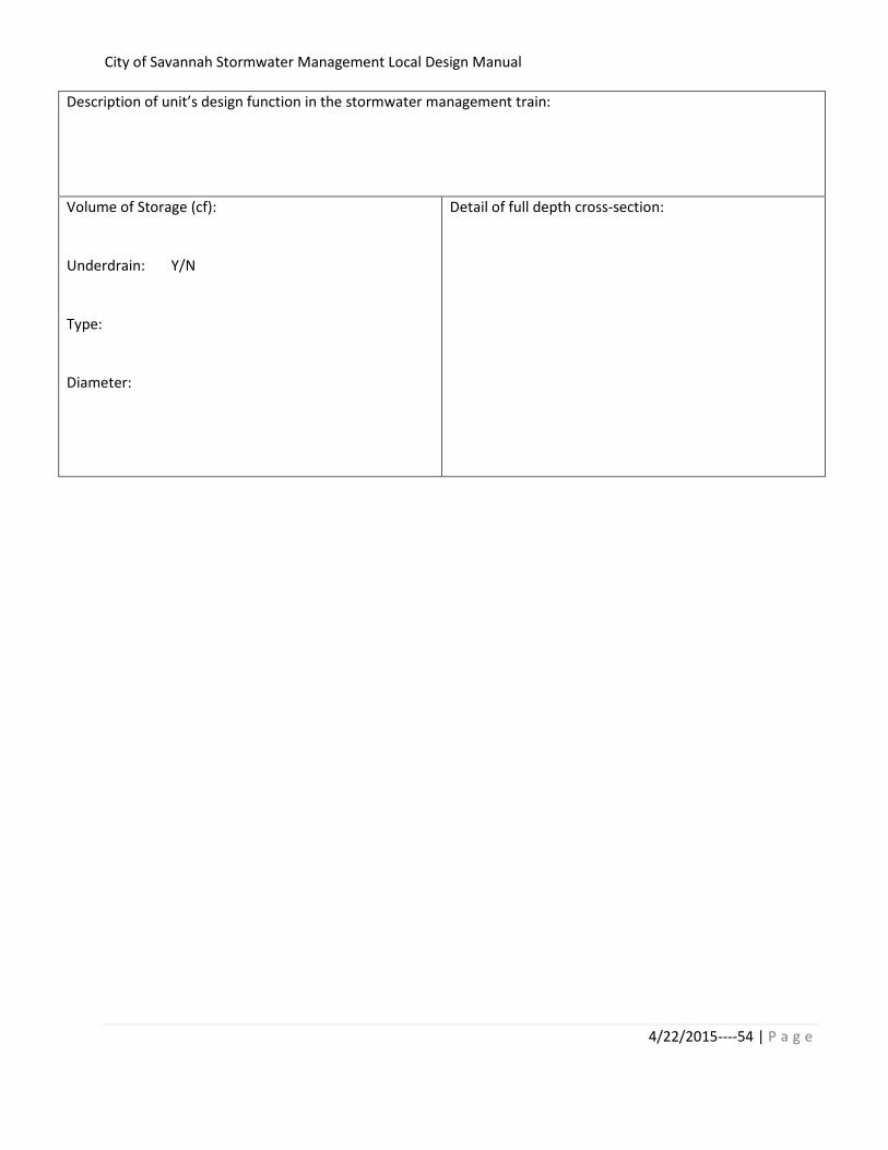
City of Savannah Stormwater Management Local Design Manual
4/22/2015----54 | P a g e
Description of unit’s design function in the stormwater management train:
Volume of Storage (cf):
Underdrain: Y/N
Type:
Diameter:
Detail of full depth cross-section:

City of Savannah Stormwater Management Local Design Manual
3/10/2015---55 | P a g e
Green Roof:: SWMU ID: Provide table for each SWMU ID
Description of design function in the stormwater management unit train:
Square feet of green:
Media depth:
Detention volume:
Overflow elevation (height above roof surface):
Detail of full depth cross-section:
Overflow Storage? Y/N
Storage volume:

City of Savannah Stormwater Management Local Design Manual
3/10/2015---56 | P a g e
Provide flow diagram of green roof overflow detention/reuse system:
Infiltration Trench: SWMU ID: Provide table for each SWMU ID
Description of unit’s design function in the stormwater management train:
Storage Volume: Inlet design:
SWMU location (to
nearest hundredth):
X:
Y:
Cross Section of Trench:

City of Savannah Stormwater Management Local Design Manual
3/10/2015---57 | P a g e
Underdrain: Y/N
Pipe Size:
Length:
Diagram:
Other Units: SWMU ID: Provide table for each SWMU ID
Description of unit’s design function in the stormwater management train:
Design Capacity/Volume: Diagram of Unit:
Outfall Coordinates (to
nearest hundredth):
X:
Y:
Instructions for completing Record Drawing Stormwater Management Unit Inventory data sheet:
Project Name, Number, Location and Consultant should be identical to the SPR information for
the project.
Provide the date of the final inspection as registered in the SPR data for the project.
Total disturbed and total impervious areas are provided with the project’s Hydrology Report but
shall be provided as-built to reflect any changes since the design submittal.

City of Savannah Stormwater Management Local Design Manual
3/10/2015---58 | P a g e
Site APv is the project’s Aquatic Resource Protection Volume from the accepted project concept
plan or stormwater design plan.
Stormwater Structure List is to include the Stormwater Management Units (SWMUs) and a
unique identifier for the project. Stormwater structures for the purposes of this form do not
include manholes, inlets, ditches (unless provided as a swale), headwalls, pipes (unless provided
as underground detention) or pipe flared end sections.
Stormwater treatment train should show in sequence all Stormwater Management practices
used to address the Stormwater Management Ordinance. This may include BMPs such as
downspout disconnects, reduced pavement area on lots, curb inlet inserts and other engineered
methods.
Enter both as-built elevation and volume of design storms for SWMUs that provide overbank
flood protection.
For each SWMU provide the description of the unit’s design function in the stormwater
management train. The description should include how the RRv, APv and/or OFP are addressed
with this unit. This information should agree with the stormwater design submittal for the
project and may come directly from the CSS Site Planning and Design Worksheet. Provide
requested documentation of as-built details for post-construction inspection and maintenance
program.
Provide Georgia Professional Engineer’s signature, registration number and date as certification
of the review and accuracy of this submittal.

City of Savannah Stormwater Management Local Design Manual
3/10/2015---59 | P a g e
Appendix H:
Application for Redevelopment Runoff Reduction Volume
Credit

City of Savannah Stormwater Management Local Design Manual
3/10/2015---60 | P a g e
Name Email:
Title:
City: State: Zip code:
Cell number:
Location/Address: Property size (acres)
Project name: Plan number in ETRACK: _____- _____________- Plan
Application is for off-site RRv ________ or impervious area off-set ________ (check one)
Soil contamination or other subsurface or geologic condition that creates risks or
hazards to infiltration of water into the ground
Off-site RRv Calculation Off-site Pervious Surface Calculation Total off-site Runoff Reduction credit
applied for: (cuft)
Total off-site pervious surface credit applied for: (sf)
RRC(off-site) [sf] = RRC (onsite) / 0.42
Total off-site Runoff Reduction required: Total off-site pervious surface required:
RRC(total) = RRC(off-site) + 0.20(RRC(off-site)) RRC(total) = RRC(off-site) + 0.20(RRC(off-site))
Please check each eligibility criterion that applies to this site
Too small/no an area outside of the building foot print
(explain)
Total Cost of purchased Run-off Reduction Volume to be managed off-site = $____________________________
Other significant site constraints (explain below):
Water Volume Calculations
Site use that is inconsistent with capture and reuse of storm water (explain below)
A physical condition that prohibits use of storm water infiltration practice (like seawall, slip piles, walls)
Project Site Information
Eligibility of off-site Compliance: Documentation of Infeasibility of On-site Compliance
Watershed/Downstream discharge point:
Applicant Information
Primary contact:
Mailing Address
Telephone number:
Credit for off-site stormwater management is only available within city right-of-way or city-owned property.

City of Savannah Stormwater Management Local Design Manual
3/10/2015---61 | P a g e
Appendix I:
Soil Infiltration Testing Protocoli

City of Savannah Stormwater Management Local Design Manual
3/10/2015---62 | P a g e

City of Savannah Stormwater Management Local Design Manual
3/10/2015---63 | P a g e

City of Savannah Stormwater Management Local Design Manual
3/10/2015---64 | P a g e

City of Savannah Stormwater Management Local Design Manual
3/10/2015---65 | P a g e

City of Savannah Stormwater Management Local Design Manual
3/10/2015---66 | P a g e

City of Savannah Stormwater Management Local Design Manual
3/10/2015---67 | P a g e

City of Savannah Stormwater Management Local Design Manual
3/10/2015---68 | P a g e

City of Savannah Stormwater Management Local Design Manual
3/10/2015---69 | P a g e
i Reference: LID Manual for Michigan-Appendix E
http://library.semcog.org/InmagicGenie/DocumentFolder/LIDManualWeb.pdf