1 nasa weather applications program 2010 program overview john a. haynes program manager, weather...
TRANSCRIPT
1
NASA Weather Applications Program2010 Program Overview
John A. HaynesProgram Manager, Weather
Applied Sciences ProgramEarth Science Division
Science Mission Directorate NASA
Washington, DC USA
2
http://science.nasa.gov/media/medialibrary/2010/08/30/2010SciencePlan_TAGGED.pdf
2010 NASA Science Plan
The 2010 Science Plan identifies the direction NASA has received from the Administration and Congress, advice received from the nation's science community, principles and strategies guiding the conduct of our activities, and challenges we face. The plan that results enables NASA, as Administrator Bolden says, to "do the best science, not just more science."
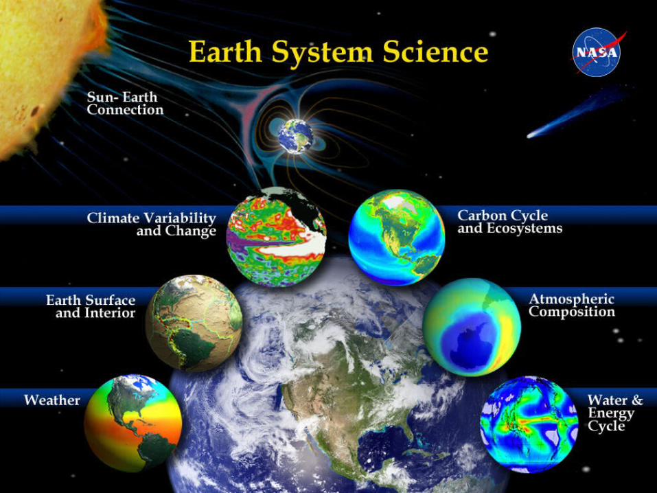
The NASA Earth Science strategic goal is stated as, “Advance Earth System Science to meet the challenges of climate and environmental change.”
Supporting document for NASA Earth Science
3
Responding to the Challenge of Climate and Environmental Change: NASA's Plan for a Climate-Centric Architecture for Earth Observations and Applications from Space (June 2010)
http://science.nasa.gov/media/medialibrary/2010/07/01/Climate_Architecture_Final.pdf
NASA's plans to revitalize the nation's research satellite system; expand research, applications, technology, and education activities using NASA and non-NASA satellite data; and develop/mature technologies required for the next generation of Earth observing missions.
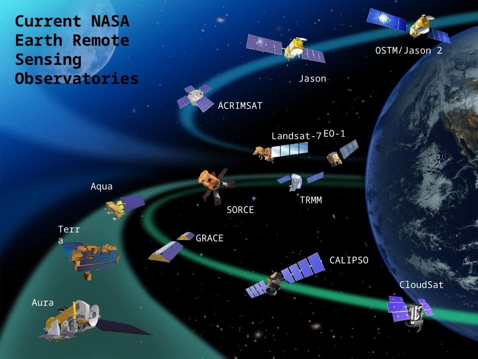
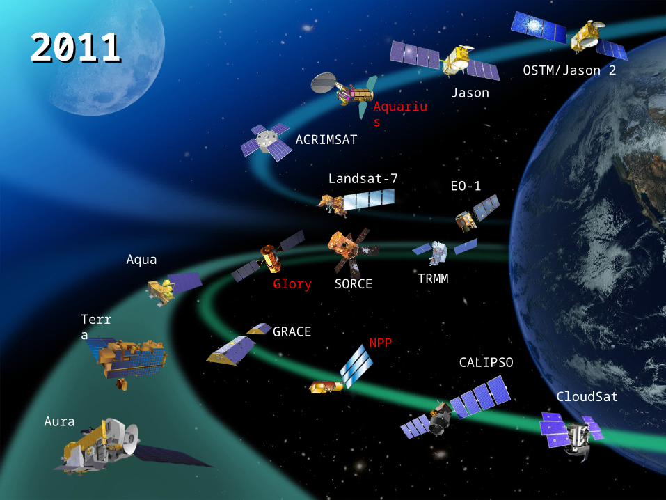
Aqua
Terra
Aura
EO-1Landsat-7
ACRIMSAT
Jason
OSTM/Jason 2
SORCETRMM
GRACE
CALIPSO
CloudSat
Current NASA Earth Remote Sensing Observatories
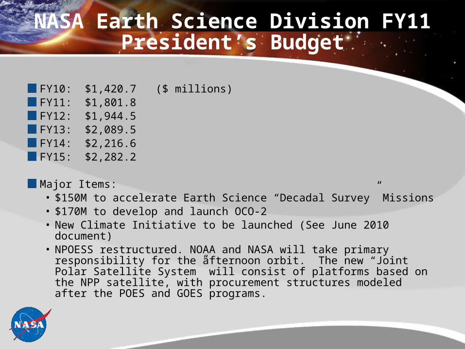
NASA Earth Science Division FY11 President’s Budget
FY10: $1,420.7($ millions)FY11: $1,801.8FY12: $1,944.5FY13: $2,089.5FY14: $2,216.6FY15: $2,282.2
Major Items:• $150M to accelerate Earth Science “Decadal Survey” Missions• $170M to develop and launch OCO-2• New Climate Initiative to be launched (See June 2010 document)• NPOESS restructured. NOAA and NASA will take primary
responsibility for the afternoon orbit. The new “Joint Polar Satellite System” will consist of platforms based on the NPP satellite, with procurement structures modeled after the POES and GOES programs.
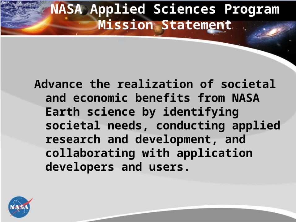
NASA Applied Sciences Program Mission Statement
Advance the realization of societal and economic benefits from NASA Earth science by identifying societal needs, conducting applied research and development, and collaborating with application developers and users.
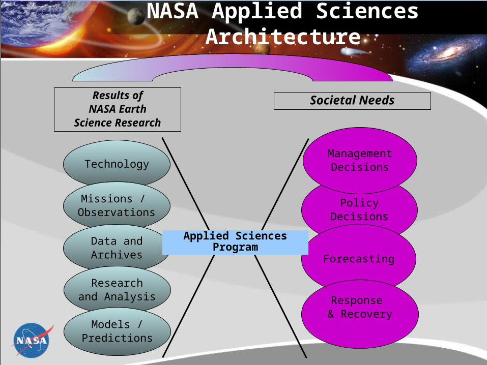
Technology
Missions / Observations
Data andArchives
Researchand Analysis
Models /Predictions
PolicyDecisions
Forecasting
Results ofNASA Earth
Science Research
Societal Needs
Applied SciencesProgram
Response & Recovery
ManagementDecisions
NASA Applied Sciences Architecture
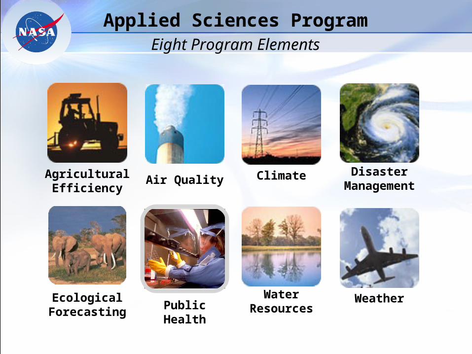
Ecological Forecasting
AgriculturalEfficiency
Air Quality
Weather
Climate
WaterResources
Disaster Management
Public Health
Applied Sciences ProgramEight Program Elements
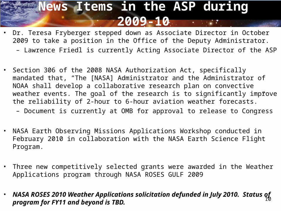
News Items in the ASP during 2009-10• Dr. Teresa Fryberger stepped down as Associate Director in October 2009 to take a
position in the Office of the Deputy Administrator.
– Lawrence Friedl is currently Acting Associate Director of the ASP
• Section 306 of the 2008 NASA Authorization Act, specifically mandated that, “The [NASA] Administrator and the Administrator of NOAA shall develop a collaborative research plan on convective weather events. The goal of the research is to significantly improve the reliability of 2-hour to 6-hour aviation weather forecasts.”
– Document is currently at OMB for approval to release to Congress
• NASA Earth Observing Missions Applications Workshop conducted in February 2010 in collaboration with the NASA Earth Science Flight Program.
• Three new competitively selected grants were awarded in the Weather Applications program through NASA ROSES GULF 2009
• NASA ROSES 2010 Weather Applications solicitation defunded in July 2010. Status of program for FY11 and beyond is TBD.
10
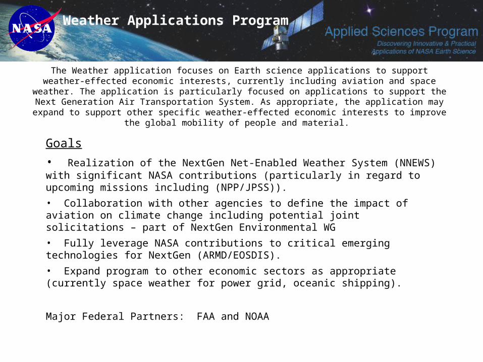
The Weather application focuses on Earth science applications to support weather-effected economic interests, currently including aviation and space weather. The application is particularly focused on
applications to support the Next Generation Air Transportation System. As appropriate, the application may expand to support other specific weather-effected economic interests to improve the global mobility of
people and material.
Goals
• Realization of the NextGen Net-Enabled Weather System (NNEWS) with significant NASA contributions (particularly in regard to upcoming missions including (NPP/JPSS)).
• Collaboration with other agencies to define the impact of aviation on climate change including potential joint solicitations – part of NextGen Environmental WG
• Fully leverage NASA contributions to critical emerging technologies for NextGen (ARMD/EOSDIS).
• Expand program to other economic sectors as appropriate (currently space weather for power grid, oceanic shipping).
Major Federal Partners: FAA and NOAA
Weather Applications Program
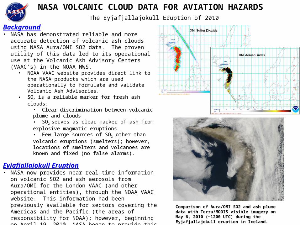
NASA VOLCANIC CLOUD DATA FOR AVIATION HAZARDS
Background• NASA has demonstrated reliable and more accurate
detection of volcanic ash clouds using NASA Aura/OMI SO2 data. The proven utility of this data led to its operational use at the Volcanic Ash Advisory Centers (VAAC’s) in the NOAA NWS.
• NOAA VAAC website provides direct link to the NASA products which are used operationally to formulate and validate Volcanic Ash Advisories.
• SO2 is a reliable marker for fresh ash clouds:• Clear discrimination between volcanic plume and clouds• SO2 serves as clear marker of ash from explosive magmatic eruptions• Few large sources of SO2 other than volcanic eruptions (smelters); however, locations of smelters and volcanoes are known and fixed (no false alarms).
Eyjafjallajokull Eruption• NASA now provides near real-time information on volcanic
SO2 and ash aerosols from Aura/OMI for the London VAAC (and other operational entities), through the NOAA VAAC website. This information had been previously available for sectors covering the Americas and the Pacific (the areas of responsibility for NOAA); however, beginning on April 19, 2010, NASA began to provide this information for sectors covering Iceland and Northwest Europe.
http://satepsanone.nesdis.noaa.gov/pub/OMI/OMISO2/index.html Comparison of Aura/OMI SO2 and ash plume data with Terra/MODIS visible imagery on May 6, 2010 (~1200 UTC) during the Eyjafjallajokull eruption in Iceland.
The Eyjafjallajokull Eruption of 2010
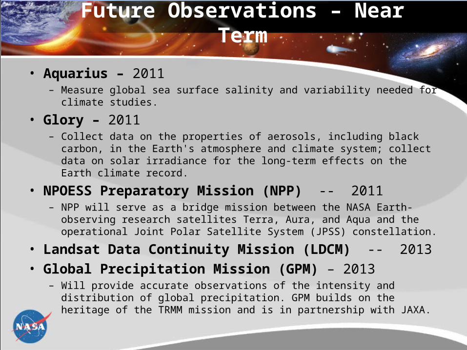
Future Observations – Near Term
• Aquarius – 2011– Measure global sea surface salinity and variability needed for climate
studies.
• Glory – 2011– Collect data on the properties of aerosols, including black carbon, in the
Earth's atmosphere and climate system; collect data on solar irradiance for the long-term effects on the Earth climate record.
• NPOESS Preparatory Mission (NPP) -- 2011 – NPP will serve as a bridge mission between the NASA Earth-observing
research satellites Terra, Aura, and Aqua and the operational Joint Polar Satellite System (JPSS) constellation.
• Landsat Data Continuity Mission (LDCM) -- 2013
• Global Precipitation Mission (GPM) – 2013– Will provide accurate observations of the intensity and distribution of global
precipitation. GPM builds on the heritage of the TRMM mission and is in partnership with JAXA.
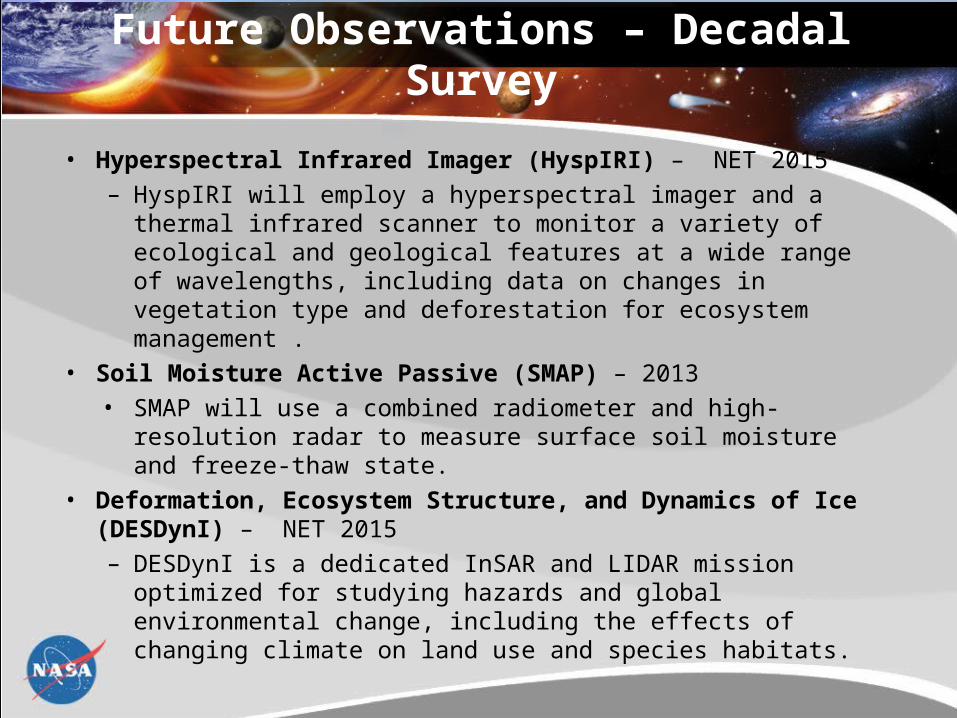
• Hyperspectral Infrared Imager (HyspIRI) – NET 2015– HyspIRI will employ a hyperspectral imager and a thermal
infrared scanner to monitor a variety of ecological and geological features at a wide range of wavelengths, including data on changes in vegetation type and deforestation for ecosystem management .
• Soil Moisture Active Passive (SMAP) – 2013• SMAP will use a combined radiometer and high-resolution
radar to measure surface soil moisture and freeze-thaw state.
• Deformation, Ecosystem Structure, and Dynamics of Ice (DESDynI) – NET 2015– DESDynI is a dedicated InSAR and LIDAR mission optimized
for studying hazards and global environmental change, including the effects of changing climate on land use and species habitats.
Future Observations – Decadal Survey
Aqua
Terra
Aura
Aquarius
SORCE TRMM
Landsat-7
ACRIMSAT
Jason
OSTM/Jason 220112011
NPP
Glory
GRACE
CloudSat
EO-1
CALIPSO
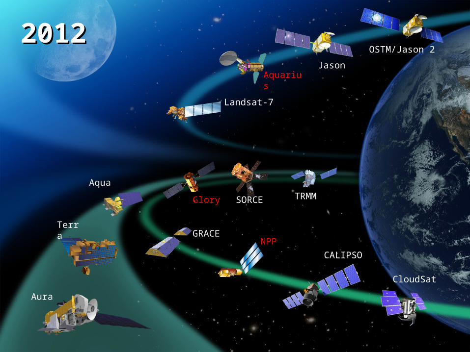
Aqua
Terra
Aura
SORCE TRMM
Jason
OSTM/Jason 220122012
Glory
Aquarius
Landsat-7
NPPGRACE
CloudSat
CALIPSO
Aqua
Terra
Aura
SORCE TRMM
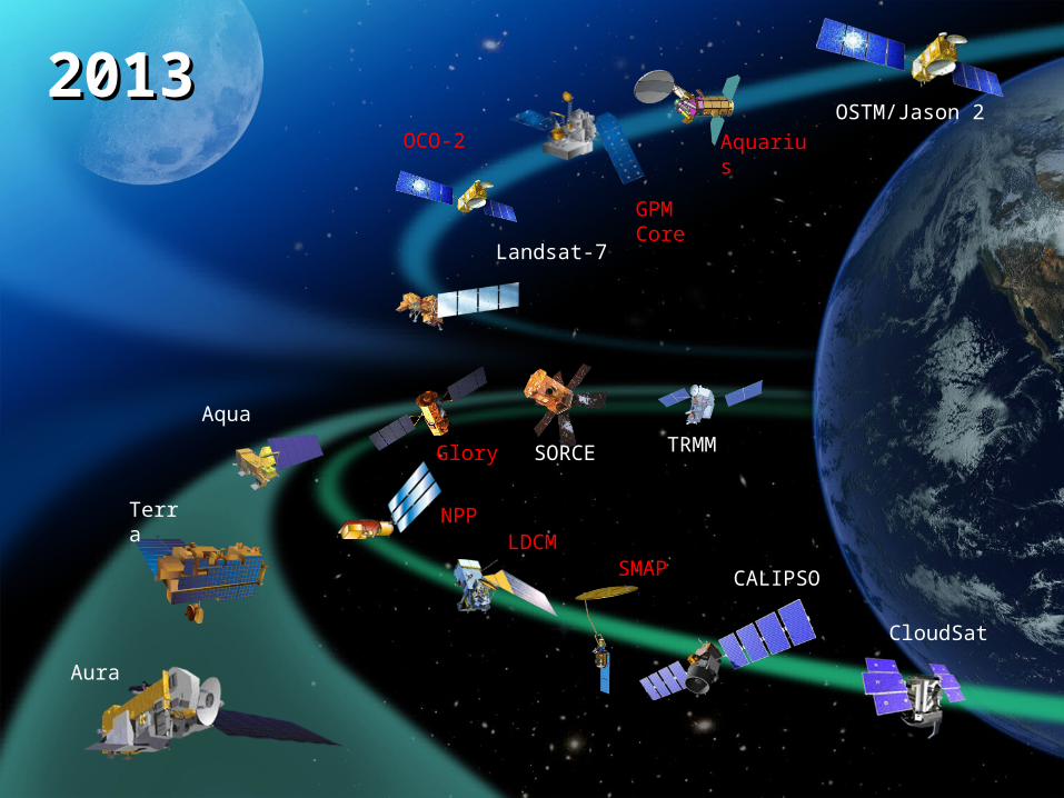
OSTM/Jason 220132013
NPP
Glory
SMAPLDCM
Aquarius
Landsat-7
CloudSat
CALIPSO
GPM Core
OCO-2
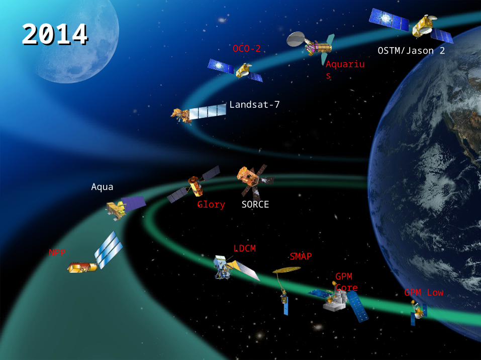
Aqua
SORCE
OSTM/Jason 220142014
NPP
Glory
GPM Core
GPM Low
Aquarius
LDCMSMAP
Landsat-7
OCO-2
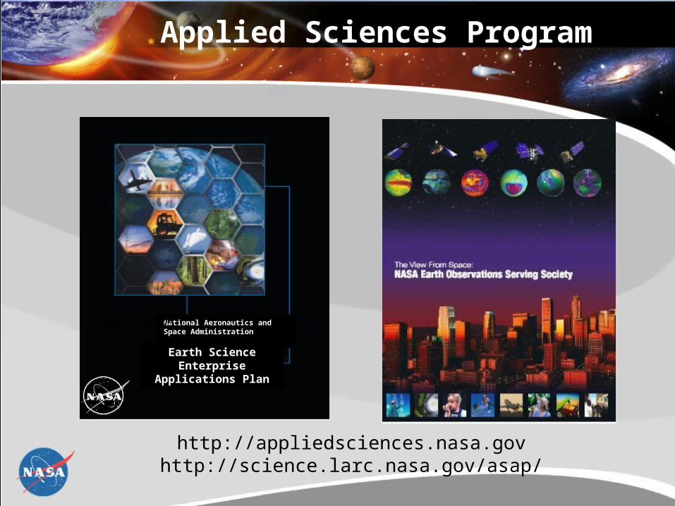
Applied Sciences Program
http://appliedsciences.nasa.govhttp://science.larc.nasa.gov/asap/
National Aeronautics andSpace Administration
Earth Science EnterpriseApplications Plan
April 2004