1 smith street parramatta reportv5 - casey & lowe · the non-indigenous archaeological program...
TRANSCRIPT
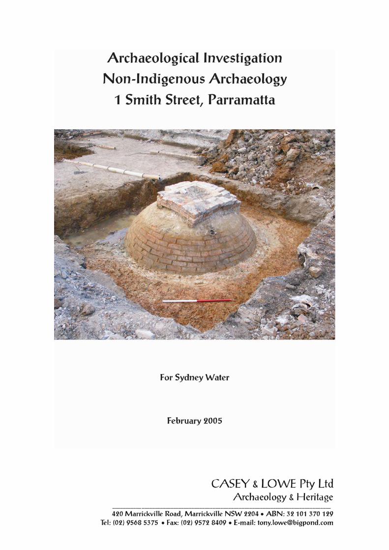

Executive Summary The non-indigenous archaeological program at 1 Smith Street identified remains associated with the former houses at 1, 3 and 5 Smith Street. This archaeological program involved archaeological testing followed by a program of sampling. Testing in the yard and house area of demolished houses along Smith Street and yards of properties fronting Darcy Street focused on ascertaining whether substantial archaeological remains were present. This testing indicated that few deposits or features were likely although three brick beehive water cisterns were found at the rear of three of the houses at 1, 3, and 5 Smith Street. During the archaeological sampling the cistern at no. 5 Smith Street was found to be backfilled with a large deposit of domestic refuse. As Section 4 discusses and illustrates these artefacts were ‘domestic’ in nature as well as representing a group typically found in the laundry and/or shed (Tables 4-5, 4-6). The domestic artefacts included teapots, cups and saucers, plates, drinking glasses and alcohol bottles, locally-manufactured bottles and jars, such as Summons & Graham ginger beer bottles as well as imported wares such as Chinese ginger jars and Japanese cups and saucers. Many of the glass bottles and jars were reused as storage vessels to contain various substances, such as paint, kerosene, and so on. In addition to those already reused items there were empty glass containers being stored, including the pharmaceutical bottles (Fig. 4.16) and ink and glue bottles (Fig. 4.17). This rubbish dump was probably put into the cistern as late as the early 1930s. Due to the high turnover of residents at 5 Smith Street these artefacts could not be definitely associated with any identifiable person or family. Photos of many of these artefacts are included in Section 4. Archaeological deposits dating from the early twentieth century are rarely found on urban archaeological sites, especially those in the Sydney CBD, due to municipal rubbish collection which allows people to dispose of goods outside their own properties. Therefore it is considered that this is an interesting group of artefacts that would warrant further research. The archaeological program and reporting included recording the remains of the cisterns and analysing their contents in some detail. These findings, as well as the results of an Indigenous archaeological excavation program on the site, will be displayed and interpreted within the foyer of the new building on the site. Appendix 1 reproduces the testing report. Appendix 2 is a print out of the computer catalogue. Appendix 3 contains artefact tables discussed in the Section 4 of the report. Appendix 4 is a specialists’ report on the glass artefacts from the site.

Contents
Executive Summary 1.0 Introduction ............................................................................................................... 1
1.1 Background ..................................................................................................................... 1 1.2 Study Area....................................................................................................................... 1 1.3 Archaeological Assessment and Permits......................................................................... 1 1.4 Authorship....................................................................................................................... 1 1.5 Acknowledgements ......................................................................................................... 2 1.6 List of Illustrations .......................................................................................................... 3 1.7 Abbreviations .................................................................................................................. 4
2.0 Historical Background.............................................................................................. 5
2.1 Early Land Use................................................................................................................ 5 2.2 Nineteenth and Early Twentieth-Century Owners and Occupants of Houses 1, 3 and 5
Taylor (Smith) Street................................................................................................... 9 3.0 Results of Fieldwork................................................................................................ 15
3.1 Testing........................................................................................................................... 15 3.2 Sampling........................................................................................................................ 18 3.3 Results of Sampling ...................................................................................................... 19 3.4 Overview of Cisterns..................................................................................................... 22 3.5 Northern Cistern............................................................................................................ 31
4.0 Description and Analysis of Artefacts ................................................................... 33
4.1 Overview of Results ...................................................................................................... 33 4.2 Analysis of Artefacts ..................................................................................................... 33
5.0 Response to the Research Design ........................................................................... 44
5.1 Response to Research Questions................................................................................... 44 6.0 Bibliography ............................................................................................................ 47 Appendix 1: Testing Report Appendix 2: Artefact Catalogue
2.1: Ceramics 2.2: Glass 2.3: Miscellaneous 2.4: Metals 2.5: Organics 2.6: Building Materials
Appendix 3: Artefact Tables Appendix 4: Specialist Glass Report - Jeanne Harris

Excavation Report 1 Smith Street, Parramatta
1.0 Introduction 1.1 Background The site at 1 Smith Street was assessed as likely to retain European archaeological remains from the 1880s and the potential for post-1788 Aboriginal materials (i.e. contact artefacts) as the unoccupied nineteenth-century site was not far from the marketplace where Aboriginal people had congregated for various functions such as the annual feast day which was held between 1813 and 1835. There was also the potential for pre-1788 Aboriginal artefacts. Casey & Lowe Pty Ltd were engaged by Sydney Water to undertake the recording of the site’s non-indigenous archaeology, with Jo McDonald Cultural Heritage Management Pty Ltd, acting as their sub-consultant, carrying out the Indigenous archaeological testing and sampling. This report presents the results of the non-indigenous archaeological program. The archaeological program was undertaken in two stages:
Archaeological Testing from 17 to 19 March 2004 Archaeological Sampling from 30 August to 1 September 2004
1.2 Study Area The study area is at the northwest corner of Smith and Darcy Streets, Parramatta (Fig. 1.1). The site was occupied by late nineteenth-century houses and twentieth-century commercial buildings. These were demolished prior to the commencement of the archaeological program, with archaeological monitoring taking place during the removal of concrete ground slabs. The site is to be redeveloped by Sydney Water as their new headquarters. 1.3 Archaeological Assessment and Permits The site was assessed by Godden Mackay Logan Pty Ltd, in Smith and Darcy Streets, Parramatta, Heritage and Archaeological Assessment, for Parramatta Rail Link, March 2003. The site was subsequently purchased by Sydney Water as the site of their new headquarters. A Section 140 permit was obtained by Sydney Water to enable non-indigenous archaeological work on the site. This permit was subsequently transferred to Casey & Lowe Pty Ltd with Tony Lowe as nominated excavation director. Indigenous testing and fieldwork was carried out by Jo McDonald Cultural Heritage Management Pty Ltd. Following the completion of the testing program it was recommended that the nature and extent of archaeological remains for the European archaeology, partly damaged by twentieth-century structures on the site, only required sample excavation and recording. This would focus on the cisterns and cesspits as well as deposits likely to have significant artefact deposits. 1.4 Authorship Sections 1 and 3 of this report were written by Tony Lowe and reviewed by Dr Mary Casey, Casey & Lowe Pty Ltd. Mary Casey wrote Sections 2, 4 and 5 which were reviewed by Tony Lowe. All photographs were taken by Tony Lowe. Fieldwork was directed by Tony Lowe who was assisted by Franz Reidel, Tim Adams and Glen Suey. All site plans were drawn by Franz Reidel and computer plans were produced by Tim Adams. Artefacts were catalogued by Rowan Ward (ceramics), Robyn Stocks (metal, miscellaneous, organics) and Jeanne Harris (glass) with data entry by Jeanne Harris. A specialist report was written on the glass artefacts by Jeanne Harris (Appendix 4).

Introduction
2
Figure 1.1: Location plan of the study area on the northwest corner of Smith and Darcy Streets. 1.5 Acknowledgements The archaeological program was funded by Sydney Water as part of their redevelopment of the site. Several Sydney Water staff contributed to the successful completion of the fieldwork program and the subsequent report-writing phase. They are: MacLaren North Don Wimalaratne Craig Heitmann Rocky de Bono, Cadence Australia Pty Ltd, project management. The NSW Heritage Office representative dealing with this site was Isabel Cobas.

Introduction
3
1.6 List of Illustrations Figures Figure 1.1: Location plan of the study area on the northwest corner of Smith and Darcy Streets. Figure 2.1: Evans, ‘Plan of the Township of Parramatta’ 1804. The lots on Macquarie Street were already
laid out and the early leases in the darker colour were made to D’Arcy Wentworth (22), Captain Piper (21) and William Balmain (20) who was also a surgeon at Parramatta. Approximate position of the study area is shown within the original grant to Captain Piper although this is not an accurate plan................................................................................................................................6
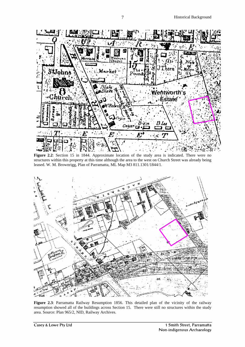
Figure 2.2: Section 15 in 1844. Approximate location of the study area is indicated. There were no structures within this property at this time although the area to the west on Church Street was already being leased. W. M. Brownrigg, Plan of Parramatta, ML Map M3 811.1301/1844/1.........7
Figure 2.3: Parramatta Railway Resumption 1856. This detailed plan of the vicinity of the railway resumption showed all of the buildings across Section 15. There were still no structures within the study area. Source: Plan 965/2, NID, Railway Archives............................................................7
Figure 2.4: Redrawing of the Parramatta Detail Survey 1895. The study area is shaded grey and the houses are numbered with their known street numbers. This shows that the whole of the city block was built on by 1895 including the study area. ML, Parramatta Detail Survey, Sheet 18......................8
Figure 2.5: Study area within the Wentworth Estate subdivision. Wentworth Estate Cadastral Plan. LTO Plan Room, DP 979263. ...................................................................................................................8
Figure 2.6: Detail of 1961 aerial photo with the study area outlined (approximate). ....................................9 Figure 2.7: Layout of buildings prior to demolition in 2004. Only the house at 3–5 Taylor Street was
extant in 1895. The rest were replaced by twentieth-century buildings. ........................................10 Figure 2.8: Plan from Parramatta Heritage Study Review 1990, inventory sheet. This shows the house as
being subdivided. It was suggested in the inventory form that this was a modern division but records, analysis of Sands and the two cisterns found at the rear of this house suggest it was always two semi-detached houses. .................................................................................................14
Figure 3.1: Plan showing location of test trenches. .....................................................................................16 Figure 3.2: Location of cisterns (circles) in relation to the non-indigenous test trenches............................17 Figure 3.3: Plan showing the expanded Trench 4 (Trench 13, middle bottom)...........................................19 Figure 3.4: Plan showing extent of additional excavation. ..........................................................................20 Figure 3.5: Study area in 1895, showing house nos 1-9 in Smith Street. ....................................................20 Figure 3.6: Plan of Trench 13. .....................................................................................................................21 Figure 3.7: Photo of Trench 13 looking north showing general yard surface with later footings (centre) and
fuel tank (right). .............................................................................................................................22 Figure 3.8: Northern cistern (#4702) prior to excavation, looking south. Note middle cistern behind. .....24 Figure 3.9: The middle cistern looking westwards. Note inlet pipes. .........................................................24 Figure 3.10: Plan of northern cistern. ..........................................................................................................25 Figure 3.11: Plan of middle cistern..............................................................................................................26 Figure 3.12: Middle cistern after removal of brick collar, looking north. ...................................................27 Figure 3.13: Southern cistern looking west. Note render and inlets. ..........................................................28 Figure 3.14: Excavation of southern cistern. ...............................................................................................28 Figure 3.15: Plan of southern cistern. ..........................................................................................................29 Figure 3.16: Profiles through middle and south cisterns..............................................................................30 Figure 3.17: Profile through north cistern....................................................................................................31 Figure 3.18: Overlay of cisterns onto 1895 plan..........................................................................................32 Figure 4.1: Asian artefacts, including Chinese ginger jars and lid, and a Japanese teapot and egg cup. Other
Asian artefacts included plain white porcelain saucers. Figure 4.2: Garden artefacts. Figure 4.3: Enamel kettles, teapots, saucepans, cooking dish, mug, candle holder and snuffer. These were
used for everyday cooking and household activities. These are typical late of the late nineteenth century through to WWII.
Figure 4.4: Alcohol bottles, many showing evidence of reuse. These include square Dutch gin bottles, whisky flasks and beer/wine bottles.
Figure 4.5: Different teapots from #4703. Figure 4.6: Various plates and a serving vessel. #4703 Figure 4.7: Tea cups and saucers and a milk jug, #4703.

Introduction
4
Figure 4.8: A po, shaving jug, part of a ewer and the bottom of a toothpowder container, #4703. Figure 4.9: Stoneware ginger beer bottle, ink bottles and part of a bed warmer, #4703. Figure 4.10: Remains of ornamental vases and a bowl. The two large white vases, while not of the same
design, are similar. The two green vases also have different forms, #4703. Figure 4.11: Remains of green glass ornamental items, #4703. Figure 4.12: Glass bottles, many of which had evidence of reuse, #4703. Figure 4.13: Food and pharmaceutical bottles, #4703. Figure 4.14: Bottles with the names of Sydney companies, #4703. Figure 4.15: Bottles with the names of local Parramatta manufacturers, including two from McIlwraiths
grocer shop which was on the corner of Darcy and Church Streets, #4703. Figure 4.16: Range of pharmecutical and toiletry bottles found in the cistern. Many of these showed clear
evidence of reuse, #4703. Figure 4.17: Ink bottles and wells and a clag (glue) bottle, #4703. Figure 4.18: Tumblers, stemmed glass and a fine etched drinking glass were found. Two of the glasses
were blackened in a fire. Figure 4.19: Early light globes dating from 1913. Forms of pre-eclectic lighting were candle sticks, and oil
lamps. The camp-stove (back left) or ‘primus’ stove is Swedish and was patented in 1919. Figure 4.20: Range of artefacts from the cesspit, #4707. Figure 4.21: Small artefacts recovered during the sieving for Aboriginal artefacts. Stem of a pipe, two
pieces of slate pencil, three marbles, beads and glass, shell and metal buttons. Tables Table 2-1: Extract from Sands Directory.....................................................................................................12 Table 2-2: Extract from Council Rate Assessments.....................................................................................13 Table 4-1: List of contexts containing artefacts which will be discussed below. ........................................33 Table 4-2: No of artefacts in each context. ..................................................................................................33 1.7 Abbreviations DP Deposited Plan Frag Fragments GML Godden Mackay Logan HRNSW Historical Records of New South Wales LTO Land Titles Office LTOD Land Titles Office Document MIC Minimum Item Count SMH Sydney Morning Herald PA Primary Application
Historical Background
5
2.0 Historical Background 2.1 Early Land Use1 William D’Arcy Wentworth The study area was part of land granted to Dr William D’Arcy Wentworth, an early assistant surgeon at Parramatta Hospital who was also resident surgeon at the ‘Rum’ hospital. He was of Anglo-Irish descent and came to New South Wales as Assistant Surgeon on the Neptune, arriving 28 June 1790. His desire to come to New South Wales was based on his apparent lack of money and four appearances in the Old Bailey. Initially he served on Norfolk Island (September 1791 to February 1796) before being appointed assistant surgeon of the colony from April 1796. He was eventually appointed as principal surgeon of the Civil Medical Department from February 1809. He held a range of other posts including justice of the peace, chief police magistrate in Sydney, commissioner of turnpike roads, and treasurer of the Police Fund. He was involved in the establishment of the Bank of New South Wales. During his period at Parramatta Hospital Wentworth was suspended by Governor Bligh for allegedly misusing the labour of sick convicts. He was one of the three individuals contracted to build the ‘Rum’ hospital by Governor Macquarie in 1810.2 Wentworth obtained his first grant in Parramatta of 147 acres in 1799 from Governor Hunter. Grants were frequently given to government officers to supplement their incomes. On 18 October 1799, he was given a lease, for 14 years, of 6 acres 20 rods on the east side of the main road leading to Sydney in the town of Parramatta (Fig. 2.1). The Quit Rent was to be 5/- per annum.3 On 24 October 1799, Lieutenant John Piper, of the New South Wales Corps, was given a Lease for 14 years, of 3 acres 135 rods to the east of this, ‘situate between the allotments leased to William Balmain and Mr D'Arcy Wentworth’, in Parramatta. The lease was given for building purposes. The Quit Rent was to be 5/- per annum.4 In May 1803, Mr Wentworth was reported as having bought lot 28 at an auction, which comprised a ‘Town Lease of 3 Acres 4 Roods … at Parramatta, for 22/-’. This appears to coincide with Piper’s lease.5 In 1804, Captain John Piper owed a total of £915/12/6 to D'Arcy Wentworth for goods etc. Offsets reduced this debt to £639/14/8.6 Evans’ Map of Parramatta of 1804 shows the position of Piper’s and Wentworth’s leases (Fig. 2.1).7 Governor King extended Wentworth’s lease for a further 14 years from 1 January 1806, ‘in consequence of the house and other improvements, Mr Wentworth has made on his lease’.8 On 31 August 1819, this land was formally granted to D'Arcy Wentworth, esquire. It comprised 31 acres in the District of Parramatta and appears to have incorporated Piper’s land as well. This grant is now known as Portion 196, Parish of St. John.9
1 This incorporates new research as well as information contained in GML 2003, Section 2.4:16-27 and draws on work by historian Terry Kass undertaken for Casey & Lowe for a number of nearby projects. 2 ADB (1) 2:579-582. 3 LTO Grants Reg 2B, No 849. 4 LTO Grants Reg 2B, No 363. 5 Sydney Gazette, 29 May 1803, p 4. 6 Piper Papers, M L A254, Vol 1, pp 29-31. 7 G. W. Evans, Plan of the Township of Parramatta, 1813 (actually 1804), ML Map M2 811.1301/1813/1. 8 LTO Grants Reg 2B, No 849. 9 Grants 11 No 58.

Historical Background
6
In his will of 5 July 1827, D'Arcy Wentworth left various properties to his son William Charles Wentworth. These included the dwelling houses and premises at Parramatta, on 31 acres, then occupied by ‘Mr Bucknell’.10 D'Arcy Wentworth died on 7 July 1827. On 22 October 1829, William Charles Wentworth mortgaged 31 acres at Parramatta with a ‘capital messuage thereon’ to Lieutenant-Colonel Thomas Shadforth for £500 for 2 years at 10%.11 This loan was discharged on 4 November 1848.12
Figure 2.1: Evans, ‘Plan of the Township of Parramatta’ 1804. The lots on Macquarie Street were already laid out and the early leases in the darker colour were made to D’Arcy Wentworth (22), Captain Piper (21) and William Balmain (20) who was also a surgeon at Parramatta. Approximate position of the study area is shown within the original grant to Captain Piper although this is not an accurate plan. During the 1830s, William Charles Wentworth leased some land for 21 years on the Sydney Road and on the continuation of Argyle Street, east of Sydney Road/Church Street. These leases were all for parcels of land north of the current alignment of Argyle Street and north of the current railway line.13 Brownrigg’s 1844 Map of Parramatta showed the study area as still being vacant although other parts of the estate on Church Street were leased (Fig. 2.2). During the 1850s, the survey of the alignment of Parramatta's streets followed by the surveys for the railway which cut across Wentworth's grant and the continuation of Argyle Street in his grant created various plans (Figs 2.3).
10 Recited in LTOD, No 730 Bk 80. 11 LTOD, No 177 Bk C. 12 LTOD, No 998 Bk 16. 13 LTOD, No 629 Bk H: No 957 Bk I.
Historical Background
7
Figure 2.2: Section 15 in 1844. Approximate location of the study area is indicated. There were no structures within this property at this time although the area to the west on Church Street was already being leased. W. M. Brownrigg, Plan of Parramatta, ML Map M3 811.1301/1844/1.
Figure 2.3: Parramatta Railway Resumption 1856. This detailed plan of the vicinity of the railway resumption showed all of the buildings across Section 15. There were still no structures within the study area. Source: Plan 965/2, NID, Railway Archives.
Wentworth’s Estate

Historical Background
8
Figure 2.4: Redrawing of the Parramatta Detail Survey 1895. The study area is shaded grey and the houses are numbered with their known street numbers. This shows that the whole of the city block was built on by 1895 including the study area. ML, Parramatta Detail Survey, Sheet 18. Figure 2.5: Study area within the Wentworth Estate subdivision. Wentworth Estate Cadastral Plan. LTO Plan Room, DP 979263.
Historical Background
9
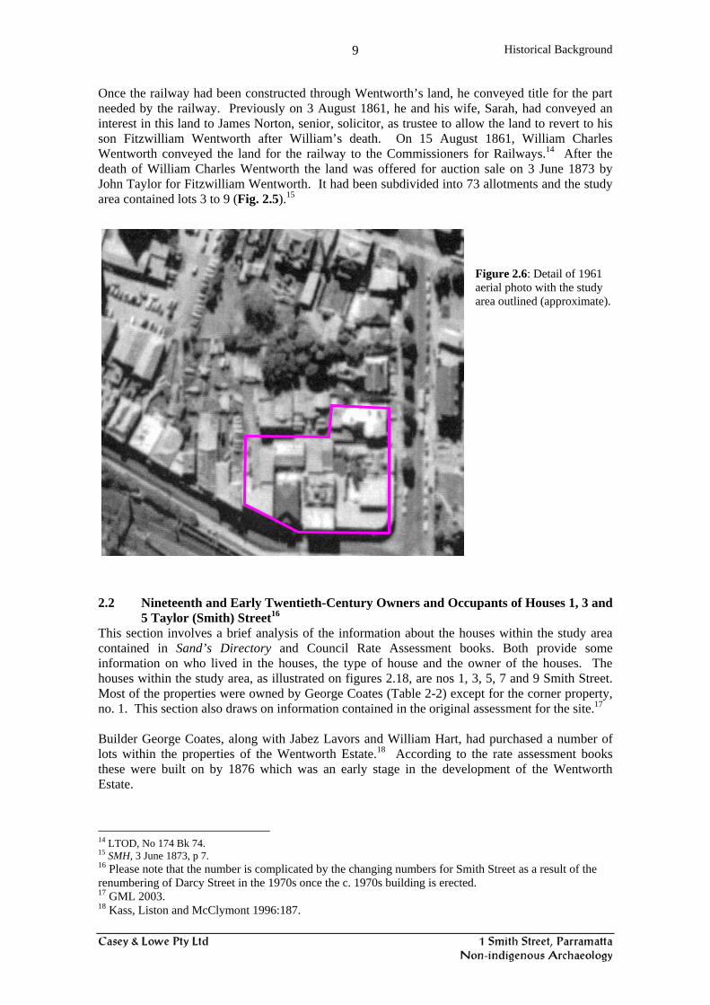
Once the railway had been constructed through Wentworth’s land, he conveyed title for the part needed by the railway. Previously on 3 August 1861, he and his wife, Sarah, had conveyed an interest in this land to James Norton, senior, solicitor, as trustee to allow the land to revert to his son Fitzwilliam Wentworth after William’s death. On 15 August 1861, William Charles Wentworth conveyed the land for the railway to the Commissioners for Railways.14 After the death of William Charles Wentworth the land was offered for auction sale on 3 June 1873 by John Taylor for Fitzwilliam Wentworth. It had been subdivided into 73 allotments and the study area contained lots 3 to 9 (Fig. 2.5).15
Figure 2.6: Detail of 1961 aerial photo with the study area outlined (approximate).
2.2 Nineteenth and Early Twentieth-Century Owners and Occupants of Houses 1, 3 and
5 Taylor (Smith) Street16 This section involves a brief analysis of the information about the houses within the study area contained in Sand’s Directory and Council Rate Assessment books. Both provide some information on who lived in the houses, the type of house and the owner of the houses. The houses within the study area, as illustrated on figures 2.18, are nos 1, 3, 5, 7 and 9 Smith Street. Most of the properties were owned by George Coates (Table 2-2) except for the corner property, no. 1. This section also draws on information contained in the original assessment for the site.17 Builder George Coates, along with Jabez Lavors and William Hart, had purchased a number of lots within the properties of the Wentworth Estate.18 According to the rate assessment books these were built on by 1876 which was an early stage in the development of the Wentworth Estate.
14 LTOD, No 174 Bk 74. 15 SMH, 3 June 1873, p 7. 16 Please note that the number is complicated by the changing numbers for Smith Street as a result of the renumbering of Darcy Street in the 1970s once the c. 1970s building is erected. 17 GML 2003. 18 Kass, Liston and McClymont 1996:187.

Historical Background
10
Figure 2.7: Layout of buildings prior to demolition in 2004. Only the house at 3–5 Taylor Street was extant in 1895. The rest were replaced by twentieth-century buildings. No 1 Smith (Taylor) Street (aka as modern 52-60 Darcy Street)19 This was owned by Herbert Coates jr in 1876 but by 1877 the owner was Thomas White who also lived there between 1877 and 1882 (Table 2-2). By 1887 White had sold the property to George Suttor who in turn sold it to Rev. J. Rest by 1895. The corner house was of timber construction and by the 1890s was being operated as a boarding house which it continued to be used for until about 1925 (Table 2-1). The cottage shown on the 1895 plan (Fig. 2.4) was demolished by 1927 as it is no longer recorded in Sands. This suggests that the wooden house was demolished and a new structure built which now faced Darcy Street. During the excavation, a cistern, possibly belonging to this 1870s house, was recorded (Figs 3.15, 3.16). This was the southern cistern (#4700) on Figure 2.18. It is possible that cesspit (#4705) belonged with this house (Fig. 3.18) but because of the changing property boundaries it may also have been associated with No. 3 Smith Street. Dating of the artefacts in the backfill of the cesspit indicates it was probably backfilled after the 1920s. This may mean that the pottery related to no. 3 Taylor (Smith) Street. No 3 to 5 Smith (Taylor) Street (aka 1 Smith Street on modern plans) The house at 3 to 5 Smith Street was still standing when the archaeological assessment for this site was written (Fig. 2.7).20 It was a brick house presumably built by George Coates who owned the property until his death when it was identified as being in the ownership of Mrs Victoria
19 Historic street numbers are used as shown on Figs 2.4, 2.7. 20 GML, March 2003:30.
7 Smith (Taylor) St 3- 5 Smith (Taylor) St

Historical Background
11
Alberta Usher Coates, his wife.21 Nos 3 to 5 were a semi-detached house even though the various plans do not show this. The sketch plan of the house (Fig. 2.8), drawn in 1990 as part of the Parramatta Heritage Review, has it as divided down the centre. The floor plan, the layout of the skillions, and the mirror image of the roof and floor layout suggest this structure was always two semi-detached houses. No. 3 had a variety of residents:
Francis Wickham from 1876 to 1882. Changes from Francis Myngaye to Herbert Coates, presumably a son or other relative of
the owner George Coates. Between 1914 and 1920 William and Ruth Ling resided there and were possibly of
Chinese ethnicity. Between 1923 and 1930 James Harvey was the resident. Between 1930 and 1932/33 James Odewahn was the resident.
No 5 also had a variety of residents:
In 1890 there were three listed residents - Mrs McIntyre, Miss Curling, a lady doctor and Mr James Baille, a school teacher, perhaps suggesting that they were boarders.
By 1900 a single family name is listed, with the names changing regularly. Residents include: Albert Williams, Frank Watsford, Frederick Person, Amos Fahey and Henry Howell. Henry Howell resided there between 1927 and 1930 but was gone by 1931.
This presents an image of frequently changing tenants. It may suggest that it was not they who backfilled the cistern but one of their neighbours when the residents were away.
The Fahey family lived in nos 5, 7 and 9 between 1923 and 1931. It is possible, with their knowledge of the house and yard, that they may have contributed the material in the cistern, perhaps when they moved out of Taylor Street in 1931.
21 GML 2003:17, LTO PA 20758.

Historical Background
12
Table 2-1: Extract from Sands Directory TAYLOR [Smith] STREET (West Side) Macquarie to Station St
Year House No? Name Occupation
1885 13? Davey, Mrs 11? Crew, William J Watson, S.J inspector of telegraph lines Sheridan, Charles surveyor 3? Smith, Miss Florence 1? Grant, William
D'Arcy to Macquarie (assumed nos based on later house nos) 1890 1 Halfpenny, John boardinghouse
3 Mingaye John CH mining assayer & analyst 5 McIntyre Mrs Curling Miss lady doctor Baille, James W.E. school teacher 7 Neale, Miss Ellen 9 Dare Mrs E.
D'Arcy to Macquarie (nos as shown in Sands) 1900 1 Adams, Miss boardinghouse
3 Perry S.W 5 Thomas F.J. accountant 7 Neale, Miss E 9 Harris, Mrs John
1910 1 Adams, Miss boardinghouse 3 Perry S.W 5 Williams, Albert 7 Neale Miss Emily 9 Simpson, L.A. dentist
1914 1 Adams, Miss Elizabeth boardinghouse 3 Ling, William 5 Watsford Frank 7 O'Donnell A.G 9 Simpson, L.A. dentist
1920 1 Adams, Miss Elizabeth boardinghouse 1921 3 Ling Mrs Ruth
5 Pearson, Frederick veterinary surgeon 7 Morris Thornton 9 Simpson, L.A. dentist
1923 1 Adams, Miss Elizabeth 3 Harvey, J. James 5 Fahey, Amos 7 Morris Thornton -- -----
1925 1 Adams, Miss Elizabeth 3 Harvey, J. James 5 Fahey, Amos 7 Morris Thornton 9 Lakeman, Albert
1927 -- ----- 3 Harvey, James 5 Howell, Henry bus proprietor 7 Fahey, Mrs Eleanor M.
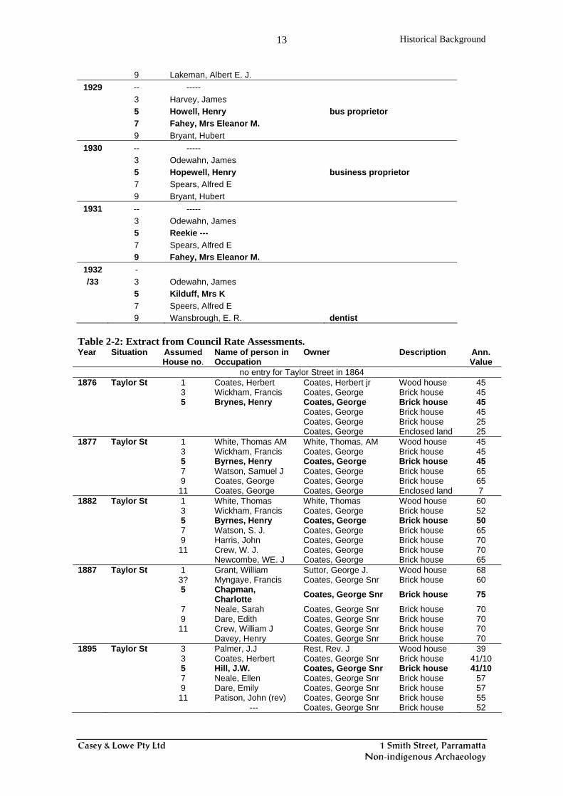
Historical Background
13
9 Lakeman, Albert E. J. 1929 -- -----
3 Harvey, James 5 Howell, Henry bus proprietor 7 Fahey, Mrs Eleanor M. 9 Bryant, Hubert
1930 -- ----- 3 Odewahn, James 5 Hopewell, Henry business proprietor 7 Spears, Alfred E 9 Bryant, Hubert
1931 -- ----- 3 Odewahn, James 5 Reekie --- 7 Spears, Alfred E 9 Fahey, Mrs Eleanor M.
1932 - /33 3 Odewahn, James
5 Kilduff, Mrs K 7 Speers, Alfred E 9 Wansbrough, E. R. dentist
Table 2-2: Extract from Council Rate Assessments. Year Situation Assumed
House no. Name of person in Occupation
Owner Description Ann. Value
no entry for Taylor Street in 1864 1876 Taylor St 1 Coates, Herbert Coates, Herbert jr Wood house 45 3 Wickham, Francis Coates, George Brick house 45 5 Brynes, Henry Coates, George Brick house 45 Coates, George Brick house 45 Coates, George Brick house 25 Coates, George Enclosed land 25 1877 Taylor St 1 White, Thomas AM White, Thomas, AM Wood house 45 3 Wickham, Francis Coates, George Brick house 45 5 Byrnes, Henry Coates, George Brick house 45 7 Watson, Samuel J Coates, George Brick house 65 9 Coates, George Coates, George Brick house 65 11 Coates, George Coates, George Enclosed land 7 1882 Taylor St 1 White, Thomas White, Thomas Wood house 60 3 Wickham, Francis Coates, George Brick house 52 5 Byrnes, Henry Coates, George Brick house 50 7 Watson, S. J. Coates, George Brick house 65 9 Harris, John Coates, George Brick house 70 11 Crew, W. J. Coates, George Brick house 70 Newcombe, WE. J Coates, George Brick house 65 1887 Taylor St 1 Grant, William Suttor, George J. Wood house 68 3? Myngaye, Francis Coates, George Snr Brick house 60 5 Chapman,
Charlotte Coates, George Snr Brick house 75
7 Neale, Sarah Coates, George Snr Brick house 70 9 Dare, Edith Coates, George Snr Brick house 70 11 Crew, William J Coates, George Snr Brick house 70 Davey, Henry Coates, George Snr Brick house 70 1895 Taylor St 3 Palmer, J.J Rest, Rev. J Wood house 39 3 Coates, Herbert Coates, George Snr Brick house 41/10 5 Hill, J.W. Coates, George Snr Brick house 41/10 7 Neale, Ellen Coates, George Snr Brick house 57 9 Dare, Emily Coates, George Snr Brick house 57 11 Patison, John (rev) Coates, George Snr Brick house 55 --- Coates, George Snr Brick house 52

Historical Background
14
Figure 2.8: Plan from Parramatta Heritage Study Review 1990, inventory sheet. This shows the house as being subdivided. It was suggested in the inventory form that this was a modern division but records, analysis of Sands and the two cisterns found at the rear of this house suggest it was always two semi-detached houses.

Results of Fieldwork
15
3.0 Results of Fieldwork 3.1 Testing Sydney Water had initially applied for the site’s archaeological excavation permit. This permit was transferred to Casey & Lowe Pty Ltd, identifying Tony Lowe as excavation director. 3.1.1 Methodology The site was monitored during the initial removal of footings and concrete ground slabs. The ground slab coverage was less than expected with most of the site having timber floors on brick piers. Concrete strip footings were only removed from the northeastern section of the site and was eventually discontinued as it caused undue disturbance to surrounding areas. It was agreed that only the existing concrete slabs would be removed with the footings being retained until after the archaeological program had been completed. The testing methodology identified to the Heritage Office was:
The excavation of a series of relatively small test pits in order to ascertain the nature of the historic archaeological remains, as set out in the Sydney Water application, is not considered to give the best indication of the nature and extent of the historic remains. Instead, it is proposed to clear larger areas in the middle of each allotment in order to identify building lines (rows of postholes or footings for example) and the possible presence of artefact spreads in rear yard areas. The areas cleared would tend to be strips approximately 1.5 x 6m and would be positioned to answer specific questions and to test the archaeological model of the site as assessed by the Godden Mackay Logan assessment, such as whether building remains are in the locations indicated on the historic plans and in what state they survive. Areas inside houses will also be cleared to test for underfloor deposits. Smaller areas would be excavated to locate cesspits or other structures shown on plan. Once features have been found they will be delineated by hand tools and recorded. This stage will be coordinated with Jo McDonald CHM who will be undertaking the testing for indigenous archaeological remains.
Testing took the form of mainly 1.5m wide trenches excavated by a 7-tonne machine using a 1.5m wide flat bucket. Ten trenches were excavated, of varying dimensions (Fig. 3.1). This removed the layer of crushed brick and concrete debris that had been left over the site to protect the underlying strata during the demolition process and then exposed older surfaces and demolition layers. Excavation stopped when substantial nineteenth-century building remains (footings, etc) were encountered. The trenches were located where houses had stood as well as in their yard areas. Other trenches cut across the rear of allotments where cesspits and outbuilding would be expected. The intention was to ascertain if substantive remains belonging to the nineteenth-century land-use of the study area were present and whether these remains included cultural debris that could be used to analyse socio-economic factors relevant to the historic use of the place. As several of the houses had only recently been demolished it was not considered that recording the outline of the buildings was worthwhile.

Results of Fieldwork
16
Figure 3.1: Plan showing location of test trenches. 3.1.2 Results of Testing The results of the testing (Appendix 1) in each trench were as follows: Trench 1: Various modern concrete and brick footings, sandstone footings. Sondage indicates
brown clay approximately 250mm below cleared surface. Trench 2: Concrete footings. Brown clay 200mm below cleared surface, becoming deeper
towards northern end. Area of sandstock brick paving or demolition collapse at northern end.
Trench 3: Concrete footings. Brown clay at 300mm depth below cleared surface in southern half of the trench.
Trench 4: This area had been built up as a platform for the recently demolished building. The fill was 500mm deep at the southern end and over a metre deep at the northern end. Artefact deposits were found in the northern end with evidence of a sandstock-brick structure.
Trench 5: An area of sandstone packing, probably for a driveway or yard surface, was located 400mm below the cleared surface, with natural clay at 650mm depth.
Trench 6: The area between modern room footings was excavated to natural clay at depth 700-900mm below the cleared surface.
Trench 7: This trench in the northwest corner of the site showed relatively shallow natural clay, some 300mm below the cleared surface. No substantive remains were present.
Trench 8: A rough sandstone wall, probably a garden or boundary wall, was uncovered running north-south. Fill above natural clay was about 500mm thick.
Trench 9: No remains except modern, clay about 500mm below cleared surface.

Results of Fieldwork
17
Trench 10: No remains except modern, clay about 500mm below cleared surface. The overall result of the testing was that no area of high potential in terms of historic potential was identified. No areas of high artefact concentrations were found, either in rear yard or underfloor areas. The only trench that had a concentration of artefacts, mainly domestic ceramic and glass, was in the southern section of Trench 4. There appeared to be signs of rubbish pits cut into the natural sub-soil strata in this area. These may be associated with cesspit structures. In contrast, Trench 3, which was placed to intercept rear yard structures including cesspits for the houses along Smith Street, provided negative results. In terms of testing results, it was interesting that the testing carried out during the indigenous archaeology program revealed three brick water cisterns missed by the initial testing (Fig. 3.2). This was partly due to the indigenous testing expanding the areas previously tested and the need to avoid removing topsoil layers during the initial testing that would be examined in the indigenous program, but it provides interesting commentary on testing programs. The cisterns would date from the 1870s houses, prior to the provision of town water, and represent major water-collection devices and were associated with the construction of houses within this property.
Figure 3.2: Location of cisterns (circles) in relation to the non-indigenous test trenches. 3.1.3 Recommendations of Testing It was recommended that the area of the site in the vicinity of Trench 4 (Fig. 3.2), where artefact-bearing features were present, should be archaeologically sampled. This would take the form of machine clearance down to the features, and their recording and excavation. The area around the features should be excavated to determine if there is evidence that the features are connected to the houses along Smith or Darcy Street. The brick cisterns should be exposed and recorded in case they were backfilled with domestic refuse.

Results of Fieldwork
18
3.2 Sampling A new excavation permit was obtained from the Heritage Office prior to the commencement of the sampling phase. 3.2.1 List of Contexts The contexts are mostly those of structures or of the contexts recovered from structures or in close association with them. Of notable interest is a large rubbish deposit (#4703) recovered from the northern cistern (#4702).
Context No Probably House No.
Description of Context
4700 1 Structure – southern cistern, (3m deep and 3m dia.) 4701 3 Structure – middle cistern 4702 5 Structure – northern cistern (3.6m internal dia. depth 2.95m) 4703 5 Fill of northern cistern (4702) 4704 1 or 3 Fill of undefined (cesspit?) feature in Trench 4. Connected to 4705? 4705 1 or 3 Sandstock-brick cesspit 4706 1 or 3 Fill – of 4705. Brown clayey with gravel, 350mm thick. 4707 1 or 3 Fill – of 4705. Grey clayey w/ rusty metal. Over brick base of cesspit. 4717 various Number given to artefacts recovered from sieving for Aboriginal stone
tools etc. 3.2.2 Sampling Methodology The aim of the sampling was to concentrate on the area in the vicinity of Trench 4 (Fig. 3.2). The area around the features would be excavated to determine if there is evidence that the features were rubbish pits or cesspits associated with the houses along Smith or Darcy Street. The excavation would initially be by machine and once the features were exposed would be continued by hand. The extent and nature of the features would be determined and recorded by plan and photograph. Deposits or accumulations of artefacts, such as in a cesspit, would be excavated in spits so that control over artefact distribution was maintained. To determine the features’ connection to the houses fronting Smith and Darcy Street, the adjacent rear yards would be excavated to record any related features. The brick cisterns would be exposed and recorded. The deposits within the cisterns would be sampled. 3.2.3 Research Design The intent of the archaeological sampling of the property was to record aspects of the late nineteenth-century housing and their yard areas, including the potential rubbish pits / cesspits, and the nature and content of the brick cisterns. Research questions that could be answered by the above would be:
Were the first houses in this subdivision sewered or did they rely on cesspits? Is there evidence of household deposits in the cesspits, which can be connected to
individual households or families who lived off Smith or Darcy Streets? This might be feasible if deposited over a short period.
How were the cisterns constructed and is there evidence of how they functioned? Does the cultural material deposited in these features provide evidence for the socio-
economic regimes of the households?

Results of Fieldwork
19
3.3 Results of Sampling 3.3.1 Trench 13 The area around Trench 4 was widened to ascertain the exact nature of the features in this area (Fig. 3.3). It was thought that a pit containing artefacts might be a cesspit which could be connected to the occupation of the corner house, no.1 Smith Street. The overlying fill around Trench 4 was removed down to natural topsoil. The cesspit had been impacted by the introduction of a concrete pier, probably belonging to the recently demolished building. A small quantity of additional artefacts associated with this cesspit were recovered.
Figure 3.3: Plan showing the expanded Trench 4 (Trench 13, middle bottom).

Results of Fieldwork
20
Figure 3.4: Plan showing extent of additional excavation.
Figure 3.5: Study area in 1895, showing house nos 1-9 in Smith Street.

Results of Fieldwork
21
Figure 3.6: Plan of Trench 13.

Results of Fieldwork
22
Figure 3.7: Photo of Trench 13 looking north showing general yard surface with later footings (centre) and fuel tank (right).
3.4 Overview of Cisterns The three cisterns were exposed. These were more-or-less in a line at the rear of the Smith Street houses (Fig. 3.4, 3.18). 3.4.1 Northern Cistern The top of the northern cistern (Fig. 3.8) had been broken away previously. It was filled with general debris including brick rubble and a large quantity of household rubbish including glass and ceramic items, and iron debris such as bedsteads. This cistern was in the rear yard of no.5 Smith Street (Fig. 3.18).

Results of Fieldwork
24
Figure 3.8: Northern cistern (#4702) prior to excavation, looking south. Note middle cistern behind.
Figure 3.9: The middle cistern looking westwards. Note inlet pipes.

Results of Fieldwork
25
Figure 3.10: Plan of northern cistern.

Results of Fieldwork
26
Figure 3.11: Plan of middle cistern.

Results of Fieldwork
27
3.4.2 Middle Cistern The middle cistern was intact and had a collar of brickwork attached around and over the original opening, perhaps to accommodate a raised ground surface (Fig. 3.9, 3.11, 3.16). Terracotta pipes led into the cistern, the upper half of which was rendered. The brickwork was removed but otherwise the cistern was left intact (Fig. 3.12).
Figure 3.12: Middle cistern after removal of brick collar, looking north. 3.4.3 Southern Cistern The southern cistern was close to the present Darcy Street boundary. It had a rendered upper surface and a squared opening (Fig. 3.13). It was excavated out and was full of sandstock bricks (Fig. 3.14).

Results of Fieldwork
28
Figure 3.13: Southern cistern looking west. Note render and inlets.
Figure 3.14: Excavation of southern cistern.

Results of Fieldwork
29
Figure 3.15: Plan of southern cistern.

Results of Fieldwork
30
Figure 3.16: Profiles through middle and south cisterns.

Results of Fieldwork
31
Figure 3.17: Profile through north cistern. 3.5 Northern Cistern As described above, the northern cistern contained a quantity of domestic refuse (#4703) that may represent a single household collection. The provenance of the artefacts can be determined by overlaying the plan of the three cisterns onto the 1895 plan (Fig. 3.18). From this overlay it appears that the northern cistern belongs to the house at 5 Smith Street. This was a semi-detached house. This overlay implies that there may have been another cistern to the north behind 7 Smith Street. Work in this area was restricted by the access driveway through the site and a live electrical connection running east-west across the site. The site sheds were situated on what had been 9 Smith Street but the modern building in this location had caused major disturbance. In order to ascertain whether the artefacts recovered from the cistern could be connected to a single family or household, a search was done of Sands Directory which records residents from 1885 to 1930. Smith Street was known as Taylor Street at this time. Sand’s Directory indicates that there was a regular turnover of residents at no.5 Smith Street (Table 2.1).

Results of Fieldwork
32
Figure 3.18: Overlay of cisterns onto 1895 plan.

Artefacts
33
4.0 Description and Analysis of Artefacts 4.1 Overview of Results Five contexts or deposits at the site contained artefacts (Table 4-1). Context 4703, the backfill of the northern cistern and associated with no.5 Smith Street, contained the largest quantity of artefacts – 305 items (Table 4-2). The other contexts were much smaller. Contexts 4706 and 4707 were both within the cesspit which was associated with either 1 or 3 Smith Street. This cesspit was disturbed when a concrete pier cut through it and it is possible that this disturbance involved the redeposition of deposit 4704 which was found adjacent to the cesspit and was not defined by a cut. The disturbance by the pier made it difficult to determine which side of the property boundary the cesspit was on. Other disturbance by twentieth-century construction removed evidence of other cesspits. During the program for excavation for Indigenous/Aboriginal archaeology some small artefacts associated with the European occupation were collected. These were given the context number 4717 for cataloguing purposes. Only those artefacts considered of interest in 4717 were retained and catalogued. Table 4-1: List of contexts containing artefacts which will be discussed below.
Context No Probably House No.
Description of Context
4703 5 Fill of northern cistern (4702), 4704 1 or 3 Fill of undefined (cesspit?) feature in Trench 4. Connected to 4705? 4706 1 or 3 Fill – of 4705. Brown clayey with gravel, 350mm thick. Above 4707. 4707 1 or 3 Fill – of 4705. Grey clayey fill with rusty metal. Over brick base of
cesspit. Below 4707. 4717 various Number given to artefacts recovered from sieving for Aboriginal stone
tools etc. Table 4-2: No of artefacts in each context.
Context Min. No.
Items % # Frags % 4703 310 67 245 56 4706 30 6 48 11 4707 100 22 135 31 4717 25 5 9 2
465 100 437 100 4.2 Analysis of Artefacts22 The section involves an analysis of artefacts recovered from the site. The purpose of analysis is to explore the social and cultural meaning of these deposits and to assist with a response to the research questions. Analysis of the artefacts from this site can also provide comparative analysis with other sites in Parramatta, Sydney and elsewhere. The tables discussed in this section of the report are in Appendix 3. Context 4703 contained 310 items, the most artefacts from the site, being 66 per cent of the overall total (Table 4-2). The main cesspit deposit #4707 had 100 artefacts or 22 per cent of items with only 30 artefacts in 4706, the upper deposit within the cesspit. The main focus of the following discussion is on context #4703 which contained the most artefacts and is also the most interesting.
22 For details of the cataloguing program see Casey 2004.

Artefacts
34
4.2.1 Context 4703 Dating Dating the artefacts is important as it allows us to understand when the artefacts were disposed of which assists with identifying the residents of the house or houses who may have thrown them out and who once owned these artefacts. Dating is also important to locate the range of temporal activities at the site. This is an interesting context in terms of dating. As Table 4-3 indicates there are artefacts which have a range of FROM (terminus post quem (TPQ) or point after which) dates throughout the nineteenth and into the early twentieth century. The issue about a TPQ is that when there are items dating from the 1920s and 1930s then the artefacts can only have been thrown away after these were manufactured, purchased, used and then discarded. While one item with a later date might be considered a later intrusion and therefore not reliable in terms of identifying a date for the creation of a context, this is not the case with #4703 as there is a consistent pattern within the context. Analysis of the dates (TPQ) of manufacture for items in context 4703 identified 30 artefacts made from the 1920s, six after 1923 and two after 1930 (Table 4-3). Therefore the dating of this context to the 1930s is reasonably sound. At its earliest it would date to the 1920s. Also interesting about this deposit is that quite a few artefacts – 26 items, that could NOT have been made after (terminus ante quem - TAQ) 1919 and another 62 no later than the 1920s. This makes a total of 66 per cent of items with a known TAQ date considerably prior to the last known latest manufacturing date of the 1930s (Table 4-4). In addition the Scottish manufactured whisky flask (9) stopped being made in 1930 although it is possible that the bottles and their contents could be sold for the next few years. These indicate that there is possibly some delay in disposing of these items. They could be considered heirloom artefacts kept within a family because of their value – either monetary or intangible. Yet when we examine the dates within different classes of artefacts, notably glass, the suggested reasons for the survival of these items is that they were reusable glass containers, bottles, and were stored for future use or for as alternative storage (Table 4-3, 4-4; Fig. 4.4). The evidence from the contents within these bottles indicated that they were not the original contents for which they were purchased. A number of bottles and jars contained turpentine-related products, paint, oils etc, many of which were not identified other than by their smells. They were being used to store noxious items typically stored in a laundry or shed. As well many of the bottles were empty and were being ‘hoarded’ for future use as storage containers, in much the same way as we would store used take-away food containers or jars today. They were being recycled. 4.2.2 Nature of Context 4703 The cistern at no 5 Smith Street was backfilled with a large deposit containing some bricks and the 310 artefacts (MIC) (Table 4-2). The top of the cistern (#4702) was already broken when it was found. It had been backfilled almost to the top with a rubbish deposit (Fig. 3.8). The top of the backfill material consisted of ashy material with some brick but as it got deeper it became a wet slurry-like material which was excavated by machine. This deposit is interesting as it appears to represent a throw-out of unwanted artefacts: bottles (113), jars (11), whisky flasks (19), ink bottles (12), Chinese ginger jars (6) as well as older style ceramics, garden shears, electric light globes (4) as well as 13 teapots and enamel kitchen vessels (Table 4-9; Figs 4.1, 4.4, ). No animal bone, the refuse of daily meals, was found in this deposit. These appear to be the results of a general clear out of items from a shed/laundry and kitchen. This may have been after an elderly resident died or when someone moved and were unable or unwilling to take these artefacts.

Artefacts
35
The artefacts appear to represent a mixture of primary and possibly secondary refuse activity.23 Many of the artefacts, such as the bottles, flasks and jars were whole and many still had their stoppers (Figs 4.4, 4.9, 4.12, 4.13, 4.16, 4.17). Most of the enamel artefacts were well used but has not yet reached the end of their use life (Fig. 4.3). In contrast only a few ceramic items were whole or near complete, such as the tea cups and teapots (Figs 4.5, 4.7) and the po and shaving mug (Fig. 4.8). The plates and saucers all had more than half of the items missing (Figs 4.6, 4.7), as did the ornamental vases and glass artefacts, and drinking glasses (Figs 4.10, 4.11, 4.18). This may mean that the incomplete vessels had been previously broken and stored rather than thrown away, perhaps to be repaired and that they were separately disposed of, some going into the cistern and some going elsewhere. The artefacts were unwanted for a number of possible reasons. The empty bottles and those storing substances were not considered useful or valuable enough to be kept. The ceramic artefacts, such as the po and shaving mug, may have been considered unfashionable, old fashioned or unhygienic and therefore undesirable. The Chinese ginger jars were no longer considered attractive and they could not be used to store items as they could not be easily sealed. In addition the garden items were also probably broken and no longer useful although the shears were complete and are a design still available today (Fig. 4.2). One edging tile by itself is not especially useful. An unusual component of this deposit was the absence of a substantial deposit of animal bone, the refuse of daily meals. These are typically found in refuse deposits. Also found was part of a metal bed frame which was not kept. A hypothesis for the formation of this group of artefacts is that it represents a process of hoarding for a lengthy period of time, probably from the 1890s to the 1920s but they were not thrown out until the 1930s. This presumably occurred after the connection of reticulated water to the house when there was no longer any reason for storage of water in the cistern, although this does not negate its continued operation for the collection of the stormwater off the roof rather than let it pool on the ground. The sewerage/stormwater system up to the 1890s was empting into Parramatta River and may not have been a fully integrated system and was probably not connected to all houses at this time. The 1895 plan (Fig. 2.4) does not indicate the presence of sewerage lines which should be the case as these plans were produced for the Metropolitan Sewerage Water and Drainage Board who did not take over management of the Parramatta water supply until 1915.24 What becomes clear is that, probably in the 1930s, the cistern was backfilled and that stormwater once collected from the roof was no longer stored in the cistern but either left to pool or was transported off site in the combined sewer/stormwater system. The reason for the construction of the cisterns is that in the 1870s there were still no pipes to transfer the water from Hunt’s Creek Reservoir to residences in Parramatta. The main source of water was paying for water carts to deliver it to residents.25 Therefore the cisterns were presumably constructed to augment this type of water supply. Reticulated water became available after 1882-1884 with the construction of a pumping station at Hunt’s Creek and the laying of pipes into Parramatta and Harris Park. The hypothesis that this deposit relates to a clear-out of a kitchen and shed/laundry, presumably collecting over a period of time, is somewhat negated by the absence of a long-term resident at no. 5 Taylor (Smith) Street (Section 2.2). This sort of deposit usually relates to a lengthy residence in one place rather then the peripatetic tenants who resided at no. 5. Another layer of interpretation may be added by identifying this as a deposit where the various bottles were collected for monetary purposes for someone with a negligible income and that they saw the bottles as a source of income, as in the case of a bottle-o.26 Banjo Patterson’s poem the ‘Bottle-o’ is reproduced below. The use of this term
23 For a detailed explanation of different disposal patterns see Crook and Murray 2004. 24 Kass, Liston and McClymont 1996:304. 25 Kass, Liston and McClymont 1996:163-164, 182. 26 There were few pensions or unemployment benefits prior to 1943; Clark 1981:214.
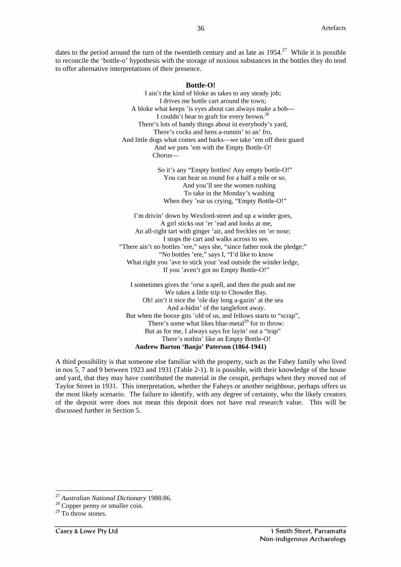
Artefacts
36
dates to the period around the turn of the twentieth century and as late as 1954.27 While it is possible to reconcile the ‘bottle-o’ hypothesis with the storage of noxious substances in the bottles they do tend to offer alternative interpretations of their presence.
Bottle-O! I ain’t the kind of bloke as takes to any steady job;
I drives me bottle cart around the town; A bloke what keeps ’is eyes about can always make a bob—
I couldn’t bear to graft for every brown.28 There’s lots of handy things about in everybody’s yard,
There’s cocks and hens a-runnin’ to an’ fro, And little dogs what comes and barks—we take ’em off their guard
And we puts ’em with the Empty Bottle-O! Chorus—
So it’s any “Empty bottles! Any empty bottle-O!”
You can hear us round for a half a mile or so. And you’ll see the women rushing To take in the Monday’s washing
When they ’ear us crying, “Empty Bottle-O!”
I’m drivin’ down by Wexford-street and up a winder goes, A girl sticks out ’er ’ead and looks at me,
An all-right tart with ginger ’air, and freckles on ’er nose; I stops the cart and walks across to see.
“There ain’t no bottles ’ere,” says she, “since father took the pledge;” “No bottles ’ere,” says I, “I’d like to know
What right you ’ave to stick your ’ead outside the winder ledge, If you ’aven’t got no Empty Bottle-O!”
I sometimes gives the ’orse a spell, and then the push and me
We takes a little trip to Chowder Bay. Oh! ain’t it nice the ’ole day long a-gazin’ at the sea
And a-hidin’ of the tanglefoot away. But when the booze gits ’old of us, and fellows starts to “scrap”,
There’s some what likes blue-metal29 for to throw: But as for me, I always says for layin’ out a “trap”
There’s nothin’ like an Empty Bottle-O! Andrew Barton ‘Banjo’ Paterson (1864-1941)
A third possibility is that someone else familiar with the property, such as the Fahey family who lived in nos 5, 7 and 9 between 1923 and 1931 (Table 2-1). It is possible, with their knowledge of the house and yard, that they may have contributed the material in the cesspit, perhaps when they moved out of Taylor Street in 1931. This interpretation, whether the Faheys or another neighbour, perhaps offers us the most likely scenario. The failure to identify, with any degree of certainty, who the likely creators of the deposit were does not mean this deposit does not have real research value. This will be discussed further in Section 5.
27 Australian National Dictionary 1988:86. 28 Copper penny or smaller coin. 29 To throw stones.

Artefacts
37
Figure 4.1: Asian artefacts, including Chinese ginger jars and lid, and a Japanese teapot and egg cup. Other Asian artefacts included plain white porcelain saucers.
Figure 4.2: Garden artefacts.
Figure 4.3: Enamel kettles, teapots, saucepans, cooking dish, mug, candle holder and snuffer. These were used for everyday cooking and household activities. These are typical late of the late nineteenth century through to WWII.

Artefacts
38
Figure 4.4: Alcohol bottles, many showing evidence of reuse. These include square Dutch gin bottles, whisky flasks and beer/wine bottles.
Figure 4.5: Different teapots from #4703.
Figure 4.6: Various plates and a serving vessel. #4703

Artefacts
39
Figure 4.7: Tea cups and saucers and a milk jug, #4703.
Figure 4.8: A po, shaving jug, part of a ewer and the bottom of a toothpowder container, #4703.
Figure 4.9: Stoneware ginger beer bottle, ink bottles and part of a bed warmer, #4703.

Artefacts
40
Figure 4.10: Remains of ornamental vases and a bowl. The two large white vases, while not of the same design, are similar. The two green vases also have different forms, #4703.
Figure 4.11: Remains of green glass ornamental items, #4703.
Figure 4.12: Glass bottles, many of which had evidence of reuse, #4703.

Artefacts
41
Figure 4.13: Food and pharmaceutical bottles, #4703.
Figure 4.14: Bottles with the names of Sydney companies, #4703.
Figure 4.15: Bottles with the names of local Parramatta manufacturers, including two from McIlwraiths grocer shop which was on the corner of Darcy and Church Streets, #4703.

Artefacts
42
Figure 4.16: Range of pharmecutical and toiletry bottles found in the cistern. Many of these showed clear evidence of reuse, #4703.
Figure 4.17: Ink bottles and wells and a clag (glue) bottle, #4703.
Figure 4.18: Tumblers, stemmed glass and a fine etched drinking glass were found. Two of the glasses were blackened in a fire.

Artefacts
43
Figure 4.19: Early light globes dating from 1913. Forms of pre-eclectic lighting were candle sticks, and oil lamps. The camp-stove (back left) or ‘primus’ stove is Swedish and was patented in 1919.
Figure 4.20: Range of artefacts from the cesspit, #4707.
Figure 4.21: Small artefacts recovered during the sieving for Aboriginal artefacts. Stem of a pipe, two pieces of slate pencil, three marbles, beads and glass, shell and metal buttons.
Response to the Research Design
44
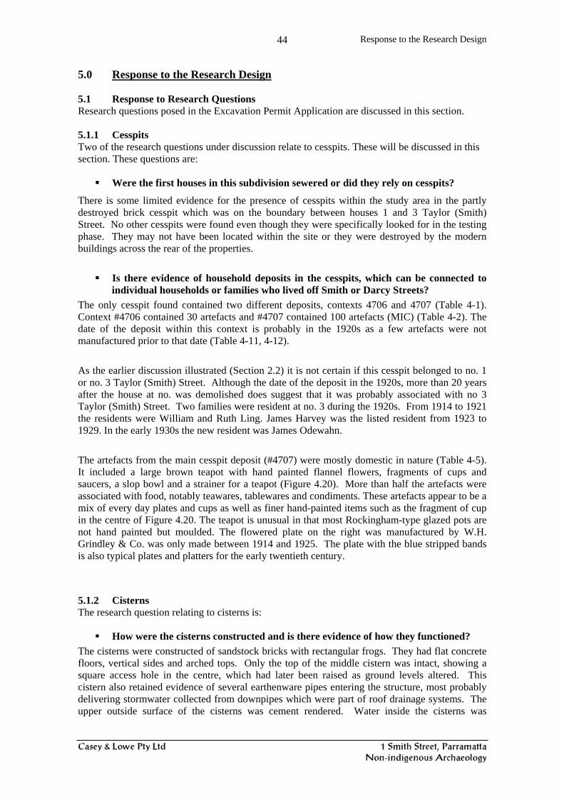
5.0 Response to the Research Design 5.1 Response to Research Questions Research questions posed in the Excavation Permit Application are discussed in this section. 5.1.1 Cesspits Two of the research questions under discussion relate to cesspits. These will be discussed in this section. These questions are:
Were the first houses in this subdivision sewered or did they rely on cesspits?
There is some limited evidence for the presence of cesspits within the study area in the partly destroyed brick cesspit which was on the boundary between houses 1 and 3 Taylor (Smith) Street. No other cesspits were found even though they were specifically looked for in the testing phase. They may not have been located within the site or they were destroyed by the modern buildings across the rear of the properties.
Is there evidence of household deposits in the cesspits, which can be connected to individual households or families who lived off Smith or Darcy Streets?
The only cesspit found contained two different deposits, contexts 4706 and 4707 (Table 4-1). Context #4706 contained 30 artefacts and #4707 contained 100 artefacts (MIC) (Table 4-2). The date of the deposit within this context is probably in the 1920s as a few artefacts were not manufactured prior to that date (Table 4-11, 4-12). As the earlier discussion illustrated (Section 2.2) it is not certain if this cesspit belonged to no. 1 or no. 3 Taylor (Smith) Street. Although the date of the deposit in the 1920s, more than 20 years after the house at no. was demolished does suggest that it was probably associated with no 3 Taylor (Smith) Street. Two families were resident at no. 3 during the 1920s. From 1914 to 1921 the residents were William and Ruth Ling. James Harvey was the listed resident from 1923 to 1929. In the early 1930s the new resident was James Odewahn. The artefacts from the main cesspit deposit (#4707) were mostly domestic in nature (Table 4-5). It included a large brown teapot with hand painted flannel flowers, fragments of cups and saucers, a slop bowl and a strainer for a teapot (Figure 4.20). More than half the artefacts were associated with food, notably teawares, tablewares and condiments. These artefacts appear to be a mix of every day plates and cups as well as finer hand-painted items such as the fragment of cup in the centre of Figure 4.20. The teapot is unusual in that most Rockingham-type glazed pots are not hand painted but moulded. The flowered plate on the right was manufactured by W.H. Grindley & Co. was only made between 1914 and 1925. The plate with the blue stripped bands is also typical plates and platters for the early twentieth century. 5.1.2 Cisterns The research question relating to cisterns is:
How were the cisterns constructed and is there evidence of how they functioned? The cisterns were constructed of sandstock bricks with rectangular frogs. They had flat concrete floors, vertical sides and arched tops. Only the top of the middle cistern was intact, showing a square access hole in the centre, which had later been raised as ground levels altered. This cistern also retained evidence of several earthenware pipes entering the structure, most probably delivering stormwater collected from downpipes which were part of roof drainage systems. The upper outside surface of the cisterns was cement rendered. Water inside the cisterns was

Response to the Research Design
45
probably accessed by hand pumps situated adjacent to each structure. Once reticulated water became available the cisterns were no longer used to provide water and were backfilled. 5.1.3 Material Culture at No. 5 Smith Street
Does the cultural material deposited in these features provide evidence for the socio-economic regimes of the households?
This is a difficult question to apply to context #4703 and the following discussion will therefore focus on furthering our understanding of this type of deposit by posing a different question.
What is different and interesting about this deposit? How does it further our limited understanding of the material culture of early twentieth-century Parramatta? Does this context offer us a snapshot of working class/ middle class life in Parramatta between 1900s and 1930s?
Context #4703, the main deposit from the cistern at house no. 5 Smith Street, contains an interesting and significant early twentieth-century deposit. As Section 4 illustrates it contains artefacts that are ‘domestic’ in nature as well as representing a group typically found in the laundry and/or shed (Tables 4-5, 4-6). The domestic artefacts include teapots, cups and saucers, plates, drinking glasses and alcohol bottles. Ones relating to the use of laundry or shed, where they would typically be stored, are the gardening tools, the camp stove, and the reused glass storage vessels containing various substances, such as paint, kerosene, and so on. In addition to these are the empty glass containers not in current use, including the pharmaceutical bottles (Fig. 4.16) and ink and glue bottles (Fig. 4.17). Chinese Ginger Jars There were a small but interesting group of 12 items from Asia. From China there were six ginger jars and a saucer, and from Japan an eggcup, a teapot and remains of two bottles (Fig. 4.10). To date we have found ginger jars on two other sites in Parramatta - 109 George Street and the George & Charles Street site where they were found in two different properties, one of which was associated with a Chinese market gardener Ah Chew. They are starting to appear as part of the anticipated corpus of a late nineteenth and early twentieth-century deposits. It is likely that preserved ginger could be purchased in shops in Parramatta, probably in those selling sweets or confectionary. It is also possible that Chinese preserved ginger was purchased from shops that were intended to mainly serve a Chinese immigrant population. The presence of these Asian items in the period before WW2 also shows that non-Asian resident in Parramatta were buying more exotic food products as well as everyday items, such as teapots and egg cups. It may also indicate that because the European residents were living nearby to Chinese residents that there was exposure to cross cultural contact. Products Made and Sold in Parramatta Another interesting aspect of the artefacts in context #4703 is the presence of a number of bottles or jars associated with products manufactured in Parramatta as well as wider a field in Sydney and New South Wales. This is discussed in some detail in the artefact report for the glass (Appendix 4). Of particular interest are the four glass bottles and a single stoneware bottle with the names of local businesses (Table 4.16; Fig. 4.15). There were three local pharmacy bottles manufactured for exclusive use by specific businesses:
Morey Chemists, Parramatta L. W. Pye, Chemist (by exam), Parramatta Marshal Pharmacist, Petersham
There were two local Parramatta aerated-water producers: Newling & Walker
Response to the Research Design
46
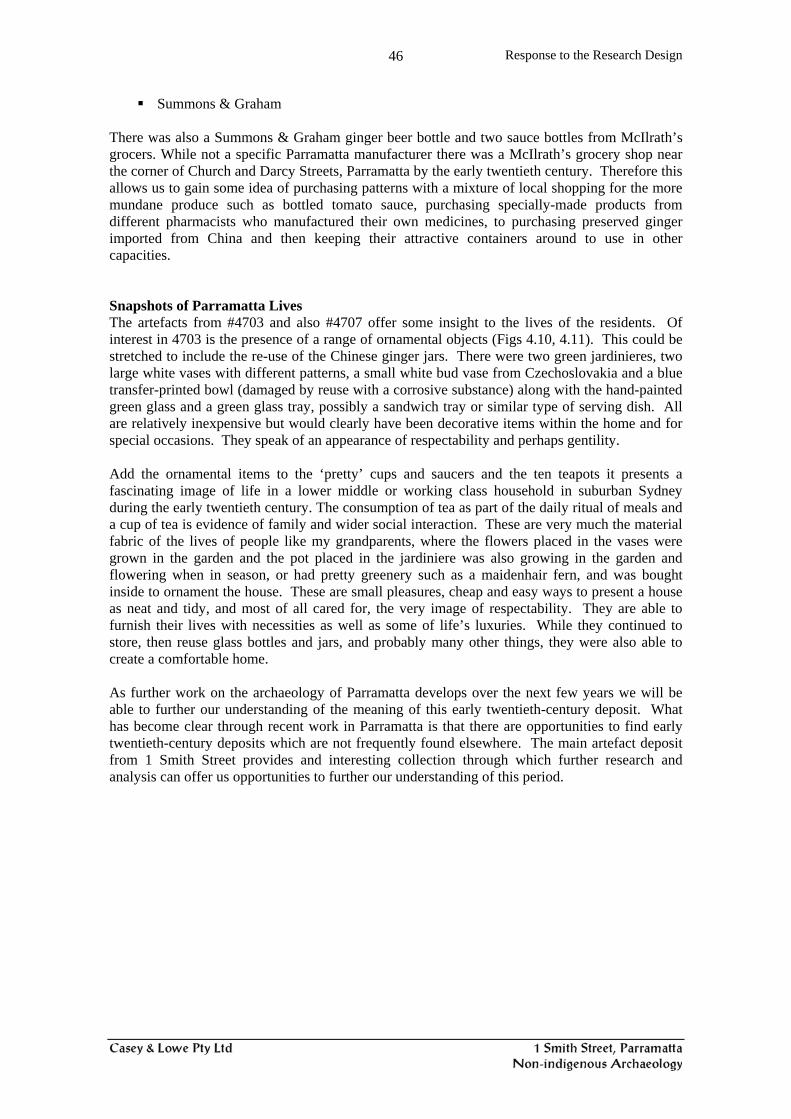
Summons & Graham There was also a Summons & Graham ginger beer bottle and two sauce bottles from McIlrath’s grocers. While not a specific Parramatta manufacturer there was a McIlrath’s grocery shop near the corner of Church and Darcy Streets, Parramatta by the early twentieth century. Therefore this allows us to gain some idea of purchasing patterns with a mixture of local shopping for the more mundane produce such as bottled tomato sauce, purchasing specially-made products from different pharmacists who manufactured their own medicines, to purchasing preserved ginger imported from China and then keeping their attractive containers around to use in other capacities. Snapshots of Parramatta Lives The artefacts from #4703 and also #4707 offer some insight to the lives of the residents. Of interest in 4703 is the presence of a range of ornamental objects (Figs 4.10, 4.11). This could be stretched to include the re-use of the Chinese ginger jars. There were two green jardinieres, two large white vases with different patterns, a small white bud vase from Czechoslovakia and a blue transfer-printed bowl (damaged by reuse with a corrosive substance) along with the hand-painted green glass and a green glass tray, possibly a sandwich tray or similar type of serving dish. All are relatively inexpensive but would clearly have been decorative items within the home and for special occasions. They speak of an appearance of respectability and perhaps gentility. Add the ornamental items to the ‘pretty’ cups and saucers and the ten teapots it presents a fascinating image of life in a lower middle or working class household in suburban Sydney during the early twentieth century. The consumption of tea as part of the daily ritual of meals and a cup of tea is evidence of family and wider social interaction. These are very much the material fabric of the lives of people like my grandparents, where the flowers placed in the vases were grown in the garden and the pot placed in the jardiniere was also growing in the garden and flowering when in season, or had pretty greenery such as a maidenhair fern, and was bought inside to ornament the house. These are small pleasures, cheap and easy ways to present a house as neat and tidy, and most of all cared for, the very image of respectability. They are able to furnish their lives with necessities as well as some of life’s luxuries. While they continued to store, then reuse glass bottles and jars, and probably many other things, they were also able to create a comfortable home. As further work on the archaeology of Parramatta develops over the next few years we will be able to further our understanding of the meaning of this early twentieth-century deposit. What has become clear through recent work in Parramatta is that there are opportunities to find early twentieth-century deposits which are not frequently found elsewhere. The main artefact deposit from 1 Smith Street provides and interesting collection through which further research and analysis can offer us opportunities to further our understanding of this period.
Bibliography
47
6.0 Bibliography Primary Sources Sand’s Directory Rate assessment Books, Parramatta Council Secondary Sources The Australian National Dictionary, 1988, Oxford University Press, Melbourne. Casey & Lowe Pty Ltd, 2004, 1 Smith Street, Preliminary Results of Archaeological Recording,
for Sydney Water, September 2004 Casey, Mary 2004 ‘Falling through the cracks: method and practice at the CSR site, Pyrmont’,
Australasian Historical Archaeology 2004:27-43. Crook, Penny and Tim Murray, 2004 ‘The analysis of cesspit deposits from The Rocks,
Sydney’, Australasian Historical Archaeology 2004:44-56. Godden Mackay Logan Pty Ltd, 2003, Smith and Darcy Streets, Parramatta, Heritage and
Archaeological Assessment, for Parramatta Rail Link, March 2003. Clark, Manning 1981 A short history of Australia, McMillan, Sydney. Harris, E. Jeanne, Geoff Ginn, and Cosmos Coroneos, ‘How to dig a dump: strategy and research
design for investigation of Brisbane’s nineteenth-century municipal rubbish dump’, Australasian Historical Archaeology 2004:15-26.

APPENDICES Appendix 1: Testing Report Appendix 2: Artefact Catalogue
2.1: Ceramics 2.2: Glass 2.3: Miscellaneous 2.4: Metals 2.5: Organics 2.6: Building Materials
Appendix 3: Artefact Tables Appendix 4: Specialist Glass Report - Jeanne Harris

Appendix 1: Testing Report

Appendix 2: Artefact Catalogue
2.1: Ceramics 2.2: Glass 2.3: Miscellaneous 2.4: Metals 2.5: Organics 2.6: Building Materials

Appendix 3: Artefact Tables

Appendix 4: Specialist Glass Report – Jeanne Harris