1 the boundary and annexation survey (bas) u.s. census bureau geography division & national...
TRANSCRIPT

•1
The Boundary and Annexation Survey The Boundary and Annexation Survey (BAS)(BAS)
U.S. Census BureauGeography Division
&
National Processing Center
•2
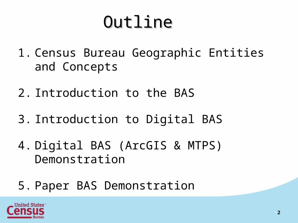
OutlineOutline
1. Census Bureau Geographic Entities and Concepts
2. Introduction to the BAS
3. Introduction to Digital BAS
4. Digital BAS (ArcGIS & MTPS) Demonstration
5. Paper BAS Demonstration
•3
Overview of Census BureauOverview of Census BureauGeographic AreasGeographic Areas
andandConceptsConcepts
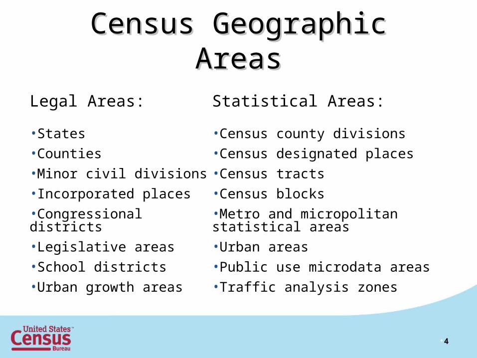
Census Geographic AreasCensus Geographic Areas
Legal Areas:
•States
•Counties
•Minor civil divisions
•Incorporated places
•Congressional districts
•Legislative areas
•School districts
•Urban growth areas
Statistical Areas:
•Census county divisions
•Census designated places
•Census tracts
•Census blocks
•Metro and micropolitan statistical areas
•Urban areas
•Public use microdata areas
•Traffic analysis zones
•4
•5
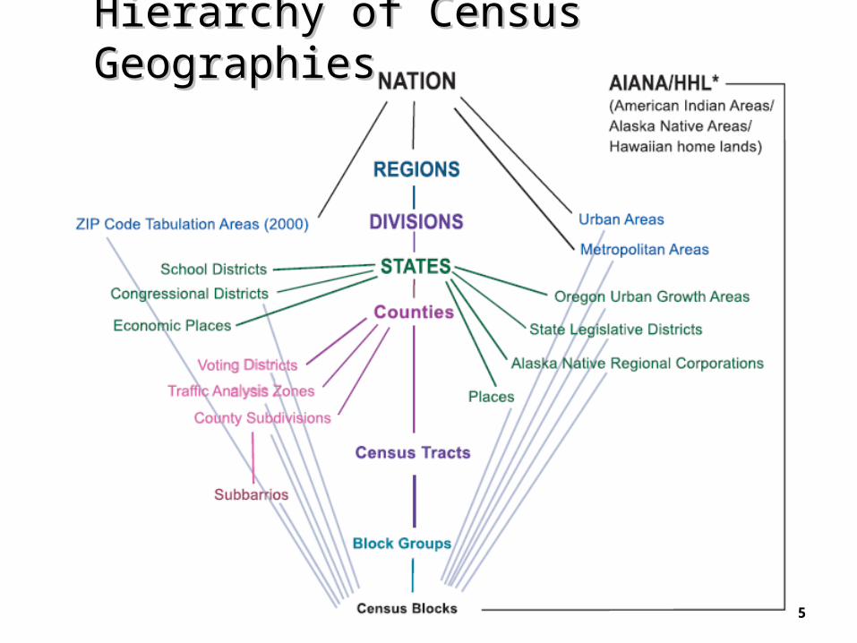
Hierarchy of Census GeographiesHierarchy of Census Geographies
•6
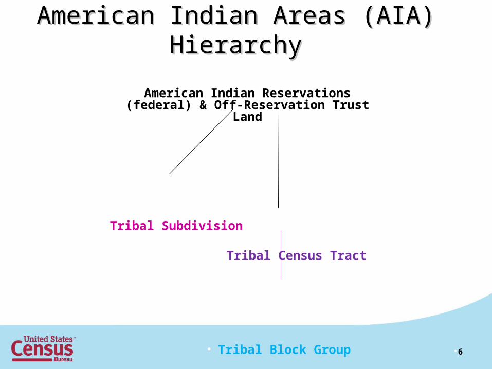
American Indian Areas (AIA) HierarchyAmerican Indian Areas (AIA) Hierarchy
• American Indian Reservations (federal) & Off-Reservation Trust Land
Tribal Subdivision
Tribal Census Tract
• Tribal Block Group
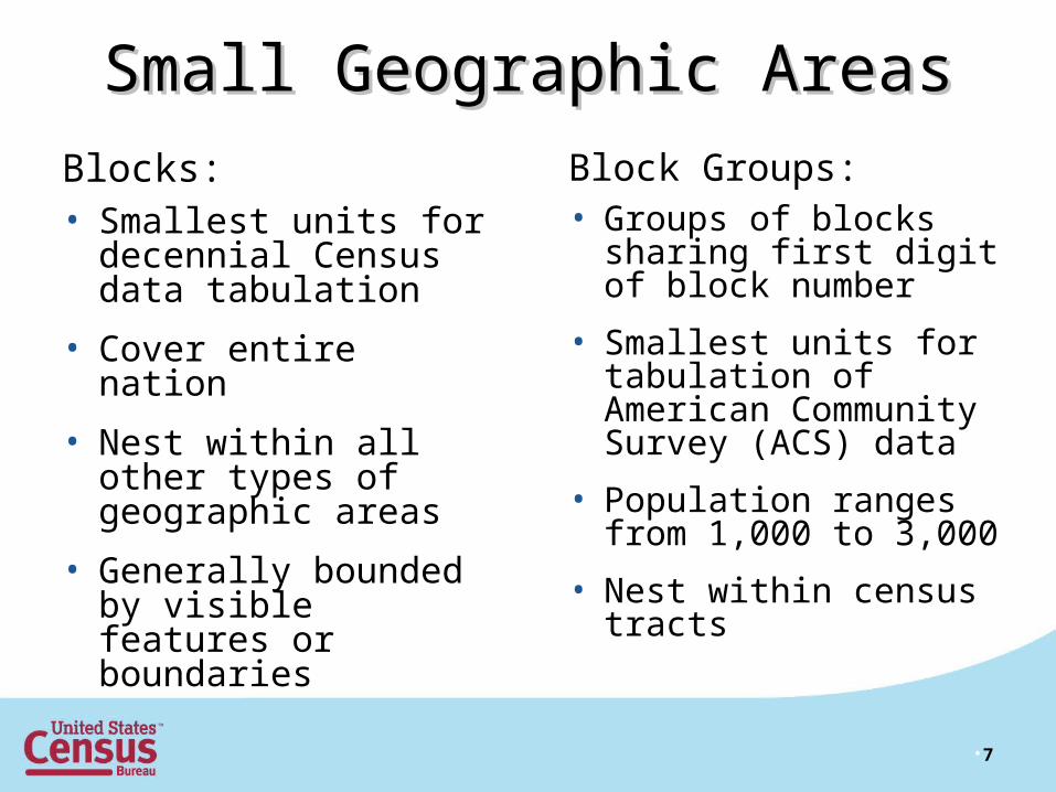
Small Geographic AreasSmall Geographic Areas
Blocks:• Smallest units for
decennial Census data tabulation
• Cover entire nation
• Nest within all other types of geographic areas
• Generally bounded by visible features or boundaries
Block Groups:• Groups of blocks
sharing first digit of block number
• Smallest units for tabulation of American Community Survey (ACS) data
• Population ranges from 1,000 to 3,000
• Nest within census tracts
•7

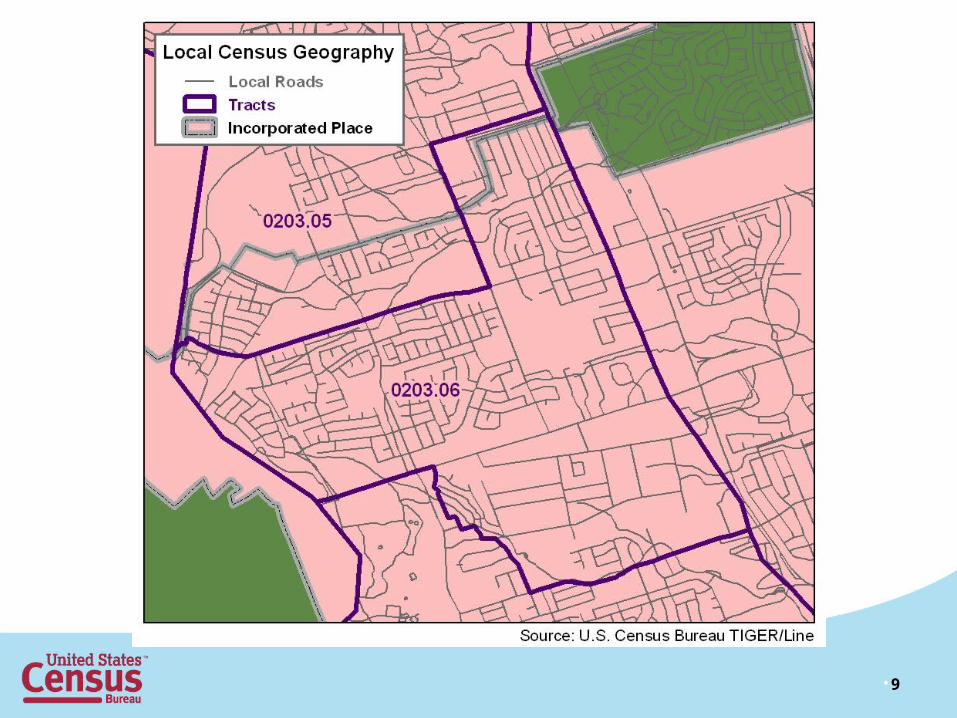
Census TractsCensus Tracts
•8
• Small, relatively permanent statistical subdivisions of a county
• Relatively consistent boundaries over time• Size: optimally 4,000 people; range between
1,000 and 8,000• Approximately 74,000 census tracts in U.S. • Defined nationwide for the first time in Census
2000; however Block Numbering Areas (BNAs) and tracts covered the entirety of the nation in 1990
•9

•10

•11
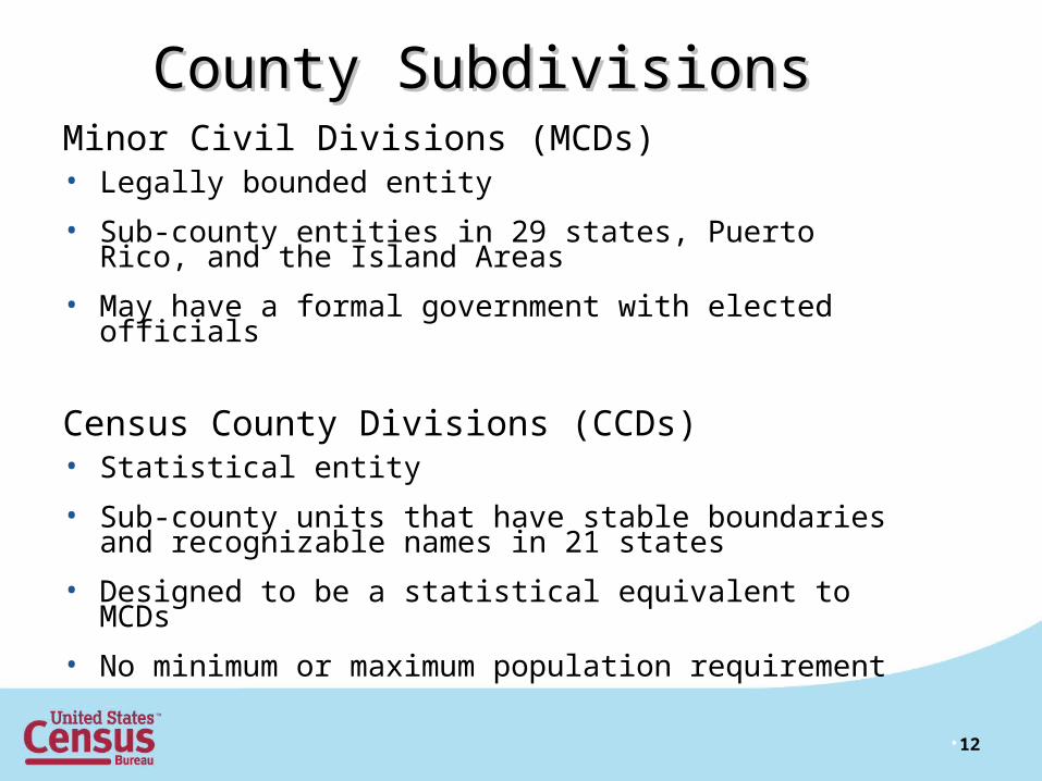
County SubdivisionsCounty SubdivisionsMinor Civil Divisions (MCDs) • Legally bounded entity
• Sub-county entities in 29 states, Puerto Rico, and the Island Areas
• May have a formal government with elected officials
Census County Divisions (CCDs) • Statistical entity
• Sub-county units that have stable boundaries and recognizable names in 21 states
• Designed to be a statistical equivalent to MCDs
• No minimum or maximum population requirement
•12

Minor Civil Division (MCD)Minor Civil Division (MCD)• Township and Town – the most common names• Other MCD names:
– Election district– Magisterial district– Parish governing authority district (Louisiana only)– Supervisor district (Mississippi only)– Election precinct (Illinois and Nebraska)– Gore (Maine and Vermont)– Grant (New Hampshire and Vermont)– Location (New Hampshire only)– Plantation (Maine only)– Purchase (New Hampshire only)
•13
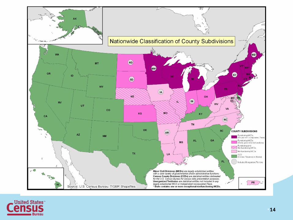
•14
PlacesPlacesIncorporated Places• Legally bounded entity• Depending on the state, examples include cities,
boroughs, towns, and villages
Consolidated Cities• Legally bounded entity• Incorporated place that has consolidated its
government functions with a county or sub-county.• Ex: Indianapolis, IN and Louisville, KY
•15
PlacesPlacesCensus Designated Places (CDPs)
• Statistical entity
• Created to present census data for an area having a concentration of population, housing, and commercial structures
• Boundaries delineated by the Census Bureau, with assistance from planning organizations
• Locally identifiable name
• Not inside an existing incorporated place
•16
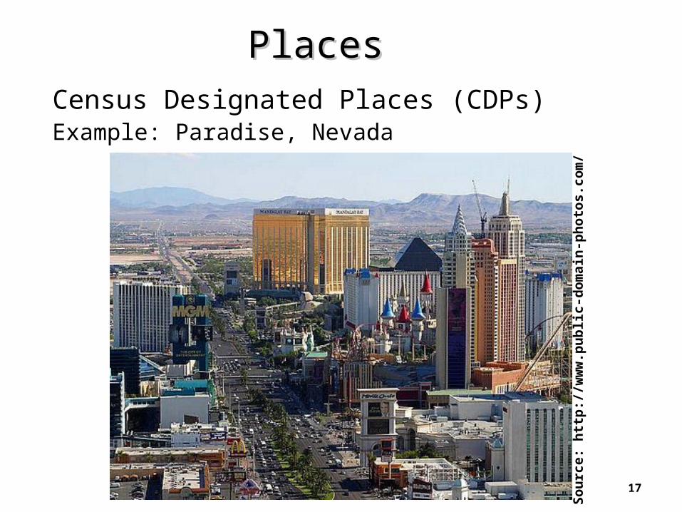
PlacesPlacesCensus Designated Places (CDPs)Example: Paradise, Nevada
•17
• Sou
rce:
htt
p://
ww
w.p
ublic
-dom
ain-
phot
os.c
om/
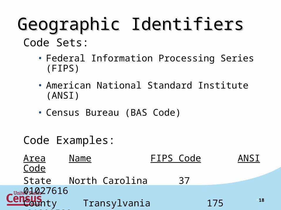
Geographic IdentifiersGeographic Identifiers
•18
Code Sets:• Federal Information Processing Series (FIPS)
• American National Standard Institute (ANSI)
• Census Bureau (BAS Code)
Code Examples:
Area Name FIPS Code ANSI CodeState North Carolina 37 01027616County Transylvania 175 01008589Place Wilmington 74440 02405754

BAS CodesBAS Codes
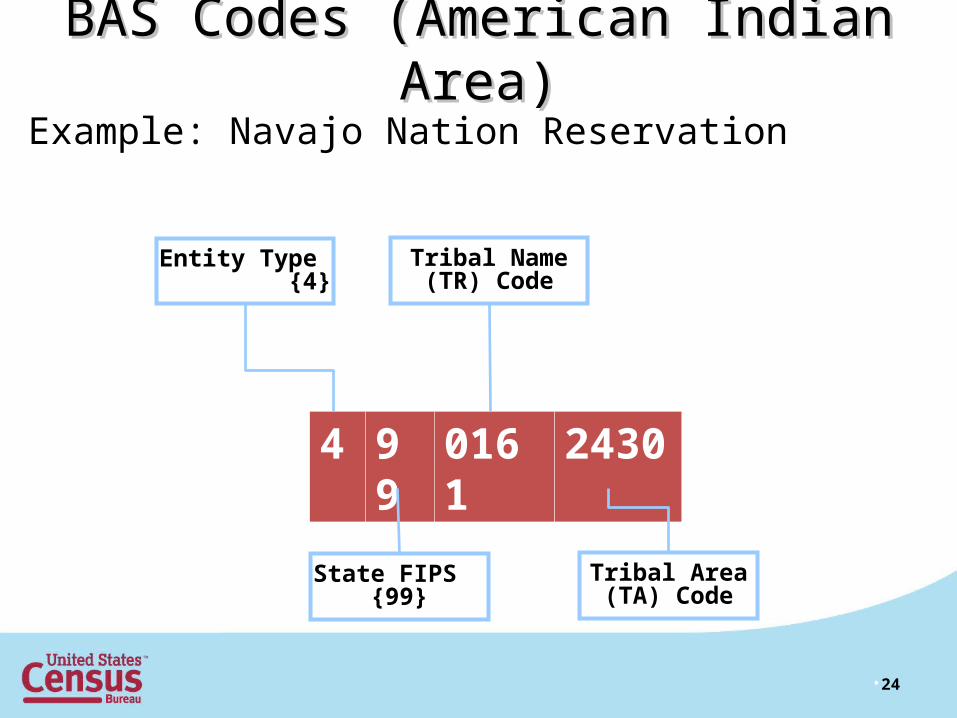
There are 5 types of entities recognized for the BAS:
Entity Code Entity Type .
0 Consolidated City
1 Incorporated Place
2 County or County Equivalent
3 Minor Civil Division (MCD)
4 Federally recognized American Indian reservations and off-reservation
trust lands
•19

• The BAS entity code is an 11-Digit Code
• Entity types 0 through 3 use FIPS codes
• Entity type 4 uses unique code developed by Census
•20
9 99 999 99999
State FIPS Code
Entity FIPS Code
County FIPS Code
Entity Type {0, 1, 2, 3, 4}
BAS CodesBAS Codes
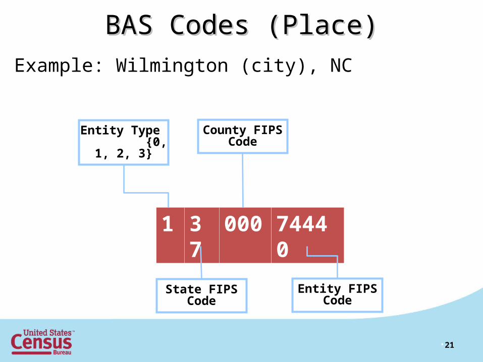
Example: Wilmington (city), NC
•21
1 37 000 74440
State FIPS Code
Entity FIPS Code
County FIPS Code
Entity Type {0, 1, 2, 3}
BAS Codes (Place)BAS Codes (Place)

Example: Transylvania County, NC
•22
2 37 175 00000
State FIPS Code
Entity FIPS Code
County FIPS Code
Entity Type {0, 1, 2, 3}
BAS Codes (County)BAS Codes (County)

Example: Long Creek Township, ND
•23
3 38 023 47780
State FIPS Code
Entity FIPS Code
County FIPS Code
Entity Type {0, 1, 2, 3}
BAS Codes (Minor Civil Division)BAS Codes (Minor Civil Division)
•24
4 99 0161 2430
State FIPS {99}
Tribal Area (TA) Code
Tribal Name (TR) Code
Entity Type {4}
Example: Navajo Reservation and Off Reservation Trust Land
BAS Codes (American Indian Area)BAS Codes (American Indian Area)
Example: Navajo Nation Reservation
•25
Census BureauCensus Bureau
Geographic ProductsGeographic Products
• 2010 Census Data Products: United States
• 2010 TIGER/Line Shapefiles Flyer
• Standard Hierarchy of Census Geographic Entities
• Map of 2010 Population Distribution in the United States
• Working with TIGER/Line Shapefiles: Downloading
• Working with TIGER/Line Shapefiles: Downloading from AFF
• American FactFinder Flyer
•26
Packet MaterialsPacket Materials
http://www.census.gov/geo/www/index.html
• December 31, 2010 – Apportionment Data to the President
• Feb to Mar 2011 – Redistricting Data
• Nov 2010 to Jan 2011 – Redistricting Geographic Files
• Oct 2012 – Urban/Rural Data
• Jul to Aug 2013 – Core-Based Statistical Areas Data
•27
Key Census Data ProductsKey Census Data Products
– Metropolitan Statistical Areas– Micropolitan Statistical Areas
• Public product created from the MAF/TIGER database
• Digital files containing geographic features (roads,
rivers, legal & statistical boundaries, address ranges,
etc.), including information about the features and their
location
• Covers United States, Puerto Rico, and Island Areas
• 2010 Shapefiles released state-by-state from December
2010 – February 2011
• Updated data is released yearly
• www.census.gov/geo/www/tiger/index.html
•28
TIGER/Line ShapefilesTIGER/Line Shapefiles
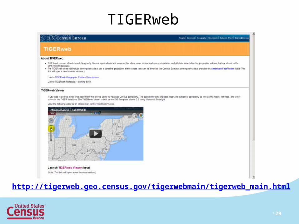
TIGERweb
•29
•http://tigerweb.geo.census.gov/tigerwebmain/tigerweb_main.html

http://www.census.gov/geo/www/bas/bashome.html
•30
BAS HomepageBAS Homepage
•31
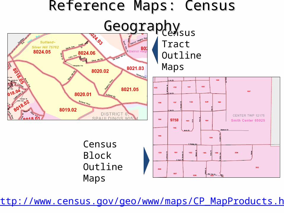
Census Tract Outline Maps
Census Block Outline Maps
Reference Maps: Census GeographyReference Maps: Census Geography
•http://www.census.gov/geo/www/maps/CP_MapProducts.htm
•32
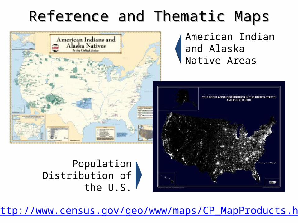
Reference and Thematic MapsReference and Thematic Maps
Population Distribution of the U.S.
American Indian and Alaska Native Areas
•http://www.census.gov/geo/www/maps/CP_MapProducts.htm