1 the historic ice storm of january 26-28, 2009. 2 outline brief review of the stormbrief review of...
TRANSCRIPT

1
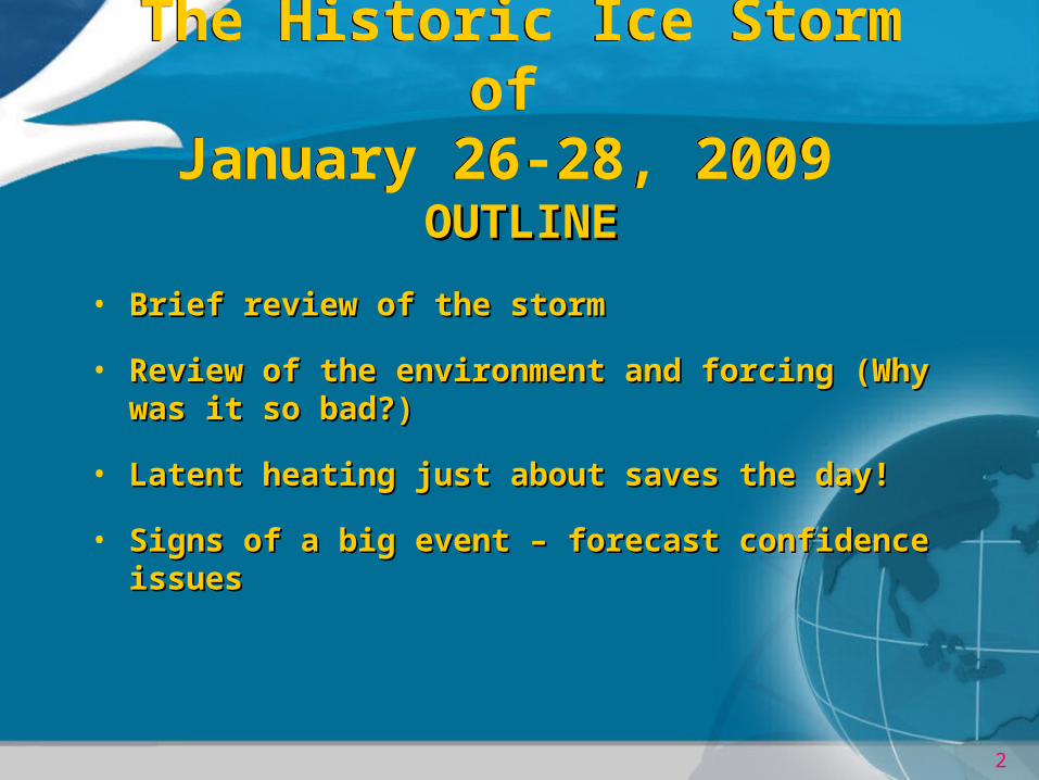
The Historic Ice Storm of January 26-28, 2009
The Historic Ice Storm of January 26-28, 2009
2
The Historic Ice Storm of January 26-28, 2009
The Historic Ice Storm of January 26-28, 2009
OUTLINEOUTLINE
• Brief review of the stormBrief review of the storm
• Review of the environment and forcing (Why was it so Review of the environment and forcing (Why was it so bad?)bad?)
• Latent heating just about saves the day!Latent heating just about saves the day!
• Signs of a big event – forecast confidence issuesSigns of a big event – forecast confidence issues

3
The Historic Ice Storm of January 26-28, 2009
The Historic Ice Storm of January 26-28, 2009

4
The Historic Ice Storm of January 26-28, 2009
The Historic Ice Storm of January 26-28, 2009

5
The Historic Ice Storm of January 26-28, 2009
The Historic Ice Storm of January 26-28, 2009
6
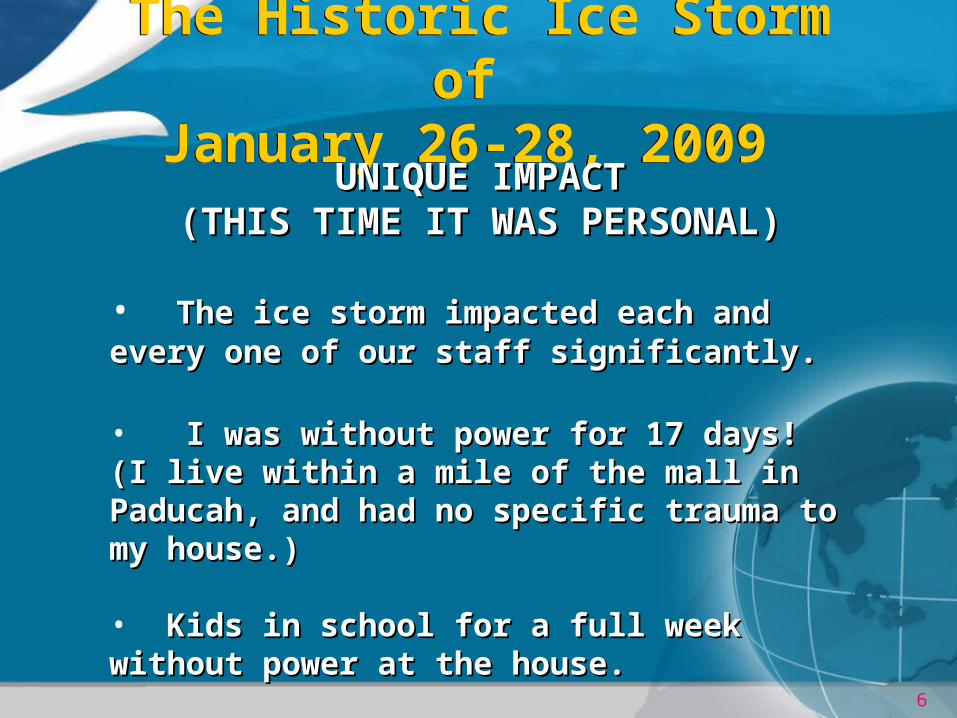
The Historic Ice Storm of January 26-28, 2009
The Historic Ice Storm of January 26-28, 2009
UNIQUE IMPACTUNIQUE IMPACT(THIS TIME IT WAS PERSONAL)(THIS TIME IT WAS PERSONAL)
• The ice storm impacted each and every one of our The ice storm impacted each and every one of our staff significantly.staff significantly.
• I was without power for 17 days! (I live within a I was without power for 17 days! (I live within a mile of the mall in Paducah, and had no specific mile of the mall in Paducah, and had no specific trauma to my house.)trauma to my house.) • Kids in school for a full week without power at the Kids in school for a full week without power at the house.house.

7
January 26-28, 2009 Ice Storm Radar
January 26-28, 2009 Ice Storm Radar
KPAH Reflectivity & METARs
6 PM Monday 12 AM Tuesday

8
January 26-28, 2009 Ice Storm Radar
January 26-28, 2009 Ice Storm Radar
KPAH Reflectivity & METARs
6 AM Tuesday 12 PM Tuesday

9
January 26-28, 2009 Ice StormEnvironment 6 PM Friday (23rd)January 26-28, 2009 Ice Storm
Environment 6 PM Friday (23rd)

10
January 26-28, 2009 Ice Storm Environment 6 PM Monday
January 26-28, 2009 Ice Storm Environment 6 PM Monday
11
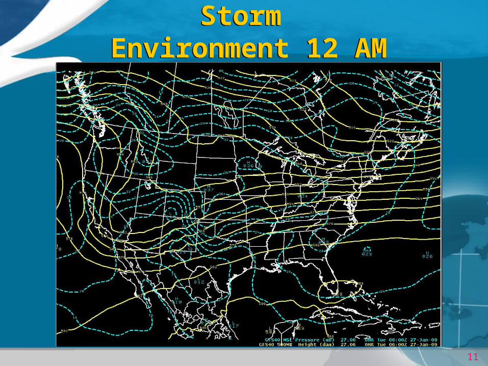
January 26-28, 2009 Ice Storm Environment 12 AM Tuesday
January 26-28, 2009 Ice Storm Environment 12 AM Tuesday

12
January 26-28, 2009 Ice Storm Environment 6 AM Tuesday
January 26-28, 2009 Ice Storm Environment 6 AM Tuesday

13
January 26-28, 2009 Ice Storm Environment 12 PM Tuesday
January 26-28, 2009 Ice Storm Environment 12 PM Tuesday
14
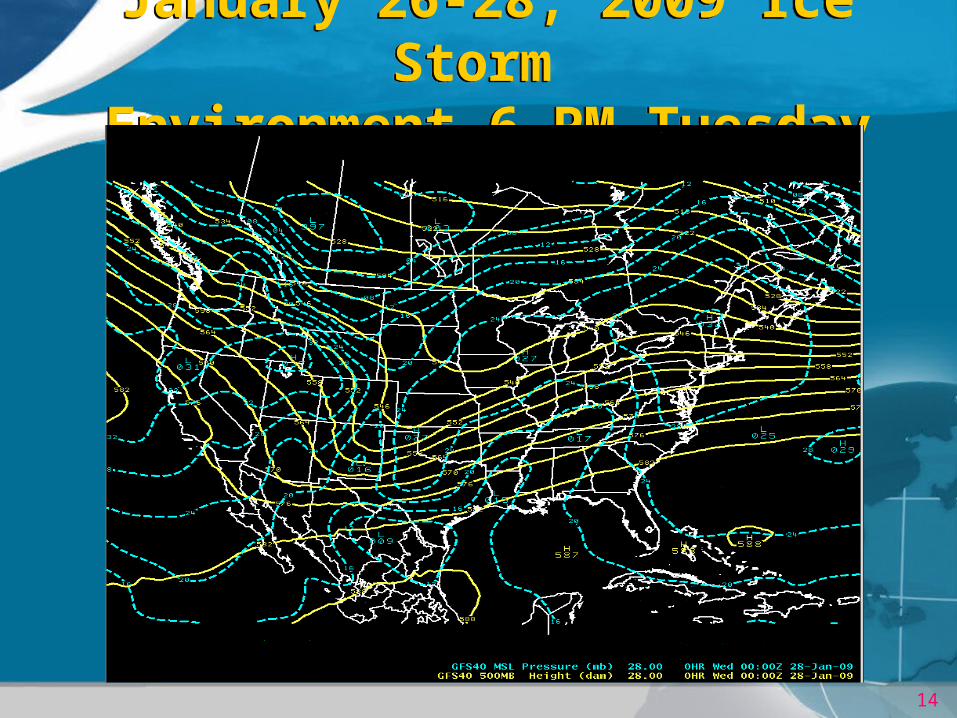
January 26-28, 2009 Ice Storm Environment 6 PM Tuesday
January 26-28, 2009 Ice Storm Environment 6 PM Tuesday

15
January 26-28, 2009 Ice Storm Environment 6 AM WednesdayJanuary 26-28, 2009 Ice Storm Environment 6 AM Wednesday

16
January 26-28, 2009 Ice Storm Environment
January 26-28, 2009 Ice Storm Environment
850-700mbTheta-e Conv.
800mb Wind
6 PM Monday
17
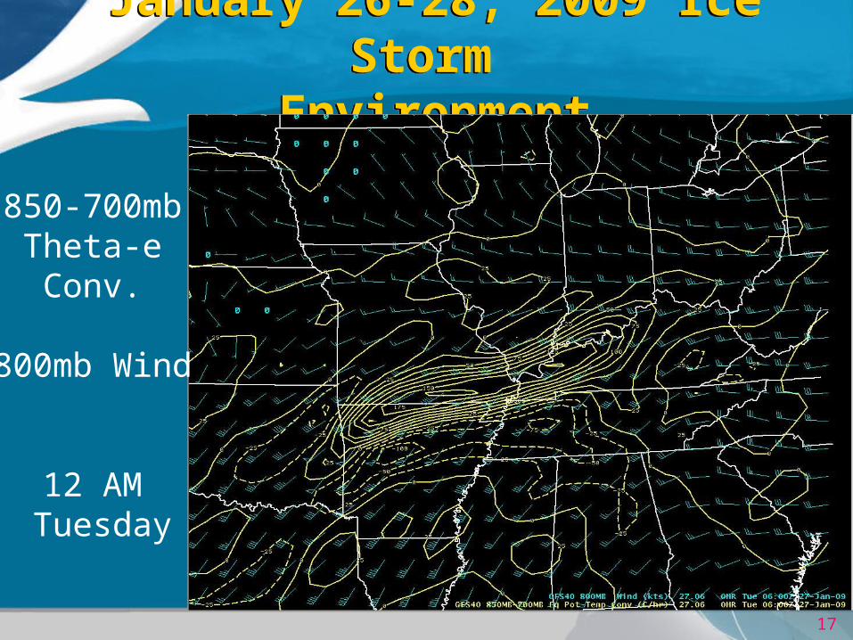
January 26-28, 2009 Ice Storm Environment
January 26-28, 2009 Ice Storm Environment
850-700mbTheta-e Conv.
800mb Wind
12 AM Tuesday

18
January 26-28, 2009 Ice Storm Environment
January 26-28, 2009 Ice Storm Environment
850-700mbTheta-e Conv.
800mb Wind
6 AMTuesday

19
January 26-28, 2009 Ice Storm Environment
January 26-28, 2009 Ice Storm Environment
850-700mbTheta-e Conv.
800mb Wind
12PM Tuesday

20
January 26-28, 2009 Ice Storm Environment
January 26-28, 2009 Ice Storm Environment
850-700mbTheta-e Conv.
800mb Wind
6 PM Tuesday

21
January 26-28, 2009 Ice Storm Environment
January 26-28, 2009 Ice Storm Environment
850-700mbTheta-e Conv.
800mb Wind
12 AMWednesday

22
January 26-28, 2009 Ice Storm Environment
January 26-28, 2009 Ice Storm Environment
Sounding At
KPAH
6 PM Monday

23
January 26-28, 2009 Ice Storm Environment
January 26-28, 2009 Ice Storm Environment
Sounding At
KPAH
12 AMTuesday

24
January 26-28, 2009 Ice Storm Environment
January 26-28, 2009 Ice Storm Environment
Sounding At
KPAH
6 AM Tuesday

25
January 26-28, 2009 Ice Storm Environment
January 26-28, 2009 Ice Storm Environment
Sounding At
KPAH
12 PM Tuesday

26
January 26-28, 2009 Ice Storm Environment
January 26-28, 2009 Ice Storm Environment
Sounding At
KPAH
6 PM Tuesday

27
January 26-28, 2009 Ice Storm Environment
January 26-28, 2009 Ice Storm Environment
Sounding At
KPAH
12 AMWednesday

28
January 26-28, 2009 Ice Storm Environment
January 26-28, 2009 Ice Storm Environment
• Classic freezing rain soundings, with a warm layer atop a sub-freezing layer at the surface.
• Lack of instability prolonged and persistent light to moderate rain rates efficient accretion.
• Latent heating sudden warming Monday night, with surface temperatures near the freezing mark.

29
January 26-28, 2009 Ice Storm Latent Heat Concerns
January 26-28, 2009 Ice Storm Latent Heat Concerns
KPAH & METARs -- 27 JAN 2009
10 AM
12 AM
2 AM

30
January 26-28, 2009 Ice Storm The Perfect Storm
January 26-28, 2009 Ice Storm The Perfect Storm
• Sub-freezing air in place for over 72 hours before storm.
• Persistent southwest flow aloft with cool northeast flow at the surface.
• Persistent low-level forcing for lift, with lots of moisture streaming into the region.
• No instability lighter rain rates efficient icing
• Latent heating continuously offset by cool northeast surface flow. Temperatures staying at or below freezing.

31
January 26-28, 2009 Ice Storm Forecast Confidence
January 26-28, 2009 Ice Storm Forecast Confidence
1. Persistent trends in successive runs of a single model. 24+ hours of consistency leads to increased confidence.
2. Personal experience can lead to forecast confidence. “I’ve seen this many times.” – pattern recognition.
3. Clustering of the operational models around a common solution.
4. #3 is a baby step toward Ensemble Forecast Systems.

32
January 26-28, 2009 Ice StormForecast Confidence
January 26-28, 2009 Ice StormForecast Confidence

33
January 26-28, 2009 Ice Storm Environment 6 AM Tuesday
January 26-28, 2009 Ice Storm Environment 6 AM Tuesday

34
January 26-28, 2009 Ice Storm Forecast Confidence Long Term
January 26-28, 2009 Ice Storm Forecast Confidence Long Term
• Noticed this pattern on 4 runs of the GFS over a 2 day period. European model very similar.
• Recognized the pattern as one that could lead to an unpleasant winter scenario for our area.
• Aware that these models typically depict major large-scale events very well and very early (7-10days out).

35
January 26-28, 2009 Ice Storm Forecast Confidence Long Term
January 26-28, 2009 Ice Storm Forecast Confidence Long Term
ILZ094-KYZ005>009-011-211030-MASSAC-MCCRACKEN-GRAVES-LIVINGSTON-MARSHALL-CALLOWAY-LYON-INCLUDING THE CITIES OF...METROPOLIS...PADUCAH...MAYFIELD...SMITHLAND...BENTON...MURRAY...EDDYVILLE302 PM CST TUE JAN 20 2009
.MONDAY THROUGH TUESDAY...MOSTLY CLOUDY WITH A 40 PERCENT CHANCEOF RAIN OR SNOW. HIGHS IN THE UPPER 30S. LOWS IN THE UPPER 20S.
HAZARDOUS WEATHER OUTLOOKNATIONAL WEATHER SERVICE PADUCAH KY324 PM CST TUE JAN 20 2009
.DAYS TWO THROUGH SEVEN...WEDNESDAY THROUGH MONDAY
A SIGNIFICANT WINTRY PRECIPITATION EVENT IS POSSIBLE DURING THE FIRSTHALF OF NEXT WEEK
AREA FORECAST DISCUSSIONNATIONAL WEATHER SERVICE PADUCAH KY125 PM CST TUE JAN 20 2009 .LONG TERM /FRIDAY NIGHT THROUGH TUESDAY/...SIGNIFICANT WINTRY PRECIPITATION LOOKING MORE LIKELY AT SOME POINT THE FIRST HALF OF NEXT WEEK.

36
January 26-28, 2009 Ice Storm Signs of a Big Event
January 26-28, 2009 Ice Storm Signs of a Big Event
37
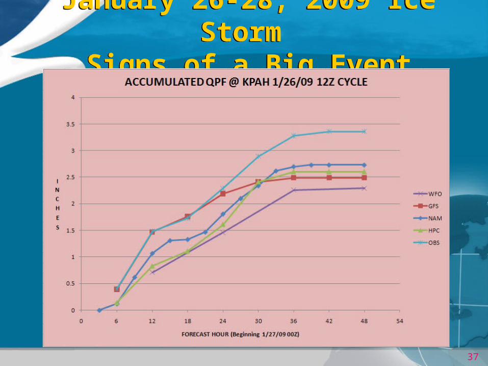
January 26-28, 2009 Ice Storm Signs of a Big Event
January 26-28, 2009 Ice Storm Signs of a Big Event

38
January 26-28, 2009 Ice Storm Signs of a Big Event
January 26-28, 2009 Ice Storm Signs of a Big Event

39
January 26-28, 2009 Ice Storm Forecast Confidence Short Term
January 26-28, 2009 Ice Storm Forecast Confidence Short Term
• Successive model cycles with good clustering of major
liquid-equivalent precipitation.
• The models did not generate enough precipitation, but the inter-model consistency and consistent trend toward the extreme, increased confidence that a major event was about to unfold.
• The only question at this point, was just how bad would it be?

40
January 26-28, 2009 Ice Storm Short-Range Ensemble ForecastsJanuary 26-28, 2009 Ice Storm
Short-Range Ensemble Forecasts
• Consists of 21 individual models or model runs.
• Consists of models with different numerical guts, or the same models using slightly different observations.
• Statistics such as the mean and standard deviation can be used to quantify the variability in the forecast.
• How quickly the model forecasts diverge with time gives a direct measure of how predictable the evolution of the current environment is.
41
January 26-28, 2009 Ice Storm Short-Range Ensemble ForecastJanuary 26-28, 2009 Ice Storm Short-Range Ensemble Forecast
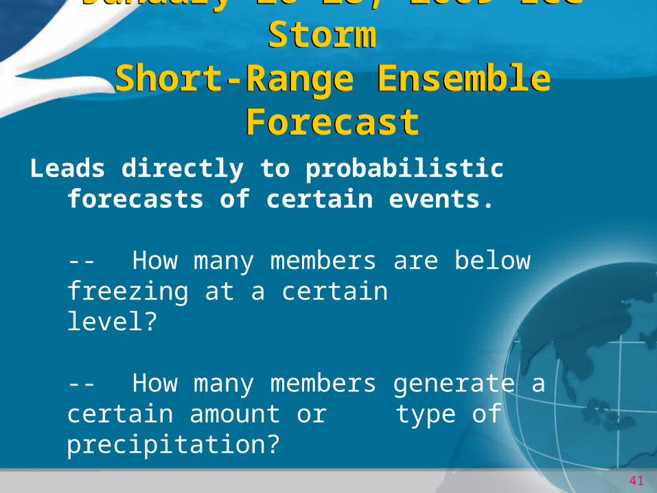
Leads directly to probabilistic forecasts of certain events.
-- How many members are below freezing at a certain level?
-- How many members generate a certain amount or type of precipitation?
-- How many members have winds above a certain level?

42
January 26-28, 2009 Ice Storm SREF Signs of a Big Event
January 26-28, 2009 Ice Storm SREF Signs of a Big Event
SREF9 AM
Monday
Chance of FZRA
& 1”/24 hrs QPF
Valid 6 PM Tuesday

43
January 26-28, 2009 Ice Storm SREF Signs of a Big Event
January 26-28, 2009 Ice Storm SREF Signs of a Big Event
SREF9 AM
Monday
Chance of FZRA
& 2”/24 hrs QPF
Valid 12 AM Wednesday

44
January 26-28, 2009 Ice Storm SREF Signs of a Big Event
January 26-28, 2009 Ice Storm SREF Signs of a Big Event
SREF9 AM
Monday
Chance of T< 0C
@ Surface & 850mb
Valid 6 AM Tuesday
45
January 26-28, 2009 Ice Storm SREF Signs of a Big Event
January 26-28, 2009 Ice Storm SREF Signs of a Big Event
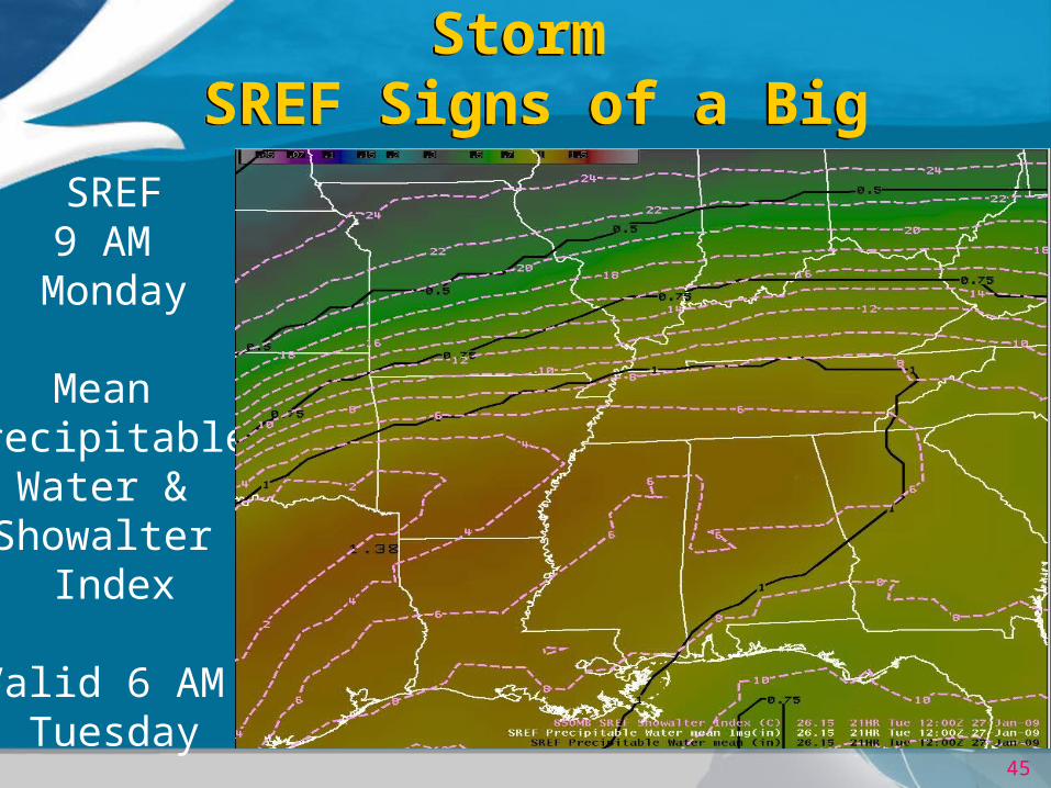
SREF9 AM
Monday
Mean Precipitable
Water & Showalter
Index
Valid 6 AM Tuesday
46
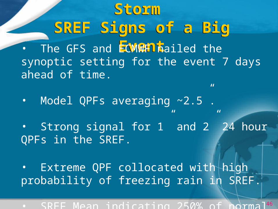
January 26-28, 2009 Ice Storm SREF Signs of a Big Event
January 26-28, 2009 Ice Storm SREF Signs of a Big Event
• The GFS and ECMWF nailed the synoptic setting for the event 7 days ahead of time.
• Model QPFs averaging ~2.5”.
• Strong signal for 1” and 2” 24 hour QPFs in the SREF.
• Extreme QPF collocated with high probability of freezing rain in SREF.
• SREF Mean indicating 250% of normal precipitable water with no instability.
47
Will it ever happen again?
Not likely, but…..
It could happen this season or next!
The Historic Ice Storm of January 26-28, 2009
The Historic Ice Storm of January 26-28, 2009