10 health and safety
TRANSCRIPT
The Pacific Grove General Plan 1
A wide range of hazards must be considered in planning for urban development. Some of these hazards are natural, such as seismic shaking; some are man-made, such as noise; and others are natural hazards exacerbated by human activity, such as development in areas sensitive to soil erosion or liquefaction. Many potential hazards can be avoided in the development process through locational deci-sions, while other hazards can be tolerated or mini-mized by including mitigation measures in the planning and land use regulation process.
This chapter inventories and assesses the major hazards confronting Pacific Grove, including seismic and geologic hazards, erosion, wildland and urban fires, flooding, and noise. It also covers fire and police, the emergency forces that must deal with the hazards and secure the safety of the community.
10.1 SEISMIC AND GEOLOGIC HAZARDS
Monterey County is situated in a seismically active area. (See Figure 10-1, Earthquake Faults.) A number of faults traverse the county near the Monterey Peninsula, including the San Andreas Fault, which runs north-south about 28 miles east of Pacific Grove. The San Andreas Fault is considered capable of pro-ducing an earthquake with a magnitude of up to 8.5 on the Richter scale. The U.S. Geological Survey in 1990 estimated that there is a 67 percent chance of a magnitude 7 or larger earthquake in the San Francisco Bay Area during the next 30 years with an epicenter somewhere between San Jose and Santa Rosa.
Two other active fault zones affecting Pacific Grove are the Monterey Bay and the Palo Colorado-San Gregorio Fault Zones. These two areas, both of which have experienced movement along individual fault segments, are separated by the submerged Monterey Canyon.
The Monterey Bay Fault Zone is located offshore in the northern and southern areas of Monterey Bay. The maximum magnitude earthquake likely to be generated by this fault zone is about 6.5, which could generate tsunamis on the Pacific Grove coastline.
The Palo Colorado-San Gregorio Fault Zone is a northwest-trending zone located six miles west and south of Pacific Grove. This active fault zone connects the Palo Colorado Fault near Point Sur, south of Monterey, with the San Gregorio Fault near Point Año Nuevo, where it intersects the San Andreas Fault System. The Palo Colorado-San Gregorio Fault has the capability of producing an earthquake with an es-timated maximum magnitude of 7.5 on the Richter scale.
Besides these three active fault zones, there are another 15 potentially active faults within Monterey County. Those closest to Pacific Grove are the Navy Fault and Cypress Point Fault. The Navy Fault is a northwest-trending fault that runs through the center of the City of Monterey into Monterey Bay. The Cypress Point Fault also trends northwest, running through the southwestern portion of the Monterey Peninsula, just northeast of Pescadero and Cypress Points. Most faults in Monterey County run parallel to the San Andreas fault in a northwest direction, and are considered sub-units of the San Andreas Fault System.
10.1.1 Seismic Hazards
Pacific Grove, while exposed to seismic hazards, is situated in a relatively stable area of granitic bedrock, and is relatively better off than other parts of the county. Since 1856, the three most severe quakes to affect Pacific Grove were the April 1906, October 1926, and October 1989 quakes. The 1989 Loma Prieta quake, which measured 7.1 on the Richter scale, caused very little damage in Pacific Grove.
10 Health and Safety

Health and Safety, Chapter 10
The Pacific Grove General Plan 2
Figure 10-1 Earthquake Faults
Health and Safety, Chapter 10
The Pacific Grove General Plan 3
10.1.2 Groundshaking
Groundshaking is the vibration that radiates from the epicenter of an earthquake. Because it can damage or collapse buildings and other structures, and because the shaking effects can be damaging well beyond the fault trace that generates the shaking, groundshaking is considered the most serious and direct hazard pro-duced by an earthquake. The intensity of the vibration or shaking and its potential impact on structures and urban development is determined by (1) the nature of the underlying rock and soil; (2) the structural characteristics of the building; (3) the quality of workmanship and building materials used; (4) the location of the epicenter and the magnitude of the earthquake; and (5) the duration and character of the ground motion.
The potential for damage is most likely to be minimal where bedrock is located close to the ground surface. Pacific Grove is situated in such an area and can be considered relatively stable. Nevertheless, older buildings constructed before building codes were in effect, and even newer buildings constructed before earthquake resistance provisions were included in building codes in 1933, are the most likely to suffer damage in an earthquake. However, most buildings in Pacific Grove are one or two stories and are predomi-nantly wood frame, which makes them among the most structurally resistant to earthquake damage. In Pacific Grove there are only 12 of the older masonry buildings without earthquake resistant reinforcement that are the most susceptible to the sort of structural failure that causes the greatest loss of lives. The greatest concentration of old masonry buildings, some with cornices and parapets that are not firmly anchored, is in the Downtown area.
Fire is often the major form of damage resulting from groundshaking, largely as a result of the great number of buildings constructed of combustible materials, damage to the City’s firefighting facilities, and the rupture of water mains. Ninety percent of the destruction in the 1906 San Francisco earthquake was caused by fire. Most earthquake-induced fires start because of ruptured power lines, damage to wood, gas, or electrical stoves, and damage to other gas or electrical equipment. This points to the need for greater use of non-combustible material and special construction techniques so that water mains will remain intact during large earthquakes. Critical facilities, such as hospitals and fire stations, must be
sited, designed, and constructed to withstand severe groundshaking.
10.1.3 Ground Failure
In addition to structural damage, groundshaking can also cause ground failure, such as liquefaction, settlement, lurch cracking, lateral spreading, and earthquake-induced landslides.
Liquefaction is the loss of soil strength due to seismic forces acting on water-saturated granular soils. This loss of strength leads to a “quicksand” condition in which objects can either sink or float depending on their density. The potential for liquefaction in Pacific Grove exists primarily in beach and sand dune areas, and in fill areas close to the shoreline. This potential is greatest in the Spanish Bay and Asilomar areas.
Settlement is the vertical compaction of soils and alluvium caused by groundshaking. It may range from a land surface drop of a few inches to several feet, and may occur as far as 75 to 80 miles from the epicenter. There are no areas subject to settlement in Pacific Grove’s Planning Area.
Lurch cracking refers to fractures, cracks, and fissures from a few inches to many feet in length pro-duced by groundshaking, settling, compaction of soil, and sliding. In a major earthquake, lurch cracking is likely to result in the extensive rippling and fracturing of pavements and curbs, and damage to sewer, gas, and water lines.
Lateral spreading is the horizontal movement or spreading of soil toward an open face such as a stream bank or the open side of fill embankments. In Pacific Grove’s Planning Area, the most likely locations to be affected are improperly engineered fill areas or steep, unstable banks. But because Pacific Grove is situated on stable bedrock, the potential for significant damage from either lurch cracking or lateral spreading is low.
An earthquake large enough to be felt can also cause rockfalls, landslides, rock avalanches, and mud and debris flows. Severe landslide damage and disruption of access could occur as the result of a moderate to major earthquake along Highway 68.
10.1.4 Tsunami Hazards
A tsunami is a large ocean wave generated by an earthquake in or near the ocean. Submarine earthquakes of magnitudes in excess of 6.5 on the Richter scale appear to be the principal cause of
Health and Safety, Chapter 10
The Pacific Grove General Plan 4
tsunamis, although tsunamis also have been triggered by submarine landslides and volcanic eruptions. Tsunamis are actually a series of very long-period waves (lasting five minutes to several hours) that are low in height when traversing water of oceanic depth. But when tsunami waves approach shore where the water depth decreases rapidly, wave refraction, shoaling, and bay or harbor resonance may result in dramatically increased wave heights.
Most tsunamis that have struck the California coast in the past⎯such as the 1964 Crescent City disaster⎯have resulted from very distant earthquakes, primarily in the Aleutian Islands. Because of flooding and wave action, the tsunami hazard associated with large distant earthquakes appears to be high along beaches and within harbor facilities.
The major California offshore faults close to Monterey Bay are probably strike-slip faults, and earthquakes generated on strike-slip faults are not likely to produce large-scale tsunamis. Thus, tsunami potential asso-ciated with a local offshore seismic event is low.
Nevertheless, tsunamis have occurred within the Monterey Bay region, resulting in significant damage to harbors and other coastal facilities. There is no record of any tsunamis more than 10 feet high occurring along the Monterey County Coast. The effect of a tsunami wave on the Pacific Grove shore-line would be comparable to a swiftly rising and falling tide. For the Pacific Grove shoreline, the main safety hazard from a tsunami is the possibility that residents on Ocean View Boulevard and other low altitude streets such as Coral Street and Acropolis Street who are not evacuated may be caught by the waves. There is also the possibility that sight-seers who evade police tsunami warning barriers and follow the tsunami drawdown into the exposed intertidal areas may be swept away by the following crest of the tsunami as were 61 sightseers in Hilo, Hawaii, in 1960.
A tsunami warning system has been set up with the Pacific Tsunami Warning Center in Hawaii, and the Alaska Tsunami Warning Center in Alaska. These Centers will provide warnings to the National Weather Service which will pass them on to the Pacific Grove Police Department.
Areas above the seacliff in Pacific Grove are consid-ered to have a low tsunami hazard, while beaches and areas below the seacliff are considered to have a high tsunami hazard.
Health and Safety, Chapter 10
The Pacific Grove General Plan 5
10.1.5 Summary of Seismic and Tsunami Hazards
Potential seismic and tsunami hazards in the Pacific Grove Planning Area have been mapped in the Monterey County and Cities Seismic Element. The map is divided into zones of relative seismic hazard based on bedrock type, soil type, and proximity to known faults. Past studies and evaluation of seismic hazards in the region indicate Pacific Grove is in a relatively stable area. The principal danger to struc-tures is caused by groundshaking, and the potential for such damage is only low to moderate. Liquefaction potential is limited mostly to the Spanish Bay area. Low areas adjacent to beaches and the immediate shoreline are potentially subject to tsunami inundation.
10.1.6 Landslide and Erosion Hazards
The potential for landslides and serious erosion exists wherever natural or man-made disturbances have created unstable soil and slope conditions. Erosion is a natural process that is affected by variables such as the amount and intensity of rainfall, ocean wave exposure, properties of soil type and underlying rock, and vegetative or organic debris cover. It becomes a serious problem only when man-made factors are also at work. Landslides are usually more destructive and can be triggered by either natural causes (such as seismic shaking or stream erosion) or by human activities such as grading, compaction, and filling, which can increase the load on unstable ground masses.
Soils. A number of soil properties have important implications for development and resource manage-ment. Soil-related issues to be addressed in planning and management include erosion, drainage, runoff, and expansive soils. The soils in the Planning Area have only a moderate erosion hazard and a moderate runoff potential.
Landslides. Unstable and potentially unstable slopes can be identified by bowl-shaped or step-like hillsides, broken and sheared bedrock and/or soil deposits, near-surface saturated conditions as evidenced by springs or seepage areas, slopes generally greater than 15 percent, and broken ground and/or tilted vege-tation. All are indications of poor slope stability.
Most areas of Pacific Grove have an extremely low potential for landsliding. No significant landslides have been recorded in the city, and with the exception of a few low bluff areas along the waterfront that are
used as parks and are protected by retaining walls, no significant areas of landslide susceptibility have been identified. Only a relatively small portion of the city contains slopes over 30 percent: Calabrese Canyon, some coastal bluffs, Benito Avenue, Piedmont Avenue, Hillside Avenue, Adobe Lane, and Syida Drive.
Erosion. Erosion and deposition are common natural geologic processes that result from gullying, rilling, ravelling, and bank cutting. In areas undisturbed by human activity, these processes may or may not pose a hazard. They may, however, be accelerated by con-centrating natural surface flows into culverts or by removing vegetative cover. Then the chances of hazardous conditions increase.
The 1978 Pacific Grove environmental hazards element identified three areas as high erosion hazard zones. These areas have since been further developed and no longer pose a serious erosion problem. The areas were Calabrese Canyon, Spanish Bay, and an area adjacent to the Samuel F. B. Morse Reserve. The construction and landscaping associated with the housing development at Calabrese Canyon and the new golf course and hotel at Spanish Bay have re-duced the overall erosion hazard.
The grading of sites can, nevertheless, present an erosion hazard which can affect not only the property being developed but also adjacent and downslope properties. Sediment traveling from eroded areas usually affects an area much larger than the site under construction. Section 24.06.020 of Pacific Grove’s Subdivision Ordinance is intended to control the erosion-inducing effects of development. The City also requires that temporary cover or mulching be used to protect bare soil and slopes to mitigate erosion hazards during construction in rainy periods.
10.1.7 Marine-related Erosion Hazards
The ocean and bay shore on the north and west of the city are subject to weathering, erosion, and deposition of rocks and sand from both ocean winds and waves. Whereas sandstone and bedded cliffs have posed cliff-retreat problems for urban areas on the other side of Monterey Bay, Pacific Grove’s shoreline is mostly dominated by exposed granitic rock that forms a relatively stable and durable barrier to protect shore-line development from the constant barrage of ocean waves. Although wave activity can become intense during winter storms, the Pacific Grove shore has not retreated significantly.
Health and Safety, Chapter 10
The Pacific Grove General Plan 6
Approximately 80 percent of the city’s shoreline is still in its natural state. The remaining 20 percent (all between Point Pinos and Point Cabrillo) has been altered with seawalls to provide protection from wave action. Two small areas (at Point Cabrillo and on the ocean side of Point Pinos) have either protective beaches or stable rock formations. The U.S. Depart-ment of Navigation and Ocean Development has classified four small areas where man-made shoreline improvements may be endangered, although damage may not have occurred recently. Along the rest of the natural shoreline, existing improvements are not considered in danger from wave damage.
Pedestrian traffic along the immediate shoreline can contribute to shoreline bluff erosion. Walkers can disturb protective vegetation in bluff-top areas. Loss of vegetative cover leads to further abrasion of the bluffs, and run-off and storm wave action increase erosion and sedimentation. The City’s seawall con-struction program has tried, since 1970, to remedy the conditions caused in part by heavy pedestrian use of the shoreline. The seawall has enhanced public access in certain locations, and may also have had a beneficial effect on maintaining water clarity in the Marine Gardens Fish Refuge.
Very few structures in Pacific Grove have been built directly adjacent to the shoreline. Roadways (Ocean View Boulevard and Sunset Drive) separate urbanized land uses from the shore. Those portions of Ocean View Boulevard adjacent to any steep drop to sea level are protected by retaining walls. There is, therefore, no significant ocean wave-related erosion hazard to existing urban development.
The erosion hazard from wind on sand dunes along the shoreline between the Lighthouse Reservation and the Spanish Bay area is significant. Unless stabilized by vegetation or snow fences, dune sands will shift and change frequently. Without such stabilization, construction and siting of structures in the dune area constitutes a hazard to both the new structures and surrounding properties. Disturbance or removal of natural dunes will also increase wind damage hazards.
10.2 SEISMIC AND GEOLOGIC GOALS, POLICIES, AND PROGRAMS
GOAL Prevent loss of life, injury, and
1 property damage from geologic and seismic hazards.
POLICY 1 Design underground utilities, in-cluding water and natural gas mains, to withstand seismic forces.
POLICY 2 Continue City requirements for post-earthquake building replacement, reconstruction, and rehabilitation to conform to the latest City codes.
POLICY 3 Ensure that any hazardous conditions associated with unreinforced masonry (URM) buildings are miti-gated to an acceptable level.
Program A Prepare and adopt construction and design standards for underground utili-ties, particularly natural gas and water, to minimize damage from seismic activity and soil-related problems.
Program B Maintain, in the Pacific Grove Municipal Code, a Seismic Hazards Identification Program that identifies potentially hazardous buildings.
All unreinforced masonry (URM) buildings that are potentially hazardous have been identified, and the City has developed and implemented a mitigation program to reduce the associated hazards.
10.3 FLOODING
The potential for flooding exists whenever excess surface runoff collects and concentrates. This may occur because of inadequate storm drainage or because the natural capacity of a stream or drainage system has been exceeded.
The natural landscape of Pacific Grove peaks near the city boundary with the Presidio of Monterey and slopes gently north and west toward Monterey Bay and the Pacific Ocean. This slope gives the city a mostly unobstructed natural gravity drainage system. Pacific Grove is on a peninsula without any significant streams or rivers and no true floodplains. Several low areas of the city near Asilomar State Beach and Conference Grounds, however, were designated as “flood prone” in the 1978 Pacific Grove environ-mental hazards element. Flooding in these areas has since been mitigated Source: by installation of new
Health and Safety, Chapter 10
The Pacific Grove General Plan 7
storm drains, and there is no significant flood danger to the city.
10.4 DAM FAILURE
The California-American Water Company recently reconstructed the Forest Lake Reservoir to make it more resistant to earthquake and storm damage that could cause local flooding. Cal-Am’s reservoir within the city limits poses no significant inundation hazard. It is no longer being used for potable water storage.
Program C Explore the use of the California-American Reservoir for potential storage of reclaimed water.
10.5 STORM HAZARDS
Winter storms along the Pacific Grove shoreline have the potential of producing breaking waves exceeding 20 feet in height at the 20-foot depth contour. Although the offshore reef areas dissipate much of the storm wave energy, run-up can reach the low-lying shoreline areas below or at the 20-foot elevation (including the waterfront parklands and roadways). Boulders and other debris flung onto the shore are the primary storm hazards in the area.
Another potential storm hazard results from the con-figuration of Monterey Bay. The bay tends to produce sets of larger waves followed by quiet periods. These quiet periods may lure the unwary too close to the shoreline. The City has recognized the hazard these unexpected large waves pose by posting warning signs along the shoreline.
A study of storm damage in the vicinity of Monterey Harbor from 1910 to 1960 indicates periodic damage to harbor structures and moored boats, but little loss of life. The winter storms of 1982-83 downed trees, damaged piers and some seawalls, and flooded part of the Asilomar area. Although recreational use of the shoreline has intensified substantially since 1970, the heaviest use is during the summer months when storm activity is rare. (Most storms occur between October and April.)
POLICY 4 Maintain adequate storm warning communication systems.
The Pacific Grove Police Department receives weather warnings directly from the National Weather Service’s Forecast Office for the San Francisco Bay
Region. A new National Weather Service forecast station at the Monterey Peninsula Airport, focusing on the coastal counties between Sonoma and San Luis Obispo counties, opened in 1994.
10.6 AIRCRAFT CRASH HAZARDS
Under some wind conditions, commercial, private, and military airplanes fly over Pacific Grove on their approach to land at the Monterey Peninsula Airport. This is a potential hazard.
POLICY 5 Work with the Airport District to monitor safety and noise concerns for Pacific Grove.
10.7 EMERGENCY RESPONSE
Pacific Grove has a Multi-Hazard Emergency Plan which was revised and updated in January 1992. The plan covers responses to earthquakes, hazardous material incidents and ocean oil spills, tsunamis, transportation incidents including aircraft and highway accidents, and nuclear emergencies.
The plan provides overall organizational and opera-tional concepts for responding to the various hazards. This plan is to be used in conjunction with the City’s
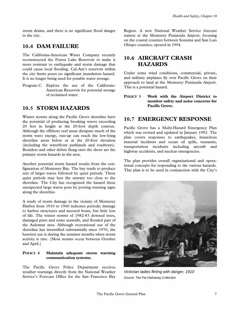
Victorian ladies flirting with danger, 1910 Source: The Pat Hathaway Collection

Health and Safety, Chapter 10
The Pacific Grove General Plan 8
Emergency Operating Center Standard Operating Procedures and the City’s Radio Amateur Civil Emergency Service Plan.
Evacuation routes are shown in Figure 10-2. See Figure 10-3 for major sanitary sewer and storm drain collection systems. Figure 10-4 shows major water mains.
GOAL
2
Provide aid to the community as needed in the event of natural or man-made disasters.
POLICY 6 Ensure that City emergency response
procedures are adequate to deal with natural or man-made disasters in the community.
POLICY 7 Periodically update and test the effec-tiveness of the City’s Multi-Hazard Emergency Plan.
POLICY 8 Ensure that individuals and agencies assigned emergency responsibilities under the Multi-Hazard Emergency Plan prepare appropriate supporting plans and related standard operating procedures.
POLICY 9 Maintain a level of preparedness adequate to implement all parts of the Multi-Hazard Emergency Plan.
Program D Periodically review and update alerting procedures and resources lists.
Program E Review County and State emergency response plans and procedures to ensure coordination with the City’s Multi-Hazard Emergency Plan as part of the periodic update of the City’s plan.
Program F Develop and implement public infor-mation programs concerning disaster re-sponse and emergency preparedness.
Program G Identify emergency access routes.
Program H Include provisions for persons with dis-abilities in emergency response plans.

Health and Safety, Chapter 10
The Pacific Grove General Plan 9
Figure 10-2 Evacuation Routes

Health and Safety, Chapter 10
The Pacific Grove General Plan 10
Figure 10-3 Major Sanitary Sewer and Storm Drain Collection Systems

Health and Safety, Chapter 10
The Pacific Grove General Plan 11
Figure 10-4 Major Water Mains

Health and Safety, Chapter 10
The Pacific Grove General Plan 12
Program I Identify alternative water sources for fire-fighting purposes for use during a dis-aster.
Program J Designate and develop a command center for use during emergencies.
Program K Develop and maintain mutual aid agree-ments and communications links with surrounding jurisdictions for assistance during emergencies.
10.8 TOXIC AND HAZARDOUS WASTES
The generation, storage, disposal, and transportation of toxic or hazardous wastes in Pacific Grove is not a significant issue. The City maintains a hazardous materials storage area at the City Corporation Yard.
The City supports the establishment of a substation in the city for the collection of hazardous materials. See Program L in Section 6.6 of Chapter 6, Natural Resources.
Program L Continue to maintain appropriate li-censes and permits for the storage of hazardous materials.
10.9 AIR AND WATER POLLUTION
There are no significant air or water quality problems in the Planning Area. (Water quality and the City’s intention to control non-source pollutants are dis-cussed in Chapter 6, Sections 6.2 and 6.6.)
The excellent ventilation provided by the weather patterns inhibits the buildup of air pollutants. How-ever, Pacific Grove is part of the North Central Coast Air Basin, which is a non-attainment area for State and federal ozone standards and for State inhalable particulate standards. Attainment means complying with State and federal ambient air quality standards within an air basin.
There are few industrial sources of air pollution in Pacific Grove. Emissions come from automobiles, and from sources such as dry cleaners and gasoline dispensers.
The City has the following air quality goals, policies, and programs:
GOAL
3
Promote attainment, and insofar as possible, improve air quality in Pacific Grove and the Monterey Bay area.
POLICY 10 Address State and federal regulations to keep funding to maintain attain-ment.
Program M Support and participate in regional air quality planning programs.
POLICY 11 Use the CEQA process to identify and avoid or mitigate potentially sig-nificant air quality impacts of development.
In doing so, the City will consult with the Monterey Bay Unified Air Pollution Control District concerning air quality issues associated with specific development proposals.
POLICY 12 Continue to support the efforts of the Transportation Agency for Mon-terey County to implement the Mon-terey County Congestion Management Plan.
Program N Ensure that new development, or major rehabilitation, redevelopment, or con-version, incorporates the infrastructure, facilities, and design standards necessary to encourage and accommodate public transportation, ridesharing, and non-automobile travel modes.
10.10 FIRE HAZARDS
There is a potential for both wildland and structural fires to threaten life and property in Pacific Grove. Wildland fires, which result from both human activity and natural causes, occur in forests, brush, or grass-lands, but may threaten structures and urban devel-opment. Structural fires usually result from human activity. Substandard structures present the highest potential for injury, death, or loss of property.

Health and Safety, Chapter 10
The Pacific Grove General Plan 13
10.10.1 Wildland Fire Hazards
Wildland fires are unlikely to present a hazard to Pacific Grove during most of the year, but such fires do occur periodically and naturally. The buildup of understory brush (which under natural conditions would be periodically burned off) creates conditions conducive to large and intense fires. Variables such as humidity, drought, rainfall, wind velocity, type of vegetation, and fuel buildup determine the start, spread, and control of wildland fires. The most hazardous fire conditions occur during the annual dry season (May to October).
The border of the Del Monte Forest with Pacific Grove has a potential for wildland fires that can endanger urban development. Undeveloped forested areas directly behind houses in this area are highly hazardous because of the accumulation of large amounts of dry brush and dead wood that can become fuel for a wildland fire. A May 31, 1987, fire in Del Monte Forest burned 160 acres, destroyed 32 houses, and caused an estimated $16 million in damage. Monterey County contracts with the California Department of Forestry for fire protection in this part of the Planning Area.
Some areas within the city limits also pose a wildland fire hazard. In Pacific Grove Acres, structure fires can set off wildland fires. The forested portions of the Lynn “Rip” Van Winkle Open Space could pose a fire threat to the schools and housing across Congress Avenue. Washington Park and Asilomar State Beach and Conference Grounds have a smaller potential for an outbreak of wildland fire, since they are well-maintained and regularly cleared of fire-prone debris and brush and are broken up by pavements and cleared areas.
The California Department of Forestry has developed a classification of wildland fire hazards for all “State responsibility lands.” The State responsibility lands within the Pacific Grove Planning Area, all of which are unincorporated, have been designated as having a moderate fire potential.
10.10.2 Structural Fire Hazards
A large number of structures within the original Retreat are substandard in terms of current fire and building codes. These older buildings were constructed on small lots with little or no yard space between them. Many are of single-wall construction, and nearly all are wood frame. Many have original electrical wiring and circuits that fail to meet the
electrical demands of large numbers of modern household appliances. In addition, many older two- and three-story dwellings throughout the city have been converted into apartments or rooming houses; and increasing the number of family units within a building increases the fire risk.
A number of wood-frame commercial buildings in the Downtown lack adequate fire protection. Some of the masonry buildings have common basements without fire-wall separations between properties. The lack of fire walls at property lines and within buildings gives the Downtown the city’s greatest potential for fire.
Lack of water supply and low pressure can seriously constrain fire fighting capabilities. Most of Pacific Grove has adequate water supply for fire suppression; areas that have inadequate water supply need to be upgraded. As of 1994, the areas within the city with inadequate water supply for normal fire protection were:
The 1100 and 1200 blocks of Forest Avenue;
The 600 block of Spazier;
The 600 block of Hillcrest;
The 300 and 400 blocks of Bishop;
The area bounded by the 1000 block of Forest, between Beaumont Avenue and Morse Drive;
The 1200 block of Adobe Lane; and
The 600 and 700 blocks of Mermaid Avenue.
Although California-American Water Company has a
A tradition of public safety, 1920 Source: The Pat Hathaway Collection

Health and Safety, Chapter 10
The Pacific Grove General Plan 14
water main improvement program, its priorities are based on customer complaints and leaks⎯not on fire fighting needs. Therefore, the City will need to include a water main improvement program in its capital improvement planning.
The original Retreat and Mermaid Avenue areas are designated “target hazard areas” because of the density of buildings and type of building construction. In addition, Mermaid Avenue has inadequate fire flow. To increase the fire flow, a new water main was extended from Lovers Point Park 950 feet westerly into the 700 block of Ocean View Boulevard, and a new hydrant was installed at the end of this main.
10.11 FIRE PROTECTION
The Pacific Grove Fire Department serves the city from a single, centrally located fire station at 600 Pine Avenue. The department is staffed by approximately 18 full-time, paid professional firefighters and 35 vol-unteers. For all fires and emergencies, the department maintains “running orders” which determine the number and type of equipment to be dispatched and personnel required. In first-alarm or greater fire situations, off-duty personnel are called in to staff reserve or back-up equipment located at the station, and volunteers are dispatched directly to the fire scene.
In addition to fire volunteers, the department has a volunteer ocean rescue unit that provides service on a countywide basis. Those involved in the ocean rescue program have diving experience and are not involved with fire suppression.
Pacific Grove has a mutual aid agreement with all fire agencies in Monterey County. The County Commu-nications Center in Monterey handles communi-cations and dispatches units. During 1990, the department’s average response time was approxi-mately three minutes, with response times rarely exceeding five minutes.
Peninsula Medics Ambulance Company provides paramedic service on the Monterey Peninsula with one full-time ambulance stationed behind the Pacific Grove Fire Department.
As required by the Public Utilities Commission, the City has established minimum acceptable flow rates for fire protection. These minimum water flow rates are listed in the latest adopted edition of the Uniform Fire Code, Appendix III-A, Division III, “Fire-flow Requirements for Buildings.”
10.12 FIRE PROTECTION GOALS, POLICIES, AND PROGRAMS
GOAL
4
Prevent loss of life, injury, and prop-erty damage from fires, release of hazardous materials, natural disasters, and exposure to other hazardous conditions.
GOAL
5
Ensure an adequate level of fire and medical emergency service to the community.
School children learn fire prevention
An ocean rescue
Health and Safety, Chapter 10
The Pacific Grove General Plan 15
POLICY 13 Require new development to provide
all necessary water service, fire hydrants, and roads consistent with Fire Department standards and City requirements which relate to the project.
POLICY 14 Require new development to comply with the minimum fire-flow rates contained in Appendix III-A in the most recent and locally-adopted edition of the Uniform Fire Code.
POLICY 15 Require all construction to meet the applicable current City codes for fire and life safety.
Program O Review the application of the City’s requirements for on-site fire suppression systems, including sprinklers and pumps, in all new construction.
POLICY 16 Ensure adequate fire equipment ac-cess through the development review process.
POLICY 17 Ensure adequate water fire-flow throughout the city.
Program P Regularly monitor fire-flow to ensure adequacy.
Program Q Schedule the improvement of water mains in the City’s Capital Improvements Program (CIP).
POLICY 18 Maintain an ongoing fire and life safety inspection program for all occupancies, except one- and two-family dwellings.
Program R Continue to inspect all occupancies annually, except one- and two-family dwellings.
POLICY 19 Maintain an ongoing comprehensive hazard abatement program that requires property owners to remove fire hazards, including vegetation, hazardous structures and materials, and debris, as directed by the Fire Department.
Special conditions may apply in natural areas or where endangered species occur.
Program S Continue the current annual weed abatement program.
Program T Continue and improve current fire pre-vention practices, including the current annual city fuel reduction program, in close cooperation with the City Forester.
Program U Incorporate a fire safety component in the forestry management plan which takes into consideration the preservation of natural forest characteristics.
Program V Require businesses that manufacture, store, use, or transport significant quantities of hazardous and toxic mate-rials to annually identify such materials and their quantities and to notify the Fire Department of any changes in such materials or activities.
Program W Maintain a current inventory of hazard-ous and toxic materials by location, for use by the Fire Department and the Community Development Department.
Program X Continue all existing health, safety, and education programs.
POLICY 20 Endeavor to achieve and maintain an overall fire insurance (ISO) rating of 3 or better.
Program Y Monitor fire and emergency response times, staffing levels, facilities, and equipment.
POLICY 21 Maintain an average response time of three minutes for Priority 1 (emer-gency) calls.
Program Z Work with the 911 reporting system to shorten response time.
POLICY 22 Maintain a high level of fire apparatus performance.
Program AA Include replacement of aging fire apparatus in the City’s Capital Improve-ments Program (CIP).
Health and Safety, Chapter 10
The Pacific Grove General Plan 16
Program BB Remove fire hydrants from Mermaid Avenue.
The street is too narrow, and there is inadequate flow from the hydrants.
POLICY 23 Maintain and enhance the current level of emergency medical service to the community.
Program CC Maintain all line, full-time fire personnel as certified Emergency Medical/ Defibrillator Technicians (EMT-D).
Program DD Conduct a service level/cost-analysis study to determine if an increase in Fire Department personnel’s current level of training would improve current emer-gency medical services. Implement find-ings as appropriate.
POLICY 24 Ensure that training programs sensi-tize emergency personnel to the special needs of persons with disabilities.
10.13 POLICE
The Pacific Grove Police Department is located at 580 Pine Avenue, adjacent to City Hall and the Fire Department. The police facility includes a booking room, an interviewing room, and three short-term holding cells.
As of 1994, the department has 37 full-time and 11 part-time staff. Police are dispatched through the Monterey County Communications Center in Monterey, although City patrol units maintain radio contact with the Pacific Grove Police Department for warrant checks and teletype information.
Total criminal offenses reported in Pacific Grove declined from 967 in 1992 to 921 in 1993, a decrease of 5 percent. For the same period, crimes against people increased 14.6 percent, from 121 in 1992 to 140 in 1993. Crimes against property increased from 635 reports in 1992 to 654 in 1993. Citations for moving violations increased 14.2 percent, from 3,004 in 1992 to 3,498 in 1993. Parking citations decreased, from 20,763 in 1992 to 13,836 in 1993, a drop of 33.37 percent.
Response times for the Police Department are cate-gorized according to the severity of the reported of-
fense or complaint. During the period between 1990 and 1993, the department responded to calls in an average of between two and five minutes.
GOAL
6
Prevent crime and promote the pro-tection of people and property.
POLICY 25 Maintain an adequate level of police
equipment and personnel consistent with city growth and development.
POLICY 26 Provide minimum response time for Priority 1 (emergency) calls.
Program EE Work with 911 to shorten response time.
POLICY 27 Encourage the use of private patrols and security personnel in large resi-dential and commercial develop-ments to supplement police services.
Program FF Monitor response times and report annually on the results of the monitoring.
Program GG Continue to provide neighborhood security and crime prevention informa-tion and training to neighborhood groups and homeowners associations.
Program HH Develop a community safety program that addresses youth and gangs.
The police department maintains several community
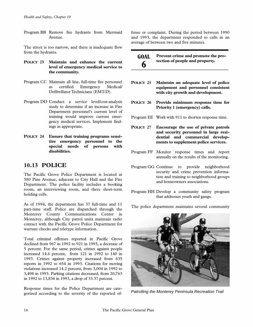
Patrolling the Monterey Peninsula Recreation Trail

Health and Safety, Chapter 10
The Pacific Grove General Plan 17
relations programs: McGruff for crime prevention, Neighborhood Watch for crime suppression, and DARE (Drug Awareness Response in Education).
10.14 NOISE
Pacific Grove has a number of potentially significant noise sources. They include traffic on Highway 68 and major city streets, operations at the Monterey Penin-sula Airport, and one identified stationary noise source (the Mission Linen Service Plant).
10.14.1 Highway Noise
Noise exposure contours for major sources of traffic noise within the city are shown in Figure 10-5. The Ldn contours generally are based on annual average conditions and are not intended to be site-specific. Since the calculations did not take into account the shielding provided by local buildings or topographic features, the distances shown on Figure 10-5 should be considered worst-case estimates of noise exposure along roadways in the community. (Noise exposure behind the first row of buildings along a roadway will typically be reduced between 5 and 15 dB.)
10.14.2 Aircraft Noise
Aircraft arriving and leaving the Monterey Peninsula Airport, located approximately 3.5 miles to the east, generate some noise in Pacific Grove. Measurements conducted in the vicinity of Sinex and Carmel Avenues in October 1987 indicated that maximum noise levels from individual arriving aircraft following the Instrument Landing System (ILS) for Runway 10 ranged from approximately 60-70 dBA for light propeller aircraft to approximately 65-80 dBA for commuter and jet aircraft. Departing aircraft turning north over the bay produced maximum noise levels from 62 dBA for a twin engine commuter aircraft (Swearingen Metroliner) to 75 dBA for a B727. According to airport management, overflights of Pacific Grove by arriving aircraft occur most frequently during the summer months, especially during the morning. Based on noise contours pre-pared by the airport, annual average noise exposure is less than 60 dB CNEL within Pacific Grove for existing airport operations. Noise from helicopters is now minimized with the closing of Fort Ord.
10.14.3 Industrial and Other Stationary Noise Sources
Only one stationary noise source has been identified within Pacific Grove: the Mission Linen Service Plant located in an unincorporated area at Sunset Drive and Congress Avenue. The plant normally operates between 7:30 a.m. and 4:00 p.m. Monday through Friday, and occasionally somewhat later than 4:00 p.m. and on Saturday. Major sources of noise associ-ated with the plant are delivery trucks moving about the loading areas of the plant, and roof-mounted fans associated with lint collection equipment and dryers. Noise measurements conducted in October 1987 indicated that noise levels from the fans ranged from approximately 52-53 dBA along Congress Avenue to approximately 57-59 dBA in front of multi-family residential uses across Sunset Drive from the plant. Noise levels 240 feet west of the plant were approxi-mately 56 dBA. Based on the above-described hours of operation and noise level measurements, noise exposure exceeding 60 dB Ldn from this operation does not affect existing noise-sensitive land uses. The Police Department and Monterey County Sheriff have no records of any noise complaints from this source since the date of the 1987 noise survey. Periodic use of the fog horn at Point Pinos may create unavoidable noise. The U.S. Coast Guard has deflected much of the sound seaward through the use of baffles.
10.14.4 Community Noise Survey
A community noise survey was conducted to docu-ment noise exposure in areas of the community con-taining noise-sensitive land uses: all residential uses, schools, and long-term care medical facilities (such as hospitals and nursing homes). The community noise survey results indicate that noise levels within the city of Pacific Grove are generally typical of a quiet sub-urban community with estimated Ldn values ranging from 39-61 dB. Maximum noise levels are generally caused by local traffic or intermittent aircraft overflights.
GOAL
7
Protect Pacific Grove residents from the harmful effects of excessive noise.
POLICY 28 Review possible noise-producing uses
and mitigate as necessary.
POLICY 29 Prevent encroachment of noise-sensitive land uses on existing indus-

Health and Safety, Chapter 10
The Pacific Grove General Plan 18
trial facilities or other stationary noise sources.
POLICY 30 Prevent the expansion or intensifi-cation of existing noise-producing commercial/utility uses on adjacent residential properties.

Health and Safety, Chapter 10
The Pacific Grove General Plan 19
Figure 10-5 1992 and 2012 Traffic Noise Contours

Health and Safety, Chapter 10
The Pacific Grove General Plan 20
Recommended allowable noise exposures for noise-sensitive land uses are shown in Figure 10-6.
Program II Require that new noise-sensitive uses in proximity to existing noise sources include receiver-based mitigation measures.
Program JJ Prevent new noise-sensitive land uses from locating in areas exposed to existing or projected future levels of noise from transportation noise sources that exceed 60 dB Ldn/CNEL (70 dB Ldn/CNEL in playgrounds and parks) unless the project design includes effective mitigation measures to reduce noise in outdoor activity areas and interior spaces to the levels specified in Figure 10-6.
Program KK Mitigate any noise created by new transportation and roadway improvement projects so that they will not exceed the levels specified in Figure 10-6 within the
outdoor activity areas and interior spaces of existing noise-sensitive land uses.
Program LL Mitigate any noise created by new pro-posed stationary noise sources so that they will not exceed the noise level stan-dards of Figure 10-7 on lands designated for noise-sensitive uses.
This program does not apply to noise levels associated with agricultural operations on land designated or zoned for industrial uses.
Program MM Review proposed noise-producing com-mercial uses in residential areas through the use permit process and mitigate po-tential noise impacts.
Program NN Enforce the most current sections of the California Vehicle Code relating to ade-quate vehicle mufflers and modified ex-haust systems.
Program OO Purchase only equipment and vehicles that comply with noise level standards
Figure 10-6 Recommended Allowable Noise Exposure
Transportation Noise Sources
Outdoor Activity1
Areas
Interior Spaces
Interior Spaces
Land Use Ldn/CNEL, dB Ldn/CNEL, dB Leq, dB2
Residential 603 45 --
Transient Lodging 603 45 --
Hospitals, Nursing Homes 603 45 --
Theaters, Auditoriums, Music Halls -- -- 35
Churches, Meeting Halls 603 -- 40
Office Buildings 603 -- 45
Schools, Libraries, Museums -- -- 45
Playgrounds, Neighborhood Parks 70 -- --
1Where the location of outdoor activity areas is unknown, the exterior noise level standard is applied to the property line of the receiving land use.
2As determined for a typical worst-case hour during periods of use. 3Where it is not possible to reduce noise in outdoor activity areas to 60 dB Ldn/CNEL or less using a practical application of the best available noise reduction measures, an exterior noise level of up to 65 dB Ldn/CNEL may be allowed, provided that available exterior noise level reduction measures have been implemented and interior noise levels comply with this table.
Source: Brown-Buntin Associates, Inc.

Health and Safety, Chapter 10
The Pacific Grove General Plan 21
consistent with the best available noise control technology.
Program PP Review and modify as necessary the City’s noise ordinance.
The ordinance should (1) employ guidelines of the California Office of Noise Control; (2) be designed to protect persons from excessive levels of noise that interfere with sleep, communication, relaxation, health, or legally permitted use of property, whether such noise is from existing or future sources; (3) make it unlawful to create noise that exceeds the standards of Figure 10-7, as measured at the exterior of noise-sensitive land uses; (4) contain maximum allowable levels of interior noise created by exterior sources; (5) provide for exemptions or modifications to noise requirements for construction activities, school func-tions, property maintenance, heating and cooling equipment, utility facilities, waste collection, and other sources; and (6) establish responsibilities andprocedures for noise measurements, enforcement, abatement, and variances.
Program QQ Continue to enforce existing ordinances relating to inappropriate and unnecessary noise.
Figure 10-7 Maximum Allowable Noise Exposure, Stationary Noise Sources*
Daytime Nighttime (7 a.m. to 10 p.m.) (10 p.m. to 7 a.m.)
Hourly Leq, dB 50 45 Maximum level, dB 70 65
*As determined at the property line of the receiving land use. Whendetermining the effectiveness of noise mitigation measures, the standards may be applied on the receptor side of noise barriers or other property line noise mitigation measures.
Source: Brown-Buntin Associates, Inc.