10319 non technical summary resubmission 2 - iema · existing view from the monarch's way...
TRANSCRIPT
Bridport Waste Management CentreConstruction of New Facilities
Environmental Statement
Non-Technical Summary
October 2013
© D
ors
et C
ou
nty
Co
un
cil

Existing view from the Monarch's Way
Proposed view from the Monarch's Way (5 years after opening)
Proposed model view of the public HRC element of the facility
Proposed model view of access road into the public HRC element of the facility

Introduction
An Environmental Statement (ES) has been submitted by Dorset County Council (DCC) on behalf of Dorset Waste Partnership (DWP) to accompany a detailed planning application for a Waste Management Centre (WMC) in Bridport. The WMC would comprise a Household Recycling Centre (HRC) and a Waste Transfer Station (WTS). The application has been submitted to DCC as Waste Planning Authority. It constitutes an Environmental Statement under Schedule 2 of the Town and Country Planning (Environmental Impact Assessment) Regulations 2011.
The ES sets out the findings of the Environmental Impact Assessment (EIA) work undertaken by the applicant and their team, and forms part of the environmental information to be used by DCC to determine the outcome of the planning application. This is a summary of the ES.
Site and Surrounding Area
The wider site is approximately 5.7ha in size and is located on the southern edge of Bridport. The wider site contains a plant nursery, areas of grass pasture, various livestock enclosures and a number of small commercial enterprises.
The site is bounded by mature trees and shrubs and is surrounded by agricultural land. The Grade II Listed 17th Century Broomhills Farmhouse is located to the south east of the site. Access is via an existing junction off the A35. The River Brit flows approximately 250m to the east of the site and a tributary flows through the site in an easterly direction. Three water bodies are located along the tributary.
The site is located within the Dorset AONB. The Broomhills Meadows Site of Nature Conservation Interest (SNCI) is located within the site. A footpath crosses the site to the west and the Monarch’s Way footpath is located to the east of the site. There is currently no public transport provision to the site.
Site boundary
Existing recycling centre
N
Site Location Plan

The Need for the Development
The existing facility at South Street was developed as a temporary facility while a permanent site could be found following the closure of the Bothenhampton landfill site. A series of temporary planning consents have kept the facility open and an application to extend the permission for a further two years was submitted to DCC in February 2013. The facility is small, inefficient and not accessible to all members of the public due to the use of the steps. The size of the site and the need to close it when full skips are removed and replaced, means there can be queuing out on to the road during busy times.
The need for a new WMC to serve the west of the county to fulfil the objectives of the Municipal Waste Strategy (2003) was addressed in the preparation of the Bournemouth, Dorset and Poole Waste Local Plan, adopted in 2006. The DWP became the Waste Collection Authority for West Dorset in April 2013.
An important factor in locating a facility is the proximity principle (as defined in the Waste Framework Directive 2008/98/EC). This requires waste to be managed or disposed of as close as possible to its source to reduce the environmental impact of transporting waste itself. There remains an ongoing need for a further WMC to serve the Bridport area and to complete a network of centres serving the county. Due to the size of the AONB and the need for the facility to be located close to the source of the waste, there is no scope for locating the facility outside of the AONB. The issues associated with building a WMC in the AONB can be suitably addressed or mitigated by careful design, landscape design and access arrangements.
DWP considered the possibility of providing separate HRC and WTS sites. However, the provision of separate sites could not be justified taking into account the costs and significant environmental impacts associated with the development of two sites in the AONB, the impact of construction, the increased management and the additional transport required in providing separate facilities. It is not considered sustainable, desirable, practical or economic to provide separate sites. The increased impact of providing separate facilities will be mitigated more effectively by providing a single combined facility and meet the policy objectives of the Joint Municipal Waste Management Strategy (2009).
Images of existing Household Recycling Centre, Bridport.
Stepped access to containers
Shared public and operator access
Access via built up residential street

The Alternative Sites Considered
The search for a new site began in the 1990’s and since then several studies and public information days have been undertaken. The latest of which was an extensive review of alternative sites undertaken during 2009 and 2010. The assessment was split into 3 stages and considered 40 sites in total.
None of the sites were identified as being preferable over the others, however Broomhills was identified as having the greatest potential for successful delivery of the proposed scheme. In September 2011 the Dorset Waste Partnership Joint Committee and the Dorset County Council Cabinet unanimously agreed the site is viable and a planning application should be submitted.
Description of the Development
The objective of the design is to provide a sustainable, accessible, safe and efficient facility which is visually integrated into the landscape and provides enhancement for local wildlife.
Several alternative scheme layouts have been considered and these have influenced the proposed scheme layout. There are various constraints including the SNCI, the water course, an area of asbestos contamination and the nursery site. The site is also located within the Dorset AONB which has influenced the design.
The scale and appearance has been carefully designed to ensure that the facility would be integrated into the landscape, for example by using natural materials and colours and by cutting the WTS building into the slope to reduce the overall height.
The facility would provide a Household Recycling Centre (HRC) to receive waste delivered to the site from householders
D.M.
Bat
Reptile
D.M.
Bird
D.M.
Bat
BirdD.M.
D.M.
Proposed Site LayoutNOT TO SCALE

and from commercial customers. The WTS would receive waste and recycling collected by the WDDC kerbside collections and would bulk it up for onward transportation. The WTS would also bulk up items received by the HRC.
The HRC would be a split level facility allowing members of the public to dispose of their waste from a comfortable height and would therefore not require steps making the facility accessible to all. A canopy covers the HRC containers and part of the parking spaces allowing people to dispose of their waste in the dry.
The WTS and HRC operational area are located at the lower level. This allows a complete separation of operational vehicles and the public and means the facility does not need to be closed in order to remove full containers, as currently happens at the existing HRC at South Street. This ensures that the facility is safer and more efficient.
Access to the facility is via the existing junction off the A35. The junction will be improved and traffic lights installed to control flows and ensure safe access to and from the facility. The access road will have sufficient capacity for peak time flows, therefore avoiding queues on the A35. The Transport Assessment (TA) and ES chapter have identified that this capacity would only be reached if there was a major incident on site, such as a fire.
Scope
The scope of the Environmental Statement has been agreed with DCC, through a Scoping Opinion received 24th January 2013, and consists of the following environmental topics:
• Landscape Character and Visual Context;
• Ecology and Nature Conservation;
• Historic Environment;
• Traffic and Access;
• Noise and Vibration;
• Air Quality and Dust;
• Water, Flood Risk and Site Drainage;
• Odour;
• Topography, Soils, Geology, Land Stability and Contaminated Land.
Consultation and Community Engagement
The ES sets out the extensive community engagement and consultation with statutory and non statutory consultees. The most recent public exhibition was held in November 2012 to inform members of the public of the preliminary design of the scheme and to allow them to provide feedback verbally or via the feedback forms provided. The ES provides a summary of these responses.
The Environmental Statement will be consulted on by DCC officers, statutory and non statutory consultees and members of the public.
Environmental Impact Assessment
Landscape Character and Visual Context
The assessment provides a baseline description of the existing landscape character at a national, regional and local scale. Overall the character of the site’s environs is one of an intricate assortment of small pastoral fields, woodland blocks, tree belt, riparian vegetation and wet grassland, together with miscellaneous agricultural and employment units on the adjacent Broomhills nursery. The site is wholly located within the Dorset AONB, but its landscape elements are not considered to be exemplary within the wider character areas and a number of components have led to an erosion of the existing quality of the landscape. The general condition of the landscape ranges from medium to good, whilst the sensitivity to change is considered to be medium to high based on defined criteria.
Visually, the site is reasonably well contained limiting views to a number of local vantage points and distant

views from elevated ground. The AONB designation is recognised, and heightens the sensitivity of a number of viewpoints, especially those where wide panoramas over the surrounding countryside and coast are obtained. Typically, the site itself is not prominent in distant views and greater impacts are predicted from closer viewpoints (east, south and west of the site). From the north, the existing A35 boundary vegetation provides a reasonable screen to much of the site.
The potential landscape and visual impacts from the development include the creation of a new building and associated structures on an existing partially developed site, the loss of existing woodland block vegetation and the widening of the A35 junction; the potential loss of existing open grassland, wet grassland and woodland, and the impacts of new external lighting and highways ‘clutter’. Construction impacts including groundworks, plant movements, vegetation clearance and building activities are also recognised.
The design attempts to avoid or minimise potential adverse impacts through the siting and layout of the facility and the scale, massing and proposed finished levels. Together with the application of new earth
bunds, extensive planting, formation of new wetland habitats and careful selection of building materials, the design seeks to re-integrate the existing landscape character elements whilst reducing the visual prominence of the new built elements of the scheme. The location of the site and the design of the facility are designed to protect the tranquillity and sense of remoteness which are key features of the AONB.
Overall, the impacts on landscape character and visual context, following mitigation are typically neutral or minor adverse, although beneficial impacts are also recognised.
Ecology and Nature Conservation
An ecological assessment, desk study and a range of protected species surveys have been undertaken to identify and assess the ecological potential of the site and the surrounding area. The ES assesses the likely impacts on the ecological receptors and identifies mitigation and enhancement measures. A Landscape and Ecological Management Plan (LEMP) accompanies the planning application. The following habitats and species have been identified and assessed:
Designations Plan
0 1km 0.5

• Broomhills Meadows Site of Nature Conservation Interest (SNCI): This designated site lies to the west of the proposed development site and is designated for its wet neutral grassland with stream, and single species swamp.
• Water Features: There is a stream, several ponds and ditches on site.
• Grasslands: Semi-improved neutral, and Semi-improved grassland are present on site. Such fields are subject to varying degrees of grazing.
• Hedgerows: The site contains several species-rich hedges with trees.
• Bats: Species recorded using the site include Common Pipistrelle, Soprano Pipistrelle, Noctule, Serotine, Daubenton’s bat, Barbastelle, Lesser Horseshoe and Natterer’s bat.
• Breeding Birds: 28 species of bird were recorded on site, of which 25 species were confirmed breeding.
• Dormice: Dormice were noted using the areas of woodland near to the access road. No juveniles were noted during the survey in 2011.
• Water Voles: Water Voles were noted using the water features on site.
• Otters: No evidence of Otters was noted on site, although the watercourses have the potential to be used by them.
• Reptiles: Slow Worms and Grass Snakes have been identified on site.
• Amphibians: Surveys in 2011 found no Great Crested Newts on site. Palmate Newts were noted on site.
• Badgers: Two outlier setts were noted - 1 entrance on the south-west boundary, the other 20m east of the first entrance.
• Invasive species: Japanese Knotweed was noted on site.
Construction impacts have been identified
as being negative in the short term due to the temporary nature of the construction phase. However, positive impacts in the long term are predicted due to enhancement and mitigation measures included within the design of the facility, such as enhancements to and management of the SNCI, the addition of bat and bird boxes, and the creation of new water bodies on site.
Historic Environment
A Historic Environment assessment has been undertaken to assess the potential impact of the proposed development on designated and non designated heritage assets.
There are no designated heritage assets, as defined by the National Planning Policy Framework (NPPF), located on the site. Twenty are located within 500m and the closest of these is the Grade II Listed 17th Century Broomhills Farmhouse, which is located to the south of the site. These assets are considered to be of medium significance. The assessment has identified that during construction there would be no impacts on the setting and during operation there will be a slight adverse impact on the setting of the farmhouse.
There are 5 non designated heritage assets within the development area which are considered to be of low to negligible significance. They are:
• Former wet ditch;
• Two historic hedgerows;
• Earthwork remains of two probable former field boundaries;
Broomhills Grade II Listed 17th Century Farmhouse

• A probable historic pond.
During construction there would be a slight adverse impact on these non designated heritage assets and during operation there would be no impacts.
Monitoring during construction is proposed as mitigation with the results reported and analysed in accordance with a written programme of archaeological works to be agreed with the planning authority. Proposed tree planting will help screen views of the WMC from the Broomhills Listed Building.
Traffic and Access
The traffic and access implications of the proposed site are considered in the Environmental Statement and the accompanying Transport Assessment.
The site is accessed via an existing junction off the A35 by way of a simple priority T-junction. The A35 is a trunk road and it is managed and maintained by the Highways Agency (HA). There have been extensive
consultations with the HA regarding the viability of and improvements to the junction. Improvements to the existing junction would include widening, installing traffic lights providing a left turn filter lane (requiring minor widening of the A35) and coloured road surfacing. A public footpath crosses the site on the western boundary. The nearest bus stop and cycleway is to the east, near to the Crown roundabout. There is no formal pedestrian or cycle connection (other than the A35 itself) to the Crown roundabout.
STAGE 1 STAGE 2
Flow uncontrolled Flow uncontrolled
Existing accesses to properties and fields, connected to new access road.
New southern kerbline tying-in to existing at this point.
Traffic signal controller
Maintenance vehicle area
Scale 1:500
Scale 1:200
Proposed Junction Layout
Entrance to Broomhills Nursery

Temporary construction traffic is considered to have an adverse minor impact based on a worst case assessment. However, the small increase in traffic during the construction period is not likely to be noticeable on the highway. During the operation, the proposed signal junction is not expected to worsen traffic conditions on the A35. The junction will have sufficient spare capacity to accommodate any future increase in traffic that may occur, beyond the 2023 design year.
The traffic levels and traffic impact of the site are predicted to be minimal, predominantly as a result of the site generating only a very small level of traffic, and that much of this traffic is already on the highway using the existing facility at South Street. The operation of the facility is not expected to worsen or improve the accident rate on the A35 between the Miles Cross Junction and the Greens Roundabout.
Noise and Vibration
A noise and vibration assessment has been undertaken to assess the potential impacts during construction and operation. Three potential receptors have been identified, Broomhills Farmhouse, Rose Cottage/Sea View Cottage and the properties in Watton to the north. Measurements of the lowest ambient and background noise levels were taken at Broomhills Farmhouse and are considered to be representative of the worst-case situation at all nearest affected residential properties during weekdays and weekends.
No sources of vibration have been identified at the site and a vibration assessment has not been undertaken due to the low accuracy associated with modelling. Piling during construction has the potential to cause vibration impacts, however, no limits are proposed. It is recommended that the construction team develop a relationship with local residents early on in the scheme so there is a clear procedure to follow if complaints should arise.
Temporary construction noise is considered to be moderate at Broomhills Farmhouse.
Mitigation measures such as limiting working hours and using vehicles with silencers have been proposed. During operation, the proposed strategy should ensure no worse than moderate impacts at Broomhills Farmhouse between 07:00-08:00am and 19:00-21:00pm. At all other times impacts would be minor. This is based on a 2m high acoustic fence being installed around part of the site to reduced impacts. Impacts would be negligible at the properties in Watton. At Rose Cottage/Sea View Cottage impacts would be minor between 07:00-08:00am and 19:00-21:00pm, but negligible at all other times.
The DMRB states that potential noise impacts at junctions do not require consideration as set out in Chapter 11, Section 2, Part 7, Paragraph A5.23:
‘Speed variations at junctions should generally be ignored in assessing noise nuisance as there is a trade-off between the effects of reducing speed and the additional engine noise generated by deceleration and acceleration.’
Air Quality and Dust
This chapter of the ES has assessed the main air pollutants of concern related to traffic emissions, nitrogen dioxide (NO2) and fine particulate matter (PM10 and PM2.5), as well as the impacts of dust during the construction phase.
No significant sources of traffic emissions have been identified on site and the nearest source is considered to be the A35. The closest Air Quality Management Area (AQMA), designated by WDDC, is located in Chideock, approximately 3.5km to the west. Exceedences of the annual mean NO2 objective have been detected along East Road in Bridport, approximately 1.8 km northeast of the development site. WDDC has not, however, declared this an AQMA.
5 residential properties (receptors) have been identified close to the site. The predicted annual mean NO2 concentrations in the year of opening are below the objective at all receptors. The magnitudes
of change, when compared to the ‘without development’ scenario, are small at one receptor and are imperceptible at all other receptors, and thus the impacts are negligible at all receptors. In terms of PM10 and PM2.5, no exceedences of the objectives are predicted therefore all impacts are negligible.
Potential receptors for dust impacts have been identified as Broomhills Farmhouse, the Broomhills Nursery site and the Broomhills Meadows SNCI. There is the potential for negligible to moderate adverse impacts at these receptors, due to dust emissions during earthworks and construction, and by the tracking out of dust onto the highway by vehicles accessing the site. However, an extensive range of mitigation measures have been proposed to reduce all impacts to negligible during construction.
An environmental permit will be required from the Environment Agency before operations are allowed to commence on site, and this will include the control of dust. All WTS activities will be undertaken within the building, thereby reducing the risk of dust impacts. The HRC activities will take place outside, underneath a canopy, allowing some risk of dust impacts to occur. The Dust Management Plan submitted as part of the Environmental Permit will include measures to control dust on site.
Water, Flood Risk and Site Drainage
The water, flood risk and site drainage implications of the proposed development are considered within the Flood Risk Assessment and Environmental Statement. The majority of the site and the development area are located within Flood Zone 1. The minor trunk road widening lies within Zones 2 and 3 of the River Brit flood plain. No formal drainage system currently exists within the Site, with water draining via a series of field drains to a minor watercourse which is located along the southern boundary. The watercourse is a minor tributary of the River Brit which flows approximately 350m to the south-east. There is a minor risk of flooding around the
existing pond on site however this does not encroach onto the development footprint.
There is considered to be no risk of groundwater flooding and impacts on ground and surface water abstractions have been assessed as not significant.
Potential surface water quality impacts have been identified as accidental spillages of contaminating liquids and the potential for generating suspended solids during earthworks. Prior to mitigation measures being implemented there could be moderate significant impacts. However, mitigation measures such as maintaining vehicles, avoiding the use of solvents, limitation of stockpiled materials and adopting all relevant Pollution Prevention Guidelines will reduce potential impacts to not significant.
The construction and operation of the proposed facility would increase the low permeability surfaces on site which will result in an increase in the volume and rapidity of surface water runoff in response to rainfall events. This could lead to an increase in flooding downstream. Prior to mitigation measures being implemented there could be moderate significant impacts. A combination of attenuation measures have been included within the design of the facility including a green roof, permeable paving and attenuation ponds in order to regulate runoff from the site and maintain the existing runoff rate. These measures will reduce potential impacts to not significant.
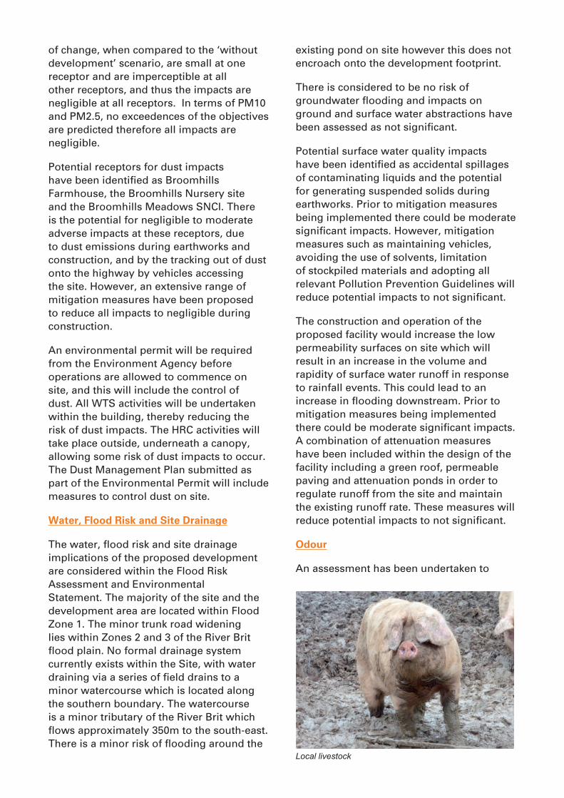
Odour
An assessment has been undertaken to
Local livestock

assess the potential impacts from the proposed facility. There are currently no statutory odour standards by which to definitively judge the risk of harm to amenity from odour in the UK. However, DEFRA published guidance in 2011 which outlines the issues which should be taken into consideration in terms of odour from a planning and land-use perspective.
The potential for odour emissions could come from the delivery, handling, storage and transfer of kerbside municipal waste within the WTS and the receipt and storage of any residual organic wastes transferred into the HRC by members of the public.
The impact assessment indicates there is unlikely to be any risk of adverse odour impact from the proposed facility. Mitigation measures incorporated into the design include a ventilation system to draw odours out of the WTS building and the building will be sealed as far as possible to minimise the routes of leakage of air to the atmosphere. An Odour Management Plan will be prepared as part of the Environment Agency’s environmental permitting requirements.
Topography, Soils, Geology, Land Stability and Contaminated Land
This chapter of the ES identifies the existing topography, soils and geology
of the proposed site, stability of the land and any issues of contaminated land. It assesses the potential impacts of the proposed development upon the land and the potential impacts of the land upon the development.
The site slopes gently from around 15mAOD to around 5mAOD in a south east direction, and is underlain by clays and mudstones, and alluvium is also considered likely to be present. The ground investigation reports concluded that due to the slope of the site and the lateral variations in the ground conditions, a piling foundation is required. The site comprises Greenfield and brownfield elements with an area of Made Ground. This area has been identified as having some Asbestos Containing Materials (ACM).
Potential impacts identified include the ACMs, contamination of soils during construction, erosion of soils and unvegetated areas leading to siltation of water courses during construction and operation and compactions of soils. Recommended mitigation measures include capping of areas containing asbestos and handpicking pieces of asbestos from excavated materials, appropriate storage and handling of hazardous materials, directing water away from slopes, use of wide tyres or tracks on construction vehicles and segregation of different soil types.
CommentsDorset Waste Partnership would welcome any comments on the environmental aspects of the proposals, and these should be sent to:
David DiazDorset Waste Partnership
Grove HouseMillers CloseDorchester
DT1 1SS
This ES is made available for viewing at the above address and will be available to view online at www.dorsetforyou.com. Copies can be purchased, on request, from the above
address and a charge of £85 for a hard copy and £5 for a CD will be made to cover the costs of reproduction. This NTS is also available as a brochure free of charge from the above address.