11. appendices - california department of water resources€¦ · · 2014-04-1611. appendices...
TRANSCRIPT

11. Appendices
Meeting Minutes
Davis - Dalwig Legislative Act
Lake Perris State Recreation Area Information
MWD Memorandum
Calculations/Quantities
GWashington Group International
PERRIS DAM RECONNAISSANCE STUDY
Page 11-1

The Resources AgencyDepartment of Water Resources
Division of Operations and Maintenance
Perris Dam Reconnaissance Study - Kick off Meeting
March 9, 2006
Resources Bldg, Room 6019:00 - 11 :00 am
1. Introductions
2. Background
3. Purpose, Goals, and Objectives
4. Deliverables/Schedule
5. Roles and Responsibilitiesa. Operations and Maintenance (HQ and Southern FD)b. Washington Group Internationalc. Engineering (includes Real Estate Branch)d. Environmental Servicese. State Water Project Analysis Officef. Cooperating State Agencies (Parks & Recreation, Fish & Game)e. State Water Contractors
8. Points of ContactlTeam Member Appointments
9. Team Meeting Logistics
10. Cost Object
11. Next Steps

The Resources AgencyDepartment of Water Resources
Division of Operations and Maintenance
Perris Dam - Background Information
March 9, 2006
MAIN PARTICIPANTS
>- Owner: CA Department of Water Resources (DWR)
" DWR Participants: Operations and Maintenance (O&M) - L e /.l.c\
Engineering (DOE) (\40.\ esicJ« ,,\~~)
Environmental ServicesState Water Project Analysis Office
>- State Dam Safety Regulator: DWR's Division of Safety of Dams (DSOD)
~ Water Contractors: Metropolitan Water District (MWD)Coachella Valley Water DistrictDesert Water Agency
>- Parks, Recreation, & Camping: CA Department of Parks & Recreation
" Fishing and Wildlife: CA Department of Fish & Game
>- Boating: CA Department of Boating & Waterways
DAM STATISTICS
>- Height at Maximum Section:>- Dam Crest Elevation:>- Spillway Crest Elevation:>- Maximum Operating Elevation:>- Storage Capacity at Spillway Crest:>- Surface Area at Spillway Crest:
RECREATION
128 feet1600 feet1590 feet1588 feet131,452 acre-feet2292 acres
>- Fishing, Hiking, Biking, Hunting, Boating, Camping, Swimming, Picnicking, RockClimbing, Horseback Riding.
Page 1

T&E SPECIES IDENTIFIED AT RESERVOIR
po. Least Bell's Vireopo. Western Willow Flycatcher
S-\~ \(CV\..1 \<...a. V\..jwl/ a <-t'-Cl'\:
Cl 'f\t.t\ ceth "",' ....
KEY DATES AND EVENTS
po. June 2005 - Perris Dam draft seismic re-evaluation study report given to O&M.
,. July 2005 - DSOD concurred with proposed reservoir restriction of Elevation1563, 27 feet below the spillway crest, as interim safety measure.
po. August 15, 2005 - Started lowering Lake Perris. Reached the restricted level(Elev. 1563) on October 30,2005.
>- Reservoir Storage Reduced by 52,362 Ac-Ft =42%>- Reservoir Surface Area Reduced by 410 Acres = 18%
>- October 2005 - Independent Safety Review Consultant Board concurred withDOE's engineering findings. Received DWR Executive approval to proceed withthe remediation of Perris Dam to restore to original maximum operatingelevation.
,. February 7, 2006 - Received letter from MWD requesting a reconnaissancestudy to be completed by March 8, 2006 (see attached spreadsheet prepared byMWD for Study Matrix of Options).
oacre·feet44,000 acre-feet (-Elev. 1545)74, 500 acre-feet131 ,452 acre-feet
S"DOI {ICE:' '" 700,000 - 1,000,000 acre-feet
,. Empty Reservoir:,. Lowered Reservoir (Recreation Only):>- Elevation 1563:,. Elevation 1588: *-,. Expanded Reservoir:
Page 2

Perris Dam Reconnaissance StudyKick Off Meeting Participants
March 9, 2006
E-MAILTELEPHONEORGAN IZATION
\. l
])~i~
.£t2lJ. (J//oke._,
Y~t124J~2- XJJ.lV2~~~----1-L~-d/5?~~ #~tA,J~:-~JL_--rer~~JLtLtff n~tS__ ...Q~M ±~tllf£r!! ~e(~~~BOY
I(

March 9, 2006
Perris Dam Reconnaissance Study
Attendee List From Metropolitan Water District
Name I Or~. I Phone Number I E-Mail AddressWally Lieu Engineering (213) 217-6008 [email protected]
Wayne Bousley Engineering (213) 217-6545 [email protected]
Curtis Baynes Real Property (213) 217-6208 [email protected]
Kamyar Motamedi Engineering (213) 217-6581 [email protected]
Chris Hill Engineering (213) 217-7969 [email protected]
Brian Folsom Engineering (213) 217-6350 [email protected]
Laura Simonek Engineering (213) 217-6242 [email protected]
Christiana Gruber Water Resources (213) 217-5795 [email protected]
Kevin Donhoff Water Resources (213) 217-6359 [email protected]
Mike Morel Water Systems (213) 217-6592 [email protected]
Arleen Arita Engineering-- (213) 217-6460 [email protected]

The Resources AgencyDepartment of Water Resources
Division of Operations and Maintenance
Perris Dam Reconnaissance StudyRoles and Responsibilities
March 9, 2006
1. Operations and Maintenancea. Manage projectb. Coordinate with, define tasks for, and fund consultantc. Deliver report to MWD and other stakeholdersd. Provide information on reliability of SWP facilitiese. Provide water quality informationf. Provide imput for operation of the reservoir
2. Washington Group Internationala. Prepare report and delivering to O&Mb. Collect informationc. Facilitate regular meetings with team membersd. Provide engineering servicese. Provide geologic/foundation impactsf. Determine downstream impacts
3. Engineeringa. Provide real estate information for expanded dam optionsb. Provide cost estimates for land purchases for expanded dam
optionsc. Provide geologic reports or engineering drawings to consultant
4. Environmental Servicesa. Provide permitting requirements and cost estimates for permits
5. State Water Project Analysis Officea. Provide information regarding existing contract with stakeholders
6. Department of Parks & Recreationa. Determine impacts to recreation usageb. Determine impacts to DPR's program
7. Department of Fish & Gamea. Determine impacts to fisheries and wildlife
Page 1

8. Department of Boating and Waterwaysa. Determine required boating facilities for all options and cost
estimates
9. State Water Contractorsa. Provide operational needs for the futureb. Provide imput for operation of the reservoir
Page 2

The Resources AgencyDepartment of Water Resources
Division of Operations and Maintenance
Meeting Minutes
Perris Dam Reconnaissance StudyKick Off Meeting
March 9, 2006
PARTICIPANTS
See attached lists.
INTRODUCTION
A reconnaissance study kick off meeting for Lake Perris was held at the ResourcesBuilding in Sacramento and via videoconference on March 9, 2006. MWDrepresentatives were able to video in for the meeting. Attached are the agenda,background information, and roles and responsibilities that were provided at themeeting.
On February 7, 2006, the Metropolitan Water District (MWD) requested the Departmentof Water Resources (DWR) perform a reconnaissance study for Lake Perris to considera full range of options at the site. The reconnaissance study will be used to develop along-term plan for Lake Perris that presents the best value for all stakeholders. Thereservoir was restricted to Elevation 1563 in July 2005 as an interim safety measureuntil the dam seismic stability issues are resolved.
DWR's consultant, Washington Group International (WGI), will be preparing thereconnaissance study report with input from DWR, California State Departments ofParks and Recreation (DPR), Fish and Game (DFG), Boating and Waterways (DBW).DWR's State Water Contractors, MWD, Coachella Valley Water District, and DesertWater Agency, will also provide input.
DISCUSSION
Discussion items included report, schedule, roles and responsibilities, points of contact,team meeting logistics, and next steps. The expanded reservoir options will include a500,000, 700,000, and 1,000,000 acre-foot reservoir. Information from a 1990reconnaissance study that was performed during the planning of Diamond Valley Lake

Meeting MinutesPerris Dam Reconnaissance Study Kick Off MeetingMarch 9, 2006Page 2
that included an enlarged Lake Perris option would be utilized to the extent possible.WGI expressed concern with some of the information in the report being outdated.During the discussions, MWD reported that the Lake Perris enlargement options shouldconsider being able to pump water from their Colorado River Aqueduct system. Thiswould include new pipelines and pumping facilities.
Report: MWD had requested DWR in their Feb. 7, 2006 letter that a draftreconnaissance study report be completed by March 8, 2006. During the meeting MWDexpressed urgency for completing a draft report by mid April 2006. However, WGIreported that completing a draft report in approximately 5 weeks could not be done. Inaddition, WGI expressed that completing a comprehensive study that includedreconnaissance level engineering and cost estimates by June 2006 could not becompleted either. WGI reported that normally these types of studies take two years tocomplete. WGI recommended identifying critical issues and requirements and usingweighting factors for impacts in comparing the options. Identifying critical issues earlyon in the process would most likely rule out some of the options and identify thepreferred options requiring more investigation. WGI's proposal was found agreeable bythe meeting participants. WGI plans to gather and compile information from thenecessary stakeholders to prepare the report. MWD agreed to provide assistance andsupport to help with the preparation of the report.
Schedule: It was agreed that a draft report will be completed the first week of June2006 and a final report by the end of June 2006. WGI will provide interim updates ofprogress every three weeks. Interim updates, the draft report, and final report will betransmitted to all appropriate stakeholders.
Roles and Responsibilities: The roles and responsibilities are attached. The onlysignificant changes to the handout are that DFG didn't feel it had staff to provide input tothe study. It was agreed DWR's Division of Environmental Services will provide fish andwildlife input with review by DFG. WGI will address the socio-economic impacts foreach option.
Points of Contact: The points of contacts listed below will work closely with WGI toprovide input.
Teresa SutliffJohn BunceJeanne KuttelCarolyn BrownJanis OffermanCliff WinstonRob CookeGary Watts
DWR O&M HQ - Project CoordinatorDWR O&M Southern Field Division - OperationsDWR Division of Engineering (DOE) - Project CoordinatorDWR DES - Environmental ResourcesDWR DES - Cultural ResourcesDWR DOE Real Estate BranchDWR State Water Project Analysis Office (SWPAO)DPR-Regional Manger

Meeting MinutesPerris Dam Reconnaissance Study Kick Off MeetingMarch 9, 2006Page 3
Ron KrueperTerry ForemanSteve WatanabeBrian FolsomZachary AhingaMark Johnson
DPR - Park SuperintendentDFGDBWMWDCoachella Valley Water DistrictCoachella Valley Water District
Ron Krueper ([email protected]), Terry Foreman ([email protected]), SteveWatanabe ([email protected]), and Mark Johnson ([email protected]) did notattend but were represented at the meeting.
Team Meeting Logistics: The next meeting and an inspection of the dam andreservoir are scheduled for March 20, 2006 at Lake Perris. WGI agreed to send out anagenda for this meeting and determine who would be attending so DWR and DPR couldmake the necessary arrangements. It was noted that MWD would be sending some oftheir staff. It was agreed WGI will be preparing and sending out a schedule of futuremeetings.
Next Steps: WGI will begin gathering information and arranging next team meetings.
Other: It was agreed water quality improvements to the Lake Perris and Perris Damfacilities would be considered for each option. This included relocation or modificationof the existing inlet line and improvements to the outlet tower.
POST MEETING NOTES
Additional contacts provided after the meeting:
Fei-fan Yeh ([email protected])Warren Paul ([email protected])Dave Samson ([email protected])Paul Farris ([email protected])David Luker ([email protected])
WGIWGIDWR SWPAO (Point of Contact)DWR Real Estate Branch (Point of Contact)Desert Water Agency

PERRIS DAM RECONNAISSANCE STUDYRECON MEETING AND TOUR
Monday, March 20, 2006DPR Conference Room at Perris Dam
Washington Group participation from approximately 11 :OOam til 12:30pm.
Agenda for Washington Group segment:
1. Introductions2. Reconnaissance Study Status3. Study Issues4. Next Meeting
Requested participants (in addition to Project Management Staff):
1. Representatives from OWR and MWO Engineering Groups2. Representatives from OWR and MWO Operations Groups3. Representatives from OWR and MWO Environmental and Cultural Groups4. Representatives from OWR and MWO Water Quality Groups5. Representative from OWR Real Estate Group6. Representatives from OPR responsible for Perris Reservoir operations7. Representative from Fish and Game8. Representative from Boating and Waterways (OPR may be able tohandle)
In the days ahead Washington Group will be submitting and discussing requestsfor information and questions in support of the report preparation withparticipating groups; we will brief the group at the meeting on the issues whichare currently foreseen and request input as to any additional issues.

S" t...('- B1T - 81.'<U"
'c (f,0 -ffP-."F?d
~5} iifiJ- )0'195 \. 443' d~1 D
cr )' I ~ Cf 'YO ~~ t,~l <,j
",
SR', LAN!) AcG--r,;NT (Q/b)b:S3 -seals
1(0)'3Z?-1t 7r4:G1} '7 t.pl-gr~) (
(.--.V'~I!;)--! l +- . )t;p""",/--r~....., I't.___ ')-1;', .2/7· 6:('7 2....-
"-
Coylfy{lrJ- !tI.JA.tv(jA. ('Us) 'It::f - 57qr
7LN P ?"o6 !L4j)-tS '.2.1~ [11- -r;, )s-q
~W p 1: J,)tJ / rtf),.J htt- 'iJto IR "., - '7'1. -&
I'
i./.. ,,\ II -SR ~iDL _ f1::.he;,'lj 7bo'-'iI8~--22S1
CA, srf\if. PARk:5 DISfr<crS UPi~jJ\fTtrv~ 95(~443-,242..3
y llJ 12. !~ -F" t) &-/)cc:.. ' ()...; \ \2. ' '0 ..0 j-, '" ;;l • )1"3 (~J__ ,/./'. f ~ t. ~~ ,c .;
f3=,A"f1I'-i"i\;\l~vJAyS D\v""'I-N C+-'11~ (q/b) 26 >-Bl47
riltJ'[>- .5'4'71 Dv. S/: D'-jY :;;7~ 217"'r=j-9'&'/f
M,l;JQ-' §)L~v l\%+ ~-0 ~~~f.f1tr 0~] tl7 ~.. fbvgM lAlr? - f!:I..,'~ P~'f'~r 1"1 r;p... (2--,:3) 217- 639.>
1)WR-D~N\ R()~ &rorJ. (4fll)~63-~50C>
DPeDFIZ.D\-\~
f}~((
t)wR - R~'Al.. G:SnTIZ'
ve7G¥-1 /.IJJt(£t:-- ~~tt:Jfl ~T '@Vcr.D<.<J l\_ -S;:::e> tJlt7Z!i12 o~,
Mwo- DPS»l Wf) - W (2 fY)
M l.U D - l"'-i /'Z,h
Dtv12 - OIlt--Yl--1
j <:< b (;;>-\ Pc! 5L..I,
(l\....l,:;r-\ \Z.0ibz\,}..lC".~H~ I.
/kCZ'.rJ1J.! %1-1

WASHINGTON GROUP INTERNATIONAL
Meeting Minutes
Lake Perris Reconnaissance Study
Lake Perris State Recreation AreaMonday, March 20, 2006
PARTICIPANTS
See attached list. Also attending by telephone conference were Janis Offerman and CarolynBrown of the DWR Division of Environmental Services.
AGENDA
The meeting generally followed the attached agenda. The Reconnaissance Study portion of themeeting lasted from approximately 11 :00 am to 12:30 pm. It was held in the Museum as a followon to another meeting of some of the same participants and to allow a later tour of the dam andrecreation facilities.
DISCUSSION
Following introductions, Washington reported that their work has been focused on gatheringinformation and finding out what work on the various reservoir level options has already beendone by others. A list of questions was submitted to MWD and discussions followed, withanswers to be provided at this meeting. Also, a list of known issues that need to be evaluatedwith each option was distributed to the persons identified as points of contact.
Regarding recreation issues, a major one is that all of the land surrounding the reservoir is setaside in a Riverside County plan for threatened and endangered species, much of it for theStevens kangaroo rat. Mitigation would most likely require acquiring a multiple of the submergedacreage of suitable kangaroo rat habitat.
Water-based uses of the recreation area are in very large demand, including swimming, boatingand fishing. At present, 50% of the normal boating is lost because of the reduced reservoirsurface area. Swimming is sometimes reduced because of water quality degradation. This wouldbe worsened with a 40,000 AF reservoir.
The loss of non-mountainous land surrounding the reservoir that is heavily used for camping,picnicking, hunting, equestrian use, bicycling, hiking and rock climbing would be a serious issue.Cultural issues exist, but there are no hazardous waste sites known to DPR.
MWD reported that Perris is used as backup for the Mills Treatment Plant, the Colorado RiverAqueduct and the San Diego Canal. An estimated tens of thousands of AF per year are put intoand taken out of Perris, mostly in the winter months when outages of other systems arescheduled. A reservoir size of 40,000 AF would cause MWD serious operational problems. Noanalysis has been done on what effects would be on MWD operation with a 74,000 AF reservoir.MWD is quite satisfied with the original 132,000 AF size of the reservoir. Additional sizing abovethe 132,000 AF seemed to of interest to MWD, however, no extremely urgent need wasexpressed.

There are about 20 A. of wetlands downstream of the dam that are supported by the seepagewater from the dam. Also, it was reported that the housing development downstream from thedam is supplied with domestic water from wells using groundwater (also fed by seepage).
MWD reported that Riverside County has maps of the area at a scale of 1:24,000 and 4 ft.contour intervals that have been obtained and copies given to Washington. MWD also providedanswers to Washington's earlier written questions, generally indicating that little definitive workhas been done on the larger reservoir options. The reservoir volumes and areas were providedfor the three expanded reservoir sizes. A multilevel outlet is desired for any of the options and,probably, a multilevel intake also. The long-term plan for Perris water supply for the original andlarger options is to use the Inland Feeder, with inlet at the east end of the reservoir.
MWD agreed that they could look at dam cross-sections and develop quantities as indicators ofprobably cost level for the qualitative comparison of options.
NEXT MEETING
The next meeting was proposed for DWR offices on or about April 5. (It has since beenscheduled for 10:30 am to 12:30 pm on April 6.
After lunch Gary Watts and Ron Krueper of DPR led a tour of the recreation area and its facilities,taking the participants all the way around the reservoir and into some of the adjacent areas. Allwere impressed with the extensive facilities, the DPR efforts in maintaining facilities and providingservices and the very heavy use of the area by the public, particularly in the summer months. Itwas very obvious to all, especially Washington, that the Lake Perris Area is very dependent onthe present recreation facilities. It was also stated that the DPR could possibly consider asomewhat larger reservoir, perhaps a 240,000 AF option, and still be able to develop thenecessary recreation benefits to satisfy the present demands or at least be equivalent to thepresent conditions.

PERRIS DAM RECONNAISSANCE STUDYMEETING
Thursday, April 6, 2006, 10:30 amDWR Conference Room 601
AGENDA
1. Introductions
2. Area-Capacity CurvesIntroduce latest Area-Capacity Curve
3. Options MatrixPresent Matrix to confirm items for considerationDiscuss weighting and other factors
4. Construction magnitude vs. costDiscuss various cross-sections and dike requirementsDiscuss costing issuesDiscuss MWD concerns
5. OperationsDiscuss MWD future operationsF. Yeh's analysis
6. RecreationUpdate on data supplied by DPR
7. Socio-economicRequest copy of earlier economic study of recreation impacts
8. Other Items for discussion
9. Next meeting

ATTENDEES AT LAKE PERRIS RECONNAISSANCESTUDY MEETING
DWR - APRIL 6, 2006
Sacramento - DWR
John Bunce - DWR O&MGary Watts - DPRJanis Offerman - DWR DESJeanne Kuttel - DWR DOEDan Peterons - DWR O&MWalt Beer - DFGTeresa Sutliff - DWR O&MJoe Ehasz - WGIGlen Rockwell- WGI
Los Angeles - MWD
Folsom, Brian (Engineering)Lieu,Wally M (Engineering)Hill,Christopher J (Engineering)Morel,Mike (Operations)Gruber,Christiana (Water Resource Management)Donhoff,Kevin A (Water Resource Management)Motamedi,Kamyar (Engineering)Simonek,Laura J (Environmental Planning)Arita,Arleen A (Engineering)
Video from Pearblossom:
Surjit Bajaj - DWR O&MBill Stewart - DWR O&MJaime DeSantiago - DWR O&MGeno Young - DWR O&M
Teleconference:
Mark Krause - DWATerry Foreman - DFGZachary Ahinga - CVWDFei-fan Yeh - WGIDerek Adachi - DWR DES

WASHINGTON GROUP INTERNATIONAL
Meeting Minutes
Lake Perris Reconnaissance Study
Department of Water Resources, SacramentoThursday, April 6, 2006,10:30 - 12:15
PARTICIPANTS
See attached list.
AGENDA
The meeting followed the attached agenda.
AREA-CAPACITY CURVE
Following introductions, Washington reported that the area-capacity curve has been studied andrevised to be compatible with data provided by MWD. The figures for elevation and capacity forthe options being studied are now:
1542 ft. 40,000 AF1563 72,0001588 126,8411640 257,0001706 500,0001752 700,0001814 1,000,000
The largest change from figures being used earlier is for the 500,000 AF reservoir, changing from1720 ft. to 1706 ft. A new area-capacity curve was distributed.
OPTIONS MATRIX
The major topic for discussion was an explanation of the options matrix tables. Tables forOperations, Recreation, Environmental, Property, Water Quality, Regional Socio-Economic andPermitting were distributed. The tables for Operations included both an issue by issue briefcommentary for each reservoir option as well as a table for insertion of screening evaluationnumbers and weighting for each sub-issue, the screening numbers to range from -5 to +5 andthe weighting to total 100 percent. The tables for the other major issues were only for thescreening evaluation numbers and weighting. Also, a Summary table for all major issues,including some that have no sub-issues, was distributed. At present, this has suggested possibleweighting, but this will be discussed in more detail at the next meeting. The screening evaluationfigures will transfer from the sub-topic sheets as the total weighted figure for each option. It wasrequested that the specialists in each field from the participating organizations consider and fillout both the commentary table and the screening evaluation table for their discipline for maximumbenefit for the study. The following leads and team members were appointed to complete theforms by April 14 and return them to Glen Rockwell:
Property: Paul Farris (Lead), Gary Watts, Ron Krueper, Terry Foreman, Curtis DaynesEnvironmental: Carolyn Brown (Lead), Janis Offerman, Derek Adachi, Laura Simonek,Gary Watts, Ron Krueper, Terry Foreman, Dan Peterson
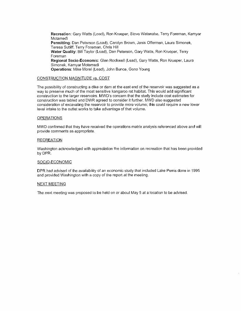
Recreation: Gary Watts (Lead), Ron Krueper, Steve Watanabe, Terry Foreman, KamyarMotamediPermitting: Dan Peterson (Lead), Carolyn Brown, Janis Offerman, Laura Simonek,Teresa Sutliff, Terry Foreman, Chris HillWater Quality: Bill Taylor (Lead), Dan Peterson, Gary Watts, Ron Krueper, TerryForemanRegional Socio-Economic: Glen Rockwell (Lead), Gary Watts, Ron Krueper, LauraSimonek, Kamyar MotemediOperations: Mike Morel (Lead), John Bunce, Geno Young
CONSTRUCTION MAGNITUDE vs. COST
The possibility of constructing a dike or dam at the east end of the reservoir was suggested as away to preserve much of the most sensitive kangaroo rat habitat. This would add significantconstruction to the larger reservoirs. MWD's concern that the study include cost estimates forconstruction was tabled and DWR agreed to consider it further. MWD also suggestedconsideration of excavating the reservoir to provide more volume; this could require a new lowerlevel intake to the outlet works to take advantage of that volume.
OPERATIONS
MWD confirmed that they have received the operations matrix analysis referenced above and willprovide comments as appropriate.
RECREATION
Washington acknowledged with appreciation the information on recreation that has been providedby DPR.
SOCIO-ECONOMIC
DPR had advised of the availability of an economic study that included Lake Perris done in 1995and provided Washington with a copy of the report at the meeting.
NEXT MEETING
The next meeting was proposed to be held on or about May 5 at a location to be advised.

PERRIS DAM RECONNAISSANCE STUDYMEETING
Friday, May 5, 200610:00 am - 2:30 pm w/lunch break
Conference Room US1-102MWD, 700 N. Alameda Ave.
Los Angeles
(Teleconference Number 213-217-7888, Conf. Code 25007)
AGENDA
1. Introductions
2. Reservoir Option Data
3. Options Matrix- Review matrices prepared- Discuss weighting
4. Construction magnitude- Discuss various dam and dike requirements
5. Other Items for discussion
6. Next meeting

PERRIS DAM RECONNAISSANCE STUDY
MEETING PARTICIPANTS
MAYS, 2006
NAME ORGANIZATION TELEPHONE E·MAIl
KfWlOf". fW'\< cL. wd U. 0. ~ ffl'.
':2 I? -7-17 -~MA' a-ari fit- e /Yl LAId h 10,cc(Y'

WASHINGTON GROUP INTERNATIONAL
Meeting Minutes
Perris Dam Reconnaissance Study
Metropolitan Water District, Los AngelesFriday, May 5,2006, 10:00 - 2:45
PARTICIPANTS
See attached list.
AGENDA
The meeting followed the attached agenda.
RESERVOIR OPTION DATAFollowing introductions, Washington presented a table with data on the various reservoir options.Copies were also sent bye-mail prior to the meeting and distributed at the meeting.
OPTIONS MATRIX
The major topic for discussion was discussion of the options matrix tables. The tables wereprojected onto a screen, discussed and modified per the discussion. Rating matrices forRecreation, Environmental, Property, Operations, Water Quality, Seepage/Groundwater,Reliability/Safety Water Supply (changed to Water Storage) and the Summary were discussed.Others were omitted in order to have time to fully discuss the weightings to be applied in theSummary Rating Matrix. The Summary Rating Matrix with the agreed-upon weighting for eachmajor issue is attached; the modified issues matrices will be sent later by separate e-mail.
CONSTRUCTION MAGNITUDE
Construction of the dike or dam at the northeast end of the reservoir as a way to preserve muchof the most sensitive kangaroo rat habitat was discussed. It was agreed that this represents aconservative approach to minimizing needed acquisition of mitigating habitat land. Washingtonwill provide information as to the alignment and amount of inundation reduction provided by thedams.
OTHER ITEMS
It was confirmed that the schedule established for submittal by Washington of the Draft Report isfor the first week of June. The next meeting will discuss the Draft Report.
NEXT MEETING
The next meeting was proposed to be held on or about June 14 at a location to be advised,probably at Lake Perris.

PERRIS DAMRECONNAISSANCE STUDY
MEETING
Wednesday, June 14, 2006, 9:30 amIndian Museum and Visitor's Center at Lake Perris
1. Introductions (All)2. Review Draft Report Results (WGI)
- Discussion of parametric studies- Alternative technical solutions for northeast dam
3. Discussion of Draft Report (All)4. Schedule for Final Report (WGI)5. Post Reconnaissance Report Activities/Schedule (Rich)6. Comments/Questions (All)

PERRIS DAM RECONNAISSANCE STUDY
MEETING PARTICIPANTS
JUNE 14, 2006
NMlE ORGANlZI\TION TUEPI-IONE E·MAIl
Ill" e. (-:>AH ~ rtJ J)~UK ~l :n~':,-1;'597 .510,\~(~jl~ i.(.;l'~pr ,e".aT' V~AIP ~Il 1"'-..., .;() tu .fA )G~ vI~,.u- -~" ,U-1:-: '7 r- II" I~u'~(). nl\l ,I'.&. .r.A
'r.h ri ~ I,..}; ~( "' urn~ f-n,t?o I{~ W.O. ZI ')" Z\1 ~1 '\,(,c cJ,1'11~ I"fIwe-<h 2~.co ff\
A.Y/~r.Yl IJ~t+() 111I VI 0 1'r~ "11- (.,4~o t'I a r ,.fa @. rn VKJ. f, 1..0, CCrr ~
tl~l~ 'ft;1L~V7-1 MwV 2/~ ·'trl" G.., 5 :> bFt is'';';ii@'1f1wlll~ { t·,
Ct\(4<?f \c.Jb u r.ztA~E:R. ' I 1.1:> . 'Zl 9 ' S1'1 .. (!..,q \ru..VJ P.•v" ;lU 1M rJ l,.t ~W,
~{}N k I?vrr;jJf:~voPI< '1f7r 1 £;(J -5'((.1:. b 11kt'? fA I::' P£'J< (JM~ /(5 c.; .6-
,{naJa AJj;, Ao.e.. ~WO .213 'U7 b:.q4 ~~dnj44"(";) )Uu,~hzo..., \l
\ ~A'/) /:/)6 W t-z-/ 7Yl1'-7}!;/) ~Wn-lkttO~ f.A7~6t!A-GIa~WO H-.AJ. 't/'
t.:rCInt..l 0<. So It< L,J, a"Q
,'OS FO/DUJT2 (,,(0\) 'i 'iV - e51<j J~_.<LuJ~11f. G6·'5o ....-
PAUl. FARR' 5 Dwf\ Ff ""S03 ,SWIS ~t=ItAA,s-.• L~~" A_or. V

PERRIS DAM RECONNAISSANCE STUDY
MEETING PARTICIPANTS
JUNE 14, 2006'-'---' ..
NAME ORGANlZATlON TELEPHONE E-MAIL
.::sOc..-. B-vLS-:;::- Was Vi Ii' r . .( h<A Iq)J:,~~S-S2.QD ~O:&e~• ..p tJ.. O'-S 2. ,6) {U
(~!;}r[))VJ1 J)r;}/f)!J PJ1/ff -Ad) tJ/P 1f5-j/r;61 thraolJ//? to;2"fiJr. I~;j}. fJpj ""::j:;X\\~> (,JW.:r tv\u \\\.,,\ 'hlJJt:: ~l'HfOt"" tTlk.> \f4t:;'- b flfJ
'-" Vx\ \1 \ \ 0 (D (L~};T.Lr, te, c; () ,j
CAfl-Y WATTS f)ffZ,j
95/-413-J..423 bWAlrS rd)f/rfV(s. CIJ .6DV
ZAc.hAl1-"f Ak~~fAc... CoA i. k-f.llt. \l Ld 'D ~o'3ey ~ ...Ut; J. o...l., ; l-.l I.<'i ~ Cvw j ~.
J.<t,. o/\AA ,1 "". 'rt?IJ hM+1 pJL. mwf) 21~.J 17.1.. <;X1 IL ttnO.rOM1/1.: @> /YJ /AJ/) J./.~11/4(b{ f{R.fJ,r).,~ f DvJA 17CO-3X'.,-tj.Cf11 M/(RAtJ.Q:(2, {)Ull (J)t..(t-
GU:::N {COCI<wEW- 5""20 -5rl· g~1.\0 -~\IV ~s.1-4 \ 'S 6. -ro tJ lJ Y'ock ..-. @ ~$"'. co""
.. ..

WASHINGTON GROUP INTERNATIONAL
Meeting Minutes
Perris Dam Reconnaissance Study
Lake Perris State Recreation AreaDistrict Headquarters
Wednesday, June 14, 2006, 9:30 - 3:45
LOCATION
The location, originally planned for the Indian Museum and Visitor's Center, waschanged to the conference room of the DPR District Headquarters because of ascheduling conflict. Excellent display facilities and equipment were available andused for the meeting discussions.
PARTICIPANTS
See attached lists.
AGENDA
The meeting generally followed the attached agenda.
DISCUSSION
WGI presented the summary results of the study by displaying and reviewing theSummary Matrix table, representative issues sensitivity tables and the summarySensitivity Analyis Rankings table, all as included in the Perris DamReconnaissance Draft Report. These showed that the 1588 ft. and 1640 ft.reservoir elevation options were the most highly rated options for the base caseand for almost all of the sensitivity analysis adjustments. Only when the WaterStorage issue weighting factor was increased by 100 percent or theenvironmental impacts weighting factor was decreased by 100 percent did thetwo most highly rated options change.
The inclusion of the northeast dam as an integral part of the study was discussed.The analysis was intended to be based on that arrangement. It was agreed thatall issues had been rated on that basis except for environmental and that theenvironmental team will re-examine all sub-issues to be consistent and reportany differences to WGI for inclusion in the analysis of the final report.

The group went through the Draft Report page by page with discussion andsuggested corrections, additions and modifications in wording. These were allduly noted, and the agreed-upon revisions will be made by WGI. DWR gave theirmarked copy of the report to WGI for use in the revisions. The changes are notextensive and do not change the basic results and conclusions.
The attending group agreed with the summary results of the study.
SCHEDULE FOR FINAL REPORT
WGI will submit the Final Report to DWR by June 30, and the report will bedistributed to other participants in the first week of July.
POST RECONNAISSANCE REPORT ACTIVITIES
Rich Sanchez explained that DWR will accept official comments on the reportfrom the participating groups in July. The plan is to then commence with moredetailed studies for preliminary design and cost estimates for the most preferredoption or the top two favored options based on the decision reached by DWRand the major stakeholders.
COMMENTS/QUESTIONS
There were no further comments or questions.

[Ron Krueper - Re: Davis-D_a_lw-,i9::.-·~"_A_ci~_-_·-__"·_"_····"_--==_"·"_"·..__~__._____~_~=.===========:.. :: ~ ..__._==.. ············..·_···· .. ········ Page1l
.- ...- ........- ........_. .___--'.J
From:To:Date:Subject:
Enrique [email protected] ..gov6/13/20064:30:18 PMRe: Davis-Dalwig Act
The following is the entire chapter as it appears at:http://www.leginfo.ca.gov/cgi-bin/calawquery?codesection=wat
WATER CODESECTION 11900-11901
11900. The Legislature finds and declares it to be necessary forthe general public health and welfare that preservation of fish andwildlife be provided for in connection with the construction of statewater projects.
The Legislature further finds and declares it to be necessary forthe general public health and welfare that facilities for thestorage, conservation or regulation of water be constructed in amanner consistent with the full utilization of their potential forthe enhancement of fish and wildlife and to meet recreational needs;and further finds and declares that the providing for the enhancementof fish and wildlife and for recreation in connection with waterstorage, conservation, or regulation facilities benefits all of thepeople of Califomia and that the project construction costsattributable to such enhancement of fish and wildlife and recreationfeatures should be borne by them.
The Legislature further finds and declares it to be the policy ofthis State that recreation and the enhancement of fish and wildliferesources are among the purposes of state water projects; that theacquisition of real property for such purposes be planned andinitiated concurrently with and as a part of the land acquisitionprogram for other purposes of state water projects; and thatfacilities for such purposes be ready and available for public usewhen each state water project having a potential for such uses iscompleted.
11903. As used in this chapter. "project" means any physicalstructure to provide for the conservation, storage, regulation,transportation, or use of water, constructed by the State itself orby the State in co-operation with the United States.
11905. The provision of this chapter shall apply to the CentralValley Project and every other project constructed by the Stateitself or by the State in co-operation with the United States,including, but not limited to, the State Water Resources DevelopmentSystem.
11910. There shall be incorporated in the planning and constructionof each project those features (including, but not limited to,additional storage capacity) that the department, after giving fullconsideration to any recommendations which may be made by theDepartment of Fish and Game, the Department of Parks and Recreation,the Department of Boating and Waterways, any federal agency, and anylocal governmental agency with jUrisdiction over the area inVOlved,determines necessary or desirable for the preservation of fish andWildlife, and necessary or desirable to permit, on a year-round

IRon Krueper - Re: Davis-Dalwig Act
basis, full utilization of the project for the enhancement of fishand wildlife and for recreational purposes to the extent that thosefeatures are consistent with other uses of the project, if any. Itis the intent of the Legislature that there shall be full and closecoordination of all planning for the preservation and enhancement offish and wildlife and for recreation in connection with state waterprojects by and between the Department of Water Resources, theDepartment of Parks and Recreation, the Department of Boating andWaterways, the Department of Fish and Game, and all appropriatefederal and local agencies.
11910.1. In furtherance of the policies specified in Section 11910,the Department of Fish and Game, the Department of Parks andRecreation, the Department of Boating and Waterways, and othergovemmental agencies shall submit their recommendations or commentson reconnaissance studies or feasibility reports of the Department ofWater Resources relating to any project or feature of a projectwithin 60 days following receipt of a formal request for review fromthe Department of Water Resources.
11910.5. Such recreational purposes include, but are not limitedto, those recreational pursuits generally associated with theout-of-doors, such as camping, picnicking, fishing, hunting, watercontact sports, boating, and sightseeing, and the associatedfacilities of campgrounds, picnic areas, water and sanitaryfacilities, parking areas, view points, boat launching ramps, and anyothers necessary to make project land and water areas available foruse by the public.
11911. The planning for public recreation use and fish and wildlifepreservation and enhancement in connection with state water projectsshall be a part of the general project formulation activities of theDepartment of Water Resources, in consultation and co-operation withthe departments and agencies specified in Section 11910, through theadvance planning stage, including, but not limited to, thedevelopment of data on benefits and costs, recreation land useplanning, and the acquisition of land. In planning and constructingany project, the department shall, to the extent possible, acquireall lands and locate and construct, or cause to be constructed, theproject and all works and features incidental to its construction insuch a manner as to permit the use thereof for the preservation andenhancement of fish and wildlife and for recreational purposes uponcompletion of the project.
11912. The department, in fixing and establishing prices, rates,and charges for water and power, shall include as a reimbursable costof any state water project an amount sufficient to repay all costsincurred by the department, directly or by contract with otheragencies, for the preservation of fish and wildlife and determined to
Page 21

··"-""""""";[f=R=o=n=K=r=u=e=pe=r=-=R=e=:=D=a=v=is=-=o=a=lw=i9--=A=ct==----··-----·~···-··
be allocable to the costs of the project works constructed for thedevelopment of that water and power, or either. Costs incurred forthe enhancement of fish and wildlife or for the development of publicrecreation shall not be included in the prices, rates, and Chargesfor water and power, and shall be nonreimbursable costs.
11913. (a) The Legislature hereby declares its intent that, exceptas funds are provided pursuant to Section 11915, there shall beincluded in the bUdget for the department for each fiscal year, andin the Budget Act for each fiscal year, an appropriation from theGeneral Fund of the funds necessary for enhancement of fish andwildlife and for recreation in connection with state water projectsas provided in this chapter.
(b) Notwithstanding subdivision (a), the obligation of the StateWater Resources Development System to reimburse the California WaterFund pursuant to paragraph (3) of subdivision (b) of Section 12937shall be reduced by the total of unreimbursed department costsincurred in the 1988-89 fiscal year and each succeeding fiscal yearfor enhancement of fish and wildlife and for recreation pursuant tothis chapter. The reduction shall be contingent upon annual approvalby the Legislature, in the Budget Act or other act, of thedepartment's allocation of those costs.
11914. The department shall make any necessary revisions in theallocation of costs of any state water project works constructed forthe development of water and power, or either, which would resultfrom the expenditure of funds under this chapter for enhancement offish and wildlife and recreation in connection with such works.
11915. All moneys deposited in the Central Valley Water ProjectConstruction Fund pursuant to the provisions of Section 12.1 ofChapter 138, Statutes of 1964, First Extraordinary Session andsubdivision (c) of Section 6217 of the Public Resources Code, and allaccruals to such moneys so deposited, are hereby appropriated to thedepartment for expenditure by the department without regard tofiscal years for the purposes of the construction fund, in amountsequal to allocations to recreation and fish and wildlife enhancementand to the costs of acquiring rights-of-way. easements and propertyfor recreation development which have become effective pursuant toSection 11912.
11915.1. The provisions of this chapter shall not limit thedepartment in the financing and construction of any of the facilitiesof the State Water Resources Development System pursuant to theprovisions of Chapter 8 (commencing with Section 12930) of Part 6,nor shall they constitute a limitation on or modification of theresponsibility of the department to make allocations of costs

~ Krueper - Re: Davis-Dalwig Act
provided for in water supply contracts executed pursuant thereto.
11915.5. For the purpose of furthering recreation in any project ofthe department, the department may exchange any real property it hasacquired for property in the state owned by the United States whichis of substantially equal value, whether or not such real property ofthe United States is adjacent to or needed for any project of thedepartment. Such title or rights as the department deems necessaryfor the proper operation and maintenance of the water conservation,flood control or power features of any water project shall not beincluded in any exchange consummated under this section.
Any such exchange involving real property acquired by thedepartment solely for recreation shall be concurred in by theDepartment of Parks and Recreation. Any such exchange involvingproperty acquired by the department solely for fish and wildlifepurposes shall be concurred in by the Department of Fish and Game.Any such exchange involving property acquired solely for fish,wildlife and recreational purposes shall be concurred in by theDepartment of Fish and Game and the Department of Parks andRecreation. Real property of the United States not necessary for aproject of the department shall be acquired by the department byexchange under this section only if another agency of stategovernment has agreed to acquire such real property from thedepartment for the actual cost to the department of the real propertywhich is to be given in exchange therefor; provided, that any amountappropriated to the department to reimburse it for priorexpenditures for acquisition of such land shall be deducted from theactual cost.
11917. The Department of Fish and Game shall manage fish andwildlife resources at state water projects, including any suchadditional resources as are created by such projects, in a mannercompatible with the other uses of such projects.
11918. The Department of Parks and Recreation is authorized todesign, construct, operate, and maintain public recreation facilitiesat state water projects, with the exception of the planning, design,and construction of boating facilities, which shall be theresponsibility of the Department of Navigation and Ocean Developmentpursuant to subdivision (c) of Section 50 of the Harbors andNavigation Code. Before commencing the construction of any suchfacilities, the Department of Parks and Recreation shall submit itsplans and designs to the local govemmental agencies havingjurisdiction over the area involved. The Department of Parks andRecreation shall make every effort to fulfill its responsibilitiesunder this section by entering into contracts with the United States,local public agencies, or other entities, to the end that maximumdevelopment of the recreational potential of state water projectsshall be realized. The Department of Parks and Recreation shall havethe authority to establish and enforce standards for the

Lake Pen:isSRA
DopartmBnt of Parks and RBcreatill1Monthly AttendancB
SoUhem reid Dam.. I rebd Epie District
iIIf11I..YfAI Pal DAY USE fIII DAY USE OVIINGfT WIllIG TOTAL ATTBIJANC(
7/1/200 1 164,9:J8 9,34 7 34,035 200,~
8/1/200 1 132,216 7,414 34,497 174,1Z1
9/1/2JJJ 1 109,274 6,12 2 22,529 137,925
10/1/2001 47,CJ22 2,72 4 16,964 67,610
11/1/2001 16,436 4,82 0 11,455 32,711
12/1/2001 9,:JJ 7 742 6,<n 3 16,562
1/1/200 2 25,165 1,486 7,'32 9 34,5002/1/200 2 0 45,374 8,396 53,TlO
3/1/200 2 30,431 28,014 15,'579 7~024
4/1/200 2 70,313 48,157 20,351 l33,821
5/1/200 2 85,071 39,221 27,570 1Sl.,862
6/1/200 2 145,594 0 29,816 175,41D
7/1/200 2 171,993 0 38,222 210,215
8/1/200 2 144,186 0 39,512 183,{OO
9/1/200 2 1(12,179 0 26,033 128,217
1O/1/2(XQ 22,788 18,974 19,769 61.,531
11/1/2(XQ 13,021 17,721 12,954 43,696
12/1/2OC12 5,065 28,800 6,34 1 40,2941/1/200 3 24,574 1,44 4 9,66 3 35,E£l.
2/1/200 3 31,631. 1,84 6 8,751 42,228
3/1/200 3 49,397 2,82 9 8,780 61.,006
4/1/200 3 52,297 2,95 5 18,333 73,5:D
5/1/200 3 132,745 7,369 28,334 168,448
6/1/200 3 122,412 6,82 8 27,'iQ2 157,062
7/1/200 3 174,Jl9 9,97 8 34,414 2lB,781
8/1/200 3 173,614 9,82 9 35,342 2lB,785
9/1/200 3 SQ,409 5,182 18,552 114,143
10/1/2003 35,361 6,34 9 20,615 62,32511/1/2003 22,540 1,22 0 9,074 32,834
12/1/2003 14,233 2,92 3 4,10 8 21,2661/1/200 4 24,728 2,39 8 11,291 33,417
2/l/2JJJ 4 13,839 3,780 5,493 Z3,112
3/1/200 4 56,803 28,019 12,770 g],ff.12.
4/1/200 4 70,19) 4,014 24,160 ~,364
5/1/200 4 125,575 7,44 3 23,991 157,009H onday, H a rctl 20, 2(1)6 Page 1 of2
(r Vc(2)

.-nI-YIAI PUJDAYUSE FIfI DAY lISE OVEINDIT CA... IDrAl ATlBIWG
6/1/200 4 125,6'±9 7,171 28,29J 161,llO
7/1/200 4 161,741 9,25 5 42,1.52 213,148
8/1/200 4 126,394 7,36 5 26,078 159,s:.Jl
9/1/200 4 93,939 5,462 23,224 122,625
10/1/2004 25,726 4,075 12,049 41,ffD
11/1/2004 11,078 2,631 5,57 2 19,281
12/1/2004 8,715 30,489 4,05 0 43,254
1/1/200 5 14,210 824 7,016 22.OCD2/1/200 5 9,702 49J 4,34 3 14,535
3/1/200 5 36,701 4,631 8,27 4 49,Er6
4/1/200 5 72,282 1,250 18,014 91,.546
5/1/200 5 124,594 6,031 19,7rQ :un,326
6/1/200 5 117,876 6,64 2 23,091 147,6)9
7/1/200 5 185,894 10,686 36,491 Z33,an.8/1/200 5 lZI,585 7,12 3 26,305 161.,0139/1/200 5 68,081 4,167 17,841 !X:l,009
10/1/2005 21,923 4,55 7 5,9J 2 32,.:E2
1111/2005 10,654 2,251 5,95 4 1B,W12/1/2005 5,32 4 1,246 3,083 9,653
1/1/200 6 8,42 8 1,810 5,54 0 15,Tl8
2/1/200 6 5,719 4,669 5,65 2 16,00fatal AtbnIIJm 3,872,823 486,234- 1,008,981 5,368,038
AIIII'llIIB At1aIIIlml: EB,JSl 8,EI:l 3 J&,OIB ~
H m day, H a rdl Zl, Zl 06 P<g'! 2 of 2

.,~ • t.:!",
. ;
9
21
.- .
.f
9Q '.
i
, .._-_. /:'y
s}t..l.~•••etL.._.__•..•••.•.Il1u. ••••
Map 3. M.lnagement Units. Each unit is outlined in redNumbers reflect the priority given to each uni!: I-high;2.-medium; 3-ml'dium!low;'4-low; 5-none; 6-none. Criteria
A--F

Park Open:Total Acreage:Highest Point:Lowest Point:Lake Elevation:Lake Depth:Storage Capacity:Surface Area:Roads:Day Use Parking:Launch Ramps:Boarding Docks:Marina:Trails:
Restrooms:
Campsites:
Picnic Tables:Stoves:Drinking FountainsBenchesLandscaping
LAKE PERRIS FACILITY SUMMARY
Spring 1971 Dedicated May 19738,800 acres (includes lake)2,2692 feet (BernasconiHills)1,478 feet (Mid dam area)low pool: 1,565ft. high pool: 1,588 ft.low pool: 85 ft. high pool: 108 ft.low pool: 80,000 AF, high pool: 122,000 AFlow pool: 1,800 acres, high pool: 2,200 acres32.2 miles paved, 10 miles maintained dirt2,700 car spaces, 422 Car and Boat trailer4 (3, 8 lanes, 1, 5 lanes)8 (includes ADA fishing dock)250 boat slips, 4,000 sq ft. store10 miles paved bicycle trail15 miles harrowed riding trail5 miles maintained hiking trail34 Restroom Buildings (235 toilet fixtures)64 chemical toilets431 family (254 hook-up with water, electrical,gray water drains,177 tent campsites), 6 groupcampsites developed (25-100 person each andup to 129 vehicles total)1 Equestrian camp, 10 units (primitive)1,268710656210,090 trees (with bubblers)6,900 shrubs, 55 acres turf39 acres ground cover75 miles PVC irrigation line

· State of California. The Resources Agency
~~!iY" DEPARTMENT OF PARKS AND RECREATION. P.O. Box 942896. Sacramento, CA 94296·0001,. ®
Arnold Schwarzenegger, Governor
Ruth Coleman, Director
Potential Impacts to the San Jacinto Wildlife Area/Lake Perris Core Reserve areafrom altering the elevation of the Lake Perris Dam.
Threatened or endangered species:A) Occupied by three species: Stephen's kangaroo rat, least Bell's vireo, and the
Southwest willow flycatcherB) Occasional wintering site for Bald eagles, one attempt at nesting has been
documentedC) Potential habitat for many more: including the California gnatcatcherD) Documented presence known for at least 29 California species of special
concern: 17 birds, 4 mammal, 6 reptiles and amphibians, and 2 plants.a. Up to 6 active burrowing owl nests documented annually since 2000b. Long eared owls documented nesting in grasslandc. Key foraging area for resident golden eaglesd. Foraging habitat for two bat speciese. Red diamond rattlesnakes of all size classes regularly sited
The San Jacinto Wildlife Area/Lake Perris Core Reserve provides reproductive andforaging habitat for numerous other wildlife species most notable are neo-tropicalmigrant birds and large mammals including top carnivores like the mountain lion,bobcat, and coyote.
Impacted resources-habitat types: each increasingly rare locally in Riverside Countyand in the State of California
A) California Native grasslanda. Estimates very but it is generally agreed upon that at least 95% of
grasslands have disappeared in North Americab. Only 2% of California's grasslands are vegetated by native perennial
grassesc. Lake Perris' SKR-preserve is a mixed native California and exotic
annual grassland with a high diversity of associated native floweringplant species present, which presents an important opportunity forrestoration (over 80 species of native flowering plants)
B) Coastal sage scruba. Coastal sage scrub habitats have been so affected by disturbance that
estimates say that there is somewhere between 10-33% left in tact inCalifornia
C) Ripariana. Temporary impacts to riparian habitats along the East end of the lake,
on the island, and in front of the Lake Perris dam

Stephens' Kangaroo Rat Preserve:The San Jacinto Wildlife Areal Lake Perris (SJWAlLP) Core Reserve totals 10,932acres, 3640 of which are considered occupied. The San Jacinto Wildlife Area/ LakePerris Core Reserve, along with the Lake Mathews-Estelle Mountain Core Reserve, isone of two first priority core reserves in Riverside County, according to the RecoveryPlan for the Stephens' Kangaroo Rat. Priority status is given based on the total amountof habitat, the amount of occupied habitat, and potential threat of disturbance. At theproposed 1720' elevation/ 500,000 AF level there would be a loss of approximately1535 acres of occupied core habitat. This is approximately 42% of the SJWAlLP corehabitat area.
The San Jacinto Wildlife Area/Lake Perris Core Reserve is important partly because it isa blending of diverse vegetation communities, including sensitive ones, leading toincredibly high biodiversity. Nearly 200 species of animals and 150 species of plantshave been documented on the reserve. Further fragmentation of these currentlypreserved lands will have a negative effect on biodiversity locally.
Lowering the level of the lake for recreation only:Lowering the level of Lake Perris will offer outstanding opportunities for habitatrestoration.

· State of California. The Resources Agency
DEPARTMENT OF PARKS AND RECREATION. P.O. Box 942896. Sacramento, CA 94296·0001,. ®
November 4,2005
Arnold Schwarzenegger, Governor
Ruth Coleman, Director
Summary of activities to date of, Least Bell's Vireo, Vireo bellii pusillus, andSouthwest Willow Flycatcher, Empidonax traillii extimus, at Lake Perris StateRecreation Area.
Least Bell's Vireo (LBVI) were first documented at Lake Perris SRA in 2001. Presence/absence surveys for sensitive species were done in conjunction with the constructionplanning for the paved bike path which currently runs around the Eastern and Southernperiphery of the lake. Since that first Least Bell's Vireo documentation two to threepresence/ absence surveys have been done annually. For the first time, during the 2005surveys a pair Southwest Willow Flycatcher (SWFL) was documented. This pair wasrecorded in the same location on two occasions approximately a month apartsuggesting an attempt at nesting. The center of activity can be generally described asthe willow riparian zone at the Southeast end of the lake.
Year # of LBVI Juveniles (y/n) # of SWFL Juveniles (y/n)(pairs) (pairs)
2001 3 Yes 0 No2002 2 Yes 0 No2003 2 Yes 0 No2004 2 Yes 0 No2005 1 Yes 1 No
Additional note:California gnatcatchers, Poliopti/a californica, have been reported by birders in sagescrub habitats just above the willow riparian zone on the South side of the lake butnever confirmed during formal surveys. Blue grey gnatcatchers, Polioptila caerulea,have been confirmed and may have previously been misidentified as Californiagnatcatchers.
Other management activities undertaken to provide for these sensitive species are,annual Brown-headed cow bird, Molothrus ater, trapping cycles and intensemanagement to eliminate and maintain the elimination of Tamarisk, Tamarix sp.,infestations within the potential habitat zone.

• ~=POUTANWATER DISTRICTOFsOUTHERNCAUFORNIA
Date:
To:
From:
Subject:
July 28, 2005
Brian Folsom, Project Management Unit, Corporate Resources Group
Robert Harding, System Analysis Unit, Water Resource Management Group
Reservoir Reconnaissance Study
Metropolitan management requested staff to perform a reservoir reconnaissance study todetermine if additional surface water storage would be necessary to meet future waterdemands or capture additional water supplies. This memo presents the results of the supplyanalysis performed to determine if additional surface water storage could be utilized. Thereservoir reconnaissance study was conducted using the IRPSIM model, which models year toyear storage operations.
IRPSIM Reliability Modeling
IRPSIM uses a modeling method known as sequentially indexed Monte-Carlo simulation. Inshort, the model integrates projections of demands and water supplies for each forecast yearand adjusts each independent projection up or down, based on an assumed pattern of futureweather drawn from the historic record. For instance, if Metropolitan expected the weatherover the next 20 years (2005-2025) to be the same as the last 20 years (1984-2004), thenIRPSIM would adjust the projected 2005 demands and supplies using the historical 1984hydrology, and adjust the projected 2006 demands and supplies using the historical 1985hydrology, and so on.
Metropolitan cannot predict the weather for any forecast year. Instead, IRPSIM cycles throughhistorical years of hydrology to generate a probability distribution of reliability for each forecastyear. In this way, Metropolitan can evaluate the probability of being in shortage or surplus foreach forecast year, given the range in historical hydrology. This method of sequential analysisis effective in capturing the operation of storage resources that are drawn upon and refilledbased on supplies and demands.
Study Methods
For this study, a hypothetical surface reservoir with unlimited put, take, and storage capacitywas created in IRPSIM. The unlimited reservoir was added to the existing resource portfolio,

and operated as the lowest priority storage program. This approach produces the full rangeand timing of possible benefit from the new reservoir, beyond that of existing programs.
To see if there was a benefit to locating the reservoir on a particular part of the system, theanalysis was repeated three times, with the reservoir located in Metropolitan's blended-area,on the SWP system, and on the CRA system.
After the preliminary results were reviewed, a second analysis was created with the put, takeand storage capacity of the blended-area reservoir limited to 750,000 acre-feet. Thissimulation illustrates how the reservoir would operate if it were limited to a realistic size. Thefollowing modeling assumptions were used:
• Demands based on the draft 2005 System Overview Existing and ContractedSales Model run
• Resource portfolio based on 2005 Budget Process IRPSIM run
o CRA supplies produced by CRSS simulation 2004-06-013
- Initial Reservoir conditions based on USBR 06/09/2004 24-month studyprojections for end of December 2004
- This run does not allow MWD to take partial surplus under 1125E until afull aqueduct is delivered.
o SWP supplies taken from the 2002 Reliability Report for 2021 LaD
o SWP blending restrictions are phased out by 2008
o Inland feeder online in 2007
o 2006 - 2050 simulation period
o 1922 - 1998 historical hydrologies
o Hypothetical reservoir online in 2015
o Beginning of simulation storage set to 1/1/2005 actual levels
o Storage programs operated under the following general priorities:
12345678

Study Scenarios
Utilization of both the limited, and unlimited reservoirs was evaluated under the three differentsupply scenarios, described below:
1. Baseline
• Local resource programs build to 500,000 acre-feet by 2025 and remain at that levelthrough the remainder of the simulation
• Conjunctive use programs inside of Metropolitan's service area continue to operateas presently contracted through 2050
• Conjunctive use programs outside of Metropolitan's service area are removed fromthe simulation as contracts expire. Takes of water remaining in these programsbeyond the contract end dates are allowed
2. Continued conjunctive use
• Local resource programs build to 500,000 acre-feet by 2025 and remain at that levelthrough the remainder of the simulation
• Conjunctive use programs inside of Metropolitan's service area continue to operateas presently contracted through 2050
• Conjunctive use programs outside of Metropolitan's service area continue to operateas presently contracted through 2050.
3. Continued conjunctive use and increased local production
• Local resource programs build to 500,000 acre-feet by 2025, and continue toincrease to 750,000 acre-feet by 2050
• Conjunctive use programs inside of Metropolitan's service area continue to operateas presently contracted through 2050
• Conjunctive use programs outside of Metropolitan's service area continue to operateas presently contracted through 2050
Results
Figures 1, 2, and 3 show the total 2015 to 2050 production by trial of the unlimited reservoirunder the three different supply scenarios, in each of the three locations.

Figure 1: Total Production of Blended Area UnlimitedSurface Reservoir (2015 to 2050)
0,~ ~ ~ ~ ~ ~ ~ ~ ~ ~ ~ ~ ~ ~ ~ ~ ~ ~ ~ ~0 0 0 0 0 0 0 0 0 0 0 0 0 0 0 0 0 0 0 0OJ '<t co C") co C") co N f'- N f'- N <0 C;; <0 (\j <0 0 LO 0OJ OJ co co f'- f'- <0 <0 LO LO '<t '<t C") N
Likelihood of Exceedence
500,000 +----------I--~~__#_-
3,000,000
2,500,000 -
2,000,000 --CI)CI)
ot; 1,500,000 ----CI)...C.)<t
1,000,000 -
-Baseline -Continued CUP -Continued CUP & Increased LRP
Figure 2: Total Production of SWP Exclusive UnlimitedSurface Reservoir (2015 to 2050)
3,000,000
2,500,000
2,000,000n;CI)
ot; 1,500,000CI)...'C.)
<t1,000,000
500,000
Likelihood of Exceedence
-Baseline -Continued CUP -Continued CUP & Increased LRP

Figure 3: Total Production of eRA Exclusive UnlimitedSurface Reservoir (2015 to 2050)
3,000,000
2,500,000 -- -
I~ 2,000,000
CIl
'* 1,500,000CIl...U
oct1,000,000
500,000
cf!. 'if!.co N<D <D
Likelihood of Exceedence
-Baseline -Continued CUP -Continued CUP & Increased LRP
The charts above, show similar patterns of total production under all three supply scenarios,and in all three locations. These results are summarized in Table 1 below.
Table 1: Summary of Total Production (acre-feet) for Three Unlimited ReservoirLocations, Under Three Different Supply Scenarios.
Supply Scenario Maximum Use I 50% Exceedence Trials wi No UseBlended Area
Baseline 2,800,000 820,000 14%Continued CUP 2,800,000 820,000 18%Continued CUP & Inreased LRP 2,950,000 880,000 12%
SWP ExclusiveBaseline 2,800,000 820,000 14%Continued CUP 2,800,000 820,000 18%Continued CUP & Inreased LRP 2,950,000 880,000 12%
eRA ExclusiveBaseline 2,800,000 690,000 16%Continued CUP 2,800,000 690,000 19%Continued CUP & Inreased LRP 2,950,000 730,000 13%

Figures 4, 5, and 6, show the maximum annual production by trial, for the three different supplyscenarios, and reservoir locations.
Figure 4: Maximum Annual Take from Blended AreaUnlimited Surface Resevoir (2015 to 2050)
1,500,000 -
1,250,000
1,000,000 -..CI)CI)
d; 750,000 -...(J
~500,000
250,000 -
0
Likelihood of Exceedence
-Baseline -Continued CUP -Continued CUP & Increased LRP
Figure 5: Maximum Annual Take from SWP ExclusiveUnlimited Surface Reservoir (2015 to 2050)
1,500,000
1,250,000
1,000,000
Qj
'* 750,000CI)...(J
~500,000
250,000
Likelihood of Exceedence
-Baseline -Continued CUP -Continued CUP & Increased LRP

Figure 6: Maximum Annual Take from eRA ExclusiveUnlimited Surface Reservoir (2015 to 2050)
1,000,000
800,000
600,000
400,000
200,000 -
.~ ~ ~ ~ ~ ~ ~ ~ ~ ~ ~ ~ ~m ~ ro ~ ro ~ ro N ~ N ~ N ~m m ro ro ~ ~ ~ ~ ~ ~ ~ ~ ~
Likelihood of Exceedence
-Baseline -Continued CUP -Continued CUP & Increased LRP
Figures 4, 5, and 6, show that the maximum annual production does not vary much betweenthe three different supply scenarios, but does differ somewhat by reservoir location. Theresults of the maximum annual take analysis are summarized in Table 2.
Table 2: Summary of Maximum Annual Production (acre-feet) for Three UnlimitedReservoir Locations, Under Three Different Supply Scenarios.
Supply Scenario Maximum Take 50% Exceedence I Trials wI No TakesBlended Area
Baseline 880,000 430,000 14%Continued CUP 920,000 430,000 18%Continued CUP & Inreased LRP 800,000 460,000 12%
SWP ExclusiveBaseline 1,300,000 440,000 14%Continued CUP 1,300,000 440,000 18%Continued CUP & Inreased LRP 1,200,000 480,000 12%
eRA ExclusiveBaseline 820,000 370,000 16%Continued CUP 820,000 370,000 19%Continued CUP & Inreased LRP 700,000 360,000 13%

500,000
Figures 7, and 8, show the results of the same analysis when the put, take, and storagecapacities of the blended-area reservoir are limited to 750,000 acre-feet.
Figure 7: Total Production of 750 TAF Blended AreaSurface Reservoir (2015 to 2050)
3,000,000 -.------------~------~~--__,
2,500,000 -
2,000,000 -f- -
Qj
~ 1,500,000 - -
~1,000,000 1----------
,,- r- . ------I
~-
o l---"'-':~~-~-....,...,c--r-Tr--rr--c--r-rr----,.--c--r----,.--n--,-,--d
Likelihood of Exceedence
-Baseline -Continued CUP -Continued CUP & Increased LRP
Figure 8: Maximum Annual Take from 750 TAF BlendedArea Surface Reservoir (2015 to 2050)
1,000,000 -..-----------_~- ~----__,
800,000 -1----------
Qj 600,000 -1-----------------------~~__1
~~
~ 400,000 -I---------:-=-=-=-~;;;;;;~...----=:;,.!!!!!!!!!~~200,000 -
I
a - , I
Likelihood of Exceedence
-Baseline -Continued CUP -Continued CUP & Increased LRP
Results of this analysis are similar to the unlimited analyses; neither the total production ormaximum annual production of the limited reservoir vary much under the different supply

scenarios. The limited reservoir also has about the same overall frequency of use as theunlimited reservoirs, but the range of use is limited by the put, take and storage capacityconstraints.
Conclusions
In the baseline case, the analysis indicates that Metropolitan could use between 690 TAF and890 TAF of surface storage at the 50 percent exceedance level over the study period. Theusage of a 750 TAF acre-foot reservoir was evaluated for both total and annual usage over the2015 to 2050 time frame. Over the study period, a 750 TAF capacity reservoir would provide atotal yield of 750 TAF approximately 52 percent of the time. Annual takes (withdrawals) fromthis same reservoir would reach approximately 350 TAF about 50 percent of the time. A 750TAF capacity reservoir appears feasible from a water supply standpoint.

PERRIS RECONNAISSANCE STUDYEMERGENCY DRAWDOWN FLOWS
RES.EL. HEAD DR'WD'N DRD'N AREA 1 AREA 2 AVG.AR. VOLUME FLOWFT. FT. FT. EL. FT. ACRES ACRES ACRES AF CFS
1542 62 6.2 1535.8 1350 1200 1275 7905 3991563 83 8.3 1554.7 1720 1660 1690 14027 7071588 108 10.8 1577.2 2292 2150 2221 23987 12091640 160 16.0 1624 3182 2923 3053 48840 24621706 226 22.6 1683.4 4247 3882 4065 91858 46311752 272 27.2 1724.8 4540 4360 4450 121040 61021814 334 33.4 1780.6 5000 4900 4950 165330 8335
BASED ON REQUIRED DRAWDOWN OF 10 PERCENT OF HEAD IN 10 DAYSBOTTOM OF RESERVOIR AT ELEV. 1480 FT.

PERRIS DAM RECONNAISSANCE STUDYAREA SAVED FROM SUBMERGENCE BY NE.DAM
BASE ELEV. = 1600 FT.
RES'V'R AREA DELTA TOTAL ORIG NEW ORIG NEWELEV SAVED VOLSVD VOLSVD VOL VOL AREA AREA
FT. ACRES AF AF AF AF ACRES ACRES
1640 400 8000 8000 257000 249000 3200 28001706 1100 49500 57500 500000 442500 4200 31001752 1350 56350 113850 700000 586150 4550 32001814 1700 94550 208400 1000000 791600 5000 3300
ALL AREAS SAVED ARE VERY APPROXIMATE

PERRIS REMEDIATION STUDYVOLUME OF EAST DAMAssumes freeboard of 13 ft. and foundation excavation of 8 ft.
RESERVOIR AT ELEV.1640 FT.TOTAL
LENGTH FT. 1350 4000 3000 8350GROUND LEVEL FT. 1620 1600 1620DAM HEIGHT FT. 41 61 41DAM X-SEC.AREA SO.FT. 7523.5 15463.5 7523.5DAM VOLUME CU.YDS. 376175 2290889 835944.4 3503008
RESERVOIR AT ELEV.1706 FT.TOTAL
LENGTH FT. 1500 4500 1500 1500 1500 2100 11100GROUND LEVEL FT. 1620 1600 1605 1640 1675 1690DAM HEIGHT FT. 107 127 122 87 52 37DAM X-SEC.AREA SO. FT. 44351.5 61531.5 56974 29971.5 11544 6271.5DAM VOLUME CU.YDS. 2463972 10255250 3165222 1665083 641333.3 487783.3 16214672
RESERVOIR AT ELEV. 1752 FT.TOTAL
LENGTH FT. 1550 4600 2400 1500 1500 1500 1700 14750GROUND LEVEL FT. 1625 1600 1605 1630 1655 1680 1725DAM HEIGHT FT. 148 173 168 143 118 93 48DAM X-SEC.AREA SO. FT. 82584 111671.5 105504 77291.5 53454 33991.5 9984DAM VOLUME CU.YDS. 4740933 19025515 9378133 4293972 2969667 1888417 628622.2 42925259
RESERVOIR AT ELEV. 1814 FT.TOTAL
LENGTH FT. 2000 4600 2400 1500 1500 1500 1500 1700 16700GROUND LEVEL FT. 1635 1600 1605 1630 1655 1680 1725 1725DAM HEIGHT FT. 200 235 230 205 180 155 110 110DAM X-SEC.AREA SO.FT. 148000 202687.5 194350 155287.5 120600 90287.5 46750 46750DAM VOLUME CU.YDS. 10962963 34531944 17275556 8627083 6700000 5015972 2597222 2943519 88654259

LAKE PERRIS REMEDIATION STUDYMAIN DAM VOLUME FOR ENLARGEMENTS
ASSUMES BOTTOM ELEVATION OF 1480 FT. AND 8 FT. OF EXCAVATION TO FOUNDATIONDAM VOLUME FOR DAM HEIGHT OF 128 FT. IS 25 MILLION CUBIC YARDSMAXIMUM CROSS-SECTIONAL AREA IS 62464 SQ. FT.(5120 UNDER CREST, 57344 REMAINDER:EFFECTIVE LENGTH FOR 1588 FT. ELEV. IS 10800 FT.ASSUME EFFECTIVE LENGTH OF 10800+2*DELTA H FOR OTHER HTS.ASSUME FREEBOARD OF 13 FT. FOR DAMS HIGHER THAN 1600 FT.
NOMINAL EFFECT. EMBANK.RES.EL. DAM EL. DAM HT. DAM HT. LENGTH VOL.
ft. ft. ft. ft. ft. ml.cu.yds.
1588 1600 120 128 10800 251640 1653 173 181 10906 491706 1719 239 247 11038 911752 1765 285 293 11130 1291814 1827 347 355 11254 190

lake Perris Enlargement OptionsSaddle Dam Quantities
Quantity Assumptions:13 foot freeboard4:1 slopes upstream & downstream slopes of main dam2:1 slopes upstream & downstream slopes of saddle damsQuantities calculated from maps with 20 foot contours (accuracy is +/- 10 feet)
Dam Description / Water Elev / CapacityQuantity (Cubic Yds)
(rounded to nearest 1000)
Dam Elev 1719' / Water Elev 1706' / 500,000 AFSoutheast Saddle Dam 132,000Northeast Saddle Dam 407,000
Dam Elev 1765' / Water Elev 1752' / 700,000 AFSoutheast Saddle Dam 624,000East Saddle Dam 1,957,000Northeast Saddle Dam 1,338,000
Dam Elev 1827' / Water Elev 1814' /1,000,000 AFSoutheast Saddle Dam 1,992,000East Saddle Dam 4,945,000Northeast Saddle Dam 4,570,000Northwest Saddle Dam 831,000

Washington Group InternationalIntegrated Engineering, Construction, and Management Solutions