19-october-2009 7th fig regional conference, hanoi developing vietnam’s cadastral data standards...
TRANSCRIPT

19-October-20097th FIG Regional Conference,
Hanoi
Developing Vietnam’s Cadastral Data Standards
based on ISO 19100

19-October-20097th FIG Regional Conference,
Hanoi
Presentation
• by DOI Do Duc• with contributions from
o THANG Nguyen Van o Dr. GIANG Tran Bacho TUAN Vo Anho TOAN Nguyen Quang

19-October-20097th FIG Regional Conference,
Hanoi
Overview
• Introduction• Existing technical regulations on cadastral
data in Vietnam• Necessity of cadastral data standards• Using ISO/TC 211 standard family 19100• Vietnam cadastral data standards• Conclusion

19-October-20097th FIG Regional Conference,
Hanoi
Existing technical regulations on cadastral data in Vietnam
• Existing technical regulations on cadastral data in Vietnam o Cadastral mappingo Cadastral attribute data

19-October-20097th FIG Regional Conference,
Hanoi
Existing technical regulations on cadastral data in Vietnam
• Existing technical regulations on cadastral mapping in Vietnam include:o Cadastral mapping regulation that governs contents of
cadastral maps, thematic basis, accuracy requirement, classification layers of DGN format CAD features, and practical requirements and methods to be used for cadastral surveying and mapping;
o Set of mapping symbols: governing presentation of cadastral map contents.

19-October-20097th FIG Regional Conference,
Hanoi
Existing technical regulations on cadastral data in Vietnam
• Cadastral attribute datao Cadastral attribute data include the following categories: Land
parcel, land user, land administrator, shared and own land use, land use purpose, land use history, land use temporal term, financial obligation, land use restriction, land price, properties associated with land, land use certificate, land change
o Regulations for such information are currently guidelines as to how entries are made in cadastral records such as land index book, cadastral book, LUC issuance book, land change and LUC book, therefore the regulations are more about the content of the information, not data structure model.

19-October-20097th FIG Regional Conference,
Hanoi
Necessity of cadastral data standards
• The provinces have met with difficulties in developing cadastral databases
• There have been inconsistencies among databases of the provinces
• The existing regulations on data exchange for updating and distributing cadastral data are currently about distributing cadastral maps in MicroStation DGN format, or extracting parcel maps from cadastral maps, or analog forms for data distribution
• The existing regulations have made it difficult for developing cadastral databases using spatial database technology as well as exchanging cadastral data; they have also restricted LIS applications
19-October-20097th FIG Regional Conference,
Hanoi
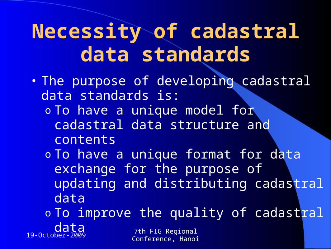
Necessity of cadastral data standards
• The purpose of developing cadastral data standards is:o To have a unique model for cadastral data
structure and contentso To have a unique format for data exchange for
the purpose of updating and distributing cadastral data
o To improve the quality of cadastral data

19-October-20097th FIG Regional Conference,
Hanoi
Using ISO/TC 211 standard family 19100
• ISO 19100 - Fundamental usingo 19101 Reference modelo 19102 Overviewo 19104 Terminology

19-October-20097th FIG Regional Conference,
Hanoi
Using ISO/TC 211 standard family 19100
• 19103 Conceptual schema language• 19107 Spatial schema• 19109 Rules for application schema• 19110 Feature cataloguing methodology• 19113 Quality principles • 19114 Quality evaluation procedures• 19115 Metadata• 19117 Portrayal• 19136 GML• 19152 LADM

19-October-20097th FIG Regional Conference,
Hanoi
Using ISO/TC 211 standard family 19100
ISO 19100
BASIC GEODATA STANDARDS
SPECIALISED DATA STANDARDS
profiles
application

19-October-20097th FIG Regional Conference,
Hanoi
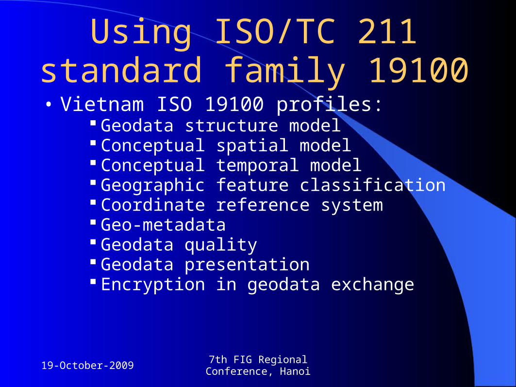
Using ISO/TC 211 standard family 19100
• Vietnam ISO 19100 profiles: Geodata structure model Conceptual spatial model Conceptual temporal model Geographic feature classification Coordinate reference system Geo-metadata Geodata quality Geodata presentation Encryption in geodata exchange
19-October-20097th FIG Regional Conference,
Hanoi
Using ISO/TC 211 standard family 19100
• Vietnam ISO 19100 profiles: Geodata structure model Conceptual spatial model Conceptual temporal model Geographic feature classification Coordinate reference system Geo-metadata Geodata quality Geodata presentation Encryption in geodata exchange

19-October-20097th FIG Regional Conference,
Hanoi
Vietnam cadastral data standards• Main contents:
o Feature Catalogueo Application Schemao GML application schema for cadastral data

19-October-20097th FIG Regional Conference,
Hanoi
Vietnam cadastral data standards(feature catalogue)
• The features defined in the cadastral feature catalogue include: o Spatial featureso Attribute features
• The main characteristics of features defined in cadastral feature catalogue include:o Each feature has a unique identifier developed in
conformity to uuid (Universally Unique Identifiers)o Each feature has temporal attributes: beginTime and
endTime

19-October-20097th FIG Regional Conference,
Hanoi
Vietnam cadastral data standards(feature catalogue)
• Using uuid helps maintain the relation between features in the cadastral database and facilitate updating/synchronising cadastral databases.
• The beginTime and endTime attributes are used for features that have different temporal versions, facilitating their organization in the cadastral database and allowing for retrieving historical data at any point of the past
• Uuid is used not only for all cadastral features (spatial and attribute) but also other features, such as:o Parcel identifiero Real estate identifier
• The parcel identifier consists of administration code, cadastral sheet map code, and parcel number in sheet.

19-October-20097th FIG Regional Conference,
Hanoi
Vietnam cadastral data standards(Spatial schema)
• Spatial attributes of geographical features are presented using geometric primitives or topological primitives
• For land parcels, winged-edge topology is used; therefore it is necessary to expand the spatial schema of ISO 19107 to make it suitable for the topology

19-October-20097th FIG Regional Conference,
Hanoi
Vietnam cadastral data standards(Spatial schema)

19-October-20097th FIG Regional Conference,
Hanoi
Vietnam cadastral data standards(Spatial schema)

19-October-20097th FIG Regional Conference,
Hanoi
Vietnam cadastral data standards(Spatial schema)

19-October-20097th FIG Regional Conference,
Hanoi
Vietnam cadastral data standards(application schema)
• The DC_Object is developed based on the VersionedObject in ISO 19152 to facilitate management of historical data in the database. To manage different versions of one feature instant, the DC_Object uses one uuid for each feature instant. Therefore, the features of DC_Object include:
Uuid for each feature instant beginTime for each version of the feature instant endTime for each version of the feature instant

19-October-20097th FIG Regional Conference,
Hanoi
Vietnam cadastral data standards(application schema)
Each cadastral feature when changed (from one version to another or replaced to present another feature) will refer to a feature that describes transactions that changed the feature such as transactionType, transactionDate, the authorities that process the transactions:

19-October-20097th FIG Regional Conference,
Hanoi
Vietnam cadastral data standards(application schema)
Relational diagram between party, land use right, right to own buildings and other properties associated with land
19-October-20097th FIG Regional Conference,
Hanoi
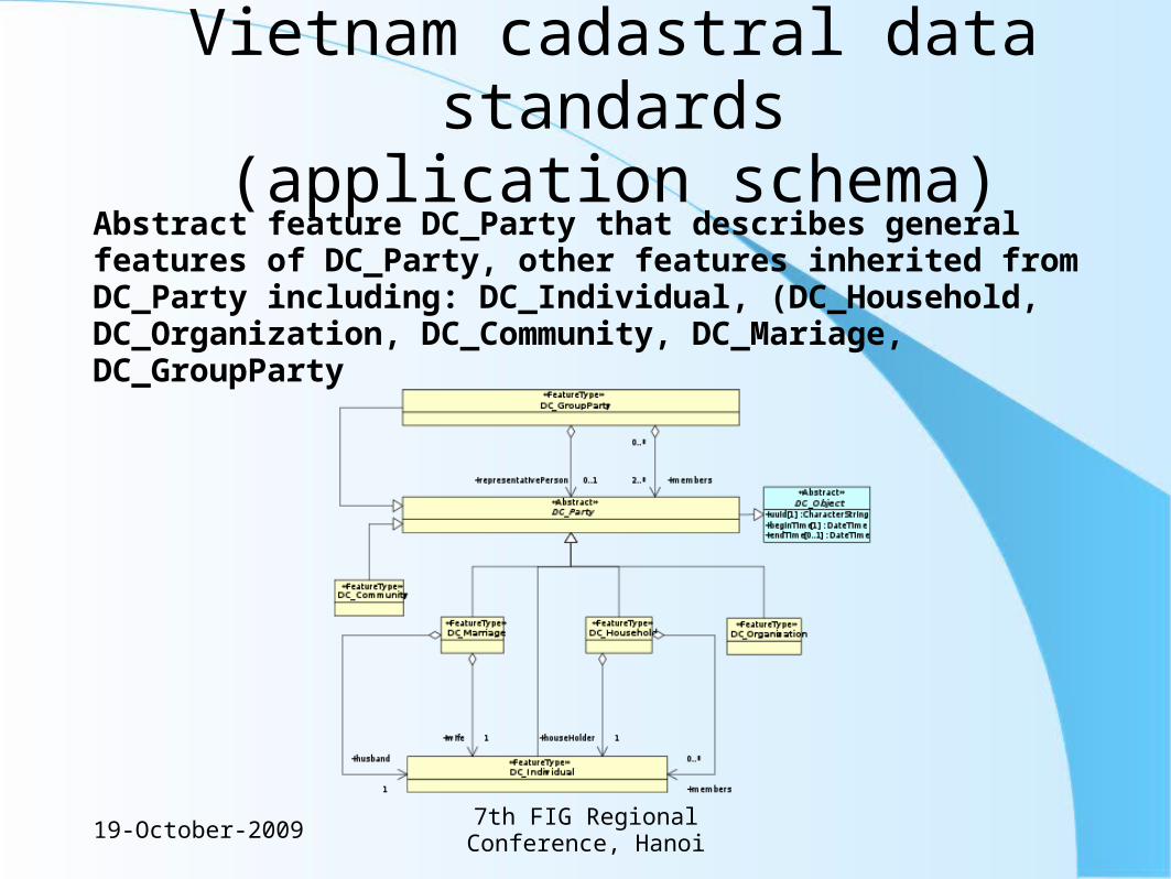
Vietnam cadastral data standards(application schema)
Abstract feature DC_Party that describes general features of DC_Party, other features inherited from DC_Party including: DC_Individual, (DC_Household, DC_Organization, DC_Community, DC_Mariage, DC_GroupParty

19-October-20097th FIG Regional Conference,
Hanoi
Vietnam cadastral data standards(application schema)
• Integrating basic geodata application schema into cadastral application schema:o Frontiers, administrative boundaries;o Reference;o Transport;o Hydrology;o Topography

19-October-20097th FIG Regional Conference,
Hanoi
Vietnam cadastral data standards(GML application schema )
• The GML application schema is developed primarily for two purposes: o To provide a method, format for change
update only;o To provide a format distributing cadastral data
for other applications.

19-October-20097th FIG Regional Conference,
Hanoi
Vietnam cadastral data standards(GML application schema )
• For updating o The land administration of Vietnam is divided into 4
levels: central (General Department of Land Administration-GDLA), provincial (Department of Land Administration - DONRE), district (Section of Natural Resources and Environment - SONRE), communal (communal land administration)
o For cadastral data, it is required that historical data is stored. Therefore, when a feature changes, new version of it will be created to update.
o The type of features that update a cadastral feature to turn it into a historical feature in the database:
19-October-20097th FIG Regional Conference,
Hanoi
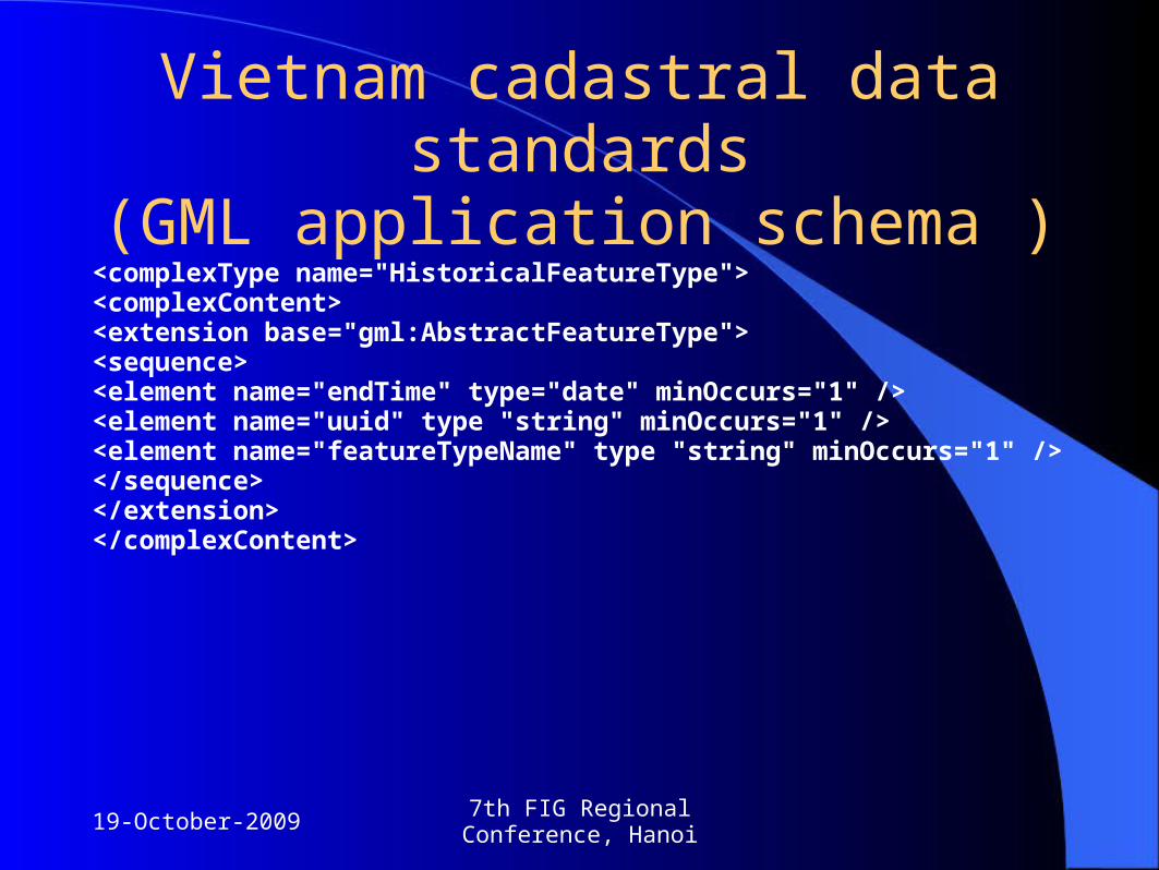
Vietnam cadastral data standards(GML application schema )
<complexType name="HistoricalFeatureType"><complexContent><extension base="gml:AbstractFeatureType"><sequence><element name="endTime" type="date" minOccurs="1" /><element name="uuid" type "string" minOccurs="1" /><element name="featureTypeName" type "string" minOccurs="1" /></sequence></extension></complexContent>

19-October-20097th FIG Regional Conference,
Hanoi
Vietnam cadastral data standards(GML application schema )
• GML application schema for distributing cadastral datao One feature instant has different versions o the versions have the same uuid and only differ in beginTime o the actual id of a version of the feature instant should be uuid and
beginTime o GML only supports relation between elements via XLink and requires that
each element have one unique id throughout the GML documentso it is impossible to use the GML relation mechanism for coding the relation
between features in the cadastral application schema (as the actual id is uuid and beginTime).
o GML application schema is only used to support distributing cadastral data at a specific point of time or distributing various GML records for various points of time.

19-October-20097th FIG Regional Conference,
Hanoi
Conclusion• Based on the draft standards ISO 19152 and others of ISO
19100, the draft cadastral data standards of Vietnam have been developed and are being piloted in some provinces
• A unique set of cadastral data standards offers the possibility for standardising cadastral data required for consistent land procedures, for a national land database and land information system to be built, for convenience in distributing and exchanging cadastral data for multi-users ranging from the Government, ministries, to various layers of governance and local authorities and the community.

19-October-20097th FIG Regional Conference,
Hanoi
Thank you!DOI Do [email protected]
THANG Nguyen Van [email protected]
Dr. GIANG Tran Bach [email protected]
TUAN Vo [email protected]
TOAN Nguyen [email protected]