2.0 data collection
TRANSCRIPT

PLANNING LEVEL ANALYSIS
2 Oakes Road Crossing of Florida’s Turnpike
RFP B-05-41; Task 1
Figure 1-1; Study Corridor 2.0 DATA COLLECTION
A field visit was performed to review existing conditions along the corridor and to
identify potential issues that may impact the proposed improvements. Pictures of the
field visit are located in Appendix A. Findings of the field visit are summarized in the
following subsections. A base map, shown in Figure 2-1, was prepared to show the
location of key points referenced throughout this report.
2.1 West Segment
The West Segment of the corridor begins at Davie Road and ends at the Florida
Turnpike. Existing Right-of-Way (R/W) width in this segment varies from 20-ft
near Davie Road to 70-ft near the Turnpike. Oakes Road is nonexistent in this
segment. There is a local private road nearby that is signed as SW 36th Street.
The local private road is not on public R/W and is used by Ferncrest Village and
Everglades Lake Community to maintain their internal circulation. A picture of
the local private road is shown in Figure 2-2.

PLANNING LEVEL ANALYSIS
3 Oakes Road Crossing of Florida’s Turnpike
RFP B-05-41; Task 1
Figure 2-1; Base Map

PLANNING LEVEL ANALYSIS
4 Oakes Road Crossing of Florida’s Turnpike
RFP B-05-41; Task 1
Figure 2-2; Local Private Road, Oakes Road R/W on Other Side of Fence
Most of the R/W dedicated for the West Segment of Oakes Road is currently
being used by Tindall Hammock Irrigation & Soil Conservation District (THISCD)
and Central Broward Drainage District (CBDD) to convey stormwater runoff east.
Swales, shallow ditches, pipe culverts, and deep canals are components of the
THISCD and CBDD runoff conveyance system located within the Town’s existing
R/W. Near Davie Road, encroachments into the R/W have taken place by the
neighboring community of Ferns Crest, as shown in Figure 2-3. In addition, there
is a concrete culvert running along the Oakes Road R/W for a distance of about
900-ft. This culvert and the R/W encroachment terminate when the shallow ditch
begins, as shown in Figure 2-4. Runoff from the culvert is conveyed through a
drainage ditch that runs within the R/W for about 1500-ft and reaches a depth of
about 5-ft with a width of approximately 15-ft, as shown in Figure 2-5. The
drainage ditch is connected to a THISCD retention area, as shown in Figure 2-6.
Discharge from the THISCD retention area continues east through a concrete
culvert running along the R/W before outfalling into a deep canal, as shown in
Figure 2-7. The canal runs approximately 1770-ft up to the Turnpike where it
then turns south and runs alongside the Turnpike before discharging into the C-
11 Canal.

PLANNING LEVEL ANALYSIS
5 Oakes Road Crossing of Florida’s Turnpike
RFP B-05-41; Task 1
Figure 2-3; Encroachment into the Town's R/W, near Davie Road
Figure 2-4; End of R/W Encroachment, Beginning of Shallow Ditch within R/W.

PLANNING LEVEL ANALYSIS
6 Oakes Road Crossing of Florida’s Turnpike
RFP B-05-41; Task 1
Figure 2-5; Typical Dry Ditch Segment within R/W.
Figure 2-6; CBDD/THISCD Retention Area within R/W

PLANNING LEVEL ANALYSIS
7 Oakes Road Crossing of Florida’s Turnpike
RFP B-05-41; Task 1
Figure 2-7; CBDD/THISCD Deep Canal within Oakes Road R/W
2.2 Bridge Segment
The Bridge Segment begins and ends on the west and east side of the Turnpike,
respectively. A permit from the Florida Turnpike Enterprise (FTE) will be required
for this crossing. In addition, close coordination with Florida Power and Light
(FPL) and Florida Gas Transmission (FGT) will be required since they both have
facilities near the proposed crossing location. Facilities for FPL consist of
transmission lines crossing the Turnpike, as shown in Figure 2-8. A FGT gas
valve pit is located on the eastern side of the Turnpike, near the proposed
crossing, as shown in Figure 2-9.

PLANNING LEVEL ANALYSIS
8 Oakes Road Crossing of Florida’s Turnpike
RFP B-05-41; Task 1
Figure 2-8; Overhead Transmission Lines at Proposed Bridge Crossing Location
Figure 2-9; Florida Gas Transmission Gas Valve Pit on East Side of Turnpike
PLANNING LEVEL ANALYSIS
9 Oakes Road Crossing of Florida’s Turnpike
RFP B-05-41; Task 1
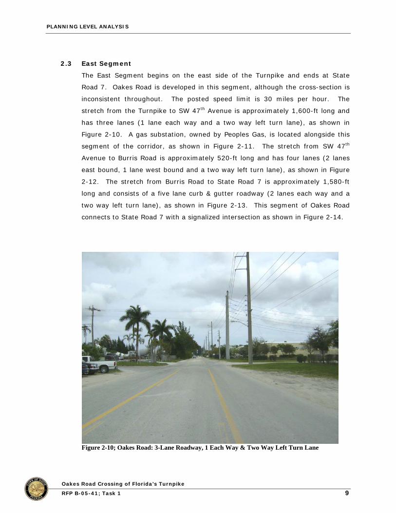
2.3 East Segment
The East Segment begins on the east side of the Turnpike and ends at State
Road 7. Oakes Road is developed in this segment, although the cross-section is
inconsistent throughout. The posted speed limit is 30 miles per hour. The
stretch from the Turnpike to SW 47th Avenue is approximately 1,600-ft long and
has three lanes (1 lane each way and a two way left turn lane), as shown in
Figure 2-10. A gas substation, owned by Peoples Gas, is located alongside this
segment of the corridor, as shown in Figure 2-11. The stretch from SW 47th
Avenue to Burris Road is approximately 520-ft long and has four lanes (2 lanes
east bound, 1 lane west bound and a two way left turn lane), as shown in Figure
2-12. The stretch from Burris Road to State Road 7 is approximately 1,580-ft
long and consists of a five lane curb & gutter roadway (2 lanes each way and a
two way left turn lane), as shown in Figure 2-13. This segment of Oakes Road
connects to State Road 7 with a signalized intersection as shown in Figure 2-14.
Figure 2-10; Oakes Road: 3-Lane Roadway, 1 Each Way & Two Way Left Turn Lane

PLANNING LEVEL ANALYSIS
10Oakes Road Crossing of Florida’s Turnpike
RFP B-05-41; Task 1
Figure 2-11; Peoples Gas Substation Adjacent to Study Corridor
Figure 2-12; Oakes Road: 4-Lane Roadway, 2 EB, 1 WB, & Two Way Left Turn Lane

PLANNING LEVEL ANALYSIS
11Oakes Road Crossing of Florida’s Turnpike
RFP B-05-41; Task 1
Figure 2-13; Oakes Road: 5-Lane Roadway, 2 Each Way, & Two Way Left Turn Lane
Figure 2-14; Oakes Road Signalized Intersection at SR-7