20 november 2011 - the yellowstone trail
TRANSCRIPT

Arrow Contents
“A Good Road from Plymouth Rock to Puget Sound”
Official Publication ofThe Yellowstone Trail Association
Number 20
Nov.2011
The Yellowstone Trail with an Eastern Accent – Part Two
The old Trail wanders invisibly through some serious cities in Central and Western New York—Syracuse, Rochester, Buffalo—alongside the remnants of another historic Trail, the Erie Canal. It soon gets rural again where I live on the Trail in Chautauqua County. My house in Brocton, New York, was a roadhouse/hotel a century ago.
In the area, three fascinating religious foundations pop up: Lily Dale, the Vatican City of the US religion of Spiritualism; The Chautauqua Institution, begun as a summer school for Methodist Sunday School teachers; and The Brotherhood of the New Life, a communal religion, right on the Trail, across from my house.
All three were founded in the 1870s but with very different creation myths. Hearing (or pretending to hear) noises and voices from “Mr. Splitfoot,” surely a comic euphemism for the devil, the Fox Sisters of Hydesville, New York, helped to create a movement that spun out of control and swept the world. In reaction against Darwinian materialism, people (then and now) longed to believe in life after death and attempts to contact the spirits of the dead. Lily Dale today is a tiny village (pop. about 275) on two pretty lakes, seven miles south of Fredonia and the YT. Most of the residents Con’t next page
Mac Nelson is a long-time member of the Yellowstone Trail Association and Distinguished Teaching Professor of English Emeritus, State University of New York – Fredonia; and the author of Twenty West, The Great Road Across America, SUNY Press.
In the eastern states, US Highway 20 more or less follows the route of the old YT. But Mac looks beyond the pavement for stories that surround the route and give more meaning to following the Trail today.
Click on page #:
YT with Eastern Accent--------- 1
Good Roads Movement -------- 3
Trail-O-Grams
YT Travel Report - Roehl
On the Trail with Mark------
------------------- 4
Preparing for the Trip West----- 5
------ 9
--- 11
Notes from the YTA----------- 12
YT Travel Report - Sherwood-- 7
A YT Poem ----------------------- 8
That’s Mac Nelson under the hat pitching in Wrigley Field on his beloved Chicago Cubs’ sacred ground. He has friends in high places who arranged for Mac to throw out an opening ball on September 17, Cubs vs. Houston. Despite his 77 years and Mac’s claim that “when I raise my right shoulder and move it vigorously it sounds like I am popping corn in there,” he managed to get the ball to the catcher. A man of many talents is our Mac!
Spokane 11Post Falls 11Coeur d’Alene 11Kellogg 11
Bozeman 7Livingston 4Gardiner 8Reed Point 8
Laurel 9Rosebud Creek 9Miles City 7,9Terry 9Fallon 9Mildred 10ismay 10Haynes 7Lemmon 7Ipswich 3,7Wegdahl 5Granite Falls 5Sacred Heart 5Hudson 4Chicago 2Pullman 2Plymouth 4Chautauqua 1Brocton 1 Lily Dale 1Fredonia 1Hydesville, 1
Buffalo 1
Rochester1Syracuse1
Places mentioned in
this issue (with page number)
The Yellowstone Trail
Roche
ster 1
Hyd
esvi
lle 1
,Fre
doni
a 1
Lily D
ale 1
,
Chipp
ewa
Falls
12O
livia
12
Broct
on 1
Syra
cuse
1
Chaut
auqu
a 1,
Buffa
lo 1
,Chi
cago
2,
Ipsw
ich
3,7Boz
eman
7
Kello
gg 11
Post F
alls
11
Coeur
d’A
lene
11,
Livin
gsto
n 4
Reed
Point
8
Gardiner 8
Ellens
burg
8
Spok
ane 1
1,
Hay
nes 7
Yaki
ma
8
Laure
l 9
Mile
s City
7,9
Terr
y 9, Fal
lon
9
Roseb
ud C
reek
9
Mild
red
10,Ism
ay 1
0
Lemm
on 7
Weg
dahl
5, G
rani
te F
alls
5
Sacr
ed H
eart
5,
Hud
son
4 Pullm
an 2
Plym
outh
4

are spirit mediums. They are said to give good value for a “reading.” There are formal services on Sunday, during which mediums attempt to contact spirits of the dead. The town looks like an 1870s time warp--almost all the houses are wooden carpenter Gothic. There is a charmingly creaky old assembly hall and, in the summer, a parade of speakers from the A list of the nation’s spiritualists.
thIn its heyday, the late 19 century, Lily Dale was as famous and reputable as Chautauqua. That has changed. Lily Dale looks faded, neglected, off the map, while the modern Chautauqua Institution has become a posh, mellow summer paradise with high rents and serious claims to intellectual and artistic excellence. The older architecture of Chautauqua (ten miles south of the YT) is similar to Lily Dale’s—Teddy Roosevelt era Gothic cottages, with some newer hotels—but shiny and better maintained. (TR once called Chautauqua “the most American place in America.”) It has a fine symphony, good theatre and dance, and eminent guest speakers and preachers who come for a week and interact with the Chautauquans. Garrison Keillor has visited “The Amp” (the old wooden outdoor Amphitheater) twice with this Prairie Home Companion crew. He had only to expand his Lutheran jokes to include Methodists and Presbyterians. George Gershwin composed much of his Concerto in F in a studio here. Chautauqua’s religious roots are still important, though probably less than they once were. There is genuine ecumenical outreach, for example, to a conservative Jewish group.
A stroll around the Chautauqua grounds (free on Sundays, pricey other days) takes you back to the time of the creation of the Yellowstone Trail. As in the early years of Yellowstone National Park, motorcars were banned here; they are still discouraged, but grudgingly allowed with special permits. The feeling on the grounds is upbeat, earnest and quiet. There is a lovely view of Chautauqua Lake from the dozens of rockers on the front porch of the old Atheneum Hotel. And they still let you pick TWO desserts from the table d’hote menu. Yum.
The Brotherhood of the New Life found its third home here, and stayed for about twenty years. Its leader, Thomas Lake Harris, required celibacy and hard farm work from his followers, who grew hay and fruit crops, especially grapes. In the same county and decade which is credited with the foundation of the Woman’s Christian Temperance Union, his cash crop was wine—an average of twenty thousand gallons a year! When the community broke apart in lawsuits and ill will, it reformed and moved to Santa Rosa, California, for its last gasps.
Before the motor car and “Good Roads,” much of America’s travel and business ran on water and, later, on rails. My little village of Brocton was the humble birthplace (in 1831) of one of America’s leading industrialists and capitalists, George M. Pullman. After a minimal education, he began his career here at 14. Later, he moved to Chicago and was a great success in housing construction after the Chicago fire. He then began building railroad cars, including those sleeping cars that bore his name and made him fabulously wealthy. He built Pullman, Illinois, south of Chicago, as a company town to produce his products and swell his fortune. Many of the buildings are still there, quite handsome row houses, with indoor plumbing, unusual for the time—just before the YT.
His utopian company town failed, as all eventually do, in the face of a great recession, consequent labor strife, and his negative, rigid reaction to his workers’ pleas. The city of Pullman still exists and is well worth a visit today, as is the entire eastern third of our Trail, from Boston to Chicago.
I have fascinating Amish and Trappist neighbors, too. Ours was a road of important ideas and religious movements as well as emerging auto travel. The eastern Trail is rich in history—enjoy it. ©
The YT with an Eastern Accent, Con’t.
Abraham Lincoln travelled eastward (by train) along the route
of the YT to go to Washington, fame, triumph, and death. On the way, he stopped in Westfield, New York, to
meet an eleven year old girl, Grace Bedell, who had written to him and suggested he grow a beard, because
"all the ladies like whiskers and they would tease their husbands to
vote for you." He later said she might have got him elected.
2

On May 30, 1880, bicyclists from across the nation gathered in Newport, Rhode Island. It was the first national meeting of a new society, the League of American Wheelmen, formed the previous year to draw attention to the need for better roads.
While it may seem odd that Newport, best known for the opulent mansions euphemistically called “summer cottages” by their owners, should host the first national gathering of bicycle enthusiasts,
it was actually a perfectly appropriate setting for the meeting. Cycling was a mode of transportation that was mostly reserved for the wealthy. America was still mostly agrarian and a farmer couldn’t hitch a plow to a bicycle.
In the 1880’s, bicycles represented the cutting edge of technology. It was the age of the high-wheeler, also known as the “Penny-Farthing” – a mode of transportation that offered independence from the crowds and limitations of the railroad, and that didn’t need to be fed, watered or rested like a horse. Bicycles were an important link in the chain of technological development that would result in automobiles and airplanes just a few years later.
Bicycles made travel around the countryside a pleasant pastime, except for the abysmal condition of many of the roads. As the popularity of bicycling increased, so did the cries for improved roads on which to ride them. Bicycle clubs sprang up in most major cities, which sponsored rides and races. Local clubs lobbied for improved roads, but they acheived little.
For all of its previous history, building and maintenance of roads in Colonial and Post-Colonial North America had been left to the people who used them most. That arrangement meant that the cities, towns, and villages enjoyed relatively good roads, but the condition of the miles of roads in the countryside between them varied widely, but was usually very poor.
There had been efforts in the years preceding the Newport meeting to force state governments to take a more active role in the road system in the name of better postal service. Those efforts had failed because the rural residents who would benefit were few in number and widely scattered, and therefore disorganized.
Albert Augustus Pope, the founder of the Pope Bicycle Company, of Hartford, Connecticut, (later Columbia Bicycles) was instrumental in organizing the meeting in Newport. As a cyclist, Pope had experienced the difficulties of rural road conditions. As a businessman and industrialist, he saw the potential boom that could result from improved conditions.
With the forming of the League of American Wheelmen (LAW), the issue of rural road improvement suddenly had a unified group of important and influential advocates. Following the Newport meeting, the members of the fledgling organization returned to their homes to spread their “Good Roads” doctrine. The momentum behind the issue built quickly into a national movement, especially after the LAW began publishing Good Roads Magazine in 1891.
In 1894, Massachusetts became the first state in the country to name a state-level highway commission in response to the Good Roads Movement. Connecticut followed suit in 1895. Other states were slower to respond, but by 1910, many states, including most of the northeast, had named commissioners or formed departments and gave then the responsibility of highway and bridge construction and maintenance.
In 1898, Horatio Earle of Detroit, who would come to be known as the “Father of Good Roads,” was appointed to chair a Good Roads committee for the Michigan Division of the LAW. The following year, Earle was unanimously elected the League’s Chief Consul. He ran on a platform to end League-sanctioned bicycle racing, which had become a wedge issue, and pushed the Good Roads Movement. In 1900, Earle was elected to the Michigan Senate as a LAW candidate. The following year, he sponsored a Senate Resolution to create a Michigan State Highway Commission, to which he was subsequently elected chair.
As the 20th century began, the bicycle craze of the 1880’s and 90’s was coming to an end. Many former cycling enthusiasts found a new darling: the automobile. The LAW, which had reached its peak membership just a few years before in 1898, dissolved in 1902, due to dwindling membership. That same year saw the birth of the American Automobile Association, which picked up the advocacy for good roads where the LAW had left off.
As automobiles gained popularity, many manufacturers, as well as makers of component parts, chose to invest in road construction out of a mix of public spirit and a large dose of self-interest. They were an industrialist in Indianapolis, Indiana, whose company Prest-O-Lite supplied headlights to virtually every US auto manufacturer. In 1913, he proposed building the Lincoln Highway across the United States from New York City to San Francisco.
In 1912, the Yellowstone Trail was conceived by South Dakota businessman, J.W. Parmley. The idea, at first proposed as a 25-mile-long local road, evolved into an ambitious plan to knit together a route from the Plymouth Rock in Massachusetts to the Puget Sound in Washington State. Without the deep pockets of a wealthy industrialist, the planned road relied on the cooperative efforts
led by Carl G. Fisher,
Con’t next page
The League of American Wheelmen and the
Good Roads MovementSteve reports “I have lived, along with my wife Linda, on Jacob's Ladder Trail (AKA Yellowstone Trail) for more than 25 years. Our front door is a scant thirty feet from the pavement.
I was the charter, and to-date longest-serving, president of the Jacob's Ladder Trail Scenic Byway Advisory Board, formed in 1992 when the road was granted state scenic Byway status.
I'm an avid cyclist, photographer, and watercolor painter. My paintings can be seen on my website
Linda and I travel as much as money, time, and commitments allow.
www.stevehamlinwatercolors.com
3
HistoryCorner
hc ua ss es tta s C nM o er dre nspot
teS v e y Hab m lin
of individual members and local governments across the country.
With the passage of the Federal Aid Highway Act in 1925, the Good Roads Movement was effectively ended. The movement had succeeded. With the exception of the occasional private road, responsibility for road and bridge construction and maintenance between municipalities had been shifted to the state and federal governments nationwide.
Good Roads, Continued
Trail-O-Grams
Some may argue that the gains that were made by the LAW towards improvement of rural roads would have been made without their advocacy by automobile enthusiasts, although it might have been a decade or two later. In his 1925 autobiography, Horatio Earle, who had participated in the movement as cyclist, politician, chair of a state-level highway commission, and undoubtedly motorist, argued to the contrary: "I often hear now-a-days, the automobile instigated good roads; that the automobile is the parent of good roads. Well, the truth is, the bicycle is the father of the good roads movement in this country." ©
ž joined together to host a workshop about promoting the YT. We learned about available grants and selection of local sites worth
advertising to the tourist. Cooperative promotion was another important topic. The YTA and Tourism Department will each have links to the other on their web sites.
ž This just in from Livingston, Montana: Paul Shea of the Yellowstone Gateway Museum reports that the Livingston Chamber of Commerce will sponsor a July 2 parade with the Yellowstone
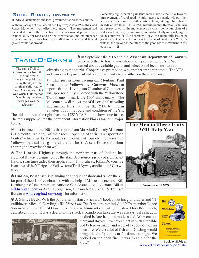
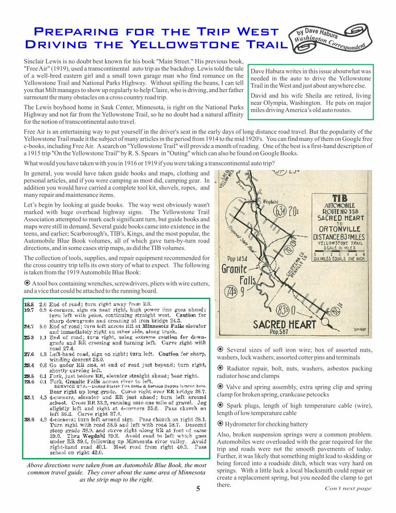
thTrail theme to mark the 100 anniversary. The Museum now displays one of the original traveling information tents used by the YTA to inform travelers about the route and condition of the YT.
The old picture to the right from the 1928 YTA Folder shows one in use. The tents supplemented the permanent information kiosks found in major hotels.
thž Just in time for the 100 is the report from Marshall County Museum in Plymouth, Indiana, of their recent opening of their “Transportation Center” which marks Plymouth as the center of four old highways, the Yellowstone Trail being one of them. The YTA sent flowers for their opening and we wish them well.
ž The Lincoln Highway through the northern part of Indiana has received Byway designation by the state. A resource survey of significant historic structures aided their application. Think ahead, folks. Do you live in an area of the YT ripe for Yellowstone Trail Byway application? Can we talk?
ž Hudson, Wisconsin, is planning an antique car show and run on the YT thfor part of their 100 celebration with the help of Minnesota member Bill
Dirnberger of the American Antique Car Association. Contact Bill at or Andrea Jorgenson, Hudson Area C. of C. & Tourism
Bureau at for information.
ž A Glance Back: With the popularity of Barry Prichard’s book about his grandfather and YT trailblazer, Michael Dowling, (We Blazed the Trail) we are reminded of YTA member Lance Sorenson’s picture find of Dowling’s cottage in Minnesota. Dowling’s in-law, Flora Bordewich, described it thus: “It was a deer hunting shack at Kandiyohi Lake ...it was always just a shack ...
he died before he got it modernized. We went out there and stayed. I’ve never slept in such a terrible bed before or since, and we had to cook out on an open fire. We ate a lot of fish and Dowling would bring a load of people out for dinner at night. We cooked on the open fire. It was fresh air for the kids.”
In September the YTA and the Wisconsin Department of Tourism
[email protected]@hudsonwi.org
The name Trail-O-Grams comes from the
original Arrow newsletter published during the days of the original Yellowstone
Trail Association. That was when THE method of sending quick short
messages was the telegram!
4Book available at
www.yellowstonetrail.org/id20.htm
Sinclair Lewis is no doubt best known for his book "Main Street." His previous book, "Free Air" (1919), used a transcontinental auto trip as the backdrop. Lewis told the tale of a well-bred eastern girl and a small town garage man who find romance on the Yellowstone Trail and National Parks Highway. Without spilling the beans, I can tell you that Milt manages to show up regularly to help Claire, who is driving, and her father surmount the many obstacles on a cross country road trip.
The Lewis boyhood home in Sauk Center, Minnesota, is right on the National Parks Highway and not far from the Yellowstone Trail, so he no doubt had a natural affinity for the notion of transcontinental auto travel.
Free Air is an entertaining way to put yourself in the driver's seat in the early days of long distance road travel. But the popularity of the Yellowstone Trail made it the subject of many articles in the period from 1914 to the mid 1920's. You can find many of them on Google free e-books, including Free Air. A search on "Yellowstone Trail" will provide a month of reading. One of the best is a first-hand description of a 1915 trip "On the Yellowstone Trail" by R. S. Spears in "Outing" which can also be found on Google Books.
What would you have taken with you in 1916 or 1919 if you were taking a transcontinental auto trip?
In general, you would have taken guide books and maps, clothing and personal articles, and if you were camping as most did, camping gear. In addition you would have carried a complete tool kit, shovels, ropes, and many repair and maintenance items.
Let’s begin by looking at guide books. The way west obviously wasn't marked with huge overhead highway signs. The Yellowstone Trail Association attempted to mark each significant turn, but guide books and maps were still in demand. Several guide books came into existence in the teens, and earlier; Scarborough's, TIB's, Kings, and the most popular, the Automobile Blue Book volumes, all of which gave turn-by-turn road directions, and in some cases strip maps, as did the TIB volumes.
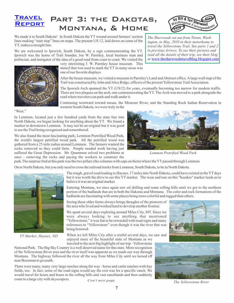
The collection of tools, supplies, and repair equipment recommended for the cross country trip tells its own story of what to expect. The following is taken from the 1919 Automobile Blue Book:
A tool box containing wrenches, screwdrivers, pliers with wire cutters, and a vice that could be attached to the running board.
Several sizes of soft iron wire; box of assorted nuts, washers, lock washers; assorted cotter pins and terminals
Radiator repair, bolt, nuts, washers, asbestos packing radiator hose and clamps
Valve and spring assembly, extra spring clip and spring clamp for broken spring, crankcase petcocks
Spark plugs, length of high temperature cable (wire), length of low temperature cable
Hydrometer for checking battery
Also, broken suspension springs were a common problem. Automobiles were overloaded with the gear required for the trip and roads were not the smooth pavements of today. Further, it was likely that something might lead to skidding or being forced into a roadside ditch, which was very hard on springs. With a little luck a local blacksmith could repair or create a replacement spring, but you needed the clamp to get there.
ž
ž
ž
ž
ž
ž
Dave Habura writes in this issue aboutwhat was needed in the auto to drive the Yellowstone Trail in the West and just about anywhere else.
David and his wife Sheila are retired, living near Olympia, Washington. He puts on major miles driving America’s old auto routes.
Preparing for the Trip West Driving the Yellowstone Trail
Con’t next page5
Above directions were taken from an Automobile Blue Book, the most common travel guide. They cover about the same area
as the strip map to the right.of Minnesota

Tires were a major source of concern and problems. Punctures and blowouts were so routine they are only mentioned in most accounts if they result in long delays or accidents.
The prudent traveler carried at least:
Two demountable rims plus two tires and four tubes
Chains and extra cross links
Blowout shoe and patches, supply of tire patches and assorted tools, jacks, air pump Tire repairs were performed on the road. Tubes were patched (vulcanized), and boots were applied to cut and blown out tires by the driver. A blowout boot could be bought from the Montgomery Ward catalog
Chicken wire to pull out of sand
Gallon of Oil, Gallon of Gasoline [Automobiles of the period used oil by the gallon, not the quart, so at least a gallon was a common amount to carry. By the teen’s, gasoline and oil were available all along the Yellowstone Trail, but it was advised that travelers fill up at every opportunity in the less settled areas]
Grease Gun and can of grease, oil squirt gun
Funnel and pint measure
Water bag and bucket [Water was essential not just for drinking, but for the radiator.]
Pull out, shovel, rope, axe
Collapsible shovels, hand cranked devices to pull the car out of mud, sand, or the roadside ditch, and wire rope were considered essential.
Roads made of sand were a frequent problem in the dry season. The advice was to never stop, or your back wheels would sink in. Chains were often used routinely, not just in sand but on wet pavement where tires easily skidded. There were even devices that looked a bit like the paddlewheels on a steamboat that could be attached to the hub and spokes of your drive wheels to give you traction in deep mud, but this was not a frequent problem on the Yellowstone Trail in the summer.
Camping gear wasn't a great deal different than today, just more primitive. One thing that did differ was the variety of sleeping arrangements devised to fit the auto tourist. Car beds, tents attached to the auto, and covered beds using the running board were popular.
Clothing differed, but had to be chosen in consideration of the conditions and automobile designs of the time. Automobiles lacked the passenger heating and cooling equipment we have today, were usually open, and often subject to weather. That a publication lists a windshield as a necessity suggests how much exposed to weather a tourist could be.
Roads in the summer were often very dusty, especially if the road bed was through alkali, or used heavily by freight and farm wagons. The dust permeated everything, so drivers and passengers often wore caps, goggles, scarves, and gloves. Men were advised to wear khaki riding britches, laced below the knee, and US Army officer’s brown shirts with patched pockets, and carry a heavy mackinaw coat with shawl collar. The caps for ladies were functional as shown in the Montgomery Ward ad from 1919.
One popular book, Dykes Automobile Encyclopedia for 1917, recommends that the male sleep in his clothes when camping on the transcontinental trip. The same book describes how to cut and prepare bacon, prepare rice, and dried peas from army rations for camp fare on a transcontinental adventure.
All in all, the transcontinental western trip by automobile in the teens doesn't seem quite the romantic stuff of the Lewis novel, but perhaps love does conquer all.
ž
ž ž
ž ž
ž ž ž
ž ž
©
Preparing, Continued
6
7
Part 3: the Dakotas, Montana, & Home
The Sherwoods set out from Tieton, Wash-ington, in May, 2010 in their motorhome to travel the Yellowstone Trail. See parts 1 and 2 in previous Arrows. To see their pictures and read all the details of their trip, see their blog at www.thesherwoodstravelblog.blogspot.com
We made it to South Dakota! In South Dakota the YT wound around farmers’ section lines making “stair step” lines on maps. The present US 12, laid down on some of the YT, makes a straight line.
We are welcomed to Ipswich, South Dakota, by a sign commemorating the YT. Ipswich was the home of Trail founder, Joe W. Parmley, local business man and politician, and instigator of the idea of a good road from coast to coast. We visited the
very interesting J. W. Parmley house museum. This stencil that was used to mark the YT in many areas was one of our favorite displays.
After the house museum, we visited a museum in Parmley's Land and Abstract office. A large wall map of the Trail was constructed by John and Alice Ridge, officers of the present Yellowstone Trail Association.
The Ipswich Arch spanned the YT (US12) for years, eventually becoming too narrow for modern traffic. There are two plaques on the arch, one commemorating the YT. The Arch was moved to a park alongside the road where travelers can park and walk under it.
Continuing westward toward mesas, the Missouri River, and the Standing Rock Indian Reservation in western South Dakota, we were truly in the
“West.”
In Lemmon, located just a few hundred yards from the state line into North Dakota, we began looking for anything about the YT. We found a marker in downtown Lemmon. It may not be an original but it was good to see the Trail being recognized and remembered.
We also found the most fascinating park, Lemmon Pretrified Wood Park, the world's largest petrified wood park. All the petrified wood was gathered from a 25 mile radius around Lemmon. The farmers wanted the rocks removed so they could farm. People needed work having just suffered the Great Depression. Mr. Quammen solved two problems at once - removing the rocks and paying the workers to construct the park.The surprise find at this park was the two pillars (the columns with caps on them) where the YT passed through Lemmon.
On to North Dakota, but you only need to cross the railroad tracks from Lemmon, South Dakota, to be in North Dakota.
The rough, gravel road leading to Haynes, 17 miles into North Dakota, could have existed in the YT days but it was worth the drive to see this YT marker. The wear and tear on this "hoodoo" marker leads us to believe it was an original marker.
Entering Montana, we once again saw oil drilling and some rolling hills until we got to the northern portion of the badlands that are in both the Dakotas and Montana. The color and rock formations of the badlands are fascinating with some places being more colorful and rugged than others.
Seeing these older farms always brings thoughts of the pioneers of the area who lived and worked hard to develop another frontier.
We spent several days exploring around Miles City, MT. Since we were always looking to see anything that mentioned “Yellowstone,” it was fun to be rewarded with road signs and many references to “Yellowstone” even though it was the river that was being honored.
When we left Miles City after a restful several days, we saw and enjoyed more of the beautiful state of Montana as we traveled to the next big highlight of our trip - Yellowstone
National Park. The Big Sky Country is a well deserved name for this state. More recognition of the Yellowstone River area and the river itself was apparent as we made our way through Montana. The highway followed the river all the way from Miles City until we turned off near Bozeman to go south.
There were many, many very large ranches along the way - horse and cattle ranches with hay fields, too. In fact, some of the road signs would say the exit was for a specific ranch. We would travel for hours and hours in the rolling hills and vast ranchlands and then suddenly come to a large city with skyscrapers. Con’t next page
TravelReport
Lemmon Pretrified Wood Park
YT Marker, Haynes, ND
The Yellowstone River

8
As we travel, we stay in Passport America RV parks. We were fortunate to find a park along our route in the little town of Reed Point, Montana. After setting up our RV, we went for a stroll and were surprised to find a spray-painted YT sign on a local resident's picket fence. It had been a long time since we had seen any markers of the trail.
Every small western town needs a saloon but this town had two of them within a block of each other and on the same side of the street. Naturally, one of them was named the Wild Horse Saloon and the other name was just as appropriately named the Waterhole Saloon.
Ed Note: The Rest of the Story –The Sherwoods entered Yellowstone National Park through the western, Big Sky route, but they did visit the north Gardiner entrance, by which Yellowstone Trail travelers entered, but they missed the historic, preserved route to the YT to Livingston along the west shore of the Yellowstone River. They then returned to their home in Washington via Wyoming, southern Idaho and Oregon, where the YT did not roam.
It is interesting to note that their home in Tieton, Washington, is about eight miles from the 1915-1925 route of the YT along Wenas Road from Yakima to Ellensburg. It seems that the Sherwoods just can’t shake the Yellowstone Trail. They believe “it is part of the history of the United States that deserves to be remembered and preserved.” ©
Help Needed for Coming PublicationsJohn and Alice Ridge are planning a book about the Trail. It will be a mile-by-mile guide along the whole of the Trail featuring sites and sights of possible interest to tourists. We have many sites identified, but we ask for your help. If your community has sites along the Trail that you think would interest a tourist (buildings that stood there in 1912-1930, parks that date back, museums, vistas, etc.) please let us know at
or through with a short description and a picture, if possible.
thTo Wisconsin readers: we are preparing the 2012, 100 anniversary edition of Driving the Yellowstone Trail in Wisconsin. If you want to add anything to the description of your community which appeared in the 2009 edition, please let us know soon. Publication is expected in March. You can contact us either by our web site (see above) or at or by mail at PO Box 65, Altoona, WI 54720.
[email protected] www.yellowstonetrail.org
Perhaps you will enjoy this little poem Dave Habura found on page 10 of the April 1920 Western Washington Motorist:
The Yellowstone Trail
O, the Yellowstone Trail is along, long trail,
Where it girdles the north likea ribbon of gold,
And many’s the car that hastraveled afar;
And many’s the tale by theA campfire told.
O, the Yellowstone Trail is abeautiful trail,
As it winds through the pinesover mountains steep.
And slips by the streams wherethe yellow sun dreams,
Or loses itself in the canyonsdeep.
O, the Yellowstone Trail is acarefree trail,
Where the east meets the west,with a word or a smile,
As they yield to the lure thatmust ever endure,.
Of beauty unfolding mile aftermile.
O, the Yellowstone Trail is abeckoning Trail,
And it calls to the heart that is heavy with care;
"Oh, it’s time for a play—comeand journey away
On the Yellowstone Highwayto everywhere!"’
Then welcome the joys of thiswonderful trail
When the woods are adornedwith their springtime green,
When the evening breeze in themurmuring trees,
Will lull you to sleep by thecampfire’s gleam.
——Sunny Wright.
Couer de Alene, Idaho.

9
After a spectacular sunset ride through the Beartooth Mountains, we rejoined the YT, homebound to the east, around Laurel, Montana.
Signs reminding us that we were “Out West:” In Red Lodge, Montana, motel room: “For your convenience, we have placed these clean, useable rags in your room to be used for cleaning your guns, drying your dogs, polishing your boots, etc. The towels and washcloths in the bathroom are reserved for personal use only. Thank you.” In Miles City laundromat: “Please, no horse blankets or saddle blankets.”
At Miles City we wondered if Olive was still in “her” room. Several times during the night, I cautiously knocked, and gently put my ear to the door of Room 250 across the carpeted hallway from our room at the 110-year-old Olive Hotel in Miles City,Montana, along the Yellowstone Trail. We were told that #250 is still occupied by Olive, daughter of a previous owner.
I was only slightly disappointed that she didn’t answer my knock…Olive died in 1971 and reputedly haunts the room.
Hotel staff over the years reported the materialization of a female ghost thought to be Olive Kinney. “Guests in Olive’s Room have noted a toilet tank chain that swings by itself and an indentation that suddenly appears on the bedspread even though no one is visible,” according to “Haunted Montana: a ghost hunter’s guide to haunted places you can visit—if you dare!” by Karen Stevens.
A recent owner, Carol Schneider, dubbed it the “Antique Room.” It has a beautiful old cabinet radio from the late 1920s or ‘30s, brass bedstead, antique dresser and a photo of Olive on the wall above the bed. The huge claw-foot bathtub is still on the marble floor. The room can still be rented, with advance notice. “A couple of times guests have left suddenly,” Schneider said, according to Stevens. “They said the water turned itself on and the toilet flushed itself.”
The upscale hotel is on the National Register of Historic Places. According to the U.S. Dept. of Interior, it was built in 1899 as the Leighton Hotel. In 1908, Maud and Albert Kinney bought it and renamed it the Olive Hotel after their daughter. That year, the Chicago, Milwaukee and St. Paul Railway arrived, and the hotel was expanded with a new façade, lobby and the east addition. A three-story addition arose to the rear. The lobby features high quality oak woodwork and multi-colored tile flooring and curvilinear beveled glass tiffany-style window designs.
By the time YT travelers were staying at the Olive, it housed a café, barber shop, cigar and curio stand, buffet and sample rooms where ranchers and commercial travelers met. Two fireproof, poured concrete garages built in 1908 and 1912 demonstrate the rising importance of the automobile. Although the 1920s drought and 1930s Depression wounded Miles City’s economy, the hotel remained a gathering place for townspeople and ranchers. After WW II, the Olive prospered.
One account has the hotel being built on the site of a saloon reputedly owned by General George A. Custer’s horse wrangler, Charlie Brown.
When we entered the room with the current manager, we saw no “orb” and felt no electrical field. But we were happy that we had decided to follow the old Yellowstone Trail and stay at Olive’s place rather than, say, a Super 8 on I-90. Definitely more interesting. Some night we just may return and stay in room #250. And just maybe…
The Powder River, north of Miles City, is claimed by “exuberant parties” to be “a mile wide, an inch deep and runs uphill.” Captain Clark, of the Lewis and Clark Expedition, named it the Redstone in 1806, as had the Indians. On July 30, 1806, he camped across the Yellowstone from the mouth of the Powder. Gen. Custer camped 25 miles from here in 1876. His scouts found Indians on Rosebud Creek and chased them with the Battle of the Little Bighorn resulting.
Historic Kempton Hotel is in Terry, Montana. A neon sign, installed in 1926, is still functioning at this oldest continuously operating hotel in Montana. We interrupted a couple of older gents having morning coffee at McDonalds, thinking they probably knew of the old YT. They directed us to it with advice that cell phones won’t work out there, “but if you have trouble, a cowboy may come along on a horse to help.”
This is the fourth in a series of articles in which the Roehls reflect upon their auto trip along the
Yellowstone Trail from Wisconsin to Yellowstone National Park and back.
Roehls Drive the Yellowstone Trail -
Visiting Olive and Geneonc ss ii n CW orresp sto nn ed
arC l &y Jab n et Roehl
TravelReport
Con’t next page
Lobby of the Olive Hotel
Kempton Hotel in Terry, Montana

We followed the old US10 (YT) to Fallon, where part-time postmistress Jo Auk directed us through miles of “no-services” rangeland. We didn’t find the Westmore “ghost town” we sought, but saw other abandoned towns.
Before Ismay, population 25, we crept through Mildred, population 0! The only life was at the Breen Family Inc. grain elevator. Everyone seems to have left on one day and didn’t bother to return! Dilapidated old school, houses, cars, feed mill, filling station, post office, snack bar, church with dangling bell in steeple, all abandoned.
At Ismay, Montana, on our homeward trek, we were exploring the old YT when we met rancher Gene Garber, 86, mowing grass around a Right to Life shrine at the edge of town.
Gene, a Sheridan, Wyoming, native, served in the Pacific in 1944-6. Upon his return, he met his wife who came here after the war as a displaced person from Belgium. They met in the US and married in 1946, then moved to Montana. They bought a campground which in YT days had given out maps and sold groceries to YT travelers. Gene knew of another YT route to the west 30 miles shorter, but that route was never recognized by the old Yellowstone Trail Association.
He has sold much of his ranch but still owns about two townships--15 miles across Custer County. Others lease his land to run 2,000 head of cattle.
The Ismay school had 75 kids in 1950, but by 1962, it closed. At one point, the community changed its name to “Joe” Montana. His wife helped raise $150,000 for people with cancer, or those whose houses burned, and to build the firehouse.
He explained that the Right to Life shrine was built on the site of St. Francis Catholic Church, after it was moved out in 1994. Petrified stone at the shrine is from his and his wife’s ranch. Mass is said in Ismay once a year, outside or in the fire hall.
“The Yellowstone Trail was more for tourists” than were other trails with significant history, Gene said, such as the 1875 Bismark to Fort Keogh (Miles City) trail for military and supply wagon trains. Gene erected an historical sign about that
trail. He also had two YT marked rocks on his ranch, but we couldn’t find those, driving dirt roads around his ranch for about an hour.
In three hours on gravel roads through rangeland, we saw one tractor, one car, two motorcycles and one SUV. How vast this country is!
A Yellowstone Trail Association postcard had a map of the trail across the U.S. on the front, with a place for date and note that “I am touring over the Yellowstone Trail. Mail will reach me at (City/State) not later than _____ I am at the place marked X today. “A good road from Plymouth Rock to Puget Sound.” .©
In the next issue the Roehls return home to Wisconsin and ponder about travel as it was 100 years ago.
10
Ed. Note: Reproductions of the YTA Post Card from the 1920’s is available at
For your next trip on the Yellowstone Trail, have a supply ready to send to your friends!
www.yellowstonetrail.org/misc_materials.htm
Mildred, Montana

This past summer I took a road trip of 34 days and 6,000 miles to explore the Yellowstone Trail in the West. I “highballed” to the Spokane, Washington, area, and then began following the YT back towards Wisconsin in my ’05 Kia Sorento. My trip odometer mileage turned 2,000 while I was in Spokane.
After a good night’s sleep in the back of my Kia at the Post Falls, Idaho, KOA, I was up bright and early. Actually an hour earlier than I thought it was, because I had entered the Pacific Time Zone and all my clocks (and my brain) were still on Mountain Time.
I headed for Spokane with no plan in mind, only about 30 miles away. I stopped for coffee and jumped on I-90...big mistake...it was 7:00 am and I was in rush hour traffic. Four lanes Westbound were packed with heavy traffic and speeds were 20 to 45 mph. I'm a back roads guy and I did not like this one bit.
I had entered Spokane into my GPS with no address, so it took me to the main downtown exit and there was a big blue VISITOR CENTER sign. "OK, I'll start there", I thought, so I followed the rest of the little blue signs right to the Convention Center and the Visitor Center across the street. I parked in back and walked around the front to see a sign saying it would not open until 8:30...it was 8:15, but just as I turned to walk away, a car pulled up and a woman said "I'll go in the back door and open up for you"!
She did, and then introduced herself as Mary Beth. We talked for almost an hour. She was a rare find. She has traveled a lot, knew the old roads in the area and beyond, and had a great answer for any question I posed. Whatever the Spokane CVB is paying her is not enough.
Mary Beth gave me a few brochures and marked up a map to the "little red wagon" (it's a 12 feet high and 27 feet long Radio Flyer) and then to the Davenport Hotel, along with some other sights. I cannot fully describe the Davenport, other than it is the most opulent and luxurious hotel I've seen, especially impressive since it was built in 1914 and was known then as the finest hotel in the West. It was completely renovated recently and it is wonderful. I walked around for about an hour and looked at their large framed photos of the old days and generally admired everything.
Did I mention it’s right on the Yellowstone Trail? The YT followed Sprague Ave. and the hotel occupies the entire block between Sprague and First Ave. The hotel was only a year old when the YT came to Spokane.
My maps from confirmed that the YT followed Sprague Ave. east along a stretch of strip malls and used car lots. Sprague eventually turns into Appleway, named for the many orchards that used to be in the area. It continues to the Washington / Idaho state line. Heading east into Idaho, the YT follows Seltice Way and then another Appleway Rd. into Coeur d'Alene. Not much fun with business areas all the way. From downtown Spokane all the way to the east side of Coeur d'Alene there is every kind of place imaginable, trying to sell you something...from new and used cars and trucks, real estate, holistic spas, and food to tattoos and tacos.
I followed the original YT route through town to Sherman Ave. and then turned south along Lake Coeur d'Alene Drive until I came to the "Real Deal"...Yellowstone Trail Road...the original route out
to Wolf Lodge Creek, and it is a super-scenery drive both under, over and beside I-90, the "new" route as it wanders along. Wow! Finally, I was back out on the mountain roads and loving every minute of it.
The YT route from Coeur D'Alene Lake to Wolf Lodge Creek is older 2-lane blacktop, but a spectacular drive as is all of this area. From there it's mostly good gravel on Adler Creek Rd. and on to Cedar Creek Rd. and eventually comes out at I-90's Exit 28, where you can no longer follow the YT for a few miles because I-90 is on top of it.
The weather turned nasty - cold and raining again - so I jumped ahead to Kellogg on I-90 for a stay at the Trail Motel, $44/night and a pretty nice place with comfortable, clean rooms, WIFI, free ice, and good coffee! This entire area is very interesting and a fun part of the Yellowstone Trail to explore.
I’ll write more about Idaho in the next Arrow. To read my trip blog, and then click on ARCHIVE on the left column below my intro.
* This Arrow again features articles about the YT written by our members. If you would like to contribute, please contact us.
* Plans are being made for the 100th birthday of the YTA. Why not organize an event in your area? Keep us informed of your plans so we can help promote them.
* Thanks for sending in your Association dues. We appreciate all new and continuing members. Tell your friends about our group... share this Arrow with them…they can join us by clicking here:
* Visit our Facebook page, It's interesting and fun to follow the posts and interact with us, and each other.
www.YellowstoneTrail.org
http://yellowstonetrail.tumblr.com/
www.yellowstonetrail.org/id82.htm
www.facebook.com/YellowstoneTrail
Happy Trails, Mark Mowbray, Executive Director [email protected] / 608-436-3978 ©
On the Trail with Mark
11
GPS in Action
I-90 above the YT in Coeur d’Alene
Notes from the YTA
12
Contact Mark Mowbray, our Executive Director, to ask anything about YTA. Membership, donations, ways to get involved, project ideas – or just to introduce yourself! )Click to e-mail Mark. [email protected]
Happy Holiday Wishes from YTA
As we explained in recent Arrows, The YT will be 100 in 1912. That is, the Yellowstone Trail Association first met as a loose group of men, some members of the Good Roads movement, in Ipswich, South Dakota ,on the rainy night of April 23, 1912. And, as you know, for the next 18 years it was wildly popular because it allowed those newfangled autos to travel long distances.
Because the Trail is approximately 3600 miles long today, and because there is no sustained, consistent leadership beyond pockets of interest, there will be no national, synchronized event planned. Interested
thcommunities are doing something but each is approaching the 100 anniversary in its own way.
So far we have heard from communities in five states which are starting their planning. Another corridor of towns along the Trail in Wisconsin is looking at additional celebrations in 2015, when the Trail reached there.
We offer the following ideas which can be fashioned according to local custom:
We gave you a heads-up in past Arrows suggesting that communities could mark their portion of the Trail with road signs. See for a suggested sign. Or make your own, but let’s make them similar so they can be recognized by travelers.
get school kids out to paint rocks yellow along your portion of the Trailattach a “Yellowstone Trail” flair to your regularly scheduled community “days” such as Olivia’s
Corn Days, or Chippewa Falls’ Pure Water Days, etc. by putting YT banners on antique cars in your usual parade
have an antique car show and Sociability Run on your part of the YTa foot race
businesses can put YT stickers inside their windows to show support. Design your own, but see for an idea
serve yellow and black foods (the YT colors) such as banana cream pie with chocolate drizzle, etc.ask restaurants to re-name regular menu items (Flapper flapjacks; Al Capone Burgers; Charleston
Cheesburgers; Speakeasy beverages, etc.)have a chalkfest on sidewalks w/YT or 1920's theme1920's dress contest or fashion showcreate a walking map to your town’s historic homes; a
treasure hunt for kids using historical sites and the Trail on the treasure map
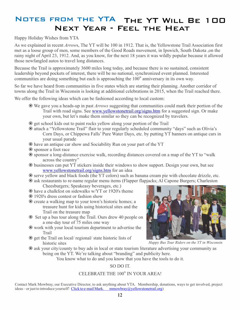
Set up a bus tour along the Trail. Ours drew 40 people on a one-day tour of 75 miles one way
work with your local tourism department to advertise the Trail
et the Trail on local/ regional/ state historic lists of historic sites
ask your city/county to buy ads in local or state tourism literature advertising your community as being on the YT. We’re talking about “branding” and publicity here.
You know what to do and you know that you have the tools to do it.
SO DO IT. th
CELEBRATE THE 100 IN YOUR AREA!
ž
ž ž
ž ž sponsor ž sponsor a long-distance exercise walk, recording distances covered on a map of the YT to “walk
across the country”ž
ž ž
ž ž ž
ž
ž
ž g
ž
www.yellowstonetrail.org/signs.htm
www.yellowstonetrail.org/signs.htm
The YT Will Be 100 Next Year - Feel the Heat
Happy Bus Tour Riders on the YT in Wisconsin