2009 priority development plans - adlc.us
TRANSCRIPT

2009 PRIORITY DEVELOPMENT
PLANS

ADLC Superfund Priority Development Program ApplicationsCurrent as of: September 23, 2008
PDP # Application Date Property Owner Location Contact Person Type of Project Development Funding Timing Special Considerations
Current Remedy Status
Acres
1 22-Sep-08 Gateway Christian Fellowship East Yards Phillip Masters Church + Rec Area Self-funded
Cleanup to occur prior to and/or concurrent with development beginning in 2009
Need additional pre-environmental and geotech sampling (ground penetrating radar?)
Existing temporary remedy 7.29
2 22-Sep-08 Francis & Jodie ShermanHighway 1 (w of Town Pump) Francis Sherman
Commercial Development
To be determined
Cleanup prior to development
Sherman to pursue potential developers based on conceptual plan
Unremediated (AR ISWP completed) 3.18
3 22-Sep-08 ALDC A1 Site Jim DavisonResidential Development
To be determined
Cleanup prior to development
ADLC to pursue potential developers based on conceptual plan Unremediated 14.08
4 22-Sep-08 ALDC Block 3, Lot 0-4 Jim DavisonResidential Development
To be determined
Cleanup prior to development
ADLC to pursue potential developers based on conceptual plan
Existing 6" cover 14.03
5 22-Sep-08 ALDC C1 Site Jim DavisonHotel or seasonal housing
To be determined
Cleanup prior to development
ADLC to pursue potential developers based on conceptual plan
Existing 6" cover 7.28
6 22-Sep-08 Anaconda-Deer Lodge County East Yards Becky GuayRecreational Development
To be determined
Cleanup prior to development
responsible party and operation and maintenance funds
Existing temporary remedy 48.00

Anaconda-Deer Lodge County Superfund Priority Development Program Property Development Plan No. 1
Page 1 of 2
Subject Property Information Owner: Assembly of God Church Contact Info: Phillip Masters Gateway Christian Fellowship
PO Box 1117 Anaconda, MT 59711-1117 406-563-3534 [email protected]
Geocode: 30128502402110000 Address: East Yards (street unnamed) Map: See Attachment 1 Current Cleanup Status
Property has not been remediated. No sampling data available from Atlantic Richfield. ADLC sampled property in November 2006 with results showing arsenic was
greater than 250 ppm in the 0-2 inch range, and below 2 inches concentrations of arsenic as high as 2,081 ppm were observed together with high concentrations of lead (1,770 ppm).
This property has been identified as potentially containing buried waste that may or may not be Superfund applicable.
Covenants, Conditions and Restrictions
Attribute Description Assembly of
God IND_USE Industrial use restriction No COM_USE Commercial use restriction No RES_USE Residential use restriction Yes RECREATION Recreational use restriction No GRAZING Grazing restricted No GEN_WELL General well restriction Yes POT_WELL Potable well restriction Yes PUBLIC_ACC Public access restriction No MIN_MAT_PR Mineral/Hazardous Material Ban Yes HAZMAT Hazardous materials restriction Yes IRRIGATION Irrigation restriction Yes UNLINED_PO Unlined Pond/Container Restrictions Yes TI_ZONE Technical Impractibility Zone No NO_REM_INT ? Yes OWN_PROP_M Owner property maintenance Yes OWN_O_M Owner operation and maintenance Yes OWN_WEEDCN Owner weed control No

Anaconda-Deer Lodge County Superfund Priority Development Program Property Development Plan No. 1
Page 2 of 2
OWN_FENCE_ Owner fencing required Yes FUTURE_DVL Future development restriction Yes OWN_ADD_RE Owner additional remediation required Yes
OWN_BEST_M Owner best management practices required No
AGREEMENT AR agreement with owner No EASEMENT AR easement with owner No REV_INTERE AR reversionary interest No WILDLIFEMG wildlife management No PROP_BENEF ? Yes RESTRICTIO Does the property have restrictions Yes BOOK Deed Book 109 PAGE Deed Page 15
See also Real Property Conveyance/Transfer Agreement, 1994 (Attachment 2).
Development Proposal
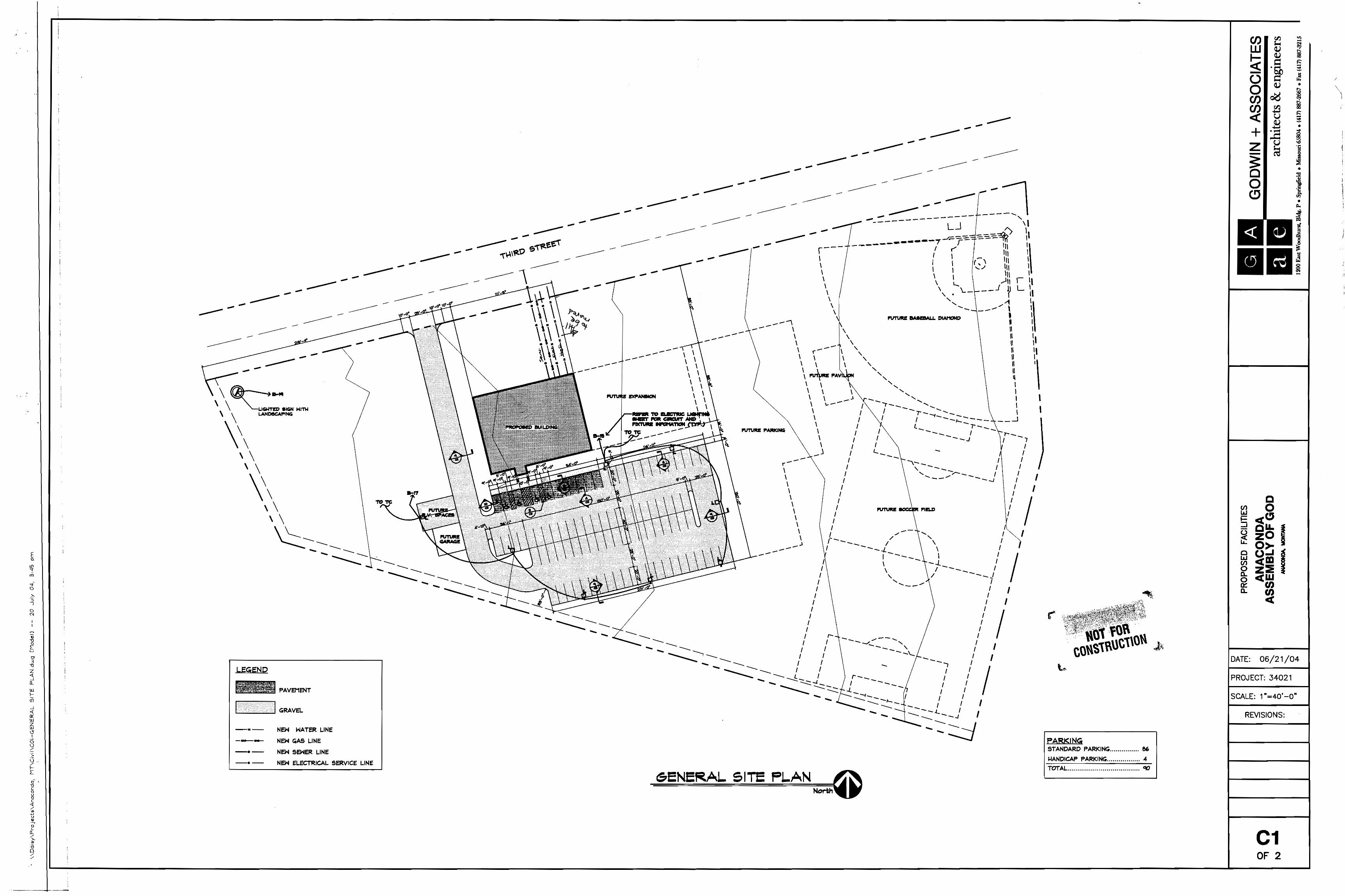
The Owners propose to construct a new church on the property. The attached drawings show the proposed plan for the building, parking lot and associated facilities together with information on the foundations. (See Attachment 3) As proposed, the parking lot and building would be consistent with the required Superfund remedy for residential/commercial land use and an 18 inch clean cover would be required in all other areas. The owner proposes to conduct development concurrent with or following cleanup activities. The owner could begin development activities in early summer 2009.
The owner has requested that the property be remedied consistent with residential land use levels. The owner has also requested that assistance be provided by EPA and ADLC to cleanup any non-Superfund waste identified on the site by seeking EPA Brownfields Program assistance and/or other assistance as may be appropriate.
Recommendation
The County Planning Department has reviewed and recommends this proposal and it has been endorsed as a priority development property by the ADLC County Commission. In accordance with the county’s Interim Institutional Controls Program, it is recommended that additional soils characterization be performed prior to design of a remedial and/or institutional controls work plan. The sampling should consist of additional sub-surface soils samples to a depth of 18 inches and deeper where waste might be disturbed as a result of development.

ATTACHMENT 1:
MAP

------
ACRES ~ 330.84
30-1285-01-3-04-01-0000
ANACONDA-DEER LODGE COUNTY
ACRES ~ 103.91
30-1285-02-4-02-11-0000ASSEMBLY OF GOD OF ANACONDA MT
ACRES ~ 7.47
30-1285-02-4-02-04-0000GM PARTNERSHIP LLP
ACRES ~ 4.18
30-1285-02-4-02-16-0000ANACONDA-DEER LODGE COUNTY
ACRES ~ 4.4
30-1285-01-3-04-03-0000
ANACONDA-DEER LODGE COUNTY
ACRES ~ 18.6
30-1285-02-4-02-07-0000ANACONDA-DEER LODGE COUNTYACRES ~ 3.38
30-1285-02-4-02-02-0000
GUHLKE DAVID R
ACRES ~ 1.73
30-1285-11-1-01-03-0000ARCO ENVIRONMENTAL REMEDIATIONACRES ~ 635.77
30-1285-02-4-01-01-0000
STATE OF MONTANA DEPT F W & P
ACRES ~ 1.97
30-1
285 -
02-4
-02 -
01-0
000
AN
DE
RS
ON
SY
LVIA
LA
CR
ES
~ 1
30-1285-02-4-02-05-0000ANACONDA-DEER LODGE COUNTY
ACRES ~ 3.08
30-1285-01-3-04-02-0000ANACONDA-DEER LODGE COUNTY
ACRES ~ 6.7
30-1285-02-4-01-02-0000ARCO ENVIRONMENTAL REMEDIATION
ACRES ~ 7.81
30-1285-02-4-01-06-0000PUCCINELLI TONY & SANDRA L
ACRES ~ 1.04
30-1285-02-4-01-04-0000PUCCINELLI TONY E & SANDRA L
ACRES ~ 1.33
30-1285-02-4-01-03-0000ANACONDA ARROW PROPERTIES LLC
ACRES ~ 1.44
30-1285-02-4-02-03-0000PUCCINELLI TONY & SANDRA L
ACRES ~ 0.67
30-1285-02-4-01-05-0000PUCCINELLI TONY & SANDRA L
ACRES ~ 0.66
30-1285-02-4-03-02-0000ANACONDA COPPER CITY BOWL INC
ACRES ~ 1.68
30-1285-02-4-03-04-0000HEBERT DAVID & CHRISTINA
ACRES ~ 0.41
E 4TH ST
E PARK AVE
UNK 155
UNK 153
MT HIGHWAY 1
0 110 220 330 44055
Feet ³
LegendOWNERSHIP
Ownership Boundary
SUBJECT PROPERTY
Restrictive Covenant Properties
AS BUILTSREMEDY DEPTH
0
2
6
18
REMEDY STATUS GE 250STATUS
ISWP DELIVERED
LANDOWNER RESPONSIBLE FOR RA
PHASE 1 COMPLETE - NEED PHASE 2
PHASE 1 COMPLETE - NO ACTION
SCHEDULED 2006 REMEDIATION
REMEDY STATUS LT 250STATUS
ISWP DELIVERED
PHASE 1 COMPLETE - NO ACTION
SCHEDULED 2006 REMEDIATION
SURVEYED
ASSEMBLY OF GODSUPERFUND EXHIBIT
Printed: 11.05.08
NOTE: Acreage is approximate.

ATTACHMENT 2:
REAL PROPERTY CONVEYANCE/
TRANSFER AGREEMENT

\e .
)
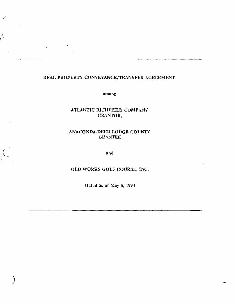
REAL PROPERTY CONVEYANCE/TRANSFER AGREEMEr.'T
among
ATLANTIC RICHFIELD COMPANY GRANTOR,
ANACONDA-DEER LODGE COUNTY GRANTEE
and
OLD WORKS GOLF COURSE, INC.
Dated as of May 5, 1994
..

)
ARTICLE VII RESTRICfIVE COVENANTS AND DEVELOPMENT PERMIT SYSTEM
7.1 General. In order to comply with, and ensure consistency with, the OW /EADA Remedy, ADL and all future owners of the Properties must be subject to certain limitations/prohibitions of certain activities or uses on or of the Properties. ARCO and ADL hereby agree that certain restrictions must be placed on the Properties in order to prevent any direct or indirect action which interferes with, is inconsistent with, hinders, delays, diminishes, or frustrates the implementation, effectiveness, purposes, integrity, or O&M of the OW /EADA Remedy, or any Remedial Action required under Applicable Law or by any federal, state or local governmental entity, or any other actions that ARCO deems necessary or advisable to address Environmental Conditions on or related to the Properties. Each of the restrictive covenants and obligations set forth in this Article VII is and shall be a covenant running with the land, binding on ADL and all ADL's successors in interest to the Properties, including any subsequent owners that acquire an interest in the Properties. As such, each restrictive covenant set forth herein which applies to a Property shall be specifically set forth in the Quitclaim Deed conveying that Property from ARCO to ADL, in any subsequent deed or other form of transfer or conveyance of any interest in the Property from ADL to any successors, inclUding without limitation all subsequen\ owners of the Property, and in all subsequent deeds or other forms of transfer or conveyance of any interest in the Property from any of ADL'S successors to any subsequent persons or entities acquiring any interest in the Property, including without limitation all subsequent owners of the Property. Each restrictive covenant set forth herein shall be enforceable to the fullest extent permitted by Montana law. If for any reason, any of the restrictive covenants set forth herein fail to meet the technical, legal requirements of restrictive covenants under Montana law, such standards shall remain fully enforceable between the Parties hereto under the terms and conditions of this Agreement.
7:2 . Restrictive Covenants. The following restrictive covenant is applicable to all of the Properties: ADL and its Successors in Interest and Assigns, including without limitation all subsequent owner(s) and/or developers (whether or not they are owners) of the Properties or any portion thereof ("Owner"), shall not take, authorize or allow any direct or indirect action which interferes with, is inconsistent with, hinders, delays, diminishes, or frustrates the implementation, effectiveness, purposes, integrity, or O&M of the OW /EADA Remedy, or any Remedial Action required under Applicable Law or by any federal, state or local governmental entity, or any other actions that ARCO deems necessary or advisable to address Environmental Conditions on or related to the Properties.
1lle following restrictive covenants are applicable to each of the Properties:
26 -

)
condition and repair and shall not interfere with their . operation, as described more specifically in the O&M Plans.
e. East Anaconda Yards ParceL
(1) Water Well Ban;
(2) The Owner of any interest in the Parcel shall maintain the Parcel in accordance with, and in a manner consistent with, the requirements of the OW /EADA Remedy, including the O&M requirements of such remedy, as described more specifically in the O&M Plans;
(3) Residential development shall be prohibited; J
(4) Unlined Pond/Container Restrictions;
(5) Any fencing erected by ARCO in accordance with the requirements of the OW /EADA Remedy shall be maintained by Owner in good condition and repair as described more specifically in the O&M Plans;
(6) Owner shall maintain all caps and drainage control structures installed by ARCO or its agents on this Parcel in good condition and repair and shall not interfere with their operation, as described more specifically in the O&M Plans;
(7) Owner shall be solely responsible for any additional remediation which may be necessary to accommodate Future Development. Any such remediation must be undertaken in accordance with, and in a manner consistcnt with, the requirements of the OW /EADA Remedy, the Development Permit System, Environmental Laws, and other Applica:ble Laws;
(8)
(9)
Mineral Development Ban;
Parcel may be used only for Commercial or Light Industrial development and those Open Space uses associated with Benny Goodman Park;
33

(10) Hazardous Material Ban except for the Light Industrial area5 shown on Exhibit Z; and
(11) Irrigation of the Parcel only shall be permitted in the Light Industrial area5 of the Parcel shown on the map attached hereto a5 Exhibit Z. Such irrigation only shall be permitted so long a5 the irrigation (i) is permitted by the OW /EADA Remedy, (ii) is in compliance with the O&M Plans set forth on Exhibit A, and (iii) does not exacerbate the existing Environmental Conditions on the Parcel.
f. Drag Strip Parcel.
(1) The Owner of any interest in the Parcel shall maintain the Parcel in accordance with, and in a manner consistent with, the requirements of the OW /EADA Remedy, including the O&M requirements of such remedy, as described more specifically in the O&M Plans;
(2) Potable Water Well Ban;
(3) Unlined Pond/Container Restriction;
(4) Residential development shall be prohibited;
(5) Owner shall be solely responsible for any additional remediation which may be necessary to accommodate future Development. Any such remediation ITIllst be undertaken in accordance with, and in a manner cOllsistent with, the requirements of the OW /EADA Remedy, the Development Permit System, Environmental Laws, and other Applicable Laws;
(6) Mineral Development Ban; and
(7) Hazardous Material Ban.
g. Mill Creek Parcel.
(I) The Owner of any interest ill the Parcel shall maintain the (',Ircel in accordance With, amI in a Illanlln consistent with, the
34 .'

ATTACHMENT 3:
SITE PLAN


Anaconda-Deer Lodge County Superfund Priority Development Program Property Development Plan No. 2
Page 1 of 2
Subject Property Information Owner: Francis and Jodie Scherman Contact Info: All Seasons Self Storage, LLC P.O. Box 1158 Anaconda, MT 59711-1158 (406) 560-1941 [email protected] Geocode: 30128502411030000 Address: Old Works/East Anaconda Industrial Area Wells Parcel Map: See Attachment 1 Current Cleanup Status
Property has not been remediated. Sampling performed by Atlantic Richfield and Landowner Remedial Action
Work Plan completed November 30, 2001 (see Attachment 2). Atlantic Richfield proposes to remove visual waste related to old railroad bed
and remove upper 2” soils where contaminated to greater than 500 ppm arsenic.
Sampling results indicate significant waste at depth on the site would be left in place.
This property has been identified as potentially containing buried waste that may or may not be Superfund applicable.
Covenants, Conditions and Restrictions
See Remedial Action Work Plan completed August 30, 2002 (Attachment 3) See Grant Deed (Attachment 4).
Development Proposal
The Owners propose to construct a commercial development on the property or sell the property to others for development. The owner proposes to consider development or sale following cleanup activities. The owner could begin development activities in early summer 2009 if property were previously remediated.
The owner has requested that the property be remedied consistent with residential/commercial land use levels. The owner has also requested that assistance be provided by EPA and ADLC to cleanup any non-Superfund waste identified on the site by seeking EPA Brownfields Program assistance and/or other assistance as may be appropriate.
Recommendation
The County Planning Department has reviewed and recommends this proposal and it has been endorsed as a priority development property by the ADLC

Anaconda-Deer Lodge County Superfund Priority Development Program Property Development Plan No. 2
Page 2 of 2
County Commission. In accordance with the county’s Interim Institutional Controls Program, it is recommended that additional soils characterization be performed prior to design of a remedial and/or institutional controls work plan. The sampling should consist of additional sub-surface soils samples to a depth of 18 inches and deeper where waste might be disturbed as a result of development.

ATTACHMENT 1:
MAP

------
ACRES ~ 330.84
30-1285-01-3-04-01-0000ANACONDA-DEER LODGE COUNTY
ACRES ~ 103.91
30-1285-01-3-02-01-0000TOWN PUMP INC
ACRES ~ 6.28
30-1285-02-4-11-04-0000ANACONDA LOCAL DEVELOPMENT COR
ACRES ~ 9.97
30-1285-02-4-11-01-0000STATE OF MONTANA
ACRES ~ 5.39
30-1285-02-4-11-02-0000STATE OF MONTANA
ACRES ~ 3.51
30-1285-02-4-11-03-0000SCHERMAN FRANCIS
ACRES ~ 3.18
30-1
285-
01-3
-03-
03-0
000
MC
DO
WEL
L H
AR
OLD
DEA
NA
CR
ES ~
2.5
8
30-1285-02-4-06-14-0000ANACONDA LOCAL DEVELOPMENT CORACRES ~ 1.99
30-1
285-
02-4
-07-
07-0
000
A W
A R
E IN
CA
CR
ES ~
1.5
1
30-1285-01-2-01-01-0000SZOMBATHY BEATRICE
ACRES ~ 4.88
30-1285-01-3-03-01-0000KITTLESON MICHAEL J & KERRY L
ACRES ~ 1.11
30-1285-02-1-01-02-0000ANACONDA LOCAL DEVELOPMENT COR
ACRES ~ 10.63
30-1285-02-4-08-02-0000PUCCINELLI RAYMOND J
ACRES ~ 1.58
30-1285-02-4-02-05-0000ANACONDA-DEER LODGE COUNTY
ACRES ~ 3.08
30-1285-02-4-02-07-0000ANACONDA-DEER LODGE COUNTY
ACRES ~ 3.38
30-1285-01-3-02-02-0000TOWN PUMP INC
ACRES ~ 0.21
UN
K 7
4
MT HIGHWAY 1POLK
ST
DRIVEWAY
UNK 75
MT HIGHWAY 1
0 75 150 225 30037.5
Feet ³
LegendOWNERSHIP
Ownership Boundary
SUBJECT PROPERTY
Restrictive Covenant Properties
AS BUILTSREMEDY DEPTH
0
2
6
18
REMEDY STATUS GE 250STATUS
ISWP DELIVERED
LANDOWNER RESPONSIBLE FOR RA
PHASE 1 COMPLETE - NEED PHASE 2
PHASE 1 COMPLETE - NO ACTION
SCHEDULED 2006 REMEDIATION
REMEDY STATUS LT 250STATUS
ISWP DELIVERED
PHASE 1 COMPLETE - NO ACTION
SCHEDULED 2006 REMEDIATION
SURVEYED
Printed: 11.05.08
FRANCIS SCHERMANSUPERFUND DATA
NOTE: Acreage is approximate.

ATTACHMENT 2:
OLD WORKS – INDUSTRIAL
AREA REMEDIAL ACTION WORK PLAN / FINAL DESIGN REPORT
NOVEMBER 30, 2001


ATTACHMENT 3:
OLD WORKS – INDUSTRIAL
AREA REMEDIAL ACTION WORK PLAN / FINAL DESIGN REPORT
AUGUST 30, 2002


ATTACHMENT 4:
GRANT DEED

,',
t:j;: .. , ... 1 ,.,
.. :: .
.;,"~.v,ft; '-'.: . .;:. '
:~t~~:f':\~J'" , ,
''. '
.)
""'ff~', 1
JI:O 'I'; '" ~1~:!!. ~~:t:,~~
d.,y ('{ Hov('!r.J,;.", '''11 ... ';' .rut beu,,'t"ttn TnI-:
A.~A~Nti;-~f~·~-~V ~~"~I~l~::~r:~'corl~~,At H)nf;:: q~~(~"1/ ~l\d .'n"~., s:~!rIiYj(. i;,ii~ ... ~ .. t' "(rl,,.'.~d .. ~~~'~ .. ,,;;i~d •. ,,;'nt'no.
- '. " "1-:: . ' .. 'ft.'""':>'"
'fluH. thu Gr(\nlor. itt £;'on.i,l~rltt.l~l'l,ot lhe til",,, r,! ;'tW , ' .. " 0011 .. , 1$1.001. to it In hhnd now I'Ald by~:ihtt (~t:tnt(>Af M,d
:'<::.OJ\.~_~y\,,~U\ too. t ha ;"'>. -~.';. '.' ~;,..: .:'
:(o.t.v~.r I 611 or - ,.~
in A:f'ld"tt, thf' thJrt~cn only ot thfl fOllO""n\IJ ... ·d¢·tt(~rih,.(1 PT'np1'O,Y
111ttUltO in U1(' ('ounty ot t'l~Qt I.D,-lqv, St.lfO nf HOfltttn4. tH
.,Lt, \'" - 'i."./':;; I _ ..-
.,:.~:-'.<':' . A lrAC,t.',et l.(\nd ~:dt.u"tod in ... , pQrtion of the 't8oulh"ut .1/4 oC S"ction 'l'>Io III •• "r.the South"" .. 1/0
''',''01' S"dtn", OM tl). 'rd\lnRhl\l'Pour (4). N6~,th. ""nq" £1';110" Ill! West. Hqllt.anft Principal &ridilln belM If'!>''''
,;'(Q~r~,+-~,! 10 ",1\1 ;d".er fJ!,!d!II~;f ~HCiw~ :,jj;;,'1:,,, ,.", ~::1\~'~~: ~~~:;' ~. ". :;'f,,\-,',I:; ,:~~.~:~'.;'M~ :";',,:, \I~~~,:~,~,~:.',.~~~.);,~l_ ... -£ . ,\1 "
"',·:(';"(~j>;;B<iQi",,~;ii''l',ftt :,tli."S~u't1ii!i'~,tllot'itI't:JOf th" tt:a .... tl " ",""It.r .. indollcr!bed .... hlcl1','pof,lit".Ia,ft !>OInt on th .. "lorth
crly riqht-Or .. wny lind ,o( u"S'.-,II!(.'jhway lO .. }\. And nitle) beinr.l th(! Southt.\.ltst cornor of, tt)f~ MontAnA NtH itm(\ I Gu.nrd 'tr<l<:t. (rom which pOint. th.~ N~.t 1/4 CClrf\Ot' ()f SOction. 2. "1'.4 N., R.lt<W'f'.M.f'.M., boArtl North l1J· ~O· 44" W""6t. 411J.cn (out, thonc~. (nlfll fI,,101 P<'lrH o! bO(finhitl'J. Iflt. Course, alOng the !·',,-.t bounrl:it\' of ~ni'" Nat-101I"l Outh"ti 'l'rnct, Nor-lh 04:- 2f1t W'toAt, 4!lO.l)O !('c~tJ thOflCC, 2!,d, Cournc, 1l1on~. tho. Routhorly ilduhd.try o( tho k.J\ .• iIl.I\. JtAdicLStcltion~'t'rac.t,' South 4.- 43' Enat, ,
, H9.0a' t""ti t:.!1'H''''',Jrd'Colii:s ... , oloI\9' ... ld $outh.,rly, ' bo(;ndaty lIor.th' 85'\')17 ·~~~.t:.";~~OO~'6i;<,f,,.,t to the, "ort..!lw"at coo<n". ot the'!(cnnollllY,."l'nct'I" then':,. {:4th coun~.' a.long the WCllft· boundary or" -tlald ~(tt\ne"tlY 'tt"Aet, ~iO\tt,h 04- 2J' .~AAt, 191). 30 h~ut to A polnt on .<'lid Not"Uw-rly t:i.ght of Wlly lino At Hlqh\rfny Statton 12S • 9S~ a (' •. mc('ot(~
".rl~ht-ot .. \oi';y m3rxor; thcflcn, Sth Courao-, "hUH1 lAid ~i'1ht-ot-wIlY. South8S· Q(,' weSt. H4. {"at to tit" point of be'11nninq and 3.182 "''lio,;,'
;,:< , :. ", .." "~
ol,,<:or\\Ie:~lIn~ ;tr.
~
"
r'V Co,,)
-:2 iJj

'. :;. .
<'.: . \ ,.'.
,".
, i f
, , .,.
,,'.-
, .... .~.
\.11-(\(\ tho p.'lf'ty h~r",to .'tfHl hl. rCRl)q,elIVc.·.u.ee .... lJt"l
(lxr;CutOr" .. 1dmLnl_tt'tltarfJ (t~,r •• ~lf1~.i "~~:)~::;~-. 1. Tit'" th<) l<:>l .h"·::~ 1,;':\i~4t"':~:>th"
. .:: ~', , ::'i;'~~,'.~.: .':-y, .;<':'. ". ,'f~/~~'t:> llf survey to I>~ t ilod .~l'h~'" c:oul\.~y ,,"l.i .. ~~nd
'. . • • . ,.n,',_
\o(tll not h«' (un.hot' "ltarftd wlthOUt,~ Apl)rt'V~rj-. ". -;'~"
~.~ .That the ,lot ~h41l,:,b&.u."'lf<)t A'lOe"ll" ";"~';'(fd
'l"v.;to~ .. <'nl, that ~inq ItI"r:~W"d in ~~~~"~~ion 12. <~.i.~,1 .. ;-!. 3', ThAt t·' ... "lndlvlduAl .... ut'/: .• y.tci ..... nl conolot v_."
dr II h!t! ",.11 to
AccQrdDnC~ wi.th
4';"1111",,,,. dilpth at 25 (""t, can.tructod In::,: U: .. "rltorlli.'eotablhhOtl t~:HAC 162.14H'lif:
:, '-c'.\".'
th:~Alth lmd l::f\Vltontn(mt.11 ~cle:nQesJ .' ,
Th.~ the :ll\dtv!dll~~~.,.i"~,9" dlsp6"Ii,l,.YAtom w{l:-{;/'; . . .. . " .. ~ ,
, ::
COtnilH of d Rcptic t.4nk and."::alibft:Urfact.\ dCAi.hfl(11d tlf fluch' . , .
• 1." and deftCrlpttonG~ "'11'C~;'ml'iy''''1,.h ~~Ir··J.od~" C.:>"nty· ".~.' " .:, ..... ,',~~,~.;.:, ., •... -". ·:.:;;-,>l;::.~.·,·· ,-'" ..... "
Soptl~'$yat"m Rogulatlons :1Ui4·/UlC 16-i,14UO)-&HHo, ". '.:,," ... '
5.
tour teet .above tho w~tt\r tablo1
'6. Th" .. no ... ,,;'go diap<lJlai eyol",. .halt b .. Mnatrucied
"'ithin 100 r""t or tho mdxlmum hlq/ .. '''t<'r lev". of .. lQO )'t!4,t \:';~ .. ,....... .. , .. ~;?)j;;'>.;." : >1"\
, 10<><1 ,:~.f .. anyat.te"'!\1 : lake, . ;"uorcour._e., . ~:;;trl;J.9"1;.i"l\ ,<\~:~cl\ •. '",,;.i,;" ·:,~{~f;!;,\.c.,.." '" "">":'-~l:"' ~:':<\:Aj'~:,·>, .: ~:<.' «, .. ~.!t(~1~;,:-..'· <','; : ',;~,;~~?~,.>:,
norwl,thin 100 Ceet,oC any;'domosUc wfttor"l-!/pjily Boure:,,..'" . , , ,'-' , " ':;:",'" " ::"~' .
7. 'I'Mt ","tor supply and """'4'1" (I\spoaal .. yn""'~ Will
b*:' locct«:,d IHl fthown on tho .,pprov~d p1:'1na:
. , ~,' "!
.~',~ . ,,', :,.~: "~ ',,-
tv W .. • ~!
.:..J I • a
• -Ji'

"" ;,"
, , "
~> " ':'-'~ ., :,:.: '.;. ,",
".'-
... ;
r.. Thllt .,If\tla tor t.h .... ),prQI'o • .,d ~ .... t,.~,~ And ifU):. ... t,.tult.i . . \,~<'!:;,./.: "., -',
.""A'Z<I .yo t ",.. ..til bot r .. vl /l~d and,' .1'f!raV~" by lit.. 0.. .. r , /. ' •• " " •• ' \ .,,;-; .. <
LQ<\qoCOunty na41lh ""I>arl'.l!la",t b<>tcirfr 'IiI>natrll"tl"n I>
- '. ," .... -: .. ~.' proVid4', ~h('t t~urch!\ .. ~r of 9.,
prll,!t"rty with., copy of lhQ: t'tutlfjeAl., ot ~\lt'V(t\·f I.·Wf"'n..,,,d .. ".>;:".
<:opy of th l A u()~u. .. ncnt i , ". <"
HI, . ,:(,"
'that lrlAtrum6nt. o~, tr.,not",r" !OL:"h1. t'rnt>,·rt y , .; ~i;. . - ~ :_,
11. That CirlliHtor 1ntantla th.,t Wh"lCV~;r .~~)(>r().aC'}Wf\ froln
IHqh"a~", 10-11 to"Ob Id do.cri~d property. I f:i,iity. sh.'! 1
rarnaln In t)C!cct. ..:,,> ... :", . ~::;~~j1-~~·;< , i.t It ~~;;~lod'P,~"H{,,~lly ~~~~~.,t~\It .. 'Grant';.
t.hot'~i,ld \>rd;~i~y.n;'l1 iwI~~"d r~;;it~:·lJtif~;.;d I,url''''.''' >"~'. ;.::: i '"l/::' . ",:.,.,- .. ,:"; ',::'t;,·,r·; ,
thol> of balnq An auto..o.bi I """ .. al ..... ,,lp 'or ~i't~rn"tlv" bud"" •• ,
and tho prol'"rty .h>ll not bei, ':'\lbdi";irl~d,
'thoro 18, h~",ovor', rOBorV~d and CXCt"pt.tt'" from thll1
COl\v:eY4ncc u"to th(! Grantor, '~tlJ 6U':Ctt,UJOrd and A1utl(Jn~f all
Wa tor, 1Ii.1tcfe and Wolter r J <,tht. l rom ~1Io I;'"m ~t)r 1':'9~l Creek or
tiny Of ita tri.bu~Arlo8 helonq'~i'9 to or llf'pUr~onAnt: to t.ho
",bovo-d&scr ibcd ," pr~mlscB. or' Any part thereof t or tuu:f!to(Oro
used upon SAid pramiocA, or Any part thot:"(\of.
[t is furtho:t' undtft'lttood I\nd llqrood (hAt, lUi .:l c(lven4nt "
runnlnq with the land and aft. d part of' the conaidotntion fot, ~">:.~': '! •• ~~~ "'
the 011,1 .. Ilnd tr4n.Cor of, .. 115 pr"",;." •• tho "Grlllnto", Its
,,,":,"/,:,;~:~.\mi!li'U:~!";~:l:~~~':~:~;'~~~::~·:~:~ii;;;'~1lr~tr~~ml~~~ti::t"~r. i"~~"· rodll.<:t.lon

",,..j'
": ; "
,!, _ ~, A!
. -:;' ,j" I,'
;
:.: i '" . ~ ,
~;(l\,;\ !
n:,{,·' ~A. Pi?',' "'I " "'-C',' i~<:;/l ;'--
' .. :.', '
- ;.' ; ':. uny nt.hln' '"~.1\U .... hAt-aGOval". :~t\ht'lel&:od wlth it. 11'1\ 11 tfl'J Of'
.t"AtIltln., n$'nrltt,10f' ••• nd,t,,"~ Or;1J,t~,., hl. hoir. "n~l " •• tqOfl
do)."rohy ,,,leu,, An~ .t~f",~~"r:JhCh.nl .. ,.ni1 hol~ hac .. l .... , . ,t:> '. :;.: :ii,' "., ' , _ ' . " " ': th,,· O~ .. ntur. iLo .U"o/: •• ~9':'''.~(\ .... 19n.,:,offl,,0 .. , .'Iente
<, ,,:. y' ' .' '~:,\~.·i~~::,>. . , A~(t' (ulplnyo,,-., tram-an,f' ab~:.ll dat"ul<l" •• ",4 cl&l",. or '.
d~~90' lo Any ftnd: .li.;';;~;~~.~c!. pr{\l"'i.~1~')l1tU.lo4:C/", . til ... bo" .. pco;,.l .... ~~d ~~1:.i~9 ~\lt, of it~:u IInq •• ,,~~l ;,,'.1
: , '-,_~'~.i;-!i, "',:':~::' ....... ,.", ,~" . 'ot:, Ot".f. OPCH·l\tlon·~,_::-,~,";~n~.~ii·"':J;' , ~j~~;:~::~~;;;;;:!<~~" .~~,~~r.~::~.~~.<'.;J ';, Itx15fiM-lIiO llNO R£SIIRliiNG;" hov .. "" c • ' (r"", thl. eOI\\I,;yl;n".
all or~., m(ltAla antI 'Jft'~nQr'ai~,·t of any nAt::~'~ 'Wt\4t.Ot't~~~';' ~.< , ;'; "'- ;,;/,,~~~~~'~k~': .': , :j:·r;w".!<: .' '-;::,:L
Inciuibil9 9'" "n~.".o,U, al!d,:.o.~.>::: J\y4~o-c4t~~,.;lIub.t .. nce,'" i 7.,:, , '"'''1·,··'f.:~ " :~''?,: '::l':.}~.:,t;,£,:·~~";t7:~.};X! ,; ~ · ... -:dF~: ":':, 'l-;~~;;:~~::r
u!>,Or';!!' and under .aid ~l,M~~;';!'ithU).,;~li1ht t.o pro'I~Ct."AiId explore tor And to mine. ',It>>Ctract:, and rome-vO t.hf! "J\nu~.
t"'1"thor "ith toa ua" of l.UCh, of th".lIrtace ..... IftAY 1>0 :., ". .'.-...~,U,' ~.;~,.!~1-,t>; _"'" " ".r ,~:_,,:: -r;;, ,J '
""c. .... ry ("II' p .. o.pCC'tJ. ... 9":.nd "XPlor1h~, (01';. end .. (IIlng or , ,
othor",istl QxtrAr:t Inq lind aa~~Ylnq Away the')~alft. t prov.tdod,'·
however, thll t . th.. crantoi'i;.ii~Atl PIlI,i, to;~4i.~i~Antn. thO: '" . i~" ",' . , :,,\ .. ',)· ... -,:::,~~j.J.~;r .. ' ~ .. :,,' \.:~!i~:"t~Rf::.',:'" , , ':, toaanliable ",,,rkat V41"."4t.it.ho, tim .... u';!)':ilort.la"a of j,,h,, ..
"'"',:p~:,,;>~::,,-',,:''''' " ,-, '--::', -,::' - "'. eurtn.cc may bo raqu'1rad, arfd' lUI tho ."rno'may be ,roquired, of
·au.,h. portion. of th ..... urCace· at aAid pre .. i .......... y be: U.8"d , "~';:, :: .
,~ I' .. ' " ~,
~ci W 1--.. -
; ,

: .
1..
';:,'
~:. ~ " "'". '
, ;1.,;.,
yO"~:1'77. bbt',(o:· .... ".-..
1'\·.,\Cn~Hl;\ COr1f'''t-."l f thf) COrporA'ttOn: th~t tnc~~utfld. Ul'" wlt..hArt. t"u~' I, ..
""'nt And ""kn(\"le~'q"'f t.a 1M th~~ .~~di.co<PM"t·l"n " ... "ut"Q~i .... '" ,,~ . " :; ': . '
iN WIT!U;/lll wm:ItI!Ol", '1 h ........ h.r"ilnto lot Illy !Inuit Imel ,\ (( I ",,<I I.Y No~A.'d.u ;80a}" 'th .. IIAY 'And. yn,\r 11\ th '" ""rtHic ... till:,f,tr.~:"ab()V(> W'l!lttCin; . .,' ~ .' .
'. "
'.
. .'~.
., ... ,
. ),.; .
.,
1'0) W
• ., .,

Anaconda-Deer Lodge County Superfund Priority Development Program Property Development Plan No. 3
Page 1 of 2
Subject Property Information Owner: Anaconda Local Development Corporation Contact Info: Jim Davison
118 East Seventh St. Anaconda, MT 59711 (406) 563-5538 Fax: (406) 563-3275 [email protected]
Geocode: 30128502206020000 30128502206010000
Address: A1 Property, Map: See Attachment 1 Current Cleanup Status
Property has not been remediated. No sampling data available from Atlantic Richfield. ADLC sampled property in November 2006 with results showing arsenic was
greater than 250 ppm in the 0-12 inch range and concentrations of metals at depths of up to 18 inch or deeper suggest significant buried waste exists at this site.
This property has been identified as potentially containing buried waste that may or may not be Superfund applicable.
Covenants, Conditions and Restrictions
Attribute Description A-1 IND_USE Industrial use restriction No COM_USE Commercial use restriction No RES_USE Residential use restriction No RECREATION Recreational use restriction No GRAZING Grazing restricted No GEN_WELL General well restriction Yes POT_WELL Potable well restriction Yes PUBLIC_ACC Public access restriction No MIN_MAT_PR Mineral/Hazardous Material Ban Yes HAZMAT Hazardous materials restriction Yes IRRIGATION Irrigation restriction No UNLINED_PO Unlined Pond/Container Restrictions Yes TI_ZONE Technical Impractibility Zone No NO_REM_INT ? Yes OWN_PROP_M Owner property maintenance Yes OWN_O_M Owner operation and maintenance Yes OWN_WEEDCN Owner weed control No

Anaconda-Deer Lodge County Superfund Priority Development Program Property Development Plan No. 3
Page 2 of 2
OWN_FENCE_ Owner fencing required No FUTURE_DVL Future development restriction Yes OWN_ADD_RE Owner additional remediation required Yes
OWN_BEST_M Owner best management practices required No
AGREEMENT AR agreement with owner Yes EASEMENT AR easement with owner No REV_INTERE AR reversionary interest No WILDLIFEMG wildlife management No PROP_BENEF ? Yes RESTRICTIO Does the property have restrictions Yes BOOK Deed Book 135 PAGE Deed Page 210
See also Real Property Conveyance/Transfer Agreement, 1994 (Attachment 2).
Development Proposal
The Owners propose to construct a residential development on the property. The owner proposes to conduct development concurrent with or following cleanup activities. The owner will undertake conceptual design activities in November 2008 and provide when available. The owner could begin development activities in early summer 2009.
The owner has requested that the property be remedied consistent with residential land use levels. The owner has also requested that assistance be provided by EPA and ADLC to cleanup any non-Superfund waste identified on the site by seeking EPA Brownfields Program assistance and/or other assistance as may be appropriate.
Recommendation
The County Planning Department has reviewed and recommends this proposal and it has been endorsed as a priority development property by the ADLC County Commission. In accordance with the county’s Interim Institutional Controls Program, it is recommended that additional soils characterization be performed prior to design of a remedial and/or institutional controls work plan. The sampling should consist of additional sub-surface soils samples to a depth of 18 inches and deeper where waste might be disturbed as a result of development.

ATTACHMENT 1:
MAP

------
ACRES ~ 330.84
30-1285-02-2-06-02-0000ANACONDA LOCAL DEVELOPMENT COR
ACRES ~ 9.1
30-1285-02-1-01-01-0000ANACONDA-DEER LODGE COUNTY
ACRES ~ 285.79
30-1285-02-2-06-01-0000ANACONDA LOCAL DEVELOPMENT COR
ACRES ~ 4.03
30-1285-02-3-40-03-0000
GUNDERSON ROBBIE J
ACRES ~ 2.48
30-1285-03-1-27-01-0000HOUSING AUTHORITY OF ANA
ACRES ~ 7.45
30-1285-03-1-19-08-L001BGM EQUIPMENT COMPANY INCACRES ~ 0.98
30-1285-02-3-40-05-0000GUNDERSON ROBBIE JACRES ~ 0.69
30-1285-02-2-04-10-0000DALKE DAVID D
ACRES ~ 0.29
30-1285-02-2-04-04-0000DALKE LLC
ACRES ~ 0.16
30-1285-02-2-04-06-0000DALKE LLC
ACRES ~ 0.16
30-1285-02-2-04-07-0000DALKE LLC
ACRES ~ 0.15
30-1285-02-2-04-02-0000CFP ENTERPRISES LLC
ACRES ~ 0.15
30-1285-02-2-04-01-0000JOHNSON ROY W
ACRES ~ 0.1530-1285-02-3-35-03-0000CARROLL ALBERTA J
ACRES ~ 0.16
30-1285-03-1-18-22-0000DOBBINS JAMES R & HENRIETTA F
ACRES ~ 0.15
30-1285-02-3-35-09-0000CAVANAUGH ROBERT J
ACRES ~ 0.0830-1285-02-3-35-02-0000
HARGUS DARLENEACRES ~ 0.08
30-1285-02-3-35-13-0000BIZJAK DONNA M
ACRES ~ 0.06
AS = 74 ppm
AS = 74 ppm
AS = 102 ppmAS = 76 ppm
AS = 172.46 ppm
AS = 64 ppm
AS = 61 ppm
AS = 62 ppm
AS = 115.1 ppm
AS = 67.79 ppmAS = 194.1 ppm
AS = 153.66 ppm
AS = 69 ppm
AS = 125.57 ppm
AS = 162.45 ppm
AS = 210.89 ppm
AS = 160.22 ppm
AS = 189.76 ppm
AS = 189.3 ppm
AS = 124.51 ppm
AS = 201.97 ppm
AS = 178.19 ppm
AS = 175.77 ppm
AS = 187.26 ppm
AS = 132.84 ppm
AS = 214.42 ppm
AS = 194.83 ppm
AS = 195.17 ppm
PIZZINI WAY
GOOSE TOWN RD
PAU
LIN
E D
R
BIRCH ST
E FRONT ST
AS = 74.9 pp
AS = 111.34 ppmAS = 157.35 ppm
0 70 140 210 28035
Feet ³
LegendOWNERSHIP
Ownership Boundary
SUBJECT PROPERTY
Restrictive Covenant Properties
AS BUILTSREMEDY DEPTH
0
2
6
18
REMEDY STATUS GE 250STATUS
ISWP DELIVERED
LANDOWNER RESPONSIBLE FOR RA
PHASE 1 COMPLETE - NEED PHASE 2
PHASE 1 COMPLETE - NO ACTION
SCHEDULED 2006 REMEDIATION
REMEDY STATUS LT 250STATUS
ISWP DELIVERED
PHASE 1 COMPLETE - NO ACTION
SCHEDULED 2006 REMEDIATION
SURVEYED
Printed: 11.06.08
A-1 PROPERTYSUPERFUND DATA
NOTE: Acreage is approximate.

ATTACHMENT 2:
REAL PROPERTY CONVEYANCE/
TRANSFER AGREEMENT

( i \,
)
REAL PROPERTY CONVEYANCE/TRANSFER AGREEMEr.'T
among
ATlANTIC RICHFIELD COMPANY GRANTOR,
ANACONDA·DEER LODGE COUNIY GRANTEE
and
OLD WORKS GOLF COURSE, INC.
Tlatcd as o( May 5, 1994

)
ARTICLE VII RESTRICfIVE COVENANTS AND DEVELOPMENT PERMIT SYSTEM
7.1 General. In order to comply with, and ensure consistency with, the OW /EADA Remedy, ADL and all future owners of the Properties must be subject to certain limitations/prohibitioll5 of certain activities or uses on or of the Properties. ARCO and ADL hereby agree that certain restrictions must be placed on the Properties in order to prevent any direct or indirect action which interferes with, is inconsistent with, hinders, delays, diminishes, or frustrates the implementation, effectiveness, purposes, integrity, or O&M of the OW /EADA Remedy, or any Remedial Action required under Applicable Law or by any federal, state or local governmental entity, or any other actions that ARCO deefllS necessary or advisable to address Environmental Conditioll5 on or related to the Properties. Each of the restrictive covenants and obligations set forth in this Article VII is and shall be a covenant running with the land, binding on ADL and all ADL's successors in interest to the Properties, including any subsequent owners that acquire an interest in the Properties. As such, each restrictive covenant set forth herein which applies to a Property shall be specifically set forth in the Quitclaim Deed conveying that Property from ARCO to ADL, in any subsequent deed or other form of transfer or conveyance of any interest in the Property from ADL to any successors, inclUding without limitation all subsequen\ owners of the Property, and in all subsequent deeds or other forms of transfer or conveyance of any interest in the Property from any of ADL'S successors to any subsequent persons or entities acquiring any interest in the Property, including without limitation all subsequent owners of the Property. Each restrictive covenant set forth herein shall be enforceable to the fullest extent permitted by Montana law. If for any reason, any of the restrictive covenants set forth herein fail to meet the technical, legal requirements of restrictive covenants under Montana law, such standards shall remain fully enforceable between the Parties hereto under the tenns and conditions of this Agreement.
7:2 . Restrictive Covenants. The following restrictive covenant is applicable to all of the Properties: ADL and its Successors in Interest and Assigns, including without limitation all subsequent owner(s) and/or developers (whether or not they are owners) of the Properties or any portion thereof ("Owner"), shall not take, authorize or allow any direct or indirect action which interferes with, is inconsistent with, hinders, delays, diminishes, or frustrates the implementation, effectiveness, purposes, integrity, or O&M of the OW /EADA Remedy, or any Remedial Action required under Applicable Law or by any federal, state or local governmental entity, or any other actions that ARCO deems necessary or advisable to address Environmental Conditions on or related to the Properties.
1lle following restrictive covenants are applicable to each of the Properties:
26 -

requircmenls of such remedy, as described more specifically in the O&M Plans; and
(2) Owner shall be solely responsible for any additional remediation which may be necessary 10 accommodate Future Development. Any such remediatiOIl musl be undertaken in accordance with, and in a manner consistent with, the requiremenl~ of the OW /EADA Remedy, the Development Permit System, Environmental Laws, and olher Applicable Laws.
I. Lumber Yard Parcel.
(I) The Owner of any inlerest in thc Parcel shall maintain the Parcel in accordance' with, and in a manner consistent with, the requirements of the OW /EADA Remedy, including thc O&M rcquirements of such remeuy, as described more specifically in the O&M Plans;
(2) Water Well Ban;
(3) Unlined Pond/Container Re~lrictions;
(4) Owner shall be solely responsible for any additional remediation which may be necessary to accommodate Future Development. Any such remediation must be undertaken in accordance with, and in a manner cOl15islent with, the requiremenls of the OW /EADA Remedy, the Development Permit System, Environmental Laws. and other Applicable Laws;
(5) Mineral Develupment Ban; and
(6) lbza rdous Material Ban.
7_> IncQIPoration or Final Standards. This Agreement shall incorporate and be governed by all final Performance Standards and Institutional Controls provided for in the OW /EADA Remedy. including withuut limitation the Development Permit System. and any activities implemented or maintained 0[1 the Properties shaH be implemented or 1l1ainlained ill accordance with such Performance Standards and Institutional Controls.
36

Anaconda-Deer Lodge County Superfund Priority Development Program Property Development Plan No. 4
Page 1 of 2
Subject Property Information Owner: Anaconda Local Development Corporation Contact Info: Jim Davison
118 East Seventh St. Anaconda, MT 59711 (406) 563-5538 Fax: (406) 563-3275 [email protected]
Geocode: 30128502406080000 30128502406110000
30128502406120000 30128502406130000 30128502406140000
Address: Block 3, Lots 1, 2, Railroad Loading & Unloading Yard, 3A, and 5, Deer Lodge Drive and Polk St
Map: See Attachment 1 Current Cleanup Status
Existing 6” remedial cover suitable for industrial land use. This property has been identified as potentially containing buried waste that
may or may not be Superfund applicable. Covenants, Conditions and Restrictions
None Development Proposal
The Owners propose to construct a residential development on the property. The owner proposes to conduct development concurrent with or following cleanup activities. The owner will undertake conceptual design activities in November 2008 and provide when available. The owner could begin development activities in early summer 2009.
The owner has requested that the property be remedied consistent with residential land use levels. The owner has also requested that assistance be provided by EPA and ADLC to cleanup any non-Superfund waste identified on the site by seeking EPA Brownfields Program assistance and/or other assistance as may be appropriate.
Recommendation
The County Planning Department has reviewed and recommends this proposal and it has been endorsed as a priority development property by the ADLC County Commission. In accordance with the county’s Interim Institutional Controls Program, it is recommended that additional soils characterization be

Anaconda-Deer Lodge County Superfund Priority Development Program Property Development Plan No. 4
Page 2 of 2
performed prior to design of a remedial and/or institutional controls work plan. The sampling should consist of additional sub-surface soils samples to a depth of 18 inches and deeper where waste might be disturbed as a result of development.

ATTACHMENT 1:
MAP

30-1285-02-1-01-01-0000ANACONDA-DEER LODGE COUNTY
ACRES ~ 285.79
30-1
285-
02-4
-08-
01-0
000
PUC
CIN
ELL
I RAY
MO
ND
J J
RAC
RE
S ~
3.9
9
30-1285-02-4-06-13-0000ANACONDA LOCAL DEVELOPMENT COR
ACRES ~ 4.71
30-1285-02-4-06-11-0000ANACONDA LOCAL DEVELOPMENT COR
ACRES ~ 4.15
30-1285-02-4-11-02-0000STATE OF MONTANA
ACRES ~ 3.51
30-1285-02-4-08-03-0000
PUCCINELLI RAYMOND J
ACRES ~ 1.8
30-1285-02-4-08-02-0000PUCCINELLI RAYMOND J
ACRES ~ 1.58
30-1285-02-4-06-10-0000ANACONDA-DEER LODGE COUNTY
ACRES ~ 2.07
30-1285-02-4-06-14-0000ANACONDA LOCAL DEVELOPMENT COR
ACRES ~ 1.99
30-1
285-
02-4
-06-
09-0
000
AN
AC
ON
DA
-DE
ER
LO
DG
E C
OU
NTY
AC
RE
S ~
17.
11
30-1
285-
02-1
-01-
02-0
000
AN
AC
ON
DA
LOC
AL
DE
VE
LOP
ME
NT
CO
RA
CR
ES
~ 1
0.63
30-1
285-
02-4
-11-
04-0
000
AN
AC
ON
DA
LOC
AL
DE
VE
LOP
ME
NT
CO
RA
CR
ES
~ 9
.97
------
ACRES ~ 330.84
30-1285-02-4-06-12-0000ANACONDA LOCAL DEVELOPMENT COR
ACRES ~ 1.55
30-1285-02-4-06-08-0000ANACONDA LOCAL DEVELOPMENT COR
ACRES ~ 1.03
30-1285-02-4-06-07-0000ANACONDA LOCAL DEVELOPMENT COR
ACRES ~ 0.5
30-1285-02-4-06-06-0000ANACONDA LOCAL DEVELOPMENT COR
ACRES ~ 0.5
30-1285-02-4-06-05-0000ANACONDA LOCAL DEVELOPMENT COR
ACRES ~ 0.49
30-1285-02-4-06-04-0000ANACONDA LOCAL DEVELOPMENT COR
ACRES ~ 0.59
POLK
ST
DEER LODGE DR
0 80 160 240 32040
Feet ³
LegendOWNERSHIP
Ownership Boundary
SUBJECT PROPERTY
Restrictive Covenant Properties
AS BUILTSREMEDY DEPTH
0
2
6
18
REMEDY STATUS GE 250STATUS
ISWP DELIVERED
LANDOWNER RESPONSIBLE FOR RA
PHASE 1 COMPLETE - NEED PHASE 2
PHASE 1 COMPLETE - NO ACTION
SCHEDULED 2006 REMEDIATION
REMEDY STATUS LT 250STATUS
ISWP DELIVERED
PHASE 1 COMPLETE - NO ACTION
SCHEDULED 2006 REMEDIATION
SURVEYED
BLOCK 3 LOTS 1-5SUPERFUND EXHIBIT
Printed: 11.06.08
NOTE: Acreage is approximate.
LOT 1
LOT 2
RAILROAD LOADING &UNLOADING YARD
LOT 3A
LOT 1

Anaconda-Deer Lodge County Superfund Priority Development Program Property Development Plan No. 5
Page 1 of 2
Subject Property Information Owner: Anaconda Local Development Corporation Contact Info: Jim Davison
118 East Seventh St. Anaconda, MT 59711 (406) 563-5538 Fax: (406) 563-3275 [email protected]
Geocode: 30128502101020000 Address: C1 Property (street unnamed) Map: See Attachment 1 Current Cleanup Status
Existing 6” remedial cover suitable for industrial land use. This property has been identified as potentially containing buried waste that
may or may not be Superfund applicable. Covenants, Conditions and Restrictions
Attribute Description C-1 IND_USE Industrial use restriction No COM_USE Commercial use restriction No RES_USE Residential use restriction Yes RECREATION Recreational use restriction No GRAZING Grazing restricted No GEN_WELL General well restriction Yes POT_WELL Potable well restriction Yes PUBLIC_ACC Public access restriction No MIN_MAT_PR Mineral/Hazardous Material Ban Yes HAZMAT Hazardous materials restriction Yes IRRIGATION Irrigation restriction No UNLINED_PO Unlined Pond/Container Restrictions Yes TI_ZONE Technical Impractibility Zone No NO_REM_INT ? Yes OWN_PROP_M Owner property maintenance Yes OWN_O_M Owner operation and maintenance Yes OWN_WEEDCN Owner weed control No OWN_FENCE_ Owner fencing required No FUTURE_DVL Future development restriction Yes OWN_ADD_RE Owner additional remediation required Yes OWN_BEST_M Owner best management practices required No

Anaconda-Deer Lodge County Superfund Priority Development Program Property Development Plan No. 5
Page 2 of 2
AGREEMENT AR agreement with owner Yes EASEMENT AR easement with owner No REV_INTERE AR reversionary interest No WILDLIFEMG wildlife management No PROP_BENEF ? Yes RESTRICTIO Does the property have restrictions Yes BOOK Deed Book 136 PAGE Deed Page 620
See also Real Property Conveyance/Transfer Agreement, 1994 (Attachment 2).
Development Proposal
The Owners propose to construct a hotel or seasonal development on the property. The owner proposes to conduct development concurrent with or following cleanup activities. The owner will undertake conceptual design activities in November 2008 and provide when available. The owner could begin development activities in early summer 2009.
The owner has requested that the property be remedied consistent with residential land use levels. The owner has also requested that assistance be provided by EPA and ADLC to cleanup any non-Superfund waste identified on the site by seeking EPA Brownfields Program assistance and/or other assistance as may be appropriate.
Recommendation
The County Planning Department has reviewed and recommends this proposal and it has been endorsed as a priority development property by the ADLC County Commission. In accordance with the county’s Interim Institutional Controls Program, it is recommended that additional soils characterization be performed prior to design of a remedial and/or institutional controls work plan. The sampling should consist of additional sub-surface soils samples to a depth of 18 inches and deeper where waste might be disturbed as a result of development.

ATTACHMENT 1:
MAP

30-1285-02-1-01-01-0000ANACONDA-DEER LODGE COUNTY
ACRES ~ 285.7930-1285-01-1-03-01-0000
ANACONDA-DEER LODGE COUNTYACRES ~ 199.84
30-1285-02-1-01-02-0000ANACONDA LOCAL DEVELOPMENT COR
ACRES ~ 10.63
30-1285-02-4-11-04-0000ANACONDA LOCAL DEVELOPMENT COR
ACRES ~ 9.97
30-1285-01-3-02-01-0000TOWN PUMP INC
ACRES ~ 6.28
30-1285-01-2-01-01-0000S
ZOM
BATH
Y BE
ATRIC
EA
CR
ES
~ 4.88
30-1285-02-4-11-02-0000STATE OF MONTANA
ACRES ~ 3.51
30-1285-02-4-11-01-0000STATE OF MONTANA
ACRES ~ 5.39 30-1
285-
01-3
-03-
02-0
000
STO
KA
N M
ICH
AE
L T
AC
RE
S ~
3.5
9
30-1
285-
02-4
-06-
13-0
000
ANAC
ON
DA
LOC
AL
DEV
ELO
PMEN
T C
OR
ACR
ES ~
4.7
1
30-1
285-
01-2
-01-
02-0
000
YAN
KE
RO
NA
LD C
FA
MIL
Y TR
US
TA
CR
ES
~ 4
.39
30-1
285-
01-3
-03-
03-0
000
MC
DO
WE
LL H
AR
OLD
DE
AN
AC
RE
S ~
2.5
8
------
ACRES ~ 330.84
30-1285-02-4-06-14-0000ANACONDA LOCAL DEVELOPMENT COR
ACRES ~ 1.99
30-1285-02-4-11-03-0000SCHERMAN FRANCIS
ACRES ~ 3.18
30-1285-02-4-06-12-0000ANACONDA LOCAL DEVELOPMENT COR
ACRES ~ 1.55
30-1285-02-4-07-07-0000A W A R E INCACRES ~ 1.51
30-1285-02-4-08-02-0000PUCCINELLI RAYMOND J
ACRES ~ 1.58
30-1285-01-3-02-02-0000TOWN PUMP INC
ACRES ~ 0.21
UN
K 7
4POLK
ST
UNK 75
DRIVEWAY
0 125 250 375 50062.5
Feet ³
LegendOWNERSHIP
Ownership Boundary
SUBJECT PROPERTY
Restrictive Covenant Properties
AS BUILTSREMEDY DEPTH
0
2
6
18
REMEDY STATUS GE 250STATUS
ISWP DELIVERED
LANDOWNER RESPONSIBLE FOR RA
PHASE 1 COMPLETE - NEED PHASE 2
PHASE 1 COMPLETE - NO ACTION
SCHEDULED 2006 REMEDIATION
REMEDY STATUS LT 250STATUS
ISWP DELIVERED
PHASE 1 COMPLETE - NO ACTION
SCHEDULED 2006 REMEDIATION
SURVEYED
C-1SUPERFUND EXHIBIT
Printed: 11.06.08
NOTE: Acreage is approximate.

ATTACHMENT 2:
REAL PROPERTY CONVEYANCE/
TRANSFER AGREEMENT
( i \,
)
REAL PROPERTY CONVEYANCE/TRANSFER AGREEMEr.'T
among
ATlANTIC RICHFIELD COMPANY GRANTOR,
ANACONDA·DEER LODGE COUNIY GRANTEE
and
OLD WORKS GOLF COURSE, INC.
Tlatcd as o( May 5, 1994

)
ARTICLE VII RESTRICfIVE COVENANTS AND DEVELOPMENT PERMIT SYSTEM
7.1 General. In order to comply with, and ensure consistency with, the OW /EADA Remedy, ADL and all future owners of the Properties must be subject to certain limitations/prohibitioll5 of certain activities or uses on or of the Properties. ARCO and ADL hereby agree that certain restrictions must be placed on the Properties in order to prevent any direct or indirect action which interferes with, is inconsistent with, hinders, delays, diminishes, or frustrates the implementation, effectiveness, purposes, integrity, or O&M of the OW /EADA Remedy, or any Remedial Action required under Applicable Law or by any federal, state or local governmental entity, or any other actions that ARCO deefllS necessary or advisable to address Environmental Conditioll5 on or related to the Properties. Each of the restrictive covenants and obligations set forth in this Article VII is and shall be a covenant running with the land, binding on ADL and all ADL's successors in interest to the Properties, including any subsequent owners that acquire an interest in the Properties. As such, each restrictive covenant set forth herein which applies to a Property shall be specifically set forth in the Quitclaim Deed conveying that Property from ARCO to ADL, in any subsequent deed or other form of transfer or conveyance of any interest in the Property from ADL to any successors, inclUding without limitation all subsequen\ owners of the Property, and in all subsequent deeds or other forms of transfer or conveyance of any interest in the Property from any of ADL'S successors to any subsequent persons or entities acquiring any interest in the Property, including without limitation all subsequent owners of the Property. Each restrictive covenant set forth herein shall be enforceable to the fullest extent permitted by Montana law. If for any reason, any of the restrictive covenants set forth herein fail to meet the technical, legal requirements of restrictive covenants under Montana law, such standards shall remain fully enforceable between the Parties hereto under the tenns and conditions of this Agreement.
7:2 . Restrictive Covenants. The following restrictive covenant is applicable to all of the Properties: ADL and its Successors in Interest and Assigns, including without limitation all subsequent owner(s) and/or developers (whether or not they are owners) of the Properties or any portion thereof ("Owner"), shall not take, authorize or allow any direct or indirect action which interferes with, is inconsistent with, hinders, delays, diminishes, or frustrates the implementation, effectiveness, purposes, integrity, or O&M of the OW /EADA Remedy, or any Remedial Action required under Applicable Law or by any federal, state or local governmental entity, or any other actions that ARCO deems necessary or advisable to address Environmental Conditions on or related to the Properties.
1lle following restrictive covenants are applicable to each of the Properties:
26 -

{ ( "
( )
(9) , Owner shall not encumber all or any portion of the Parcel without the prior written consent of AReo, which consent may be withheld with or without cause;
(10) Owner shall not convey this Parcel to anyone other than a "Qualified Transferee" as such term is defined in Section 18.2.c. hereof;
(11) Residential development shall be prohibited; V
(12) Unlined Pond/Container Restrictions;
(13) Mineral Development Ban;
(14) Hazardous Material nan;
(15) Any and all irrigation of those portions of the Parcel other than the Golf Course (as shown on the map attached hereto as Exhibit V) shall be prohibited. Irrigation of the Golf Course only shall be permitted so long as such irrigation (i) is permitted by the OW /EADA Remedy, (ii) is in compliance with the O&M plan set forth on Exhibit A, and (iii) does not exacerbate the existing Environmental Conditions on the Parcel;
(16) The Old Works Historic Trail System (as shown on the map attached hereto as Exhibit W) shall be maintained by Owner in good condition and repair in accordance with the OW /EADA Remedy and as outlined in the O&M Plans; and
(17) Access to structures along the Old Works Himnic Trail System including but not limited to historic flues and fouodations, shall be prohibited.
c. BallfieldsllndllsHial Park Parcel.
(1) Water Well llan;
(2) 11le Owner of any inlerest in the Parcel shall maintain the Parcel In accordance with the requirements of the OW /EADA
30 -

{e )
)
Remedy, including the O&M requirements of such remedy, as described more specifically in the 0& M Plans;
(3) Owner shall maintain the cap and ballfields in good condition and repair in accordance with the OW /EADA Remedy and as described more specifically in Exhibit A;
(4) Residential development shall be prohibited; V
(5) Owner shall be solely responsible for any additional remediation which may be necessary to accommodate Future Development. Any such remediation must be undertaken in accordance with, and in a manner consistent with, the requirements of the OW /EADA Remedy, the ADL Development Permit System, Environmental Laws and other Applicable Laws;
(6)
(7)
(8)
Unlined Pond/Container Restrictions;
Mineral Development Ban;
Irrigation of the Parcel only shall be permitted in the areas of the Parcel shown on the map attached hereto as Exhibit X. Such irrigation of the Parcel only shall be permitted so long as the irrigation (i) is pennitted by the OW /EADA Remedy, (ii) is in compliance with the O&M Plans set forth on Exhibit A, and (iii) does not exacerbate the existing Environmental Conditions on the Parcel;
(9) Parcel may be used for recreational uses in conjunction witll the anticipated golf course, the existing ball fields and trails, and development for Commercial, Industrial or Light Industrial purposes;
(10)
(1\)
Hazardous Material Ban; and
Owner shall maintain all caps and drainage control structures installed by ARCO or its agen15 on this Parcel in good condition and repair and shall not interfere with their operalion, as described more specifically in the 0& M Plans.
31

Anaconda-Deer Lodge County Superfund Priority Development Program Property Development Plan No. 6
Page 1 of 2
Subject Property Information Owner: Anaconda Deer Lodge County Contact Info: Becky Guay Geocode: 30128501304010000 Address: East Yards Map: See Attachment 1 Current Cleanup Status
Existing remedial cover suitable for industrial land use. ADLC sampled property in November 2006 with results showing arsenic was
greater than 250 ppm in the 0-12 inch range and concentrations of metals at depths of up to 18 inch or deeper suggest significant buried waste exists at this site.
This property has been identified as potentially containing buried waste that may or may not be Superfund applicable.
Covenants, Conditions and Restrictions
Attribute Description
East Anaconda
Yards IND_USE Industrial use restriction No COM_USE Commercial use restriction No RES_USE Residential use restriction Yes RECREATION Recreational use restriction No GRAZING Grazing restricted No GEN_WELL General well restriction Yes POT_WELL Potable well restriction Yes PUBLIC_ACC Public access restriction No MIN_MAT_PR Mineral/Hazardous Material Ban Yes HAZMAT Hazardous materials restriction Yes IRRIGATION Irrigation restriction Yes UNLINED_PO Unlined Pond/Container Restrictions Yes TI_ZONE Technical Impractibility Zone No NO_REM_INT ? Yes OWN_PROP_M Owner property maintenance Yes OWN_O_M Owner operation and maintenance Yes OWN_WEEDCN Owner weed control No OWN_FENCE_ Owner fencing required Yes FUTURE_DVL Future development restriction Yes OWN_ADD_RE Owner additional remediation required Yes

Anaconda-Deer Lodge County Superfund Priority Development Program Property Development Plan No. 6
Page 2 of 2
OWN_BEST_M Owner best management practices required No AGREEMENT AR agreement with owner No EASEMENT AR easement with owner No REV_INTERE AR reversionary interest No WILDLIFEMG wildlife management No PROP_BENEF ? Yes RESTRICTIO Does the property have restrictions Yes BOOK Deed Book 109 PAGE Deed Page 15
See also Real Property Conveyance/Transfer Agreement, 1994 (Attachment 2).
Development Proposal
The Owners propose to construct a recreational and community amenity development on the property. The owner proposes to conduct development concurrent with or following cleanup activities. The owner has undertaken conceptual design plans as part of the East Anaconda Superfund ReUse Plan. The owner could begin development activities in early summer 2009.
The owner has requested that the property be remedied consistent with residential land use levels. The owner has also requested that assistance be provided by EPA and ADLC to cleanup any non-Superfund waste identified on the site by seeking EPA Brownfields Program assistance and/or other assistance as may be appropriate.
Recommendation
The County Planning Department has reviewed and recommends this proposal and it has been endorsed as a priority development property by the ADLC County Commission. In accordance with the county’s Interim Institutional Controls Program, it is recommended that additional soils characterization be performed prior to design of a remedial and/or institutional controls work plan. The sampling should consist of additional sub-surface soils samples to a depth of 18 inches and deeper where waste might be disturbed as a result of development.

ATTACHMENT 1:
MAP

30-1285-01-3-04-01-0000ANACONDA-DEER LODGE COUNTY
ACRES ~ 103.91
------
ACRES ~ 330.84
30-1
285-
01-4
-01-
01-0
000
AR
CO
EN
VIR
ON
MEN
TAL
REM
EDIA
TIO
N
AC
RES
~ 1
52.5
30-1285-01-3-04-03-0000
ANACONDA-DEER LODGE COUNTY
ACRES ~ 18.6
30-1285-11-1-01-03-0000ARCO ENVIRONMENTAL REMEDIATION
ACRES ~ 635.77
30-1285-01-1-03-01-0000ANACONDA-DEER LODGE COUNTY
ACRES ~ 199.84
30-1285-01-3-02-01-0000TOWN PUMP INCACRES ~ 6.28
30-1285-02-4-11-01-0000
STATE OF MONTANA
ACRES ~ 5.39
30-1285-12-1-01-01-0000ARCO ENVIRONMENTAL REMEDIATION
ACRES ~ 584.13
30-1285-01-3-04-02-0000ANACONDA-DEER LODGE COUNTY
ACRES ~ 6.7
30-1285-02-4-11-03-0000SCHERMAN FRANCIS
ACRES ~ 3.18
30-1285-01-3-03-02-0000STOKAN MICHAEL T
ACRES ~ 3.59
30-1285-02-4-02-07-0000ANACONDA-DEER LODGE COUNTY
ACRES ~ 3.38
30-1285-01-3-03-01-0000KITTLESON MICHAEL J & KERRY L
ACRES ~ 1.11
30-1285-02-4-02-05-0000ANACONDA-DEER LODGE COUNTY
ACRES ~ 3.08
AS = 244.13 ppm
0 160 320 480 64080
Feet ³
LegendOwnership Boundary
SUBJECT PROPERTY
Restrictive Covenant Properties
AS BUILTSREMEDY DEPTH
0
2
6
18
REMEDY STATUS GE 250STATUS
ISWP DELIVERED
LANDOWNER RESPONSIBLE FOR RA
PHASE 1 COMPLETE - NEED PHASE 2
PHASE 1 COMPLETE - NO ACTION
SCHEDULED 2006 REMEDIATION
REMEDY STATUS LT 250STATUS
ISWP DELIVERED
PHASE 1 COMPLETE - NO ACTION
SCHEDULED 2006 REMEDIATION
SURVEYED
Printed: 10.13.08
EAST ANACONDA YARDSSUPERFUND DATA
DEVELOPMENT ACRES ~ 48

ATTACHMENT 2:
REAL PROPERTY CONVEYANCE/
TRANSFER AGREEMENT

( i \,
)
REAL PROPERTY CONVEYANCE/TRANSFER AGREEMEr.'T
among
ATlANTIC RICHFIELD COMPANY GRANTOR,
ANACONDA·DEER LODGE COUNIY GRANTEE
and
OLD WORKS GOLF COURSE, INC.
Tlatcd as o( May 5, 1994

)
ARTICLE VII RESTRICfIVE COVENANTS AND DEVELOPMENT PERMIT SYSTEM
7.1 General. In order to comply with, and ensure consistency with, the OW /EADA Remedy, ADL and all future owners of the Properties must be subject to certain limitations/prohibitioll5 of certain activities or uses on or of the Properties. ARCO and ADL hereby agree that certain restrictions must be placed on the Properties in order to prevent any direct or indirect action which interferes with, is inconsistent with, hinders, delays, diminishes, or frustrates the implementation, effectiveness, purposes, integrity, or O&M of the OW /EADA Remedy, or any Remedial Action required under Applicable Law or by any federal, state or local governmental entity, or any other actions that ARCO deefllS necessary or advisable to address Environmental Conditioll5 on or related to the Properties. Each of the restrictive covenants and obligations set forth in this Article VII is and shall be a covenant running with the land, binding on ADL and all ADL's successors in interest to the Properties, including any subsequent owners that acquire an interest in the Properties. As such, each restrictive covenant set forth herein which applies to a Property shall be specifically set forth in the Quitclaim Deed conveying that Property from ARCO to ADL, in any subsequent deed or other form of transfer or conveyance of any interest in the Property from ADL to any successors, inclUding without limitation all subsequen\ owners of the Property, and in all subsequent deeds or other forms of transfer or conveyance of any interest in the Property from any of ADL'S successors to any subsequent persons or entities acquiring any interest in the Property, including without limitation all subsequent owners of the Property. Each restrictive covenant set forth herein shall be enforceable to the fullest extent permitted by Montana law. If for any reason, any of the restrictive covenants set forth herein fail to meet the technical, legal requirements of restrictive covenants under Montana law, such standards shall remain fully enforceable between the Parties hereto under the tenns and conditions of this Agreement.
7:2 . Restrictive Covenants. The following restrictive covenant is applicable to all of the Properties: ADL and its Successors in Interest and Assigns, including without limitation all subsequent owner(s) and/or developers (whether or not they are owners) of the Properties or any portion thereof ("Owner"), shall not take, authorize or allow any direct or indirect action which interferes with, is inconsistent with, hinders, delays, diminishes, or frustrates the implementation, effectiveness, purposes, integrity, or O&M of the OW /EADA Remedy, or any Remedial Action required under Applicable Law or by any federal, state or local governmental entity, or any other actions that ARCO deems necessary or advisable to address Environmental Conditions on or related to the Properties.
1lle following restrictive covenants are applicable to each of the Properties:
26 -

)
condition and repair and shall not interfere with their . operation, as described more specifically in the O&M Plans.
e. East Anaconda Yards ParceL
(1) Water Well Ban;
(2) The Owner of any interest in the Parcel shall maintain the Parcel in accordance with, and in a manner consistent with, the requirements of the OW /EADA Remedy, including the O&M requirements of such remedy, as described more specifically in the O&M Plans;
(3) Residential development shaH be prohibited; J
(4) Unlined Pond/Container Restrictions;
(5) Any fencing erected by AReO in accordance with the requirements of the OW /EADA Remedy shall be maintained by Owner in good condition and repair as described more specifically in the O&M Plans;
(6) Owner shall maintain all caps and drainage control structures installed by ARCO or its agents on this Parcel in good condition and repair and shall not interfere with their operation, as describcd more specifically in the O&M Plans;
(7) Owner shall be solely responsible for any additional remediation which may be necessary to accommodate Future Development. Any such remediation must be undertaken in accordance with, and in a manner consistcnt with, the requirements of the OW /EADA Remedy, the Development Permit System, Environmental Laws, and other Applica:ble Laws;
(8)
(9)
Mineral Development Ban;
Parcel may be used only for Commercial or Light Industrial development and those Open Space uses associated with Benny Goodman Park;
33

(10) Hazardous Material Ban except for the Light Inuustrial areas shown on Exhibit Z; and
(11) Irrigation of the Parcel only shall be permitteu in the Light Inuustrial areas of the Parcel shown on the map attached hercto as Exhibit Z. Such irrigation only shaJJ be permitted so long as the irrigation (i) is permitteu by the OW /EADA Remeuy, (ii) is in compliance with the O&M Plans set forth on Exhibit A, and (iii) uoes not exacerbate the existing Environmental Conditions on the Parcel.
f. Drag Strip Parcel.
(1) The Owner of any interest in the Parcel shall maintain the Parcel in accoruance with, anu in a manner consistent with, the requirements of the OW /EADA Remeuy, incluuing the O&M requirements of such remeuy, as uescribeu more specifically in thc O&M Plans;
(2) Potable Water Well Ban;
(3) Unlineu Ponu/Container Restriction;
(4) Resiuential uevelopment shall be prohihiteu;
(5) Owner shall be solely rcsponsihle for any auuitional remediation which may be necessary to accoIl1mouatc future Development. Any such remeuiation ITIllst he undertaken in accordance with, and in a manner consistent with, the requirements of the OW /EADA Remedy, the Development Pcrmit System, Environmcntal Laws, anti other Applicablc Laws;
(6) Mineral Development Ban; anu
(7) Hazaruous Material Ban.
g. Mill Creck Parcel.
(I) The Owner of any interest in the Parcel shall maintain the I',lrcel in accordance with, and in a Illannn consistent with, the
34 .'