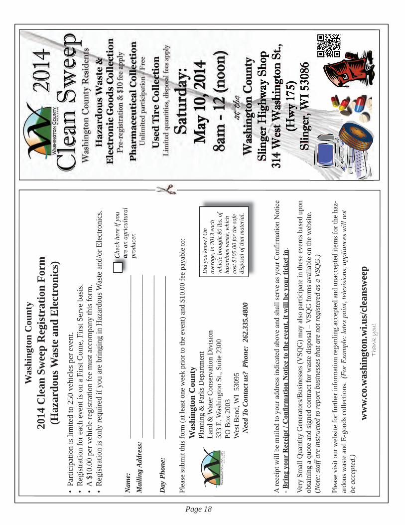
2014 spring/summer
TRANSCRIPT
WASHINGTON COUNTY PLANNING & PARKS DEPARTMENT
Volume 9 Issue #1 www.co.washington.wi.us Spring / Summer 2014
Page 1
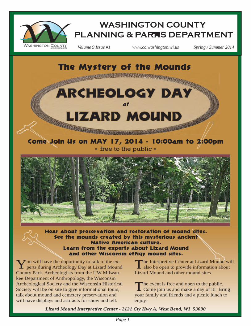
ARCHEOLOGY DAY
LIZARD MOUNDat
You will have the opportunity to talk to the ex-perts during Archeology Day at Lizard Mound
County Park. Archeologists from the UW Milwau-kee Department of Anthropology, the Wisconsin Archeological Society and the Wisconsin Historical Society will be on site to give informational tours, talk about mound and cemetery preservation and will have displays and artifacts for show and tell.
Come Join Us on MAY 17, 2014 - 10:00am to 2:00pm - free to the public -
Hear about preservation and restoration of mound sites.See the mounds created by this mysterious ancient
Native American culture.Learn from the experts about Lizard Mound
and other Wisconsin effigy mound sites.
The Interpretive Center at Lizard Mound will also be open to provide information about
Lizard Mound and other mound sites.
The event is free and open to the public.Come join us and make a day of it! Bring
your family and friends and a picnic lunch to enjoy!
Lizard Mound Interpretive Center - 2121 Cty Hwy A, West Bend, WI 53090
The Mystery of the Mounds
Page 2
Golf & Parks Division
- In This Issue - Archeology Day... 1Golf & Parks ... 2-5Planning ... 6-8GIS... 9Land Use ... 10-11USDA-NRCS ... 12Land & Water ... 13-21Kids Corner ... 22-23
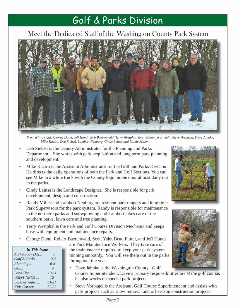
From left to right: George Dunn, Jeff Hundt, Bob Baerenwald, Terry Westphal, Beau Flitter, Scott Yahr, Steve Vorpagel, Dave Jahnke, Mike Kactro, Deb Sielski, Lambert Neuburg, Cindy Leinss and Randy Miller
• DebSielskiistheDeputyAdministratorforthePlanningandParksDepartment.Sheworkswithparkacquisitionandlongtermparkplanninganddevelopment.
• MikeKactroistheAssistantAdministratorfortheGolfandParksDivision.HedirectsthedailyoperationsofboththeParkandGolfSections.YoucanseeMikeinawhitetruckwiththeCountylogoonthedooralmostdailyoutintheparks.
• CindyLeinssistheLandscapeDesigner.Sheisresponsibleforparkdevelopment,designandconstruction.
• RandyMillerandLambertNeuburgareresidentparkrangersandlongtimeParkSupervisorsfortheparksystem.RandyisresponsibleformaintenanceinthenorthernparksandsnowplowingandLamberttakescareofthesouthernparks,lawncareandtreeplanting.
• TerryWestphalistheParkandGolfCourseDivisionMechanicandkeepsbusywithequipmentandmaintenancerepairs.
• GeorgeDunn,RobertBaerenwald,ScottYahr,BeauFlitter,andJeffHundtareParkMaintenanceWorkers.Theytakecareofthemaintenancerequiredtokeepyourparksystemrunningsmoothly.Youwillseethemoutintheparksthroughouttheyear.• DaveJahnkeistheWashingtonCountyGolfCourseSuperintendent.Dave’sprimaryresponsibilitiesareatthegolfcourse;healsoworksonspecialparkprojects.• SteveVorpagelistheAssistantGolfCourseSuperintendentandassistswithparkprojectssuchassnowremovalandoff-seasonconstructionprojects.
Meet the Dedicated Staff of the Washington County Park System
responsibilities are at the golf course;

Page 3
Golf & Parks Division
Itchingtogetoutonthelinks,enjoysomebeautifulsceneryandgetsomeexercise?
OpeningdayattheWashingtonCountyGolfCourse (WCGC) is always difficult to predict andthisyearwasnoexception.TheGolfCourseopenedonWednesday,April9th.
DidyouknowthatWashingtonCountyGolfCourseinHartford,Wisconsin
israted4½starsbyGolfDigestandisthenumberonemunicipalgolfcourseinthe
state?DesignedbyArthurHills,this18holechampionshipgolfcourse,completewitha3holepracticecourseopenedin1997andhasalargedrivingrangewithtargetgreens,afullservicegolfshopanddeli.Want to improve your golf swing or figure out why that golf ball always lands in the rough? The PGA professionalatthecoursecanhelpyouwiththat!Individualandgrouplessonsareavailableforallagesandskilllevels.Forinformationonopeningdayandfees,pleaseseeourwebsiteatwww.golfwcgc.com;forlessonsoroutingscallthegolfshopat262-670-6616oremailusatwcgc@charter.net.ForupdatesfollowWCGConFacebook.
Opening Day At Washington County Golf Course
“Next to a leisurely walk I enjoy a spin on my tandem bicycle. It is
splendid to feel the wind blowing in my face and the springy motion of my iron steed. The rapid rush through the air gives me a delicious sense of strength and buoyancy, and the exercise makes my pulse dance and my heart sing.” - Helen Keller
Eisenbahn State Trail Resurfacing
Aleisurelywalkorbikerideon2milesofnewlyresurfacedEisenbahnStateTrailnorthofBarton
willhelptoputaspringinyourstepandshakeoffthewinterdoldrums.
Page 4
Golf & Parks Division
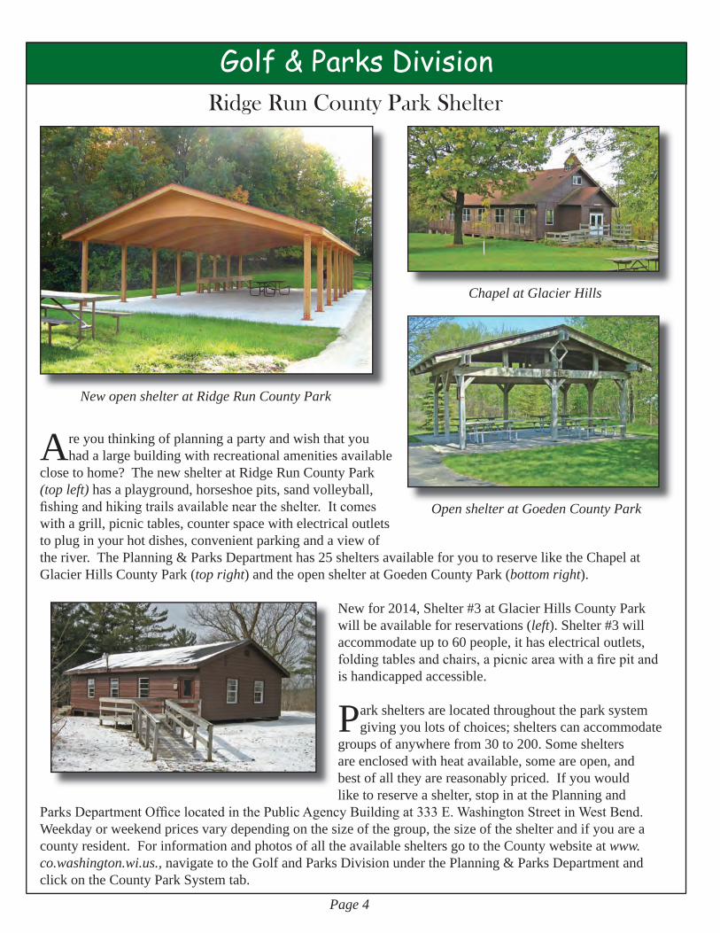
Areyouthinkingofplanningapartyandwishthatyouhadalargebuildingwithrecreationalamenitiesavailable
closetohome?ThenewshelteratRidgeRunCountyPark(top left)hasaplayground,horseshoepits,sandvolleyball,fishing and hiking trails available near the shelter. It comes withagrill,picnictables,counterspacewithelectricaloutletstopluginyourhotdishes,convenientparkingandaviewoftheriver.ThePlanning&ParksDepartmenthas25sheltersavailableforyoutoreserveliketheChapelatGlacierHillsCountyPark(top right)andtheopenshelteratGoedenCountyPark(bottom right).
Newfor2014,Shelter#3atGlacierHillsCountyParkwillbeavailableforreservations(left).Shelter#3willaccommodateupto60people,ithaselectricaloutlets,folding tables and chairs, a picnic area with a fire pit and ishandicappedaccessible.
Parksheltersarelocatedthroughouttheparksystemgivingyoulotsofchoices;shelterscanaccommodate
groupsofanywherefrom30to200.Somesheltersareenclosedwithheatavailable,someareopen,andbestofalltheyarereasonablypriced.Ifyouwouldliketoreserveashelter,stopinatthePlanningand
Parks Department Office located in the Public Agency Building at 333 E. Washington Street in West Bend. Weekdayorweekendpricesvarydependingonthesizeofthegroup,thesizeoftheshelterandifyouareacountyresident.ForinformationandphotosofalltheavailablesheltersgototheCountywebsiteatwww.co.washington.wi.us.,navigatetotheGolfandParksDivisionunderthePlanning&ParksDepartmentandclickontheCountyParkSystemtab.
Ridge Run County Park Shelter
New open shelter at Ridge Run County Park
Open shelter at Goeden County Park
Chapel at Glacier Hills

Golf & Parks Division
Paul E. MuellerPlanning&ParksDepartmentAdministrator
Retires after 33 Years
Cheerful,friendlyandhelpful.Allwordsto
describeMargaretKerrywhoretiredonOctober16th,2013after31yearsofservicetoWashingtonCounty.MargaretworkedintheRegister of Deeds Office for17yearsbeforecom-ingtothePlanningandParksDepartmentandworkinghereasaPro-gramAssistantfor14moreyears.WewishMargaretwellinherretirement,andshehasreportedtoseveralofusthatsheisenjoyingittremendously.
PaulMueller’slastdayonthe
jobwasFebruary25,2014.PaulhasservedasthePlanningandParksDepartmentAdministratorforWashingtonCountyfor33years.Mr.Muellerhasalonglistofaccomplishmentsthat have benefited
allcountyresidentsincludingthedevelopmentofourCountyParkSystemandGolfCourse.Paul’sdedication,experience,andleadershipwillbemissed.Thanksforajobwelldone!
2014 Running Events scheduled for the Washington County Parks & Eisenbahn State Trail
“If you can’t win, make the fellow ahead of you break the record.”
Fulfill your personal challenge this year; get up off the couch and train for that run you’vealwaysdreamedofdoing,thensignupforoneoftheseeventsin2014!
TheAdrenalineMarathon,includingahalfmarathonandquartermarathonarescheduledforSundayApril27,2014ontheEisenbahnTrail.TheseeventsaresponsoredbytheCouncilonAlcoholandotherDrugAbuse.Formoreinfo,seewww.adrenalineraces.orgDtourMinistriesinKewaskumissponsoringtheFleetofFeetfundraiserrelayraceonSaturday,October18,2014ontheEisenbahnStateTrail.Raceproceedswillbenefit Casa Hogar ALFA Orphanage in South America. Watch their website for moreinfoatwww.casahogaralfa.org
Races sponsored by Trail Dog Running: • Rocky’sRollercoaster5K&Seven-milerunatUWWC,RidgeRunCountyParkandtheIceAgeTrailonJune28.• WildDogDash5Kracewithdogsandowners(at least one of them has to be on a leash!)atHeritage
TrailsCountyParkonSeptember28,2014.• FestivalofColors5K&10KraceatGlacierHillsCountyParkonSaturday,October11,2014.Comeforthefallcolorsandtowatchtheracersevenifyoudon’twanttorun!
PatDanaher,co-ownerofTrailDogRunning,isalsosponsoringatrailrunningcampforkidsscheduledforJune23thruJune27atRidgeRunCountyPark.Formoreinformationonalloftheseracesandthecampgotowww.traildogrunning.com
Margaret KerryPlanning&ParksDepartment,ProgramAssistant
Retires after 31 Years
Page 5
Page 6
Planning DivisionCleaning up Local Communities
Washington County and Local Communities form Coalition to Target Federal Grant Dollars through EPA Brownfields Program
Have you noticed specific properties in your community thatmaylookrun-down,abandoned,orunsightly?Your
communityrepresentativeshave,andmanyofthesepropertiesareontheradarforimprovement.Suchpropertiesarecommonly labeled as “brownfields.” Brownfields, as defined bytheUnitedStatesEnvironmentalProtectionAgency(EPA)arerealproperty,theexpansion,redevelopment,orreuseofwhichmaybecomplicatedbythepresenceorpotentialpresenceofahazardoussubstance,pollutant,orcontaminant.Cleaningupandreinvestinginthesepropertiesprotectstheenvironment,reducesblight,andtakesdevelopmentpressuresoffgreenspacesandworkinglands.WashingtonCountyhasformedacoalitionwiththeCitiesofWestBendandHartfordandtheVillagesofJackson, Richfield and Slinger and submitted an application to the EPA for a Coalition Assessment Grant for Hazardous Substance and Petroleum Brownfieldsrequestinganamountof$600,000.
Assessmentgrants,ifawarded,willallowWashingtonCountytoestablishadetailedinventoryofredevelopmentsitesintheCounty,conductaseriesofPhase1andPhase2environmentalassessmentsandidentifyrisks,ifany,forbusinesseswantingtoinvestanddevelopthesites.Fundingwouldbeutilizedduringathree-yearprojectperiod.TheEPAisexpectedtoannouncegrantawardsinspring2014.
SiteRevitalizationSteeringCommittee(SRC)In an effort to effectively redevelop and revitalize brownfield sites throughout the County, a Site Revitalization SteeringCommittee(SRC)wasformedtoprovideinputintothegrantapplicationandimplementationplansifthegrantisawarded.TheSRCalsoselectedprioritysitesforpotentialredevelopment.
SiteSelectionInpreparingforthegrantapplication,CoalitionpartnersselectedprioritysitesbasedonthefollowingSiteSelectionCriteria:
Thepresenceofknownorsuspectedenvironmentalcontamination-threatstopublichealthTheredevelopmentpotentialandmarketabilityofthesiteCommunitygoalsandtheextenttowhichredevelopmentfurthersgoalsQualityoflifefactors(potentialtoeliminateblightandenhancecommunitylivability)Environmentaljusticeconsiderations-disproportionateimpactonsensitiveorat-riskpopulations
The initial target areas for funding are five high priority revitalization sites identified by the Coalition as part of an initial inventoryandprioritizationprocesscompletedin2013.Allofthesitesarewithintheoldestportionsofeachurbanarea,severalwithhistoric development dating to the mid-1800’s. The five sites are locatedintheCitiesofHartfordandWestBendandtheVillagesof Jackson, Richfield, and Slinger.
•••••
Formoreinformation,pleasevisit:www.co.washington.wi.us/SRP
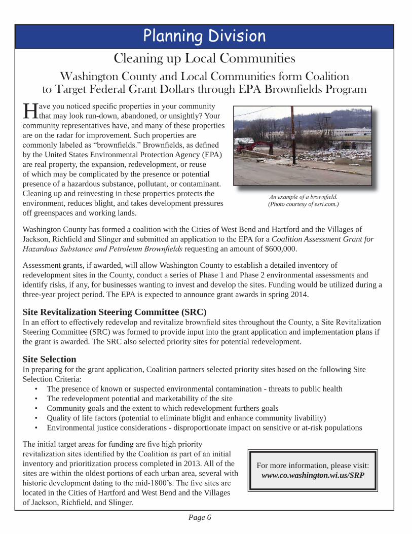
An example of a brownfield.(Photo courtesy of esri.com.)

Page 7
Planning Division
Formoreinformationregardingtheamendments,pleasevisitthePlanningDivision’swebpage:
www.co.washington.wi.us/PLN
Washington County AdoptsComprehensive Plan Amendments
Washington County has amendedits comprehensive plan.
WashingtonCountyhasamendeditscomprehensiveplan.SincebeingadoptedbytheWashington
CountyBoardofSupervisorsonApril15,2008,A Multi-Jurisdictional Comprehensive Plan for Washington County: 2035wasdueforupdates,includingchangestotheCounty’s2035LandUsePlan,aswellastheincorporationoftheCounty’snewFarmlandPreservationPlan.BothamendmentdocumentswereconsideredandadoptedbytheCountyBoardonDecember10,2013.
TownofHartfordConsidersFarmlandPreservationZoningWiththeCounty’srecentadoptionofitsupdatedFarmlandPreservationPlan,localgovernmentsthathaveadoptedfarmlandpreservationareas(FPAs)havetheopportunitytoparticipateinfarmlandpreservationprogramsoutlinedinWisconsin’sWorkingLandsInitiative(Chapter91oftheWisconsin Statutes).
TheTownsofBarton,GermantownandHartfordadoptedFPAs.LandownerswithinthesetownswithlandinFPAscanvoluntarilyparticipateintheAgriculturalEnterpriseArea(AEA)taxcreditprogramandwouldbeeligibletoclaim$5.00peracre.ThesetownscouldalsoenactfarmlandpreservationzoningwhichwouldinvolveconvertingallareasdelineatedasFPAsintoafarmlandpreservationzoningdistrict.LandownerswithinafarmlandpreservationzoningdistrictcouldvoluntarilyparticipateintheStatetaxcreditprogramgiventheirfarmoperatesincompliancewithsoilandwaterconservationstandardsasoutlinedintheWorkingLandsInitiative.Participantswouldbeeligibletoclaim$7.50peracreinafarmlandpreservationzoningdistrictand$10.00peracreifalsowithinanAEA.
TheTownofHartfordisconsideringenactingfarmlandpreservationzoningandiswelcomingpublicinputbeforemakingadecision.TheTownheldapublicinformationalmeetingonSaturday,February1,2014toinformresidentsaboutfarmlandpreservationzoningandtogaugelandownerinterestinparticipating.Townresidentsareencouraged to contact Town officials and provide input.
Tosignup,simplygoto:http://datcp.wi.gov/Environment/Working_Lands_Initiative/Newsletter/index.aspxClick on “Sign up to receive ‘Working Lands Connection’ Newsletter electronically”
Signuptoreceivethe“WorkingLandsConnection”newsletterelectronically!AgreatsourceforinformationabouttheWisconsinWorkingLandsProgramincludingprogram
information,upcomingeventsandopportunities,andnewsfromaroundthestate.

Page 8
Planning Division
Get Moving Washington County!Ifyoustillhaven’tcheckedoutWashingtonCounty’sownactivelivingwebsite,youshould!TheGet Moving Washington Countywebsiteincludesauser-friendlymappingapplicationthatallowsyoutolocaterecreationalresourcesandmapyourplanstobeactiveandmanyotherinformational resources that will help you find ways to get up and “Go!” Check out the Calendar of Events to be informedaboutwellnesseventsinyourcommunity.
To stay up to date on events and ways to get moving, “like” Get Moving Washington County on FacebookOpportunity for the active – Inspiration for the inactive – Awareness for all
www.GetMovingWashingtonCounty.org
Your opinion is needed tohelp shape the future of our region!
TheSoutheasternWisconsinRegionalPlanningCommission(SEWRPC)has launched a major planning effort—“VISION 2050”—that aims
toupdate,reevaluate,andextendtheregionallanduseandtransportationplans to the year 2050. The planning will utilize “visioning”, which will involve residents defining how they want their communities and the Region todevelop,andhowtheywanttobeconnectedtothedifferentplaceswhere
theylive,work,andplay.TheintendedresultoftheVISION2050effortwillbealong-rangevisionandyear2050regionallanduseandtransportationplansforSoutheasternWisconsinthatwillguidedecisionmakersforyearstocome.
AcriticalpartoftheVISION2050processwillbepublicinvolvementandinput—thisiswhereyougetachancetohelpout.Therewillbeextensivepublicoutreachthroughouttheprocess.Thisoutreachwillbedesignedtogetgreaterinputintotheprocess,helpingourfellowresidentstounderstandtheoftendifficult land use and transportation choices we face as a Region and to have their voicesheardastheseimportantchoicesaremadeoverthenextseveraldecades.
ForinformationregardingpublicinputopportunitiesandtostayinformedthroughouttheentireVISION2050process,pleasesign
upfortheVISION2050e-newsletterbyvisitingthewebsite:www.vision2050sewis.org
VISION 2050 is a way for YOU to influence the future of your community andSoutheasternWisconsinbyhelpingtoanswertwomainquestions:
HowdoyouwantyourcommunityandtheRegiontodevelop?Howdoyouwanttobeconnectedtothedifferentplacesinyourcommunityandthe
Regionwhereyoulive,work,andplay?
••

Page 9
Geographic Information Systems DivisionTop 5 Recent Enhancements to Washington County’s
On-Line Land Information Web Sites#5-ImprovedAccesstoHighwayPlans – A .pdf file listing the highway plans available from theHighwayDepartmenthasbeenreplacedwithasearchableapplication.HighwayplansfromtheCountyClerkandtheRealPropertyListerwerescannedandadded,makingthenewapplicationasinglelocationtoresearchandviewallhighwayplansavailablefromWashingtonCounty.
Modifications were made to the older digital files to simplify access. The New Highway Plan application is accessibleathttp://www.co.washington.wi.us/highwayprojects
#4-NewSurveysaddedtotheSurveyLook-upApplication–TheLandUseandGISDivisionsofthePlanningandParksDepartmentareworkingonaprojecttoscanallsanitarypermit files. To date, the Land Use Division found over 800 plats of survey in the sanitary files that were missing from the County Surveyor’s files. The missing plats of surveys will be indexed
and added to the County Surveyor files to make that repository as complete as it can be. The sanitary permit file scanning project is on-going and any additional surveys found will also be added to the surveyor file application.Thegoalistomakeallsurveysknowntothecountyavailablethroughasingleapplication.Thesurveyor file application is accessible at http://www.co.washington.wi.us/surveys
#3–2013AerialImagery–ImageryfromlateApril/earlyMay,2013isnowavailablefortheentirecounty.Accessthisimagerybygoingtohttp://maps.co.washington.wi.us/andexpandingthe “Image Layers” group in the “Advanced Map” tab.Note:The2010/2011Orthophotographhasahigherresolutionandbetterspatialaccuracywhen
comparedtothe2013imagery.Therefore,the2010/2011Orthophotographremainsthedefaultimagelayer.
#2–UpdatedFloodplains,Wetlands,andShorelandZones–TheFederalEmergencyManagement Agency (FEMA) adopted new floodplain data for Washington County in November 2013. Changes to the floodplain required changes to the county’s regulated shoreland zones. At the same time, county regulated wetlands were modified to reflect the most current version of the
WisconsinWetlandInventory.Floodplains,shorelandzones,andwetlandsincludedinhttp://maps.co.washington.wi.ushavebeenupdated to reflect these significant changes.
#1–PictometryViewer(ObliqueAerialImages)Enhancements–In2013WashingtonCountyacquired
imagerytakenatanobliqueangle.Theseimagesareaccessedusingthe“PictometryViewer” tool in the “Advanced Map” of http://maps.co.washington.wi.us.Recentimprovements to the “Pictometry Viewer” includetheabilitytooverlayparcellinesontheobliqueimageryandlockinyourdisplayto a specific year of imagery.

Page 10
Land Use DivisionBenefits of a Natural Shoreline
WashingtonCountyhasawidevarietyofwaterwayswithin itsboundaries, from the large relativelyclearBigCedarLaketosmallglacialkettlelakesandpondsandlargewatershedriverssuchasthe
MilwaukeeRiver to small, clear tributary creeks.What they all have in common is that allwaterbodiesbenefit greatly by having a natural shoreline, contributing to your level of enjoyment.
Shoreline HabitatWhencreatingashorelinehabitatyoushouldconsiderboththeterrestrial(ground)plantsnearthewateraswellastheaquaticplantsneartheshoreline,asbothcomprisethetransitionareafromuplandstoopenwater.Bothgroundandaquaticplantsareessentialformaintainingastableandhealthyshoreline.
Why a City Lot on a Lake?Toooftenisthecaseinwhichashorelandpropertyownermanagestheirlakelotslikeatraditionalcitylotbybringingamowedyardrighttothewater’sedge.Thispracticeresultsinproblemssuchas:
• Greenwater: mowed lawns easily allows unfiltered rain runoff to enter the waterbody, bringing with itfertilizers,petwaste,andlawnclippings.Thisincreasednutrientloadinthewatercontributestoalgaebloomsthatmakesswimminglessenjoyableandreduceswateroxygenlevelsthatreducethevariety of fish in the waterbody.
• Shoreline erosion: if native near-shore aquatic plants such as bulrushes, cattails, and sedges areallowedtothriveneartheshore,shorelineerosionisunlikelytooccurfromwaveaction.
• Nuisancewildlife:manicuredlawnsuptothewater’sedgecanbelessaestheticallypleasing,thannaturalhabitat.Manicuredlawnsactuallyattractnuisancewildlifesuchasgeese.Goosedroppingscan be significant nuisance to a homeowner and a source of pollution for the waterbody.
Shoreline erosion resulting from the lack of upland or aquatic vegetation Source: Minnesota Department of Natural Resources

Page 11
Page 11
Land Use DivisionWhy a Waterbody Benefits From a Natural Shoreline
Natural shorelines benefit waterways in many ways including:• Vegetationalongtheshorelinetrapandstopnutrientsandpollutantsbeforereachingthewater
• Deeprootednativevegetationpreventserosionofshorelinebankswhichhelpspreservenear-shoreaquaticvegetation
• Shorelinevegetationofallkindsandlayers–grasses,shrubsandtrees–provideessentialhabitatforawidevarietyofwildlifeincludingsongbirds,waterfowl,turtles,frogs,andsmallmammals.
• Near shore aquatic plants provide tremendous benefits to fish in several ways:aSmallaquaticorganismsfoundherearea
significant source of food for fishaFishsuchaspikeandperchlaytheireggs
ontheplantsaThe plants provide a place of shelter for
smaller fish fryaAquatic plants produce oxygen which is
essentialforawaterbodytohaveadiversefish population
• Woodyvegetationleftintactinanaturalshorelinebenefits waterbodies as well. Underwater limbs, branches and twigs that fall into the water alsoprovideagoodenvironmentforthesmallerwaterorganisms to grow and provide habitat for fish. Larger limbs can provide resting areas for suchanimalsasducks,otherbirds,andturtles.
Buffers and Regulations
Whentalkinginregulatoryterms,thesenaturalshorelinesaredescribedasabufferarea.Moststudiesshowthatanaturalshorelineorbufferareashouldbeaminimumof35feetinlandfromthewater’sedge.In
WashingtonCountyremovalofexistingnaturalvegetationalongashorelineislimitedtothefollowing:• Class3Waterbody-atleast70%cannotbeclear-cuttoadepthof35feetfromthewater• Class2Waterbody-atleast70%cannotbeclear-cuttoadepthof50feetfromthewater• Class1Waterbody-atleast70%cannotbeclear-cuttoadepthof75feetfromthewater
Ifahomeownerwishestoclearanareatogainaccesstoawaterbodywithintheseregulations,groundcovermustbemaintainedintheclearedarea.Oftentimesbuffersarerequiredtobeestablishedwhenahomeownerproposesaprojectnearawaterbody.Thedistanceastructure(suchasaresidence)isproposedtobeconstructedfromthewaterbodywilldetermineifabufferisneededtobeinstalled,andhowmuchofabufferwillbeneeded.InWashingtonCounty,theShoreland/Wetland/FloodplainOrdinanceCh.23regulatesvegetationremovalandbufferrequirements along waterbodies. Specifically, sections Ch.23.10and23.14iswhereyoushouldlookifyouhavequestionsontheserequirements.
A benefit of limbs left in the water - a resting spot for a Great Blue Heron
Restored Shoreland Buffer Source: Minnesota Department of Natural Resources
Source: Wisconsin Department of Natural Resources, PUB-FH-428 04, The Water’s Edge

Page 12
USDA - Natural Resources Conservation Service West Bend Field Office
ManypeoplethinkoftheConservationStewardshipProgramasagreatprogramforfarmers,withoutrealizing it offers great benefits for all landowners, communities, and citizens.
FarmerswhoenrollinCSParealreadytakingcareofthelandandagreetotakefurtherstepsforsoil,water,andwildlife.Thismeanscleanerwaterandair,healthiersoil,energyconservation,wildlifehabitat,andbetterforests…foreveryone!
Rented Land in CSPLandownerswhorenttheirfarmlandtootherstofarmarewisetoencouragetherenterstoenrollinCSP.CSPensureslandisfarmedsustainablywithlong-termhealthofthesoilandwaterinmind.Intensivefarmingwithoutconservationleadstosoildegradation,adeclineincropyields,sedimentandpollutantrunofftowater,andlong-termlossinlandvalues.
ThepersonwhoenrollsinCSP,therenterorowner/operator,hastheresponsibilitytocarryouttheactionstheyhaveagreedto,todocumenttheiractions,andtobearanyassociatedcosts.TheirannualCSPpaymentsarebasedontheamountofadditionalconservationworktheyagreetodo.
CSP and WildlifeMany CSP enhancements help wildlife thrive. You will see more wildlife with CSP from game birds, fish, and deertoturtlesandhoneybees.AswithallNRCSprograms,publicaccessisnotrequired.CSPsafeguardstheproductivityofthelandandbuildslandvaluebyhelpingtoprotectthesoil,water,air,andanimallifeforthefuture.
Frequently Asked Questions:Q: If I want to sell my land within the next five years, does thisrestrictmyabilitytosell?A:No, if the land is sold and the future owner does not intend to continue renting the land to the participant, the land can be removed from the contract.Q: Howdoesthislimitmyuseoftheproperty?A:CSP does not limit the use of the land for the owner’s recreation. However, conservation practices will need to remain in place throughout the life of the contract.Q:WhatifIwanttorentmylandtoanotherproducerinthe next five years?A:If a CSP participant loses control of the rented land, it will be removed from the contract.
For more information on this topic or other USDA Programs contact:
JoshOdekirk,USDA-NRCSWashington/OzaukeeCounty
DistrictConservationistphone:262.335.4801-ext.3or
[email protected] the web:
http://www.nrcs.usda.gov/
USDA is an equal opportunity employer and provider.
Better Land and Water through Conservation Stewardship Program (CSP)

Page 13
Land & Water Conservation DivisionOverview of the State’s Livestock Facility Siting Law and Rule
Neworexpandinglivestockfacilitiesareattractingmoreandmoreattentionacrossthestateasfarmsexpandandincreaseanimalnumbers.Localgovernmentsmustusestatesitingstandardsiftheywant
toretaintheauthoritytoapproveordenysitingandexpansionrequests.TheLivestockFacilitySitingLawcameintoeffectonMay1,2006amidststatewideconcernsforthepurposeofprovidinguniformregulationoflivestockfacilities.
TheLivestockFacilitySitingLawconsistsofastatestatute(s.93.90)andrule(ATCP51)thatestablishstatestandardsandprocedureslocalgovernmentsmustuseiftheychoosetorequireconditionaluseorotherpermitsforsitingnewandexpandedlivestockoperations.Thesitingstatuteaffectslocalordinancesthatrequireconditionaluseorothersimilarpermits,butdoesnotaffectotherordinancessuchasshorelandandflood plain zoning. The statute limits the exclusion of livestock facilities from agricultural zoning districts.
Thesitingstandardsonlyapplytonewandexpandinglivestockfacilitiesinareasthatrequirelocalpermits,andthenonlyiftheywillhave500animalunits(AU)ormoreandexpandbyatleast20%.Formore
informationvisittheWisconsinDepartmentofAgricultureTradeandConsumerProtectionwebsiteat:http://datcp.wi.gov/Environment/Livestock_Siting/
Source: DATCP

Page 14
Land & Water Conservation DivisionAre We Taking Our Drinking
Water For Granted?
In2005,WashingtonCountyhadapopulationof126,158withalmosteveryonedrinkinggroundwaterfromprivate
ormunicipalwells.InthatsameyeartheUSGSestimatedthatcitizensofWashingtonCountyconsumedover13milliongallonsofgroundwaterperday.Thatequals4.8BILLIONgallonsperyear!OurdrinkingwaterinWashingtonCountycomesfromoneofthreeaquiferslistedfromshallowesttodeepest:thesandandgravelaquifer,limestone/dolomiteaquiferandthesandstone aquifer. These aquifers depend on the infiltration ofrainandsnowtorechargeandsadlyhavebeendecliningduetopastandpresentland-usesinWashingtonCounty.DidyouknowthesandstoneaquiferbelowWashingtonCountyhasdeclinedover300feetinsomeplaces?
So what can we do to change this? The first thing we candoisconservewaterbysimplyusingless.The
secondthingwecandoisrecyclerainwaterandpromoteinfiltration. Everyone, from individuals to entire cities can pitchintoprotectourgroundwater.
Everyone:• Conservewaterbyusingcommonsense;take
shortershowers,turnthewateroffwhilebrushingorshaving,onlyrunthedishwasherandwashingmachinewithfullloads,repairleaks,etc.
Rural & Urban Homeowners:• Whenpurchasingwashingmachines,dishwashers,showerheadsandtoilets,purchasewatersavingmodels.• Establishsmallerlawnsorreplacethemwithnativeplantspeciesthatareadaptedtoourclimate.Native
species require less water, infiltrate more water and provide habitat for wildlife unlike turf lawns. • Collectrunofffromyourroofintorainbarrelsordirecttherunofftoraingardens.
Farmers:• Consideragriculturalpracticesthatincreasesorganicmatteranddevelopsgoodsoilstructure(ex.no-till/
conservationtillage,covercrops,andconservationcroprotations).
Cities, Villages & Towns:• Establishwellheadprotectionordinancesthatprotectrechargeareas.• Establish ordinances that require new developments to infiltrate more stormwater where possible.• EmbraceLID(lowimpactdevelopment)practicesonmunicipalprojects(ex.greenroofs,porouspavers/
pavementandraingardens).Source: U.S. Environmental Protection Agency
Source: Wisconsin Geological and Natural History Survey. (2007) Drawdown in Deep Sandstone (St Peter) from 1864 to 2000 [Drawing]. Retrieved 04 March 2014 from U.S. Geological Survey “Effect of Pumping on Shallow and Deep Water Levels in Southeastern Wisconsin.”
http://wi.water.usgs.gov/glpf/cs_pmp_wls.html
S
S
S
S
S
S
S
S

Page 15
Land & Water Conservation Division
Agrowingconcernacrossthestateistheincreasinglevelsofnitrogeninsurfaceandgroundwater.As
morefertilizerandmanurearespreadonthelandscapethereisagreaterpotentialforenvironmentalissuestooccur.Tocompoundthisproblemtherehasbeena recent increase in the amount of field tile installed asaresultofhighercommodityprices.Thesetilesefficiently collect water and deliver it to a stream at a singleoutletpipe.
Youcanhelptoreducenutrientloadstosurfacewaterbymaintainingrecordsoftileandtileoutlet
locations. Before applying any nutrients to a field considerthedepthtothesetilelines,typeofmanure(solidvs.liquid),andsoilconditions.Ifsoilconditionsaredry,cracksmayforminthesoilallowingmanuretoquicklymoveintothetilesystem.Afteranapplicationofmanure,watchtheoutletsoftilestoensurethatmanureisnotleavingthroughthetilesystem.
Anewpracticethatisbeingexperimentedwithisdrainagewatermanagementsystems.Thissystem
includesastructurenearthetileoutletthatcanpreventtile water from leaving the field during non-cropping timesoftheyearormanagedtoretainmoistureandnutrients.
Shallowbedrockisanotherconcernfornitrogenmanagement.
Unfortunately,currentstandardsdonotindicatespreadingrestrictionsuntilbedrockiswithin20inchesofthesurface.Inmostcases20inchesofsoilisnotadequatetopreventgroundwatercontamination.Themorethebetter;even five feet of separation is not risk freebutwithpropermanureapplicationmethodstheriskcanbegreatlyreduced.
Save Money - Conserve Nutrients with
Drainage Management Systems Drainage Management SystemsS
Drainage Management SystemsS
Additional Methods toConserve Nutrients:
1) Do Not apply manure during a drought
2) Apply manure at lesser rates
3) Time the application to plant uptake as close as possible
SRead More on Drain Tiles on Page 20.
Farming Smarter
Increasingknowledgeaboutagronomyandimprovingsoilhealthisjustonewayto
farmsmarter.OverthelastfewmonthstheLand&WaterConservationDivision(LWCD)reachedouttofarmersbyofferingopportuni-tiestobroadenhorizonsonagriculture.NutrientManagementcontinuestobeastrongfocusforthosewhoareconcernedabouttheenvironmentandtheirpocketbooks.
InFebruary,aSNAPPlus(SoilNutrientAp-plicationPlanner)computertrainingwasof-
fered;10countyfarmersexpandedtheirnutri-entplanningskillsthatafternoon.
“Thinking Outside The Barn” - a partner-shipbetweenLWCDandUW-Exten-
sion,providedinformationonthefollowingtopics:soilcompaction,nutrientremovalrates,glyphosateresistantweeds,andalternativefeedsources.Over40farmersandagriculturaledu-catorsjoinedusforthisveryinformativeday.

Page 16
Land & Water Conservation Division
Clusterdevelopmentdesign, as defined by
theSoutheasternWisconsinRegionalPlanningCommission,“involvesthegroupingofdwellingsonaportionofadevelopmentparcelinordertopreservetheremainderoftheparcelin open space.” Typically PlannedUnitDevelopmentsandConservationSubdivisionsareusedtoencourageclusteringofhomes.
Manyofthesubdivisionscreatedwiththesetools
arereferredtoas“clustersubdivisions” because homes aregroupedinclusterssurroundedbycommonopenspaceaccessibletoallthoselivinginthesubdivision.Severaltownsandvillagesin Washington County have these tools defined in theirrespectivelocallanddivisionordinances.Inbothscenarios,developersareallowedtocreatesubdivisionswithsmallerlotsizesandsetbacks
thaniftheyweredevelopingtraditionalsubdivisions.Theselessersizeandsetbackrestrictionsareallowedaslongasrequirementslikekeepinglargeportionsofthedevelopmentascommonopenspacearemet.
Cluster DevelopmentsGoing Green!
Source: Greenfield, Susan. “Conservation Subdivisions: Planning for Green Development.” Applied Ecological Services, Inc. 28 Feb. 2014. http://www.ncwrpc.org/wapa/Susan_Greenfield.pdf
Source: Greenfield, Susan. Conventional Subdivision vs. Conservation Subdivision [Drawing]. Retrieved 28 Feb. 2014 from “Conservation Subdivisions: Planning for Green Development.” Applied Ecological Services, Inc. http://www.ncwrpc.org/wapa/Susan_Greenfield.pdf
(continued on Page 17)

Page 17
Land & Water Conservation Division
Advantages of Conservation Subdivisions:
• Reduces the cost of development; less public infrastructure (ex. road and sewer) which also lowers future maintenance costs. • Preserves rural setting by protecting prime farmland, scenic natural features, wetlands, rivers and lakes. • Provides open public spaces for passive recreational activities like hiking and nature viewing. • Reduces impervious areas reducing runoff. • Increases infiltration, recharging groundwater aquifers.
Overallconservationsubdivisionshavealessernegativeimpactontheenvironmentthan
traditional subdivisions. To find out if your town, villageorcityencouragesconservationsubdivisionscontactyourlocalzoningadministratororplanner.
Source: SEWRPC. “Educational Services / Model Ordinances.” 27 Feb. 2014. http://www.sewrpc.org/SEWRPC/communityassistance/EducationalServices2.htm
Cluster Developments - Going Green! (cont. from Page 16)
Example of a Conservation Subdivision located in the Village of Richfield, Section 29 Source: Washington County 2013 Aerial Pictometry
Page 18
Was
hing
ton
Cou
nty
2014
Cle
an S
wee
p R
egist
ratio
n Fo
rm(H
azar
dous
Was
te a
nd E
lect
roni
cs)
• Pa
rtici
patio
n is
lim
ited
to 2
50 v
ehic
les p
er e
vent
.•
Reg
istra
tion
for e
ach
even
t is o
n a
Firs
t Com
e, F
irst S
erve
bas
is.
• A
$10
.00
per v
ehic
le re
gist
ratio
n fe
e m
ust a
ccom
pany
this
form
.•
Reg
istra
tion
is o
nly
requ
ired
if yo
u ar
e br
ingi
ng in
Haz
ardo
us W
aste
and
/or E
lect
roni
cs.
Nam
e:
__
____
____
____
____
____
____
____
____
____
____
___
Mai
ling
Addr
ess:
___
____
____
____
____
____
____
____
____
____
____
__
__
____
____
____
____
____
____
____
____
____
____
___
Day
Pho
ne:
___
____
____
____
____
____
____
____
____
____
____
__
Plea
se su
bmit
this
form
(at l
east
one
wee
k pr
ior t
o th
e ev
ent)
and
$10.
00 fe
e pa
yabl
e to
:W
ashi
ngto
n C
ount
yPl
anni
ng &
Par
ks D
epar
tmen
tLa
nd &
Wat
er C
onse
rvat
ion
Div
isio
n33
3 E.
Was
hing
ton
St.,
Suite
230
0PO
Box
200
3W
est B
end,
WI
5309
5N
eed
To C
onta
ct u
s? P
hone
: 26
2.33
5.48
00
A re
ceip
t will
be
mai
led
to y
our a
ddre
ss in
dica
ted
abov
e an
d sh
all s
erve
as y
our C
onfir
mat
ion
Not
ice
- Bri
ng y
our
Rec
eipt
/ C
onfir
mat
ion
Not
ice
to th
e ev
ent,
it w
ill b
e yo
ur ti
cket
in.
Very
Sm
all Q
uant
ity G
ener
ator
s/B
usin
esse
s (V
SQG
) may
als
o pa
rtici
pate
in th
ese
even
ts b
ased
upo
n ob
tain
ing
a qu
ote
and
sign
ed c
ontra
ct fo
r was
te d
ispo
sal –
VSQ
G fo
rms a
vaila
ble
on th
e w
ebsi
te.
(Not
e: st
aff a
re in
struc
ted
to re
port
busin
esse
s tha
t are
not
regi
stere
d as
a V
SQG
.)
Plea
se v
isit
our w
ebsi
te fo
r fur
ther
info
rmat
ion
rega
rdin
g ac
cept
ed a
nd u
nacc
epte
d ite
ms f
or th
e ha
z-ar
dous
was
te a
nd E
-goo
ds c
olle
ctio
ns.
(For
Exa
mpl
e: la
tex
pain
t, te
levi
sions
, app
lianc
es w
ill n
ot
be a
ccep
ted.
)w
ww.
co.w
ashi
ngto
n.w
i.us/c
lean
swee
p T
han
k y
ou!
Chec
k he
re if
you
ar
e an
agr
icul
tura
l pr
oduc
er.
Chec
k he
re if
you
ar
e an
agr
icul
tura
l
Did
you
kno
w? O
n av
erag
e, in
201
3 ea
ch
vehi
cle
brou
ght 8
0 lb
s. of
ha
zard
ous w
aste
, whi
ch
cost
$105
.00
for t
he sa
fe
disp
osal
of t
hat m
ater
ial.

Page 19
Brin
g yo
ur e
xpire
d an
d un
used
m
edic
ine
in th
e or
igin
al c
onta
in-
er (i
f pos
sibl
e).
Nev
er fl
ush
or p
our
unus
ed m
edic
ine
dow
n th
e dr
ain.
Plea
se se
e ou
r web
site
for a
list
of a
ccep
tabl
e ph
arm
aceu
tical
subs
tanc
es.
No
need
les o
r sh
arps
acc
epte
d.N
o Pr
e-re
gist
ratio
n is
nec
es-
sary
if y
ou o
nly
have
med
icin
es.
Phar
mac
eutic
al /
Med
icin
e C
olle
ctio
n
Use
d Ti
re C
olle
ctio
n
Brin
g yo
ur u
sed
vehi
cle
tires
to
the
Full
Serv
ice
Cle
an S
wee
p.C
harg
es a
pply
dep
endi
ng o
n th
e si
ze
of th
e tir
e (o
n or
off
rim).
Fee
is
doub
le if
tire
s are
on
rims.
Cas
h or
che
ck a
ccep
t-ed
at t
ime
of d
rop
off.
For
larg
er q
uant
ities
(20+
) pl
ease
cal
l 262
.335
.480
0.N
o Pr
e-re
gist
ratio
n is
ne
cess
ary
if yo
u on
ly h
ave
tires
.
For W
ashi
ngto
n C
ount
y re
side
nts t
his
Full
Serv
ice
Cle
an S
wee
p is
you
r op
portu
nity
to d
ispo
se o
f unw
ante
d ha
zard
ous c
hem
ical
s and
ele
ctro
nic
good
s fro
m y
our h
ouse
hold
or f
arm
ope
ratio
n.Pr
e-re
gist
ratio
n an
d $1
0.00
per
veh
icle
fee
isne
cess
ary
for h
azar
dous
was
te a
nd/o
r E-g
oods
;se
e di
rect
ions
on
the
back
of t
his b
roch
ure.
The
follo
win
g lis
t inc
lude
s acc
epte
d an
d un
ac-
cept
ed it
ems (
not a
ll in
clus
ive)
. For
mor
e de
tails
pl
ease
vis
it ou
r web
site
or c
all t
he o
ffice
.A
ccep
ted
Haz
ardo
us W
aste
• D
rain
cle
aner
, floo
r-car
e pr
oduc
ts, a
ceto
ne, b
rake
flui
d,
gaso
line,
stai
n, v
arni
sh, o
il-ba
sed
pain
t, w
ood
pres
erva
tive,
fu
ngic
ide,
inse
ct sp
ray,
poi
sons
, rec
harg
eabl
e ba
tterie
s, th
erm
omet
ers,
and
wee
d ki
ller.
• U
nuse
d, d
amag
ed, b
anne
d or
oth
erw
ise
unw
ante
d ag
ricul
tura
l che
mic
als,
incl
udin
g he
rbic
ides
, ins
ectic
ides
, fu
ngic
ides
and
rode
ntic
ides
.
• C
omm
on p
estic
ides
such
as:
2,4
-D, c
apta
n, c
hlor
dane
, D
DT,
hep
tach
lor,
linda
ne, m
alat
hion
, par
athi
on, p
enta
chlo
-ro
phen
al, t
oxap
hene
and
2,4
,5-T
.
• O
ther
agr
icul
tura
l haz
ardo
us w
aste
incl
udin
g ve
terin
ary
supp
lies,
lead
or m
etal
bas
ed p
aint
, mer
cury
man
omet
ers,
acid
was
hes a
nd e
ngin
e cl
eane
rs.
Una
ccep
ted
Haz
ardo
us W
aste
Late
x w
ater
-bas
ed p
aint
, Wat
er-b
ased
stai
ns o
r var
nish
es,
Rad
ioac
tives
(inc
ludi
ng sm
oke
alar
ms)
, In
fect
ious
and
bi
olog
ical
was
tes,
Freo
n 11
and
12,
Veh
icle
bat
terie
s, Ex
-pl
osiv
es (i
nclu
ding
det
onat
ors &
bla
stin
g ca
ps).
Ple
ase
see
the
web
site
for D
ispo
sal W
aste
Alte
rnat
ives
.
Haz
ardo
us W
aste
&
Ele
ctro
nic
Goo
ds C
olle
ctio
n
E-G
oods
Elec
troni
c te
chno
logy
is a
lway
s ev
olvi
ng a
nd re
side
nts a
re c
onst
antly
up
grad
ing
thei
r com
pute
r equ
ipm
ent.
Rec
ycle
you
r end
-of-
life
elec
tron-
ics t
hrou
gh th
e Fu
ll Se
rvic
e C
lean
Sw
eep.
Our
w
ebsi
te li
sts a
ll ac
cept
ed e
lect
roni
c ite
ms.
Sor
ry,
no T
Vs o
r app
lianc
es a
ccep
ted.
Lim
it on
e pe
r ho
useh
old
for d
ehum
idifi
ers.
2014
Ful
l Ser
vice
Cle
an S
wee
p
Was
te D
rop
Off
Loc
atio
n fo
r M
ay E
vent
in S
linge
r
Dis
posa
l Fee
s:(in
clud
es ta
x)
Bic
ycle
Tire
s $2
.00/
ea.
Tire
s < 1
6”$2
.00/
ea.
Tire
s 16-
19.5
”$3
.00/
ea.
Tire
s > 1
9.5”
$10.
00/e
a. F
ront
Tra
ctor
Tire
s$2
0.00
/ea.
Rea
r Tra
ctor
Tire
s$4
0.00
/ea.
Ski
d St
eer T
ires
$4.0
0/ea
. F
ork
Lift
Tire
s $6
.00/
ea.
End
Loa
der o
r Spr
eade
r Tire
s$8
0.00
/ea.
Com
bine
Tire
s$4
0.00
/ea.
Tire
s on
rims a
re 2
x th
e di
spos
al fe
e.
Dir
ectio
ns:
Tra
vel H
wy
60 to
Hw
y 17
5 N
orth
ap
prox
imat
ely
1 m
i. to
the
Was
hing
ton
Cou
nty
Slin
ger
Hig
hway
Sho
p31
4 W
est W
ashi
ngto
n St
., (H
wy
175)
Slin
ger,
WI 5
3086
Hwy 175
Hw
y 60
Hwy 41
Was
hing
ton
Cou
nty
Slin
ger H
ighw
ay S
hop
Con
tact
/ Pa
ymen
t Inf
orm
atio
n:
Was
hing
ton
Cou
nty
Plan
ning
& P
arks
Dep
artm
ent
Lan
d &
Wat
er C
onse
rvat
ion
Div
isio
n33
3 E.
Was
hing
ton
St.,
Ste.
230
0PO
Box
200
3W
est B
end,
WI
5309
5-20
03w
ww
.co.
was
hing
ton.
wi.u
s/cl
eans
wee
pPh
one:
262
.335
.480
0Pr
e-Re
gist
ratio
n N
umbe
r: 2
62.3
35.4
808
Hwy
175

Page 20
Land & Water Conservation Division
Well Water Test Kits Include 8 Analyses:
S ColiformBacteria S NitratesplusNitriteNitrogen S TotalHardness S Alkalinity S Conductivity S pH S CorrosionIndex S Chloride
Washington County
Well Water Testing
KnowWhatYouDrink!
Wellwatertestkitsareavailablefor pick-up in the office. If your
drinkingwatercomesfromaprivatewellwerecommendhavingthewatertestedannually.Stopinforatestkittoday.
Test Your Well Water
TiledrainageplaysanimportantroleinWisconsin’sagriculturalsystems.
Understandingthepurposeoftiledrainage,locatingtile drainagesystemsandproperdraintilemaintenancearekeycomponentstomaintainingagriculturalproductivityandprotectingwaterqualityinWisconsin.
Aseriesoffactsheetstitled“TileDrainageinWisconsin” have been developed in coordination with UW DiscoveryFarms,UWExtensionandUWCollegeofAgricultureandLifeSciences.Thisseriesoffactsheetsaredesignedtoinformfarmersoftheconsiderationsofmanagingtile-drainedagriculturallandscapesandtomakemoreinformedmanagementdecisionswhenworkingintiledrainedlandscapes.
Thethreefactsheetsare1)UnderstandingandLocatingTileDrainageSystems;2)MaintainingTileDrainageSystemsand3)ManagingTile-DrainedLandscapestoPreventNutrientLoss.
Foundat: http://www.uwdiscoveryfarms.org/OurResearch/AgriculturalTileDrainage
New “Buzz Words” in the Conservation World
Thestandardwaterqualitygoalistoreducetheamountofphosphorusandsedimentinourpublicwaterbodies.In2011,
theWisconsinLegislatureapprovedadministrativerulechangesthatprovideoptionsforpointsourcefacilitiesinlieuofreducingpollutantloadsintheirdischarge.Therulechangeisdesignedtopromotecooperationamongpointsourcefacilitiesandgeneratorsofnonpointpollution.AdaptiveManagementandWaterQualityTradingmaybecheaperalternativesforpointsourcefacilities.
Water Quality Trading isarathersimpleconcept.WaterQualityTradingiswhereapartythatisfacedwithhighpollutionreductioncostscancompensateanotherpartyinordertoachievesimilarorbetter water quality benefits at a much lower cost.
Adaptive Management,ontheotherhand,isastrategywherewaterqualitystandardsaremetthroughasystematicapproachtooverallimprovementinnaturalresourcemanagement.Waterqualityisachievedthroughtheimplementationofawiderangeofpracticesforthecontrolofbothpointandnonpointpollutionfocusingonphosphorusreduction.Thecompliancewiththephosphoruswaterqualitystandardsisthenproventhroughsurfacewatermonitoringdata.Thesuccessofanadaptivemanagementprogram must include the “buy in” from all citizens working togetheronacommongoal.
Youcanexpecttohearmoreabouttheseconceptsandhowtheymayimpactyouinthecomingyears.
Drainage Tiling System
Wisconsin” have been developed in coordination with UW
Subsurface drainage is used for agricultural,
residential and industrial purposes to remove
excess water from poorly drained land. An
important feature statewide, drainage enhances
Wisconsin agricultural systems, especially in
years with high precipitation. Drainage systems
improve timeliness of field operations, enhance
growing conditions for crop production, increase
crop yields on poorly drained soils and reduce
yield variability. In addition to agronomic benefits,
subsurface drainage can improve soil quality by
decreasing soil erosion and compaction.
To maintain agricultural productivity and protect
water quality, producers, consultants and agency
personnel must understand tile drainage, locate
drainage systems and properly maintain them.
The purpose of this
publication is to:
provide information on tile
drainage systems throughout
Wisconsin and
describe methods to locate
tile drains in the field.
Tile Drainage in Wisconsin:
Understanding and Locating
Tile Drainage Systems
Matthew D. Ruark
Assistant Professor of Nutrient Management,
UW-Extension Soil Scientist, UW–Madison
Natural Resources Extension Specialist,
Biological Systems Engineering Department,
FACT SHEET NO. 1 GWQ054
Once the til
es are loca
producers or consultants sh
develop ac
curate maps and
copies (bo
th electronic a
“
Tile drains play an important role in Wisconsin’s
agricultural production systems. Drains alleviate
saturated soil conditions, maintaining optimal
root zone moisture for plant growth. Saturated
soils can kill or damage crops by depriving roots of
oxygen. Saturated soils also delay field access and
can increase soil compaction if fields are worked.
Water-logged soils can cause denitrification, the
process where soil bacteria convert nitrate to
nitrogen gas, thereby decreasing available nitrogen
for plants. Regular maintenance of tile drains is
an important management practice to ensure
agricultural productivity on tile-drained land in
Wisconsin.
The purpose of this
publication is to:provide information on inspecting
and maintaining tile drainage
systems andpresent issues to consider when
modifying existing tiles or installing
new drains.
Tile Drainage in Wisconsin:
Maintaining Tile
Drainage Systems
John C. Panuska
Natural Resources Extension Specialist,
Biological Systems Engineering Department,
UW-Madison Matthew D. Ruark
Assistant Professor of Nutrient Management,
UW-Extension Soil Scientist, UW–Madison
Eric T. CooleyResearch Coordinator, UW-Discovery Farms
Tile drainage systems
should be inspected
annually, preferably at
peak flow times that
typically occur during
heavy rainfall events. ”
Figure 1: Tile outlet with a rodent guard.
FACT SHEET NO. 2 GWQ056
ile drains play an important role in Wisconsin’s
agricultural production systems. Drains alleviate
saturated soil conditions, maintaining optimal
root zone moisture for plant growth. Saturated
soils can kill or damage crops by depriving roots of
oxygen. Saturated soils also delay field access and
can increase soil compaction if fields are worked.
Water-logged soils can cause denitrification, the
process where soil bacteria convert nitrate to
nitrogen gas, thereby decreasing available nitrogen
for plants. Regular maintenance of tile drains is
an important management practice to ensure
agricultural productivity on tile-drained land in
Tile Drainage in Wisconsin:
Maintaining Tile
Drainage Systems
Tile drainage systems
should be inspected
annually, preferably at
peak flow times that
typically occur during
heavy rainfall events.
Subsurface drainage of agricultural land has the ability to improve yields and reduce surface runoff and erosion losses. However, with a reduction in surface runoff, more water infiltrates the soil and percolates through the soil profile. This is of particular importance to farmers, as this water can also transport essential plant nutrients, specifically nitrogen and phosphorus, out of the root zone. Once nutrients reach the tile drain, they have a direct conduit to surface waters.
Tile-drained agricultural land must be well-managed to reduce the loss of nutrients to surface waters. Nutrient management practices must be carefully followed to minimize the risk of nutrient loss and to maximize fertilizer use efficiency. Additional considerations need to be taken with manure applications on tile-drained land to both minimize nutrient loss and prevent manure entry into tile drains.
Tile Drainage in Wisconsin:
Managing Tile-Drained Landscapes to Prevent Nutrient Loss
Eric T. CooleyCo-Director, UW-Discovery Farms
Matthew D. RuarkAssistant Professor of Nutrient Management,UW-Extension Soil Scientist, UW–Madison
John C. PanuskaNatural Resources Extension Specialist, Biological Systems Engineering Department, UW–Madison
Proper management of crop nutrients on tile-drained landscapes is the key to reducing nutrient loss and maximizing nitrogen use efficiency.”
“
FACT SHEET NO. 3 GWQ064
The purpose of this publication is to:
provide information on nutrient management concerns in tile-drained agricultural landscapes, and
present management and treatment practices to reduce the loss of nutrients from tile systems to surface water.
Page 21
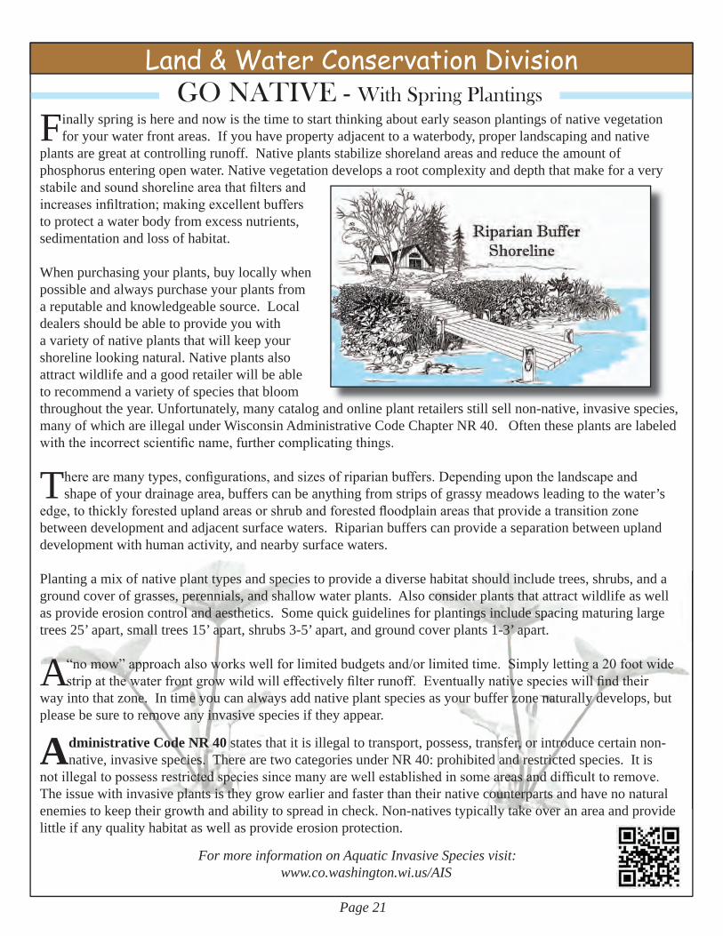
Land & Water Conservation DivisionGO NATIVE - With Spring Plantings
Finallyspringishereandnowisthetimetostartthinkingaboutearlyseasonplantingsofnativevegetationforyourwaterfrontareas.Ifyouhavepropertyadjacenttoawaterbody,properlandscapingandnative
plantsaregreatatcontrollingrunoff.Nativeplantsstabilizeshorelandareasandreducetheamountofphosphorusenteringopenwater.Nativevegetationdevelopsarootcomplexityanddepththatmakeforaverystabile and sound shoreline area that filters and increases infiltration; making excellent buffers toprotectawaterbodyfromexcessnutrients,sedimentationandlossofhabitat.
Whenpurchasingyourplants,buylocallywhenpossibleandalwayspurchaseyourplantsfromareputableandknowledgeablesource.Localdealersshouldbeabletoprovideyouwithavarietyofnativeplantsthatwillkeepyourshorelinelookingnatural.Nativeplantsalsoattractwildlifeandagoodretailerwillbeabletorecommendavarietyofspeciesthatbloomthroughouttheyear.Unfortunately,manycatalogandonlineplantretailersstillsellnon-native,invasivespecies,manyofwhichareillegalunderWisconsinAdministrativeCodeChapterNR40.Oftentheseplantsarelabeledwith the incorrect scientific name, further complicating things.
There are many types, configurations, and sizes of riparian buffers. Depending upon the landscape and shapeofyourdrainagearea,bufferscanbeanythingfromstripsofgrassymeadowsleadingtothewater’s
edge, to thickly forested upland areas or shrub and forested floodplain areas that provide a transition zone betweendevelopmentandadjacentsurfacewaters.Riparianbufferscanprovideaseparationbetweenuplanddevelopmentwithhumanactivity,andnearbysurfacewaters.
Plantingamixofnativeplanttypesandspeciestoprovideadiversehabitatshouldincludetrees,shrubs,andagroundcoverofgrasses,perennials,andshallowwaterplants.Alsoconsiderplantsthatattractwildlifeaswellasprovideerosioncontrolandaesthetics.Somequickguidelinesforplantingsincludespacingmaturinglargetrees25’apart,smalltrees15’apart,shrubs3-5’apart,andgroundcoverplants1-3’apart.
A“no mow” approach also works well for limited budgets and/or limited time. Simply letting a 20 foot wide strip at the water front grow wild will effectively filter runoff. Eventually native species will find their
wayintothatzone.Intimeyoucanalwaysaddnativeplantspeciesasyourbufferzonenaturallydevelops,butpleasebesuretoremoveanyinvasivespeciesiftheyappear.
AdministrativeCodeNR40statesthatitisillegaltotransport,possess,transfer,orintroducecertainnon-native,invasivespecies.TherearetwocategoriesunderNR40:prohibitedandrestrictedspecies.Itis
not illegal to possess restricted species since many are well established in some areas and difficult to remove. Theissuewithinvasiveplantsistheygrowearlierandfasterthantheirnativecounterpartsandhavenonaturalenemiestokeeptheirgrowthandabilitytospreadincheck.Non-nativestypicallytakeoveranareaandprovidelittleifanyqualityhabitataswellasprovideerosionprotection.
For more information on Aquatic Invasive Species visit: www.co.washington.wi.us/AIS

Page 22
Planning & ParksDepartment
Kids Corner Kids
Cor
ner
FreeFishingClinicHeldforKids!Saturday – April 12th
Sandy Knoll County Park(2064 Wallace Lake Rd., West Bend, WI 53090)
Children15yearsoldandyoungerhadan opportunity to fish, learn about
equipment, safety, fish identification, and more. This event was sponsored bytheWestBendKiwanisEarlyRisers,SoutheastWisconsinTroutUnlimited,WisconsinDepartmentofNaturalResources(WDNR),CityofWestBend-Park,Recreation&ForestryDepartmentandWashingtonCountyPlanning&ParksDepartment.
HungryrainbowtroutwerestockedbytheWDNRatSandyKnollParklocated in the Town of Trenton for children to try their luck at fishing.
Fishingpolesandbaitwereprovidedoryoucouldbringyourown.Doorprizes,freefood,andrefreshmentswerealsoprovided.
Clean Ways for WaterwaysA Website for Children
http://www.cleanways.org/
Whatwedoinourback-yardsandourcommu-
nitiescanmakeallthedif-ferencetothequalityofourlakesandstreams.Visitthewebsitewithyourchildren.
Conservation CampJune 25-27, 2014
Camp Bird - Marinette County
ConservationCampisawaytowidenone’seyesintotheworldofnaturalresources.Childrenentering6th-8thGradesinSeptemberhaveanopportunitytoattend
conservationcamp.Thiscampintroducesavarietyofcareersinnaturalresourcesandconservationinamannerdesignedforchildrenwhohaveaninterestinnatureandtheoutdoors.Thefeeforattendingthecampis$60.00perstudentifregistrationispost-markedonorbeforeMay30th,ifpostmarkedafterMay30ththefeeis$75.00.
Childrencandiscoverandexploretopicspresentedbyprofessionalsandvolunteersfromvariousagencieson:SWildlifeSHabitatSWaterQualitySFisheriesSForestrySOrienteeringSCanoeing
WashingtonCountyisofferingfourfullscholarshipstoattendthecamp.WinnerswillbechosenbasedonthecontentoftheiressaysthatareduebyMay1,2014.Moreinformationcanbefoundonthewebsite:
www.co.washington.wi.us/lcd - Conservation Education - Kids

Page 23
Planning & ParksDepartment
Kids CornerKids
Cor
ner2014 Conservation Poster Contest
This years theme is “DIG DEEPER Mysteries in the Soil.” A total of 426 WashingtonCountystudentsand8schoolsparticipatedintheConserva-
tionPosterContest.Thelocalposterswerecritiquedandjudgedandthetop3posterswereawarded1st,2ndand3rdplace.Allstudentsthatparticipatedinthe contest received a certificate. The top 3 winners of each division received awards.Divisionsincluded:GradesK-1,Grades2-3,Grades4-6,Grades7-9andGrades10-12.A2014-2015schoolcalendarwasdevelopedandhigh-lightedthetop3winners.Firstplacewinnersadvancedtotheareaandstatecompetitions.CongratulationstoBenMcMeekenfortakinghome1stplaceatstate;it’sofftoNationals!
The2015PosterthemewillbeWildlifeHabitatandcanbefoundatthefollowingwebsiteunderwww.co.washington.wi.us/lcd - click Conser-
vation Education - Kids.Thankyoutoallstudents(teachersandparents,alike)whoparticipatedinthisyearscontest.
Grades K-1Asamina Villalobos
Plat Elementary - Kindergarten
Grades 2-3Molly Christianson
Plat Elementary - 2nd Grade
Grades 4-6Benjamin McMeeken
Allenton Elementary - 4th Grade
Grades 7-9Abby Gastrau
Richfield Elementary-8thGrade
Grades 10-12Nicholas Askin
West Bend West High School - 12th Grade
Grades 2-3
2014 - 2015 School Calendar Celebrating the 2014 Conservation Poster Contest
Artwork by: Molly Christianson
1st PlaceWinners
Benjamin McMeeken - State Winner

Washington County Planning & Parks Department 333 E. Washington St., Suite 2300 PO Box 2003 West Bend, WI 53095-2003 Phone: 262.335.4445 Fax: 262.335.6868 www.co.washington.wi.us
PRST STDU.S. POSTAGE
PAIDWEST BEND WIPERMIT NO. 90
Planning & Parks Department Newsletter is publishedsemi-annuallyforWashingtonCountyresidents.Viewpointsofauthorsdonotnecessarily reflect those of the Planning, Conservation and Parks Committee ortheWashingtonCountyBoardofSupervisors.ThePlanning,ConservationandParksCommitteeandthePlanningandParksDepartmentstaffencourageresponsesfromthepublic.
Planning&ParksDepartmentMissionStatement:The public is provided with recreational benefits, environmental protectionandincreasedawareness,compliancewithregulations,vibrantlocaleconomy,sensiblegrowthandanimprovedqualityoflifeinWashingtonCounty.Planning, Conservation and Parks Committee MembersMichaelR.Miller,ChairpersonRaymondW.Heidtke,Vice-ChairpersonGeraldJ.Schulz,SecretaryMelvinK.Ewert,CountyBoardSupervisorPeterI.Sorce,CountyBoardSupervisorMichaelParsons,CountyBoardSupervisorToddWhite,CountyBoardSupervisorRossBishop,FSARepresentative-LCCMember
Planning & Parks DepartmentDeboraSielski,DeputyAdministratorMikeKactro,AssistantAdministratorforGolf&ParksPhilGaudet, LandResourcesManagerEricDamkot,GISManagerPaulSebo,CountyConservationist Printed in the U.S.A.
In This Issue: Page(s)
Archeology Day - May 17, 2014 1
Golf & Parks Division Meet the Washington County Park System Staff 2 Opening Day at Golf Course / Eisenbahn State Trail 3 New Ridge Run Shelter / County Retirees 4-5
Planning Division Brownfield Grant Application 6 Comp Plan Amendments & Hartford Farmland Zoning 7 Vision 2050 - Your Opinion is Needed 8
Geographic Information Systems Division Top 5 Recent Enhancements to Web Sites 99 Land Use Division Benefits of a Natural Shoreline 10-11
USDA-NRCS Better Land & Water Through CSP 12
Land & Water Conservation Division Overview of Livestock Facility Siting Law 13 Are We Taking Our Drinking Water for Granted? 14 Save Money Conserve Nutrients / Farming Smarter 15 Cluster Developments - Going Green! 16 - 17 Clean Sweep - May 10th - at Slinger Hwy Shop 18 - 19 New “Buzz Words” in Conservation / Drainage Tiling 20 Go NATIVE - with Spring Plantings 21
Kids Corner Free Fishing Clinic - April 12th - Sandy Knoll Park 22 Conservation Camp - June 25-27 / Poster Contest 22 - 23
10 % Recycled Fiber
ThisNewsletterisavailableincoloronthewebsite!Go Green...Go Green...Go GreenIn an effort to conserve environmental and financial resources, please consider receiving the newsletter electronically.
Sendanemailto:[email protected] call262.335.4800
2014 Breakfast on the FarmRiverback Farms - Falk Family
June 14th 6:30am - 11:30am