2020 comprehensive parks and recreation plan - …212d0b0f-a03e-4846-a212... · 2020 comprehensive...
TRANSCRIPT

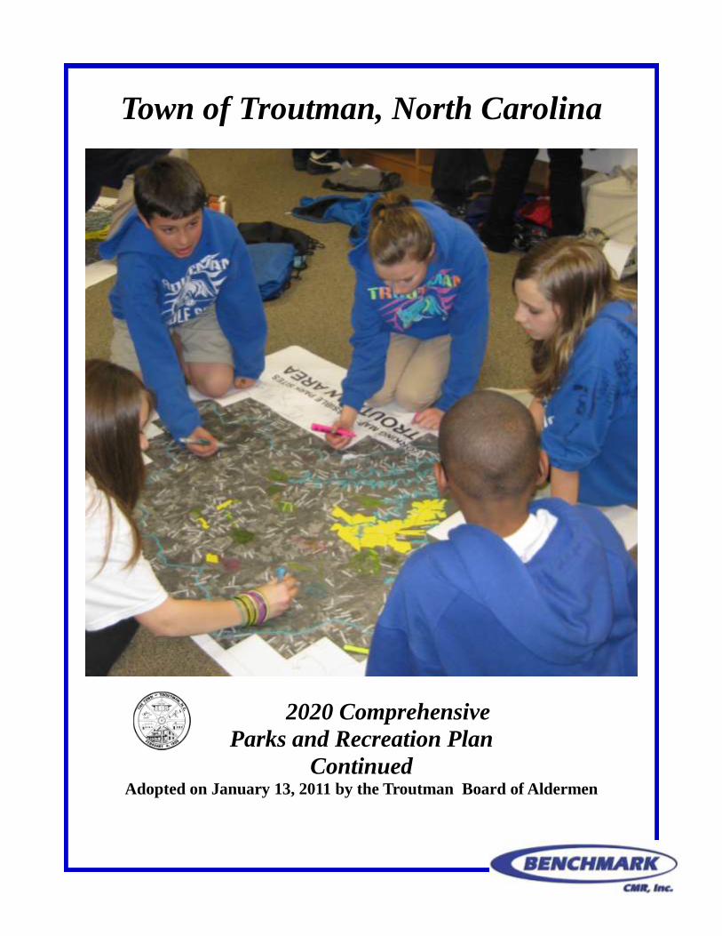
Town of Troutman, North Carolina
2020 Comprehensive
Parks and Recreation Plan Adopted on January 13, 2011 by the Troutman Board of Aldermen
Acknowledgements
Troutman Board of Aldermen Elbert Richardson, Mayor
Mike Spath, Mayor Pro Tempore
Jenny Blevins
Curt Rogers
Betty Jean Troutman
Amanda Weiser
Troutman Parks & Recreation Committee Jan Comer, Chair
Scott Stewart, Vice Chair
Kay Brawley
Ted Delisi
Charles Delnero
Ryu Goto
Carrie Harrison
Jeff James
Angela Laneir
Kenny Miller
Curt Rogers
Susan Sappenfield
Joel Settle
Marty Todd
Advisors & Staff David Saleeby, Town Manager
Town of Troutman
Robert Woody, Director
Iredell County Parks & Rec
Matthew Carswell, Engineer
West Consultants
Erika Martin, Project Planner
Benchmark CMR Inc.
Becky Link, Deputy Clerk
Town of Troutman
Special Thanks Students and Faculty at
Troutman Middle School Lake Norman State Park

Reserved for letter from the Mayor.
Vision Statement
Troutman’s high-quality parks, beautiful
open spaces, protected natural areas, and
innovative recreational facilities are welcoming
to all. The verdant parks have been
thoughtfully designed to be accessible and offer
unique experiences for all ages, abilities, and
interests.
The Town’s greenways offer easily navigable
and integrated connections between
neighborhoods, community destinations, and
town parks. Residents are active participants in
promoting the establishment of new parks and
recreational programs while keeping existing
facilities clean, safe, and well maintained for
the Town’s current and future residents.
Table of Contents
Background page 1 Plan Summary
Study Area and Demographics
Previous Plans
Inventory page 5 Town Facilities
Lake Norman State Park
School Facilities
Troutman Youth Athletic Association
Barium YMCA
Churches & Existing Facilities Chart
ESC Park page 11
Community Input page 34 Overall Participation
Troutman’s Youth
Troutman’s General Public
Recommendations & Implementation page 50 Goals & Objectives
Funding
Appendix page 54
Sources
Surveys
East Monbo Road
Table of Maps and Figures
Figure 1: Map of Troutman Area page 2
Figure 2: Troutman Middle School Plans page 8
Figure 3: Chart of Existing Facilities page 10
Figure 4: Map of Site Topography page 14
Figure 5: Map of Site Soils page 15
Figure 6: Map of Existing Site Structures and Trees page 17
Figure 7: 3 Mile Park Influence page 18
Figure 8: 1/2 Mile Park Influence page 19
Figure 9: Map of Site Acquisition and Development page 27
Figure 10: Troutman-ESC Park Master Site Plan page 30
Figure 11: Troutman-ESC Park Phase 1 page 31
Figure 12: Map of Future Park Sites page 44
Figure 13: Map of Proposed Trails and Sidewalks page 45
McEachern Greenway, Concord (photo by Bill Galloway)
Background Plan Summary
In January of 2010 the Board of Aldermen were given the opportunity to partner with Engi-
neered Sintered Components (ESC) to develop the Town’s first park. The Board of Aldermen
appointed a small committee on February 19, 2010 to explore development of a park plan for
the ESC site and apply for a Parks And Recreation Trust Fund (PARTF) grant. In March the
park planning committee expanded its membership to form the “Troutman Parks and Recrea-
tion Committee.” The initial purpose of the Parks and Recreation Committee was to develop a
communitywide parks and recreation plan and assist in site development of the park. The deci-
sion to expand was affirmed by the Board of Aldermen on June 10, 2010 as each member was
appointed to a one year term. In conjunction with development of the Parks and Recreation
Plan, the Committee worked to develop the Master Site Plan for the Town’s first park.
The Troutman Parks and Recreation Committee includes individuals representing the disabled
community, the retirement community, youth, parents, teachers, preachers, business leaders,
town leaders, industrial operators, school officials, and various athletic interests. This 13 mem-
ber committee began meeting in April as the Steering Committee for this plan to understand the
recreational needs of the entire community. To accomplish this, the Committee surveyed and
held meetings for the general public and youth. The Town of Troutman Comprehensive Parks
and Recreation Plan was recommended by the Parks and Recreation Committee on December
20, 2010, recommended by the Planning Board on December 21, 2010, and adopted by the
Board of Aldermen on January 13, 2010. What follows is a 10 year parks and recreation plan to
serve as a guide for development of recreational facilities and services in the Troutman area.
1
Study Area & Demographics
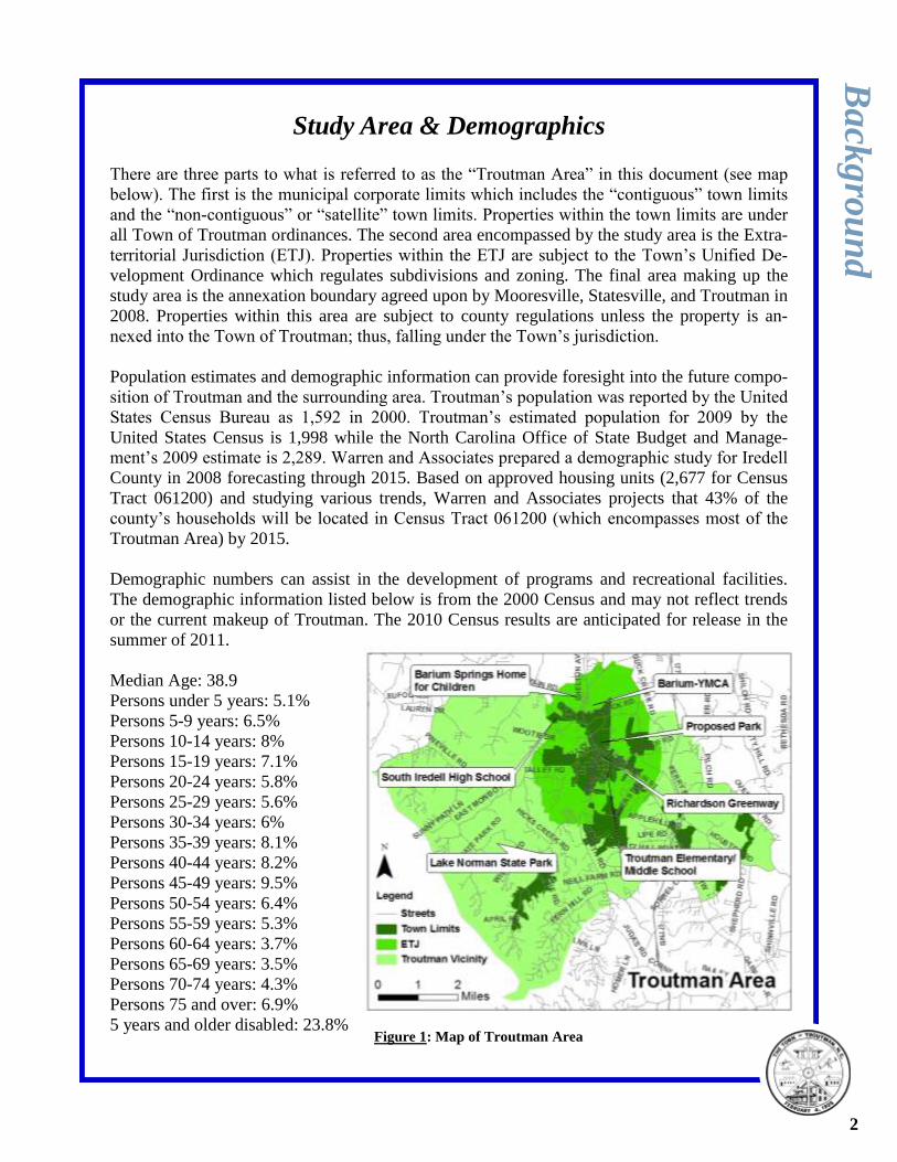
There are three parts to what is referred to as the “Troutman Area” in this document (see map
below). The first is the municipal corporate limits which includes the “contiguous” town limits
and the “non-contiguous” or “satellite” town limits. Properties within the town limits are under
all Town of Troutman ordinances. The second area encompassed by the study area is the Extra-
territorial Jurisdiction (ETJ). Properties within the ETJ are subject to the Town’s Unified De-
velopment Ordinance which regulates subdivisions and zoning. The final area making up the
study area is the annexation boundary agreed upon by Mooresville, Statesville, and Troutman in
2008. Properties within this area are subject to county regulations unless the property is an-
nexed into the Town of Troutman; thus, falling under the Town’s jurisdiction.
Population estimates and demographic information can provide foresight into the future compo-
sition of Troutman and the surrounding area. Troutman’s population was reported by the United
States Census Bureau as 1,592 in 2000. Troutman’s estimated population for 2009 by the
United States Census is 1,998 while the North Carolina Office of State Budget and Manage-
ment’s 2009 estimate is 2,289. Warren and Associates prepared a demographic study for Iredell
County in 2008 forecasting through 2015. Based on approved housing units (2,677 for Census
Tract 061200) and studying various trends, Warren and Associates projects that 43% of the
county’s households will be located in Census Tract 061200 (which encompasses most of the
Troutman Area) by 2015.
Demographic numbers can assist in the development of programs and recreational facilities.
The demographic information listed below is from the 2000 Census and may not reflect trends
or the current makeup of Troutman. The 2010 Census results are anticipated for release in the
summer of 2011.
Median Age: 38.9
Persons under 5 years: 5.1%
Persons 5-9 years: 6.5%
Persons 10-14 years: 8%
Persons 15-19 years: 7.1%
Persons 20-24 years: 5.8%
Persons 25-29 years: 5.6%
Persons 30-34 years: 6%
Persons 35-39 years: 8.1%
Persons 40-44 years: 8.2%
Persons 45-49 years: 9.5%
Persons 50-54 years: 6.4%
Persons 55-59 years: 5.3%
Persons 60-64 years: 3.7%
Persons 65-69 years: 3.5%
Persons 70-74 years: 4.3%
Persons 75 and over: 6.9%
5 years and older disabled: 23.8%
Ba
ckg
rou
nd
Figure 1: Map of Troutman Area
2
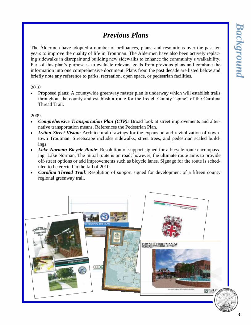
Previous Plans
The Aldermen have adopted a number of ordinances, plans, and resolutions over the past ten
years to improve the quality of life in Troutman. The Aldermen have also been actively replac-
ing sidewalks in disrepair and building new sidewalks to enhance the community’s walkability.
Part of this plan’s purpose is to evaluate relevant goals from previous plans and combine the
information into one comprehensive document. Plans from the past decade are listed below and
briefly note any reference to parks, recreation, open space, or pedestrian facilities.
2010
Proposed plans: A countywide greenway master plan is underway which will establish trails
throughout the county and establish a route for the Iredell County “spine” of the Carolina
Thread Trail.
2009
Comprehensive Transportation Plan (CTP): Broad look at street improvements and alter-
native transportation means. References the Pedestrian Plan.
Lytton Street Vision: Architectural drawings for the expansion and revitalization of down-
town Troutman. Streetscape includes sidewalks, street trees, and pedestrian scaled build-
ings.
Lake Norman Bicycle Route: Resolution of support signed for a bicycle route encompass-
ing Lake Norman. The initial route is on road; however, the ultimate route aims to provide
off-street options or add improvements such as bicycle lanes. Signage for the route is sched-
uled to be erected in the fall of 2010.
Carolina Thread Trail: Resolution of support signed for development of a fifteen county
regional greenway trail.
Ba
ckg
rou
nd
3
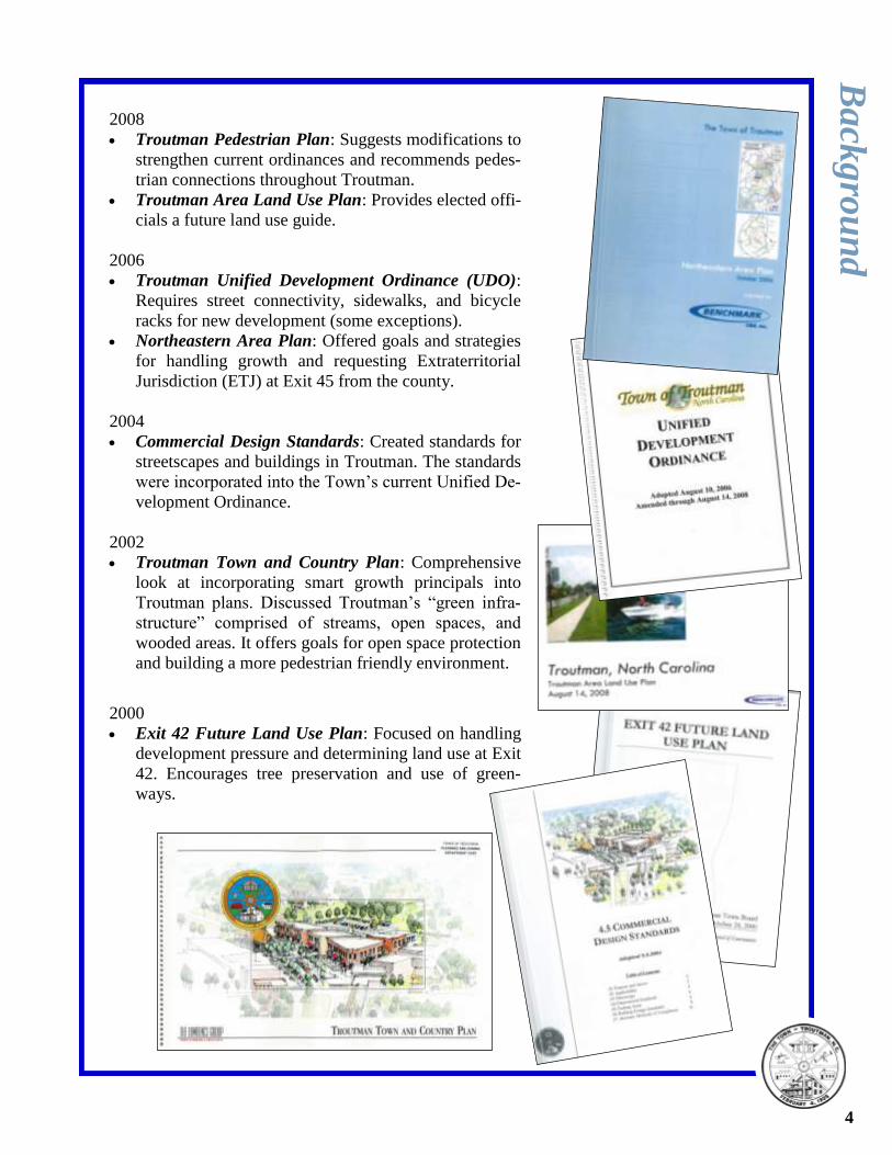
2008
Troutman Pedestrian Plan: Suggests modifications to
strengthen current ordinances and recommends pedes-
trian connections throughout Troutman.
Troutman Area Land Use Plan: Provides elected offi-
cials a future land use guide.
2006
Troutman Unified Development Ordinance (UDO):
Requires street connectivity, sidewalks, and bicycle
racks for new development (some exceptions).
Northeastern Area Plan: Offered goals and strategies
for handling growth and requesting Extraterritorial
Jurisdiction (ETJ) at Exit 45 from the county.
2004
Commercial Design Standards: Created standards for
streetscapes and buildings in Troutman. The standards
were incorporated into the Town’s current Unified De-
velopment Ordinance.
2002
Troutman Town and Country Plan: Comprehensive
look at incorporating smart growth principals into
Troutman plans. Discussed Troutman’s “green infra-
structure” comprised of streams, open spaces, and
wooded areas. It offers goals for open space protection
and building a more pedestrian friendly environment.
2000
Exit 42 Future Land Use Plan: Focused on handling
development pressure and determining land use at Exit
42. Encourages tree preservation and use of green-
ways.
Ba
ckg
rou
nd
4
Inventory Town Facilities
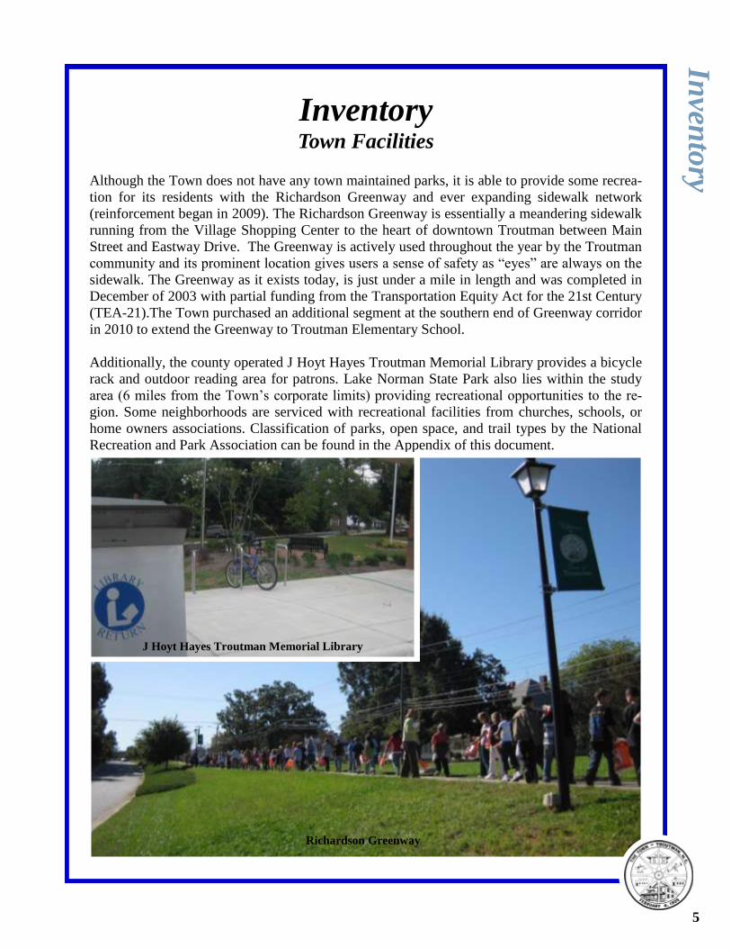
Although the Town does not have any town maintained parks, it is able to provide some recrea-
tion for its residents with the Richardson Greenway and ever expanding sidewalk network
(reinforcement began in 2009). The Richardson Greenway is essentially a meandering sidewalk
running from the Village Shopping Center to the heart of downtown Troutman between Main
Street and Eastway Drive. The Greenway is actively used throughout the year by the Troutman
community and its prominent location gives users a sense of safety as “eyes” are always on the
sidewalk. The Greenway as it exists today, is just under a mile in length and was completed in
December of 2003 with partial funding from the Transportation Equity Act for the 21st Century
(TEA-21).The Town purchased an additional segment at the southern end of Greenway corridor
in 2010 to extend the Greenway to Troutman Elementary School.
Additionally, the county operated J Hoyt Hayes Troutman Memorial Library provides a bicycle
rack and outdoor reading area for patrons. Lake Norman State Park also lies within the study
area (6 miles from the Town’s corporate limits) providing recreational opportunities to the re-
gion. Some neighborhoods are serviced with recreational facilities from churches, schools, or
home owners associations. Classification of parks, open space, and trail types by the National
Recreation and Park Association can be found in the Appendix of this document.
Inven
tory
J Hoyt Hayes Troutman Memorial Library
Richardson Greenway
5
Lake Norman State Park
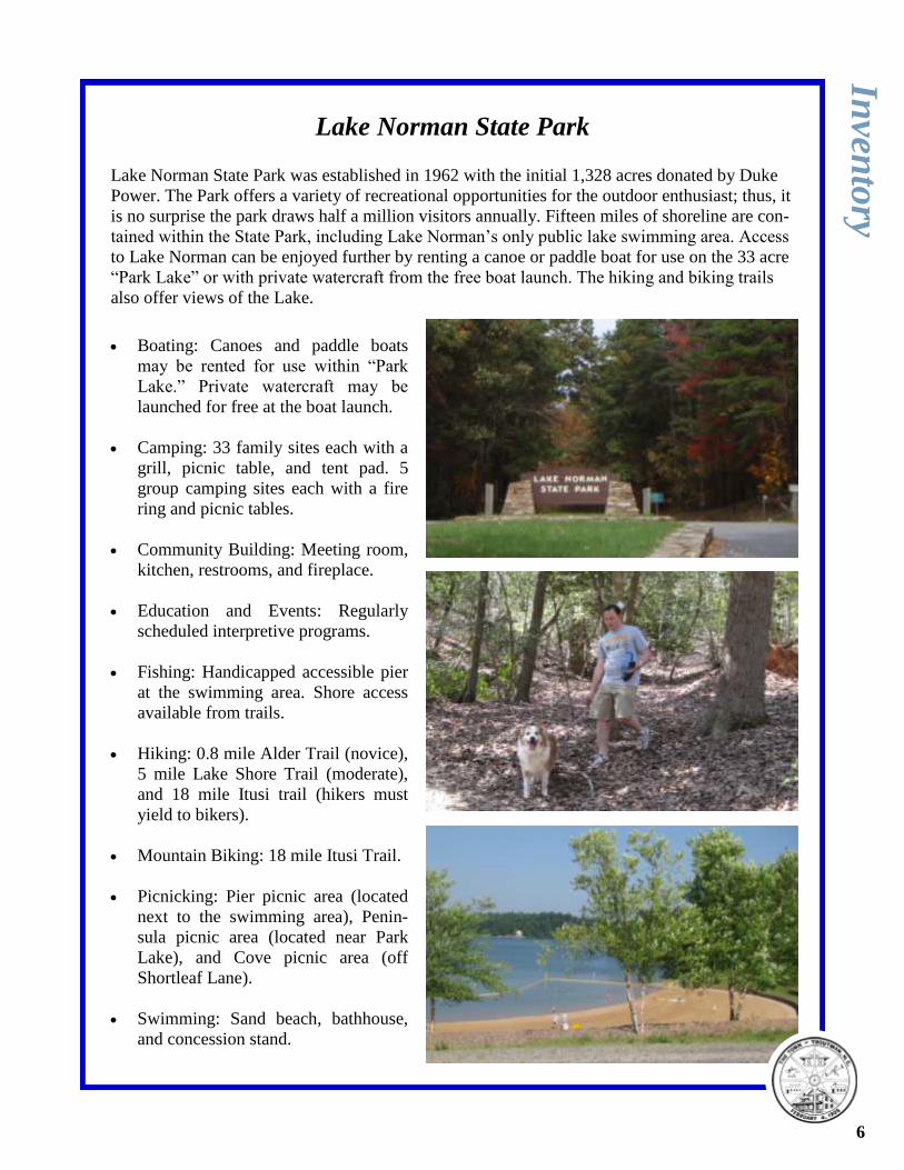
Lake Norman State Park was established in 1962 with the initial 1,328 acres donated by Duke
Power. The Park offers a variety of recreational opportunities for the outdoor enthusiast; thus, it
is no surprise the park draws half a million visitors annually. Fifteen miles of shoreline are con-
tained within the State Park, including Lake Norman’s only public lake swimming area. Access
to Lake Norman can be enjoyed further by renting a canoe or paddle boat for use on the 33 acre
“Park Lake” or with private watercraft from the free boat launch. The hiking and biking trails
also offer views of the Lake.
Boating: Canoes and paddle boats
may be rented for use within “Park
Lake.” Private watercraft may be
launched for free at the boat launch.
Camping: 33 family sites each with a
grill, picnic table, and tent pad. 5
group camping sites each with a fire
ring and picnic tables.
Community Building: Meeting room,
kitchen, restrooms, and fireplace.
Education and Events: Regularly
scheduled interpretive programs.
Fishing: Handicapped accessible pier
at the swimming area. Shore access
available from trails.
Hiking: 0.8 mile Alder Trail (novice),
5 mile Lake Shore Trail (moderate),
and 18 mile Itusi trail (hikers must
yield to bikers).
Mountain Biking: 18 mile Itusi Trail.
Picnicking: Pier picnic area (located
next to the swimming area), Penin-
sula picnic area (located near Park
Lake), and Cove picnic area (off
Shortleaf Lane).
Swimming: Sand beach, bathhouse,
and concession stand.
Inven
tory
6
School Facilities
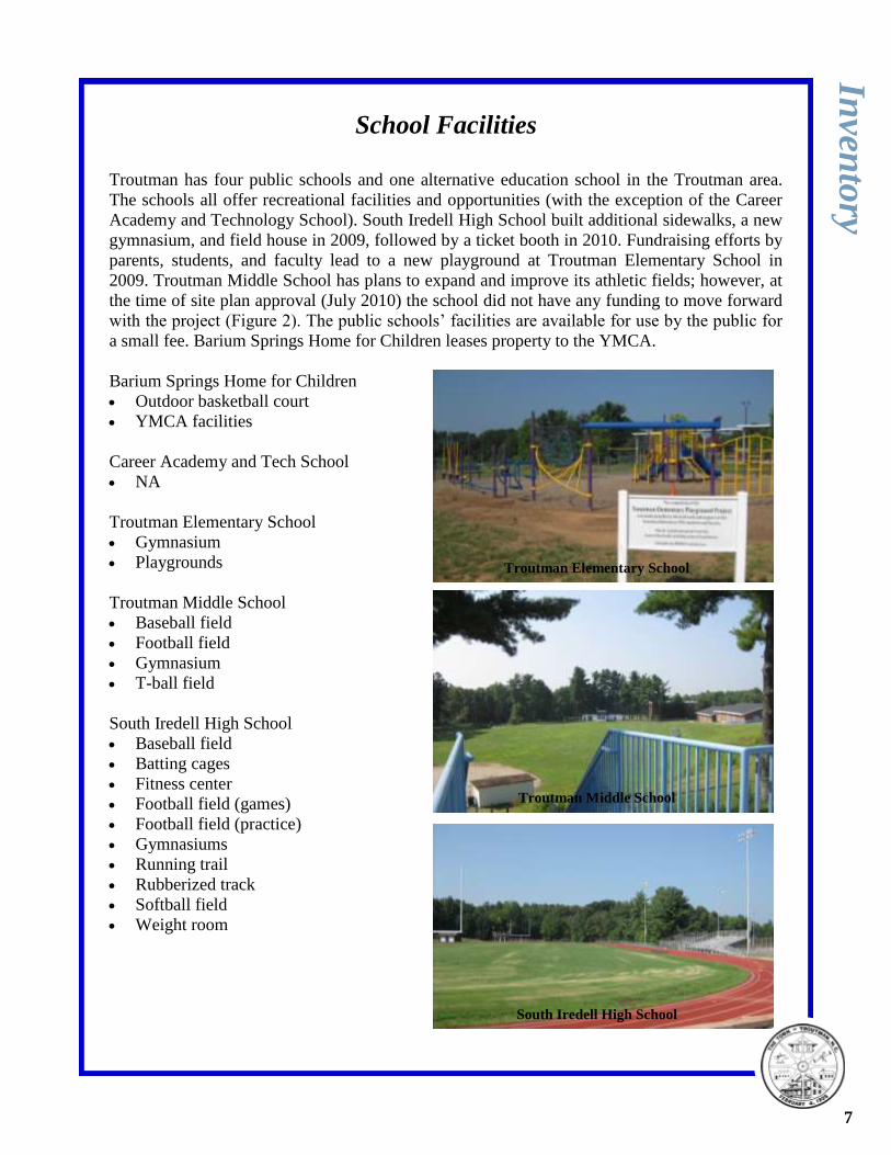
Troutman has four public schools and one alternative education school in the Troutman area.
The schools all offer recreational facilities and opportunities (with the exception of the Career
Academy and Technology School). South Iredell High School built additional sidewalks, a new
gymnasium, and field house in 2009, followed by a ticket booth in 2010. Fundraising efforts by
parents, students, and faculty lead to a new playground at Troutman Elementary School in
2009. Troutman Middle School has plans to expand and improve its athletic fields; however, at
the time of site plan approval (July 2010) the school did not have any funding to move forward
with the project (Figure 2). The public schools’ facilities are available for use by the public for
a small fee. Barium Springs Home for Children leases property to the YMCA.
Barium Springs Home for Children
Outdoor basketball court
YMCA facilities
Career Academy and Tech School
NA
Troutman Elementary School
Gymnasium
Playgrounds
Troutman Middle School
Baseball field
Football field
Gymnasium
T-ball field
South Iredell High School
Baseball field
Batting cages
Fitness center
Football field (games)
Football field (practice)
Gymnasiums
Running trail
Rubberized track
Softball field
Weight room
Inven
tory
Troutman Elementary School
South Iredell High School
Troutman Middle School
7

Page Holder (Figure 2)
Inven
tory
8
Troutman Youth Athletic Association (TYAA)
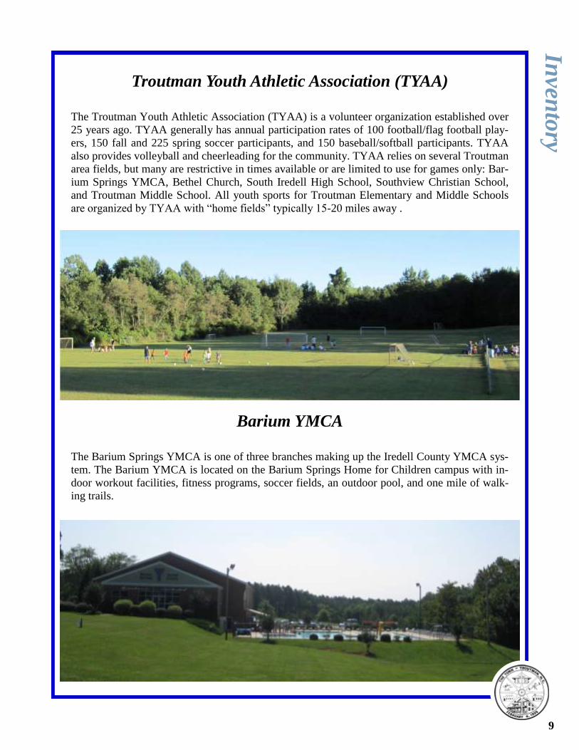
The Troutman Youth Athletic Association (TYAA) is a volunteer organization established over
25 years ago. TYAA generally has annual participation rates of 100 football/flag football play-
ers, 150 fall and 225 spring soccer participants, and 150 baseball/softball participants. TYAA
also provides volleyball and cheerleading for the community. TYAA relies on several Troutman
area fields, but many are restrictive in times available or are limited to use for games only: Bar-
ium Springs YMCA, Bethel Church, South Iredell High School, Southview Christian School,
and Troutman Middle School. All youth sports for Troutman Elementary and Middle Schools
are organized by TYAA with “home fields” typically 15-20 miles away .
Barium YMCA
The Barium Springs YMCA is one of three branches making up the Iredell County YMCA sys-
tem. The Barium YMCA is located on the Barium Springs Home for Children campus with in-
door workout facilities, fitness programs, soccer fields, an outdoor pool, and one mile of walk-
ing trails.
Inven
tory
9
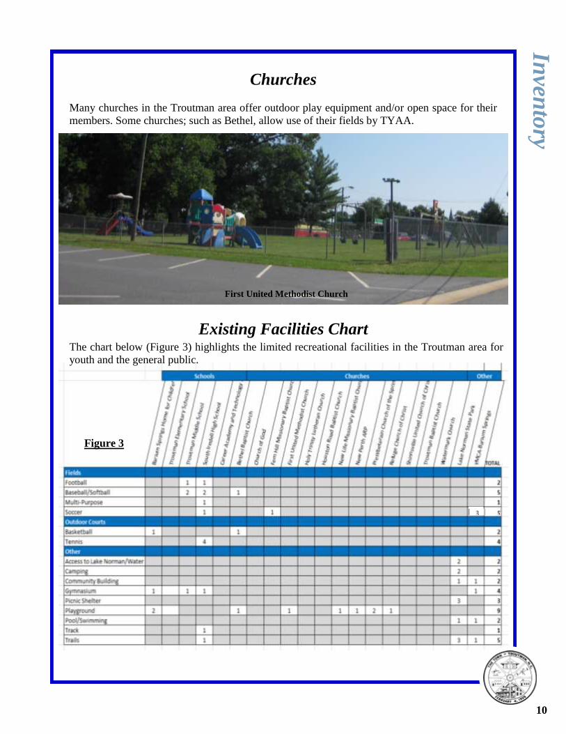
Churches
Many churches in the Troutman area offer outdoor play equipment and/or open space for their
members. Some churches; such as Bethel, allow use of their fields by TYAA.
Existing Facilities Chart
Inven
tory
First United Methodist Church
10
The chart below (Figure 3) highlights the limited recreational facilities in the Troutman area for
youth and the general public.
Figure 3
Town of Troutman, North Carolina
Troutman-ESC Park
Master Plan
Adopted on January 13, 2011 by the Troutman Board of Aldermen
11
Table of Contents*
Background page 13
Site Analysis page 14
Stakeholder and Community Input page 18
Site Development page 26
Appendix page 52
*See system wide Town of Troutman Comprehensive Parks and Recreation Plan for information on com-
munity recreational needs.
Table of Figures**
Figure 4: Topography and Water Features page 14
Figure 5: Soils page 15
Figure 6: Structures and Trees page 17
Figure 7: 3 Mile Park Influence page 18
Figure 8: 1/2 Mile Park Influence page 19
Figure 9: Site Acquisition and Development page 27
Figure 10: Troutman-ESC Park Master Site Plan page 30
Figure 11: Troutman-ESC Park Phase 1 page 31
**See system wide Town of Troutman Comprehensive Parks and Recreation Plan for additional figures.
12
Tro
utm
an
-ES
C M
aster P
lan
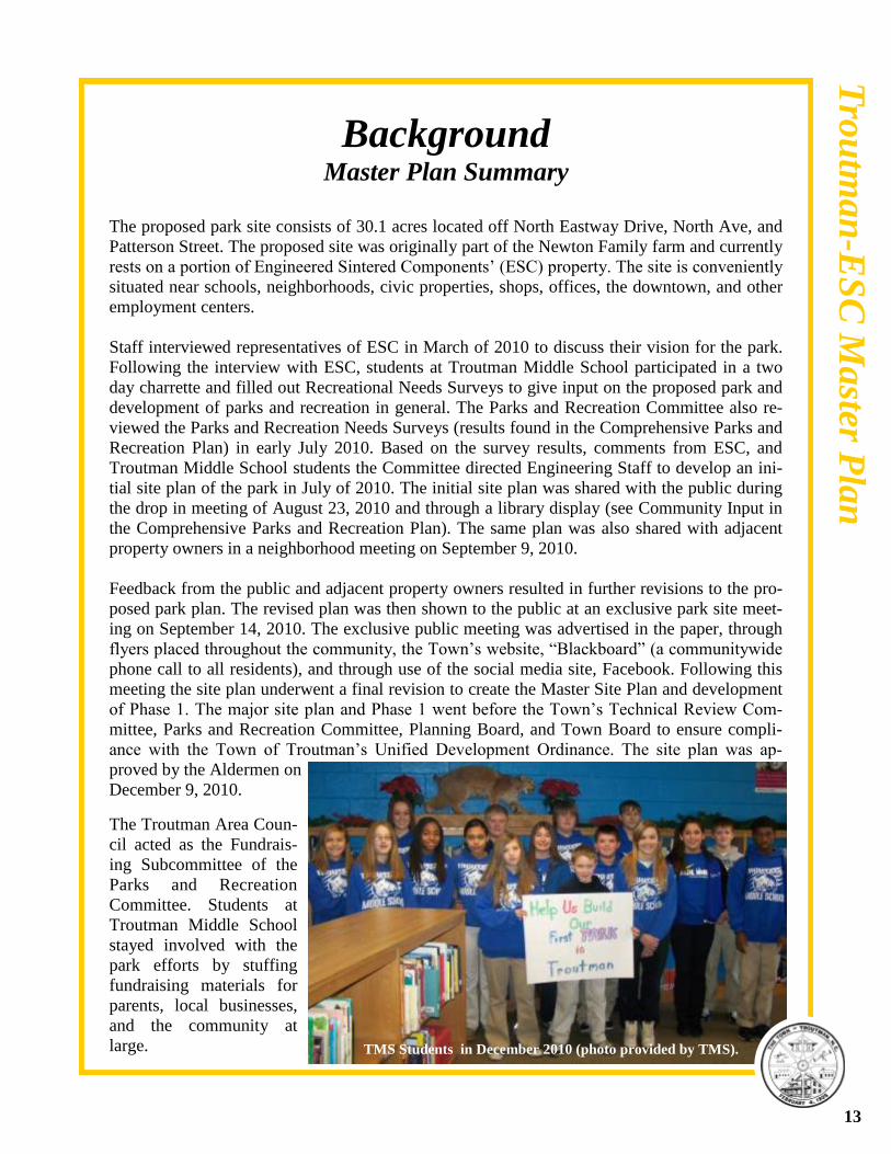
Background Master Plan Summary
The proposed park site consists of 30.1 acres located off North Eastway Drive, North Ave, and
Patterson Street. The proposed site was originally part of the Newton Family farm and currently
rests on a portion of Engineered Sintered Components’ (ESC) property. The site is conveniently
situated near schools, neighborhoods, civic properties, shops, offices, the downtown, and other
employment centers.
Staff interviewed representatives of ESC in March of 2010 to discuss their vision for the park.
Following the interview with ESC, students at Troutman Middle School participated in a two
day charrette and filled out Recreational Needs Surveys to give input on the proposed park and
development of parks and recreation in general. The Parks and Recreation Committee also re-
viewed the Parks and Recreation Needs Surveys (results found in the Comprehensive Parks and
Recreation Plan) in early July 2010. Based on the survey results, comments from ESC, and
Troutman Middle School students the Committee directed Engineering Staff to develop an ini-
tial site plan of the park in July of 2010. The initial site plan was shared with the public during
the drop in meeting of August 23, 2010 and through a library display (see Community Input in
the Comprehensive Parks and Recreation Plan). The same plan was also shared with adjacent
property owners in a neighborhood meeting on September 9, 2010.
Feedback from the public and adjacent property owners resulted in further revisions to the pro-
posed park plan. The revised plan was then shown to the public at an exclusive park site meet-
ing on September 14, 2010. The exclusive public meeting was advertised in the paper, through
flyers placed throughout the community, the Town’s website, “Blackboard” (a communitywide
phone call to all residents), and through use of the social media site, Facebook. Following this
meeting the site plan underwent a final revision to create the Master Site Plan and development
of Phase 1. The major site plan and Phase 1 went before the Town’s Technical Review Com-
mittee, Parks and Recreation Committee, Planning Board, and Town Board to ensure compli-
ance with the Town of Troutman’s Unified Development Ordinance. The site plan was ap-
proved by the Aldermen on
December 9, 2010.
TMS Students in December 2010 (photo provided by TMS).
13
The Troutman Area Coun-
cil acted as the Fundrais-
ing Subcommittee of the
Parks and Recreation
Committee. Students at
Troutman Middle School
stayed involved with the
park efforts by stuffing
fundraising materials for
parents, local businesses,
and the community at
large.
Tro
utm
an
-ES
C M
aster P
lan
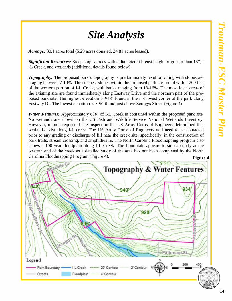
Site Analysis Acreage: 30.1 acres total (5.29 acres donated, 24.81 acres leased).
Significant Resources: Steep slopes, trees with a diameter at breast height of greater than 18”, I
-L Creek, and wetlands (additional details found below).
Topography: The proposed park’s topography is predominately level to rolling with slopes av-
eraging between 7-10%. The steepest slopes within the proposed park are found within 200 feet
of the western portion of I-L Creek, with banks ranging from 13-16%. The most level areas of
the existing site are found immediately along Eastway Drive and the northern part of the pro-
posed park site. The highest elevation is 948’ found in the northwest corner of the park along
Eastway Dr. The lowest elevation is 896’ found just above Scroggs Street (Figure 4).
Water Features: Approximately 638’ of I-L Creek is contained within the proposed park site.
No wetlands are shown on the US Fish and Wildlife Service National Wetlands Inventory.
However, upon a requested site inspection the US Army Corps of Engineers determined that
wetlands exist along I-L creek. The US Army Corps of Engineers will need to be contacted
prior to any grading or discharge of fill near the creek site; specifically, in the construction of
park trails, stream crossing, and amphitheatre. The North Carolina Floodmapping program also
shows a 100 year floodplain along I-L Creek. The floodplain appears to stop abruptly at the
western end of the creek as a detailed study of the area has not been completed by the North
Carolina Floodmapping Program (Figure 4).
14
Figure 4
Tro
utm
an
-ES
C M
aster P
lan
Site Analysis
I-L Creek.
15
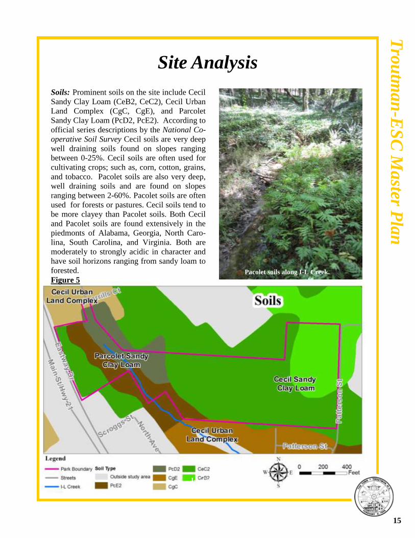
Pacolet soils along I-L Creek.
Tro
utm
an
-ES
C M
aster P
lan
Soils: Prominent soils on the site include Cecil
Sandy Clay Loam (CeB2, CeC2), Cecil Urban
Land Complex (CgC, CgE), and Parcolet
Sandy Clay Loam (PcD2, PcE2). According to
official series descriptions by the National Co-
operative Soil Survey Cecil soils are very deep
well draining soils found on slopes ranging
between 0-25%. Cecil soils are often used for
cultivating crops; such as, corn, cotton, grains,
and tobacco. Pacolet soils are also very deep,
well draining soils and are found on slopes
ranging between 2-60%. Pacolet soils are often
used for forests or pastures. Cecil soils tend to
be more clayey than Pacolet soils. Both Cecil
and Pacolet soils are found extensively in the
piedmonts of Alabama, Georgia, North Caro-
lina, South Carolina, and Virginia. Both are
moderately to strongly acidic in character and
have soil horizons ranging from sandy loam to
forested.
Figure 5
Town Hall looking towards future park site. View of View of ESC from park site.
Site Analysis
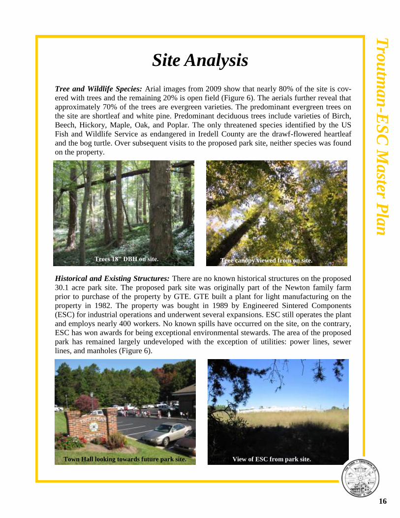
Tree and Wildlife Species: Arial images from 2009 show that nearly 80% of the site is cov-
ered with trees and the remaining 20% is open field (Figure 6). The aerials further reveal that
approximately 70% of the trees are evergreen varieties. The predominant evergreen trees on
the site are shortleaf and white pine. Predominant deciduous trees include varieties of Birch,
Beech, Hickory, Maple, Oak, and Poplar. The only threatened species identified by the US
Fish and Wildlife Service as endangered in Iredell County are the drawf-flowered heartleaf
and the bog turtle. Over subsequent visits to the proposed park site, neither species was found
on the property.
Historical and Existing Structures: There are no known historical structures on the proposed
30.1 acre park site. The proposed park site was originally part of the Newton family farm
prior to purchase of the property by GTE. GTE built a plant for light manufacturing on the
property in 1982. The property was bought in 1989 by Engineered Sintered Components
(ESC) for industrial operations and underwent several expansions. ESC still operates the plant
and employs nearly 400 workers. No known spills have occurred on the site, on the contrary,
ESC has won awards for being exceptional environmental stewards. The area of the proposed
park has remained largely undeveloped with the exception of utilities: power lines, sewer
lines, and manholes (Figure 6).
Trees 18” DBH on site. Tree canopy viewed from on site.
16
Tro
utm
an
-ES
C M
aster P
lan

Page Holder (Figure 6)
Trees 18” DBH on site. Tree canopy viewed from on site.
17
Tro
utm
an
-ES
C M
aster P
lan
Site Analysis
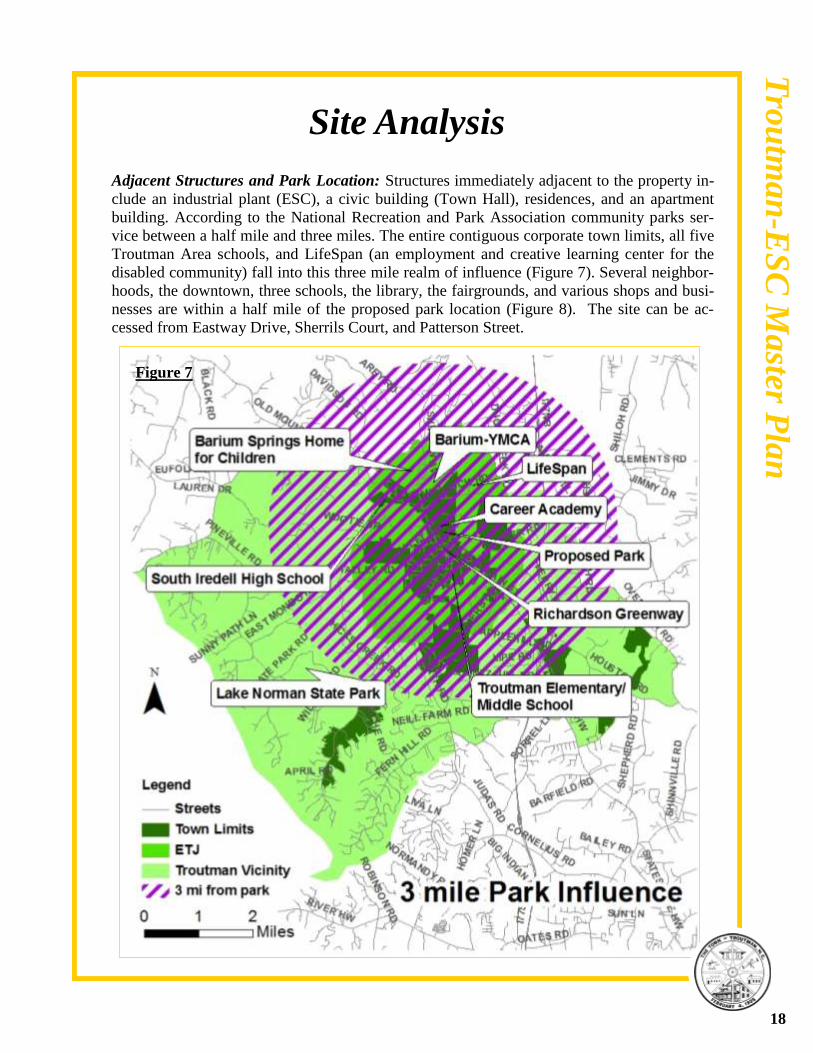
Adjacent Structures and Park Location: Structures immediately adjacent to the property in-
clude an industrial plant (ESC), a civic building (Town Hall), residences, and an apartment
building. According to the National Recreation and Park Association community parks ser-
vice between a half mile and three miles. The entire contiguous corporate town limits, all five
Troutman Area schools, and LifeSpan (an employment and creative learning center for the
disabled community) fall into this three mile realm of influence (Figure 7). Several neighbor-
hoods, the downtown, three schools, the library, the fairgrounds, and various shops and busi-
nesses are within a half mile of the proposed park location (Figure 8). The site can be ac-
cessed from Eastway Drive, Sherrils Court, and Patterson Street.
18
Tro
utm
an
-ES
C M
aster P
lan
Figure 7

Page Holder (Figure 8)
19
Tro
utm
an
-ES
C M
aster P
lan
Stakeholder and Community ESC Stakeholder Interview
ESC’s Park Vision
ESC representatives noted during their March 1, 2010 interview with Staff that their company’s
vision for the park is one of giving back: enhancing the quality of life for their workers and the
community through increased social interaction and recreational opportunities.
Recreational Facilities
The representatives shared they were open to the results that would arise from the public, but
expressed a desire to see the following: picnic area with restrooms, walking/hiking trails, ath-
letic fields (especially softball or baseball), natural areas/stream preservation, and a playground.
They noted that ESC could potentially help with funding for a picnic pavilion.
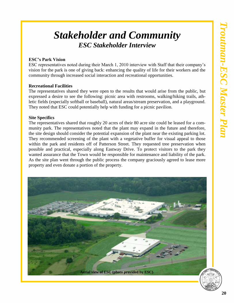
Site Specifics
The representatives shared that roughly 20 acres of their 80 acre site could be leased for a com-
munity park. The representatives noted that the plant may expand in the future and therefore,
the site design should consider the potential expansion of the plant near the existing parking lot.
They recommended screening of the plant with a vegetative buffer for visual appeal to those
within the park and residents off of Patterson Street. They requested tree preservation when
possible and practical, especially along Eastway Drive. To protect visitors to the park they
wanted assurance that the Town would be responsible for maintenance and liability of the park.
As the site plan went through the public process the company graciously agreed to lease more
property and even donate a portion of the property.
Aerial view of ESC (photo provided by ESC).
20
Tro
utm
an
-ES
C M
aster P
lan
Stakeholder and Community Input Troutman Middle School Input
21
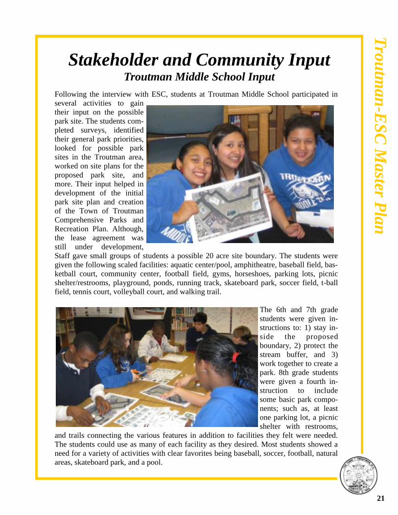
Following the interview with ESC, students at Troutman Middle School participated in
several activities to gain
their input on the possible
park site. The students com-
pleted surveys, identified
their general park priorities,
looked for possible park
sites in the Troutman area,
worked on site plans for the
proposed park site, and
more. Their input helped in
development of the initial
park site plan and creation
of the Town of Troutman
Comprehensive Parks and
Recreation Plan. Although,
the lease agreement was
still under development,
Staff gave small groups of students a possible 20 acre site boundary. The students were
given the following scaled facilities: aquatic center/pool, amphitheatre, baseball field, bas-
ketball court, community center, football field, gyms, horseshoes, parking lots, picnic
shelter/restrooms, playground, ponds, running track, skateboard park, soccer field, t-ball
field, tennis court, volleyball court, and walking trail.
The 6th and 7th grade
students were given in-
structions to: 1) stay in-
side the proposed
boundary, 2) protect the
stream buffer, and 3)
work together to create a
park. 8th grade students
were given a fourth in-
struction to include
some basic park compo-
nents; such as, at least
one parking lot, a picnic
shelter with restrooms,
and trails connecting the various features in addition to facilities they felt were needed.
The students could use as many of each facility as they desired. Most students showed a
need for a variety of activities with clear favorites being baseball, soccer, football, natural
areas, skateboard park, and a pool.
Tro
utm
an
-ES
C M
aster P
lan
22
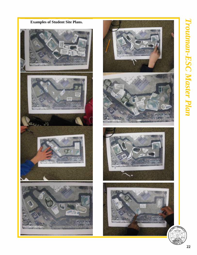
Examples of Student Site Plans.
Tro
utm
an
-ES
C M
aster P
lan
Stakeholder and Community Input Neighborhood Stakeholder Meeting
All adjacent property owners to the proposed park site were invited to give feedback on the pro-
ject. Ten property owners participated, with the majority of participants owning property on
Patterson Street. Those living on Patterson Street were especially concerned with the preserva-
tion of their quiet street. The proposed plan showed a full access entrance within their neighbor-
hood. Mrs. Elva Reavis spoke on behalf of Patterson Street residents at the neighborhood meet-
ing and the park public input meeting. The transcript of her concerns in its entirety can be found
in the appendix. Mrs. Reavis explained that 4 out of the 5 houses immediately bordering the
park were lived in by widows. She shared further concern over the proximity of the softball
field to these homes. Additionally, she noted that the trees within the property were virgin
woods and should be preserved. Other residents wanted screening of their property from the
park with a fence and vegetation. Some residents expressed fear that their property would lose
value. Studies from National Recreation and Park Association and Trust for Public Lands de-
termined the proximity of property to parks has a positive impact on value. Two residents spoke
in favor of the plan, one owning an apartment building on Sherrils Court. The other living on
North Eastway Dr expressed her hope that the park would be built so her young daughter and
many other children could enjoy a place to play in their own community. The remaining adja-
cent property owners were neutral on development of the park and had come to the meeting for
informational purposes.
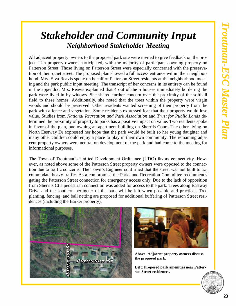
The Town of Troutman’s Unified Development Ordinance (UDO) favors connectivity. How-
ever, as noted above some of the Patterson Street property owners were opposed to the connec-
tion due to traffic concerns. The Town’s Engineer confirmed that the street was not built to ac-
commodate heavy traffic. As a compromise the Parks and Recreation Committee recommends
gating the Patterson Street connection for emergency access only. Due to the lack of opposition
from Sherrils Ct a pedestrian connection was added for access to the park. Trees along Eastway
Drive and the southern perimeter of the park will be left when possible and practical. Tree
planting, fencing, and ball netting are proposed for additional buffering of Patterson Street resi-
dences (including the Barker property).
Above: Adjacent property owners discuss
the proposed park.
Left: Proposed park amenities near Patter-
son Street residences.
23
Tro
utm
an
-ES
C M
aster P
lan
Stakeholder and Community Input Public Input Meeting
The public was invited to attend a public input meeting on September 14, 2010 to exclusively
discuss the proposed park. A presentation of efforts (see youth and general public input found
in the Comprehensive Parks and Recreation Plan) and frequently asked questions was given,
then the floor was opened up for questions and comments by the public, and followed by sta-
tions. Nearly thirty were in attendance, the majority of which spoke in support of the plan
(transcript found in the appendix).
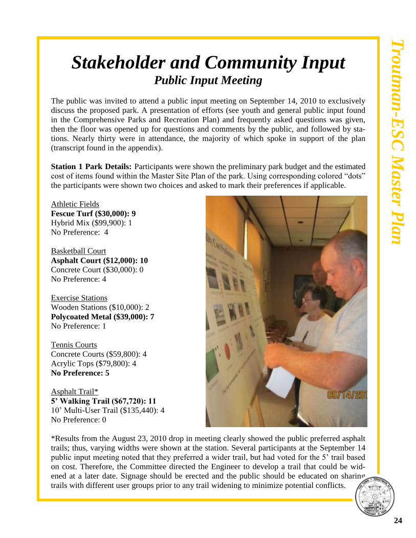
Station 1 Park Details: Participants were shown the preliminary park budget and the estimated
cost of items found within the Master Site Plan of the park. Using corresponding colored “dots”
the participants were shown two choices and asked to mark their preferences if applicable.
Athletic Fields
Fescue Turf ($30,000): 9
Hybrid Mix ($99,900): 1
No Preference: 4
Basketball Court
Asphalt Court ($12,000): 10
Concrete Court ($30,000): 0
No Preference: 4
Exercise Stations
Wooden Stations ($10,000): 2
Polycoated Metal ($39,000): 7
No Preference: 1
Tennis Courts
Concrete Courts ($59,800): 4
Acrylic Tops ($79,800): 4
No Preference: 5
Asphalt Trail*
5’ Walking Trail ($67,720): 11
10’ Multi-User Trail ($135,440): 4
No Preference: 0
*Results from the August 23, 2010 drop in meeting clearly showed the public preferred asphalt
trails; thus, varying widths were shown at the station. Several participants at the September 14
public input meeting noted that they preferred a wider trail, but had voted for the 5’ trail based
on cost. Therefore, the Committee directed the Engineer to develop a trail that could be wid-
ened at a later date. Signage should be erected and the public should be educated on sharing
trails with different user groups prior to any trail widening to minimize potential conflicts.
24
Tro
utm
an
-ES
C M
aster P
lan
Stakeholder and Community Input Public Input Meeting
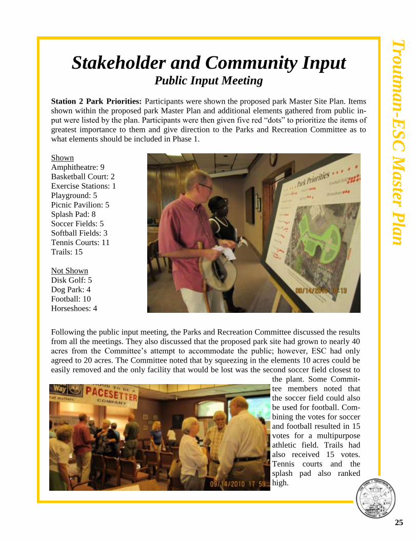
Station 2 Park Priorities: Participants were shown the proposed park Master Site Plan. Items
shown within the proposed park Master Plan and additional elements gathered from public in-
put were listed by the plan. Participants were then given five red “dots” to prioritize the items of
greatest importance to them and give direction to the Parks and Recreation Committee as to
what elements should be included in Phase 1.
Shown
Amphitheatre: 9
Basketball Court: 2
Exercise Stations: 1
Playground: 5
Picnic Pavilion: 5
Splash Pad: 8
Soccer Fields: 5
Softball Fields: 3
Tennis Courts: 11
Trails: 15
Not Shown
Disk Golf: 5
Dog Park: 4
Football: 10
Horseshoes: 4
Following the public input meeting, the Parks and Recreation Committee discussed the results
from all the meetings. They also discussed that the proposed park site had grown to nearly 40
acres from the Committee’s attempt to accommodate the public; however, ESC had only
agreed to 20 acres. The Committee noted that by squeezing in the elements 10 acres could be
easily removed and the only facility that would be lost was the second soccer field closest to
the plant. Some Commit-
tee members noted that
the soccer field could also
be used for football. Com-
bining the votes for soccer
and football resulted in 15
votes for a multipurpose
athletic field. Trails had
also received 15 votes.
Tennis courts and the
splash pad also ranked
high.
25
Tro
utm
an
-ES
C M
aster P
lan

Stakeholder and Community Input Public Input Meeting
The Committee concluded that the splash pad and amphitheatre were more seasonable in nature
and therefore, should be developed in a later phase. They revisited the Recreational Needs Sur-
veys, confirmed that soccer, football, and trails had ranked high. Also, based on survey results
they opted for an all seasons playground and picnic pavilion with the convenience of restrooms
for the first phase. Based on all the public input they further directed the Engineer to add
“shortcut trails” to Sherrils Court and from Town Hall, move the road to the lower portion of
the park to keep all facilities together and children from crisscrossing the parking area to get to
different facilities, add a third tennis court to allow for tournament games, move the amphithea-
tre closer to concessions, restrooms, and parking for convenience, denote that the Patterson
Street connection was for emergency access only, add turnaround spaces for cars, add bus park-
ing, add additional picnic facilities, and add horseshoes.
Other suggestions from the public that the committee recommends looking into upon park de-
velopment are lighting, landscaping, safety, and educational signage for the nature trail. Light-
ing comments were geared towards visibility, safety, and energy efficiency. A detailed land-
scaping plan will be developed following approval of the Master Site Plan for the park in accor-
dance with the Town of Troutman Unified Development Ordinance (UDO). Landscaping will
be required to buffer adjacent properties and to add shade to the parking areas. Additional land-
scaping is also proposed and recommended by the Committee for park aesthetics and additional
buffering of Patterson Street residents.
The Committee also determined that the nature trail could be included in Phase 1 as a civic
group project. The public had suggested educational signage be erected along the nature trail as
well. The two day charrette with the students of Troutman Middle School revealed aspirations
of continuing to participate in park planning and community development. Woody Keen with
Trail Dynamics, LLC notes that children should be kept in mind when trail building. He sug-
gests family involvement with trail construction, using various textures along trails, kid friendly
obstacles or elements, and signage that keeps kids plugged into the outdoors. For example at
Craters of the Moon National Monument Park in Idaho children drew pictures and developed
the text for educational signage. Following a similar approach at this park is recommended.
The National Crime Prevention Council
has developed “Crime Prevention Through
Environmental Design.” Part of this meth-
od includes avoidance of shrubbery which
could harbor unwanted persons. Due to
potential budget constraints in Phase 1
little to no lighting is proposed; thus, the
park should be closed after dark; unless
and until, lighting is added.
Photo by Woody Keen, Trail Dynamics, LLC
26
Tro
utm
an
-ES
C M
aster P
lan
Site Development
The Parks and Recreation Committee developed the Master Site Plan and Phase 1 from recrea-
tional needs findings in the Town of Troutman Comprehensive Parks and Recreation Plan, in-
put from adjacent property owners, and an exclusive meeting to discuss the park site with the
public. The project was presented to and received support from the following civic organiza-
tions: Greater-Statesville Chamber of Commerce, Girl Scouts of Iredell County, Lion’s Club of
Troutman, Troutman Area Council, and Troutman Rotary Club. The site was found to be suit-
able for park development through the environmental review.
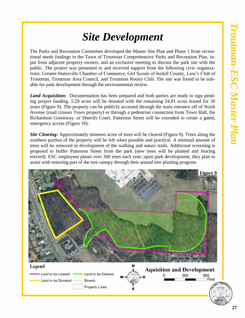
Land Acquisition: Documentation has been prepared and both parties are ready to sign pend-
ing project funding. 5.29 acres will be donated with the remaining 24.81 acres leased for 30
years (Figure 9). The property can be publicly accessed through the main entrance off of North
Avenue (road crosses Town property) or through a pedestrian connection from Town Hall, the
Richardson Greenway, or Sherrils Court. Patterson Street will be extended to create a gated,
emergency access (Figure 10).
Site Clearing: Approximately nineteen acres of trees will be cleared (Figure 9). Trees along the
southern portion of the property will be left when possible and practical. A minimal amount of
trees will be removed in development of the walking and nature trails. Additional screening is
proposed to buffer Patterson Street from the park (new trees will be planted and fencing
erected). ESC employees plants over 300 trees each year; upon park development, they plan to
assist with restoring part of the tree canopy through their annual tree planting program.
27
Figure 9
Tro
utm
an
-ES
C M
aster P
lan
Site Development
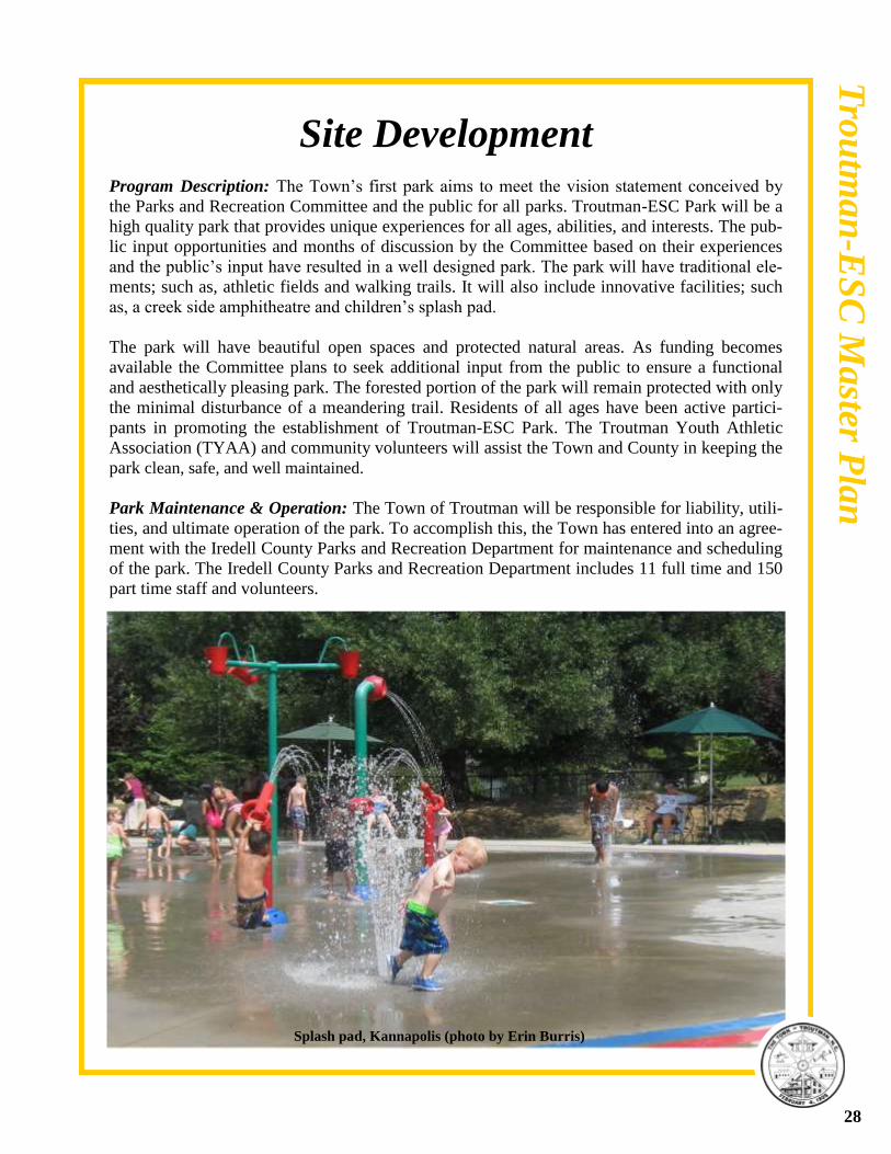
Program Description: The Town’s first park aims to meet the vision statement conceived by
the Parks and Recreation Committee and the public for all parks. Troutman-ESC Park will be a
high quality park that provides unique experiences for all ages, abilities, and interests. The pub-
lic input opportunities and months of discussion by the Committee based on their experiences
and the public’s input have resulted in a well designed park. The park will have traditional ele-
ments; such as, athletic fields and walking trails. It will also include innovative facilities; such
as, a creek side amphitheatre and children’s splash pad.
The park will have beautiful open spaces and protected natural areas. As funding becomes
available the Committee plans to seek additional input from the public to ensure a functional
and aesthetically pleasing park. The forested portion of the park will remain protected with only
the minimal disturbance of a meandering trail. Residents of all ages have been active partici-
pants in promoting the establishment of Troutman-ESC Park. The Troutman Youth Athletic
Association (TYAA) and community volunteers will assist the Town and County in keeping the
park clean, safe, and well maintained.
Park Maintenance & Operation: The Town of Troutman will be responsible for liability, utili-
ties, and ultimate operation of the park. To accomplish this, the Town has entered into an agree-
ment with the Iredell County Parks and Recreation Department for maintenance and scheduling
of the park. The Iredell County Parks and Recreation Department includes 11 full time and 150
part time staff and volunteers.
28
Splash pad, Kannapolis (photo by Erin Burris)
Tro
utm
an
-ES
C M
aster P
lan
Site Development
The existing county fee and scheduling system will be extended to this park site. Troutman
TYAA will get first priority to park facilities. There will be no fee to enter the park, but a fee
will be required to reserve facilities. For example, if an individual, business, or organization
wishes to reserve a facility; such as, a picnic shelter or ball field they would pay a fee to ensure
availability. However, if recreational facilities are not reserved, anyone can use them at no cost.
The only exception may be the future development of the splash pad. Due to the high cost of
water and staff needed to oversee the facility during seasonal operation, a minimal entrance fee
may be established for this element.
Permits Needed: The Master Site Plan and Phase 1 have been reviewed and recommended by
the Town of Troutman Technical Review Committee, Parks and Recreation Committee, Plan-
ning Board, and approved by the Town Board. A zoning permit, landscaping plans, and engi-
neering design documents will require additional approval from Town Staff. Permits will be
needed from Iredell County for soil and erosion, building, and health inspections. Prior to con-
struction of any amenities near I-L Creek, the location of such amenities will need to be staked
and approved by the US Army Corps of Engineers. The streets adjacent to the proposed park
are Town streets and the use will not adversely affect any state streets (as parks are typically
used during off-peak hours); therefore, no permits are required from NCDOT.
Master Site Plan: See Figure 10
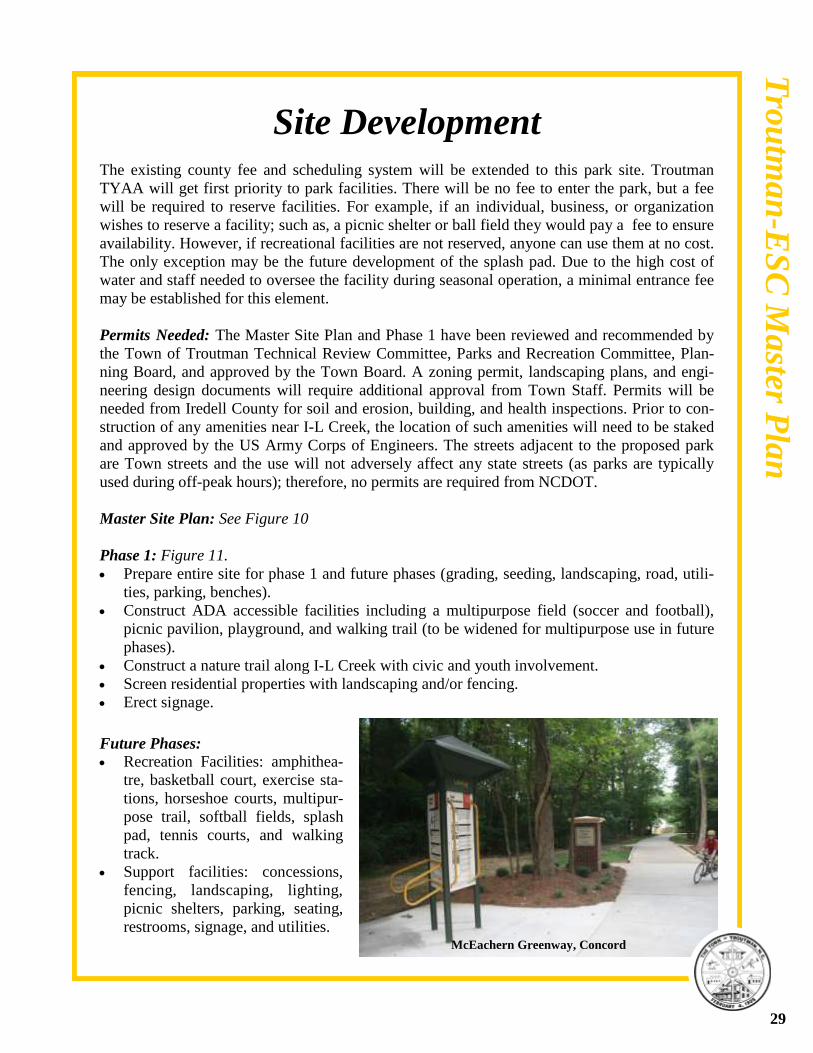
Phase 1: Figure 11.
Prepare entire site for phase 1 and future phases (grading, seeding, landscaping, road, utili-
ties, parking, benches).
Construct ADA accessible facilities including a multipurpose field (soccer and football),
picnic pavilion, playground, and walking trail (to be widened for multipurpose use in future
phases).
Construct a nature trail along I-L Creek with civic and youth involvement.
Screen residential properties with landscaping and/or fencing.
Erect signage.
29
Future Phases:
Recreation Facilities: amphithea-
tre, basketball court, exercise sta-
tions, horseshoe courts, multipur-
pose trail, softball fields, splash
pad, tennis courts, and walking
track.
Support facilities: concessions,
fencing, landscaping, lighting,
picnic shelters, parking, seating,
restrooms, signage, and utilities.
Tro
utm
an
-ES
C M
aster P
lan
McEachern Greenway, Concord

Page Holder (Figure 10)
30
Tro
utm
an
-ES
C M
aster P
lan

Page Holder (Figure 11)
31
Tro
utm
an
-ES
C M
aster P
lan

Site Development Budget Estimate for Entire Project
ITEM QUANTITY TOTAL PRICE
Paved Trail– Asphalt 2,388 LF @$18.00/LF $106,780.00
(5’ trail with fit stations)
Playground Lump Sum $120,000.00
(surfacing and equipment)
Ball fields Lump Sum $254,320.00
(fencing, dugouts, lighting)
Basketball Court-Asphalt Lump Sum $12,000.00
Tennis Courts– Acrylic Top Lump Sum $119,700.00
Amphitheatre Lump Sum $100,000.00
Horseshoes Lump Sum $300.00
Splash Pad Lump Sum $350,000.00
Main Pavilion Lump Sum $342,000.00
(restrooms, concessions, storage)
Softball Pavilion Lump Sum $182,500.00
(restrooms, concessions, storage)
Picnic Shelter Lump Sum $10,000.00
6’ Sidewalks– Concrete 1,514 LF @ $20.00/LF $39,480.00
Benches $1,500.00/EA $16,500.00
Roads and Parking Areas Lump Sum $168,480.00
Storm Drainage Lump Sum $148,260.00
(with catch basin)
Site Preparation Lump Sum $299,410.00
(erosion control, grading, seeding, matting)
Irrigation System Lump Sum $57,000.00
(multipurpose field and playing areas)
Landscaping Lump Sum $50,000.00
Trail and Street Lighting 72@1,400.00/EA $100,800.00
Cost to Develop Project $2,477,530.00
Contingencies (5%) $123,876.50
Planning/Incidental Cost (10%) $247,753.00
Land Acquisition/Donation ($496,800.00)
Total Project Cost $3,345,959.50
32
Tro
utm
an
-ES
C M
aster P
lan

Site Development Budget Estimate Phase 1
ITEM QUANTITY TOTAL PRICE
5’ Paved Trail– Asphalt 2,388 LF @$18.00/LF $43,000.00
(wooded area)
6’ Sidewalks– Concrete 1,514 LF @ $20.00/LF $30,300.00
Roads and Parking Areas Lump Sum $140,490.00
Storm Drainage Lump Sum $145,760.00
(with catch basin)
Site Preparation Lump Sum $289,410.00
(erosion control, grading,
seeding, matting)
Irrigation System Lump Sum $38,000.00
(multipurpose field and playing areas)
Playground Lump Sum $60,000.00
(surfacing and equipment)
Landscaping Lump Sum $20,000.00
Pavilion Lump Sum $257,000.00
(with restrooms, concessions,
storage)
Cost To Develop Project $1,023,690
Contingencies (5%) $51,200.00
Planning and Incidental Land Cost (10%) $102,400.00
Land Donation/Acquisition ($496,800.00)
Total Project Cost $1,674,360.00
Total PARTF Grant Request $500,000.00
Total Local Match $1,174,360.00
(includes land donation)
33
Tro
utm
an
-ES
C M
aster P
lan
Town of Troutman, North Carolina
2020 Comprehensive
Parks and Recreation Plan
Continued Adopted on January 13, 2011 by the Troutman Board of Aldermen
Community Input Overall Participation
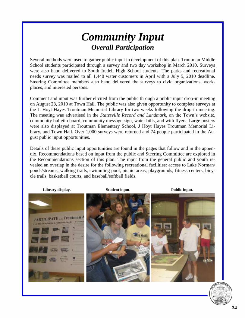
Several methods were used to gather public input in development of this plan. Troutman Middle
School students participated through a survey and two day workshop in March 2010. Surveys
were also hand delivered to South Iredell High School students. The parks and recreational
needs survey was mailed to all 1,440 water customers in April with a July 5, 2010 deadline.
Steering Committee members also hand delivered the surveys to civic organizations, work-
places, and interested persons.
Comment and input was further elicited from the public through a public input drop-in meeting
on August 23, 2010 at Town Hall. The public was also given opportunity to complete surveys at
the J. Hoyt Hayes Troutman Memorial Library for two weeks following the drop-in meeting.
The meeting was advertised in the Statesville Record and Landmark, on the Town’s website,
community bulletin board, community message sign, water bills, and with flyers. Large posters
were also displayed at Troutman Elementary School, J Hoyt Hayes Troutman Memorial Li-
brary, and Town Hall. Over 1,000 surveys were returned and 74 people participated in the Au-
gust public input opportunities.
Details of these public input opportunities are found in the pages that follow and in the appen-
dix. Recommendations based on input from the public and Steering Committee are explored in
the Recommendations section of this plan. The input from the general public and youth re-
vealed an overlap in the desire for the following recreational facilities: access to Lake Norman/
ponds/streams, walking trails, swimming pool, picnic areas, playgrounds, fitness centers, bicy-
cle trails, basketball courts, and baseball/softball fields.
34
Library display. Student input. Public input.
Troutman’s Youth
Public Participation of Troutman’s Youth Following the formation of the Park Planning Committee, Troutman staff spent two days in
March with the students of Troutman Middle School (TMS) to gather the views of young citi-
zens in regards to parks and recreation. As a result 348 Middle School students filled out a rec-
reational needs survey and worked through several public input exercises. In an effort to further
include the viewpoints of the youth the Parks and Recreation Committee also solicited the input
of South Iredell High School (SIHS) students through a recreational needs survey, nearly 400
students responded. Due to logistics and time constraints the surveys were brief, but the results
provided valuable insight into the needs of Troutman’s youngest citizens.
The students at TMS were respectful, alert, insightful, and thankful for the opportunity for their
voice to be heard. The views below showcase the exuberance of youth, but also highlight a
commonality in many respects to the needs of adults.
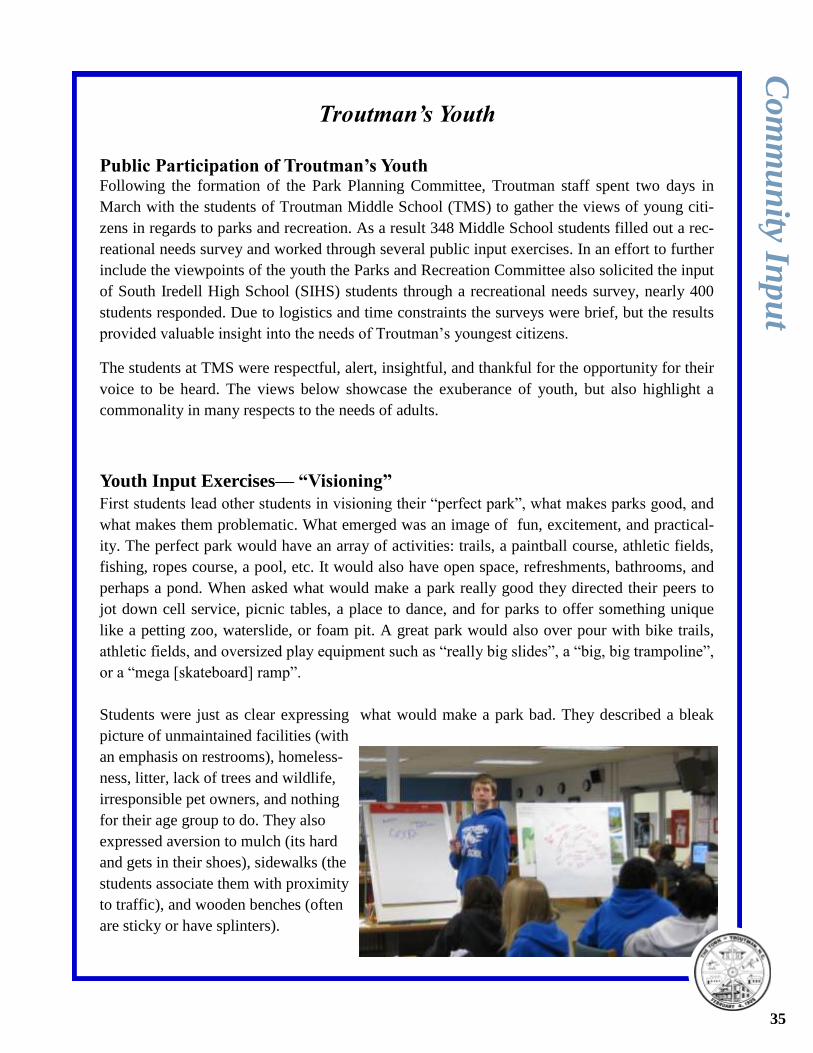
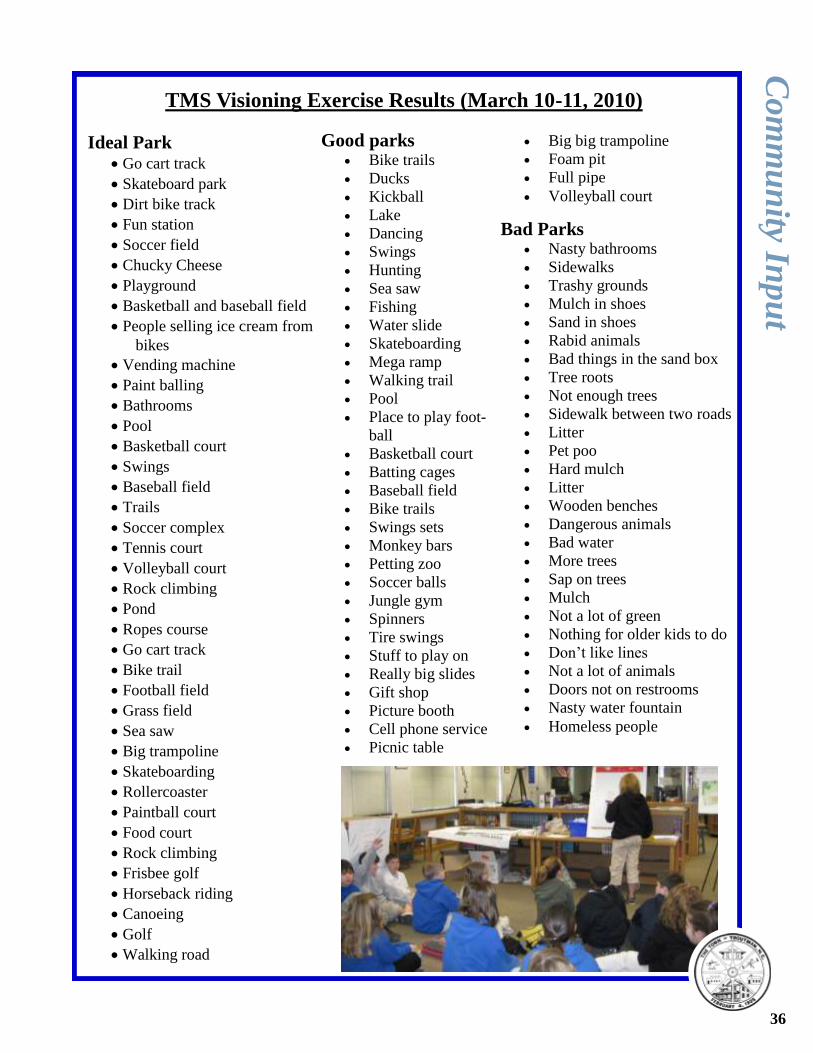
Youth Input Exercises— “Visioning”
First students lead other students in visioning their “perfect park”, what makes parks good, and
what makes them problematic. What emerged was an image of fun, excitement, and practical-
ity. The perfect park would have an array of activities: trails, a paintball course, athletic fields,
fishing, ropes course, a pool, etc. It would also have open space, refreshments, bathrooms, and
perhaps a pond. When asked what would make a park really good they directed their peers to
jot down cell service, picnic tables, a place to dance, and for parks to offer something unique
like a petting zoo, waterslide, or foam pit. A great park would also over pour with bike trails,
athletic fields, and oversized play equipment such as “really big slides”, a “big, big trampoline”,
or a “mega [skateboard] ramp”.
Students were just as clear expressing what would make a park bad. They described a bleak
picture of unmaintained facilities (with
an emphasis on restrooms), homeless-
ness, litter, lack of trees and wildlife,
irresponsible pet owners, and nothing
for their age group to do. They also
expressed aversion to mulch (its hard
and gets in their shoes), sidewalks (the
students associate them with proximity
to traffic), and wooden benches (often
are sticky or have splinters).
Co
mm
un
ity Inp
ut
35
Ideal Park Go cart track
Skateboard park
Dirt bike track
Fun station
Soccer field
Chucky Cheese
Playground
Basketball and baseball field
People selling ice cream from
bikes
Vending machine
Paint balling
Bathrooms
Pool
Basketball court
Swings
Baseball field
Trails
Soccer complex
Tennis court
Volleyball court
Rock climbing
Pond
Ropes course
Go cart track
Bike trail
Football field
Grass field
Sea saw
Big trampoline
Skateboarding
Rollercoaster
Paintball court
Food court
Rock climbing
Frisbee golf
Horseback riding
Canoeing
Golf
Walking road
Good parks Bike trails
Ducks
Kickball
Lake
Dancing
Swings
Hunting
Sea saw
Fishing
Water slide
Skateboarding
Mega ramp
Walking trail
Pool
Place to play foot-
ball
Basketball court
Batting cages
Baseball field
Bike trails
Swings sets
Monkey bars
Petting zoo
Soccer balls
Jungle gym
Spinners
Tire swings
Stuff to play on
Really big slides
Gift shop
Picture booth
Cell phone service
Picnic table
Big big trampoline
Foam pit
Full pipe
Volleyball court
Bad Parks Nasty bathrooms
Sidewalks
Trashy grounds
Mulch in shoes
Sand in shoes
Rabid animals
Bad things in the sand box
Tree roots
Not enough trees
Sidewalk between two roads
Litter
Pet poo
Hard mulch
Litter
Wooden benches
Dangerous animals
Bad water
More trees
Sap on trees
Mulch
Not a lot of green
Nothing for older kids to do
Don’t like lines
Not a lot of animals
Doors not on restrooms
Nasty water fountain
Homeless people
TMS Visioning Exercise Results (March 10-11, 2010)
Co
mm
un
ity Inp
ut
36
Youth Input Exercises— “Stations”
Following the visioning process, students rotated through four stations 1) to find possible park
sites in the Troutman area, 2) conceptualize a park site, 3) identify their recreational needs, and
4) complete surveys. Town staff went to TMS with the knowledge that Troutman-ESC Park
was a possibility, but prepared activities that would be of value in overall planning for parks
and recreational facilities in the years to come.
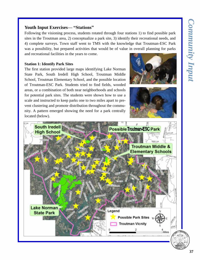
Station 1: Identify Park Sites
The first station provided large maps identifying Lake Norman
State Park, South Iredell High School, Troutman Middle
School, Troutman Elementary School, and the possible location
of Troutman-ESC Park. Students tried to find fields, wooded
areas, or a combination of both near neighborhoods and schools
for potential park sites. The students were shown how to use a
scale and instructed to keep parks one to two miles apart to pre-
vent clustering and promote distribution throughout the commu-
nity. A pattern emerged showing the need for a park centrally
located (below).
Co
mm
un
ity Inp
ut
37
Aquatic centers
Amphitheatres
Baseball fields
Basketball courts
Community centers
Football fields
Gyms
Horseshoes
Parking lots
Picnic shelters/restrooms
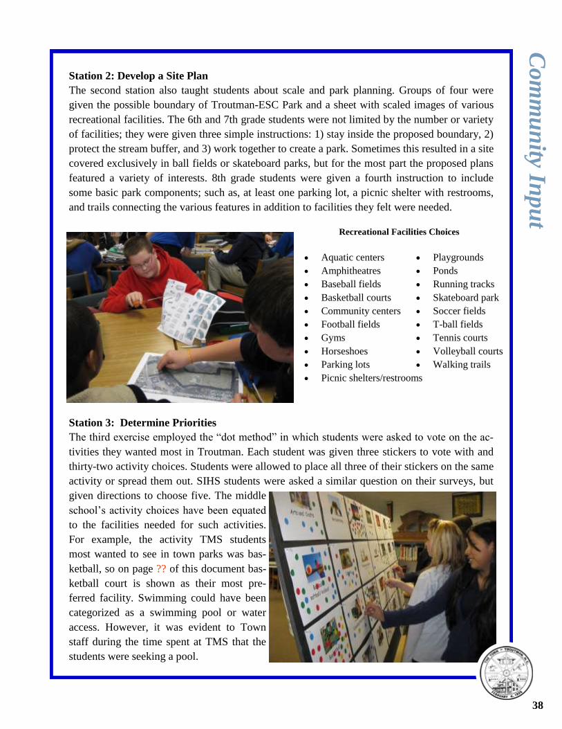
Station 2: Develop a Site Plan
The second station also taught students about scale and park planning. Groups of four were
given the possible boundary of Troutman-ESC Park and a sheet with scaled images of various
recreational facilities. The 6th and 7th grade students were not limited by the number or variety
of facilities; they were given three simple instructions: 1) stay inside the proposed boundary, 2)
protect the stream buffer, and 3) work together to create a park. Sometimes this resulted in a site
covered exclusively in ball fields or skateboard parks, but for the most part the proposed plans
featured a variety of interests. 8th grade students were given a fourth instruction to include
some basic park components; such as, at least one parking lot, a picnic shelter with restrooms,
and trails connecting the various features in addition to facilities they felt were needed.
Station 3: Determine Priorities
The third exercise employed the “dot method” in which students were asked to vote on the ac-
tivities they wanted most in Troutman. Each student was given three stickers to vote with and
thirty-two activity choices. Students were allowed to place all three of their stickers on the same
activity or spread them out. SIHS students were asked a similar question on their surveys, but
given directions to choose five. The middle
school’s activity choices have been equated
to the facilities needed for such activities.
For example, the activity TMS students
most wanted to see in town parks was bas-
ketball, so on page ?? of this document bas-
ketball court is shown as their most pre-
ferred facility. Swimming could have been
categorized as a swimming pool or water
access. However, it was evident to Town
staff during the time spent at TMS that the
students were seeking a pool.
Playgrounds
Ponds
Running tracks
Skateboard park
Soccer fields
T-ball fields
Tennis courts
Volleyball courts
Walking trails
Recreational Facilities Choices
Co
mm
un
ity Inp
ut
38
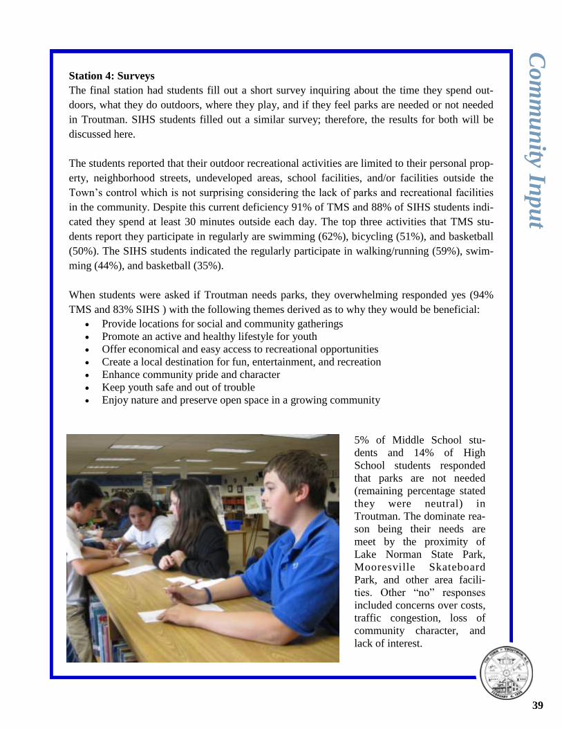
Station 4: Surveys
The final station had students fill out a short survey inquiring about the time they spend out-
doors, what they do outdoors, where they play, and if they feel parks are needed or not needed
in Troutman. SIHS students filled out a similar survey; therefore, the results for both will be
discussed here.
The students reported that their outdoor recreational activities are limited to their personal prop-
erty, neighborhood streets, undeveloped areas, school facilities, and/or facilities outside the
Town’s control which is not surprising considering the lack of parks and recreational facilities
in the community. Despite this current deficiency 91% of TMS and 88% of SIHS students indi-
cated they spend at least 30 minutes outside each day. The top three activities that TMS stu-
dents report they participate in regularly are swimming (62%), bicycling (51%), and basketball
(50%). The SIHS students indicated the regularly participate in walking/running (59%), swim-
ming (44%), and basketball (35%).
When students were asked if Troutman needs parks, they overwhelming responded yes (94%
TMS and 83% SIHS ) with the following themes derived as to why they would be beneficial:
Provide locations for social and community gatherings
Promote an active and healthy lifestyle for youth
Offer economical and easy access to recreational opportunities
Create a local destination for fun, entertainment, and recreation
Enhance community pride and character
Keep youth safe and out of trouble
Enjoy nature and preserve open space in a growing community
5% of Middle School stu-
dents and 14% of High
School students responded
that parks are not needed
(remaining percentage stated
they were neutral) in
Troutman. The dominate rea-
son being their needs are
meet by the proximity of
Lake Norman State Park,
Mooresville Skateboard
Park, and other area facili-
ties. Other “no” responses
included concerns over costs,
traffic congestion, loss of
community character, and
lack of interest.
Co
mm
un
ity Inp
ut
39
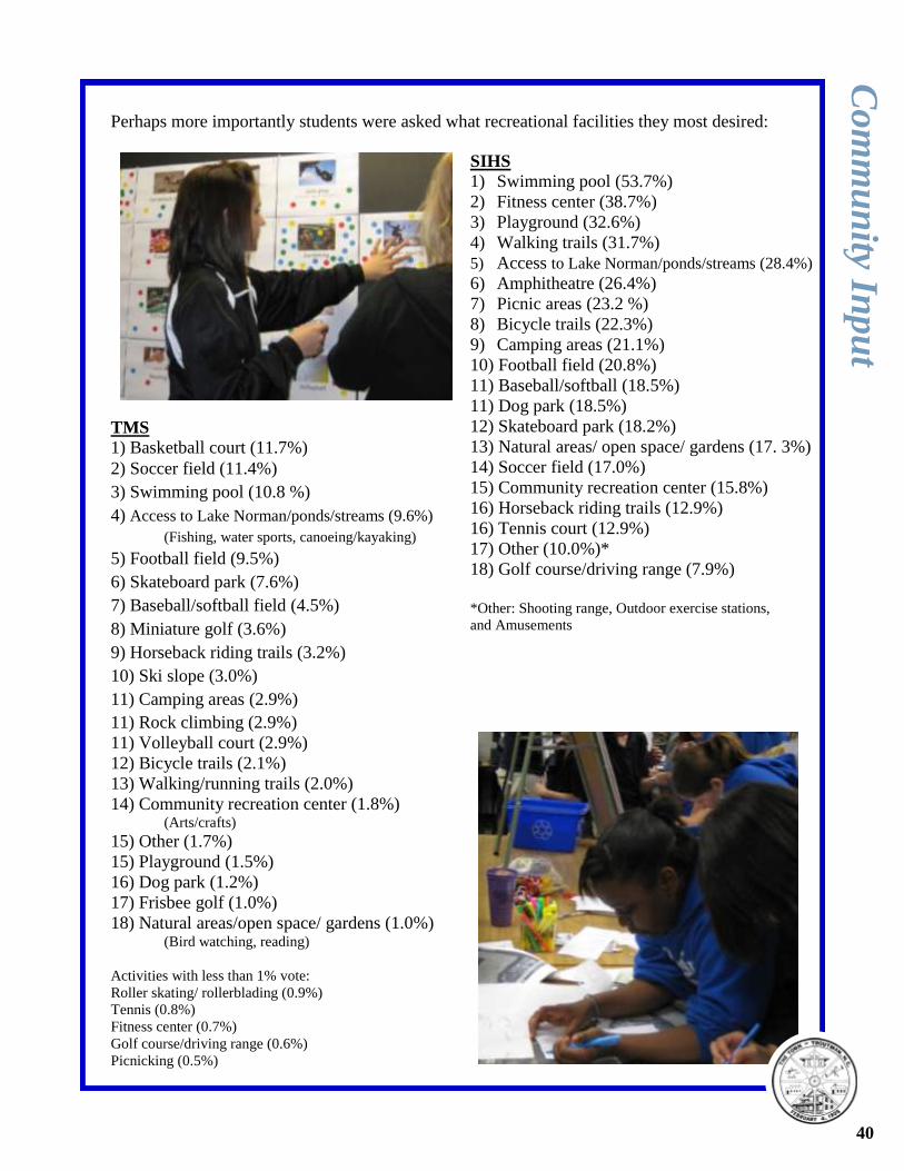
Perhaps more importantly students were asked what recreational facilities they most desired:
TMS
1) Basketball court (11.7%)
2) Soccer field (11.4%)
3) Swimming pool (10.8 %)
4) Access to Lake Norman/ponds/streams (9.6%)
(Fishing, water sports, canoeing/kayaking)
5) Football field (9.5%)
6) Skateboard park (7.6%)
7) Baseball/softball field (4.5%)
8) Miniature golf (3.6%)
9) Horseback riding trails (3.2%)
10) Ski slope (3.0%)
11) Camping areas (2.9%)
11) Rock climbing (2.9%)
11) Volleyball court (2.9%)
12) Bicycle trails (2.1%)
13) Walking/running trails (2.0%)
14) Community recreation center (1.8%) (Arts/crafts)
15) Other (1.7%)
15) Playground (1.5%)
16) Dog park (1.2%)
17) Frisbee golf (1.0%)
18) Natural areas/open space/ gardens (1.0%) (Bird watching, reading)
Activities with less than 1% vote:
Roller skating/ rollerblading (0.9%)
Tennis (0.8%)
Fitness center (0.7%)
Golf course/driving range (0.6%)
Picnicking (0.5%)
SIHS
1) Swimming pool (53.7%)
2) Fitness center (38.7%)
3) Playground (32.6%)
4) Walking trails (31.7%)
5) Access to Lake Norman/ponds/streams (28.4%)
6) Amphitheatre (26.4%)
7) Picnic areas (23.2 %)
8) Bicycle trails (22.3%)
9) Camping areas (21.1%)
10) Football field (20.8%)
11) Baseball/softball (18.5%)
11) Dog park (18.5%)
12) Skateboard park (18.2%)
13) Natural areas/ open space/ gardens (17. 3%)
14) Soccer field (17.0%)
15) Community recreation center (15.8%)
16) Horseback riding trails (12.9%)
16) Tennis court (12.9%)
17) Other (10.0%)*
18) Golf course/driving range (7.9%)
*Other: Shooting range, Outdoor exercise stations,
and Amusements
Co
mm
un
ity Inp
ut
40
Troutman’s Public
Public Participation The Parks and Recreation Committee served as the steering committee for this document. In
April a survey was sent out to all 1,440 water customers and the committee worked to get the
survey out to various groups in the Troutman area. The survey officially closed on July 5, 2010
with 310 participants. In early summer, staff lead the Committee through two Action Planning
workshops to determine parks and recreational needs and develop a draft vision and goals. The
public was then invited to participate in a public input drop in meeting on August 23, 2010 to
comment on the Comprehensive Parks and Recreation Plan and community park site. A second
public input meeting to exclusively discuss the master plan for the Town’s first community park
was held September 14, 2010. The public also had opportunities to participate through a display
at the J Hoyt Hayes Troutman Memorial Library. The public was informed of the meetings
through the newspaper ads, website notices, social media, water bills, flyers, e-mails, the scroll-
ing community sign, and word of mouth.
“Visioning”
Staff asked the steering committee the same questions asked of Troutman Middle School stu-
dents: what makes parks ideal, good, and problematic. Additionally staff asked the steering
committee to consider the threats and opportunities facing park development in Troutman. The
steering committee noted uniqueness, inclusiveness, and a nurturing community spirit make
ideal parks. Furthermore, they suggested that parks are made great with safety features; such as
lighting, visibility, maintenance, and activity. Lack of shade, poor parking, and a deficiency in
activities were reasons listed for uninviting parks. The steering committee noted opportunities
for park development in Troutman include knowledgeable citizens, proximity to water, and land
availability. Threats include development pressure, lack of a parks and recreation department,
and misconceptions (specifically, a recent announcement of a baseball complex in the county.
Some committee members expressed concern that it may appear that Troutman residents will
have access to the complex, and thus are not in need of ball fields. However, this particular fa-
cility is proposed to be a commercial training facility.)
Based on these visioning exercises and comment from the youth and general public the follow-
ing vision statement emerged:
Troutman’s high-quality parks, beautiful open spaces, protected natural areas, and innovative
recreational facilities are welcoming to all. The verdant parks have been thoughtfully de-
signed to be accessible and offer unique experiences for all ages, abilities, and interests.
The Town’s greenways offer easily navigable and integrated connections between neighbor-
hoods, community destinations, and town parks. Residents are active participants in promot-
ing the establishment of new parks and recreational programs while keeping existing facilities
clean, safe, and well maintained for the Town’s current and future residents.
Co
mm
un
ity Inp
ut
41
Ideal Park Climbing toys
Amusements
Monkey bars
Bike path/twisty walkway
connecting facilities
Playgrounds by fields/facilities
Picnic areas
Hopscotch
Trees
Safe
Sandbox
Baseball field
Basketball court
Athletic fields
Accessible equipment to the
handicapped community
(swings, basketball goals,
etc.)
Swings
Water fountain
Shaded areas
Sprayground/splash pad
Restrooms near rec facilities
Bocce court
Concessions– ice cream
Amphitheatre
Open space
Clean, well-kept restrooms
Large shelters for gatherings
Kiosk/information booth
Good spectator seating
Picnic areas
Putt putt
Bike trails
Parking
Connection to other parks with
greenway
Cardio/ exercise station
Nature center
Pond/ water feature
Fishing
Cooking facilities
Good parks Water feature
Visibility
Variety
1st aide station
Trees
Natural settings
Safe
Community
Lights
Clean
Paved parking
Facilities in good
condition/ well
maintained
Active park
Bad Parks Overflowing trash-
cans
Poor parking
No variety
Flat, boring terrain
Dogs
Can’t see the park
Unsafe
Dust
Poor seating
Bad field conditions
Vandalism
No shade
Sand
Community
Bugs
Opportunities Knowledgeable citizens re-
garding sports and recreation
Land availability
Partnership with businesses
Already have organized
youth sports
Fair amount of existing fa-
cilities nearby
Baseball park/complex
Proximity to water
Concerned citizens
County for maintenance and
management
Place for low-moderate in-
come to play
Threats Contentment with the status
quo
Aging community
Maintenance concerns
Limited resources– need
more businesses
Baseball park/complex
Parks not being kept for rec-
reational use by the
Troutman community
Roads
Land development
Lack of support
No parks and rec dept
Misconceptions
Lack of education
Funding
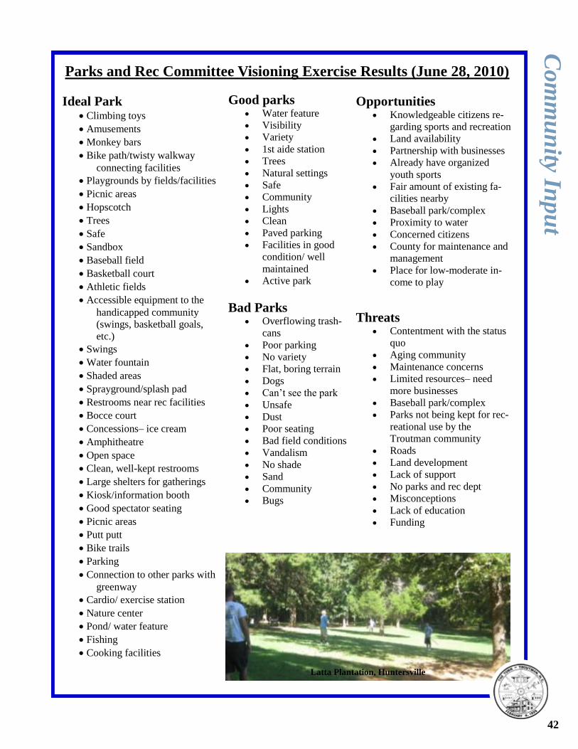
Parks and Rec Committee Visioning Exercise Results (June 28, 2010)
Co
mm
un
ity Inp
ut
42
Latta Plantation, Huntersville
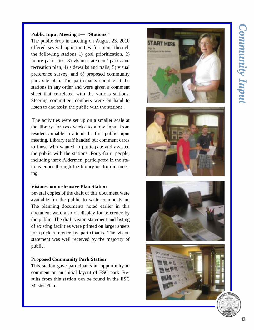
Public Input Meeting 1— “Stations”
The public drop in meeting on August 23, 2010
offered several opportunities for input through
the following stations 1) goal prioritization, 2)
future park sites, 3) vision statement/ parks and
recreation plan, 4) sidewalks and trails, 5) visual
preference survey, and 6) proposed community
park site plan. The participants could visit the
stations in any order and were given a comment
sheet that correlated with the various stations.
Steering committee members were on hand to
listen to and assist the public with the stations.
The activities were set up on a smaller scale at
the library for two weeks to allow input from
residents unable to attend the first public input
meeting. Library staff handed out comment cards
to those who wanted to participate and assisted
the public with the stations. Forty-four people,
including three Aldermen, participated in the sta-
tions either through the library or drop in meet-
ing.
Vision/Comprehensive Plan Station
Several copies of the draft of this document were
available for the public to write comments in.
The planning documents noted earlier in this
document were also on display for reference by
the public. The draft vision statement and listing
of existing facilities were printed on larger sheets
for quick reference by participants. The vision
statement was well received by the majority of
public.
Proposed Community Park Station
This station gave participants an opportunity to
comment on an initial layout of ESC park. Re-
sults from this station can be found in the ESC
Master Plan.
Co
mm
un
ity Inp
ut
43
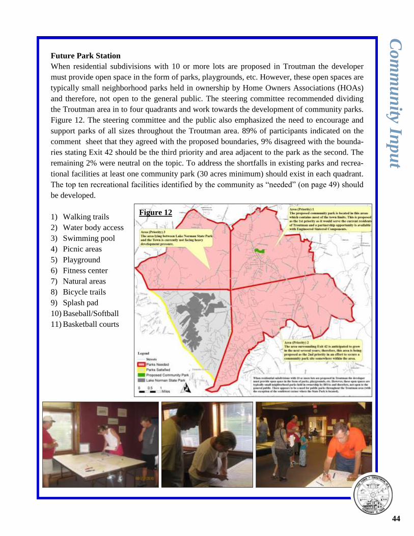
Future Park Station
When residential subdivisions with 10 or more lots are proposed in Troutman the developer
must provide open space in the form of parks, playgrounds, etc. However, these open spaces are
typically small neighborhood parks held in ownership by Home Owners Associations (HOAs)
and therefore, not open to the general public. The steering committee recommended dividing
the Troutman area in to four quadrants and work towards the development of community parks.
Figure 12. The steering committee and the public also emphasized the need to encourage and
support parks of all sizes throughout the Troutman area. 89% of participants indicated on the
comment sheet that they agreed with the proposed boundaries, 9% disagreed with the bounda-
ries stating Exit 42 should be the third priority and area adjacent to the park as the second. The
remaining 2% were neutral on the topic. To address the shortfalls in existing parks and recrea-
tional facilities at least one community park (30 acres minimum) should exist in each quadrant.
The top ten recreational facilities identified by the community as “needed” (on page 49) should
be developed.
1) Walking trails
2) Water body access
3) Swimming pool
4) Picnic areas
5) Playground
6) Fitness center
7) Natural areas
8) Bicycle trails
9) Splash pad
10) Baseball/Softball
11) Basketball courts
Co
mm
un
ity Inp
ut
44
Figure 12
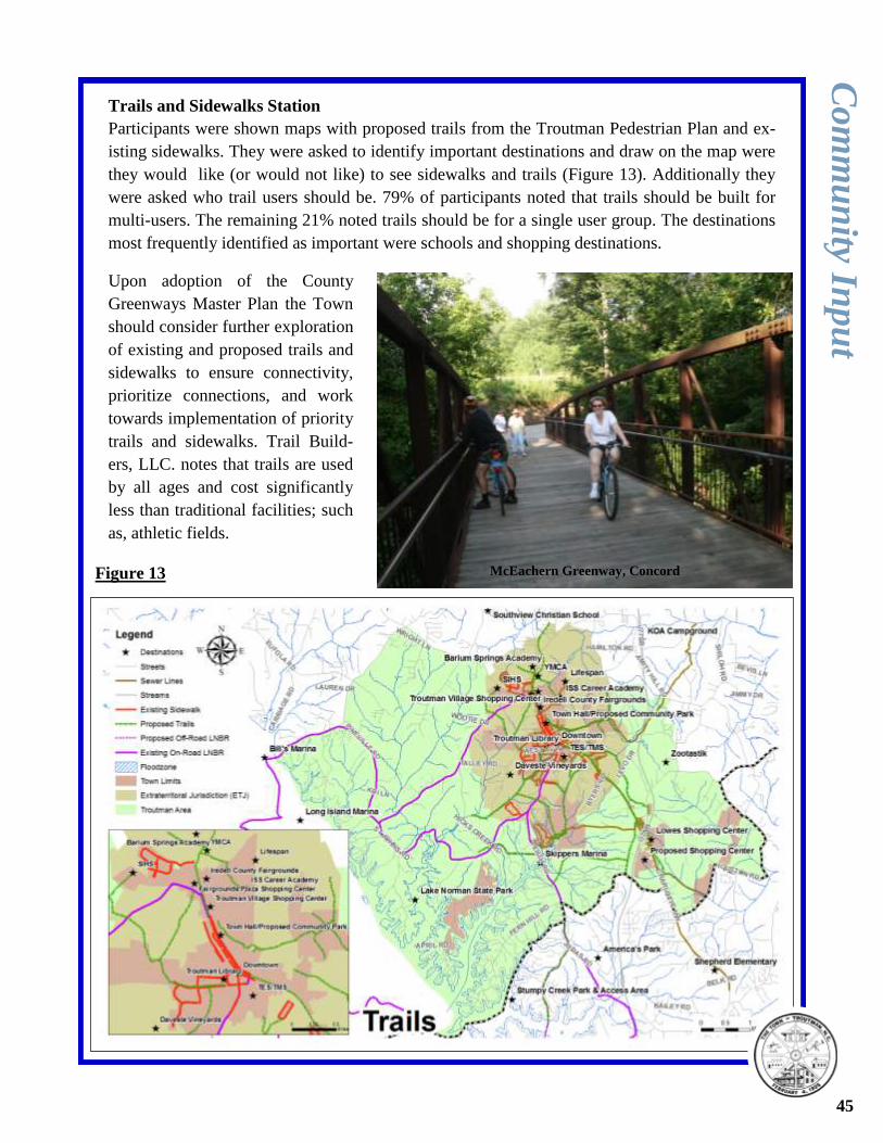
Trails and Sidewalks Station
Participants were shown maps with proposed trails from the Troutman Pedestrian Plan and ex-
isting sidewalks. They were asked to identify important destinations and draw on the map were
they would like (or would not like) to see sidewalks and trails (Figure 13). Additionally they
were asked who trail users should be. 79% of participants noted that trails should be built for
multi-users. The remaining 21% noted trails should be for a single user group. The destinations
most frequently identified as important were schools and shopping destinations.
Co
mm
un
ity Inp
ut
45
Upon adoption of the County
Greenways Master Plan the Town
should consider further exploration
of existing and proposed trails and
sidewalks to ensure connectivity,
prioritize connections, and work
towards implementation of priority
trails and sidewalks. Trail Build-
ers, LLC. notes that trails are used
by all ages and cost significantly
less than traditional facilities; such
as, athletic fields.
Figure 13 McEachern Greenway, Concord
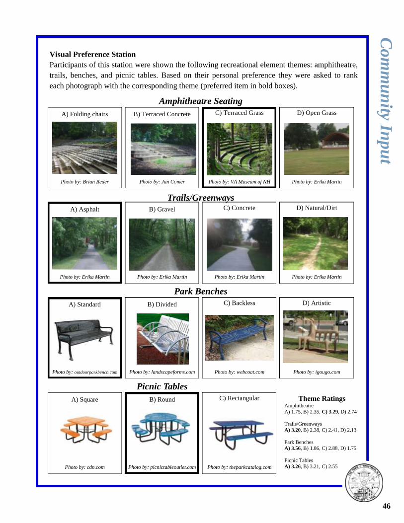
Visual Preference Station
Participants of this station were shown the following recreational element themes: amphitheatre,
trails, benches, and picnic tables. Based on their personal preference they were asked to rank
each photograph with the corresponding theme (preferred item in bold boxes).
Co
mm
un
ity Inp
ut
A) Folding chairs
Photo by: Brian Reder
B) Terraced Concrete C) Terraced Grass D) Open Grass
Photo by: Jan Comer Photo by: Erika Martin Photo by: VA Museum of NH
A) Asphalt
Photo by: Erika Martin
B) Gravel C) Concrete D) Natural/Dirt
Photo by: Erika Martin Photo by: Erika Martin Photo by: Erika Martin
A) Standard
Photo by: outdoorparkbench.com
B) Divided C) Backless D) Artistic
Photo by: landscapeforms.com Photo by: igougo.com Photo by: webcoat.com
A) Square
Photo by: cdn.com
B) Round C) Rectangular
Photo by: picnictableoutlet.com Photo by: theparkcatalog.com
Park Benches
Trails/Greenways
Amphitheatre Seating
Picnic Tables
Theme Ratings Amphitheatre
A) 1.75, B) 2.35, C) 3.29, D) 2.74
Trails/Greenways
A) 3.20, B) 2.38, C) 2.41, D) 2.13
Park Benches
A) 3.56, B) 1.86, C) 2.88, D) 1.75
Picnic Tables
A) 3.26, B) 3.21, C) 2.55
46
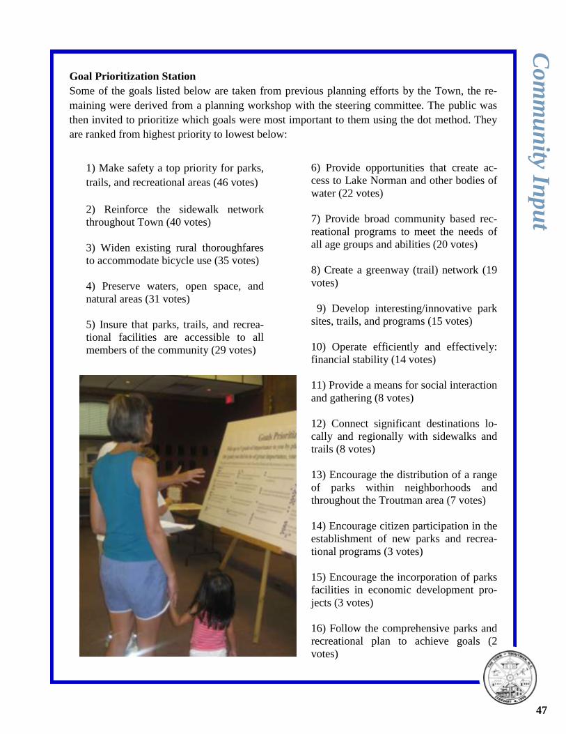
Goal Prioritization Station
Some of the goals listed below are taken from previous planning efforts by the Town, the re-
maining were derived from a planning workshop with the steering committee. The public was
then invited to prioritize which goals were most important to them using the dot method. They
are ranked from highest priority to lowest below:
Co
mm
un
ity Inp
ut
6) Provide opportunities that create ac-
cess to Lake Norman and other bodies of
water (22 votes)
7) Provide broad community based rec-
reational programs to meet the needs of
all age groups and abilities (20 votes)
8) Create a greenway (trail) network (19
votes)
9) Develop interesting/innovative park
sites, trails, and programs (15 votes)
10) Operate efficiently and effectively:
financial stability (14 votes)
11) Provide a means for social interaction
and gathering (8 votes)
12) Connect significant destinations lo-
cally and regionally with sidewalks and
trails (8 votes)
13) Encourage the distribution of a range
of parks within neighborhoods and
throughout the Troutman area (7 votes)
14) Encourage citizen participation in the
establishment of new parks and recrea-
tional programs (3 votes)
15) Encourage the incorporation of parks
facilities in economic development pro-
jects (3 votes)
16) Follow the comprehensive parks and
recreational plan to achieve goals (2
votes)
1) Make safety a top priority for parks,
trails, and recreational areas (46 votes)
2) Reinforce the sidewalk network
throughout Town (40 votes)
3) Widen existing rural thoroughfares
to accommodate bicycle use (35 votes)
4) Preserve waters, open space, and
natural areas (31 votes)
5) Insure that parks, trails, and recrea-
tional facilities are accessible to all
members of the community (29 votes)
47
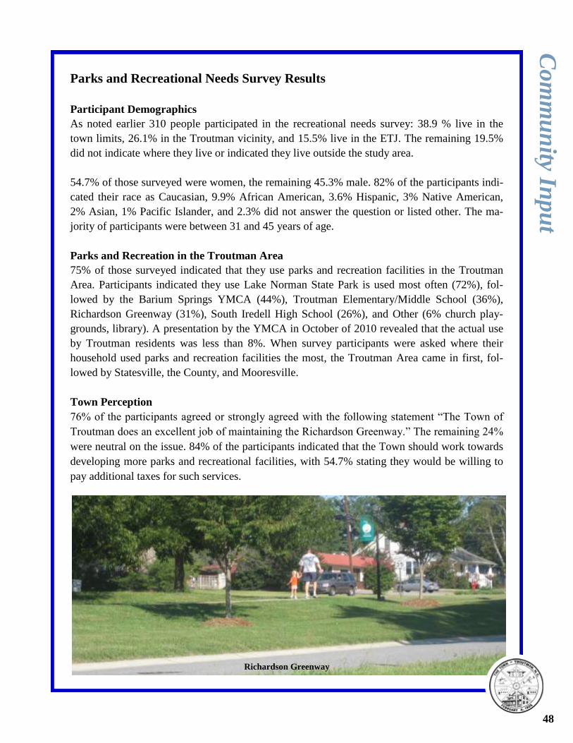
Parks and Recreational Needs Survey Results
Participant Demographics
As noted earlier 310 people participated in the recreational needs survey: 38.9 % live in the
town limits, 26.1% in the Troutman vicinity, and 15.5% live in the ETJ. The remaining 19.5%
did not indicate where they live or indicated they live outside the study area.
54.7% of those surveyed were women, the remaining 45.3% male. 82% of the participants indi-
cated their race as Caucasian, 9.9% African American, 3.6% Hispanic, 3% Native American,
2% Asian, 1% Pacific Islander, and 2.3% did not answer the question or listed other. The ma-
jority of participants were between 31 and 45 years of age.
Parks and Recreation in the Troutman Area
75% of those surveyed indicated that they use parks and recreation facilities in the Troutman
Area. Participants indicated they use Lake Norman State Park is used most often (72%), fol-
lowed by the Barium Springs YMCA (44%), Troutman Elementary/Middle School (36%),
Richardson Greenway (31%), South Iredell High School (26%), and Other (6% church play-
grounds, library). A presentation by the YMCA in October of 2010 revealed that the actual use
by Troutman residents was less than 8%. When survey participants were asked where their
household used parks and recreation facilities the most, the Troutman Area came in first, fol-
lowed by Statesville, the County, and Mooresville.
Town Perception
76% of the participants agreed or strongly agreed with the following statement “The Town of
Troutman does an excellent job of maintaining the Richardson Greenway.” The remaining 24%
were neutral on the issue. 84% of the participants indicated that the Town should work towards
developing more parks and recreational facilities, with 54.7% stating they would be willing to
pay additional taxes for such services.
Co
mm
un
ity Inp
ut
48
Richardson Greenway
Parks and Recreational Needs Survey Results Continued
Co
mm
un
ity Inp
ut
Recreational Activities
1) Walking/Running (63.5%)
2) Swimming/Aquatics (47.4%)
3) Fishing (42.3%)
4) Fitness Programs (38.2%)
5) Baseball/Softball/Kickball (36.9%)
6) Picnicking (36.2%)
7) Reading (35.5%)
8) Basketball (34.1%)
9) Hiking (33.4%)
10) Dog Walking (31.4%)
11) Camping (30.7%)
11) Football (30.7%)
12) Soccer (30.4%)
13) Bicycling, Road/Greenway (28%)
14) Arts and Crafts (27.3%)
14) Golf (27.3%)
15) Miniature Golf (26.6%)
16) Water Sports (25.3%)
17) Site Seeing (23.5%)
18) Tennis (20.8%)
19) Bicycling, Mountain (20.1%)
20) Solo Play (19.8 %)
21) Canoeing/Kayaking (16.7%)
22) Performing Arts (16%)
23) Bird Watching (15.7%)
23) Shooting Sports (15.7%)
24) Volleyball (12.6%)
25) Horseback Riding (10.6%)
26) Roller-Skating/ Rollerblading (9.6%)
27) Other (8.5%) *
28) Horseshoes (8.2%)
29) Frisbee Golf (7.8%)
30) Frisbee (6.1%)
31) Rock Climbing (4.8%)
32) Skateboarding (4.4%)
33) Bicycling, Motocross (1.7%)
* Other: Amusements, ATV riding, Community
Events, Geocaching, Gardening, & Travel.
Recreational Facilities
1) Walking Trails (66.9%)
2) Access to Lake Norman/Ponds/Streams (66.2%)
3) Swimming Pool/Aquatics Center (53%)
4) Picnic Areas (49.1%)
5) Playground (48.1%)
6) Fitness Center (45.6%)
7) Natural Areas/Open Areas/Gardens (41.8%)
8) Bicycle Trails (35.5%)
9) Water Spray Park/Splash Pad (31.4%)
10) Baseball/Softball Fields (33.1%)
10) Basketball Courts (33.1%)
11) Soccer Fields (30.7%)
12) Community Recreation Center (29.3%)
13) Camping Areas (28.6%)
14) Amphitheatre (27.5%)
15) Football Field (26.5%)
16) Dog Park (25.4%)
17) Golf Course (23.7%)
17) Tennis Courts (23.7%)
18) Education Center (19.2%)
19) Golf Driving Range (18.1%)
20) Volleyball Courts (13.6%)
21) Horseback Riding Trails (10.8%)
22) Skateboard Park (5.9%)
23) Other (4.5) **
**Other: Batting Cages
49
McEachern Greenway, Concord (photo by Bill Galloway)
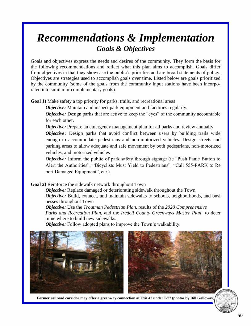
Recommendations & Implementation Goals & Objectives
Goals and objectives express the needs and desires of the community. They form the basis for
the following recommendations and reflect what this plan aims to accomplish. Goals differ
from objectives in that they showcase the public’s priorities and are broad statements of policy.
Objectives are strategies used to accomplish goals over time. Listed below are goals prioritized
by the community (some of the goals from the community input stations have been incorpo-
rated into similar or complementary goals).
Goal 1) Make safety a top priority for parks, trails, and recreational areas
Objective: Maintain and inspect park equipment and facilities regularly.
Objective: Design parks that are active to keep the “eyes” of the community accountable
for each other.
Objective: Prepare an emergency management plan for all parks and review annually.
Objective: Design parks that avoid conflict between users by building trails wide
enough to accommodate pedestrians and non-motorized vehicles. Design streets and
parking areas to allow adequate and safe movement by both pedestrians, non-motorized
vehicles, and motorized vehicles
Objective: Inform the public of park safety through signage (ie “Push Panic Button to
Alert the Authorities”, “Bicyclists Must Yield to Pedestrians”, “Call 555-PARK to Re
port Damaged Equipment”, etc.)
Goal 2) Reinforce the sidewalk network throughout Town
Objective: Replace damaged or deteriorating sidewalk throughout the Town
Objective: Build, connect, and maintain sidewalks to schools, neighborhoods, and busi
nesses throughout Town
Objective: Use the Troutman Pedestrian Plan, results of the 2020 Comprehensive
Parks and Recreation Plan, and the Iredell County Greenways Master Plan to deter
mine where to build new sidewalks.
Objective: Follow adopted plans to improve the Town’s walkability.
50
Former railroad corridor may offer a greenway connection at Exit 42 under I-77 (photos by Bill Galloway)
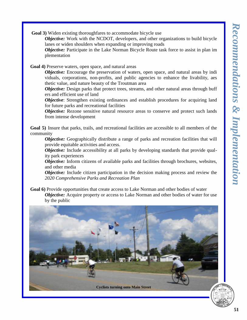
Goal 3) Widen existing thoroughfares to accommodate bicycle use
Objective: Work with the NCDOT, developers, and other organizations to build bicycle
lanes or widen shoulders when expanding or improving roads
Objective: Participate in the Lake Norman Bicycle Route task force to assist in plan im
plementation
Goal 4) Preserve waters, open space, and natural areas
Objective: Encourage the preservation of waters, open space, and natural areas by indi
viduals, corporations, non-profits, and public agencies to enhance the livability, aes
thetic value, and nature beauty of the Troutman area
Objective: Design parks that protect trees, streams, and other natural areas through buff
ers and efficient use of land
Objective: Strengthen existing ordinances and establish procedures for acquiring land
for future parks and recreational facilities
Objective: Rezone sensitive natural resource areas to conserve and protect such lands
from intense development
Goal 5) Insure that parks, trails, and recreational facilities are accessible to all members of the
community
Objective: Geographically distribute a range of parks and recreation facilities that will
provide equitable activities and access.
Objective: Include accessibility at all parks by developing standards that provide qual-
ity park experiences
Objective: Inform citizens of available parks and facilities through brochures, websites,
and other media
Objective: Include citizen participation in the decision making process and review the
2020 Comprehensive Parks and Recreation Plan
Goal 6) Provide opportunities that create access to Lake Norman and other bodies of water
Objective: Acquire property or access to Lake Norman and other bodies of water for use
by the public
Reco
mm
end
atio
ns &
Imp
lemen
tatio
n
51
Cyclists turning onto Main Street
Goal 7) Provide broad community based recreational programs to meet the needs of all age
groups and abilities
Objective: Work with the Iredell County Parks and Recreation, YMCA, TYAA, and
other interested groups to provide wellness programs
Objective: Inform citizens of available programs brochures, websites, and other media
Objective: Be responsive to community needs in program development and review the
2020 Comprehensive Parks and Recreation Plan
Goal 8) Create a greenway (trail) network
Objective: Develop trails that provide safe and secure connections between neighbor
hoods and community destinations
Objective: Work with property owners to secure property or easements for trail develop
ment
Objective: Continue to work with the organizers of the Carolina Thread Trail and Lake
Norman Bicycle Route to build regional connections and tourism
Objective: Develop cohesive signage for wayfinding between parks, schools, and other
community destinations
Objective: Use the Troutman Pedestrian Plan and results of the 2020 Comprehensive
Parks and Recreation Plan to determine where to build trails
Goal 9) Develop interesting/innovative park sites, trails, and programs
Objective: Allow ordinance flexibility in the design and creation of parks, greenways,
and open space
Objective: Work with the Iredell County Parks and Recreation, YMCA, TYAA, and
other interested persons to implement innovative programs
Objective: Provide a range of parks and recreation facilities throughout the Troutman
area
Goal 10) Operate efficiently and effectively; financial stability
Objective: Develop a Parks and Recreation Capital Improvement Plan
Objective: Develop parks and recreation facilities that are sustainable (developing a cost
effective maintenance plan)
Objective: Cultivate partnerships with public agencies, community organizations, corpo-
rations, citizens, and various groups to develop affordable solutions to secure land/
funding
Objectives: Actively pursue financial assistance through grant and loan programs
Objective: Encourage community organizations and citizens to help with basic mainte
nance and clean up
Objective: Incorporate parks and recreation in economic development projects
Goal 11) Provide a means for social interaction and gathering
Objective: Encourage community events and celebrations within parks and recreational
facilities; such as, family reunions, company picnics, Arbor Day Celebrations, artistic
displays, outdoor movie nights, musical ensembles, etc.)
Objective: Include facilities in park and recreation design that will facilitate social inter
actions and gatherings; such as, picnic shelters, amphitheatres, fields, benches, etc.
Objective: Provide for educational experiences through signage and programs
Reco
mm
end
atio
ns &
Imp
lemen
tatio
n
52
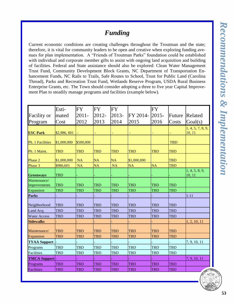
Funding
Current economic conditions are creating challenges throughout the Troutman and the state;
therefore, it is vital for community leaders to be open and creative when exploring funding ave-
nues for plan implementation. A “Friends of Troutman Parks” foundation could be established
with individual and corporate member gifts to assist with ongoing land acquisition and building
of facilities. Federal and State assistance should also be explored: Clean Water Management
Trust Fund, Community Development Block Grants, NC Department of Transportation En-
hancement Funds, NC Rails to Trails, Safe Routes to School, Trust for Public Land (Carolina
Thread), Parks and Recreation Trust Fund, Wetlands Reserve Program, USDA Rural Business
Enterprise Grants, etc. The Town should consider adopting a three to five year Capital Improve-
ment Plan to steadily manage programs and facilities (example below).
Facility or
Program
Esti-
mated
Cost
FY
2011-
2012
FY
2012-
2013
FY
2013-
2014
FY 2014-
2015
FY
2015-
2016
Future
Costs
Related
Goal(s)
ESC Park $2,986, 601 - - - - - -
1, 4, 5, 7, 8, 9,
10, 11
Ph. 1 Facilities $1,000,000 $500,000 TBD
Ph. 1 Maint. TBD TBD TBD TBD TBD TBD TBD
Phase 2 $1,000,000 NA NA NA $1,000,000 TBD
Phase 3 $986,601 NA NA NA NA NA TBD
Greenways TBD - - - - - -
1, 4, 5, 8, 9,
10, 11
Maintenance/
Improvements TBD TBD TBD TBD TBD TBD TBD
Expansion TBD TBD TBD TBD TBD TBD TBD
Parks - - - - - - - 1-11
Neighborhood TBD TBD TBD TBD TBD TBD TBD
Land Acq. TBD TBD TBD TBD TBD TBD TBD
Water Access TBD TBD TBD TBD TBD TBD TBD
Sidewalks - - - - - - - 1, 2, 10, 11
Maintenance/ TBD TBD TBD TBD TBD TBD TBD
Expansion TBD TBD TBD TBD TBD TBD TBD
TYAA Support - - - - - - - 7, 9, 10, 11
Programs TBD TBD TBD TBD TBD TBD TBD
Facilities TBD TBD TBD TBD TBD TBD TBD
YMCA Support - - - - - - - 7, 9, 10, 11
Programs TBD TBD TBD TBD TBD TBD TBD
Facilities TBD TBD TBD TBD TBD TBD TBD
Reco
mm
end
atio
ns &
Imp
lemen
tatio
n
53
Appendix
Sources & Tools Used
Benchmark CMR Inc.: Northeastern Area Plan. 2006.
Benchmark CMR Inc.: Troutman Area Land Use Plan. 2008
Benchmark CMR Inc.: Town of Troutman Unified Development Ordinance. 2006.
Centralina Council of Governments: Exit 42 Future Land Use Plan. 2000.
Centralina Council of Governments: Troutman Pedestrian Plan. 2008.
Institute of Cultural Affairs: Group Facilitation Methods. 2005 Workshop.
Lawrence Group: Commercial Design Standards. 2004.
Lawrence Group: Troutman Town and Country Plan. 2002.
National Recreation and Park Association: The Impact of Greenways on Property Values. 2005.
National Recreation and Park Association: NRPA Parks and Open Space Classifications. 1995.
National Resources Conservation Service: www.nrcs.usda.gov . 2010.
North Carolina Department of Transportation: Comprehensive Transportation Plan, Town of Troutman. 2009.
Race, Bruce and Torma, Carolyn: Youth Planning Charrettes. 1998.
Site Solutions: Comprehensive Recreation Master Plan, Iredell County. 2008.
Survey Monkey: www.surveymonkey.com. 2010.
Trail Dynamics, LLC: Leave No Child Indoors: Making Trails Interesting and Fun for Kids. 2010 Workshop.
Trust for Public Lands: Measuring the Economic Value of a City Park System. 2009.
United States Census Bureau. American Fact Finder, Troutman, NC: www.factfinder.census.gov. 2010.
United States Fish and Wildlife Service National Wetlands Inventory: www.fws.gov/wetlands. 2010.
Warren & Associates: Iredell County Demographic Forecast 2007-2015. 2008.
54
Lake Norman (photo by Jason Martin)

General Park Standards
The National Recreation and Park Association has developed the following classification sys-
tem for parks, open space, and trails:
Classification General Description Location Size Criteria
Mini-Park
Used to address limited, iso-
lated or unique recreational
needs
Less 1/4 mile dis-
tance in residential
setting
Between 2500
sq. ft. and one
acre in size
Neighborhood
Park
Neighborhood park remains the
basic unit of the park system
and serves as the recreational
and social focus of the
neighborhood. Focus is on in-
formal activity and passive rec-
reation
1/4 mile to 1/2 mile
distance and unin-
terrupted by non-
residential roads
and other physical
barriers
5 acres is consid-
ered minimum
size. 5 to 10
acres is optimal
School-Park
Depending on circumstances,
combining parks with school
sites can fulfill the space re-
quirements for other classes of
parks, such as neighborhood,
community, sports complex,
and special use
Determined by lo-
cation of school
district property
Variable depends
on function
Community
Park
Serves broader purpose than
neighborhood park. Focus is on
meeting community-based rec-
reation needs, as well as pre-
serving unique landscapes and
open spaces
Determined by the
quality and suitabil-
ity of the site. Usu-
ally serves two or
more neighbor-
hoods within a 1/2
to 3 mile distance
As needed to ac-
commodate de-
sired uses. Usu-
ally between 30
and 50 acres
Large Urban
Park
Large Urban parks serve a
broader purpose than commu-
nity parks and are used when
community and neighborhood
parks are not adequate to serve
the needs of the community.
Focus is on meeting commu-
nity-based recreational needs
as well as preserving unique
landscapes and open spaces
Determined by the
quality and suitabil-
ity of the site. Usu-
ally serves the en-
tire community.
As needed to ac-
commodate de-
sired uses. Usu-
ally a minimum
of 50 acres with
75 or more acres
being optimal
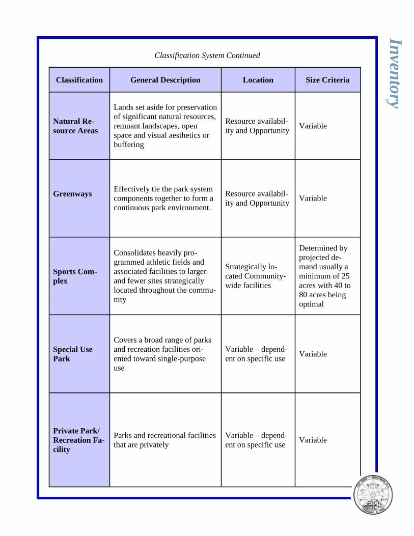
Classification System Continued
Classification General Description Location Size Criteria
Natural Re-
source Areas
Lands set aside for preservation
of significant natural resources,
remnant landscapes, open
space and visual aesthetics or
buffering
Resource availabil-
ity and Opportunity Variable
Greenways
Effectively tie the park system
components together to form a
continuous park environment.
Resource availabil-
ity and Opportunity Variable
Sports Com-
plex
Consolidates heavily pro-
grammed athletic fields and
associated facilities to larger
and fewer sites strategically
located throughout the commu-
nity
Strategically lo-
cated Community-
wide facilities
Determined by
projected de-
mand usually a
minimum of 25
acres with 40 to
80 acres being
optimal
Special Use
Park
Covers a broad range of parks
and recreation facilities ori-
ented toward single-purpose
use
Variable – depend-
ent on specific use Variable
Private Park/
Recreation Fa-
cility
Parks and recreational facilities
that are privately
Variable – depend-
ent on specific use Variable
Inven
tory
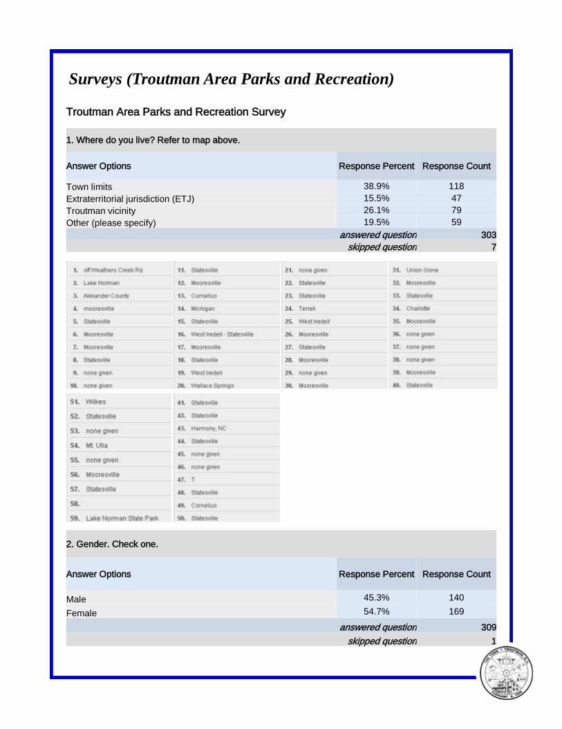
Surveys (Troutman Area Parks and Recreation)
Troutman Area Parks and Recreation Survey
1. Where do you live? Refer to map above.
Answer Options Response Percent Response Count
Town limits 38.9% 118
Extraterritorial jurisdiction (ETJ) 15.5% 47
Troutman vicinity 26.1% 79
Other (please specify) 19.5% 59
answered question 303
skipped question 7
2. Gender. Check one.
Answer Options Response Percent Response Count
Male 45.3% 140
Female 54.7% 169
answered question 309
skipped question 1
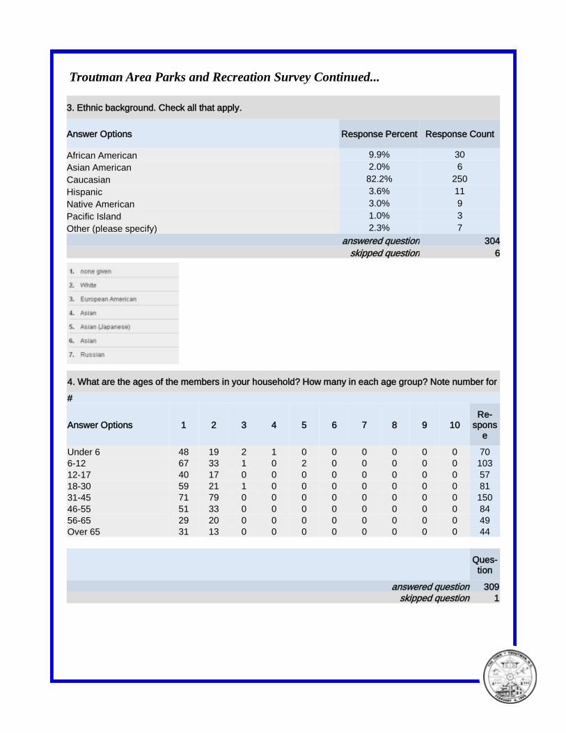
Troutman Area Parks and Recreation Survey Continued...
3. Ethnic background. Check all that apply.
Answer Options Response Percent Response Count
African American 9.9% 30
Asian American 2.0% 6
Caucasian 82.2% 250
Hispanic 3.6% 11
Native American 3.0% 9
Pacific Island 1.0% 3
Other (please specify) 2.3% 7
answered question 304
skipped question 6
4. What are the ages of the members in your household? How many in each age group? Note number for
#
Answer Options 1 2 3 4 5 6 7 8 9 10 Re-
sponse
Under 6 48 19 2 1 0 0 0 0 0 0 70
6-12 67 33 1 0 2 0 0 0 0 0 103
12-17 40 17 0 0 0 0 0 0 0 0 57
18-30 59 21 1 0 0 0 0 0 0 0 81
31-45 71 79 0 0 0 0 0 0 0 0 150
46-55 51 33 0 0 0 0 0 0 0 0 84
56-65 29 20 0 0 0 0 0 0 0 0 49
Over 65 31 13 0 0 0 0 0 0 0 0 44
Ques-tion
answered question 309
skipped question 1
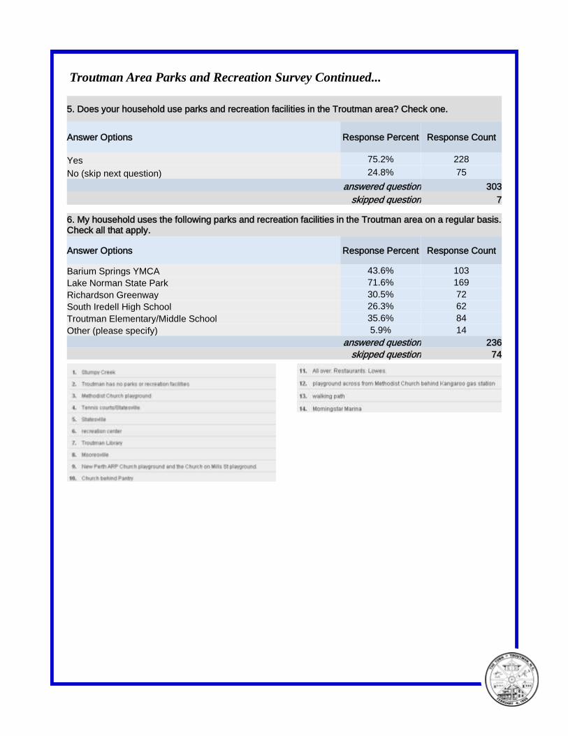
Troutman Area Parks and Recreation Survey Continued...
5. Does your household use parks and recreation facilities in the Troutman area? Check one.
Answer Options Response Percent Response Count
Yes 75.2% 228
No (skip next question) 24.8% 75
answered question 303
skipped question 7
6. My household uses the following parks and recreation facilities in the Troutman area on a regular basis. Check all that apply.
Answer Options Response Percent Response Count
Barium Springs YMCA 43.6% 103
Lake Norman State Park 71.6% 169
Richardson Greenway 30.5% 72
South Iredell High School 26.3% 62
Troutman Elementary/Middle School 35.6% 84
Other (please specify) 5.9% 14
answered question 236
skipped question 74

Troutman Area Parks and Recreation Survey Continued...
7. Where does your household use parks and recreation facilities the most? Check one.
Answer Options Response Percent Response Count
County (Stumpy Creek/Outdoor Center/ etc.) 14.1% 40
Mooresville (Liberty Park/Skate park/ etc.) 6.0% 17
Statesville (Aquatics center/greenway system/ etc.) 15.2% 43
Troutman (Lake Norman State Park/ etc.) 59.4% 168
Other (please specify) 5.3% 15
answered question 283
skipped question 27
8. The Town of Troutman does an excellent job of maintaining the Richardson Greenway. Check the statement that best reflects your opinion.
Answer Options Response Percent Response Count
Strongly agree 29.5% 85
Agree 46.9% 135
Neutral 23.6% 68
Disagree 0.0% 0
Strongly disagree 0.0% 0
answered question 288
skipped question 22
9. Do you think Troutman should develop more parks and recreation facilities? Check one.
Answer Options Response Percent Response Count
Yes 84.4% 238
No 15.6% 44
answered question 282
skipped question 28
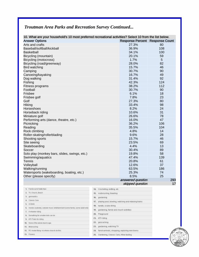
Troutman Area Parks and Recreation Survey Continued...
10. What are your household's 10 most preferred recreational activities? Select 10 from the list below.
Answer Options Response Percent Response Count
Arts and crafts 27.3% 80 Baseball/softball/kickball 36.9% 108 Basketball 34.1% 100
Bicycling (mountain) 20.1% 59 Bicycling (motocross) 1.7% 5
Bicycling (road/greenway) 28.0% 82 Bird watching 15.7% 46 Camping 30.7% 90
Canoeing/kayaking 16.7% 49 Dog walking 31.4% 92
Fishing 42.3% 124 Fitness programs 38.2% 112 Football 30.7% 90
Frisbee 6.1% 18 Frisbee golf 7.8% 23
Golf 27.3% 80 Hiking 33.4% 98 Horseshoes 8.2% 24
Horseback riding 10.6% 31 Miniature golf 26.6% 78
Performing arts (dance, theatre, etc.) 16.0% 47 Picnicking 36.2% 106
Reading 35.5% 104 Rock climbing 4.8% 14 Roller-skating/rollerblading 9.6% 28
Shooting sports 15.7% 46 Site seeing 23.5% 69
Skateboarding 4.4% 13 Soccer 30.4% 89 Solo play (monkey bars, slides, swings, etc.) 19.8% 58
Swimming/aquatics 47.4% 139 Tennis 20.8% 61
Volleyball 12.6% 37 Walking/running 63.5% 186 Watersports (wakeboarding, boating, etc.) 25.3% 74
Other (please specify) 8.5% 25 answered question 293
skipped question 17
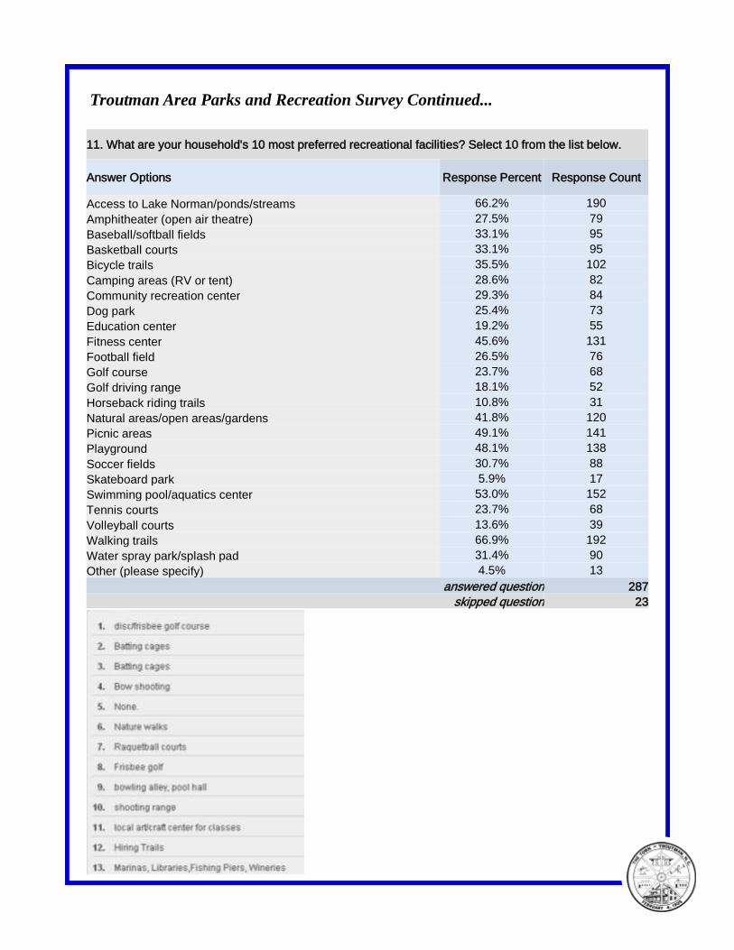
Troutman Area Parks and Recreation Survey Continued...
11. What are your household's 10 most preferred recreational facilities? Select 10 from the list below.
Answer Options Response Percent Response Count
Access to Lake Norman/ponds/streams 66.2% 190
Amphitheater (open air theatre) 27.5% 79
Baseball/softball fields 33.1% 95
Basketball courts 33.1% 95
Bicycle trails 35.5% 102
Camping areas (RV or tent) 28.6% 82
Community recreation center 29.3% 84
Dog park 25.4% 73
Education center 19.2% 55
Fitness center 45.6% 131
Football field 26.5% 76
Golf course 23.7% 68
Golf driving range 18.1% 52
Horseback riding trails 10.8% 31
Natural areas/open areas/gardens 41.8% 120
Picnic areas 49.1% 141
Playground 48.1% 138
Soccer fields 30.7% 88
Skateboard park 5.9% 17
Swimming pool/aquatics center 53.0% 152
Tennis courts 23.7% 68
Volleyball courts 13.6% 39
Walking trails 66.9% 192
Water spray park/splash pad 31.4% 90
Other (please specify) 4.5% 13
answered question 287
skipped question 23
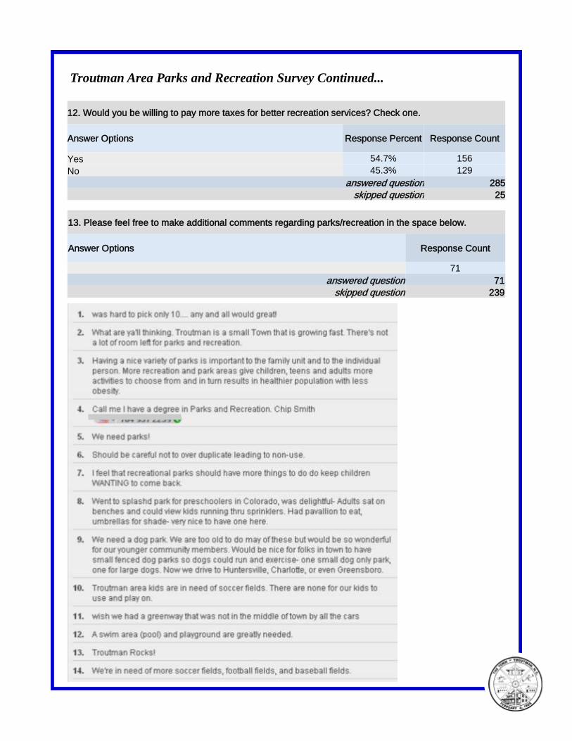
Troutman Area Parks and Recreation Survey Continued...
13. Please feel free to make additional comments regarding parks/recreation in the space below.
Answer Options Response Count
71
answered question 71
skipped question 239
12. Would you be willing to pay more taxes for better recreation services? Check one.
Answer Options Response Percent Response Count
Yes 54.7% 156
No 45.3% 129
answered question 285
skipped question 25

Troutman Area Parks and Recreation Survey Continued...
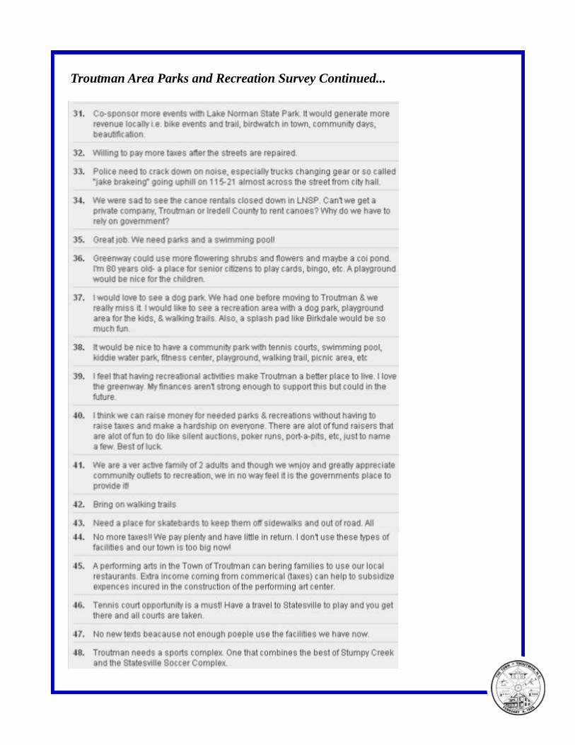
Troutman Area Parks and Recreation Survey Continued...
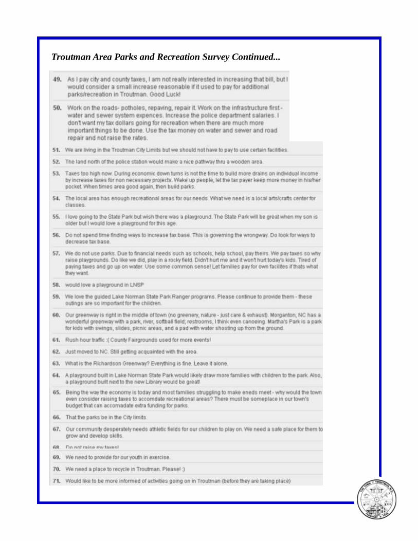
Troutman Area Parks and Recreation Survey Continued...
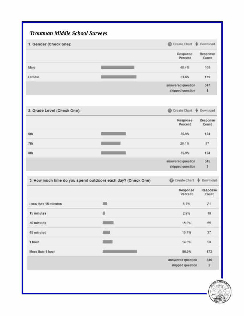
Troutman Middle School Surveys
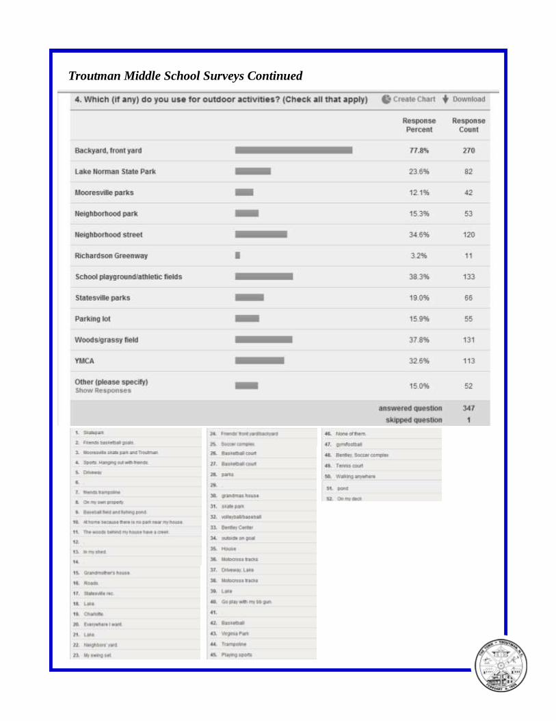
Troutman Middle School Surveys Continued
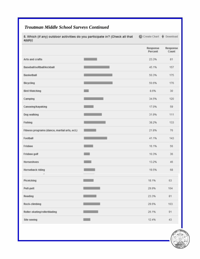
Troutman Middle School Surveys Continued
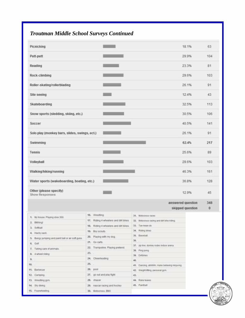
Troutman Middle School Surveys Continued
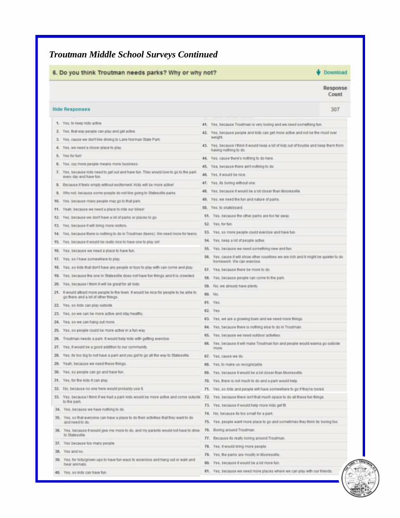
Troutman Middle School Surveys Continued
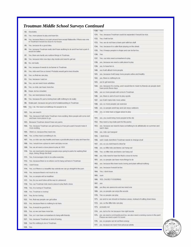
Troutman Middle School Surveys Continued
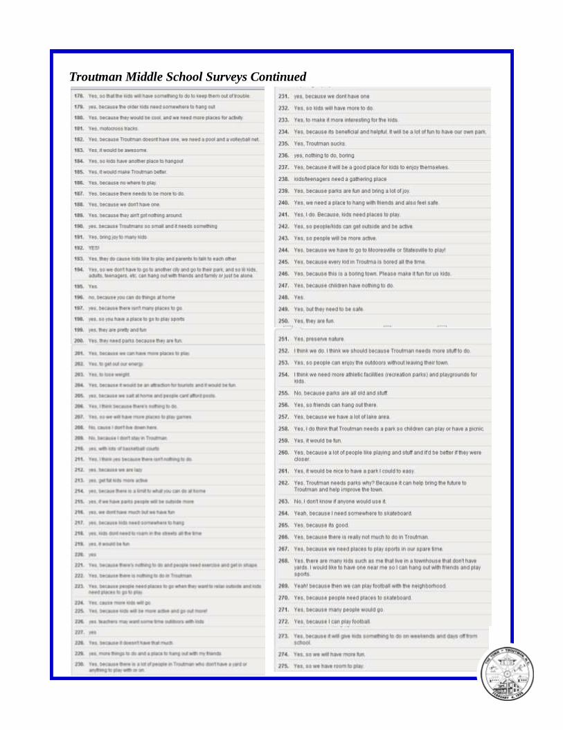
Troutman Middle School Surveys Continued
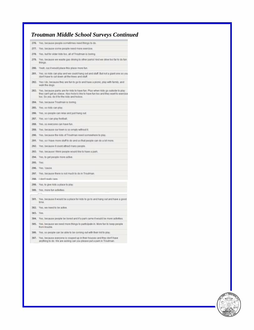
Troutman Middle School Surveys Continued
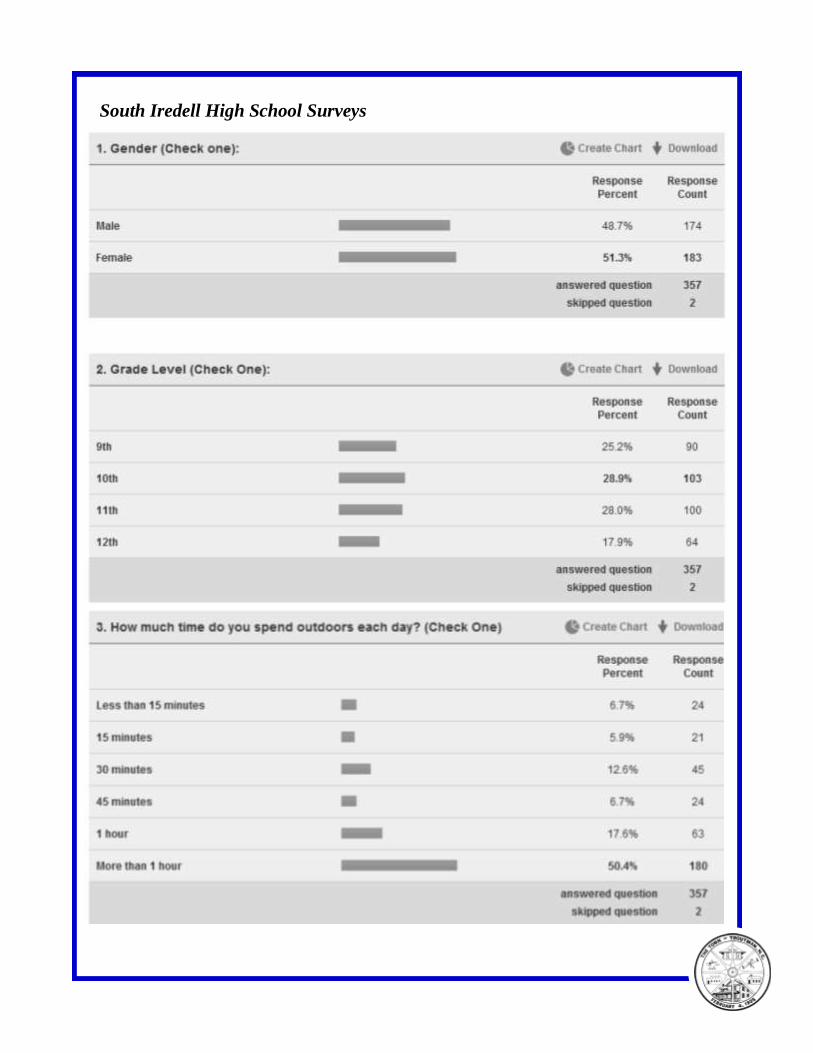
South Iredell High School Surveys
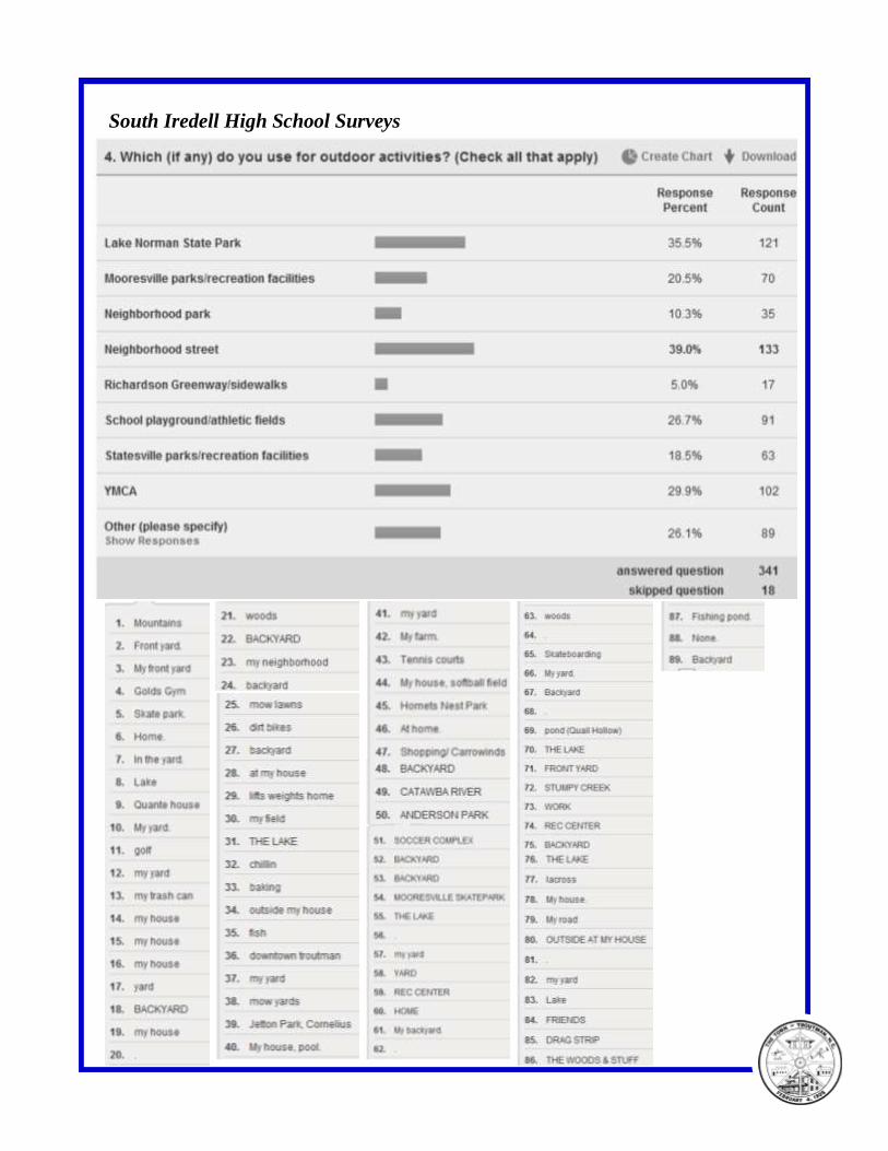
South Iredell High School Surveys
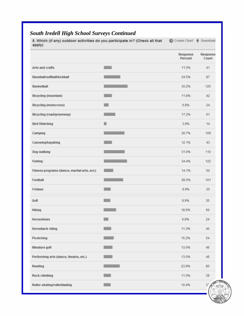
South Iredell High School Surveys Continued
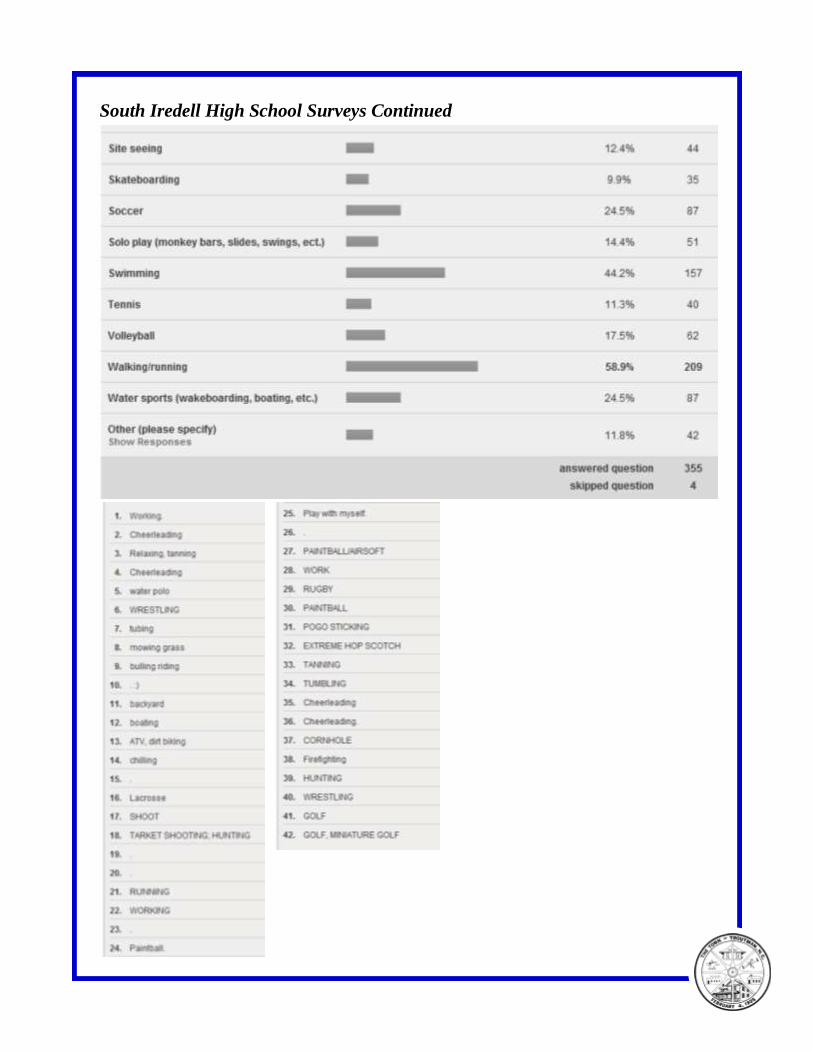
South Iredell High School Surveys Continued
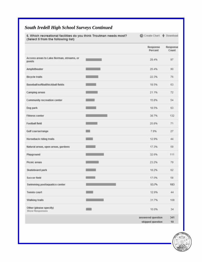
South Iredell High School Surveys Continued
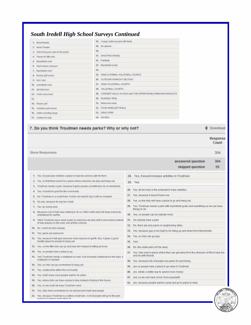
South Iredell High School Surveys Continued
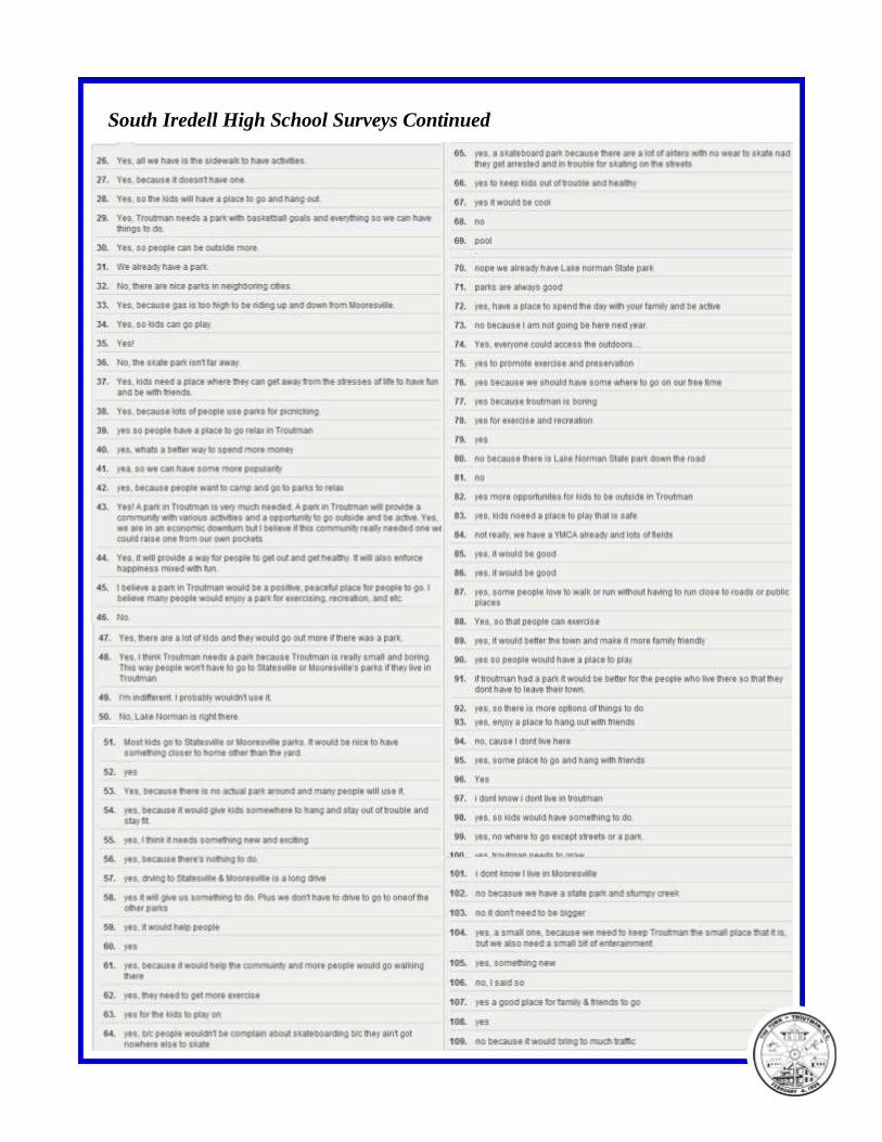
South Iredell High School Surveys Continued
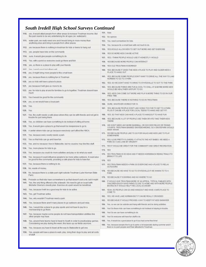
South Iredell High School Surveys Continued
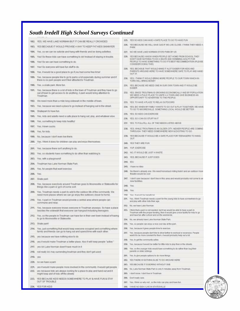
South Iredell High School Surveys Continued
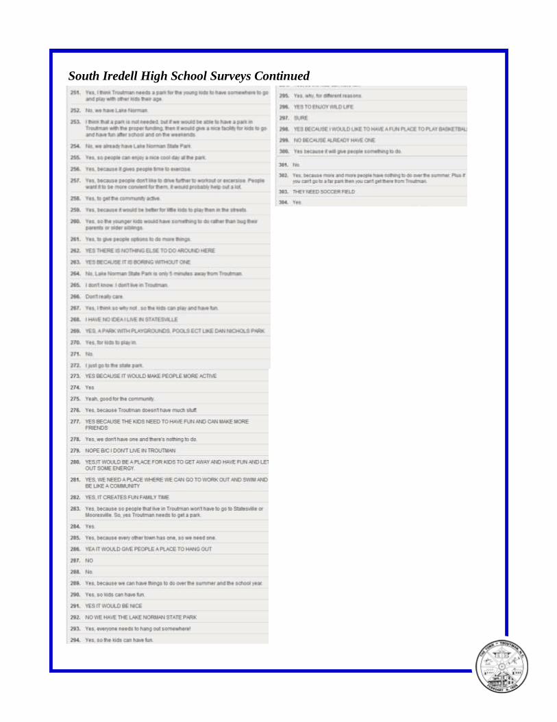
South Iredell High School Surveys Continued
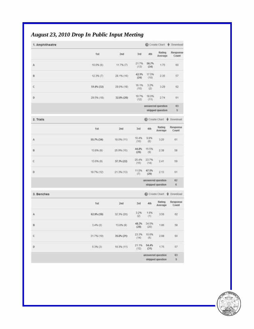
August 23, 2010 Drop In Public Input Meeting
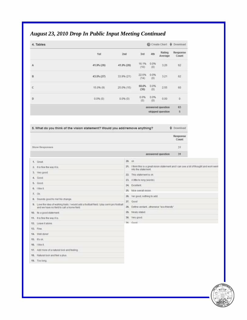
August 23, 2010 Drop In Public Input Meeting Continued
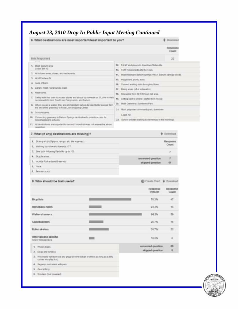
August 23, 2010 Drop In Public Input Meeting Continued
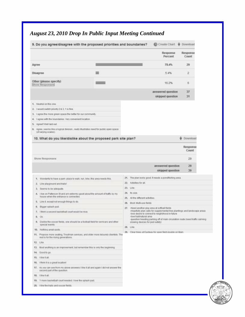
August 23, 2010 Drop In Public Input Meeting Continued
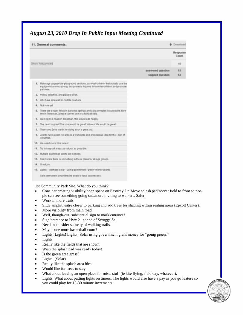
August 23, 2010 Drop In Public Input Meeting Continued
1st Community Park Site. What do you think?
Consider creating visibility/open space on Eastway Dr. Move splash pad/soccer field to front so peo-
ple can see something going on...more inviting to walkers. Safer.
Work in more trails.
Slide amphitheatre closer to parking and add trees for shading within seating areas (Epcott Center).
More visibility from main road.
Well, though-out, substantial sign to mark entrance!
Sign/entrance to Hwy 21 at end of Scroggs St.
Need to consider security of walking trails.
Maybe one more basketball court?
Lights! Lights! Lights! Solar using government grant money for “going green.”
Lights
Really like the fields that are shown.
Wish the splash pad was ready today!
Is the green area grass?
Lights! (Solar)
Really like the splash area idea
Would like for trees to stay
What about leaving an open place for misc. stuff (ie kite flying, field day, whatever).
Lights. What about putting lights on timers. The lights would also have a pay as you go feature so
you could play for 15-30 minute increments.
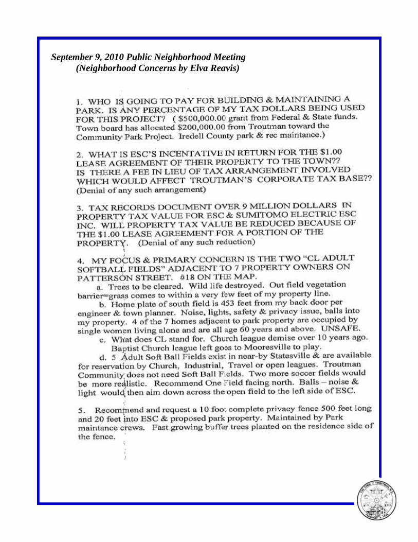
September 9, 2010 Public Neighborhood Meeting
(Neighborhood Concerns by Elva Reavis)
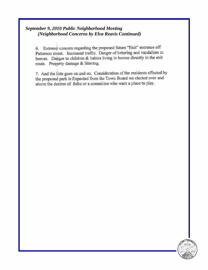
September 9, 2010 Public Neighborhood Meeting
(Neighborhood Concerns by Elva Reavis Continued)
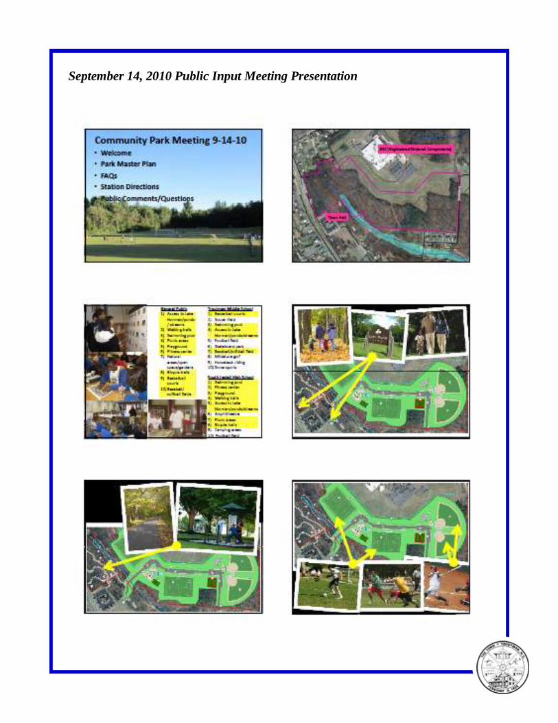
September 14, 2010 Public Input Meeting Presentation
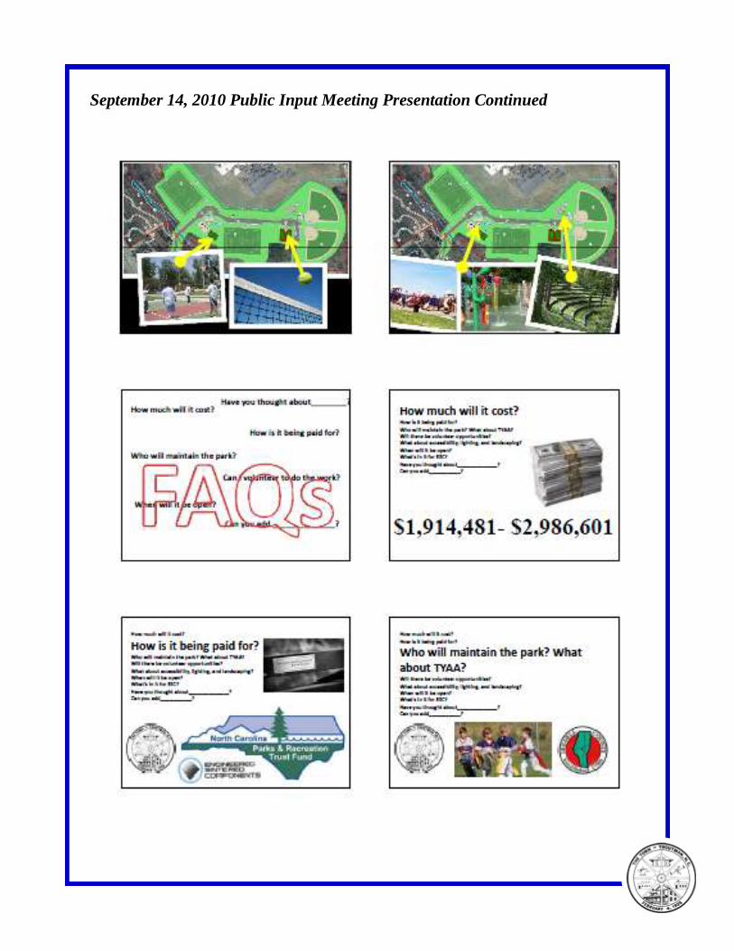
September 14, 2010 Public Input Meeting Presentation Continued
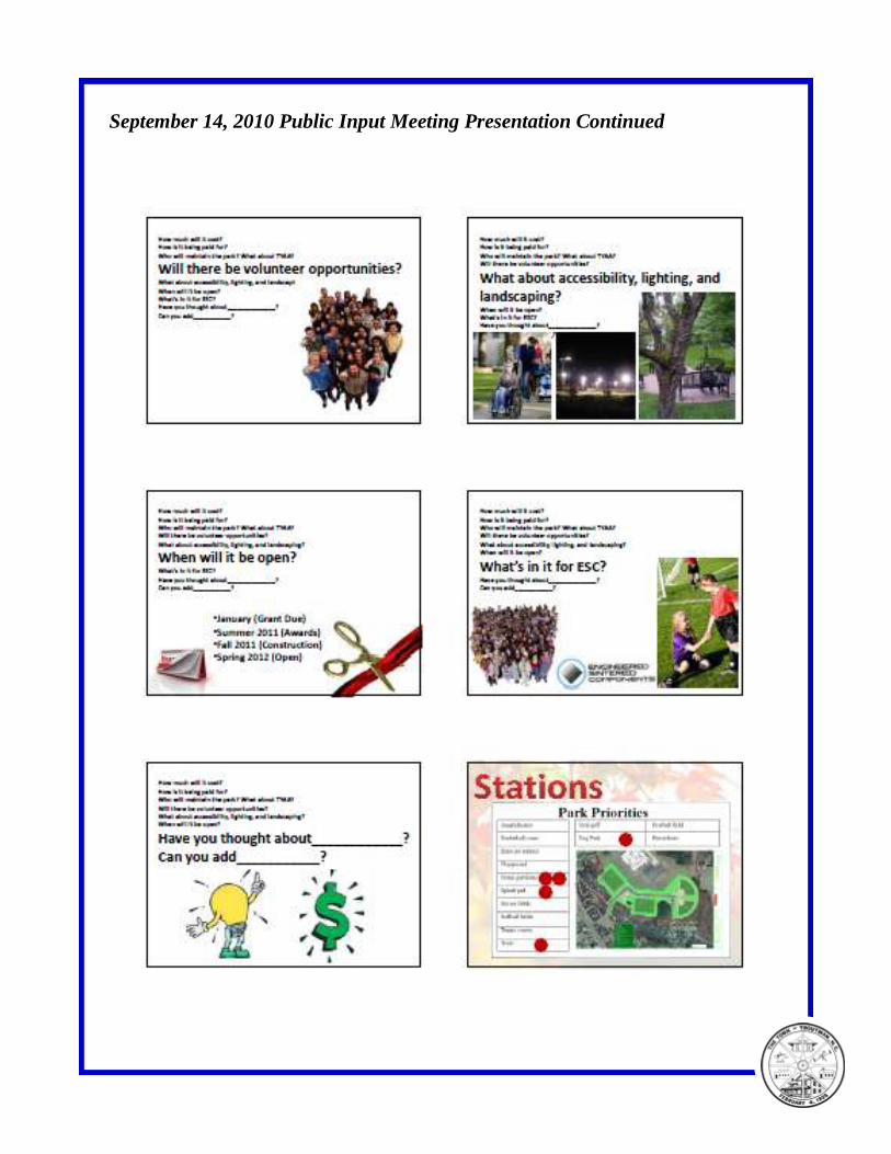
September 14, 2010 Public Input Meeting Presentation Continued
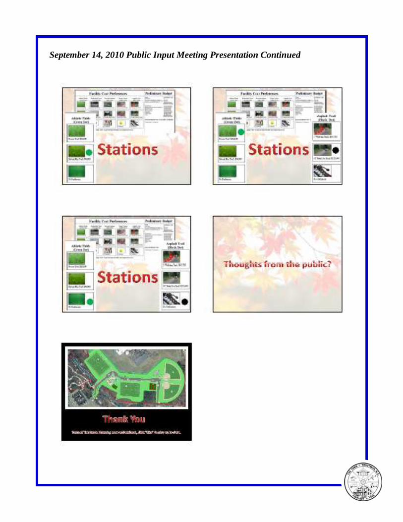
September 14, 2010 Public Input Meeting Presentation Continued
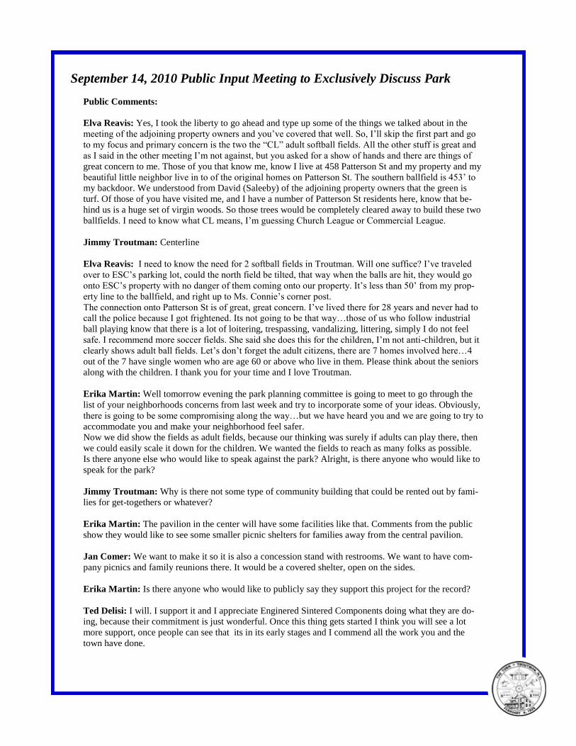
September 14, 2010 Public Input Meeting to Exclusively Discuss Park
Public Comments:
Elva Reavis: Yes, I took the liberty to go ahead and type up some of the things we talked about in the
meeting of the adjoining property owners and you’ve covered that well. So, I’ll skip the first part and go
to my focus and primary concern is the two the “CL” adult softball fields. All the other stuff is great and
as I said in the other meeting I’m not against, but you asked for a show of hands and there are things of
great concern to me. Those of you that know me, know I live at 458 Patterson St and my property and my
beautiful little neighbor live in to of the original homes on Patterson St. The southern ballfield is 453’ to
my backdoor. We understood from David (Saleeby) of the adjoining property owners that the green is
turf. Of those of you have visited me, and I have a number of Patterson St residents here, know that be-
hind us is a huge set of virgin woods. So those trees would be completely cleared away to build these two
ballfields. I need to know what CL means, I’m guessing Church League or Commercial League.
Jimmy Troutman: Centerline
Elva Reavis: I need to know the need for 2 softball fields in Troutman. Will one suffice? I’ve traveled
over to ESC’s parking lot, could the north field be tilted, that way when the balls are hit, they would go
onto ESC’s property with no danger of them coming onto our property. It’s less than 50’ from my prop-
erty line to the ballfield, and right up to Ms. Connie’s corner post.
The connection onto Patterson St is of great, great concern. I’ve lived there for 28 years and never had to
call the police because I got frightened. Its not going to be that way…those of us who follow industrial
ball playing know that there is a lot of loitering, trespassing, vandalizing, littering, simply I do not feel
safe. I recommend more soccer fields. She said she does this for the children, I’m not anti-children, but it
clearly shows adult ball fields. Let’s don’t forget the adult citizens, there are 7 homes involved here…4
out of the 7 have single women who are age 60 or above who live in them. Please think about the seniors
along with the children. I thank you for your time and I love Troutman.
Erika Martin: Well tomorrow evening the park planning committee is going to meet to go through the
list of your neighborhoods concerns from last week and try to incorporate some of your ideas. Obviously,
there is going to be some compromising along the way…but we have heard you and we are going to try to
accommodate you and make your neighborhood feel safer.
Now we did show the fields as adult fields, because our thinking was surely if adults can play there, then
we could easily scale it down for the children. We wanted the fields to reach as many folks as possible.
Is there anyone else who would like to speak against the park? Alright, is there anyone who would like to
speak for the park?
Jimmy Troutman: Why is there not some type of community building that could be rented out by fami-
lies for get-togethers or whatever?
Erika Martin: The pavilion in the center will have some facilities like that. Comments from the public
show they would like to see some smaller picnic shelters for families away from the central pavilion.
Jan Comer: We want to make it so it is also a concession stand with restrooms. We want to have com-
pany picnics and family reunions there. It would be a covered shelter, open on the sides.
Erika Martin: Is there anyone who would like to publicly say they support this project for the record?
Ted Delisi: I will. I support it and I appreciate Enginered Sintered Components doing what they are do-
ing, because their commitment is just wonderful. Once this thing gets started I think you will see a lot
more support, once people can see that its in its early stages and I commend all the work you and the
town have done.
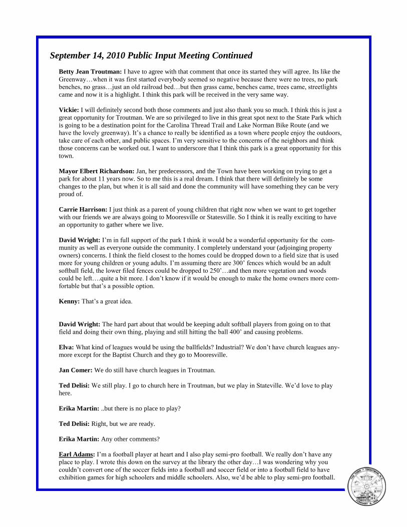
September 14, 2010 Public Input Meeting Continued
Betty Jean Troutman: I have to agree with that comment that once its started they will agree. Its like the
Greenway…when it was first started everybody seemed so negative because there were no trees, no park
benches, no grass…just an old railroad bed…but then grass came, benches came, trees came, streetlights
came and now it is a highlight. I think this park will be received in the very same way.
Vickie: I will definitely second both those comments and just also thank you so much. I think this is just a
great opportunity for Troutman. We are so privileged to live in this great spot next to the State Park which
is going to be a destination point for the Carolina Thread Trail and Lake Norman Bike Route (and we
have the lovely greenway). It’s a chance to really be identified as a town where people enjoy the outdoors,
take care of each other, and public spaces. I’m very sensitive to the concerns of the neighbors and think
those concerns can be worked out. I want to underscore that I think this park is a great opportunity for this
town.
Mayor Elbert Richardson: Jan, her predecessors, and the Town have been working on trying to get a
park for about 11 years now. So to me this is a real dream. I think that there will definitely be some
changes to the plan, but when it is all said and done the community will have something they can be very
proud of.
Carrie Harrison: I just think as a parent of young children that right now when we want to get together
with our friends we are always going to Mooresville or Statesville. So I think it is really exciting to have
an opportunity to gather where we live.
David Wright: I’m in full support of the park I think it would be a wonderful opportunity for the com-
munity as well as everyone outside the community. I completely understand your (adjoinging property
owners) concerns. I think the field closest to the homes could be dropped down to a field size that is used
more for young children or young adults. I’m assuming there are 300’ fences which would be an adult
softball field, the lower filed fences could be dropped to 250’…and then more vegetation and woods
could be left….quite a bit more. I don’t know if it would be enough to make the home owners more com-
fortable but that’s a possible option.
Kenny: That’s a great idea.
David Wright: The hard part about that would be keeping adult softball players from going on to that
field and doing their own thing, playing and still hitting the ball 400’ and causing problems.
Elva: What kind of leagues would be using the ballfields? Industrial? We don’t have church leagues any-
more except for the Baptist Church and they go to Mooresville.
Jan Comer: We do still have church leagues in Troutman.
Ted Delisi: We still play. I go to church here in Troutman, but we play in Stateville. We’d love to play
here.
Erika Martin: ..but there is no place to play?
Ted Delisi: Right, but we are ready.
Erika Martin: Any other comments?
Earl Adams: I’m a football player at heart and I also play semi-pro football. We really don’t have any
place to play. I wrote this down on the survey at the library the other day…I was wondering why you
couldn’t convert one of the soccer fields into a football and soccer field or into a football field to have
exhibition games for high schoolers and middle schoolers. Also, we’d be able to play semi-pro football.
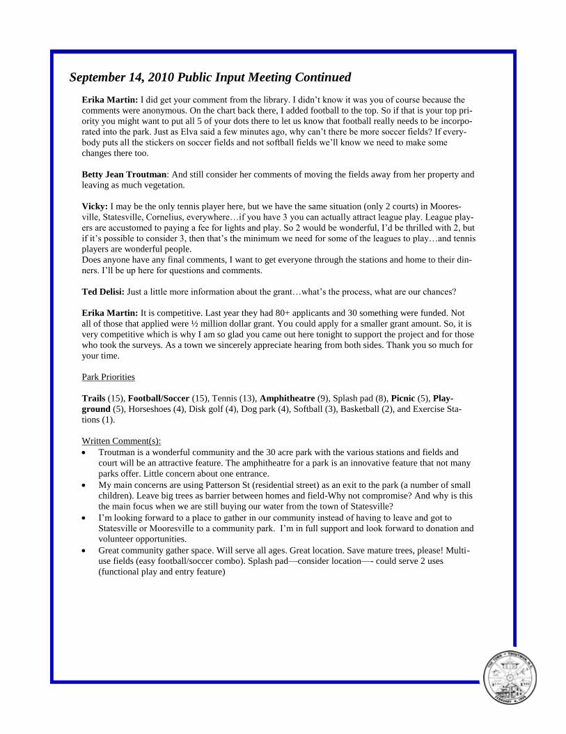
September 14, 2010 Public Input Meeting Continued
Erika Martin: I did get your comment from the library. I didn’t know it was you of course because the
comments were anonymous. On the chart back there, I added football to the top. So if that is your top pri-
ority you might want to put all 5 of your dots there to let us know that football really needs to be incorpo-
rated into the park. Just as Elva said a few minutes ago, why can’t there be more soccer fields? If every-
body puts all the stickers on soccer fields and not softball fields we’ll know we need to make some
changes there too.
Betty Jean Troutman: And still consider her comments of moving the fields away from her property and
leaving as much vegetation.
Vicky: I may be the only tennis player here, but we have the same situation (only 2 courts) in Moores-
ville, Statesville, Cornelius, everywhere…if you have 3 you can actually attract league play. League play-
ers are accustomed to paying a fee for lights and play. So 2 would be wonderful, I’d be thrilled with 2, but
if it’s possible to consider 3, then that’s the minimum we need for some of the leagues to play…and tennis
players are wonderful people.
Does anyone have any final comments, I want to get everyone through the stations and home to their din-
ners. I’ll be up here for questions and comments.
Ted Delisi: Just a little more information about the grant…what’s the process, what are our chances?
Erika Martin: It is competitive. Last year they had 80+ applicants and 30 something were funded. Not
all of those that applied were ½ million dollar grant. You could apply for a smaller grant amount. So, it is
very competitive which is why I am so glad you came out here tonight to support the project and for those
who took the surveys. As a town we sincerely appreciate hearing from both sides. Thank you so much for
your time.
Park Priorities
Trails (15), Football/Soccer (15), Tennis (13), Amphitheatre (9), Splash pad (8), Picnic (5), Play-
ground (5), Horseshoes (4), Disk golf (4), Dog park (4), Softball (3), Basketball (2), and Exercise Sta-
tions (1).
Written Comment(s):
Troutman is a wonderful community and the 30 acre park with the various stations and fields and
court will be an attractive feature. The amphitheatre for a park is an innovative feature that not many
parks offer. Little concern about one entrance.
My main concerns are using Patterson St (residential street) as an exit to the park (a number of small
children). Leave big trees as barrier between homes and field-Why not compromise? And why is this
the main focus when we are still buying our water from the town of Statesville?
I’m looking forward to a place to gather in our community instead of having to leave and got to
Statesville or Mooresville to a community park. I’m in full support and look forward to donation and
volunteer opportunities.
Great community gather space. Will serve all ages. Great location. Save mature trees, please! Multi-
use fields (easy football/soccer combo). Splash pad—consider location—- could serve 2 uses
(functional play and entry feature)
118 South Main Street Kannapolis, NC 28081
704-933-5990
www.benchmarkplanning.com