3 25 426 27 5 28 6 29 7 8 9 7 -...
TRANSCRIPT

12 05 25 000m 12 05 26 000m 12 05 27 000m 12 05 28 000m 12 05 29 000m
12 05 25 000m 12 05 26 000m 12 05 27 000m 12 05 28 000m 12 05 29 000m
35 7
3 00
0m35
74
000m
35 7
5 00
0m35
76
000m
35 7
7 00
0m35
78
000m
35 7
9 00
0m
35 7
3 00
0m35
74
000m
35 7
5 00
0m35
76
000m
35 7
7 00
0m35
78
000m
35 7
9 00
0m
Babad Do'ag Trail - HikeLemmon.com2014/11/3, 1:24000, WGS 84 N

HikeLemmon.com Babad Do’ag Page 1
Babad Do’ag Trail
Overview
The Babad Do’ag Trail #705 is a restored route
up MacDougal Ridge (named for the cactus I
believe) that provides a nice ramble and quite
lovely views from a short ridge.
Location: This hike is located in the Pusch
Ridge Wilderness in the Santa Catalina
Mountains north of Tucson, Arizona.
Start: Babad Do’ag Vista and Trailhead
Parking (Lower Highway Hikes) (Vehicle
Access: Paved Roads/Passenger Car
(Mountain Road - be careful of weather
conditions!))
End: Babad Do’ag Vista and Trailhead
Parking (Lower Highway Hikes)
Fee: No
Driving Distance from Speedway
Campbell: 16.5 miles
Driving Time from Speedway Campbell: 35
Minutes
Hike Type: Out and Back
Hiking Distance: 4.5 miles
Elevation Gain: 1,250'
Elevation Loss: 1,250'
Highest Elevation: 4,700'
Lowest Elevation: 3,550'
Downloadable PDF Map: Babad Do'ag Trail
Map And Description
Dogs: Yes
Bikes: No (Pusch Ridge Wilderness)
Driving Directions
Google Maps Directions from the Speedway and Campbell intersection in Tucson to Babad Do’ag Vista
and Trailhead Parking.
Quick version:
Drive East on Speedway (5.0 miles)
Left on Wilmot and continue on Tanque Verde (4.3 miles)
Left on Catalina Highway (7.1 miles)
Signs will help you find the turn into this area - the parking here serves both a nice vista with several
informational signs and the Babad Do'ag Trail. Babad Do’ag Trail starts across the highway (on the
down-moountain side) just up-mountain from the parking area - the start of the trail is marked with a
sign.

HikeLemmon.com Babad Do’ag Page 2
Trail Notes
The mileages and elevations below are approximate (don't expect the values below to match your GPS
exactly).
0.0 miles, 3550′: Start from the Babad Do’ag
Vista and Trailhead Parking [Waypoint thbd],
walk out of the parking area and up the
highway – the trailhead is a few hundred feet
up the highway on the down-mountain side.
[Waypoint BD01]
0.15 miles, 3650′: As you continue along the
trail avoid an old trail to the right – you may
have to look carefully to find the trail
especially after the monsoon rains when
everything is green and growing. [Waypoint
BD02]
The trail continues to climb towards Point
4780 and eventually begins to parallel the
canyon to the west on the hillside below
Point 4780.
1.1 miles, 4250′: A nice vista close to the trail.
[Waypoint BD03]
1.9 miles, 4650′: At a well worn junction an
unofficial route splits off to the right (this
route can be used to reach Point 4780) while
the Babad Do’ag trail continues to the
left/north across a short ridge with great
views. [Waypoint BD04]
2.2 miles, 4700′: The trail ends at an end of
trail sign. From here there a number of
possible off-trail destinations but the
simplest hike is to reverse your route back to
the parking area. [Waypoint bdend]
This trail gets it’s name from the Tohono
O’odham name for the Santa Catalina Mountains
– Babad Do’ag, which means “Frog Mountain”.
HikeLemmon.com Babad Do’ag Page 3
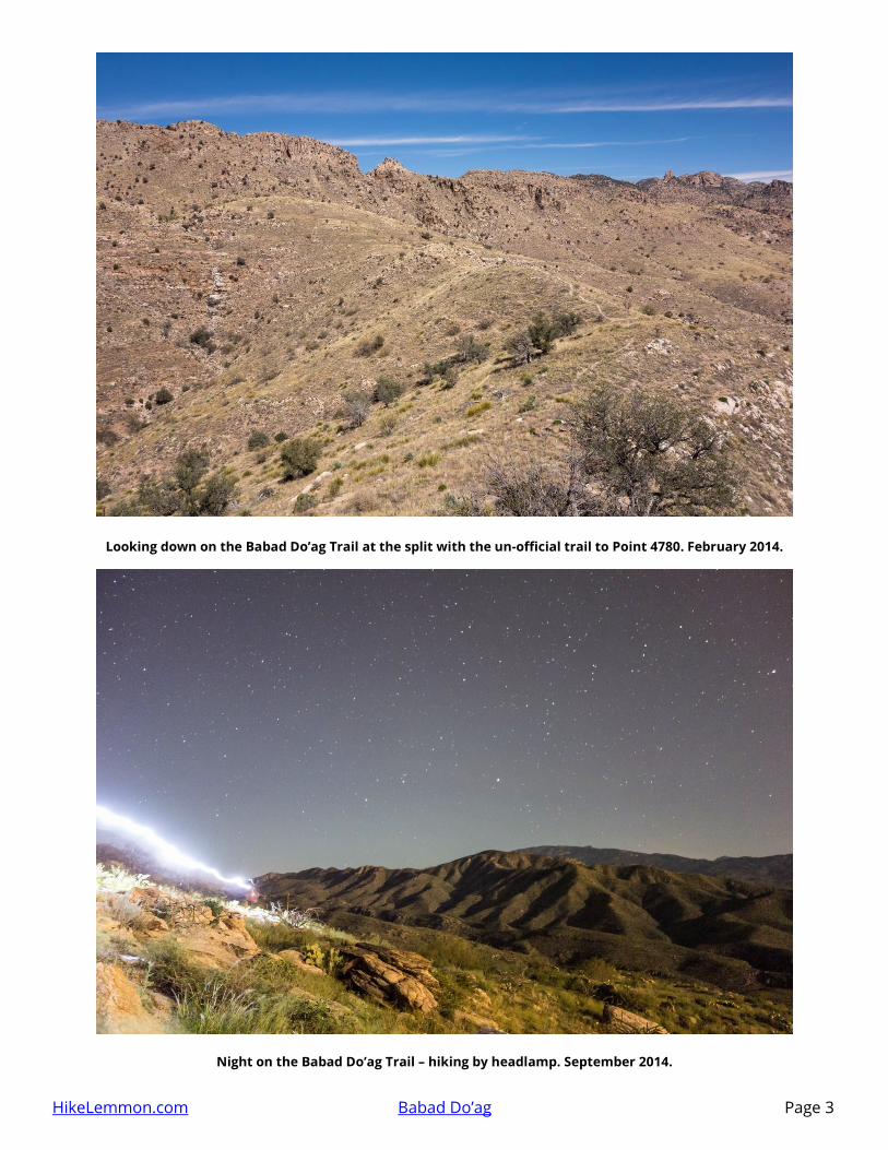
Looking down on the Babad Do’ag Trail at the split with the un-official trail to Point 4780. February 2014.
Night on the Babad Do’ag Trail – hiking by headlamp. September 2014.