3 project description - erm · 3 project description ... x the construction of a cofferdam just...
TRANSCRIPT
ENVIRONMENTAL RESOURCES MANAGEMENT ZAMBEZI RIVER AUTHORITY: KARIBA DAM REHABILITATION ESIA
3-1
3 PROJECT DESCRIPTION
This Chapter provides an overview of the technical features of the proposed Kariba Dam Rehabilitation Works. The information in this Chapter has been sourced from the Plunge Pool Reshaping Detailed Design Report (2014) and the Emergency Gate and New Gantry Detailed Design Report (2012) prepared by Tractebel Engineering /Coyne et Bellier. ZRA has appointed Tractebel Engineering (FRANCE) and Coyne et Bellier to conduct the detailed design and construction supervision of the Kariba Dam Rehabilitation Works.
3.1 PROJECT LOCATION
The Kariba Dam is a double curvature concrete arch dam located at GPS co-ordinates: 16°31′18″S 28°45′41″E in the Kariba Gorge of the Zambezi River Basin between Zambia and Zimbabwe (refer to Figure 1.1 and Figure 1.2 in Chapter 1). It is situated 130 km (in a straight line) south-south-east of Lusaka (Zambia), and 280 km (in a straight line) north-west of Harare (Zimbabwe). The closest towns are Kariba in Zimbabwe and Siavonga in Zambia. Both are located along the lakeshore. The international road M15 crosses the Zambia-Zimbabwe border on the Kariba Dam crest. Therefore, the site can be reached from both banks, i.e. from Zambia and from Zimbabwe. All necessary equipment and material for the works will likely be brought on site by way of these two major roads. However, at this stage the exact transport route to import all equipment is unknown. More detail will be provided in the ESIA.
3.2 BACKGROUND TO KARIBA DAM
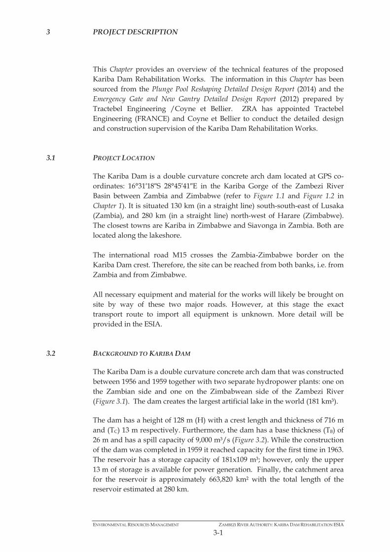
The Kariba Dam is a double curvature concrete arch dam that was constructed between 1956 and 1959 together with two separate hydropower plants: one on the Zambian side and one on the Zimbabwean side of the Zambezi River (Figure 3.1). The dam creates the largest artificial lake in the world (181 km³). The dam has a height of 128 m (H) with a crest length and thickness of 716 m and (TC) 13 m respectively. Furthermore, the dam has a base thickness (TB) of 26 m and has a spill capacity of 9,000 m³/s (Figure 3.2). While the construction of the dam was completed in 1959 it reached capacity for the first time in 1963. The reservoir has a storage capacity of 181x109 m³; however, only the upper 13 m of storage is available for power generation. Finally, the catchment area for the reservoir is approximately 663,820 km² with the total length of the reservoir estimated at 280 km.

ENVIRONMENTAL RESOURCES MANAGEMENT ZAMBEZI RIVER AUTHORITY: KARIBA DAM REHABILITATION ESIA
3-2
Figure 3.1 Kariba Dam Wall
Source: ZRA, 2014.

ENVIRONMENTAL RESOURCES MANAGEMENT ZAMBEZI RIVER AUTHORITY: KARIBA DAM REHABILITATION ESIA
3-3
Figure 3.2 Dimensions of the Kariba Dam Wall
Source: ZRA, 2014. Power from the reservoir is generated through two underground power stations located on the North (left) bank in Zambia and on the South (right) bank in Zimbabwe (Figure 3.3). There are twelve turbines, six on either side of the Zambezi River. More specifically 6 x 125 MW (750 MW) on the South bank and 6 x 180 MW (1,080 MW) (four old and two recently commissioned) on the North bank. The combination of these turbines produces 6,400 MWh per annum.

ENVIRONMENTAL RESOURCES MANAGEMENT ZAMBEZI RIVER AUTHORITY: KARIBA DAM REHABILITATION ESIA
3-4
Figure 3.3 General Layout of the Kariba Dam Hydropower Facility
Source: ZRA, 2014.

ENVIRONMENTAL RESOURCES MANAGEMENT ZAMBEZI RIVER AUTHORITY: KARIBA DAM REHABILITATION ESIA
3-5
3.3 AREA OF INFLUENCE
The definition for “Area of Influence” (AoI) used in this Report is from the African Development Bank’s Integrated Safeguards System (The World Bank’s (1) definition is similar and included as a footnote). According to the African Development Bank:
The project’s AoI is delineated and explicitly covered in any impact assessment. The AoI encompasses the following, as appropriate: The area likely to be directly affected by the project; Related or associated facilities dependent on the project that are not funded
by the project and that would not have been implemented if the project did not exist; and
Areas, including the communities within them, potentially affected by unplanned but technically predictable activities likely to be induced by the project.
After analysing the Project, the Direct AoI has been defined to be areas falling inside 5 km of the dam wall. This is limited to 5 km, as the vast majority of the Project impacts will be experienced in very close proximity to the dam wall and immediate surrounds. There are two activities that may have a direct impact greater than 5 km, namely – 1. The transport of construction materials to the site – as the transport
routes are outside of the scope of this Project, recommendations as to the safe transport of construction materials will be included in the Framework ESMP.
2. Possible Changes to the Spilling Regime – may have an influence greater than 5 km downstream of the dam wall; however it is not envisaged at this stage that the change in spill regime will be outside of the parameters that have been followed in the past. As a result, it is not expected that sensitive receptors downstream of the dam wall will be impacted.
An area of up to 10 km around the dam wall constitutes the Indirect AoI. Figure 3.4 below indicates the currently defined AoI boundaries of the Project. From an ecological (terrestrial and aquatic) perspective the Indirect Ecological Area of Influence extends about 20km downstream of the Kariba Dam wall, but this is specifically downstream and confined to the river channel.
(1) World Bank AoI: Project area of influence: The area likely to be affected by the project, including all its ancillary aspects, such as power transmission corridors, pipelines, canals, tunnels, relocation and access roads, borrow and disposal areas, and construction camps, as well as unplanned developments induced by the project (e.g., spontaneous settlement, logging, or shifting agriculture along access roads). The area of influence may include, for example, (a) the watershed within which the project is located; (b) any affected estuary and coastal zone; (c) off-site areas required for resettlement or compensatory tracts; (d) the airshed (e.g., where airborne pollution such as smoke or dust may enter or leave the area of influence; (e) migratory routes of humans, wildlife, or fish, particularly where they relate to public health, economic activities, or environmental conservation; and (f) areas used for livelihood activities (hunting, fishing, grazing, gathering, agriculture, etc.) or religious or ceremonial purposes of a customary nature.

ENVIRONMENTAL RESOURCES MANAGEMENT ZAMBEZI RIVER AUTHORITY: KARIBA DAM REHABILITATION ESIA
3-6
After discussions with the World Bank, the African Development Bank and the ZRA at the initial Project meeting (20 August 2014), it was agreed that the Area of Influence associated with unplanned events (for example, catastrophic failure of the dam wall), would not be included in the ESIA. Moreover, stakeholder engagement will not be extended to communities downstream of the dam wall that may be impacted by catastrophic failure. It was suggested that the Emergency Response Plan for the dam is being updated by the ZRA and that stakeholder engagement with downstream communities would be carried out as part of this study by the ZRA. However, this said, this ESIA will consider dam safety issues associated with the integrity of the coffer dam during the construction phase and subsequent safety of the construction team, instability of dam wall foundations during pumping of water from the plunge pool and integrity of the dam from blasting events during the construction phase (this is discussed further in Chapter 7).

ENVIRONMENTAL RESOURCES MANAGEMENT ZAMBEZI RIVER AUTHORITY: KARIBA DAM REHABILITATION ESIA
3-7
Figure 3.4 Locality Map with Project Area of Influence

ENVIRONMENTAL RESOURCES MANAGEMENT ZAMBEZI RIVER AUTHORITY: KARIBA DAM REHABILITATION ESIA
3-8
Apart from the need to rehabilitate the plunge pool, there is also a need to rehabilitate the six sluice gates that make up the spillway. The work needed within the sluices is associated with the refurbishment of the concrete surface of all sluices which have been distorted over the years due to an advanced alkali-silica reaction. Without functional sluices the reservoir level cannot effectively be maintained to take into account the flood regime of the Zambezi River. Without the ability to release water from the reservoir, there is a danger of the reservoir being too full prior to a flood event, and the subsequent flood event causing over topping of the dam wall which could lead to dam failure. The aim of the Kariba Dam Rehabilitation Works is to improve the stability of the plunge pool through reshaping its profile. This will limit the preferential erosion towards the foundations of the dam along zones of weak rock. The project also aims to rehabilitate the six sluice gates of the spillway, enabling the ongoing use of the spillway function to manage the reservoir levels.
3.4 PLUNGE POOL REHABILITATION
This Section presents the activities required to rehabilitate the plunge pool. The rehabilitation of the plunge pool aims to address the downstream erosion that could undermine the stability of the dam wall. This rehabilitation will be in the form of an excavation and reshaping of the plunge pool. The primary aim of reshaping the plunge pool profile is to improve the stability of the plunge pool, limiting preferential erosion towards the foundations of the dam, along zones of weak rock. In order to arrive at the solutions described below the engineering team undertook; Multi-beam Bathymetric Survey of the Pool; Plunge Pool Geotechnical Investigations; and Plunge Pool Hydraulic Modeling. Generally, the rehabilitation of the plunge pool will include a number of activities: The construction of a cofferdam just downstream of the plunge pool,
which will block off the plunge pool from the downstream river. The pumping/dewatering of the plunge pool. The excavation of the plunge pool. The deposition of excavated rock material in the existing quarry on the
north bank. The reshaping of the excavated plunge pool into terraced steps.
PLEASE NOTE:
The two key components of the rehabilitation works, namely the rehabilitation of the plunge pool and the spillway, are discussed in more detail in Section 3.4 (Page 3-8) and Section 3.5 (Page
3-21).

ENVIRONMENTAL RESOURCES MANAGEMENT ZAMBEZI RIVER AUTHORITY: KARIBA DAM REHABILITATION ESIA
3-9
3.4.1 Banks Stability
As reshaping the plunge pool will enlarge the natural scour pool by excavation, the slopes of the river banks will be modified. This will be undertaken in a terraced manner as it will reduce dynamic pressures in the pool and reduce flow re-circulation towards the dam toe. Figure 3.5 and Figure 3.6 illustrate the terraced slopes through vertical cross-sections.
Figure 3.5 Plunge Pool Reshaping - Vertical Cross Section A-A in the Axis of the River
Source: Tractebel Engineering, 2014
Figure 3.6 Plunge Pool Reshaping - Vertical Cross Section B-B from Right to Left Banks
Source: Tractebel Engineering, 2014

ENVIRONMENTAL RESOURCES MANAGEMENT ZAMBEZI RIVER AUTHORITY: KARIBA DAM REHABILITATION ESIA
3-10
Also, the lowering of the water level in the plunge pool during excavation works could weaken the rock foundation due to de-confinement and loss of balance of water pore pressure. Tractebel Engineering (2014) carried out geotechnical investigations to establish the stability of both river banks, the dam toe and rock wedges. The geotechnical study of the banks stability established that due to the good quality of the rock both banks are stable. Along the south bank, two different geological movements were identified from the first reservoir impounding, namely shallow and deep slides. The shallow slide is located 150 m downstream of the plunge pool and 20 m above water table, therefore the plunge pool dewatering will not influence this “shallow” slide. The deep slide is located downstream of the south abutment, with the slip surface exit approximately at 450 m elevation while slip surface enter is around 500 m elevation. Even though this deep slide is closer to the plunge pool than the shallow slide, it is still above the water table, in a dry area, and according to the study will not be influenced by the plunge pool dewatering. On the north bank, different polyline slip surfaces have been considered, following the observed sub-vertical and sub-horizontal discontinuities on site. For each case minimal safety conditions were considered; and in all cases rapid drawdown creates unstable conditions. Therefore the water level must be lowered in a measured manner in order to maintain balance of pore pressure between the plunge pool and the foundation. Given the good quality of rock, failure could only occur according to the study along existing discontinuities. Therefore, groundwater level should be cautiously monitored, and discontinuities should be visually checked during the emptying of the plunge pool.
3.4.2 Cofferdam
A cofferdam is a temporary enclosure that will be built across the river downstream of the dam wall just upstream of the turbine outlets. It will be constructed to allow an enclosed area to be pumped out; creating a dry work environment for the work on the plunge pool to proceed. Once the excavation of the plunge pool is complete, the cofferdam will be removed. Three alternative cofferdam designs were considered (these are presented in Chapter 8). The preferred alternative would consist of the establishment of a cofferdam at the beginning of the works, removed at the end of the dry season and then re-installed at the beginning of the following dry season (refer to Figure 3.7 and Figure 3.8). This cofferdam design allows for easier mobilization and demobilization between potential flood events, and allows for a three phase work program.

ENVIRONMENTAL RESOURCES MANAGEMENT ZAMBEZI RIVER AUTHORITY: KARIBA DAM REHABILITATION ESIA
3-11
The cofferdam will comprise of 10 piers spaced 13 m apart, with nine stoplogs in between. On both banks a gravity dam will connect the last pier with the bank and the crest of the cofferdam will be 389.9 m. Excavation will be required to flatten the natural ground level and a sill will be constructed between the piers to ensure flat watertight contact between the stoplog and the foundation.

ENVIRONMENTAL RESOURCES MANAGEMENT ZAMBEZI RIVER AUTHORITY: KARIBA DAM REHABILITATION ESIA
3-12
Figure 3.7 Plan View of Downstream Cofferdam with Piers and Stoplogs
Source: Tractebel Engineering France /Coyne et Bellier, 2014

ENVIRONMENTAL RESOURCES MANAGEMENT ZAMBEZI RIVER AUTHORITY: KARIBA DAM REHABILITATION ESIA
3-13
Figure 3.8 Cross Section of Cofferdam
Source: Tractebel Engineering France /Coyne et Bellier, 2014

ENVIRONMENTAL RESOURCES MANAGEMENT ZAMBEZI RIVER AUTHORITY: KARIBA DAM REHABILITATION ESIA
3-14
3.4.3 Pumping Operations
Pumping will commence as soon as the establishment of the cofferdam (detailed in Section 3.4.2) is complete and when both power stations are discharging (i.e. tail water level at elevation 388.7 m). The total volume of water to be pumped from the plunge pool is approximately 625,000 m³. There are three identified pumping periods: 1. Between the cofferdam closure and the beginning of excavation works.
This is estimated to take one month. 2. The plunge pool drawdown, i.e. during excavation works. The pumped
out flow will be adapted to the work progress, as long as it does not threaten the banks’ stability.
3. When the plunge pool water level will be at its minimal, around 310 m.
During this period, the water level will be kept at a constant level and the pumped flow will correspond to the seepage discharge.
It is also anticipated that another pumping system will be set up to discharge leakages along the cofferdam, but it will be independent from pumps into the plunge pool.
3.4.4 Excavation Works in the Plunge Pool
Excavation and pumping will be carried out simultaneously. While excavations are being carried out on one of the plunge pool steps, the pumps will keep lowering the water level underneath. The objective is to be able to excavate continuously even when switching from one step to the next one situated below it. An estimated 295,000 m³ of rock will be carefully excavated due to the excavation depth below the current Tail Water Level (TWL). The reshaping of the plunge pool into terraced steps (refer to Figure 3.9) will reduce dynamic pressures in the pool and reduce flow recirculation towards dam toe. As a result, it is estimated that the power density will be reduced from 25 kW/m3 to 7.5 kW/m3. Trial blasts will be carried out, whereby increasing charges of explosives will be fired and the impacts of the vibrations on the surrounding sensitive structures will be measured. The choice of explosives to be used will be considered very carefully. While ammo-nitrate fuel oil (ANFO) is commonly used as it is inexpensive and has sufficient strength, its water sensitivity is high. It is therefore recommended that surface bulk emulsions are used. Blasting will take place for approximately six months.

ENVIRONMENTAL RESOURCES MANAGEMENT ZAMBEZI RIVER AUTHORITY: KARIBA DAM REHABILITATION ESIA
3-15
Once the blasting has occurred, material will be removed from the plunge pool and transported to and stockpiled on the north bank in an open quarry pit (about 2.5 km from the plunge pool – refer to the locality of the open quarry pit in Figure 8.1 in Chapter 8). Once the plunge pool excavation works are completed, some concreting works will be performed to reinforce the weak areas of the plunge pool. This is discussed in more detail in Section 3.4.5.

ENVIRONMENTAL RESOURCES MANAGEMENT ZAMBEZI RIVER AUTHORITY: KARIBA DAM REHABILITATION ESIA
3-16
Figure 3.9 Plan View of Plunge Pool Terraced Excavation Works
Source: Tractebel Engineering France /Coyne et Bellier, 2014

ENVIRONMENTAL RESOURCES MANAGEMENT ZAMBEZI RIVER AUTHORITY: KARIBA DAM REHABILITATION ESIA
3-17
3.4.5 Fault Zone Treatment
The geological fault in the plunge pool requires a special treatment as it presents an area with a high density of joints. Figure 3.10 shows the fault axis.
Figure 3.10 Fault Axis on the Target Geometry of the Plunge Pool
As a result the engineers have designed a concrete slab to cover the fault zone along the axis, with an anchoring system, minimising the area that has a point of weakness (see Figure 3.11). The anchoring is required to ensure the stability of the concrete slab and will take into consideration the uplift capacity, anchor capacity, rock stability and bond strength in its design.
Source: Tractebel Engineering France /Coyne et Bellier, 2014

ENVIRONMENTAL RESOURCES MANAGEMENT ZAMBEZI RIVER AUTHORITY: KARIBA DAM REHABILITATION ESIA
3-18
Figure 3.11 Plunge Pool Reshaping (with upstream strengthening of fault zone)
Source: ZRA, 2014.
3.4.6 Access Roads
Access to the plunge pool will be from the existing M15 national road on the north bank, and then the existing tarred road from the M15 down to the north bank turbine outlets. From the turbine outlets a permanent new road approximately 100 m in length and 10 m wide (with additional 5 m safety margin) will be constructed behind the north bank powerhouse to facilitate the construction works (see Figure 3.12). Furthermore, excavation of the slope will be necessary to free a 15 m wide band of flat ground for the construction. Figure 3.12 below shows the overall plan view of the proposed plunge pool rehabilitation works and access road from the north bank.

ENVIRONMENTAL RESOURCES MANAGEMENT ZAMBEZI RIVER AUTHORITY: KARIBA DAM REHABILITATION ESIA
3-19
Figure 3.12 Overall Plan View of Plunge Pool Rehabilitation Works
Source: Tractebel Engineering France /Coyne et Bellier, 2014

ENVIRONMENTAL RESOURCES MANAGEMENT ZAMBEZI RIVER AUTHORITY: KARIBA DAM REHABILITATION ESIA
3-20
3.4.7 Integrity Monitoring during Plunge Pool Works
Existing structures and surroundings must be closely monitored to ensure that they are not damaged by the plunge pool works, specifically from dewatering and blasting. In addition to the vibration monitoring, a monitoring system to reinforce the surveillance of the pore pressure in the rock foundation around the pool and the surveillance of the movement of the dam, its toe and the banks will also be implemented.
3.4.8 Reservoir Management
Flood Management
Flood management during construction is a key feature of this project. The three-month peak flood period of the Zambezi River usually takes place from February to April, and is a key constraint on the Project. The spillage season of the Kariba Dam usually takes place from January to August (the spillage season and the high-flood season do not overlap because a reservoir rule curve is applied to provide a sufficient dumping capacity in advance, in order to regulate the high floods). Limited amounts of water are usually spilled every now and then in order to closely match the reservoir level rule from January to August. Because the works are located at the toe and within the spillway of the dam wall, they must be performed during the non-spillage period, which leaves a short time window. Several simulations to find optimised scenarios that increase the non-spillage period, and limit consequences on energy production and water availability during and after works were carried out. Three alternative scenarios, based on a series of assumptions, have been retained depending of the duration made available for works. These alternatives are discussed in detail in Chapter 8. The preferred option will allow for plunge pool rehabilitation works to be carried out over a period of 7 months, after which time all materials and equipment will have to be dismantled to allow for the 5 months spillage period, before the works can be resumed for another 7 months. Preparation for Spillage and Recommencement of Works
Before a spillage occurs, all material equipment and workforce shall be removed from the plunge pool, and the cofferdam shall be prepared for a spillage episode. Once the spillage season is over, the cofferdam will be put back in operation and the water will be pumped out of the plunge pool area so that the works can be resumed. The “preparation” of the cofferdam for the spillage can mean, depending on its design (to be defined by the Contractor), either its complete or partial removal, with either an opening of the gates, or no specific measures being taken if its destruction by the flood is accepted.

ENVIRONMENTAL RESOURCES MANAGEMENT ZAMBEZI RIVER AUTHORITY: KARIBA DAM REHABILITATION ESIA
3-21
When the cofferdam is put back in operation after the spillage, it could consist in either its complete or partial reconstruction, a closing of the gates, or its complete reconstruction with the cleaning of the riverbed if it was destroyed and washed away by the flood.
3.4.9 Work Schedule
The construction schedule will depend on the spillage duration governed by the specific hydrological conditions during the works. However, based on the preferred scenario presented in Section 3.4.8 the on-site works to reshape the plunge pool are estimated to take about three and a half years to complete, inclusive of three five-month long spillage seasons.
3.4.10 Cost Estimates
The estimated costs for the plunge pool rehabilitation are given below in Table 3.1.
Table 3.1 Estimated Plunge Pool Rehabilitation Costs
Activity Annual Budget (‘000 US$)
2014 2015 2016 2017 2018 Amount
Tendering 452 452 Project Launching 20 20 Construction Supervision 100 580 600 450 528 2,258 Construction Works Design 538 780 1,318 Mobilisation and Site Establishment 21,100 21,100 Cofferdam Construction 10,100 4,000 2,000 16,100 Implementation of Monitoring Instrumentation 670 670 Staged Dewatering of Pool (sync with excavation) 450 350 195 995
Staged Excavation of Pool (sync with dewatering) 3,850 8,450 7,100 19,400
Treatment of Fault Zone 4,860 4,860 Removal of Ramps 1,520 1,520 Removal of the Cofferdam 2,500 2,500 Demobilisation 8,810 8,810 TOTAL BUDGET FOR PLUNGE POOL 1,110 37,530 13,400 14,605 13,358 80,003
Source: ZRA, 2014
3.5 SPILLWAY REHABILITATION
The Kariba Dam Rehabilitation Works also includes the need to rehabilitate the concrete surface of all six sluice gates that make up the spillway of the Kariba Dam. These have been distorted over the years due to an advanced alkali aggregate reaction (AAR) or concrete swelling (particularly vertical swelling). The following section discusses the activities required to rehabilitate the spillway. Figure 3.13 and Figure 3.14 below show the layout of the spillway and the six sluice gates.

ENVIRONMENTAL RESOURCES MANAGEMENT ZAMBEZI RIVER AUTHORITY: KARIBA DAM REHABILITATION ESIA
3-22
Figure 3.13 Plan View of the Existing Spillway
Source: ZRA, 2014.
Figure 3.14 Upstream View of Spillway Prior to Dam Filling
Source: ZRA, 2014. The progressive distortion of the concrete and the built-in parts (BIP) resulting from AAR has caused and is still causing considerable problems for the safe and reliable operation of the stopbeams within the sluice gates. In order to address this concern, refurbishment of the stopbeam civil works in the upstream guide slots of each sluice gate is required; however, the most damage is present in sluice gate 2 due to possible angle of water flow and the different geometry of this sluice.
Upstream
Downstream

ENVIRONMENTAL RESOURCES MANAGEMENT ZAMBEZI RIVER AUTHORITY: KARIBA DAM REHABILITATION ESIA
3-23
Furthermore, the original design of the spillway was compromised and avoided the full cost of a large emergency gate to avoid a situation where there was no possible means of closure under flow. However, the lack of reinforcement of concrete parts supporting the stopbeams in the sluice gates evidenced, and the general poor condition of built-in parts and surrounding concrete means that the compromise solution is no longer viable. Therefore, the design, fabrication and installation of an emergency gate and new gantry are proposed. The main works regarding the spillway refurbishment includes the assemblage and transport of a floating cofferdam (discussed in Section 3.5.1) for the dewatering of sluice gates 1 and 3 to 6. The existing stopbeams will be used to create a cofferdam for sluice gate 2, due to the different geometry associated with its waste disposal function. Refurbishment works associated with sluice gate 2 is discussed in Section 3.5.3.
3.5.1 Installation of a Floating Cofferdam and Rehabilitation of Sluices Gates 1, 3, 4, 5 and 6
The floating cofferdam will allow for the dewatering and subsequent rehabilitation of sluices one, three, four, five and six, and it will be installed in the front of the upstream face of the spillway. It has a total estimated weight of 540 tons, as well as a height of 39,772 mm, is 14,180 mm in width and a depth of 6,784 mm. The distance between lateral seals is 10,750 mm (Figure 3.15).
Generally, the following activities will be required for the spillway rehabilitation: • Installation of a Floating Cofferdam and Rehabilitation of Sluices Gates 1, 3, 4, 5 and 6; • Upgrading of a Slipway for Assembly of Floating Cofferdam; • Rehabilitation of Sluice Gate 2; • Installation of a New Emergency Gate and Gantry These activities are discussed in further detail in Section 3.5.1 to Section 3.5.4 below.

ENVIRONMENTAL RESOURCES MANAGEMENT ZAMBEZI RIVER AUTHORITY: KARIBA DAM REHABILITATION ESIA
3-24
Figure 3.15 Floating Cofferdam
Source: ZRA, 2014. Preliminary Preparation Works
Prior to construction and installation of the floating cofferdam, divers will visually inspect the sluices to detect and report on potential defaults on the upstream concrete faces of the spillway. The divers will also carry out underwater grouting (for cracks and construction joints). Following underwater inspection and grouting; the divers will anchor the steel supports for the cofferdam as follows:

ENVIRONMENTAL RESOURCES MANAGEMENT ZAMBEZI RIVER AUTHORITY: KARIBA DAM REHABILITATION ESIA
3-25
Surface preparation of anchoring areas by scrubbing, chipping off and pouring mortar between the concrete face and the steel anchor plate.
The installation of a HB32/HB40 anchorage system, which consists of an injection mortar made of epoxy resin and reinforcement bars. These bars are threaded at their outer end and will contain nuts and washers. The HB32/HB40 anchorage length is around 2 m and is designed for shear and tensile forces.
Assembly and Transport of Cofferdam
The floating cofferdam will have a width of approximately 2.95 m between the skin plate and sealing plane, thus allowing access of workers and equipment/materials. The floating cofferdam will be assembled onshore and transported to the dam in one piece instead of installation in several parts. Following construction of the cofferdam, it will be transported by means of a barge across the reservoir and taken to the dam sluice gates (refer to Figure 3.16).
Figure 3.16 Floating Cofferdam on way to Sluice Gate
Source: ZRA, 2014. Installation of Cofferdam onto Sluice
Once the cofferdam has been transported to the spillway, the floating cofferdam is positioned in front of the sluice to be refurbished and positioned by means of hitch lines installed between the floating cofferdam and the crest of the dam (refer to Figure 3.17). The crest beam of the floating cofferdam is connected to two lifting strand jacks, and is then lifted to the crest of the dam. During this operation, hitch lines are adjusted to maintain the floating cofferdam in the correct alignment. Once the crest beam has been positioned

ENVIRONMENTAL RESOURCES MANAGEMENT ZAMBEZI RIVER AUTHORITY: KARIBA DAM REHABILITATION ESIA
3-26
at the correct level, the cofferdam is secured (refer to positioned cofferdam in Figure 3.18).
Figure 3.17 Floating Cofferdam being hoisted onto Sluice Gate
Source: ZRA, 2014.

ENVIRONMENTAL RESOURCES MANAGEMENT ZAMBEZI RIVER AUTHORITY: KARIBA DAM REHABILITATION ESIA
3-27
Figure 3.18 Floating Cofferdam in Position on a Sluice Gate
Source: ZRA, 2014.

ENVIRONMENTAL RESOURCES MANAGEMENT ZAMBEZI RIVER AUTHORITY: KARIBA DAM REHABILITATION ESIA
3-28
Ballasting
Once the floating cofferdam has been correctly it is filled with water. This prevents accumulation of pressure and reduces mechanical stress on the structure. Dewatering of Sluices
The water within the sluice is emptied by slowly opening the floodgate. Once the sluice is totally empty, leaks are located from downstream and blocked from upstream. Following dewatering of the sluices rehabilitation works can commence. Sluice Rehabilitation and Installation of Stopbeams
Built-in-parts within the sluices need to be replaced and refurbished. The outer layer of concrete will be removed, after which the new stainless steel sills and lintels will be installed, and established with new high strength concrete. Grooves need to be rebuilt to adapt to the new emergency gate. New concrete will be anchored and reinforced on the old concrete to resist the load of new built-in-parts, and control cracking. Following rehabilitation of the sluices, new stopbeams will be installed inside the refurbished grooves, upstream of the spillway. The stopbeams weigh approximately 119 tons, and have a height of 14,100 mm, width of 11,330 mm and a depth of 1,710 mm. The installation time is estimated at 19 hours. The stopbeams will be installed in the refurbished grooves by a mobile crane and divers will be required to connect and disconnect the stopbeam to the crane. New stopbeams will enable dewatering of sluices for maintenance works. The stopbeams will be operated individually by means of the new gantry situated at the spillway crest (refer to Section 3.5.4). Withdrawal of Cofferdam
The floating cofferdam is withdrawn in the reverse sequence from its installation. Once the floating cofferdam is back in flotation, it can be stored (in water) and stowed on the bank or it can be installed on another sluice. Anchorages will be cut and supports and bottom seal casing will be removed by divers after temporary cofferdam’s removal.
3.5.2 Upgrading of a Slipway for Assembly of Floating Cofferdam
As mentioned in Section 3.5.1, the floating cofferdam will need to be constructed onshore and launched into Kariba Lake from a slipway (Figure 3.19). The preferred slipway site is located about 2 km south west from the Kariba Dam wall (see Figure 3.20). The existing slipway site will need to be upgraded to allow for the assembly of the floating cofferdam and the area will need to be slightly sloped in the lake direction to launch the cofferdam. The slipway is comprised of a hoist, rails and lorries as well as a mobile crane to assemble the floating cofferdam.

ENVIRONMENTAL RESOURCES MANAGEMENT ZAMBEZI RIVER AUTHORITY: KARIBA DAM REHABILITATION ESIA
3-29
The dimensions of the slipway will be as follows – 32 m x 50 m assembly area with a slope of 10 degrees. Length of the slope will be approximately 138.5 m, to keep a 10 m water
depth under minimum lake level.
Figure 3.19 Slipway for Launching the Floating Cofferdam
Source: ZRA, 2014. (Note: depicted tug boat not to scale.)

ENVIRONMENTAL RESOURCES MANAGEMENT ZAMBEZI RIVER AUTHORITY: KARIBA DAM REHABILITATION ESIA
3-30
Figure 3.20 Location of Preferred Slipway Site
Source: Google Earth, 2014.
3.5.3 Rehabilitation of Sluice Gate 2
Sluice gate 2 has a different structure to the other sluice gates. The geometry of sluice gate 2 does not allow the floating cofferdam (as is detailed in Section 3.5.1) to be used to dewater it. Sluice gate 2 currently has a set of stop beams towards the bottom of the sluice; however, additional stopbeams are needed to fill the height of the trash disposal grooves (refer to Figure 3.21). A second set of stopbeams is proposed to be installed. The proposed new stopbeams weigh 254 tons, are 33,400 mm in height, 11,330 mm in width and 1,711 mm in depth. Stopbeams that will be used after refurbishment are fitted with a specific and removable guiding pad structure that can be changed to fit either the existing upstream grooves of sluice gate 2 or to the new refurbished grooves (with a new geometry). Stopbeams are handled with a mobile crane positioned on the crest of the dam. During installation, divers will monitor all the operations (to ensure smooth running and no jamming). Divers are also used to disconnect the stopbeam from the spreader attached to the mobile crane when the stopbeam has reached its underwater position. The major difficulty of the works lies in the localization of the existing structural rebars - which should not be damaged.

ENVIRONMENTAL RESOURCES MANAGEMENT ZAMBEZI RIVER AUTHORITY: KARIBA DAM REHABILITATION ESIA
3-31
Figure 3.21 Sluice Gate No. 2 Stopbeams
Source: ZRA, 2014.
3.5.4 Installation of a New Emergency Gate and Gantry
Emergency Gate
It is proposed that a new emergency gate be installed (refer to Figure 3.22). The new emergency gate provides the following functionalities: Closure by simple gravity against full water flow in event of problem with
a floodgate (emergency gate function);
New set of stop beams
Current set of stop beams

ENVIRONMENTAL RESOURCES MANAGEMENT ZAMBEZI RIVER AUTHORITY: KARIBA DAM REHABILITATION ESIA
3-32
Dewatering of the sluice in a balanced condition to inspect and work in the floodgate sluice (this function is already available via the existing set of stopbeams);
Opening of a sluice in a balanced condition under normal operations; Opening in flow to control lake level with this sluice should the floodgate
be unavailable and in open position (accidental situation). It can be stored in close proximity to the dam for immediate use.
The gate will be assembled at the top of the groove and lowered in one block by a new gantry fitted on the crest (see Figure 3.23). The total weight of the emergency gate is 145.8 tons, with a height of 14,125 mm, a width of 11,370 mm and a depth of 1,762 mm. The time required to assemble/disassemble the emergency gate is 30 hours and the time required to lower/lift the gate once assembled is 3 hours. The gate will be designed in as five part fixed-wheel gate with downstream skin plate and can be assembled and disassembled easily.
Figure 3.22 Emergency Gate
Source: ZRA, 2014.

ENVIRONMENTAL RESOURCES MANAGEMENT ZAMBEZI RIVER AUTHORITY: KARIBA DAM REHABILITATION ESIA
3-33
Figure 3.23 Emergency Gate and Gantry Function
Source: ZRA, 2014.
Emergency Gate Under Assembly Emergency Gate Closed Emergency Gate Opened

ENVIRONMENTAL RESOURCES MANAGEMENT ZAMBEZI RIVER AUTHORITY: KARIBA DAM REHABILITATION ESIA
3-34
Gantry System
The existing gantry does not have the requisite functionality to serve the refurbished spillway (the lifting capacity is too low) and is proposed to be replaced. The new gantry will be used to: Install/remove the emergency gate and stopbeams into/from the sluice
gate; Transfer stopbeams from their storage position to the sluice gate; and Move the emergency gate elements between sluice gates during assembly.
The new gantry will have a weight of 165 tons, with a normal lifting capacity of 400 tons, an accidental lifting capacity of 740 tons and a total lifting stroke of approximately 38,000 mm.
3.5.5 Provisional Work Schedule
It is assumed that works associated with rehabilitation of the spillway will take 8 years to complete. The refurbishment of one sluice gate would take one year, from the installation of the temporary cofferdam to its removal. The commissioning order would follow the refurbishment order for sluices number six to four, commissioning taking place within the two years following sluice’s refurbishment.
3.5.6 Cost Estimate
The estimated costs for the spillway rehabilitation are presented in Table 3.2.
Table 3.2 Estimated Spillway Rehabilitation Costs
Activity ANNUAL BUDGET (‘000 US$) Amount (US$) 2014 2015 2016 2017 2018 2019 2020 2021 2022
Tendering 377 377
Floating Cofferdam 35,000 13,200 48,200 Sluice n°2 specific cofferdam 11,620 11,620
Emergency gate 4,500 1,230 5,730
Gantry Runway 2,866 2,866
Gantry 3,500 3,286 6,786
New stopbeams 2,865 2,865 Slipway-drydock preparation 2,500 7,454 9,954 (S6)Sluice 6 Refurbishment 5,550 5,550 (S5)Sluice 5 Refurbishment 5,550 5,550

ENVIRONMENTAL RESOURCES MANAGEMENT ZAMBEZI RIVER AUTHORITY: KARIBA DAM REHABILITATION ESIA
3-35
Activity ANNUAL BUDGET (‘000 US$) Amount (US$)
2014 2015 2016 2017 2018 2019 2020 2021 2022(S4)Sluice 4 Refurbishment 5,550 5,550 (S3)Sluice 3 Refurbishment 5,550 5,550 (S1)Sluice 1 Refurbishment 5,550 5,550 (S2)Sluice 2 Refurbishment 5,550 5,550
Gantry installation 9,600 9,600 Emergency gate installation 5,700 5,700 New stopbeams supply 2,860 2,860 Commission of the new system 150 150
TOTAL BUDGET FOR SPILLWAY REFURBISHMENT
377 62,851 30,720 5,550 5,550 23,710 5,550 5,550 150 140,008
Source: ZRA, 2014