42248-013: second chittagong hill tracts rural … · 3.3 safeguard monitoring team ... these were...
TRANSCRIPT

Social Monitoring Report Project No. 42248-013 Semestral Report June 2014
2763-BAN (SF): Second Chittagong Hill Tracts Rural Development Project Prepared by Ministry of Chittagong Hill Tracts Affairs for the People’s Republic of Bangladesh and the Asian Development Bank.

This social monitoring report is a document of the borrower. The views expressed herein do not necessarily represent those of ADB's Board of Directors, Management, or staff, and may be preliminary in nature. In preparing any country program or strategy, financing any project, or by making any designation of or reference to a particular territory or geographic area in this document, the Asian Development Bank does not intend to make any judgments as to the legal or other status of any territory or area.

Government of the People’s Republic of Bangladesh Ministry of CHT Affairs (MoCHTA)
Second Chittagong Hill Tracts Rural Development Project (CHTRDP II)
ADB Loan no. 2763-BAN (SF)
Semi-Annual Report on
Social Safeguards Monitoring
January 2013 – June 2014
Prepared by: Project Management Office, CHTRDP-II
With assistance from Euroconsult Mott MacDonald / ADSL Ltd.
For Asian Development Bank

1
Disclaimer: The report uses ADB terminology ‘indigenous peoples’ for which usually alternate terminology is used by the Government of Bangladesh; such as ‘tribes’, ‘tribal peoples’, ethnic minority’, ‘small ethnic groups’, etc. Regardless of this different nomenclature, these are meant to be understood as ‘indigenous people as defined and accepted in the Safeguards Policy Statement (SPS) of ADB, as adopted in June 2009.
This report is issued for the party who commissioned it and for specific purposes connected with the above-captioned project only, and does not necessarily reflect the views of ADB or the Government concerned, and ADB and the Government cannot be held liable for its contents.
It should not be relied upon by any other party or used for any other purpose. We accept no responsibility for the consequences of this document being relied upon by any other party, or being used for any other purpose, or containing any error or omission which is due to an error or omission in data supplied to us by other parties.
This document contains proprietary intellectual property.

2
TableofContents
Acronyms .................................................................................................................................................. 3
Executive Summary .................................................................................................................................. 4
1. Introduction and Background ......................................................................................................... 6 1.1 INTRODUCTION TO THE PROJECT ................................................................................................... 6 1.2 PROJECT LOCATIONS ................................................................................................................... 6 1.3 PROJECT BACKGROUND AND DESCRIPTION ................................................................................... 8 1.4 PHYSICAL PROGRESS OF THE PROJECT ACTIVITIES ....................................................................... 10 1.5 REPORTING PERIOD ................................................................................................................... 10
2. Status of Safeguard Plans Implementation Activities ................................................................. 11 2.1 COMPENSATION PAYMENT FOR LAND ACQUISITION AND RESETTLEMENT .......................................... 11
2.1.1 Rural Road Component ....................................................................................................... 11
3. Social Monitoring ........................................................................................................................... 15 3.1 CHTRDP II: SAFEGUARDS MONITORING FRAMEWORK ................................................................. 15 3.2 INSTITUTIONAL ARRANGEMENTS FOR SAFEGUARDS COMPLIANCE .................................................. 16 3.3 SAFEGUARD MONITORING TEAM ................................................................................................. 18 3.4 COMMUNITY INFRASTRUCTURE ................................................................................................... 18 3.5 INSTITUTIONAL DEVELOPMENT AND CAPACITY BUILDING ............................................................... 20 3.6 STATUS OF PUBLIC PARTICIPATION AND CONSULTATIONS ............................................................ 21
4. Grievance Redress Mechanism .................................................................................................... 23
5. Concluding Observations .............................................................................................................. 26
Annex 1: Land Administration in the CHT ............................................................................................ 27
Annex 2: Mochta Executive Order on Land Acquisition and Resettlement ....................................... 31
Annex-3: Safeguards Issues in the Loan Covenants ........................................................................... 38
Figures
Figure 1: Project Implementation Arrangement ......................................................................................... 16
Figure 2: Resettlement Organization Chart ............................................................................................... 17
Figure 3: CHTRDP II Grievance Redress Mechanism .............................................................................. 25
TABLES TABLE 1: NUMBER OF APS AND SAPS................................................................................................................................ 11
TABLE 2: DESCRIPTION OF AFFECTED STRUCTURES (BETBUNIA ROAD) ....................................................................................... 12
TABLE 3: DESCRIPTION OF AFFECTED STRUCTURES (PANCHARI ROAD) ....................................................................................... 12
TABLE‐4: NUMBER OF AFFECTED TREES BY TYPE (TIMBER/FRUIT) AND SIZE (BETBUNIA ROAD) ........................................................ 14
TABLE‐5: NUMBER OF AFFECTED TREES BY TYPE (TIMBER/FRUIT) AND SIZE (PANCHARI ROAD) ........................................................ 14
TABLE‐6: TYPE OF AFFECTED LAND UNDER LAR (IN DECIMAL), BY PERCENTAGE (BETBUNIA ROAD) .................................................. 15
TABLE‐7: TYPE OF AFFECTED LAND UNDER LAR (IN DECIMAL), BY PERCENTAGE (PANCHARI ROAD) ................................................. 15
TABLE 8: LIST OF CI SUBPROJECTS APPROVED AND IMPLEMENTATION STARTED BY JUNE’14. .......................................................... 18
TABLE 9: CI SUBPROJECTS UNDER FEASIBILITY STUDY ............................................................................................................. 20
TABLE 10: SAFEGUARDS RELATED WORKSHOPS AND TRAINING ................................................................................................ 20
TABLE 11: SUPPORT COMMITTEES’ MEETINGS ........................................................................................................ 22

3
Acronyms ADB : Asian Development Bank AP : Affected Person CHT : Chittagong Hill Tracts CHTRC or RC : CHT Regional Council CHTRDP II : Second CHT Rural Development Project CI : Community Infrastructure DC : Deputy Commissioner DPMO : District Project Management Office EPF : Environmental Planning Framework FPIC : Free, Prior and Informed Consent GoB : Government of Bangladesh GRC : Grievance Redress Committee HDC : Hill District Council IPP : Indigenous Peoples Plan JVT : Joint Verification Team LARAEC : LAR Assessment / Estimation Committee LARF : Land Acquisition and Resettlement Framework LARP : Land Acquisition and Resettlement Plan LGED : Local government Engineering Department MAD : Micro Agribusiness Development MARV : Maximum Allowable Replacement Value MoCHTA : Ministry of CHT Affairs PCJSS : Parbattya Chattagram Jana Samhati Samity PF : Protected Forest PIC : Project Implementation Consultants PMO : Project Management Office PPTA : Project Preparatory Technical Assistance PVAT : Property Valuation Assessment Team RF : Reserve Forest R-NGO : Social safeguard and Resettlement NGO RRM : Rural road Maintenance SAP : Severely Affected Person SPS : Safeguard Policy Statement USF : Un-classed State Forest

4
ExecutiveSummary The government of Bangladesh (GoB) and Asian Development Bank (ADB) signed the loan agreement for the Second Chittagong Hill Tracts Rural Development Project `(CHTRDP II) on 13th December 2011. Actual implementation started with the mobilization of the Project Director and his team in January 2012 and with the mobilization of the team leader of the project implementation consultants (PIC) and his core team in November 2012. The Safeguards and Quality Monitoring Cell has been established in 2013 with two specialists from which one for Social Safeguard Monitoring and another for Environmental and quality monitoring. Second Chittagong Hill Tracts Development Project (CHTRDP II) is being jointly implemented by Local Government Engineering Department (LGED) and Chittagong Hill Tracts Regional Council (CHTRC) through Hill District Council (HDC) with a budget of some USD 70.82 million, of which USD 55 million is a loan from ADB. The project comprise of 5 distinct components; (A) Institutional Development and Capacity Building, (B) Rural roads and markets, (C) Community Infrastructure, (D) Micro Agri-business Development, (E) Project Management. LGED is responsible for the implementation of Rural Roads while Hill District Council (HDC) is responsible for Community Infrastructure (CI) component and Micro Agri-Business Development (MAD) component. As per the conditions of ADB’s Safeguard Policy Statement (SPS), 2009, the project is categorized A for Involuntary Settlement and Indigenous Peoples (IP) and category B for Environment. The report details the compliance of the CHTRDP II with ADB’s Safeguards Policy Statements, 2009. The report covers the period from January 2013 to June 2014. The CHTRDP-II has total 19 rural roads under Rural Road components and 600 villages under community Infrastructure component where there is provision for development/construction of various community infrastructure including village road, stair, tube-well, irrigation pump and power tiller, etc. Land acquisition is required for rural road component while there will be no requirement of land acquisition rather people will voluntarily offer land for the CI component. If there is any emergency requirement of and acquisition for the CI component then the issue will be handed over to RR component. Safeguard Monitoring of CHTRDP II: ADB’s Safeguard Policy Statements (SPS, June 2009) provides the overarching framework as to the implementation and monitoring of safeguards in the CHTRDP II. Consequently specific Indigenous Peoples Plan (IPP), Land Acquisition and Resettlement Framework (LARF) and Environment Planning Framework (EPF) were prepared during the Project Preparation Technical Assistance (PPTA) of the project and became an imperative part of the Loan Agreement. By June 2014, two Land Acquisition and Resettlement Plan (LARPs) have been prepared and submitted to ADB for vetting. These were subsequently submitted to MoCHTA for approval. The two rural road sub-projects are:
I. Betbunia-Chayeri Bazar – Bormachari road, Rangamati district II. Panchari-Bhaibon Chara road, Khagrachari district
The LARPs were developed through extensive consultations with the affected communities, households and persons and as well as other relevant stakeholders based on the principles of ‘free, prior and informed consent’ (FPIC). The R-NGO, at first, identified and carried out detailed socio-economic survey on the affected persons/families, of which the following APs and HHs were found in the 4 roads.
Table‐1:NumberofAPsandSAPs APs SAPs Female-headed HHS* Total Betbunia Road 32 14 08 46 Panchari Road 105 19 08 124 *This category includes both APs and SAPs

5
A very important measure by CHTRDP II with regard to safeguards is the recognition of customary ownership of lands (i.e. land without title deeds) by the region’s indigenous peoples, which is as high as 70%.
For the Betbunia road, in total, 14.74 acresb) of land is acquired for the construction of the road, of which 1.72acres under recorded ownership and the remaining 13.02acres under customary ownership.
At Panchari road, most of the owners have recorded ownership titles and very little of it is under customary ownership. A total of 8.37 acres of land will be acquired from which 2.66 acres customary land and 5.71 acres Recorded land.
In addition, several categories of structures will need to be removed for the road constructions; 5 such structures for the Betbunia Road and 20 for the Panchari road. The affected structures are mostly temporary (made of CI sheet, Bamboo, etc.) and being used as houses, shops, latrines, agricultural sheds, etc.
The construction of the roads will also cause the felling of trees. In total, 3,408 trees of varying sizes has to be cut down for Betbunia Road, 2487 for Panchari.
As quite a large quantity of the land to be acquired for these two roads are without ownership titles, these were taken under the ‘customary ownership’ category and in close consultations with the local authority, in particular, the Hill district Councils (HDCs) and the traditional leadership (Head Man, Karbari), During socio-economic survey by R-NGO 46 affected persons as well as land owners (customary and title land holders) have been found and none of the land owner has been paid compensation as yet due to ownership problems among co-sharers and record of rights are not updated. The Deputy Commissioner, Rangamati is supposed to start compensation payment to affected persons those who updated their record of right within December, 2014.
Community Infrastructure Component: The CI component comprises of 3 distinct subcomponents; Sub-component – 1: Small feeder roads/path and market-sheds at community level; Sub-component – 2: Small scale water resources infrastructures (i.e. water supply and irrigation),
and Sub-component – 3: Watershed management
During the reporting period, 15 new subprojects (Rangamati: 12, Khagrachari: 2, and Bandarban: 1) have been approved for implementation, in addition to the 6 pilot subprojects that have been studied during PPTA. The interventions largely comprised of various small-scale rural infrastructure interventions; such as, feeder road, rural trails, concrete stairs, culverts, small irrigation and drinking water supply. On average, each subproject benefited about 200 households or 1,000 persons, of whom some 90% of the beneficiaries are of indigenous ethnic origin. Given the types of the interventions, the overall amount of land requirement per subproject was small and the community members voluntarily donated it all. The watershed management sub-component – a small-scale pilot intervention – is a community-based initiative and includes 6 subprojects, 2 per Hill District. Each of the subprojects interventions requires land, which is voluntarily donated by the communities to the subprojects. The contractors of the civil construction of RR and CI component are deploying local people both male and female where appropriate. In some cases male are getting a bit higher wages due to nature of work but both of them are paid similar wage for similar types of work. Institutional Development and Capacity Building: The component is meant to support in building the capacity of the institutional stakeholders with a priority focus on the social safeguards and the SPS. In this regard a total of eleven (11) workshops and trainings have been organized during the reporting period. A three-tier Grievance Redress Mechanism (GRM) has been established in the project to facilitate the people in getting judgment in terms of social, resettlement and environmental issues. Alternative Dispute Resolution Forum is the first tier of the GRM which has been established at Headman level while Grievance Redress Committee (GRC) is at Hill District Council (HDC level) and Regional Advisory Council (RAC) at CHT Regional Council (CHTRC) level. If anyone is dissatisfied with the verdict at Headman level he/she can approach the ADRF to forward the issue at GRC (HDC) level. If dissatisfaction still remains at HDC level he/she can approach to bring the issue at CHTRC level. Apart from this people will have every right to bring the issue to the existing formal court of law.
b) One Acre is 4046.86 sq.meter. One Acre is 100 decimal.

6
1. IntroductionandBackground
A loan agreement for the Second Chittagong Hill Tracts Rural Development Project (CHTRDP II) was signed between the Government of Bangladesh (GoB) and Asian Development Bank (ADB) on 13th December 2011. The region of the Chittagong Hill Tracts (CHT) is comprised of the three hill districts, namely: Bandarban, Rangamati and Khagrachari and is situated at the southeastern corner of Bangladesh. The region is a sharp contrast to the rest of Bangladesh; geographically it is mountainous and ethnically and culturally, its inhabitants, in their majority, belong to various ethnic minority groups, who all qualify as ‘indigenous peoples’ as per the above mentioned SPS of ADB. All of them have their own distinct language and cultural traditions.
1.1 Introduction to the Project
According to the loan covenant between the government of Bangladesh and ADB the Project Management Office (PMO) of the CHTRDP-II has set up office at Rangamati in January 2012 and in the subsequent months recruitment of the other project team for the District Project Management Offices (DPMOs) in the three Hill Districts was completed. The implementation of the activities started from November of the same year with the mobilisation of the project implementation consultants’ team. While the rural roads (RR), community infrastructure (CI) and micro-agribusiness development (MAD) components of this Project are intended to benefit large numbers of the predominantly indigenous peoples of the Chittagong Hill Tracts, unless it is well managed, they can pose severe economic, social and environmental risks on affected communities, eco systems and affect vulnerable group and poor disproportionally. Hence, ADB commits to avoid, minimize, mitigate and compensate for the adverse impacts through well designed and appropriately implemented plans/programs on environmental management, involuntary resettlement and indigenous peoples through Safeguard Policy Statement (SPS), 2009. For ADB’s support the safeguards are a cornerstone to inclusive economic growth and environmental sustainable growth and safeguard issues should therefore be seen as an integral part of the development process. As per the conditions of the vulnerability of the environment, resettlement and indigenous peoples in this Project, Involuntary Resettlement received category A as well as the Indigenous Peoples (IP), and category B for Environment.1
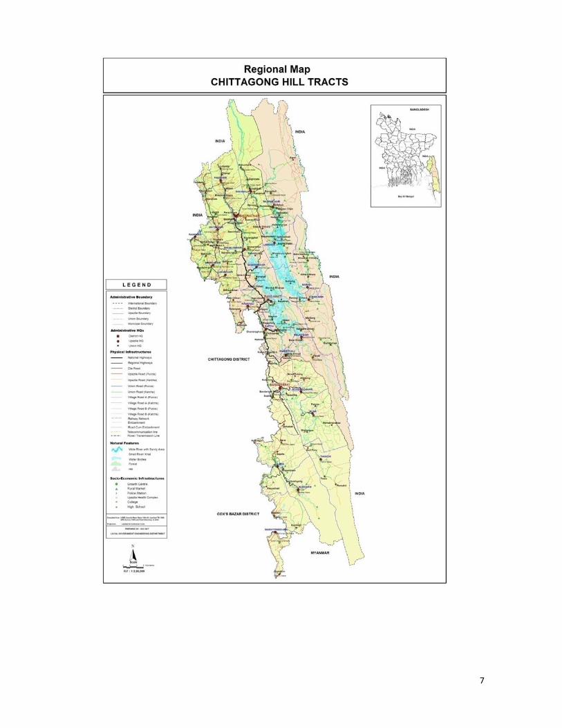
1.2 Project Locations The Chittagong Hill Tracts Rural development Project (CHTRDP-II) is located at three hill districts, namely: Bandarban, Rangamati and Khagrachari and is situated at the southeastern corner of Bangladesh. The region is a sharp contrast to the rest of Bangladesh; geographically it is mountainous and ethnically and culturally, its inhabitants, in their majority, belong to various ethnic minority groups, who all qualify as ‘indigenous people as per the above mentioned SPS of ADB. All of them have their own distinct language and cultural traditions. Administrative and legal setting, the ethnic and cultural diversity, land tenure system, and issues of Indigenous Peoples are unique in Chittagong Hill Districts.
1 Safeguards Categories: Category A – The project is likely to have significant adverse social and/or environmental impacts that are irreversible, diverse, or unprecedented. These impacts may affect an area larger than the sites or facilities subject to physical works. Category B – If the Project’s potential on the social and/or environmental impacts are less adverse than those of category A projects. These impacts are site-specific, few if any of them are irreversible, and in most cases mitigation measures can be designed more readily than for category A projects. Social and/or environmental assessments are required for Categories A and B. Category C – A project is likely to have minimal or no adverse social and/or environmental impacts. No social and/or environmental assessment is required although social and/or environmental implications need to be reviewed.
7

8
1.3 Project Background and Description CHTRDP II comprised of 5 components;
A. Institutional Development and Capacity Building B. Rural roads (RR)
C. Community Infrastructure (CI)
D. Micro Agri-business Development (MAD) E. Project Management
Component A: Institutional Development and Capacity Building
Institutional Development and Capacity Building and Training is specifically meant to respond to the
capacity building needs of the project’s stakeholders which also includes ‘social safeguards’. The targeted recipients are the institutions and other stakeholders who play a role in the effective implementation of the project and play a role in the decentralized governance of the region.
Component B: Rural Roads
Rural road component is being implemented by the Local Government and Engineering Department
(LGED) and comprises of the construction of rural roads across the 3 hill districts. It requires extensive land acquisitions in compliance with ADB’s Safeguard Policy Statement (2009). Component C: Community Infrastructure
Community Infrastructure component supports construction of small scale infrastructure at community level and is sub-divided into 3 intervention areas; a) Small feeder roads/paths between and within villages
and to markets and the construction of village market sheds; b) Small-scale water resources infrastructure, and c) Watershed management. It also requires some land acquisitions.
Component D Micro-Agribusiness Development (MAD),
Micro-Agribusiness Development (MAD) is an area-based approach with selected communities along the rural roads constructed under the project for income rising of the targeted communities through the
development of value chains from improved production, to logistics and market development. The component, till date, is still to be rolled out.
Component E: Project Management
Project Management is meant for support to the project’s implementation and for results monitoring.

.CHTRDP
II Implemenntation Arra
angement
9

10
1.4 Physical Progress of the project activities
According to project design, civil construction in the rural road component (Betbunia Chaeri Bazar road) is scheduled to be started by September 2014 while construction works of various interventions of the community infrastructure component has been started. Out of the total 21 sub-Projects (including p1- p6 subproject prepared during PPTA) of the CI component about 6 sub-project are ongoing and remaining are yet to start. In coming period most of the interventions will start in full swing.
1.5 Reporting Period
This report covers the period January 2013 till June 2014, since it is the first Safeguards Monitoring Report and the first year of Project implementation was spent on preparatory works such as formulating the necessary implementation guidelines and procedures, and with awareness building and training of the various stakeholders involved in actual implementation. The purpose of this report is to inform the main stakeholders and the general public the status and compliance of the respective Safeguards Policy through the production of semi-annual Safeguards Monitoring Reports. This report is also produced in compliance with the Project’s Loan Agreement and with ADB’s social safeguards stipulations as per the SPS, 2009.

11
2. StatusofSafeguardPlansImplementationActivities The project’s Land Acquisition and Resettlement Guidelines were developed during the first half of 2013 and which were subsequently approved by MoCHTA with vetting from CHTRC and ADB, in November 2013. The contracting of the R-NGO also was completed around the same time and the subsequent months were consumed in the preparatory works, most importantly, in setting up the various support committees to Land Acquisition and Resettlement. So, in reality the implementation of the activities essentially started from 2014. Below, the overall progress is provided in detail as regards the compliance of the safeguards issues in CHTRDP II up to the period June 2014.
2.1 Compensation payment for land acquisition and resettlement Land acquisition takes place in only rural road (RR) component according to the project design. For community infrastructure components the project encourages local people to provide land on voluntary basis. In case of land acquisition requirements (if there is no alternative) for the CI component the issue will be handed over to RR component for compensation payment.
2.1.1 RuralRoadComponent As of June 2014, 2 Land Acquisition and Resettlement Plan (LARPs) have been prepared and submitted to ADB and subsequently to MoCHTA; vetting by the former and approval by the latter. The LARPS were prepared by the R-NGO Taungya with assistance by an external consultant specifically recruited for this purpose. The 2 rural road sub-projects are;
I. Betbunia-Chairy Bazar – Bormachari road, Rangamati district II. Panchari-Bhaibon Chara road, Khagrachari district
The preparation of the LARPs adopted a meticulous process. Based on the projected alignment of the proposed road as provided and toe-lines marked with concrete poles by LGED, the R-NGO carried out detailed socio-economic survey on the affected persons/families, conducted consultation meetings with the affected communities and other stakeholders, and worked closely with the government agencies and local autonomous government institutions including the traditional leadership. The socio-economic baseline survey found 46 and 124 affected households for the Betbunia and Panchari road respectively. The brief snapshots are as follows;
Table 1: Number of APs and SAPs
APs SAPs Female-headed HHS* Total Betbunia Road 32 14 8 46 Panchari Road 105 19 8 124 *This category includes both APs and SAPs
During preparation of the LARP the affected people and other stakeholders were consulted at field level. A total of 10 consultation meeting were held at Betbunia-Chairy Bazar Road and 6 consultation meetings were held at Panchari-Bhaibhon Chara road. The discussion in these consultation meetings encompassed various relevant issues; such as, project goals and objectives, project timeline, compensation payment mechanism, roles of the affected people and project in payment of compensation assessment and payment process, relocation requirements, etc. Majority of the CHT population do not have legal ownership documents of their land; as high as 70 percent in the case of the indigenous peoples’ communities and about 45 percent for the Bengali inhabitants (UNDP/CHTDF, 2007). This is an unusually high percentage by any yardstick that is rooted in the complex and contested history of demographic evolution in the region and livelihood patterns of its inhabitants, in particular the indigenous peoples’ communities. For Betbunia road, in total 5 such structures will be dismantled as follows;

12
Table 2: Description of Affected Structures (Betbunia road)
S. N.
Name of owner
Fathers/Husbands Name
Village Sex Type of Structur
e
Owner-ship
Length and
width
Description of Structure
1 Areshi Marma
Late: Mongya Rui Marma
Dabua Para
Male
Doweling House
Self 26 x 24 Feet
House Made of mud wall, Roof with CI sheet, mud floor
2 Mantu Marma
Yongcha Marma
Dabua Para
Male
Husking Machine shed
Self 18 x 12 Feet
Wall made of bamboo, Roof with CI Sheet and mud floor
3 HlathowaiMarma
Suichau Marma
Dabua Headman Para
Male
Tea and Grocery Shop
Self 20 x 19 Feet
Wall made of bamboo, Roof with CI sheet and mud floor
4 HlathowaiMarma
Suichau Marma
Dabua Headman Para
Male
Doweling House
Self 28 x 22 feet
Wall made of Bamboo, Cemented floor and roof with CI sheet.
5 Yong Thowai Marma
Late Josai Marma
Balukhali
Male
Tea stall and Grocery shop
Self 22 X 16 Feet
Wall made of mud, roof with CI sheet, mud floor, wooden window and door
So as expected, a significant percentage of the land ownership still remains under customary ownership and/or without documentation. For the Betbunia road, in total, 14.74 acres of land is acquired for the construction of the road. This includes both recorded and customary ownerships; 1.72 acres under recorded ownership and the remaining 13.02 acres under customary ownership. However, for Panchari road, most of the owners have legal ownership titles and very little of it is under customary ownership. In addition to land, various categories of structures will need to be dismantled for the road constructions at Panchari road. The details about the affected structure at Panchari road are as follows;
Table 3: Description of Affected Structures (Panchari road)
Sl. No
Name of owner
Fathers/Hus-bands Name
Village Type of Structur
e Ownership
Length and wide
Description of Structure
1 Md. Abdul Gafur
S/O Late Fajar Ali
Molla Para
Shop On Government Land
12 feet length and 9 feet width
Mud floor, without wall and roof with CI sheet.
2 Jayana Alo Chakma
S/O Late Balichan Chakma
Manikya Para
House Self 38 feet length and 17 feet width
Mud floor, clay wall and roof with CI sheet
3 Binata Chakma
W/O Late Indra Mani Chakma
Manikya Para
Grocery and Tea Shop
Rented land for shop from Jayana Alo Chakma, AP No-04 in the list of table-2
26 feet length and 15 feet width
Mud floor , Bamboo wall and roof with CI sheet
4 Bimal Kanti Chakma
S/O Late Biranga Chakma
Manikya Para
House Self 28 feet length and 20 feet width
Mud floor, bamboo wall and roof with CI sheet

13
Sl. No
Name of owner
Fathers/Hus-bands Name
Village Type of Structur
e Ownership
Length and wide
Description of Structure
5 Sarat Jyoti Chakma
S/O Malya Ban Chakma
Manikya Para
House Self 26 feet length and 12feet width
Mud floor , half brick wall and half with bamboo and roof with CI Sheet
6 Dipayon Chakma
S/O Late Dhanya Ban Chakma
Manikya Para
Grocery and Teashop
Self 30 feet length and 11 feet width
Mud floor , half brick wall and half with bamboo and roof with CI Sheet
7 Nata Baran Dewan
S/O Late Niranjan Dewan
Suta Karma Para
Husking Machine House
Rented land for machine house from Bikram Kishor Chakma, AP Nno-8 in the list of table-2
26 length and 14 feet width
Pucca floor, Bamboo wall and roof with CI sheet
8 Udayan Chakma
S/O Ramani Mohan Chakma
Suta Karma Para
Grocery Shop
Rented land for shop from Bikram Kishor Chakma, AP Nno-8 in the list of table-2
14 feet length and 12 feet width
Mud floor, bamboo wall and roof with CI Sheet and Sungrass
9 Debaranjan Chakma
S/O Late Nalakka Chakma
Suta Karma Para
House
Rented land for house from Kalata Muni Chakma AP No-15 in the list of table-2
15 feet length and 10 feet width
Mud floor, bamboo wall roof with CI sheet and Sungrass
10 Shanti Chakma
S/O Debaranjan Chakma
Suta Karma Para
House
Rented land for house from Kalata Muni Chakma, AP no 15 in the list of table-2
15 feet length and 10 feet width
Mud floor , bamboo wall roof with CI Sheet and Sungrass
11 Priti Ranjan Chakma
S/O Rajandra Lal Kabari
Uttar Shantipuur
House Self 30 feet length and 20 feet width
Pucca floor, brick wall and roof with CI Sheet
12 Parimal Chakma
S/O Late Goutan Muni Chakma
Uttar Shantipuur
Grocery and Tea Stall
Self 21 feet length and 19 feet width
Pucca floor, brick wall and roof with CI Sheet
13 Deba Ratan Chakma
S/O Late Upendra Chakma
Uttar Shantipuur
Grocery and Tea Stall
Self 13 feet length and 23 feet width
Mud floor, bamboo wall and roof with CI Sheet.
14 Shova Ranjan Chakma
S/O Kalo Moy Chakma
Dakkin Shantipur
House
Rented land from Kalomoy Chakma, AP No-59 in the list of table-2
27 feet length and 18 feet wide
Mud floor ,bamboo wall and roof with CI Sheet
15 Kulapradip Chakma
S/O Sunit Baran Chakma
Uttar Shantipuur
House Self 16 feet length and 8 feet width
Pucca floor, without wall and roof with CI Sheet
16 Samar Chakma
S/O Late Priya Dulal Dhakma
Baura Para
Husking Machine House
Self 23 feet length x 10 feet
Pucca floor, Bamboo wall, roof with CI Sheet

14
Sl. No
Name of owner
Fathers/Hus-bands Name
Village Type of Structur
e Ownership
Length and wide
Description of Structure
17 Runu Chakma
S/O Late Sukh Shanti Chakma
Baura Para
Cow Shed
Self 12 feet length and 10 feet width
Mud floor, without wall and roof with CI sheet
18 Runu Chakma
S/O Late Sukh Shanti Chakma
Baura Para
Latrine Self 6 feet length and 5 feet width
Mud floor, Bamboo wall and roof with CI Sheet
19 Ratna Chakma
S/O Krisna Prashad Chakma
Nalinda Para
House
Rented land from Binoy Kanti Khisa, AP No-110 in the list of table-2, page-
22 feet length and 20 feet width
Pucca floor, brick wall (half) , roof with CI sheet
20
Chota Panchari Govt. Primary School
Joti Lal Chakma, SMC Chairperson
Baura Para
Latrine Self 6 feet length and 5 feet width
Pucca sanitary latrine
The affected people belong to three communities; Bengali (1 family) Marma (3 families) and Chakma (120 families). As mentioned in the above Table, 20 different structures need to be relocated from 19 different individuals. Of them 9 are dwelling house, 2 latrines, 2 husking machine house, 6 tea stall and grocer shops and 1 cowshed. Among the houses one is fully brick made building with tin shed. Among others, some are semi Pucca (permanent) and the rest are bamboo and wooden made. In addition to affected structures, the construction of the roads also caused felling of trees. A total of 3408 various categories of trees have been affected by the project from which 3307 (97.62%) timber type and only 81 (2.38%) is fruit bearing. Among the total affected trees most of them are small and sapling (2853) and 501 trees are medium while only 54 trees are large category. A recapitulation for both roads is provided below;
Table-4: Number of affected trees by type (Timber/fruit) and size (Betbunia road)
Category of Tree Large Medium Small Sapling Total Percentage
Timber 32 489 1133 1673 3327 97.62
Fruit Trees 22 12 46 1 81 2.38
Total 54 501 1179 1674 3408 100 The Panchari road construction will also result the loss of various species of trees like, teak, karoi, gamar, mehagani etc. as found in the SES result. The trees are of two types; timber type and fruits bearing. All these trees are further sub-categorized according to their number and sizes; large, medium, small and sapling in the table below:
Table-5: Number of affected trees by type (Timber/fruit) and size (Panchari road)
Category of trees Large Medium Small Sapling Total % Timber 62 822 394 82 1360 54.68 Fruit Trees 501 353 249 24 1127 45.32 Total 563 1175 643 106 2487 100%
There are different categories and quality among the timber type trees and the price also varies in accordance with category and quality of the timber. Similarly, different types of fruit bearing trees like, papaya, jackfruits, banana, guava, mango, litchi, pineapple, orange, bel, kul, ata, kamranga, chalta etc to be fell down for construction.

15
Most of the land acquired under Betbunia road falls under the category of Hilly land/slopes (76.60%) followed by cropped land (20.88%) and orchard (2.52%). The details are provided in table 6 below;
Table-6: Type of Affected land under LAR (in decimal), by Percentage (Betbunia road)
Type of land Quantity of land (Acre) Percentage
Orchard/Homestead 0.3728 2.52%
Hills/Hill Slopes 11.3375 76.60%
Multi crop/Paddy land 3.0908 20.88%
Others 0 0
Total 1,4.8011 100 At Panchari Road, most of the affected land is used for agriculture (54.77%) followed by orchard (33.53%) and other categories (11.70%). There is forest land affected by the subproject. Land acquisition by category is presented in table 7.
Table-7: Type of Affected Land under LAR (in decimal), by Percentage (Panchari road)
Type of land Quantity of land (Decimal) Percentage
Orchard/Homestead 2.81 33.53%
Forest 0 0
Multi crop/Paddy land 4.58 54.77%
Others 0.98 11.70%
Total 8.37 100% A complicating factor with regard to land acquisition in the CHT is that the current legal dispositions of Bangladesh do not recognize customary tenurial ownership of land, the most prevalent modality of land ownership of the region’s indigenous peoples’ communities notwithstanding the provisions stipulated in ADB’s SPS and the Project’s LARF which clearly lay down the safeguards measures for the indigenous peoples on customary tenurial security over land and natural resources.
3. SocialMonitoring
3.1 CHTRDP II: Safeguards Monitoring Framework
The Safeguard Policy Statements (SPS, June 2009) of ADB provides the overarching framework as to the monitoring of safeguards by CHTRDP II. As mentioned above, the project is categorized as A for Indigenous Peoples and Involuntary resettlement, and categorized as B for Environment. Consequently specific Indigenous Peoples Plan (IPP), Land Acquisition and Resettlement Framework (LARF) and Environment Planning Framework (EPF) were prepared during the Project Preparation Technical Assistance (PPTA) of the project. Based on the IPP, LARF and EPF, separate Guidelines for land acquisition – which also incorporates the indigenous peoples safeguards issues – was developed subsequently when the project started. Finally, LGED, responsible for the implementation of Component B – Rural Roads, is tasked with carrying out an environmental assessment for each road before construction starts based on specific guidelines. The Land Acquisition and Resettlement Guidelines of CHTRDP II also incorporate the legal provisions of the Government of Bangladesh, the LAR-Framework and the IP-Plan for this Project, while keeping the SPS as its overarching reference, particularly for proper compensation. This was re-enforced and validated by an Executive Order (EO) of the Ministry of CHT Affairs (MoCHTA) of the Government of Bangladesh which is attached in Annex 2 to this report. The Land Acquisition and Resettlement Guidelines lays down the process as well as the scope of land acquisition and resettlement for CHTRDP II. This includes the various provisions to respect in compliance with the SPS which are to be documented in detail as Land Acquisition and Resettlement Plans (LARPs)

16
for each major infrastructure subproject following a template included in the Guidelines. CHTRDP II’s Community Infrastructure (CI) component includes grant support for rural access roads and water projects may which require small-scale land acquisition, but no resettlement of affected families is anticipated. This concern also equally applies to its sub-component; watershed management. Consequently, all CI subproject activities are based on a ‘feasibility study’ that incorporates the compliance of safeguards as per SPS.
3.2 Institutional Arrangements for Safeguards Compliance MOCHTA holds the responsibility as the ‘Executive Agency’ for CHTRDP II with the CHTRC as the ‘Lead Implementing Agency’. The Project Management Office (PMO) under the Project Director is responsible for the overall management, supervision and coordination of the activities. The Project Director is vested with the authority to withhold the disbursement of funds to the defaulting agency until such time the process to rectify the fault is put in progress. The Project Implementation Consultants’ (PIC) team’s task is to ensure the necessary technical backstopping on safeguards and capacity building with main responsibility assumed by the Social Safeguard Specialist (SSS) and Institutional Development and Capacity Building Specialist of the team. Further, a Safeguard and Quality Monitoring Cell (SQMC) has been established in the PMO to ensure that the project is implemented with due concern for safeguards and quality and, specifically to ensure that these issues are adequately addressed to the requirements of ADB. It reports both to: (1) the Project Director; and (2) independently to ADB. The implementation arrangement is shown in the Figure next page. As mentioned above, LGED is responsible for the implementation of the Roads and Market Component and the District Project Management Offices (DPMO) in the 3 districts are responsible for implementing the Community Infrastructure component in their respective district. As regards safeguards implementation, LGED is specifically responsible for satisfying all safeguard requirements of the Government and ADB in terms of: LAR, Gender, IPs, and the environment and for this, to allow access to the personnel of the SQMC to scrutinize and aspects of proposed, ongoing, or completed work, at the time; and
Figure 1: Project Implementation Arrangement
The overall implementation of the LAR activities involves a range of committees and stakeholders, as outlined in detail in the CHTRDP II’s LAR Guidelines which is approved by the above-mentioned MoCHTA Executive Order. The Committees and Institutions involved are;

17
Key Institutional Stakeholders in the LAR Guidelines Implementation
Oversight and Policy Guidance & Backstopping Local Government Engineering Department (LGED) District Project Management Office (DPMO) Hill District Council (HDC) Project Management Office (PMO) CHT Regional Council (CHTRC) Ministry of CHT Affairs (MoCHTA) Safeguard Quality & Monitoring Cell (SQMC) Project Implementation Consultant (PIC)
Specific to Implementation of LAR Activities Resettlement Advisory Committee (RAC) LAR Assessment/Estimation Committee (LARAEC) Property Valuation Assessment Team (PVAT) Alternative Dispute Resolution Forum (ADRF) Grievance Redress Committee (GRC) Non-Government Organizations (NGOs) Office of the Deputy Commissioner Office of the Circle Chief and Headmen
The various committees and institutions each have specific responsibilities as regards safeguards implementation and compliance. These are provided in detail in CHTRDP II’s Land Acquisition and Resettlement Guidelines. On the whole, MOCHTA, through the CHTRC and the HDCs, has overall coordination, planning, implementation and financing responsibilities. The Project Director serves as Chief Resettlement Officer (CRO) and the DPDs are District Resettlement Officer (RO). In this capacity, the CRO is responsible for the supervision of the implementation work, with the help of HDC and the R-NGO. The CRO is assisted by the District Resettlement Officer in each Hill District. The implementation of safeguards for resettlement is provided in the figure below;
Figure 2: Resettlement Organization Chart
18
3.3 Safeguard Monitoring Team The Social Safeguard Specialist (SSS) of the Project Implementation Consultants (PIC) team was recruited in June 2013 and mobilised in September 2013 after the originally assigned SSS-consultant resigned from this job. The SSS is responsible for technical backstopping and as well as ensuring quality. Recruitment procedure for the Resettlement NGO (R-NGO) was completed by August 2013 and from September 2013 the R-NGO, Taungya, was mobilised. The R-NGO is responsible for the field level execution of the resettlement and IP safeguard activities. Taungya carries out the field level socio-economic survey, consultations with the affected persons (APs) and other relevant stakeholders, facilitating assessment of valuation of land and properties under acquisition and as well as addressing grievances, and finally liaise with the government and other agencies including the PMO on the payment of compensation to the affected persons and their families. For the Community Infrastructure (CI), the assessment for land acquisition is carried out by the NGOs sub-contracted by the project for social mobilization (S-NGO) further vetted by the PIC on the overall quality control. The assessment is carried out based on a template which also includes a section on the environmental safeguard issues, carried out by the S-NGOs. There are 3 S-NGOs under the project, each responsible for one of the three Hill Districts, namely, Bandarban (Toymu), Rangamati (Green Hill) and Khagrachari (Trinamul). The Local Government Engineering Department (LGED) is responsible for the environmental assessment of the rural roads subprojects built under Component B – Rural Roads of CHTRDP II. This is included in the overall feasibility assessment of each sub-project i.e. rural roads, to be constructed by LGED. A Safeguards and Quality Monitoring Cell (SQMC) has been established in the Project in March 2013 to monitor quality of construction works and monitor compliance with social and environmental safeguards. It will have two-fold reporting responsibilities: (i) to the Project Director, PMO; and (ii) independently to Asian Development Bank (ADB). The role of the SQMC is to ensure that the Project is implemented with due concern for safeguards and quality and specifically to ensure that these issues are adequately addressed to the requirements of ADB: The SQMC comprise of two national consultants (with intermittent inputs of total 40 person-months as per PAM but contracted for 28 person moths for two specialists), an environmental engineer (14 person months) and a social safeguard specialist (14 person-months).
3.4 Community Infrastructure The components comprises of 3 distinct subcomponents, as is also mentioned above;
Sub-component – 1: Small feeder roads/path and market-sheds at community level Sub-component – 2: Small scale water resources infrastructures Sub-component – 3: Watershed management
During the reporting period, 16 new subprojects (Rangamati: 13, Khagrachari: 2, and Bandarban: 1) have been approved for execution, in addition to the 6 pilot subprojects that have been studied during PPTA. The subprojects largely comprised of various small-scale rural infrastructure interventions; such as, feeder road, rural trails, concrete stairs, culverts, small irrigation and drinking water projects, etc, essentially covering the sub-component 1 & 2. The list of the approved sub-projects is provided below;
Table 8: List of CI subprojects approved and implementation started by June’14.
SL Name of the
village Union Upazilla District Type of interventions
P1 Sapchari-Wagga Para
Wagga Kaptai Rangamati Village water supply, village footpaths, foot bridge.
P2 Jibtoli Headman Para
Jibtoli Rangamati Sadar
Rangamati Village water supply, village access (foothpaths), Market-shed.
P3 Joggyachola Para
Manikchara Manikchara Khagrachari
Irrigation system improvement (lined canals), water supply
P4 Chitta Member Para
Bowalkhali Dighinala Sadar
Khagrachari
Village irrigation improvement, village water supply, footh paths
P5 Chemidulu Kuhalong Bandarban Bandarban Village irrigation improvement,

19
SL Name of the
village Union Upazilla District Type of interventions
Para Sadar village water supply, footh paths, rcc stairs
P6 Kafru Para Soroi Lama Bandarban Village access, foot path and rcc stairs
1 Basanta Para Sualok Bandarban Sadar
Bandarban Village Footpath
2 Dharmaghar – Dharmapur via Gulakana Para
Perachara Khagrachari Sadar
Khagrachri Village access, HBB road
3 Mejar Para Laxmi Chari Laxmi Chari
Khagrachari
Market Shed
4 Pankua Para,
Tinkunia Bilaichari Rangamati Village footsteps, Irrigation and agriculture equipments 5(3 power tillers and 6 p6ump machine).
5 Kathuria para Bangalhalia Rajasthali Rangamati *Irrigation and agriculture equipments (2 power tillers and 4 pump machines). * Water Supply: 5 DSP pumps
6 Mitingyachari Gagra Kawkhali Rangamati HBB road 7 Bhalachari Para Kangrachari Bilaichari Rangamati *Irrigation and agriculture
equipments (4 power tillers and 6 pump machines). * Water Supply: 2 ring wells
8 Debachari Para Kengrachari Bilaichari Rangamati *Irrigation and agriculture equipments (4 power tillers and 6 pump machines).
9 Dighalchari Debamatha Para
Kengrachari Bilaichari Rangamati *Irrigation and agriculture equipments (3 power tillers and 5 pump machines). * Water Supply: 2 ring wells
10 Noyajiri Para Gainda Rajasthali Rangamati HBB road with footsteps 11 Keretkaba para Moghban Rangamati
sadar Rangamati *Irrigation and agriculture
equipments * Water Supply
12 Kuturia para Bangalhalia Rajasthali Rangamati Village road 13 Mubachari para Bandukbhan
ga Rangamati sadar
Rangamati 2 footsteps, 2 power tillers, 4 water pump machines, 2 tube wells
14 Triratnankur Uttar Para
Kalampati Kawkhali Rangamati HBB Road with drain
15 Beng Chari to Devachari
Mogban Rangamati Sadar
Rangamati Village road
16 Bunia Chara Gaindha Rajasthali Rangamati Village access, HBB Road Note: subprojects P1 to P6 have been surveyed during PPTA and approved as pilot CI subprojects.
On average, each subproject benefited about 200 households or 1,000 persons. Prior to approval for implementation, the sub-projects are prepared based on a template that includes socio-economic survey of the beneficiaries and as well as a statement about the land acquisition requirements and environmental impacts. The social mobilization NGO carried out the baseline, conducted consultations with the communities and other relevant stakeholders including on the land acquisition requirements. Given the types of the sub-projects, the overall amount of land acquisitions per sub-project was small and voluntarily donated by the community members. The sub-project feasibility studies include detailed information on the amount land acquired. This also includes the detailed information about the consultations with the communities and stakeholders.

20
The watershed management sub-component is also a community-based initiative aimed at conservation of better watershed management at community level. The project includes 6 sub-projects, 2 per hill districts. The preliminary feasibility of the 5 sub-projects is currently being carried out during the reporting period at the following locations;
Table 9: CI Subprojects under feasibility study
Subproject name Upazilla District Site area 1. Mazra chara watershed Project Sadar Bandarban 70 acres 2. Peemrongchara micro- watershed project Sadar Do 108 acres 3. Dhevachari watershed project Sadar Rangamati 375 acres 4. Godachara micro-watershed project Dighinala Khagrachari 59 acres 5. Tarabonchara project Dighinala Do 3,149 acres
As detailed above, each of the sub-projects requires land which is voluntarily donated by the communities to the sub-project activities. Much like the Rural Roads sub-components, each of the feasibility studies includes detailed consultations with the communities and the relevant stakeholders. The participants include community elders, land donors, local leaders and as well as representatives of local governments such as UP ward members and Chairmen. The deliberations of these consultations are attached in the feasibility reports as annex. The feasibility studies, for all 3 sub-components, also include brief assessments of environmental impacts. Given the types of projects i.e. small-scale infrastructures, the assessment essentially focused on the following;
Impacts on soil, in particular soil erosion Damage to the adjoining forests, shrubs and bushes Risks of landslides from soil excavations/cutting
The feasibility studies clearly spelt out measures to keep such negative impacts at a minimum and wherever possible, to eliminate such impacts. A key principles regarding the watershed management sub-projects, has been to create vegetation and forest coverage with local species of fauna and flora. CHTRDP II took it as guiding principles that no alien species of trees and shrubs are planted as part of creating vegetation for the watershed sub-projects.
3.5 Institutional Development and Capacity Building The component, as the title, indicates is meant to support in building the capacity of the institutional stakeholders who play pivotal role in the implementation of the project but also in the broader decentralized administrative setup of the CHT region. Consequently, the training package includes a broad of topics relevant to the aims and objectives of the project i.e. CHTRDP II. A key area of focus of the trainings was the social safeguards and the SPS, including related training such as GIS/GPS reading and reporting. In total, five (5) workshops and trainings have been organized till the reporting period by the CHTRDP II management. The training was organized and conducted by the Project Implementation Consultants (PIC) team. The Institutional Development and Training Specialist took the lead role for coordination with further assistance from the Social Safeguards Specialist in the delivery of the training. The Table below provides the details.
Table 10: Safeguards related Workshops and Training
Training topics Date Venue Participants’ profiles
Orientation Workshop Environment and
26. April 2014
ASHIKA Conference Room, Outer Stadium, Rangamati
PIC, DPMO, LGED, SM-NGO, R-NGO Staff.

21
Training topics Date Venue Participants’ profiles
Social Safeguard Land Acquisition and Resettlement Plan Implementation Training
27 April 2014
District Sports Association Conference Room, Rangamati Stadium, Rangamati.
Regional Council Representative, , Land Officer-HDC Offices, Headman, PIC, DPMO, R-NGO’s staff, and Engineers & Surveyors -LGED, President/Secretary of Headman Association and Chairman Association of CHT.
Land Acquisition and Resettlement Implementation Workshop
28 April 2014
Conference Room, Rangamati Hill District Council, Rangamati.
Regional Council Representative, Land Acquisition Officer and Kanoongo-D.C Offices, Land Officer-HDC Offices, Headman, PIC, DPMO, R-NGO’s staff,and LGED Staff, President/Secretary of Headman Association and Chairman Association of CHT.
GIS/GPS Software & Reporting Training Course
23-24 June 2014
Conference Room, Project Management Office, CHTRDP II, Rangamati.
R-NGO staff
Orientation on Indigenous People Safeguard
28-30 June 2014
Conference Room, Project Management Office, CHTRDP II, Rangamati.
R-NGO Staff
The trainings ensured the requisite backstopping to the project team (PMO, DPMO, NGOs, other stakeholders) in the compliance of the safeguards requirements of ADB. In addition to the trainings organized by CHTRDP II, ADB also organized separate orientation meetings on the subject on separate occasions, in Rangamati and Bandarban. The Social Safeguards Specialist of ADB Bangladesh Resident Mission conducted the orientations. 3.6 Status of Public Participation and Consultations Consultation and participation are key cornerstones of CHTRDP-II. The project organized orientation workshops immediately after its inceptions in an effort to inform the larger public in the region about the broad outlines of the interventions. This was started with the ‘Inception Workshop’ in Rangamati on 12 December 2012 with the attendance of the representatives of the major CHT institutions, (CHTRC, HDCs) concerned government institutions (MoCHTA, LGED, ERD, Planning Commission, Ministry of Finance), local governments (UP and Upazilla Chairmen) Traditional Institutions (Circle Chief, Headmen and Karbari) and civil society (NGOs, local elites, etc). Similar workshops were subsequently held also in the hill districts of Bandarban and Khagrachari, although with smaller number of attendance. The orientation workshops were particularly organized to inform the CHT public at large to uphold the principle of transparency of the CHTRDP II’s interventions. This is also equally to seek a greater degree of public participation in its operations and implementation. Subsequently, in all the steps, CHTRDP II worked closely with the relevant institutions in the region and a broad range of other relevant stakeholders, most important being the communities and the affected persons, as part of the preparations of the LARPs. In total 16 meetings were held with the communities for the preparation of the LARPs; 10 for Betbunia road and 6 for Panchari road. In addition, separate meetings of the support committees - JVT/LARAEC, PVAT, GRC – were held on the following dates as provided in the table below;

22
Table 11: Support Committees’ meetings
Name of the Committee Betbunia road Panchari Road
Socio-economic Survey (SES) 14- 16 December, 2013
10 -11 January, 2014 24- 26 February, 2014 30 April - 2 May, 2014
LAR Assessment and Estimation Committee (LAREC/JVT)
26.06, 2014 27 May,2014
Property Valuation Assessment Team (PVAT 15, 12,2014 Meeting not yet organized
Alternative Dispute Resolution Forum (ADRF) 29 05,2014 28 ,2014 The issue of the grievance redress i.e. ADRF and GRC is further elaborated in the section below. These consultations and close collaboration led to the decision of paying compensations to the APs and SAPs even if they did not possess legally recognized ownership documents. In other words, the project took into recognition the customary ownerships of land of the region’s indigenous peoples, thus giving precedence to the stipulations of the SPS of ADB notwithstanding the fact that the country’s legal framework. Subsequently, the valuation assessment was carried out on the basis of the government rate on which a premium of 50% as MARV was added to the lands. In addition, CHTRDP II also provided requisite compensations for the standing structures and crops as found in the socio-economic survey. It should be mentioned that the principles of ‘Free, Prior and Informed Consent’ (FPIC) was followed throughout the land acquisition process with the APS and SAPs. The execution of LARP was carried out as per the Entitlement Matrix which is included as integral part of the LARP. Following valuation of the properties (land, structures and standing crops), the project organized public hearings to seek grievance redress of the affected persons and communities. There were all meticulously documented and included in the LARPs. It should be noted that, no particularly serious grievances were raised by the APs and SAPs which underscores the salience of the consultations previously held with them. Similar consultations with the communities, village elders and local representatives were held for the community infrastructure sub-projects as part of the process of preparing the sub-project feasibility studies. On average 2 consultation meetings were organized for each of the 16 sub-projects (please see the detailed list above) under the CI component.

23
4. GrievanceRedressMechanism CHTRDP-II paid utmost attention to this issue and took it as most important of the LAR process. The project’s Land Acquisition and Resettlement Guidelines include a detailed process on grievance redress which comprises, broadly, the following; A grievance redress committee (GRC) is formed at the district level with the following members; (1) Chairman or Representative of HDC, Chairperson, (2) NGO representative, Member Secretary and the following as members (3) Representative, DC Office, (4) Land Officer, HDC, (5) Representative, Headmen Association (6) Representative, Union Parishad (7) Two representatives of the APs, Members (at least 1 being a woman)
The setting up of the GRCs was subsequently sanctioned in the above-mentioned MoCHTA Executive Order too which is provided as Annex. The GRC receives grievance cases from the APs and SAPs through the NGO (i.e. Taungya) and gives deliberations to resolve resettlement and compensation issues. The grievance cases are heard at first at a local – Union – level at an Alternative Dispute Resolution Forum (ADRF) formed for the purpose of CHTRDP II. In all hearings – ADRF or GRC – the R-NGO arranges the presence of a legal adviser as an observer and also to facilitate and support the APs in finding a solution to the cases of grievances. If a case of grievance is not resolved at the ADRF and GRC level, these are referred to the project’s Resettlement Advisory Committee (RAC), although all through the process the APs/SAPs maintains the right to seek appropriate recourse before a competent court of law of Bangladesh. The representative of the NGO, as the member secretary of the GRC, upon receipt of complaints, organizes a GRC (or ADRF) hearing. All grievance cases submitted before the GRC are to be settled within fifteen (15) days of receiving the complaints from the AP. The overall model of CHTRDP II’s grievance redress mechanism is summarized in the graph provided below;
[Betbunia-Chairy Bazar road covers two Mouzas; Betbunia Mouza and Dabua Mouza. Due to remoteness
and inaccessible communication Alternative Dispute Resolution Forum (5 members including two women) has been formed one in each Mouza. Consequently, two ADRF have been duly formed on 29.05.2014 for the Betbunia road, one is in Betbunia Mouza and the other one is in Dabua Mouza in the following:
ADRF members for Betbunia Mouza:
Sl. No. Name Village Designation and Contact no.
01 Mr.Antuza Chowdhury Headman Para Convenor,01828552683 02 Mr. Shuri Marma Chowdhury Para Member, No mobile 03 Ms. Aungmething Marma Pachu Para Member,01840425898 04 Mr.Ruicha Aung Marma Pachu Para Member,01830367726 05 Ms. Ukrabai Marma Chowdhury Para Member, No mobile
ADRF members for Dabua Mouza:
Sl. No. Name Village
Designation and Contact no.
01 Mr. SM Chowdhury Headman Para Convenor,01555270027802 Mr. Suithoai Karbari Dabua Para Member,01820321579 03 Ms. Arema Marma 3 no ward Fatikchari Member, no mobile 04 Ms. Matrauimu Marma Lamur Para Member, no mobile 05 Mr. Hlathoai Marma Headman para Member, 01818101543

24
ADRF members for Panchari Road:
S.L Name Village Designation and Contact no
1 Mr. Subrata Chakma Choto Karma para Convener,01553755761 2 Ms. Soheli Chakma Santipur Member, no mobile 3 Mr. Utpalakha Chakma South Santipur Member,no mobile 4 Mr. Shamol Kanti Chakma Baburu Para Member,01556620154 5 Mr. Bishwa Mitra Chakma South Santipur Member, no mobile
For Panchari road one ADRF has been formed on 28.05.2014 because of only one Sotokurma mouza is coved by the road.
ADRF members Raikhali Road:
(Part‐1)
S.L Name Village Sex Designation Mobile Number
1 Uching thowai Chowdhury
Naran giri Mukh
Male Convener 01852407939
2 Ubasing Karbari Jhogona chari
Male Member 01830733510
3 Mong pru Karbari
Kala Maishaya
Male Member No mobile
4 Suicrasing Marma
Jgogonachari
Female Member No mobile
5 Eshasing Marma
Jgogonachari
Female Member No mobile
The ADRF was formed for the Raikhali Road on !2.07.2014
There were no grievances placed before the ADRF and GRC until June 2014. Local people are known about the process of grievance redress mechanism through group discussion, consultation meetings and
personal contact.

25
Figure 3: CHTRDP II Grievance Redress Mechanism
In the case of implementation of the project’s LAR activities, following the decisions of the LARAEC/JVT about the land and properties under acquisition, the APs and SAPs were served notices of the LARAEC meetings’ decisions by the DC office through the R-NGO (Taungya) and were asked to notify their grievances (if any) to the project management through the NGO. This same step was also followed after the PVAT meetings decisions where the communities were asked to raise their grievances about the overall amount of the valuation. After service the notice at each step, the R-NGO (Taungya) subsequently held further consultations with the APs, SAPS and the communities adjacent to the roads to receive their grievance. However, both in the cases of Betbunia road and Panchari road, no cases of grievance were received – neither on the issue of land acquisition nor on the overall valuation. As made on the previous page, this demonstrates the right and effectiveness of the consultations organized by the R-NGO under the project. It is noted that, no serious grievances have so far been raised by the APs and SAPs. For public appraisal about the grievance mechanism, circulation of a general notice among the affected people and other stakeholders in local language will be more effective. A specimen of general notice is as under-

26
A specimen of the public notice is as under -
Public Notice
This is to inform the inhabitants of the villages in Chittagong Hill Districts (Rangamati, Bandarban and Khagrachhari) that the Government of Bangladesh (GoB) has undertaken the project with financial support from the Asian Development Bank (ADB). Land acquisition and resettlement plans are being implemented. Civil Construction of the project will start soon. Necessary land for the project has been acquired and requisitioned as per ADB policy and GoB laws.
If any individual or community has any comments or complaints over the project activities particularly on social, resettlement or environmental issues, their complaints will be heard and resolved by the Grievance Redress Committees with due attention.
The aggrieved person/community are advised to send their comments/ complaints (if any) to the Coordinator of Resettlement NGO (TANGYA)
(JInu Chakma) Documentation Officer
TAUNGYA
5. ConcludingObservations The reporting period was largely consumed by the various preparatory activities before rolling out the field level implementation. As regards the safeguards compliance, it provided some unique challenges and also the opportunity to overcome. The region’s complex administrative and legal setup and political and cultural sensitivity called for a patient approach. CHTRDP II is the first donor supported project in CHT to adopt compliance of safeguards on the indigenous peoples and involuntary resettlement following the adoption of the SPS by ADB. The application of the SPS provisions thus provided challenges on a number of aspects; interpretation of the various provisions of the SPS, abiding by the legal norms of Bangladesh without compromising the standards laid down in the SPS (a good example is the issue of compensation for customary ownership of land by the indigenous peoples’ communities which have had to be overcome though an Executive Order by the Ministry of CHT Affairs as the current laws in Bangladesh do not allow such compensation), the troubleshooting for politically contentious issues (land ownership is being the most prominent) and finally, not the least, a lack, in general, of qualified human resources which could implement the safeguards provisions in the field. These ‘teething problems’ have had to be overcome with imparting the requisite skills to the project personnel through training and other capacity building measures and very importantly by patient negotiation and dialogue with the various stakeholders. It is expected that following this initial phase of the project, no significant issues and problems regarding the safeguards compliance will be confronted by the project in the upcoming period.
*******

27
Annex 1: Land Administration in the CHT
A. Category and Types of Land Lands in the CHT fall into several categories; the largest portions of which are forests. These are sub-divided, by laws, into three categories; (1) Reserve Forests (RF), (2) Protected Forests (PF) and (3) Unclassed State Forests (USF) The history of Reserve Forests in CHT dates back to the colonial period. The first Reserve Forest was declared in the second half of the 19th century with the most recent as late as 1990s. All together, the RFs constitute about 25% of the total territory of the region. The Department of Forest is the custodian of the reserve forests; all activities of the people including their entry in to the Reserve Forest area is restricted and punishable by law. The PFs are a relatively recent introduction, created in the 1960s as ‘game reserves’ with the explicit objectives of conservation of fauna and flora and are located mostly in Rangamati. Forest Department is the custodian but in difference to RF, certain activities and as well as movement of the local people are allowed in the PF. Unclassed State Forests (USF) constitute the largest portion of land in the CHT and are also the main ‘bone of contention’ in the controversy over ‘khas land’ (from the point of view of the government) vs. communal/collectively owned land (from the point of view of the Indigenous Ethnic Minority Peoples). No individual titles exist on the USF. The Headman is considered as the custodian; s/he is the first to be consulted by law in the case of their exploitation/utilization. In addition, the Headman is vested by law to its management and exploitation and can give land titles to anyone (local community members in practice) for homesteads. The Circle Chief, exercises its jurisdiction over the USFs through the Headmen. Besides, lands in CHT are classified as per the following types;
Paddy land: These are all individually owned/titled and taxes are collected by the local Headman. Following the Kaptai dam, there is not much ‘paddy land’ available in the region however.
Fringe land: These are lands submerged under the Kaptai lake but cultivable for a crop (usually paddy) annually during the lean season. No permanent individual title/ownership exists over these land, and are generally managed under a system of ‘one year lease’ (ek sona bondobosta) by the office of the Circle Chief through the Headman who also collects the taxes from the leasees.
Groove land: Following the construction of Kaptai dam, the then Pakistan government through the East Pakistan Agricultural Development Corporation (now Bangladesh Agricultural Development Corporation) undertook an initiative of a project of horticulture and fruit gardening, mostly to mitigate the negative impacts of the dam. These are individually owned plot/parcels, and taxes are collected by the Headmen.
Private lands: There lands owned by individuals with proper titles. Except in the Bazar Fund and municipality areas, taxes are collected by the Headmen.
Village commons: Technically, there are parts of USFs, but should be considered a separate category. Traditionally, every village had a parcel of land (some as big as several hundred hectares) earmarked for domestic uses (and never commercial) of its produces (timber, fruits, bamboos, etc.). The entire community is responsible for its maintenance and nurturing under the custodianship of the Headmen. Once every village used to have one of such ‘common forest’, but now their existences are rapidly vanishing.
b. Key pieces of legislations Lands in the CHT are managed by a number of laws. Below is a brief overview of the key pieces of legislations concerning land administration in the region;
CHT Regulations 1900 (popularly called, the CHT Manual)
This is the key legal reference till date and defines the region’s administrative framework, revenue collection, power and authority of the traditional institutions (e.g. Circle Chief and Headmen) and justice system including ‘tribal justice’ system. The Act was amended a number of times (7 or 8 times; the last in 2003), but still remains a key reference.
Forest Act, 1927 (as amended in 2003)
It is the key law on the administration of Forests in the country. It replaced the older (adopted in 1876) law and has been recently amended in 2003. For CHT, the law has a major impact, given 25% of the region is Reserve and Protected Forests and with the USF, this percentage can be more than 60% of the region!

28
Headmen Rules, 1936
The rules were elaborated by W. J. Christie, a British Civil Service official, as an annotation to the 1900 Act (particularly pertaining to the Rules, 34, 44 and 46) to clarify the role of the Headmen on their authority to land and revenue administration and as well on dispensation of customary tribal justice.
Bazar Fund Rules, 1936
The Rules were adopted by the British (and still in enforcement) regarding the management/administration of the markets (hat and bazaar). By doing so, these also frame out the land management in market areas.
CHT (Land Acquisition) Regulation, 1958
The Regulation replaces certain sections of the CHT 1900 Act but it was specifically adopted to clarify the government’s authority for acquisition of land on the eve of the Kaptai dam construction. In the process, it remains as the most important legal instrument for the government with regard to land acquisition in the region.
Forest Transit Rule, 1974
Defines transit/transports of forest products and produces to and fro Chittagong Hill Tracts with the rest of the country.
Land Khatian Ordinance, 1984
Meant for the entire country for land titling, certain sections of it are also applicable for the CHT, although the full effect of the ordinance will be realized only when a comprehensive cadastral survey is carried out in the region.
Land Appeal Board Rules, 1989
Piece of legislation defining the power, authority and as well as procedures for dispensation of land related litigations in the country. Certain parts of it are also applicable for the CHT, primarily impinging on the authority of the Circle Chief and broadening the power of the DC.
HDCs (Bandarban, Rangamati and Khagrachari) Act, 1998 (along with the Schedule – 1)
A major piece of legislation for the decentralized governance of the CHT, Section 64 of the HDCs Act states;
“Notwithstanding anything contained in any law for the time being in force, no land within the boundaries of Rangamati (and Khagrachari and Bandarban) Hill District shall be given in settlement without the prior approval of the Council and such land cannot be transferred to a person who is not a domicile of the said district without such approval. Provided that, this provision shall not be applicable in case of areas within the Protected and Reserve Forests, Kaptai Hydroelectricity Project, Betbunia Earth Satellite Station, land transferred or settled in Government and Public interest, land and forest required for state purposes”. This is a very broad authority which in practice the HDCs have seldom exercised till date. Their weak institutional capacity and subservience to the ruling party may be the main explanation.
CHT Accord 1997
The Accord does not have a ‘formal’ legal status but because of the key role it played in ‘formally’ ending the conflicts in the CHT, it might be considered as a de facto legal document and contains specific measures (e.g. CHT Land Dispute Resolution Commission, see below) for settling land disputes in the region.
CHT Land Commission Act, 2001
The Act is one of the most important instruments coming out of the Peace Accord for resolution of land related disputes. The Commission, however, still remain non-functional, although recently the government has put an amendment before the parliament for vote.
CHT Regional Council Act, 1998 The RC is a key authority for the region’s decentralized governance, hence potentially having major bearing on the land governance in the region. However, the institution remains hobbled by weak institutional capacity with the government showing little interest for its empowerment.

29
c. Land Administration System: Institutional Setup A broad range of institutional stakeholders are involved in the administration of land and forest resources in the CHT, as elaborated below;
Headman
S/he is the key authority/institution in the land and revenue administration in the region, comparable to the tehsildar in the plains. There are in total 356 mouzas in the CHT (Bandarban: 93, Rangamati: 136, Khagrachari: 127), with each Headman having 1 or more mouzas under his/her jurisdiction. With regard to acquiring, transfer or sale of land titles, headmen are the first contacts and authority. They are also the primary official for revenue collection (land tax rates not revised since the British period – 1930s). Their authority encompasses a broad area of subjects, as follows;
1. Collection of land revenue and depositing the same to the Government treasury; he collects Jhum tax from Jhum families;
2. The Headman is also responsible for looking after the land within his Mouza. He is supposed to keep land records. In matters of settlement, transfer, purchase or sale of landed property, his consent is required.
3. S/He prepares Jhum Touzi annually and submits the same to the Circle Chief. Jhum Touzi refers to a statement containing some information relating to Jhum families and payment of Jhum tax etc;
4. S/He provides assistance in land disputes, survey, lease and transfer of Government land; 5. Settlement of minor civil and criminal disputes; Settlement of disputes brought to him by the
people of the Mouza to ensure justice following the prevailing social norms and customs. He can impose a fine of upto Tk. 25;
6. Maintenance of law and order and assisting administration and police in prevention of theft and other crimes.
7. Protection of forest and other resources; 8. Communicating Government directives and policies to the inhabitants of the Mouza; 9. Regulation of Jhum cultivation and cutting of bamboos and other trees; 10. Maintenance of ferry ghats. 11. Can give land allotment up to 30 decimal for homestead purpose 12. Can give one-year lease (Eksona bandobasti) of fringe land
Circle Chief
The Circle Chiefs are head of the traditional hereditary Chieftainship system, formally first incorporated in the formal government structure by the British in the later part of 19th century. Considered ‘custodian and repository’ of the traditional value system of the indigenous peoples in the region, they hold primary authority in the land and revenue administration and also the traditional justice system as the authority over the Headmen and the traditional institutions. Their authority is recognized by law and both in land acquisition and titling process, they play a pivotal role.
1. The Circle Chiefs act as advisory council to the Deputy Commissioner. They assist the Deputy Commissioner with information and advice on administrative matters of their Circles. In keeping with this advisory role, S/he also sits as member in the Advisory Council of i) the Chittagong Hill Tracts Development Board ii) Ministry of Chittagong Hill Tracts Affairs and iii) CHT Land Commission. They can also attend the meetings of the HDCs within their concerned Circles.
2. Circle Chiefs are entrusted with the implementation of the government’s orders and directives in the Mouzas of their Circles.
3. He ensures training of the Headmen in matters related to revenue collection, maintenance of peace and order, welfare-oriented programs etc. under his personal supervision.
4. Circle Chiefs promote education, health service and material development of the people. 5. He settles issues/disputes referred to him by the Headmen as and when necessary. In the CHT,
civil and criminal cases are not many as disputes are settled locally by the Circle Chiefs. 6. Circle Chief can impose a fine of upto Tk. 50 (not revised since British period). They can put under
detention an offender until an order of the Deputy Commissioner is received. The Circle Chief can distribute the money realized from fines to the aggrieved persons according to the prevailing social customs.
7. He is responsible for collection of revenue and depositing the same to the treasury after deducting his and Headman’s share as per prescribed rates.
Deputy Commissioner
They used to enjoy, besides their usual administrative powers, very broad authority in almost every

30
aspects of government’s administration, far more extensive than their peers in the plains. However, following the establishment of the HDCs (called LGCs prior to PA) in late 1980s and particularly with the resulting administrative and governance framework of the Peace Accord (CHTRC and MoCHTA), they currently enjoy a far more reduced power. Nevertheless, they still are the ‘final authority’ with regard to acquisition, sale or transfer of land titles/ownership.
Hill District Councils (HDCs) The HDCs are the key fulcrum of the region’s decentralized administration. Land is one of the transfer subjects (which is not yet transferred), but as explained above, they still can influence in very important way, all land transfers, titling and acquisition.

31
Annex 2: MoCHTA Executive Order on Land Acquisition and Resettlement

32
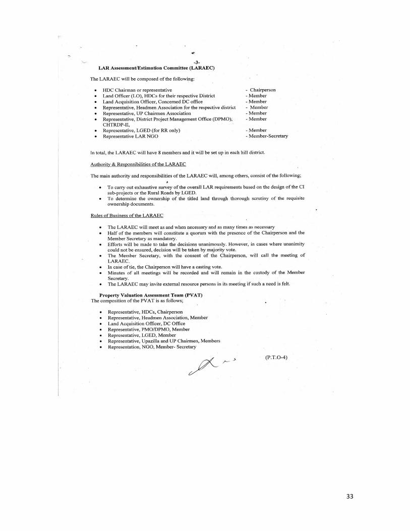
33

34

35

36

37

38
Annex-3: Safeguards issues in the Loan Covenants
Covenant / Safeguard Obligations Status of Compliance as of June
2014 Remarks
Land Acquisition and Involuntary Resettlement:The Borrower shall ensure or cause the Implementing Agencies to ensure that all land and all rights-of-way required for the Project, each Subproject and all Project facilities are made available to the Works contractor in accordance with the schedule agreed under the related Works contract, and that all land acquisition and resettlement activities are implemented in compliance with (a) all applicable laws and regulations of the Borrower relating to land acquisition and involuntary resettlement; (b) the Involuntary Resettlement Safeguards; (c) the LARF; and (d) all measures and requirements set forth in the respective RP, and any corrective or preventative actions set forth in a Safeguards Monitoring Report.
All relevant documents are provided to the work contractors by LGED with copy to PMO, following the stipulations of as stated in the left column. In the case of the CI sub-projects, this is ensured by the DPMO.
The Borrower shall ensure or cause the Implementing Agencies to ensure that all land and all rights-of-way required for the Project, each Subproject and all Project facilities are made available to the Works contractor in accordance with the schedule agreed under the related Works contract, and that all land acquisition and resettlement activities are implemented in compliance with (a) all applicable laws and regulations of the Borrower relating to land acquisition and involuntary resettlement; (b) the Involuntary Resettlement Safeguards; (c) the LARF; and (d) all measures and requirements set forth in the respective RP, and any corrective or preventative actions set forth in a Safeguards Monitoring Report.
The borrower, through the DC office, ensured the acquisition of land and associated properties following the laws of Bangladesh and in compliance of the safeguards policy of ADB. An LARP is prepared for each of the 2 roads that document all the relevant issues of safeguard compliance including grievance redress. For the CI sub-projects, the feasibility studies for each of 15 sub-projects documents the compliance of safeguards on the IPs, Resettlement, Environment and Gender.
Indigenous Peoples: The Borrower shall ensure or cause the Implementing Agencies to ensure that the preparation, design, construction, implementation and operation of the Project and all Project facilities comply with (a) the Borrower’s obligations as a signatory to the ILO Convention 107 on Indigenous and Tribal Populations Convention, 1957; (b) the Indigenous Peoples Safeguards; and (c) all measures and requirements set forth in the IPP, and any corrective or preventative actions set forth in a Safeguards Monitoring Report. Human and Financial Resources to Implement Safeguards Requirements 11. The Borrower shall make available the necessary budgetary and human resources to fully implement the EMPs, the RPs and the IPP.
The 2 LARPs were prepared in extensive consultations with the communities, affected persons and all relevant stakeholders based on the principle of ‘free, prior and informed consent’ (FPIC). The compensation for land under customary ownership by the IP communities is ensured, despite the ambiguous legal status by Bangladesh in this regard. The feasibility studies of CI sub-projects were equally prepared based on FPIC principles.
Safeguards-related Provisions in Bidding Documents and Works Contracts: The Borrower shall ensure or cause the Implementing Agencies to ensure that all bidding documents and contracts for Works contain provisions that require contractors to: (a) comply with the measures and requirements relevant to the contractor set forth in the IEE, the EMP, the RP and the IPP (to the extent they concern impacts on affected people during construction), and any corrective or preventative actions set out in a Safeguards Monitoring Report; (b) make available a budget for all such environmental and social measures; (c) provide the Borrower with a written notice of any
The constructions of all infrastructures under CHTRDP II are done in full compliance of these provisions. The LARPs are very clear on these provisions and documents in detail about how this is complied. The 2 LARPs and the feasibility studies of the 15 CI sub-projects are meant to detail the issues of safeguards compliance as regards, environment, IP, Resettlement and

39
Covenant / Safeguard Obligations Status of Compliance as of June
2014 Remarks
unanticipated environmental, resettlement or indigenous peoples risks or impacts that arise during construction, implementation or operation of the Project that were not considered in the IEE, the EMP, the RP or the IPP; (d) adequately record the condition of roads, agricultural land and other infrastructure prior to starting to transport materials and construction; and (e) fully reinstate pathways, other local infrastructure, and agricultural land to at least their pre-project condition upon the completion of construction.
Gender and as well as to provide instructions for implementation.
Safeguards Monitoring and Reporting: 13. The Borrower, together with the Implementing Agencies, shall do the following: (a) submit semi-annual Safeguards Monitoring Reports to ADB and disclose relevant information from such reports to affected persons promptly upon submission; (b) if any unanticipated environmental and/or social risks and impacts arise during construction, implementation or operation of the Project that were not considered in the IEE, the EMP, the RP or the IPP, promptly inform ADB of the occurrence of such risks or impacts, with detailed description of the event and proposed corrective action plan;
This is the first semi-annual report for CHTRDP II on the matter. Subsequent reports will be produced on time in the coming period and will be submitted to ADB accordingly
Labor Standards 14. The Borrower and the Implementing Agencies shall ensure that the turnkey contracts for Goods and the contracts for Works in relation to the Project include specific provisions to ensure that the contractors (a) comply with applicable core labor standards, labor laws and incorporate applicable workplace occupational and health and safety principles; (b) eliminate discrimination in respect of employment and do not differentiate payment between men and women or between people from different ethnic groups for work of equal value; (c) do not employ child labor; (d) eliminate forced or compulsory labor; and (e) maximize employment of females in accordance with the provisions of the Gender Action Plan, and maximize employment of other local poor and disadvantaged persons for construction purposes, provided that the requirements for efficiency are adequately met.
The contracts to work contractor is very much clear in this regard. The project’s works uphold the best labour standard as per the labour laws of Bangladesh. Priority is given to the most disadvantaged and marginalized groups/households including the indigenous peoples communities for employment under the project. The project takes conspicuous measures to avoid any child being employed under the project. Also, the Gender action plan is meticulously followed as regards employing women for the project’s works.
Gender and Development: 15. The Borrower and the Implementing Agencies shall comply with and implement the Gender Action Plan in accordance with its terms, allocate adequate resources for such implementation, and shall monitor and report to ADB on key gender outcome and output targets in accordance with the project performance and monitoring system developed for the Project, including with respect to (i) women's access to employment opportunities in operation and maintenance of rural roads and community infrastructure; (ii) the allocation of selling space to women in market buildings; and (iii) women's participation in market management committees, water supply and operation and maintenance teams, and common interest groups.
50% of the Labour Contract Society (LCS) members under CHTRDP II are women. At least 30% of all construction works subcontracted under the CI component are given to women. For the RR component under LGED, at least 20% of the works are awarded to the women. At least 50% of the space for market sheds under CI are given to women members. All market management committees includes at least 30% women as members. The same percentage is also maintained in the watershed management committees.