5 project development
TRANSCRIPT
MMRA | Environment Effects Statement 5–1
5 Project Development
5.1 Introduction This chapter describes the development of Melbourne Metro and provides the rationale for the form of the project assessed in this EES. It summarises how the component solutions of the Concept Design were developed, the alternative design options considered during design development and the process to select the proposed alignment and associated infrastructure. Details of the Concept Design, design options and proposed construction methodology assessed in this EES are described in Chapter 6 Project Description.
Melbourne Metro builds on the work of previous project development of various iterations of the project. This commenced in 2008 with Sir Rod Eddington’s Investing in Transport – East West Link Needs Assessment, with further development work undertaken by successive governments since that time.
A detailed discussion about the strategic and capital investment options is available in the Melbourne Metro Business Case (http://melbournemetro.vic.gov.au/about-the-project/business-case). This chapter focuses on the selection of the project options (alignment and station options) that have been assessed in this EES to develop the recommended Environmental Performance Requirements set out in Chapter 23 Environmental Management Framework.
As illustrated in Figure 5-1, strategic options were identified to respond to the key transport problems facing Melbourne. Potential capital investment options to deliver the preferred strategic option were then assessed. Finally, potential project options for the Melbourne Metro alignment and stations were developed and assessed.
The proposed horizontal and vertical alignment and associated infrastructure for Melbourne Metro have been developed through extensive integrated transport planning analysis, at both a strategic and detailed level. Options were selected and refined to ensure the alignments and stations would:
a Address the identified transport issues facing Melbourne (discussed in Chapter 2 Project Rationale and Benefits)
b Minimise potential adverse environmental, social and economic impacts
c Maximise the benefits to be gained by the investment to deliver Melbourne Metro.

MMRA | Environment Effects Statement 5–2
In assessing options during the development of Melbourne Metro, the following matters were considered:
•
•
•
•
•
•
Transport Integration Act 2010
Project Objectives
Technical requirements
Relevant technical reports
Stakeholder and community views
Relevant policies and legislative requirements.
Figure 5-1 Melbourne Metro planning and development process
Identifying and assessing strategic and capital investment options
Strategic options
Against a background of Melbourne’s strong population growth and an increasing demand for travel to and from Melbourne's CBD, three overarching problems need to be addressed:
• Risk to Melbourne’s liveability and reduction in access to job and key activity precincts due to chronic overcrowding and unreliability of services
• Reduction in Melbourne’s prosperity and productivity due to the physical constraints of the transport network
• Limited access to Central Melbourne and the potential for urban renewal due to insufficient public transport with limited transport capacity.
These problems are described in Section 2.4.3 in Chapter 2 Project Rationale and Benefits.
A number of potential strategic interventions to address these problems were identified, including limited material investment (sufficient only to keep the existing network operating), transport congestion pricing, reconfigured timetables, new CBD road capacity and new inner city rail capacity.

MMRA | Environment Effects Statement 5–3
After analysing potential strategic interventions, three strategic options were developed to address the problems listed above and improve Melbourne’s transport system. These strategic options were then assessed to evaluate the benefits, cost, time, risk and dis-benefits of each option.
Strategic Option 1: Current state Current operations with productivity improvements not requiring significant investment beyond currently planned expenditure
Strategic Option 1 assumes that committed investments would be delivered (as expressed in current Victorian and Commonwealth policies and budgets), but that government would make limited material capital investment. This option does not address existing demand and capacity constraints or support improved reliability performance on the rail network to overcome chronic overcrowding and deliver additional capacity to key growth areas. It would likely result in further overcrowding and congestion on Melbourne’s key transport infrastructure (including roads) over the medium to long term.
Strategic Option 2: Demand and productivity management Demand management (such as reducing or diverting demand for public transport) and productivity improvements on existing assets or systems without significant investment
Strategic Option 2 could offer short-term productivity and capacity gains at relatively low cost (noting that these improvements would also be required in advance of any project to increase supply). But it does not overcome existing demand and capacity constraints or materially improve reliability on the existing rail network over the medium to long term. Restrictive land use interventions of a scale necessary to arrest the growth in demand for travel to Central Melbourne would take time to implement and have negative effects on liveability and productivity.
Strategic Option 3: Increase supply Increasing capacity for access to the CBD through significant capital investment in public transport assets or road alternatives.
Strategic Option 3 was determined to be the recommended strategic option on the basis that it:
• Provides the most comprehensive medium to long-term solution to meet increasing demand and capacity constraints on the rail network
• Provides better public transport for priority CBD development precincts that, in turn, should deliver growth in high-value jobs and enable productivity benefits
• Reduces congestion and travel times, enhancing Melbourne’s liveability and generating greater productivity and economic growth.
The analysis concluded that Strategic Option 3 was most likely to respond effectively to the three overarching transport problems facing Melbourne (described above). This option comprises the following interventions:
• HCMTs – introducing HCMTs to increase passenger capacity and expand the fleet
• New inner-city rail capacity – constructing an underground railway to relieve overcrowding (especially in the City Loop), cater for future growth, increase access to jobs and services, and reduce congestion
• Wider Network Enhancements – upgrading the existing rail corridors (including track and signal works) to enable more trains to operate.
While increasing supply is the recommended Strategic Option, opportunities to implement elements of Strategic Option 2 would continue to be explored to drive short to medium term capacity and reliability improvements from existing infrastructure.

MMRA | Environment Effects Statement 5–4
Capital investment options
Thirteen potential capital investment options were assessed to deliver the preferred strategic option and increase supply across the rail network. These options included deployment of HCMTs on different lines, duplication of the City Loop, a widening of the viaduct between Flinders Street Station and Southern Cross Station, a new tunnel between North Melbourne and Richmond, the Melbourne Rail Link (Fishermans Bend) and Melbourne Metro.
Each option was assessed against four evaluation criteria that were developed to assist in determining the option’s ability to address the identified problems and realise the desired benefits:
• Increasing rail capacity and improving service reliability in time to meet growth
• Improving access to jobs in Central Melbourne and stimulating urban renewal • Deliverability and minimising productivity impacts caused by disruptions
• Cost, where a distinguishing factor.
Two options were shortlisted for further detailed evaluation: Melbourne Metro and the Melbourne Rail Link (Fishermans Bend). A full account of this assessment is provided in the Melbourne Metro Business Case.
Melbourne Metro was assessed as having a number of advantages compared to the Melbourne Rail Link (Fishermans Bend). Melbourne Metro better addresses the transport issues facing Melbourne. It also facilitates significant transport and network benefits, as well as having the potential to drive higher levels of productivity, support economic and employment growth and improve liveability by providing greater access to social and economic opportunities.
Melbourne Metro would provide the most effective and direct congestion relief to trams running to and through the CBD and has significant potential for stimulating urban renewal and redevelopment.
At opening, Melbourne Metro provides a significant increase in inner city station capacity, primarily through the provision of two new central CBD stations as well as three new stations servicing Arden, Parkville and Domain. The Melbourne Rail Link (Fishermans Bend) does not provide the same degree of capacity relief, as it does not provide new inner city stations and would significantly increase the numbers of people using Southern Cross, North Melbourne and Richmond stations. The Melbourne Rail Link (Fishermans Bend) would not provide a station at Parkville to support this growing education and biomedical precinct.
Melbourne Metro requires limited rail service disruptions during the construction phase, while the Melbourne Rail Link (Fishermans Bend) would involve major disruption to the core of the rail network, including shutting two out of four City Loop tunnels for a period of time to support the reconfiguration of the City Loop.
In addition, Melbourne Metro offers the lowest net present value cost to expand the core of the rail network in the future. The Melbourne Rail Link (Fishermans Bend) would lead to a different ultimate network configuration in the longer term, which would be significantly less cost effective to implement.
For these reasons, Melbourne Metro was determined to be the recommended capital investment option.

MMRA | Environment Effects Statement 5–5
5.2 Project Options A detailed assessment was undertaken of horizontal and vertical alignment options and options for the location, alignment and construction of station boxes for Melbourne Metro.
Design of the selected project options for Melbourne Metro has been developing over several years (as described in Chapter 2 Project Rationale and Benefits). Detailed design development would continue to refine elements of the project, including constructability and design issues for operational components.
5.2.1 Melbourne Metro alignment options Alignment options for Melbourne Metro were assessed against the following criteria:
•
•
•
Improving access to jobs in the Melbourne CBD and key employment hubs outside the city centre, and supporting and stimulating urban renewal
Deliverability and extent of disruptions
Cost (including upfront capital costs and operating and maintenance costs).
Throughout the project development process, MMRA has worked in collaboration with DEDJTR, PTV, DELWP and other relevant stakeholders to undertake a comprehensive project options analysis. Given the scale and complexity of the project, the options analysis was multifaceted with a particular focus on the project’s ability to address the transport issues facing Melbourne and achieve the benefits sought.
The following sections provide a summary of the options considered within the precincts identified along the Melbourne Metro alignment.
Western Portal (Kensington) The western portal would enable the Sunbury line to veer off from the existing rail corridor in the vicinity of South Kensington station and travel via the Melbourne Metro tunnels to ultimately join up with the Cranbourne/Pakenham Line.
Two portal (tunnel entrance) options were considered:
• Option A: commence the track slew toward the Melbourne Metro tunnels on the east side of Kensington Road into a decline structure situated in the council reserve on the south side of Childers Street into the portal located at the western interface of the cut and cover section directly opposite Ormond Street with the TBM retrieval shaft (eastern end of the cut and cover structure) situated in Bakehouse Road on the east side of McClure Road

MMRA | Environment Effects Statement 5–6
• Option B: commence the track slew toward the Melbourne Metro tracks located on a widened embankment on the west side of Kensington Rd, cross Kensington Road on a rail over road bridge, progress on a decline structure situated in the council reserve on the south side of Childers Street into the portal located at the western interface of the cut and cover section approximately 120m west of Ormond Street with the TBM retrieval shaft (eastern end of the cut and cover structure) situated within the council reserve immediately west of the existing South Kensington station subway at the intersection of Ormond and Childers Street.
Figure 5-2 Potential western portal locations
MMRA | Environment Effects Statement 5–7
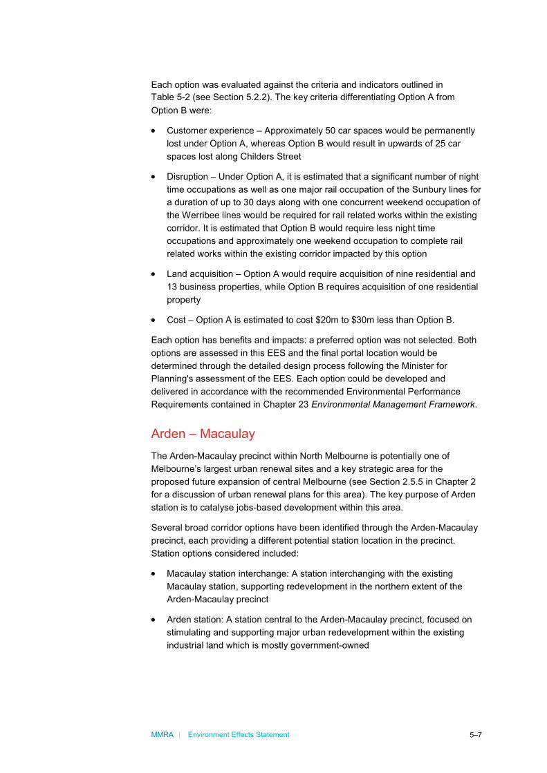
Each option was evaluated against the criteria and indicators outlined in Table 5-2 (see Section 5.2.2). The key criteria differentiating Option A from Option B were:
•
•
•
•
Customer experience – Approximately 50 car spaces would be permanently lost under Option A, whereas Option B would result in upwards of 25 car spaces lost along Childers Street
Disruption – Under Option A, it is estimated that a significant number of night time occupations as well as one major rail occupation of the Sunbury lines for a duration of up to 30 days along with one concurrent weekend occupation of the Werribee lines would be required for rail related works within the existing corridor. It is estimated that Option B would require less night time occupations and approximately one weekend occupation to complete rail related works within the existing corridor impacted by this option
Land acquisition – Option A would require acquisition of nine residential and 13 business properties, while Option B requires acquisition of one residential property
Cost – Option A is estimated to cost $20m to $30m less than Option B.
Each option has benefits and impacts: a preferred option was not selected. Both options are assessed in this EES and the final portal location would be determined through the detailed design process following the Minister for Planning's assessment of the EES. Each option could be developed and delivered in accordance with the recommended Environmental Performance Requirements contained in Chapter 23 Environmental Management Framework.
Arden – Macaulay The Arden-Macaulay precinct within North Melbourne is potentially one of Melbourne’s largest urban renewal sites and a key strategic area for the proposed future expansion of central Melbourne (see Section 2.5.5 in Chapter 2 for a discussion of urban renewal plans for this area). The key purpose of Arden station is to catalyse jobs-based development within this area.
Several broad corridor options have been identified through the Arden-Macaulay precinct, each providing a different potential station location in the precinct. Station options considered included:
•
•
Macaulay station interchange: A station interchanging with the existing Macaulay station, supporting redevelopment in the northern extent of the Arden-Macaulay precinct
Arden station: A station central to the Arden-Macaulay precinct, focused on stimulating and supporting major urban redevelopment within the existing industrial land which is mostly government-owned

MMRA | Environment Effects Statement 5–8
• North Melbourne station interchange: A station interchanging with the existing North Melbourne station, supporting redevelopment in the southern extent of the Arden-Macaulay precinct.
Figure 5-3 Potential alignments and station locations in Arden-Macaulay area
The preferred option is a station central to the Arden-Macaulay precinct, which has been assessed in this EES.
The North Melbourne interchange station would have some minor advantages for some customers on the Upfield, Craigieburn and Seymour lines in respect of interchange opportunities and travel time. However, alternative interchange options are available two stops further along the line in the CBD (at Southern Cross Station), and the travel time savings are relatively minor. The Macaulay interchange station provides fewer advantages, as it would only interchange with the Upfield line.
The North Melbourne and Macaulay interchange stations would have smaller land use catchments than the Arden-Macaulay precinct and, because they are positioned at locations already serviced by a station, would play a much smaller role in stimulating redevelopment – missing the major redevelopment opportunity in the central Arden precinct.
Both the North Melbourne and Macaulay interchange stations would involve significantly higher cost than the Arden-Macaulay precinct. The Macaulay interchange station option would either require the tunnel to continue west under the Maribyrnong River to a portal in Footscray or involve a new permanent structure bisecting JJ Holland Park.
The North Melbourne and Macaulay interchange stations would both require a much greater degree of urban disruption and private land acquisition compared to the Arden location, which positions the station in a predominantly industrial area within the government-owned land in the Arden-Macaulay precinct.

MMRA | Environment Effects Statement 5–9
The government-owned land in the Arden-Macaulay precinct is proposed to form the largest single construction work site for Melbourne Metro, including providing support for tunnelling operations for the northern section of the project’s alignment.
Parkville Several options were considered and two key options were assessed: the construction of an underground station on Flemington Road or on Grattan Street (shown on the plan below).
Figure 5-4 Potential alignments and station locations in the Parkville area
The preferred option for a new Parkville station is the Grattan Street location, which has been assessed in this EES.
Flemington Road is not preferred as it is located the greatest distance from the central part of the University of Melbourne, potentially increasing the travel time of students and teaching staff. Flemington Road is also positioned on the periphery of the Parkville precinct, away from key areas of demand.
The provision of a station at Parkville in Grattan Street would be expected to provide significant connectivity benefits for people seeking to access this education and hospital precinct, (including students, employees and patients) and to relieve the congested St Kilda Road – Swanston Street tram corridor.
A station at Grattan Street would also support the developing role of this area as the central hub for the Parkville precinct.

MMRA | Environment Effects Statement 5–10
CBD – Horizontal A number of different horizontal alignments and station location options were considered for the CBD (shown in the Figure 5-5):
•
•
•
•
•
•
Spring Street
Exhibition Street
Russell Street
Swanston Street variations:
– Two stations, alignment under Swanston Street
– One station only, at CBD South
– Two stations, alignment offset under buildings east of Swanston Street
– Two stations, CBD South station moved under the Yarra River
Elizabeth Street
William Street.
The preferred option is for Melbourne Metro to use the Swanston Street route with two stations on the basis that:
•
•
•
Swanston Street offers direct interchange with both Melbourne Central Station and Flinders Street Station, maximising the use of the new Arden, Parkville and Domain stations by making it easy for passengers from all lines to interchange to access these stations. The only other option offering direct interchange with these stations is Elizabeth Street, which would involve significantly higher capital costs due to complex ground conditions and interaction with tall buildings in Southbank that have subterranean components (such as basement car parks and structural elements)
In terms of interdependencies with other key decision points, the Swanston Street alignment is compatible with the optimal station locations in Parkville and Arden. The Elizabeth Street and William Street options would require a sub-optimal station location in Parkville (too far west of the University of Melbourne or too far south of the hospitals precinct) and problematic alignments through Southbank
The single station option on the Swanston Street alignment offers negligible savings in comparison to the two station option, as the very high number of passengers using the single station would require it to be substantially larger than either of the two stations under the other options. This option would also have significantly reduced benefits for the network

MMRA | Environment Effects Statement 5–11
•
•
•
•
A single central CBD station would have fewer convenient interchange opportunities with other rail services, affecting access to employment and other activities, and reducing the number of customers using Melbourne Metro. While only one station box would require construction, the size of the station required to accommodate passenger numbers would lead to additional disruption and private land acquisitions at the station location
The 'offset alignment' option along Swanston Street is more costly and would involve tunnelling deep under buildings. This option is likely to result in potentially greater disruption to property during construction and significantly more strata acquisition
The option to shift the CBD South station under the Yarra River would add significantly to the capital cost of the project and prolong the construction program. While it would reduce some impacts on Swanston Street, it would significantly increase the potential for impacts on the Yarra River and poses much greater construction complexity, including a greater risk of works in the complex Yarra River ground conditions resulting in settlement and damage to structures
The Swanston Street alignment (under the street) is estimated to involve the lowest capital cost of all options for the creation of two CBD stations.
Figure 5-5 Potential CBD horizontal alignment and station options

MMRA | Environment Effects Statement 5–12
CBD – Vertical Following the confirmation of Swanston Street with two stations as the horizontal alignment through the CBD, further consideration was given to the optimal vertical alignment.
The proposed vertical alignment of the Melbourne Metro tunnels through the CBD presents a number of complexities and challenges, in particular navigating the City Loop rail tunnels under La Trobe Street and the vast array of services that are located within the broader road reserves, as well as the complex ground conditions at the Yarra River.
Two vertical alignment options have been considered (shown on Figure 5-6):
•
•
A shallow alignment passing over the City Loop
An optimised deeper alignment passing under the City Loop.
Figure 5-6 Potential CBD vertical alignments
The key considerations in assessing these options were:
• The shallow alignment would use a cut and cover construction for the CBD station boxes and would involve a significant amount of disruption, including restricted access across all modes of transport along Swanston Street over a number of years and complete diversion of Swanston Street tram routes through the CBD, resulting in significant disruption to businesses and residents in the area. The shallow alignment would involve more major utility diversions than the deeper alignment, requiring greater disruption of a number of streets adjacent to Swanston Street

MMRA | Environment Effects Statement 5–13
•
•
•
•
•
In contrast, the optimised deeper alignment offers no major extended disruptions to Swanston Street, with no major tram diversions away from Swanston Street expected during construction and minimal impact on the Swanston Street and La Trobe Street landscapes. While some level of disruption associated with the deeper alignment is inevitable (including truck traffic to station construction sites and soil excavation), the degree of disruption to pedestrians, road traffic and business owners would be significantly less than under the shallow alignment
The optimised deeper alignment stations would be constructed using a mined cavern construction method (as opposed to the cut and cover approach envisaged for the shallow alignment). This construction technique eliminates surface disruption on Swanston Street, which allows trams to continue to run on Swanston Street
The cost of the optimised deeper alignment is not estimated to be materially different to the project capital cost of a shallow alignment along Swanston Street, due to significantly less impact on utility services and reduced disruption on Swanston Street
The shallow alignment would provide a slightly better outcome than the alternative option in terms of walking journey times, emergency egress and station access
Hydrogeological ground conditions are not considered to be a determining factor for either the shallow or optimised deeper alignment and are considered manageable
In terms of crossing the CityLink tunnels, both options have benefits and impacts: a preferred option was not selected. Both options are assessed in this EES and the final vertical alignment through CityLink would be determined through the detailed design process following the Minister for Planning's assessment of the EES. Each option could be developed and delivered in accordance with the recommended Environmental Performance Requirements contained in Chapter 23 Environmental Management Framework
The most significant differences between the shallow and deeper vertical alignments relate to constructability and disruption. A high level summary of these differences is set out in Table 5-1.
Based on the analysis above and differences summarised in the table below, the deeper Swanston Street alignment is the preferred vertical alignment solution for Melbourne Metro.
The CBD vertical and horizontal alignment has also been revisited through an iterative process with MMRA’s technical advisers confirming that the preferred horizontal alignment through the CBD remains Swanston Street with two stations, given the optimised deep alignment is the preferred route.

MMRA | Environment Effects Statement 5–14
Table 5-1 Constructability and disruption differences, shallow versus deeper alignment
Alignment Constructability Disruption
Shallow Advantages • Simpler construction techniques
• No disruption advantages identified
Disadvantages • Longer program duration due to working restrictions and major utility service relocations
• More interfaces between construction activities and the public
• Swanston Street access restrictions for all modes of transport for a number of years
• Significantly impacts Swanston Street businesses
• Two to three month closures required of Flinders, Collins and La Trobe Street over the period of construction
• Diversion of 10 tram routes from Swanston Street
• Major utility diversions requiring disruption of street adjacent to Swanston Street
• Impacts between La Trobe and Collins Street from services affected by shallow tunnelling
• Flinders Street impacted for 2 to 3 months (same as for deeper alignment)
Deeper Advantages • Ability to work around the clock for underground works
• Fewer interfaces between construction activities and the public
• Swanston Street largely accessible for all transport modes throughout construction, Collins and La Trobe Street remain as existing
• Trams through CBD – unchanged
• Temporary building closures avoided
• Significant reduction in the utility services requiring diversion
Disadvantages • More complex, although still common construction techniques
• Flinders Street impacted for two to three months (same as for shallow alignment)

MMRA | Environment Effects Statement 5–15
Domain The Domain precinct is of significant strategic importance to the planning and urban development of Melbourne. This area incorporates St Kilda Road, Melbourne’s most prominent boulevard and an established higher density residential and commercial precinct, and is surrounded by a mix of high and lower density office, educational and residential uses that generate a significant volume of road, public transport, walking and cycling trips.
Several options were considered in this area, with two key alignment and station location options assessed, as shown on Figure 5-7:
•
•
Domain station, aligned under St Kilda Road
South Melbourne station, aligned under Kings Way.
Figure 5-7 Potential alignments and station locations in Domain and South Melbourne
The provision of a station at Domain would provide significant connectivity benefits for people seeking to access the St Kilda Road employment and residential precinct and key civic and recreational facilities, relieving the St Kilda Road/Swanston Street tram corridor. It would also be an important interchange station between train and tram services for the area’s residential and business catchment.

MMRA | Environment Effects Statement 5–16
The South Melbourne location would also support existing business, tourism and cultural uses; however, this location is estimated to cost significantly more than Domain. This cost is driven by the complex ground conditions around the location of the proposed South Melbourne station, additional property acquisition costs, the need to navigate existing structures and the additional tunnel length. Further, South Melbourne would benefit from the proximity of a station at Domain and improved access through tram network changes that would be enabled by a station at Domain.
Eastern Portal The eastern portal would enable the Cranbourne/Pakenham Line to diverge from the existing rail corridor just south of Toorak Road, and travel towards the CBD via the Melbourne Metro tunnels. To achieve this, the Cranbourne/Pakenham and Frankston Lines would require reconfiguration and realignment.
The eastern portal would be located in the rail reserve adjacent to the South Yarra Siding Reserve. The location of the eastern portal was determined by the following factors:
•
•
•
•
•
•
Selecting a suitable location to tie into the existing rail geometry of the Cranbourne/Pakenham Line between Chapel Street and Toorak Road
The requirement to retain the existing Chapel Street bridge and Toorak Road bridge
The requirement to retain the existing alignment and functionality of William Street bridge
To achieve suitable clearance to the building with deep basements on Toorak Road
To achieve suitable clearances to adjacent running lines and structures
Minimising property impacts, including parkland at the South Yarra Siding Reserve.
From the eastern portal, the tunnels would pass under Osborne Street, Davis Avenue, Powell Street, Myrtle Street and Macfarlan Street and travel west under Toorak Road and Fawkner Park to connect with the new Domain station.

MMRA | Environment Effects Statement 5–17
Figure 5-8 Eastern portal position
5.2.2 Melbourne Metro stations Specific criteria were developed against which the station options for Melbourne Metro could be assessed. These criteria reflect the transport system objectives and decision-making principles under the Transport Integration Act 2010.
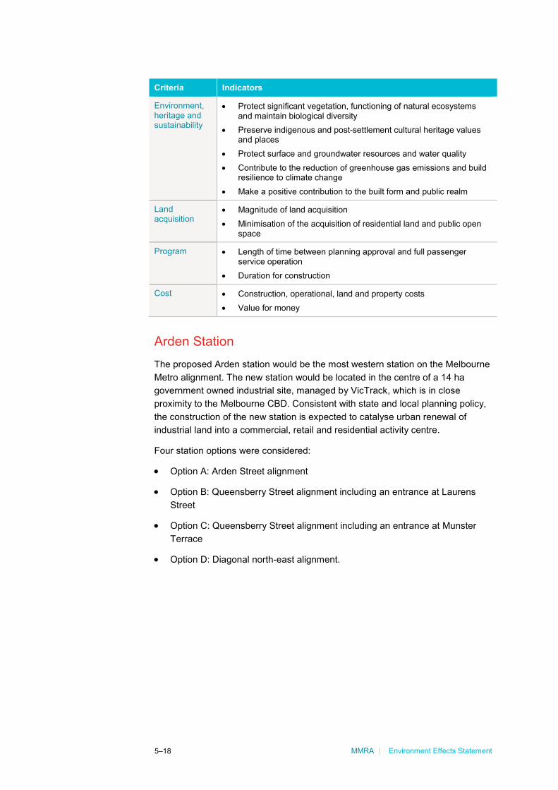
These criteria were refined further to provide more specific indicators against which the options for the location of the Melbourne Metro stations could be evaluated. The criteria and indicators are shown below.
Table 5-2 Station options assessment criteria and indicators
Criteria Indicators
Customer experience
•
•
•
Ease of interchange between all relevant transport modes
Accessibility of station location/entrance(s)
Optimise passenger movement (connectivity and legibility) and integration with wider rail network
Transport system outcomes
•
•
•
Reliability (frequency and punctuality)
Provides for operational flexibility, capacity and maintainability
Minimise spatial and infrastructure requirements to allow for future transport provision
Constructability •
•
Risks associated with construction method
Eliminated and/or mitigated any residual safety aspects
Disruption •
•
•
•
Impact on transport network during construction
Minimise displacement impacts (residences, public open spaces, businesses, utilities, etc) Maintain and enhance community cohesiveness
Maintain community safety and amenity
MMRA | Environment Effects Statement 5–18
Criteria Indicators
Environment, heritage and sustainability
•
•
•
•
•
Protect significant vegetation, functioning of natural ecosystems and maintain biological diversity Preserve indigenous and post-settlement cultural heritage values and places
Protect surface and groundwater resources and water quality
Contribute to the reduction of greenhouse gas emissions and build resilience to climate change
Make a positive contribution to the built form and public realm
Land acquisition
•
•
Magnitude of land acquisition
Minimisation of the acquisition of space
residential land and public open
Program •
•
Length of time between planning approval and full service operation
Duration for construction
passenger
Cost •
•
Construction, operational,
Value for money
land and property costs
Arden Station The proposed Arden station would be the most western station on the Melbourne Metro alignment. The new station would be located in the centre of a 14 ha government owned industrial site, managed by VicTrack, which is in close proximity to the Melbourne CBD. Consistent with state and local planning policy, the construction of the new station is expected to catalyse urban renewal of industrial land into a commercial, retail and residential activity centre.
Four station options were considered:
•
•
•
•
Option A: Arden Street alignment
Option B: Queensberry Street alignment including an entrance at Laurens Street
Option C: Queensberry Street alignment including an entrance at Munster Terrace
Option D: Diagonal north-east alignment.

MMRA | Environment Effects Statement 5–19
Figure 5-9 Potential Arden station positions
Each option was evaluated against the criteria and indicators shown in Table 5-2.
Option D: North-east alignment with an entrance on Laurens Street and provision for two future north-south entrances that are in-line with Fogarty and Queensberry Street, was assessed as being the optimal station position and orientation, and has been assessed in this EES.
The key criteria that differentiated Option D from the others were:
•
•
•
•
Customer experience – Option D would adequately serve the area upon operations commencing, being close to the existing community to the east of the area, while also being easily accessible from Arden Street. Longer term, Option D provides the best array of entrances to serve a renewed precinct north and south of Arden Street
Disruption – The Option D station box would be fully constructed within the government-owned land (managed by VicTrack) and therefore cause minimal disruption over and above that caused by the use of the area as the main construction site for Melbourne Metro
Land acquisition – Option D requires no land acquisition
Cost – While Option D is not the cheapest, it is cheaper than Options A and C as these have longer alignments and additional land acquisition requirements.

MMRA | Environment Effects Statement 5–20
Parkville Station The proposed Parkville station would serve the health, research and education precinct to the north of the CBD. Three station locations options were considered, all with entrances on the north side of Grattan Street to serve the University of Melbourne and destinations to the north of the precinct and one entrance to the southwest of the station on Grattan Street to serve the hospital precinct and Flemington Road destinations:
•
•
•
Option A: Cut and cover construction in Grattan Street between Royal Parade and Leicester Street
Option B: Cut and cover construction in Grattan Street across the intersection at Royal Parade
Option C: Cut and cover construction in Grattan Street with a mined cavern section beneath the intersection at Royal Parade.
Figure 5-10 Potential Parkville station positions

MMRA | Environment Effects Statement 5–21
Each option was evaluated against the criteria and indicators shown in Table 5-2.
Option A was assessed as providing the optimal solution, with the main differentiating criteria including:
•
•
•
•
•
Transport system outcomes – Option A provides the greatest flexibility for the location of a future Parkville station for the Clifton Hill Line beneath Royal Parade. Options B and C would require a future Clifton Hill Line station to be much deeper to clear the Parkville Melbourne Metro station. However, Option A does incur increased maintenance costs and journey times between Parkville station and CBD North station due to additional track curves in the proposed alignment between the two stations. As such, it did not score more highly than Option B on this criterion
Constructability – Option A has the least complex construction methodology (cut and cover construction in Grattan Street), allowing the station box to be constructed in one stage. This compared favourably to Option B, which would require three stages to manage the transport impacts on Royal Parade, and Option C, which has the most complex construction methodology as is has two construction methods: a mined cavern and cut and cover
Disruption – Option A would cause the least disruption to surrounding land uses, and transport operations on Royal Parade would not be impacted as greatly, relative to the other options. Importantly, Option A station box position causes the least disruption to the precinct's health and research facilities, including emergency access to Royal Melbourne Hospital
Environment, heritage and sustainability – The key differentiator was that Options A and C would not affect the Victorian Heritage Register listed Royal Parade boulevard. All options would require the removal of large mature trees
Program and cost – Due to Option A’s construction methodology (cut and cover construction), it would have the shortest construction duration and carry the lowest risk of program delays when compared to Options B and C. Costs under Option A could be reduced further during the detailed design phase as the construction methodology and structural design are refined.

MMRA | Environment Effects Statement 5–22
CBD North Station The CBD is Melbourne’s business and financial centre. It is a hub for retail, financial, educational, recreational, tourist and entertainment activities of state and national importance, and services a variety of residents, workers and visitors.
Figure 5-11 CBD North station overview
A key benefit of the Swanston Street alignment is the ability to interchange with Melbourne Central Station at CBD North. Consequently the southern entry of the station must have immediate proximity to Melbourne Central Station which is located under La Trobe Street between Swanston and Elizabeth Street.
An entry on the north-west corner of the La Trobe and Swanston Street intersections was identified as preferable to other locations for a southern entrance to CBD North station. This location has the most direct access to the Melbourne Central concourse for interchange to CBD North station. Other potential locations were not considered feasible including the State Library forecourt, RMIT campus east of Swanston Street or expanding access through Melbourne Central Shopping Centre as they were affected by heritage, constructability or disruption issues including the configuration of plant and ventilation of Melbourne Central station at its eastern end limiting the opportunity for connections.
Options for the southern entrance of CBD North station focussed on the amount of land required to provide space for the station entry. As shown in Figure 5-11, three scenarios were considered which can broadly be classified as maximum (Option A), medium (Options B) and minimum (Option C) acquisition footprints taking into account the existing property boundaries in the area.

MMRA | Environment Effects Statement 5–23
Figure 5-12 Potential CBD North station entrance footprints
Within these three footprints the following key station elements would have to be provided:
•
•
•
•
Station entry including escalators/lifts, gateline, ticket office
Passenger interchange to Melbourne Central Station
Station plant including fire egress
Back of house areas.
Option B was assessed as providing the optimal solution for the following reasons:
•
•
Transport system outcomes – Option C does not provide adequate space for all required station elements. Passenger circulation spaces were not adequate for the proposed number of passengers and would have filled any basement spaces requiring plant spaces to either be built under roads (increasing disruption) or at a separate location requiring different land acquisition
Land acquisition – Option B compared with Option A has a smaller amount of property acquisition.

MMRA | Environment Effects Statement 5–24
CBD South Station
Figure 5-13 CBD South station overview
Northern entrance
CBD South station is expected to be one of the busiest stations on Melbourne Metro with most passenger movements to be concentrated to the north of the station. Given the expected patronage, the station has a number of proposed entries including one at the southern end of the box on the Western side of Swanston Street, an interchange to Flinders Street Station and an entry in Federation Square.
Three northern station entrance options were considered taking account of the constraints in the area of heritage buildings such as the Town Hall, Manchester Unity Building and Capitol Theatre limiting options to locate an entry:
•
•
•
Option A: City Square
Option B: entrance located on the south-west corner, the Wales Building
Option C: 234 Collins Street entry with plant and equipment in the City Square.

MMRA | Environment Effects Statement 5–25
Figure 5-14 Potential CBD South station northern entrance footprints
Option A was assessed as providing the optimal solution. The key criteria that differentiated Option A from the others were:
•
•
•
Constructability – Option B requires the demolition of multiple tall buildings in tight urban areas. Construction access to this would have been adjacent to Collins and Swanston Street tram stops. Option C may retain the existing building at 234 Collins Street, but also requires City Square, therefore imposing dual impacts. Option A provides a larger area for construction activities, increasing efficiencies and providing the ability to manage construction traffic
Disruption – Option A was assessed to have lower levels of disruption compared to Option C which would significantly disrupt Collins Street. Option A’s acquisition of City Square reduces direct business disruption, but would impact adjacent businesses and users of the underground carpark
Land acquisition – Option B requires the acquisition of the strata titled Wales Building, and Option C requires the acquisition of 11 retail premises and potential relocation of commercial businesses within 234 Collins Street. Option A does require the acquisition of City Square and underground car parks however much of the space is able to be returned to public uses post-project.

MMRA | Environment Effects Statement 5–26
Southern entrance
A key driver of the southern entrance is the connection with Flinders Street Station. The southern end of Swanston Street is heavily constrained by heritage buildings including St Paul’s Cathedral, Young and Jackson Hotel, Nicholas Building, and Flinders Street Station. The train tracks under Federation Square connecting to Flinders Street Station limit the ability to provide a major station entry on the south side of Flinders Street.
Consequently two southern station entrance options were considered:
•
•
Option A: a series of properties along Swanston Street
Option B: a design that uses a series of properties along Swanston Street, plus Port Phillip Arcade.
Figure 5-15 Potential CBD South station southern entrance footprints

MMRA | Environment Effects Statement 5–27
Option B was assessed as providing the optimal solution. The key criteria differentiating Option B from the other option were:
•
•
•
Customer experience – Option B provides better station accessibility and legibility as Option A does not provide access from Flinders Street or Flinders Lane (through Scott Alley and Royston Place)
Transport system outcomes – Option B provides the best operational flexibility, capacity and maintainability with more appropriate plant room space
Constructability and disruption – Option B reduced the complexity and ultimately construction disruption of the link between CBD South station entry and Flinders Street Station by providing for a direct connection across Flinders Street to the main station entry.
Domain Station Melbourne Metro includes a new station at Domain, which would operate as a key interchange point with tram routes serving St Kilda Road, South Melbourne, Southbank and the growing western CBD.
The new Domain station would be located under St Kilda Road, adjacent to Albert Road. The station would have three entrances: within the Shrine of Remembrance Reserve, within the relocated Domain tram interchange in the centre of St Kilda Road and within open space between Albert Road and St Kilda Road where the South African Soldiers Memorial is currently located.
Figure 5-16 Domain station position

MMRA | Environment Effects Statement 5–28
5.3 Design Refinements Design of the preferred project options for Melbourne Metro has been developing over several years. As noted in Chapter 2 Project Rationale and Benefits, extensive investigations have been undertaken to develop the rail tunnel concept and determine the optimal horizontal and vertical alignment and construction methodologies, as well as the location and design of the new stations and above-ground infrastructure.
These investigations have progressively refined and improved the design of Melbourne Metro to avoid major adverse impacts, optimise benefits and ensure that the project provides the uplift in capacity needed to support Melbourne’s growing population.
The findings of the specialist investigations undertaken for the EES have been used to refine the Concept Design and construction methodologies to minimise the environmental effects of Melbourne Metro. In turn, the refined Concept Design and methodologies have then been re-assessed by the specialists to confirm the reduced effects and revise the recommended Environmental Performance Requirements to set performance standards to be achieved.
Examples of refinements to the design of the proposed Melbourne Metro include:
Precinct Refinements
Western portal
Works refined to only be within Childers Street and not on the edge of JJ Holland Park
Arden Change to station orientation at Arden and tunnel alignment to Parkville station because of the shift of the Parkville station box to be out of Royal Parade
Parkville Shifting Parkville station box to the east out of Royal Parade and the hospitals precinct to reduce impact on Royal Parade and Royal Melbourne Hospital
Parkville Removal of Parkville station entrances at Royal Melbourne Hospital and Barry Street
CBD North Shifting CBD North station north to remove impacts on the State Library forecourt and reduce impacts on La Trobe Street
CBD North Use of Franklin Street (west side) and A’Beckett Street for construction and station components, with Franklin Street being closed east of Swanston Street to traffic
CBD South Removal of small section of the Dangerfield property that was originally required in the station footprint (the property has heritage value)
Domain Revising the layout for the construction of the proposed Domain station to reduce the impact on the Shrine of Remembrance Reserve and require fewer tree removals

MMRA | Environment Effects Statement 5–29
The process of refining and evolving the various elements of the project has resulted in a well-tested Concept Design for Melbourne Metro that avoids most of the major adverse impacts typically associated with a large scale transport project in a densely populated inner urban area. As a result, across the proposed Melbourne Metro alignment during both the construction and operation phases, a relatively small number of risks have been assessed as having a ‘high’ residual rating following the achievement of the recommended Environmental Performance Requirements and proposed mitigation measures.
Detailed design development would continue to refine elements of Melbourne Metro, including constructability and design issues for operational components.