a comparison of solar radiation modeling tools -...
TRANSCRIPT

Erin Costello A comparison of Solar Radiation Modeling Tools The Oregon Department of Environmental Quality uses effective shade as an indicator of water quality parameters as well as a target for restoration activities. Effective shade is that shade which prevents incoming solar radiation (insolation) from penetrating the stream surface. It is represented as a percent, which is the ratio of received solar radiation to total insolation. Estimates of potential and received solar radiation are generated by the stream thermodynamics model called Heat Source. This research compares Heat Source estimates of insolation to estimates of insolation generated by the Points Solar Radiation tool within ArcToolbox. Both of these models make radiation calculations based on digital elevation model inputs and simulated solar activity derived from time period and location. The performance of the Heat Source model is evaluated based on how its insolation estimates compare to those of the Points Solar Radiation tool. Five points along a stream line were modeled. Insolation estimations were plotted against each other and the root mean square error (RMSE) was calculated. The R² value of the trend line for this dataset was 0.3315. The RMSE ranged from 55 to 741. These results indicate no obvious correlation or relationship between estimates. This implies that the Heat Source model is not producing trustworthy estimates of insolation. The disparity between insolation estimates could be explained by the parameters selected for the Heat Source model. Next steps include altering these parameters, such as elevation sample distance, number of directions sampled and input DEM resolution, until insolation outputs more closely match outputs from the Points Solar Radiation tool.

A Comparison of Solar Radiation Modeling Tools
Erin Costello Digital Terrain Analysis
December 7, 2017
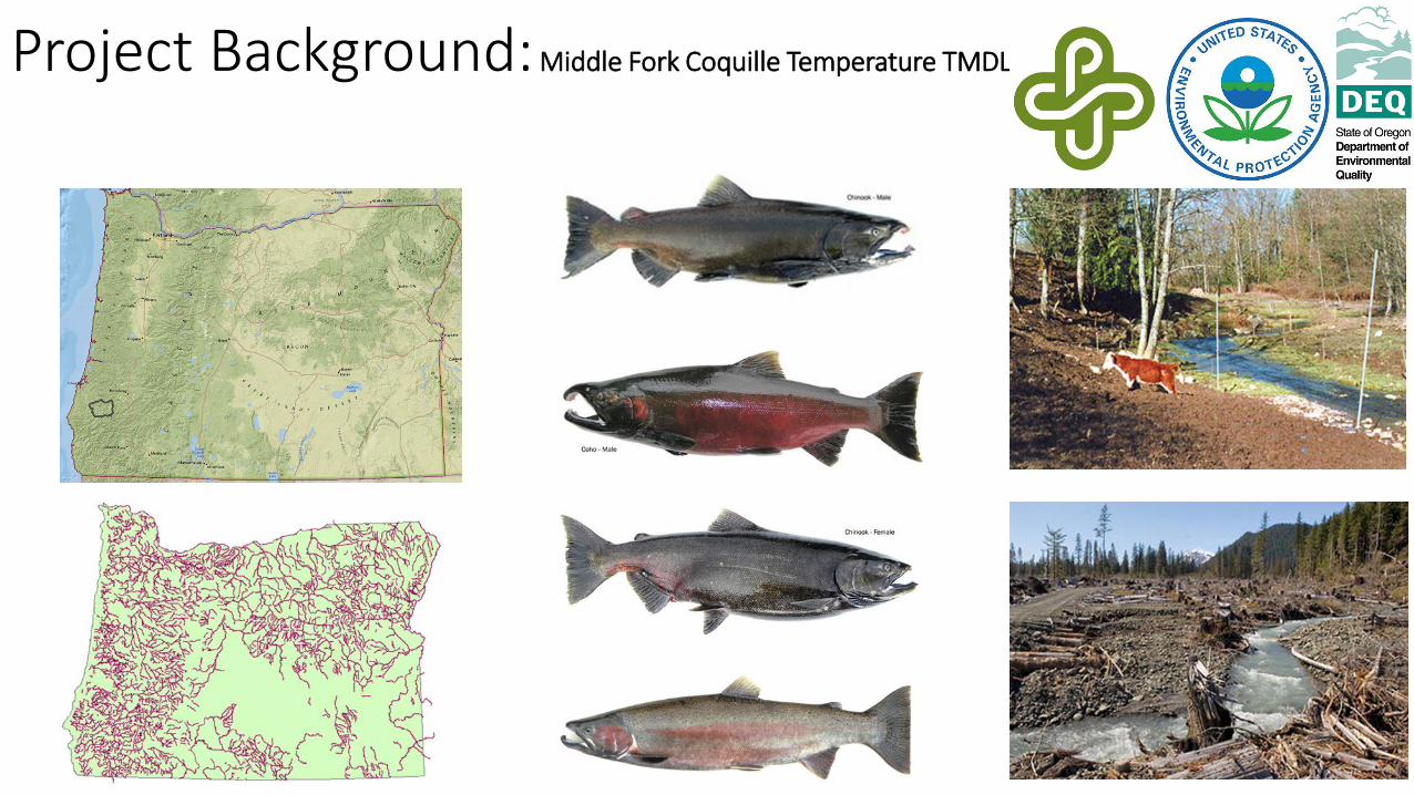
Project Background: Middle Fork Coquille Temperature TMDL

Research Questions • Do two different models of incoming solar radiation produce
similar results?
• Is there a correlation between modeled incoming solar radiation
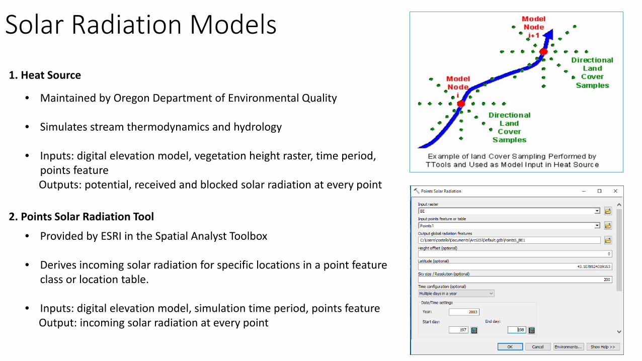
Solar Radiation Models
• Maintained by Oregon Department of Environmental Quality
• Simulates stream thermodynamics and hydrology
• Inputs: digital elevation model, vegetation height raster, time period, points feature
Outputs: potential, received and blocked solar radiation at every point
1. Heat Source
2. Points Solar Radiation Tool
• Provided by ESRI in the Spatial Analyst Toolbox
• Derives incoming solar radiation for specific locations in a point feature class or location table.
• Inputs: digital elevation model, simulation time period, points feature Output: incoming solar radiation at every point
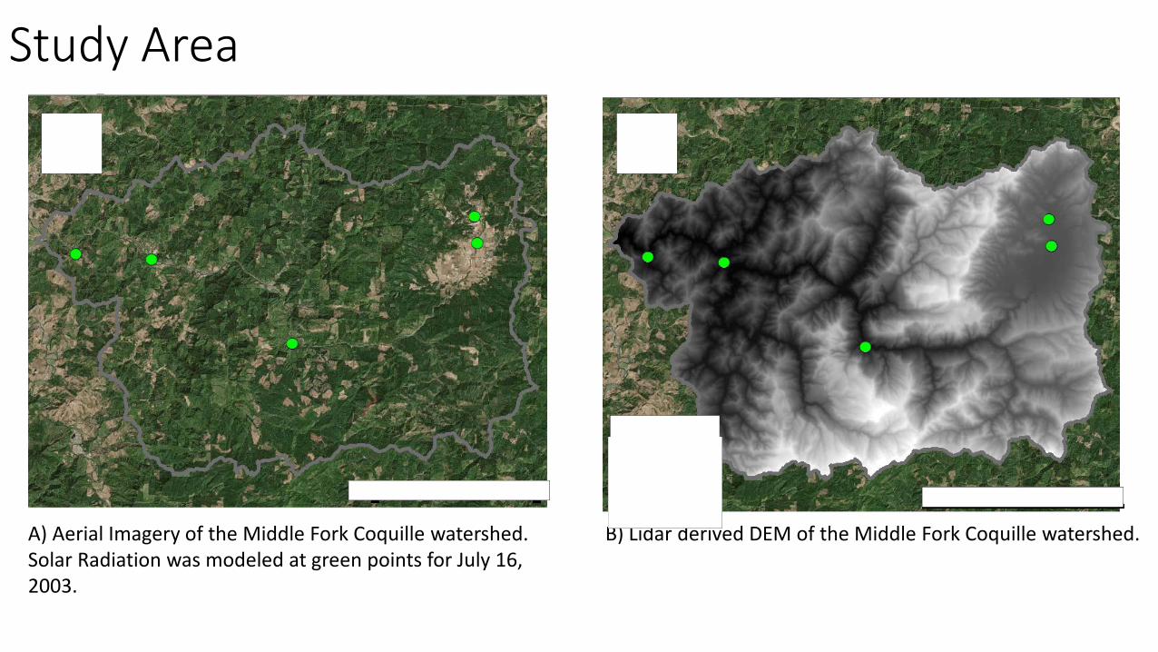
Study Area
A) Aerial Imagery of the Middle Fork Coquille watershed. Solar Radiation was modeled at green points for July 16, 2003.
B) Lidar derived DEM of the Middle Fork Coquille watershed.

Results Points Solar Radiation Tool (July 16, 2003)
Heat Source (July 16, 2003)
FID Stream (KM)
Incoming Solar Radiation (WH/m²)
Incoming Solar Radiation (WH/m²) RMSE
0 4.4 5348.97 6090.07 741.09 1 13.9 5513.02 6095.39 582.37 2 32.9 5436.46 5381.15 55.31 3 56.8 5688.17 5437.02 251.14 4 61 5822.82 5440.07 382.75
R² = 0.3315
5300
5400
5500
5600
5700
5800
5900
5300 5400 5500 5600 5700 5800 5900 6000 6100 6200
Poin
ts S
olar
Rad
iatio
n(W
H/m
²)
Heat Source (WH/m²)
Points Solar Radation vs Heat Source Radiation
5300
5400
5500
5600
5700
5800
5900
6000
6100
6200
0 10 20 30 40 50 60 70W
att h
ours
per
met
er sq
uare
d
Stream Kilometer
Modeling Incoming Solar Radiation
Points Solar Radiation
Heat Source

Conclusions • No obvious correlation between Points Solar Radiation and Heat Source estimates of
incoming solar radiation.
• This casts doubt on the methodology of Heat Source calculations of incoming solar radiation
Discussion • Know your model before trusting the output!
• Heat Source was originally created to sample coarser digital elevation models, is high resolution of lidar derived
surface models introducing error?
• I used a bare earth surface for the DEM input for Points Solar Radiation, would a DSM be more appropriate?
• Next steps: Play around with other Heat Source settings in attempt to calibrate model to Points Solar Radiation outputs, e.g. directions sampled, sample distances, node distances, DEM and DSM resolution.