a day in the life of a rig move surveyor marinesafe...
TRANSCRIPT

A day in the life of a Rig Move Surveyor
MarineSafe Forum
Phil Wells
18th August 2016
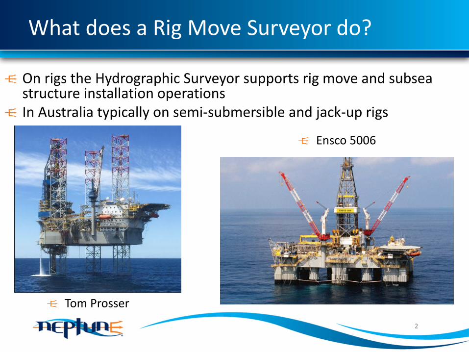
What does a Rig Move Surveyor do?
On rigs the Hydrographic Surveyor supports rig move and subsea structure installation operationsIn Australia typically on semi-submersible and jack-up rigs
2
Ensco 5006
Tom Prosser

What is end result?
3
For a jack-up it may be the rig jacked up adjacent to a platform and skidded out over the right slot

What is end result?
4
For a semi-sub it may be anchors and mooring lines clear of assets
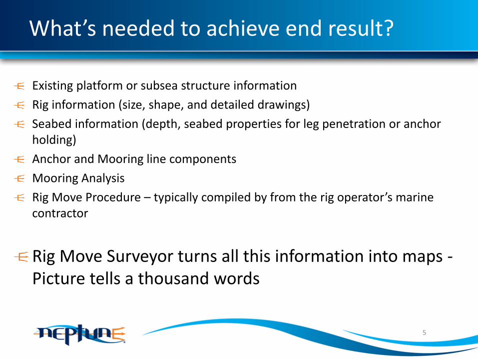
What’s needed to achieve end result?
Existing platform or subsea structure information
Rig information (size, shape, and detailed drawings)
Seabed information (depth, seabed properties for leg penetration or anchor holding)
Anchor and Mooring line components
Mooring Analysis
Rig Move Procedure – typically compiled by from the rig operator’s marine contractor
Rig Move Surveyor turns all this information into maps -Picture tells a thousand words
5

The jack-up rig move story board
6
Plan for the right well slot(s)

The jack-up rig move story board
7
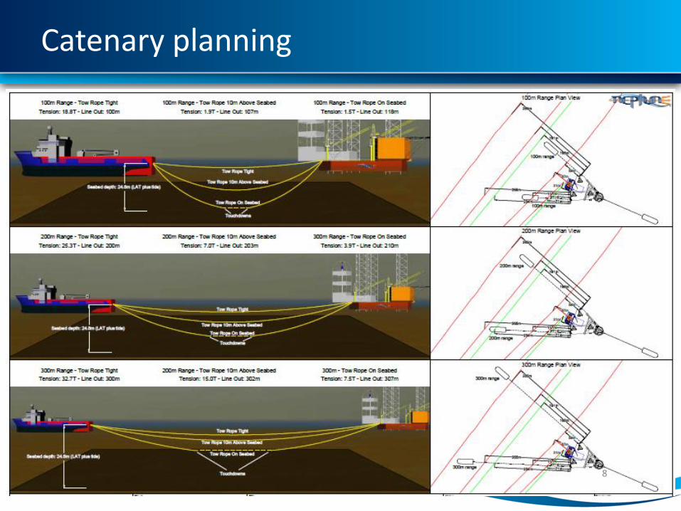
Catenary planning
8

Catenary planning
9

QC – is platform where we think it is?
10

Proximity to subsea assets
11
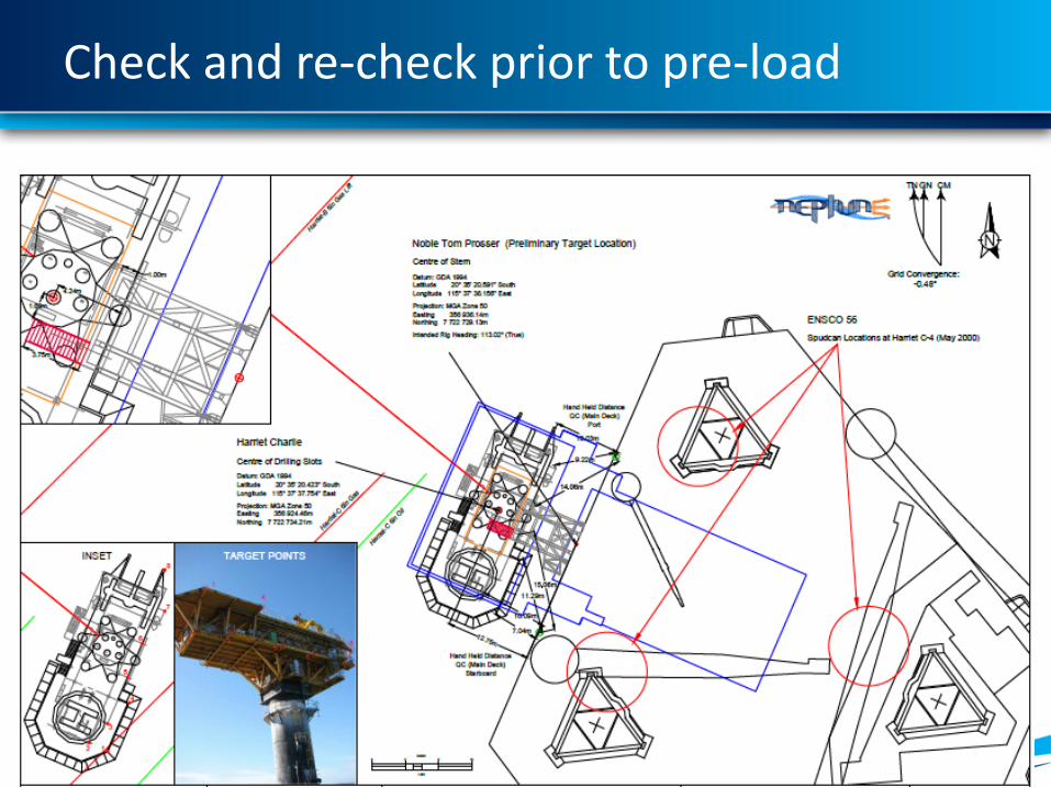
Check and re-check prior to pre-load
12

Why is height important?
13
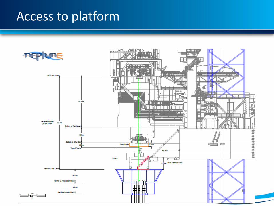
Access to platform
14

How to get it to right height
15
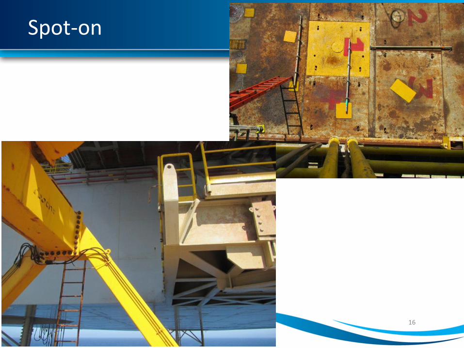
Spot-on
16

Semi-sub anchor sequence
17
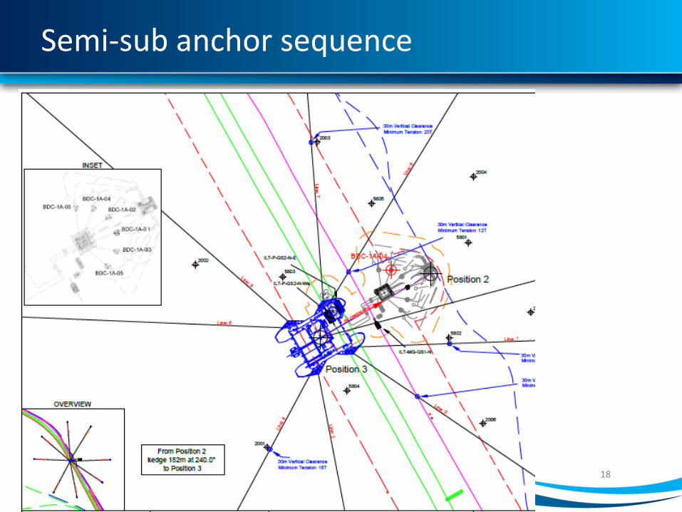
Semi-sub anchor sequence
18

Telemetry is important
19
Rigs and towing or anchor handing vessels all need to see the same thing

What’s a survey system look like on the rig?
20

What’s a survey system look like on the boat?
21

Real time 3D Catenary
22
Following a incident in 2013 operators the perception of value of centenary monitoring increased
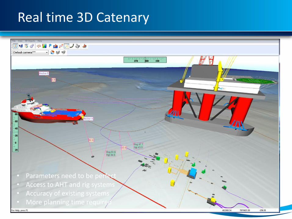
Real time 3D Catenary
23
• Parameters need to be perfect• Access to AHT and rig systems• Accuracy of existing systems • More planning time required

3D Catenary data flow
24
Bathymetry (Site Survey)
Infrastructure(As-built Survey)
Mooring Analysis Data
QC & Prep(incl Client & Marine Rep)
3D Catenary System
3D Models(Seabed and structures)
Neptune Mooring Plan
2D NavigationRig & Tug Winch
Data
Onshore
Offshore
Anchor Sequence Planning
Rig & Tug Wire/Chain Data

SIMOPS support – value of planning
25