a european-wide birdtam system using the weather radar … · peter desmet, adriaan dokter, silke...
TRANSCRIPT
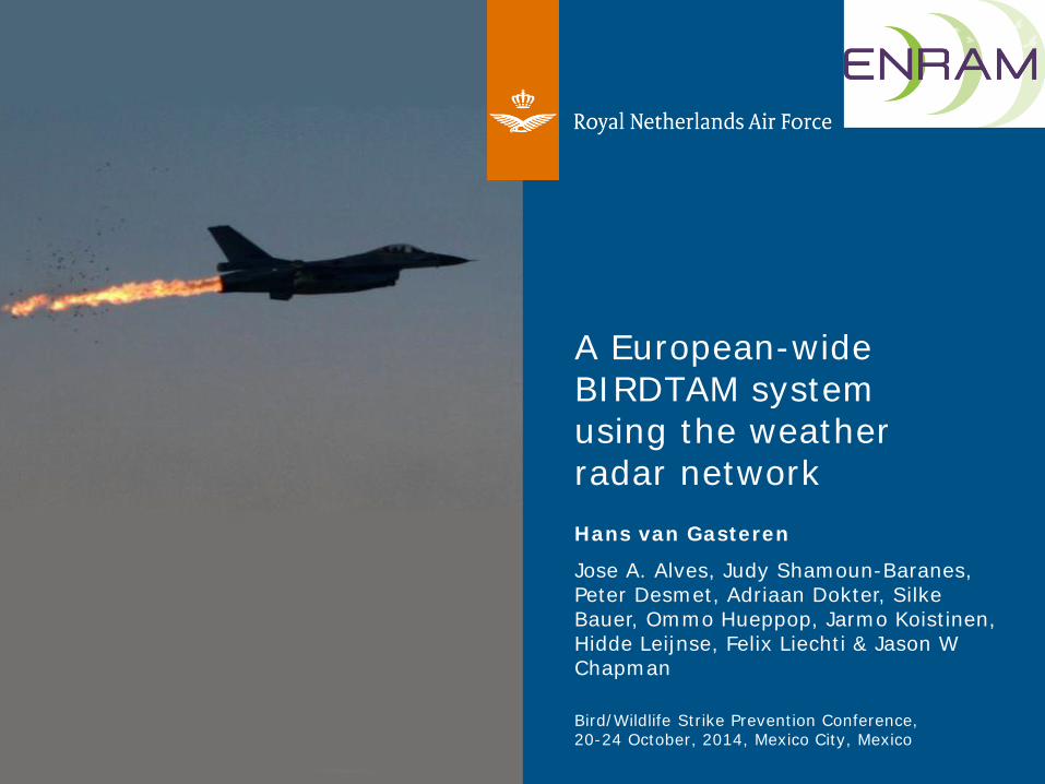
A European-wide BIRDTAM system using the weather radar network Hans van Gasteren
Jose A. Alves, Judy Shamoun-Baranes, Peter Desmet, Adriaan Dokter, Silke Bauer, Ommo Hueppop, Jarmo Koistinen, Hidde Leijnse, Felix Liechti & Jason W Chapman
Bird/Wildlife Strike Prevention Conference, 20-24 October, 2014, Mexico City, Mexico
Royal Netherlands Air Force 2
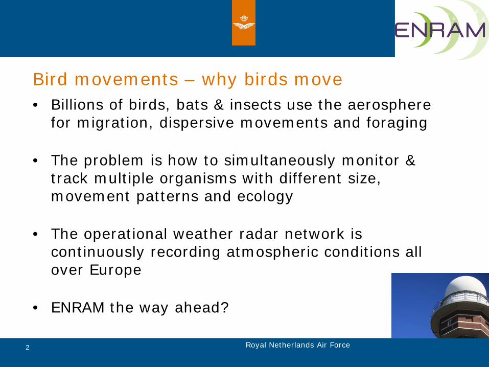
Bird movements – why birds move • Billions of birds, bats & insects use the aerosphere
for migration, dispersive movements and foraging
• The problem is how to simultaneously monitor & track multiple organisms with different size, movement patterns and ecology
• The operational weather radar network is continuously recording atmospheric conditions all over Europe
• ENRAM the way ahead?

Royal Netherlands Air Force 3
Radar aeroecology and flight safety
US Airways landed in Hudson River, New York 1.2 billion USD per year

Royal Netherlands Air Force 4
En-route BIRDTAM system •Bird detection system installed on air defense radars
Royal Netherlands Air Force 5
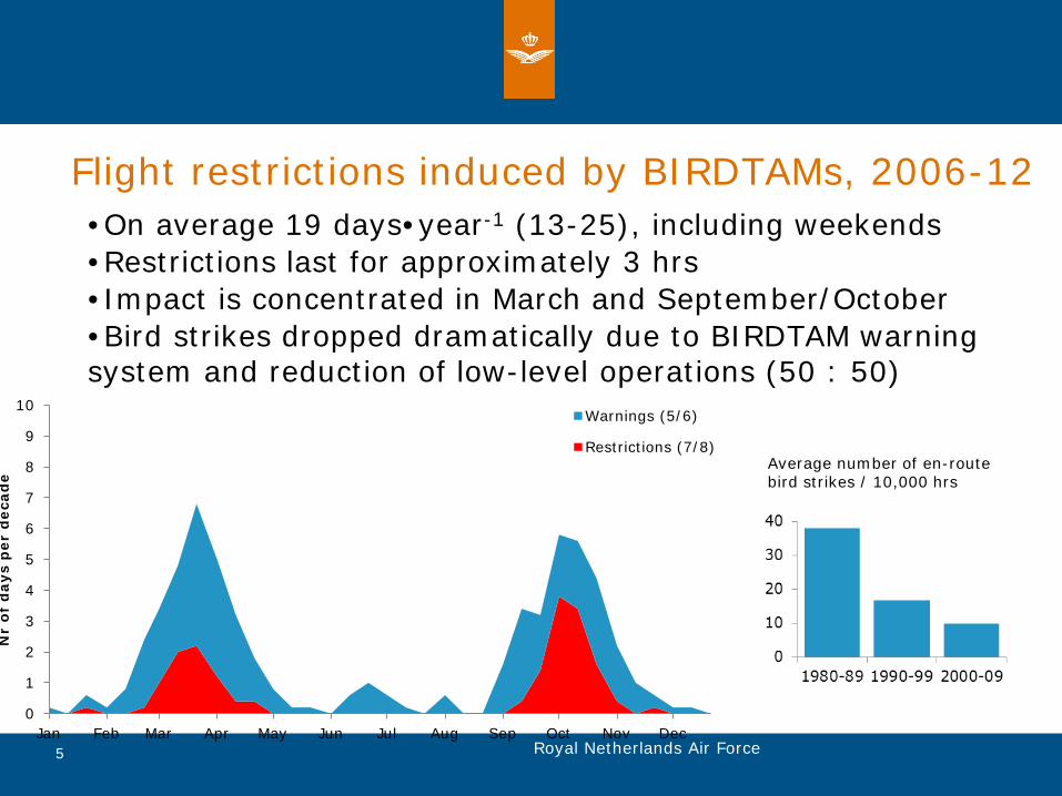
Flight restrictions induced by BIRDTAMs, 2006-12 •On average 19 days•year-1 (13-25), including weekends •Restrictions last for approximately 3 hrs •Impact is concentrated in March and September/October •Bird strikes dropped dramatically due to BIRDTAM warning system and reduction of low-level operations (50 : 50)
0
1
2
3
4
5
6
7
8
9
10
Jan Feb Mar Apr May Jun Jul Aug Sep Oct Nov Dec
Nr
of d
ays
per
dec
ade
Warnings (5/6)
Restrictions (7/8)Average number of en-route bird strikes / 10,000 hrs

Royal Netherlands Air Force 6
Relative frequency of en-route bird strikes European Bird Strike Database, jets only, 1991-2000.
Figures are corrected for flight hours, no data from eastern-European countries
Note both high bird strike areas as bombing ranges
Dekker & Van Gasteren 2005 EURBASE: Military bird strike frequency in Europe

Royal Netherlands Air Force 7
Radar aeroecology and flight safety Flysafe: An ESA Integrated Application promotion program • Calibration with bird detection radar at 3 locations • NL & BE: C-Doppler, FR - Dual polarization • Reflectivity & radial velocity • Density, speed and direction • Altitude profiles every 15 minutes • Development of bird detection algorithm FlySwift: real time monitoring of bird movements 24/7, BE (3 radar), NL (2 radar) http://www.flysafe-birdtam.eu/
Dokter et al 2011 Interface

Royal Netherlands Air Force 8
European Network for the Radar surveillance of Animal Movement
Shamoun-Baranes et al 2014 Movement Ecology
• e-COST Action • Research networking • 23 countries (incl. Austria / Turkey) • Management committee • 4 working groups • STSM (Short term scientific mission) • www.enram.eu
Foster international and multidisciplinary collaboration to monitor and study animal movement at a continental scale

Royal Netherlands Air Force 9
ENRAM aims through 4 working groups • WG1: improve classification and retrieval
algorithms
• WG2: data quality and validation of biological-classification algorithms
• WG3: visualizing spatio-temporal patterns of animal movement
• WG4: integrate information in animal research across multiple taxa

Royal Netherlands Air Force 10
Mass migration case study • Mass migration April 7-8 2013 • Layering at several locations • Coldest spring in 40 years • Complex wind conditions • Challenge: how do we visualize
movement dynamically with minimal amount of information? 2013-04-07 20:00 UTC, wind 925 mb
Fig 2, Shamoun-Baranes et al 2014 Movement Ecology
Royal Netherlands Air Force 11
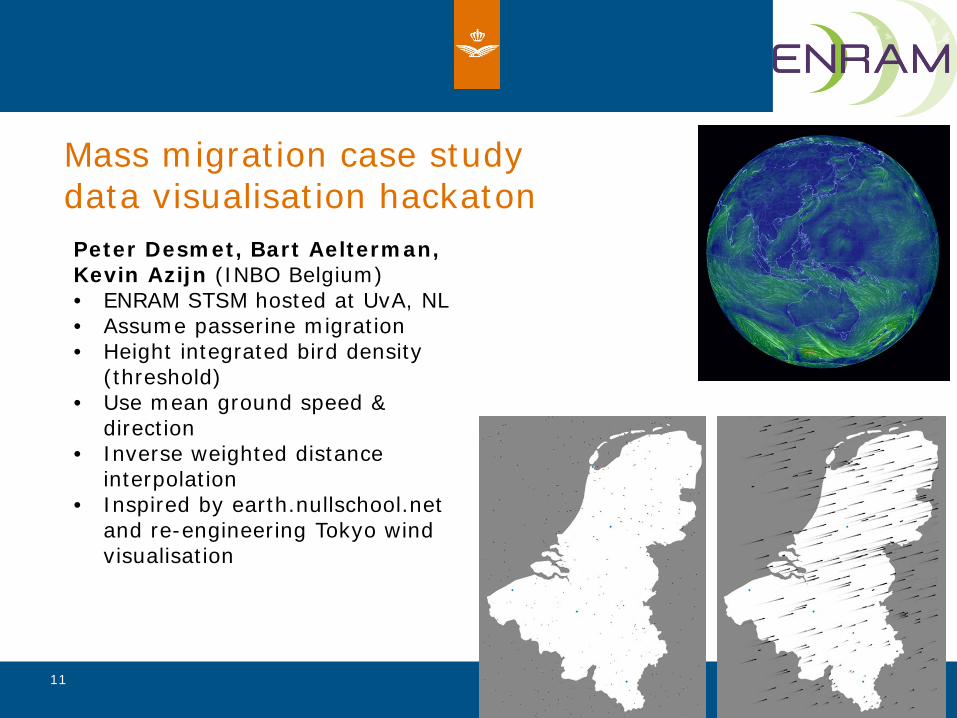
Mass migration case study data visualisation hackaton Peter Desmet, Bart Aelterman, Kevin Azijn (INBO Belgium) • ENRAM STSM hosted at UvA, NL • Assume passerine migration • Height integrated bird density
(threshold) • Use mean ground speed &
direction • Inverse weighted distance
interpolation • Inspired by earth.nullschool.net
and re-engineering Tokyo wind visualisation
Royal Netherlands Air Force 12
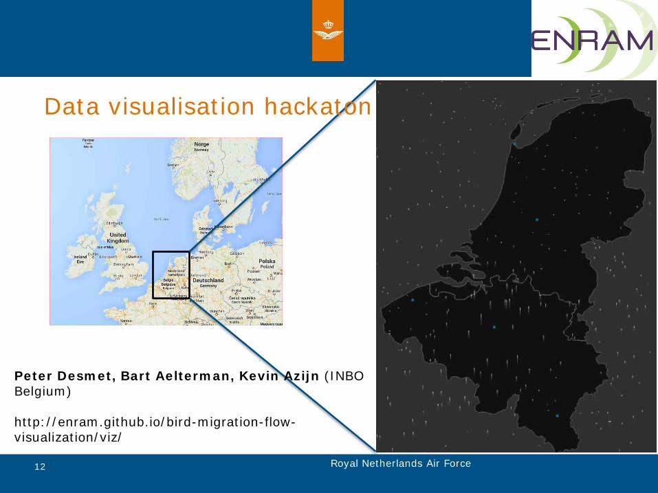
Data visualisation hackaton
Peter Desmet, Bart Aelterman, Kevin Azijn (INBO Belgium) http://enram.github.io/bird-migration-flow-visualization/viz/

Royal Netherlands Air Force 13
Summary • ENRAM:
• International and interdisciplinary network • Improve existing algorithms • New ways of exploring and visualizing movement data • Integrating techniques • Continental-scale monitoring
• Applied applications for Air Forces: • European BIRDTAM warning system • No access needed to secure air defence systems,
standardization • From FlySafe in The Netherlands and Belgium towards ENRAM
on a European wide scale • Reducing en-route bird strikes (50%) in the militaries against
minimum operational impact and costs. Who will join us?