a framework for collaboration in the wildland/urban interface
TRANSCRIPT
1
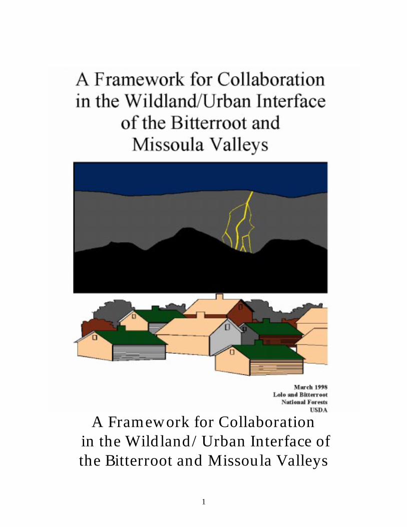
A Framework for Collaboration
in the Wildland/Urban Interface of the Bitterroot and Missoula Valleys

Writers: Vic Applegate & Sherry Munther
Editors: Glenda Wallace & Kitty Ortman
Steering Committee Members:
Chuck Wildes Rodd Richardson Sam Redfern Barb Beckes Lolo National Forest Bitterroot National Forest Lolo National Forest Lolo National Forest Jack Kirkendall Vic Applegate Sue Heald Dan Bailey Bitterroot National Forest Lolo National Forest Bitterroot National Forest Lolo National Forest Dave Stack Dave Silvius Sherry Munther Tom Wagner Lolo National Forest Bitterroot National Forest Regional Office Bitterroot National Forest Jeff Janke Scott Waldron Jim Freeman Glenda Wallace Montana Dept. of Natural Missoula County Fire Bitter Root Resource Missoula County Fire Resources & Conservation Protection Association Conservation & Development Protection Association Mark Lewing Kit Sutherland Tony Swallow John Blaine Montana Dept. of Natural Bitter Root Resource Bitter Root Resource Natural Resources Resources & Conservation Conservation & Development Conservation & Development Conservation Service Jeff Amos Greg Munther Dixie Dies Connie Fox Bitterroot National Forest Lolo National Forest Bitterroot National Forest Lolo National Forest Harvey Hackett MaryLee Bailey Beryl Bailey Jack Atthowe Bitterroot Water Forum Bitterroot Valley Bitterroot Valley Ravalli County Nancy Jemmett Allen Bjergo Bill Silverman Hoot Gibson Grangeville, ID Bitter Root Resource Missoula County Victor, MT Conservation & Development

3
CONTENTS
Page
Introduction 1 The Fire Environment 3 The USFS Fire Management Response 6 A Strategy for Collaboration 11 Initial Roles & Responsibilities 14 References 17 Appendices 19

INTRODUCTION
Since the wilderness debates of the 1960s, much progress has been made in recognizing the beneficial role of fire in wildland ecosystems, but as we all know, there is a wildfire manage- ment challenge in those areas where wildlands transition into developing private lands. Since this "wildland/urban interface" area in western Montana often occurs in high-hazard, forested areas, the perception is the interface fire problem belongs to us. The truth is no one agency or organization can effectively deal with the magnitude of the problem. In the fall of 1996, the Lolo and Bitterroot Forest Supervisors created an interagency, community-involved Steering Committee to investigate what efforts were underway locally to reduce the threat of catastrophic fire in the wildland/urban interface of the Missoula and Bitterroot Valleys. The results of their research, as well as a framework for collaboration with these partners, are included in this report. Area of Concern --From the town of Alberton on the western border of Missoula County to Hellgate Canyon just east of the city of Missoula, and then south to the town of Darby in Ravalli County. This Area of Concern, specifically, encompasses the Frenchtown Face and the Grant Creek/Rattlesnake Creek areas and the Bitterroot River basin (see Relief Map of Study Area on following page). Reason for Concern In the last two decades, fires in the wildland/urban interface have become much larger and burned with greater intensity (Arno, 1996). This is due in part to decades of aggressive fire exclusion, which has altered the normal fire regime. Fire are more intense today because forested lands in western Montana are characterized by an accumulation of fuels on the ground, extensive stands of trees displaying ladder fuels, a closed canopy, and a high vulnerability to fire from human activities and natural causes. To the landowners and communities living within the wildland/urban interface, this poses an extreme fire risk to human life and property, rare or unique cultural and natural resources, and ecosystem health, etc. Objectives --Reduce the risk of fire loss in the wildland/urban interface on both public and private lands. The evidence of success will include the following:
1. Safer, more efficient suppression of fires due to reduced fuel loadings and fire intensities; 2. Forest conditions that satisfy wildlife, aesthetic, economic, and other goals of landowners; 3. Participants sharing knowledge and data with neighbors; and 4. Participants taking care of their own property.

v

THE FIRE ENVIRONMENT The typical interface area in the Missoula and Bitterroot Valleys represents a transition in land ownership and environment: specifically, the landscape transitions from national forest to private ownership and from trees to grasslands and shrublands. Based on vegetation habitat types, which can determine potential fire severity and growth, this environment contains much of the driest areas of the Lolo and Bitteroot National Forests, thus it results in the longest fire season of any of the forest types within the two National Forests. Wildfire Hazard Wildfire hazard is the term we chose that represents the degree that a fire will ignite, spread and burn with high intensity in a forest setting. It is probably not possible to prevent wildfire occurrence in the wildland/urban interface areas of the Missoula and Bitterroot Valleys. However, by treating the vegetation within and adjacent to the interface area, it is possible to reduce the hazard, thereby insuring that future wildfires will result in much less loss of resource values and less risk to developments and people. The Fuel The wildland/urban interface is dominated by ponderosa pine and dry habitat types. Other types are represented, but not to the extent of the ponderosa pine and dry Douglas-fir types. Without periodic fire or other disturbances, these drier ecosystems are prone to developing dense and layered tree cover of shade tolerant Douglas-fir (Habeck, 1994, 1990), (Arno, 1991). This forest stand dynamic and vegetation accumulation results in higher intensity and larger size wildfires that commonly race into the crowns of the taller trees (rather than burning along the ground) killing all of the trees within the burned area. These stand replacement wildfires also destroy any unprotected structures within the burned area. Table 1 on the following page indicates the amount of pre-fire control burning that is estimated to have occurred prior to the settlement of the area by Europeans. The estimate of these acres is based on the habitat group acreages and the fire group classifications determined from the fire ecology research paper Fire Ecology of Western Montana Forest Habitat Types by William Fischer et al (1987) and Forest Habitat Types of Montana by Pfister et al (1977). We also used the potential natural vegetation grouping by Ken Brewer (1997) as an ecological environmental surrogate. This data produced an average frequency of fire within each group, which was then applied to the total acres by group for an approximation of the average annual burning within the interface. These calculations indicate that within the total study area three percent of the area or 70,000 acres burned on an average annual basis. Table 2 indicates that an average of 9,600 acres burned on an annual basis within the area termed the wildland/urban interface zone.

Table 1. Annual Average Acres Burned Estimate Of Pre-1800s Within The Total Study Area
Habitat
Group
Fire Group
Total Acre
s (M's)
Fire Frequency
Range Years
Burned Acres Factor
Annual Acres
Burned
1,2 2,4 891 5-25 .07 62,000 3,4 5
6,11 7,8
509 15-50 50-200
.009
5,000
7 9 456 117-146 .0008 400 8 9 199 117-146 .0008 200 9 7,8 183 100-500 .0003 100
10,11 10 386 35-300 .006 2,300
Total Acres
2,624 70,000
These acres are not defined by fire intensity, but generally the drier types (Fire Groups 2, 4 &11) were stand underburning, and the wetter types (Fire Groups 6, 7, 8, 9 & 10) were mixed severity to full, stand replacement burning. Table 2. Annual Average Acres Burned Estimate Of Pre-1800s Within And Adjacent To The Interface
Habitat
Group
Fire Group
Total Acre
s (M's)
Fire Frequency
Range Years
Burned Acres Factor
Annual Acres
Burned
1,2 2,4 133 5-25 .07 9,000 3,4 5
6,11 7,8
72 15-50 50-200
.009
600
7 9 56 117-146 .0008 -- 8 9 19 117-146 .0008 -- 9 7,8 13 100-500 .0003 --
10,11 10 2 35-300 .006 --
Total Acres
295 9,600
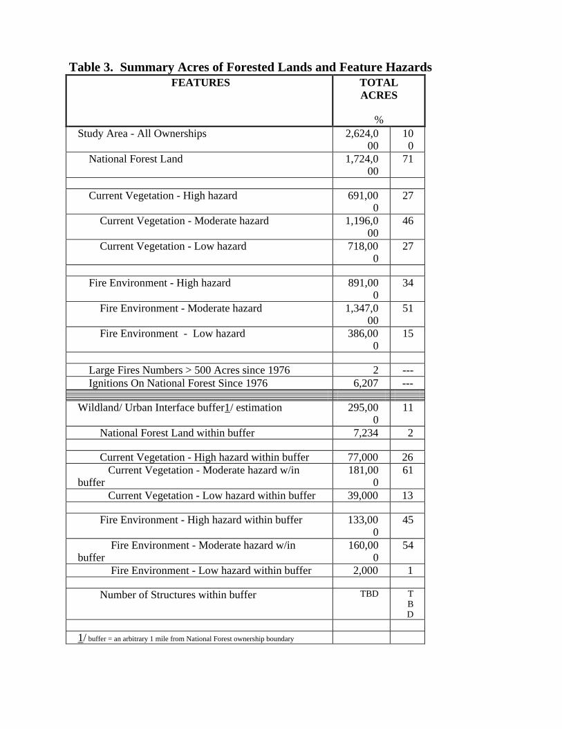
Table 3. Summary Acres of Forested Lands and Feature Hazards FEATURES TOTAL
ACRES
% Study Area - All Ownerships 2,624,0
00 100
National Forest Land 1,724,000
71
Current Vegetation - High hazard 691,00
0 27
Current Vegetation - Moderate hazard 1,196,000
46
Current Vegetation - Low hazard 718,000
27
Fire Environment - High hazard 891,00
0 34
Fire Environment - Moderate hazard 1,347,000
51
Fire Environment - Low hazard 386,000
15
Large Fires Numbers > 500 Acres since 1976 2 --- Ignitions On National Forest Since 1976 6,207 ---
Wildland/ Urban Interface buffer1/ estimation 295,00
0 11
National Forest Land within buffer 7,234 2
Current Vegetation - High hazard within buffer 77,000 26 Current Vegetation - Moderate hazard w/in buffer
181,000
61
Current Vegetation - Low hazard within buffer 39,000 13
Fire Environment - High hazard within buffer 133,000
45
Fire Environment - Moderate hazard w/in buffer
160,000
54
Fire Environment - Low hazard within buffer 2,000 1
Number of Structures within buffer TBD TBD
1/ buffer = an arbitrary 1 mile from National Forest ownership boundary
USFS FIRE MANAGEMENT RESPONSE Given the high hazard environment and physical features of the wildland/urban interface in the Missoula and Bitterroot Valleys, the most obvious question is, "What can be done?" The answer: clearly identify and reduce the wildfire hazard in this area. In the case of large trees and structures within the interface, our desire is to insure that whenever a wildfire burns through the area, most larger trees and structures are able to survive. This can be accomplished only through prompt wildfire control, necessary prevention techniques, reduced fuel loading and minimizing the ability of wildfires to spread through the crowns of trees. Hazard Identification, Ranking & Mapping As an outgrowth of this project, an interdisciplinary team from the Bitterroot and Lolo Forests and the Regional Office (see Appendix A) was formed to identify and rank the wildfire hazard features within and adjacent to the wildland/urban interface in the Bitterroot and Missoula Valleys. This team identified the need for seven maps, or information sets, to assist managers in assessing the fuel hazard and priority treatment areas for their forests. They are summarized in Table 4 on page 8. Two of the recommended maps (Length of Fire Season and Ranking of Stand Replacing Fires) have been created--using Geographical Information Systems (GIS)--and are included here. A more detailed mapping effort will occur as individual landscape and project assessments are completed. This effort will help us identify the needs of the fire environment as well as the resource and social issues involved. Treatment Strategies Fuel treatments based on vegetation and fire ecology are the most significant methods currently feasible to reduce wildfire intensity in the Area of Concern. These types of treatments include understory tree and shrub removal, thinning, pruning and prescribed fire. Many publications, such as Protecting People And Homes From Fire In The Interior West (USDA, Forest Service, 1988) and Fuel Reduction In Residential And Scenic Areas (Scott, 1997), are available for successful assessment and treatment methodologies. In these papers, fire hazard reduction is directly related to the reduction of wildfire intensity, which increases the ease and cost of fire control. However, none of the treatments envisioned or other conceived actions can reduce the potential for ignition or stop wildfires from occurring within this area in the near future. In fact, in some habitat types, treatment may actually increase the potential for ignition. For example, when live and dead woody fuels are removed from dense tree stands a more open forest is created, which allows for more extensive grass cover. This cover is more easily ignited than woody material. Yet the bottom line is this: Wildfires in treated areas have a higher probability for underburns (where most of the overstory trees survive) than untreated areas (where the probability for a stand replacement fire and nearly complete mortality of the overstory trees is significant). The measurable success of treatments can be summarized in five areas:
- Reduced fuel loading

- Reduced wildfire intensity - Reduced potential for crowning wildfire - Reduced resistance to wildfire control - Increased fuel treatment projects within the interface
Fuel Treatment Projects As a result of this project, Bitterroot and Lolo Forest Supervisors are identifying a need for increased hazard identification and fuel treatment work in a one-mile area surrounding the population centers of the Missoula and Bitterroot Valleys. Fuel treatment projects have also been initiated/and or strengthed in the Lolo and Bitterroot Forests. They include the Pattee Blue Project and the Northside Analysis Area near the city of Missoula. These projects involve about 4500 acres, and the Lolo Forest has another 10,000 of treatment projects scheduled. In the Bitterroot Valley, the Bitterroot Forest has scheduled approximately 5,000 acres of fuel treatment (prescribed fire and prescribed fire and mechanical thinning) along the interface buffer in the near future.

Table 4. Bitterroot and Missoula Valley Wildland/Urban Interface Maps MAPPING DESCRIPTION AND POTENTIAL USE
Length of Fire Season (based on habitat group) or Fire Environment Hazard Ranking
This map depicts the habitat type groups/fire groups, ranking them by droughtiness, which is a surrogate measure of the length of the fire season. The driest areas or highest hazard areas have the longest period of time each year when fires can be ignited, spread and burn at high intensity. The map data is from a statistical analysis for potential vegetation by Brewer, (1997). The Arc macro language used is listed in Appendix G.
Ranking of Stand-
Replacing Fire Likelihood or
Current Vegetation Hazard Ranking
This map depicts the ranking of hazard by vegetation types. This vegetation data is derived from Satellite Imagery Landcover Classification, (SILC), completed by the University of Montana, Wildlife Spatial Analysis Lab (1996). The ranked polygons represent the potential to support high intensity, stand replacement wildfire through low intensity, stand underburning. See Appendix F for data coding descriptions.
Urban Interface (layer exists on the above two maps)
This map depicts the boundary between most forest and private ownership. Omitted are areas of large private ownership such as Plum Creek and some isolated partial sections of National Forest Land outside the proclaimed boundary. In most instances, the interface boundary is the same as the forest boundary. Adjacent to this interface boundary is an arbitrary 1 mile buffer on either side for visual display and for quantifying acres of potential or current condition. It contains a majority of the area that many people consider as the wildland/urban interface.
Urban Interface
Structures *
This map depicts the location of many of the valuable structures as obtained from county records. This map is useful in identify the proximity of structures and higher hazard areas.
Large Wildfires *
This map depicts the large wildfires greater than 500 acres that have occurred on the National Forests since 1976. A table also lists the suppression costs for a few of these large wildfires.
Wildfire Starts * This depicts the location of known wildfire starts on the National Forests
since 1976.
Current Fuels * This map is not yet complete, but it will display an estimated fuel loading model called FARSITE, which is based on work by the USFS Fire Sciences Lab utilizing satellite imagery and field sampling.
Completed * Fuel Hazard
Reduction Areas
This map is not yet complete, but it will display the location and estimated acres of fuel reduction/ ecosystem restoration projects. .
* Maps to be created.


A STRATEGY FOR COLLABORATION Although the managers of the Lolo and Bitterroot Forests can reduce fire hazards and improve forest health in the Area of Concern by prescribing fuel treatment in their jurisdictions, these lands are still at risk from wildfire on adjacent untreated lands. Consequently, the Project Steering Committee suggests that the previously recommended fuel treatment actions be coordinated among ownerships beyond what has traditionally been done. Key Players The managers of the Lolo and Bitterroot Forests are not alone in their recognition of the increasing wildland/urban interface fire hazards in the Area of Concern. A number of agencies, organizations and individuals in the Bitterroot and Missoula Valleys are working to redress the risk of catastrophic interface fire. They include the Montana Department of Natural Resources and Conservation, the Natural Resources Conservation Service - Bitter Root Resource Conservation and Development (RC&D) Area of Ravalli, Missoula and Mineral Counties, and the Missoula County Fire Protection Association (MCFPA), among others. These groups have been rating wildfire hazards in their jurisdictions and are attempting to modify private landscapes as well. They're educating home and landowners about fire risks, working to improve access routes and other unsafe wildland fire practices, and demonstrating effective fuel thinning projects on common grounds, i.e. parks and private roads in risky interface areas. Starting Points After researching local and regional needs and solutions, the Steering Committee for this project determined and agreed that the staff and volunteers of the Bitter Root RC&D and the MCFPA-- with appropriate Forest Service and other partner support--could successfully lead the endeavor to educate homeowners about wildfire risks, solutions and treatments in the Area of Concern. They also identified the following message points and the collaboration strategy explained on page 12. Key Messages During the course of the project, Steering Committee members determined the following message points for US Forest Service staff:
1. We've got a problem that crosses political, jurisdictional, and ownership boundaries. Wildfire does not recognize abstract human boundaries and it's been a regular influence in this area for centuries. This dry habitat istorically burned every 10-20 years. Much of the Area of Concern has not burned in 70-80 years, and the potential for large, severe fires has increased. 2. A collaborative effort is timely. Even though the National Forests comprise a large share of the land, the Forest Service cannot solve the problems by just addressing them on National Forest lands. As partners, we'll be successful if this is a shared effort with the communities, the landowners including Plum Creek Timberland Company and the Forest Service.
3. More individual responsibility for protection/concern/care of each landowner's investment will be needed. 4. Treatment will increase safety and create a healthy, sustainable ecosystem. Scenery and property values of Forest Service and other lands will be enhanced. 5. The Forest Service is a partner with state and local governments to protect people and property. The Forest Service also works with home and landowners to teach them how to make their homes and land safe from fire. (National Talking Points, 8/30/96)
Other Message Points: The following message points were created by another subset of the Steering Committee, consisting of Bitter Root RC&D and MCFPA representatives. They are intended to summarize the wildland/urban interface problem for the home and landowner:
1. You have a problem. --For homes with an increased fire hazard/risk, i.e. combustible roof or dense forest (fuel) nearby or encompassing the home.
2. There are solutions to your problem. The risks and hazards of the wildland/urban
interface have occupied fire professionals for more than a decade. Means to minimize risk do exist.
3. You are not alone in solving your problem. Agencies such as the Bitter Root RC&D,
MCFPA, the Forest Service and the Montana Department of Natural Resources and Conservation offer assistance in identifying hazards. MCFPA has created an action plan to actively seek funding and implement methods for "on-the-ground" change. Other assistance programs are being developed and/or identified. The insurance industry, in particular, is offering public awareness campaigns and considering other incentives to assist homeowners in minimizing their risks.
Awareness To assist the MCFPA and the Bitter Root RC&D in their education/motivation efforts in the wildland/urban interface of the Lolo and Bitterroot Forests, the Steering Committee recommended the Forest Service provide the following products and services:
1. "Risk" maps created for identified high-risk neigborhoods to serve as a catalyst for neighborhood discussions and action.
2. Personnel and financial support to Bitter Root RC&D, the MCFPA and other appropriate
local agencies to help residents develop the following: • map of all properties, obtained from County; • map showing location & boundaries of all interface development clusters; • detailed map of each cluster showing location of all utility valves & shutoffs; • maps showing preferred escape paths; and a • map showing roads and trails in the surrounding area.

3. Support to help disseminate information through mass and interpersonal communication campaigns, i.e. booths at county fairs, one-on-one dialogs with individual homeowners or at meetings of homeowner associations, realtors, architects, builders, etc. 4. Support to help train citizens in fire behavior, defensible space, etc.
Partner Consultation To support the education work of local agencies such as the MCFPA and the Bitter Root RC&D, the Steering Committee recommended that Forest Service staff support the following activities. Support for Individual Homeowner/Landowners:
1. Identify who will be available and has a desire to participate. 2. Meet with individual neighborhood groups to review "risk" and discuss options for their
particular piece of the interface area. 3. Consult and followup with individual landowners (i.e. a hazard checklist, information on brush clearing, safety zones, appropriate building materials, turn-around areas for fire
trucks and other emergency vehicles, etc.) Support for Neighborhood Organizations:
1. Organize homeowner associations into clusters, i.e. Ninemile or Florence areas, according to location, risk, etc.
2. Prepare data sheets (names, addresses, phone numbers, special needs, utility shutoff locations, etc.)
3. Identify available communication systems, i.e. telephone trees, citizen band radio networks, protocols, practice drills, neighborhood maps.
Application Where possible the Forest Service will assist individuals or landowners to implement landscape fuel reductions & structural modifications by providing technical expertise and/or grant opportunities:
1. Clearing by individual landowners (chipping & spreading of unwanted vegetation, prescribed burning, and/or clearing & offering of firewood, etc.)
12. Clearing by individual homeowners (tree removal, brush clearing, etc. for defensible space)
3. Retrofit of homes and other structures (roof replacement, safe firewood locations, etc.)

INITIAL ROLES & RESPONSIBILITIES
Counties & State Roles • Leadership role in partnership with the Forest Service and other agencies • Lead efforts in training/awareness (RC&D and MCFPA) • Pursue creative funding (i.e. grants, scholarships, insurance incentives, etc.) • Vital communication link between key players Forest Service Role • Take a strong interest in the cooperative effort and apply fuel reductions on National Forest
lands
• Provide expertise/support for training • Support "volunteer" participation of employees in this effort • Provide some funding (i.e. grants, etc.) • Include monitoring/collaborative planning in reports and processes • Provide assistance in public involvement efforts and interface with the media Forest Service Responsibilities Active public support is critical to the success of this strategy. The Forest Supervisors of the Bitterroot and Lolo Forests place a high priority on fire management in the wildland/urban interface and encourage their employees' involvement in these collaborative efforts. Interest and activities will include not only providing expertise and support as Forest Service employees, but as members of the various communities and neighborhoods involved. 1. Internal awareness is important in order for employees to participate one-on-one with their
individual neighborhoods, homeowner associations, etc. Employee discussion/awareness sessions will be built into this process.
Responsible Party: Forest Supervisors/Fire Management Officers/Public Affairs Officers When: Initiated in November 1996 (ongoing)
2. District Fire Management Officers and District Rangers will meet with neighborhood associations and rural fire department representatives as assigned or as can be incorporated

into other meetings with these parties. Landscape assessments will feature this issue and provide more depth in understanding the problem.
Responsible Party: District Rangers and District Fire Management Officers When: Initiated in July 1997 (ongoing)
3. Forest Service employees' role is to provide information and assist with their expertise when asked. Employees will also be supported by management in their roles as homeowners and citizens within their communities and neighborhoods.
Responsible Party: All employees When: As needed
4. Forests will develop a funding source strategy in cooperation with the Regional Office
Cooperative Forestry Group. This will include a grant search of potential sources of funds. It will also target Regional Office/Washington Office staff who can direct funds to this project.
Responsible Party: Forest Supervisors; Regional Office- Cooperative Forestry When: Farm Bill/RCA grant proposals are due Mar. 30 of each year

CONCLUSION
Work to minimize the wildfire hazards and risks on National Forest lands and private lands adjacent to National Forest lands in the Bitterroot and Missoula Valleys is underway. However, the scale of risk and need in the Area of Concern indicates that much more support is needed. Questions raised by this project are included in Appendix D. We submit this Strategy for Collaboration, knowing that as its goals are implemented it will do much to address the interface fire status quo. Lolo and Bitterroot Forest Supervisors intend to follow the activities of this project through periodic updates with staff and partners.

REFERENCE MATERIAL
Data Analysis Specific to this Project: The Forest Service is beginning to build a GIS database that will identify wildfire risk areas from the Bitterroot to the Missoula Valleys and adjacent lands. This information will be combined with information that local fire districts, counties and state agencies have or are building so that all parties can benefit from each others' efforts. This is being accomplished through already established or new (as needed) agreements between these organizations. Robert Keane of the Intermountain Forestry Sciences Lab is developing a fuels and vegetation spatial data base for the Bitterroot Front in order to investigate the risk of fire in the urban setting. These GIS layers will be at 30-50 meter resolution and will encompass wilderness, private and federally managed land areas. Ground-truth plots will be established across the entire Front to create, validate and test these data layers. The FARSITE model will be linked to these layers so that fire behavior can be estimated. Research: Projects underway that can help us in this effort include the following: Understanding Natural Fire Spread: Reducing Fire Suppression In Wilderness and Fire Risk In the Urban Interface Zone Contact: Peter Landres, Leopold Institute, July 1996 (Coop venture with University of Montana
Hot Property In Montana: GIS and the Wildland/Urban Interface Problem Contact: Kelly Close, P.O. Box 272501, Fort Collins, CO 80527 Adapting a Manual Fire Risk Rating Process to GIS: The Whitefish Case Study Contact: Mike Kopitzke, Southwestern Land Office, Montana Dept. of Natural Resources and Conservation 1401 27th Ave, Missoula, MT 59804; and Ken Wall, GeoData Services, Inc., 1120 Cedar, Missoula, MT 59802
Other: Fire Ecology Educational Materials - Some materials, handouts, lesson plans, and hands-on materials are already available. This includes "The Story Tree," a 600-year old ponderosa pine cross section with fire scar--complete with an interpretive display and lesson plan, and FIREWORKS, which is a box of curricula and hands-on educational materials developed by the Intermountain Research Station and the Bitterroot Ecosystem Management Research Project. Materials are ready for pilot use by teachers and environmental educators. Contact: Nancy McMurray or Jane Kapier Smith, Intermountain Fire Sciences Lab (406) 329-4809 or 329-4805

REFERENCES
Arno, Stephen F. 1996. The Seminal Importance of Fire in Ecosystem Management - Impetus for This Publication. In The Use of Fire in Forest Restoration. Gen Tech Rep. INT-341. USDA Forest Service. Intermountain Research Station. 5 p.
Arno, Stephen F.; Brown, James K. 1991. Overcoming the Paradox in Managing Wildland
Fire. In Western Wildlands, Spring 1991. 7 p. Brewer, Ken. 1997. Potential Natural Vegetation Classification of the Bitterroot Face, a
discriminant analysis of forest inventory plots. USDA Forest Service, Northern Region.
Fischer, William C.; Bradley, Anne F. 1987. Fire Ecology of Western Montana Forest Habitat Types. Gen. Tech. Rep. INT-223. Ogden, UT. USDA, Forest Service, Intermountain Forest and Range Experiment Station. 95 p.
Habeck, James. R. 1994. Using General Land Office Records to Assess Forest Succession in
Ponderosa Pine/Douglas-fir Forest in Western Montana. In Northwest Science, Vol. 68, No. 2, 1994. 9 p.
Habeck, James. R. 1990. Old-Growth Ponderosa Pine-western Larch Forests in Western
Montana: Ecology and Management. In the Northwest Environmental Journal, vol 6, no. 2, Fall/Winter 1990. 22p.
Pfister, Robert D.; Kovalchik, Bernard L.; Arno, Stephen F.; Presby, Richard C. 1977. Forest
Habitat Types of Montana. Gen. Tech. Rep. INT-34. Ogden, UT. USDA, Forest Service, Intermountain Forest and Range Experiment Station. 174 p.
Scott, Joe H. 1997. Review Draft of Fuel Reduction in Residential and Scenic Areas: A
comparison of three Treatments in a Western Montana Ponderosa Pine Stand. Research Paper INT- . Ogden, UT. USDA, Forest Service, Intermountain Forest and Range Experiment Station. 39 p.
University of Montana, Wildlife Spatial Analysis Lab and the USDA, Forest Service, Northern
Region. 1996. Satellite Imagery Landcover Classification, SILC. USDA, Forest Service. 1988. Protecting People and Homes from Fire in the Interior West:
Proceedings of the Symposium and Workshop. Gen. Tech. Rep. INT-251. Ogden, UT. USDA, Forest Service, Intermountain Forest and Range Experiment Station. 213 p.
Williams, J.T. ; Rothermel, R.C. 1992. Fire Dynamics in Northern Rocky Mountain Stand Types. USDA Forest Service. Intermountain Research Station. Research Note INT-405. 4p.

Appendix A Task group members
The Bitterrroot and Lolo wildland/urban interface group is composed of the following members.
Any of these may be contacted for information regarding this effort.
Name Position Location
Vick Applegate Forest Silviculturist Lolo National Forest Dave Atkins Ecologist Northern Region Office Dan Bailey Fire Management Officer Lolo National Forest
Dave Browder Biological Scientist Lolo National Forest Jim Fears GIS Coordinator Bitterrroot National
Forest Sue Heald Forest Ecologist Bitterrroot National
Forest Jack
Kirkendall Fire Management Officer Bitterrroot National
Forest Rich Lasko Fire Management Program Manager Northern Region Office Anne Rys-
Sikora Fire Management GIS Coordinator Lolo National Forest
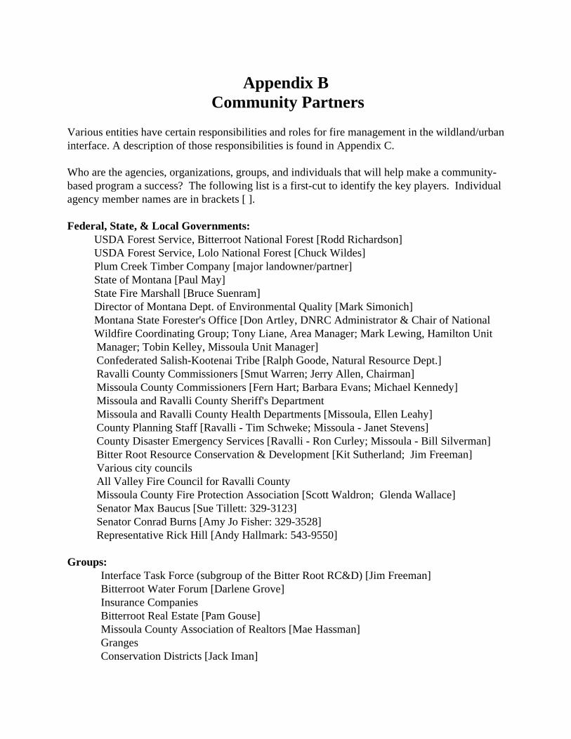
Appendix B
Community Partners
Various entities have certain responsibilities and roles for fire management in the wildland/urban interface. A description of those responsibilities is found in Appendix C. Who are the agencies, organizations, groups, and individuals that will help make a community-based program a success? The following list is a first-cut to identify the key players. Individual agency member names are in brackets [ ]. Federal, State, & Local Governments: USDA Forest Service, Bitterroot National Forest [Rodd Richardson] USDA Forest Service, Lolo National Forest [Chuck Wildes] Plum Creek Timber Company [major landowner/partner] State of Montana [Paul May] State Fire Marshall [Bruce Suenram] Director of Montana Dept. of Environmental Quality [Mark Simonich]
Montana State Forester's Office [Don Artley, DNRC Administrator & Chair of National Wildfire Coordinating Group; Tony Liane, Area Manager; Mark Lewing, Hamilton Unit
Manager; Tobin Kelley, Missoula Unit Manager] Confederated Salish-Kootenai Tribe [Ralph Goode, Natural Resource Dept.] Ravalli County Commissioners [Smut Warren; Jerry Allen, Chairman] Missoula County Commissioners [Fern Hart; Barbara Evans; Michael Kennedy] Missoula and Ravalli County Sheriff's Department Missoula and Ravalli County Health Departments [Missoula, Ellen Leahy] County Planning Staff [Ravalli - Tim Schweke; Missoula - Janet Stevens] County Disaster Emergency Services [Ravalli - Ron Curley; Missoula - Bill Silverman] Bitter Root Resource Conservation & Development [Kit Sutherland; Jim Freeman] Various city councils All Valley Fire Council for Ravalli County Missoula County Fire Protection Association [Scott Waldron; Glenda Wallace] Senator Max Baucus [Sue Tillett: 329-3123] Senator Conrad Burns [Amy Jo Fisher: 329-3528] Representative Rick Hill [Andy Hallmark: 543-9550]
Groups:
Interface Task Force (subgroup of the Bitter Root RC&D) [Jim Freeman] Bitterroot Water Forum [Darlene Grove] Insurance Companies Bitterroot Real Estate [Pam Gouse] Missoula County Association of Realtors [Mae Hassman] Granges Conservation Districts [Jack Iman]

Service Clubs: Rotary Kiwanis
Lions Hamilton Business Association Missoula Exchange Club [P.O. Box 8926, Missoula, MT 59807] Missoula and Hamilton Chamber of Commerce (others?) Missoula Business & Professional Women [P.O. Box 4323; Missoula]
Communities:
Stevensville Garden Club [Dale Thacker] Victor Garden Club [Phyllis McKeevers] Darby Civic Group [Rosie Huxstead] Hamilton Garden Club [Dale Hutenen, City Adminis.; Laurel Hagestad, Mayor of Hamilton] Florence Civic Group [Margie Lubinski] Corvallis [Alan Bjergo] Pinesdale [Rocky Devuruse] Sula [Gary Wetzsteon] West Fork Lolo [Lolo Community Council; Lolo Planning Board, Jean Belangie; Rich Zinns, President of Bitterroot State Bank]
Neighborhoods:
Ninemile area: Elk Ridge Homeowners Association (Six Mile area) Sorrel Springs Homeowners Association (behind Frenchtown)
Missoula area: Pattee Canyon Landowners Association [Clem Work] Blue Mountain/O'Brien Creek Homeowners Association [Charles Stevenson] Butler Creek Neighborhood AssociationFriends of Grant Creek Consulting Foresters: [Matt Arno 543-2970 & Joe Scott 726-3897]
Individual landowners: (key landowners to involve early on)
Plum Creek Timber Company Bitterroot Valley area:
Tom Rufatto Arne Bolin Fred Burnum Cad Baldwin Ed Cummings Steve Arno
Ninemile area: Bob Rennie, Alberton

George Galada, Ninemile Rd., Huson Frank Pettinato, Missoula Dave Forbes, Roman Cr. Rd., Frenchtown Bob Morrison, Jr., Sixmile Rd., Huson Scott Duncan, Ninemile Rd., Huson Tom & Cindy Picciano, Ninemile Rd., Huson Carol Guthrie, Old Coyote Rd, Huson
Interest Groups: Friends of the Bitterroot [President Jim Olson; Darlene Grove; Terry Noble] Friends of Grant Creek [Kim Birck; Emily Lauchnor] Friends of the Rattlesnake [Cas Chinsky] Friends of Pattee Canyon [Mavis McElvey; Ron Erickson] Grass Roots for Multiple Use [Bernie Swift] Bonner Development Group [Bruce Hall; Gary Matson] Trout Unlimited [Marshall Bloom; Doris Milner] Ravalli Fish & Wildlife Association [Ira Hoft] Five Valleys Audubon Society [P.O. Box 8425, Missoula, MT 59807 Women's Voices for the Earth [Bryony Schwan] 4H [Rob Johnson, MSU Extension Agent] Boy Scouts Irrigation Districts [Ravalli, Tonya Bumbarger, atty.] Wilderness Dams [Brian Langston; Tom Rufatto; Jack Bueker] Stockgrowers [Ed Cummings; Tom Rufatto] Stone Container [Frenchtown Plant Manager, Bob Boschee; Forester, Bob Chandler] Forest Service Retirees Association Society of American Foresters Wildlife Society Rocky Mountain Elk Foundation [Allan Christiansen] National Wildlife Federation [Tom France]
Research: Aldo Leopold Wilderness institute [Dave Parsons, Peter Landres] Intermountain Research Station [Dick Krebill]
Forestry Sciences Lab [Clint Carlson, BEMRP Project] Fire Sciences Lab [Steve Arno; Kevin Ryan; Bob Keane; Colin Hardy]
University of Montana, School of Forestry [Perry Brown; Ron Wakimoto; Bob Pfister] Technology Transfer
MSU Forest Stewardship Program [Bob Logan] Bitterroot Water Forum [Rob Johnson) Forest Service Retirees Association Consultants BEAR - Bitterroot Ed Group [Kerry Wall-MacLane 961-521 1 ] Learning Center-Network-[Carolyn Durgin 243-66551

Media Ravalli Republic [363-3300] Bitterroot Star [777-3928] Missoulian [Sherry Devlin: 523-5268] Missoula Independent [Dan Oko: 543-6609] Montana Kaiman (University of Montana) [243-6541] KECI TV Channel 13 NBC [Larry Frost: 721-5642] KPAX TV Channel 8 CBS [Paul Shoemaker:543-7106; Ian Marquand, CoordinTue Oct 12 14:31:51 1999ator] KTMF TV Channel 23 ABC and FOX [No news dept.: 542-8900] MCAT Missoula Community Access TV [542-6228] BVTV Bitterroot Valley Public Television [961-3692] KLYO AM Radio/ KBMG FM Radio [Hamilton: 363-301 0] KDXT XT93 FM Radio [Wendy Carpenter: 728-9399] KGRZ 1450 AM Radio [Wendy Carpenter: 728-9399] KMSO FM 102 [Bob Borino: 542-1025] KUFM 89 FM Radio [Sally Mauk: 243-4931] KYLT AM 1340 Radio [Alan Kay: 728-5000] KLCY 930 AM Radio [728-9300] KYSS 95 FM Radio [728-9300] KGVO 1290 AM Radio [Brian Prowitz: 728-9300] KZOQ FM 100 [Alan Kay: 728-5000
]
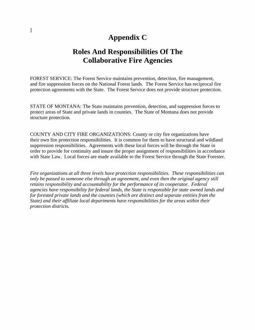
Appendix C
Roles And Responsibilities Of The
Collaborative Fire Agencies
FOREST SERVICE: The Forest Service maintains prevention, detection, fire management, and fire suppression forces on the National Forest lands. The Forest Service has reciprocal fire protection agreements with the State. The Forest Service does not provide structure protection. STATE OF MONTANA: The State maintains prevention, detection, and suppression forces to protect areas of State and private lands in counties. The State of Montana does not provide structure protection. COUNTY AND CITY FIRE ORGANIZATIONS: County or city fire organizations have their own fire protection responsibilities. It is common for them to have structural and wildland suppression responsibilities. Agreements with these local forces will be through the State in order to provide for continuity and insure the proper assignment of responsibilities in accordance with State Law. Local forces are made available to the Forest Service through the State Forester. Fire organizations at all three levels have protection responsibilities. These responsibilities can only be passed to someone else through an agreement, and even then the original agency still retains responsibility and accountability for the performance of its cooperator. Federal agencies have responsibility for federal lands, the State is responsible for state owned lands and for forested private lands and the counties (which are distinct and separate entities from the State) and their affiliate local departments have responsibilities for the areas within their protection districts.

Appendix C (continued) Key Tasks for Forest Personnel
Who Task Lolo/Bitterroot Forest Supervisors Key spokespersons for agency as well as
serving on Steering Group** Lolo/Bitterroot District Rangers Each Ranger would become task force
interface contact with neighborhoods & communities.
Forests: • Fire Management Officer • Resource & Planning Staff • Public Affairs • Technical Group (Vic Applegate) • All employees
• Provide staff work & support to effort;
spokespeople as assigned. • Develop strategy for fund-raising
through grant sources.
Regional Office: • Fire Management (Rich Lasko; Jerry
Williams) • Air Quality (Ann Acheson) • Cooperative Forestry (Nan
Christianson; Dean Graham; Dave Atkins)
• Assistance in supporting effort &
expertise as needed. • Assist Forests in identifying funding
sources (Farm Bill/RCA grants, etc.)
Forest Service Research: • Dave Parsons, Peter Landres: Aldo Leopold Wilderness Institute • Ronni Korol, Forestry Sciences Lab • Steve Arno, Kevin Ryan, Bob Keane, Colin Hardy: Fire Lab
** STEERING GROUP • Forest Supervisors [Chuck Wildes/Rodd Richardson (note: Steve Kelly retired in late '97)] • State Forester Representative • Resource Conservation & Development [Freeman &/or Sutherland] • Missoula County Fire Protection Association [Scott Waldron] • 1 County Commissioner from each county of Missoula, Ravalli, & Mineral
Retirees: [Potential list: to be revised on an ongoing basis] • Bob McKee • Bob Mutch • Jim Brown • Jerry Hinman • Jerry Fiman (West Fork) • Mick Dezell • Tony Swallow • John DeBarber • Ed Heilman
• Project supervision; training &
development; support • RC&D & Missoula County Fire
Protection Assoc. • Training/Development • Newsletter experience

• Jack Puckett • John Inman • Dale Thacker • Dave Colclough • Bob Bigler • Ralph Cisco • Jack Losensky • Wayne Avants • Forest Hayes • Jim Freeman • Steve Kelly
• Working with Msla. County Park
Board • RC&D President

Appendix D
Questions to Explore The following questions have come up in the course of developing this collaboration strategy. The answers and solutions to some of these questions will most likely be resolved throughout the process just as other questions will be added to this list. 1. Will reduced insurance premiums and liability be explored to encourage individual
landowners to participate in this program? 2. What are the options for disposal of excess fuels, e.g., chipping, burning, marketing,
fuelwood? 3. Would a cost comparison between this process and the high cost of suppression of wildfire be
helpful? 4. Would a comparison for air quality be helpful? 5. What are the most effective and most efficient means for increasing awareness, promoting
consultation, and accomplishing applications? 6. Will it be possible to use FARSITE as a demonstration for individual homeowners? 7. What incentives could landowners be offered for lowering the fire risk on their property?
Examples might include lower insurance rates; registered as a fire-safe property, etc.

Appendix E
Data Code Ratings The following data codes were combined for the ranking of vegetation fire hazard. The data is from scene P41/R28.
Cover Type code Size Class code 0000 1999 : 0 /* urban 2000 2999 : 10 /* agricultural 3100 3199 : 10 /* grassland 3200 3399 : 10 /* shrubland 4100 4199 : 30 /* broadleaf forest 4201 4201 : 50 /* engelmann spruce 4203 4203 : 30 /* lodgepole pine 4206 4206 : 30 /* ponderosa pine 4207 4207 : 40 /* grand fir 4208 4208 : 50 /* subalpine fir 4212 4212 : 40 /* douglas fir 4214 4214 : 50 /* rm juniper 4215 4215 : 20 /* western larch 4219 4219 : 40 /* mixed whitebark pine forest 4220 4220 : 50 /* mixed subalpine 4221 4221 : 35 /* mixed mesic 4222 4222 : 35 /* mixed xeric 4225 4225 : 40 /* douglas fir/grand fir 4228 4228 : 30 /* western larch/lodgepole 4301 4301 : 30 /* mixed needle/broad (see 4100) 5000 9999 : 00 /* water,riparian, cloud, alpine meadow
0 : 10 /* grass 1 : 10 /* seed/sap 2 : 25 /* pole 3 : 20 /* medium 4 : 10 /* large tree no_data for most 5 : 10 /* low shrub 6 : 10 /* medium shrub 7 : 10 /* high shrub
Aspect codes Canopy class code
Elevation code
1 - 45 : 1 45 - 135 : 3 135 - 315 : 5 315 - 361 : 1
0 : 0 1 : 1 2 : 4 3 : 5
0 -1524 : 5 1524 - 2134 : 3 2134 - 9999 : 1
Silc Aspect code Slope code Final Hazard categories
0 - 0 : 3 1 - 2 : 1 3 - 3 : 3 4 - 7 : 5 8 - 8 : 1
0 - 35 : 2 35 - 60 : 4 61 - 999 : 5
0 - 40 : 1 40 - 80 : 2 80 - 120 : 3 120 - 160 : 4 160 - 200 : 5

Appendix E (continued) Rules for Cover Type/Ladder Fuel Rating
The following rule was used to decide if a plot was considered to have ladder fuels: - if the amount of cover is less tan or equal to 5% in the seedling class or sapling class then the stand was considered not to have ladder fuels. - The risk value was on a 1-5 scale with 5 being the highest intensity fire. Therefore, based on the professional estimate of the group the medium multi-storied stands have the greatest intensity.
COVER TYPE LADDER
FUELS
SEED/SAP POLE
MED
LARGE
4201 - ES Yes No
1 2.5
2
No Data
4202 - LP Yes No
1 2.5
2
No Data
4206 - PP Yes No
1 2.5
2
4
4207 - GF Yes No
1 3.5 5 4
4208 - AF Yes No
1 3.5 2
No Data
4212 - DF Yes No
1 3.5 2
No Data
4215 - WL Yes No
1 3.5 5
No Data
4219 - WBP mix Yes No
1 3.5 2
No Data
4220 - ES/AF Yes No
1 3.5 5 No Data
4221 - mesic Yes No
1 3.5 5 4
4222 - PP/DF Yes No
1 2.5 2
1
4223 - DF/LP Yes No
1 3.5 5 No Data
4225 - DF/GF Yes No
1 3.5 5 No Data

Appendix F ARC Macro Language for Vegetation Hazard Rankings
/* the 6 variables are slope, silc_aspect, covertype, canopy_code, size_class,multi-story correction %name%_sl = int ( slope ( %dem_grid% , percentrise ) ) %name%_sl_r = slice ( %name%_sl , table , slope.rmp ) %name%_hill = hillshade ( %dem_grid% , 235 , 58 ) /*-----------------------------non-DEM related variables /* read the size class field from silc and remap it. /* a correction to the risk/hazard number is added later %name%_sc = int ( %silc_grid%.sizeclass ) %name%_sc_r = slice ( %name%_sc , table , size.rmp ) %name%_ct = int ( %silc_grid%.covertype ) %name%_ct_r = slice ( %name%_ct , table , cover_type.rmp ) %name%_cc = int (%silc_grid%.canopycode ) %name%_cc_r = slice ( %name%_cc , table , canopy_code.rmp ) %name%_as = %silc_grid%.asp %name%_as_r = slice ( temp_as , table , lab_as.rmp ) /* three additional grids to add risk (pole=1,medium=3,large=3) for certain covertypes tmp_corr_pol = con (( %name%_ct == 4207 or %name%_ct == 4208 or %name%_ct == 4212 or ~ %name%_ct == 4215 or %name%_ct == 4219 or %name%_ct == 4220 or ~ %name%_ct == 4221 or %name%_ct == 4223 or %name%_ct == 4225 ) and %name%_sc == 2 , 1 , 0 ) tmp_corr_med = con (( %name%_ct == 4207 or %name%_ct == 4208 or %name%_ct == 4215 or %name%_ct == 4220 ~ or %name%_ct == 4221 or %name%_ct == 4223 or %name%_ct == 4225 ) and %name%_sc == 3 , 3 , 0 ) tmp_corr_lar = con (( %name%_ct == 4206 or %name%_ct == 4207 or %name%_ct == 4221 ) and %name%_sc == 4 , 3 , 0 ) ccr = con ( isnull ( %name%_cc_r ),0, %name%_cc_r ) slr = con ( isnull ( %name%_sl_r ),0, %name%_sl_r ) asr = con ( isnull ( %name%_as_r ),0, %name%_as_r ) ctr = con ( isnull ( %name%_ct_r ),0, %name%_ct_r ) scr = con ( isnull ( %name%_sc_r ),0, %name%_sc_r ) tmpp = con ( isnull (tmp_corr_pol ),0,tmp_corr_pol ) tmpm = con ( isnull (tmp_corr_med ),0,tmp_corr_med ) tmpl = con ( isnull (tmp_corr_lar ),0,tmp_corr_lar ) %name%_sum = 2 * ccr * 10 + slr * 10 + ctr + scr + tmpp * 10 + tmpm * 10 + tmpl * 10 %name%_sum_r = slice ( %name%_sum , table , sum.rmp ) tmp_corr_pol2 = con (( %name%_ct == 4207 or %name%_ct == 4208 or %name%_ct == 4212 or ~ %name%_ct == 4215 or %name%_ct == 4219 or %name%_ct == 4220 or ~ %name%_ct == 4221 or %name%_ct == 4223 or %name%_ct == 4225 ) and %name%_sc == 2 , 1 , 0 ) tmp_corr_med2 = con (( %name%_ct == 4207 or %name%_ct == 4208 or %name%_ct == 4215 or %name%_ct == 4220 ~ or %name%_ct == 4221 or %name%_ct == 4223 or %name%_ct == 4225 ) and %name%_sc == 3 , 3 , 0 ) tmp_corr_lar2 = con (( %name%_ct == 4206 or %name%_ct == 4207 or %name%_ct == 4221 ) and %name%_sc == 4 , 3 ,0)
continued on next page

Appendix F (continued)
continued from previous page
ccr2 = con ( isnull ( %name%_cc_r ),0, %name%_cc_r ) ctr2 = con ( isnull ( %name%_ct_r ),0, %name%_ct_r ) scr2 = con ( isnull ( %name%_sc_r ),0, %name%_sc_r ) tmpp2 = con ( isnull (tmp_corr_pol2 ),0,tmp_corr_pol2 ) tmpm2 = con ( isnull (tmp_corr_med2 ),0,tmp_corr_med2 ) tmpl2 = con ( isnull (tmp_corr_lar2 ),0,tmp_corr_lar2 ) /* SIZE 10 grass to 25 pole (size class) /* COVER_TYPE 4201 4201 : 50 /* engelmann spruce 4203 4203 : 30 /* lodgepole pine /* CROWN CLASS 0 : 0 1 : 1 2 : 4 3 : 5 /* normalize to 50 except for correction factor ( 1 max /plot ) normalized to 20,30,30) %name%_sum2 = ccr2 * 10 + ctr2 + scr2 * 2 + tmpp2 * 10 + tmpm2 * 10 + tmpl2 * 10 %name%_sum_r2 = slice ( %name%_sum2 , table , sum.rmp ) Codes assigned to topographic and vegetative values:

Appendix G ARC Macro Language for Potential Natural Vegetation
/* aml for creating habitat group groups eleven = con (urban_dem >= 2439 ,1,0) ten = con (urban_dem >= 2134 and urban_dem < 2439 , 1 , 0) nine = con ( urban_dem >= 1799 and urban_dem < 2134 and urban_slope >= 25 and ~ urban_asp >= 90 and urban_asp <= 225 , 9 ,0 ) eight = con ( urban_dem < 2134 and urban_slope < 25 and urban_dem >= 1646 , 8 ,0) seven = con ( urban_dem >= 1646 and urban_dem < 2134 and urban_slope >= 25 and ~ ( urban_asp < 90 or urban_asp > 225 ) , 7 ,0) thre_fo_five = con ( urban_dem < 1646 and ( urban_asp < 90 or urban_asp >= 315 ) , 3 , 0 ) one_two = con ( urban_dem < 1799 and urban_dem >= 1646 and urban_slope >= 25 and ~ urban_asp >= 90 and urban_asp < 225 or urban_dem < 1646 and urban_asp >= 90 and urban_asp < 315 ,1 ,0) &return
