a guide to the “draft” 2021 unifi ed development ordinance
TRANSCRIPT
A Guide to the “Draft” 2021
Unifi ed Development Ordinance
2 Jeff ersonville Department of Planning & Zoning
3A Guide to the Draft 2021 Unifi ed Development Ordinance
Overview and Purpose
Process and Time-line
Document Comparison
General Changes
Single Family Residential
Multi-family Residential
Commercial
Other Districts
Specifi c Changes by Article
4
5
6
7
8
11
12
13
14
City of Jeff ersonville Department of Planning & Zoning
500 Quartermaster Court Suite 200Jeff ersonville, IN 47130812-285-6413www.cityofj eff .net/planning-and-zoning
Table of Contents
4 Jeff ersonville Department of Planning & Zoning
The City of Jeff ersonville last updated its zoning code in 2001. Its subdivision control ordinance is even older (last updated in 1996). Much has changed in the 20+ years since these documents were drafted: • Jeff ersonville has experienced tremendous
growth and revitalization,• The City annexed 5,500 acres in 2008• Development patterns have changed due to
technology, economics, demographics and lifestyle changes, and
• The documents themselves have been amended on numerous occasions.
The City has therefore determined that it is time to revisit these documents and perform a thorough update of both documents. Rather than update each document individually, the City has decided to create one document that combines both elements in order to create one document that controls all development within the City: a Unifi ed Development Ordinance (UDO).
The 2001 Zoning Code update was a complete overhaul of the previous ordinance, it changed the format, redefi ned zoning districts, added diagrams, and improved functionality overall. The document was so well written and user friendly, that it won an outstanding achievement award from the Indiana Chapter of the American Planning Association. Twenty years later this format still works incredibly well. Our goal in creating the UDO is to keep the basic framework of the original document, add in the subdivision control regulations and update the code based on the changes in development patterns over the last 20 years. The document will give more fl exibility for redeveloping aging commercial corridors and creating new subdivisions, ensure quality construction in our Downtown and preserve the character of our existing neighborhood.
What is a UDO?
A Unifi ed Development Ordinance (UDO) is a combination of zoning controls, subdivision regulations and other pertinent development regulations in one unifi ed document that controls all development within the City.
What Does this Mean for Me?What Does this Mean for Me?This is an important question, and one that is somewhat diffi cult to answer. For most residents of the City (especially those living in the middle of an established subdivision), the new changes will have very little, if any, impact. For those with homes abutting commercial development or vacant land the changes could bring some changes in future development patterns, but overall, the Planning Department has strived to keep the provisions that protect home owners from future development as best we can.
For owners of commercial and industrial properties, we feel the code gives more fl exibility in how to develop/redevelop your property (especially where it abuts other commercial and industrial uses). We have also built in more fl exibility for the development of new residential subdivisions on large parcels within the City.
5A Guide to the Draft 2021 Unifi ed Development Ordinance
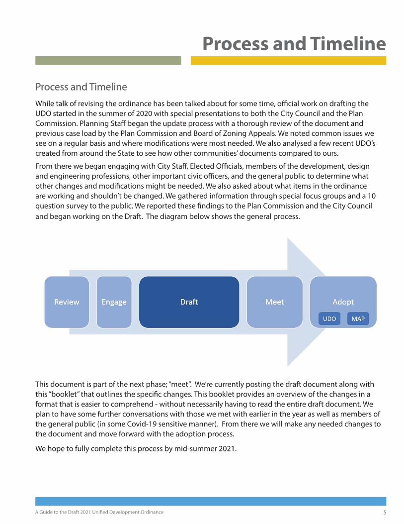
Process and TimelineProcess and TimelineWhile talk of revising the ordinance has been talked about for some time, offi cial work on drafting the UDO started in the summer of 2020 with special presentations to both the City Council and the Plan Commission. Planning Staff began the update process with a thorough review of the document and previous case load by the Plan Commission and Board of Zoning Appeals. We noted common issues we see on a regular basis and where modifi cations were most needed. We also analysed a few recent UDO’s created from around the State to see how other communities’ documents compared to ours.
From there we began engaging with City Staff , Elected Offi cials, members of the development, design and engineering professions, other important civic offi cers, and the general public to determine what other changes and modifi cations might be needed. We also asked about what items in the ordinance are working and shouldn’t be changed. We gathered information through special focus groups and a 10 question survey to the public. We reported these fi ndings to the Plan Commission and the City Council and began working on the Draft. The diagram below shows the general process.
This document is part of the next phase; “meet”. We’re currently posting the draft document along with this “booklet” that outlines the specifi c changes. This booklet provides an overview of the changes in a format that is easier to comprehend - without necessarily having to read the entire draft document. We plan to have some further conversations with those we met with earlier in the year as well as members of the general public (in some Covid-19 sensitive manner). From there we will make any needed changes to the document and move forward with the adoption process.
We hope to fully complete this process by mid-summer 2021.
Process and Timeline

What is “Subdivision Control?”
Subdivision Control is the set of rules and regulations that guides the division of property. This includes small divisions (such as dividing a lot in two) but also large divisions that create entire neighborhoods, or large commercial developments or industrial parks. The Subdivision Control Ordinance portion of the UDO contains rules about street design, lot layout, fi re hydrant locations, street lights, drainage, and (new to this update) provision of the communal postal boxes now being required by the US Postal Service in new residential subdivisions.
6 Jeff ersonville Department of Planning & Zoning
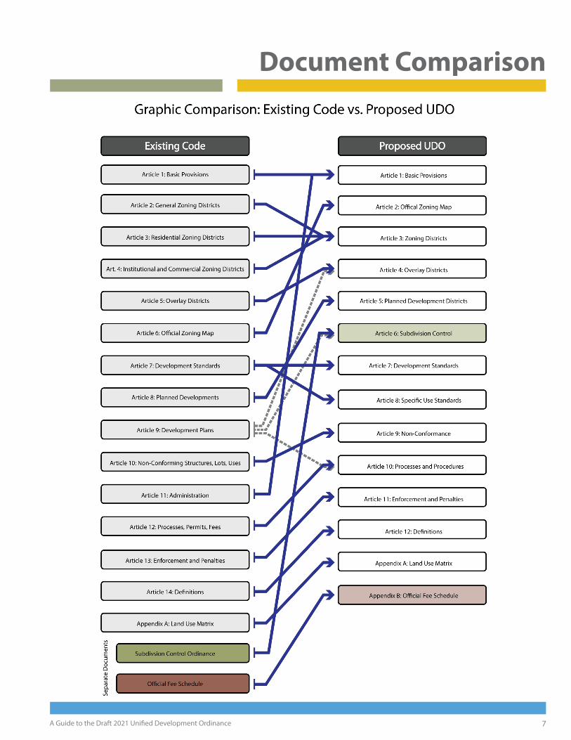
In creating the Unifi ed Development Ordinance, we started with the basic framework of the existing zoning ordinance and looked at ways to shift and reorganize the component parts to make a more streamlined document that includes the Subdivision Control Ordinance as well as the Offi cial Fee Schedule. The graphic on the next page shows a comparison of the existing codes and how we’re bringing them together in one document. Many of the existing articles are transferred directly into the UDO, while others are being combined or split into component parts. The resulting document should look and function just like the old ordinances, even though their components
have been rearranged slightly.
Some changes of note:
• Article 1 “Basic Provisions” and Article 11 “Administration” from the existing zoning code have been combined in
the new UDO.
• The two-page layouts for all zone districts (now in Articles 3 & 4) and the general zoning district information
(now in Article 2) have been combined into one article.
• Article 7 was split in two. Article 7 now focuses on standards that are generally applicable to all zone districts (e.g. parking, landscaping, signs, etc.), while Article 8 focuses on standards that are use-specifi c (e.g. gas station
standards, home occupation standards, etc.).
• Article 9, Development Plans, was split three ways as its various content was directly applicable to other parts of the ordinance. For example, many of the overlay district standards were in Article 9 and they made much more
sense grouped with the language and material in the article on Overlay Districts.
For clarity sake, there are a few smaller moves, not pictured here. One such example is the “height standards” found in Article 7 of the existing ordinance. The existing height standards were more of an overall “defi nition” rather than specifi c district based standards. We felt that moving the information to Article 3 where we had other “defi nitions” for District Development Standards made logical sense.
With the revised layout we feel the new UDO is actually a bit more streamlined than the existing zoning code, even though we’ve added in an entirely new section - namely the subdivision control ordinance.
Document Comparison
7A Guide to the Draft 2021 Unifi ed Development Ordinance
Document Comparison

Why R4?In the existing zoning code R3 is designated “Old City Residential,” and is intended to guide residential development in the more historic parts of town. Over the years, however, this zone district has crept into other parts of the city via rezoning. In order to build in some additional allowances for Downtown properties without impacting suburban ones, we felt we needed to create a new “Old-City” zone district. R3 properties in the Downtown area will be changed to R4 with adoption of a revised zoning map as part of this process.
8 Jeff ersonville Department of Planning & Zoning
Another overarching change in the new UDO is a slight reworking of the zone district naming system. In the existing code each district is given a two digit code (e.g. C1, DC, R1, IS, etc.) and a colored icon. These districts are grouped in the document by general classifi cation (commercial, industrial, residential, etc.) but are not alphabetized making some of them a bit hard to fi nd. To make things easier, staff decided to change a few of the zone district names for the sake of allowing us to alphabetize all the zone districts within the document and (while doing so) keep general classifi cations like “commercial” and “industrial” grouped together. For example: OC (Offi ce Commercial) in the old code would not be next to C1 or C2 (other commercial districts) if alphabetized. By changing OC to CO, we can now alphabetize them and keep all the commercial districts grouped together.
In order to better coordinate with the offi cial zone map, we’ve also updated the color scheme so that the icons within the UDO now match the colors found on the zoning map. The chart below shows the changes.
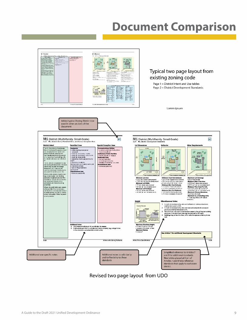
One of the defi ning features of the existing zoning code is the “two-page layout” for each zone district found in Articles 3 & 4. The two page layout describes the intent, allowed uses, and the primary development standards for each zone district. This layout presents all the primary information in one easy to use place and even contains graphics to help folks understand the standards presented. The new UDO retains this feature, but modifi es it slightly in order to add additional clarifi cations and modifi cations to the standards. The changes can be seen in the diagram on the following page.
Two-Page Layout
Zone Districts - Before and After
9A Guide to the Draft 2021 Unifi ed Development Ordinance
Document Comparison
Why is “fl exibility” so important?Development is diffi cult. If it was easy, everyone would be doing it, right? Rigid standards work great if all your land is perfectly fl at and perfectly rectangular, but that just isn’t the case. In the real world, there are oddly-shaped parcels, slopes, watercourses, utility lines, and a number of other obstacles that developers must work around. When rigid standards run up against unusual terrain or other infrastructure, developers must apply for “variances”. Adding fl exibility in to some of the dimensional standards allows well-designed development to occur without having to go through the variance process. It can also lead to preservation of natural landscapes and the creation of public open spaces.
10 Jeff ersonville Department of Planning & Zoning
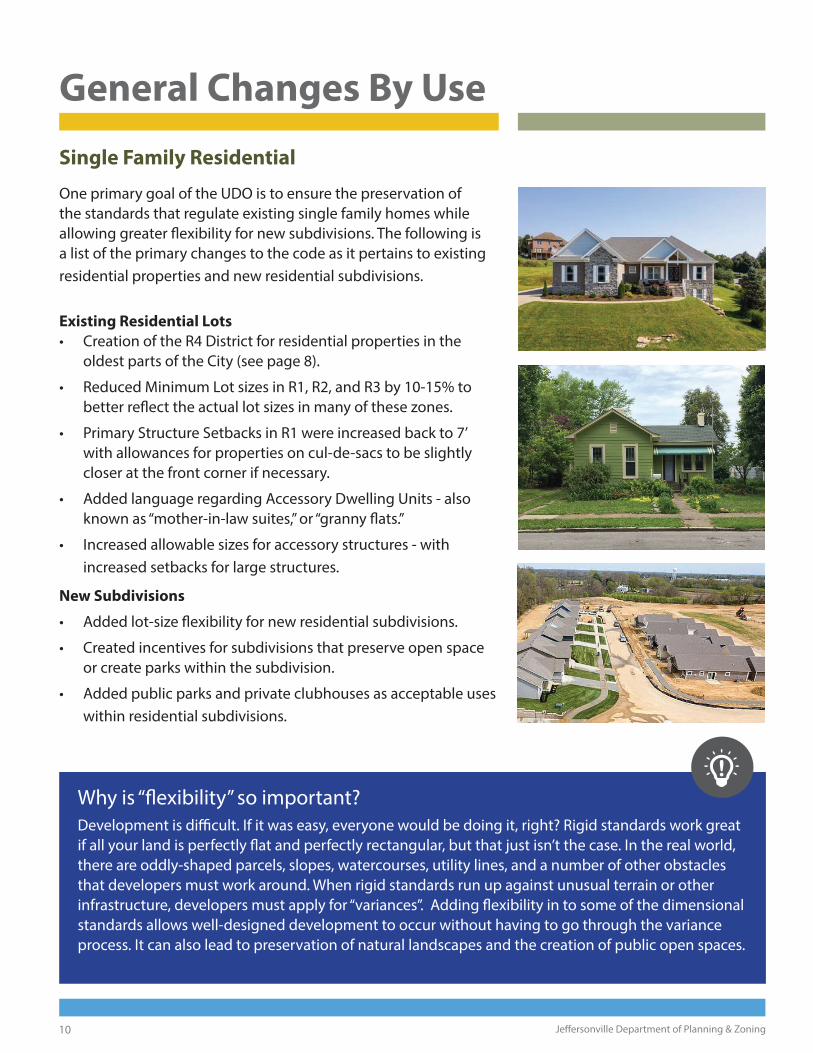
Single Family Residential
One primary goal of the UDO is to ensure the preservation of the standards that regulate existing single family homes while allowing greater fl exibility for new subdivisions. The following is a list of the primary changes to the code as it pertains to existing residential properties and new residential subdivisions.
Existing Residential Lots
• Creation of the R4 District for residential properties in the oldest parts of the City (see page 8).
• Reduced Minimum Lot sizes in R1, R2, and R3 by 10-15% to better refl ect the actual lot sizes in many of these zones.
• Primary Structure Setbacks in R1 were increased back to 7’ with allowances for properties on cul-de-sacs to be slightly closer at the front corner if necessary.
• Added language regarding Accessory Dwelling Units - also known as “mother-in-law suites,” or “granny fl ats.”
• Increased allowable sizes for accessory structures - with increased setbacks for large structures.
New Subdivisions
• Added lot-size fl exibility for new residential subdivisions.
• Created incentives for subdivisions that preserve open space or create parks within the subdivision.
• Added public parks and private clubhouses as acceptable uses within residential subdivisions.
General Changes By Use

Why eliminate the Density standards?Most regulation deals with the scale and intensity of development and somehow over the years “Density,” the number of dwelling units per acre, has been equated with scale and intensity. The problem is that density is not necessarily related to scale at all. Case in point: The small 1920’s bungalow-style apartment building in Claysburg (above left) has 23 units on half an acre. As such, its density is 46 dwelling units per acre. The large, 12-builidng complex shown on the right covers 15 acres, but its density is only 17 dwelling units per acre. The scale is big, but the density is small in comparison to the neighborhood-scale apartment building in Claysburg.
By putting maximum caps on density, we make it easier for large sprawling apartment projects to occur, and harder for compact, neighborhood-scale projects to happen. It also means wasting space. If the apartment complex on 15 acres was designed in a similar manner to the Claysburg apartment building, it could house almost three times as many people and it would have a much higher assessed value (which would generate signifi cantly more tax revenue).
By eliminating the Maximum Density standard, Staff feels we have the opportunity to get better designed, more compact development. Ultimately other standards on height, parking, amenities and landscaping and such will ensure that developments do not get over-crowded.
11A Guide to the Draft 2021 Unifi ed Development Ordinance
Looking back over our records, every new multi-family residential development in the last 5 years has needed a parking and/or density variance from our code. In cases where every project needs a variance, its a good indicator that our code needs to be adjusted. Here are the primary adjustments that we’ve made to multi-family housing in the UDO:
• Eliminated the Maximum Density standard (see below). The diff erences between M1, M2, & M3 will be defi ned by number of buildings and/or number of units in the development (in other words, project scale rather than density).
• Overhauled the amenity standards and made them mandatory for M2 as well as M3 developments.
• Allowed multi-family residential as an permitted use in C2 zones and a special exception use in C1 zones in order to create options for revitalization of commercial corridors.
• Built in more fl exibility on parking requirements (see page 17).
Multi-Family Residential
General Changes By Use
12 Jeff ersonville Department of Planning & Zoning
General Changes by Use
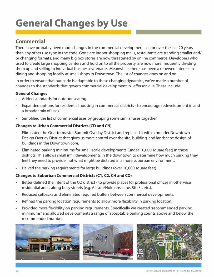
CommercialThere have probably been more changes in the commercial development sector over the last 20 years than any other use type in the code. Gone are indoor shopping malls, restaurants are trending smaller and/or changing formats, and many big box stores are now threatened by online commerce. Developers who used to create large shopping centers and hold on to all the property, are now more frequently dividing them up and selling to individual businesses/tenants. Meanwhile, there has been a renewed interest in dining and shopping locally at small shops in Downtown. The list of changes goes on and on.
In order to ensure that our code is adaptable to these changing dynamics, we’ve made a number of changes to the standards that govern commercial development in Jeff ersonville. These include:
General Changes
• Added standards for outdoor seating.
• Expanded options for residential housing in commercial districts - to encourage redevelopment in and a broader mix of uses.
• Simplifi ed the list of commercial uses by grouping some similar uses together.
Changes to Urban Commercial Districts (CD and CN)
• Eliminated the Quartermaster Summit Overlay District and replaced it with a broader Downtown Design Overlay District that gives us more control over the site, building, and landscape design of buildings in the Downtown core.
• Eliminated parking minimums for small-scale developments (under 10,000 square feet) in these districts. This allows small infi ll developments in the downtown to determine how much parking they feel they need to provide, not what might be dictated in a more suburban environment.
• Halved the parking requirements for large buildings (over 10,000 square feet).
Changes to Suburban Commercial Districts (C1, C2, CH and CO)
• Better defi ned the intent of the CO district - to provide places for professional offi ces in otherwise residential areas along busy streets (e.g. Allison/Holmans Lane, 8th St. etc.).
• Reduced setbacks and eliminated required buff ers between commercial developments.
• Refi ned the parking location requirements to allow more fl exibility in parking location.
• Provided more fl exibility on parking requirements. Specifi cally we created “recommended parking minimums” and allowed developments a range of acceptable parking counts above and below the recommended number.
13A Guide to the Draft 2021 Unifi ed Development Ordinance
Other Districts
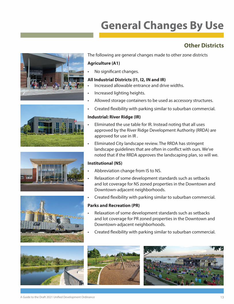
The following are general changes made to other zone districts
Agriculture (A1)
• No signifi cant changes.
All Industrial Districts (I1, I2, IN and IR)
• Increased allowable entrance and drive widths.
• Increased lighting heights.
• Allowed storage containers to be used as accessory structures.
• Created fl exibility with parking similar to suburban commercial.
Industrial: River Ridge (IR)
• Eliminated the use table for IR. Instead noting that all uses approved by the River Ridge Development Authority (RRDA) are approved for use in IR .
• Eliminated City landscape review. The RRDA has stringent landscape guidelines that are often in confl ict with ours. We’ve noted that if the RRDA approves the landscaping plan, so will we.
Institutional (NS)
• Abbreviation change from IS to NS.
• Relaxation of some development standards such as setbacks and lot coverage for NS zoned properties in the Downtown and Downtown-adjacent neighborhoods.
• Created fl exibility with parking similar to suburban commercial.
Parks and Recreation (PR)
• Relaxation of some development standards such as setbacks and lot coverage for PR zoned properties in the Downtown and Downtown-adjacent neighborhoods.
• Created fl exibility with parking similar to suburban commercial.
General Changes By Use

14 Jeff ersonville Department of Planning & Zoning
Specifi c Changes
This last section discusses some of the more specifi c changes within the document by Article. We aim to provide a broad overview here. There are numerous small revisions throughout the document including the correction of spelling, grammar, and numerical errors, clarifying confusing language, formatting changes, etc. that are not necessarily spelled out here. Also, for the sake of brevity, we have not included every specifi c detail of the changes made.
Article 1: Basic Provisions
• Updated language and dates as necessary for the new ordinance.
• Added a couple of general provisions formerly in Article 2.
• Added all information previously contained in Article 11 “Administration.” This primarily includes the summary of powers of City Council, Plan Commission and the Board of Zoning Appeals.
• Granted Plan Commission the right to make modifi cations to any of the standards in Article 7 during the plan review process. This includes items like signs and landscaping (which they already could grant) but now includes items such as accessory structures, fences, lighting, and parking. Variance to any other standards in the ordinance shall be made by the BZA. We feel that this will free the BZA of a number of cases involving the minutia of site design. So they can focus on more important items such as variance from primary development standards (height, setbacks, lot coverage, etc.) and any special use standards (now in Article 8).
Article 2: Zoning Map (previously Article 6)
• No signifi cant changes made.
Article 3: Zone Districts
• This article combines information formerly in Articles 2, 3 & 4.
• Alphabetized all zone districts and updated descriptions as needed.
• Added additional defi nition information for the District Development Standards listed.
• Added a general provision on the requirement for water and sewer hookups - previously on the two-page layouts.
• Slightly modifi ed the two-page layouts (see page 8-9).
• Modifi ed use tables and Development Standards tables as discussed on pages 10-13.
Article 4: Overlay Districts
• This article is a combination of information formerly found in Articles 5 and 9.
• Reorganized the Article to combine all overlay district information in one place and alphabetized all overlay districts for ease of reference.
• Reformatted all overlay districts to create consistency between each district and added general maps to each district.
• Added language regarding the Jeff ersonville Historic District to this Article.

15A Guide to the Draft 2021 Unifi ed Development Ordinance
Specifi c Changes
Article 4: Overlay Districts (continued)
• Created a Downtown Design Overlay District (DDOD) that gives us more control over the site, building, and landscape design of buildings in the Downtown core and the Spring Street Corridor in Claysburg (see above). The standards in this district do not apply to Single Family homes within the District. The design language for this district is based largely on Greenwood Indiana’s design code.
• Removed the Quartermaster Summit Overlay District (as its now contained within the DDOD).
• Removed design language from the Downtown Res. Overlay District (now contained in the DDOD).
• Removed portions of the Commercial Corridor Overlay District now located in the DDOD so we do not have overlapping standards.
• Revised the boundaries of the Commercial Corridor Overlay District to 1) be more parcel specifi c, 2) include some additional commercial areas in Jeff (such as the 8th and Middle area) and 3) exclude Hamburg Pike between the DDOD and Charlestown New Albany Road, which is mostly residential, institutional, or industrial rather than commercial.
• Modifi ed the Commercial Corridor Overlay District standards for entrances and drives, building materials and sidewalks. Also removed language requiring pitched roofs.
• Slightly modifi ed the boundaries of the Utica Pike Overlay District (UPOD) to include some parcels we felt were missing from the overlay.
• Clarifi ed a number of items in the UPOD including exempting single family homes from fees associated with development plans, and clarifying language regarding tree preservation and scenic views.
16 Jeff ersonville Department of Planning & Zoning
Specifi c Changes
Article 5: Planned Developments (previously Article 8)• Staff completely overhauled the language in this section as the language was rather cumbersome,
and ultimately not well implemented within the City over the last two decades. The new language is a hybrid of the Planned Development Standards found in the UDO’s for Greenwood and Richmond, Indiana.
Article 6: Subdivision Control
• Most of this article is from the 1996 Subdivision Control ordinance and its subsequent revisions. Bits of the new article come from Articles 7 and 9 of the existing Zoning Code.
• Revised defi nitions of Major vs. Minor plats. Minor plats may now include up to 4 parcels, as long as there is no new roadway or land dedicated to the City for other utilities. This is a fairly standard practice in several of the communities we’ve researched for this project.
• Added procedural information on both major and minor plats - including requirements for submittal.
• Updated standards for subdivision layout, easements, street lights, street design, fi re hydrants, etc. with guidance from the City Engineers, Drainage, Wastewater and the Fire Department.
• Added and modifi ed language regarding the creation of “conservation subdivisions” (formerly in Article 9). The new language should make it easier for developers to set aside parks and open space in new subdivisions in exchange for smaller lots elsewhere on site.
Article 7: Development Standards
• This article contains a large portion of the information formerly in Article 7.
What’s a Conservation Subdivision?A Conservation Subdivision a new residential (or mostly residental) community that sets aside a certain percentage of natural open space or parkland in exchange for smaller lots and more compact development elsewhere on the site. Conservation subdivisions can help preserve existing forests, fl oodplains, ponds, or other natural or historic features on the property. Ellingsworth Commons is a good example of a Conservation Subdivision in Jeff ersonville, setting aside nearly 40 acres of parks and open spaces when complete.
• Alphabetized all sub-articles in this chapter for ease of reference.
• Added a table at the beginning of the Article, showing which standards in this section apply to which zone districts - a similar table was formerly found in the two page layout for each zone district.
• Modifi ed size standards for accessory structures in residential districts. Added notes about mechanical equipment (e.g. generators) in all other districts.
• Completely updated the amenity standards for Multi-family residential. Rather than requiring specifi c amenities, the new language creates a “point system” for the provision of amenities. New developments will need to earn a certain number of amenity points based on the number of units. These can be earned by providing any combination of the amenities listed in this section. Previously this only applied to M3 properties. We have now required this for M2 properties as well.
17A Guide to the Draft 2021 Unifi ed Development Ordinance
Specifi c Changes
Article 7: Development Standards (continued)
• Increased allowable entrance drive widths in industrial districts.
• Grouped “Floodplain Standards” in with other “Environmental Standards” and modifi ed them to be consistent with the most current policy (City and State) regarding fl oodplains.
• Added the Fee In-lieu of Landscape ordinance language to the landscape code in this article.
• Added notes about species diversity in landscape plans.
• Exempted projects in River Ridge from landscape review (as discussed on page 13).
• Noted that Buff er Yard trees may count toward some of the required minimum plantings on site. Previously they were added on top of the required trees, leading to over-planting and/or needless waiver requests.
• Added R4 to the buff er yard chart.
• Increased the allowable height for site lighting in industrial districts.
• Added Outdoor Seating Standards - we get questions on this from time to time, but have not had any rules about it.
• Modifi ed parking requirements for M2 & M3 properties to allow for a bit more fl exibility. Allows developer to choose between the current standard (1.5 spaces per unit) or an option to provide parking by unit type (1 space per studio or 1 bedroom unit and 1.75 spaces per unit with more than one bedroom). Senior housing/assisted living facilities may reduce parking requirements to .66 spaces per unit.
• Modifi ed parking requirements for increased fl exibility in commercial, industrial, and institutional zone districts as noted on page 12.
• Excepted properties on Riverview Drive (upriver from Duff y’s Landing) from RV standards. Due to regular fl ooding issues we have generally allowed RV’s to be parked here so long as they can be moved in the event of a fl ood.
• Clarifi ed language and changed some rather outdated standards regarding electronic signage. The changes match Clarksville’s sign ordinance.
• Allowed marquee-type signs to project slightly above the roof line of a building.
• Allowed slightly larger signs for apartment complexes, and additional signage for community spaces within residential subdivisions and apartment complexes (e.g. clubhouse, community park, etc.).
• Clarifi ed language and slightly increased allowable signage for NS and PR zoned properties.
• Excepted monument signs for large multi-tenant commercial buildings from counting towards the maximum allotted building signage, and increased allowable height to 10 feet (previously 8).
• Removed permitting requirements for Temporary Signs - as almost no businesses in the City ever apply for temporary signs, and we do not have capacity to track who is putting up signs, when, and for how long. Other communities such as Fort Wayne have eliminated permits for Temporary Signs for this reason. The rules about type and size and location remain.
18 Jeff ersonville Department of Planning & Zoning
Specifi c Changes
Article 8: Special Use Standards
• The information in this Article was previously in Article 7. The reason for this separation was discussed on page 14 in Article 1.
• Alphabetized all sub-articles in this chapter for ease of reference as we did in Article 7.
• Added a table at the beginning of the Article, showing which standards in this section apply to which zone districts - a similar table was formerly found in the two page layout for each zone district.
• Added special standards for accessible dwelling units (these are based on Greenwood, IN)
• Combined the three types of auto sales businesses into two (as two types were identical) as follows: Auto Sales with limited services and Auto Sales with full showrooms and/or services. This change from 3 to 2 types was updated in the use tables in Article 3 and in the Use Matrix in Appendix A.
• Cleaned up a bit of language regarding sales of fi reworks.
• Completely revised the Telecommunication/Wireless Facility Standards to comply with twenty years of change in the telecommunications industry and the regulation thereof. We have based this text off another recently drafted ordinance and text given to us by a professional code consultant working in Indiana.
• Added the language regarding substance abuse treatment from 2020-OR--41 as recently amended.
Article 9: Nonconformance (previously Article 10)
• Added clearer defi nitions between Illegal nonconforming and legal nonconforming structures.
• Added burden of proof language for legal nonconforming structures.
• Modifi ed language regarding damaged structures, to conform with Indiana SB 100 passed in 2020
Article 10: Processes and Procedures (previously Article 12)
• Outlined all actions that require an application
• Revised notifi cation language as follows: Notifi cation will be given to all adjacent properties and all properties within 660 feet (1/8 mile) of the property boundary line. (This is a simpler process for staff and consistent with many other communities in Indiana.)
• Added a “sunset provision” - If no work has commenced after 3 years, a new permit will be required.
• Added some additional language regarding installation of landscaping for certifi cates of occupancy
• Added language regarding our Certifi cate of Zoning Compliance for new businesses (2016-OR-88)
• Better defi ned which projects must apply for Development Plan Approval and clarifi ed a number of the requirements/procedures involved in the development plan approval process.
• Revised the list of projects that require an improvement location permit.
• Added the Mobile vendor/transient merchant language from (2014-OR-26) most recently amended this past November (2020-OR-57).
• Noted that processes and procedures for planned development districts are in Article 5.
• Noted that all processes and procedures for plats (major and minor) are in Article 6.
19A Guide to the Draft 2021 Unifi ed Development Ordinance
Specifi c Changes
Article 10: Processes and Procedures (cont.)
• Clarifi ed some language about sign permitting.
• Clarifi ed some language about applying for a special exception.
• Completely overhauled language about permitting telecommunications and wireless facilities to comply with twenty years of change in the telecommunications industry and the regulation thereof. Like the information presented in Article 8, this language is pulled together from a number of other recently drafted codes in the state.
• Added language stating requests for Development Standards Variances, Use Variances, and Zoning Amendments require public notice per Indiana code.
Article 11: Enforcement and Penalties (previously Article 13)
• Modifi ed the fi nes and penalties for notice of violation and created separate fees based on type of use.
Article 12: Defi nitions (previously Article 14)
• Added and modifi ed defi nitions as needed throughout this Article.
Appendix A: Land Use Matrix
• Modifi ed as needed per changes in Article 3.
Appendix B: Schedule of Fees
• Added this fee schedule - previously not in this document - No changes made to any of the fees.
• Added Landscape In-lieu fees to the fee schedule.
The Department of Planning and Zoning hopes that this overview has been helpful in understanding the changes being proposed in our endeavor to create a new Uniform Development Ordinance for the City of Jeff ersonville. We realize that this may seem like a lot of changes, but we feel that the overall impacts of these changes will not be as big as they seem.
Please note that this draft is not the fi nal document, and we will make revisions and such as necessary based on the comments and concerns we receive from the community.
If you have any further questions, please do not hesitate to reach out to our offi ce.
City of Jeff ersonville Department of Planning and Zoning500 Quartermaster Court Suite 200Jeff ersonville, IN 47130812-285-6413www.cityofj eff .net/planning-and-zoning
City of Jeff ersonville Department of Planning & Zoning500 Quartermaster Court Suite 200Jeff ersonville, IN 47130812-285-6413www.cityofj eff .net/planning-and-zoning