a history of stella mines
TRANSCRIPT

A HISTORY OF STELLA MINES
Compiled by Stuart Casanova159 Riverledge RoadHammond, NY.February 1995.

CONTENTS
Preface Pg. 2
Geologic Map Pg. 6
Old Tax Map Pg. 7
Underground Maps Pg. 8
1995 Surface Map Pg. 15
1995 Mill Area Map Pg. 17
Old Photos of Stella Mines Pg. 18
1995 Photos of Stella Mines Pg. 30
"Stella Mine" by Rebecca C. Brunet, April 2, 1963. (This paper includes a number of interesting people oriented stories about the life and times of Stella Mines). Pg. 68
"Stella Mines 1917-1921" by Dr. Rutherford Delmage, dated February 23, 1987. (His Stellaville recollections). Pg. 70
"Durban Memo" by W.B.Gunnison, October 1, 1977. (This is a note about the Danish family of the chemist at Stella Mines). Pg. 71
"Notes on Frank Vergare" by Walter Gunnison, 16 Apr 1975. (An interesting visit with an Italian immigrant who spent 15 years at Stella mines). Pg. 72
"A Visit with Lelland Young" by Stuart Casanova(Recollections of a long time Hermon resident). Pg. 74
"Stella Mines 1904-1920" by Daniel P. Vining, 30 April 1987. (An excellent account of Stella Mines). Pg. 75
"Pyrite Deposits of St. Lawrence and Jefferson Counties, New York" byJohn J. Prucha, NYS Bulletin 357, 1957. (A technical description of the geology and operations of the Stella Mine). Pg. 83
2

PREFACE
This paper is based on a talk given by Stuart Casanova at the Hermon Library on May 20, 1995.
I wish to thank Robert Browning, the present owner of Stella mines for his permission to tour the mine site and take photographs of the area.
Thanks also to Mary Smallman, Frank Lewis and Lelland Young for their valuable contributions to this paper.
St. Lawrence County in New York State has a number of mineral deposits which include iron, talc, zinc and pyrites. Pure pyrite, called Fools Gold, is the chemical Iron Sulfide . The sulfur component of pyrites was mined extensively in the 1800's and early 1900'sfor the manufacture of sulfuric acid.
Stella Mines located between DeKalb Junction and Hermon became the largest producer of pyrites in New York State. Between 1904 and 1920 more than 500,000 tons of ore concentratewas produced there. That concentrate averaged 40 % elemental sulphur. The amount of ore concentrate shipped out would have been the equivalent of a 90 foot by 90 foot base ball diamond piled 1000 feet high. There are extensive tailings left at Stella Mines, but the mill concentrating process left only 2 % sulphur in the tailings. Due the acidic nature of the ore beds, the pyrites are not nice "gold" crystals, but are clumps of rusty pyrite grains. The ore bodies averaged about 10 feet thick and extended about 1000 feet in width. The mines were ata downward angle of 20 to 40 degrees in a northwesterly direction, and were worked down to a depth of 900 feet. The mines continued until 1920 when practically pure sulphur became available from Gulf Coast deposits in Texas.
My interest in Stella Mines goes back to my grandfather, Frank N. Casanova. He had been aminer in Ironwood, Michigan before he enlisted in the 34th Michigan Volunteers in the Spanish-American War of 1898, where he fought at Santiago, Cuba. From 1900 to 1903 he operated a silver mine in Tezuitlan, Mexico. In 1904 he became Superintendent of Stella Mines. At that time, the St. Lawrence Pyrite Company was under the control of the Landenburg, Thalman and Company of New York. The company had agreed to pay the owners of the property 10 cents a ton on all ore mined and at least $75 every 60 days. Frank Casanova supervised the building of a new mine on the Stella Vein and another on the Anna Mine which lies about 1200 feet to the southeast. A new mill and railroad was built to concentrate and transport the ore. The settlement of Stellaville became a thriving community reaching a population of several hundred.
Frank N. Casanova's oldest son, Walter, said, "We lived in Hermon for a year and then moved to a new house built at Stella Mines. I started school in the one roomer between Stella Mines and DeKalb Junction (the Acres School, now torn down). Later we went to the Hermon School." (Stuart Casanova is the son of Walter). Walter's mother, Helena, said that she was always worried because he would go off wandering about the mine area and she was afraid
3

that he would fall down a shaft. Helena also told the story that while living at Stella Mines there was a boy who was Catholic and wore a St. Christopher medal. He and Walter went swimming in the pond at the nearby dam on Elm Creek. He loaned Walter the medal - who then jumped into the water and was able to dog paddle and learned to swim for the first time. Walter remembered that his father showed him the house where the explosives were stored and told him never to play around there.
Their second oldest son, Carl Casanova was born on December 17, 1906 at their home on Canton Street in Hermon. They later moved to a new house that was built at Stellaville. A story has been passed down that Carl, who was about five years old at the time, got a scolding for throwing stones down the Anna shaft. Their third son, Gilbert was born in that house in Stellaville June 17, 1912.
Frank N. Casanova's youngest son, Frank E. Casanova, recalls the following stories that hadbeen told to him: "Once at Stella Mines a car of waste was being hoisted when Dad saw a unusual piece of ore on it and he jumped on to remove it. The car started suddenly before he could jump off, throwing him off backward down the shaft. He managed to grab hold of a ladder, butsuffered torn ligaments. Another time an ore bucket was coming up not fully loaded. Dad jumped on to inspect it. Through the carelessness of the operator the car started and to avoid a beam in the shaft Dad had to let the car run over his legs. He was bruised but not broken.I remember Mom saying Dad would bring home the diamond drilling point and throw it in thewoodbox behind the stove for safekeeping. In Stellaville the mine chemist was Peter Durban - The story has been passed down that he had been a sailor on a Danish warship and had heard the officers tell of the good wine to be had in Leghorn, Italy. So when they visited that port Durban smuggled a bottle aboard. When he got around to sampling it he found it tasted like oil, so he took it back to the store where he had bought it and broke it on the door. When he related the experience to the officers they told him that to keep the air from the wine there was always an inch or two of olive oil on top, which had to be poured off carefully."
Helena Casanova continued a correspondence with the Peter Durban's wife, Anna, after she returned to Denmark. The Casanova boys kept some of the Danish stamps which they pasted into a notebook.
Here is one of them.
4

Frank Casanova's cousin , Angelo C. Casanova came with his wife and children from Campolongo, Beluno, Italy and worked there until 1918. The composition of Angelo's family can be seen in the 1915 Census records for DeKalb, St. Lawrence Co.
An article located by Mrs. Mary Smallman in the Commercial Advertiser said : James Morrisey drowned at the St. Lawrence Pyrites Co. in Hermon when he fell in a mine skip "landing in 100 feet of water, couldn't swim.
In 1914 my grandfather left Stella Mines and became mine captain at the zinc mines in Edwards, NY for the Northern Ore Company.
Frank Casanova's wife, Helena, visited Stella Mines with her son Carl, his wife Marion and his daughter Nancy. In a letter from Edwards dated September 4, 1946 Helena said: " Carl, Marion and Nancy came up Friday night. Saturday Carl had business in Potsdam so we all went along. It was a lovely day and on the way back we stopped at Stella Mines. I wanted to show Nancy the house where her Daddy and Uncle Gibby were born, but lo and behold we couldn't find it. I don't know whether it was moved away or burned down. After fighting my way through the weeds waist high and ruining a perfectly good pair of stockings I found the foundation and cellar with six foot trees growing out of it. Up on the sidehill was one scrubby apple tree from some grand-pa planted forty years ago, so I picked about a dozen crippled apples from it. Of a once thriving Mining village there are four shacks ready to fall apart. I was awfully sorry we stopped. I'd rather not have seen it. That mine was working up to 26 years ago and I didn't think anything could go back to nature so quickly, in the South Pacific yes, but not in this cold northern climate."
5

(Note -- The maps and photographs may be expanded by using zoom magnification.)
GEOLOGIC MAP
Geologic map from "Pyrite Deposits of St. Lawrence County and Jefferson Counties, New York" by John Prucha, New York State Museum and Science Service Bulletin Number 357.
6

TAX MAP
This Tax Map from the St. Lawrence County Clerk's Office of "Stella Mines, DeKalb, NY" was probably made about 1890 after the first pyrites were mined in Stellaville. Mine No.1, Mine No.2, and a power house are shown on a road on a road to the west. These mines stopped operating in 1898. The location of Mine No.1 is close to the Stella mineshaft that was sunk in 1905. On the right side of the map Elm Creek runs from bottom to top. The old grist mill is shown in the lower right with the words "Tillapaugh 139B1149". E.A. Tillapaugh's house is shown in the bend of the creek. The house of "Chas. Noble" shownopposite the dam, later became the location of the Office, Laboratory and Storehouse of Stella Mines.
7

UNDERGROUND MAPS
This is the first of a series of maps showing the underground workings of the mines. These maps were made in 1909 and were found by Frank Lewis in the walls of his garage in Hermon. This map shows the No 1 and No. 2 shafts and the mined out areas.
8

This is a map of the Anna Mine Level 2 and shows shafts No. 4 and No. 7.
Lelland Young remembered seeing miners entering and leaving the mine via the airshaft, which is shown pointing upwards under the X.
X
9

This is a map of Level 3 in the Anna Mine.
10

This is Level 4 of the Anna Mine.
11

12

This map shows the complex arrangement of the Anna veins and the mining methods that were used.
13

This drawing shows the vein structure in the vicinity of Anna mine shaft No. 4.
14

1995 SURFACE MAP
On the following page is a surface "Map of Stella Mines" made by the author in 1995. This map shows the roads and contours as they exist today. Rt. 17 has been straightened somewhat and graded more gently since the active mining days of Stellaville. For example, the main roadis now much closer to the Anna mine than it was. The old road is shown in dashed lines. The new road (shown in orange) has also been graded higher in elevation and now covers many houses as well as the Mine Office. The contour lines on the map are shown in 20 foot intervals, i.e., 400, 420, 440, 460, 480, 500, etc., and represent elevation in feet above sea level. Map coordinates are shown on the left and bottom margins. The Pyrite Veins are shownin yellow, and Elm Creek in blue
Using the map coordinates find --
Stella Mine #1 at 7-B, Stella Mine #2 at 4-B, Anna Mine #4 at 8-G, Anna Mine #7 at 9-G, the Mill at 7-C, the railroad turntable at 5-C, the dam and old grist mill on Elm Creek at 5-G, and the Cave-In at 7-G.
On the right side of the map are shown the location of former houses, numbered 1, 2, 3, and 4. They were occupied by the following families :
1-- Willis and Stella Wells2-- John Wells3-- Peter and Anna Durban4-- Zephrin (Peter) and Edna Filiatrault. In 1995, Jane Aurelio (Peter and Edna's
daughter) remembered that Peter Durban was a mean man. That when his wife Anna Durban and children left him to go back to Denmark, she gave Jane a glass kitten, and gave Jane's sister a glass hen.
15

16

17

1995 MILL AREA MAP
The Pyrites Mill is now gone and all that can be seen is on this map of the "Stella Mines MillArea". This shows cement foundations of the mill, cement pilings that were probably footings for the three mill elevators, the base of the power house chimney, the stone abutment for the railroad line that brought ore to the mill, and the bed of the railroad that took concentrated ore and tailings from the mill.
18

OLD PHOTOS OF STELLA MINES
The following series of photos 1 through 12 includes old pictures which were obtained from The St. Lawrence County Historical Society in Canton, NY and from Mrs. Mary Smallman, the Historian of Hermon, NY.
Please refer to the 1995 "Map of Stella Mines".
1 : This photo was labeled "Stellaville under construction", and was probably a photo of Mine No. 1 taken around 1884. Mine No.1 operated until 1898. In 1905 a new mine was located here and was called the Stella shaft". An old undated tax map found in the St. Lawrence County Deeds and Records Office in Canton, shows that "Mine No.1" was located about 1500 feet west of the dam on Elm Creek. The old tax map also shows "Mine No.2" located about 600 feet northeast of "Mine No.1".
19

2 : This photo, taken after 1905 is looking north. The mill is the large white building. Note the many houses located at Stellaville, and the road located in the center distance leading to DeKalb.
20

3 : This photo is also looking north. The multi-story building on the left is the "Top House" of the Stella shaft and loading platform. A railroad spur passes in front of the Stella shaft.In the middle of the picture there is a tailings pond. The mill is on the right. On the extreme right edge of the photo a railroad car bringing ore to the mill can be seen just past the smoke stack. The small white building located just this side of the chimney is the power house. The remains of the chimney and the foundation of the steam engine can still be seen. See drawing labeled "Stella Mines Mill Area". On the lower left hand side of the mill is another railroad platform where the concentrated ore and tailings were loaded and then taken from the mill.
21

4 : This photo which is looking northwest shows the back mill, the engine and railroad cars. The bottom dumping cars carried ore from the mine shafts to the upper part of the mill. On theextreme bottom lower left of the photo can be seen part of the stone bridge abutment which is part of the rail road bed. That abutment can still be seen and is shown on the drawing labeled "Stella Mines Mill Area".
22
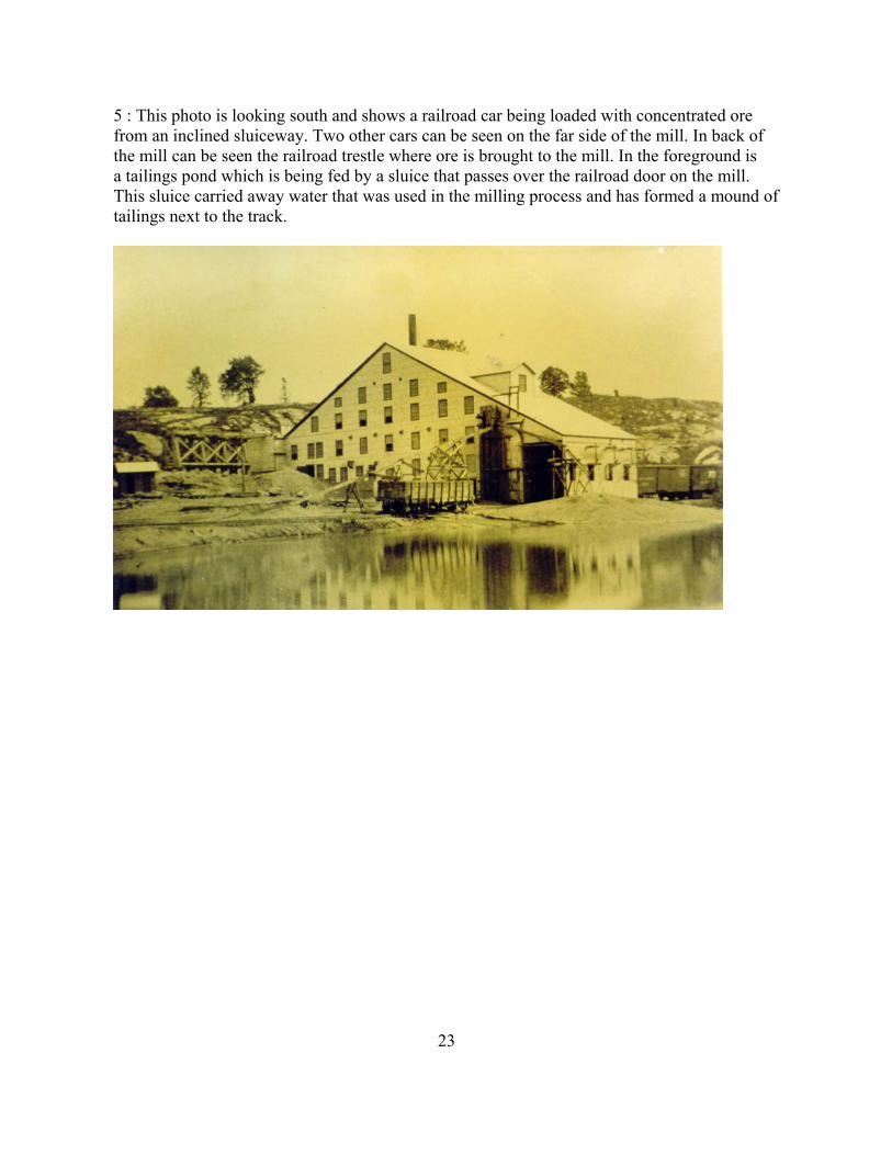
5 : This photo is looking south and shows a railroad car being loaded with concentrated ore from an inclined sluiceway. Two other cars can be seen on the far side of the mill. In back of the mill can be seen the railroad trestle where ore is brought to the mill. In the foreground is a tailings pond which is being fed by a sluice that passes over the railroad door on the mill. This sluice carried away water that was used in the milling process and has formed a mound oftailings next to the track.
23

6 : This view is looking south, and the mill is shown on the left. In the foreground is the roadbed of the main line railroad. This photo was taken several years after the previous photo because the tailings pond has been drained by a ditch on the lower left and an addition has been built on the back of the mill. The tailings at the time of this photo were being dumped by the main road as shown in Photo 13 or at the Tailings Pond which is located above 2000 feet south of the mill. On the horizon on the right side of the photo is the Top House building of the Stella mineshaft which is loading an ore car. Just this side of the spur line for that ore car isanother building with a wing to the right with the door open. This may have been the machine shop, and part of the foundations can still be seen. On the right hand side of the photo in line with the tree, on the far side of the spur line is another building with a large door. This may have been the engine and railcar repair shop. See mound in the center of photo 16.
24

7 : This photo was taken some time after the previous photo and shows the spur line leading off to the mill on the right. Another addition has been added to the back of the mill to cover the railroad unloading platform. On the near side of the mill the simple sluiceway to load the concentrated ore on to railcars has been replaced by a heavy duty loading structure that has been erected to hold concentrated ore until ready for the railroad cars.
25

8 : This is a photo of the Anna Mine top house and is labeled "St. Lawrence Pyrites Co., No. 4 mine, Stellaville". This is the mineshaft building that was located on the "A Vein". The photograph is looking south in the direction of Hermon. The track coming down the side of thebuilding goes directly down into the Anna mineshaft. Loaded ore bucket cars are pulled up this incline to the top of the building and the ore is then loaded onto railcars and then sent to the mill. A railroad car is being loaded from a chute on the left side of the building. A rock cut for the rail road can be seen in the distance - this cut is made through the "Z Vein".
26

9 : This photo of the Anna Mine is looking east and was labeled "Stella Mines, Hermon, NY. Top House No. 4". It shows a number of the miners posing for this picture. It makes you wonder what the occasion was for this event. On the right hand side of the picture a chute has been built which dumps off rock and dirt that was not of ore quality. That rock pile can still be seen as in photos 33 and 44. Photo 35 shows a wheel from an ore car that was recovered from this site.
27

10 : This is the locomotive that was used at Stella Mines. It was driven by Mr. Lephart.
28

11 : This photo was labeled "Office, Laboratory and Storehouse, St. Lawrence Pyrites Company, near Hermon, NY". This building was located on the northwest corner of the entrance road to the mine. See photo 40. Peter M. Durban was the chemist at Stella Mines and his laboratory was in this building. Note the attached "outhouse" on the back of the building. The barn structure has the name "Chas. Noble" on the gable end. He was the owner of this farmland before it became Stella Mines.
29

12 : This photo was taken at Stella Mines about 1907.Front row: Frank N. Casanova and his sons Walter and Carl.Back row: Peter Durban, Anna Durban, Helena Casanova, Gene Tillapaugh.
Gene Tillapaugh owned the property on the east side of the road opposite the mine office. He was a miller and later ran a store at this location. At a later date Joseph Rotundo ran a store here.
30
PHOTOS OF STELLA MINES IN 1995
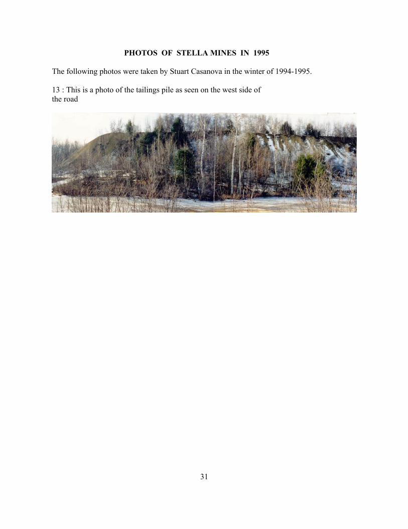
The following photos were taken by Stuart Casanova in the winter of 1994-1995.
13 : This is a photo of the tailings pile as seen on the west side ofthe road
31

To start this tour of the Stella mines area, stop where the high voltage power line crosses Route 17, the climb the embankment on the west side of the road that has been cleared for the power line. Refer to the 1995 "Map of Stella Mines".
14 : This photo is looking southwest along the Power Line from tower A". Tower "B" is in themiddle of the picture. Just beyond tower "B is the main railroad bed from DeKalb to Hermon. Just beyond the second tower in the photo (tower C") can be seen a yellowish mound of rocks, this is the location of the Stella mineshaft.
32

15 : This photo is about 600 feet closer to the Stella mineshaft and is looking southwest from underneath the power line from a point on the spur railroad leading to the mill. Tower "C" is just this side of the yellowish rockpile at the Stella mineshaft. The spur railroad to the Stella mineshaft runs between tower "C" and the yellowish rockpile. Just beyond the grassy area in the foreground is where the old tailings pond was located. This photo was taken from the same point as photo 6. The mill stood on the left behind the evergreen trees. The railroad shed stood between the Stella yellowish rockpile and the solid gray rocks on the right.
33

16 : This photo of the tailings pond was taken about 200 southwest of photo 15. The mound ofdirt in the center of the photo is the location of the machine shop (?) shown in the center foreground of photo 6. The mill would be on the left edge of this photo 16. Note the base of Tower "C" on the right.
34

17 : This photo is looking south. Robert Browning, son of the present owner of this property, is looking at an outcrop of pyrites. He is standing on the railroad bed of the spur line leading to the Stella Mine shaft which is on the right.
35

18 and 19: This is the outcrop of pyrites mentioned in photo 17. This narrow vein of pyrites issilvery-gold in appearance and is composed of tightly compacted pyrite crystals about one eighth of an inch in size. The silvery appearance is probably due to lead sulfide in the vein.
36

20 : This photo is looking south and down into the 20 foot wide opening of the Stella mineshaft. Various debris has been pushed into the opening to reduce accidents.
37

21: This photo is taken about 50 feet back from the Stella mineshaft, which is in the far centerof the picture. The rock pile for the Stella mineshaft is in the foreground. Notice a hammer standing on a rock on the left side of the photo.
38

22 : The hammer in the previous photo sat on the rock in the center of this photo. This close-up photo shows the various types of ore taken from the Stella shaft.
39

23 : The hammer handle is leaning on the main ore vein located in a prospect pit which is located about 60 feet south of the Stella mineshaft. The rock of this rusty pyrites ore vein breaks easily and some has crumbled into the prospect pit.
40

24 : This photo is looking NORTHEAST. The yellowish rock pile of the Stella mineshaft is inthe foreground, and the opening of the Stella mine shaft is 7 inches from the right edge of this photo. The railroad spur to the Stella mineshaft ran just the yellowish rockpile and this side of Tower "C". Beyond tower "C" is the location of the pond seen in photo 5, and beyond that can be seen the railroad beds for the spur line to the mill and beyond that, the DeKalb - Hermon mainline.
41

For the next five photos, please reference the map of "The Stella Mines Mill Area"
25 : This photo is looking southeast in the mill area. Near the left edge of this photo is the masonry buttress which supported the railroad spur to the upper part of the mill. Near the right edge is the base of the power house chimney.
42

26 : This photo is looking northwest from the base of the chimney of the mill and shows some of the cement piers that supported the mill structure.
43

27 : This photo and the next show a masonry channel or aqueduct that lies on the hill east of the mill. That channel probably took water from pond located 2000 feet to the south and brought it to the mill for use in the concentrating process.
44
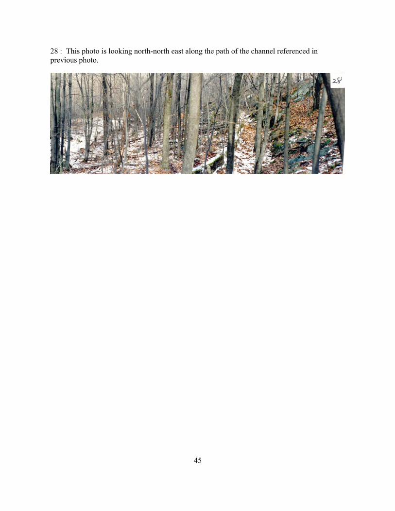
28 : This photo is looking north-north east along the path of the channel referenced in previous photo.
45

Now, go north to the main rail road line rock cut ....
29 : This photo shows the main line rail road rock cut at Stella Mines and is looking southeast toward Hermon. This type of rock is called amphibolitic gneiss. When this rock cut was made,there were no compressor driven air hammers. During this period of time, all of the mining and the making of this rock cut was done by a man swinging a sledgehammer, another holdingthe chisel to make a hole for the blasting powder.
46
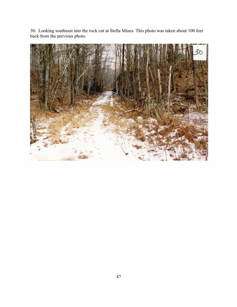
30: Looking southeast into the rock cut at Stella Mines. This photo was taken about 100 feet back from the previous photo.
47

31: This photograph was taken from nearly the same location and direction as Photo 7. The rail road cut can be seen in the upper left corner of the photo. In the middle of the center photo is the cement foundation of a structure. The foundations of the mill are obscured behind the brush in the distance of the right hand photo. In the lower right hand corner a portion of the rail road turntable can be seen.
48

32 : This is a photo of the railroad turntable. The center post of the turntable is about 5 feet in diameter and 6 feet tall. The photo is taken looking north. The main line railroad bed from DeKalb to Hermon runs on the level grassy section in the right side of the picture. The power line tower "A" is shown on the top right. On the lower right of the picture is a cement foundation that may have been the location of the motor that drove the turntable.
49

Now, go south through the railroad cut and follow the railroad bed south about 1000 feet to the rock pile on the mainline of the railroad which went from DeKalb to Hermon ....
33: This is a photo of Kari Ouderkirk standing on the rock pile of the Anna Mine which is on the "A Vein". In the old photos it is called the
"No. 4 Mine". This photo from the railroad bed is looking west, in the opposite direction to old photo 9.
Kari is the great-great granddaughter of Frank N. Casanova.
50

34: This photo is looking south. The cement cap over the Anna Mine shaft is in the foreground. To the right in the background is the Anna Mine rock pile. The Anna shaft went down a distance of 600 feet at about a 45 degree angle. The Anna shaft also provided access to the "B Vein, "C vein" and "Z vein". These veins were worked underground along the path of the ore for a distance of 1800 feet. The ore from theAnna shaft was taken by bottom dumping railroad cars to the upper level of the mill.
51

35 : This is a photo of the cast iron wheel from an ore car that ran on the tracks leading down into the Anna mine shaft, as shown in Photo 8. This wheel is 16 inches in diameter and was used to hoist ore from the depthsof the Anna mine to the "Top House".
52

36 : This is a photo of a rock cut on the "Z vein" which is located along the railroad tracks about 300 feet south of the Anna rock pile. This rock cut can be seen in old photo 8 on the left side of the photo in the distance.
53

37 : Photo looking west where the "Z vein" is exposed in the railroad cut.
54

38 : The "Z vein" from the railroad cut.
55

39 : This is a photo of the cave-in on the "A vein". It is about 100 feet in diameter and 40 feet deep. This cave-in was centered on the airshaft which is shown on the underground map on page 9. The cave-in is also shown on the right side of the mine map, on page 16.
56

40 : The house of Superintendent Frank N. Casanova was on the left, the Mine Office and Laboratory were on the right side of this road.
57

41 : This photo is looking southeast at the falls on Elm Creek. Some of the old mill foundations can just be seen on the left of the photo.
58

42 : This photo is looking northeast across Elm Creek and shows toward the left, the foundations of the old grist mill. The concrete buttress shown in the center was part of the dam spillway that furnished water to turn awater wheel.
59

43 : Prospect pit on the "B vein" located on map coordinate 10-F.
60

44 : Frank Casanova's carbide mining lamp and a piece of his blasting fuse.
61

45 : The dynamite storehouse. This is the only surviving building from the days of Stella Mines. Note the heavy steel door and the sand filled double walls. The whole building is covered with sheet metal. This building is located 1500 feet west of the Stella shaft.
62

46 : Looking east at the foundation of a house that has the remains of a water cistern in the cellar. This house was located on the hill on the south side of Rt 17, in the lower right corner of coordinate 1-B.
63

47a and 47b are panorama photos looking north over the pond by the mill. The spur to the Stella shaft is on theleft just past the base of tower "C".
64

48 : This is an outcrop of quartz-hornblend-biotite gneiss located about 250 feet west of the Stella shaft. The rail road repair shop would have been in the foreground.
65

49 : Please refer to the map of the "Stella Mines Mill Area" -- this is a photo of the remaining wall in the mill looking south from a point 50 feet north of the chimney.
66

50 : This photo is looking south from the foundation of the mill. The railroad abutment is on the left edge. The chimney is on the right edge of the photo.
67

51 : This is Frank Casanova's prospecting hammer.
68

STELLA MINEBy Rebecca C. Brunet, April 2, 1963
On the main road from Hermon to DeKalb Jct, there is a large pile of waste to remind us that this was once a thriving and prosperous mines known as the St. Law. Pyrites Mines. It was in operation from about 1903—1921.
During the war the mines furnished sulphur to the government for ammunition. This was the only contract the company had filled. About the time the war ended there wasa sulphur mines in Texas. This mines was richer and easier to mine and Stella Mines was forced to close.
There were approximately two hundred men employed at the mines. These men worked 10 hour shift and the mill workers 11-13 hour shifts.
These people were all very hard working most of them were foreigners many Russian, Polish Italians and. a few Spanish families. Many lived in boarding houses and at one time there were more than fifteen.
The mill, electrical, machine, blacksmith, and a store house were the buildings owned by the company and these were located in back of the railroad. The only store was located on the hill This was operated and owned by Joseph Rotundo.
The mines had an output of from 350 to 450 ton per day, and the grade was 70% sulphur, 25% iron and the remaining 5% was a mixture that no one seems to judge very valueable. At the time it was operating at full capacity it required two men as hoist operators.
Some of the men who worked there from this locality were William and Webb Roulston mill bosses, Don Chancy chief electrician, John Thompson, Otto Pattburg, and Frank Casanova superintendents, William Gore time keeper, Tom Williams. Men who are stillliving and who gave me the information are Joseph Mansolati shop fore—man, Frank Vergare charge of dynamite and Pete Filliatreau a black smith and repairman.
In my search for material I have heard some unusual and almost unbelievable stories as they are so far removed from the present time. One concerning the foreign women who had boarding houses at mines These women were all hard workers and they cleaned, washed, and served each man his meals from rations he had purchased for less then $10 a month. Many remember seeing Russian and Italian women baking bread in large out—door brick ovens.
One of the greatest tragedies to strike was the epidemic of flu about 1918 with over twenty deaths. The epidemic spread rapidly as the houses were overcrowded and the company as well as the people were not prepared. There was an emergency hospital converted from an old warehouse. Gertrude Hàile of this village delivered soup made by the women in the village for the sick. It was during these visits that she contacted the flu.
69

In an old newspaper article there were articles of rather unusual incidents. Vernon Green undertaker was called to take care of a body. He was unable to go that nightand gave orders to remove the body to a cold room with the head elevated and he would embalm him in the morning. When he arrived in the morning and entered the room the man raised his head and with as much disgust as he could muster said "It’s about time some one came, you are the first one to come near me since last night.” The man had been su-bjected to the cold room for too long a time and did not recover. There was also another incident of a man who kept inquiring from the Doctor if he was going to die as he felt dirty and if he was going to die wanted to die clean. The Doctor finally said that he might die, but that if he took a bath he would surely die. The man insisted that if he was going to die would die clean. He rose from his bed, took his bath put on clean clothes and was dead in a few hours.
There were many articles in the paper over the number of deaths and mistakes that some of the doctors had made, however there were no law— suits over these and many were inclined to agree with the doctor that had written the article.
This information was gathered from talking to people that at one time lived at Stella tines., I had always regarded the waste material as such and had heard very little of the history.
Many of the stories were more interesting than the one’s I have written but to avoid any embarrassment have not mentioned them. At the closing of the mines some of the families remained in Hermon and others moved to nearby towns to work in mines , and others moved on to new territory. The building’s and railroad were torn down and houses have been dismantled until there are very few traces left of a once very prosper-ous business not only for the company but for the surrounding villages.
Rebecca C. BrunetTown Of Hermon, Historian
April 2, 1963
70

STELLA MINES 1917-1922
by Dr. Rutherford E. Delmage
"Stellaville Mine" as it was called in my young boyhood, consisted of a hamlet of 30-40 wooden frame houses (rented homes of miners and employees of "the Company"), on either side of the road between Hermon and DeKalb. Midpoint on the plateau stood a large two story building, the Company offices.
Behind the promontory before the curve reared up "The works" -- the above ground part of the mining operation; scaffolds, cranes, lifts and other paraphernalia - chutes with pulleys and levers, with the open loading cars for ore on the railroad siding connecting the little "spur line" railway that ran from DK Jct to Herm Jct. In the minesabove ground and below labored the workers - many Italians and Poles and other foreign nationalities among them (Spanish, Irish, Russian, German) but also native born Americans. (For example, young Phil McCarthy about 20, later to become the founder of McCarthy's Restaurant in Canton.)
An Italian, Frank Vergare was one of the mine electricians; he operated a Silent Movie theater in Hermon & later was school janitor HHS; married a local lady Evangeline Johns. He lived to be over 90. Mr Durban, a Dane, was a clerk in the mine office.
The manager of the mine was a well educated and personable mining engineer, Otto Pattburg (wf was Pauline) . His assistant was Mr McClintock. He and his family later moved to Gouv.
Two of the officials of the spur RR were the manager, a RR engineer Mr Timmerman. The driver of the locomotive was Mr Lephart. The mine physician was my father Frank W. Delmage (1871-1937).
On the promontory (before the curve & the "Creek Road" low lying) stood two attractive above average middle class houses, the residences of the Pattbergs and the McClintocks.
The local general store, featuring groceries and some articles of clothing & footwear, stood alongside the road on the right, before the turn opposite the promontory.This was operated by "Joe" Rotundo. He and his sons later moved to Gouv, where they operated a garage & auto sales bldg & even "dabbled" in aeronautics, constructing one ofthe first small airports in SL Co. Some of his sons & grandsons and dau's and gr-grandfather Joe & wife are still living.
I recall in particular the colorful "foreignness" (what we call today "Ethnic diversity) of the miners, their wives & children as they came on foot to seek medical andminor surgical attention from my father, the mine phys. They spoke in strange tongues ofgreat fascination to a boy from 6-10. The women wore bandanas of multicolored gingham ontheir heads & many of the men sported mustaches; the children in warm weather trudged along their way barefooted. They had great vivacity.
On Sat. nights especially, they thronged the downtown sidewalk, spilling into the road - chatting and laughing. They attended the movies. They shopped in the stores. Toa lad - just at the end of World War I in that time, they seemed eminently and noisily friendly, lively and carefree.
Written Feb 23 1987 by R E D, ae 76.
71

DURBAN MEMO
By W. B. Gunnison, Oct 1, 1977
The following is a memo prepared by Walter B. Gunnison concerning the Durban
family who lived for a time at Stellaville ---
Memo:
Glenn N. Durban and his sister, Mrs. Lucile Faaborg, of Copenhagen,
Denmark, were in Hermon one morning during the week of September 26, revisiting
scenes from part of their
childhood. Glenn lives in Voorheesville, near Albany, and is manager of machinery and
equipment operation for General Motors at their Schenectady plant. Their father, Peter
M. Durban, was chemist at Stella Mines from 1917 to 1922. He and their mother, Anna
Dorothea Durban, were both born in Denmark. During the Stella Mines days, the fami1y
lived near the mines on the Hermon-DeKalb Junction Road.
Glenn and his sister stopped at the Hepburn Library, hoping to see old
pictures and any other pertinent material. Ordinarily, the library would have been
closed, but Nancy Bardeschewski was holding her nursery school there and was able to
produce some pictures from the library files which antedated the period the Durbans were
here. Nancy also called me on the telephone. I responded to see whether there was any way
I could help.
Glenn told me his parents were divorced while he and his sister and a brother
were still young. Their mother returned to Denmark with the children, but Peter Durban
remained in this section for a while he tried farming, without much success. For a while
Glenn lost touch with his father.
Back in this country, Glenn served in the army and then entered St. Lawrence
University in the class of ‘43, obtaining his degree at Columbia . Eventually, after a
reunion, he took in his father, who lived with Glenn and his family, until he moved to a
nursing home in Menands, near Albany, where he died.
W. B. G. Oct 1, 1977
72

NOTES ON FRANK VERGARE
by Walter Gunnison 16 April 1975
Notes on Frank Vergare, taken in a talk in the back kitchen Wednesday night, April 16, 1975. He needed a medical form filled out and was to see the doctor in Ogdensburg the following Friday. Toni Lewis was to take him.
We talked about what used to be on the site of the condensery on Main Street overlooking Elm Creek at the bridge. He remembered a shop and a shack and two blacksmith shops. Then the National Condensary became established there. Frank said that a woman, Irene Javis, living in the second house from the railroad on Miner Street, Canton, would remember about the condensery. A second company took over the condensery and a rail was extended from the station to it. A freight car was loaded there.
Frank came to Hermon in 1907. After arriving in this country at the age of 18, at New York, he went to Watertown. Apparently a friend of the family lived there. While in Watertown, he signed up an agent for a job in a mining operation at Richville. Then he came Hermon, where he was in charge of dynamiting. Before that he did drilling He learnedabout dynamite while working at the mine.
He worked at the mine 15 (?) years. Was there when it closed, possibly in 1919. He ran a pump there for a year and a half after the mine closed, There was a water problem involved. The mine closed because sulfur closer to the ground surface had been located inTexas. “You only needed to scoop it with a crane.”
In March, 1922, he went to Chicago to work for Western Electric, making components for a power booster used on transmission lines, He was there 10 years. He went back to mining in 1943, this time at the J and L operation at Benson Mines, he worked there one summer and then quitting in the fall to hunt. Then he got a job at Clifton Mines and was there 2½ years. Something about his wife here. Either she became ill or she died. He got a job as janitor at the old high school and was there 14 years. He retired.
He sailed from Naples at the age of 17, and was 18 when he landed at New York. He comes from the Province Rome is in - was born in Montifliscone a town of some 10,000 population, 45 miles north of Rome. He had three brothers and a sister: Agabeo, who also came to this country and then returned; Anthony, who lived in Albany and was killed whileworking for Niagara Mohawk; Olivia, who stayed home, and Generoso, the youngest.His father, John, “worked around.” His mother was Assunta Mangane. Frank’s birthdate: Feb. 25, 1887.
His passage to this country was worked out by an agent, and he sailed on the English ship, Algeria. From NYC, a train to Watertown, where there was a mine agent looking for men.
At Stella Mines, 103 men worked undergrouud. They kept going and coming as Frank put it. Perhaps there were 30 more at the mill and an outdoor gang of 8 or 10. The ore was shipped by rail. The ore was broken up and then milled to about pea size. Other than the train, there was no transportation, and all the workers lived in or near Hermon.
In 1914, Frank took over a movie house, the Wonderland, and ran it till 1921. He went to Syracuse briefly in 1919, but came back to run the pump at the mine.
The movie house was on Church Street. A fellow from Norfolk original1y had it, but by some sort of transaction fell through and Frank took over. Performances were Monday,
73

Wednesday and Saturday evenings. The capacity was 150 seats.
Frank knows how to repair clocks, especially grandfather clocks He just picked up this knowledge somewhere, on his own. He is acquainted with the town clock in the Baptist Church steeple.
He is concerned over the spelling of his name; thinks it might be Vergari. Wife was
Evangeline Johns.
Has daughter in Binghamton.Lee Fairbanks had Frank at his house recently to fix a grandfather clock. They had a goodvisit when the job was done.Frank prefers to get around on his own. He accepts transportation to see doctor and dentist, but turns down offers of a ride when it is a question of getting around within the village. Even when the going is he slips and slides his way to the store and post office. For years he has attended St. Augustine Chapel, and has looked ‘tier the church and taken the collection on Sunday.
He still speaks with a heavy accent. Question: when was the time he had occasion to speakItalian?
Perhaps more Later.
by Walter Gunnison 1975
74

A VISIT WITH LELLAND YOUNG OF HERMON ON MARCH 15, 1995
Lelland Young, at the age of 86 years is a spry, bright and entertaining man who remembers a great deal about Stella Mines. From 1929 until 1934 he and his brothers ran the Dance Hall at Stellaville. That building used to be the Office of the St. Lawrence Pyrites Company. Lelland said they cleared the first floor of that building so dances could be held there. The upstairs was still contained the rooms for the offices and was left untouched. He said that a great many people came there and he used to call the square dances. He said, “We got paid for it, only a couple of dollars, but then people only made 20 cents an hour.”
The road ran only about 10 feet from the front door of the building. When the new road went through Stellaville, it ran slightly to the west of the old road and covered the foundation of the old Mine Office. In 1930 he said there were three houses still standing just south of the old Mine Office. Only the foundation of the Superintendents house can be seen now.
He remembered, “There was a lot of sulphur mined there during first World War to make gunpowder. The ore was drawn up conveyor buckets to the Top Houses of the mineshafts. Waste rock was dumped into a pile near the mine, and the good ore was run through a crusher and loaded into railroad cars and sent to the mill. The railroad enginethat pulled those cars was called Old Smokey.”
“Between the road and the river there was another shaft that went down. The men could go down a ladder and go anywhere in that mine. It was meant for an escape for them to come out. It was right across from where they cemented the Anna Mine. It was above thefalls. The cave—in is where the escape hole was. The cave—in happened in the early 1940s as I recall.”
In the power house there were boilers for steam engines, and that they also drilled the rock using steam powered drills, because they didn't t have compressed air jack hammers like they do now.” He remembered when he was a boy that in about 1920 the mining stopped and the mill building was taken down.
“By the 1930's the Top House of the Anna Nine was all gone and of course any machinery in there was gone, he said. The Anna mineshaft was covered with a cement pad about 1940 because there had been several accidents around the country where children fell down old shafts.
“In 1935 and 1936 I took all of the machines that were left from the Stella Top Houseand the Mill. In the mill the machines were bolted to concrete bases. Some of them machines are there yet, they sank underwater. I drew all that steel to Buffalo so that the Japs could throw it back at us.”
In retracing the path of the old road, as it was in the 1930s, he said that it ran closer to the river. It ran just in front of Gene Tillapaugh 's house in the bend of Elm Creek, past Joe Rotundo's store and then right next to the river up to Tiernan's house. The new road has cut through rocks under the power line, filled in the valley between Tillapaugh's and Tiernan's, and has covered over the houses of Leafy Crowder, Roxy Aldrich and Albert Redmond. He said that there was a nice dam at Gene Tillapaugh's grist mill and had about 8 feet of water there. Gene Tillapaugh later moved into Hermon and lived next to the school across the street from Lelland Young s house.
Interview by Stuart Casanova.
75

76

Stella Mines 1904-1920
By Daniel P. Vining, 30 April 1987
For a time it was said. that there were more cows than people in St. Lawrence County. The mining
industry has been one of the reasons it has any population at all. Over the years it has been secondary to dairy
farming in the numbers of people and dollars involved. For many of its towns and. villages, continuous prosperity
has been an elusive thing. Businesses seem to come and so leaving the remnants of past factories and other
engineering achievements. In the 1960s, a visitor to the village of Hermon could see the abandoned C-M-Die and.
milk condensery buildings standing by Elm Creek. On the way to DeKalb Junction one could also see an old grist
mill by the creek. One only had to look about a mile from the village to discover what their fate was. The buildings
were to be torn down and less was to remain than Stella mines and Stellaville.
A couple of generations could pass and. the residents of DeKalb and Hermon could forget what happened
between their villages. The memories are not as fresh as they are for the inhabitants of Star Lake, with the
buildings of Jones and Laughlin iron mines dormant and decaying nearby. It has been almost seventy years since
any mining was done near Hermon. With the end of mining came the end of the most prosperous periods in either
the Town of DeKalb or Hermon’s history. There are no miners left to tell the stories of the Stella prospect; the
waste tailings, rotten wood, and. metal debris are testament to another time.
The first pyrite mining began around. 1883-84, but not much has been recorded about the company
behind the operations. An account from 1898 indicates that even the search for pyrite ore had been
suspended. Edgar G. Blanknian, Geography of St. Lawrence County, recounted, “there remains only one mining
industry in active operation — that of talc” (12).
Pyrite was found in 19 different locations in Jefferson and St. Lawrence counties in an area roughly about 35 miles
long and 4 miles wide stretching from Antwerp to Canton. As It happened., these locations were not far from the railways
77

or the St. Lawrence River, so transportation was available to market pyrite ore (Prucha 8). Almost all of the pyrite
produced in New York State in the first twenty years of this century was gathered in this rectangular area
Pyrite comes in different grades, varying in composition of sulfur, iron, and silica, with trace amounts of other
elements or compounds. In a “pure state” it contains 53.3 percent sulfur and. 56.6 percent iron.” Pyrite is not often found
in a pure state, and “commercial ores” were anywhere from 45 to 50 percent sulfur Newland and Hartnagel ). The ore
found in New York did not fall within this range of values, and it averaged “between 25 and 35 percent sulfur.” The lower
figures meant that the ore had to be processed in some way to make it more concentrated., requiring the need for mills to
be set up with pyrite mining operations (63).
The pyrite found at Stella mines was no exception; the ore there had an even wider range of sulfur content,
between 15 and 10 percent. The final concentrated. ore was over 40 percent, and it specifically was desirable in making
sulfuric acid because it did not contain arsenic or other harmful impurities present in other pyrite ores (Newland, 54).
The sulfuric acid derived from pyrite was mainly used to make explosives and fertilizers, to refine petroleum, and
to galvanize steel. It was also used, in manufacturing rubber, refining sugar, processing textiles, and in making chemical
compounds such as titanium dioxide and aminonium sulfate. Pyrite was also used directly as a pigment in paint, and
indirectly as an iron ore after it is “roasted,” (Hartnagel and Broughton 81).
The pyrite at Stella mines was found in veins. The mines were named after the first shaft on a vein exploiting the
mineral. Four other veins of pyrite on this site were designated, A, B, C, and. Z. The Anna shaft was dug into A vein, and
it was the only other shaft given a name. This was a major pyrite find in the whole area because the veins were fairly
large. The average diameters of the veins in feet were: Stella vein, 10, Anna vein, 20, Z vein, 12 to 14, B vein 18, and C
vein, 6 to 8 feet (Prucha 66-7).
The Stella shaft was the main source for pyrite ore until 1900, when the owners of the mines had trouble
78

maintaining business. The Gouverneur Herald also reported that around 250 men were out of work because it closed.
(Excerpts 172).
The organization that really made mining there successful was the St. Lawrence Pyrite Company, “controlled by
Landenburg, Thalman, and. Company of New York.” They started operations sometime in 1901, and during its short
lifetime was “one of the four principal pyrite mining companies in the United States” (Prucha 13).
A statewide mining report for 1907 revealed that work had stopped in Stella shaft and had shifted to two other
shafts. By consulting other reports and looking at a geological map of Stella Prospect, it is assumed that one ore site was
the Anna shaft, with processing mill next to it, and. the other site, that was in the process of development, was on the Z
vein (Newland 50).
The deposits did not form parallel to the earth’s surface, but at slight angles running from the surface deep into
the veins. The mine shafts were built along the inclination of the deposits. The Stella shaft went down 900 feet on a 20 to
30 degree dip for a length of 1,100 feet with a spur from the railroad running in front of it. About 1,600 feet to the
southeast was Anna Shaft sunk into A vein. Because three or four other veins were close to this one, the Anna shaft
branched out into them. Even though they were close in proximity, each vein was at a different level, with a vertical
difference between 75 to 100 feet between Z, A, B, and. C veins.
The St. Lawrence Pyrite Company bought the land that the railroad passed over on December 29th, 1901. They
had to pay Carlton Bunce, of Manhattan, and the North American Trust Company $20,000 in two payments. The first one
was due in January 1905 and the second in the same month of 1906, with 5 percent interest. In their deed with Bunce, it
was revealed that the company had, obtained 5-year leases on the mining and mineral rights of over 300 acres near the
railroad Farmers that leased their land were Charles Nobles, John W Wescott, Nathan Frank, E.D. Morgan, and John
Rundell. St. Lawrence Pyrite had made most of the agreements with these men in 1898, with an option to buy the
properties when its leases were up. They had the “right to mine, carry away ore, dig,” and “open mines” (Deeds 165B
667-9). The company made it known it was pyrite they were after, and they became the most profitable mining operation
79

in Hermon and DeKalb, ever.
In 1905, the railroad ran strictly between Stella Mines and DeKalb Junction In Hermon, many people wanted the
line extended to their village The general manager of St Lawrence Pyrite, Felix A. Vogel, wished to know if there was
enough justification to extend the railroad, and he contacted Henry F. Timmerman, a clerk f or the New York Central
Railroad at DeKalb Junction. Timmerman related, “he asked me if I would go over our records for the past three years
and give him the amount of traffic received that was destined to Hermon, Russell, and DeGrasse, also the amount
delivered to our station from the above towns to be shipped out” (Palmer 167).
Vogel must have been encouraged by the report from Timmerman because St. Lawrence Pyrite bought more
land for the right of way from Stella mines into Hermon running directly parallel to Main Street. It was purchased from
John Runde1l, Dwight Stewart, and Ida M. Glasby among others, throughout 1906. The railroad that was once called
“The DeKalb Junction and Stella Mines Railroad" became the "Adirondack and St. Lawrence". The mining company
sold the right of way to A. & St. L. Railroad on January 2, 1907 for one dollar (Deeds 169C 1120-30). The immediate
reason for St. Lawrence Pyrite to push this development was to increase traffic on the line by the extension. Thus, it
made the inhabitants of the village of Hermon happy to be connected with the rest of the world, and the mining
company got better rates for shipping ore.
The superintendent of the A. & St. L. Railroad, Mr. L.A. Boyd, convinced Timmerman to take leave from the
New York Central to help him build the line from Stella Mines to Hermon, while improving facilities at DeKalb
Junction. Timmerman “supervised building the extension and yards at Hermon,” and Boyd oversaw operations in
DeKalb. The construction took place in the months of November and December of 1907 with the railroad men
working 10 hour shifts 7 days a week (Palmer 167-8).
The railroad officially opened to Hermon on January 1st, 1908. Twenty bottom-dump ore cars
and two side-dump tailing cars serviced the mines. Timmerman stated, “the traffic we were handling
80

when the mines got going full capacity and other freight far exceeded our estimate” (Palmer 168, 170).
A former passenger of the line, Mark Hemenway, remembered that St. Lawrence Pyrite had “built a
huge wood trestle across Tanner Creek.” He also noted, “The round trip passenger fare was fifty cents.
It was a lark on Saturday for a bunch of us young boys around DeKalb Junction to ride on the old
passenger coach which was nicknamed the Hickey-Barney” (“Forgotten” 19). The railroad, aided in the
processing of ore brought out of the mines by carrying it from the shafts to the mill on the site. The ore
was crushed as it was drawn out of the shafts anti put into cars which would unload into a 1200 ton
crude ore bin. The ore was then run through “a pair of grizzleys” which would separate the ore into
undersized anti oversized components. The over oversized ore was crushed again by a Gates crusher
and combined with the undersized ore. A Hancock jig was also used in the processing to grind the ore
anti remove “any foreign material which [came] into the mill, such as spikes, bolts, pieces of iron,
copper wire, etc.” (Prucha 71—2).
Water played a role in concentrating the ore after it was thoroughly crushed. It produced a
slime out of the material that would get drained by Overstrom tables or Harz jigs anti put into
concentrating bins. The waste product of the ore was the tailings, which were mainly dumped at
various locations around the mines. When the concentrated ore had drained, it was placed in storage
bins. The concentrates still were 2 to 3 percent water, but, as mentioned earlier, were higher in sulfur
content after processing. About 70 to 80 percent of the sulfur was extracted from the ore, leaving to 10
percent in the tailings (72).
In 1907, 250 to 300 tons were brought out of the shafts daily (Newland 50). Almost two tons of
unprocessed ore were needed to get one ton of concentrate (Newland and. Hartnagel 64). Rougher
concentrates, before St. Lawrence pyrite took over, were sent to Brockville, Canada and Detroit. After
the take-over, concentrated ore was sent by rail to Ogdensburg, where it was “transferred to boats and
shipped up the Great Lakes” (Prucha 13).
81

Mr. Timmerman, who then worked for A. & St. L. Railroad., brought profits to his company and
St. Lawrence Pyrite by negotiating a deal with the DeGrasse Paper Company to buy the tailings from
the mine “to fill trestle approaches to their bridge spanning the Grasse River.” Timmerman said, “we
delivered each day for three months three 80,000 hopper bottom dump gondolas to the Central at
DeKalb Junction” (Palmer 171). The mines and the railroad continued in prosperity through World War
I, when the demand. f or sulfur was needed for defense efforts. Concentrated ore sold for $6 to $8 a
ton from 1917 to 1920 (Newland and Hartnagel 61).
Pure sulfur deposits were found off the Gulf Coast of Texas and Louisiana in 1903, but were
not seriously exploited until the war broke out. This sulfur was cheaper to extract than concentrating it
from pyrite (64). This caused St. Lawrence Pyrite to close operations at Stella Mines in January 1920,
which was one of the major reasons the Adirondack and. St. Lawrence Railroad folded a year later
(Palmer 172).
Stella mines had been the biggest producer of concentrated pyrite ore prior to 1921, with 5 out
of the 6 tons from St. Lawrence and Jefferson counties coming from it. Over a million tons of
concentrate were processed in that period, leaving 9 acres of waste tailings on the site “to an average
depth of about 15 feet” (Prucha 15, 71).
A settlement grew around the mines named Stellaville, between 1905 and 1920. According to the 1915 census
of the Town of DeKaib, 262 people lived in the immediate vicinity of the mines. About 110 of those persons
actually worked in the mines or the mill. The majority of the miners were immigrants that had been in the country,
on the average, less than five years. The workers were the following nationalities: Austrian - 35, Italian
- 38,
82

Portuguese - 1, Russian -39 (many of whom were actually Polish), arid Spanish - 23 (“District 3” 19—
24).
The 1910 and 1915 censuses for Hermon and DeKalb show that most of the employees of St.
Lawrence Pyrite lived in Stellaville. Upper-level managers and employees of the railroad tended to live
in the village of Hermon or DeKalb Junction. They were foremen, electrical engineers, mineralogists,
railroad conductors or engineers, and superintendents. Two men that chose to live near the mines
were superintendent Otto Pattburg and mining engineer Archibald McClintock. The 1910 census for
Hermon recorded that at least 40 people working at the mines lived in the village, and fewer than that
did in 1915. The people that held higher positions in the mining company were, naturally, English-
speakers, quite often from England or Scotland.
A former Hermon historian, Rebecca Brunet, spoke to old mining employees for her notes on
Stella mines. She learned that the miners worked 10 hour shifts, while the mill workers' shifts were 1 to
3 hours longer. The influenza epidemic of 1918 supposedly struck Stellaville hard, with “over twenty
deaths.” A large proportion of the people at Stellaville lived without their families in boarding houses (1
—2).
Rutherford Delmage, son of the mine physician, Frederick W. Delmage, remembered Stellaville
as “a hamlet of thirty or forty wooden frame houses (rented homes of miners and other employees of
‘the Company’ on either side of the road between Hermon and Dekalb)” (Letter 1). The company office,
a two story building, stood on a plateau, and nearby was “the above-ground, part of the mining
operation” called “the Works.” Delmage remembered seeing “scaffolds, cranes, lifts, and other
paraphernalia, anti the open loading cars for ore on the railroad siding” (1).
The immigrants that came to visit his father were described as follows:
83

They spoke in strange tongues to a boy from 6 to 10. The women wore bandannas of multicolored gingham on their heads; many of the men sported mustaches; the children in warm weather trudged along their way barefooted.. They had great vivacity... On Saturday nights especially, they thronged the downtown sidewalks spilling into the road —chatting and laughing. They attended the movies. They shopped in stores (4).
Many of the people that relocated to the area moved away after the closing of the mines. Some men
that stayed in St. Lawrence County were Frank Vergare, Phil McCarthy, and Joseph Rotundo
Vergare worked as a miner, an electrician arid a dynamiter. He stayed in Hermon running a
movie theater and working at the high school as a janitor, living into his nineties. Phil Mccarthy was
“about 20” when he worked in the mines. He was native-born and went on to found McCarthy’s
Restaurant in Canton. Joseph Rotundo operated the general store at Stellaville when he was in his
thirties and forties. He moved his family to Gouverneur, “where they operated a garage and auto sales
building arid even ‘dabbled’ in aeronautics, constructing one of the first small airports in St. Lawrence
County” (Delmage 2, 4).
The attraction of immigrants to Stella mines was a reflection of what was going on elsewhere inthe state of New
York. They came her looking for prosperity, often finding jobs with the worst working conditions to support their
families. Immigrants moved out of urban centers such as New York arid Buffalo in search of employment upstate,
injecting their culture into communities populated by the descendant of English and French settlers.
For a brief period of time, the mines brought a heyday. Mr. Timmerman provided his thoughts on its
shut-down :
.........in bringing the railroad arid condensery to Hermon, we had the unstinted cooperation and support
of the people of Hermon anti, the community at large. I was very sorry to have the railroad, mine, and
84

condensery suspend operation. I think that was the general feeling of all Hermon people, too, as
everyone
enjoyed prosperity from the industries while they were operating. When they closed, the value of the
village property in Hermon declined, and many people had to leave anti seek work elsewhere.
But those who remained carried on and adjusted themselves to the changing conditions (Palmer 172—
3).
Timmerman’s statements ring true today. For the people inhabiting the small towns and villages
of St Lawrence County, life remains the same through the fat and lean years. Visitors and short-. time
residents of the area do not understand why anyone chooses to live here. It requires a certain amount
of stubbornness and a love for the upstate. They face the economic stormy and sunny periods as they
do the weather.
By Daniel P. Vining, 30 April 1987.
85

The following information is quoted from "Pyrite Deposits of St. Lawrence and Jefferson Counties, New York" by John James Prucha in the New York State Museum and Science Service, Bulletin Number 357, dated June 1957, starting at page 65 -----
"STELLA PROSPECT
The Stella prospect is located in St. Lawrence County, Town of DeKalb, Russellquadrangle, about one mile north of the village of Hermon on State Highway 87.During the active life of the mines the thriving hamlet of Stellaville was located here,but today little remains of the settlement.
The ore veins occur in typical rusty gneisses enclosed in a lens of metagabbro highlymodified by granitic injections. The metagabbro lithologically is biotitic amphiboliteand quartz-hornblende-biotite gneiss, which would probably not be recognized asmetagabbro were it not for the narrow neck connecting these rocks with therecognizable metagabbro at Pyrites to the northeast.
There are two principal ore zones separated by about 650 feet of ridge-makingquartz-hornblende-biotite gneiss which is amphibolitic in the central part but gradeslaterally, and southwestward along the trend, into a granitic quartz-biotite gneiss. Onthe northeast the amphibolitic zone interfingers with at least two marble lenses crop-ping out along the highway. A large lenticular mass of similar amphibolitic gneissunderlies the lower ore zone. Overlying the upper ore zone are about 800 feet ofmigmatitic quartz-hornhlende-hiotite gneiss superposed by dolomitic and calcareousmarbles of undetermined thickness. Within the upper quartz-hornblende-biotite zone isan infolded mass of dolomitic marble and associated quartz-diopside rock (“quartzmesh” rock) cropping out in an area about 800 x 400 feet. A gentle flexure affects all ofthe formations in the central part of the map area, where the regional northeast strikeswings around to almost north, and then back to northeast once again.
The ore veins occur in sheets or lenses of typical chloritic rusty gneisses containingvariable amounts of disseminated graphite. The ore consists of irregular reticulatingveinlets of pyrite locally coalesced to form coarse knots or clusters of pyrite grains, anddisseminated pyrite grains in a dark green graphitic and chloritic matrix. Pyrrhotitelenses and stringers occur sporadically throughout the veins, but always as discreteunits without admixed pyrite.
The initial workings were on the upper vein, which was reached through the Stellashaft. It was actively worked from time to time until the financial failure of its ownersin 1900, after which it remained idle. According to McDonald (1913, p. 690), "....the orebody, averaging 10 feet thick, extends 1,100 feet along the strike and has been worked900 feet down the dip of 20° to 30°; considerable pyrrhotite occurs in the ore."
86

The upper vein is still exposed in the collar of the Stella shaft, which is flooded andpartially blocked by rotted timbers. A 12-foot thickness of coarse nodular vein materialis exposed underlying typical rusty gneiss in the hanging wall of the vein. The shaftwas sunk right on the vein, which here strikes N. 18° E. and dips 35° northwest. Aprospect pit exposes the vein again 57 feet S. 35° W. of the shaft. Here the vein strikesN. 20° E. and dips 35° northwest. The rusty gneiss which enclosed the vein at the Stellashaft is exposed at the west foot of the rock dump near the shaft collar, and on the eastside of the abandoned railroad spur that ran directly in front of the shaft. The thicknessof the rusty gneiss, including the vein, exposed at this place is about 70 feet.
Extensions of the vein and enclosing gneiss to the northeast are obscured by tailingsfrom the mill. Outcrops of the pyritic rocks northwestward along the strike projectionare lacking, but it is probable that they underlie the narrow valley which lies betweenridges of granitic quartz-biotite gneiss.
The lower ore zone yielded the principal production from the property and consists ofat least five separate veins. All of the veins in this zone were worked from the Annashaft, which was close to the road and abandoned railroad about 1,600 feet southeast ofthe Stella shaft. The Anna shaft is now completely filled in.
McDonald (1913, p. 690) gave the following description of the Anna mine ----“The Anna shaft . . . is on a parallel lens about 1,000 feet in the footwall of the Stella
mine; the ore averages 20 feet thick and has been followed 250 feet down at 45° dipand 1,200 feet along the strike. The walls are not sharply defined and the merchantableore fades gradually into rusty gneiss. Following the general rule of the entire district,the deposits strike NE. and dip to the NW.
“The ore carries from 15 to 40% sulfur, with an average of about 21%. Practically all the mine output is concentrated; though a rather low-grade ore, it is free from arsenic and injurious impurities .
Buddington (1917, p. 22) wrote that the ore “. . . occurs as a series of veins parallel to each other and to the foliation of the enclosing gneiss. There are four, perhaps five, such veins being worked from the single shaft at the present time. These are called the Z, A, B and C veins going from bottom to top. . . . Each of the four veins is from 75 to 100 feet above the other. The Z vein has a thickness of from 12 to 14 feet; the A and B veins each average about 18 feet thick, and the C vein is from 6 to 8 feet in width. The veins vary somewhat in thickness reaching a maximum of 40 feet locally on the A and B veins.
“The Anna shaft is sunk on the A vein and the workings are down to 600 feet. The veins have been developed along the strike for a length of 1,800 feet and have been proved by diamond drilling to extend much further.”
Outcrops of the veins in the lower zone are spotty but suffice to mark the trend and
87

spacing of the ore horizons. The uppermost vein•of the lower zone, the C vein, lies in the draw just east of the ridge of quartz-hornblende-biotite gneiss which separates the upper and lower ore zones. Toward the upper end of the draw, about 400 feet west of the Anna shaft waste rock dump, two prospect pits 100 feet apart have been opened on the vein. In the farthest one about four feet of ore are exposed striking N. 45° F. and dipping 38° northwest. The vein and enclosing rusty gneiss cross the highway to the northeast 200 feet north of the house on the east side of the road, opposite Hermon village dump, and crops out in a small patch on the east side of the road, and again in the west bank of Elm Creek about 300 feet downstream from the falls.
Directly behind the house mentioned above, and in the banks of Elm Creek directlybelow the falls, another band of rusty gneiss is exposed. This probably is related to theB vein, although two distinct pyrite horizons are not delimited in outcropsouthwestward along the strike. It may be that the two separate bands east of the roadindicate bifurcation of a single vein exposed in the two prospect pits mentioned above.
The A vein can be seen in the collar of an inclined shaft which is about 75 feetsouthwest of the Anna waste rock dump alongside the highway.
The strike here is N. 25° F., dip 30° northwest. The strike of the vein projectedwould carry it under the rock dump and on across the highway, where a round cave-in100 feet across presumably marks the extension of mine workings along the trend ofthe vein. The Anna shaft is reported to have been along the abandoned railroad on thenorth side of the waste rock dump west of the highway, and thus would be directly onthe vein.
The Z vein zone is exposed in two prospect pits and a railroad cut. The latter liesalong the abandoned railroad bed 375 feet S. 27° F. of the Anna shaft rock dump. Thevein strikes N. 30° E: and dips 30° northwest. On the east side of the cut the vein is 15feet wide but narrows to about 9 feet on the west side of the cut. The vein is ofmoderately high grade nodular ore with much disseminated pyrite in a chloritic matrix.Much pegmatitic material occurs in the vein. Considerable pyrrhotite is present insmall discontinuous lenses. The vein is enclosed in a garnetiferous and amphiboliticphase of the quartzhornblende-biotite gneiss.
Two hundred feet southwest along the strike a shallow cross-trend prospect trench50 feet long exposes a strongly magnetic graphitic and garnetiferous hornblende-pyrrhotite gneiss which strikes approximately N. 50° E. and dips 28° northwest.
A smaller prospect pit 440 feet southwestward along the strike from the abovementioned trench exposes a similar pyrrhotite-rich rusty gneiss which strikes N. 40° F.and dips 25° northwest. The three occurrences mentioned above are believed todelineate the approximate horizon of the Z vein, although the vein proper is probablyexposed only in the railroad cut. This horizon is relatively much higher in pyrrhotite
88
than are the other veins where exposed.A fifth vein is indicated to lie below the Z vein, although it is probably
discontinuous along the strike. On the slope just above the abandoned railroad 600 feetsoutheastward from the Anna shaft rock dump is a sma1l patch outcrop of highlypyritic rusty gneiss striking N. 47° E. and dipping 25° northwest. About 400 feetsouthwest along the projected strike is a shallow prospect pit exposing about a foot ofcrumpled pyrite vein enclosed in typical rusty gneiss. A second pit lies 140 feet fartheralong the strike and exposes about a foot of vein material grading into pyritic rustygneiss hanging wall. The vein here strikes N. 40° E. and dips 30° northwest. It isdoubtful if this mineralized zone is of sufficiently high tenor and thickness to be ofpossible economic value.
The most conspicuous landmark of the Stella prospect is the large tailings pile seenfrom State Highway 87 near the eastern edge of the property. This tailings pile coversapproximately nine acres to an average depth of about 15 feet. Chemical analyses wererun on two bag samples of the tailings collected at random to determine if the sulfurcontent of the tailings might justify reworking by modern milling methods. However,analyses of the samples ran 1.50 percent sulfur and 2.8 percent sulfur, so that thetailings are truly waste. Similar but smaller areas of tailings lie north and south of theStella shaft.
The following account by Vogel (1908, pp. 847-850) detailing the milling processesused by the St. Lawrence Pyrite Company for ores from the Stellaville mines may givesome indication of what might be produced from the ores by modern methods:
“The ore is carried from the mines to the mill by the railroad, where it is dumpedinto a receiving bin. . . . From the crude ore bin, which has a capacity of 1200 tons, theore is drawn over a pair of grizzleys, spaced with 1-inch openings, the undersize fallinginto the boot of a Gates elevator, while the oversize goes through a No. 5, style “K”,Gates crusher, which reduces the material to 1 1/2 inches. By means of the Gateselevator, the crushed product as well as the undersize of the grizzleys is elevated intothe crushed-ore bin, after the 1-inch oversize has been eliminated by means of atrommel screen, whence it is fed to Allis-Chalmers 14 x 24 “C” roughing rolls. Thereduced material is then returned to the crushed-ore bin by means of the Gates elevator.From this bin the ore is drawn by a 12 x 24 plunger feeder which delivers it, by meansof a shaking screen, to a set of 26 x 15 type “A” rolls, which are set at about one-halfinch. Water is used to assist the sizing of the material. The reduced material and thefines of the shaking screen are delivered, by means of the No. 1 mill elevator, to twoconical trommel screens; these screens are arranged in pairs and are covered withpunched steel plate with 3/16 inch holes. The oversize is fed to three 2-compartment 24
89

x 36 roughing jigs, while the undersize is spouted to a pair of cylindrical trommelscovered with punched steel plate with 3/16 inch holes.
“The roughing jigs make a middlings product only and this is reground by a 36 x 15rigid type roll and is then returned to the No. 1 mill elevator, while the low-grade tailsare eliminated from the system. Another advantage of the roughing jigs is that they willseparate any foreign material which comes into the mill, such as spikes, bolts, pieces ofiron, copper wire etc.
“The oversize of the No. 2 trommels is fed to the No. 2 Hancock jig; the undersizeis carried to a centrifugal pump and elevated to a five-compartment spitzkasten, wherethe coarse material is separated from the slimes. The No. 2 Hancock jig will makeclean concentrates on the first four hutches, while the fifth hutch produces themiddlings, which require recrushing. The sixth hutch makes the tails.
“The middlings from the fifth hutch are reground in a set of 36 x 15 rigid type rolls,the pulp being raised by the No. 2 elevator to a three-compartment spitzkasten. Thecoarsest material, which is drawn from the first and second hutches of this No. 2spitzkasten, as well as the material from the No. 1 spitzkasten, is fed to the No. 1Hancock jig, which will also turn out clean concentrates in the first four hutches, whilethe fifth hutch will produce middlings and the sixth hutch tails. The middlings fromthis No. 1 Hancock jig are recrushed on the 36 x 15 rigid rolls and follow the samerotation as the pulp of the No. 2 jig. Four 4-compartment 18 x 30 Harz jigs have beenso placed in the mill that they will concentrate either the material fed to the No. 1 orNo. 2 Hancock jigs in case of breakdowns or will help to take care of any excessiveamount of feed.
“The slimes from the last hutches of the spitzkasten are fed to Overstrom tables andsometimes to one of the Harz jigs. All of the concentrates turned out by the differentmachines are spouted into the No. 3 elevator which raises them sufficiently high to runthem into the concentrating bins. . . . No. 3 elevator is equipped with perforated bucketswhich give the concentrates an opportunity to partly drain before they reach the storagebins; these bins allow for further drainage. . . . The concentrates are spouted from thesebins into boxcars, or gondolas, for shipment to the trade. They usually retain from 2 to3 percent of moisture and vary from 40 to 48 percent in sulfur.
“The tailings are taken care of by either a centrifugal pump or an elevator, whencethey are spouted onto the tailings pile. . . . These tails retain from 5 to 10 percent sulfur,the extraction varying from 70 to 80 percent.”
The Stella prospect is located along an abandoned branch railroad that formerly ranfrom DeKalb Junction to Hermon. The property is three miles by macadam road to therailroad at DeKalb Junction. Water for drilling purposes may be obtained in ElmCreek, which lies along the eastern margin of the mineralized area."
90

THE END
91