a knowledge-based approach for reducing cloud and shadow mingjun song and daniel l. civco laboratory...
Post on 21-Dec-2015
213 views
TRANSCRIPT

A Knowledge-based Approach for Reducing Cloud and Shadow
A Knowledge-based Approach for Reducing Cloud and Shadow
Mingjun Song and Daniel L. Civco
Laboratory for Earth Resources Information Systems (LERIS)Department of Natural Resources Management & Engineering
The University of ConnecticutU-4087, 1376 Storrs Road
Storrs, CT 06269-4087
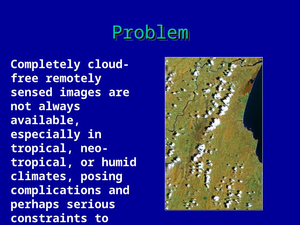
ProblemProblemProblemProblem
Completely cloud-free remotely sensed images are not always available, especially in tropical, neo-tropical, or humid climates, posing complications and perhaps serious constraints to image analysis

ObjectiveObjectiveObjectiveObjective
Develop a knowledge-based method to produce a cloud and cloud shadow-free multitemporal image composite of neo-contemporary images
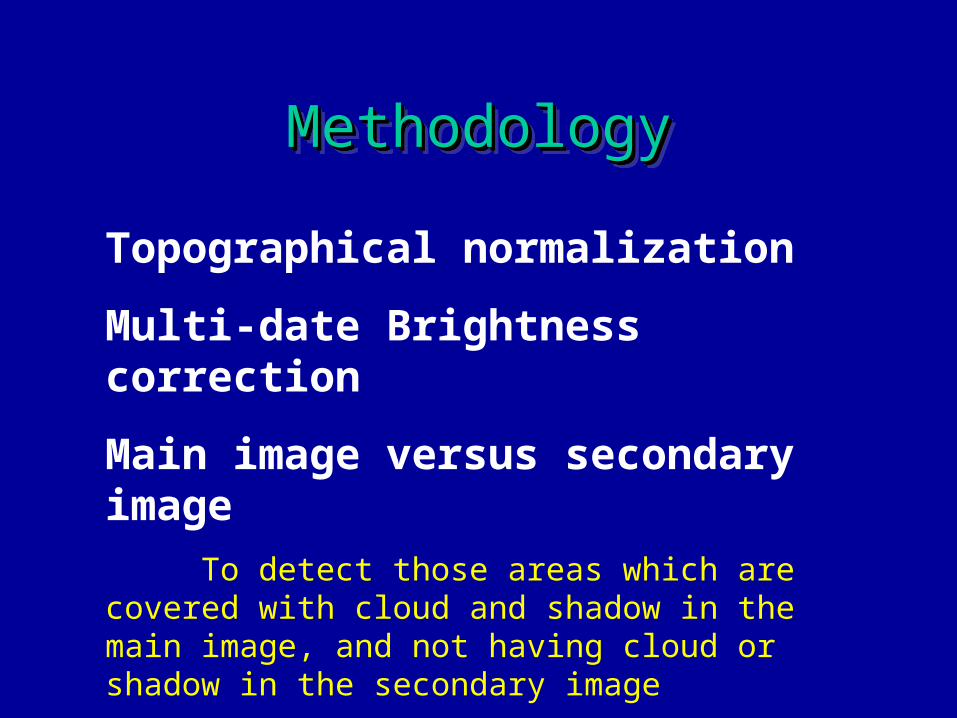
MethodologyMethodologyMethodologyMethodology
Topographical normalization
Multi-date Brightness correction
Main image versus secondary image
To detect those areas which are covered with cloud and shadow in the main image, and not having cloud or shadow in the secondary image
Replace

First Study AreaFirst Study Area
EasternMadagascarEasternMadagascar
December 15, 2000December 15, 2000April 22, 2001April 22, 2001

Topographical NormalizationTopographical Normalization
)/1( meanorigorignorm DNDNDN

Normalization ResultNormalization Result

Multi-date Brightness CorrectionMulti-date Brightness Correction
maindmainddcorr meanSDSDmeanDNDN secsecsec /)(

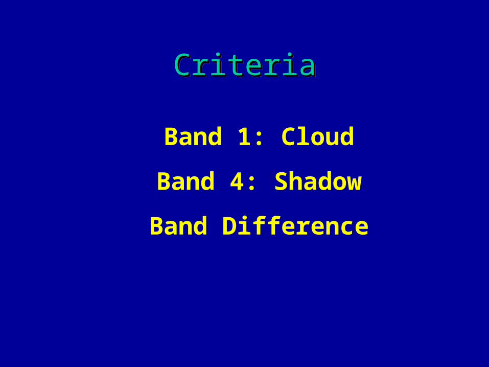
CriteriaCriteria
Band 1: Cloud
Band 4: Shadow
Band DifferenceRationale: If the difference is less than a
threshold, it should be the same object in two dates images
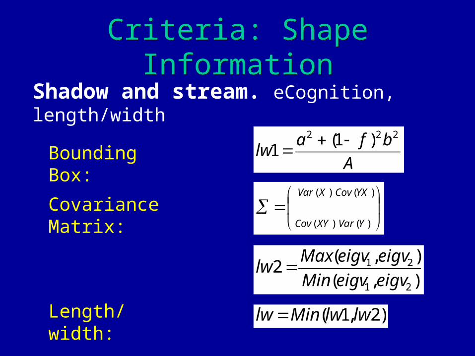
Criteria: Shape InformationCriteria: Shape Information
Shadow and stream. eCognition, length/width
Length/width: )2,1( lwlwMinlw
A
bfalw
222 )1(1
Bounding Box:
),(
),(2
21
21
eigveigvMin
eigveigvMaxlw
)(
)(
)(
)(
YXCov
YVar
XVar
XYCov
Covariance Matrix:

Knowledge BaseKnowledge Base
Parameter Cloud Shadow
Output Value 2 1
Band 1 (Main Image) > 41 >= 0
Band 4 (Main Image) >= 0 < 35
Band 1 (Secondary Image) < 33 < 33
Band 4 (Secondary Image) >= 0 > 27
Band 1 Difference > 10 >= 0
Band 4 Difference >= 0 > 10
Length-to-Width Ratio >= 0 < 9

Imagine Spatial ModelImagine Spatial Model

Cloud and Shadow DetectionCloud and Shadow Detection
Expert01_band1
00_band1
01_band401_band4
00_band400_band4
Band1_dif Band4_dif
Obj_lw

CompositeComposite
Replace

Second Study AreaSecond Study Area
ETM23 April 2001
ETM23 April 2001
ETM 26 March 2000
ETM 26 March 2000
Central-EasternConnecticut
Central-EasternConnecticut
ThamesRiver
ThamesRiver
UConnUConn

Multi-date Brightness CorrectionMulti-date Brightness Correction
Sample_01 Sample_00 Sample_00_corr 00_corr
CriteriaCriteriaCriteriaCriteria
Band 1: Cloud
Band 4: Shadow
Band Difference

Contextual InformationContextual Information
Difficulty:
Cloud edge with urban area
Shadow with water area
Rationale:
Cloud edge and shadow area should be accompanied by clear cloud area
Buffer the clear cloud area
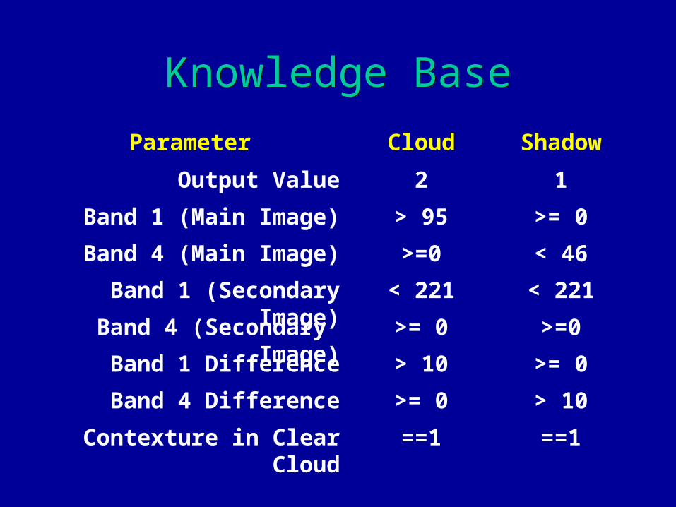
Knowledge BaseKnowledge Base
Parameter Cloud Shadow
Output Value 2 1
Band 1 (Main Image) > 95 >= 0
Band 4 (Main Image) >=0 < 46
Band 1 (Secondary Image) < 221 < 221
Band 4 (Secondary Image) >= 0 >=0
Band 1 Difference > 10 >= 0
Band 4 Difference >= 0 > 10
Contexture in Clear Cloud ==1 ==1
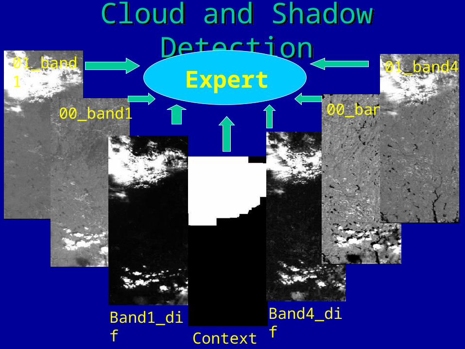
Cloud and Shadow DetectionCloud and Shadow Detection01_band1
00_band1
Band1_difContext
Band4_dif
00_band4
01_band4Expert

CompositeComposite
2001 ETM2001 ETM 2000 ETM2000 ETM
Cloud &Shadow
Area
Cloud &Shadow
Area

ConclusionConclusion
• Procedure of mosaic
• Knowledge-based
• Spectral, shape, contextural
• Easy and efficient
• Flexible
• Additional image needed for overlap areas

AcknowledgementAcknowledgementAcknowledgementAcknowledgement
National Aeronautics and Space Administration Grant NAG13-99001/NRA-98-OES-08 RESAC-NAUTILUS, Better Land Use Planning for the Urbanizing Northeast: Creating a Network of Value-Added Geospatial Information, Tools, and Education for Land Use Decision Makers.
Northeast Applications of Useable Technology In Land planning for Urban Sprawl

This presentationis available at
resac.uconn.edu

A Knowledge-based Approach for Reducing Cloud
and Shadow
A Knowledge-based Approach for Reducing Cloud
and ShadowMingjun Song and Daniel L. Civco
Laboratory for Earth Resources Information Systems (LERIS)
Department of Natural Resources Management & Engineering
The University of ConnecticutU-4087, 1376 Storrs Road
Storrs, CT 06269-4087