a new uk approach to planning and designing urban...
TRANSCRIPT
A new UK approach to planning and designing urban streets
Prof. Peter JonesCentre for Transport Studies
UCL, London

Topics Covered• Background: changing context• Manual for Streets• Framework for street planning & design• Improving London’s major public spaces Research:
1. Street life2. Stakeholder engagement in street design3. Street auditing and assessment4. Barriers to bus/rail access
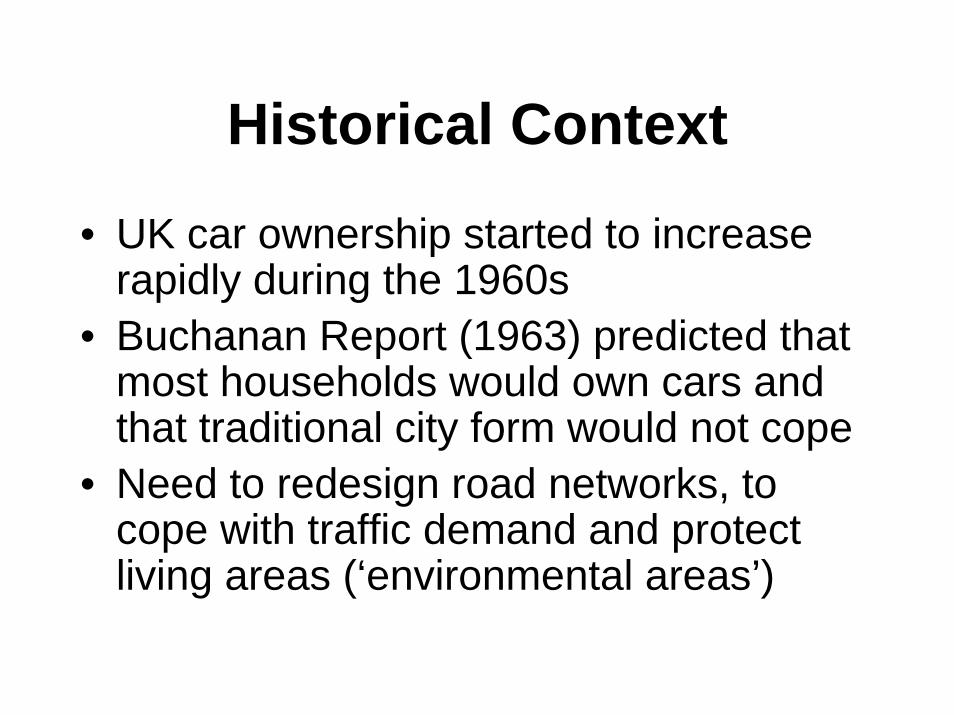
Historical Context
• UK car ownership started to increase rapidly during the 1960s
• Buchanan Report (1963) predicted that most households would own cars and that traditional city form would not cope
• Need to redesign road networks, to cope with traffic demand and protect living areas (‘environmental areas’)

Road Functions
Movement Access

Road Functions
Movement Access
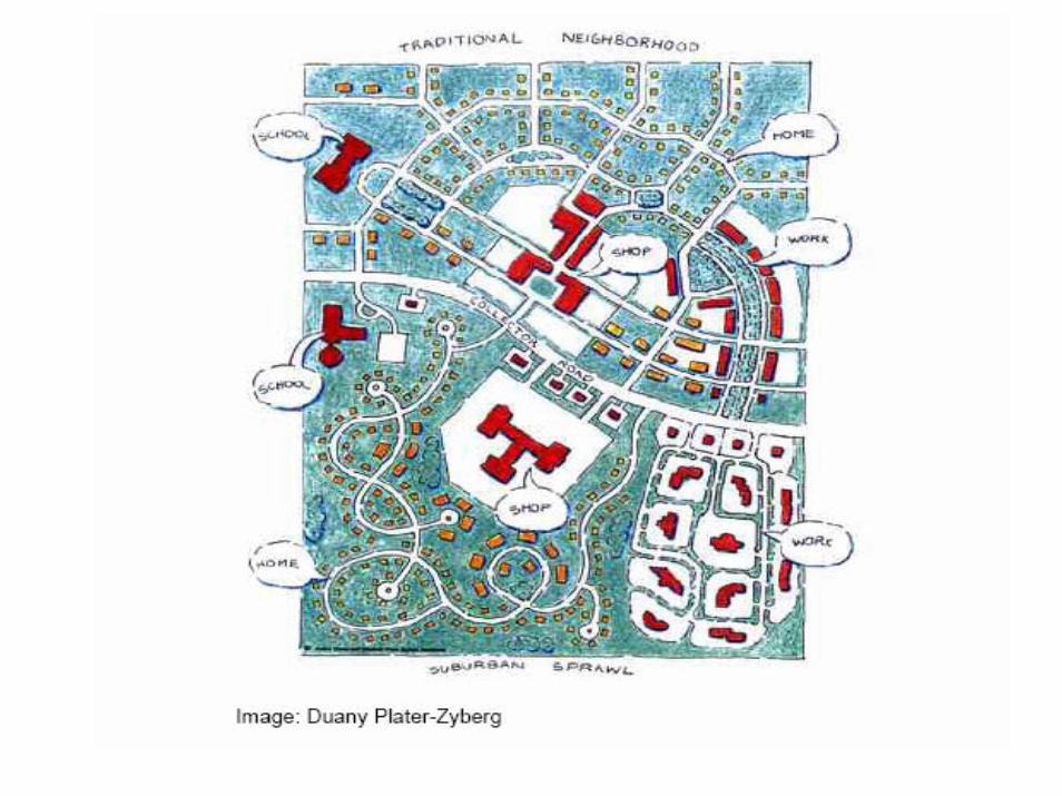
Cities re-designed as a series of
‘Corridors’ and ‘rooms’…………..

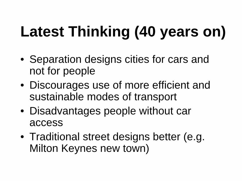
Latest Thinking (40 years on)
• Separation designs cities for cars and not for people
• Discourages use of more efficient and sustainable modes of transport
• Disadvantages people without car access
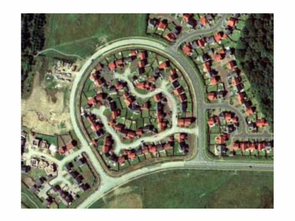
• Traditional street designs better (e.g. Milton Keynes new town)

Manual for Streets(DfT and others)
• New approach to residential street design, taking a less ‘traffic-dominant’approach
• Aims of design guidance:- build and strengthen communities- effective for movement- pleasant and attractive- acceptability safe
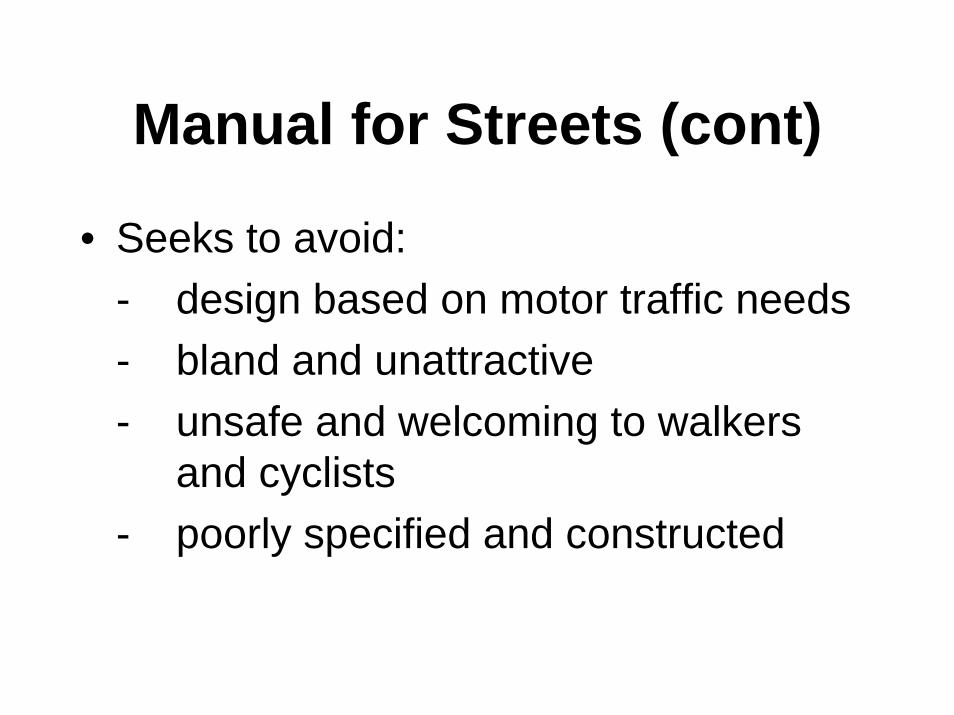
Manual for Streets (cont)
• Seeks to avoid:- design based on motor traffic needs- bland and unattractive- unsafe and welcoming to walkers
and cyclists- poorly specified and constructed

Street Design Principles
• Design to be location-specific, taking account of place & movement functions
• Emphasis on 3-D visual quality• Vehicle needs not the priority• Lower speed/safety standards to reduce
carriageway dominance • Road safety -> quality audit

Designs to be Avoided

Shift in Design Philosophy
‘Rooms and Corridors’(Buchanan, 1963)
‘Open-plan’Office
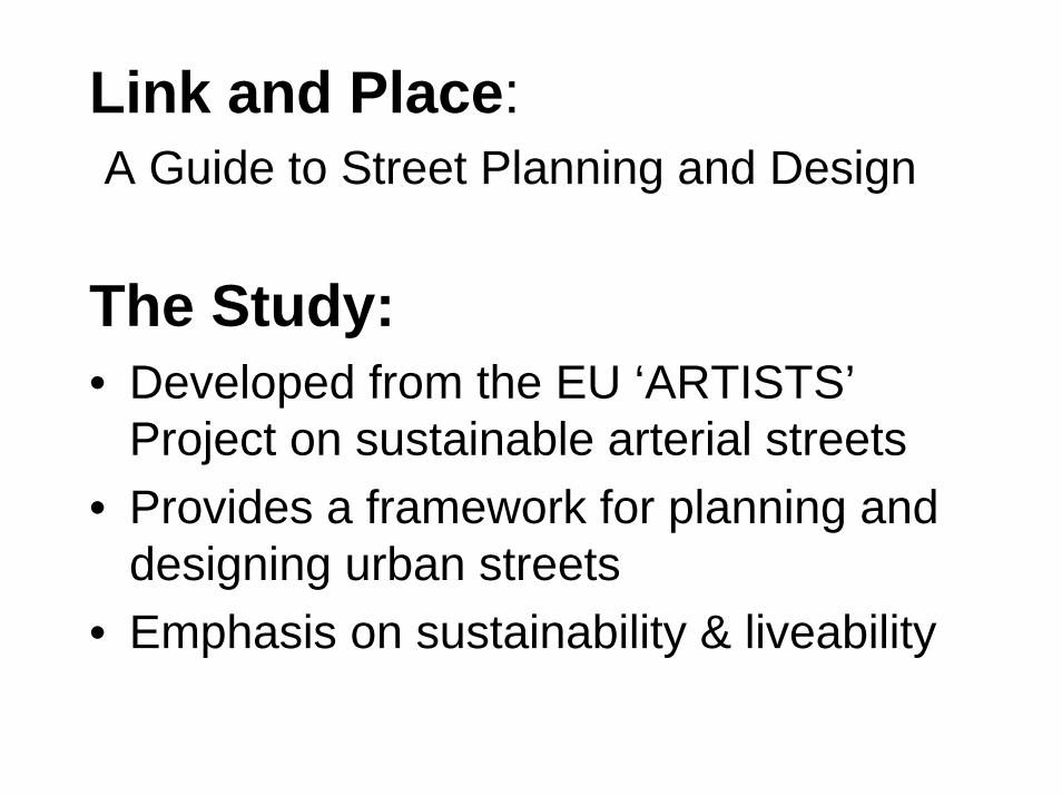
Link and Place:A Guide to Street Planning and Design
The Study:• Developed from the EU ‘ARTISTS’
Project on sustainable arterial streets• Provides a framework for planning and
designing urban streets• Emphasis on sustainability & liveability

Recognising dual function of streets
Streets fulfil two functions:
LINK function
Conduit for through movement of people
and goods
PLACE function
Destination in its own right

Through movement:
• Private cars, vans, goods vehicles
• Public transport
• Cycles
• Pedestrians
Use of a street as a Link
People movement
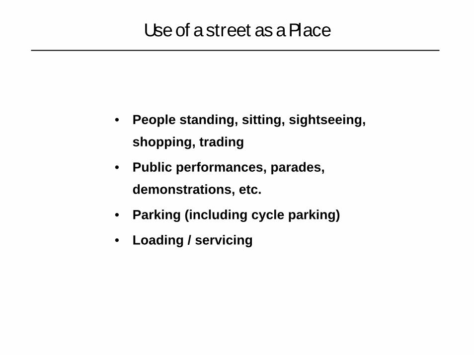
• People standing, sitting, sightseeing, shopping, trading
• Public performances, parades, demonstrations, etc.
• Parking (including cycle parking)
• Loading / servicing
Use of a street as a Place

• Spectrum of types from strategic to local routes
• Strategic routes all connect up to form a single contiguous network
LINK status
I
II
III

• Places of national status, city status, local status, etc.
• These form a scatter – not contiguous
• Overlain – independent
PLACE status
A
B
C

Some streets may prioritise local environmental qualities...
Streets form part of a complementary system
…other streets need to serve strategic movement functions

LINK & PLACE
Link
sta
tus I
II
III
A B C
Place status
national highwaycity
boulevard
district high street
local streets
Place status
Link
sta
tus
…are two independent entities

• Basis for recognising dual functionality of LINK and PLACE• Basis for addressing varying place needs along the corridors
Source:‘Link and Place - A Guide to Street Planning and Design’
Street Classification
I-B I-C I-D I-EI-A
II-A
III-A
II-B II-C
III-B
II-D II-E
III-C III-D III-E
V-A
IV-B IV-C IV-D IV-E
V-B V-C V-D V-ELo
cal
Nei
ghbo
urho
od
Dis
trict
City
Nat
iona
l
Neighbourhood
Local
District
City
National
IV-A
Arterial streets
Non-arterial streets
Place status (A, B, C, D and E)Li
nk s
tatu
s (I,
II, I
II, IV
and
V)
Link/Place classification matrix

Example: Two streets of comparable width- but with different balance of space allocation
I-A I-B I-C I-D
II-A II-B
III-A
II-C II-D
III-B III-C III-D
Overall status II-D –Link status (II) higher than Place status (D), so Link receives more attention
I-A I-B I-C I-D
II-A II-B
III-A
II-C II-D
III-B III-C III-D
Overall status IIIB –Place (B) higher than Link status (III), Place receives more attention
Recognising dual function of streets

Link/Place Trade-Offs
Pdes PdesLdes Pmin PminLmin
Pmin Pmin
Lmin
Pdes Pdes
Ldes
Lmin
Pmin Pmin
Place
Link
Ldes
Pdes
Envelope
of options
Place
Link
Lmin
Pmin
Envelope
of options
Place
Link
Lmin
Ldes
PdesPmin
Envelope
of options
Place
Link
Lmin
Pmin
Envelope
of options
No possible options to meet all minimum needs
Available space between desirable and minimum levelsAvailable space
just meets minimum needs
Available space exceeds aggregated desirable needs

Improving Major Public Spaces in London
Case Study: Trafalgar Square

The Final Plan


Flow Reductions of the Approaches to Trafalgar Square
8005501400
450450
1150
750750
1350
500400800
550500750
7501050850
800
400
467 Existing
PM Flows
World Square
AM Target Flows
World Square
PM Target Flows
1150
1350
1250
850
9001350
467 Existing
AM Flows
8005501400
450450
1150
750750
1350
500400800
550500750
7501050850
800
400
467 Existing
PM Flows
World Square
AM Target Flows
World Square
PM Target Flows
1150
1350
1250
850
9001350
467 Existing
AM Flows

Impacts of Trafalgar Square Scheme
• Very significant (c. 40%) reductions in traffic capacity in Trafalgar Square:
AM peak: 6,850 vph -> 4,000 vphPM peak: 6,300 vph -> 3,800 vph
• Pedestrian journey times across square reduced by two-thirds
• Major high quality public space created
=> Reducing Link status to meet Place needs
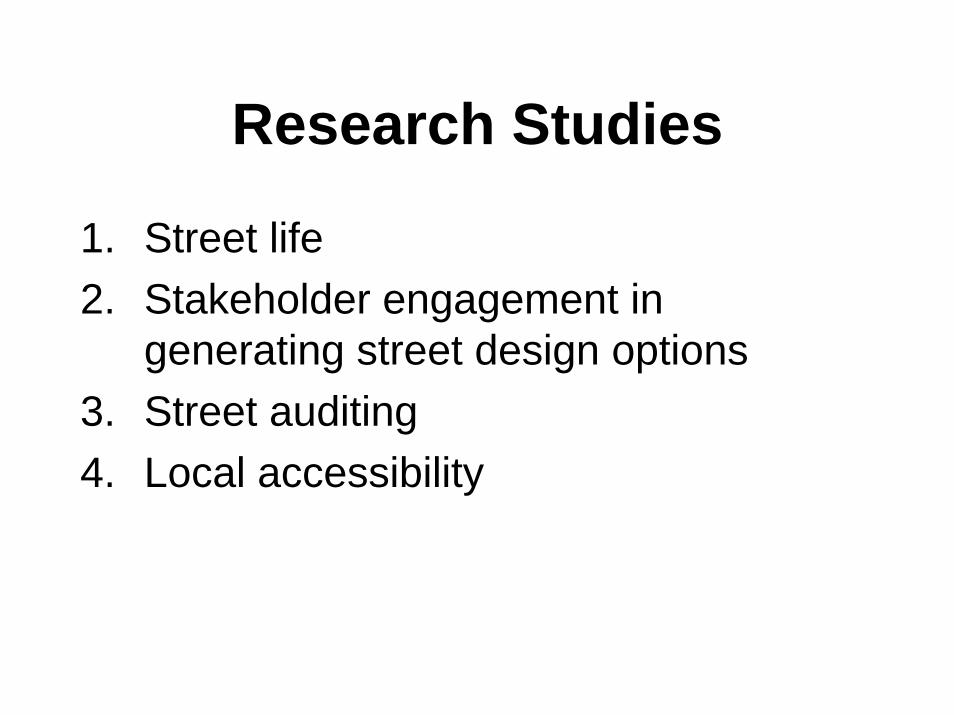
Research Studies
1. Street life2. Stakeholder engagement in
generating street design options3. Street auditing4. Local accessibility

Research 1: Street Life
“Mixed use streets” (JRF):• Study of three local high streets• Data collation, video analysis, surveys,
agency interviews, etc.• Focus on street uses and conflicts• Conclude: high streets are a valuable
part of future sustainable communities

Case Study Sites
Scale: 1:2500
Tooting London
Ball Hill Coventry
London Road Sheffield
500m

Coventry & Tooting

Diversity of Businesses
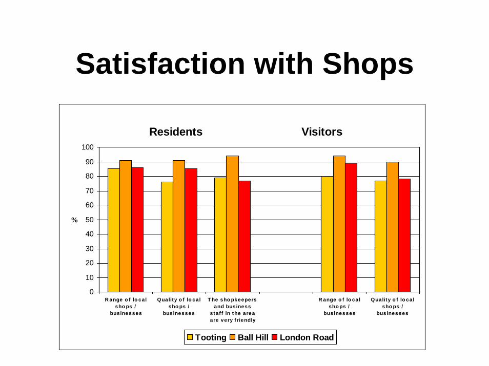
Satisfaction with Shops
Residents Visitors
0
10
20
30
40
50
60
70
80
90
100
R ange o f lo calsho ps /
businesses
Quality o f lo calsho ps /
businesses
T he sho pkeepersand business
staf f in the areaare very f riendly
R ange o f lo calsho ps /
businesses
Quality o f lo calsho ps /
businesses
%
Tooting Ball Hill London Road

Dissatisfaction with Traffic-related Problems
Street users Businesses
0102030405060708090
100
Volume ofroad traffic
Air pollutionfrom vehicles
Traffic noise Safety fromtraffic whencrossing the
road
Volume ofroad traffic
Air pollutionfrom vehicles
Traffic noise Safety fromtraffic whencrossing the
road
%
Tooting Ball Hill London Road

Dissatisfaction with Public Amenities
Residents Visitors
0102030405060708090
100
Availability ofpublic spaces and
greenery
Availability ofseating and
places to rest
Space to meetpeople and chat
Provision ofpublic toilets
Availability ofpublic spaces and
greenery
Availability ofseating and
places to rest
Space to meetpeople and chat
Provision ofpublic toilets
%
Tooting Ball Hill London Road

Range of Footway Services
• Retail services (stalls, paper sellers, etc)• Communications (phone & post boxes)• Cash point machines• Public transport services (shelters, info.)• Public amenity (seating, toilets, bins,…)• Public art and greenery• Wayfinding and traffic regulation
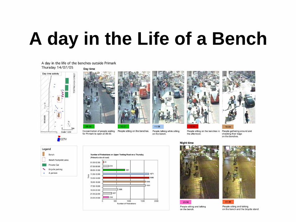
A day in the Life of a Bench

Range of Footway Users
• Workers• Entertainers• Customers• Browsers • Queuers
• Socialisers• Observers• Waiters• Resters• Inhabiters
In addition to Link users (‘striders’), CCTV show ten distinct Place users:
….most of whose needs not designed for on street

Transport Interchange: Tooting
Overground Rail
Bus
Tube
Walk
Other
Public Transport Usage After Alighting a Bus
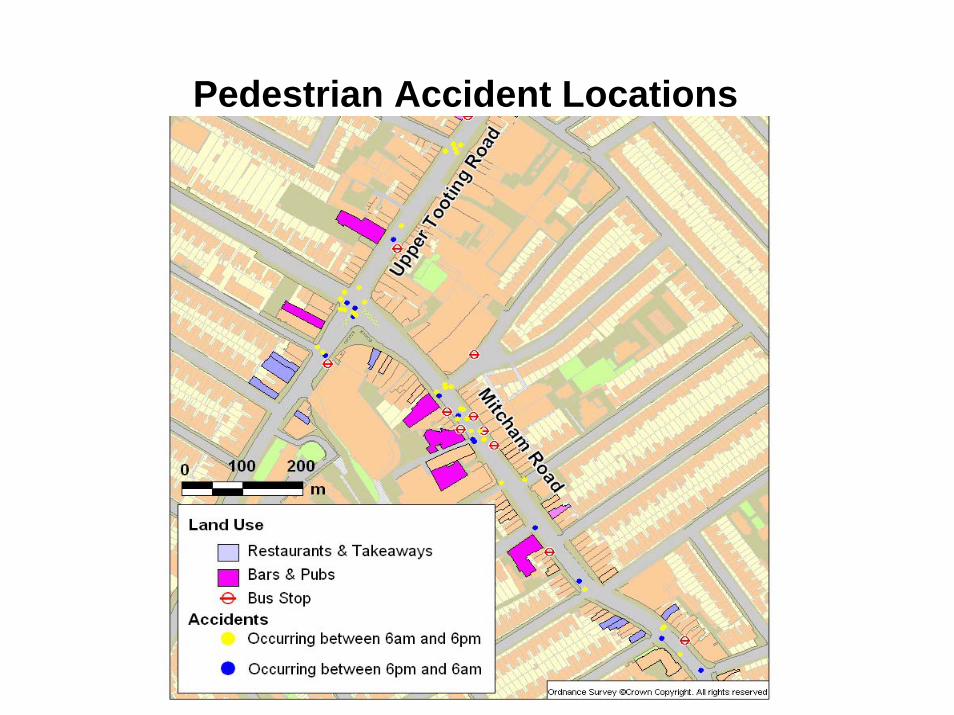
Pedestrian Accident Locations

Research 2:Stakeholder Engagement in option generation (EPSRC)
• Involving local groups in decisions about redesigning street space –particularly where conflicting views
• Using a combination of physical and electronic techniques

Place Space Allocation OptionsElaboration: Basic design options for the aggregate allocation of Place space
Options for location of ‘Place Space’ in the street, once the balance of aggregate Link/Place requirements have been determined: 1. Either side of existing ‘centre’ line 2. On south side of carriageway 3. On north side of carriageway 4. Either side of ‘true’ centre line 5. Running lanes to north and south, with central median strip
OPTION 1
OPTION 2
OPTION 3
OPTION 4 OPTION 5


Engaging with Stakeholders


Research 3: Street Auditing(Dft Inclusive Mobility Division)
• Measuring whether existing streets meet the requirements of people with disabilities and restrictions
• Based on computer-based audit tool, and laboratory measurements

Delimit Street Sections and Junctions
• Divide audit area into a set of contiguous:
- Road sections
- Junctions
- Ensure that the whole highway network is covered
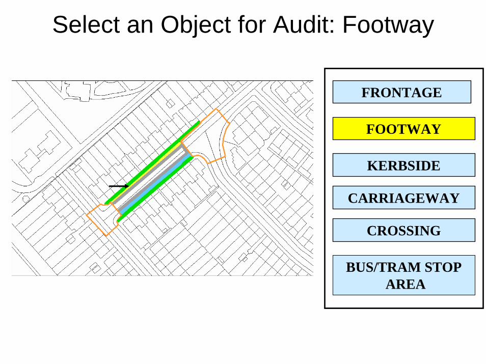
FOOTWAY
FRONTAGE
CROSSING
CARRIAGEWAY
KERBSIDE
Select an Object for Audit: Footway
BUS/TRAM STOPAREA

FOOTWAY
FRONTAGE
CROSSING
CARRIAGEWAY
KERBSIDE
BUS/TRAM STOPAREA
Footway: Features
LAMP POST
TRAFFIC SIGN
TRAFFIC SIGNAL
PARKING METER
OTHER POST/POLE
TREE/SHRUBBERY
SEAT/BENCH
INFORMATION SIGN
BOLLARD
TICKET MACHINE
TELEPHONE BOXPOST BOX
CONTROL BOXGUARD RAILING
OTHERRUBBISH/RECYCLING CONTAINER
MOVEABLE FEATUREPUBLIC ART
CYCLE PARKINGTOILET
Select a ‘Place’ Feature for Audit: Post Box

Locate Post Box on Map

Post Box AttributesIn use?
Dimensions (length/width) _____ cm by _____cm
Vertical reach acceptable?(Range = 0.75 to 1.2m)Forward reach acceptable?(max = 0.5m)
Suitable Location?
Yes
Colour contrast
No
Yes No
DetailsYes No
Details
Yes No Details
Good Average Poor
Visibility at night Good Average Poor
General condition Good Average Poor
Details
Viewing level acceptable?(Range = 0.9 to 1.8m) Yes No Details
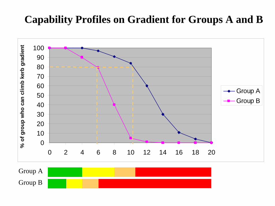
Capability Profiles on Gradient for Groups A and B
0102030405060708090
100
0 2 4 6 8 10 12 14 16 18 20
% o
f gro
up w
ho c
an c
limb
kerb
gra
dien
t
Group AGroup B
Group A
Group B

Display Feature access status
Lamp post
Tree
Rubbish container
Post box
Traffic sign
Parking meter

Performance of Sections & Junctions, all Capabilities, Group B

Assessment of impact of Feature Type Y on access for Age/Gender Groups A and B
Minimum 0
20
40
80
60
Maximum 100
% o
f fea
ture
type
(in
crea
sing
diff
icul
ty)
Gro
up A
Gro
up B

Research 4: Local Accessibility(EPSRC)
• Measures of accessibility, taking into account relative unattractiveness of different walking routes
• Based on survey results for different social groups

Data Collection
What additional time will person spend walking to avoid a route to a bus stop:
• Up a steep hill?• Across a busy main road with no
pedestrian crossing?• Along a poorly lit road at night?• With no seat or shelter at bus stop?


Mapping Catchment Areas
• Assumes a basic 5 minute walking zone• Different walk speeds assumed for
different age groups• Catchment areas reduced to reflect the
weighting given to less attractive walking routes


Conclusions
• Growing UK interest in streets as places, and contributing to sustainability and quality of life
• Currently developing new guidance to assist with planning & implementation
• Provides new areas for research