a scana company · identification of the permitting authority(ies) for transmission line...
TRANSCRIPT
Ronald B. ClaryGeneral Manager
New Nuclear Deployment
A SCANA COMPANY July 20, 2009NND-09-0198
U.S. Nuclear Regulatory CommissionDocument Control DeskWashington, DC 20555-0001
ATTN: Document Control Desk
Subject: V. C. Summer Nuclear Station Units 2 and 3Docket Numbers 52-027 and 52-028Combined License Application - Response to NRCEnvironmental Report (ER) Requests for Additional Information(RAI): TLine-2 and 3
Reference: 1. Letter from Ronald B. Clary to Document Control Desk,Submittal of Revision 1 to Part 3 (Environmental Report) of theCombined License Application for the V. C. Summer NuclearStation Units 2 and 3, dated February 13, 2009.
2. Letter from Patricia J. Vokoun to Ronald B. Clary, Requests forAdditional Information Related to the Environmental Review forthe Combined License Application for the V. C. SummerNuclear Station, Units 2 and 3, dated June 22, 2009.
By letter dated March 27, 2008, South Carolina Electric & Gas Company(SCE&G) submitted a combined license application (COLA) for V.C. SummerNuclear Station (VCSNS) Units 2 and 3, to be located at the existing VCSNS sitein Fairfield County, South Carolina. Subsequently the Environmental Report(ER), Part 3 of the application, was revised and submitted to the NRC (reference1).
The enclosure to this letter provides the SCE&G response to RAI items TLine-2and 3 transmitted by the NRC via reference 2.
Please address any questions to Mr. Alfred M. Paglia, Manager, NuclearLicensing, New Nuclear Deployment, P. 0. Box 88, Jenkinsville, S.C. 29065; bytelephone at 803-345-4191; or by email at [email protected].
PROSCE&G I New Nuclear Deployment . P. 0. Box 88 • MC P40 . Jenkinsville, South Carolina 29065 o www.sceg.com

Document Control DeskPage 2 of 2NND-09-0198
I declare under penalty of perjury that the foregoing is true and correct.
Executed on this '2o day of , 2009
Ronald B. ClaryGeneral ManagerNew Nuclear Deployment
ARR/RBC/ar
Enclosures
c (with Enclosures):Patricia VokounCarl BerkowitzRichard DardenFileNet
c (without Enclosures):Luis A. ReyesJohn ZeilerChandu PatelStephen A. ByrneRonald B. ClaryBill McCallWilliam M. CherryRandolph R. MahanKathryn M. SuttonRich LouieJohn J. DeBlasioApril RiceJoe Gillespie

VCSNS UNITS 2 and 3Environmental Report Review
Response to NRC Requests for Additional Information
NRC RAI Letter Dated June 22, 2009
NRC RAI Number: RAI TLine-2 Revision: 0
Reference ER Information Needs Item: N/A
Question Summary (RAI):Provide land use classification data that are in a consistent format for the Santee Cooperand SCE&G transmission siting studies, with respect to Santee Cooper Table 3.8 andSCE&G Tables 4.3-1, 4.3-2, and 4.3-3, based on the most recent data source(s) for thetwo studies. Include the data source citation(s) for land use data reported in the SCE&Gsiting study Tables 4.3-1, 4.3-2, and 4.3-3.
Full Text (supporting information):The staff cannot determine the source of the land use data reported in the SCE&Gtransmission siting study. If the SCE&G and Santee Cooper studies used different landuse GIS data, then the staff needs to know upon which source to rely.
VCSNS Response:Both Santee Cooper and SCE&G used recent Land Use (LU)/ Land Cover (LC)information with coverage over the entire state, i.e. SC-GAP Project, South Carolina 27-Land Cover, South Carolina Cooperative Fish and Wildlife Research Unit, USGSBiological Resources Division, South Carolina Department of Natural Resources, 2001.
To refine data accuracy of the SC GAP Project data, SCE&G adjusted the GAP Projectland cover quantities based on 2006 satellite imagery. Test models were prepared usingthe imagery and Erdas Imagine software to allow adjustments in the GAP data toaccount for land cover changes that have occurred since the GAP data was developed.(i.e., SCE&G used the GAP project classification protocol but adjusted quantities toaccount for clear cutting, development modification to land cover, etc.) There are 3references for this in Appendix A of SCE&G's transmission line siting report as follows:.
Geo 23m - Resource Satellite [Satellite Imagery]. Acquisition Date 3 May 2006.GeoEye. 27 Oct. 2007 <http://www.geoeye.com>.
Geo 23m - Resource Satellite [Satellite Imagery]. Acquisition Date 7 Aug. 2006.GeoEye. 7 Nov. 2007 <http://www.geoeye.com>.
Geo 23m - Resource Satellite [Satellite Imagery]. Acquisition Date 29 Sept. 2006.GeoEye. 27 Oct. 2007 <http://www.geoeye.com>.
Santee Cooper's separation of Land Use and Land Cover was made because nearly99% of Santee Cooper's transmission lines will be routed within existing maintainedRight of Way (Land Use). More recent LU/LC information is available for some counties;however, to evaluate data consistently over the entire length of the transmissioncorridors, the most complete data set was used in transmission line siting studiesprepared by Santee Cooper. The Land Use of property adjacent to the transmissioncorridors was included in Santee Cooper's Transmission Line Siting Study (August2008) Section 3.3 to provide context for the location of the proposed routes. A
1 of 2

VCSNS UNITS 2 and 3Environmental Report Review
Response to NRC Requests for Additional Information
discussion of the Land Cover types occurring within the existing maintained right of wayis included in Section 3.4 of the Santee Cooper Transmission Line Siting Study.
SCE&G separated Land Use and Land Cover to comply with its transmission line sitingstudy protocol, which addresses/measures the effects of each separately. Land uses ofproperty within the entire siting study areas of the VCSNS-Lake Murray 230 kV Line,VCSNS-Killian 230kV Line and VCNS-St. George 230 kV Lines were mapped bySCE&G and applied in its siting study. The Land Cover types within the potential routeright-of-ways are included in Sections 4.2 and 4.3 of SCE&G's transmission line sitingstudy.
SCE&G believes that the minor differences in the land use and land cover data used bySantee Cooper and SCE&G are appropriate given the different results of the expectedtransmission routing by each company. As Santee Cooper has proposed routing nearly99% of its proposed transmission lines within existing right of way, their Land Usediscussion is understandably different when compared to SCE&G's which may requiremore new right of way than the Santee Cooper lines.
Associated COLA Revisions:
No COLA revision is required as a result of the response to this RAI.
Associated Attachments:
None
2 of 2

VCSNS UNITS 2 and 3Environmental Report Review
Response to NRC Requests for Additional Information
NRC RAI Letter Dated June 22, 2009
NRC RAI Number: RAI TLine-3 Revision: 0
Reference ER Information Needs Item: N/A
Question Summary (RAI):Provide the following information in reference to the projected transmission line
construction and operation:
1. Identification of the permitting authority(ies) for transmission line construction2. Description of the transmission line siting procedures that were or are to be followed3. A list of and schedule for environmental reviews that will be conducted as part of the
transmission line siting procedure4. Standards/procedures for the interconnection operation and the right-of-way
maintenance5. Identification of basic electrical design parameters, including transmission design
voltage or voltages, minimum conductor clearances to ground, and the maximuminduced current to ground from vehicles or obstacles under the transmission lines
6. Predicted noise levels resulting from transmission system construction and operation7. Description of land use limitations within the transmission line corridors8. General methods of construction for the proposed new transmission lines and
upgrades (e.g., tower foundations, stringing, location of access roads, span length,and clearing of rights-of-way).
Full Text (supporting information):During the site audit, the staff was referred to the two siting studies to obtain thisinformation; however these studies do not provide adequate detail for the items listed.
VCSNS Response:1. Identification of the permitting authority(ies) for transmission line
construction
South Carolina Electric and GasFor 230kV T-line construction, South Carolina Electric and Gas is subjectto the South Carolina Public Service Commission (SCPSC) and as suchare subject to the rigorous SCPSC approval process. Ultimate approvalto construct is dependent on receipt of a certificate issued by the SCPSCas required in the South Carolina Utility Facility Siting and EnvironmentalProtection Act discussed in detail herein.
The South Carolina Utility Facility Siting and Environmental ProtectionAct, § 58-33-10 et seq., South Carolina Code, Ann. (1976, as amended)(hereinafter "Act") stipulates that construction of a "Major Utility Facility"cannot begin in South Carolina until a Certificate of EnvironmentalCompatibility and Public Convenience and Necessity ("Certificate") hasbeen issued by the South Carolina Public Service Commission("Commission"). All transmission lines with voltages of 125 kV or higher
1 of 13

VCSNS UNITS 2 and 3Environmental Report Review
Response to NRC Requests for Additional Information
are "major utility facilities", as defined by the Act'; therefore, all 230 kVlines proposed by SCE&G will require certification by the Commission
2since none qualify to be exempted from the Act. Major utility facilitiesundertaken by the South Carolina Public Service Authority are explicitly
3exempted from the Act.
The Act requires an applicant for a Certificate to file an application withthe Commission in a form acceptable to the Commission containing thefollowing information 4:
a) A description of the location and of the major utility facility to bebuilt;
b) A summary of any studies which have been made by or forapplicant of the environmental impact of the facility;
c) A statement explaining the need for the facility; and,d) Any other information as the applicant may consider relevant or as
the commission may by regulation or order require. A copy of thestudy referred to in item (b) above shall be filed with thecommission, if ordered, and shall be available for publicinformation.
It is required, therefore, that the complete documentation of any sitingstudy associated with any proposed 230 kV line in South Carolina underthe jurisdiction of the Act be filed with the Commission along with theapplication for a Certificate. In the case of SCE&G, the transmission linesiting process includes comprehensive documentation of siting studiesassociated with all 230 kV transmission lines, which are filed with theCertificate applications in all cases. The siting study documentationincludes all technical reports, such as biological and cultural resourceinvestigation reports, that were completed in conjunction with the routeselection. The documentation provides a description of the systematic,rational steps that led from the identification of all viable alternative routesto the narrowing, analyzing, and ranking of the alternative routes. Thedecision-making process is based on clear, quantified data that ismeasured against each alternate route on a qualitative and quantitativebasis. The data includes an array of multiple data sets to account foreffects to environmental resources, land use characteristics, culturalresources, and aesthetic considerations. The SCE&G siting process isdiscussed- in the V.C. Summer Nuclear Station Onits 2 and 3Transmission Line Siting Study, Chapters 2 and 5.
The Act sets out the procedure whereby the Commission may issue aCertificate. The Certificate may be obtained after notice to all partiesidentified in the Act and a hearing before the Commission. Proof ofservice that the parties listed in the Act have received notice, which
§ 58-33-20 (2) (b) SC Code, Ann. (1976, as amended)2 § 58-33-110 (4) (a-d) SC Code, Ann. (1976, as amended)3 § 58-33-20 (2) (b) SC Code, Ann. (1976, as amended)4 § 58-33-120 (1) (a-d) SC Code, Ann. (1976, as amended)
2 of 13
VCSNS UNITS 2 and 3Environmental Report Review
Response to NRC Requests for Additional Information
includes a copy of the application, is required to be presented to theCommission as a part of the application. The Act provides a* listing of the
5parties to receive notice , which include the "....Office of Regulatory Staff,the chief executive officer of each municipality, and the head of eachstate and local government agency charged with the duty of protectingthe environment or of planning land use in the area in the county in which
,,6any portion of the facility is to be located. Further, the Act requires thatthe applicant provide public notice to persons residing in themunicipalities entitled to receive notice under § 58-33-120 (2) by the".....publication of a summary of the application and the date on or aboutwhich it will be filed with the Commission, in newspapers of generalcirculation as will serve substantially to inform such persons of the
,,7application. The parties to a certification proceeding are set out in theAct and include":
a) the applicant;b) the Office of Regulatory Staff, the Department of Health and
Environmental Control, the Department of Natural Resources, andthe Department of Parks, Recreation and Tourism;
c) each municipality and government agency entitled to receiveservice of a copy of the application under subsection (2) ofSection 58-33-120 if it has filed with the commission a notice ofintervention as a party within thirty days after the date it wasserved with a copy of the application; and
d) any person residing in a municipality entitled to receive service ofa copy of the application under subsection (2) of Section58-33-120, any domestic nonprofit organization, formed in wholeor in part to promote conservation or natural beauty, to protect theenvironment, personal health, or other biological values, topreserve historical sites, to promote consumer interest, torepresent commercial and industrial groups, or to promote theorderly development of the area in which the facility is to belocated; or any other person, if such a person or organization haspetitioned the commission for leave to intervene as a party, withinthirty days after the date given in the published notice as the datefor filing the application, and if the petition has been granted bythe commission for good cause shown.
The clear intent of the notice requirements of the Act and the identificationof participants in the certification proceedings for a major utility facility isto give persons and organizations that may have an interest in theproposed project an opportunity to participate in the public hearing beforethe Commission.
5 § 58-33-120 (2-4) SC Code, Ann. (1976, as amended)6 § 58-33-120 (2) SC Code, Ann. (1976, as amended)7 § 58-33-120 (3) SC Code, Ann. (1976, as amended)8 § 58-33-140 (1) (a-d) SC Code, Ann. (1976, as amended)
3 of 13

VCSNS UNITS 2 and 3Environmental Report Review
Response to NRC Requests for Additional Information
The Commission shall render a decision after the hearing and mustinclude certain specific findings set out in the Act. Among those findings,the Commission must determine that "...there is reasonable assurancethat the proposed facility will conform to applicable State and local lawsand regulations issued there-under, including any allowable varianceprovisions therein ... "9 Obviously, the Legislature intended for theCommission to issue a Certificate that requires compliance with local lawsand regulations to avoid as much disruption of counties andmunicipalities' authority as possible. However, the Legislature alsounderstood that (i) the Commission needed the authority to provide forthe public good (ii) that utilityservice is a necessity and (iii) that theutilities under its jurisdiction must be allowed to provide safe andadequate service to the using and consuming public at reasonable rates.The Legislature, therefore, gave the Commission the authority to"... refuse to apply any local law or local regulation if it finds that, asapplied to the proposed facility, such law or regulation is unreasonablyrestrictive in view of the existing technology, or of factors of cost oreconomics or of the needs of consumers, whether located inside oroutside of the directly affected government subdivisions."' 0 Additionally,in its opinion, "...if the Commission finds that any regional or local law orregulation, which would be otherwise applicable, is unreasonablyrestrictive ... it shall state in its opinion the reasons thereof.""
The Act partially addresses the schedule upon which a certificationproceeding will be conducted. Once the applicant files the application fora certificate, "The Commission shall promptly fix a date for thecommencement of a public hearing, not less than sixty or more thanninety days after the receipt, and shall conclude the proceedings as
02expeditiously as practicable. There is no time period set out in the Actfor the Commission to render its decision.
SCE&G also follows the regulations of other appropriate bodies whetherstate, federal or other local municipality. These permits are similar toSantee Cooper and are discussed in detail in the Santee Cooperdiscussion that follows.
Santee Coope
Santee Cooper, as a state owned public utility, does not fall under theSouth Carolina Public Service Commission guidelines. However, duringthe transmission line construction process, Santee Cooper must obtaincertain federal, state, and local permits as conditions dictate, as doesSCE&G. These are as follows:
9 § 58-33-160 (1) (e) SC Code, Ann. (1976, as amended)10 § 58-33-160 (1) (e) SC Code, Ann. (1976, as amended)11 § 58-33-170 SC Code, Ann. (1976, as amended)12 § 58-33-130 (1) SC Code, Ann. (1976, as amended)
4 of 13

VCSNS UNITS 2 and 3Environmental Report Review
Response to NRC Requests for Additional Information
Many of these permits are discussed individually in several sub-sectionsof Section 4 of the Siting Study. The following is a list of permits that maybe required prior to installation activities. This list is not exhaustive andmay change as specific design and installation plans are developed forthis project and as rules/regulations may change in the coming years.
Federal PermitsCertain construction activities in jurisdictional wetlands, streams or otherwaters of the U.S. may require a Section 404 Clean Water Act permit,which is regulated by the U.S. Army Corps of Engineers, CharlestonDistrict.
The U.S. Army Corps of Engineers may also require federal permits forcrossings of navigable waters of the U.S. under Section 10 of the Riversand Harbors Act.
State PermitsStormwater Pollution Prevention Plans (SWPPPs) may be required inaccordance with SCDHEC's Standards for Stormwater Management andSediment Reduction.
SCDHEC may also require State Navigable Waters Permits associatedwith crossings of State Navigable waters and Section 401 Water QualityCertification for certain Federal Actions, including the USACE Section 404and Section 10 Permits.
SCDHEC's Office of Ocean and Coastal Resource Management (OCRM)may require Coastal Zone Consistency (CZC) certification under thestormwater management program for the portion the transmissioncorridors located in the coastal counties.
The State Historic Preservation Office, SHPO, may also requireprogrammatic agreements. Therefore, SHPO will be contacted/involvedas impacts to cultural resources are identified and determined
Local PermitsIt may be necessary to obtain additional county and/or municipal permitsrelated to sediment control and/or stormwater management injurisdictions with a SCDHEC authorized program. There are no knownlocal or county land use or permit requirements that would affect the sitingof the transmission lines.
2. Description of the transmission line siting procedures that were orare to be followed
SCE&G utilizes a comprehensive, three-phase transmission line sitingprocess (Discussed in Section 2.0 of SCE&G's Transmission Line SitingStudy). Phase I focuses on collecting all land use, environmental,cultural, and engineering data that should influence the development of
5 of 13

VCSNS UNITS 2 and 3Environmental Report Review
Response to NRC Requests for Additional Information
alternate routes, and involves collecting an array of data from local, state,and federal sources in addition to field studies to develop various datasets. This phase also includes the delineation of a siting study area,collection of data within the area, community workshops for the purposeof receiving information from the people within the siting study area,weighting of the data to reflect the individual data factor's sensitivity toline construction, and combining the weighted data to determine itscumulative influence on line siting. Phase I concludes with thedevelopment of alternate routes through areas of lowest constraint to themaximum practical extent. Throughout the data collection effort arepoints of interaction with various agencies, including county and municipalagencies in the siting study area. This interaction during the early stagesof the siting process together with notice requirements of the FacilitySiting and Environmental Protection Act (1976, as amended) and.thedesignation of specific entities as participants in the South Carolina PublicService Commission's certification proceedings for major utility facilities,including 230 kV lines, ensures that the interest of all stakeholders arefairly represented and considered when siting and certifying projects inSouth Carolina.
Santee Cooper considers the following five factors when selecting a routefor new transmission lines: economics, environmental impact, safety,system reliability and long range implications to the transmission system.Economic factors may include the cost of acquiring easements for newRight of Way (ROW), clearing the land, transmission line construction andconstruction of new substations. Environmental impacts may includewetlands, protected species, cultural resources, wildlife, aesthetics, noise,geology, prime farmland, hydrology, land use, land cover,electromagnetic field, floodplains and air quality.
As specific potential routes for a new transmission corridor aredetermined, safety, system reliability and long range implications of thetransmission system are addressed. The safety of a transmission route isimproved by making the route as direct as possible, thus minimizing thenumber of points of intersection and the number of crossings (roads, rail,water, etc). System reliability is improved by limiting the length of thecorridor between substations and routing the corridor to be as accessibleas possible (easily accessible terrain, near public access points, etc.),thereby providing more reliable service to end users. Long rangeimplications to the transmission system refer to the design of a "looped"system, rather than a "radial" system, so that power flows to substationsfrom more than one source, which minimizes outages to end users. A"looped" system is where the transmission lines are connected throughmultiple substations to form a circle (or "loop"). A "radial" system is wheretransmission lines terminate at a single substation which is not linked toanother substation or power source.
As mentioned earlier, Santee Cooper's Line Siting Process is not subjectto review by the South Carolina Public Service Commission and as suchdoes not fall under all of the same requirements as SCE&G.
6 of 13
VCSNS UNITS 2 and 3Environmental Report Review
Response to NRC Requests for Additional Information
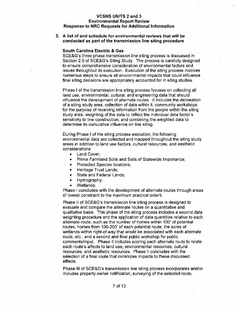
3. A list of and schedule for environmental reviews that will beconducted as part of the transmission line siting procedure
South Carolina Electric & GasSCE&G's three phase transmission line siting process is discussed inSection 2.0 of SCE&G's Siting Study. The process is carefully designedto ensure comprehensive consideration of environmental factors andissues throughout its execution. Execution of the siting process involvesnumerous steps to ensure all environmental impacts that could influencefinal siting decisions are appropriately accounted for in siting studies.
Phase I of the transmission line siting process focuses on collecting allland use, environmental, cultural, and engineering data that shouldinfluence the development of alternate routes. It includes the delineationof a siting study area, collection of data within it, community workshopsfor the purpose of receiving information from the people within the sitingstudy area, weighting of the data to reflect the individual data factor'ssensitivity to line construction, and combining the weighted data todetermine its cumulative influence on line siting.
During Phase I of the siting process execution, the followingenvironmental data are collected and mapped throughout the siting studyareas in addition to land use factors, cultural resources, and aestheticconsiderations:
" Land Cover;• Prime Farmland Soils and Soils of Statewide Importance;* Protected Species locations;• Heritage Trust Lands;* State and Federal Lands;" Hydrography;" Wetlands;
Phase I concludes with the development of alternate routes through areasof lowest constraint to the maximum practical extent.
Phase II of SCE&G's transmission line siting process is designed toevaluate and compare the alternate routes on a quantitative andqualitative basis. This phase of the siting process includes a second dataweighting procedure and the application of data quantities relative to eachalternate route, such as the number of homes within 100' of potentialroutes, homes from 100-200' of each potential route, the acres ofwetlands within right-of-way that would be associated with each alternateroute, etc., and a second and final public workshop for publiccomments/input. Phase II includes scoring each alternate route to relateeach route's affects to land use, environmental resources, culturalresources, and aesthetic resources. Phase II concludes with theselection of a final route that minimizes impacts to these discussedeffects.
Phase III of SCE&G's transmission line siting process incorporates and/orincludes property owner notification, surveying of the selected route,
7 of 13

VCSNS UNITS 2 and 3Environmental Report Review
Response to NRC Requests for Additional Information
intensive field investigations along the selected route to determine thelocation and identification of any sensitive resources in the right-of-waythat will need to be addressed, construction planning, agency contact (asappropriate), state and federal project permitting and/or licensing, formaldocumentation of the siting study, and right-of-way easement negotiationand procurement.
The following is a chart displaying SCE&G's transmission line sitingprocess.
TRANSMISSION LINE SITING PROCESS
PHASE I f :9
Protect Scopng I Team MemberRaespos~idyAssignmerts
'IDelin•!i•efln of Sibg Study Areaand Irnfal Data CollecFn
IICmnzityWorkshc(s)
I f-tContact
Analyze Canspila and Apply SiibstarrtiveIrfomatimn Rec-ed From qte C•xnmuri
Fina R-egomal. Frronm•aManl, andLand Use Data Coffedtan End EFT"
Afterate Rutze Evelutifidn end.Carone nrte
Comunuity Wrt5sh•p(s)Aec Comwmets
PHA'SE" III
Analyze arnd Compae Community CommeTtsand Irfomakn I
IF79d Reaine• of A•tmrate Routes andZu.tmenmt (I needed)
IDevelop Aitemate RouteEvslua5on Cri~erta
AltF;.nae Rou•e EwvAtaonarAd RarIng
Cost amd Eroutneed EvAatioSchedule Devetorpenut
PrefenLed Route
Survey N••lkar h-oPrpryOwnersAffected bySetaced ot
Annowuce the Selected Route
to thie Corunl
Suroey theSelected Ro•te
Addibtoat Studies (Weglnd Delineatimn,Biolegical StDies. Cutura Resumce Stu&_s,em.)if required I
Com:bme Data I e•_=mirn Most SubleAreas tfr Alterna!_ Trarkrnston UneRoutes TlhJouheiitteg S5m udy Area I
Ir
IIncturrng Piny ltecessa• Measures boILirze EnionieralEffeds
Frqpare Transnisdon LineSitmg Re•oit
Submit To R ee-rw Agecks ILicensiri Agflrones As •teeded
AppJved Route
lýveirp A-.3te Ror•es Thr•ughMoWt Sutable Areas
L POUCT 1 identifiction of Alternate Routes I
In summary, environmental planning is not merely a "review procedure" inSCE&G's transmission line siting process; rather, it is integral to everystep in the process from initial data gathering to final route selection andcontinues through actual line construction. The design of the sitingprocess ensures that selected routes are ones that minimize affects toenvironmental, cultural, land use, and aesthetic resources. Moreover, theprocess is traceable to ensure that the decision making rationale can bereviewed in any permitting or licensing proceeding. This traceability is
8 of 13

VCSNS UNITS 2 and 3Environmental Report Review
Response to NRC Requests for Additional Information
very detailed and includes numbers (units, acres, miles, etc.) of specificresources that will likely be affected by line construction. Finally, thespecificity of the siting study findings with respect to type, locations, andnumbers of resources that could be potentially affected by lineconstruction allows for precise construction planning to minimize or totallyavoid impacts.
For Santee Cooper, once a Route is selected as discussed in Section 2.2of Santee Cooper's Siting Study, Santee Cooper conducts a land surveyand completes an environmental study including wetland delineation (tobe verified by USACE), Threatened and Endangered species study, anda Historic and Archeological study.
Santee Cooper then applies for any Federal, State, and Local permits,providing them with the environmental study, or portions of it, dependingon their requirements. When the design is far enough along, SanteeCooper can then apply to the USACE for navigable water crossingpermit(s). Santee Cooper applies for each required permit. SanteeCooper also prepares Stormwater Pollution Prevention Plans whennecessary.
4. Standards/procedures for interconnection operation and right-of-way maintenance.
SCE&G and Santee Cooper have FERC approved Open AccessTransmission Tariffs that include a Large Generator InterconnectionProcedure (LGIP). The LGIP applies to all generators 20 MW or greaterrequesting Transmission Interconnection Service to either of ourTransmission Systems.
SCE&G and Santee Cooper provide Interconnection Service to agenerating facility after an Interconnection Request is made inaccordance with the Transmission Tariffs. The request is used tointerconnect a new Generating Facility or either increase the capacity ormake a Material Modification to the operating characteristics of anexisting Generating Facility that is interconnected with either transmissionsystem.
An Interconnection System Impact Study is completed to evaluate theimpact of the proposed interconnection on the safety and reliability of theintegrated transmission system. The study identifies system impacts thatwould result if the Generating Facility were interconnected and identifiesrequired transmission improvements
Right of Way Maintenance is discussed in the ER in sections 3.7.2, 5.1.2,and 5.6.1. These sections explain how SCE&G and Santee Cooper havevegetation management programs in place to prevent overgrowth in theROWs. Aerial inspections to support routine maintenance activities aretypically conducted once each year by SCE&G and twice each yearý by
9 of 13
VCSNS UNITS 2 and 3Environmental Report Review
Response to NRC Requests for Additional Information
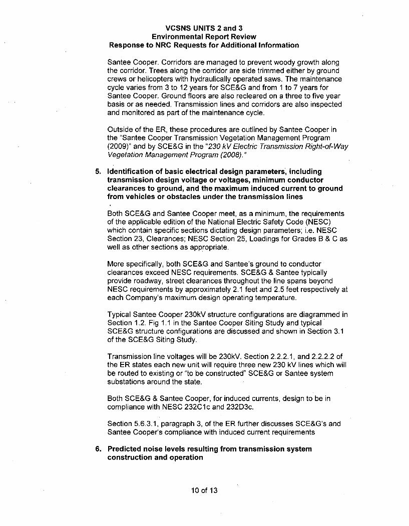
Santee Cooper. Corridors are managed to prevent woody growth alongthe corridor. Trees along the corridor are side trimmed either by groundcrews or helicopters with hydraulically operated saws. The maintenancecycle varies from 3 to 12 years for SCE&G and from 1 to 7 years forSantee Cooper. Ground floors are also recleared on a three to five yearbasis or as needed. Transmission lines and corridors are also inspectedand monitored as part of the maintenance cycle.
Outside of the ER, these procedures are outlined by Santee Cooper inthe "Santee Cooper Transmission Vegetation Management Program(2009)" and by SCE&G in the "230 kV Electric Transmission Right-of-WayVegetation Management Program (2008)."
5. Identification of basic electrical design parameters, includingtransmission design voltage or voltages, minimum conductorclearances to ground, and the maximum induced current to groundfrom vehicles or obstacles under the transmission lines
Both SCE&G and Santee Cooper meet, as a minimum, the requirementsof the applicable edition of the National Electric Safety Code (NESC)which contain specific sections dictating design parameters; i.e. NESCSection 23, Clearances; NESC Section 25, Loadings for Grades B & C aswell as other sections as appropriate.
More specifically, both SCE&G and Santee's ground to conductorclearances exceed NESC requirements. SCE&G & Santee typicallyprovide roadway, street clearances throughout the line spans beyondNESC requirements by approximately 2.1 feet and 2.5 feet respectively ateach Company's maximum design operating temperature.
Typical Santee Cooper 230kV structure configurations are diagrammed inSection 1.2. Fig 1.1 in the Santee Cooper Siting Study and typicalSCE&G structure configurations are discussed and shown in Section 3.1of the SCE&G Siting Study.
Transmission line voltages will be 230kV. Section 2.2.2.1, and 2.2.2.2 ofthe ER states each new unit will require three new 230 kV lines which willbe routed to existing or "to be constructed" SCE&G or Santee systemsubstations around the state.
Both SCE&G & Santee Cooper, for induced currents, design to be incompliance with NESC 232C1c and 232D3c.
Section 5.6.3.1, paragraph 3, of the ER further discusses SCE&G's andSantee Cooper's compliance with induced current requirements
6. Predicted noise levels resulting from transmission systemconstruction and operation
10 of 13
VCSNS UNITS 2 and 3Environmental Report Review
Response to NRC Requests for Additional Information
Noise levels from transmission line operation are'addressed in the sitingstudies completed by both SCE&G and Santee Cooper in sections 6.12and 4.9.2 of the respective studies. The SCE&G study states that thenoise level will remain below 40 dB while the Santee Cooper study statesthat noise will stay below 42 dBA. However, in both cases, these noiselevels will approach the stated levels only while the listener is very closeto the transmission lines and then only in wet days. Noise levels aregenerally inaudible over other sources of background noise. For areference, 40 dB is considered to be close to the noise level of a quietlibrary.
As mentioned in the Santee Cooper Siting Study on Page 4-18,construction activities will temporarily increase noise levels in the area.However, methods are implemented to mitigate the problem such asprohibiting work during sensitive nighttime hours and proper maintenanceof construction equipment.
Section 5.6.3.3 of the ER states that "...noise along the existingtransmission lines is very low or inaudible" and that "SCE&G and SanteeCooper seldom receive complaints on noise from transmission lines."
Currently, the number of complaints is minimal and complaints regardingtransmission line noise are handled on a case by case basis.
7. Description of land use limitations within the transmission linecorridors
After construction of the transmission lines, SCE&G and Santee Cooperboth maintain programs seeking to maintain the right of way whichinclude vegetation management as mentioned in Section 5.6.1 of the ER.Furthermore, as described in section 6.5 of the SCE&G Siting Study, themost significant land use limitation of the proposed transmission lines willbe the permanent restriction on structure erection and timber productionin the right of way as outlined in the respective company's encroachmentguidelines and/or the right of way easement document wording.
8. General methods of construction for the proposed new transmissionlines and upgrades (e.g., tower foundations, stringing, location ofaccess roads, span length, and clearing of rights-of-way).
South Carolina Electric & GasConstruction and upgrade methods to build new lines, i.e. installfoundations, set poles, string conductor, and clear ROWs will followstandard SCE&G practices which are in line with industry acceptedpractices. Clearing and establishing new rights of way typically involvesthe use of specialized equipment such as the "Shinn Cutter". The shinncutter mulches vegetation, trees and stumps (to ground level or above) inan environmentally efficient manner. SCE&G deliberately leaves stumpslow cut with root systems intact, i.e. no grubbing with minimal soil
11 of 13

VCSNS UNITS 2 and 3Environmental Report Review
Response to NRC Requests for Additional Information
disturbance. These methods allow access while preserving water qualityas new, desirable vegetation is established in the corridor.
SCE&G follows the SCE&G Wetlands Standard Operating Procedurewhen right of way conditions dictate, i.e. utilizing chain saws for handcutting; mats, high flotation equipment and/or other as restricted inwetland areas.
For new construction or upgrades, within existing ROWs, SCE&G'sherbicide program has created ROWs that are covered with naturalgrasses that protect the soil and surrounding water quality. Unlike woodyspecies, grasses have a better root system that will naturally protect theenvironment during construction activities.
Lines will typically be constructed with single shaft single-circuit or doublecircuit steel or concrete poles. Typical SCE&G structure configurationsare discussed and shown in Section 3.1 of the SCE&G Siting Study.These poles are erected with appropriate construction equipment.
Depending upon soil and design conditions, individual poles may bedirect-embedded in an augured hole and backfilled with "select" or nativematerial or the pole may require a designed foundation, either a vibratorysteel caisson or augured, reinforced concrete foundation with the poleattached by appropriate anchor bolts.
Span lengths are affected by topography, clearance restrictions, andother design considerations. Spans are typically 500 to 800 feet asdiscussed in Section 3.1 of SCE&G's Siting Study.
Access to the line and structure locations are typically through existingfield or woods roads, drives, local county or state roads. Once the right ofway area is accessed; construction manpower and equipment typicallytraverses down the cleared right of way. SCE&G does not typicallyconstruct new access roads along or down the right of way. However, ifrequired appropriate permitting and Best Management Practices will bepursued/followed.
Santee CooperDuring clearing and construction, Santee Cooper complies with Federal,State, and Local authorities and their requirements. Regarding clearing,Santee Cooper removes the trees and underbrush. No grubbing ordisturbing the root system or changing existing contours is allowed.During construction, poles may be direct embedded in an augured hole,vibrated into place, or placed on top of installed concrete foundation.Stringing is completed using a controlled tension method. Span lengthsand structure locations are determined in the design phase of project.Construction specifications are prepared for each specific project.
12 of 13

VCSNS UNITS 2 and 3Environmental Report Review
Response to NRC Requests for Additional Information
Associated COLA Revisions:No COLA revision is required as a result of the response to this RAI.
Associated Attachments:None
13 of 13