-a- · through truss othrr: open-spandrel concrete arch bridge materials (enter categories from...
TRANSCRIPT

NPS Form 10-900 (Oct. 1990)
OMBNo. 10024-0018
O
United States Department of the Interior National Park Service
National Register of Historic Places Registration Form
This form is for use in nominating or requesting determinations for individual properties and districts. .See instructions in Howio Complete the National Register of Historic Places Registration Form (National Register Bulletin 16A}. Complete each Jtem^'flfii|R|r^,"^jh the appropriate box or by entering the information requested. If an item does not apply to the property being documented, enter,"N/A" fpr'"pot applfcQftK" For functions, architectural classification, materials, and areas of significance, enter only categories and subcate^gories from tt^%^r%tions. Place additional entries and narrative items on continuation sheets (NPS Form 10-900a). Use a typewriter; word pVuujssbr, or cdmpttteQ'tdagmplete all items.
1. Name of Property
historic name Twin Bridge*
Other names/Site number Hendrinks rmmfy Bridge m 78, Rig Four Railmad Bridge 063-140-30030,10040, 30IU1
2. Location
Street & number r.nnnty RnaH 1 SO Fast nvftr White T.ick Peek_____
City Or town Danville________________________________
state Indiana______ code TN_____ county HenHricks
N/A n not for publication
————B vicinity
code o*n zip code 46121
3. State/Federal Agency Certification
As the designated authority under the National Historic Preservation Act, as amended, I hereby certify that this $ nomination D request for determination of eligibility meets the documentation standards for registering properties in the National Register of Historic Places and meets the procedural and professional requirements set forth in 36CFR Part 60. In my opinion, the property H meets D does not meet the National Register criteria. I recommend that this property be considered significant D nationally D statewide ED Jacally ( D See continuation sheet for additional comments.)
Signature of certifying/officl Date
Indian ent of Natural Resources
In my opinion, the property D meets D does not meet the National Register criteria. ( D See continuation sheet for additional comments.)
Signature of certifying official/Title Date
State or Federal agency and bureau -A-4. National Park Service CertificationI hereb/certify that the property is:
fi/ entered in the National Register. D See continuation sheet.
rj determined eligible for the National Register
rj See continuation sheet. Q determined not eligible for the
National Register
D removed from the National Register D other, (explain:) _________
Date of Action
Twin Hpnri ricks IN
Name of Property County and State
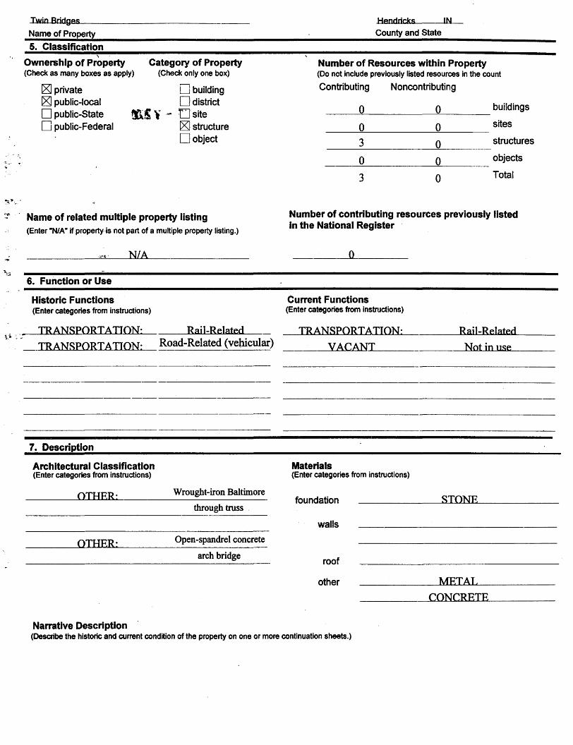
5. Classification
Ownership of Property(Check as many boxes as apply)
E3 private £3 public-local D public-State D public-Federal
Category of Property(Check only one box)
LJ building D district
- Osite [X] structure D object
Number of Resources within Property(Do not include previously listed resources in the count
Contributing Noncontributing
0
0
3
0
3
0
0
0
0
0
buildings
sites
structures
objects
Total
Name of related multiple property listing(Enter "N/A" if property is not part of a multiple property listing.)
__________ N/A_____________
Number of contributing resources previously listed in the National Register
0
6. Function or Use
Historic Functions(Enter categories from instructions)
TRANSPORTATION: Rail-Related
Current Functions(Enter categories from instructions)
TR ANSPORT ATION: Rail-RelatedTRANSPORTATION!_ Road-Related (vehicular) _____VACANT Not in use
7. Description
Architectural Classification(Enter categories from instructions)
OTHRR; Wrought-iron Baltimore
through truss
OTHRR: Open-spandrel concrete
arch bridge
Materials(Enter categories from instructions)
foundation
walls
STONF.
roof
other MFT AT.
CONCRETE
Narrative Description(Describe the historic and current condition of the property on one or more continuation sheets.)

Twin Hendricks _ INName of Property County and State
8. Statement of Significance
Applicable National Register Criteria(Mark V in one or more boxes for the criteria qualifying the propertyfor National Register listing.)
[x] A Property is associated with events that have made a significant contriibution to the broad patterns of our history.
B Property is associated with the lives of persons significant in our past.
Property embodies the distinctive characteristics of a type, period, or method of construction or represents the work of a master, or possesses high artistic values, or represents a significant and distinguishable entity whose components lack individual distinction.
Property has yielded, or is likely to yield, information important in prehistory or history.
Criteria Considerations(Mark "x" in all the boxes that apply.)
Property is:
>;
P B* • n C•*• D D
D E
D F.
D G
owned by a religious institution or used for religious purposes.
removed from its original location.
a birthplace or grave.
a cemetery.
a reconstructed building, object, or structure.
a commemorative property.'ess tnan 50 years of age or achieved significancewithin the past 50 years.
Narrative Statement of Significance(Explain the significance of the property on one or more continuation sheets.)
Areas of Significance(Enter categories from instructions) ENGINEERING
TRANSPORTATION
Period of Significancer.1870- 1Q06_______
Significant Datesc.l 870________
1RR7
1906
Significant Person(Complete if Criterion B is marked above)
N/A___________________
Cultural Affiliation
N/A__________
Architect/BuilderIndiana Rridgft flnmpany nf Indianapolis
Diinne, W.M_______________
9. Maior Bibliographic References
Bibliography(Cite the books, articles, and other sources used in preparing this form on one or more continuation sheets.)Previous documentation on file (NPS):
D preliminary determination of individual listing (36CFR 67) has been requested
D previously listed in the National Register D Other State agency
Primary location of additional data:State Historic Preservation Office
D previously determined eligible by the National Register
G designated a National Historic Landmark
D recorded by Historic American Buildings Survey
D recorded by Historic American Engineering Record # ______________
D Federal agency
D Local government
D University
D Other
Name of repository:

Twin
Name of PropertyIN
County and State
10. Geographical Data
Acreage of Property 3.65
UTM References(Place additional UTM references on a continuation sheet.)
Verbal Boundary Description(Describe the boundaries of the property on a continuation sheet.)
Zone Easting
4 LUNorthing
D See continuation sheet
Boundary Justification(Explain why the boundaries were selected on a continuation sheet.)
11. Form Prepared By
name/title Joseph P. Salriihar TTT
organization
street & number N
city or town Indianapolis
St., Apt 417
date 4/15/QQ
telephone 317-955-0091
state zip code 46202
Additional DocumentationSubmit the following items with the completed form:
Continuation Sheets
MapsA USGS map (7.5 or 15 minute series) indicating the property's location.A Sketch map for historic districts and properties having large acreage or numerous resources.
PhotographsRepresentative black and white photographs of the property.
Additional items(Check with the SHPO or FPO for any additional items)
Property Owner(Complete this item at the request of SHPO or FPO.)
name
street & number
city or town
telephone
state zip code
Paperwork Reduction Act Statement: This information is being collected for applications to the National Register of Historic Places to nominate properties for listing or determine eligibility for listing, to list properties and to amend existing listings. Response to this request is required to obtain a benefit in accordance with the National Historic Preservation Act, as amended (16 U.S.C. 470 et seq.).
Estimated Burden Statement: Public reporting burden for this form is estimated to average 18.1 hours per response including time for reviewing instructions, gathering and maintaining data, and completing and reviewing the form. Direct comments regarding this burden estimate or any aspect of this form to the Chief, Administrative Services Division, National Park Service, P.O. Box 37127, Washington, DC 20013-7127; and the Office of Management and Budget, Paperwork Reductions Projects (1024-0018), Washington, DC 20503.

NFS Form 10-900-a QMB Approval No. 1024-0018 (8-86)
United States Department of the InteriorNational Park Service
National Register of Historic Places Continuation Sheet
Section Number _7_ Page 1 Twin Bridges, Hendricks County, Indiana
Architectural Description:
Introduction:There are three resources at this site: a concrete railroad bridge, built by the Big Four Railroad; a
wrought-iron highway bridge, known as Hendricks County #178; and a stone abutment which once carried an iron railroad bridge, built by the Indianapolis & St. Louis Railroad. The two bridges span the west fork of White Lick Creek, about V* mile southwest of Danville, Indiana. The stone abutment lies between the two bridges. The surrounding terrain is wooded and hilly to the east and south, wooded to the west, and open to the north. (PHOTO 1)
Jndianapolis & St. Louis RR abutment:This cut-stone railroad abutment (PHOTO 2) was built c. 1870 to support a single-track Pratt deck truss
across White Lick Creek and County Road 150 East. The Pratt deck truss was removed around 1906 when the *Big Four Railroad replaced it with the concrete arch bridge. A second abutment stood on the east side of
nty Road 150 East until 1989, when it wasl&m down to make way for a new road.The remaining abutment stands atop a substantial wingwall supporting an earthen embankment. The
wuigwall is also made of cut-stone blocks. The wingwall extends 20' to the north, touching the cut-stone abutments of the iron truss bridge. The south end of the wingwall is less substantial and extends only 5'. The wingwall is about 15' high and is partially covered by brush. One stone at the top of the wingwall has four metal bolts (PHOTO 3) which once anchored the Pratt truss. Other stones in this area are carved with various initials. The date " 1900" appears several tunes in these carvings.
The abutment above the wingwall formed the back of the deck truss and carried the single rail line. It is about 10' wide and 15' tall. It is set back 5' from the edge of the wingwall. The abutment extends back to the west about 20'. The rough-faced cut-stone blocks measure 30" x 30" x 48", and are set with a lime-based mortar. (PHOTO 4)
Judging from historic photographs, the abutment and wingwall appear to have changed little over the years. The southern end of the wingwall may have been reduced in size when construction began on the concrete bridge. The elevation south of the old abutment was changed by the new rail line (which is 15' higher than the old one), and the wingwall may have simply been buried. The north wuigwall and bridge abutment are in good condition. The stone blocks are intact and in place with very few exceptions. The site is overgrown, but the abutment can be seen from the road.
The east abutment was slightly smaller than the west abutment, but the wingwall was larger (it held back more fill). Like its counterpart, it was constructed of cut-stone. No trace of this abutment remains. However, the steep hill of the railroad embankment is still visible, and the old railroad line can be made out at the top. (PHOTO 7) From the road, one can visualize where the old abutment once stood.

NPS Form 10-900-a QMB Approval No. 1024-0018 (8-86)
United States Department of the InteriorNational Park Service
National Register of Historic Places Continuation SheetSection Number 7 Page 2 Twin Bridges, Hendricks County, Indiana
Hendricks County Bridge #178:Hendricks County Bridge #178 (PHOTO 5) is a pin-connected Baltimore through truss constructed
in 1887 by the Indiana Bridge Company of Indianapolis. It spans 149'-6" over White Lick Creek, facing northwest-southeast. The west truss is offset about 6 feet to the south. Each truss is subdivided by a series of sub-struts and sub-ties to create the equivalent of twelve short panels, each measuring 12'-5". The trusses rest on a cut-stone substructure.
The three central verticals are compression-bearing and are fabricated from two sizes of laced channels.* The two outer full verticals, as well as the six sub-verticals, are made from a pair of cylindrical eyebars. The diagonals, sub-struts, and sub-ties vary from die-forged to loop-welded eyebars, some of which are adjustable. An I-beam diagonal serves as a collision strut in the first and sixth panels. The main, double-intersecting diagonals consist of three die-forged eyebars, one of which is adjustable. The truss also has an adjustable member (to protect the central verticals from buckling) parallel to and midway between the two chords across the four center panels which then stretches diagonally to the top chord-endpost connection. Heavy rectangular die-forged eyebars (three for the endpost panels; two for the center panels) form the lower chord and run through the intermediate panel points. Double U-bolted to pins below the lower chord, girder floor beams carry the asphalt-over-timber deck. The deck is 16'-8" wide and rides 17' above the water. (PHOTOS 6,7,8)
The bridge carries a nameplate on its southeast portal. (PHOTO 9) A similar nameplate once existed on the northwest portal, but has been removed. The railing consists of a metal channel which does not appear to be original; it is welded to the verticals. The wooden deck is in good condition, and the asphalt roadway covering it is in fair condition.
The bridge has been closed to highway traffic. Overall, the bridge is in good condition with some minor rusting.
Big Four RR Bridge:This three-span concrete structure (PHOTO 10) was built in 1906 to carry two railroad tracks across
White Lick Creek and County Road 150 East. The rings are segmental and coped. They are about 2' deep at the center of each span, and about 4' deep where they join a pier tower or abutment. They are raised vertically on the piers (PHOTO 11) as necessary to balance each other (10-12' in the center span). Above the rings, arched spandrel columns support a 2' concrete slab deck on which the crushed-stone roadbed lies. The spandrel columns are solid and extend the width of the structure, creating a series of tunnel-like cells within the bridge. (PHOTO 12) A 3'-square access hole in the center of each spandrel column allows access to the entire structure. The heavy piers are hollow inside to conserve concrete. A 15* high concrete wingwall holds back the embankment below the east abutment to allow the County road to pass through the east arch. The date "1906" is carved into the center arch on both sides of the bridge. (PHOTO 13)

NPS Form 10-900-a OMB Approval ^ 1Q24-0018 (B-B6)
United States Department of the InteriorNational Park Service
National Register of Historic Places Continuation Sheet
Section Number 7.8 Page _2_ Twin Bridges, Hendricks County, Indiana
The bridge and both tracks are still actively used. The bridge is in good condition, although it is in need of maintenance. The south side of the bridge seems to have weathered more than the north side; in one case, the concrete has worn away to expose the reinforcing rods hi a few spandrel columns in the west arch. (PHOTO 14) The interior of the bridge is covered with graffiti, but the exterior is not. The bridge maintains its integrity and appears to have undergone no modifications or alterations in its 90 years of service. The coping of the arch rings is unusual, especially for a railroad bridge hi a rural setting.
Statement of Significance:
Overview:The Twin Bridges of Hendricks County consist of an iron truss highway bridge and a concrete
railroad bridge, both spanning White Lick Creek just east of Danville. A stone abutment, all that remains of an earlier iron railroad bridge which spanned the Creek, is a contributing resource. All three structures are significant under Criterion C (Engineering) and Criterion A (Transportation).The iron bridge, known as Hendricks County Bridge #178 , is a rare example of a Baltimore truss bridge, which was used in the late 19th century for railroads and (more rarely) for highways. The concrete bridge, which carries two CSX railroad tracks, is a very early example of an open-spandrel concrete arch bridge. The stone bridge abutment is a rare survivor from the early days of the railroad in Indiana.
The Twin Bridges retain their integrity. One stone abutment for the old iron railroad bridge still stands; the other was demolished recently to make way for a new connector road. The remaining abutment retains its integrity, and the site as a whole has not been significantly altered by this new construction. The bridges stand as monuments to the expansion of transportation in Hendricks County, and the rapid changes in technology that helped to speed that expansion. The iron and concrete bridges were rated "Outstanding" in the Hendricks County Interim Report (1989). The stone abutment was rated "Contributing". 1
Railroad Abutment:The Indianapolis & St. Louis Railroad was organized in 1868 to build a railroad between Terre
Haute and Indianapolis, linking with the St. Louis, Alton, and Terre Haute RR's line to St. Louis.2 This was the first link between the Hoosier capitol and the bustling center of the country. The line was completed through Putnam County by 1870; presumably, the Hendricks County portion was completed about the same time.3
In crossing the west fork of White Lick Creek, the railroad's engineers devised a rather monumental structure; an eight-panel Pratt deck truss seated on large, cut-stone abutments. Deck trusses

NPS Form 10-900-a OMB Approval No. 1024-0018 (8-86)
United States Department of the InteriorNational Park Service
National Register of Historic Places Continuation Sheet
Section Number _8__ Page 4 Twin Bridges, Hendricks County, Indiana
are not common to Indiana, for rarely is the grade high enough (or the clearance great enough) to allow the trussing to lie below the roadway. At the Twin Bridges site, however, a large hill on the east side of the stream necessitated the construction of a large embankment to the west, as well as a high-level crossing. The single-track deck truss appears quite substantial in historic photographs; the trusses themselves are at least as large as the current Baltimore highway truss.4
The surviving bridge abutment seems rather small today, considering the large structure it once carried. The abutment is high, but not particularly wide. The east abutment was somewhat larger, because it had to hold back a larger amount of earth. The west abutment was also limited hi size by County Road 150, which passes just to the north. In fact, the stone substructure for the Baltimore truss touches the stone abutment for the old Pratt railroad bridge.
The stone abutment retains a surprising degree of integrity. Although the site has gradually become overgrown with trees and brush, the stonework is clearly visible. The stones are also still firmly in place, unmoved by more than a century of abandonment. A reminder of the great truss which once stood here can be seen in the remains of the iron bolts which anchored the span to the stone.
The east abutment was torn down by the county in 1989. This allowed for the construction of a new road which connects to US 36. Previously, county residents traveling down Twin Bridges Road had to make a sharp turn on the iron bridge, then follow a twisty route into town, through back streets, before reaching the main road. The new road bypasses the iron bridge, which is now closed to traffic. Although the east abutment is gone, the railroad embankment behind it still exists. Standing at the site, one can easily visualize where the old abutment and railroad bridge stood.
Twin #1: Hendricks County Bridge #178The Indianapolis Bridge Company began operation in 1883 with $10,000 in capital and the backing
of two experienced bridge builders. Company President William W. Winslow had worked for the King Iron Bridge Company and the Wrought Iron Bridge Company, two of Ohio's most prolific bridge builders. Company Vice-President Solomon H. Godman held patents for a "plate-leg girder" design, and was a skilled engineer.5
In short order Godman and a group of Indianapolis businessmen raised $75,000 hi additional stock and overthrew Winslow as president. In doing so, they removed themselves from the control of the Wrought Iron Bridge Company, and began to fabricate and design then* own bridges.
The new company built more than 180 bridges across the state; a handful still stand. Competition from Ohio firms proved to be too much, however, and the fledgling company found itself on the financial shoals by 1885. Salvation came in the form of a group of Muncie businessmen, who reorganized the firm as the Indiana Bridge Company of Indianapolis in May, 1886. This was the situation when the company contracted to build a bridge over White Lick Creek in Hendricks County, just east of Danville, which

NFS Form 10-900-a OMB Approval No. 1024-0018 (8-86)
United States Department of the InteriorNational Park Service
National Register of Historic Places Continuation Sheet
Section Number _8__ Page 5 Twin Bridges, Hendricks County, Indiana
would become known as Hendricks County Bridge #178.6 The firm moved to Muncie, Indiana in late 1887, and became known as the Indiana Bridge Company. There they would become the largest and most prolific Indiana bridge builder.
Hendricks County # 178 is not the first highway bridge to span this particular stretch of White Lick Creek. A bridge of some sort was listed in the 1876 county atlas of Hendricks County. This may have been a timber bridge or an iron one.7 When designing the replacement structure, the Indiana Bridge Company faced an unusual challenge- designing a heavy duty bridge, on a skew, that was compact enough to fit under the I&StL's railroad bridge. The skew was necessary to snake around the massive stone abutments holding up the deck truss.
The new bridge fit- but barely. Photographs of these "twin" bridges show the upper chord of the Baltimore truss only a few feet from the bottom chord of the Pratt deck. Likewise, the road continued to wind around the stone abutments. Wagons entering the bridge from the southeast had to negotiate a 90 degree turn before crossing the river.
The tight squeeze caused by the railroad bridge may be the reason why the County Commissioners selected this unusual truss type. Certainly a twisty county road like this was not intended to handle heavy traffic loads. Alternate routes were available for residents living in the southeast part of Center Township. However, the length of the span required-150 feet -was generally the upper limit of most Pratt truss bridges in the 19th century.8 Lengthening the Pratt any further would have required unusually high trusses, and these would not fit under the deck truss bridge. The Baltimore may have been a better option.
Hendricks # 178 is an important survivor in that it is one of only 3 surviving Baltimore truss bridges in Indiana, and one of only 2 highway trusses. In addition, the bridge is one of only two structures still standing which are known to have been built by the Indiana Bridge Company during its short-lived tenure in Indianapolis (the other bridge, in both cases, is Martin County #21).
The iron bridge was closed to traffic hi 1989 when the new connector road to US 36 was built. Leaving the bridge open would have created a major traffic hazard. Bypassing the old road also protected Bridge # 178 from being torn down. The bridge is currently not maintained, but no significant signs of deterioration are evident. Plans are currently underway to restore the bridge for pedestrian use.
The Baltimore Truss:The growth of America's railroad system (160,000 miles of track was built between 1865 and
1900) and the increasing size of trains placed ever-increasing demands on the bridges which carried them.9 In the 1870s and 1880s, it was common to have at least 25 bridge failures per year on America's railroads, or one for every 5,000 miles of track. 10
Early railroad bridges usually employed one of two truss types: the Pratt and the Howe. Both were originally designed to combine wood and metal members, but by the 1870s they were being made

NPS Form 10-900-a OMB Approval No. 1024-0018(O-OD)
United States Department of the InteriorNational Park Service
National Register of Historic Places Continuation Sheet
Section Number _8_ Page 6 Twin Bridges, Hendricks County, Indiana
entirely of iron to increase their strength. Both bridges had their limits, however, and the railroads often tested them with disastrous results. Two high-profile accidents in the late 1870s involving Howe trusses placed the need for better bridges in the public spotlight. 11 Engineers soon began tinkering with the Pratt's design to give the truss a greater carrying capacity. The first of these 'modified trusses' was the Baltimore truss, first built in 1871. 12
The Baltimore truss featured subdivided panels, which in turn helped support a much lighter and stronger floor system than would have been possible with a comparative Pratt truss. The use of subdividing diagonals was cheaper than the conventional strengthening method of multiple-panel diagonals (such as the Whipple truss) because it used less iron. Thus, the Baltimore was stronger and cheaper than competing designs. The truss was named for the Baltimore and Ohio Railroad, which was completing a major expansion program in the 1870s and became the leading builder of the new bridge type. 13
Twin #2: Big Four Railroad BridgeThe Indianapolis and St. Louis Railroad came under the control of the Cleveland, Columbus,
Cincinnati, and Indianapolis Railroad hi 1882. Known popularly as the "Bee Line", the C.C.C.& I. was a Vanderbilt-backed organization with an eye for expansion. It merged with the Cincinnati, Indianapolis, St. Louis, and Chicago Railroad (commonly known as the "Big Four") in 1889. 14
The newly formed Cleveland, Cincinnati, Chicago, and St. Louis Railroad (also known as the "Big Four") was a subsidiary of the New York Central Railroad, one of the largest rail networks hi America. Although technically an independent firm, the Big Four worked according to the NYC's plans. At the turn of the century, those plans were for expansion. 15
By 1900 the New York Central and its archrival, the Pennsylvania Railroad, found themselves competing for the same traffic along nearly parallel routes. In Hendricks County, for example, the Big Four RR ran west-east through Reno, Danville, and Avon, while the Pennsy ran west-east through Coatsville, Amo, and Plainfield. In addition, the B&O Railroad had a line running to Indianapolis through Brownsburg in the northeast corner of the county. Competition was fierce, and every company did what was needed hi order to stay one step ahead. With this in mind, NYC set out to double-track its Big Four lines in Indiana.
The I&STL RR deck truss, just three decades old, was already outdated. Expansion of the bridge was impossible due to site constraints. A heavier truss in the same spot would interfere with the county bridge below. The only option, and the one eventually taken, was to bypass the old span entirely and start from scratch just downstream.
Once again, railroad engineers were faced with a site problem rarely found in Indiana- a wide and deep river valley combined with a high embankment and a rather cluttered valley floor. To span the river at this point (with two tracks) would have required a Pennsylvania truss, and a large one at that. Concrete,
NPS Form 10-900-a OMB Approval No. 1024-0018
United States Department of the InteriorNational Park Service
National Register of Historic Places Continuation Sheet
Section Number 8 Page 7 Twin Bridges, Hendricks County, Indiana
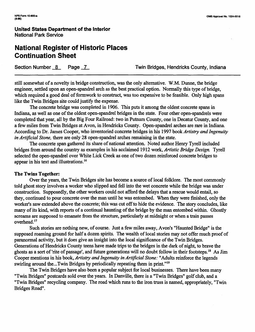
still somewhat of a novelty in bridge construction, was the only alternative. W.M. Dunne, the bridge engineer, settled upon an open-spandrel arch as the best practical option. Normally this type of bridge, which required a good deal of formwork to construct, was too expensive to be feasible. Only high spans like the Twin Bridges site could justify the expense.
The concrete bridge was completed in 1906. This puts it among the oldest concrete spans in Indiana, as well as one of the oldest open-spandrel bridges in the state. Four other open-spandrels were completed that year, all by the Big Four Railroad: two hi Putnam County, one in Decatur County, and one a few miles from Twin Bridges at Avon, in Hendricks County. Open-spandrel arches are rare in Indiana. According to Dr. James Cooper, who inventoried concrete bridges in his 1997 book Artistry and Ingenuity in Artificial Stone, there are only 28 open-spandrel arches remaining hi the state.
The concrete span gathered its share of national attention. Noted author Henry Tyrell included bridges from around the country as examples in his acclaimed 1912 work, Artistic Bridge Design. Tyrell selected the open-spandrel over White Lick Creek as one of two dozen reinforced concrete bridges to appear in his text and illustrations. 16
The Twins Together:Over the years, the Twin Bridges site has become a source of local folklore. The most commonly
told ghost story involves a worker who slipped and fell into the wet concrete while the bridge was under construction. Supposedly, the other workers could not afford the delays that a rescue would entail, so they, continued to pour concrete over the man until he was entombed. When they were finished, only the worker's saw extended above the concrete; this was cut off to hide the evidence. The story concludes, like many of its kind, with reports of a continual haunting of the bridge by the man entombed within. Ghostly screams are supposed to emanate from the structure, particularly at midnight or when a train passes overhead. 17
Such stories are nothing new, of course. Just a few miles away, Avon's "Haunted Bridge" is the supposed roaming ground for half a dozen spirits. The wealth of local stories may not offer much proof of paranormal activity, but it does give an insight into the local significance of the Twin Bridges. Generations of Hendricks County teens have made trips to the bridges in the dark of night, to brave the ghosts as a sort of 'rite of passage', and future generations will no doubt follow in their footsteps. 18 As Jim Cooper mentions in his book, Artistry and Ingenuity in Artificial Stone: "Adults reinforce the legends swirling around the... Twin Bridges by periodically repeating them in print."19
The Twin Bridges have also been a popular subject for local businesses. There have been many "Twin Bridges" postcards sold over the years. In Danville, there is a "Twin Bridges" golf club, and a "Twin Bridges" recycling company. The road which runs to the iron truss is named, appropriately, "Twin Bridges Road".

NPS Form 10-900-a OMB Approval No. 1024-0018 (8-86)
United States Department of the InteriorNational Park Service
National Register of Historic Places Continuation Sheet
Section Number 8 Page 8 Twin Bridges, Hendricks County, Indiana
Conclusion:The Twin Bridges stand as a reminder to a period in time when rapid growth was transforming the
Indiana countryside. Railroads and highways were continually upgraded to meet the ever-growing demands of then* users. In just 35 years, this crossing saw at least four bridges rise and fall along the creek banks; two highway bridges, including Hendricks County # 1 78, and two railroad bridges; one iron, one concrete. The careful stonework of the surviving railroad abutment contrasts with the massive bulk of the concrete arches. Between them, the complex iron work of the Baltimore truss stands as a reminder to the glory days of Indiana bridge-building.
All three structures represent rare building types in Indiana. The Baltimore truss is one of only three to survive in the state. It is also one of only two bridges remaining from the days when the Indiana Bridge Company operated in Indianapolis; a 'bridge* of sorts between the fledgling Indianapolis Bridge Company and the nationally-known Indiana Bridge Company of Muncie. The concrete arch span is among the oldest of its kind, as well as one of the oldest concrete bridges in general. It is also one of just 28 open-spandrel arch bridges still extant in Indiana. The stone railroad abutment is an unusual example of a first generation railroad structure. The railroads were constantly upgrading and replacing then* assets; to have such a large structure survive for so long is quite unusual.
The old iron bridge was bypassed in 1989 when a new road was built to provide a direct link to U.S. Route 36. The new connector road has altered the formerly secluded nature of the spans, but they retain their architectural character and integrity. Neither they nor the 1870 stone abutment have undergone any significant changes since their construction. The site is important as a long-standing transportation link for both rail and road traffic. In addition, the two surviving bridges have become beloved local landmarks, complete with their own ghost story. For these reasons, these three structures deserve the honor of listing in the National Register of Historic Places.

NFS Form 10-900-a QMB Approval No. 1024-0018
United States Department of the InteriorNational Park Service
National Register of Historic Places Continuation SheetSection Number 8 Page 9 Twin Bridges, Hendricks County, Indiana
Endnotes:
1. Historic Sites and Structures Inventory Interim Report: Hendricks County. Indianapolis: Historic Landmarks Foundation of Indiana, 1989, 38.
2. Drury4 George H. The Historical Guide to North American Railroads. Waukesha, WI: Kalbach Books, 1991,213.
3. Historic Sites and Structures Inventory Interim Report: Putnam County. Indianapolis: Historic Landmarks Foundation of Indiana, 1982, xix.
4. Historic Sites and Structures Inventory Interim Report: Hendricks County.. 19: Industrial Souvenir of Hendricks County. State of Indiana. Plainfield, IN: Friends Press, 1904, 12.
5. Cooper, James L. Iron Monuments to Distant Posterity: Indiana's Metal Bridges 1870-1930. Greencastle, IN: DePauw University, 1987, 16.
6. Ibid, 17.7. Andreas, A.T. Illustrated Historical Atlas of the State of Indiana. Chicago: Baskin, Forster, & Co.,
1876,32.8. Cooper, Iron Monuments. 64.9. Parker, Francis H. Indiana Railroad Depots: A Threatened Heritage. Muncie, IN: Ball State
University, 1989, 2.10. Steinmann, David B. Bridges and Their Builders. New York: Dover Publications, 1957, 166.11. Ibid, 165. The bridge failures were the 1877 collapse of the Ashtabula Bridge in Ohio, and the 1879
collapse of the Firth of Tay Bridge hi Scotland. Both accidents killed nearly 100 people.12. Cooper, Iron Monuments. 68.13. Drury, 36.14. Ibid, 214.15. Ibid.16. Cooper, James L. Artistry and Ingenuity in Artificial Stone: Indiana's Concrete Bridges 1900-1942.
Greencastle, IN: DePauw University, 1997, 223.17. Baker, Ronald L. Hoosier Folk Legends. Bloomington, IN: Indiana University Press, 1982, 64. 1 8. Degh, Linda. "The Haunted Bridges Near Avon and Danville and Their Role hi Legend Formation."
Indiana Folklore (1969), II, 75. 19. Cooper. Artistry and Ingenuity. 223.
NPS Form 10-900-a QMB Approval No, 1024-0018 (8-86)
United States Department of the InteriorNational Park Service
National Register of Historic Places Continuation SheetSection Number 9 page 10 Twin Bridges, Hendricks County, Indiana
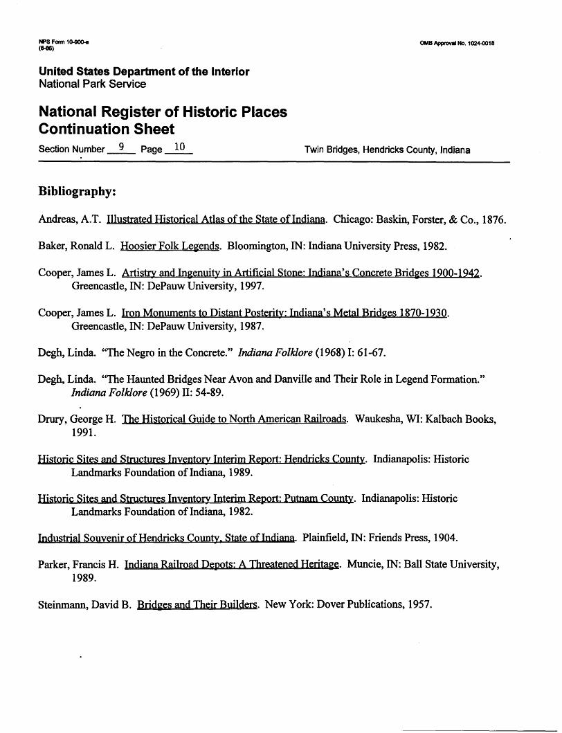
Bibliography:
Andreas, A.T. Illustrated Historical Atlas of the State of Indiana. Chicago: Baskin, Forster, & Co., 1876.
Baker, Ronald L. Hoosier Folk Legends. Bloomington, IN: Indiana University Press, 1982.
Cooper, James L. Artistry and Ingenuity in Artificial Stone: Indiana's Concrete Bridges 1900-1942. Greencastle, IN: DePauw University, 1997.
Cooper, James L. Iron Monuments to Distant Posterity: Indiana's Metal Bridges 1870-1930. Greencastle, IN: DePauw University, 1987.
Degh, Linda. "The Negro in the Concrete." Indiana Folklore (1968) I: 61-67.
Degh, Linda. "The Haunted Bridges Near Avon and Danville and Their Role in Legend Formation." Indiana Folklore (1969) II: 54-89.
Drury, George H. The Historical Guide to North American Railroads. Waukesha, WI: Kalbach Books, 1991.
Historic Sites and Structures Inventory Interim Report: Hendricks County. Indianapolis: Historic Landmarks Foundation of Indiana, 1989.
Historic Sites and Structures Inventory Interim Report: Putnam County. Indianapolis: Historic Landmarks Foundation of Indiana, 1982.
Industrial Souvenir of Hendricks County. State of Indiana. Plainfield, IN: Friends Press, 1904.
Parker, Francis H. Indiana Railroad Depots: A Threatened Heritage. Muncie, IN: Ball State University, 1989.
Steinmann, David B. Bridges and Their Builders. New York: Dover Publications, 1957.

NPS Form 10-900-a OMB Approval No. 1024-0018
United States Department of the InteriorNational Park Service
National Register of Historic Places Continuation SheetSection Number 10 Page ii Twin Bridges, Hendricks County, Indiana
Verbal Boundary Description:
The boundary is defined by a circle whose center is at the southeast corner of Hendricks County Bridge #178. The circle has a radius of 225 feet.
Boundary Justification:
Contains the two bridges and the stone abutment within their historic context area.

NFS Form 10-900-a OMB Approval No. 1024-0018 (8-86)
United States Department of the InteriorNational Park Service
National Register of Historic Places Continuation SheetSection Number .Photospage 12 Twin Bridges, Hendricks County, Indiana
Photographs:
The following information is common to all photographs:1.Twin Bridges2. Hendricks County, Indiana3. Joseph P. Saldibar,III4. February 20,19995. Indiana Department of Natural Resources,
Division of Historic Preservation and Archaeology402 W. Washington St., Room W274Indianapolis, IN 46202
#s 6 and 7 vary as noted in the following list:
Photo # Description of View
1 1887 Baltimore truss, c. 1870 stone abutment, and 1906 concrete bridge, looking west.
2 c.l 870 stone railroad abutment, general view, looking west.
3 Detail, stone abutment, showing iron bolts which once anchored the Pratt deck truss
railroad bridge. Looking east.
4 Detail, stone abutment, showing cut-stone blocks of abutment face. Looking west
5 1887 Baltimore truss, general viewm looking northwest.
6 Detail, Baltimore truss, showing pinned connection of lower chord, verticals, and diagonal
members. Looking southwest.
7 Detail, Baltimore truss, showing truss webbing. Also shows hill in background which is
all that remains of the east stone abutment (demolished 1989) and embankment for
old I.&StL RR line. Looking east.
8 Detail, Baltimore truss, showing truss webbing. Also shows 1906 concrete bridge.
Looking southeast.
9 Detail, Baltimore truss, showing bridge nameplate, top chord, portal, and skew. Looking
west.
NFS Form 10-900-a OMB Approval No. 1024-0018
United States Department of the InteriorNational-Park Service
National Register of Historic Places Continuation SheetSection Number Photospaqe 13 Twin Bridges, Hendricks County, Indiana
Photo # Description of View
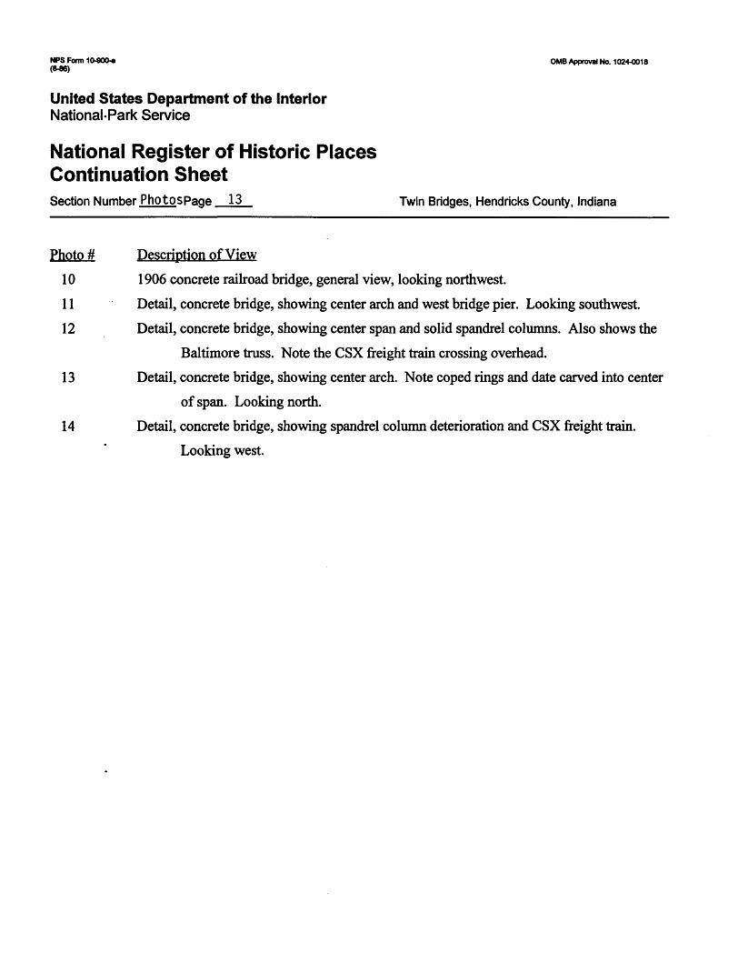
10 1906 concrete railroad bridge, general view, looking northwest.
11 Detail, concrete bridge, showing center arch and west bridge pier. Looking southwest.
12 Detail, concrete bridge, showing center span and solid spandrel columns. Also shows the
Baltimore truss. Note the CSX freight train crossing overhead.
13 Detail, concrete bridge, showing center arch. Note coped rings and date carved into center
of span. Looking north.
14 Detail, concrete bridge, showing spandrel column deterioration and CSX freight train.
Looking west.

Remains of I. & St. L RR line
Boundary Line
New (1989) Bypass Road
Remains of I. & St. L RR line
Big Four Railroad Bridge *
Twin BridgesHendricks County, Indiana Sketch Map Scale: 1" = 100'

Twin BridgesHendricks County, Indiana Photo Key Map Scale: 1" = 100'