aberdeen city conservation area character appraisals and ... · swot analysis 18. aberdeen city ......
TRANSCRIPT
To be read in conjunction with Section 1: Strategic Overview and Section 2: Management Plan
January 2015
Aberdeen City Conservation Area Character Appraisals and Management Plan
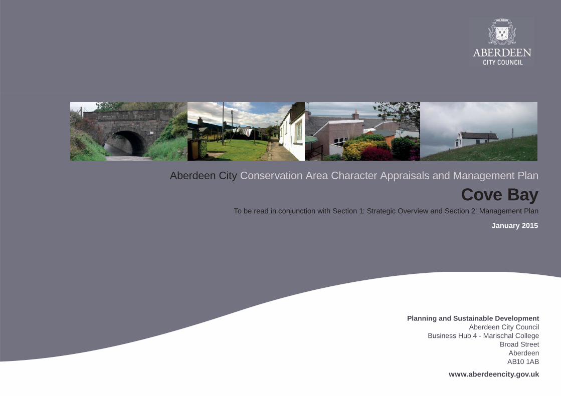
Cove Bay
Planning and Sustainable DevelopmentAberdeen City Council
Business Hub 4 - Marischal CollegeBroad Street
Aberdeen AB10 1AB
www.aberdeencity.gov.uk
2 Aberdeen City Conservation Area Character Appraisal | Cove Bay | January 2015
Contents
1 Introduction 3Profi le 3Summary of signifi cance 3
2 Location, History and Development 5Location 5Development history 5
3 Character 8Setting 8Built environment 9Public realm 13Natural environment 16
4 Management 18SWOT analysis 18
3Aberdeen City Conservation Area Character Appraisal | Cove Bay | January 2015
5Cove Bay
1 Introduction
1.1 Profi le
Designation date 22 December 1975Extended NoPrevious character appraisals n/aArticle 4 Direction YesSize (hectares) 33.7Number of character areas n/aNumber of listed buildings Cat C - 21Buildings at Risk 0Scheduled Ancient Monuments 0Adjoining Conservation Areas n/a
1.2 Summary of signifi cance
Both Cove Bay and Footdee were designated as Conservation Areas in 1975 because they were the only remaining examples of fi shing communities following the removal of Old Torry during the oil boom. At that time Cove Bay was largely unspoilt with fi sher and quarrier cottages of considerable charm and character. The setting of Cove Bay on the scenic cliff tops leading down to the harbour is one of its signifi cant features. Elements of the fi shing village however are still evidenced by the street pattern in the village core and the orientation of fi sher cottages with their gables facing the sea.

4 Aberdeen City Conservation Area Character Appraisal | Cove Bay | January 2015
Location of the conservation areas within the City of Aberdeen
© Crown copyright. All rights reserved. Aberdeen City Council 100023401 2012.
N
5 Cove Bay
Top : Stoneyhill TerraceBottom :Hasman Terrace
5Aberdeen City Conservation Area Character Appraisal | Cove Bay | January 2015
2 Location, history and development
2.1 Location
Cove Bay Conservation Area is located on the coast, approximately fi ve miles south of Aberdeen, just within the city boundary. It extends from the western extremity of the railway line; the North Sea coastline to the east; Kettle Cove to the south and Poor Man cove to the north.
2.2 Development history
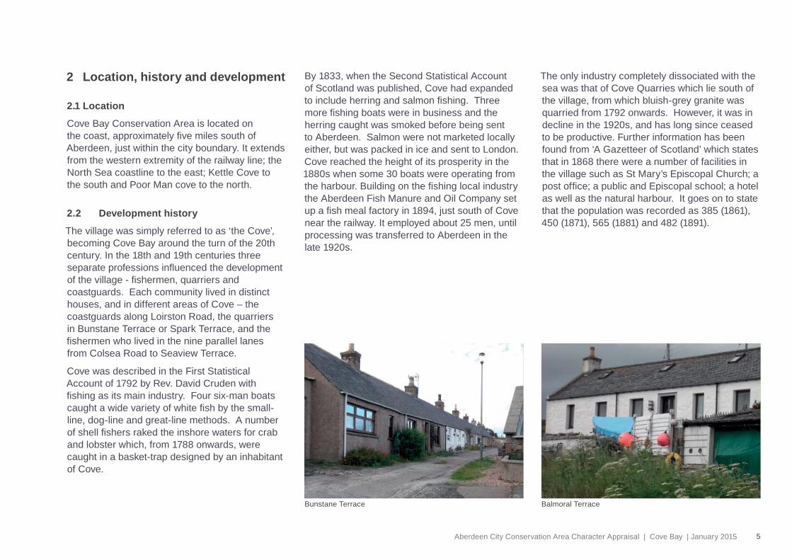
The village was simply referred to as ‘the Cove’, becoming Cove Bay around the turn of the 20th century. In the 18th and 19th centuries three separate professions infl uenced the development of the village - fi shermen, quarriers and coastguards. Each community lived in distinct houses, and in different areas of Cove – the coastguards along Loirston Road, the quarriers in Bunstane Terrace or Spark Terrace, and the fi shermen who lived in the nine parallel lanes from Colsea Road to Seaview Terrace.
Cove was described in the First Statistical Account of 1792 by Rev. David Cruden with fi shing as its main industry. Four six-man boats caught a wide variety of white fi sh by the small-line, dog-line and great-line methods. A number of shell fi shers raked the inshore waters for crab and lobster which, from 1788 onwards, were caught in a basket-trap designed by an inhabitant of Cove.
By 1833, when the Second Statistical Account of Scotland was published, Cove had expanded to include herring and salmon fi shing. Three more fi shing boats were in business and the herring caught was smoked before being sent to Aberdeen. Salmon were not marketed locally either, but was packed in ice and sent to London. Cove reached the height of its prosperity in the 1880s when some 30 boats were operating from the harbour. Building on the fi shing local industry the Aberdeen Fish Manure and Oil Company set up a fi sh meal factory in 1894, just south of Cove near the railway. It employed about 25 men, until processing was transferred to Aberdeen in the late 1920s.
The only industry completely dissociated with the sea was that of Cove Quarries which lie south of the village, from which bluish-grey granite was quarried from 1792 onwards. However, it was in decline in the 1920s, and has long since ceased to be productive. Further information has been found from ‘A Gazetteer of Scotland’ which states that in 1868 there were a number of facilities in the village such as St Mary’s Episcopal Church; a post offi ce; a public and Episcopal school; a hotel as well as the natural harbour. It goes on to state that the population was recorded as 385 (1861), 450 (1871), 565 (1881) and 482 (1891).
Balmoral TerraceBunstane Terrace
6 Aberdeen City Conservation Area Character Appraisal | Cove Bay | January 2015
5 Cove Bay
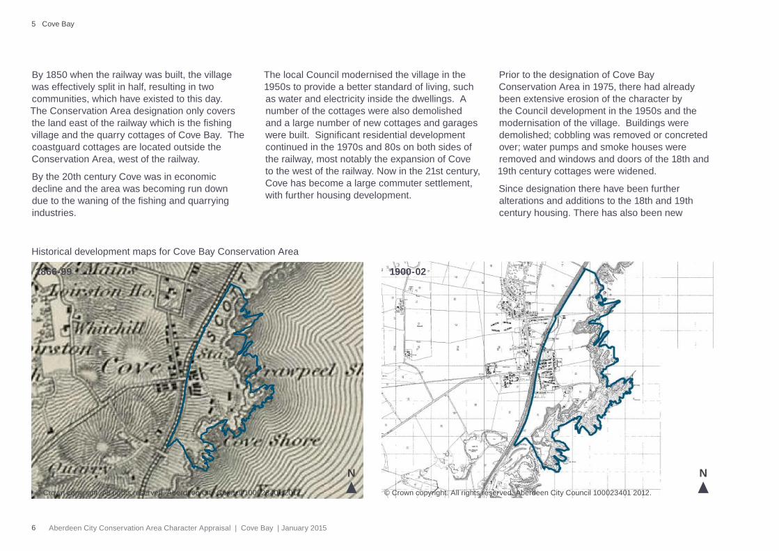
By 1850 when the railway was built, the village was effectively split in half, resulting in two communities, which have existed to this day. The Conservation Area designation only covers the land east of the railway which is the fi shing village and the quarry cottages of Cove Bay. The coastguard cottages are located outside the Conservation Area, west of the railway.
By the 20th century Cove was in economic decline and the area was becoming run down due to the waning of the fi shing and quarrying industries.
The local Council modernised the village in the 1950s to provide a better standard of living, such as water and electricity inside the dwellings. A number of the cottages were also demolished and a large number of new cottages and garages were built. Signifi cant residential development continued in the 1970s and 80s on both sides of the railway, most notably the expansion of Cove to the west of the railway. Now in the 21st century, Cove has become a large commuter settlement, with further housing development.
Prior to the designation of Cove Bay Conservation Area in 1975, there had already been extensive erosion of the character by the Council development in the 1950s and the modernisation of the village. Buildings were demolished; cobbling was removed or concreted over; water pumps and smoke houses were removed and windows and doors of the 18th and 19th century cottages were widened.
Since designation there have been further alterations and additions to the 18th and 19th century housing. There has also been new
1900-021866-99
Historical development maps for Cove Bay Conservation Area
© Crown copyright. All rights reserved. Aberdeen City Council 100023401 2012.© Crown copyright. All rights reserved. Aberdeen City Council 100023401 2012.
N N
7Aberdeen City Conservation Area Character Appraisal | Cove Bay | January 2015
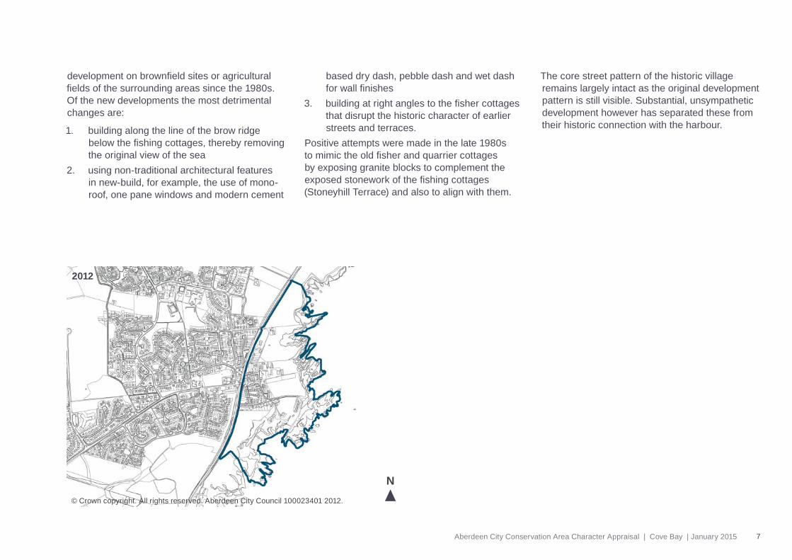
2012
development on brownfi eld sites or agricultural fi elds of the surrounding areas since the 1980s. Of the new developments the most detrimental changes are:
1. building along the line of the brow ridge below the fi shing cottages, thereby removing the original view of the sea
2. using non-traditional architectural features in new-build, for example, the use of mono-roof, one pane windows and modern cement
based dry dash, pebble dash and wet dash for wall fi nishes
3. building at right angles to the fi sher cottages that disrupt the historic character of earlier streets and terraces.
Positive attempts were made in the late 1980s to mimic the old fi sher and quarrier cottages by exposing granite blocks to complement the exposed stonework of the fi shing cottages (Stoneyhill Terrace) and also to align with them.
The core street pattern of the historic village remains largely intact as the original development pattern is still visible. Substantial, unsympathetic development however has separated these from their historic connection with the harbour.
© Crown copyright. All rights reserved. Aberdeen City Council 100023401 2012.
N
8 Aberdeen City Conservation Area Character Appraisal | Cove Bay | January 2015
5 Cove Bay
3 Character
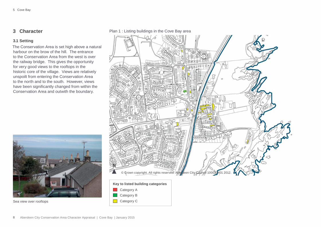
3.1 Setting The Conservation Area is set high above a natural harbour on the brow of the hill. The entrance to the Conservation Area from the west is over the railway bridge. This gives the opportunity for very good views to the rooftops in the historic core of the village. Views are relatively unspoilt from entering the Conservation Area to the north and to the south. However, views have been signifi cantly changed from within the Conservation Area and outwith the boundary.
© Crown copyright. All rights reserved. Aberdeen City Council 100023401 2012.
Plan 1 : Listing buildings in the Cove Bay area
Category ACategory B
Category C
Key to listed building categories
N
Sea view over rooftops
9Aberdeen City Conservation Area Character Appraisal | Cove Bay | January 2015
3.2 Built environment
3.2.1 Typical building forms and featuresIt is important to highlight architectural features that give the area its special character – these revolve around the fi shing and the quarrier cottages which have the following features:
• Scottish and Welsh slate pitch roofs
• Sash and case windows – one on either side of a central door (not many examples left)
• Random rubble walls – whitewashed/ lime based harling or exposed stonework
• Skews – stones fi nishing a gable upstanding from the roof
• Smoke houses on curtilages
• Cobble paving and gullies
• Small grassed communal areas between lanes
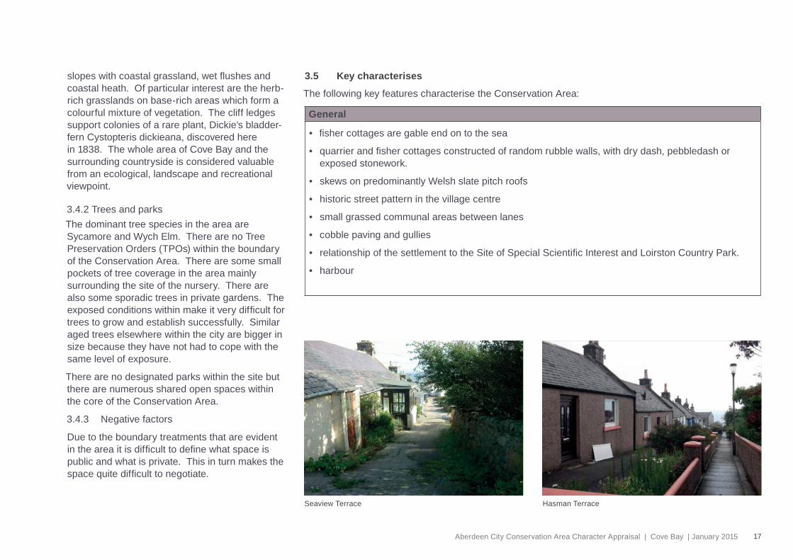
• Fisher cottages are gable end to the sea
• Quarrier cottages have a sloping angled roof
The Conservation Area consists of a historic core of 19th century cottages. A total of 18 of the quarrier and fi sher cottages are Category C currently listed, out of an approximate total of 49.
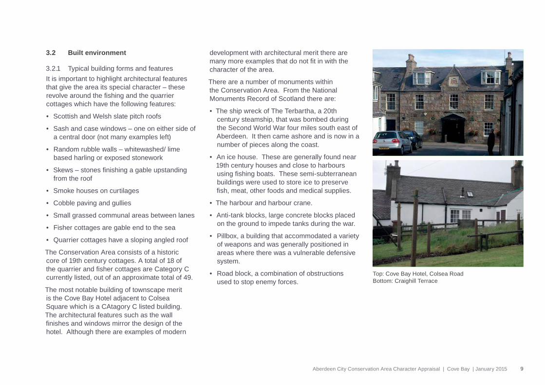
The most notable building of townscape merit is the Cove Bay Hotel adjacent to Colsea Square which is a CAtagory C listed building. The architectural features such as the wall fi nishes and windows mirror the design of the hotel. Although there are examples of modern
development with architectural merit there are many more examples that do not fi t in with the character of the area.
There are a number of monuments within the Conservation Area. From the National Monuments Record of Scotland there are:
• The ship wreck of The Terbartha, a 20th century steamship, that was bombed during the Second World War four miles south east of Aberdeen. It then came ashore and is now in a number of pieces along the coast.
• An ice house. These are generally found near 19th century houses and close to harbours using fi shing boats. These semi-subterranean buildings were used to store ice to preserve fi sh, meat, other foods and medical supplies.
• The harbour and harbour crane.
• Anti-tank blocks, large concrete blocks placed on the ground to impede tanks during the war.
• Pillbox, a building that accommodated a variety of weapons and was generally positioned in areas where there was a vulnerable defensive system.
• Road block, a combination of obstructions used to stop enemy forces.
Top: Cove Bay Hotel, Colsea RoadBottom: Craighill Terrace
10 Aberdeen City Conservation Area Character Appraisal | Cove Bay | January 2015
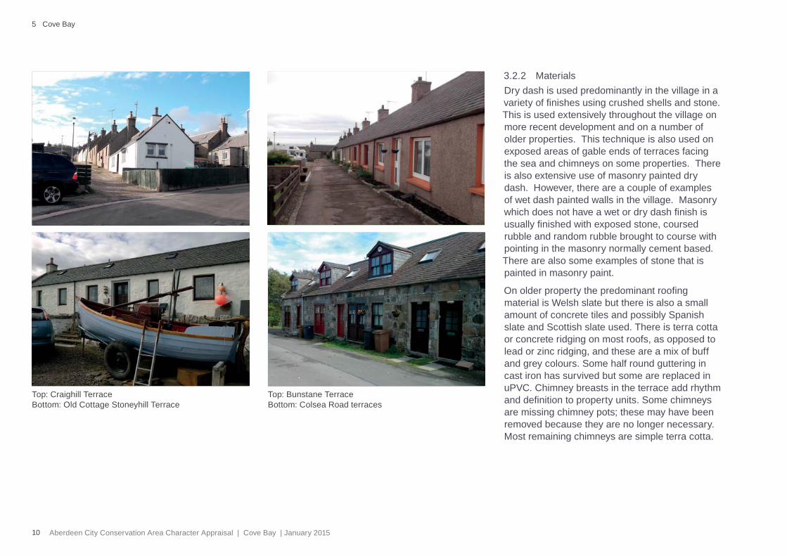
Top: Craighill TerraceBottom: Old Cottage Stoneyhill Terrace
5 Cove Bay
3.2.2 MaterialsDry dash is used predominantly in the village in a variety of fi nishes using crushed shells and stone. This is used extensively throughout the village on more recent development and on a number of older properties. This technique is also used on exposed areas of gable ends of terraces facing the sea and chimneys on some properties. There is also extensive use of masonry painted dry dash. However, there are a couple of examples of wet dash painted walls in the village. Masonry which does not have a wet or dry dash fi nish is usually fi nished with exposed stone, coursed rubble and random rubble brought to course with pointing in the masonry normally cement based. There are also some examples of stone that is painted in masonry paint.
On older property the predominant roofi ng material is Welsh slate but there is also a small amount of concrete tiles and possibly Spanish slate and Scottish slate used. There is terra cotta or concrete ridging on most roofs, as opposed to lead or zinc ridging, and these are a mix of buff and grey colours. Some half round guttering in cast iron has survived but some are replaced in uPVC. Chimney breasts in the terrace add rhythm and defi nition to property units. Some chimneys are missing chimney pots; these may have been removed because they are no longer necessary. Most remaining chimneys are simple terra cotta.
Top: Bunstane TerraceBottom: Colsea Road terraces
11Aberdeen City Conservation Area Character Appraisal | Cove Bay | January 2015
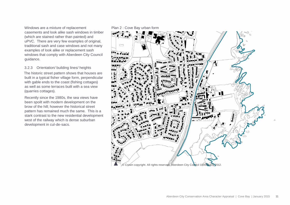
Plan 2 : Cove Bay urban form
N© Crown copyright. All rights reserved. Aberdeen City Council 100023401 2012.
Windows are a mixture of replacement casements and look alike sash windows in timber (which are stained rather than painted) and uPVC. There are very few examples of original, traditional sash and case windows and not many examples of look alike or replacement sash windows that comply with Aberdeen City Council guidance.
3.2.3 Orientation/ building lines/ heightsThe historic street pattern shows that houses are built in a typical fi sher village form, perpendicular with gable ends to the coast (fi shing cottages) as well as some terraces built with a sea view (quarries cottages).
Recently since the 1980s, the sea views have been spoilt with modern development on the brow of the hill; however the historical street pattern has remained much the same. This is a stark contrast to the new residential development west of the railway which is dense suburban development in cul-de-sacs.
12 Aberdeen City Conservation Area Character Appraisal | Cove Bay | January 2015
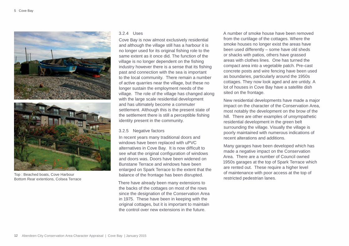
3.2.4 UsesCove Bay is now almost exclusively residential and although the village still has a harbour it is no longer used for its original fi shing role to the same extent as it once did. The function of the village is no longer dependent on the fi shing industry however there is a sense that its fi shing past and connection with the sea is important to the local community. There remain a number of active quarries near the village, but these no longer sustain the employment needs of the village. The role of the village has changed along with the large scale residential development and has ultimately become a commuter settlement. Although this is the present state of the settlement there is still a perceptible fi shing identity present in the community.
3.2.5 Negative factorsIn recent years many traditional doors and windows have been replaced with uPVC alternatives in Cove Bay. It is now diffi cult to see what the original confi guration of windows and doors was. Doors have been widened on Bunstane Terrace and windows have been enlarged on Spark Terrace to the extent that the balance of the frontage has been disrupted.
There have already been many extensions to the backs of the cottages on most of the rows since the designation of the Conservation Area in 1975. These have been in keeping with the original cottages, but it is important to maintain the control over new extensions in the future.
A number of smoke house have been removed from the curtilage of the cottages. Where the smoke houses no longer exist the areas have been used differently – some have old sheds or shacks with patios, others have grassed areas with clothes lines. One has turned the compact area into a vegetable patch. Pre-cast concrete posts and wire fencing have been used as boundaries, particularly around the 1950s cottages. They now look aged and are untidy. A lot of houses in Cove Bay have a satellite dish sited on the frontage.
New residential developments have made a major impact on the character of the Conservation Area, most notably the development on the brow of the hill. There are other examples of unsympathetic residential development in the green belt surrounding the village. Visually the village is poorly maintained with numerous indications of recent alterations and additions.
Many garages have been developed which has made a negative impact on the Conservation Area. There are a number of Council owned 1950s garages at the top of Spark Terrace which are rented out. These require a higher level of maintenance with poor access at the top of restricted pedestrian lanes.
5 Cove Bay
Top : Beached boats, Cove HarbourBottom Rear extentions, Colsea Terrace
13Aberdeen City Conservation Area Character Appraisal | Cove Bay | January 2015
3.3 Public realm
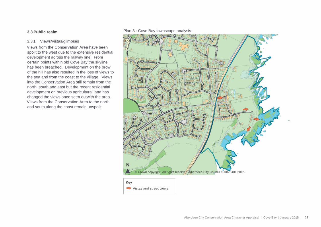
3.3.1 Views/vistas/glimpsesViews from the Conservation Area have been spoilt to the west due to the extensive residential development across the railway line. From certain points within old Cove Bay the skyline has been breached. Development on the brow of the hill has also resulted in the loss of views to the sea and from the coast to the village. Views into the Conservation Area still remain from the north, south and east but the recent residential development on previous agricultural land has changed the views once seen outwith the area. Views from the Conservation Area to the north and south along the coast remain unspoilt.
Plan 3 : Cove Bay townscape analysis
© Crown copyright. All rights reserved. Aberdeen City Council 100023401 2012.
N
Vistas and street views
Key
14 Aberdeen City Conservation Area Character Appraisal | Cove Bay | January 2015
N
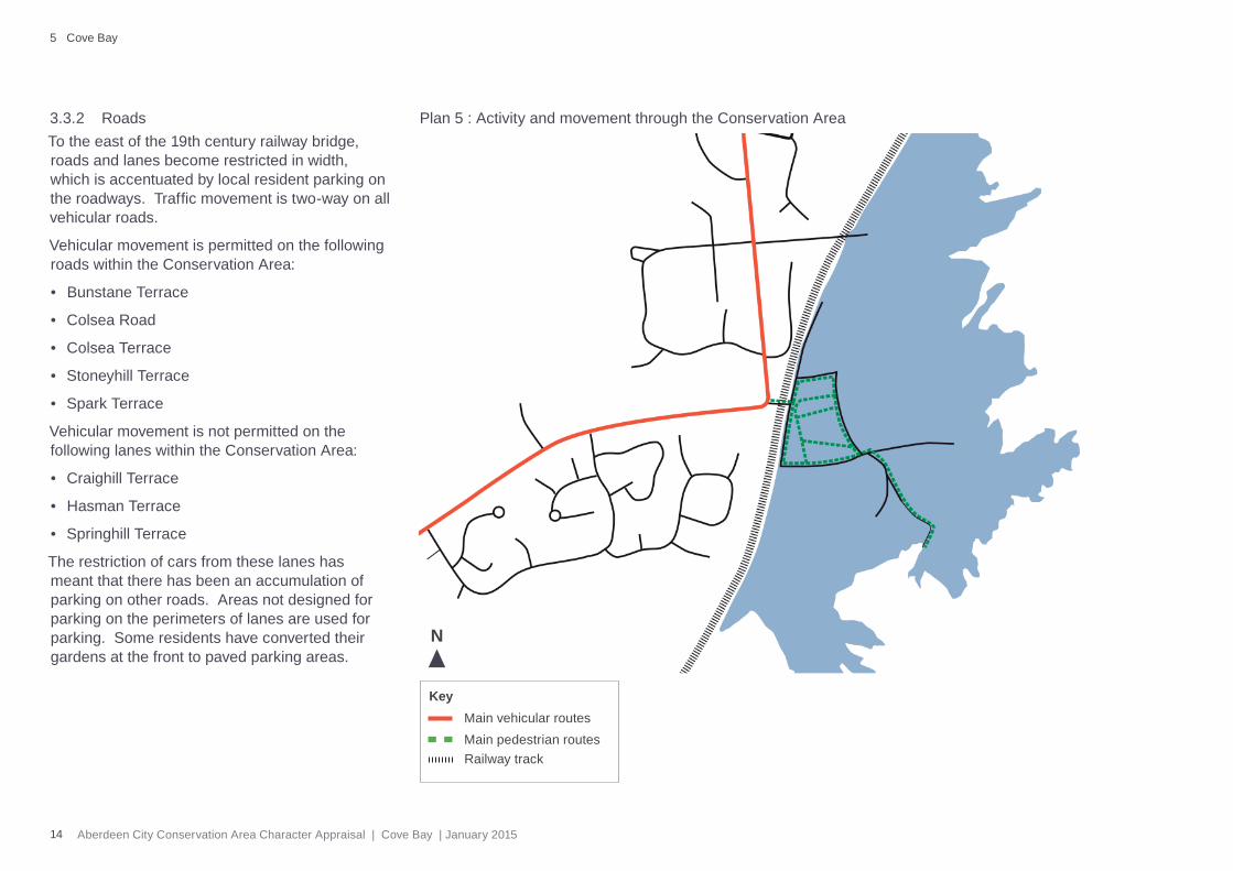
3.3.2 RoadsTo the east of the 19th century railway bridge, roads and lanes become restricted in width, which is accentuated by local resident parking on the roadways. Traffi c movement is two-way on all vehicular roads.
Vehicular movement is permitted on the following roads within the Conservation Area:
• Bunstane Terrace
• Colsea Road
• Colsea Terrace
• Stoneyhill Terrace
• Spark Terrace
Vehicular movement is not permitted on the following lanes within the Conservation Area:
• Craighill Terrace
• Hasman Terrace
• Springhill Terrace
The restriction of cars from these lanes has meant that there has been an accumulation of parking on other roads. Areas not designed for parking on the perimeters of lanes are used for parking. Some residents have converted their gardens at the front to paved parking areas.
Plan 5 : Activity and movement through the Conservation Area
Main vehicular routesKey
Main pedestrian routesRailway track
5 Cove Bay
15Aberdeen City Conservation Area Character Appraisal | Cove Bay | January 2015
Some roadways and lanes are privately owned with residents therefore obliged to maintain them. Some are well maintained but the areas around the garages are not. However, there are some examples of the surfaces not being well maintained. The main vehicular roads, i.e. Colsea Road and Stoneyhill Terrace, are Council owned and are relatively well maintained.
3.3.3 PavementsWhere vehicular movement is allowed, these streets generally have formal pavements. However, where there is no vehicular movement allowed, these make for very informal paths.
3.3.4 Street treesThe Conservation Area has no trees planted specifi cally on the streets and very few planted on the pedestrian lanes. Most trees are planted within private gardens.
3.3.5 SignageThere are three types of 20th century street signage used throughout the village, which are set on steel posts and have blue or black backgrounds with white lettering. Traditionally street signs would have been set or painted on walls of the houses using a black background and silver lettering. House numbers would have been done in a similar way.
3.3.6 Street furnitureA variety of modern down lighters exist, of no particular note – a modern steel lamp exists alongside a lantern style which shows no consistency.
3.3.7 Negative factorsThere is no consistency with the street furniture however its design is subtle and not visually obtrusive. Greater standardisation would emphasise the Conservation Area’s identity. There has been little effect from traffi c or utilities engineering apart from satellite dishes on frontages.
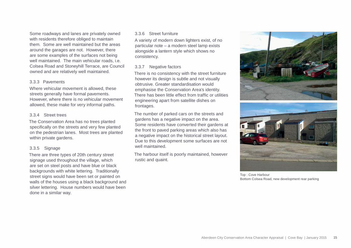
The number of parked cars on the streets and gardens has a negative impact on the area. Some residents have converted their gardens at the front to paved parking areas which also has a negative impact on the historical street layout. Due to this development some surfaces are not well maintained.
The harbour itself is poorly maintained, however rustic and quaint.
Top : Cove HarbourBottom Colsea Road, new development rear parking
16 Aberdeen City Conservation Area Character Appraisal | Cove Bay | January 2015
3.4 Natural environment
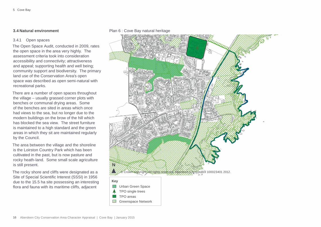
3.4.1 Open spacesThe Open Space Audit, conducted in 2009, rates the open space in the area very highly. The assessment criteria took into consideration accessibility and connectivity; attractiveness and appeal; supporting health and well being; community support and biodiversity. The primary land use of the Conservation Area’s open space was described as open semi-natural with recreational parks.
There are a number of open spaces throughout the village – usually grassed corner plots with benches or communal drying areas. Some of the benches are sited in areas which once had views to the sea, but no longer due to the modern buildings on the brow of the hill which has blocked the sea view. The street furniture is maintained to a high standard and the green areas in which they sit are maintained regularly by the Council.
The area between the village and the shoreline is the Loirston Country Park which has been cultivated in the past, but is now pasture and rocky heath-land. Some small scale agriculture is still present.
The rocky shore and cliffs were designated as a Site of Special Scientifi c Interest (SSSI) in 1956 due to the 15.5 ha site possessing an interesting fl ora and fauna with its maritime cliffs, adjacent
Plan 6 : Cove Bay natural heritage
© Crown copyright. All rights reserved. Aberdeen City Council 100023401 2012.
N
Urban Green SpaceKey
o TPO single treesTPO areasGreenspace Network
5 Cove Bay
17Aberdeen City Conservation Area Character Appraisal | Cove Bay | January 2015
slopes with coastal grassland, wet fl ushes and coastal heath. Of particular interest are the herb-rich grasslands on base-rich areas which form a colourful mixture of vegetation. The cliff ledges support colonies of a rare plant, Dickie’s bladder-fern Cystopteris dickieana, discovered here in 1838. The whole area of Cove Bay and the surrounding countryside is considered valuable from an ecological, landscape and recreational viewpoint.
3.4.2 Trees and parksThe dominant tree species in the area are Sycamore and Wych Elm. There are no Tree Preservation Orders (TPOs) within the boundary of the Conservation Area. There are some small pockets of tree coverage in the area mainly surrounding the site of the nursery. There are also some sporadic trees in private gardens. The exposed conditions within make it very diffi cult for trees to grow and establish successfully. Similar aged trees elsewhere within the city are bigger in size because they have not had to cope with the same level of exposure.
There are no designated parks within the site but there are numerous shared open spaces within the core of the Conservation Area.
3.4.3 Negative factors
Due to the boundary treatments that are evident in the area it is diffi cult to defi ne what space is public and what is private. This in turn makes the space quite diffi cult to negotiate.
3.5 Key characterises
The following key features characterise the Conservation Area:
General
• fi sher cottages are gable end on to the sea
• quarrier and fi sher cottages constructed of random rubble walls, with dry dash, pebbledash or exposed stonework.
• skews on predominantly Welsh slate pitch roofs
• historic street pattern in the village centre
• small grassed communal areas between lanes
• cobble paving and gullies
• relationship of the settlement to the Site of Special Scientifi c Interest and Loirston Country Park.
• harbour
Seaview Terrace Hasman Terrace
18 Aberdeen City Conservation Area Character Appraisal | Cove Bay | January 2015
5 Cove Bay
4 Management
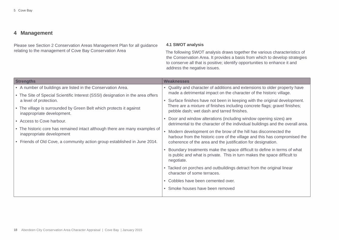
Please see Section 2 Conservation Areas Management Plan for all guidance relating to the management of Cove Bay Conservation Area
4.1 SWOT analysis
The following SWOT analysis draws together the various characteristics of the Conservation Area. It provides a basis from which to develop strategies to conserve all that is positive; identify opportunities to enhance it and address the negative issues.
Strengths Weaknesses• A number of buildings are listed in the Conservation Area.
• The Site of Special Scientifi c Interest (SSSI) designation in the area offers a level of protection.
• The village is surrounded by Green Belt which protects it against inappropriate development.
• Access to Cove harbour.
• The historic core has remained intact although there are many examples of inappropriate development
• Friends of Old Cove, a community action group established in June 2014.
• Quality and character of additions and extensions to older property have made a detrimental impact on the character of the historic village.
• Surface fi nishes have not been in keeping with the original development. There are a mixture of fi nishes including concrete fl ags; gravel fi nishes; pebble dash; wet dash and tarred fi nishes.
• Door and window alterations (including window opening sizes) are detrimental to the character of the individual buildings and the overall area.
• Modern development on the brow of the hill has disconnected the harbour from the historic core of the village and this has compromised the coherence of the area and the justifi cation for designation.
• Boundary treatments make the space diffi cult to defi ne in terms of what is public and what is private. This in turn makes the space diffi cult to negotiate.
• Tacked on porches and outbuildings detract from the original linear character of some terraces.
• Cobbles have been cemented over.
• Smoke houses have been removed

19Aberdeen City Conservation Area Character Appraisal | Cove Bay | January 2015
Opportunities Threats• Defi ned small area that lends itself well to any community led
enhancement scheme based on opportunities identifi ed earlier in the appraisal eg new or restored surfaces and boundary treatments; street furniture; planting; lighting scheme and traffi c management changes
• External funding opportunities for local heritage action
• Continued decline of the Conservation Area if no action is taken
Colsea RoadStoneyhill Terrace Balmoral Terrace
20 Aberdeen City Conservation Area Character Appraisal | Cove Bay | January 2015
5 Cove Bay
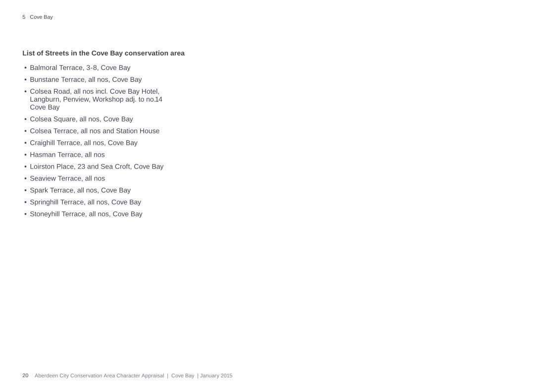
• Balmoral Terrace, 3-8, Cove Bay
• Bunstane Terrace, all nos, Cove Bay
• Colsea Road, all nos incl. Cove Bay Hotel, Langburn, Penview, Workshop adj. to no.14 Cove Bay
• Colsea Square, all nos, Cove Bay
• Colsea Terrace, all nos and Station House
• Craighill Terrace, all nos, Cove Bay
• Hasman Terrace, all nos
• Loirston Place, 23 and Sea Croft, Cove Bay
• Seaview Terrace, all nos
• Spark Terrace, all nos, Cove Bay
• Springhill Terrace, all nos, Cove Bay
• Stoneyhill Terrace, all nos, Cove Bay
List of Streets in the Cove Bay conservation area