active tectonics, digital elevation model analysis, and remote sensing in geon pi meeting update
DESCRIPTION
J Ramón Arrowsmith Department of Geological Sciences, Arizona State University, [email protected] http://activetectonics.la.asu.edu/GEONatASU/index.htm http://www.geoinformaticsnetwork.org/swgeonet/ With Jeff Conner, Chris Crosby, and Gilead Wurman. - PowerPoint PPT PresentationTRANSCRIPT

www.geongrid.orgCYBERINFRASTRUCTURE FOR THE GEOSCIENCES
Active tectonics, Digital Elevation Model analysis, and remote sensing
in GEON
PI Meeting update
J Ramón Arrowsmith Department of Geological Sciences, Arizona State University, [email protected] http://activetectonics.la.asu.edu/GEONatASU/index.htm
http://www.geoinformaticsnetwork.org/swgeonet/ With Jeff Conner, Chris Crosby, and Gilead Wurman
www.geongrid.orgCYBERINFRASTRUCTURE FOR THE GEOSCIENCES
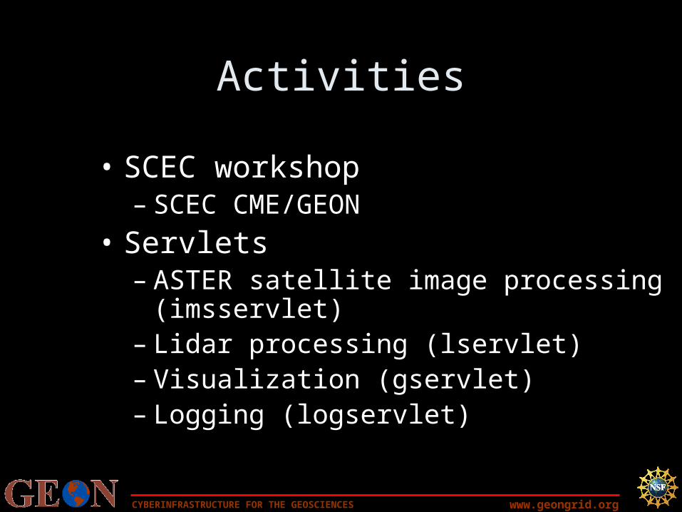
Activities
• SCEC workshop– SCEC CME/GEON
• Servlets– ASTER satellite image processing
(imsservlet)– Lidar processing (lservlet)– Visualization (gservlet)– Logging (logservlet)

www.geongrid.orgCYBERINFRASTRUCTURE FOR THE GEOSCIENCES
SCEC-CME/GEON ties
Workflow construction: Bertram and Yolanda are in touch, but the geoscience level is not as involved
GIS (SCEC is weak there, but the community needs it)Resources in GEON are available as services; GMT vs. GIS. Could be
good to have a goal for interoperability at AGU. ARCIMS gmt arcgrid ascii format send it the file and get a color image back. Shapefiles send to dynamic arcims session back. Base data for SOCAL.
Visualization: LA3D/SCEC VIDEO spherical coordinate system with no fixed reference point Alpha stage; GEON is weak there USR. Vis workshop in January. Could tie with IDV guys for VIDEO.
USR for the greater rockies. How do we build a model for it? What are the difficulties? Should extrude the QFAULTS data
PHIL: Can we put the systems together in a some way for the geological geophysical communities: look at the strengths
CIG - codeCME - modelsGEON – dataEarthscope – has all the data flowingMeta system that takes advantage of all of the projects. Issue of open source: companies have scec or geon buy a site license? User
community has access to that software. Would publicize the software for a larger community.

www.geongrid.orgCYBERINFRASTRUCTURE FOR THE GEOSCIENCES
LA3d

www.geongrid.orgCYBERINFRASTRUCTURE FOR THE GEOSCIENCES
Java servlets on ASU GEON NODE
lservlet
gservlet
imsservlet
logservlet

www.geongrid.orgCYBERINFRASTRUCTURE FOR THE GEOSCIENCES
Servlet questions/issues
• Vs. webservice?
• Common technologies
• Load balancing (locally and on the grid)
• Portal implementation (local/main GEON)

www.geongrid.orgCYBERINFRASTRUCTURE FOR THE GEOSCIENCES
GRASS-based LiDAR processing webservice
Subset of Airborne Laser Swath Mapping (ALSM aka LiDAR) data from Oct. 16, 1999 Hector Mine earthquake (Mw 7.1) mapping.
~80,000 pts = 2.6 MB

www.geongrid.orgCYBERINFRASTRUCTURE FOR THE GEOSCIENCES
http://agassiz.la.asu.edu:8080/lservlet

www.geongrid.orgCYBERINFRASTRUCTURE FOR THE GEOSCIENCES
lservlet job running on pop node~ 5.5 minutes to run 80,000 pts.

www.geongrid.orgCYBERINFRASTRUCTURE FOR THE GEOSCIENCES

www.geongrid.orgCYBERINFRASTRUCTURE FOR THE GEOSCIENCES
Products:

www.geongrid.orgCYBERINFRASTRUCTURE FOR THE GEOSCIENCES

www.geongrid.orgCYBERINFRASTRUCTURE FOR THE GEOSCIENCES
Coming soon:
- full function lservlet page with user control over various interpolation parameters (by GSA)
- Jobs running on HP cluster at SDSC (by GSA??)
- Capability to ingest and interpolate data of various projections
- Enhanced functionality – hillshade etc.

www.geongrid.orgCYBERINFRASTRUCTURE FOR THE GEOSCIENCES
http://agassiz.la.asu.edu:8080/gservlet

www.geongrid.orgCYBERINFRASTRUCTURE FOR THE GEOSCIENCES

CYBERINFRASTRUCTURE FOR THE GEOSCIENCES www.geongrid.org
ASTER level-1B data have had system radiometric corrections and geometric coefficients applied and are reprojected to a given map projection.
1166 “granules” available
http://aspen.asu.edu/website/Geoinformatics/viewer.htmhttp://www.geoinformaticsnetwork.org/swgeonet/

www.geongrid.orgCYBERINFRASTRUCTURE FOR THE GEOSCIENCES
Connection Method• ArcIMS, Java Servlet, Manager
Program, Java Implemented Server

www.geongrid.orgCYBERINFRASTRUCTURE FOR THE GEOSCIENCES
Logging of activities
• http://agassiz.la.asu.edu:8080/logservlet
• Also needs to be there in the portal(s)

www.geongrid.orgCYBERINFRASTRUCTURE FOR THE GEOSCIENCES
Software/GEON Node issues-see forum posts
X-windows?• Samba is running well• Red Hat glibc libraries too old• ARCIMS:
– Raster/grids support?– Tomcat version 3 versus most-up-to-
date version 4 on nodes (we have both running)