adopt an ordinance granting mosaic fertilizer, llc an
TRANSCRIPT

AGENDA REQUEST NO.
Adopt an Ordinance granting Mosaic Fertilizer,LLC an Official Zoning District Atlasamendment (RZ 2016-05) to change fromAgriculture 10 (A-10) to Phosphate Mining-Industrial (PM-I) the zoning district of14,053.50+ acres of land generally locatednorth of SW Adams Road, south of theDeSoto/Hardee County line, west of NE CountyRoad 661, and east of the DeSoto/Manatee/Sarasota County line.
1

WHAT ARE ZONING DISTRICT REGULATIONS?
Zoning district regulations establish a map delineating the boundariesof zones which, along with the zoning text, identifies the types of landuses allowed on real property, such as residential, commercial,agricultural, mining and industrial uses.
The zoning district regulations also dictate the manner in which theland is developed by restricting the density, building heights, setbacksand other attributes related to development.
Zoning district regulations seeks to either limit or encourage growthwithin the community depending on the aim of local government. Anyperson seeking a zoning district map amendment (also called arezoning) must satisfy the specified factors or consideration beforeapproval can be given. A rezoning is a preliminary development orderbecause it does not grant the right to develop the property.
2

THIS EVENING’S AGENDA
This evening the Board will be considering arezoning, which is a preliminary development orderwhich provides no rights to mine, or develop thesubject property in any way.
Some of the comments the Board may hear thisevening will address the impacts caused by issuanceof the Operating Permit. While these impacts areimportant and substantial, tonight’s public hearingis not the proper forum for consideration of thoseissues.
3

OTHER MOSAIC PHOSPHATE MINING APPLICATIONS
Mosaic Fertilizer, LLC has already filed thePhosphate Mining Master Plan and OperatingPermit Applications and staff is evaluating thoseapplications.
When staff has completed its review, thoseapplications will be brought before the Board at aduly noticed public hearing to determine whetheror not those applications to allow phosphate miningshould be approved.
4

PROPOSED 14,053.4-ACRE REZONING
5
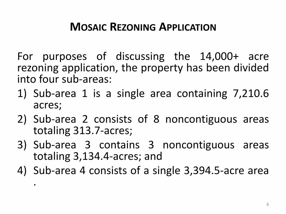
MOSAIC REZONING APPLICATION
For purposes of discussing the 14,000+ acrerezoning application, the property has been dividedinto four sub-areas:1) Sub-area 1 is a single area containing 7,210.6
acres;2) Sub-area 2 consists of 8 noncontiguous areas
totaling 313.7-acres;3) Sub-area 3 contains 3 noncontiguous areas
totaling 3,134.4-acres; and4) Sub-area 4 consists of a single 3,394.5-acre area
.
6

SUB-AREA 1 REZONING OF 7,210.6-ACRES
7

SUB-AREA 2 REZONING OF 313.7-ACRES
8

SUB-AREA 3 REZONING OF 3,134.45-ACRES
9

SUB-AREA 4 REZONING OF 3,394.5-ACRES
10

BACKGROUND – ZONING DISTRICT REGULATIONS
On September 29th, 1981, the Board adoptedOrdinance No. 81-10, which ordinance repealedOrdinance No. 1973-3 and established new zoningdistrict regulations and zoning district map.
The new zoning district regulations included the“Phosphate Mining and Earth Moving District (M-I)”and the new Zoning District Map rezoned 8,985-acres of land to M-I district. Since that time, therehave not been any site specific rezoningapplications to the M-I zoning district.
11
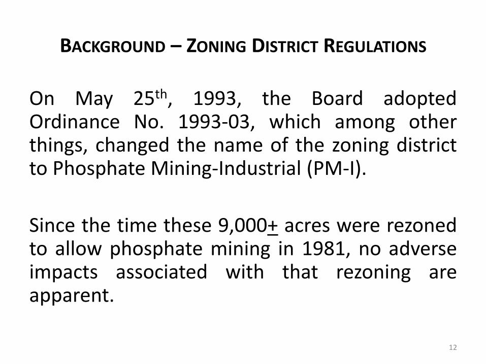
BACKGROUND – ZONING DISTRICT REGULATIONS
On May 25th, 1993, the Board adoptedOrdinance No. 1993-03, which among otherthings, changed the name of the zoning districtto Phosphate Mining-Industrial (PM-I).
Since the time these 9,000+ acres were rezonedto allow phosphate mining in 1981, no adverseimpacts associated with that rezoning areapparent.
12

BACKGROUND – COMPREHENSIVE PLAN
The 2010 DeSoto County Comprehensive Plan, adoptedApril 23rd, 1991, contained few provisions governingmining and phosphate mining.
Future Land Use Element (FLUE) Policy L.1.1 providedthat the extraction of mineral resources may bepermitted in all future land use classifications subject toall applicable local regulations.
FLUE Policy L.1.2 required a reclamation plan as part ofthe extractive use permit.
13

BACKGROUND – COMPREHENSIVE PLAN
On September 28th, 2010, the DeSoto County Board ofCounty Commissioners (Board) adopted Ordinance No.2010-26, which amended the FLUE by adding an objectiveand implementing policies pertaining to creation of aGeneralized Phosphate Mining Overlay (GPM-O)designation and added a 25,000+ acre GPM-O to theFuture Land Use Map (FLUM).
The Board’s establishment of the GPM-O designationensured that phosphate mining activities could not occurcountywide but were limited in application to the areadefined by the GPM-O designation.
14

FUTURE LAND USE ELEMENT POLICY 1.3.8
Phosphate mining/extraction and related landuses are allowed in the Rural/Agriculture landuse category only when the area is included inthe Generalized Phosphate Mining OverlayDesignation and in accordance with theGeneralized Phosphate Mining OverlayDesignation objective and policies, as well asother policies within the Future Land UseElement and Conservation Element which applyto phosphate mining activity.
15

FUTURE LAND USE ELEMENT OBJECTIVE 1.12B
The Interim 2040 Generalized Phosphate Mining OverlayDesignation Map (FLUEMS-5) consists of private lands that arelikely to contain phosphate minerals located within theRural/Agriculture Future Land Use District and the PhosphateMineral Type as depicted on the Generalized Surface MineralsMap. Establishment of the Generalized Phosphate MiningOverlay Designation will ensure the orderly development ofphosphate mining activity, including the extraction of mineralresources and reclamation of mined land in a mannercompatible with the overall development of the County andthe protection of environmental resources as furtherprescribed in the policies listed below and Phosphate MiningRegulations set forth in the land Development Regulations.
16

BACKGROUND – COMPREHENSIVE PLAN
On January 27th, 2015, the DeSoto County Board ofCounty Commissioners adopted Ordinance No.2015-01, which amended the Comprehensive Plan’sDefinitions Element (DE), the FLUE, and theConservation Element (CE).
The DE amendments revised the definition ofreclamation and added definitions for restoration,ecological value, mitigation, and phosphate miningcorridor.
17
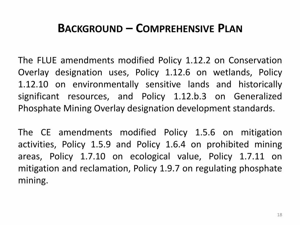
BACKGROUND – COMPREHENSIVE PLAN
The FLUE amendments modified Policy 1.12.2 on ConservationOverlay designation uses, Policy 1.12.6 on wetlands, Policy1.12.10 on environmentally sensitive lands and historicallysignificant resources, and Policy 1.12.b.3 on GeneralizedPhosphate Mining Overlay designation development standards.
The CE amendments modified Policy 1.5.6 on mitigationactivities, Policy 1.5.9 and Policy 1.6.4 on prohibited miningareas, Policy 1.7.10 on ecological value, Policy 1.7.11 onmitigation and reclamation, Policy 1.9.7 on regulating phosphatemining.
18

BACKGROUND – COMPREHENSIVE PLAN
Neither the 2010 nor the 2015 Comprehensive Planamendments contained any policy:
1) Restricting the size of land within the GPM-Odesignation which may be rezoned at any onetime to PM-I district; or
2) Requiring that land already zoned PM-I districtmust first be mined and reclaimed before anynew rezoning application to PM-I can beapproved.
19

MOSAIC APPLICATIONS FILED
On December 14th, 2016, MFL filed with the DeSoto CountyDevelopment Department three development orderapplications:
1) An Official Zoning District Atlas amendment (also called arezoning) application to change the zoning district of14,000+ acres from Agriculture 10 (A-10) to PhosphateMining-Industrial (PM-I);
2) A Phosphate Mining Master Plan (PMMP) application, whichprovides a description of pre-mining, mining and post-mining and reclamation activities over the life of a mine; and
20

MOSAIC APPLICATIONS FILED
3) An Operating Permit (OP) application, which identifiesthe specific phosphate mining activities proposed over aspecified period of time.
This Power Point Presentation only addresses the rezoningapplication.
As noted earlier, at some future date the Phosphate MiningMaster Plan and the Operating Permit applications will bebrought to the Board at a duly noticed public hearing forconsideration.
21

REZONING APPLICATION REVIEW
LDR Section 20-1498(a) provides that the report and recommendationsof the Planning Commission to the Board of County Commissionersshall show that the Planning Commission has studied and consideredthe proposed change in relation to 15 listed factors.
At the June 5th and 6th, 2018, Planning Commission public hearing, theCommission considered the proposed rezoning application in relationto 15 listed factors at recommended the Board approved theOrdinance 3 – 2.
When applying the 15 factors to the rezoning of 14,000+ acres, it maybe useful to consider how the existing 9,000-acres zoned PM-I districthave impacted the community.
22

FACTOR 1
Whether the proposed change would be consistent withthe Goals, Objectives and Policies (GOPs) of theComprehensive Plan.
1) The areas proposed to be rezoned are consistent withthe GPM-O designation because the areas are locatedentirely within the GPM-O designation.
2) The rezoning is consistent with 8 of the 20 GOPs andthe remaining 12 GOPS are not applicable to therezoning application.
23

FLUE GOAL 1 ON FUTURE GROWTH
GOAL 1: FUTURE GROWTH. Through 2040, futuregrowth in DeSoto County will be managed usingsustainability and smart growth principles toaccommodate new growth without compromisingthe ability of future generations to meet theirneeds. The Future Land Use Element shall be usedas a tool to direct the most intensive growth intothe urban center and surrounding areas, optimizingservices and infrastructure, protecting the ruralcharacter of the County, and protecting theenvironment.
24
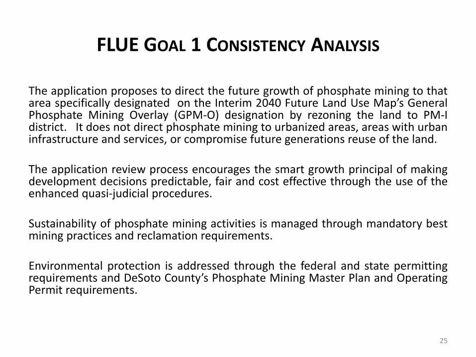
FLUE GOAL 1 CONSISTENCY ANALYSIS
The application proposes to direct the future growth of phosphate mining to thatarea specifically designated on the Interim 2040 Future Land Use Map’s GeneralPhosphate Mining Overlay (GPM-O) designation by rezoning the land to PM-Idistrict. It does not direct phosphate mining to urbanized areas, areas with urbaninfrastructure and services, or compromise future generations reuse of the land.
The application review process encourages the smart growth principal of makingdevelopment decisions predictable, fair and cost effective through the use of theenhanced quasi-judicial procedures.
Sustainability of phosphate mining activities is managed through mandatory bestmining practices and reclamation requirements.
Environmental protection is addressed through the federal and state permittingrequirements and DeSoto County’s Phosphate Mining Master Plan and OperatingPermit requirements.
25

FACTOR 2
The existing land use pattern.
The existing land use pattern can be described aspredominantly rural, which is characterized primarily byagricultural lands with woodlands and wetlands andscattered buildings.
This rural classification is supported by the Desoto CountyProperty Appraiser land use classification, which showsthe area designated Generalized Phosphate MiningOverlay contains substantial lands devoted topastureland, orchards, and croplands.
26

FACTOR 3
The creation of an isolated district unrelated to adjacentand nearby districts.
All but one property to be rezoned abuts property alreadyzoned PM-I district. The remaining property is partiallylocated within a Section that includes two other sub-areas to be rezoned to PM-I district. Thus, that propertywill not create an isolated district because it is nearby toother property to be rezoned to PM-I district. Allproperties are located within the GPM-O designation.
27

EXISTING ZONING CONDITIONS
28
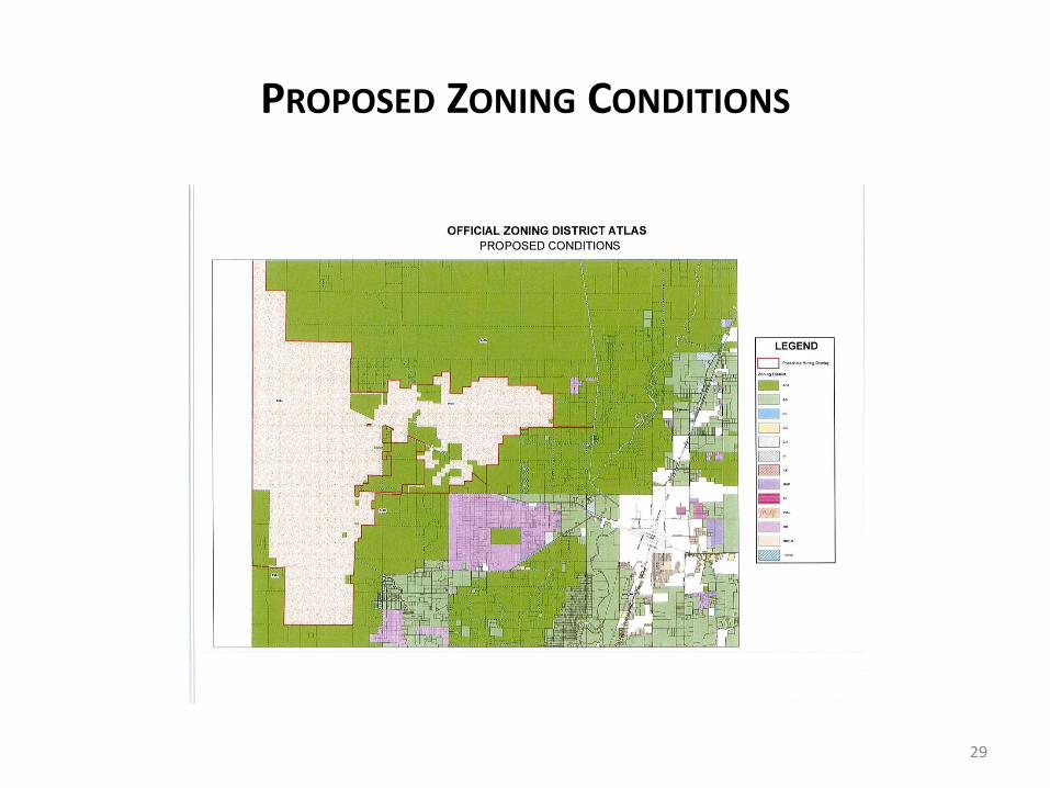
PROPOSED ZONING CONDITIONS
29

FACTOR 4
The impact on the availability of adequate public facilitiesconsistent with the level of service standards.
• The level of service methodology is population based; and
• The proposed rezoning will not increase populationbecause the underlying residential density established bythe Rural/Agriculture designation is not being changed.
Therefore, the rezoning will not impact the availability ofpublic facilities including transportation, potable water,sanitary sewer, recreation and open space (there is noresidential component), solid waste, and drainage.
30

FACTOR 5
Whether the existing district boundaries are illogically drawn in relation to existingconditions on the property.
The existing condition on the property is the presence of the phosphate resourcesand the A-10 zoning district does not allow phosphate mining resources to beextracted. FLUE Objective 1.12b acknowledges the presence of phosphate miningresources as a reason for creating the GPM-O designation.
The PM-I zoning district is the only zoning district that allows phosphate resourcesto be extracted and the rezoning is to PM-I is consistent with the GPM-Odesignation. State law requires that Comprehensive Plan’s be implemented andthe rezoning would implement Comprehensive Plan phosphate mining provisions.
Thus, the existing zoning district boundaries are illogically drawn because theproperty has phosphate mining resources, the purpose of the GPM-O designationis to allow the extraction of phosphate, and the A-10 prohibits the property’sphosphate resources from being extracted.
31
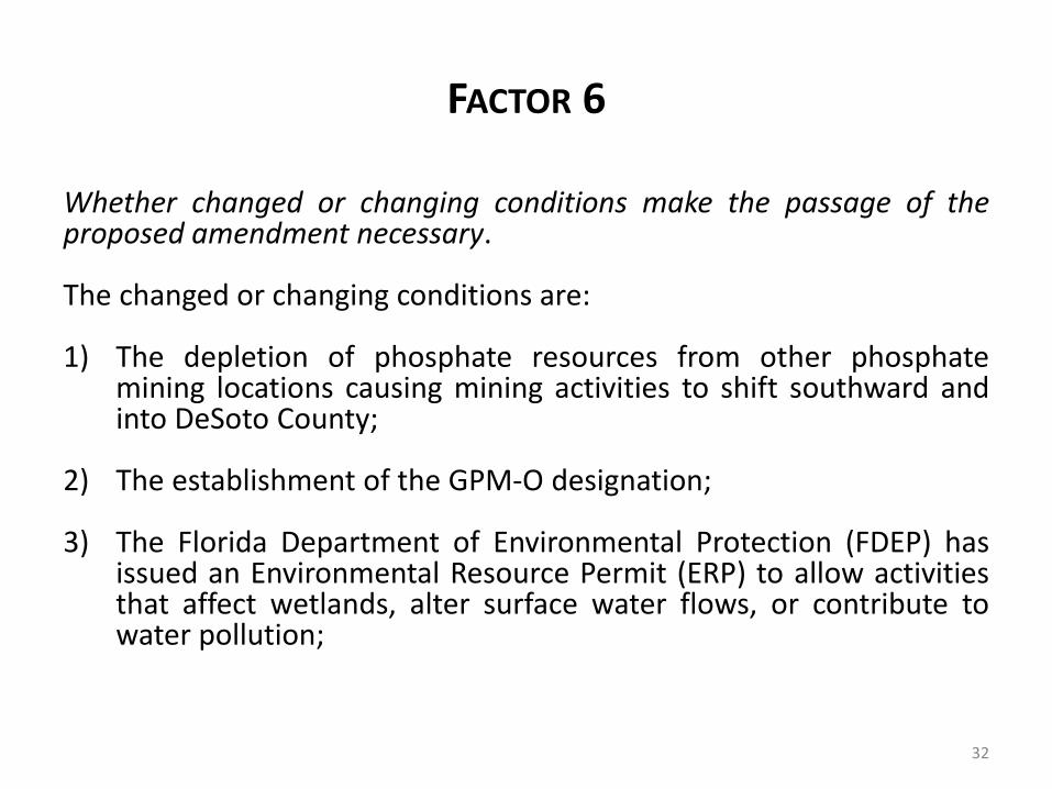
FACTOR 6
Whether changed or changing conditions make the passage of theproposed amendment necessary.
The changed or changing conditions are:
1) The depletion of phosphate resources from other phosphatemining locations causing mining activities to shift southward andinto DeSoto County;
2) The establishment of the GPM-O designation;
3) The Florida Department of Environmental Protection (FDEP) hasissued an Environmental Resource Permit (ERP) to allow activitiesthat affect wetlands, alter surface water flows, or contribute towater pollution;
32

FACTOR 6
4) The FDEP has issued a Conceptual Reclamation Planestablishing a framework of reclamation planning;
5) The Florida Division of Historical Resources has issued aCultural Resource Assessment Survey Clearance letter; and
6) The Southwest Florida Water Management District hasissued an Integrated Water Use Permit for consumptive useof ground water.
33

FACTOR 7
Whether the proposed zoning will adverselyinfluence living conditions in the area.
The proposed rezoning will not adversely influenceliving conditions in the area for the following reasons:
1) The proposed rezoning does not prohibit theexisting uses and conditions from continuing tooperate in the future. The existing agricultural andrural uses have not adversely influenced livingconditions in the area.
34

FACTOR 7
2) There is no evidence that adverse livingconditions were created when nearly 9,000acres were rezoned to PM-I in 1981.
3) There is no evidence that adverse livingconditions were created when DeSotoCounty adopted the 25,000-acres GPM-Odesignation in 2010.
35

FACTOR 7
4) Issues such as noise, vibrations, light trespassand glare, air pollution and fugitive dust are notcaused by a proposed rezoning. Theseimportant and substantial issues areappropriately addressed at the time the Boardconsiders the Phosphate Mining Master Planand Operating Permit applications.
5) Approval of the proposed rezoning does notauthorize commencement of mining activities.
36

FACTOR 8
Whether the proposed change will create or excessivelyincrease traffic congestion or otherwise affect publicsafety.
1) The Agricultural/Rural FLUM designation is not beingchanged. Thus, the PM-I zoning district allows thesame maximum number of residential dwelling unitsas the A-10 zoning district. Both the existing A-10 andproposed PM-I zoning districts could allow 13,445daily trips and 1,391 peak hour p.m. trips, notincluding the trips associated with the existing 9,000acres.
37

FACTOR 8
2) With regard to non-residential uses, the A-10 zoning districtalready allows some land uses, such as agritourism relateddevelopment and wholesale agricultural produce transferstations, which if approved by issuance of a developmentpermit, could potentially generate more daily and peak hourtrip ends than the non-residential uses allowed within thePM-I zoning district.
3) The proposed rezoning is a preliminary development orderthat does not authorize the commencement of phosphatemining activities. This is evidenced by the rezoning to PM-Idistrict of nearly 9,000 acres in the 1980’s.
38

FACTOR 8
4) Assuming the Applicant subsequently receives allrequired approvals, the transportation analysis includedwith the PMMP and OP applications show that thetraffic generated by the proposed mining activities isless than five percent of the roadway capacities, andthat such roadways will continue to operate withinadopted levels of service.
5) Public safety concerns are addressed through the PMMPand OP applications, as the LDR requires acomprehensive safety plan be provided in order toensure public safety.
39

FACTOR 9
Whether the proposed change will create a drainage problem.
1) The proposed rezoning does not authorize any change to theexisting drainage patterns and allows the continuedagricultural and rural uses on the land to continue. This isevidenced by the rezoning to PM-I district of nearly 9,000acres in the 1980’s. A rezoning is a preliminary developmentorder that does not allow mining and related activities tooccur until all federal, state, and local development permitsare acquired. If the Applicant cannot secure such permits,mining activities would be prohibited.
40

FACTOR 9
2) LDR Section 20-571(6) provides that any development for whichstormwater management permits are required by Federal, State,or SWFWMD regulations are exempt from the stormwatermanagement requirements of this division to the extent that suchpermits include review and consideration of impacts on adjacentproperty and/or County drainage and provided that thedevelopment activities has the necessary permit prior tocommencement.
3) A Florida Department of Environmental Protection (FDEP) permithas been issued and is evidence of compliance with drainagerequirements.
4) Drainage issues are important and can be substantial but are moreappropriately addressed during review of the PMMP and OPapplications and not during the rezoning application process.
41

FACTOR 10
Whether the proposed change will seriously reduce light and air toadjacent areas.
1) The proposed rezoning does not prohibit the existing agriculturaland rural uses and existing light and air conditions from continuingto operate in the future. This is evidenced by the rezoning to PM-Idistrict of nearly 9,000 acres in the 1980’s.
2) The reduction of light and air generally is due to an improperrelationship between building height and setback and is commonin high intensity urban areas, where high land costs make tallbuilding profitable. DeSoto County generally lacks the high landvalues needed to make vertical construction profitable.
42

FACTOR 10
3) The proposed rezoning does not change the existing setbacks. LDRSection 20-974(c)(2) establishes minimum setbacks ranging from 200 to1,000 linear feet from the property line for excavation activities, settlingponds and beneficiation facilities, and stockpiles. Conformance withthese requirements will be addressed when the Board hears the OPapplication.
4) The proposed rezoning does not change air quality standards. LDRSections 20-973(b)(18) and 20-974(c)(6) establishes an environmentalmonitoring program for air quality. Issues pertaining to air pollution andfugitive dust emissions will be addressed when the Board hears thePMMP and OP applications.
5) The proposed rezoning constitutes a preliminary development order andsuch approval does not authorize any mining and related activities tooperate on the property. Development may commence only when allfederal, state, and County approvals have been received.
43

FACTOR 11
Whether the proposed change will adversely affect propertyvalues in the adjacent area (i.e., stigmatization).
1) The proposed rezoning would not prohibit the existing agriculturaland rural uses from continuing to operate in the future.
2) The proposed rezoning does not place any constraints orlimitations on the adjacent property owners’ use of their lands.Such owners can proposes new uses consistent with theproperty’s zoning district.
3) There is no evidence that property values were adversely affectedwhen nearly 9,000 acres were rezoned to PM-I in 1981.
44

FACTOR 11
4) There is no evidence that property values were adverselyaffected when DeSoto County adopted the 25,000-acresGPM-O designation in 2010.
5) The proposed rezoning does not authorize thecommencement of mining and related activities.
6) A literature search did not discover any studies concludingthat phosphate mining had an adverse impact on propertyvalues in the abutting area.
45

FACTOR 11
7) Mining is a temporary land use occurring on only aportion of the proposed property at any one time.There is no evidence showing phosphate miningcauses a temporary loss in value. However,assuming that a temporary loss of value were tooccur, that temporary loss could be recapturedonce the land is reclaimed and returned to a similarstate of use prior to mining.
46

FACTOR 12
Whether the proposed change will be a deterrent to the improvement ordevelopment of adjacent property.
1) The proposed rezoning does not change the physical appearance of theproperty or adjacent property. Existing uses can continue to operate. Thisis evidenced by the rezoning to PM-I district of nearly 9,000 acres in the1980’s.
2) The proposed rezoning does not change the existing stormwater flows onthe property or adjacent property.
3) The proposed rezoning does not cause the generation of traffic or suchother conditions so as to impede adjacent property owners from havingaccess onto their property.
47

FACTOR 12
4) The proposed rezoning does not change the existing potable water andsanitary sewer conditions on the property.
5) The proposed rezoning does not authorize the commencement ofconstruction and the potential for the generation of noise, vibrations,glare, odors, and dust.
48

FACTOR 13
Whether the proposed change will constitute a grant of specialprivilege to an individual owner as contrasted with the publicwelfare.
1) Mosaic is not being granted a special privilege - Any personwith property that is located within the GPM-O designationcould request a similar rezoning to PM-I from the Board.
2) Second, the GPM-O designation protects the public welfareby limiting phosphate mining activities only to that areawithin its boundaries.
49
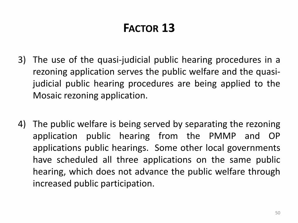
FACTOR 13
3) The use of the quasi-judicial public hearing procedures in arezoning application serves the public welfare and the quasi-judicial public hearing procedures are being applied to theMosaic rezoning application.
4) The public welfare is being served by separating the rezoningapplication public hearing from the PMMP and OPapplications public hearings. Some other local governmentshave scheduled all three applications on the same publichearing, which does not advance the public welfare throughincreased public participation.
50

FACTOR 14
Whether there are substantial reasons why the propertycannot be used in accord with existing zoning.
1) The property to be rezoned has valuable phosphateresources and the A-10 zoning district does not allowthe mining of those phosphate resources.
2) The purpose of the GPM-O designation is to allowproperty with phosphate resources to be rezoned soas to allow phosphate mining.
51

FACTOR 14
3) The inability to extract those resourcesrepresents a substantial diminution in theeconomic value of the property to the owner.The Owner should not arbitrarily be deprivedof the economic value associated with theextraction of mineral resources.
52

FACTOR 15
Whether the change suggested is out of scalewith the surrounding area.
1) The phrase “out-of-scale” is not defined and can beinterpreted various ways, such as by size of theproperty or intensity of development.
2) When the 25,000-acre GPM-O designation wasadopted, it was envisioned that the entire areawould be rezoned to PM-I. The 14,000+ acrerezoning represents 56 percent of the GPM-O.
53
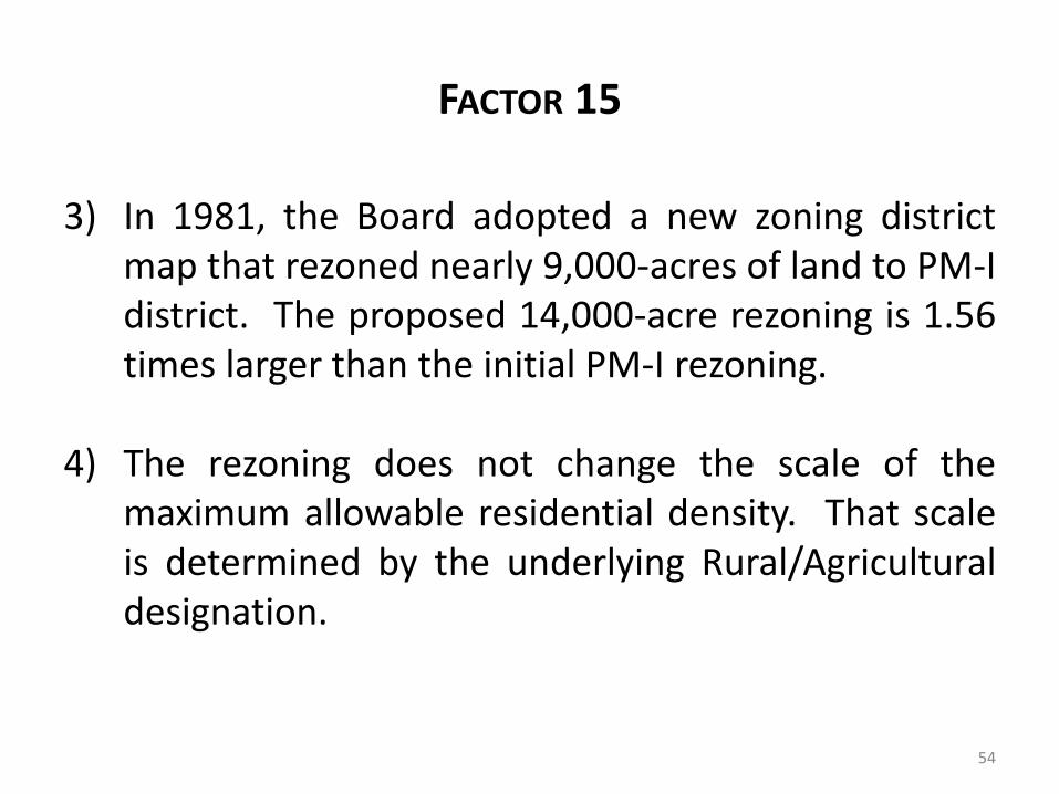
FACTOR 15
3) In 1981, the Board adopted a new zoning districtmap that rezoned nearly 9,000-acres of land to PM-Idistrict. The proposed 14,000-acre rezoning is 1.56times larger than the initial PM-I rezoning.
4) The rezoning does not change the scale of themaximum allowable residential density. That scaleis determined by the underlying Rural/Agriculturaldesignation.
54
FINDINGS AND RECOMMENDATION
In summary, the Development Director findsthe application has addressed each of the 15factors provided for in LDR Section 20-1498(a).
Based on the totality of the circumstances, theDevelopment Director recommends theOrdinance granting the Official Zoning DistrictAtlas amendment application from A-10 to PH-Ibe adopted.
55
PLANNING COMMISSION RECOMMENDATION
As noted earlier, at the end of the duly noticedPlanning Commission public hearing held onJune 5th and June 6th, 2018, the PlanningCommission by a 3-2 vote recommended theBoard approve the Ordinance rezoning theproperty.
56

END OF PRESENTATION
Any questions?
57