aerial vehicle (uav) for disaster risk reduction wilopo...asian conference on disaster reduction...
TRANSCRIPT

Asian Conference on Disaster Reduction 2016 Phuket, 25-26 February 2016
Unmanned Aerial Vehicle (UAV) Utilization for Disaster Risk Reduction
W.Wilopo & T.F. Fathani

Outline
• Background
• Disaster Risk ReductionDisaster Risk Reduction
• Method of mapping using UAV
• Application of UAV for DRR

Background g• Disasters due to both natural and human hazards
– Over 400 million people affected by natural hazards– Increasing disaster event in the last decade, especially hydrometeorology disaster
– Human caused hazards leading to disasters• Limitations of existing approaches
– Local maps with not accurate scale, limited use of GISLocal maps with not accurate scale, limited use of GIS– Concentrate in the affected area not the source of disasterd sas e
– Using not update satellite images– Mostly after disasterMostly after disaster
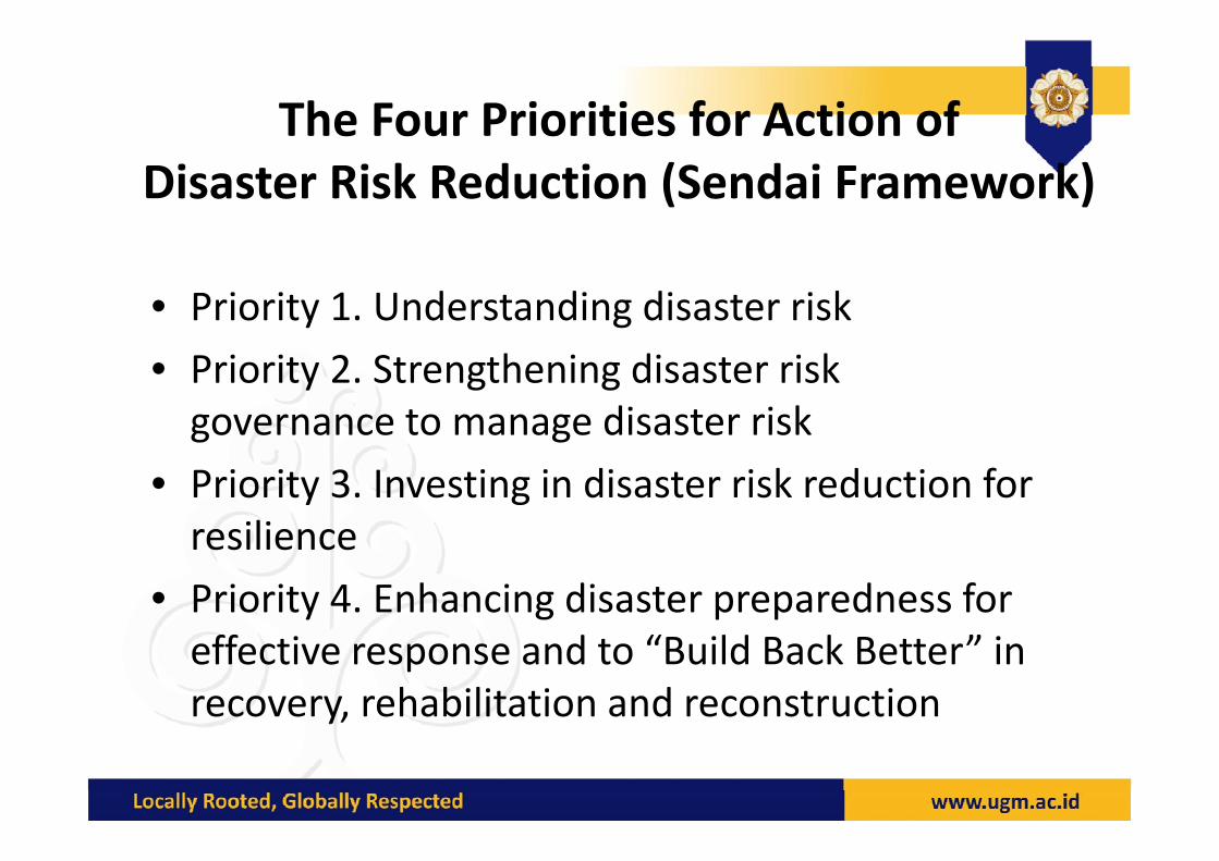
The Four Priorities for Action of Disaster Risk Reduction (Sendai Framework)
• Priority 1. Understanding disaster risk
• Priority 2. Strengthening disaster risk governance to manage disaster riskgovernance to manage disaster risk
• Priority 3. Investing in disaster risk reduction for iliresilience
• Priority 4. Enhancing disaster preparedness for effective response and to “Build Back Better” in recovery, rehabilitation and reconstructiony

Challenge to Risk Reduction & Rapid Response
Source: Li, C., 2014
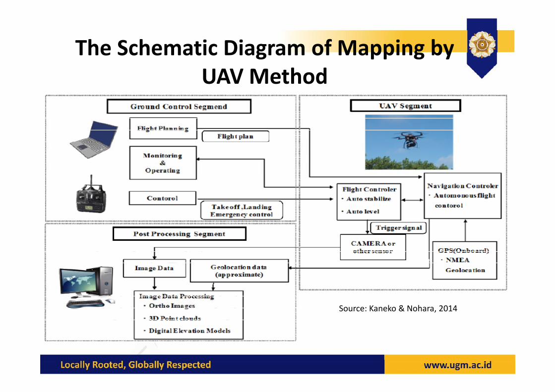
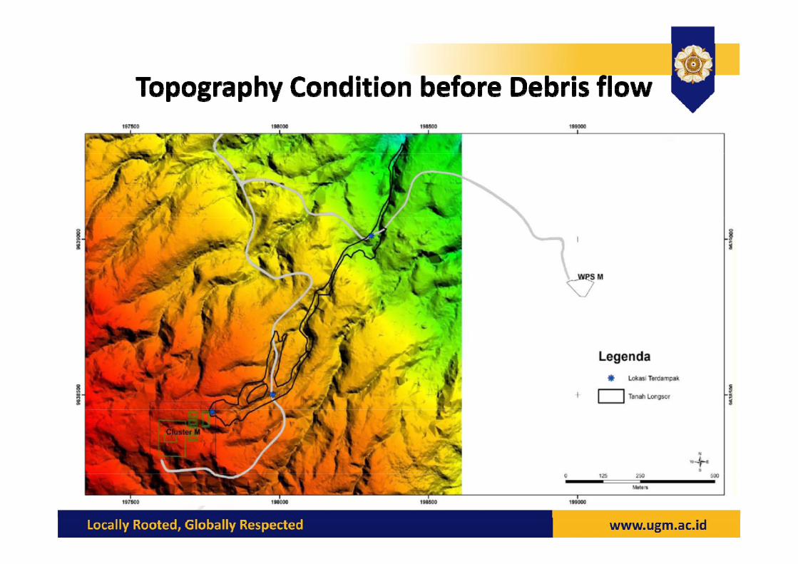
The Schematic Diagram of Mapping by UAV Method
Source: Kaneko & Nohara, 2014
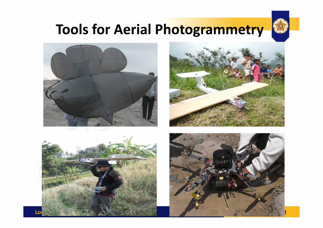
Tools for Aerial Photogrammetryg y

DigitalDigital Photogrammetry
Altitude:150m – 300 m
Effective Ground Coverage:120m – 250m
Camera:Camera:Min 12MpixelWith LensCalibration Parameter
Remote camera exposure

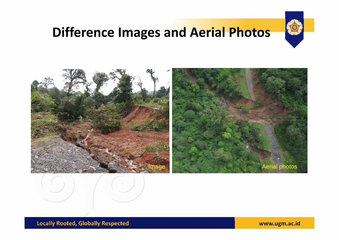
Difference Images and Aerial Photosg
Aerial photosImage

Aerial Photo with Contour

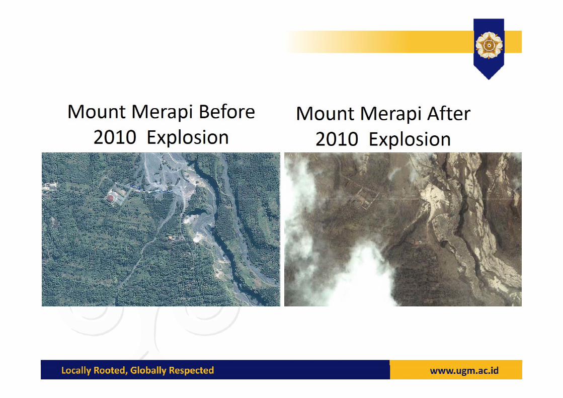
Landslide in Banjarnegara, Central Java


Conclusions
UAV for DRR :
• Accurate and effective to reach a remote areaAccurate and effective to reach a remote area for potential hazard identification
R id d i i l• Rapid assessment and monitor continuously
• Meet time‐sensitive and high resolution needs gof risk assessment, emergency response and disaster reliefdisaster relief

THANK YOU