agenda item 4a planning application 2 · report and receipt of an amended plan showing suitable...
TRANSCRIPT

Application Number and Registration Date
MO/2018/2169 (Detailed) 18-Dec-2018
Applicant Mr K Stoker
Case Officer Helen Clarke
Amendments /amplifications
Committee Date 6 March 2019
Ward(s) Fetcham East Within 20m of Bookham South Ward
Proposal Erection of one detached residential dwelling with associated parking and access.
Site Description Land r/o Northdown House, Leatherhead Road, Bookham, Leatherhead, Surrey, KT23 4RR
RECOMMENDATION: Subject to receipt of a satisfactory updated Arboricultural Report and receipt of an amended plan showing suitable surfacing for wheelchair access on the driveway/pathway, planning permission be GRANTED subject to conditions.
Summary
This application is for the erection of a chalet bungalow to the rear of Northdown House. This application differs from a previously granted application in two main ways. The first is that the property has been moved to a more central part of the plot and the porch and chimney stack have been swapped on the end elevations. The second change is that access to the property would be via the existing pathway to the northeast of the site and not through the land within the curtilage of Northdown House.
The principle of developing the site for housing has been established through the previous permission (MO/2017/0922).
Agenda Item 4aPlanning Application 2
The main issues for consideration are the effect on the character and appearance of the area, highway and pedestrian safety and the impact on the amenities of neighbouring properties. The design of the building is acceptable and not considered to harm the character of the area. The existing pathway would be widened, additional lighting added and new planting introduced to create a combined driveway and footpath. Surrey County Council advise that these changes would improve the appearance of the area and measures to keep car speeds low would maintain highway safety for both vehicles and pedestrians. Residential amenities of neighbouring properties would not be significantly affected. Therefore planning permission is recommended. 1. Development Plan
1.1. Built up area, Tree Preservation Order, Bookham NDP area
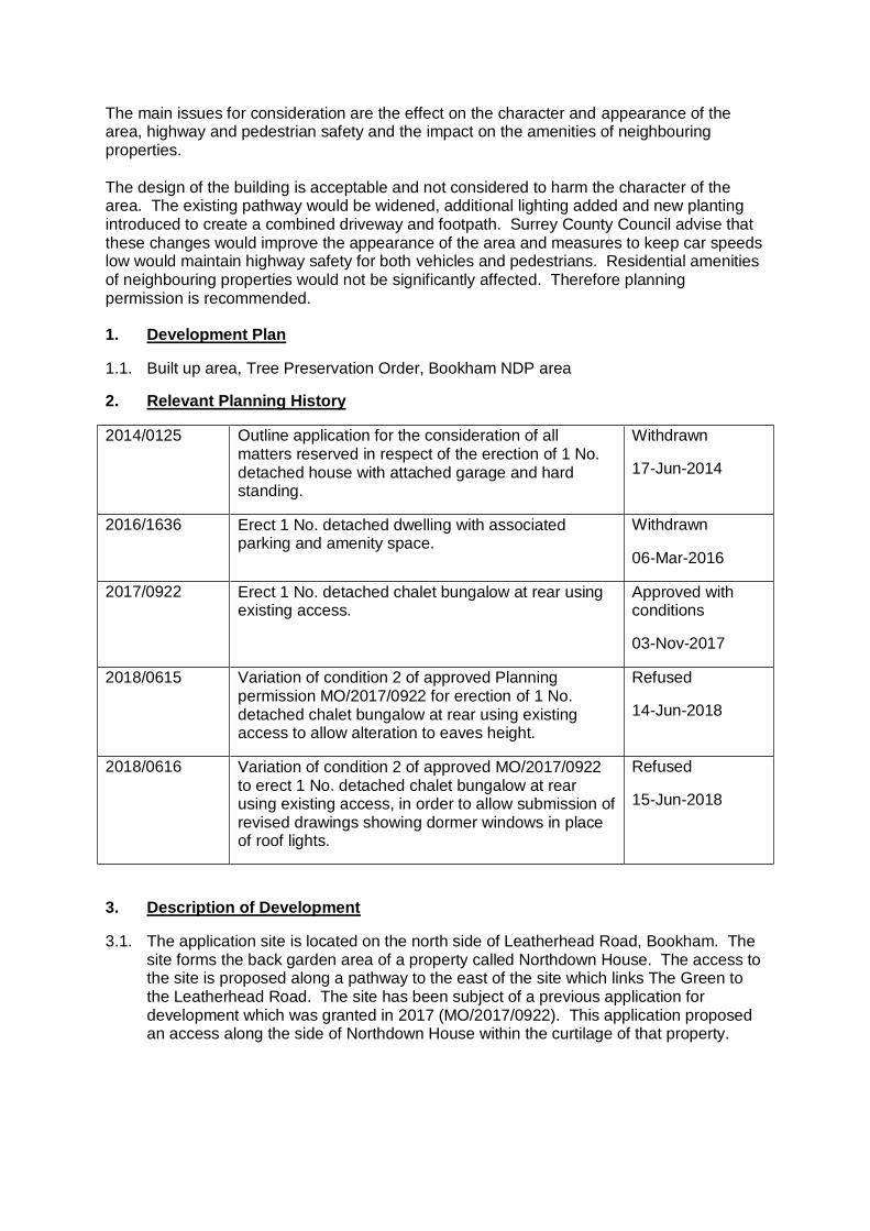
2. Relevant Planning History
2014/0125 Outline application for the consideration of all matters reserved in respect of the erection of 1 No. detached house with attached garage and hard standing.
Withdrawn
17-Jun-2014
2016/1636 Erect 1 No. detached dwelling with associated parking and amenity space.
Withdrawn
06-Mar-2016
2017/0922 Erect 1 No. detached chalet bungalow at rear using existing access.
Approved with conditions
03-Nov-2017
2018/0615 Variation of condition 2 of approved Planning permission MO/2017/0922 for erection of 1 No. detached chalet bungalow at rear using existing access to allow alteration to eaves height.
Refused
14-Jun-2018
2018/0616 Variation of condition 2 of approved MO/2017/0922 to erect 1 No. detached chalet bungalow at rear using existing access, in order to allow submission of revised drawings showing dormer windows in place of roof lights.
Refused
15-Jun-2018
3. Description of Development
3.1. The application site is located on the north side of Leatherhead Road, Bookham. The site forms the back garden area of a property called Northdown House. The access to the site is proposed along a pathway to the east of the site which links The Green to the Leatherhead Road. The site has been subject of a previous application for development which was granted in 2017 (MO/2017/0922). This application proposed an access along the side of Northdown House within the curtilage of that property.

3.2. The current application seeks planning permission for the erection of one detached residential dwelling with associated parking and access.
4. Consultations
4.1. SCC Highways - The proposed development has been considered by THE COUNTY HIGHWAY AUTHORITY who having assessed the application on safety, capacity and policy grounds, recommends the following conditions be imposed in any permission granted: - Vehicle access with visibility splays, turning area to leave in forward gear and construction management plan.
4.2. Drainage Consultant - I have reviewed the documents relating to flood risk and drainage. The site lies on chalk strata and so the proposal for a new soakaway is acceptable in principle. A condition should be applied on approval requesting the detailed drainage design including infiltration testing in accordance with BRE Digest 365 and supporting calculations in accordance with the non-statutory SuDS guidance.
4.3. Natural England - no comments
4.4. Tree Officer – (comments in relation to previous scheme MO/2019/0922) There are protected Oak Trees in close proximity to the proposal. The Tree Officer has advised that the new drive would need to be installed with a ‘no dig system’ which would result in raised levels by up to 150mm above the existing ground level. Following a conversation between the Tree Officer and the applicants Arboricultural Consultant, an ‘in principle’ solution has been agreed and as such the tree information can be conditioned accordingly.

5. Representations
5.1. 38 representations have been received from 36 different households. Three Residents Associations have also commented. The following summarised concerns have been raised:
Access/highways
a mix of vehicles and pedestrians would be dangerous
should not be allowed to be privately owned
it would have a detrimental effect on its use as a wildlife corridor
the parking area would only allow for one car to exit in a forward gear, others would have to reverse
3.1 metres is too narrow for cars and pedestrians to pass safely
vehicle visibility splays fall sort of TDP recommendations
issues with the future maintenance of the right of way
issues with public liability insurance
lots of people who use footpath have buggies and prams or are wheelchair users. these people would not have the space to pass a vehicle
no turning space for larger vehicles (delivery, emergency services) would have to reverse onto main road
object to a public right of way D2879 being taken into private ownership
vehicles would not appreciate pedestrians having priority
parking on The Green in the construction phase would be unacceptable
no deterrent to speeding cyclists like there is at present
raised granite setts unsuitable for footpath use
vehicles could park on footpath for quick getaway for burglaries in The Green
removal of vegetation would increase noise from main road
the visibility splay to the east is over someone else’s land and vehicles would be positioned on the left land side when pulling out and not in the middle
development should be within the applicants own boundaries
shrubs offer security for Rusland
could be used as a cut through for motorcycles
could affect bat population that use high trees and shrubs along path
broader issues with the sale of all the roads on the Estate
Other issues
render on building out of keeping with properties on The Green
windows would overlook private garden area
Design and Access statement refers to solar panels on a garage; however there is not garage in this proposal
drainage more runoff to properties in The Green
not enough parking for a three bed property
Arboricultural impact Assessment is not based on this proposal over development
Keswick Green Residents Association – KGRA find no merit in the current proposal as the fundamentals regarding a detriment change of use of the footpath to incorporate vehicular access remain in terms of the criteria established by the November 2016 report. The association can only reiterate that a pedestrian/ vehicular mix in reduced confines will not only change the aesthetic

essence of the footpath. But, equally create significantly greater safety consequences.
Bookham Residents Assoc. - We full endorse the local residents’, Keswick
Garden Residents Association’s and Fetcham Residents Association’s letters of Objection to this application and ask that it is refused. Planning application MO/2017/0922 has already been approved and we see no valid reason why the development of this site should be the subject of another application.
Fetcham Residents Association - We see little material difference in the
proposed utilisation of the footpath as presented now, compared with the withdrawn proposal of MO/2016/1636, hence our previously stated objections to its use remain.
We again support the concerns being expressed by residents and the KGRA in objecting to this planning application on safety and feasibility grounds and due to the significant loss of amenity to residents near and far.
6. Main Planning Policies
6.1. Government Guidance National Planning Policy Framework 2019 (NPPF) Section 5 Delivering a sufficient supply of homes Section 9 – Promoting Sustainable Transport Section 11 Making effective use of land Section 12 Achieving well-designed places
6.2. Mole Valley Core Strategy
CS1 – Where Development will be Directed CS2 – Housing Provision and Location CS3 – Balancing Housing Provision CS14 – Townscape, Urban Design and the Historic Environment CS17 – Infrastructure, Services and Community Facilities CS18 – Transport Options and Accessibility CS19 – Sustainable Construction, Renewable Energy and Energy Conservation CS20 – Flood Risk Management
6.3. Mole Valley Local Plan ENV22 – General Development Control Criteria ENV23 – Respect for Setting ENV24 – Density of Development and the Space About Buildings ENV53 – Trees in the Built-up Areas MOV2 – The Movement Implications of Development MOV5 – Parking Standards
6.4. Bookham Neighbourhood Development Plan BKEN1: Trees and hedgerows BKEN2: Design and local character BKH1: Smaller homes for downsizing and new families BKH2: Infill and garden development BKH3: Parking space standards BKIN1: Drainage

6.5. Other Documents Supplementary Planning Document - Built–-up Area Character Appraisal –Bookham and Fetcham
7. Main Planning Issues
7.1. The main planning issues for consideration are:
The effect on the character and appearance of the area
Impact on the amenities of adjoining properties
Highway Safety and parking
Sustainable Construction
Sustainable Drainage
Trees in Built-up areas
Community Infrastructure Levy The effect on the character and appearance of the area
7.2. Policy ENV22 of the Mole Valley Plan states that development should respect the character and appearance of the locality.
7.3. Policy ENV23 states that development will normally be permitted where it respects its setting taking account of the scale, character, bulk, proportions and materials of the surrounding built environment.
7.4. Policy CS14 of the Core Strategy states that all new development must respect and enhance the character of the area in which it is proposed whilst making the best possible use of the land available.
7.5. Bookham Neighbourhood Development Plan policy BKEN2 advises that all new development must demonstrate good quality design which respects the character and appearance of the surrounding area.
7.6. The proposed chalet bungalow would essentially be of the same design as the one previously approved in the 2017 application. The main difference would be a swapping around of the chimney and the entrance porch on the northwest and southeast elevations. The location of doors and windows on the front elevation would also be swapped around. The building would be moved into a more central position within the plot.
7.7. The surrounding properties within the immediate vicinity along the Leatherhead Road are two storey detached dwellings which vary in style and design. The properties immediately to the north of the site, in The Green, are mainly bungalows of a similar design.
7.8. The principle of back land development in this location has already been established and there are a number of sites that access the main Leatherhead Road.
7.9. The proposed repositioning of the dwelling within the site would increase the distance between the dwelling and No.10 The Green, from 3 metres in the previous application to 6.4 metres in this proposal. This would reduce the gap to the boundary with Northdown House from 9 metres to 5.2 metres. However there would still be a further 18.8 metres to the rear of Northdown House. The dimensions of the building would remain unchanged from the previous application.

7.10. The proposed dwelling is a traditional design with a pitched roof and three pitched roof dormers on the rear elevation. The swapping of the porch and the chimney would not have a significant impact on the overall appearance of the property. It is considered that the plot size would be similar to No.10 The Green.
7.11. It is therefore considered that the property has been designed to ensure that it contributes to the character of the surrounding area in accordance with the above listed policies and the supplementary guidance contained in the Built-up area character appraisal (BUACA), and is appropriate in terms of scale, form and appearance. Impact on the amenities of adjoining properties
7.12. The main neighbouring property would be No.10 The Green. Their side boundary is defined by fencing and hedging. The alteration to change the front porch to this north western elevation would increase the activity on this side of the property, and the parking space would also be moved to this location. However the gap between the two properties would be more than doubled, therefore it is considered that this change would not have a detrimental impact on the amenities of this neighbouring property. A secondary bedroom window is proposed on the north west elevation facing towards No. 10 The Green. A suitable planning condition is recommended requiring obscure glazing to that window in order to avoid any views towards the rear of No. 10.
7.13. The impact on the host dwelling would be mitigated by the separation distance of 18 metres and boundary screening. This distance is considered to be acceptable so as not to have a detrimental impact on the both future occupants and the host dwelling in terms of overlooking and loss of privacy.
7.14. Roof lights are proposed on the eastern elevation which would serve the staircase, bathrooms and a bedroom. Although the neighbouring property “Rusland” would have oblique views of the proposed dwelling, given the distance of 19.5 metres and the boundary screening, which includes protected Oak Trees, it is considered that the roof lights would not have a significant detrimental impact on the privacy of this neighbouring property.
7.15. The western side shares a boundary with the rear garden area of “Carinya”. This boundary is heavily planted with trees and hedging. It is considered that the three dormer windows would not impact on the privacy of this neighbouring property.
7.16. It is considered that the proposed dwelling would not have a significant impact on the amenities of the nearby properties in accordance with policy ENV22. Highway safety and parking
7.17. Local Plan policy MOV2 seeks to ensure that new development makes adequate provision for off-street parking, servicing, vehicular access and egress and movement within the site.
7.18. Paragraph 109 of the NPPF (2019) states that: Development should only be prevented or refused on highway grounds if there would be an unacceptable impact on highway safety , or the residual cumulative impacts on the road network would be severe.
7.19. One of the main changes on this application over the existing approval would be the use of the existing pathway that leads from The Green to the Leatherhead Road as the driveway to the site. It is intended that pedestrian access along the pathway would be maintained.

7.20. The changes include joining the end of the pathway to the existing access for Northdown House to allow for better visibility when exiting the site. The existing hedging along the path would be removed and the path would be resurfaced in tarmac with raised granite sets. Also included would be planted areas set in timber kerb edging and lighting posts that would be 1.2 metres high.
7.21. The existing street lighting would remain. Within the site a gate would be set in so that 2 metre visibility splays could be created either side of the gates.
7.22. The ownership of the path is now with the Crown Estates. They have been notified of the application under certificate B of the application process. The path has highway rights of way over it and this would remain even with a change of ownership.
7.23. The applicant sought the pre-application advice of the County Highway Authority in July 2018 and submitted a copy of their formal response in support of this application. The pre-application response concludes that ‘the vehicle movements generated by one new dwelling on this footpath will not have a negative impact on pedestrians. The path currently is dark and tight with overgrown vegetation on both sides, so the Highway Authority consider that the proposed plans will make the path better for pedestrians.’
7.24. The Highways Authority has concluded that the current path is overgrown and lacks adequate lighting. The proposed changes would widen the path and would improve its appearance and safety for pedestrians. Vehicles using the path would be forced to travel at a low speed with the inclusion of the raised granite setts. The number of vehicle movements generated by one dwelling is considered to be low enough not to cause issues between pedestrians and vehicles.
7.25. The applicant has acknowledged that the raised granite setts could pose problems for wheelchair users and therefore would consider have smooth areas in the middle for better access. Amended plans have been requested to deal with this issue and an update will be provided to committee.
7.26. The previous scheme had two parking spaces shown to the side of the property. The parking would be moved to the north western side of the property. There would be space for one vehicle at the side and one in front of the property. There would be space to turn a vehicle so that it could exit the site in a forward gear.
7.27. On the basis of the comments from the County Highway Authority who do not raise any highway safety concerns, it is considered that the proposal does not conflict with paragraph 109 of the NPPF or the aims of Local Plan policies MOV2 and MOV5. Sustainable construction
7.28. The proposal falls within the remit of Policy CS19 of the Mole Valley Core Strategy. The proposed development would therefore need to meet the requirements of this policy. Compliance with these aspects of policy CS19 can be satisfactorily controlled through the imposition of a suitable planning condition. Sustainable drainage
7.29. The applicant has submitted a drainage design in principle. The Council’s Drainage Consultant has raised no objection to the design and believes that a viable drainage solution can be achieved for the development. Accordingly, a suitable condition is recommended.

Trees in built-up areas
7.30. The proposal is adjacent to protected trees which run along the footpath. The applicant has re-submitted an Arboricultural Impact Assessment which accompanied the previous application (MO/2017/0922). The Council’s Tree Officer was consulted on this report at the time of the previous application and advised that in order to protect the roots of these trees the applicant would have to use the ‘no dig method’ to lay Geogrid protection and the tarmac above. An updated Arboricultural Report has been requested from the applicant detailing the impact on trees as a result of using the existing pathway as the driveway to the site. An update will be provided to committee. Community Infrastructure Levy (CIL)
7.31. Policy CS17 of the Core Strategy states that development should make provision for new infrastructure where necessary. However the Community Infrastructure Levy (CIL) has now been introduced, which places a mandatory charge on new residential developments to be used to fund infrastructure projects within the District. The Council has produced the following list of infrastructure types that will be funded through CIL receipts (known as the Council’s Regulation 123 List)
• Transport schemes other than site-specific access improvements; • Education • Primary Health Care • Leisure and Recreation • Community facilities • Flood defence and mitigation works • Waste collection and recycling facilities This development is CIL liable and a CIL contribution of £34,440.73 would be generated from the development. However, this figure may be amended if further information is forthcoming, and it may also be subject to an application for exemption.
8. Conclusion
The principle of the proposed new three bed chalet bungalow in the rear garden area of the Northdown House has already been established by the previous permission MO/2017/0922. This new property would add one additional dwelling to the District’s housing stock. The property would respect the character of the surrounding area and would not significantly impact the amenities of the neighbouring properties. There would be sufficient parking on site for the size of property and the access way, although an existing public footpath would benefit from substantial improvements that would serve the surrounding area. Subject to receipt of a satisfactory updated Arboricultural Report and receipt of an amended plan showing suitable surfacing for wheelchair access on the driveway/pathway, permission is recommended.
9. Recommendation
Subject to receipt of a satisfactory updated Arboricultural Report and receipt of an amended plan showing suitable surfacing for wheelchair access on the driveway/pathway, planning permission be GRANTED subject to the following conditions:

1. The development hereby permitted shall be begun before the expiration of three years
from the date of this permission. Reason: To comply with Section 91(1) of the Town and Country Planning Act 1990 as amended by Section 51(1) of the Planning and Compulsory Purchase Act 2004.
2. The development hereby permitted shall be carried out and completed in all respects strictly in accordance with the submitted documents and plan numbers P777-01-03, P777-01-02, P777-01-07, P777-01-04, P777-01-05, the location plan and supporting information contained within the application and no variations shall take place. Reason: To accord with the terms of the submitted application and to ensure minimal impact on local amenity and the environment in accordance with Mole Valley Core Strategy policy CS14 and Mole Valley Local Plan policy ENV22.
3. Before any above ground works commence, details of the materials to be used in the construction of the external surfaces of the development hereby permitted shall be submitted to and approved in writing by the Local Planning Authority. Development shall be carried out in accordance with the approved details. Reason: To ensure the development harmonises with its surroundings in accordance with Mole Valley Local Plan policy ENV22 and policy CS14 of the Mole Valley Core Strategy.
4. Before any above ground works commence, details of the hard surfacing to be used within the site shall be submitted to and approved in writing by the Local Planning Authority. The details shall indicate either porous materials or the provision of a direct run-off from the hard surface to a permeable or porous area. All hard surfacing shall be carried out in accordance with the approved details, completed prior to the first occupation of the development hereby permitted and thereafter, permanently retained as such. Reason: To preserve the visual amenity of the area and prevent the increased risk of flooding, in accordance with Mole Valley Local Plan policy ENV25 and policies CS14 and CS20 of the Mole Valley Core Strategy.
5. No development shall take place until details of the existing ground levels of the site, the proposed finished levels of the ground, the ground floor slab level of each building, and the finished levels of any access road and driveway showing their relationship with the existing levels of the immediately adjoining land and buildings, have been submitted to and approved, in writing, by the Local Planning Authority. The development shall be carried out in accordance with the approved levels. Reason: The Local Planning Authority is satisfied that it is fundamental to the development permitted to address this issue before development commences and that without this safeguard planning permission should not be granted and to protect the amenities and privacy of adjoining properties in accordance with Mole Valley Local Plan policy ENV22.
6. Prior to the commencement of the development hereby permitted, surface water drainage details shall be submitted for the approval in writing by the Local Planning

Authority. Such details shall include an assessment of the potential for the disposal of surface water by means of a sustainable drainage system in accordance with the principles set out in the National Planning Policy Framework. The assessment shall provide information of the design storm period and intensity (typically a 1 in 100 year storm of 30 minutes duration with an allowance for climate change), the method employed to delay and control the surface water discharged from the site and the means to prevent pollution of the receiving groundwater and/or surface water. Where applicable, the details shall include infiltration tests, calculations and controlled discharge rates. If the development is to discharge water into the ground in any form, then a full BRE Digest 365 infiltration test (or falling head test for deep bore soakaways) will have to be submitted to the Local Planning Authority prior to commencement of any works on site. The suitability of infiltration methods should be verified (i.e. possible contaminated ground). The approved drainage scheme shall be implemented prior to the first occupation of the development. Reason: The Local Planning Authority is satisfied that it is fundamental to the development permitted to address this issue before development commences and that without this safeguard planning permission should not be granted and, in the interests of sustainable development, in accordance with the advice contained in the National Planning Policy Framework and policy CS20 of the Mole Valley Core Strategy.
7. Prior to any above ground works commencing, details to reduce the carbon emissions of the predicted energy use of the development hereby permitted by at least 10% through the on-site installation and implementation of decentralised and renewable or low-carbon energy sources shall be submitted and approved by the Local Planning Authority and be implemented prior to the first occupation of the development. Reason: To optimise renewable energy and its conservation, in accordance with policy CS19 of the Mole Valley Core Strategy.
8. The development hereby approved shall not be first occupied unless and until the proposed vehicular access to Leatherhead Road has been constructed and provided with visibility splays in accordance with the approved plans and therefore the visibility splays shall be kept permanently clear of any obstruction over 1.05 m high. Reason: The above condition is required in order that the development should not prejudice highway safety nor cause inconvenience to other highway users, in accordance with the National Planning Policy Framework, and saved polices MOV2 and MOV5 of the Mole Valley Local Plan.
9. The development hereby approved shall not be first occupied unless and until space has been laid out within the site in accordance with the approved plans for vehicles to be parked and for vehicles to turn so that they may enter and leave the site in forward gear. Thereafter the parking and turning areas shall be retained and maintained for their designated purposes. Reason: The above condition is required in order that the development should not prejudice highway safety nor cause inconvenience to other highway users, in accordance with the National Planning Policy Framework, and saved polices MOV2 and MOV5 of the Mole Valley Local Plan.

10. No development shall commence until a Construction Transport Management Plan, to include details of: (a) parking for vehicles of site personnel, operatives and visitors (b) loading and unloading of plant and materials (c) storage of plant and materials (d) programme of works (including measures for traffic management) Reason: The above condition is required in order that the development should not prejudice highway safety nor cause inconvenience to other highway users, in accordance with the National Planning Policy Framework, and saved polices MOV2 and MOV5 of the Mole Valley Local Plan.
11. Prior to the first occupation the first floor window in the northwest elevation of the development hereby permitted shall be glazed in obscured glass and only openable above a height of 1.7 metres above the internal floor level. The window shall be permanently retained in that condition thereafter. Reason: To protect the amenities and privacy of adjoining residential properties in accordance with Mole Valley Local Plan policy ENV22.
Informatives 1. The developer is reminded that it is an offence to allow materials to be carried from the
site and deposited on or damage the highway from uncleaned wheels or badly loaded vehicles. The Highway Authority will seek, wherever possible, to recover any expenses incurred in clearing, cleaning or repairing highway surfaces and prosecutes persistent offenders. (Highways Act 1980 Sections 131, 148, 149.)
2. The developer is advised that as part of the detailed design of the highway works required by the above condition(s), the County Highway Authority may require necessary accommodation works to street lights, road signs, road markings, highway drainage, surface covers, street trees, highway verges, highway surfaces, surface edge restraints and any other street furniture/equipment.
3. The permission hereby granted shall not be construed as authority to carry out any works on the highway. The applicant is advised that prior approval must be obtained from the Highway Authority before any works are carried out on any footway, footpath, carriageway, or verge to form a vehicle crossover or to install dropped kerbs. Please see www.surreycc.gov.uk/roads-and-transport/road-permits-and-licences/vehicle-crossovers-or-dropped-kerbs.
4. The permission hereby granted shall not be construed as authority to carry out any works on the highway or any works that may affect a drainage channel/culvert or water course. The applicant is advised that a permit and, potentially, a Section 278 agreement must be obtained from the Highway Authority before any works are carried out on any footway, footpath, carriageway, verge or other land forming part of the highway. All works on the highway will require a permit and an application will need to submitted to the County Council's Street Works Team up to 3 months in advance of the intended start date, depending on the scale of the works proposed and the classification of the road. Please see http://www.surreycc.gov.uk/roads-and-transport/road-permits-and-licences/the-traffic-management-permit-scheme. The applicant is also advised that Consent may be required under Section 23 of the Land Drainage Act 1991. Please see www.surreycc.gov.uk/people-and-community/emergency-planning-and-community-safety/flooding-advice.

5. The applicant is advised that the approval of details and/or samples required by condition(s) is subject to a fee, details of which may be viewed on the Council's website under the planning pages. The fee may cover more than one condition where the details are submitted at the same time. Where subsequent submissions are made, a further fee will be payable per individual submission. The fee should be paid at the time of submission of the formal request. PLEASE NOTE that this approval process may take up to 8 weeks from the date of the request. Applicants are therefore advised to submit requests in a timely manner.