agr mcrs brochure
DESCRIPTION
AGR MCRS BrochureTRANSCRIPT
Identify opportunities
with confidence
MCRSMulti-Client Regional Studies
02
500 WITH
RMR™ CTS™
02

The advantage you get with AGR is down to the experience of our subsurface professionals, plus Multi-Client Regional Studies (MCRS) - a bespoke product with an enviable reputation.
MCRS is custom-made for either the Norwegian Sea or the Barents Sea. What sets it apart is both its depth of information and its ability to identify areas to invest in and focus on, both inside and outside licensing rounds.
The experience of AGR’s team has been used to develop MCRS – providing clients with information on subsurface areas in terms of geology, as well as the spatial distribution and quality of potential reservoirs. This enables confident, informed decisions to be made on which blocks to focus on prior to a licensing round.
Detailed studies for the Norwegian and Barents seas
03
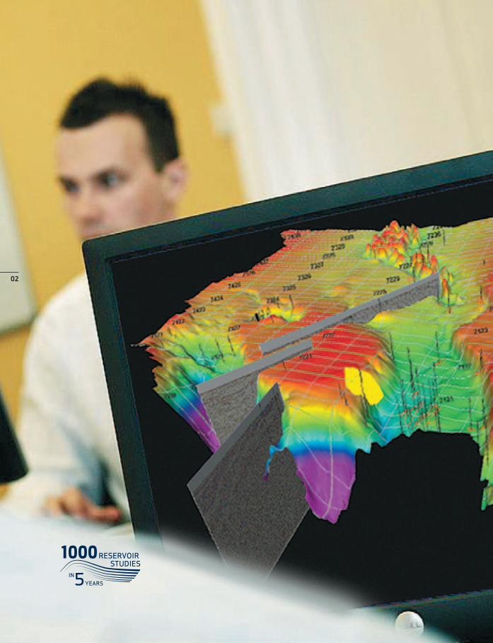
AGR has completed more than 1,000 reservoir studies in only 5 years, covering 61 countries on six continents.
When it comes to making the right investment decisions in exploration acreage, it’s reassuring to be able to rely on a company whose understanding and knowledge of reservoirs go deeper than most.
Erik Lorange, Exploration Manager Norway

04
Making it possible to know the unknownMCRS provides a benchmark and a toolbox for clients aiming for a licence application on the Norwegian Continental Shelf. These detailed studies include:
• Prospectivity screening and basic information for APA and licence round applications;
• All public seismic and well data included in the study;
• Identification of key prospects and prospectivity trends;
• Interpreted horizons;
• An ideal basis for development of geological concepts and prospective trends, with reservoir characteristics laid out as an image overlay in Petrel;
• Basin modelling studies on the NCS in partnership with SINTEF;
• The key wells have been selected on the basis of reservoir importance and worked up in terms of reservoir characterisation;
• Computer Processed Interpretations CPI of petrophysical properties in more than 100 wells.
Regional reservoir studies provide an integrated view on the distribution of potential reservoirs, facies and their controls at basin and field scales within a stratigraphic framework.

05
Multi-Client Regional Studies (MCRS) improved the decision making process - both at bid stage and through the life of a field.
AGR’s comprehensive MCRS provides a complete suite of decision making products that include all-inclusive, complete data sets of seismic, wells, biostratigraphy, petrophysics, horizon interpretation, time grids, depth grids and velocity grids.

NoRWEGIAN SEA Multi-Client Studies
Velocity and depth GridsNPD public stacking velocities have been calibrated to match check-shots in wells and smoothed to represent regional structural elements covering 12 horizons.
time Grids reGional horizons This dataset may be adjusted to fit any project (UTM zone) and software. It introduces a sound basis for further detailed interpretation.
petrophysical database 2009A comprehensive study covering 50 wells, consisting of composite wireline logs, interpreted lithology, porosity and water saturation. It also includes a table of zonal averaged parameters.
norweGian sea inteGrated basin study 2010 (sinteF)This is a joint effort study following a highly successful study in the Barents Sea, combining a comprehensive data-base with novel modelling techniques to describe petroleum systems and identify the key risk factors for exploration in the different basins.
norweGian sea multi-client reGional reserVoir study Palaeogeographic facies maps prepared for key time periods in the Jurassic, Cretaceous and Palaeocene ages. Core description study of 40 wells with approximately 3900m digitised in WellCad software with digitised core descriptions.
06

07
Whatever you need to know about opportun- ities in the Norwegian or Barents seas, AGR has the in-depth data.
BARENTS SEA Multi-Client Studies
Velocity and depth GridsNPD public stacking velocities have been calibrated to match check-shots in wells and smoothed to represent regional structural elements.
time Grids reGional horizonsThis dataset may be adjusted to fit any project (UTM zone) and software. It introduces a sound basis for further detailed interpretation.
petrophysical database 2008This covers 38 wells, consisting of composite wireline logs, interpreted lithology, porosity and water saturation. The database also includes a table of zonal averaged parameters.
barents sea inteGrated basin study 2008 (sinteF) The Integrated Barents Sea Study (IBS 2005/8) is combining a comprehensive database with novel modelling techniques to describe petroleum systems and identify key risk factors for exploration in the Barents Sea.
barents sea open acreaGe prospectiVity screeninGA screening study demonstrating prospectivity, volumes and risks basin-wide. Prospective areas have been classified and blocks are suggested for nomination in concession rounds.
Michael Mazur, Senior Geophysicist, Norway.
08
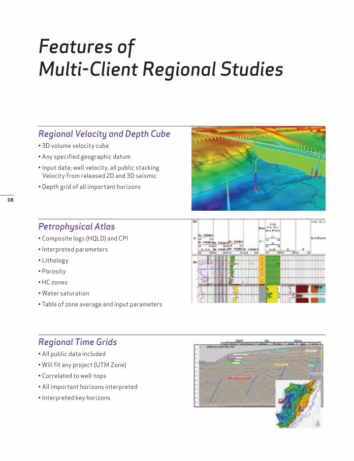
Features of Multi-Client Regional Studies
Regional Velocity and Depth Cube• 3D volume velocity cube
• Any specified geographic datum
• Input data; well velocity, all public stacking Velocity from released 2D and 3D seismic
• Depth grid of all important horizons
Petrophysical Atlas• Composite logs (HQLD) and CPI
• Interpreted parameters
• Lithology
• Porosity
• HC zones
• Water saturation
• Table of zone average and input parameters
Regional Time Grids• All public data included
• Will fit any project (UTM Zone)
• Correlated to well-tops
• All important horizons interpreted
• Interpreted key horizons
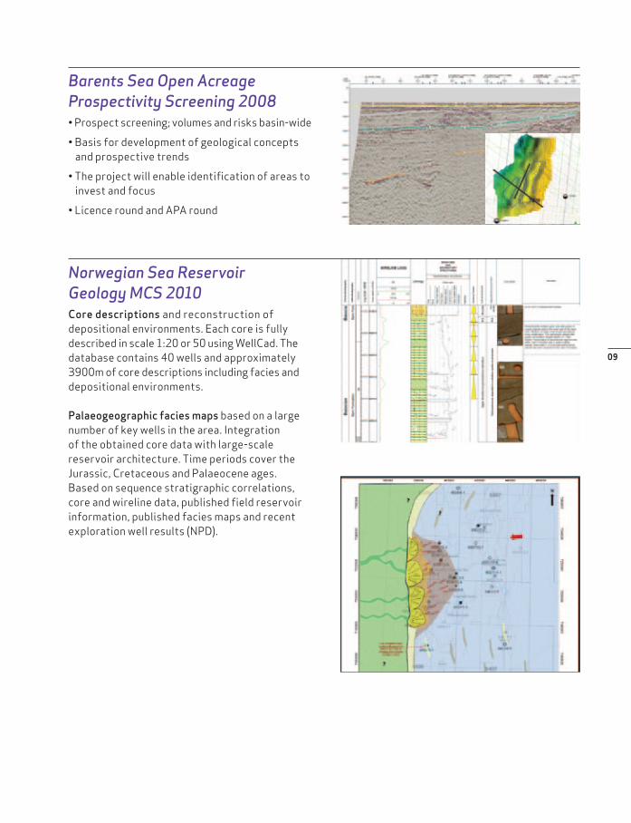
Barents Sea Open Acreage Prospectivity Screening 2008• Prospect screening; volumes and risks basin-wide
• Basis for development of geological concepts and prospective trends
• The project will enable identification of areas to invest and focus
• Licence round and APA round
Norwegian Sea Reservoir Geology MCS 2010Core descriptions and reconstruction of depositional environments. Each core is fully described in scale 1:20 or 50 using WellCad. The database contains 40 wells and approximately 3900m of core descriptions including facies and depositional environments.
Palaeogeographic facies maps based on a large number of key wells in the area. Integration of the obtained core data with large-scale reservoir architecture. Time periods cover the Jurassic, Cretaceous and Palaeocene ages. Based on sequence stratigraphic correlations, core and wireline data, published field reservoir information, published facies maps and recent exploration well results (NPD).
09

10

11
With a deeper understanding of reservoir geology, AGR will give you a head start on the competition.
A successful exploration programme begins with a detailed understanding of reservoir geology, the distribution and quality of potential reservoirs, the characteristics of rock formation and their controls at basin and field scales.
AGR provides a low-cost entry tool for clients to obtain a significant amount of interpreted key horizons and well data, supported by a complete public 2D and 3D seismic database on which to make sound planning and investment decisions.
Let AGR’s highly experienced Reservoir Management team do the hard work for you to give you a head start on the competition.

Contact AGR about MCRS at the following offices:
NORWAYKarenslyst Allé 4P.O.Box 444 SkøyenNO-0213 OsloTel: +47 24 06 10 00E-mail: [email protected]
www.agr.com
NORWAYVestre Svanholmen 4 NO-4313 SandnesTel: +47 24061000 E-mail: [email protected]