ai and big data spatial highlighted indonesian gis market
TRANSCRIPT
INFRASTRUCTURE 4.0GIS, Big Data & Artificial Intelligence for Speed Train Railways Construction Monitoring
ENCONA ENGINEERING | EIDARA MATA [email protected] | info.[at].eidaramata.com

INDUSTRIAL
REVOLUTION 4.0
Drones extend existing aerial photography and sensor data collection methods. Because drones are short range, they complement other data sources, including satellite imagery, manned aircraft and ground robots. Service providers aggregate these sources, filter, analyze and deliver results to a smartphone or other display.

Droning The Railways
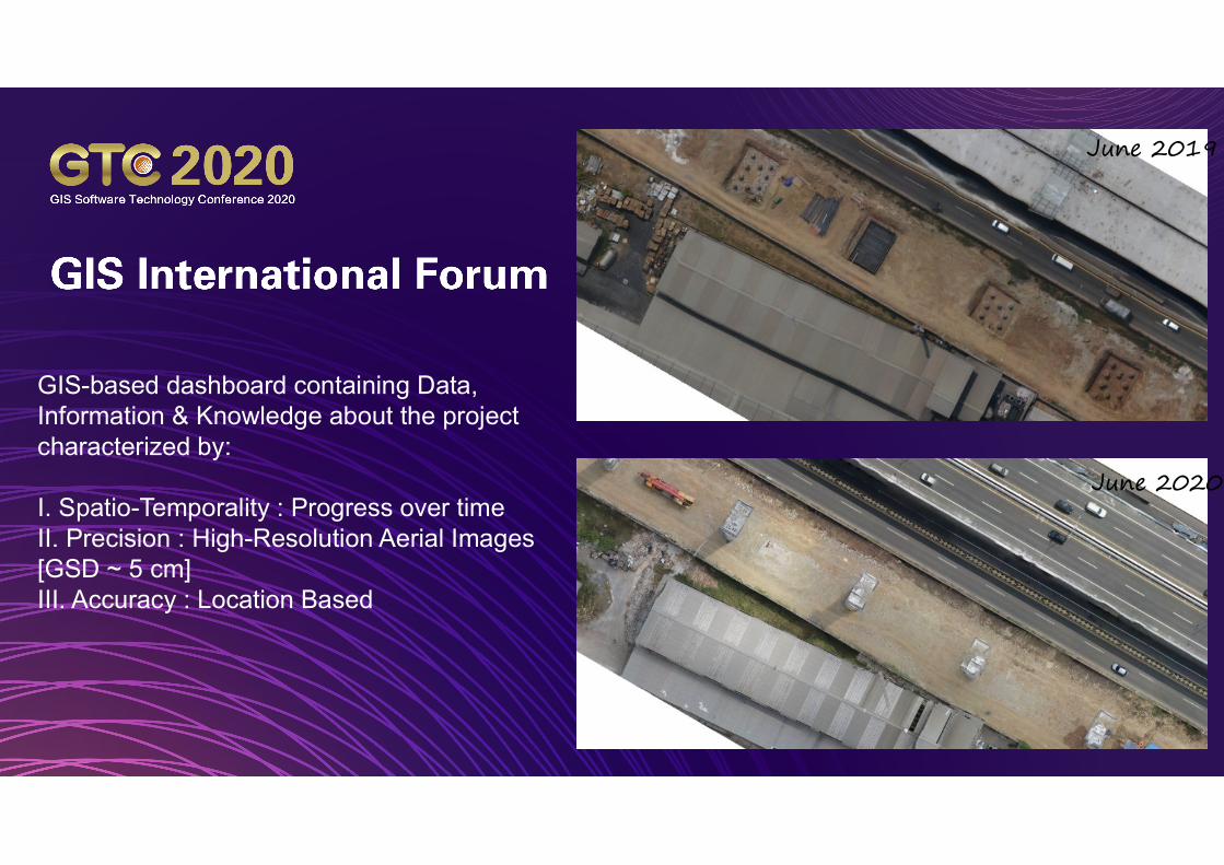
GIS-based dashboard containing Data, Information & Knowledge about the project characterized by:
I. Spatio-Temporality : Progress over timeII. Precision : High-Resolution Aerial Images [GSD ~ 5 cm]III. Accuracy : Location Based
June 2019
June 2020

Zoom Picture + AI Picture + ML Principal Substructure: Piles
Substructure: Piles
Superstructure: Pile Cap
Machine Learning [AI – Algorithm] used to train machine to recognize objects / construction components automatically.
I. More data ~ more “clever” machine II. Efficiencey : Once defined, algorithm
will count all construction components [object of interest and object of important]
III. Accuracy : - more data high accuracy

Substructure: Pile Groups
Superstructure: Girder

DISCUSSION
AccuracyEfficiencyBenefits : spatio temporality
I. EfficiencyII. Accuracy &
PrecisionIII. Spatio-
TemporalityIV. Hardware,
Software & Brainware
V. ReliabilityVI. Towards GIS 4.0