air masses, fronts and weather systems. movements of air masses and fronts are vital to our...
TRANSCRIPT
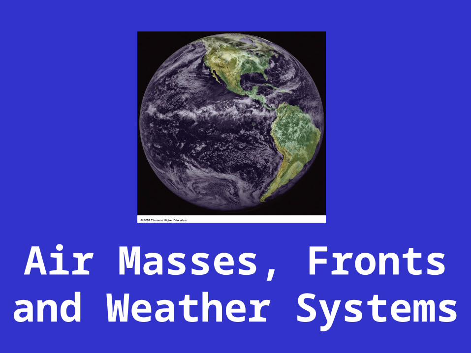
Air Masses, Frontsand Weather Systems
Movements of Air Masses and Fronts are vital to our understanding and prediction of Weather Systems
Weather Forecasting requires that we understand:
Cyclones (L=Lows) and Anticyclones (H=Highs)
Air Masses and Fronts
Again, Let’s Recall the
5+ Basic Elements of the Atmosphere-- Also called Elements of Weather and Climate
Solar Energy ▪ Temperature ▪ Pressure ▪ Wind ▪ Precipitation
In this segment, we’ll discuss the last of these elements:+ Air Masses (and Fronts)
What is an Air Mass?• A large body of air with similar temperature and/or
humidity• Occupies thousands of square miles of the Earth’s
surface, and can be several miles high• Born in a source region where they acquire their
temperature and moisture characteristics
Source Regions
• Stable source regions are generally in the subtropics or near to the poles
• They are often regions of low relief and calm wind that prevent turbulent mixing and allow the air to take on the conditions of the surface over which it forms
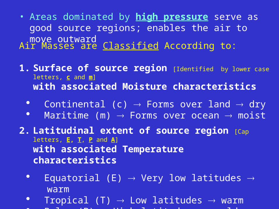
• Areas dominated by high pressure serve as good source regions; enables the air to move outward
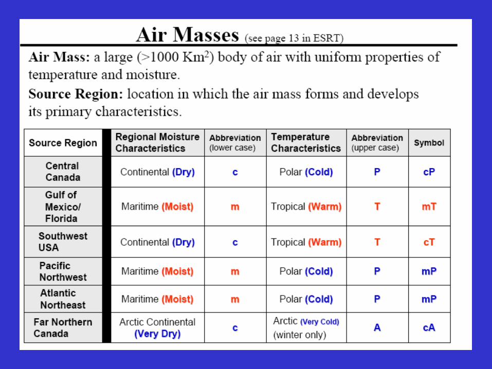
Air Masses are Classified According to: 1. Surface of source region [Identified by lower case letters,
c and m]
with associated Moisture characteristics
Continental (c) Forms over land dry Maritime (m) Forms over ocean moist
2. Latitudinal extent of source region [Cap letters, E, T, P and A]
with associated Temperature characteristics
Equatorial (E) Very low latitudes warm Tropical (T) Low latitudes warm Polar (P) High latitudes cold Cold Arctic (A) Poles very cold
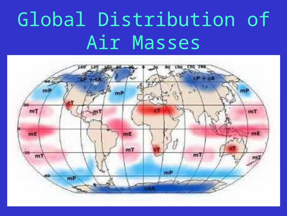
Global Distribution of Air Masses
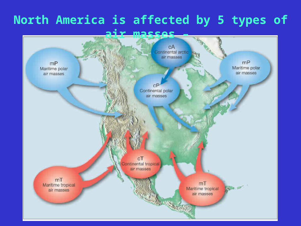
North America is affected by 5 types of air masses –
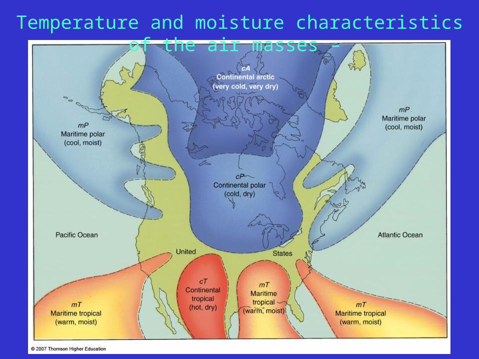
Temperature and moisture characteristics of the air masses –
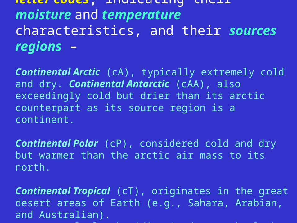
Air Masses are thus identified by letter codes, indicating their moisture and temperature characteristics, and their sources regions –
Continental Arctic (cA), typically extremely cold and dry. Continental Antarctic (cAA), also exceedingly cold but drier than its arctic counterpart as its source region is a continent. Continental Polar (cP), considered cold and dry but warmer than the arctic air mass to its north. Continental Tropical (cT), originates in the great desert areas of Earth (e.g., Sahara, Arabian, and Australian). -- extremely low humidity is due to the lack of available water.

Maritime Polar (mP), cool and moist; brings mild weather to coastal locations.
Maritime Tropical (mT), warm and moist; responsible for much of the precipitation east of the Rocky Mountains.
Maritime Equatorial (mE), form near the equator; very warm and humid; convection and convergence of these in the ITCZ responsible for heavy rainfalls in the equatorial rainforests.
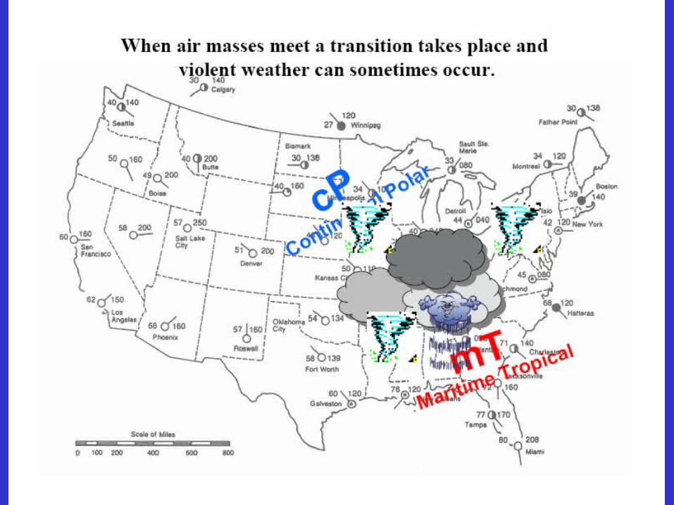
The North American region is affected by the first five types of air mass (cA, cP, cT, mP, mT -- See Map)
Note: often a lower case “k” or “w” may be added to air mass names to indicate if they are colder (k) or warmer (w) than the surface below;
e.g., mTk or mTw – may suggest stability or instability in the air mass.
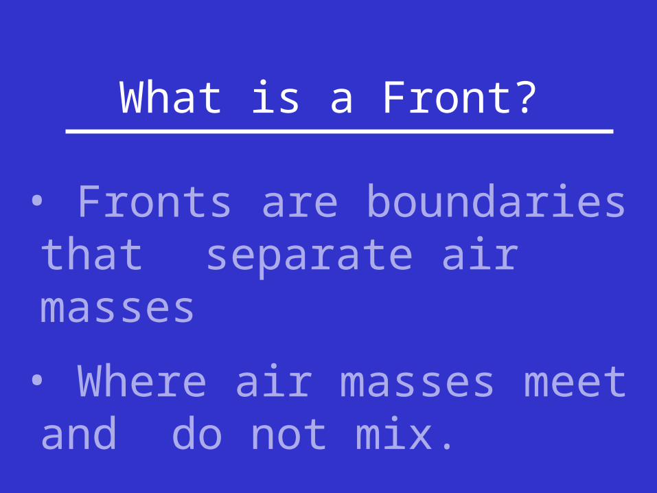
What is a Front?
• Fronts are boundaries that separate air masses
• Where air masses meet and do not mix.
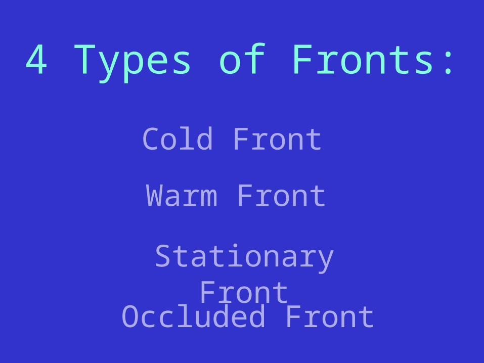
4 Types of Fronts:
Cold Front
Occluded Front
Stationary Front
Warm Front
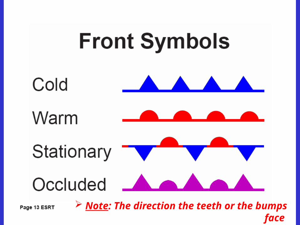
Note: The direction the teeth or the bumps face is the direction the front is moving
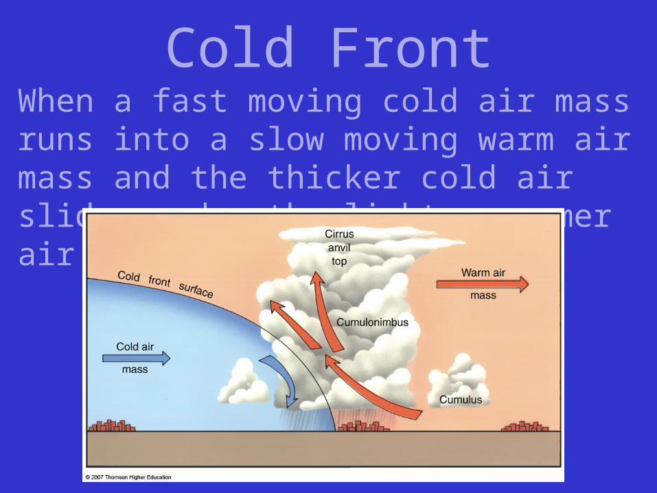
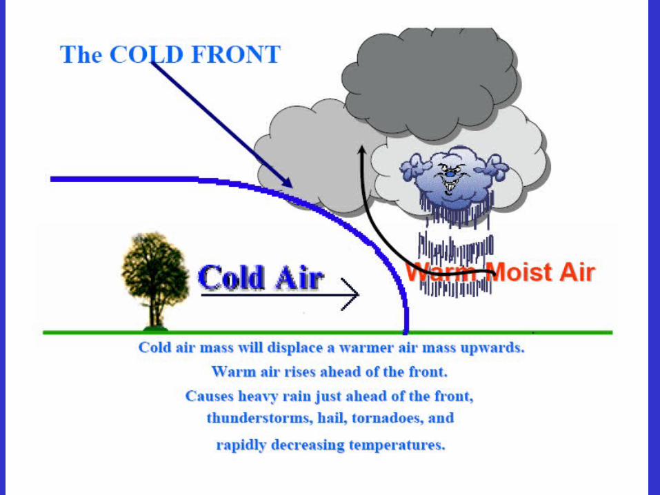
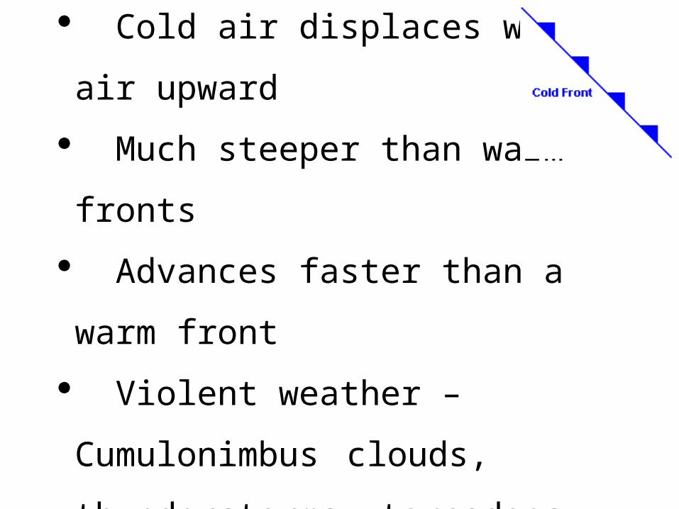
Cold FrontWhen a fast moving cold air mass runs into a slow moving warm air mass and the thicker cold air slides under the lighter warmer air.
COLD FRONT
Cold air displaces warm air upward
Much steeper than warm fronts
Advances faster than a warm front
Violent weather – Cumulonimbus
clouds, thunderstorms, tornadoes,
hail, short, sharp showers
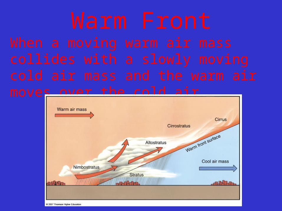
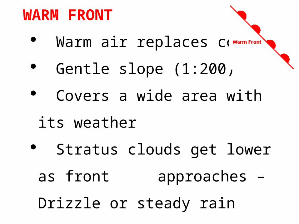
Warm FrontWhen a moving warm air mass collides with a slowly moving cold air mass and the warm air moves over the cold air.
WARM FRONT
Warm air replaces cold
Gentle slope (1:200)
Covers a wide area with its weather
Stratus clouds get lower as front
approaches – Drizzle or steady rain
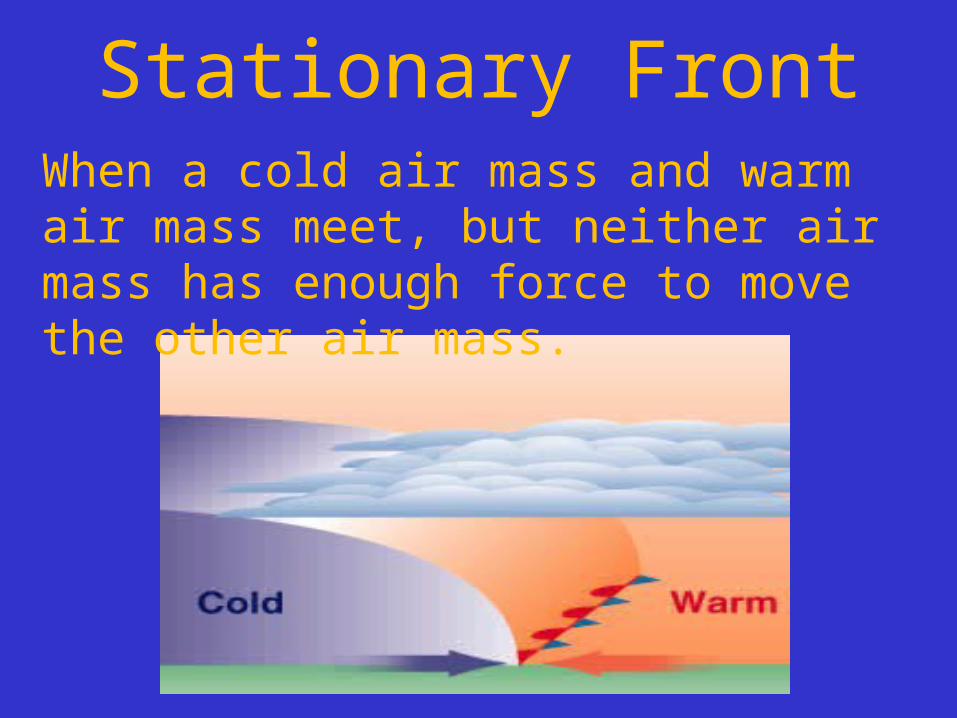
Stationary FrontWhen a cold air mass and warm air mass meet, but neither air mass has enough force to move the other air mass.
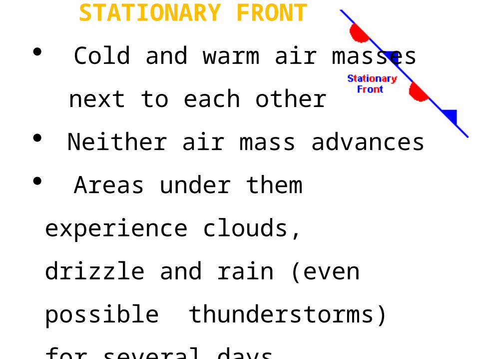
STATIONARY FRONT
Cold and warm air masses
next to each other
Neither air mass advances
Areas under them experience clouds,
drizzle and rain (even possible
thunderstorms) for several days
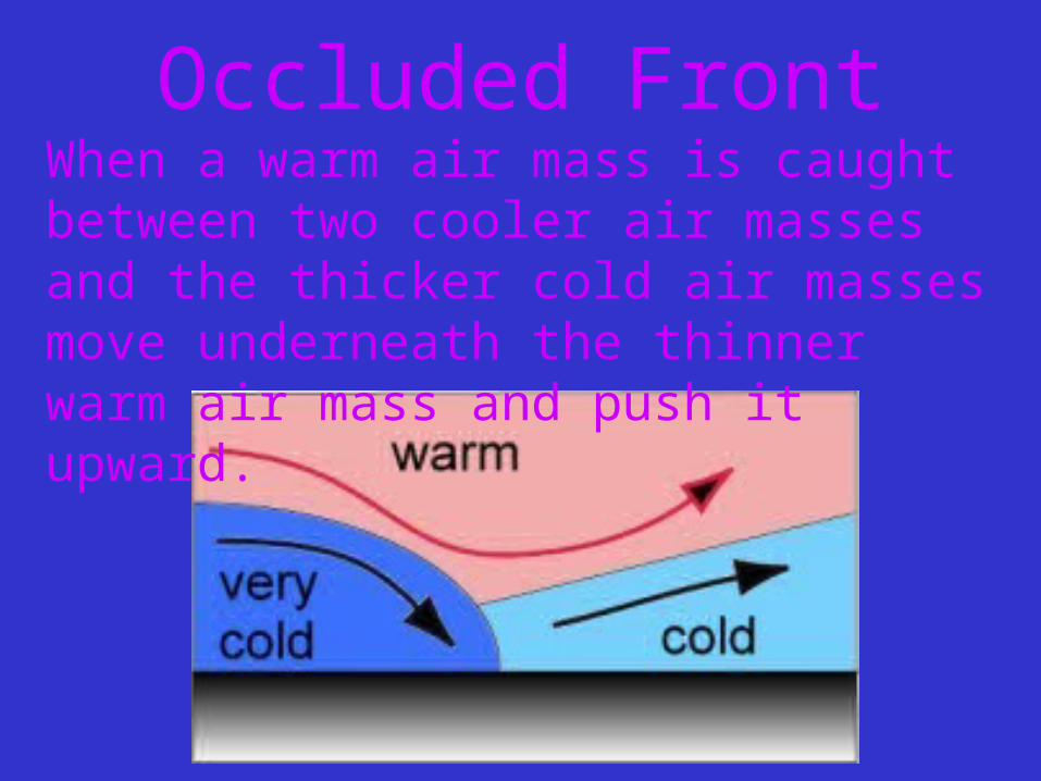
Occluded FrontWhen a warm air mass is caught between two cooler air masses and the thicker cold air masses move underneath the thinner warm air mass and push it upward.
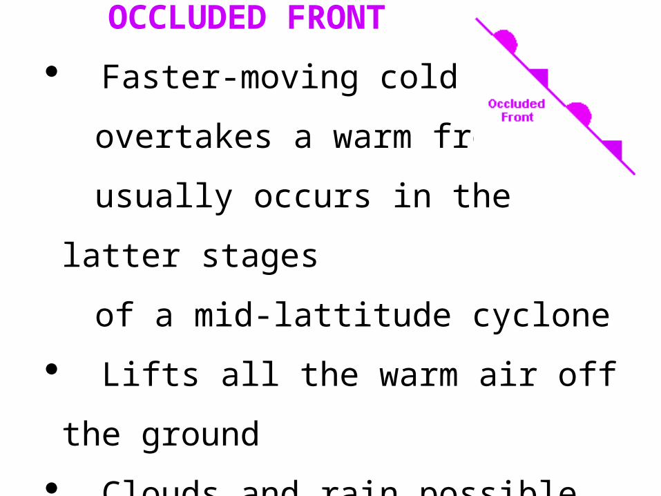
OCCLUDED FRONT
Faster-moving cold front
overtakes a warm front –
usually occurs in the latter stages
of a mid-lattitude cyclone
Lifts all the warm air off the ground
Clouds and rain possible
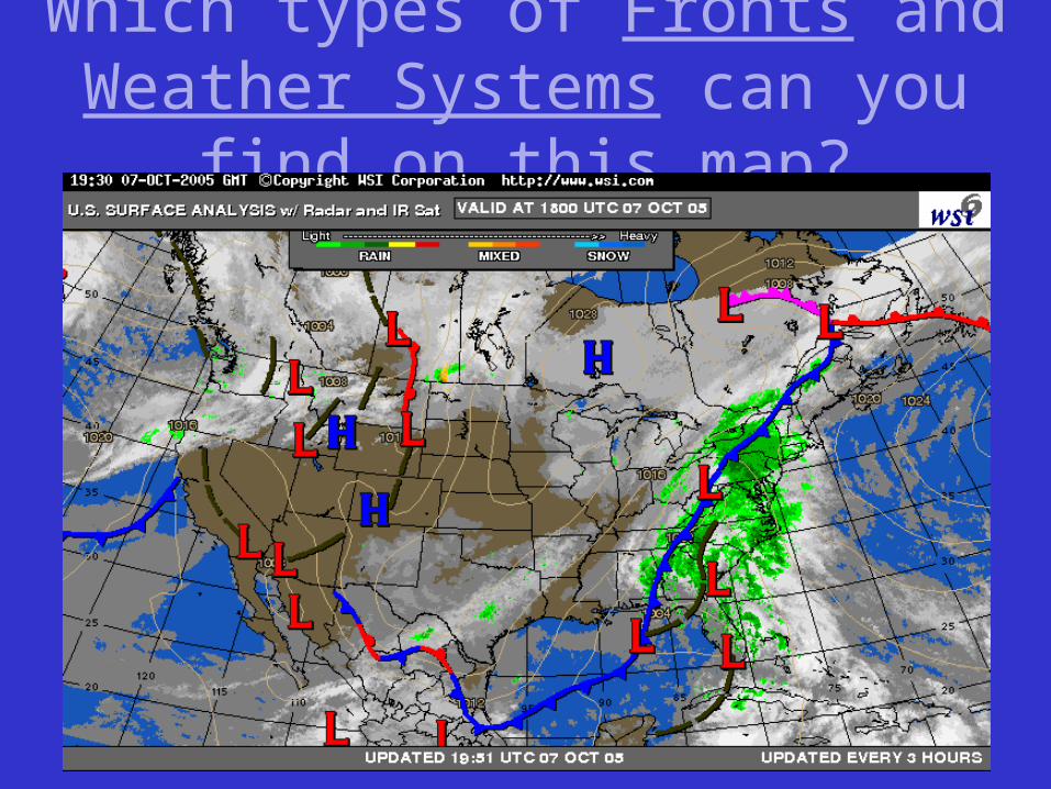
Which types of Fronts and Weather Systems can you find on this map?
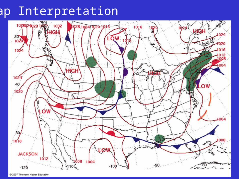
Map Interpretation