aitkin county s tfiles.dnr.state.mn.us/maps/water_access/counties/aitkin.pdf · sandy riverbringing...
TRANSCRIPT

Tamarack
© 2013 Minnesota Department of Natural Resources
200
67
29
74200
169
169
169
169
169
169
169
169
10
200200
2
200200
10
65
65
36
36
14
65
65
65
65
65
65
65
65
65
10
1818
10
36
1440
64
32 32
31
6
6
40
6
232
3
3
29
3
68
68
19
29
29
19
7
5
5
5
3
10
101
1
1
54
54
56
56
5
5
5 72
47
18
1818
47
18
1818 18 18
27
27
27
27
27
1176
28
28 28
76 39
39
12
12
12
12
51
51
81
38
85
37
169
210
210
210 210210
210
16
16
8
53
4
4 4 57
57
27
27
13
30
13
75
75
34
34
2
26
222
26
2626
38
80
17
17
15
84
22
22
28
23
61
61
6123
2560
60
58
59
2124
24
20
20
Cranberry Lake
ShovelLake
Holy WaterLake
Little
Hill
River
HillRiver
Hill
Lake
Morrison
Br.
TaylorLake
Washburn Lake
Haypoint
Will
ow
River
RiverHill
RiverPool
Moose
Moose
Riv
er
Moose Willow River Ditch
Jacobson
VanduseLake
Ball BluffHay Lake
SwanRiver
Libby Br.
Rabey
LittleBall BluffLake
Ball Bluff Lake
Blackface Lake
Bay Lake
LongLake
Cutaway LakeBoot
Lake
Rat House Lake
WolfLake
Savanna Lake
Shumway LakeLoon
Lake
RemoteLake
GlacierLake
Big Sandy
Lake
Hill
River
DitchW
illow
River
Willow
River
Lake
Aitkin
BassLake
BrownLakeLibby
Lake
Miss
issipp
i
River
Oxbow Lake
Libby
Round
Lake
PrairieRive
r
StonyLake
Little Prairie Lake
Balsam
Prairie R.
Wakefield Lake
LittleTamarack
River
River
IslandLake
Horseshoe Lake
AndersonLake
SheshebeeMinnewawaLake
Minnewawa
Sandy R. Lake
Flowage Lake
Blind Lake
MoultonLake
Esquagamah Lake
RoundLake
Waukenabo
WhiteElk Lake
MooseLake
MudLake
EdnaLake
Waukenabo
Lake
SitasLake
Swatara
Moose River
BassLake
OtterLake
Shovel Lake
Willow
River
McKinneyLake
Whi
te
Elk
Br.
Palisade
Aitkin
Co. Rd.54
Kimberly
MILLE LACS LAKE
CR
OW
WIN
G C
O.
AIT
KIN
CO
.
AITKIN CO.
MILLE LACS CO.
AITKIN CO.
MIL
LE
LA
CS
CO
.
KANABEC CO.
AITKIN CO.
KANABEC CO.
PIN
E C
O.
PIN
E C
O.
CA
RLT
ON
CO
.
AIT
KIN
CO
.C
AR
LTO
N C
O.
AIT
KIN
CO
.
ST.
LO
UIS
CO
.S
T. L
OU
IS C
O.
ITASCA CO.
CA
SS
CO
. ITASCA CO.
AIT
KIN
CO
.
CA
SS
CO
.
AIT
KIN
CO
.
CR
OW
WIN
G C
O.
FarmIslandLake
Bennettville
Little Pine LakeThornton
Lake
SunsetLake
Tame FishLake
LakeCedar
Hamm
alL.
HangingKettleLake
Spirit L
ake
HickoryLake
Mal
lard
Lake
Lone
Ripple Lake
NordLake
Lake
ElmIsl
and
Lake
Glory Glen
Wealthwood
TwentyLake
Malmo
BigPineLake
RoundLake
BirchLake
Cutler
Nichols
Tamarack
RiceRiver
RiceRiver
Portage Lake
TurnerLake
RockL.
RoundLake
DavisLake
SteamboatLake
McGregor
Sandy
Riv
er
SandyRiver
Sandy
RiverRice Lake
DouglasLake
NelsonLake
Rice Lake
East LakeMandy Lake
Dam Lak
e
Dam
Br.
CampLake
Newstrom Lake
Thor
Lawler
StarvationLake
Dutch Lake
Dead
Moose
R.
FiveSection Creek
Beckman
Cr.
Porcupine Lake
Split
Split Rock Lake
Rock
River
Arthyde
Ronald
Pliny
SeventeenCr.
Borden
Cr.
Sugar Lake
ClearLake
SwampLake
RabbitLake
Section 35Lake
Wladimiraf Lake
Section 12Lake
Sissabagamah Lake
SethLake
Hansen Lake
Blue Lake
Red Top
CedarLake
BearLake
Snake
Rive
r
Snake
River
Giese
McGrath
Pine
Lake
Bear Cr.
Cowan
Bro
ok
Chesley
Bro
ok
FrenchLake
Hassman
Long
Lak
e
GunLake
Wilkins
Lake
Fleming
Lake
JenkinsLake
LongLake
Townline Lake
BassLake
Miss
issipp
i
Riv
er
Sissabagamah
Cr.
Cr.
RabbitRipple
R.
Cedar
Cr.
Littl
e
Willow R.
StarryLake
LeeFerry
Hwy 169
Aitkin
N
Wold’s FerryCrossing
Hwy. 65
W
SE
E
NDam
E
S
Malmo
Reddy Creek
Wealthwood
NorthGarrisonBay
Co. Hwy.37
Silver Star Rd.
AitkinCounty
Park
BearCreek
Pike Point
Shaw-bush-kung
Liberty Beach
Cedar Creek
Isle
Father Hennepin
State Park
JacobsonCampground
N
S
B
A
NORTH
1 2 3 4 5
C
D
E
F
1 2 3 4 5
B
A
C
D
E
F
Water Access (Trailer)
Water Access (Carry in)
Fishing Pier
Dam (on State Water Trail)
Accessible Lake
Lake With No Access
Accessible River
River or Stream
State Water Trail
Interstate or Highway
County Or Township Road
City Street
Primitive Road
Lake with Multiple Invasives
Eurasian Watermilfoil
Spiny Water Flea
Zebra Mussels
Aitkin County
Invasive Species Information
Location Map
Scale In Miles
1 2 3 4 50 6
Public Water Accesses in Aitkin County
Water Body NameMap GridLocation
RampType
FishSpecies Administrator Water Body Name
Map GridLocation
RampType
FishSpecies Administrator
Ball Bluff Lake
Big Pine Lake
Dam
North
East
South
Blackface Lake
Blind Lake
Blue Lake
Cedar Lake
Clear Lake
Cutaway Lake
Dam Lake
Elm Island Lake
Esquagamah Lake
Farm Island Lake
Farm Island Lake
Fleming Lake
French Lake
Gun Lake
Hammal Lake
Hanson Lake
Hanging Kettle Lake
Hay Lake
Hickory/Little Pine Lakes
Hill Lake
Hill Lake (North)
Hill Lake (South)
Little Ball Bluff Lake
Lone Lake
Long Lake
Loon (Town Line) Lake
Mallard (Rice) Lake
Malmo
North Garrison Bay
Wealthwood
Reddy Creek
Pike Point
Shaw-bush-kung
Liberty Beach
Cedar Creek
Minnewawa Lake (SE)
Minnewawa Lake (E)
Minnewawa Lake (W)
A4
E2
B4
B4
C4
C4
A4
C2
D2
D2
E3
B4
D3
D2
C2
E2
D2
C3
C3
C3
D2
D2
D2
A4
D2
A3
A3
A3
A4
E2
D3
B5
E2
E3
E2
E2
E2
F1
F2
F3
F3
C4
C4
C4
concrete
concrete
concrete
concrete
concrete
concrete
concrete
concrete
carry in
concrete
concrete
carry in
concrete
earth
concrete
concrete
concrete
concrete
earth
concrete
concrete
concrete
concrete
concrete
carry in
fishing pier
concrete
concrete
earth
concrete
concrete
concrete
carry in
concrete
concrete
concrete
carry in
concrete
concrete
concrete
concrete
concrete
concrete
concrete
C,LB,N,S
C,LB,N,S,W
C,N,S,W
C,N,S,W
C,N,S,W
C,N,S,W
LB,N,S,
N / A
ST
C,LB,N,S,W
C,LB,N,S,W
N,S,W
C,N,S,W
C,N,S,W
C,N,S,W
C,LB,N,S,W
C,LB,N,S,W
C,LB,N,S,W
C,N,S,W
C,LB,N,S,W
C,LB,N,S,W
C,S
N / A
C,N,S
N / A
C,LB,N,S,W
C,LB,N,S,W
C,LB,N,S,W
N / A
C,LB,N,S,W
C,LB,N,S,W
N / A
N / A
C,M,N,S,SB,W
C,M,N,S,SB,W
C,M,N,S,SB,W
C,M,N,S,SB,W
C,M,N,S,SB,W
C,M,N,S,SB,W
C,M,N,S,SB,W
C,M,N,S,SB,W
C,LB,N,S,W
C,LB,N,S,W
C,LB,N,S,W
DNR
DNR
DNR
USCOE
Township
DNR
DNR
DNR
DNR
DNR
DNR
County
DNR
DNR
DNR
DNR
DNR
DNR
DNR
DNR
DNR
DNR
DNR
DNR
DNR
DNR
City
DNR
County
DNR
DNR
DNR
DNR
DNR
DNR
DNR
DNR
DNR
DNR
DNR
DNR
DNR
DNR
Township
Jacobson Campground Lee Ferry
Wold’s Ferry Crossing
Berglund Co Pk (Palisade)
Waldeck (Hwy 169)
Kimball Access
Aitkin Access
Moulton Lake
Nord Lake
Pine Lake
Portage Lake
Rabbit Lake
Remote Lake
Rice River (open May 1 - Nov 30, no motors)
Ripple Lake
Rock Lake
Round Lake
Round Lake
Round Lake
Sandy River (Hwy. 65)
Savanna Lake
Section 12 Lake
Shumway (Green) Lake
Shumway (Green) Lake
Sissabagamah Lake
Snake River (Bear Creek)
Snake River (Silver Star Rd)
Snake River (Aitkin Co Pk)
Spirit Lake
Sugar Lake
Swamp Lake
Taylor Lake
Turner Lake
Twenty Lake
Vanduse Lake
Wladimiraf (Section 10) Lake
Washburn Lake
Waukenabo Lake
White Elk Lake
Wilkins Lake
Wolf Lake
A4
B4
C4
C3
C2
D2
D2
C2
D2
F5
D3
D3
B4
D4
D2
C4
C4
C2
E2
C4
B5
D3
B5
B5
D2
F4
F4
F4
E2
E3
E3
A3
C3
E3
A4
D2
A3
C2
B2
C3
B5
concrete
carry in
concrete
concrete
concrete
carry in
concrete
concrete
concrete
concrete
concrete
earth
carry in
concrete
concrete
concrete
concrete
concrete
concrete
earth
carry in
concrete
concrete
fishing pier
concrete
carry in
earth
carry in
concrete
concrete
carry in
carry in
carry in
carry in
earth
concrete
earth
concrete
gravel
concrete
concrete
various
various
various
various
various
various
various
C,LB,N,S,W
C,N,S,W
N / A
C,N,S
C,N,S
N / A
various
C,LB,N,S,W
C,N,S
C,LB,N,S,W
C,LB,N,S,W
N,S,W
various
N / A
C,S,LB,N
C,N,S
C,N,S
C,LB,N,S
various
various
various
C,LB,N,S,W
C,LB,N,S,W
N / A
ST
C,N,S
N / A
C,LB,N,S
C,LB,N,S
N / A
C,LB,N,S,W
N / A
C,LB,N,S,W
C,LB,N,S
County
County
DNR
County
County
County
County
DNR
DNR
DNR
DNR
DNR
DNR
USFWS
DNR
DNR
DNR
DNR
DNR
DNR
DNR
DNR
DNR
DNR
DNR
County
DNR
County
DNR
DNR
DNR
DNR
County
DNR
County
DNR
DNR
DNR
DNR
Township
DNR
Administrator: DNR - MN Dept. of Natural ResourcesMN DOT - MN Dept. of TransportationUSFS - U.S. Forest ServiceUSFWS - U.S. Fish and Wildlife ServiceUSCOE - U.S. Corps of EngineersNPS - National Park Service
Fish Species: C — Crappie, LB — Largemouth Bass, LT — Lake Trout,M — Muskellunge, N — Northern Pike, S — Sunfish,SB — Smallmouth Bass, ST — Stream Trout, W — Walleye,N / A — Not Available
* State Park Vehicle Permit Required
*
**
*
*
Aquatic Invasive Species (AIS)Laws and Requirements:
Before leaving the water access or shoreline property, you MUST:
Clean off ALL aquatic plants and animals Drain all water including bilge, livewells, baitwells, bait buckets, motor and ballast tanks Pull the plug and leave it out
Get into the habit of taking these three simple steps, and it will soon become part of your routine. Pull away from the boat ramp area. Check for plants while strapping the boat down. Pull the plug when adjusting the motor. If you have other people (especially kids) with you, have them help! Adding a few minutes will help safeguard our waters.
Cleaning water-related equipment is just as important as cleaning boats, so while you’re cleaning your boat, please remember to also:
Clean anchors, ropes, fishing tackle, and other objects that were in the water. Many species can be transported in the mud or in fishing lines and rope Dump water out of canoes, kayaks, and other watercraft before leaving
These are YOUR waters and it is YOUR responsibility to inspect, clean, and drain your boats!
AIS Bait Laws
It is illegal to transport lake and river water. To save your bait (minnows or leeches), the DNR recommends bringing bottled or tap water from home and keeping it in your vehicle or cooler. Bringing ice can be a good idea on warm days to cool down the water.
DO NOT dump unwanted bait into water bodies or on the shoreline! Unwanted bait belongs in the trash or a designated compost bin. Unwanted worms must be disposed of in the trash.
Working Together to Protect the Waters Watercraft Inspectors are here to ensure watercraft and equipment are “clean in, clean out!” If you need assistance, have questions about the laws, or are curious about the program, please ask!
Ways you can help the Watercraft Inspectors: Please clean your boat and pull your plug as soon as you are safely able to. That way when the inspector comes, the inspection process will move quickly If there is a Decontamination Unit present, please follow all the instructions given by the inspectors, for your safety and theirs. There will be plenty of time to ask questions and watch them work from a safe distanceWays the Watercraft Inspectors can help you: The inspectors have tools, wrenches and pliers, so if you are having trouble with your plug, ask! If there are weeds that are hard to reach, inspectors can also help pull weeds off boats or other such tasks. They also have grabbing tools for plants
When you see the Watercraft Inspectors, please be cooperative. The law requires compliance with inspectors, and it will help everyone to be on their way in a timely and pleasant manner.
Safe Boating
Personal Floatation Devices (PFD) - On all boats (except a sailboard) regardless of length there must be a readily accessible Coast Guard approved wearable PFD for each person on board. In addition, on boats 16 feet or longer, except canoes and kayaks, there must also be at least one Coast Guard approved throwable device, such as a ring buoy or seat cushion.
Boating While Intoxicated (BWI) - Boating while intoxicated is illegal. For persons found to be under the influence there are significant penalties, including fines and possible jail sentences.
Personal Watercraft - Special laws apply including wearing a PFD and operating at slow no wake speed at certain distances from other watercraft, swimmers and other objects in the water. Operator age restrictions also apply. Consult the Boating Guide for more information. A DNR safety video is available free of charge.
MIS
SIS
SIP
PI R
IVE
R
MIL
LE
LA
CS
LA
KE
BIG
SA
ND
YL
AK
E
Public Water Access in Minnesota:
The Minnesota DNR State Parks and Trail’s water recreation program provides approximately 1,600 boat accesses, over 350 fishing piers and shore fishing sites, and manages 34 designated Water Trails in Minnesota. The DNR, Federal Government and local communities operate boat accesses. See the table on the right for specific site information. The DNR boating programs are funded by user fees including boat license & gas tax related to marine use.
Public accesses are usually open 24 hours unless otherwise posted. Most sites have launch ramps but some sites, especially on smaller rivers, are carry in only. Bathrooms and docks are usually located only on the larger and busier sites.
Public Water Access Rules - The launch area must be kept clear and the following activities are unlawful: littering, camping, shooting, building fires, and consuming alcoholic beverages. See Minnesota Rules, chapter 6218 for complete rules.
Boating in Minnesota
The annual Minnesota Boating Guide summarizes Minnesota's boating laws and regulations in an easy-to-read form. The guide supplies information about operating watercraft on the state's lakes and rivers. Operator age restrictions apply to operators 17 years old and younger.
Licensing - All motorized and non-motorized watercraft must be licensed by the Department of Natural Resources (DNR). Please contact the DNR License Bureau for information.
Fishing in Minnesota
Fishing Regulations and Licensing - All persons 16 and older are required to have the appropriate license with them when fishing. Licenses are available through the DNR License Bureau, most County Auditors and many stores that sell fishing related goods. Trout fishing requires a trout stamp. For more information call the DNR information Center at (651) 296-6157 or 1-888-646-6367. To purchase a license by phone 24 hours a day, call 1-888-MN-LICENSE (665-4236).
Selective Harvest Fishing - Improved technology and increased fishing have caused the quality of fishing to decline in many waters. Practicing “Selective Harvest” offers anglers an opportunity to take some fish home while releasing others back into the water to improve fishing quality. Here are some tips to use for effective Selective Harvest fishing:
Use barbless hooks Play the fish quickly and handle the fish carefully Never hold the fish by the eyes Use a needle nose pliers to remove hooks or cut the line if it is too deep Ease the fish back into the water, do not throw it back
Sustainable Natural Environments
Practice Sustainable Water Recreation!A healthy and attractive natural environment enables people to enjoy the outdoors without negative impacts on the environment. Communities working together can improve water resources by promoting environmentally sensitive land use practices along rivers and throughout watersheds. Be courteous to other boater and water users Keep a reasonable distance from birds, wildlife, and aquatic vegetation Travel at safe speeds and be aware of the effect your wake has on the shoreline and other users Operate your watercraft at a slow no wake speed when appropriate Use watercraft that is the appropriate type and size for the water resource Boating doesn’t require continuous movement; enjoy floating, anchoring, and beaching Conserve fuel by properly operating and maintaining your watercraft Don’t litter and do properly dispose of boat and sanitary wastes
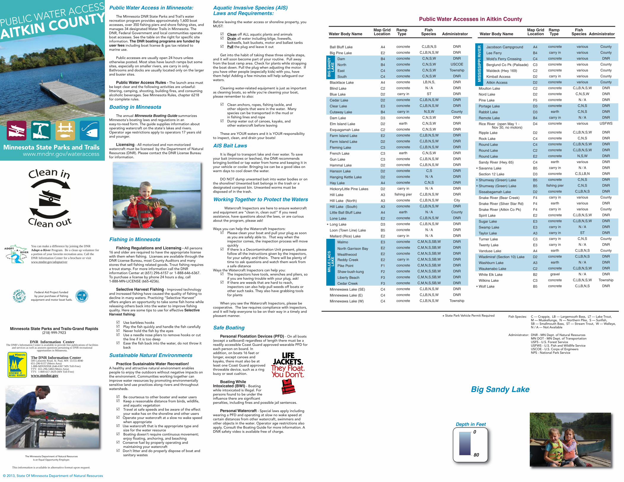
Depth in Feet
Big Sandy Lake
PUBLIC WATER ACCESS
www.mndnr.gov/wateraccess
AITKIN COUNTY
Minnesota State Parks and Trails
© 2013, State Of Minnesota Department of Natural Resources
The Minnesota Department of Natural Resourcesis an Equal Opportunity Employer.
Federal Aid Project fundedby your purchase of fishing
equipment and motor boat fuels.
You can make a difference by joining the DNR Adopt-a-River Program. Be a clean up volunteer for a portion of your favorite recreation area. Call the DNR Information Center for a brochure or visit www.mndnr.gov/adoptariver
This information is available in alternative format upon request.
DNR Information CenterThe DNR’s Information Center is available to provide free publications of facilities
and services as well as answers questions pertaining to DNR recreational opportunities in Minnesota.
The DNR Information Center500 Lafayette Road, St. Paul, MN 55155-4040651-296-6157 (Metro Area)1-888-MINNDNR (646-6367 MN Toll-Free)TTY: 651-296-5484 (Metro Area)TTY: 1-800-657-3929 (MN Toll-Free)www.mndnr.gov
Minnesota State Parks and Trails-Grand Rapids(218) 999-7923
DeDeptptp hh inin FFeeeett
0
80