analytical review of research reports on the social impacts of … · 2013-03-08 · i. report...
TRANSCRIPT

I
4
LI
Analytical Review of Research Reports
on the Social Impacts of Water Resources
Development Projects
September 1979 Contract Report 19-1
Submitted to. US ARMY ENGINEER
01OSTITIITE FOR
WUT P•rinniql
KINGMAN BUILDING FORT BELVOIR, VIRGINIA 22060
411
ITATCT.ASSTRTFt1 SECURITY CLASSIFICATION OF THIS PAGE (When Date Entered)
,
REPORT DOCUMENTATION PAGE READ INSTRUCTIONS
BEFORE COMPLETING FORM , I. REPORT NUMBER 2. GOVT ACCESSION NO. 3. RECIPIENT'S CATALOG NUMBER
IWR Contract Report 79-1 4. TITLE (and Subtitle) 5. TYPE OF REPORT & PERIOD COVERED
Analytical Review of Research Reports on the Social Impacts of Water Resources Development Projects 6. PERFORMING ORG. REPORT NUMBER
7. AUTHOR(a) 13. CONTRACT OR GRANT NUMBER(a)
Henry H. Hitchcock, Principal Investigator DACW-72-78-M-0290 R. Chester Strobel, Research Assistant
9. PERFORMING ORGANIZATION NAME AND ADDRESS 10. PROGRAM ELEMENT, PROJECT, TASK AREA & WORK UNIT NUMBERS
11. CONTROLLING OFFICE NAME AND ADDRESS 12. REPORT DATE
, USA Engr Institute for Water Resources September 1979 Kingman Building 13. NUMBER OF PAGES
Fort Belvoir, Virginia 22060 14. MONITORING AGENCY NAME & ADDRESS(II different from Controlling Office) 15. SECURITY CLASS. (of this report)
15e. DECLASSIFICATION/DOWNGRADING SCHEDULE
16. DISTRIBUTION STATEMENT (of this Report)
Approved for public release; distribution unlimited
17. DISTRIBUTION STATEMENT (of the abstract entered in Block 20, if different from Report)
18. SUPPLEMENTARY NOTES
19. KEY WORDS (Continue on reverse side if necessary and identify by block number)
Post-Audit, Social Impact, Public Participation, Wster Resources Planning, Institutional Analysis, Mitigation, Environmental Impact Assessment
241 ABSTRACT (=anthem as reverse side ft nacesaaty sad identify by block number)
Much discussion, analysis, and speculation surrounds Social Impact Analysis in Water Resources Planning. This study examines all available post-audit studies that have found linkages between water development projects and social impacts. It then analyzes and reviews these impacts by the type of study, location, and project. The report is meant to be a reference guide for field planners tasked with doing Social Impact Assessment. Several quick reference tasks keying into the main body of analysis are available to the planner who desires to use this report as a reference tool in specific projects.
DD F°R" 1473 JAN 73 EDITION OF I NOV SS IS OBSOLETE UNCLASSIFIED SECURITY CLASSIFICATION OF THIS PAGE (When Date Entered)

SECURITY CLASSIFICATION OF THIS P AGE(When Data Entered)
It,
4e. if
A
•0
SECURITY CLASSIFICATION OF THIS P AGE(When Data Entered)

TABLE OF CONTENTS
CHAPTER 1: INTRODUCTION 1
CHAPTER 2: IMPACT SUMMARY. 7
CHAPTER 3: STATE OF THE ART REVIEW 46
APPENDIX A INDIVIDUAL STUDY REVIEWS A-1
APPENDIX B: BIBLIOGRAPHY
B-1 •
APPENDIX C "Social Impact Assessment On Leaving the Cradle" C-1
PREFACE
• This analytical review pulls together post case studies (one of the neglected resource bases for planners) in a format designed around field planners' needs. We think systematically outlining findings of other social scientists is not only a valuable data base, but a start at build-ing a cumulative knowledge of water resources development social impacts.
V' The review is intended to be both a research tool and an operating field planner's tools. We encourage comments about the content, utility, and format of the review.
Mrs. Sandra Young of the CERC Library, Kingman Buiding, Ft. Belvoir, Virginia, secured the studies for use in this publication. Mr. L. Lulich of the DOE Water Resources Scientific Information Center assisted with the description used in the computer search. The contributions of Mrs. Young and Mr. Lulich are gratefully acknowledged.

•
9
A READER'S GUIDE
This analytical review of research reports on the social impacts of water resources development projects is designed to assist planners in the identification and evaluation of the impacts of project actions. Focusing on research on impacts that have occurred, it is intended to help the planner understand the nature of social impacts and the pro-cesses that surround their emergence. This is the second such analytical review of research reports superseding the previous review (IWR-77-3) by combining the previous research with a new set of study reviews.
From the variety of research reports on the social aspects of water resources, 240 studies were selected as potential studies of impacts. Of these 240, 81 were selected becasue they identified social impacts that had occurred as a result of specific projects.
The impacts identified in these 81 studies are presented in three levels of summary. The most general summaries organized around impact categories are: distribution, opportunity, local service delivery and community response. These impact category summaries, found in Chapter 2, identify the distribution of individual impacts across categories and stages of project activity (pre-construction, construction, and post-construction). The individual impacts are identified by review number and position in the review, impact 47A refers to the first impact (A) discussed in review #47.
Having identified an impact in the impact category summaries, you have two options for finding out more about the impact. You can turn to the summary listing of impacts and study characteristics in Table 2-5 at the end of Chapter 2. Here you find a brief identification of the impact, the data sources used in the study, the type of project discussed, the objectives of the research, the date of the research, and the names and disciplinary background of the researchers.
Instead of using Table 2-5, you could turn to Appendix A for the specific study review indicated by the impact number. The study review contains a detailed description of the impact including the groups impacted, the indicators used to measure the impact, the extent of the impact, the cause of the impact, and the process of its emergence. In addition, a detailed description is included of the overall methodology used in the study.
If for instance you are interested in interest groups' response to project actions in the pre-construction phase, the first step is to review the impact category summaries to find the category in which interest group activity falls. Finding it in the community response category, you might select opposing interest groups as your focus. The two impacts covering opposing interest groups in the pre-construction phase are 1C and 51A. Before turning directly to study review 1 or 51, you might want some preliminary information on the impacts to see whether they are relevant to your current interest. For this information turn to the summary list of impacts and study characteristics in Table 2-5 to find that impact 1B

• ......■"..
refers to the coalition of interest groups to block a chemical plant in South Carolina, while impact 51A discussed interest group action in op-position to inter-basin transfers of water in Massachusetts. If the inter-basin transfer issue more closely approximates current interest, turn to study review 51 in Appendix A for a complete discussion of the impact.
- , This review is organized primarily around impact categories and im-
pacts on the assumption that the planner is facing a particular situation at a particular time and needs the information organized along the lines of time (project phase) and scope (impact category). If, however, a particular work by a specific author is desired, look through the biblio-graphy for the author's name to see whether a study by that author has been reviewed. If a review number is located next to the study turn directly to the study review or to the summary of study characteristics and impacts in Chapter 2.
In addition to presenting the planner with a systematic reporting of impacts that have resulted from specific projects, the review provides a brief overview of the status of our knowledge of social impacts resulting from water resources development projects. Chapter 3 summarizes the types of projects, the geographical areas, and the academic disciplines that have been used in the identification of social impacts in this field. The chapter also contains a summary of the distribution of impacts identified by project phase and impact category. The research questions which con-clude the chapter highlight areas in need of further research if the understanding of social impacts of water resources development projects is to improve.
The major conclusions of the review relating to the state of knowledge about social impacts and the state of the art in retrospective social impact assessment are summarized in "Social Impact Assessment on Leaving the Cradle" (Appendix C). For a quick overview of the important points contained in this summary, this paper should suffice. If detailed dis-cussion of impacts and their emergence is desired, the review should be used.
v
1
t

•
•
Chapter 1 INTRODUCTION
The analysis of the social impacts of water resource development projects has recently become an important part of water resources planning. Increasing numbers of laws and regulations such as Corps Regulation ER-1105-2-240, are requiring planners to evaluate the possible effects of their actions on the social well-being of a local area, a state, and the nation. One result of this interest in the social impacts of water resources development projects has been a proliferation of research on the subject. As is normal in a new field lacking an accepted conceptual foun-dation ) this research is of widely varying utility to the planner in evaluating a project's social impacts.
The purpose of this analytical review is to organize and analyze the existing research on the socal impacts of water resources development projects so it can be easily and effectively used by water resource planners. By concentrating on studies which have identified impacts through post-audit analyses, the intent is to provide a basis for understanding what constitutes a social impact and how such impacts are related to project actions. The specific objectives of this review are:
-- Maximize the use of existing research methods and results by planners, especially as regards the linking of impacts with specific project actions,
--Identify the implicit patterns of current research to (a) enable the planner to evaluate the quality of existing knowledge about social impacts and (5) help the planner recognize the areas of greatest uncertainty in evaluating social impacts;
--Suggest future directions for research in this area designed to increase the quality of knowledge and thereby reduce the uncer-tainties of evaluation.
The method used to meet these objectives is the "case survey method " 1 a literature review technique which enables one to reliably operationalize
qualitative evidence found in a variety of case studies. The technique is based on the application of a predesigned format to each case study. The format, rather than restate the conclusions of the case study, focuses on the evidence the case study offers which is relevant to the pre-designated categories. Since the case survey method is most useful in areas where research does not follow an accepted paradigm, it is particualry applicable to research on social impacts of water resources development.
1 Robert Yin and Karen Heald. Evaluating Policy Studies by Using the Case SurveLMethod. (Santa Monica California RAND Corp. March 19755.

2
The specific steps followed in the application of the case survey method to research reports on the social impacts of water resources development projects were:
--Identification of relevant studies
--Selection of case studies for review
--Application of a pre-designed format
The relevant studies were identified using three types of sources 1) existing bibliographies on water resources, 2) a computer search at the Department of Interior's Water Resources Scientific Information Center, and 3) individuals and institutions involved in the water resources field. Table 1 lists the bibliographies consulted and Table 2 presents the descriptors used in the DOI computer search. Focusing on work done after 1961 these sources provided over 240 research reports dealing with the social aspects of water resources development projects.
From this initial selection of 240 reports (see Appendix B: Bibli-ography), 81 studies were chosen for review. * The criteria for selecting these 81 studies were:
--Post-Audit Focus
--Social Impact Emphasis
--Specific Project(s) Discussed.
Post-Audit Focus: Only studies which discussed impacts that had occurred, or were occurring, were included. This eliminated the prospective studies that are connected with planning studies and environmental impact studies. The purpose of the review is to provide the planner with demonstrated impacts, not conjecture. The assumption behind the post-audit focus is that proven effects have not been effectively used as a basis for evaluation potential social impacts.
Social Impact Focus: The exact composition of a social impact is not defined anywhere in literature. This review follows the guidelines of the Principles and Standards and Corps Regulation ER-1105-2-240. Impacts on income distribution, population mobility, population density, emergency preparedness, community cohesion, local governments, recreation and leisure opportunities, educational and cultural opportunities, public health, community growth and stability, and the displacement of people were the major types of impacts considered under the Social Impact Category (see computer search descriptors: Table 1-2).

3
Specific Project(silMention: To be included in the review the research had to refer to specific water resource development projects. The projects did not have to be identified a study of all the water resource projects in Wyoming was accepted. But, the projects did have to exist either physically or in the planning process. Studies of attitudes about water or water resources in general were not included, nor were studies of specific events such as floods (unless some mention was made of a specific flood control project). The key concept in this selection criteria was that of imminence; the project had to exist in the minds of the people being impacted.
Using these three criteria, 81 studies were selected from 240 identified research reports. A pre-designed format for reviewing the research was then applied to each study. This format (described in more detail in Appendix A) covered the methodology and techniques used to identify impacts and the specific impacts identified.
The following chapters of this review contain the results of the application of the format to the 81 selected studies. Chapter 2 discusses the types of impacts identified in terms of our general impact categories. It ends with a summary listing of the characteristics (date, researchers, disciplinary back-ground, type of project, location, Ojectives, and data sources) of the studies and the impacts identified. Chapter 3 summarizes the distributions of the study characteristics and impacts to provide an overview of the state of know-ledge regarding social impacts of water resources development projects. A series of research questions are presented for use in designing future post-audit studies of social impacts of water resources development projects.
Appendix A contains the 81 individual study reviews upon which Chapters 2 and 3 are based. Beyond being the foundation for the analysis in those chapters the individual study reviews contain a wealth of information on the social impacts of water resources development projects. Appendix B contains the bibliography of the 240 studies which were identified as relevant to social impacts of water resources development projects. The studies with a review number in the left hand margin were those that were selected for review.
Appendix C is a paper presented at the First Canadian Symposium on Social Impact Assessment in Banff, Alberta during December 1978. The paper, entitled "Social Impact Assessment: On Leaving the Cradle", is a summary of this review. It covers the nature of the format, the types of impacts identified, and the state of the art of identifying the social impacts of past water resources development projects.

4
TABLE 1-1
Bibliographies Used to Identify Relevant Studies
Cooke, T.J., et al. Communications for Urban Water Resources Management --A. Review and Annotated Bibliography W.E. Gates Associations Inc., February, 1974.
Ditton Robert Browning. The Identification and Critical Analysis . of Selected Literature Dealing With the Recreational Aspects of Water Resources Use, Planning_and Development. Research Report No. 23. Water Resources Center, University of Illinois, Urbana, Illinois, 1969.
Economic Studies Section and Environmental Resources Branch Portland District, Corps of Engineers. Bibliography of Social and Land-Use Impacts of Water Resource Developments, September 1976.
Giefer, Gerald J. and Todd, David. Water Publications of State Agencies: A Bibliography of Publications on Water Resources and Their Management. Water Information Center, Inc. Huntington, New York, 1974.
Hamilton, H.R , et al. Bibliography on Socio-Economic Aspects of . Water Resources U.S. Department of the Interior/Office of Water Resources Research, March, 1966.
Hornbeck, K. Morrision D. and Warner, W., editors. Environment - A BibliogrApitt of Social Science and Related Literature. Environmental Protection Agency. #600/5-54-011, February, 1974.
James L. Douglas, editor. Man and Water - The Social Sciences in Management of Water Resources. Center for Developmental Change, The Kentucky Water Resources Institute, University of Kentucky, 1974
Lehmann, Edward J. Planning and Impact of Water Resource Programs, NTIS Biblio-graphy, April 1975.
Lehmann Edward J. Public Opinion and Sociology_ of Water Resources Development, NTIS Bibliography, April, 1975.
Research Reports. Office of Water Resources Research, U.S. Department of Interior, 1971 to present.
Selected Water Resources Abstracts. Water Resources Scientific Information Center, Office of Water Research and Technology. U.S. Department of Interior, 1968 to present.
Shields, Mark. Social Impact Assessment Bibliography. Institute for Water Resources, Ft. Belvoir, Virginia. I.W.R. Paper 74-P6, 1974.

Singh, R.A. and Wilkenson Kenneth P. Social Science Studies of Water Resources Problems: Review of Literature and Annotated Bibliography. State College Mississippi: Water Resources Research Institute, Mississippi State University, 1968.
Social Impact Assessment. Environmental Psychology Program ) CUNY Graduate Center, New York, New York, 1974 to present.
Social Impact of Water Resource, U.S. Department of the Interior/Office of Water Resources and Technology Bibliography, 1976.
Water Resources Scientific Information Center-Computer Search. WRSIC U.S. Department of Interior, Washington, D.C., 1978.
Water Resources -- Social Impact, DDC Bibliography (April 15, 1976).

6
Table 1-2
Descriptors Used in Computer Search*
1. Social Aspects: Attitudes, Community Development, Rural Sociology, Social Adjustment, Social Change, Social Impact, Social Participation, Area Redevelopment, Local Government, Psychological Aspects, Water Resources Development.
2. Social Change: Social Impact.
3. Social Function: Social Change, Social Participation.
4. Social Impact: Social Adjustment, Social Change, Social Mobility, Social Values.
5. Social Needs: Social Participation, Social Values.
6. Social Participation: Social Needs, Social Adjustment.
7. Social Mobility: Community Development, Migration, Rural Sociology, Social Impact.
8. Social Values: Social Impact, Social Needs.
9. Additional Terms: Income Distribution, Recreation and Leisure, Community Cohesion, Population Density, Mobility, Governments, and Education and/or Cultural Opportunities.
These categories were looked at singly and cross-matched. The areas or topics that had similar subheadings were matched against other areas to see if any additional studies would be identified as a result of a more specific group description. t

CHAPTER 2 IMPACT SUMMARY
The central purpose of this review is to aid planners in identifying social impacts that could result from project actions. This impact summary is the most important part of the review for the fulfillment of that purpose; it provides the key to unlock the store of information found in the individual study reviews found in Appendix A. Impacts are summarized by category and project phase. The chapter ends with a summary listing of impacts and characteristics of the studies reviewed (Table 2-5). Discussion of the implications of the distributions of the impacts can be found in in Chapter 3: State of the Art.
This summary categorizes each impact identified in the study reviews along two dimensions: Project Phase and Impact Category. Project Phase refers to the time during a project's lifetime at which the impact occurs. For the purposes of this review a simple pre-construction, construction, post-construction division is used. The reason for the lack of greater specifici-ty regarding the timing of impacts is the failure of the research reviewed to make clear distinctions on this dimension. Also, despite its simplicity, the typology has some validity in that the types of impacts found in one category at one phase of the project have common qualities which differentiate them from impacts in the same category in other phases. For instance, pre-construction community response impacts focus most heavily on awareness and perception of the project while post-construction community response impacts are concerned primarily with impacts on community cohesion.
Division of impacts into impact categories is more arbitrary than locating them in project phases. There is no established set of social impact cate-gories for water resources development projects. Not enough research has been dole for such a set of categories to emerge. This review takes a prelim-inary step towards developing a set of social impact categories for water resources development projects; the categories presented below are a combi-nation of the Principles and Standards' social well-being account, the items discussed in Corps regulation ER-1105-20-240 and the impacts observed in this review of 81 studies of social impacts of water resources development projects. While they may not reflect the universe of possible social impacts from such projects, these categories do cover the range of impacts identified in the study reviews. The four impact categories are
--Distribution
--Opportunity
--Local Services
--Community Response
Distribution impacts refer to changes in the patterns of activity and status resulting from project actions. Demographic impacts such as shifts in residential patterns, population density, land use, and housing are con-sidered distribution impacts. Similarly, chalges in the distribution of income and land values are considered distribution impacts. Rounding out

8
the category are the general distribution of costs and benefits resulting from the project. The distribution impacts identified in the 81 study reviews can be classified under the following general headings:
- Population Change --Density --Mobility/Migration
- Land Use Changes --Values --Uses
- Distribution of Costs and Benefits --General --Relocated
Opportunity impacts focus on the changes resulting from a project which affect the ability of a member of a community to satisfy a range of needs and desires. At the most basic level this may refer to job opportunities or more generally to economic or community development opportunities. Opportunity impacts can also cover available recreational and aesthetic opportunities as well as educational and cultural opportunities. The subcategories for this impact catergory are:
- Community Development
- Economic Opportunity
- Job Opportunities
- Amentities --Recreation --Aesthetics
Local services impacts include the range of effects on the delivery of community services resulting from actions at various project phases. These impacts focus on the ability of local organizations to deliver services, effects on revenue and expenditures, and effects on the structure and leadership of local service organizations. They also refer to the changes in the quality of the local services resulting from projects actions. These effects are usually in the areas of water services, health, schools, law enforcement, safety (fire protection and flood protection), and local roads. While the major focus of this impact category is on local government services, effects on local non-governmental services are also considered. The impacts which pertain to the local services category can be organized as follows:
- Local Finances --Revenues --Expenditures

A
v.
9
- Local Services --Water --Health --Roads --Safety --Schools --Law Enforcement
- Local Leadership --General --Government
Community response impacts refer to the reactions of members of a community to a project and its impacts and the effect of those reactions on the nature of interactions among members of the community. Included in this category are perceptual impacts of a project ranging from simple awareness of a project to a position of opposition or support for the project. These positions of opposition or support are often the result of different views of the costs and benefits associated with a project. Sometimes this opposition or support is translated into activities related to the project such as attendance at hearings or participation in interest group activity. The range of attitudes and activities resulting from a project can thus effect the nature of interactions among members of a community; in some cases, the community becomes a more cohesive group, in others, lasting conflicts .develop. The following headings are used to classify community response impacts:
- Awareness
- Perception of Impacts --General --Relocated
Attitudes Toward Projects
Level of Involvement
Interest Group Formation
Community Interactions --Cohesion --Conflict
Tables 2-1, 2-2, 2-3, and 2-4 provide a guide to the impacts which relate to the distribution, opportunity, local services, and community response categories. These tables are organized by project phase and specific area of impact within the impact category. Impacts are identified by the review number of the study in which they appear and their location in that review. For instance, in table 2-3, the impacts relating to improved water services are impacts 57A and 12C or the first impact discussed in study review number 57 and the third impact discussed in study review 12.
i'

OE,
10
TABLE 2-1 Distribution
..............
Types Project Pre-Construction Construction Post-Construction of Impact
hase
1. Population Change
A. Density 37B, 37D 60A
B. Mobility/Migration 21A, 28B, 28C, 64C 63C 12A, 21A
2. Land Use Changes:
A. Values 28A, 46A, 78A, 78B 49B, 78A, 78B 12B, 68C, 72A, 72B,
B. Uses 71A 2C, 37A, 37C, 2C, 2E, 18C, 55A, 68! 78C 71A
3. Distribution of Costs/Benefits
A. General 26D 17A, 17C, 18B, 31A, 36A, 43A, 79B
B. Relocated 27A, 47C 27A, 27B, 47C
-

25A
61F
64A
75A
27C
8D, 23A, 31B, 35B, 38A, 38B, 61C, 67A, 67B. 67C
6B, 8B, 42A, 61C, 80D
4. Amenities
A. Recreational Benefits
B. Aesthetic Opportunities
1 1
TABLE 2-2 Opportunity
roject Type ' of Impact ase I Pre-Construction I Construction Post-Construction
1. Community Development
A. Enhanced
B. Constrained
22D, 35D, 57B, 61G,
50D
10C, 37B 10C, 37B, 49D,
2. Economic Opportunity
A. Positive
B. Negative 27C, 44C
33A
22B, 33B, 35D, 41C, 61F, 68C, 80C
31A, 44C
3. Job Opportunities
A. Increased 49A, 61G 42B, 80A
75A 25A, 61C 49E, 62A

12
TABLE 2-3 Local Services
. Pre-Construction Construction Post-Construction
1, Local Finances
A. Revenues 10A, 75D 10A,70B 10A, 17B, 29A,
B. Expenditures 10B 10B, 41B 41B
2. Services
A. Improved 54A 54A
Water 57A 12C, 57A
Health 49C, 61D 61D, 80B
Roads 49F
Safety 64B 8A, 22C, 80F ,
B. Strained 410, 6111 31C, 61H
Law Enforcement 29C 60, 29C, 50C
Schools 65A, 70A
Roads 29B 29B, 35C
C. Not Affected 74A
3. Local Leadership
A. General 57C, 611 611 2A, 35F, 48B, 57C 611, 810
B. Government 4A, 611, 64E 611 2D, 6C, 41A. 611. 79C, 81C
. .
13 TABLE 2-4
Comnunity Response
Types Project of Phase
Impact
Pre-Construction Construction Post-Construction
I. Awareness 4C, 5A, 168, 248, 268
A. High 5C, 9A, 16A, 26A, 45C
B. tow 5B, 14A, 44A, 45C, 24C, 44A 768
2. Perception of Impacts 13C, 39A, 56A, 758 79A
A. General Concerns 3A, 50, 11B, 13B, 778 17D, 308, 48A, 688 130, 18C, 280, 01A 32A, 40A, 50A, 59A, 65A, 67C
B. Relocation Concerns 19A, 448, 52A, 37A, 448, 52A, 21C 52B, 538, 64C 528 640
C. Perceived Benefits 198, 19C, 40A, 6A ,35E, 67A, 68C 64B, 66A
, 3. Attitudes Towards 13A, 16C, 190, 53B 530 73A Project: 32A, 66C. 69B
A. Support ''C, 11A, 22A, 24A, 24 7 240, 21B, 35A, 35E, 61A, 24A, 26C, 34A, 61A, 63i, 68B 398, 458, 64A, 638 76C, 81A
B. Opposition 98, 138, 148, 44B, 508, 53C 7A, 54C, 738 14C, 158, 150, 16D, 10A, 20A, 448, 45A, 47A, 518 53C, 54C, 59A, 651, 75C
4. Level of Involvement 130, 15E, 668, 77A
A. High 77A 77A
B. Low 40, 9D, 208. 26A, GOA, 66C, 69A, 76A
5. Interest Group 66D
A. Support IC, ISA
B. Opposition 1B, 51A
6. Community Interactions:
A. Cohesion 9E, 15F, 538, 530, 53A, G9B. 61B. 61E 20, 8C, 8E, 18C. 308. 61B, 61E, 758 3GB, 41C, 41E, 548. 6111.
B. Conflict 1A, ID, 3A, 47B, 638 20, 8E, 41A, 73B 9E, lbF, 28D,
30A, 51B, 660
111R

14
These tables can be used in a variety of ways. At the most general level they give the planner an.idea of the range of possible impacts that result from project actions. If a specific type of impact is of interest, the tables can be used to indicate which impacts are directly applicable and which are closely related to that type of impact. Or if one wishes to investigate the types of impacts that occur in a particular phase of a project, they are easily located in the project phase columns of each of the tables.
To use these tables effectively, several features of their organization should be noted. A number of impacts appear in more than one project phase, this is a result of the lack of specificity in the studies reviewed as to the timing of impacts. There is little duplication of impacts across impact categories or across subcategories of impacts. Some subcategories denote aspects of the general heading (for example- community interactions: community cohesion, community conflict); other subcategories signify positions relative to the general heading (for example- attitude toward project: opposition, support). In several cases, a subcategory is used to distinguish impacts relevant to persons who are relocated as a result of the project. Most impacts are located under subcategories; those that are not refer to aspects of the general category not covered by the subcategories.
While these tables are very useful for locating impacts of interest they do not fully detail the nature of those impacts. For that information the reader must turn to either Table 2-5 for the summary listing of impacts and study characteristics or to the individual study reviews in Appendix A. Table 2-5 contains brief titles for each of the impacts noted in Tables 2-1 to 2-4. The individual study reviews provide more extensive information on the impacts - groups impacted, the indicators used to measure the impact, the extent of the impact, and the cause of the impact, and the process of its emergence.

Table 2-5: Summary of Impacts and Study Characteristics
TYPE PROJECT- STUDY AUTHORS LOCATION/ DATA
# AUTHORS DATE BACKGROUND PURPOSES PHASE(S) OBJECTIVES OF RESEARCH SOURCES IMPACTS
Albert, 1973 Political Chemical Plant Pre- In light of opposition to locating a chem- Interviews A) Interagency conflict. Harold E. Sci. Const. ical plant, looking at Govt.-Private and public (P.I.) (Albert) South Carolina sector interaction in relating to a records. B) Coalition of interest
water resources development, groups to block plant. Hall, David Agricul-
Res. Ass. tural 1) Establish points of contact between C) Formation of interest R-1 Econo- government and private sector, groups supporting the
mist 2) Determine relationships between groups plant. (Hall) and government.
' 3) Discover how interest groups get gov- 0) Cancellation of intent ernment support. to build.
4) Pinpoint possible breakdown in communi- cation between government and private sector.
Andrews, 1975 Sociology Reservoir- Post- Examine competing and conflicting uses of Interviews A) Community Power Struc- Wade H. Recreation, Const. water and examine social effects of change with local ture elaboration.
irrigation, in use of water. Water use and institu- officials, Dunaway, dnd power tonal structures and policies. mailed B) Conflict between new William C. generation. question- and older interested
1) Conceptual approach to conflict of use. naires, parties. R-2 Utah-Idaho 2) Describe conflicts in water use in and
Bear valley. secondary C) Decrease in Agricul- 3) Analyze institutional constraints & sources. tural Land.
conflicts. 4) Recommend policies.
D) Creation of Bear Lake Regional Commission.
0 Decrease in number of farmers.
Andrews, 1972 Sociology Flood control Pre- Brief review of: 1) physical factors Secondary A) Social conflict over Wade. and Channeliza- Const. relating to flooding; 2) social factors Sources aesthetics.
tion, affecting flooding; 3) flooding damage. Dunaway, William. Salt Lake City
Area R-3 Geersten,
Dennis.

TYPE PROJECT- STUDY AUTHORS' LOCATION/ DATA # AUTHORS DATE BACKGROUND PURPOSES PHASE(S) OBJECTIVES OF RESEARCH SOURCES IMPACTS
Andrews, 1974 Sociology Urban Flood Pre- Exploratory study of social variables Two random A) Differing institutional
Wade. Control propos- Const. most important to making public decisions samples: responses to public als, channel- " about controlling flood waters of streams: close- and pressure.
Geersten, ing, recrea- a) describe important institutions; b) open-ended
Dennis tion, retention describe behavior of people regarding questions. B) Low awareness of perti- basins, and flood control decisions. Objectives: a) nent government agen-
R-4 parkways. Determine social factors effecting flood cies.. control decisions; b) Discover and mea- sure attitudes (institutional) affecting C) Differing levels of decision-making. awareness of specific
plans and their impli-cations.
D) Low level of political activity.
Andrews, 1970 Sociology Several reser- Pre- Exploratory study: Random A) Differing levels of
Wade. voirs and Const. sample; awareness about pro- canals-irriga- 1) Determine social-psychological value interview- posed projects.
Geersten, tion, water patterns advancing or impeding ing--open
Dennis. supply, and development of water as a resource, and close- B) Low accuracy of know- recreation, ended, ledge regarding
R-5 2) Determine how basic cultural agd social porjects. Idaho-Utah organizational arrangements are inter-
related in motivations and attitudes C) Farmers most interested and are instrumental in enhancing or in the projects. impeding development and use of water.
D) Inequities perceived in differing degrees.
Andrews, 1974 Sociology 5 reservoirs, Post- Open-ended A) Reduction of economic
Wade. 4 canals, 2 Const. 1) Explore and describe social conditions ques. with anxiety. power plants, where a major reclamation water develop- officials
Madsen, (Utah)--irri- ment project was built; 2) Analyze corres- and farm- B) Beauty of area enhanced
Gary. gation, water pondence between present condition and ers. Sec- use, power and original goals; where have goals been ondary C) Administrative prob-
R-6 Legaz, recreation. surpassed? 3) Explore methods of evaluat- sources- lems developed.
Gregor. ing social and aesthetic (non-economic) densus da- value. ta, Bureau D) Limited law enforce-
of Reclam- Ment difficulties. ation, and local . records.

TYPE PROJECT- STUDY AUTHORS' LCCATION/ DATA
# AUTHORS DATE BACKGROUND PURPOSES PHASE(S) OBJECTIVES OF RESEARCH SOURCES IMPACTS
Andrews, 1973 Sociology Chanhelization, Pre- Initial effort to develop a composite Two random A) Differing levels of Wade. and Stream lining Const. model of hydrologic and sociologic systems samples opposition to pro-
Hydrology (Utah): as relates to urban water resources plan- using open- posed projects. et.al . flood control. fling: 1) Define problems of flood control and close-
in urban areas; 2) Identify hydrologic and ended soc4ologic components of these problems questions.
R-7 ano linkages between them; 3) Evaluate available data and data collection pro-cecures; 4) Develop concepts for a model of hydro-social systems; 5) Test, to a limited oegree, the validity of model relationships.
Andrews, 1972 Sociology, Reservoir- Pre- Explore the benefits and costs of elements Explor- A) Reduction of anxiety Wade. Economics, Flood control, Const., which may be contributing to the quality atory open over flooding.
ard irrigation, Const. of life of people living in and being af- and close- et.al . Political and storage, and fected by a water development project ended ques- B) Enhancement of aesthe-
Science. Post- area. Look for means of identifying rel- tions. tic value of area. Central Utah Const. evant variables and measuring them.
A-8 C) Increased economic/ social stability. - •••.1
D) Enhancement of certain leisure activities.
E) Increased juvenile delinquency.
Arnett, 1976 Reservoir- Pre- Produce descriptive data on the potential Random A) All respondents had general Vance E. Flood control, Const, social impact of a proposed reservoir pro- selection awareness of the project, yet
water quality, ject in Johnson County, Kentucky. of inter- few had accurate knowledge Johnson, pollution con- view sub- about the project. Sue trol, and jects.
recreation. Personal B) Take-area residents strongly R-9 interviews opposed to the project.
Paintsville and on- Kentucky sight in- C) Residents outside the take-
spections.
area strongly favored the construction of the dam.
D) Relatively little partici- pation in, or knowledge of, activities against the dam by residents outside the area.
, E) Significant levels of con- ! flict between opposition and I supporters of the project.

TYPE PROJECT- STUDY AUTHORS' LOCATION/ DATA
# AUTHORS DATE BACKGROUND PURPOSES PHASE(S) OBJECTIVES OF RESEARCH SOURCES IMPACTS
Bates, 1969 Reservoir- Pre- Ascertain the influence construction of a Primary A) Loss of rural acreage
Clyde T. Flood control, Const., large reservoir has on the tax revenue records- due to reservoir con- navigation. Const. available to, and the expenditures re- counties: struction did not sig- power, water and quired of local government. Specifically, budgets, nificantly increase.
' supply alier Post- to determine the effect on property tax census da- severity of property recreation. Const. revenue and expenditures of county govern- ta, pro- tax.
R-10 ment and school districts during period of perty val- B) Construction of reservol Central and right-of-way acquisition and construction ues, tax did not cause significar Western of large multi-purpose reservoirs in rates, increases in government Kentucky their jurisdictions, personal school expenditures.
income, C) Potential for community land val- economic growth enhancc ues, school after relocation. revenue, etc. Per- sonal in- - terviews with local officials and busi-nessmen:
Becker, 1971 Reservoir- Pre- Determine what some of the factors Cluster A) Most respondents favor Catherine Flood control, Const. associated with a favorable attitude Sample of the reservoir project.
J. recreation, toward a reservoir project are, area water quality households. B) Changes in community ccntrol, re- expected, not in development family.
R-11 assistance, and wildlife development.
Paintsville, Kentucky
Blase, 1973 Agricul- Water and Post- Identity and document changes in two Interviews, A) Increased in-migration Melvin G. tural sewage utili- Const, communities subsequent to the initiation and surveys due to water project.
Economics ties. of Public Water Supply Districts (PWSE). of the
Green, affected B) Differential increases Parman R. Boone and area. in land prices for
Barton rural and rural-urban
R-12 Maton, Counties, areas. Arthur. Missouri.
C) Improvement in house-hold facilities as a result of water pro-jects.

Bowes, John E.
Staman, K.R.
PHASE(S)
Pre- Cons:t.
3 Reservoirs-Flood control, water quality, and recrea-tion.
Iowa
STUDY
1974
R-13
TYPE PROJECT- AUTHORS' LOCATION/ BACKGROUND PURPOSES
West River Diversion Pro-ject, West River Region, Western North Dakota
OBJECTIVES OF RESEARCH
present an ititensive analysis of social variables - public attitudes, community needs, and information transfer - that are important to the planning and public participation in the development of the West River Region. Describe the present state of public opinion and also gather information predictive of eventual public satisfaction.
DATA SOURCES
Selected interview sample; 310 total interviews, including community leaders and agen-cy per-sonnel.
IMPACTS
A) Despite general aware-ness of project, most people unable to decide for or against project.
B) Opposition more closely linked to concerns a- bout social well being than concerns about environmental quality.
C) General public and com-munity leaders tend to view project in terms a` one big advantage or disadvantage.
AUTHORS 1 DATE
D) Expectation of effect on job generates dif-ferent information uses and activities than those of the general public.
R-14
Bultena, Gordon L.
(Prin. In-vestigator)
1975 Sociology Pre- Cons t.
In-depth interviews and mailed question-naires.
A) Lack of knowledge about proposed reservoirs.
B) Opposition to projects.
C) Opposition to the Army Corps of Engineers.
1) Determine level and character of pub-lic knowledge about proposed reservoir projects.
2) Determine public attitudes toward pro-posed reservoir projects.
3) Ascertain social benefits and costs as perceived by those whose communities would be impacted.
4) Examine level of recreational use of proposed reservoir sites.
5) Examine interaction of APmy Corps and citizens in areas of proposed reser-voir.

Bultena, Gordon L.
Bultena, Gordon L.
Rogers, David L.
Sociology
Sociology and Anthro-
pology
Reservoir-Water Quality, Flood Control, and recrea-tion.
Raccoon River, Jefferson, Iowa.
Determine citizens' knowledge about the proposed project, test the relationship between knowledge of the project and personal assessments of its desirability, and examine the imoortance of selected variables for differential knmledge levels.
Personal inter:- views in areas di-rectly af-fected by proposed project.
Reservoir- Flood control, recreation, and water quality.
Iowa.
STUDY # DATE AUTHORS
AUTHORS' BACKGROUND
TYPE PROJECT-LOCATION/
PURPOSES PHASE(S) OBJECTIVES OF RESEARCH DATA
SOURCES IMPACTS
R-15
1974
1973
Pre- Cons t.
Pre- Const,
Examine the public's attitudes toward the proposed project and assess how various public interests were being articulated and advanced through organized group actions.
Survey of Community leaders, and mem-bers of interest groups.
A)
B)
C)
D)
E)
F)
—
A)
B)
R-16 Conners, Karen A.
Local business leaders organized to promote the project.
Opposition to the pro-ject developed in rural communities upstream from the proposed daM.
Law level of public awareness of the pro-posed project.
Twice the number of citizens opposed the project as supported it
Residents felt they should be consulted but also feel low sense of efficacy.
The Jefferson reservoir proposal was stopped.
••••■•..........t....r.'
High level of aware-ness of proposed. project.
Personal involvement in reservoir issLe is most important in explaining variation in levels of knowledge.
C) Increased knowledge about the project served to polarize public opinion.
D) Lack of focus in op-position to the pro-ject.

TYPE PROJECT- STUDY AUTHORS' LOCATION/ DATA
# AUTHORS DATE BACKGROUND PURPOSES PHASE(S) OBJECTIVES OF RESEARCH SOURCES IMPACTS
Burby, 1971 City and Reservoirs- Post- Create an awareness of the problems con- Personal A) People owning shoreline Raymond J. Regional Recreation and Const. fronting recreational communities and to inter- property ra. , k problems
Planning hydroelectric, explain variation in the perception of views, of surrounding towns Weiss, problems among recrea.tion area households, and communities as rel-
Shirley F. Lake Norman, atively unimportant. North Carolina
R-17 and Lake Sid- B) Despite concern over ney, Lanier, local services, proper- Georgia. ty taxes are not per-
ceived as a significant problem.
C) Difference in impor-tance of drawdown be-tween Lake Lanier and Lake Norman property owners.
D) Property owners from rural areas are more likely to perceive problems than those from urban areas.
Burdge, 1973 Sociology 4 Reservoirs, Pre- Develop a composite picture of the migra- Ooen and A) Growing opposition/ Rabel J. purposes not Const., tion process using data from families and close- polarization as con-
given. Const. individuals forced to move due to reser- ended struction nears. Johnson, and voir construction. Identify the social question-
Sue Post- economic and material benefits and costs naires. 1 B) Financial situation Const. associated with forced relocation. Des- Some per- - worsened.
R-18 cribe the role of the relocating agency. sonal Particular attention is paid to those who inter- C) Social patterns
. found the process psychologically and views, changed. economically costly.

TYPE PROJECT- STUDY AUTHORS' LOCATION/ DATA
# AUTHORS DATE BACKGROUND PURPOSES PHASE(S) OBJECTIVES OF RESEARCH 'SOURCES IMPACTS
Burdge, 1970 Sociology Reservoirs_ Pre- Examine how rural people anticipate Personal A) Apprehension over mov- Rabel J. Multi-purpose. Const. forced moves as a result of flood control inter- ing related inversely
projects and how they change their life views with with the people's will- • Ludtke, Southeastern in accepting separation from familiar adult mem- ingness to separate
Richard L. Ohio and Cen- surroundings. bers in themselves from their
tral Kentucky. each corn- current situation.. R-19 munity.
B) People with favorable attitudes towards the project were more willing to move.
C) Those with positive vested interests as a result of the project expected to engage in moves requiring the greatest degree of social separation.
D) Degree of knowledge that people had was negligible in terms ol-their attitudes towards the project.
Bylund, 1966 Irrigation, Pre- Understand the issues and factors involved Interviews A) Highly visible oppo- H. Bruce Bear River, Const. in a change, from the standpoints of fa- with oppo- sition to project.
Utah. cilitating the change and minimizing the nents and disruption, conflict and disorganization supporters. B) Lack of advocacy for that might result. Research cultural, Secondary project. social, organizational, and social-psycho- data analy-
R-20 logical factors associated with a proposed sis:news- change in water usage patterns, paper arti-
cles.
-

well-
1 so
TYPE PROJECT-
STUDY AUTHORS' LOCATION/ DATA # AUTHORS DATE BACKGROUND PURPOSES PHASE(S) OBJECTIVES OF RESEARCH SOURCES IMPACTS
Campbell, 1976 Rural Flood control, Pre- Identify and analyze the impacts of the Interviews, A) Rate of migration to
Rex R. Sociology navigation, Const., navigation system and its reservoirs upon primary and the McClellan-Kerr recreation, Const. population change, especially migration, secondary counties exceeded the
et.al water supplies, and data: ml- su,rounding areas. power genera- Post- gration tion, and Const. data, land B) Virtually no one held
R-21 economic acquisition a negative opinion of restoration, and condem- the McClellan-Kerr
nation pro- project. McKellan-Kerr cedures, System, Okla- relocation C) Relocation caused sig- homa and impacts, nificant negative eco- Arkansas. and person- nomic and emotional
al impacts stress on those that of reloca- had to be relocated.• tion.
Cook, Earl. 1974 Geography, Reservoir - Post- Reservoir impact or hindsight study. Mailed A) Favorable reactions to Sociology, Flood Control, Const. Comparison of what was expected to result question- the dam by local resi-
et.al . Anthro- power, and with what actually occurred. A series of naires dents. (Schaeffer) pology and ground water 9 studies on hydrologic, economic, and and in- Recreation recharge. sociological aspects. dependent B) Add to economic growth. and Park interviews. (Schaeffer)
R-22 Studies . C) Increase community
safety. (Schaeffer)
D) Increase general social being (Cook) (must be added to impact tables i
Cooppedge, 1968 Agricul- Reservoirs - Post- Describe recreationists' characteristics Interviews A) Water level of reser- Robert 0. tural Flood control Const. and attitudes at two of the state's larg- using pre- voir largely unimpor-
Economics, and irrigation. est reservoirs, devise a method for mea- designed tant to recreationists' Gray, suring the recreational demand for water question- decision to visit the
James R. Elephant Butte and estimate recreational water values at naire. reservoir. and Navajo the two reservoirs.
R-23 Reservoirs, New Mexico . .

TYPE PROJECT-
STUDY. AUTHORS' LOCATION/ DATA
STUDY. ,
# AUTHORS DATE BACKGROUND PURPOSES PHASE(S) OBJECTIVES OF RESEARCH SOURCES IMPACTS
Dasgupta, 1967 Social Watershed Const. Delineate factors related to the atti- Structured A) People with high level Satadal Anthro- projects- tudes of local landowners toward watershed interviews of socio-economic sta-
pologist flood control, development programs. On the individual with 84 tus are more likely to level, delineate fac:tors related to a fa- landowners. be favorable to the
Mississippi vorable attitude toward watershed pro- project. grams. At the community level, compare
R-24 two communities and their levels of atti- B) People with some know- tude toward the programs and reasons for ledge of the project it. are more likely to be
favorable to the • project.
. C) Lack of knowledge about
relevant institutions.
D) Land damage by flood increases the likeli-hood that an individual will be favorable to the project.
Day, J.C. 1974 Geography Reservoir - Const. Present a preliminary analysis of the im- Random A) Attitudes indicate that (Day) Recreation and pact of the G. Ross Lord Dam and assoc- sample of the project produces no
Gilpin, J.R. flood control. iated recreation land in Toronto, Ontario single- significant financial • Maritime on nearby residdhtial property values; family and or amenity benefits to
Resource G. Ross Lord develop a methodology for the analysis of duplex the area. Management Dam, Toronto. this qu.istion in other areas, and consider homes in
R-25 (Gilpin) the propriety and magnitude of social study benefit that may be attributed to in- area. creased property Values resulting from Personal construction of man-made lakes. Inter-
views.
Del Rio, 1970 Agricul- Watershed pro- Pre- Personal A) High degree of aware- Ferdinand. ture, So- ject-flood Const. 1) Determine personal characteristics of observa- ness-low level of
ciology, control, the people of the area; tion, and activity. et.al . Anthro- 2) Characterize the community in terms of secondary '
pology, Puerto Rico. solidarity, cohesion, mobility, atti- sources, B) Differing levels of Soil Con- tude towards present and future; and ques- accuracy in percention
R-26 servation 3) Ascertain attitudes, knowledge and tionnaires. of projects main pur- and Agri- opinion towards watershed project; pose. cultural 4) Determine farming situation; Extension 5) Help program developing in watershed. C) High degree of approval
for project.
D) Little disagreement over distribution of benefits.

TYPE PROJECT-
STUDY AUTHORS' LOCATION/ DATA
# AUTHORS DATE BACKGROUND PURPOSES PHASE(S) OBJECTIVES OF RESEARCH SOURCES IMPACTS
Donnermeyer, 1974 Sociology Reservoir- Pre- Explore the hidden economic costs of Question- A) Financial impacts of
Joseph F. Flood Control. Const. forced relotation due to water resource naires and relocation.
Carr Fork and- projects. interviews. Korshing, Reservoir- Zon,!t. B) Increase of indebted-
Peter F. Eastern ness among those re-
Kentucky. located.
R-27 Burdge, Rabel J. C) Changes in quality of
life.
Drucker, 1973 Anthropol- Reservoir- Pre- Define the impact of new patterns of land Partici- A) Change perceptions of
Philip. ogists flood control Const. buying related to reservoir proposal pant obser- land value. and recreation, part of a larger study on impacts of pro- vation,
posed dam construction. field B) Raise fear of out- Kentucky interviews, migration.
and some
R-28 secondary C) Raise fears of in-mi- , Sources. gration and transients.
D) Create anxiety and dis-organization of social structure.
Drucker, 1973 Anthropol- 3 Reservoirs- Pre- Analyze the impact of reservoir formation Partici- A) Unfounded fears of loss Philip. ogists flood control, Const. on local government. Emphasis on percep- pant obser- of tax revenue result-
recreation, and and tions of impact and actual impacts. Im- vation and ing from reservoir.
Clark, water supply. Post- pact of a proposed and two completed res- brief open- Jerry Const. ervoirs analyzed. Translate results into ended ques- B) Increased burden on
Kentucky. practical aids to decision-making. Exam- tionnaires. local roads.
R-29 Smith, me local government functions - reservoir Diane impact on those functions, people's adapt- C) Greater burden on law
ation to perceived problems. enforcement agencies.

TYPE PROJECT- STUD/ AUTHORS LOCATION/ DATA
# AUTHORS DATE BACKGROUND PURPOSES PHASE(S) OBJECTIVES OF RESEARCH SOURCES IMPACTS
Drucker, 1974 Anthropol- 2 Reservoirs- Pre- Test tl..e utility of anthropological method Partici- A) Intra-community ani-
Philip. ogists flood control, Const. and concept in evaluating and explicating pant obser- mosities develop.
recreation, and and socio-cultural impact. Check hypothesis ver, key
Smith, water quality. Post- concerning importance of impact on socio- informants, B) Social disorganization
Charles. Const. economic culture of people displaced, and open- is not perceived as
Kentucky. ended ques- significant as economic
R-30 Reeves, tionnaires. changes.
Edward.
Dwyer, 1978 Forestry Multiple- Pre- Examine selected local socio-economic Interviews, A) Economic development
John F. Economics, purpose Const. impacts of the recreation activity asso- sncondary benefits and impacts Leisure reservoir, and ciated with a large reservoir. Identify soJrces failed to materialize.
Espeseth, Studies, Post- significant impacts, predict future rec- newspaoer Robert D. and Polit- Lake Shelby- Const. reation developments and make suggestions accounts, B) Recreational benefits,
ical Sci- ville, as to how local impacts may be predicted reports, and impacts that have
R-31 McLaughlin, ence Illinois. and handled, and pri- materialized. David L. mery social,
economic, C) Strain on local service labor, per- delivery from large sonal, and number of recreation business visitors. data.
Fliegel, 1974 Agricul- Expansion of a Pre- Examine the process through which infor- Self-ad- A) Though the problem is Frederick. tural sewage plant Const. mation about water issues is disseminated ministered acute, concern fails to
Economics and pollution to and within a local community and iden- question- crystalize. Kivlin, and control. tify factors creating distortion. Speci- naire;
Joseph E. Sociology fically, a) to what extent relevant mostly Momence, audience even minimally exposed; b) which close-
R-32 Illinois. sources most influential, c) what meanings ended. were assigned to which issues, d) deter- mine extent directly vs. indirectly re- lates to distortion of information. Focus on multi-step communication.

TYPE PROJECT- STUDY AUTHORS' LOCATION/ - DATA
if AUTHORS DATE BACKGROUND PURPOSES PHASE(S) OBJECTIVES OF RESEARCH SOURCES IMPACTS
• Garrison, 1972 Economics Reservoir- Post- 1) Estimate the local economic impact of Secondary A) Contribution of rec-
Charles B. recreation Const. recreation activities at Norris Lake. sources,: reation to local econ- and power Focus on primary impact - payroll and TVA sur- omy relatively unim- generation, employment of enterprises flowing veys and portant.
directly to recreation users and sec- estimates _ Norris Dam, ondary-multiplier effects of respond- and feder- B) Impact of water-based
R-33 Eastern ing incomes generated by recreation; al govern- industry on the local Tennessee. 2) Compare recreation based impacts of nent data: economy much greater
water based industry, census, than the impact of employ-ent recreation. estimates, and busi- ness data.
Gillings, 1969 Sociology Irrigation, Pre- Identify some pertinent sociological Personal A) Both rural and urban James Lane hydro-electric Const. variables in the field of water resources, interviews residents favor the
power, recrea- explore their relationship, and generate taken in development of the tion, and flood a partial (or middle range) theory rele- Idaho and Bear River Project. control. vant to the attitudes concerning natural Utah.
resource development, use and control. R-34 Bear River
Project, Idaho, Utah, and Wyoming. •
TYPE PROJECT- STUDY AUTHORS' LOCATION/ DATA
# AUTHORS DATE BACKGROUND PURPOSES PHASE(S) OBJECTIVES OF RESEARCH SOURCES IMPACTS
Gunn, 1972 Tourism- *River Ualk Post-: 1) to sketch the present trends in river Survey and A) Strong positive reac-
Clare A. Recreation development pro- Const. development for recreation in U.S. interviews tion to the project
' Develop- ject: flood cities, of voters, area by local residents
Reed, David. ment, Parks prevention pro- 2) to analyze the landscape character of users, and and visitors. and Recrea- gram - cutoff the San Antonio River Walk, business-
Couch, tion, and channel and 3) to obtain the opinions and attitudes men in the B) Increased recreational-
R-35 Robert E. Recreation, channel relocation toward the use and characteristics of project leasure opportunities economic revita- the River Walk from visitors, voters, area and for local citizens and lization, aesthe- organizations and adjacent property city. visitors. tic recreational owners. and business C) Downtown traffic and
development, and parking felt to be preservation of somewhat of a problem. historic land- marks. D) Economic and social con-
ditions improved in the San Antonio, TX. urban core area.
E) Residents of the city take great pride in the River Walk complex.
Hackbart, 1973 Dams, canals, Post- 1) Evaluate social well-being potential Secondary A) Altered distribution Merlin, and irrigation Const. objective of resource development sources of income
projects in projects; census and Long, Gary. Wyoming. 2) Evaluate social well-being change data from B) Increased economic
associated with resource developments Bureau of diversity. York, Mike. in Wyoming. Reclama-
R-36 tion.

TYPE PROJECT- STUDY AUTHORS' LOCATION/ DATA
# AUTHORS DATE BACKGROUND PURPOSES PHASE(S) OBJECTIVES OF RESEARCH SOURCES IMPACTS
Hecock, Geography Keystone Reser- Pre- 1) Measurement of the types of changes in A Land Use A) Instability of land use Richard D. voir-flood con- Const. land use that are associated with the Information and trauma of reloca-
trol, energy and .development of Keystone Reservoir. System was tion most evident in Rooney, generation and Const. 2) Identification of the extent of such developed the inundation and John F., recreation. changes. to examine shoreland zones in the Jr. 3) Identification of the variables which the region- early stages of reser-
R-37 Northeast are relevant in stimulating land use al land use voir construction. Oklahoma changes. and land
4) Development of and testing of a model use change B) Increased residential whicn predicts such changes. patterns, and commercial devel-
5) Evaluation of the land use information 11 land use opment in shoreland system used in this research in order categories and intermediate zones to ascertain its utility in assessing were estab- during second phase of land use impacts from reservoir devel- lished and construction. opments. 4 regions
designated C) Land devoted to agri- to assess cultural uses decreases land use steadily throughout con- change over struction period. time.
D) Density and number of structures increase in areas affected by the project.
Hecock, 1972 Geography Keystone Reser- post- Look at neglected area-impact of public Random A) Recreational partici- Richard voir-multi- Const. development investments on recreation sample pation affected.
purpose. behavior. Help solve problems with interviews- Rooney, assessment of recreation benefits. open and B) Loss of hunting and
John Northeast close- fishing streams. Oklahoma. ended
R-38 questions.

TYPE PROJECT- STUDY AUTHORS' LOCATION/ DATA
# AUTHORS DATE BACKGROUND PURPOSES PHASE(S) OBJECTIVES OF RESEARCH SOURCES IMPACTS
Higgins, 1967 Three reser- Pre- Examine financial and economic costs Postcard A) The more a project af-
John vo4 rs-flood Const. incurred in acquiring right of way for question- fects the local land
Malvern, control and three Corps reservoirs and relate these naires. owners, the greater the
Jr. recreation, costs to attitude characteristics of land reaction - both posi-• owners and local publics. Consider extra- tive and negative.
Kentucky and economic value placed on land by landown- ,
R-39 Ohio. ers and local publics guide the planner B) The more knowledge held in estimating special personal "sentiment" about the project the (private) values placed on real estate, more favorable the
attitude.
Hogg, T.C. Anthro- Holley Dam- Pre- Understand the relations between variable Interviews A) Many inhabitants of the
pology flood control, Const. patterns of social organization and the and open- river basin feel little
Beard, R.W. (Hogg) recreation, and development of natural resources in a giv- ended need for the proposed irrigation, en setting. Also, conduct a baseline ethno- benefits and object to
study to provide a basis for testing graphic the likely impacts of Calapooia River hypotheses concerning the social conse- question- the project.
R-40 Basin, Oregon. quences of resource development. naires.
•
Hogg, T.C. 1970 Anthro- Two dams-flood Pre- Assess the impacts of the construction of Partici- A) Increased legalism and pology control, irri- Const., two dams on the behavioral and attitudinal pant obser- formalism in cmnmunity
Smith, (both) gation, power, Const. patterns of Santiam Basin. vers and government leading to Courtland and recreation, and general conflict. L. Post- question-
Const. naires. B) Purchase of recreation
R-41 Compiled equipment life hist- ories. C) Changing town social Interviews. - structure.
0) Rapid growth and decline of community services.
. E) New town image.

TYPE PROJECT- STUDY AUTHORS' LOCATION/ DATA
# AUTHORS DATE BACKGROUND PURPOSES PHASE(S) OBJECTIVES OF RESEARCH SOURCES IMPACTS
Holloway, 1973 Economics Three reser- Post- Provide a set of techniques for measuring Lack of A) Enhance the beauty of
Milton. and voirs-water Coast. market and non-market benefits and costs of Secondary the area.
Operations use, recrea- , - Water resource systems. Develop techniques data;used
et.al . Research tion, flood and test them for economic, environmental a survey of B) Increase in job control, and and social impacts-specifically interested random sam- opportunities. power. in computer oriented analytical techniques. pie of
R-42 local resi- North Central dents on Texas. nature of
impacts.
,
James, 1968 Dewey Reser- Post- To illustrate how alternative goals of Primary A) Redistribution of
L. Douglas. voir-flood Const. ranking investment projects might be and second- income and recreational
control and explicitly weighted; the multidimensional ary data- benefits from high to recreation, problem is simplified to two dimensions- costs and low income groups.
economic efficiency and income distribu- benefits Eastern tion Evaluation of a case study. assigned
R-43 Kentucky. to the pro- . ject by
the COE, tax and cost data, financial data from relevant landowners and visi-tors to the project.

TYPE PROJECT- .
STUDY AUTHORS' LOCATION/ DATA
# AUTHORS DATE BACKGROUND PURPOSES PHASE(S) OBJECTIVES OF RESEARCH SOURCES IMPACTS
Johnson, 1974 Sociology Four reser- Pre- Attempt to reveal the human meaning Behind Data from A) Lack of knowledge and
Sue voirs-flood Const. public policy. Focus on the negative as- four reser- poor awareness of the
control, rec- and ptcts of forced migration by describing voir stud- proposed project.
Burdge, reation, and Const. longitudinally, the process of relocation ies-inter-
Rabel J. exonomic from the first warning of impending migra- views with B) Opposition to reservoir
development. tion to settlement in new homes. relocatees, construction directly
R-44 and from linked to strong resis-
Kentucky. local news- tance to relocation. papers.
C) A majority of families felt that they were in worse condition after relocation.
Kaynor, 1973 Proposed Pre- Determine how public policy evolves in Secondary A) Significant levels of
Edward R. reservoir- Const. respect to out-of-basin transfer of . data-news- ooposition to the di-
power, flood water: Subordinate questions are: papers and version project in the
control, rec- 1) How did the various interested public public affected area. reation, and groups form their opinions in this con- hearings water supply. troversial issue? testimony; B) Respondents favored the
R-45 2) How did the attitudes of these public Interviews project 2 to 1.
Massachusetts. groups change in time and what factors with in- accounted for these changes? volved corn- C) Actual knowledge of the
3) How effective were public hearings in munity mem- project was fairly high.
providing an opportunity for expres- bers and sion of public opinion? those know-
4) What factors most strongly influenced ledgegble the attitudes of members of the special about the task force assigned by the federal project. court to the study of the proposed legislation?
Knetsch, 1964 Proposed Pre- Extend the appraisal of the economic Land value A) Estimated increase of
Jack L. reservoir- Const. consequences of water resource develop- and sales certain land values due
1 flood control, ment projects and to estimate the impact data. to reservoir construc- navigation, of reservoirs on surrounding land values. Interviews tion is almost double recreation with own- the existing land val- and hydro- ers or ues without the project
R-46 electric sellers power, and land
appraisers. Tennessee Valley.

TYPE PROJECT- '
STUDY. AUTHORS' LOCATION/ DATA # AUTHORS DATE BACKGROUND PURPOSES PHASE(S) OBJECTIVES OF RESEARCH SOURCES IMPACTS
Lawless, 1977 Technology .Truman Dam- Pre- Trace the events that surround the con- Analysis A) Strong initial local Edward W. Assessment power, flood Const. struction of the Truman Dam over a 22- of news- opposition to the pro-
and control and and year period. Identify the issues and paper ject fades after pro- Chemistry recreason. Const. actions involved. Describe the outcomes articles. ject is redesigned.
of the court battles and issue resolu- Warsaw, tions that embroiled the project. B) Attempts to stop con-
R-47 Missouri. struction of the dam intensifies conflict between opposition and supporters of the project.
C) Slowed land acquisition seriously hurt those landowners waiting to be bought out.
Leadley, 1975 Rural Sayers Reser- Post- Focus on community organizational re- Focused A) Residents perceive di- Samuel M. Sociology voir- Eonst. . sponse to dam related social changes as interviews- rection of change cor-
Northern evidenced by community influentials' per- open format rectly but not the Pennsylvania. ceptions: 1 estimate nature of percep- using open- magnitude.
tions; 2) identify sociological variables ended ques- related to perceptual errors; 3) estimate tionnaires. B) Lack of community or-
R-48 effects of errors in perception on ganizational response community organizations. to reservoir induced
changes.
Lynch, 1969 Multipurpose- Const. Identify and evaluate the development Primary and A) Additional jobs and Lawrence K. Mud River Wa- benefits which have occurred as a result secondary wages made available as
tershed in of small watershed projects in two case economic a result of watershed Kentucky and study areas and to project the additional and social I development. Brush Creek benefits which are expected to occur. data. Watershed in Also, Interviews, B) Positive land value
R-49 West Virginia. methodology for estimating future devel- ' changes. opment benefits in areas for which small watershed projects are being planned. C) - Renewal of public
health hazards.
0) Stabilized towns' eco-nomic and social
I structure.
E) Recreational and social benefits.
,
F) Road improvements.

TYPE PROJECT- STUDY AUTHORS' LOCATION/ DATA
# AUTHORS DATE BACKGROUND PURPOSES PHASE(S) OBJECTIVES OF RESEARCH SOURCES IMPACTS
Mack, Ruth 1974 Political North Spring- Pre- Desire to learn where social impacts occur Secondary A) Anxiety resulting from Science field Dam- Const. and what they consist of. Interest in as Sources: delay and uncertainty.
flood control —:671-i-ve wide a spectrum of impacts as possible, newspaper and recrea- arts Intend to develop criteria against which accounts, B) General animosity tion. Post- specific flood management plans can be published towards the Corps.
Const. evaluated: interviews R-50 Vermont. I) Detailed case studies--flood & dam and other C) Increased law enforce-
. social impacts. ; available ment problems. 2) Method for evaluating social impacts. documents.
D) Loss of town develop-ment options.
Martel, 1972 Reservoir- Pre- Development methods to better enable plan- Secondary A) Formation of citizens Robert J. water supply Const. ners to deal more effectively with socio- sources: groups in opposition
and power, economic-political issues involved in newspapers, to the project. McLaughlin, water resource management. Analyze, diag- legislative
Dennis. Western nose, and make predictions about political hearings, B) Blocking of the Massachusetts. conflict. etc. Inter- project.
R-51 . views and participant observation.
,
Napier, 1972 Agricul- Watershed de- Pre- Analyze social psychological response to Interviews. A) Alienation is not con- Ted L. tural velopment pro- Const. forced relocation due to externally im- sistentently related to
Economics ject--two pro- and - posed water resource development, forced relocation. and Rural jects in Ohio Const. Sociology and two in B) Negative attitudes to-
West Virginia. ward forced relocation. R-52

TYPE PROJECT-
STUDY AUTHORS' LOCATION/ DATA
# AUTHORS DATE -BACKGROUND PURPOSES PHASE(S) OBJECTIVES OF RESEARCH SOURCES IMPACTS.
Napier, 1977 Agricul- Watershed Pre- Evaluate the hypothesis that people af- Interviews. A) Acquisition of private
Ted 1.. tural projects. Const. fected by large scale development efforts property and resulting
Economics- Two in West and ' would develop negative attitudes toward displacement of people
Moody, and Virginia and Const. the changed community and would not be did not produce a frag-
Cathy Rural two in Ohio. favorable toward the project or the use mented social group.
Wright Sociology of eminent domain laws for development
R-53 purposes. B) Disrupted residents did not exhibit negative attitudes toward chang-ed community.
C) Negative attitudes toward the projects and land acquisition.
D) Change may have served to enhance the social cohesiveness of the affected groups.
Napier, 1976 Agricul- Reservoir- Pre- Evaluate the social impact of a rural Interviews A) Increase in satisfac-
Ted L. tural water supply. Const. development project upon the resident with re- tion with community
Economics and population of a farming area in central located services between pre-
Wright, and Central Ohio. Post- Ohio. Determine attitudes toward the and non- and post-construction
Cathy J. Rural Const. development project and what factors were relocated periods. Sociology predictive of positive and/or negative members
R-54 attitudes to the project. of the B) Increase in sense of affected cormiunity cohesion be- area. ween pre- and post-
cons tructi on periods.
C) Negative attitudes toward project largely a result of attitudes toward land acquisi- tion for project.
Oyen, 1975 Economics Coralville Dam Pre- Perform an ex-post evaluation of the Interviews A) Increased number of
Duane B. on the Iowa Const. agricultural benefits attributable to a and pri- agricultural acres
River. and flood control project and the analysis mary and converted to produc-
Barnard, Post- of the factors affecting agricultural ' secondary tive uses as a result
Jerald R. Flood control. Const. land Use change in relation to the data con- of flood protection. Coral ville Dam project. cerning
R-55 Iowa farm pro-duction, acres in use (before and after project),
- costs, I etc.

TYPE PROJECT- .
STUDY ' AUTHORS' LOCATION/ DATA
# AUTHORS DATE BACKGROUND PURPOSES PHASE(S) OBJECTIVES OF RESEARCH SOURCES IMPACTS
Pendse, 1974 Agricul- Proposed dam-- Pre- Ascertain trade-off values for five en- Random A) Widely varying percep- Dillip. tural flood control. Const. vironmental features: floods, water rec- sample sur- tions of the value of
Economics. reation, scenic view, wilderness, and vey using the proposed project.
Wycoff, Santiam River, historical camping and recreation parks, close- and
J. B. Western, Develop a methodolo6 to value intangible open-ended Oregon. benefits by determining intensity of sat- question-
R-56 isfaction of users of water resources naires. projects. 1) Identify opinions about re- Use pic- servoir. 2) Determine relationship be- tonal tween demographic characteristics and represen- environmental goods. 3) Establish trade- tations. off values for different environmental goods. .
Peterson, 1971 Anthro- Public water Pre- In general, to determine the influence Interviews A) Lower and middle income John H., pology supply systems- Const. of community organization on the organ- and primary families able to afford Jr. water supply. and ization and management of community water data gath- reliable water sources
Post- systems in selected rural areas. More ered from as a result of the wa- Mississippi Const. specifically: 1) to examine the hypothe- the state, ter system development. County, sis that the level of effectiveness of district,
R-57 Mississippi. rural water system development and manage- and B) Water system perceived ment is related positively to the degree county FHA by local residents as of overall community organization, and offices. increasing land values, 2) to utilize the above information to stimulating growth, and develop recommendations as to how water stabilizing the corn- resources management programs might be munity. oriented to derive maximum benefit from community leadership and organization C) Local leadership variables, strengthened in single
community water systems.

TYPE PROJECT- •
STUDY AUTHORS' LOCATION/ DATA
# AUTHORS DATE BACKGROUND PURPOSES PHASE(S) OBJECTIVES OF RESEARCH SOURCES IMPACTS
Peterson, 1975 Anthro- Proposed multi- Pre- Documentation of a single case study of Secondary A) Lack of involvement
John H., pology purpose reser- Const. reservation/reservoir planning. Sources of Indian tribe in
Jr. voir--flood and reservoir planning. control, water personal quality, rec- observa- reation, and tion.
R-58 navigation.
Pearl River, Mississippi.
Quinn, M.C. 1973 Political Navigation, Pre- 1) Identify relevant water institutions; Public A) Opposition to projects
Science flood control, Const. 2) Evaluate impact of legal, administra- record based on sensitivity to water quality, tive and political factors on water review, potential future de- and recreation, policy; personal mands created by pro-
3) Assess capability of existing insti- observa- jects. Wabash River tutions to implement systems approach. tion,
R-59 Basin, and open- Indiana. ended
interviews. -
Rivkin/ 1971 Multiple- Post- 1) Provide a basis for evaluating propos- Secondary A) Water resources invest- Carson, Georgia, Const. als aimed at influencing future population Sources ments do not affect
Inc. Oregon, Penn- increases; 2) Give a realistic assessment census data. population growth. sylvania, and of the role which water resource develop- Selected Minnesota. ment could play in creating new cities, interviews
spuring econimic growth of small cities with offi-
R-60 and improving the quality of life in cials in rural communities. urban and
regional development.
•

Multipurpose-navigation, power, recrea-tion, flood control, con-servation, and bank and chan-nel stabiliza-tion.
McClellan-Kerr navigation sys-tem, Arkansas and Oklahoma
STUDY I/ DATE AUTHORS
AUTHORS' BACKGROUND
TYPE PROJECT-LOCATION/
PURPOSES PHASES(S) OBJECTIVES OF RESEARCH DATA
SOURCES IMPACTS
Schaffer, Albert.
Schaffer, Ruth C.
Halter, Gary M.
Pre- - Cotist:. Const., and Post
Cons t.
Study thos.e groups which may have an Interest in growth, the relationship between them, the type and degree of growth that is preferred, and the measures taken to achieve these goals. Relate the con-sequences of the waterway development to the structure and functioning of each community's "growth apparatus."
Extensive interview-ing, ques-tionaires, secondary data newspapers, previous studies on the area/ project, etc.
R-61
A) Strong local and state induced opportunities.
B) Parochial attitudes of local communities chan as new people and in-dustries move in.
C) "Liveability" of areas increased.
D) Increased number of physicians attracted to some of the com-munities along the waterway system.
E) Enhanced community and state/regional self-esteem.
F) Increased mobility and a decrease in isolation for some areas due to Cti new bridges and highway access.
G) Helped increase economic stability, job oppor-tunities, and develop-ment options for many of the communities along the system.
H) Increased burden on local services in some communities along the system.
I) Modification and/or creation of local organizations to manage the effects of the waterway project.

, TYPE PROJECT-
STUDY AUTHORS' LOCATION/ DATA # AUTHORS DATE .• . PURPOSES PHASES(S) OBJECTIVES OF RESEMCH SOURCES IMPACTS
Shew, 1976 Forestry Navigation, Const. 1) Conduct a base study on the recreation Interviews, A) A majority of people Richard L and power and uses and users. observation feel that the project
Werner, Range recreation 2) Gather socio-economic data pertaining traffic will produce a negative Richard P Management to the recreation users of the Snake counters, impact on their re-
River Canyon within the study area, and creational enjoyment '3) Determine the recreational activities question- of the area.
R-62 and use patterns within the defined naires study area.
4) Identify and describe the types of recreation users in the area based on their attitudes towards recreation.
5) Correlate the activities and use patterns with the socio-economic data.
•
Singh, 1975 Sociology Reservoir - Const. Develop systematic procedures for assess- Open-ended A) Favorable Public Reac- Raghu N. and Anthro Flood control, ing environmental impacts of a public question- tion.
pology water supply, project from a sociological perspective. naire to water quality leaders. B) Cause community con- coritrol, and Interviews flict. recreation, and second-
R-63 ary data - C) Increase in residen- Kona Dam, newspaper tial mobility. East Texas articles,
records, delphl of experts.
Smith, 1970 Anthro- Black River Pre- Part of a larger study of three drainage Participani Charles pologist Reservoir - Const. areas in Kentucky now under consideration observatior A) Economic Benefits foresE Robert flood control, for stream control projects - social Secondary
benefits and costs of each phases of data - B) Limited expectation of Central Ken- reservoir development. Specific study: Informal flood control
tucky. Baseline data on one of the areas and discussion! R-64 data on the incipient impact of the with resi- C) Anxiety over relocation
proposed reservoir. dents. D) Fear of undesirable
' changes.
E) Perceived necessity for County initiative.

TYPE PROJECT- STUDY AUTHORS' LOCATION/ DATA
# AUTHORS DATE BACKGROUND PURPOSES PHASE(S) OBJECTIVES OF RESEARCH SOURCES IMPACTS
Smith, 1973 Anthro- Taylorsville Pre- Project: The impact of a new reservoir Existing A) Anxiety over impacts Charles pology Reservoir - Const. on the public school system of an area - quantita- of construction on
flood control Spencer County. tive data school district. and recreation. 1) Describe basic cultural & social on school
differences between Spencer and system. Kentucky Jefferson (Louisville) County Schools. Informal
2) Define major differences. interviews R45 3) Make recommendations - reduce or avert with offi- '
conflict likely to be created. cials and , participant observation:
i
li
Smith, 1974 Anthro- Irrigation and Pre- Examine the ideological and social Interviews,!/ A) A changing perception Courtland pology flood control. Const. factors, in the form of self-interest primary and of water development
energized by emotional commitment, that secondary "benefits" led to Salt River were determinants of how technology data - opposition to further Project, of water development was employed, voting development in the Arizona and behavior, Valley. Willamette testimony
J2. Valley Project, from B) Varying levels of c)
R-66 Oregan. public activity among people hearings, opposing the proposed etc. project..
C) Citizens of the Valley generally apathetic towards the project issue.
D),Some residents were critical of the "out-side" intervention in the issue.
_
Stone, 1971 Water supply Post- 1) Identify major incremental socio- Two surveys- A) Perceptions of
Ralph and recreation. Const. economic costs and benefits. closed benefits related to
and 2) Determine if costs related to any use questions reservoir type.
company California were'inimical to water supply function, to local 3) Develop decision-making formulations officials B) Reservoir recreation
based on socio-economic cost-benefit and state does not cause major analysis. Better integrate recreation officials problems for manage- and water supply in multi-purpose around the ment.
R-67 reservoir planning. country. C) Different activities
perceived as having different effects on water quality.

TYPE PROJECT- STUDY AUTHORS' LOCATION/ DATA
# AUTHORS DATE BACKGROUND PURPOSES PHASE(S) OBJECTIVES OF RESEARCH SOURCES IMPACTS
Thei1er, 1969 Flood protectior Post-. Identify soree of the effects of a small j IntervieWs A) Significant gap be- Donald F. and trout habi- Const. 'Watershed work plan upon the Coon Creek i and air tween expected and
tat protection, watershed in Wiscohsin. Focus on the photo actual land use change response of farmers land use practices analysis, due to watershed
Coon Creek to an actual and anticipated change in 1 development. Watershed, flood frequency. Wisconsin B) Attitudes toward pro-
ject changed from nega- R-68 tive at the beginning
to positive after it was built.
C) Increased feeling of investment security and perceived increase
. in land value prices.
Tureck, 1972 Sociology Libby Dam - Pre- Set up parameters of local community Content A) Apathy and alienation Hugo flood control Const. versus outside control, stability vs. analysis of among local residents.
and recreation, and non-stability. Establish foundations newspapers, Const. for later studies using survey data. survey, B) Lack of conflict over
Montana and inter- dam construction. views with people be- •
R-69 , 1c1171°- .
i
Seattle 1978 're-Cons Provide a case history of impact problems Primary A) Increase in new District- ind Const and solutions from enrollment increases data - students in the COE. Chief Joseph at local schools due to construction employment, two affected school
Dam, Washingon. activities on Chief Joseph Dam. student en- districts. rollment,
R-70 Hydro-electricit. school B) Income from property Power capacity tax diluted due to
figures,etc . influx construction
Washington Surveys, workers. tax rates, work sched- ules, etc.

TYPE PROJECT- STUDY AUTHORS' LOCATION/ DATA
# AUTHORS DATE BACKGROUND PURPOSES PHASE(S) OBJECTIVES OF RESEARCH SOURCES IMPAOS
Vandeveer, 1976 Agriculture" Reservoir - Pre- Develop a differential land use model Aerial A) Non-agriculture land Laurie R. Economics Multi-purpose. Const. to estimate the differential impact of Photographs use increases as
Keystone and reservoir construction on land use agriculture land use Drummond, Oklahoma Post- change within the immediate area, decreases as a result
H. Evan. Const. of reservoir construc- tion.
R-71
Vaughan, 1975 Public Flood control Post- Describe and interpret two studies Estimated A) Increase in property Claude M. Affairs and recreation. Const. dealing with the covariance analysis of market values as a result of
(Vaughan) annual property values regressed over values of flood protection. Saute, Lake Cumberland time for rural and urban property and real pro-
Don M. Economics Kentucky. flood protected shoreline, and unaffected perty for 8) Owners of shoreline (Saule) areas. 5 groups property realize an
R-72 of 12 coun increase in market ties over value of their pro- 5 year perty. periods between
, . . 1950-1965.
Webb, 1969 Sociologist Tuttle Creek Post- Study the relationship between attitude Secondary A) Attitudes about reser- Vincent Reservoir - Const. change and behavioral change in a forced sources: voir change after re- Joel flood control, resettlement situation, testimony settlement.
1) Do attitudes change from negative to and news- Kansas. positive ? paper B) Opposition attitudes
2)Any variations in change (degree and articles, supported by high R-73 process) ? Survey of levels of alienation.
. 3) What are the bases for variation ? people re . settled.
TYPE PROJECT-
STUDY ' AUTHORS' LOCATION/ DATA
# ' AUTHORS DATE BACKGROUND PURPOSES PHASE(S) OBJECTIVES OR RESEARCH SOURCES IMPACTS
Wicks, 1972 4 reservoirs in Const. Provide guidelines for anticipating the Secondary A) Local government ser-
John H. Montana impact of water resource construction sources vices not affected. projects on local government. Empirical and inter-
Taylor, estimation of predictors of change in views with
Alan H. expenditure levels df various government local functions and tax base. officials.
R-74
_
Wilkening, 1973 Rural Socio La Farge Dam - Pre- Establish the socio-economic baseline Primary A) Positive influences
E.A. logy (4) flood control Const. information on communities to be affected data - of dam most frequently
Et. Al. Anthro- and recreation, by a reservoir project before that project documents, cited.
pology is completed. Begin a continuous record state Kickapoo River of the socio-economic changes related to agencies, B) Differences among Wisconsin a flood control project. Provide a basis interviews. communities on dam's
R-75 for assessing socio-economic changes so Standard- impact on community citizens and policy makers can take them ized cohesion.
.0. into account in assessing future reservoir question- c....) projects. ' naires C) Opposition to project
sent to not generalized - community based on specific issue leaders, by specific groups and
towns.
D) Little affect on property tax anti-cipated.
Wilkenson 1966 Social Watershed Pre- In general, to determine the effect of StruCtured A) Limited participation Kenneth P. Science Projects Const. community structure on the cause and in-depth in project development.
outcome of local watershed development interviews, Flood control projects. Specifically, to: 1) examine, newspaper B) Poor knowledge of water"
in contrasting types of community settings articles, shed projects among specific linkages between watershed de- project rural landowners.
R-76 velopment projects and community struc- plans, tural characteristics, and 2) elaborate committee C) General attitudes
' theory and general hypothese based on the lists, and toward project empirical investigations to serve as a court favorable. foci for later explanatory studies. records.

-
TYPE PROJECT- STUDY AUTHORS' LOCATION/ DATA
# AUTHORS DATE BACKGROUND PURPOSES PHASE(S) OBJECTIVES OF RESEARCH SOURCES IMPACTS
Wilkenson 1970 Social 11 watershed Pre- 1) Gather more intensive and detailed in- Interviews A) High level of in- K.P. Science projects - Const., formatioh on actors and activities with "k0" volvement among
flood control. Const:, through personal interviews with actors and watershed leaders. Singh, and . participants. other pri-
Raghu N. Mississippi. Post- 2) Develop and utilize more valid and pre- mary actors B) Significant concern Const. cise measures of participation through identified about external control
content analysis of project materials by the resulting from federal coupled with survey data, first grouri. or state assistance.
3) Examine the roles and orientations of R-77 all major actocs in selected watersheds,
rather than only the board members as in the previous study, thus insuring comprehensiveness of coverage and providing for more heterogeneity in the levels of involvement represented in the sample.
4) Limit observations to completed pro-jects, thus overvoming a source of possible bias in earlier studies which considered projects at various stages of completion.
Williams, 1969 Business Ross Barnett Pre- Determine from a case study of one Land sale A) Land prices increase D.C., Jr. Reservoir - Const., resevoir any general relationships transac- significantly around
water supply Con9t. between the construction of a reservoir tions and the time that the site Daniel, and recreation, and and resulting changes in land values and land sale of the reservoir was
Dannie L. Post- identify other factors which, when prices and announced. Mississippi Const. present, will influence the extent to land val-
which the reservoir construction will ues exa- B) There were large change land values, mined for differentials between
R-78 the af- the settlement values fected and market sales area. prices in the study
area.
C) Relatively rittle in-creases in land pro-ductivity or land use
-change occurred in the areas affected by the reservoir.

TYPE PROJECT- STUDY AUTHORS' LOCATION/ DATA -
f AUTHORS DATE BACKGROUND PURPOSES PHASE(S) OBJECTIVES OF RESEARCH SOURCES IMPACTS
Williams, 1974 Oyster Creek Post- Analyze the impact of thermal pollution Random A) Differing perceptions John S. Nuclear Plant. Const. on those inhabitants and visitors to the sample or direction of general
coastal areas adjoining Barnegat Bay most survey of plant impact. Speigel, New Jersey. likely to be affected by the Oyster Creek residents.
Stephen nuclear station. Relationships of econo- In-depth B) Unequal distribution of R-79 mic impact, recreational activity,and interviews costs and benefits of
orientation of recreation to attitudes with local plant. tcward environment and the nuclear plant officials. is examined. C) Feel of pwerless in
local government.
Wills, 1969 18 community Post- Collect and develop information to show Surveys, A) Increased number' of Walter J. water systems Const. the impact of a community eater system on question- jobs.
In Illinois. the community. Develop data to show the aires, Osburn, extent of towns and farmers -hi the area interviews, B) Improved sanitation
Donald O. surrounding the town where a system had and primary conditions as a result become operational, data on of abandonment of
employment private water supplies. economy,
' demogra- C) Improved farming phics, and conditions. o
R-80 social u.
factors. D) Personal convenience and aesthetic benefits from water supply.
E) Increased housing opportunity and values.
F) Positive attitudes about increased fire protection.
11,81 Wyman, 1972 Two reservoirs Pre- 1) Uncover variables important to policy Random A) Create concern for Sherman in Kansas Const. formation in Perry and Clinton Reser- sample water quality, but not
and voirs. survey, political activity. Const. 2) Gain better understanding of variables Mailed .
which are important to individual or question- B) Desire on part of local collective behavior. Examine rela- residents to solve their
R-81 tionship between residential develop- interviews own problems. ment and water quality.
C) Low local government in-terest in water quality.
D) Lois interest in water quality by larger developers

46
CHAPTER 3: STATE OF THE ART
The impacts identified in the 81 study reviews cover a wide range of impacts of water resources development projects. They do not, however, cover the entire set of possible social impacts resulting from such projects. Rather, they re-flect the backgrounds motivations, abilities, and opportunities of the research-ers who have become interested in this subject. By recognizing the relationship between the nature of a study (the researcher's background, objectives, data sources and techniques used, and types of projects and project purposes involved) and the impacts identified, the planner will be in a better position to evaluate the strengths and weaknesses of using the data on these impacts in prospective social impact asessment.
This chapter provides the planner with a brief overview of the state of the art of retrospective assessment of social impacts of water resources development projects. The purpose is to draw out the patterns of study characteristics and discuss how they affect the types of impacts identified. First, the patterns of impacts are identified from Tables 2-1 through 2-4. Next, the patterns of study characteristics identified in Table 2-5 are summarized. On the basis of the summaries of impacts and characteristics, some observations are made concerning the current biases in retrospective social impact assessment of water resources development projects. The list of research questions following these observations is designed to help future retrospective assessments provide a more comprehensive data base on the social impacts of water resources projects.
Patterns of Impacts
The impacts identified in the 81 studies are summarized in Table 3-1. A brief review of this table is quite revealing about the state of the art in social impact assessment of water resources development projects. In terms of project phases, most of the impacts fall in either the pre-construction or postconstruction period. Construction impacts total only half of either pre-construction or post -construction impacts. One obvious reason for this imbalance is the differences in duration of these phases. The pre- and post-construction phases are quite long and somewhat indeterminate. The construction phase, on the other hand, is sharply defined and of a limited duration. Yet, the very fact that the phase is sharply defined and the changes are directly attributable to project actions should make this phase an ideal focus of impact identification. More research is needed on construction phase impacts.
The distribution of impacts across impact categories is sharply skewed by the large number of impacts categorized as community response. This category accounts for more impacts that the other three categories combined. The unusually high number of community respogse impacts is a function of the disciplinary backgrounds of the researchers involved in this field. The distribution of the impacts across the three remaining categories - opportunity, distribution, and local services is fairly even.
Looking more closely at the specific categories the largest number of impacts are found in the pre-constriction/community response category. Most of these impacts are related to perceptions of the project's impacts and support or opposition to the project. The other significant component of the pre-con-struction/community response impacts is the impacts on community cohesion.

47
Tapia 3-1: Distribution of Impacts
CATEGORY
PHASE DISTRIBUTION OPPORTUNITY LOCAL SERVICES COMMUNITY RESPONSE
Pre-Construction 21.4, 26D, 27A, 28A, 28B, 10C, 27C, 378, 64.4, 4.4, 10.4, 10B, 298, IA, 1B, IC, ID, 3A, 48 28C, 46A, 47C, 470, 64C, 75A 29C, 54A, 57C, 611, 4C, 4D, 5A, 5B, 5C, 50, 71A, 78A, 788 648, 64E, 70A, 750 9A, 96, 9C, 90, 9E, 11A,
116, 13A, 136, 13C, 130, 14A, 14B, 14C, 15A, 15B, 15C, 150, 15E, 15F, 16A, 168, 16C, 160, 18A, 18C, 19A, 196, 19C, 19D, 20A, 20B, 22A, 24A, 24B, 26A, 266, 26C, 280, 30A, 32A, 34.4, 39A, 396, 40A, 44A, 446, 45.4, 45B, 45C, 47A, 50A, 51A, 51B, 52A, 526, 536, 53C, 530, 54C, 56A, 58A, 59A, 64A, 64B, 64C, 64D, 65A, 66A, 666, 66C, 660, 67C, 69A, 696, 758, 75C, 76A, 76B, 76C, 77A, 81.4
Construction 2C, 27A, 27B, 37A, 376, 10C, 25A, 27C, 37B, 10A, 108, 418, 41D, 24A, 248, 24C, 24D, 37A, 44.4, 370, 47C, 496, 63C, 78A, 44C, 49.4, 49D, 49E, 49C, 49F, 57A, 61D, 448, 478, 508, 52A, 52B, 53A, 786, 78C 61C, 61F, 61G, 62A 61H, 611, 708, 74A 538, 53C, 530, 61A, 616, 61E,
63.4, 638, 698, 77.4, 778
Rost-Construction 2C, 2E, 12.4, 128, 17A, 66, 86, 80, 226, 2A, 20, 6C, 60, 2B, 20, 6.4, 7A, 8C, 8E, 17C, 186, 18C, 21A, 31A, 220, 23.4, 31A, 3IB, 8.4, 10A, 12C, 17B, I70, 18C, 21B, 2IC, 30B, 36A, 43A, 55A, 60A, 68A, 33A, 33B, 356, 350, 22C, 29A, 298, 29C, 35A, 35E, 366, 41.4, 41B, 68C, 71A, 72A, 726, 796, 38A, 38B, 41C, 42A, 31C, 35C, 41A, 418, 41C, 48.4, 546, 54C, 61A, 80E 428, 44C, 50D, 57B, 486, 50C. 54A, 57A, 616, 61E, 67A, 666, 68C,
61C, 6IF, 61G, 67A, 57C, 610, 61H, 611, 73A, 73B, 77A, 79.4, 81A, 676, 67C, 68A, 68C, 79C, 808, 80F, 81C, 816 80A, 80C, 80D 810
;

48
Community cohesion is the most consistently studied aspect of community response (see Table 2-4); it received approximately the same level of attention across all three project phases. In contrast, perception of impacts and support or opposition to the project, while very heavily studied in the pre-dbnstruction phase are barely touched upon in subsequent phases. Another interesting aspect of the community response category is that while there have been many studies of attitudes towards projects and their impacts, little has been done in the area of political activity in response to specific projects (involvement and interest group activity).
In contrast to the community response category the local services impact cluster around the construction and post-construction periods. This is not surprising given the fact that most 4of these impacts take place as a result of construction and operations-related actions. The majority of the impacts classified under local services are related to a specific service such as health law enforecement, or roads. The impacts are fairly evenly distributed among the different services, except for the lack of attention given to schools. In the local finances area, the interest appears to be more on the revenue raising effects of a project than on the projects effects on local expenditures.
The opportunity and distribution categories are similar to the local services category; in that most of their impacts are found in the construction and post-construction phases of a project. Again these impacts are largely changes brought about by the physical presence of the project - land lost, new indus-tries using impounded water, or people being relocated. As in the community response category, the impacts in the pre-construction phase are largely related to perceptions of possible changes in the level of opportunity or the distribution of people activities, costs, and benefits.
To summarize the discussion of Table 3-1 and the patterns in Tables 2-1 to 2-4, the majority of.the impacts focus on pre-construction or post-construction impacts. In the pre-construction case most of the impacts are related to perceptions of possible changes resulting from the project. In the post-construction phases the emphasis is less on perceptual impacts and more on the actual changes brought about by the physical presence of the reservoir. In addition to the lack of interest in the construction phase impacts, there are gaps in the coverage within impact categories. In the community response area there is a need for more research on the political involvement resulting from responses to the project. Further, there should be more analysis of the attitudes towards projects and involvement in the post-construction period. In the local services category more work is needed on all the services especially the schools; the impacts on local expenditures generally need to receive more attention. The major problem with the opportunity category is the over concentration on economic or recrea-tional opportunities. Very little has been done on the relationship of cultural or educational opportunities to the existence of a project. The distribution category also suffers from a lack of elaboration; of the limited categories noted, population density appears to be most in need of greater attention.
Study Characteristics
Several characteristics of the research that produced the impacts analyzed above are important to understanding the patterns of impacts and the implications of those patterns for the nature of the knowledge on the social impacts of water

49
resources development projects. These features include when the study was done, the projects studied (location, type, and purpose), the disciplines involved in the research, and the objectives, methods, and data sources used.
DATE OF PUBLICATION: Most of the studies reviewed were published after 1970 (see Table 3-2). This rather recent interest in the topic is largely a result of the increasing importance of social variables in water resources planning as exemplified by the Principles and Standards and the U.S. Army Corps of Engineers regulations on Multi-objective Planning. While the interest in the subject has been increasing, there appears to have been some falling off of $hterest which lead to a decline in publications in 1975 and 1976. Given the extensive coverage of sources (see Chapter 1), it is unlikely that relevant studies published in those years would not have been located. The same cannot be said for 1977 and 1978 where there may be studies not yet noted by existing bibliographies or computer data bases.
PROJECT - TYPE, LOCATION PURPOSE The overwhelming number of projects dis- cussed in these research reports are reservoirs; of the 81 studies, 51 discuss the impacts of reservoirs. The next largest class of projects is watershed projects with six studies discussing their impacts. A few of the studies discuss the impacts from large multi-project developments such as the Garrison Diversion Unit or the McClellan-Kerr Project. Less than four of the studies discussed pro-jects such as canals, channelization and stream lining, water systems, sewage systems, irrigation systems, and chemical plants. Some studies fail to make a distinction among the projects being discussed; they focus on water resources development projects in general.
Specific data on the projects discussed in the research on social impacts is lacking. Most of the studies mention the name of the reservoir and its approximate location. Very few give specific information on storage capacity, dam type, cost, estimated or actual construction period, or surface acreage of the pool. Some of this is attributable to the fact that many of the studies focus on proposed reservoirs; yet even when post-construction phase impacts are discussed, few details are given.
Table 3-3 presents the geographic distribution of the projects discussed. The numbers do not represent the number of projects, but the number of studies which mention projects in that state. The data were too fragmented to get an accurate picture of the distribution of specific projects. The greatest concen- trations of project studies are in Utah, Kentucky, and Ohio reflecting the active work of Wade Andrews, Phillip Drucker, and Ted Napier. Other than these three anomalies the projects are fairly evenly distributed throughout the country. New England, the Middle Atlantic region, the Great Plains, and the Southwest have not received the same amount of attention as the Far West, Middle West, and South.
The purposes of the projects mentioned in the individual study reviews are summarized in Table 3-4. Recreation and flood control are the major purposes cited in the studies; they totalled more than all the other categories combined. The preponderance of these purposes reflect the overwhelming emphasis on reservoirs. This affects the types of impacts that have been identified. For instance, the lack of work on navigation projects means that those social impacts that are particular to those projects such as redistribtuion of income or health effects are relatively untouched.

TABLE 3-2 DISTRIBUTION OF STUDIES BY YEAR
I I I I I' I I I I I I 1964 1965 1966 1967 1968 1969 1970 1971 1972 1973 1974 1975 1976 1977 -1978
16
15
14
13
12
11
10
9
8
7
6
5
4
3
2
1
0

TAME 3- 3 GEOGRAPHICAL DISTRIBUTION OF SOCIAL IMPACT OF WATER RESOURCE DEVELOPMENT PROJECTS RESEARCH
PUERTO RICO - 1 TORONTO _ 1
Numbers signify number of studies discussing projects in that State.
I , 4

IF
48
40
21
17
Fish & Wild-life Cons.-3 Poll. Cont-2 Indust. Use-
1
10
7 7 5
Stu
die
s in
W
hic
h P
urp
ose
Is
Men
tio
ne
d
50
45
40
35
30
25
20
15
10
. 4
TABLE 3-4 PROJECT PURPOSES MENTIONED IN STUDIES*
Flood Recreation Water Supply Power Irrigation Water quality Navigation Economics Other Control and Storage Generation
Project Purpose
*12 studies do not mention specific purposes.

24
15
12
6 6
4
3 3
Numb
er
of
Stu
die
s in
Whi
ch
Dis
cip
lin
e Is
Us
ed*
24
22
20
18
16
14
12
10
8
6
4
2
0
Sociology Economics Anthropology Political Science
Recreation Studies
Geography Agriculture Other
TABLE 3-5 DISTRIBUTION OF DISCIPLINES BY STUDY
Disciplines
*Twenty studies did not mention any disciplines
A ( Aat ',

54
DISCIPLINES: The disciplinary background of the researchers involved in social impacts of water resource developments has a great deal to do with what areas are studied and how they are approached. Figure 3-5 gives the distribution of disciplines mentioned in the studies reviewed. The graph does not represent the actual number of sociologists, geographers, or economists who have worked on this type of research, instead it represents disciplines employed in a research project. For instance, though study 2-8 has three sociologists, an economist, and a political scientist, on the graph each discipline gets only one mention. In a case where a researcher has two disciplines (e.g. sociology and anthropology) each discipline gets a mention.
The distribution of disciplines is heavily skewed towards sociologists and economists; of the two, sociology is clearly predominant with over one and one half times the number of mentions as economics (including agricultural economics). This high score for sociology is largely the result of the work of Wade Andrews and Ted Napier. The large number of anthropologists reflects the active work in this area by Phillip Drucker and his associates. Twenty studies make no mention of the disciplines of the research personnel.
OBJECTIVES/METHODS/DATA SOURCES: The variety and general tone of the objectives and methods of the studies reflects the overwhelmingly academic nature of the research done on social impacts. Many of the objectives cited involved develop-ing models, testing hypotheses, and exploring relationships among variables. This is expected, given the relatively unchartered nature of the field. There is some interest in helping the planner evaluate what the impacts of a project action will be, but that mainly comes as a natural result of increasing the general knowledge about the social impacts of water resource developments. Very few studies have as their main objective assisting the planner in making deci-sions about project actions.
The methods employed by the researchers follow the pattern of objectives. Many call their research exploratory. Several try to define variables, test hypotheses, or develop models. A few admit to using their case study as a purely exploratory, inductive exercise. The disciplinary biases of the researchers are also evident in the methods employed. Many of the studies use survey research common to sociolgical and political science research. The anthropologists stand out with their emphasis on culture systems, ethnographic analysis, and holistic approaches to the problem. Vey few researchers discuss the character and special problems of post-audit analysis of large public work projects.
The data sources used in the social impact research on water resource develop-ment projects are common across disciplinary boundaries. Almost every study uses some type of survey. The sociologists tend to use more random sample surveys of residents though they put some weight on interviews with local officials and opinion leaders. The anthropologists are strong on informal interviews using an open-ended format. This also teems to lead them to use the partici- pant observer technique quite often. The political scientists use surveys and participant observers but seem to rely most heavily on analysis of secondary sources as do the economists. Sociologists and anthropologists do not ignore these secondary sources; they merely put less emphasis on them than do political scientists and economists.

55
Observations on the State of the Art
There are definitely gaps in the coverage of the range of social impacts by the studies reviewed for this report. The relative lack of attention to construc- tion phase impacts and the overwhelming concentration in pre-construction community response impacts suggests the need for a more balanced, comprehensive approach to the retrospective identification of social impacts.
Many of the shortcomings of the current knowledge of the social impacts of water resources development projects is a result of the patterns of study charac-teristics. The large number of sociologists and anthropologists involved in the field has resulted in a natural focusing on areas such as perceptions and attitudes towards projects and community cohesion. The general lack of political scientists may partially explain the small amount of research on political irivolvement, interest group activity, and community conflict. The overwhelming preponderance of reservoirs as a focus for research has also affected the nature of the impacts identified. There may be distinct types of impacts related to other types of projects that have not appeared in these studies of the impacts of reservoirs. Given the small number of new reservoirs being built,.there is urgent need to move research away from reservoirs and toward projects more congruent with current policies. One area of future significance may be the social impacts of the planning and implementation of non-structural measures.
A major failing of the current research on the social impacts of water resources development projects is the lack of truly interdisciplinary reseach on the problem. For the most part, the research is done within the academic community, often within one department. This has meant a relatively narrow, discipline bound approach to the identification of social impacts. This divi-sion of labor becomes even more apparent when one looks at the distribution of impacts within individual studies. Only a few studies have impacts spreading over the range of impact types. Most concentrate on one or two impact sub-categories. These patterns lead one to conclude that little good, holistic (multi-phase/multi-impact) work has been done on the social impacts of water resources development projects.
The news is not all bad, however. There have been several excellent analyses of the social impacts of water resources development projects, such as the Schaffers' work on McClellan-Kerr. These studies have increased the understanding of the process by which a large public works project affects society. In addition, quite a lot has been learned about the perceptions of individuals prior to the construction of a project and their formation of attitudes about the project.
The record is spotty but encouraging. Assuming the drop off in published studies in the area is an anomoly, social impact assessment of water resources development projects is at an important stage of its relatively short life. It is time to build on the research that has gone before and to open the area up to interdisciplinary (in form and content) approaches. The bulk of this review is designed to help reach the goal of building on current knowledge. The following research questions may help in the designing of interdisciplinary, holistic approaches to social impact assessment.

56
Research Questions ,
The following questions are suggestive of the types of issues to be kept in mind in the design and conduct of interdisciplinary , analysis of the social impacts of water resources development projects. They are divided into several groups: general structure, general impact questions, and questions related to community response, local services, opportunity, and distribution.
STUDY STRUCTURE
1. Are the researchers involved in the project familiar with the approaches of other disciplines to social impact assessment?
2. Are there means within the structure of the project for the cooperation of various disciplines in the exploration of the range of project impacts?
3. Are there means for checking whether the range of impacts identified are complete?
4. Are there organizational or managerial biases towards the initial bounding of the impact identification task?
5. Is there agreement among the researchers on the criteria for attributing an impact to a project?
6. Is there agreement among the researchers on the criteria for distinguishing between the developmental and destructive aspects of the project? (This agreement can be that no such criteria exist)
GENERAL IMPACT
1. What are the processes by which the impacts occur?
2. Is there a relationship between project type and impact type and distribution?
3. Are there threshold effects relating to size of a project and the impacts that result from a project?
4. How do the avowed project purposes affect the types of impacts that occur? Is the effect of the purposes greater in the pre-construction or post-construction phase?
5. What is the process whereby impacts transcend the phase of their initiation? How do they change with the change in project phase? Do the residuals of an impact in one phase affect the nature of impacts in later phases?
6. What types of impacts are most likely to exist across project phases?

57
COMMUNITY RESPONSE
1. How does oppostion to a project affect community cohesion? Is there a threshold effect?
2. What effect do different acquisiton policies have on support or oppostion to project construction?
3. What happens during the construction and post-construction periods to interest groups formed in oppostion to the project? Do they disperse, find new causes, or continue in oppositon?
4. How does a project become accepted by the community? What residual effects does this acceptance process have? What factors facilitate the acceptance?
5. How do people react to the change brought about by the project? Do they maintain their pre-construction attitudes or does the long time it takes impacts to occur dissipate concern?
LOCAL SERVICES
1. What is the timing of impacts on local services from the construction of a project?
2. How do different project construction processes differ in their impacts on school systems, law enforcement, health.care delivery, or local tax revenues?
3. What are the constraints to community, especially local government, response to problems created by reservoir construction?
OPPORTUNITY
1. What is the effect of projects on the cultural and educational opportunities of an area?
2. Under what circumstances would project construction constrain development options?
DISTRIBUTION
1. What is the local response to risinn costs, economic and social, of maintaining a project? How does the overall cost/benefit analysis of the project shift over time?
2. How do actual inequities created by projects relate to perceived inequities? What are the intervening variables that might create per-ceptual distortion?
4.
4
1 A
4.

58
Prospects
The problems of social impact assessment are difficult but not insurmountable. As indicated, the key to better results (and therefore better utility to the planner) is improving the structure of the studies. More emphasis should be placed on identifying the full range of social impacts deriving the project actions. This requires the use of a holistic approach to the problem and a truly interdisciplinary team of reseachers. Also, the research should be undertaken with a greater interest in meeting the needs of planners. This does not mean researchers should respond to the immediate short range problems of the planner in rsearching past social impacts. Instead the planner and researcher should work together to ensure maximum coverage of impacts and realistic evaluation of their significance.
If, however, the research follows its current trends, the field will continue to fragment, leaving wide gaps in impact coverage across phases, across categories, and within categories. Using this review, planners can reverse this tendency. They can make sure researchers make best use of the existing research - its strengths and its weaknesss. Planners can also incorporate, with the assistance of reseachers, social impact data collection into normal reporting requirements for project actions. This would greatly enhance the researcher's ability to identify and evaluate significant perturbations in the society that were caused by the project. Moreover, through continued monitoring of the research using reviews such as this one, planners can better appreciate the consequences of project actions. When more different types of projects in more areas of the country have been studied, using data generated for the purpose of analyzing social impacts, the planner will have a better foundation from which to evaluate the impacts of the specific project action in question. This in turn will improve the project planning and better enable the planner to meet the legislative and administrative requirements to evaluate effects of project actions on social well-being.

APPENDIX A: INDIVIDUAL STUDY REVIEWS

A-1
APPENDIX A: INDIVIDUAL STUDY REVIEWS
These summaries are th , data base for this review of research on the social impacts'of water resource development projects. The previous chapters summarize their content but do not fully convey the wealth of material they contain. Selected fom a larger bibliography dealing with the social impacts of water resource development projects, the 81 studies reviewed met the criteria outlined in Chapter 1: post-audit focus, social impacts, and speci-fic project(s) mention.
Once a study was selected for review, a pre-designed format was applied to elicit the pertinent information relating to social impacts. The reviews are presented in that format. The first step was to record specific biblio-graphic data -- author, title, place and date of publication. Information was also collected (where available) on disciplinary background of the author and the source of funding for the research.
The objectives of the research were taken verbatim from the text of reports; little attempt was made to interpret the researchers' intent. The data describing the water resources development projects were limited to those presented in the research reports. In some cases this description includes size, storage capacity, drainage area, and type of structure. In some study reviews, descriptions of the local area's social structure, economy, and geography are presented. Most of the reports were explicit about the purposes of the project they were studying and the project phase with which they were concerned.
The next part of the format relates to the methodology employed by the researcher. In the section on general method, the overall conceptual framework of the research was reported. If a researcher tested a hypothesis, developed a model, defined variables, or applied a particular theory, this section noted it. Specific techniques for measuring impacts and data sources used in measuring impacts were reported under techniques and data used.
The remainder of the format focuses on the specific impacts of water resource development projects. The impacts reported are those identified as significant by the research report. In only a few cases are impacts reported that were not recognized by researchers as significant. The intent was to report what had been identified as social impacts, not to speculate on what impacts should have been identified.
For each impact identified several characteristics were discussed. First the groups impacted were identified. In many cases the identification of impacted groups was implicit in the measurement of the impact. Few researchers were explicit about the range of groups affected by the identified impact. Next the project phase in which the impact took place was reported. The format uses three project phases: pre-construction, construction, and post-construction. The indicators used to measure the impact were reported, where available. Again, few of the reports were explicit about which indicators or data sources related to which specific impacts.

A-2
The most information on the impacts is in the next two sections: extent of impact and cause and process. The extent of impact refers to the efforts the researchers made to gauge the magnitude and direction of the impact on the impacted groups. The cause and process section discusses any attempt to explain how the impact occurred and why it occurred. More often, the cause of the impact received greater attention that the process whereby the impact actually occurred.
The remainder of this appendix contains the results of the application of this format to the 81 selected reports on the social impacts of water resources development projects. The numbers in the upper right corners of each page refer to the impact number and where appropriate the impact number and specific impact discussed on that page.

ID# 1
NTIS# PB-223-375
STUDY TITLE Private Sector Reaction to Normal Political Institutional Procedures and Outcomes when Water is an Issue
AUTHORS Albert, Harold E. (P.I.) Res. Asst. David Hall
INSTITUTION Water Resources Institute, Clemson University
BACKGROUND Albert - Political Scientist Hall - Agricultural Economist
FUNDING LEVEL FUNDING GROUP
. Department of Interior - Office of Water Resources Research and South Carolina Water Resources Commission
PUBLICATION DATA
June 1973
la
STUDY OBJECTIVES
In light of opposition to locating a chemical plant, looking at Govt.-Private sector interaction in relation to a water resources development.
1) Establish points of contact between government and private sector. 2) Determine relationships between groups and government. 3) Discover how interest groups get government support. 4) Pinpoint possible breakdown in communication between government and private sector.
• PROJECT NAME & LOCATION Location of a $200 million BASF chemical plant on the coastal area of South Carolina, near Victoria Bluff, and Hilton Head Island on the Savannah River (one of the two unpolluted estuaries of the east coast).
DESCRIPTION Beaufort County, South Carloina. 18% of county area covered by water. Beaufort, S.C. - A natural port that was never developed. Considerable deep water dredging necessary (Corps) and 7 miles of railroad tracks. BASF needs 25-100 MGD from the Savannah River, use water - no effluents.
PURPOSES Make dye stuffs (one plant) and refine Petrochemicals - make plastics raw materials from Naphtha - sole chemical plant on coast from Baltimore to Louisiana.
PROJECT PHASE DISCUSSED Pre-Construction

lb METHODOLOGY
GENERAL: Socio-Political case study. Reconstruct conflict over a part-icular water-related issue.
TECHNIQUES AND DATA USED: Files, public records, and interviews
IMPACTS DISCUSSED
A) Interagency conflict
B) Coalition of interest groups to block plant
C) Formation of interest groups supporting the plant
D) Cancellations of intent to build
if
•

1) Differing interests of agencies (aesthetics vs. economics vs. zoning vs'. disruption of recreation traffic to Hilton Head) led to conflict.
2) Increasing costs in the face of a fixed price contract cause concern.
CAUSE AND PROCESS:
1A
IMPACT A: Conflict among state agencies on details of the plant site(such as railroad construction and dock construction).
GROUPS IMPACTED: BASF, inhabitants of Beaufort, the governor of South Carolina, State Highway Department, Low Country Regional Planning Commission, State Ports Authority.
PROJECT PHASE: Pre-Construction
INDICATORS:
EXTENT OF IMPACT: Numerous postponements in decision; no construction ever undertaken.
LINK TO OTHER IMPACTS:

1B
..•
IMPACT B: Coalition of interest groups to block plant
GROUPS IMPACTED: Hilton Head and surrounding area residents, BASF, and state officials.
PROJECT PHASE: Pre-Construction
4
INDICATORS: Participation in a symposium on common opposition to the plant. Admissions of joint strategy.
EXTENT OF IMPACT: Formation of a new citizens association. Alliance of citizen's association and developers. Environ-mentalists from all over the U. S. ally with wealthy Hilton Head residents.
CAUSE AND PROCESS: Concern over pollution and possible damage to receation industry creates concern.
Ir
•.
LINK TO OTHER IMPACTS:

k 1C IMPACT C: Formation of interest groups supporting the plant
GROUPS IMPACTED: Hilton Head and surrounding area residents, BASF, and state officials.
PROJECT PHASE: Pre-Construction
INDICATORS:
EXTENT OF IMPACT: Limited Petitions supporting BASF get 10,000 signatures, but BASF cancels anyway.
CAUSE AND PROCESS: State development board pushes to bring BASF into the area and counteract opposition.
LINK TO OTHER IMPACTS:

IMPACT D: Failure of BASF to locate in South Carolina 10
GROUPS IMPACTED: BASF, S.C. agencies, and local residents
PROJECT PHASE: Pre-Construction
INDICATORS:
EXTENT OF IMPACT: Total Withdrawal of the project plans.
CAUSE AND PROCESSES: BASF deterred by citizen opposition and resulting national (Federal Government) pressure. Caught in growing ecological concern (National) in growing ecological concern and opposition from wealthy, influential residents of Hilton Head Island.
LINK TO OTHER IMPACTS: Product of impacts A&B

FUNDING LEVEL FUNDING GROUP
Dept. of Interior - Office of Water Research & Technology (in part)
PUBLICATION DATA
November 1, 1975
2a ID# 2
NTI S#
STUDY TITLE "Social Effects of Changes in the Uses of Beat Lake, and Interstate Body of Water"
AUTHORS Andrews, Wade H. and Dunaway, William C.
INSTITUTION Institute for Social Science Research and Natural Resources, Utah State Univeristy, Logan, Utah
BACKGROUND
STUDY OBJECTIVES
Examine competing and conflicting uses of water and examine social effects of change in use of water. Water use and institutional structures and policies.
1) Conceptual apprnach to conflict of use 2) Describe conflicts in water use in Bear Valley 3) Analyze institutional constraints and conflicts 4) Recommend policies
PROJECT NAME & LOCATION Bear Lake -- in Northern Utah and Southern Idaho, heart of Bear Rivet Basin -- almost a natural reservoir
DESCRIPTION Large body of fresh water. 100 square miles of water located on a major tourist route -- Salt Lake to Yellowstone and Grand Teton. Undergoing early stages of recreational development.
PURPOSES Multi-put pose -- recreation, irrigation and power generation
PROJECT PHASE DISCUSSED Post Construction

METHODOLOGY
GENERAL: Hypotheses advanced applications of sociological conflict theory and ecological field survey: stratified sampling of property owners (Location/Predominant Residence)
2b
r
!
TECHNIQUES AND DATA USED: -- Interviews with local elected and appointed officials (28) mailed questionnaire (preceded by telephone call) to 120 randomly selected property owners.
-- Secondary data sources -- commission meetings, town council meetings, academic studies, newspaper accounts, etc.
-- Stratification -- location of residence/permancy of residence age, sex, education, occupation
IMPACTS DISCUSSED
A) Community power structure elaboration
B) Conflict between new and older interested parties
C) Decrease in agricultural land
D) Creation of Bear Lake Regional Commission
E) Decrease in number of farmers
.411 -
a

2A
IMPACT A: Community power structure elaboration
GROUPS IMPACTED: Several towns in the Bear Lake region
PROJECT PHASE: Post construction
INDICATORS:
el...
EXTENT OF IMPACT: More interest in seeking advice from outside groups to help deal with previously unencountered problems.
CAUSE AND PROCESS: Rapid social change due to alterations of land and water resource use is the source of the new problems.
I
t
LINK TO OTHER IMPACTS: Related to all other impacts.

Much of farming land previously untaxed now being taxed as recreation property, forcing many farmers and ranchers to sell out. Others can't expand their operations. Recreationists are concerned about animal waste pollution of lake.
EXTENT OF IMPACT:
2B IMPACT B: Conflict between new and old interested parties
GROUPS IMPACTED: Recreational interests and downstream agriculturists and power company
PROJECT PHASE: Post Construction
'INDICATORS: Differences on taxes and pollution among groups
CAUSE AND PROCESS: Rapid influx of recreation users with different priorities.
LINK TO OTHER IMPACTS:

Property taxes increase because of reclassification as recreational property. Farmers can't pay taxes and have to sell some of their land and/or farms. Also those farmers who stay either cut back to smaller lots or cannot expand.
CAUSE AND PROCESS:
2C IMPACT C: Decrease in agricultural property
GROUPS IMPACTED: Farmers
PROJECT PHASE: Post Construction
INDICATORS: Number of farm tracts
EXTENT OF IMPACT: Not given
LINK TO OTHER IMPACTS: Cause of Impact A.

Commission is well thought of in the area. Many officials feel it is the most appropriate means for handling the problems of the interstate body of water.
EXTENT OF IMPACT:
2D IMPACT 0: Creation of a Bear Lake Regional Commission
GROUPS IMPACTED: Entire region
PROJECT PHASE: Post Construction
INDICATORS: Secondary accounts -- informal Congressional hearings. Interviews with officials and property owners.
CAUSE AND PROCESSES: Feeling of social and environmental problems not solved by existing institutions creates Commission. High regard for Commission is the result of its close contact with local town and county officials on zoning, water, and sewage problems.
LINK TO OTHER IMPACTS: Related to Impacts A, B, C, and E.

2E IMPACT E: Decreasing number of farmers
GROUPS IMPACTED: Farmers
PROJECT PHASE: Post Construction
-4
t....
INDICATORS: Number of farm tracts
EXTENT OF IMPACT: Farmers selling land. Extent of selling not given.
CAUSE AND PROCESSES: Property taxes caused by reclassification as recreational property. Land formerly untaxed.
•
LINK TO OTHER IMPACTS: Cause of Impact A, directly related to Impact C.

ID# 3
NTIS#
STUDY TITLE
AUTHORS
INSTITUTION
BACKGROUND
Social Aspects of Flooding in the Urbanized East Salt Lake County Area
Andrews, Wade; Dunaway, William C.; Geersten, Dennis C.
Institute for Social Science Research on Natural Resources, Utah State University
Sociologists
PUBLICATION DATA
July 1972
FUNDING LEVEL FUNDING GROUP
3a,
STUDY OBJECTIVES
Brief review of: 1) physical factors relating to flooding; 2) social factors affecting flooding; 3) flooding damage.
PROJECT NAME & LOCATION Channelization and other minor flood control measures (curbs, storm drains, etc.) in and around Salt Lake City with specific regard to flooding of the Jordan River.
DESCRIPTION Areas prone to flooding. Mountains and desert quite close. Snow melt floods less prominent than cloudburst floods.
PURPOSES Flood control
PROJECT PHASE DISCUSSED Pre-Construction

312
METHODOLOGY - - - -- - - - ---
GENERAL:
* Brief Review of Research
.... TECHNIQUES AND DATA USED: Secondary sources.
IMPACTS DISCUSSED
A) Social conflict over aesthetics

IMPACT A: Social conflict over aesthetics
3A
GROUPS IMPACTED:
PROJECT PHASE:
Streamside residents
Pre-Construction
INDICATORS: Testimony at Corps Hearings
EXTENT OF IMPACT: People downstream defeat Corps proposal to cement-line or otherwise alter the channels of streams to handle flood waters from built up areas above them.
CAUSE AND PROCESS: People opposing are motivated by the feeling that they (lower stream residents) should not suffer the negative aesthetic effects of channelization
• because of a flood problem caused unnecessarily by the actions of others living upstream.
LINK TO OTHER IMPACTS:
4

FUNDING LEVEL FUNDING GROUP
Dept. of Interior - Office of Water Resources Research
PUBLICATION DATA
January 1974
4a
ID# 4
Nil S#
-b.
STUDY TITLE
AUTHORS
INSTITUTION
BACKGROUND
Social Dimensions of Urban Flood Control Decisions
Andrews, Wade and Geersten, Dennis
Institute for Social Science Research on Natural Resources, Utah State University
Sociologists
IN.
5,
STUDY OBJECTIVES
Exploratory study of social variables most important to making public decisions about controlling flood waters of streams: a) describe important institutions; b) describe behavior of people regarding flood control decisions. Objectives: a) determine social factors affecting flood control decisions; b) discover and measure attitudes (institutional) affecting decision-making.
PROJECT NAME & LOCATION Variety of flood control proposals: 1) master storm drain system; 2) Jordan River dredging and channeling -- in downtown Salt Lake City; 3) Jordon River parkways -- channel enlargement, desilting of catch basins, and recreational parks; 4) retention parks -- most of time parks; when needed, flood basins; 5) channeling streams leading into Jordan River from east.
DESCRIPTION Steep terrain -- several creeks descending rapidly from Wasatch Mountain range into heavily settled Salt Lake City area. Urbanization spreading along creeks into the mountains, altering drainage patterns.
PURPOSES Flood control and in some cases recreation.

4b
PROJECT PHASE DISCUSSED Pre-Construction
METHODOLOGY
GENERAL: Survey research, statistical analysis deals primarily with the social aspects of flood control. A limited/exploratory study. Eventually develop a model of flood behavior motivation.
TECHNIQUES AND DATA USED: Samples: 1) streamside residents: n=80; 2) Residents of flood prone areas not immediately adjacent to streams: n=19. Categories: flood experience and hazard perception, awareness and communication indexes related to flooding, levels of concern, attitudes toward proposed projects, general political, social and recreational patterns, measures of aesthetic leisure, and environmental and political factors. Statistics -- CHI square test.
•
IMPACTS DISCUSSED
A) Differing institutional responses to public pressure.
B) Low awareness of pertinent government agencies.
C) Differing levels of awareness of specific plans and their implications.
D) Low level of political activity.

Pre-Construction _ PROJECT PHASE:
4A
IMPACT A: Differing institutional responses to public pressure.
GROUPS IMPACTED: Local Government, Army Corps of Engineers and local residents.
4
INDICATORS: Secondary sources
EXTENT OF IMPACT: First, county flood control department tentatively approved stream lining (actually built in one area). Citizens group upstream, anticipating work in their area, petitioned against it -- brought a reversal of official county attitude. County flood control director said he supported multiple use retention basins. The Corps had been the advocate of the channelization because it was more efficient. After county builds a retention basis, Corps gives up advocacy of channelization.
CAUSE AND PROCESS: Differing response is the result of the fact that the local government is more sensitive to local public expression and pressure than "the more insulated and remote federal agency." Corps failed to recognize that technical efficiency and economic merit are not the most important issues.
4.
LINK TO OTHER IMPACTS:

4B
•
IMPACT B: Low awareness of pertinent government agencies
GROUPS IMPACTED: Local residents, local, state, and federal agencies
PROJECT PHASE: Pre-Construction
.1-
INDICATORS: Responses to questions in survey identify any government agencies whose main purpose in Salt Lake City is flood control. Awareness existed if flood control department or Corps was mentioned.
EXTENT OF IMPACT: Only 33% people were aware of one or more flood control agencies while 66% were aware of flood control problems. Streamside (43%) more aware than flood prone (30.3%) residents.
CAUSE AND PROCESS: Streamside more aware because of recent stream channeling debate. [Many view Corps in a national perspective rather than a local one.]
LINK TO OTHER IMPACTS: See Impact C.

4C
IMPACT C: Different levels of awareness of specific plans and implications.
GROUPS IMPACTED: Local residents
PROJECT PHASE: Pre-Construction
INDICATORS: Responses to survey questions. Read a list of plans and asked: 1) if they'd heard of it; and 2) how it would control flooding.
EXTENT OF IMPACT: Streamside residents more aware of plans and their relative desirability than flood damage residents. Parkway plan is least visible as a flood control measure. Dredging and channeling of Jordan River is most visible: people who had lived streamside longer than 6 years were much more aware of flood control projects. Most who know of projects know some specifics.
CAUSE AND PROCESS: Debate over channelization more directly affects streamside residents therefore they are more interested in finding the more desirable flood control measures. Jordon River Parkway was publicized mainly as recreation; its flood control function, because of its complexity was downplayed. Long term residents who have most awareness are homeowners directly affected by alterations in flood control measures.
LINK TO OTHER IMPACTS:

4D
•
IMPACT D: Low level of public activity.
GROUPS IMPACTED: Local residents, streamside and flood damage
PROJECT PHASE: Pre-Construction
4-
INDICATORS: Responses to survey questions on behavior to flood control proposals
EXTENT OF IMPACT: Only 5% of streamside flood damage residents have actively promoted proposals since 1965. Only one flood damage resident has actively opposed; 33% of streamside residents have actively opposed projects. All opposition was centered around stream channel ization.
CAUSE AND PROCESSES: Opposition caused by aesthetic, ecological, financial and safety concetns. People also feel plans ate not effective in controlling floods. Because floods are really rather rare, few people actively p)omote the ploject.
LINK TO OTHER IMPACTS: Linked to Impacts A & C
-1

FUNDING LEVEL FUNDING GROUP
Dept. of Interior - Office of Water Resources Research
PUBLICATION DATA
December 1970
PROJECT NAME & LOCATION
DESCRIPTION
PURPOSES
6 a
.1
ID# 5
NTIS# PB-200-725
STUDY TITLE The Function of Social Behavior in Water Resource Developement
AUTHORS Andrews, Wade and Geersten, Dennis
INSTITUTION Institute for Social Science on Natural Resources and Center for Water Resources Research, Utah State University.
BACKGROUND Andrew - Sociology. Geersten - Res. Associate
STUDY OBJECTIVES
Exploratory study:
1) Determine social psychological value patterns advancing or impeding development of water as a resource.
2) Determine how basic cultural and social organzational arrangements are interrelated in motivations and attitudes and are instrumental in enhancing or impeding develop-ment and use of water.
1
*
Oneida Narrows Reservior (Proposed) on Bear River 10 mi. N.E. of Preston, Idaho; 3,760 sq. mi. drainage area. Total capac-ity 375,000 acre feet; cost - $26 million. Honeyville Reser-voir (Proposed) - On Bear River 4 mi. S.E. of Tremonton, Utah; Drainage area 6,000 sq. miles. Total capacity, 120,000 acre feet; cost - $6 million. Enlarge existing Glendale Dam and Reservoir; cost - $4 million. Build several canals - Oneida Canal 104 mi. long; cost - $32 million. Others around 20 miles long, cost between $1-S2 million. Near Ogden, Utah, expect to divert some water to Ogden area. Primarily rural, agricultural, and Mormon.
Oneida Reservoir and Canal - irrigation, wildlife management, municipal and industrial (Ogden) water use. Glendale enlargement - irrigation. Honeyville - wildlife management, municipal and industrial water use (Ogden). All reservoirs somewhat for flood control and recreation.
PROJECT PHASE DISCUSSED Pre-construction

5b METHODOLOGY
GENERAL Exploratory - Survey Research Theoretical interest = functional/dynamic relationship of cultural values, social organizations, and social change interest in resistance to change. Also wish to aid public and private decision-making.
TECHNIQUES AND DATA USED: Random sample survey of household heads in middle and lower Bear River Basin. Interviews using open and closed-ended questionnaires (150 questions), 3 different residential categories: Metro-urban; small town, and open country. Stratified sample of all three groups. Asks questions on characteristics, attitudes about social change, water politics, irrigation, and specific proposed projects.
IMPACTS DISCUSSED
A) Differing levels of awareness about proposed projects.
B) Low accuracy of knowledge regarding projects.
C) Farmers most interested in the projects.
D) Inequities perceived in differing degrees.

5A
IMPACT A: Differing levels of awareness about proposed projects.
GROUPS IMPACTED: Residents of counties in river basin area.
PROJECT PHASE: Pre-Construction
INDICATORS: Answers to question "Have you heard of the Bear River Basin reclamation project proposed for development of Bear River?" Answer "Yes" denotes awareness.
EXTENT OF IMPACT: Idaho residents (upstream) more aware of the project than Utah residents - residents of Franklin County [Location of Oneida Narrows project] most knowledgeable (95%). Middle basin counties of Utah next with 83% awareness. Utah counties have about 75% awareness.
CAUSE AND PROCESS: Franklin leads in awareness because major dam has been proposed for that area. Utah also the scene of intense public activity by the Bear River Protective Association in opposition to the project.
LINK TO OTHER IMPACTS:

5B IMPACT B: Low accuracy of knowledge regarding projects.
GROUPS IMPACTED: Residents of Bear River Basin Counties
PROJECT PHASE: Pre-Construction
INDICATORS: Responses to open ended question - What are they going to do to the Bear River? Responses by 3 researchers and members of the Bureau of Reclamation as to correctness and specificity of knowledge. Focus primarily on farmers who are shown to be most aware.
EXTENT OF IMPACT: Only 25% of Utah farmers and 20% of Idaho farmers have high level of knowledge. Farmers and non-farmers generally not clearly informed about the projects. Little difference between states on knowledge accuracy.
CAUSE AND PROCESS: Lack of active interest in project is responsible. Mass media cited by 57% as main source of information, friends, contacts, and neighbors second at 32.1%. Government agencies and meetings about 4-5% each.
LINK TO OTHER IMPACTS: Farmers greater interest verified in Impact C, making this finding particularly significant.

CAUSE AND PROCESS:
5C IMPACT C. Farmers the most interested in the projects.
GROUPS IMPACTED: Residents of Bear River Basin Counties
PROJECT PHASE: Pre-Construction
INDICATORS: Level of knowledge, attendance at meetings, desire to become better informed, level of opposition or support for the project.
EXTENT OF IMPACT: Farmers better informed. Main activity -- attending meetings. Few non-farm people attend meetings. 55% of farmers believe they actively attempted to become better informed compared to 35% open country non-farm, 22% small town non-farm, and 4% metro-urban. Farmers have lowest percentages of no opinion on attitudes toward projects.
Main purpose of the project is irrigation so the farmers are naturally most interested. Members of the canal cooperatives significantly more active.
LINK TO OTHER IMPACTS: Farmers key figures in each impact

IMPACT D: Inequities perceived in differing degrees. 5D
GROUPS IMPACTED: Residents of Bear River Basin Area.
PROJECT PHASE: Pre-Construction
INDICATORS: Response to questions: whether one area would be benefited more than another, whether the projects would help the water picture, whether they would be hurt personally.
EXTENT OF IMPACT: Most people felt projects would not hurt them personally. Less than 33% of the open country people see project as good. Over 50% of the metropolitan people favor it. Upstream residents much more opposed to projects than downstream residents: Bear Lake County - 66% feel it will hinder the water picture; Box Elder (Utah) County say it will hinder the water picture (92%).
CAUSE AND PROCESSES: Upstream residents see benefits primarily accruing to downstream people. Why open country people consistently stronger in opposition is not clear. Personal threat does not seem to be the basis for opposition.
LINK TO OTHER IMPACTS:

FUNDING LEVEL FUNDING GROUP
Dept. of Interior - Office of Water Resources Technology (in part)
PUBLICATION DATA
December 1974
6a
ID# 6
NTIS#
STUDY TITLE Social Impacts of Water Resource Developments and Their Implications for Urban and Rural Development: A Post-Audit Analysis of the Weber Basin Ptoject in Utah.
AUTHORS Andrews, Wade; Madsen, Gary; Legaz, Gregor J.
INSTITUTION Institute for Social Science Research on Natural Resources, Utah State University
BACKGROUND Sociologists
STUDY OBJECTIVES
1) Explore and describe social conditions where a major reclamation water development project was built;
2) Analyze correspondence between present condition and original goals; where goals have been surpassed;
3) Explore methods of evluating social and aesthetic (non-economic value),
PROJECT NAME & LOCATION
DESCRIPTION
Water Basin project (Bureau of Reclamation) Northern Utah, adjacent to the Great Salt Lake. Construction 1952-1966, 5 reservoirs (62; 215; 8; 23 and 51 thousand acre feet) + 1 dam enlargement, 2 power plants, 4 canals, and 2 aqueducts (one -- 21.6 mi.). [Highly urban area of study.]
Multi-purpose: municipal water use, hydroelectric recreation, some fish and wildlife protection, irrigation.
PURPOSES

6b
PROJECT PHASE DISCUSSED Post Construction
METHODOLOGY
GENERAL: Two elements involved -- physical and social. Social is divided into two elements -- humanities and economic interests. Humanistic interests include welfare, aesthetic, and diversion/entertainment interest. Post audit methodology focusing on analysis of humanistic interests.
TECHNIQUES AND DATA USED: Two types of data -- secondary and survey. Officials and farm and non-farm publics: a) secondary data -- get at goals and impacts using Bureau of Reclamation reports, Census reports, Basin Water conservancy reports, and recreation data from a variety of sources; b) officials interviewed with a standard open ended questionnaire. Farm and non-farm populations also interviewed in open ended/ exploratory manner.
IMPACTS DISCUSSED
A) Reduction of economic anxiety
B) Beauty of area enhanced
C) Administrative problems developed
D) Limited law enforcement difficulties

General feeling that Weber projects has stimulated growth of the area through reduction of anxiety about water supply. It is the advantage cited most often by municipal officials and second most often by irrigation company officials.
EXTENT OF IMPACT:
6A
IMPACT A: Reduction of economic anxiety
GROUPS IMPACTED: Municipal, industrial and agricultural users of Weber Basin water.
PROJECT PHASE: Post Construction
INDICATORS: Responses to questions by farmers on benefits of the projects. Ranking of advantages by municipal officials. Ranking of project advantages by irrigation company officials.
CAUSE AND PROCESS: An assured dependable water supply for the Basis area is primarily responsible for reduction of anxiety.
LINK TO OTHER IMPACTS:

6B IMPACT B: Beauty of the area enhanced
GROUPS IMPACTED: Residents of Weber Basin
PROJECT PHASE: Post Construction
INDICATORS: Responses of farm and non-farm population to questions on recreation and irrigation. Also ranking of benefits by municipal and irrigation county officials.
EXTENT OF IMPACT: Aesthetic value of the reservoirs of the project is rated very high in recreational enjoyment of the project. In discussion of non-agricultural irrigation impacts, gardening improvement is frequently mentioned.
CAUSE AND PROCESS: Reservoirs as scenic attractions and assured water supply fol gardening ate major causes of this impact.
LINK TO OTHER IMPACTS:

6C IMPACT C: Administrative problems develop.
GROUPS IMPACTED: Local municipalities, Basin authorities and state agencies concerned with Weber Basin Project.
PROJECT PHASE: Post Construction
INDICATORS: Interviews with officials and rankings of disadvantages by municipal and irrigation officials.
4
+
EXTENT OF IMPACT: 1) Agricultural -- problem arises with the ease of transition of land from farming to residential subdivision. Law has not kept pace with the ease of transition and irrigation is still required where it is not needed. Owners have to pay for irrigation even though they don't use it.
2) Recreation -- management and administration had not been assumed by any one agency. Bureau of Reclamation had no authority over recreation. Due to a lack of unified administration of the project, recreation management faltered.
CAUSE AND PROCESS: Lack of administrative planning concerning possible future problems created by this project.
4
LINK TO OTHER IMPACTS:

60 IMPACT D: Limited law enforcement difficulties.
GROUPS IMPACTED: Residents of Weber Basin especially in urban areas.
PROJECT PHASE: Post Construction
INDICATORS: Interviews with residents
4
EXTENT OF IMPACT: Problems primarily at Pineview, the oldest and most urban of the reservoirs (close to Ogden). High degree of vandalism as inner city youths congregate on beaches in large numbers.
CAUSE AND PROCESSES: Forest service people are not experienced in dealing with urban youth. They are more oriented toward rural problems.
s
LINK TO OTHER IMPACTS:

FUNDING LEVEL FUNDING GROUP
Dept. of Interior - Office of Water Resources Research
PUBLICATION DATA
April 1973
7 a
.4-
ID# 7
NTIS# PB-234-318
STUDY TITLE A Preliminary Model of Hydrologic-Sociologic Flow System of an Urban Area.
AUTHORS Andrews, Wade; Riley, J. Paul; Colton, Craig W.; Shih, George B.; and Masteller, Malcolm.
INSTITUTION Institute for Social Science Research on Natural Resources and the Utah Water Research Laboratory, Utah State University.
BACKGROUND Sociology and Hydrology
STUDY OBJECTIVES
Initial effort to develop a composite model of hydrologic and sociologic systems as relates to urban water resources planning: 1) Define problems of flood control in urban areas; 2) Identify hydrologic and sociologic components of these problems and linkages between them; 3) Evaluate available data and data collection procedures; 4) Develop concepts for a model of hydro-social systems; 5) Test, to a limited degree, the validity of model relationships.
PROJECT NAME & LOCATION Various hydrologic options discussed: Channelization and stream lining most discussed. Area studies: Eastern 1/2 of Salt Lake County - 4 creeks that empty into the Jordan River which empties into Great Salt Lake. Population (1970) 131,882 - close to central business district of Salt Lake City.
DESCRIPTION Creeks are connected to canyon runoffs to the east. This and urban area make flood damage potential quite high.
PURPOSES Primarily Flood Control.
.4
PROJECT PHASE DISCUSSED Pre-Construction

METHODOLOGY
GENERAL: Interested in developing a model of policy interaction with hydrologic options. Primary interest in developing conceptual model - not in testing [more testing expected in later volumes] Preliminary testing - survey and secondary sources.
TECHNIQUES AND DATA USED: Two random samples: 1) People whose property is immediately adjacent to stream: N=80; 2) People adjacent to stream but in flood prone areas: N=119. Interviewed for attitudes and associated behavior relating to flood control. Closed-ended interview schedule.
IMPACTS DISCUSSED ------- ----------
A) Differing levels of opposition to proposed projects.
i
7b
•
4
4,
•

INDICATORS:
EXTENT OF IMPACT:
CAUSE AND PROCESS:
7A
IMPACT A: Differing levels of opposition to proposed projects.
GROUPS IMPACTED: People living adjacent to streams and people 4 in flood prone area.
PROJECT PHASE: Pre-Construction
Actions: writing letters, signing petitions, vocal protests, similar activities. Responses to survey questions.
Streamside sample closest to the city most opposed. Streamside sample closer to mountains opposed, but less than closest to city. People not adjacent to streams but in flood prone areas least opposed to channelization or stream lining. Those who opposed the project more and took more overt action against it: streamside (32%) flood prone (8%).
.t-
In the urban area, those of higher socio-economic status and who own more expensive homes are most in opposition to project; stream is an important part of their landscape. This is why people near mountains oppose -- they gre mostly of high socio-economic status. Stream not as important to people in flood prone areas who do not live directly on the stream.
LINK TO OTHER IMPACTS:
A

8a 8 ID#
NTIS#
STUDY TITLE Identification and Measurement of Quality of Life Elements in Planning for Water Resources Development: An Exploratory Study.
AUTHORS Andrews, Wade; Alten, David B., Lyon, Kenneth S.; Madsen, Gary E.; Kelly, Ros; Welling, R.; and Bower, Bruce L.
INSTITUTION Institute for Social Science Research on Natural Resources, Utah State University.
BACKGROUND Sociologist, Political Scientist, Economist, Sociologist, Sociologist
t-
4.
PUBLICATION DATA
April 1972
FUNDING LEVEL FUNDING GROUP
Dept. of Interior - Bureau of Reclamation
STUDY OBJECTIVES
Explore the benefits and costs of elements which may be contributing to the quality of life of people living in and being affected by a water development project area. Look for means of identifying relevant variables and measuring time.
PROJECT NAME & LOCATION
DESCRIPTION
PURPOSES
PROJECT PHASE DISCUSSED
Central Utah Project - Includes part of Unitah, Wasatch, Utah, Millard, and Duchesne Counties. Varieties of Projects: Utah County - Aqueducts and Utah Lake, Wasatch County, Strawberry Reservoir (being expanded) and Deer Creek Reservoir. Another is planned.
Duschesne Reservoir - just began operation, Unitah County-Steinaker Reservoir - in operation for nine years.
Flood control, irrigation and storage
Pre-Construction, Construction, Post-Construction
3

IMPACTS DISCUSSED
A) Reduction of anxiety of over flooding.
8b METHODOLOGY .
GENERAL: Four basic types of data used - Survey (formal and in-depth formal). Interaction with organized groups, and secondary sources.
4
4-
TECHNIQUES AND DATA USED: Interview schedule - exploratory, combines open and closed-ended questions, general questions on aesthetics, work, leisure, level of living, and water resources. Various lists used to generate random samples for interviews - irrigation, electrical hookups, all water users, and telephone books.
s All
-4
B) Enhancement of aesthetic value of area.
C) Increased economic/social stability.
D) Enhancement of certain leisure activities.
E) Increased juvenile delinquency.

8A
IMPACT A: Reduction of anxiety over flooding.
GROUPS IMPACTED: Residents of Duchesne and Unitah Counties, Utah.
PROJECT PHASE: Post-Construction
INDICATORS: Comparison of anxiety levels between counties with varying degrees of flood protection.
4-
1-
EXTENT OF IMPACT: Farmers of Unitah County exhibit less anxiety than other two counties [2% high to 9% high in other two counties]. Non-farmers of Unitah slightly less anxious [61% - No anxiety to 51% and 59% - no anxiety in other two counties].
CAUSE AND PROCESS: Unitah County has had 10 years eZperience with the Steinacker Reservoir thus giving them time to realize flood control benefits.
■
:11 ts
s
LINK TO OTHER IMPACTS:
1

8B
IMPACT B: Enhancement of aesthetic quality of the area.
GROUPS IMPACTED: Residents of Utah, Unitah, and Duchesne Counties.
PROJECT PHASE: Post-Construction
INDICATORS: Questions on: a) whether the reservoirs had enhanced natural beauty, and b) if emphasis should be placed on beautification of reservoir.
EXTENT OF IMPACT: All categories [farm and non-farm] show large majority feel reservoir has moderately or greatly improved beauty of an area (84%, 88%, 86%). Nearly half the sample (47%) felt more emphasis was needed on beautification.
CAUSE AND PROCESS: One factor contributing to large interest in aesthetic value is the fact that driving and sightseeing were the top ranked recreation activities by farm and non-farm groups.
LINK TO OTHER IMPACTS:

8C IMPACT C: Increased economic/social stability.
GROUPS IMPACTED: Residents of Unitah County.
PROJECT PHASE: Post-Construction
INDICATORS: Acres of land cultivated and irrigated, number of working days reported by farmers, average value of farm products, responses of residents to questions on income change.
EXTENT OF IMPACT: Residents feel incomes have raised 10-15%. Irrigated land values increased 26%, while state as a whole decreased. Number of farmers reporting more than 100 days worked, increased by 26% more than other areas. Average value of farm products increased 125% while values in rest of state increased 89%.
CAUSE AND PROCESS: Impact is a result of the project since there was no major agricultural change other than Steinacker Reservoir in the area for the ten years studied (1959-1969).
LINK TO OTHER IMPACTS:

IMPACT 0: Enhancement of certain leisure activities.
GROUPS IMPACTED: Residents of Uniiah and Wasatch Counties
PROJECT PHASE: Post-Construction
80
INDICATORS: In-depth interviews with selected residents on general benefits and costs of projects, number of garden clubs formed.
EXTENT OF IMPACT: Few people in Vernal area of Unitah County had enough water for gardens before Steinacker was constructed. Now many people garden. A number of garden clubs have been formed. Winner of the Garden Show at last years Utah State Fair lives in Vernal.
CAUSE AND PROCESSES: Increased water supply resulting from Steinacker Reservoir makes gardening more feasible.
LINK TO OTHER IMPACTS:

Impression of growing juvenile delinquency, increased number of juveniles receiving traffic citations.
EXTENT OF IMPACT:
Increased affluence of the area, resulting in part from Steinacker Reservoir, means more young people own automobiles.
CAUSE AND PROCESS:
BE
IMPACT E: Increase in juvenile delinquency.
GROUPS IMPACTED: People in Unitah County.
PROJECT PHASE: Post-Construction
INDICATORS: Comments of law enforcement officials
LINK TO OTHER IMPACTS: Partial result of Impact C

9a
ID# 9
NTIS#
STUDY TITLE Dams and People: Geographic Impact Area Analysis
AUTHORS Arnett, Vance E., and Johnson, Sue
INSTITUTION Water Resources Research Institute, University of Kentucky, Lexington
BACKGROUND
PUBLICATION DATE
1976
Research Report No. 97
FUNDING LEVEL FUNDING GROUP
U. S. Department of the Interior - Office of Water Research and Technology
STUDY OBJECTIVES
Produce descriptive data on the potential social impact of a proposed reservoir project in Johnson County, Kentucky
PROJECT NAME & LOCATION Paintsville Lake Project, near Paintsville, Kentucky in Martnlity. Located 124 miles east of Lexington.
DESCRIPTION Area's economy is based primarily on coal and natural gas. The main urban area, Paintsville, has a population of about 7,000. County's population is on the increase. The majority of the county's population is rural. Project will require purchase of 13,954 acres of land in Johnson and Morgan counties. Will destroy 200 dwellings, 3 small communities, 7 churches and 5 commercial buildings. Will relocate 76 cemeteries and 1800 graves. Will cost $33.2 million (1974 estimate). Paintsville is the county seat, a fourth class city, and in the geographic center of the county. The major industrial concern is an American Standard (plumbing supplies) plant five miles south of Paintsville.
PURPOSES Flood control, improved water quality, pollution control, and recreation. SZEBRIPy benefits of increasing economic opportunity are also cited.
PROJECT PHASE DISCUSSED: Pre-construction

9b
METHODOLOGY
GENERAL: Establishes a hypothesis that: variations will exist among impact groups in their perception of the project and its community and family impact. The groups tested are: take-area population, below-the-dam population, urban population and adjacent population. Each population is surveyed in the following areas: knowledge of the proposed reservoir, previous experience concerning reservoirs -- their purpose and knowledge of the agencies involved, and perceived impacts of the Paintsville Lake Project as seen by the individuals. Supporting baseline data was used in addition to these questions to complete the description of the sub-groups involved.
TECHNIQUES AND DATA USED: Randomly selected dwellings were used to apply structured and open-ended interviews to the members of the households. Two study sets were used: one done in February of 1974 and the other in August of the same year. 17 response sets were taken from Johnson County in the February study. In the August study, using random selection of cluster areas, 400 interviews were obtained, 100 urban and 300 rural. The rural area was divided into flood sensitive areas and the adjacent areas. Pesonal interviews, on-sight inspections, pre-test measurements and computer analysis of coded data were used to gather and examine the information used for the group impact analysis.
IMPACTS DISCUSSED
A) All respondents had general awareness of the project, yet few had accurate --
knowledge about the project.
B) Take-area residents strongly opposed to the project.
C) Residents outside the take-area strongly favored the construction of the dam.
D) Relatively little participation in, or knowledge of, activities against the dam by residents outside the area.
E) Significant levels of conflict between opposition and supporters of the project.

9A
IMPACT A: All respondents had general awareness of the project, yet few had accurate knowledge about the project.
GROUPS IMPACTED: Residents of take-area, below-the-dam area, urban area, and adjacent area.
PROJECT PHASE: Pre-construction
INDICATORS: Questions and responses concerning: location of the dam, its purposes, the cost, agencies involved, areas involved, acreage involved, etc.
EXTENT OF IMPACT: All respondents in the 4 areas surveyed had a general awareness of the project, yet each area measured poorly in terms of a good understanding of the project's purposes, scope, and potential effects. The take-area group knew the least, most knew little more than that the dam was to be built and that they would have to move sometime in the future. The other 3 areas had approximately similar levels of knowledge -- for example: 65-68% knew about where it would be located -- but 32-35% had no idea where it would be. 20-26% did not know what counties were to be involved, and 12-22% thought three instead of two counties were to be included. Approximately 92% did not know how much land was affected. 88-96% did not know how much the project cost. 33-66% knew who was constructing or funding the project. 66% did not know if electric power would be generated by the facility or not. A surprising number, 76% of below-the-dam residents, knew that the COE relocated cemeteries in the area, while only 45-52% thought that the agencies provided relocation assistance and 30-40% were not sure. 32% had no idea what happened to structures in the affected areas. Many residents in this same area were familiar with what a dam was and how it operated because there were other dams in the immediate area (the nearest was 10 minutes away). A good percentage of people knew what the primary purpose of the dam was, but were less sure of the other intended uses, etc.
, CAUSE AND PROCESS: Confusion seemed to characterize the information process. The first public meeting concerning the reservoir was interrupted by the news of the Kennedy assassination. The second meeting was less publicized and less well attended. Some residents felt misled about the purposes of the meeting, did not know it concerned the reservoir. Many residents felt the COE responsible for their confusion. The pattern of information dissemination over a 15 year period, as reported by the respondents, was: 45.5% radio; 13.6% newspapers, and 34% gossip, family, friends etc. The February study indicated that: 47% of the people obtained information through the gossip network, 35% from corps personnel, one person heard through a COE-sponsored meeting, two over the radio, and one on television.
LINK TO OTHER IMPACTS:

9B
IMPACT B: Take-area residents strongly opposed to the project
GROUPS IMPACTED: Residents living in the areas to be inundated
PROJECT PHASE: Pre-construction
INDICATORS: Interviews -- questions concerning benefits/harm of the project, attitudes towards COE activity, reasons for wanting/not wanting the dam, perceived effects on them/area, attitudes toward moving, etc.
EXTENT OF IMPACT: 97-100% of the take-over area residents opposed the project. Only two individuals saw the dam as a good thing. Most felt it would destroy the community, harm the aged -- who wanted to live out their days in peace. Many thought it would be hard to relocate and/or find new places to live. Worried about moving into a strange place and being forced into new behavior patterns. Many higher income families joined an alliance with the anti-dam forces in Morgan County -- the seat of the major opposition to the project. They filed a suit for injunctive relief -- felt that the corps had not prepared an adequate environmental impact statement. Many felt the dam would not control flooding, did not care for recreational benefits, or better economic consequences. They saw homes being lost, loss of agricultural land, anxiety over moving and finding new homes. Only 2 of 17 thought flooding was a problem. Saw residents of Paintsville (project supporters) as their adversaries.
CAUSE AND PROCESS: Very close and strong attachment to their homes and the area. Some residents thought only residents of Paintsville wanted the dam and couldn't understand the argument for increased flood control benefits. Fears of being relocated were paramount. Many residents were convinced that the flooding was caused by a different river than the one being dammed. Residents knew very little about any aspect of the project -- most of their information was manufactured at the local rumour mill. There was also significant ignorance of the corps' available assistance to help people relocate, etc.
LINK TO OTHER IMPACTS: .

9C ' IMPACT C: Residents outside the take-area strongly fehiored the construction of the dam.
GROUPS IMPACTED: Residents of the urban area, adjacent area, take area, and the below-the-dam sector.
PROJECT PHASE: Pre-construction
4
ir
...
INDICATORS: Responses to questions concerning people's perceived benefits, harm, impact of the project, the potential damages to the family, the area, the need for flood control and the general effect on the community.
EXTENT OF IMPACT: The below the dam and adjacent areas felt there would be good effects -- 70% and 68.8% respectively. Only 44% of the urban group agreed, but 55% gave no answer. 54.4% of the adjacent group also thought there would be bad effects, while 49% of the urban sample gave no answer. 37% agreed that there would be bad effects. 72% of the below-the-dam group, 74% of the urban group, and 56% of the adjacent group favored construction of the reservoir. Most felt that the flood protection, recreation, tourism and economic opportunity would be benefits of the project. Those who perceived negative impacts cited the destruction of people's lifestyles, communities, hardship for the elderly, and loss of good farm land. Many felt the dam was justified because of its flood protection benefits, but not for less critical purposes. Many thought it wrong to take a man's land away.
CAUSE AND PROCESS: The urban area and below-the-dam areas had experienced significant flooding in the past. 58% of the below-the-dam sample had experiences flooding; 46% of the urban group had suffered flood damange, and 56% had witnessed flood destruction. The residents of the adjacent area were conscious of the negative effects on those living in the take-area. "I know it would be hard on me-to have to move."
4
LINK TO OTHER IMPACTS:

IMPACT D: Relatively little participation in, or knowledge of, activities against the 9D dam by residents outside the take-area.
GROUPS IMPACTED: Citizens of urban areas, below-the-dam area, and adjacent area, and take-area.
PROJECT PHASE: Pre-construction
•
INDICATORS: Responses to survey of attitudes concerning participation in opposition activity, issues pertinent to the dam controversy, knowledge of activities against the dam.
EXTENT OF IMPACT: Of the urban sample, 27% had heard of the opposition group in Morgan County; most of the saniple knew no specifics of their activities. In the below-the-dam group, 16% knew of the Morgan County opposition group but the greatest percentage knew no specifics. Five respondents knew individuals active in the reservoir discussion. Only one individual was a member of any group related to the reservoir issue -- he was a member of the Johnson County Sportsmen's Club. The adjacent area group was a bit more active. 14 respondents had attended a meeting concerning the dam issue. 24 respondents knew people in active organizations but most were only indirectly aware of the movement -- 30 respondents stated that they were aware that the Morgan County group existed, but knew nothing specific. Those aware of the group and its activities knew that: both sides had hired attorneys, the take-area homeowners were fighting the move, neither side was considering the other's position, Senator Cook opposed the dam, some folks were opposed to flooding oil and gas wells, and folks against the dam couldn't get a local attorney (Paintsville) and had to go to Louisville for counsel.
• CAUSE AND PROCESSES: The residents outside the take area favored the project and
desired the benefits that it would bring to their areas. See Impact C.
•
LINK TO OTHER IMPACTS: Extension of Impact C.

9E
IMPACT E: Conflict between opposition and supporters of the project.
GROUPS IMPACTED: Take-area residents, below-the-dam residents, urban residents, and citizens in the adjacent area.
PROJECT PHASE: Pre-construction
INDICATORS: Responses to a range of questions covering attitudes towards the project, perception of benefits and harm, knowledge of project, its support and the people for it and against it.
EXTENT OF IMPACT: Those residents in the take-area felt that the urban area (Paintsville) was their adversary. They believed that Paintsville supported economic gain and flood control at their expense. It was felt that only Paintsville wanted the project (see Impact C). The majority of opposition was centered in the take-area region and in Morgan County. Both groups had legal counsel, the opposition had filed suit for injunctive relief (see Impact B). Although fewer members of take-area residents belonged to interest groups, a number of proponents retained legal counsel to argue their views.
CAUSE AND PROCESS: Those in the take-area faced real losses of homes and property. They viewed few if any benefits accruing to them from the construction of the dam (see Impact B). The areas outside this region perceived teal benefits from flood control and other outcomes of the project (see Impact C).
LINK TO OTHER IMPACTS: Process of Impacts A - D.
e

PUBLICATION DATE FUNDING LEVEL 1969, Report No. 23
FUNDING GROUP Dept. of Interior and Univ.
of Kentucky
STUDY OBJECTIVES Ascertain the influence construction of a large reservoir has on the tax revenue available to, and the expenditures required of local government. Specifically, to determine the effect on poperty tax revenue and expenditures of county government and school districts during period of right-of-way acquisition and construction of large multi-purpose reservoirs in their jurisdictions.
ID# 10
NTIS#
STUDY TITLE The Effect of a Large Reservoir on Local Government Revenue and and Expenditure
AUTHORS Bates, Clyde T.
INSTITUTION University of Kentucky, Water Resources Institute, Lexington
BACKGROUND
PROJECT NAME & LOCATION Investigation centered on three case studies of large reservoirs in Kentucky,Barkley, Barren, and Green. They were located in south central and western Kentucky and were constructed during the period between 1957-1968.
DESCRIPTION Each reservoir affected two counties and two school districts. Barkley Dam is located in Lyon and Trigg counties in western Kentucky, the Barren River Reservoir is located in Allen and Barren counties in southern Kentucky, the Green River Reservoir is located in Adair and Taylor counties in south central Kentucky. All three dams were-located in rural, primarily agricultural, areas. The number of acres acquired for each project was: Green 32,526; Barkley-59,458; Barren-20,109.
PURPOSES Multi-purpose projects: flood control, navigation, hydropower, water supply and recreation uses.
10a
••
?
g
•
PROJECT PHASE DISCUSSED Pre-construction, construction, post-construction

10 b
METHODOLOGY
GENERAL: The following hypotheses were used as a framework for the study investigation: 1) a gradual loss of rural acreage from the tax assessment rolls available to county governments and school districts to a large multipurpose reservoir does not increase the severity of the property tax vis-a-vis the capacity of the taxpayers to pay the tax. 2) Concomitant with acreage loss, it is further hypothesized that reservoir construction does not cause any significant increment to the expenditures of rural county governments and school districts.
TECHNIQUES AND DATA USED: Used care study analysis to determine the comparison between changes in tax levies and tax paying capacity. Introduced the concept of tax severity as a measurement standard of elasticity ratios. Examined budgeting, financial reports, expenditures, assessments, and tax ratios of county governments in each of the three dam areas. Time trend analysis of primary records dealing with counties; budgets, census figures, property values, assessed values, rates of taxation, assessed values for common and independent school districts, personal income and buying power figures, total county acreage, per-acre value of land, number of farms in the counties, and total school revenue supplied by federal, state, and local governments. There were personal interviews with local government and school officials as well as local businessmen. Data on acreage purchase and land costs were obtained from the Louisville and Nashville District offices of the U.S. Army Corps of Engineers. The baseline data was compared to the subsequent data gathered from these sources.
IMPACTS DISCUSSED
A) Loss of rural acreage due to reservoir construction did not significantly increase severity of property tax
B) Construction of reservoir did not cause significant increases in government or school expenditures
C) Potential for community economic growth enhanced after relocation

10A
IMPACT A: Loss of rural acreage due to reservoir construction did not significantly increase severity of property tax
GROUPS IMPACTED: Residents, local governments, and school districts in 6 affected counties
PROJECT PHASE: Pre-construction, construction, post-construction
INDICATORS: Revenue statements, tax rates, personal and property tax assess- ments, all measured before, during, and in two case studies, after the project was completed. Compared tax severity and elasticity coefficients to rates for entire state. Interviews with county and school officials.
EXTENT OF IMPACT: The school base elasticity coefficients, school income elasticity coefficients, county base and income elasticity coefficients all increased at rates below the average state-wide increase. Change in severity of taxes was not as great as originally expected and did not create a serious tax burden on the residents in the six affected counties. The degree of tax severity also diminished during the period of land acquisition and dam construction.
CAUSE AND PROCESS: Although fewer acres and homes remained on the assessment rolls; the resulting increase in land value, increase in home and property improvements, increased personal incomes, increased number of new homes built, and the long land acquisition periods - from 3 to 6 years for the 3 projects, the heavy tax burden and feared loss of school and government revenue was averted. There were tax rate increases during the construction periods, but they were below the state average and stayed relative to the residents ability to pay.
LINK TO OTHER IMPACTS: Related to the other impacts
4
.■
.a

h_
*
10B
IMPACT B: Construction of reservoirs did not cause significant increases in government or school expenditures.
GROUPS IMPACTED: Residents of the six affected counties
PROJECT PHASE: Pre-construction, construction
INDICATORS: County and school budgets, interviews with county and school officials
EXTENT OF IMPACT: In four of the six counties, there was no appreciable increase in county or school spending as a direct result of the dam construction. The Green reservoir did cause an increase of school spending in two counties over a 4-year period of $74,100.
CAUSE AND PROCESS: The increased expenditures in the Green project area was due to the relatively larger influx of new children brought in by the construction workers. Overall, though, there were a relatively small number of construction workers that moved into the 6 counties. Most preferred to live in larger cities 30-50 miles from the construction sites. Federal subsidies for relocation of displaced residents, for road and access way relocation due to construction, and the compensation to school districts that experienced a loss of tax base helped allay increased expenditures by local governments and school districts.
•
•
LINK TO OTHER IMPACTS:

10C
IMPACT C: Potential for community economic growth enhanced after relocation
GROUPS IMPACTED: The residents of Eddyville and Kuttawa.
PROJECT PHASE: Pre-construction and construction
INDICATORS: Interviews with county and municipal officials
EXTENT OF IMPACT: Two towns in Lyon County, Eddyville and Kuttawa, had to be relocated due to the Barkeley Reservoir. Many people used the relocation reimbursement to build new homes in the new towns. The relocation of the towns a few miles from their old sites - facilitated better planning for orderly growth. The old town locations limited such planning and growth. The new properties and homes, increased population, new jobs, and higher incomes of these relocated towns increased the tax base available to the school and government districts.
CAUSE AND PROCESS: The relocation allowed economic expansion and planning to be implemented. The Federal Government covered the cost of relocating the streets, buildings, and utilities on a replacement basis, making the economic cost to the residents or local government minimal.
-,
t,
.1
•
LINK TO OTHER IMPACTS:

PUBLICATION DATA 1971-unpublished Masters Thesis
FUNDING LEVEL FUNDING GROUP
STUDY OBJECTIVES
Determine what some of the factors associated with a favorable attitude toward a reservoir project are.
ID# 11
NTIS#
STUDY TITLE Factors Associated with Attitude Toward Reservoir Construction
AUTHORS Becker, Catherine J.
INSTITUTION University of Kentucky, Lexington
BACKGROUND
PROJECT NAME & LOCATION Multi-purpose flood control reservoir, Johnson County, Kentucky
DESCRIPTION Its location is approximately 4 miles west of Paintsville (pop. 4,500); the county seat and only city in Johnson County. Parts of the county have had a history of flooding. The area has 1,150 to 1,250 males who are unemployed (annual income less than $2,000). The project projects a manpower need estimate of 507 workers. A cemetary, 4-H camp, and approximately 30 homes will need to be relocated.
PURPOSES Flood control, recreation, fish and wildlife development, water quality control, and redevelopment assistance.
ha
PROJECT PHASE DISCUSSED Pre-construction

Independent Variables
Mediating Inter- vening Variables
Dependent Variables
Socio-economic status Age
Familism Attitude toward Traditionalism reservoir construction
-,
METHODOLOGY
GENERAL: Theoretical model established to test relationship between independent variables, mediating variables, and dependent variables:
llb
Residence Flood damage & Ownership situational variables
TECHNIQUES AND DATA USED: Cluster sampling of area households was used to identify a sample group of 400 adults (ages 18-60) in the rural and urban areas of Johnson County (300 rural, 100 from Paintsville). The county was divided into 370 clusters of 12-16 households each -80 were drawn at random, sequential random sampling was drawn from these 80 clusters. Personal interviews, using structured and open-ended questions were used to collect social, personal and attitudinal data. 373 interviews were conducted. A Likert-type scale used to measure attitudes toward reservoir construction. Guttman scaling applied to scale. Reliability checked using the Spearman-Bauman coefficient. Blalock's model used as basis for primary analysis of data.
IMPACTS DISCUSSED
A) Most respondents favor the reservoir project
B) Changes in community expected, not in family

I-
11A
IMPACT A: Most Respondents Favor the Reservoir Project
GROUPS IMPACTED: Residents of Johnson County
PROJECT PHASE: Pre-Construction
INDICATORS: Responses to questions on attitudes toward reservoir project, benefits of project, flood damage experience, and socio-economic status.
EXTENT OF IMPACT: Of the sample of 400, 78% favored the reservoir project, 13% were uncertain, and 9% opposed the project. When attitudes on the project were scaled from 1 to 7, 79% scored 3 or 4.
CAUSE AND PROCESS The effects the respondents mentioned most often were flood control (58%), recreation (29%), and tourism and job opportunities. Removal of families, the one adverse impact receiving significant attention, was mentioned by 22%. The correlation analysis revealed flood damage and socio-economic status were related to attitudes. People who had experienced flood ddmage and/or had high socio-economic status were more likely to favor the project.
.4
.
4
LINK TO OTHER IMPACTS:

11B
IMPACT B: Changes in Community expected, not in Family.
GROUPS IMPACTED: Residents of Johnson County
PROJECT PHASE: Pre-Construction
INDICATORS: Open-ended questions on effects of project on community and on family.
EXTENT OF IMPACT: Of those responding, 61% said the reservoir would produce some change in Johnson County, 17% were uncertain, and 22% saw no effect of the dam on the county. On the other hand, 53% saw no effect of the dam on the family, 20% were uncertain, and 27% saw some effect.
CAUSE AND PROCESS: The majority of effects on the family mentioned focused on increased recreation opportunities leading to more family get togethers. A few mentioned break up of families resulting from forced relocation.
LINK TO OTHER IMPACTS: Relates to Impact A.
1
S
*

• PUBLICATION DATE
Journal of Community Development Society 4(2) Fall 1973
FUNDING LEVEL FUNDING GROUP
STUDY OBJECTIVES
Identity and document changes in two communities subsequent to the initiation of Public Water Supply Districts (PWSD).
ID# 12
NTIS#
STUDY TITLE Selected Impacts of Public Water Supply Districts on Firms, Households, and Communities
AUTHORS Blase, Melvin G., Green, Parman R., and Matson, Arthur
INSTITUTION University of Missouri - Columbia
BACKGROUND Agricultural Economics
PROJECT NAME & LOCATION Boone and Barton Counties in rural Missouri.
DESCRIPTION Boone County PWSD served 317 families at a cost of approximately $373,000 for 38 miles of distribution pipe and other facilities. Service began in 1967. Barton County PWSD began delivery in 1968. It serves 700 families, has 190 miles of distribution pipe and costs approximately $1,000,000. Barton County is totally rural, while Boone County is a mixture of rural-urban.
PURPOSES Provide water and sewage utilities.
12a
PROJECT PHASE DISCUSSED Post-construction.

12 b
METHODOLOGY
GENERAL: Interviews, surveys, analysis of income data, population movements, household facilities and land values for the two districts.
TECHNIQUES AND DATA USED: Surveyed 211 members of the PWSD areas. Examined the changes in the factories listed above, from the period before the project and after its completion. Differentiated between the rural and rural-urban areas.
IMPACTS DISCUSSED
A) Increased in-migration due to water project.
B) Differential increases in land prices for rural and rural-urban areas.
C) Improvement in household facilities as a result of water projects.
f

12A
IMPACT A: Increased in-migration due to water project.
GROUPS IMPACTED: Residents of two counties studied.
4
PROJECT PHASE: Post-construction
4a-
INDICATORS: Interviews, surveys
EXTENT OF IMPACT: Boone County a rural-urban area, realized a substantial increase in population: 40% of respondents were not living or operating a business in the area before the system came into operation. 219% of these respondents indicated that the actual or expected availability of the district water had influenced their decision to move into the area. In Barton County-rural-area-25% of respondents were not living there before the system. Of.these 13% cited the actual or expected water system as influencing their decision to move into that community.
CAUSE AND PROCESS: Availability of adequate and potable water at reasonable cost.
*
LINK TO OTHER IMPACTS: Related to Impacts B and C.

12B
IMPACT B: Differential increases in land prices for rural and rural-urban areas.
GROUPS IMPACTED: Residents of two affected counties.
PROJECT PHASE: Post-construction.
INDICATORS: Interviews and surveys.
EXTENT OF IMPACT: In the rural-urban county, prices rose 77% over a two-year period after implementation of the water system. 43% of respondents reported an increase, none cited a decrease in land values. Rural residences and property in this area enjoyed a significant appreciation of prices - the average for farm land in Missouri was a 23% increase. In Barton County (rural area)- 30% of respondents indicated an increase of land prices. Those citing an increase, estimated the amount to be 21%, as compared to the 13.1% increase for farm property elsewhere in the state for that period. Rural non-farm land increased faster than farm land; an average 55.3% compared to an average of 9.2% increase.
CAUSE AND PROCESS: The presence of an "assured supply of high quality water-makes rural living more attractive and frequently more economically feasible than before.
LINK TO OTHER IMPACTS: Related to A and C.

12C
IMPACT C: Improvement in household facilities as a result of water projects.
GROUPS IMPACTED: Resident of two affected counties.
PROJECT PHASE: Post-construction
INDICATORS: Interviews and surveys
EXTENT OF IMPACT: In Boone County-25 respondents indicated that they had spent an average of $1,126 for home improvements within two years after installation of the district. Those with country homes most frequently reported improvements, those with homes in small towns spent the most money, on average, for improvements. In Barton County, a number of respondents made home improvements subsequent to initiation of district service. An average of $672 had been spent for washing machines, bathroom fixtures and dishwashers. Commercial farmers spent the most, owners made more improvements than renters. Part-time farmers spent more per family than any other group.
CAUSE AND PROCESS:
LINK TO OTHER IMPACTS:

PUBLICATION DATE
October 1974
ID# 13
NTIS#
STUDY TITLE Development Priorities in the West River Region, North Dakota: A Social Attitude and Communication Analysis
AUTHORS Bowes, John E. and Stamm, K. R.
INSTITUTION Communication Research Center University of North Dakota, Grand Forks
BACKGROUND
13a
FUNDING LEVEL FUNDING GROUP
North Dakota State Water Commission & Dept. of Interior - Water Resources Research Institute
STUDY OBJECTIVES
Present an intensive analysis of social variables - public attitudes, community needs, and information transfer - that are important to the planning and public participation in the development of the West River Region. Describe the present state of public opinion and also gather information predictive of eventual public satisfaction.
PROJECT NAME & LOCATION West River Diversion Project, West River - Western North Dakota. Also touches on Garrison Diversion Project - North Dakota.
DESCRIPTION
PURPOSES
PROJECT PHASE DISCUSSED Pre-construction

METHODOLOGY 13b
GENERAL: Analyze communication processes and public understanding of development to assess degree of shared understanding essential to well-planned development. Survey research and statistical testing. Looking beyond attitudes to find out whether people can decide on a project and whether the decisions are made on proper information.
TECHNIQUES AND DATA USED: Selected sample from Knife River Basin. Sample composed of 48% rural and 52% incorporated town residents. Total sample of 310 were interviewed. In addition, 40 community leaders were interviewed. Questionnaires were mailed to 94 agency personnel - 83% responded.
IMPACTS DISCUSSED
A) Despite general awarness of project, most people unable to decide for or against project.
B) Opposition more closely linked to concerns about social well being than concerns about environmental quality.
C) General public and community leaders tend to view project in terms of one big advantage or disadvantage.
0) Expectation of effect on job generates different information uses and activities than those of the general public.

13A
IMPACT A: Despite general awareness, most people unable to decide for or against project.
GROUPS IMPACTED: Residents of West River Region
PROJECT PHASE: Pre-construction
INDICATORS: Responses to questions on benefits, disadvantages, opinions about project.
EXTENY OF IMPACT: About 50% of general sample is aware of the project, 77% of the community leaders. Over 56% of the general sample and 77% of the community leaders had no opinion about the project.
CAUSE AND PROCESS: Most of the general sample and the community leaders are not aware of the range of project consequences. The most common answer (about 80%) was - don't know. The project is in its early stages and has little immediate relevance to most of the residents. Therefore there is little interest in deciding for or against.
LINK TO OTHER IMPACTS:
1

13B IMPACT B: Opposition to the project more closely linked to concerns over social well-being than concerns over environmental quality.
GROUPS IMPACTED: Residents of West River Region
PROJECT PHASE: Pre-construction
INDICATORS: Responses to questions on attitudes toward project and possible disadvantages.
EXTENT OF IMPACT: Using the much smaller sample of people having a) an opinion on the project and b) an idea of the disadvantages - environmental deprivation was mentioned as a disadvantage more often by people favoring the project (71.4%) than by those opposed to the project (14.3%). Social well-being was mentioned more often by those opposing the project.
CAUSE AND PROCESS:
LINK TO OTHER IMPACTS:

73C IMPACT C: General public and community leaders tend to view project in
terms of one big advantage/disadvantage
GROUPS IMPACTED: Residents of West River Region
PROJECT PHASE: Pre-construction
INDICATORS: Questions on project advantages or disadvantages
EXTENT OF IMPACT: Of the limited sample perceiving some advantages and disadvantages, the general sample respondents focused mainly on water related benefits and environmental and economic disadvantages. The community leader respondents also focused on water related benefits.
CAUSE AND PROCESS: The agency repondents who perceived advantages or disadvantages were more likely to mention a wide range of issues indicating that those responsible for the planning know more about the potential consequences than people in the area who have not been directly affected yet.
LINK TO OTHER IMPACTS:

13D IMPACT 0: Expectation of effect on job generates different information uses and activities than those of the general public.
GROUPS IMPACTED: Residents of the West River Region
PROJECT PHASE: Pre-construction
INDICATORS: Responses to questions on expected effect on job, first information about project, follow up information, and interest group membership.
EXTENT OF IMPACT: Most of the general public relies on local newspapers for first information. Community leaders use personal contacts. Among those whose jobs are affected there is a greater tendency to use informal sources and agency sources. None of the group relied on electronic media. Membership in interest groups was strongly related to the relevancc of the West River project to one's job. A Kendall's Tau value of .43 between membership in groups and relevance to job.
CAUSE AND PROCESSES: The main desire of the public is to know what the specific effect of the project will be on their lives. The difference in information sources can be explained as a) farmers' anticipating land losses as they remember the project from informal discussions and b) agency efforts to contact those they felt would be most affected. Where the relevance to job is realized, it is likely to trigger discussion and formation of interest groups.
LINK TO OTHER IMPACTS:

ID# 14
NTIS#
STUDY TITLE Community Values and Collective Action in Reservoir Development.
AUTHORS Bultena, Gordon L. (P.I.)
INSTITUTION Iowa State Water Resources Research Institute, Iowa State University
BACKGROUND
14 a
PUBLICATION DATA
September 1975
FUNDING LEVEL FUNDING GROUP
1) DOI/OWRR under PL 88-379 (matching grant) 2) Iowa Agriculture and Home Economics
Experiment Station 3) Graduate college of Iowa State
STUDY OBJECTIVES
1) Determine level and character of public knowledge about proposed reservoir projects. 2) Determine public attitudes toward proposed reservoir projects. 3) Ascertain social benefits and costs as perceived by those whose communities would
be impacted. 4) Examine level of recreational use of proposed reservoir sites. 5) Examine interaction of Atmy Corps and citizens in areas of proposed reservoir. 6) Examine citizen actions taken to influence public policy.
PROJECT NAME & LOCATION Ames Reservoir -- proposed reservoir on Skunk River near Ames, Iowa-Central Iowa (30 miles north of Des Moines).
Jefferson Reservoir -- proposed reservoir on Racoon River near Jefferson Iowa -- 50 miles due west of Ames. Saylorville Reservoir -- near Ledges State Park -- 1/2 way between Ames and Des Moines
DESCRIPTION At the time of the study, Ames and Saylorville had been authorized by Congress. Jefferson had only been proposed (by the Corps). In each case there was environmentalists/agriculturalists opposition to the reservoir.
PURPOSES Ames -- 1) flood control; 2) water quality; 3) recreation. Saylorville -- 1) flood control; 2) recreation. Jefferson -- 1) flood control; 2) water quality; 3) recreation.
PROJECT PHASE DISCUSSED Pre-construction

METHODOLOGY
GENERAL: Survey research
14b
TECHNIQUES AND DATA USED: Interviews with people in surounding counties Ames (390); Jefferson (267 + 55 with activist group opposed [ii5TOTting group refused to make membership list available], in-depth interviews with individuals prominent in the reservoir issue); Saylorville -- (191 interviews in Des Moines).
Mailed questionnaire -- Saylorville (1,000 sent -- 419 returned).
IMPACTS DISCUSSED
A) Lack of knowledge about proposed reservoirs.
B) Opposition to projects.
C) Opposition to the Army Corps of Engineers.
24,

14A
IMPACT A: Lack of knowledge about proposed reservoirs.
GROUPS IMPACTED: Population of the surroundng counties (2-3 counties pet reservoir).
PROJECT PHASE: Pre-Construction
INDICATORS: Responses to questionnaires and interviews
EXTENT OF IMPACT: Ames (40% unaware, 40% do not follow it closely). Issue had been around for over 30 years.
Jefferson (81% aware, less than 33% knew proposing group, 3% knew justifications, 60% knew major source of opposition).
Saylorville (97% knew of dam, 80% aware of possible flooding of ledges, less than 66% knew of adverse impacts from flooding).
4,
CAUSE AND PROCESS: a) Inadequate and biased distribution of information about the projects by public agencies. Costs severely discounted.
b) Interest differs with age, socio-economic status, environmental interests and standing (non-beneficial) with regard to project. Interest in specific issues was very important to knowledge about reservoirs and impacts.
4 al.
LINK TO OTHER IMPACTS:

148 IMPACT B: Opposition to proposed projects
GROUPS IMPACTED: People in region, resource agency involved, local governments
PROJECT PHASE: Pre-Construction
INDICATORS: Responses to questionnaires, interview data, review of public hearing transcripts.
EXTENT OF IMPACT: Ames -- 30% oppose, 25% support the project. Opposition stronger than support.
Jefferson -- 40% oppose, 22% support. Opposition stronger than support.
Saylorville -- 50% cost/benefits, 23% benefits/cost, only 8% feel project should be terminated.
People in Des Moines favor (47% - 11%) Saylorville Reservoir. All groups feel existing reservoirs (3) are desirable and should have been built.
CAUSE AND PROCESS: 1) Flooding, recreation, and water quality were identified as major problems by only a few people; even when seen as a major problem, solutions favored are alternatives to a reservoir.
2) Generally agreed that the reservoir would flood too much good farm land, benefit too few people, and destroy some wildlife habitat.
LINK TO OTHER IMPACTS:

14C IMPACT C: Opposition to the Army Corps of Engineers
GROUPS IMPACTED: Corps personnel, project supporters
PROJECT PHASE: Pre-Construction
INDICATORS: Attitudes to statements about the Corps
EXTENT OF IMPACT: People most favorable on opportunities for recreation and economic growth brought by Corps. Least favorable -- statements about Corps' efforts to involve local citizens in project planning and decision-making. Jefferson -- 48% felt Corps wasted taxpayers' money.
CAUSE AND PROCESS:
LINK TO OTHER IMPACTS:

ID# 15 a
NTIS#
STUDY TITLE Dynamics of Agency Public Relations in Water Resource Planning
yr AUTHORS Bultena, Gordon L.
INSTITUTION Department of Sociology and Anthropology, Iowa State University 4,
BACKGROUND Sociology
PUBLICATION DATE
1974
FUNDING LEVEL FUNDING GROUP
Office of Water Resources Research
STUDY OBJECTIVES
Examine the public's attitudes toward the proposed project and assess how various public interests were being articulated and advanced through organized group actions.
PROJECT NAME & LOCATION Proposed reservoir on the Raccoon River near Jefferson, Iowa.
DESCRIPTION
r
4 PURPOSES Water quality, flood control and recreation
PROJECT PHASE DISCUSSED Pre-construction

15b METHODOLOGY
GENERAL: Set out to measure: I) the extent of public awareness about the reservoir proposal, 2) public attitudes about the proprietorial rights of citizens to be involved in the decision-making of governmental agencies, 3) citizens' perception of the efficacy of individual and group-based action in affecting public decision-making, and 4) the behavioral involvement of citizens in the reservoir issue. In addition, the extent of citizen support in favor of or opposed to the proposed project was measured.
TECHNIQUES AND DATA USED: Surveys of the two opposing groups were attempted. The opposition group allowed a survey of their membership. The proponents would not. The proponents felt that the interviewers were not impartial and might bring ridicule to the personal views of the members and that the names of their members might be made public, causing the individuals possible embarrassment or harrassment. Persons identified as being leaders or playing influential roles in the controversy, a representative sample of people living in the affected area, and a representative sample of members of the opposition group were interviewed. A total of 323 people were interviewed from the project area.
IMPACTS DISCUSSED
A) Local business leaders organized to promote the project.
B) Opposition to the project developed in rural communities upstream from the proposed dam.
C) Low level of public awareness of the proposed project.
D) Twice the number of citizens opposed the project as supported it.
E) Residents felt they should be consulted but also feel low sense of efficacy.
F) The Jefferson reservoir proposal was stopped.

15A IMPACT A Local business leaders organized to promote the project.
GROUPS IMPACTED: Residents, businessmen and civic groups in the Jefferson community and surrounding area to be affected by the proposed project and the Corps of Engineers.
PROJECT PHASE: Pre-construction
INDICATORS: Interviews with local "water" leaders, opposition leaders, and residents familiar with the project and interest group activity.
EXTENT OF IMPACT By 1972, several local business leaders had organized a community group to promote the project that consisted of 300 members. The group's existence was used as prima facie evidence by project boosters of widespread public commitment to the reservoir. They also provided a local base or conduit for COE promotion of the proposed project. It appeared that the group's officers were using the group's existence more to legitimize their claims of widespread public support than as a forum for securing participation and involvement of community residents in the reservoir issues (see Impact C, especially the cause and process).
CAUSE AND PROCESS: Local businessmen by a heavy influx of recreationists, stable water supply and residential reservoir, would bring prosperity to
felt that economic expansion, sparked attraction of industries to the area due to a development due to the amenities of the the area.
LINK TO OTHER IMPACTS:

15B IMPACT B: Opposition to the project developed in rural communities upstream from
the proposed dam.
GROUPS IMPACTED: Rural residents and farmers in the areas to be inundated or otherwise affected by the proposed project.
PROJECT PHASE: Pre-construction
INDICATORS: Interviews with residents and opposition leaders from the affected area above the dam.
EXTENT OF IMPACT: There were approximately 275 members of the organized protest group. They distributed circulars describing likely personal and community effects of the reservoir. They also organized several public information meetings and established a _booth at the county fair with maps and descriptions of the probable social and economic costs of the proposed project for the local area. They also joined environmental groups such as the Sierra Club to try to gain wider support and endorsement of their goals. Both groups, proponents and opposition, had hardworking members and committed leadership. They traveled to other corps offices, spoke with professional personnel, contacted state and federal leaders for advice, sought advice from officials in areas with similar problems and spent hours informing themselves about the project.
CAUSE AND PROCESS: These residents saw an economic threat instead of prosperity. They saw a displacement of numerous farm families, a drop in local business activities, a loss of valuable farm land, a loss of tax revenue, and a transition of the land from a scenic wooded valley to unsightly mudflats as a result of the project. Personal interest also played a significant role in the opposition group involvement. 93%, as opposed to 33% of the general sample felt they would suffer financial losses if the project was built. 71%, compared to 5% of the general population, claimed they would lose land to the project.
LINK TO OTHER IMPACTS: Partially a result of Impact A, mostly self-interest (See Impact E - cause and process.)

IMPACT C: Low level of public awareness of the proposed project
GROUPS IMPACTED: Residents and interest groups in the vicinity of the proposed reservoir.
15C
PROJECT PHASE: Pre-construction
INDICATORS: Interviews with the residents of the sample area about their knowledge of the project, their level of understanding, and the adequacy of information disseminated about the project.
EXTENT OF IMPACT: Despite the fact that construction of a reservoir had been a longstanding issue in the community 40% of the general population sample had not heard of the project or had given the issue little attention although they knew about it. Only 20% reported that they had closely followed the events related to the project. Only 50% of the general population sample knew the COE was involved in the reservoir proposal and only a third of the people were aware that a public hearing had been recently held in the local area. 75% of the opposition group were close followers of the proposal issue while 100% knew of the COE involvement and the recent public meeting.
CAUSE AND PROCESS The proponent group had been relatively inactive and enjoyed little visibility in the general population. The COE took a passive approach to public education. Their news releases tended to stress proposed benefits to the virtual exclusion of possible costs. They would not release detailed information especially with regard to the agencies' procedures in calculating costs and benefits, to the protest group - "a rarefied subject pretty much reserved for trained economists well versed in federal law and policy." Opponents felt there was collusion among local newspaper editors who were favorable to the project. 90% of the general population sample felt they had not been adequately informed about the project by the public agencies or local newspapers.
LINK TO OTHER IMPACTS

15D
IMPACT D: Twice the number of citizens opposed the project as supported it.
GROUPS IMPACTED: Residents of the Raccoon Valley - Jefferson Reservoir area
PROJECT PHASE Pre-construction
INDICATORS: Attitudes of random sample of population interviews taken for the project area. Is the project desirable? Do you view the project justifications as a problem? Will the project alleviate the problem? etc.
EXTENT OF IMPACT: 40% of the population sample opposed the project. 22% supported it. Opponents were mor;2-adamant in their positions than the proponents. -DEly 25% of the general sample and 10% of the group sample felt that either water - - quality, flooding, or lack -U recreational opportunities (the 3 major COE benefits used as project justifications) were major problems. Persons who saw one or more of these as problem areas typically rejected the reservoir as the solution, preferring other methods than the reservoir as possible solutions (restrict settlement in the flood plains and/or clamping down on the disposal of municipal and industrial wastes in the river).
CAUSE AND PROCESSES: A host of economic, personal, aesthetic, or humanitarian reasons could be the basis for the opposition. Certainly vested interests play a significant role. But it is hard to determine why there is general population opposition or support when there are such low levels of awareness of the project and parallel issues (see Impact C).
a

15E
IMPACT E. Residents feel they should be consulted but also feel low sense of efficacy.
GROUPS IMPACTED: Residents of the Raccoon Valley and Jefferson Reservoir areas as well as proponents and opponents of the project.
PROJECT PHASE: Pre-construction
INDICATORS Interviews with general population and opposing groups. Obtained attitudes about citizen participation in activities of federal agencies, did the citizens feel they had a "say" in the final outcome, and did they participate in specific actions pertaining to the issue and if so, to what degree? They were also asked to rate those who they felt wielded power in the reservoir issue.
EXTENT OF IMPACT: Of the sample, 99% felt residents should make their views on the project known, and 86% felt that government should consult the local population to make a correct decision about building the project. 82% felt they were better qualified to decide the desirability of constructing the reservoir. But, when asked if they had taken any specific actions, those people in the general population who opposed the project (n=106) gave the following response: 9% wrote protest letters, 11% talked to politicians or agency officials, 10% attended community hearings, 23% signed a protest petition and 7% joined the existing protest group. The protest group members had rates of 51% to 100% for these same activities.
CAUSE AND PROCESS: The lack of commitment by the general opposition could be related to the feeling that their opinion or involvement would not mean much to the outcome of the issue. Only 14% of the general population sample felt their opinions would have much influence; among the protest group sample, 45% felt their opinions could be influential. The group members also had a greater faith in the democratic process for obtaining the desired results than the general sample. In addition, the group may have had a stimulating or facilitating effect on member involvement whereas the individual who opposed the project lacked this stimulus or encouragement.

15F IMPACT F: The Jefferson Reservoir proposal was stopped.
GROUPS IMPACTED: Residents, businessmen, proponents and opponents, in the Raccoon Valley area, and the COE.
RROJECT PHASE: Pre-construction
INDICATORS:
EXTENT OF IMPACT: Project failed to get necessary support of Iowa Conservation Commission.
CAUSE AND PROCESS: Opponents of the project were able to mobilize an effective group of people to counter the efforts of the COE and proponents to "sell" the project to the citizens and state officials. A national and state climate of concern for environmental quality was added support for the local movement to stop the project.
LINK TO OTHER IMPACTS: Direct result of Impacts B, D, and E.

ID# 16
NTIS#
STUDY TITLE Toward Explaining Citizens' Knowledge About a Proposed Reservoir
AUTHORS Bultena, Gordon L., Rogers, David L. and Conner, Karen A.
INSTITUTION Department of Sociology and Anthropology at Iowa State University, Ames
BACKGROUND Sociology and Anthropology
PUBLICATION DATE FUNDING LEVEL FUNDING GROUP
1973 Dept. of Interior - Office of Water Resources Research, made available through Iowa State Water Resources Research Institute
STUDY OBJECTIVES
Determine citizens' knowledge about the proposed project, test the relationship between knowledge of the project and personal assessments of its desirability, and examine the importance of selected variables for differential knowledge levels.
PROJECT NAME & LOCATION A proposed reservoir project in Iowa in the late 1960's.
DESCRIPTION
16a
PURPOSES Flood control, recreation, and water quality
PROJECT PHASE DISCUSSED Pre-construction

16b METHODOLOGY
GENERAL: Test the relationship of personal factors, general attitudes, and personal involvement in the reservoir issue and perceived personal and collective impacts of the reservoir to citizens' knowledge about the project.
S
TECHNIQUES AND DATA USED: Obtained data from 267 persons living in the areas most directly affected by the proposed project. Respondents were questioned on area of knowledge about the project. Data was gathered to measure 11 independent variables that were determined for the study: personal characteristics, attitudes and issue-specific variables. Pearsonian correlative used to measure zero-order relationships between variables and knowledge. Sig. level ..05
IMPACTS DISCUSSED
A) High level of awareness of proposed project.
B) Personal involvement in reservoir issue is most important in explaining variation in levels of knowledge.
C) Increased knowledge about the project served to polarize public opinion.
D) Lack of focus in opposition to the project. *

16A
IMPACT A: High level of awareness of proposed reservoir
GROUPS IMPACTED: Residents of affected areas
PROJECT PHASE: Pre-construction
INDICATORS: Questions on awareness of reservoir, current status, whether a hearing had been held, agency proposing project, purposes of project.
EXTENT OF IMPACT: Of the total sample, 81% were aware of the project proposal, 65% knew its current status, 54% knew the hearing had been held, and 29% knew the Army Corps was proposing the project. Recreation and flood control were mentioned as benefits by 52% and 36% of the sample.
CAUSE AND PROCESS: Longstanding local dispute over the Reservoir leads to high awareness. The Corps heavily publicized the recreation benefits.
LINK TO OTHER IMPACTS:

16B
b
IMPACT B: Personal involvement in the reservoir issue is not important to exploring variation in levels of knowledge.
GROUPS IMPACTED: Residents of affected areas
PROJECT PHASE: Pre-construction
._
INDICATORS: Questions on personal characteristics, general attitudes, and involvement in the reservoir issue.
EXTENT OF IMPACT: The combination of general attitudes, personal characteristics, and personal involvement explain 47% of the variance in knowledge. Of the explained variance, personal involvement (r = 59) and anticipation of impacts (r = 23) explain 58% while social status, age, and several attitudes (political efficacy, environmental commitment) account for 40% of the explained variance.
CAUSE AND PROCESS: Access to communications channels via interpersonal contacts and group memberships arising from involvement in reservoir issue combines with interest derived from perception of impacts to make the involved individual more informed. ,-
4,
LINK TO OTHER IMPACTS:

16C IMPACT C: Increased knowledge about the project served to polarize
public opinion . GROUPS IMPACTED:
Residents of the affected area
4
PROJECT PHASE: Pre-construction
4
INDICATORS: Interviews, surveys
EXTENT OF IMPACT: Of persons aware that a reservoir had been proposed, 49% expressed opposition, 27% expressed support and 24% were undecided about its desirability. Persons scoring high on knowledge were more likely than those who scored low to oppose the project - 71% to 43% respectively. Conversely, they were also more likely to support it-- 25% to 9% respectively. Many more people with low scores as compared to high knowledge scores were undecided or indifferent about the project -- 48% to 4%, respectively.
CAUSE AND PROCESS: Increased knowledge about the project.
0,
..
LINK TO OTHER IMPACTS: Related to impacts A and B

16D
4.
IMPACT D: Lack of focus in opposition to project
GROUPS IMPACTED: Residents of Affected Area
PROJECT PHASE: Pre-construction
t,
INDICATORS: Questions on attitudes toward project, knowledge of opposition to project - issues and groups.
EXTENT OF IMPACT: A majority of the respondents aware of the project opposed it - 49% opposed, 27% favored. However, only 27% correctly identified the three reasons brought forward in opposition (loss of agricultural land, aesthetics, and cost), 22% listed two reasons, and 60% listed one. Loss of agricultural land was mentioned by 59%, while aesthetics and cost were mentioned by 19% and 13%. Moreover, only 5% correctly listed the local groups in support and opposition to the project. The opposition group was more visible -- named by 18% as compared to the 7% who named the proponent group.
CAUSE AND PROCESSES:
'S
LINK TO OTHER IMPACTS:

p.-
ID# 17
NTIS#
STUDY TITLE Community Problems in Reservoir Recreation Areas
AUTHORS Burby, Raymond J., III and Weiss, Shirley F.
INSTITUTION Department of City and Regional Planning, University of North Carolina, Chapel Hill.
BACKGROUND City and Regional Planning
17 a
PUBLICATION DATE FUNDING LEVEL FUNDING GROUP
Office of Water Resources Research - USDI and the Water Resources Research Institute of the University of North Carolina
STUDY OBJECTIVES
Create an awareness of the problems confronting recreational communities and to explain variation in the perception of problems among recreation area households.
1971
PROJECT NAME & LOCATION Lake Norman, North Carolina and Lake Sidney, Lanier, Georgia.
DESCRIPTION Lake Norman is 15 miles north of Charlotte, North Carolina and was visited by 3 million people in 1969. It has attracted over 2,000 shoreline dwelling units since its impoundment in 1962. Lake Sidney Lanier was visited by over 11 million people since 1969 and has attracted over 3,000 shoreline dwelling units since its creation in 1957. Both reservoirs impound over 30,000 surface acres of water and have over 500 miles of shoreline.
PURPOSES Multi-purpose including recreation and hydroelectric
PROJECT PHASE DISCUSSED Post-construction

17 b
METHODOLOGY
GENERAL: Assumes that a community will have a limited agenda of issues that can or will receive public attention, that the different perception of urban-oriented recreationists, overlaid on the existing rural social and political structure, may lead to little common appreciation of problems needing public attention. Hence, the disparate values between the two groups will require an assessment of the base of support of planning and action for solution of community problems.
TECHNIQUES AND DATA USED: An interview schedule including questions on personal, social, economic, educational, and household characteristics and a ranking of the 15 most important potential problems - problems specific to their situation, and general for rural vacation homeowners in the southeast.
IMPACTS DISCUSSED
A) People owning shoreline property rank problems of surrounding towns and communities as relatively unimportant.
B) Despite concern over local services, property taxes are not perceived as a significant problem.
C) Difference in importance of draw down between Lake Lanier and Lake Norman property owners.
•41
D) Property owners from rural areas are more likely to perceive problems than those from urban areas.

17A
IMPACT A: People owning shoreline property rank problems of surrounding towns and communities as relatively unimportant
GROUPS IMPACTED: Shoreline residents, residents of local communities
PROJECT PHASE: Post construction
INDICATORS: Response to questions on ranking problems and on household purchase objectives
EXTENT OF IMPACT: Top five problems of shoreline residents (over 100 rank as very or fairly serious) - 1) vandalism, 2) refuse disposal, 3) drawdown of the reservoir, 4) water safety, and 5) fire protection - do not include major problems of nearby communities [schools, poverty, recreation facilities, traffic, race relations].
CAUSE AND PROCESS: Tendency of recreation households to view themselves as creating a community of limited liability, where they can escape the problems of their communities and the communties around them. This is supported by the fact that those who purchase shoreline property for primary residence or investment are more concerned with local community problems [schools, recreation facilities, low cost housing, water quality, property taxes].
LINK TO OTHER IMPACTS:

17B IMPACT B:
Despite concern over local services, property tax not perceived as a significant problem
GROUPS IMPACTED: Shoreline property owners
PROJECT PHASE: Post-construction
INDICATORS: Ranking of problems of shoreline property owners
EXTENT OF IMPACT: Fire protection, water safety, and refuse disposal- all local services - are ranked as very or fairly serious problems by 108, 125, and 139, yet property taxes which pay for these services are considered a problem by only 60 residents.
CAUSE AND PROCESS: Households able to afford the expense of recreational property consider property taxes as part of their recreational expense.
LINK TO OTHER IMPACTS:

17C
IMPACT C: Difference in importance of drawdown between Lake Lanier and Lake Dorman property owners.
GROUPS IMPACTED: Shoreline property owners
PROJECT PHASE: Post-construction
INDICATORS: Ranking of problems
EXTENT OF IMPACT: Drawdown of the reservoir is a major problem. 131 of 268 respondents see it as very or fairly serious. Of this 131, twice as many are from Lake Norman.
CAUSE AND PROCESS: Drawdown of the reservoir is the only concern that is ranked significantly more often as serious by recreation property owners than by investors or primary residents indicating its importance as a recreational variable. This difference is likely due to the draw-down of Lake Norman by Duke Power in the summer of 1970 (during the recreation season) to meet heavy electrical demands.
LINK TO OTHER IMPACTS

17D IMPACT D: Property owners from rural areas are more likely to perceive problems than those from urban areas.
GROUPS IMPACTED: Shoreline property owners
PROJECT PHASE: Post-construction
INDICATORS: Ranking of problems, personal characteristics.
EXTENT OF IMPACT: Recreational property owners from rural areas perceive more problems than property owners from urban areas. Vandalism, refuse disposal, water safety, property taxes, low cost housing, quality of schools, water safety, are perceived as problems more by rural individuals regardless of whether they own the land for recreation, primary residence, or investment purposes.
CAUSE AND PROCESSES:
LINK TO OTHER IMPACTS:

18 a
*
ID# 18
NTIS# PB-226-815
STUDY TITLE Social Costs and Benefits of Water Resource Construction
AUTHORS Burdge, Rabel J. and Johnson, K. Sue
INSTITUTION University of Kentucky Water Resources Research Institute
BACKGROUND Sociology
PUBLICATION DATA
November 1973
FUNDING LEVEL FUNDING GROUP
STUDY OBJECTIVES
Develop a composite picture of the migration process using data from families and individuals forced to move due to reservoir construction. Identify the social economic and material benefits and costs associated with forced relocation. Describe the role of the relocating agency. Particular attention is paid to those who found the process psychologically and economically costly.
PROJECT NAME & LOCATION Reservoirs in Kentucky and Ohio in different phases: Taylorsville Reservoir -- Central Kentucky 25 miles S.E. of Louisville, not yet started construction.
Caesars Creek Reservoir -- S.E. Ohio -- presently filling.
Paintsville Reservoir -- Johnson County in Eastern Kentucky. On the Paint Creek Branch of the Leuisa Fork River (proposed).
Cart Fork Reservoir near Hindman in Knot County -- Eastern Kentucky -- in construction.
Cave Run Reservoir -- Nibata and Rowan Counties -- Eastern Kentucky -- nearing completion. Primary emphasis on Carr Fork -- the most thorough relocation case.
DESCRIPTION

Mb
.r.
PURPOSES
PROJECT PHASE DISCUSSED Pre-Construction, Construction, Post Construction Primarily Post Construction (Carr Fork)
METHODOLOGY
GENERAL: Develop generalizations about personal life changes and attitudes resulting from water resource projects. Survey attitudes of indviduals forced to relocate longitudinal emphasis.
TECHNIQUES AND DATA USED: Questionnaires and personal interviews. Carr Fork -- Corps' records provide the universe-questionnaire developed on characteristics, attitudes towards reservoir and agencies involved with it, pre-location situation and post-location situation -- some open ended questions. Pre-tested on sample of forced migrants in low income coal regions in eastern Kentucky.
IMPACTS DISCUSSED
A) Growing opposition/polarization as construction nears.
B) Financial situation worsened. .
C) Social patterns changed.

18A
IMPACT A: Growing opposition as construction nears
GROUPS IMPACTED: People who will have to relocate as a result of reservoir construction
PROJECT PHASE: Pre-Construction
INDICATORS: Responses of people at Paintsville and Carr Fork reservoir sites
EXTENT OF IMPACT: 1970 study found people in vicinity of Paintsville Reservoir very acquiescent to the project. Opposition increased as construction approached. Spring 1973, 95% signed an anti-dam petition.
CAUSE AND PROCESS: Respondents cited: 1) inadequate information given previously; 2) Corps' desire for too much buffet land; 3) benefits accruing to others. Many moved ate older with fixed incomes and very established patterns of activity oriented around their homes -- loss of home is irreparable.
LINK TO OTHER IMPACTS:

18B
IMPACT B: Personal financial situation worsened by construction.
GROUPS IMPACTED: People relocated as a result of dam construction.
PROJECT PHASE: Post Construction
INDICATORS: Responses of Carr Fork forced migrants to questions on financial situation, indebtedness, and their reaction to the move caused by the reservoir.
EXTENT OF IMPACT: Of those who said their financial situation worsened, 58% attributed it to the move. Of those who said their situation improved, 21% said it was the result of the dam. Indebtedness is more unusual in the cash economy of eastern Kentucky than in middle class suburbs. Of the 30% whose indebtedness had increased, 73% said it was the result of the dam.
CAUSE AND PROCESS: Dam relocation affects people differentially, those who are older with fixed incomes and were landowners were the ones hurt most.
LINK TO OTHER IMPACTS:

18C IMPACT C: Social patterns changed
GROUPS IMPACTED: Those forced to relocate because of dam construction.
PROJECT PHASE: Post Construction
INDICATORS: Responses to closed and open-ended questions on changes in social patterns
ar,
EXTENT OF IMPACT: Visiting: 60% say they visit less with friends. Family activities: 38% less likely to engage in family activities (picnics, drives, shopping, etc.). 55% say change has been worse overall.
CAUSE AND PROCESS: Complaints probably true of anyone who had recently moved. But these people, rural-traditional backgrounds, are not accustomed to the idea of moving. It disrupts their lives more than it would a middle-class suburban family.
LINK TO OTHER IMPACTS:

PROJECT NAME
DESCRIPTION
19 a ID# 19
NT IS#
STUDY TITLE Factors Affecting Relocation in Response to Reservoir Development -----
AUTHORS Burdge, Rabel J., and Ludtke, Richard L. -------
INSTITUTION Water Resource Institute, University of Kentucky, Lexington, Kentucky
Report No. 29.
BACKGROUND
PUBLICATION DATE FUNDING LEVEL FUNDING GROUP
1970
STUDY OBJECTIVES
Examine how rural people anticipate forced moves as a result of flood control projects and how they change their life in accepting separation from familiar surroundings.
■•■•../.11..•■•■■•■■■■•
& LOCATION Used two test areas, one in southeastern Ohio, the other in central Kentucky.
Primarily rural areas and, in each case, a small village, will be flooded. Areas tested were to be flooded by reservoir construction.
PURPOSES Multi-purpose reservoir
PROJECT PHASE DISCUSSED Pre-construction

METHODOLOGY 19b
GENERAL: Personal interviews; test a model of forced migration using attitude ranking. Examine stress produced as the result of anticipation of migration as the primary variable in the model.
TECHNIQUES AND DATA USED: To test the model of forced migration, they used data obtained from personal interviews. All adult members of each community - 261 - were interviewed. Likert-type scales were used to measure apprehensions, attitudes, identification with place, and attitudes towards water resource development. A Sewell Scale was used to measure social status. Vested interests, social separation and knowledge were also tested. Blalock's techniques were used to make causal inferences from the non-experimental data. Goodman and Kruskal's measure, gamma, was used for the ordinal association of the data.
IMPACTS DISCUSSED
A) Apprehension over moving related inversely with the people's willingness to separate themselves from their current situation.
B) People with favorable attitudes towards the project were more willing to move.
C) Those with positive vested interests as a result of the project expected to engage in moves requiring the greatest degree of social separation.
0) Degree of knowledge that people had was negligible in terms of their attitudes towards the project.

19A
IMPACT A: Apprehension over moving related inversely with the people's willingness to separate themselves from their current situation.
GROUPS IMPACTED: People living in the affected areas
PROJECT PHASE: Pre-construction
INDICATORS: Interviews, data analysis
!Wir■I■niM••= •••■■
EXTENT OF IMPACT: Two levels were distinguished -- those feelings due to leaving old communities and those feelings due to moving to new places, new people and situations. The gamma coefficients for each category were -.40 and -.42 respectively. People who strongly identify with their present homes and groups of friends have increased levels of apprehension over leaving and are reluctant to move unless forced.
CAUSE AND PROCESS: The results "suggest the common sense conclusion that the more anxious people are by the thought of losing old friends, or facing new situations, the less likely they will want to move." [Authors]
LINK TO OTHER IMPACTS:

19B IMPACT B: People with favorable
move. attitudes towards the project were willing to
of affected areas, especially those who perceive a benefit from the project.
PROJECT PHASE: Pre-construction
-Iir
GROUPS IMPACTED: Residents
A ,
INDICATORS: Interviews, data analysis
EXTENT OF IMPACT: People experience less apprehension of leaving and will accept greater separation from their present friends if they favor the project. The gamma coefficients for the test measurements were: .22, .24, and .03.
CAUSE AND PROCESS:
LINK TO OTHER IMPACTS: Based on Impact A.
*
6,
li i

19C
'•11-
IMPACT C: Those with positive vested interests as a result of the project expected to engage in moves requiring the greatest degree of social separation.
GROUPS IMPACTED: Residents of the affected area, especially those that may be either served or harmed by the project.
PROJECT PHASE: Pre-construction
INDICATORS: Interviews, analysis of data
EXTENT OF IMPACT: Those residents with favorable attitudes towards the project and expecting to benefit from the development, appear to have reduced apprehension over leaving and consequently this enables them to accept separation from their current situations and friendships.
CAUSE AND PROCESS: Perceived benefits of project development overshadow potential costs -- both tangible and intangible.
4.
1,
LINK TO OTHER IMPACTS: Related to Impacts A and B.

IMPACT D: Degree of knowledge that people had was negligible in terms of their 19D attitudes towards the project.
GROUPS IMPACTED: Residents of the affected areas
PROJECT PHASE: Pre-construction
4
INDICATORS: Interviews
EXTENT OF IMPACT: Under the involuntary conditions of the forged migrations, knowledge of the project and its purposes did little to ameliorate people's attitudes or facilitate the move.
CAUSE AND PROCESS: Nature of the relocation
LINK TO OTHER IMPACTS: Related to all other impacts.

PUBLICATION DATE FUNDING LEVEL
Water Resources Research 2 (3) (Summer, 1966):365-369
FUNDING GROUP
In part by DOI - Office of Water Resources Research
STUDY OBJECTIVES
Understand the issues and factors involved in a change, from the standpoints of facilitating the change and minimizing the disruption, conflict and disorganization that might result. Research cultural, social, organizational, and social-psychological factors associated with a proposed change in water usage patterns.
ID# 20 e
NTIS#
STUDY TITLE
AUTHORS Bylund, H. Bruce
INSTITUTION Utah State University
BACKGROUND
PROJECT NAME & LOCATION Bureau of Reclamation Development Project
DESCRIPTION Bear River, Utah
20a
The Human Factor and Changes in Water Usage Patterns
• .1
PURPOSES Irrigation
PROJECT PHASE DISCUSSED Pre-Construction (Planning)

METHODOLOGY 20b
GENERAL: Analysis of site specific data in terms of human interaction literature. Literature review, survey research.
TECHNIQUES AND DATA USED: Content analysis of newspaper articles (1960-1964) -analyze whether factual, favoring, or opposing. Interviews with key informants among both advocates and opponents.
IMPACTS DISCUSSED
A) Highly visble opposition to project
B) Lack of advocacy for project
b,

20A
IMPACT A: Highly visible opposition to project
GROUPS IMPACTED: Residents Cf Bear River Basin [especially those with a potential personal loss].
PROJECT PHASE: Pre-construction
INDICATORS: Interviews with key informants Content analysis of newspaper articles
EXTENT OF IMPACT:
1. Protest meeting involving major vested interests immediately following Bureau of Recreation Progress Report (1960).
2. Formation of a Bear River Protection Committee (1963) by some of the Bear River Central Coordinating Committee [set up to monitor the multi-state Bear River Compact].
3. High visibility of opposition in media-204 articles against, 31 for, and 109 factual.
CAUSE AND PROCESS:
a) Threatened loss of capital goods-direct b) Fear that friends, family or constitutents might be adversely affected c) Some see potential for enhancing leadership position in community by
"fighting for the people." d) Easier for opposition to appeal to people's emotions given the
natural fear of change e) Lack of consultation in planning process
LINK TO OTHER IMPACTS:

20B
IMPACT B: Lack of local advocacy for project
GROUPS IMPACTED:
Farmers benefiting from irrigation, irrigation companies
V
PROJECT PHASE:
6 Pre-construction
INDICATORS: Interviews with key informants Content analysis of newspaper articles
EXTENT OF IMPACT: 1) Low number of favorable articles in the media
2) Lack of organization among advocates
CAUSE AND PROCESS:
1) Lack of powerful motivation. Future benefits diffuse and present situation not that bad "getting along all right now."
2) Fear of loss of self-determination. Irrigation companies now in charge. If the Government comes in, someone else will make the decisions.
LINK TO OTHER IMPACTS:
21 a
ID# 21
NTIS#
STUDY TITLE Population Change, Migration and Displacement Along the McClellan-Kerr Arkansas River Navigation System
AUTHORS Campbell, Rex R., Stangler, Gary J., Dailey, George H., and McNamara, Robert L. -------
INSTITUTION University Of Missouri, Columbia -------- --
BACKGROUND Rural Sociology
PUBLICATION DATA - -
December 1976
FUNDING LEVEL FUNDING GROUP
Institute for Water Resources
STUDY OBJECTIVES Identify and analyze the impacts of-ffiniiiTYMBT-system and its reservoirs upon population change, especially migration.
PROJECT NAME & LOCATION McClellan-Kerr Waterway System, Eastern Oklahoma and CiWirARE FER -------
DESCRIPTION Completion of the project took 25 years at a cost of $1.2 billion. It cuts WoUP-28-counties in the two state area and effects many more.
PURPOSES Flood control, navigation, recreation, municipal water supplies, economic RITTRIfion, and power generation.
PROJECT PHASE DISCUSSED Pre-construction, construction, post-construction

21 b METHODOLOGY
GENERAL: The project was divided into 3 phases. 1) Document migration patterns in the McClellan-Kerr area for the period between 1940-1975. 2) Establish links between the waterway and lakes and migration to these areas. 3) Examine the impacts of lake construction on dislocated persons. The samples, interviews, surveys, etc. were confined to the new metropolitan counties because of heterogeneity of the total areas and the limited resources available for the project.
TECHNIQUES AND DATA USED: For migration pattern data, the two-state area was examined by state, OBERS areas, Ozark portions of the states, waterway counties etc.. For phase two, household characteristics, attitudes, future plans, residential histories etc., were surveyed from an interview sample taken from 4 counties in Arkansas and 5 counties in Oklahoma. Phase 3 data was obtained from a sample of dislocated persons forced to move because of the project. The sample was taken from areas
/ taken by 3 reservoirs. Interviews focused on land acquisition and condemnation procedures, social and economic losses and benefits due to relocation, and individual impacts of relocation.
Interview schedules were selected from random samples taken from U.S. Census enumeration districts. 21 ED's were selected and 481 interviews conducted. for the allocatees, 139 names were selected and 76 interviews were completed. Multivariate procedures were applied to analyze the migration data.
IMPACTS DISCUSSED
A) Rate of migration to the McClellan-Kerr counties exceeded the surrounding areas.
B) Virtually no one held a negative opinion of the McClellan-Kerr project.
C) Relocation caused significant negative economic and emotional stress on those that had to be relocated.
*

21A
IMPACT A: Rate of migration to the McClellan-Kerr counties exceeded the surrounding areas.
GROUPS IMPACTED: Rural and urban residents in the two-state areas, residents in the affected counties, businessmen, city, state and regional planners, etc.
PROJECT PHASE: Pre-construction and post-construction
INDICATORS: Analysis of the OBERS regions 117,118,119 and the local, state, and regional demographic trends for the period between 1960-1975. Interviews with migrants and analysis of the demographic trends of the minor civil divisions (townships) along the waterway project in Arkansas. The reorganized MCD's in Oklahoma were examined as counties that were located or classified as a mainstream or tributary population center.
•■•■•■
EXTENT OF IMPACT: In the decade from 1960-1970, the McClellan-Kerr counties experienced a migration rate of 6.5% while the states' total was .8% and the Ozark region was 4.8%, From 1970-1975, the waterway areas experienced a migration rate of 7.3%. The states had a 4.3% rate, while the Ozark region increased at a 9.7% rate. However, the growth pattern along the waterway was spotty and inconsistent. Although the bordering counties along the waterway are experiencing growth, some towns such as Ft. Smith, Pine Bluff, Ozark City, Russellville, Sallisaw, Tulsa area, and Tahlequah experienced significant growth as did the areas surrounding the lakes and navigational developments that are located on or near these towns/cities. Other areas, such as Muskogee County, experienced little if any population increase. The territory, as a whole, along the waterway is so diverse that there is no consistent pattern of populaton change. The areas that experience growth may have had increases by as much as 20 to 50%, while other sections of the same county or area may have shown 5.6% to 13% increases.
CAUSE AND PROCESS: Increased attractiveness of lakefront or nearby residential locations, job opportunities, tourism, or other aesthetic or recreational reasons were important factors. Socio-cultural ties (family and friends) were also important forces involved. Most of the migrants are located in the urban centers along the waterway, except for sporadic residential locations along the lakes. The urban population increase tends to be significant while the countryside continues to lose population. 40% of the migrants came to the area because of economic reasons that may or may not be directly or indirectly related to the waterway. Social ties and amenity factors each accounted for 30% of the reasons for moving into the area. It must be remembered though, that unless the migrants were retirees, movement for amenities or social ties presupposes some economic security for the migrant. The census data did not reflect seasonal or occasional occupancy of vacation homes or the volume of visitors for fishing, boating, or other recreational uses. In addition, one-fourth of the migrants moved for retirement or with it in mind. The area provided a mix of recreational and aesthetic opportunities for them
LINK—TO UTHE1VIRPALTS1

IMPACT B: Virtually no one held a negative opinion of the McClellan-Kerr project. 21B
GROUPS IMPACTED: Residents, migrants, local governments of the affected towns/cities and counties in the waterway system.
PROJECT PHASE: Post-construction
■
INDICATORS: Interviews with residents in the sample areas; why are you staying in this area? Do you plan to move; if not, why? If the lake was not constructed yet, but was being planned, would you favor it, be against it? etc. Has the presence of the lake been good for your community?
EXTENT OF IMPACT: 11% said they would be against the project (the lakes primarily) if it did not already exist. Only 10% claimed that the lakes influenced their decision to remain in the area -- but 85% of the people do not plan to move anyway. Over 75% of the people claimed that the benefits of the project were jobs and recreation. Recreational benefits were viewed as economic gain from tourism and recreational opportunities for themselves. Older people saw the recreational aspects as means of keeping young people in the area. In addition, the job opportunities were also credited with helping to stem the out-migration of people, especially the young and educated.
CAUSE AND PROCESS: The revitalization of the area, the new opportunities, benefits, growth etc. that accompanies the waterway project helped solve a number of problems that had plagued the area for decades.
LINK TO OTHER IMPACTS: Directly related to A.

IMPACT C: Relocation caused significant negative economic and emotional stress on 21C those who had to be relocated.
GROUPS IMPACTED: Residents in the take-areas of the lakes and dam projects along the waterway
PROJECT PHASE: Post-construction
V.
•
INDICATORS: Interviews with 76 people in Oklahoma that were relocated by the project.
EXTENT OF IMPACT: 52% felt the settlement was fair, but many claimed that the smaller the acreage, the lower the price per acre. 21% felt the acquisition was a greater benefit than loss to themselves personally. 60% felt they would not benefit personally, but in the long run the benefits would outweigh the' costs. Many felt the money received was not enough to purchase comparable land, especially with rising land prices from anticipation of the reservoir. 65% of the relocatees quit farming (either retired or became unemployed - number of unemployed went from 8 to 54). Males appeared to have felt the greatest sense of loss. Those who went from self-employed to manual laborers experienced a loss of status that had a profound effect. Females emerged with more positive attitudes but blamed the experience for causing their husband's death, heart attack, stroke, or general unhappiness. Overall, the respondents tried to justify the project with the faith that it was at least beneficial to others, that their sacrfices were not in vain, that the government knew what it was doing, but also expressed an overwhelming desire to forget that it ever happened.
CAUSE AND PROCESS: 50% of the relocated had farmed the land for over 20 years, only 6% less than 5 years. These small farms had been their homes and livelihodds for many years. The reasons for their unhappiness and anomie need no further explanation.
LINK TO OTHER IMPACTS:

FUNDING LEVEL FUNDING GROUP
Dept. of Interior - Office of Water Resources Research
PUBLICATION DATA
November 1974
22a
e
_;•
4
ID# 22
NTIS#
STUDY TITLE Reservoir Impact Study
AUTHORS Cook, Earl (PI); Schaeffer, Ruth (Social Impact); Stribling, James (Recreation); Baumann, Duane; Simkowski, Nancy
INSTITUTION College of Geologic Sciences, Texas A&M (through Texas Water Resource Institute)
BACKGROUND Geography, Geosciences, Sociology
STUDY OBJECTIVES
Reservoir impact or hindsight study. Comparison of what was expected to result with what actually occurred. Series of 9 studies on hydrologic, economic, and sociological aspects.
PROJECT NAME & LOCATION Canyon Dam on the Guadalupe River in Comal County Texas (near San Antonio). Impounds a body of water known as Canyon Lake, built 1958-1964. Surface area 8,300 acres. Total construction cost -- $20,795,000. The only large impoundment in the Guadalupe Basin. Above New Braunfels, between Austin and San.Antonio: 150 miles.
DESCRIPTION Inland from the Gulf of Mexico. The area is primarily agricultural (cotton, corn, oats, sorghum) and ranching within an area of projected urban growth. (Schaeffer) 22 U.S. Army Corps Dams throughout Texas. All constructed after World War II, most after 1960. Costs ranging from 2 million to 20 million.
PURPOSES Canyon-power development, flood control, groundwater recharge, water conservation, soil conservation
w
PROJECT PHASE DISCUSSED Post Construction

METHODOLOGY
GENERAL: General method -- separate studies on hydrology, economic impact, sociological impacts, ecological impact, and floodplain insurance. Sociological (Schaeffer): a) select dam communities (82 selected); b) identify knowledgeable people; c) mailed questionnaire to selected knowledgeable people; d) in-depth interviews -- 40 people questioned in Canyon Dam area.
22b
TECHNIQUES AND DATA USED: Schaeffer: a) selected people mentioned in Corps' reports, Koximity to Dam, responses of community leaders, review by dam resident manager; b) sent letters to bank presidents, Chamber of Commerce, Lions, Kiwanis and board of reviewers, asking who is knowledgeable; c) sent 9-page 3-part questionnaire (780 sent). Part I -- background on reaction to construction; Part II -- present attitudes toWards dam's impact; Part III -- personal profile. 415 responses in 4-month period; d) using questionnaire, select key influential people in 5 areas (8 dams), 85 interviews conducted areas (mixed: some urban, some rural, one mixed canyon).
IMPACTS DISCUSSED
A) Favorable reactions to the dam by local residents (Schaeffer)
B) Add to economic growth (Schaeffer)
C) Inctease community safety (Schaeffet)
D) Increase general social well-being (Cook)

22A
IMPACT A: Favorable reaction to the dam by local residents
GROUPS IMPACTED: Local residents near 22 dams
PROJECT PHASE: Pre-Construction and Construction
ir
e
INDICATORS: Responses to questions on questionnaire
EXTENT OF IMPACT: At the 22 dams, 77% favorable. At dams built after 1950, people more favorable (80) than at dams built in 1944-1948 period (60%). 32% shift from unfavorable to favorable over the years of construction. 90% say people in the community supported rather than opposed construction [90% felt hopes realized after dam's construction]. Canyon: 69% of 40 respondents living in area when dam proposed, 95% say expectations of those favorable to the dam were met.
CAUSE AND PROCESS: Support for dam construction based on water supply, recreation and flood prevention (40%), area development (4.5%), irrigation (9%). Opposition comes from use of good roads, lumber and land support opposition primarily from groups outside impact area.
.6.
LINK TO OTHER IMPACTS:

IMPACT 8: Add to economic growth of the community 22B
GROUPS IMPACTED: Local residents split (50-40) over whether one group benefitted mote than another. 1) landowners (according to 14.5%); 2) business services (according to 13.2%; combination (according to 10.9%0 as seen as benefitting more.
PROJECT PHASE: Post Construction
INDICATORS: Responses to questionnaire of 390 respondents
EXTENT OF IMPACT: Canyon = 92.5% felt dam added to growth -- 50% general, 20% recreation, 12% commercial, 5% safety from flooding. General -- 35% -- general growth, 18% growth related to water supply.
CAUSE AND PROCESS: . 15% say recreation and industry; 10% commercial growth; 84.2% -- population growth. Canyon = early emphasis on navigation and power indicate belief that cheap freight and electricity will attract industry and industrialization would increase economic growth. (Cook section) Cook qualifies impact-says interstate highways more important than dam.
LINK TO OTHER IMPACTS:

22C IMPACT C: Increase in community safety
GROUPS IMPACTED: Residents of ateas surrounding dams
'V
PROJECT PHASE: Post construction
4r.
INDICATORS: Responses to questionnai)e
EXTENT OF IMPACT: All of Texas -- 229 leaders (55.2% say they had serious flooding problems before dam. 269 respondents (64.8%) said dam had increased.safety, 22% said no. 26.5% say dam has eradicated danger, 36.2% say dam has decteased danger, 23.4% say dam has had no effect at all.
Canyon = 92% say threat serious, 67% say dam means safety, 25% say no (cite the 1972 flash flood). 50% say damage to new Blaunfels would have been higher if dam had not been there.
CAUSE AND PROCESS:
.•
h
LINK TO OTHER IMPACTS:

IMPACT D: Increase general social well-being 22D
Canyon Dam clearly contributes to social well being -- contribution secondary to dam's primary impact -- economic health of the flood plain. Economic health allows for recreation and buying vacation homes on the lake.
EXTENT OF IMPACT:
GROUPS IMPACTED: Residents of area near Canyon Dam and people of San Antionio. Specifically:
1) Those who use Canyon and Guadalupe for recreation 2) Those who occupy downstream property 3) Those who benefit from controlled flow of Guadalupe --
municipalities that use the water, industrial plants that use, farms using it for irrigation, landowners, large operators on Guadalupe.
PROJECT PHASE: Post Construction
INDICATORS: [None cited] "Difficult to Quantify"
CAUSE AND PROCESSES: Reducing damage to flood plain, providing recreational opportunities.
LINK TO OTHER IMPACTS:

PUBLICATION DATE FUNDING LEVEL FUNDING GROUP
New Mexico State University Agricultural Experimentation Station Bulletin 535 October 1968
Dept. of Interior - Office of Water Resources Research
STUDY OBJECTIVES
Describe recreationists' characteristics and attitudes at two of the state's largest reservoirs, devise a method for measuring the recreational demand for water and estimate recreational water values at the two reservoirs.
..
23a
ID# 23
NTIS#
Ir STUDY TITLE Recreational Use and Value of Water at Elephant Butte and Navajo Reservoirs
AUTHORS Coppedge, Robert O. and Gray, James R.
INSTITUTION New Mexico Water Resources Research Institute and New Mexico Agricultural Experiement Station ,
BACKGROUND Agricultural Economics
PROJECT NAME & LOCATION Elephant Butte Reservoir - South Central New Mexico, 4 in east of Truth or Consequences Navajo Reservoir - Northwestern New Mexico (extends into Colorado) 35 mi. east of Farmington
DESCRIPTION Elephant Butte - completed 1916 -- capacity, 2,195,000 acre-feet of water 250 miles of shoreline, 2 boat docks and marinas (1966). Navajo Reservoir. Storage of water begun 1962, will have 15,600 acre-feet of water (normal), shoreline of 150 miles.
PURPOSES Elephant Butte and Navajo - flood control, irrigation
PROJECT PHASE DISCUSSED Post-construction (Navajo had not yet reached capacity)

23 b
METHODOLOGY
GENERAL: Use demand analysis (elasticity/inelasticity) to determine the demand) for recreation at the two reservoirs. Examine differences among zones of residence determined by proximity to reservoir based on survey research of attitudes and expenditures of recreationists at two reservoirs.
TECHNIQUES AND DATA USED: Interviews (using prepared questionnaire) with 518 parties at Elephant Butte and 466 parties at Navajo between June and September. Asked expenditures on a per trip basis (lodging, food, rentals, fees and fuel) number of persons in party and number of days spent, major recreational activities and reaction to water levels. Analyzed effective market demand price elasticities.
IMPACTS DISCUSSED
A) Water level of reservoir largely unimportant to recreationists' decision to visit the reservoir.
•

23A
IMPACT A: Water level largely unimportant to recreationists' decision to visit the reservoir
GROUPS IMPACTED: Recreationists of Elephant Butte and Navajo Reservoirs
PROJECT PHASE: Post-construction
INDICATORS: Responses to questions on awareness of and reaction to water levels and place of residence.
EXTENT OF IMPACT: When asked if the water level affects their decision, at Elephant Butte, 430 of the 518 parties had no reaction; the next largest number was 45 people who felt if the water level was low, don't come. At Navajo, 378 of the 466 parties had no reaction. Again, the next largest category was 52 who said if the Navajo water level was low, don't come. When the sample was asked their reaction to the water level upon their arrival, the majority had no reaction. The Elephant Butte sample, on the other hand, approved of the high level (374, approve, 129, no reaction) and disapproved of the low water level (368 disapprove, 130, no reaction)
CAUSE AND PROCESS: Awareness of the water levels of the reservoirs was high among the recreationists from the 3 nearer zones, so lack of knowledge does not appear to be an explanation. One reason for the difference between Elephant Butte and Navajo interims of approval of water levels is the fact that Navajo never reached capacity.
LINK TO OTHER IMPACTS:

FUNDING LEVEL FUNDING GROUP
Dept. of Interior and Mississippi State Univ. Water Resources Research Institute
PUBLICATION DATE
May 1967 Preliminary Report No. 18
ID# 24
NTIS#
STUDY TITLE Attitudes of Local Residents Toward Watershed Development
AUTHORS Dasgupta, Satadal
INSTITUTION Social Science Research Center, Mississippi State University •
BACKGROUND Social Anthropologist
STUDY OBJECTIVES
Delineate factors related to the attitudes of local landowners toward watershed development programs. On the individual level, delineate factors related to a favorable attitude toward watershed programs. At the community level, compare two communities and their levels of attitude toward the programs and reasons for it.
PROJECT NAME & LOCATION Watershed Development Programs in Two Watersheds in Mississippi
DESCRIPTION Watershed A - 70,000 acres of watershed, 10 flood structures, 10 miles primary channel, cost $2 million; Watershed B - 250,000 acres of watershed, 35 water structures, 180 miles primary channel, cost $9 million. Two watersheds include Trade Centers of 20,000 people in a community of 40,000. Trade Center serves as county, state, regional Center for several state projects, and headquarters for rural watershed development projects.
• PURPOSES Flood control
24a
ii
PROJECT PHASE DISCUSSED Construction - (Development)

METHODOLOGY
GENERAL: Collected data on two levels, in depth interviews with selected active participants and a survey of rural landowners directly affected by the project.
24b
*
•
. •
•
TECHNIQUES AND DATA USED: Survey covered 84 landowners in Community A and 182 in B. Used structured interviews. Data collected included personal and family characteristics, organizational participation, contact with agricultural and other related agencies, and land possession and use. Knowledge and attitudes were measured also. Used Guttman scale analysis to develop an attitude index.
IMPACTS DISCUSSED
A) People with high level of socio-economic status are more likely to be favorable to the project.
B) People with some knowledge of the project are more likely to be favorable to the project.
C) Lack of knowledge about relevant institutions.
D) Land damage by flood increases the likelihood that an individual will be favorable to the project.

24A
4,
IMPACT A: People with high level of socio-economic status are more favorable to the project.
GROUPS IMPACTED: Residents of affected areas
PROJECT PHASE: Pre-construction and construction
-7
INDICATORS: Interviews and surveys
EXTENT OF IMPACT: On individual and community levels, the high levels of organization involvement, occupational status, education, and standard of living are significantly related to favorable attitudes toward the project.
CAUSE AND PROCESS: These variables are significantly related to knowledge of the project which intervenes between them and attitude toward the project.
I,
LINK TO OTHER IMPACTS: See Impact B about knowledge

24B IMPACT B: People with some knowledge of the watershed development program are
more likely to be favorable to the program.
GROUPS IMPACTED: Residents of affected areas
PROJECT PHASE: Construction (Development)
INDICATORS: Responses to questions on knowledge of and attitudes toward watershed development programs.
EXTENT OF IMPACT: Of the 153 who had some knowledge of the project, 49% were very favorable and 31% were fairly favorable. Of the 113 with no knowledge, 21% were very favorable, 20% were fairly favorable, and 59% were unfavorable. Only 20% of those with some knowledge were unfavorable.
CAUSE AND PROCESS: The more knowledge a person had about the watershed development, the more strongly he felt the need for such a program in his community and the more he became convinced of the desirability of the program.
LINK TO OTHER IMPACTS:

24C
IMPACT C: Lack of knowledge about relevant institutions.
GROUPS IMPACTED: Residents of affected areas, institutions involved in watershed development
PROJECT PHASE: Construction (Development)
INDICATORS: Responses to questions on: objectives of watershed development programs, agencies involved, and agencies' tasks.
EXTENT OF IMPACT: Of the 266 respondents, 42% had no knowledge of the program. Of the 57% that had some knowledge, 37% were familiar with objectives but not organizations. 89% knew purposes, agencies, and not tasks; 12% knew purposes, agencies, and tasks.
CAUSE AND PROCESS:
LINK TO OTHER IMPACTS:
IMPACT D: Land damage by floods increases the likelihood that an individual will 240 be favorable to the project
GROUPS IMPACTED: Residents of affected areas
PROJECT PHASE: Construction (Development)
INDICATORS: Responses to questions on attitudes toward project, knowledge of project, and past land damage -- by individual and organized by community.
EXTENT OF IMPACT: In community A, of those who had no damage to their land, 29% were very favorable and 41% were unfavorable. Of those who had had flood damage, 57% were very favorable and 4% unfavorable. In Community B, 22% of those with no damage were very favorable while 48% were unfavorable. Among those with damage,45% were very favorable and 24% were unfavorable.
CAUSE AND PROCESSES: The relation of land damage to attitudes is independent of the knowledge one has about the project . Those who had experienced land damage were not more likely to know about the project. But they are more likely to support it.
LINK TO OTHER IMPACTS:

ID# 25
Nil S#
STUDY TITLE The Impact of Man-made Lakes on Residential Property Values: A Case Study and Methodological Exploration.
AUTHORS Day, J.C. and Gilpin, J.R.
INSTITUTION University of Western Ontario, London, Ontario, Canada and Council of Maritime Premiers, Amherst, Novia Scotia, Canada, respectively
BACKGROUND Geography and Maritime Resource Management, respectively
25a
PUBLICATION DATE
Water Resources Research 10(1) (February, 1974):37-43
FUNDING LEVEL FUNDING GROUP
Water Resources Research Support Program of Environment, Canada
STUDY OBJECTIVES
Present a preliminary analysis of the impact of the G. Ross Lord Dam and associated recreation land in Toronto, Ontario on nearby residential property values, develop a methodology for the analysis of this question in other areas, and consider the propriety and magnitude of social benefit that they be attributed to increased property values resulting from construction of man-made lakes.
PROJECT NAME & LOCATION G. Ross Lord Dam, near a residential neighborhood in north Toronto. Located on the west branch of the Don River.
DESCRIPTION $7 million development project of a 35-acre Reservoir with 315 acres for recreation and flood control. Located in an urbanized residential area. Single family house values averaged $34,000 in 1972, somewhat higher than most of Toronto's average housing prices.
PURPOSES Recreation, food control
PROJECT PHASE DISCUSSED Construction

25b METHODOLOGY
GENERAL: Examined past research on property value impacts, examined property value data, used regression analysis, interviews, questionnaires and compared multiple regression data and behavioral surveys to estimate property value changes.
:
-1
TECHNIQUES AND DATA USED: Collected data for 455 single-family and duplex homes in the study areas, examined factors that could effect assessed property values and analyzed this data using regression analysis to determine their relation to assessed residential property values. Study area residents were interviewed to determine their perceptions of and attitudes toward the project. A random sample of 162 homes and 32 apartment dwellers was interviewed.
IMPACTS DISCUSSED
A) Attitudes indicate that the project produces no significant financial or amenity benefits to the area.
es

25A
IMPACT A: Attitudes indicate that the project produces no significant financial or amenity benefits to the area.
GROUPS IMPACTED: Residents of area surrounding the project.
PROJECT PHASE: Construction
INDICATORS: Interviews
EXTENT OF IMPACT: 83% of respondents lived in the area 2 or more years; 59% for 6 years or longer, yet only 33% of the households occasionally or fre-quently walk in the park area although 82% know about the project. 94% of inter-viewers did not know about the project when they moved there; 57% were ignorant of its purposes. 85% of residents rank the area as a good or excellent place to live, but only 12% feel that the project (park) is an advantage or benefit of living in the area. 98% of respondents felt that the project did not influence their decision to live or remain in the area and 34% anticipated problems associated with the dam. 71% of the interviewees believe that the dam will not effect residential property values and of the 23% who do anticipate a change, 4 out of 5 feel that the increase will be 6-15% of present property values.
CAUSE AND PROCESS:
LINK TO OTHER IMPACTS:

In general almost 60% did not know the main purpose. 82.7% of lowlanders knew the correct answer. 33.9% of highlanders were correct.
EXTENT OF IMPACT:
25B
IMPACT B: Differing levels of accuracy in perception of purpose of project
GROUPS IMPACTED: Residents of watershed
PROJECT PHASE: Pre-construction
INDICATORS: Response to question on main purpose. Protection from floods is correct answer.
CAUSE AND PROCESS: Lowlanders most directly affected by floods so they are more likely to know the purpose of the project.
LINK TO OTHER IMPACTS: Awareness (Impact A) does not necessarily mean accuracte perception (Impact B).

ID# 26
NTIS# PB-227-482
STUDY TITLE Human Factors Involved in the Development of a Watershed in Yabucoa
AUTHORS Del Rio, Ferdinand; Collazo, Jenaro; Berrios, Angel; Garcia, Nicholas
INSTITUTION Water Resources Research Institute. School of Engineering, University of Puerto Rico
BACKGROUND Del Rio -- Agriculture; Collazo -- Sociology and Anthropology; Berrios -- Soil Conservation; Garcia -- Agricultural Extension
26a
4
f '
PUBLICATION DATA
July 1970
FUNDING LEVEL FUNDING GROUP
Dept. of Interior -- Office of Water Resources Research (in part)
STUDY OBJECTIVES
1) Determine personal characteristics of the people of the area; 2) Characterize the community in terms of solidarity, cohesion, mobility, attitude
towards present and future; 3) Ascertain attitudes, knowledge and opinion towards watershed projects; 4) determine farming situation; 5) Help program developing in watershed.
PROJECT NAME & LOCATION Guayanes River Watershed Project, Flood water retarding structures, land treatment practices, sediment pool -- watershed is 14 miles long, 306 miles wide (49.53 square miles). Total cost $4 million.
) DESCRIPTION S.E. Puerto Rico -- entirely within the municipality of Yabucoa. Heavily agricultural.
PURPOSES Protect area from heavy floods
•
PROJECT PHASE DISCUSSED Pre-Construction

METHODOLOGY
GENERAL: Survey -- belief in importance of attitudes
26b
+
a
TECHNIQUES AND DATA USED: Secondary sources and personal observation
.,
V
IMPACTS DISCUSSED
A) High degree of awareness -- low level of activity
B) Differing levels of accuracy in perception of project's main purpose
C) High degree of approval for project
t D) Little disagreement over distribution of benefits

IMPACT A: High degree of awareness -- low level of activity
GROUPS IMPACTED: Residents of Yabucoa
26A
PROJECT PHASE: Pre-construction
INDICATORS: Answers to questions: Heard of the project? Attend meetings?
EXTENT OF IMPACT: 97% of lowland and highland residents had heard of the project. 70% had not attended any meetings. 14.2% attended one. Attendance higher among lowlanders. Most people who attended acted only as spectators.
CAUSE AND PROCESS: Most people learned of the project through personal contacts -- 53% from an officer, 33% from a neighbor. Lowlanders in greater attendance because the meetings were closer to them and they were more directly affected by floods.
LINK TO OTHER IMPACTS:

26B IMPACT B: Differing levels of accuracy in perception of purpose of project
GROUPS IMPACTED: Residents of watershed
PROJECT PHASE: Pre-construction
INDICATORS: Response to question on main purpose. Protection from floods is correct answer.
EXTENT OF IMPACT In general almost 60% did not know the main purpose. 82.7% of lowlanders knew the correct answer. 33.9% of highlanders were correct.
CAUSE AND PROCESS Lowlanders most directly affected by floods so they are more likely to know the purpose of the project.
LINK TO OTHER IMPACTS: Awareness (Impact A) does not necessarily mean accuracte perception (Impact B).

26C
4,
IMPACT C: High degree of approval for project
GROUPS IMPACTED: Residents of watershed
PROJECT PHASE: Pre-construction
k
INDICATORS: Opinions on project -- bad, fair, good, excellent
EXTENT OF IMPACT: 80% feel project is worthwhile. Highlanders feel it is good (74%), lowlanders feel it is good (48%), or excellent (24%).
CAUSE AND PROCESS: These favorable responses are the result of a good education program and a well defined problem.
i.
LINK TO OTHER IMPACTS:

IMPACT D: Little disagreement over distribution of benefits
GROUPS IMPACTED: Residents of watershed
PROJECT PHASE: Pre-construction
260
INDICATORS: Responses to: Who will benefit more, highland or lowland? Are highlanders (lowlanders) concerned about your problems? Can you contribute to solving problems of highland (lowland)?
EXTENT OF IMPACT: Highland and lowland similar perception or distribution of benefits 35% (highlanders and lowlanders), say everybody. 28% (lowlanders) and 40% (highlanders) say lowlanders will benefit.
CAUSE AND PROCESSES: 86% (highlanders) and 93% (lowlanders) feel a strong communal feeling towards opposite numbers. But in both cases about 40% of people felt opposite numbers were not at all that concerned with their problems.
LINK TO OTHER IMPACTS: Both high and lowlanders feel they can contribute to the solution of both areas problems (70%).

PUBLICATION DATE
Water Resources Bulletin 10(1) (February, 1974):91-100.
FUNDING LEVEL FUNDING GROUP
STUDY OBJECTIVES Explore the hidden economic costs of forced relocation due to water resource projects.
ID# 27
NTIS#
STUDY TITLE An Interpretative Analysis of Family and Individual Economic Costs Due to Water Resource Development
AUTHORS Donnermeyer, Joseph F., Korsching, Peter F. and Burdge, Rabel J.
INSTITUTION Department of Sociology, University of Kentucky, Lexington
BACKGROUND Sociology
PROJECT NAME & LOCATION Carr Fork Reservoir in the Coal Regions of Eastern Kentucky (Knott County)
DESCRIPTION A total of 265 families and unrelated individuals were relocated by the project.
27a
PURPOSES Flood control
PROJECT PHASE DISCUSSED Pre-construction and construction

27b METHODOLOGY
GENERAL: Case study method-structured questionnaire and open-ended interview of 200 people relocated by the project.
TECHNIQUES AND DATA USED: Examined personal characteristics such as age and sex, socio-economic characteristics of occupation, education, and income, and selected economic indicators of the household before and after the move. Changes in life situations were also examined. The questionnaires and interviews were used to obtain this information.
IMPACTS DISCUSSED
A) Most people relocated not hurt financially
B) Increase of indebtedness among some who were relocated
C) Adverse changes in quality of life

27A
IMPACT A: Most people relocated not hurt financially
GROUPS IMPACTED: Those residents forced to move as a result of the project
PROJECT PHASE: Pre-construction and construction
INDICATORS: Interviews
EXTENT OF IMPACT: When questioned about over-all change in financial situation:
- 33% answered that it had worsened. - 44% felt that it had not changed. - 21% stated that it had improved. 60% of those stating that their situation had worsened, felt that it was
due to the move. Of those who felt that their situation had improved, 20% cited the relocation as the reason.
CAUSE AND PROCESS: Forced relocation due to reservoir construction; but "people who perceived financial damage due to the project were more likely to blame the move as the reason. Those who cited a financial improvement in their situation tended to cite other reasons."
LINK TO OTHER IMPACTS: Related to impacts B and C

27B IMPACT B: Increase in indebtedness among some who were relocated
GROUPS IMPACTED: Residents forced to relocated
PROJECT PHASE: Pre-construction and construction
INDICATORS: Interviews, amount of money owed before and after relocation.
EXTENT OF IMPACT: 30% of migrants owed more after moving than before. Of this 30%, 3/4 traced their indebtedness to the relocation. In the mountain culture, and especially among poorer people, a big value is placed on being debt free. Those in the following categories were hardest hit:
- older people - smaller size families - landowners - people with greater years of residence - people with lower incomes
CAUSE AND PROCESS: The relocation caused increased spending to improve or buy a new home, expense of relocation, the purchase of additional furniture, and higher price of land in new locations. Strong emotional attachment to old ' homesites, limited incomes and ability or length of time, to work to pay off additional debts also hampered emotional and financial adjustment to the new areas and homes. This latter point was especially applicable to the older residents.
LINK TO , OTHER IMPACTS: Related to A and C.

27C
IMPACT C: Adverse changes in quality of life
GROUPS IMPACTED: Residents forced to relocate
PROJECT PHASE: Pre-construction and construction
INDICATORS: Interviews
EXTENT OF IMPACT: 33% of persons whose financial situations worsened reported the following changes due to their relocation: lack of a garden, higher rents, decrease in business at new location, and higher cost of transportation to work.
CAUSE AND PROCESS: Relocation
LINK TO OTHER IMPACTS: Related to A and B

28a
ID# 28
NTIS# PB-224-982
STUDY TITLE Impact of a Ptoposed Reservoir on Local Land Values: Anthropological Analysis of Social and Cultutal Benefits and Costs from Stream Control Measures: Phase 3
AUTHORS Dtucker, Phillip; Smith, Charles; Turner, Allen
INSTITUTION Univetsity of Kentucky Watet Resoutces Institute
BACKGROUND Anthropologists
PUBLICATION DATA
July 1972
FUNDING LEVEL FUNDING GROUP
Dept. of Intetiot - Office of Water Resources Research (in part)
STUDY OBJECTIVES
Define the impact of new patterns of land buying related to reservoir proposals. .Part of a latget study on impacts of ptoposed dam construction.
PROJECT NAME & LOCATION
DESCRIPTION
3,000 acte multi-purpose tesetvoir ptoposed on Salt River neat Taylorsville, Kentucky, in Spencer County (adjacent to Jefferson County where Louisville is located) Notthwestetn Kentucky. 25 miles S.E. of Louisville, 60 miles west of Lexington, estimated cost (1969) $24-40 million.
Taylotsville -- small (950) people tural agricultutally based. Tobacco and daity fatming the major types of farming. Social otganization very tight; based on families, kin, family churches, and neighbor cooperation. Land important as soutce of status, place (home), neighborliness, income, and old age secutity.
PURPOSES Flood control and tecleation
PROJECT PHASE DISCUSSED Pre-consttuction 1962-1970.
METHODOLOGY
GENERAL: Anthropology [cognitive anthropology] assesses perceptions of local residents of subculture and values relative to the land and determine impacts of proposed construction of this subculture and values. A holistic approach.
28b
-..
9
TECHNIQUES AND DATA USED: Anthropological interviewing and participant observation. Investigators reside and/or visit area often. Using a pre-memorized schedule of questions, interviews take place in a face-to-face situation. (Believed to reduce spurious answers given on mailed questionnaires.) One-on-one discussions and discussions in town meeting places -- church, fields, general stole. Use photographs to elicit comments indicative of culturally conditioned attitudes. Review land sales 1962-1970 using county tecords (last open market sales prior to Corps buying).
IMPACTS DISCUSSED
A) Change perceptions of land value
B) Raise fears of in-migration and transients
Raise fear of out-migration .
0) Create anxiety and disorganization of social structure .
C)

1) Above the dam site, the fact that 1/2 have no interest in agriculture suggests speculative buying relevant to the dam. Sellers give it up cheap; feeling agricultural utility affected by dam proposal.
2) Below the dam, land values increase with anticipation of 'educed tisk from flood. Land value increases as dam probability increases.
3) [indirect] Move toward more commuting to Louisville from Spencer County, spurted by media emphasis on recreational potential of Taylotsville Dam, causes mote land to be sold in residential areas near main road to Louisville.
EXTENT OF IMPACT:
28A
IMPACT A: Change perceptions of land-value
GROUPS IMPACTED: Buyers and sellers of property in Spencer County, 1964-1970
PROJECT PHASE: Pre-construction
INDICATORS: Land sales prices, buyers and sellers, comments by people in the area.
CAUSE AND PROCESS: 1) Dam proposal 2) Speculation 3) Media emphasis on recreation
LINK TO OTHER IMPACTS:

Several of the complaints about the reservoir focus on types of people attracted to the area by the dam. Fear of effect of large number of recreation users on town. Also of the types of industries that would move in to serve them. Fear of becoming a "slum." Also fear of increasing tendency to move away from traditional rural community to a more suburban community. Believe these forces will push towards the county going "wet."
EXTENT OF IMPACT:
28B
IMPACT B: Raise fears of in-migration and transients
GROUPS IMPACTED: Opponents of dam in Taylorsville
PROJECT PHASE: Pre-Construction
INDICATORS: Comments by people interviewed
CAUSE AND PROCESS: These fears are spurred by the buying of a few tracts of land by Louisville doctors and lawyers (action small, impact great).
LINK TO OTHER IMPACTS: Related changes in value of land (Impact A).
•k

Fear a breakup of traditional social and familiar relations because of relocation. Feel there is not enough land for relocating people. Also, with rising land prices, it will be difficult to find land of comparable value at similar price.
EXTENT OF IMPACT:
28C
IMPACT C: Raise fear of out-migration.
GROUPS IMPACTED: Residents of Taylorsville who oppose the dam.
PROJECT PHASE: Pre-construction
INDICATORS: Comments to researchers
CAUSE AND PROCESS: Anticipation of out-migration of people who live in area to be inundated because of their inability to find suitable land at a fair price in the area.
LINK TO OTHER IMPACTS: Caused by Impact A.

IMPACT D: Increase anxiety and social disorganization within communty 280
GROUPS IMPACTED: Taylorsville community
PROJECT PHASE: Pre-construction
INDICATORS: Comments of people interviewed, discussions of conflicts over dam, changes in behavior patterns, etc.
EXTENT OF IMPACT: 1) Anti-dam petition creates conflict within families and social groups in Taylorsville. Few of these conflicts are bitter and widely known.
2) Some opponents no longer patronize Taylorsville merchants.
3) People to be dislocated unable to make plans -- must wait to see what they will get for their land.
CAUSE AND PROCESSES: ' This disorganization is caused by:
1) Polarized attitudes on the dam -- "progress" vs. maintaining the integrity of the community.
2) Belief that Taylorsville merchants and Louisville people behind the dam to further their self-interest.
3) Large number of rumors generated about Corps' procedure, difficulty in estimating what the Corps will consider "fair market value."
LINK TO OTHER IMPACTS: Opposition derived from Impacts B and C which are caused in some degree by Impact A.

ID# 29
NTIS# PB-227-968
29a
STUDY TITLE
AUTHORS
INSTITUTION
BACKGROUND
Socio-Cultural Impact of Reservoirs on Local Government Institutions: Anthropological Analysis of Social and Cultural Benefits and Costs from Stream Control Measures -- Phase 4
Drucker, Phillip; Clark, Jerry; Smith, Dianne
Univeristy of Kentucky Water Resources Research Institute
PUBLICATION DATA
October 1573
FUNDING LEVEL FUNDING GROUP
Dept. of Interior -- Office of Water Resources Research (in part)
STUDY OBJECTIVES
Analyze the impact of reservoir formation on local government. Emphasis on perceptions of impact and actual impacts. Impact of a proposed and two completed reservoirs analyzed. Translate results into practical aids to decision-making. Examine local government functions. Reservoir impact on those functions, people's adaptation to perceived problems.
PROJECT NAME & LOCATION Three reservoirs -- 2 completed, 1 proposed: a) Taylorsville Reservoir -- proposed -- in Spencer County,
North Central Kentucky, 25 miles S.E. of Louisville, 3,000 acre multi-purpose reservoir in a rural/ agricultural area;
b) Green River Lake -- completed -- Taylor County -- 90 miles S.E. of Louisville at confluence of Green River and Robinson Creek -- Summer Pool of 8,200 acres and construction completed 6/69, cast $32.4 million. Study area -- Adair and Taylor Counties, both highly agricultural. Taylor has more manufacturing. Adair median income -- $4,500, Taylor median income $6,500. Barren River Lake -- completed -- Barren and Allen Counties South Central Kentucky, 10,000 acres, 940 square miles drainage area -- completed 1964 cost $28 million. Tobacco and dairying major activities -- both counties primarily agricultural. Barren is more industrialized than Allen.

DESCRIPTION:
PURPOSES: All three multi-purpose. Flood control, recreation, water supply
PROJECT PHASE DISCUSSED: Pre- and Post-construction
METHODOLOGY
GENERAL: Anthropological -- compare impacts in three areas of similar type using cultural perspective. Impacts on social institutions. Use anthropological concepts and field methods.
29b
4-
48
TECHNIQUES AND DATA USED: Participant observer (Taylorsville), brief, open -ended questionnaire not intended for generation of quantifiable data.
IMPACTS DISCUSSED
A) Unfounded fears of loss of tax revenues resulting from reservoir.
B) Increased burden on local roads.
C) Greater burden on law enforcement agencies.
•

Near Taylorsville, opinion widely held that the reservoir will significantly decrease tax base by taking away taxable property county revenues mostly from real estate taxes. In counties surrounding other recently completed reservoirs, county financial position was not affected by the construction of a reservoir.
EXTENT OF IMPACT:
29A
IMPACT A: Unfounded fears of a loss of tax revenues as a result of the reservoir
GROUPS IMPACTED: Residents of Taylorsville, residents near Barren River and Green Reservoirs
PROJECT PHASE: Pre-construction and Post-construction
INDICATORS: Responses to questions of participant observers; patterns of revenue in counties, comments by county officials and residents.
CAUSE AND PROCESS: Taylorsville residents only looking at one factor. In other counties, trend towards higher land values and new constructiopn compensate for loss of reservoir land.
LINK TO OTHER IMPACTS:

Primary impact is increased traffic resulting from tourists attracted to the reservoir. Most people perceive greatest local need is good roads. [Taylorsville people do not anticipate the traffic problem, more concerned with increasing maintenance costs.]
EXTENT OF IMPACT:
29B
IMPACT B: Increase burden on local roads
GROUPS IMPACTED: People living near the two completed reservoirs
PROJECT PHASE: Post-construction
INDICATORS: Comments by county officials and businessmen
CAUSE AND PROCESS: Influx of recreation users strain local roads. State highway departments fail to adjust to problems created by reservoir. County maintenance inefficiency exacerbates the problem.
LINK TO OTHER IMPACTS:

Almost all agree law enforcement problems have increased markedly since reservoir construction. [Problems not great during construction as is anticipated by the Taylorsville residents.]
EXTENT OF IMPACT:
29C . IMPACT C: Greater burden on law enforcement,agencies
GROUPS IMPACTED: People living near two completed reservoirs
PROJECT PHASE: Post-construction
INDICATORS: Comments by county officials, law enforcement officials, and private citizens
CAUSE AND PROCESS: Influx of recreation users: most of the burden are minor traffic, boating, and littering violations. Number of violations more than local agencies can handle.
LINK TO OTHER IMPACTS: Both Impacts B 8 C caused by influx of recreation users.

PUBLICATION DATA FUNDING LEVEL FUNDING GROUP
December 1974 Dept. of Interior - Office of Water Resources Research (in part)
STUDY OBJECTIVES
Test the utility of anthropological method and concept in evaluating and explicating socio-cultural impact. Check hypothesis concerning importance of impact on socio-economic culture of people displaced.
30a
ID# 30
NTIS# PB-238-627
STUDY TITLE Displacement of Persons by Major Public Works: Anthropological Analysis of Social and Cultural Benefits and Costs from Stream Control Measures -- Phase 5
AUTHORS Drucker, Phillip (P.I.); Smith, Charles; Reeves, Edward
INSTITUTION University of Kentucky Water Resource Research Institute
BACKGROUND Anthropologists
PROJECT NAME & LOCATION Two reservoirs in Kentucky: a) Taylorsville Reservoir -- Spencer County, Kentucky, 2.5
miles S.E. of Louisville -- N. Central Kentucky. Proposed 3,000 acre pool -- area predominantly rural/agricultural.
b) Green River Reservoir -- Taylor and Adair Counties in S. Central Kentucky. More industrial area than Spencer County.
DESCRIPTION
PURPOSES Taylorsville -- Flood control, water quality, recreation, fish and wildlife enhancement

30b
PROJECT PHASE DISCUSSED Pre- and post-construction
METHODOLOGY
GENERAL: Ethnographic field methods to test hypothesis that man induced environmental change creates socio-cultural change. Comparison of two similar areas in terms of impact. One prior to displacement, another post-displacement.
a
TECHNIQUES AND DATA USED: Participant observer, in-depth field interviews (open-ended). Use of key information.
IMPACTS DISCUSSED
A) Intra-community animosities develop.
T B) Social disorganization is not perceived as significant as economic changes.

30A
IMPACT A: Intra-community animosities develop
GROUPS IMPACTED: Residents of communities near and in dam site -- Taylorsville and Green River.
PROJECT PHASE: Pre-construction
INDICATORS: Comments by people in the area, petitions, and letters
A
.;.
EXTENT OF IMPACT: Communities near Taylorsville and Green River Reservoir polarized around the dam issue. One person says he found out who his true friends were. Many found it difficult to remain neutral.
CAUSE AND PROCESS: Those being dislocated see their trouble benefitting others more than themselves. Town's people and downstream farmers see the opposition as standing in the way of progress.
LINK TO OTHER IMPACTS: Fears are not borne out in Impact B.
?

Social disorganization is worrisome but pales in insignificance when compared to the perception of possible economic disaster to be caused by the dam.
EXTENT OF IMPACT:
30B
IMPACT B: Social disorganization is not perceived as important as economic changes.
GROUPS IMPACTED: Those dislocated by the Green River Reservoir and those to be dislocated by Taylorsville.
PROJECT PHASE: Pre- and post-construction
INDICATORS: Comments on effects of dam on economic and social position.
CAUSE AND PROCESS: 1) Lack of social disorganization importance. Most people stay within the county and identify strongly with the county as a social unit. In Taylorsville, of 22 households, 16 were or wanted to stay in the county. In Green River area, 151 of 166 households located within 20 miles of original home sites;
2) Many dislocated at Taylorsville feel they won't be able to relocate with anywhere near the same accommo-dations. Green River people resented the threat to their economic security and the bad way in which the process of acquisition was handled. Not as much concern with their resultant economic situations.
LINK TO OTHER IMPACTS:

FUNDING LEVEL FUNDING GROUP
University of Illinois Water Resources Center, Title of the Rural Development Act of 1972 and the Illinois Agricultural Experiment Station.
PUBLICATION DATE
February, 1978
ID# 31
NTIS#
STUDY TITLE Expected and Actual Local Impacts of Reservoir Recreation: Lake Shelby- ville, Illinois
AUTHORS Dwyer, John F., Espeseth, Robert D., and McLaughlin, David L.
INSTITUTION University of Illinois, Urbana - Campaign - Dwyer and Espeseth, and Western Illinois University, Macomb - McLaughlin
BACKGROUND Forestry Economics, Leisure Studies and Political Science
STUDY OBJECTIVES Examines selected local soci-economic impacts of the recreation activity associated with a large reservoir. Identify significant impacts, predict future recreation developments and make suggestions as to how local impacts may be predicted and dealt with.
PROJECT NAME & LOCATION Lake Shelbyville, Illinois
DESCRIPTION 11,100 acre reservoir in central Illinois, part of the comprehensive management system for the Kaskaskia River. Has a 172 mile forested shoreline. There were 3 million visitor days of recreation annually in 1975 and 1976. Located in Shelby and Moultrie counties-primarily agricultural economy. The two largest towns in the two county area-Sullivan and Shelbyville- each have populations of about 5,000.
PURPOSES Multipurpose reservoir
31 a
PROJECT PHASE DISCUSSED Pre-construction and post-construction.

31 b
METHODOLOGY
GENERAL: Interviews, analysis of: newspaper accounts, reports, and primary economic, employment, industrial, recreational, construction, demographic and social data.
TECHNIQUES AND DATA USED: Using the above information analysis techniques, the attitudes and projections that people had for the reservoir project were compiled and compared to the actual impacts that occurred as a result of the project.
IMPACTS DISCUSSED
A) Economic development benefits and impacts that failed to materialize
B) Recreational benefits that have materialized
C) Strain on local service delivery from large number of recreation visitors.
4
I

31A
IMPACT A: Economy development - benefits and impacts that failed to materialize
GROUPS IMPACTED: Residents and investors in the affected areas
PROJECT PHASE: Post-construction
INDICATORS: Primary data, interviews
EXTENT OF IMPACT: Many of the benefits sought and expected by its supporters have failed to happen:
1) No industrial development as a result of the lake. 2) No increse in local populations or in population trends as
a result of the lake. 3) No impact on per capital income in Shelby or Moultrie counties. 4) Expenditures of recreationists and expenditures on vacation or
second home construction is far below expectations. 5) Retail sales were not significantly increased. 6) Reductions in the tax base.
An impact expected, was the problems that accompany industrializa-tion. Since 1) occurred, this became an issue.
CAUSE AND PROCESS: Water supply alone is not sufficient to bring industrial development about. Many other resource combinations must be available also. Lack of significant industrial lake-related growth will have a dampening effect on population trends and income levels. COE land . acquisition policies have retarded private investment along lake-shore.
LINK TO OTHER IMPACTS:

411
ir
31B
IMPACT B: Recreation benefits that have materialized
GROUPS IMPACTED: Residents of the affected areas
PROJECT PHASE: Post-construction
INDICATORS: Primary data, interviews
EXTENT OF IMPACT: Recreation expectations have largely been fulfilled: the lake has become a major recreation attraction. In 1975 and in 1976, there were 3 million visitor days of recreation reported. The recreational opportunities have greatly benefited the affected areas - more than 1/3 of the visitation at the lake is by people that live within 25 miles of the lake. There are 17 public use areas, 15 boat launching ramps, and 9 camping areas available. There were a total of 60 residential units built near the lake (see impact A). Distruption of local services was expected, and occurred. (see impact C.)
CAUSE AND PROCESS:
iii■
1
LINK TO OTHER IMPACTS:
I

31C
IMPACT C - Strain on local services from large number of recreation visitors
GROUPS IMPACTED: Residents of affected areas
PROJECT PHASE Post-construction
INDICATORS Primary data, interviews, newspaper articles.
EXTENT OF IMPACT: Recreationists have created a number of negative impacts in the lake areas: 1) increased road traffic that has required additional road maintenance and traffic control; 2) created a burden on the local transportation system; 3) increased burden on law enforcement personnel - greater number of thefts, disputes, accidents, and other related matters; 4) local govern-ments must provide additional services for a transient population; 5) there have been increased conflicts between local residents and ,"outsiders;" 6) relatively small increase in revenues in relation to significant increase in service demands placed upon local governments in tight situations - COE and state provided financial assistance helped to overcome this burden.
CAUSE AND PROCESS: Significant influx of recreationists - "outsiders," who did not pay taxes, who were viewed as being destructive to the lake and surrounding areas by local residents, and the differences in social and cultural values led to conflicts with the local residents. In addition, the increased need for services and relatively small increases in revenue created management problems. The financial aid from the COE and state came too late to ward off some of the above problems.
LINK TO OTHER IMPACTS:
FUNDING LEVEL FUNDING GROUP
Dept. of Interior - Office of Water Resources Research
PUBLICATION DATA
April 1974
4
rt
It.
ID # 32
NTIS# PB-234-543
STUDY TITLE Fidelity of Information Transmission in Local Campaigns on Water Issues
AUTHORS Fliegel, Frederick C. and Kivlin, Joseph E.
INSTITUTION Water Resources Center, University of Illinois
BACKGROUND Agricultural Economics, Sociology
STUDY OBJECTIVES
Examine the process through which information about water issues is disseminated to and within a local community and identify factors creating distortion. Specifically: a) to what extent relevant audience even minimally exposed; b) which sources most influential; c) what meanings were assigned to which issues; d) determine extent directly vs. indirectly relates to distortion of information. Focus on multi-step communication.
PROJECT NAME & LOCATION Expansion of a sewage treatment facility in Momence, Illinois. 1970 -- acute water pollution problem resulting from local industry expansion.
DESCRIPTION Momence -- (2,626) outside Kankakee in Northern Illinois near Chicago, but primarily a rural trading center and light , manufacturing area.
PURPOSES Pollution control
32a
ik
PROJECT PHASE DISCUSSED Pre-construction

32 b METHODOLOGY
GENERAL: Looking at two alternative research hypothesis:
a) Loss of information leading to faulty perceptions: the further one gets from the "objective" source;
b) Network effect levels one information discrepancies meaning distance from source does not affect perceptual accuracy. Uses a site specific case study.
TECHNIQUES AND DATA USED: Questionnaire -- (self-administered) given to a stratified sample of Momence residents:
a) Every 4th head of households from a list of water subscribers n=213;
b) Community leaders, mayor, bank presidents, editors, etc. n=22;
c) High school seniors, n=78 (interviews 1 month apart). Questions on personal characteristics, local pollution issues, information about pollution issues, attitudes toward solution to pollution problem in general, perception of position in relation to solution.
IMPACTS DISCUSSED
A) Though the problem is acute, concern fails to crystalize.
*
t
1

#
32A
IMPACT A: Though problem is acute, concern fails to crystalize
GROUPS IMPACTED: Residents of Momence
PROJECT PHASE: Pre-construction
INDICATORS: Responses to questions on focus of pollution, benefits town receives from industry, and how to solve the problem.
EXTENT OF IMPACT: Concensus (80%) that pork plant is the major source of pollution, but no consensus on solution. 42% would close plant, 58% would allow levels of pollution to continue.
CAUSE AND PROCESS: Those involved in political process less inclined to support a measure that would entail high cost to the community. Hurting industry would increase unemployment. Opposition to pollution primarily "Grass Roots" -- people who discuss problem with family and friends more likely to be anti-pollution. 1/2 of people who discuss pollution would close down the plant; 1/3 of people who don't discuss would close it.
1:
1
LINK TO OTHER IMPACTS:

A.-
i
?..
ID# 33
NTIS# PB-219-585
STUDY TITLE Local Economic Impact of Reservoir Recreation
AUTHORS Garrison, Charles B.
INSTITUTION Center for Business and Economic Research, Water Resources Research Center, University of Tennessee
BACKGROUND Economics
33a
A-
i
PUBLICATION DATA
July 1972
FUNDING LEVEL FUNDING GROUP
Dept. of Interior - Office of Water Resources Research (in part)
,STUDY OBJECTIVES
1) Estimate the local economic impact of recreation activities at Norris Lake. Focus on Primary Impact -- Payroll and Employment of enterprises flowing directly to recreation users and secondary-multiplier effects of respending incomes generated by recreation.
2) Compare recreation based impacts with impacts of water based industry.
PROJECT NAME & LOCATION Norris Lake -- Eastern Tennessee -- formed in 1936 by the Norris Dam. With its 800 mile shoreline. It is the largest and most popular of the TVA reservoirs, visitation exceeded 2 million annually throughout the 1960's.
DESCRIPTION New Johnsonville industrial plants engaged in manufacture of titanium dioxide and aluminum. Also a TVA steam plant. Norris Lake is in a three-county area (Campbell, Claiborne, Union) which is primarily rural -- one urban place (LaFollette) -- per capita income 1/2 state average manufacturing increasing in importance.
PURPOSES
PROJECT PHASE DISCUSSED Pre-construction

METHODOLOGY
GENERAL: Estimate primary impacts, Estimate secondary impacts using economic base theory (multiplier effects) and separating out effects of recreation from effects of other major developments
33b
TECHNIQUES AND DATA USED: 1) Survey by TVA in 1963 and 1964 of recreation users on their patterns of expenditures;
2) Estimates by TVA of total annual visitation, 3) County personal income estimates --
Department of Commerce, Office of Business Economics;
4) Employment estimates -- Bureau of Census -- 1963 and 1907 census of business
IMPACTS DISCUSSED
A) Contribution of recreation to local economy relatively unimportant
B) Impact of water-based industry on the local economy much greater than the impact of recreation
,

Norris Lake is very popular but compared to other forces it is unimportant to the economy. $7.4 million, recreation $634,000. Manufacturing created 1,068 jobs (926 primary, 142 secondary) recreation -- 46. Transfer payments and agriculture were even more important than manufacturing to the local economy.
EXTENT OF IMPACT:
33A
IMPACT A: Contribution of recreation to the local economy is relatively unimportant
GROUPS IMPACTED: Residents of three county area surrounding Norris Lake
PROJECT PHASE: Post-construction
INDICATORS: Visitor expenditures, personal income estimates, and employment figures
CAUSE AND PROCESS:
LINK TO OTHER IMPACTS:

Water based industry has significantly altered economy of new Jacksonville. Population increased 16% and total personal income grew 78%. Norris Lake area experienced a population decrease and became more dependent on unearned income (transfer payments).
EXTENT OF IMPACT:
IMPACT B: 33B
Impact of water based industry on local economy greater than impact of recreation
GROUPS IMPACTED: Residents of Humphreys and Benton Counties in Tennessee
PROJECT PHASE: Post-construction
INDICATORS: Personal income estimates, employment figures, comparison of impacts
CAUSE AND PROCESS:
LINK TO OTHER IMPACTS:

PUBLICATION DATE FUNDING LEVEL FUNDING GROUP
1969: PhD dissertation Dept. of Interior - Office of in Sociology Water Resources Research
STUDY OBJECTIVES
Identify some pertinent sociological variables in the field of water resources, explore their relationship, and generate a partial, or middle range, theory relevant to the attitudes concerning natural resource development, use and control.
i-
I
ID# 34 -------r- NTIS#
STUDY TITLE Attitudes Toward Water Resource Development, Use, and Control and --------- the Rural -Urban Differential in the Bear River Basin .
AUTHORS Gillings, James Lane
INSTITUTION Utah State University, Logan, Utah
BACKGROUND Sociology
PROJECT NAME & LOCATION Bear River Project, Idaho, Utah, and Wyoming.
DESCRIPTION The Bureau of Reclamation has developed an interstate plan to develop various uses of the Bear River. The plan was developed and proposed in the 1960's. The river basin consists of 7,100 square miles and covers three states. It is the largest contributor to the Great Salt Lake. The river's drop goes from 8,000 feet to about 4,300 feet. The river flows over 500 miles from the source and empties into the lake 90 miles west of the headwaters.
PURPOSES Irrigation, hydro-electric power, recreation, and flood control.
34a
PROJECT PHASE DISCUSSED Pre-construction

METHODOLOGY 34b
.s,
GENERAL: A survey of the relevant literature revealed and justified a number of problem-hypothesis categories that are tested in the study. The investigation is two-fold: it examines the rural-urban differences relating to differences in attitudes about natural resource development, use, and control; public vs. private control, preferred use of water, land and forest resources, and opinions about flood protection and water pollution problems. The second portion deals with attitudes towards sociological institutions. From the range of topics, two basic hypotheses are tested using middle range theory. They are: the rural sector of the subculture will be more conservative in certain attitudes than the urban sector of the same subculture and that there will be no significant difference between rural and urban dweller within the Bear River Drainage area in attitudes toward natural resource development, use, and control. The Mormon people comprise the subculture examined in the study
TECHNIQUES AND DATA USED: 1,095 personal interviews were conducted in Idaho and Utah. Rural samples were taken from a five-county area with farm and small town residents. The urban sample was taken from the Ogden metropolitan area. Data was coded and transferred to IBM cards. The computer programs used were QUEST,TABLEX, SOCONE, BASIC, AND FACTA. Percentage computation, Chi-square testing, co-efficients were computed; variance analysis and Kendall's coefficients of concordance were employed as the statistical methods.
IMPACTS DISCUSSED
A) Both rural and urban residents favor the development of the Bear River Project.

34A
IMPACT A: Both rural and urban residents favor the development of the Bear River Project.
GROUPS IMPACTED: Residents in the seven county area affected by the river and especially those residents who live adjacent to the river and in the immediate area.
PROJECT PHASE: Pre-construction
INDICATORS: Survey questions covering the five county area in the sample: "Do you desire the proposed water development?" and "Will you be negatively affected?" These questions were put only to those respondents who knew of the proposed project. 847 and 849 responses were obtained from a total sample population of 1,095, which indicates a high level of knowledge in the sample area.
EXTENT OF IMPACT: 88% of the urban and 69% of the rural samples desired the project. .9% urban and 16.3% rural did not desire it. The remainder of the sample didn't know: 11.7% (urban) and 14.7% (rUF11). 3.4% urban and 23.9% rural felt they would be negatively affected by the project. 67.5% urban and 65.2% rural felt tit theywould not be negatively affected by it. 29.1% urban and 10.9% rural didffTT—Znarif they would be or not.
CAUSE AND PROCESS:
LINK TO OTHER IMPACTS:

35a
ID#
NTIS#
35
PUBLICATION DATE FUNDING LEVEL
June 1972 Technical Report No. 43
FUNDING GROUP Texas Water Resources Institute, Texas A&M University, and Texas Agricultural Experiment Station
STUDY TITLE Cultural Benefits from Metropolitan River Recreation - San Antonio Prototype
AUTHORS Gunn, Clare A., Reed, David J., and Couch, Robert E.
INSTITUTION Department of Recreation and Parks - Texas A&M University
BACKGROUND Tourism - Recreation Development, Parks and Recreation, and Recreation, respectively.
STUDY OBJECTIVES
1) to sketch the present trends in river development for recreation in U. S. cities 2) to analyze the landscape character of the San Antonio River Walk, 3) to obtain the opinions and attitudes toward the use and characteristics of the River
Walk from visitors, voters, organizations and adjacent property owners.
PROJECT NAME & LOCATION Primary focus on the San Antonio Paseo del Rio (River Walk). SWATIUTTo, iexas. General Survey of America's 50 largest cities' urban river development.
DESCRIPTION River Walk is a horeshoe bend in the San Antonio River covering an area about 4 by 6 blocks in size in the central business district. This portion of the river lies about 25 feet below the street level and is flanked by trees, plant growth, shops, restaurants, and hotels. Development project funded by a general municipal improvement bond issue; cost was $300,000. .
PURPOSES Flood control, aesthetic benefits, revitalization of urban core area, focus for eEraffiTE development and resource planning.
PROJECT PHASE DISCUSSED Post-construction
-Ill
A

METHODOLOGY 35 b
GENERAL: Investigation of the qualitative aspects of a designed environment to determine how well (or poorly) it is performing urban core functions as viewed by those who control and use it.
TECHNIQUES AND DATA USED: Brief survey and review of current research literature, a survey of the 50 largest cities of the country and an inspection of 10 cities. Recreation and park directors were questioned regarding the existence of water resources for recreation, characteristics of such waters and the degree of recreational development. Quota sample used to determine visitor interview schedules (each weekend every month for a year, interviewers spent one hour at each of 9 stations around the River Walk). 720 interviews obtained. 475 questionnaire responses obtained from a representative cross section of voters in the area. All 51 property owners located contiguous to the river were surveyed - 29 usable responses obtained. Leaders of 6 key development agencies surveyed. Environmental survey of an area completed.
IMPACTS DISCUSSED
A) Strong positive reaction to the project area by local residents and visitors.
B) Increased recreational - leisure opportunities for local citizens and visitors.
C) Downtown traffic and parking felt to be somewhat of a problem.
D) Economic and social conditions improved in the urban core area.
E) Residents of the city take great pride in the River Walk complex.
1
•11,
..

35A
IMPACT A: Strong positive reaction to the project area, local residents and visitors
GROUPS IMPACTED: Visitors to the area, residents of the town, and property owners and businessmen along the River Walk complex.
PROJECT PHASE: Post-construction
INDICATORS: Response of visitors to six factors associated with the project, their reaction to the area's characteristics, the degree of satisfaction obtained from the project, voters' support of a hypothetical bond issue to improve the project, characteristics of use by voters and visitors, and their opinion of the project's value.
EXTENT OF IMPACT: 98% rated the landscaping as good on a scale of good, fair, poor, and don't know. 70% rated the restored historical buildings as good; entertainment received 43% good, 38%, don't know, 5%, poor. Uining establishments, 70% good, 10%, fair. Shops, 50%, good, 23%, don't know, 15%, fair; and night lighting, 45%, good, 35%, don't know, 10%, fair. About 80% of visitors rated the River Walk as beautiful or interesting, while only 5% felt it was ugly or boring. 81.3% of users felt they received a "value" from the visit. These feelings ranged from relaxation (34.4%), pleasure (21.5%) to beauty (14.7%) and historical/cultural (1.6%). 73.5% of the total sample would support a bond issue, even if it raised taxes, to improve the project while 16.5% would support it if it didn't raise taxes. 61.9% of the visitors and 97.6% of the voters had visited the walk before. 30% of the visitors and 18.3% of the voters had visited it over ten times last year, and 56.4% of the visitors and 58.3% of the voters had been there one to five times last year. 96.6% of the voters felt it was an attraction for tourists. 80.7% felt it was an economic benefit for the city and 75.9% felt it was a benefit to them personally. The most consistent and significant dislike was the water quality. 48.3% of the voters felt it was not clean; 42% of the visitors shared this opinion. 57.6% of the visitors thought it was clean and 42.8% of the voters agreed.
CAUSE AND PROCESS: Many of the don't know percentages for factors such as entertainment, night lighting, etc. stem trom the fact that the visitors or voters had just not been exposed to them -- many of the respondents were daytime strollers and sightseers. Due to the slight rainfall for a 4 month period, and then a heavy rainfall later in the year, the runoff could have increased turbidity of the water, hence many of the negative responses to the clean water factor. The predominance of positive responses stems from a host of causes; most significant, perhaps, that of aesthetic quality.
LINK TO OTHER IMPACTS: Result of Impacts B, C, D, E.

35B
IMPACT B: Increased recreational leisure opportunities for local citizens and visitors.
GROUPS IMPACTED: Visitors, residents, property owners, businessmen, project users, downtown workers, students, shoppers, elderly people from a nearby nursing home, photographers, etc.
PROJECT PHASE: Post-construction
INDICATORS: Landscape analysis, evaluation and enumeration of activities available at the River Walk, interviews with users in the complex, opinion surveys of users, interviews with park rangers, etc.
EXTENT OF IMPACT: The most popular activity is sightseeing and strolling through the river park. Elderly people from the nearby nursing home receive their exercise through daily walks along the complex. Rented pedal boats are popular, large numbers of settees near the water are used for reading, relaxing, etc. Sightseeing barges run at capacity during the summer months, boats are rented for private parties and business seminars. There are night clubs, a River Theatre that plays to over 30,000 people each season and there are 17 special events - festivals held on the River Walk annually. There are also dining and lodging services along the River Walk that accommodate tourists, conventioneers and local residents.
CAUSE AND PROCESS: There is great aesthetic appeal to the area. There has been an adherence to a style and character of rennovation that has kept the flavor of the area and its indigenous architectural design and indigenous materials. A blend of the old and new has been achieved. They have preserved trees and foliage and instituted an intensive landscape development program. This aspect of the complex is the most well received - "lavish," "peaceful," "breathtaking," etc. The availability of both passive and active forms of entertainment or relaxation is a significant positive factor. The greatly increased safety of the area has also benefited the complex and downtown area. 70-75% of the users felt it was completely or nearly safe. 47.1% of the voters felt it was safe. 8Z6% feltsafe about the trip from home to the complex. ATfRoUP there were people who perceived the area to be unsafe, especially at night, the park patrol reported that in 1971, there had been no offenses committed in the complex area. This upgrading . in safety may not be understood or known by all the citizens.
LINK TO OTHER IMPACTS: Part of Impacts A, D, E.
A.
• 10-

IMPACT C: Downtown traffic and parking felt to be Aomewhat of a problem.
GROUPS IMPACTED: Residents, visitors, businessmen, property owners, and downtown workers.
PROJECT PHASE: Post-construction
35C
A
.I
-ar•
INDICATORS: Response to question: Is downtown traffic and/or parking a problem? This question was asked of voters (residents) of San Antonio, property owners, along the River Walk, civic organizations, and users of the River Walk.
EXTENT OF IMPACT: 42.5% of the voters polled felt that traffic was a problem, but 54.8% thought that it was not a problem. 64.5% of the voters felt parking was a problem, 32.6% did not. The properfrowners: 12 of 29 felt that parking was a problem. 16 of 29 felt that there was no problem. Of the six organizations polled, 1 of 6 saw a problem with downtown traffic, while 5 of 6 saw no problem. The users of the River Walk, when polled, listed inadequate parking facilities as one of their dislikes about the River Walk and an area they would like to see improved (note: these negative responses were far less numerous than the positive responses). Authors: "Anyone who has flown over the area is impressed by the apparent abundance of parking lots surrounding the River Walk area."
CAUSE AND PROCESS: Some of the responses made by the organizations are good indicators of a portion of the parking and traffic debate: "People have a bad attitude about parking because for so long there was plenty and it was free. Why tax the public when the user can pay as he goes?" "It's not economically feasible to have enough parking for peak need time. There is plenty of parking, but not all of it is located where people want it." "Seldom have full parking lots: have more parking lots per capita than any major U.S. city." "Not convenient enough for some people." "Traffic is less a problem in the downtown area than at some of the mall shopping centers."
LINK TO OTHER IMPACTS: Results of Impacts B, D, E.
i

35D IMPACT D: Economic and social conditions improved in the urban core area.
GROUPS IMPACTED: Residents of San Antonio, visitors to the area, property owners along the River Walk and in the adjacent areas and the businessmen in the urban area.
PROJECT PHASE: Post-construction
INDICATORS: Historical examination of the urban area adjacent to the River Walk, interviews with visitors, voters, users, property owners, businessmen along the walk, and the development organizations that support and oversee the project; how they valued the River Walk, what its perceived social and economic value is; is it an attraction for tourists, is it an economic benefit to the city; do you expect expansion, etc.
EXTENT OF IMPACT: Redevelopment was first initiated in 1938, but for years few people visited the area. due to its reputation for thievery and assault, and its few points of interest. Only two restaurants were in the area. Commissions to develop the River Walk were initiated by 1965. Between 1965-1968, nearly 30 businesses were members of the Paseo del Rio Association (Riverwalk Association). An increasing number of commercial establishments were built or renovated to face the river. An extension channel was cut to connect the River Walk to the Hemisfair site (1968 World's Fair). Response of visitors -- "Prime reason city is unique," "main reason for San Antonio's popularity," "Brings tourists, economic assets, and social tranquility to the city," etc. 71.2 % of the total sample in the area because of sightseeing in the city or visiting the River Walk. 18.8% were there for business, work or shopping reasons. 80.7% of the voters polled thought the River Walk was an economic benefit to the city. 96.6% felt it attracted tourists. 45.4% expressed an interest in living in an apartment along the river if it was in their price range. 47.8% said they would not (only 17.9% of the occupied housing units within the city were apartments at the time). Responses of organizations and agencies: 100% felt it was an economic benefit to the city and a personal one to them ("because each tourist spends about $35 a day while here and this helps the economy of the entire community;" "biggest single selling point of the city").
CAUSE AND PROCESSES: Decades of involvement, effort, and planning -- beginning in 1924, local businessmen, landowners, city officials and civic organizations (San Antonio Improvement District, Chamber of Commerce, River Walk Commission, Paseo del Rio Association, etc.) developed the River Walk into its present state. Added stimulus came from the city's hosting of the World's Fair (Hemisfair) in 1968 - a major civic cultural complex was built between the fair site and the River Walk. San Antonio also contains the Alamo, the Spanish Governor's Palace, LaVillita, and other historic spots of interest. These attractions have combined to attract a strong tourist trade for the area. The River Walk acts as a lush, verdant respite for many of the visitors and residents.
LINK TO OTHER IMPACTS: Result of Impact A, B, E.

. A.
35E IMPACT E: Residents of the city take great pride in the River Walk complex.
GROUPS IMPACTED: Residents of San Antonio
PROJECT PHASE: Post-construction
_., INDICATORS: Response to questions put to voters - voters' opinion of the value of the project. Their relation of its value to themselves.
EXTENT OF IMPACT: 75% of the voters polled expressed the personal relation in the following items: "I love it! I go as often as possible!" "My out-of-county and state guests love dinner and boat rides on the river." "The image of the river and the beauty of San Antonio were important factors in our decision to move to this city." "Appreciate just knowing it's there." "A beautiful city reflects the people living in it." "We take all our visitors to the River." Although much fewer in number, the negative comments in this category ranged from, "Too many thieves," (see Impact B) "benefits only a few," to "We need more sanitation, security, and lights."
CAUSE AND PROCESS: See Impact A, B, and D
•••••■■■■
LINK TO OTHER IMPACTS Result of Impacts A, B, D.
4

PUBLICATION DATA
June 1973
3fa
ID# 36
NTIS# PB-238-634
STUDY TITLE An Analysis of the Social Well-being Change Associated with Resource Development Projects in Wyoming
AUTHORS Hackbart, Merlin; Long, Gary; York, Mike
INSTITUTION Water Resources Institute, University of Wyoming, Laramie
BACKGROUND
FUNDING LEVEL FUNDING GROUP
Dept. of Interior, Office of Water Resources Research (in part)
STUDY OBJECTIVES
1) Evaluate social well-being potential objective of resource development projects; 2) Evaluate social well-being change associated with resource developments in
Wyoming
PROJECT NAME & LOCATION Not one specific project. Looking at counties in Wyoming with and without federally-funded water resource development projects. Specifically -- dams, canals, and irrigation projects.
DESCRIPTION Four Wyoming River Basins:
1) Platte 2) Belle Fourche 3) Big Horn 4) Green
PURPOSES Irrigation, power, flood control, navigation, recreation
PROJECT PHASE DISCUSSED Post-construction

.I
36 b METHODOLOGY
GENERAL: Social well-being cant't be measured directly-necessary to use "Proxies" -- benefits accruing to resource projects (indices are measures of proxies which indicate social well-being). Criticizes Water Resources Council's task force well-being proxies; very interested in operational proxies of social well-being. Emphasis on welfare economics. Particularly aware of the problems of assigning value to changes because of different perceptions of utility. Proxies used in study: 1) increased real income or changing income distribution (no evaluation as to a gain or loss in well-being); 2) population dispersal and rural urban balance (no evaluation of contribution to well-being); 3) improvement of conditions contributing to economic stability; and 4) provision of educational and recreational opportunities.
TECHNIQUES AND DATA USED: Data obtained from Census of Population, Census of Agriculture, Bureau of Reclamation statistical appendices, the Office of Business Economics, and the Wyoming Employment Security Commission. Compared data from project counties against data from non-project counties. Analyzed variance to establish signigicance for certain indices. Comparisons made among counties in a river basis and among all counties.
IMPACTS DISCUSSED
A) Altered distribution of income
B) Increased economic diversity
+I

All counties decreased # of households below poverty line between 1950 and 1960, more of a decline however in resource counties (statistically significant).
EXTENT OF IMPACT:
36A
IMPACT A: Altered the distribution in income
GROUPS IMPACTED: Residents of project counties
PROJECT PHASE: Post-construction
INDICATORS: Percent of households over the poverty line using $2,368 (1950) and $2,999 (1960)
CAUSE AND PROCESS: Existence of water resource projects
LINK TO OTHER IMPACTS:

36B.
IMPACT B: Increased economic diversity
GROUPS IMPACTED: Residents of Wyoming
PROJECT PHASE: Post-construction
INDICATORS: Diversification of distribution of employment over all categories. Use employment changes by sector to measure change, entropy measure used. Entropy near 0 means little diversification, near 1 greater diversification.
EXTENT OF IMPACT: All entropy measures for 1940, 1950, and 1960
1) Within every county employment patterns diversified, same is true of each river basin;
2) Variation among counties in diversification diminished 1940-1960;
3) No recognized pattern regarding impact of resource projects. Might conclude "Resource projects have a positive influence on diversification but that a lag is involved in achieving greater diversification through resource development. (54) Project counties slightly more diversified than the state as a whole.
CAUSE AND PROCESS:
LINK TO OTHER IMPACTS:

PUBLICATION DATE FUNDING LEVEL FUNDING GROUP USDT----Tra of Water Research and Technology
ID# 37
NTIS#
37a
STUDY TITLE Land Use Changes and Reservoir Development: An Application of Land ----------- Use Information Systems
AUTHORS Hecock, Richard D., and Rooney, John F., Jr.
INSTITUTION Department of Geography, Oklahoma State University
BACKGROUND Geography
p .
STUDY OBJECTIVES 1) Measurement of the types of chan-0§-5-TRITTge-that are associated with the
development of Keystone Reservoir. 2) Identification of the extent of such changes. 3) Identification of the variables which are relevant in stimulating land use changes. 4) Development of and testing of a model which predicts such changes. 5) Evaluation of the land use information system used in this research in order to
ascertain its utility in assessing land use impacts from reservoir developments.
PROJECT NAME & LOCATION Keystone Reservoir, Northeast Oklahoma. In the 4-county area about I5-mires WER-6T-TUTs.17
DESCRIPTION Authorized in 1950 and conservation and flood control pools finished in I9587-WaTly completed in 1968 (began producing electricity). Has approximately 300 miles of shoreline with a surface area of 26,000 to 50,000 acres. Topography of area -- rolling sedimentary plains. Regional economy has been experiencing a rural to urban shift and is becoming increasingly associated with Tulsa. Primary and secondary highways transect most of the area. Highway 64 and Interstate 44 are relatively near the area. Four railroads pass through the region and focus on Tulsa.
PURPOSES Multi-purpose: flood control, energy generation, and recreation
PROJECT PHASE DISCUSSED Pre-construction and construction.

37b METHODOLOGY --GiWiTT-Test the following model: Types of land use changes expected to be associatd with reservoir development - 1) Direct changes: elimination of land uses; relocation of land uses; deve1opment -5f-TiTrUserand 2) Indirect changes: a) development of land uses attracted by reservoir, b) development of land uses attracted in past by reservoir, c) development of land uses relocated from the reservoir area, d) decreases of land uses used for a, b, or c, e) development of land uses to service development of type a, b, or c and f) decreases of land uses to service type d. Finally, factors which have been, or are expected to be important influences in land use change: 1) the character of the reservoir and its facilities, 2) the regional context of the reservoir and its facilities, 2) the regional context of the reservoir, 3) the character of the impoundment and reservoir development areas, 4)the character of the land surrounding the reservoir, and 5) the local policy environment.
TECHNIQUES AND DATA USED: A Land Use Information System (LUIS) was developed to examine the regional land use and land use change patterns in order to test the above model. The data set: 2341 one-half square kilometer cells (585 sq. kilometers or 95,000 acres) for three time periods - 1958,1964, and 1970. The following land use categories were examined: residential, commercial, manufacturing, institutional, pastureland, woodland, cultivation, highway, railroad, utilities and structures. The data set was analyzed using descriptive statistics computer programs and a computer plotting routine. All or parts of Tulsa, Osage, Pawnee, and Creek Counties were examined in the sample area. Three regions were defined: inundation zone (conservatiOn pool area), shoreland zone (adjacent to conservation pool and flood pool), intermediate zone (extending 3 kilometers from shoreland zone). Used the USGS land use classification, uniform land grid system, and aerial photography to gather data.
IMPACTS DISCUSSED
A) Instability of land use and trauma of relocation most evident in the inundation and shoreland zones in the early stages of reservoir construction.
B) Increased residential and commercial development in shoreland and intermediate zones during second phase of construction.
C) Land devoted to agricultural uses decreases steadily throughout construction period.
D) Density and number of structures increase in areas affected by the project.

37A
IMPACT A: Instability of land use and trauma of relocation most evident in the inundation and shoreland zones in the early stages of reservoir construction.
GROUPS IMPACTED: Residents living in the areas to be flooded and those living in the immediate areas next to the inundation zone.
PROJECT PHASE Construction
INDICATORS: Land use information analysis -- measured changes in land use categories in study area zones during project construction.
EXTENT OF IMPACT: The extent of relocation: 20,000 acres taken, 188 oil wells, 190 farm families relocated, a total of 1344 people from 4 towns moved, 150-200 graves relocated, 55 miles of road, 31 miles of railroad, and 169 miles of pipeline and other utlilities relocated. The land use in this zone, an inundated area went to zero, while the residential uses in the other zones, shoreland, intermediate, and remote, experienced strong growth. All urban uses increased in these zones by: 3.9% - shoreland; 10.1% - intermediate, and 8.7% - remote. These changes are measured for the construction period between 1958-1964.
CAUSE AND PROCESS: As people were forced out of the inundation zones, they relocated in the surrounding zones, for the most part, and increased the residential uses of the 3 surrounding areas. In addition, as the area became more attractive for recreation, summer houses, etc., increasing numbers of people from outside the immediate shoreland and inundation zones moved in. Manufacturing increased somewhat in the intermediate and remote zones (1.1% and .3%, respectively, and may have had a drawing effect on people also.
LINK TO OTHER IMPACTS:
■
.,_
•

37B IMPACT B: Increased residential and commercial development in shoreline and intermediate
zones during second phase of construction (1964-1970).
GROUPS IMPACTED: Citizens of shoreline area, intermediate area, remote area, and Tulsa County.
PROJECT PHASE Construction
INDICATORS: Data gathered from USGA survey, grid system analysis, and censuses to determine land use changes.
EXTENT OF IMPACT: Percentage of change in total cells in the zones having urban land use in the various categories are as follows: shoreland increased by 5.6%, intermediate zones increased 2.4%, and remote zones increased 1.5%. A portion of this increase in residential, commercial and business activity in these areas reflects to a degree the influx of Tulsa commuters into the area and the services required by them.
CAUSE AND PROCESS: The influx of people into the affected counties is due in part to the construction of the reservoir. This is strongly reflected in the relatively greater increase in urbanization along the shoreland zones. But, another factor is the continuous growth of Tulsa County during the entire period being studied. It was growing economically and in population before the reservoir was ever constructed. 80% of the employed heads of households in Southeast Osage County (part of the studied area) commute to Tulsa to work. For the 5-census county divisions, 60% of the employed heads-of-households find work in Tulsa County (also part of the study area).
LINK TO OTHER IMPACTS:

37C IMPACT C: Land devoted to agriculture uses decreases steadily throughout the
construction period.
GROUPS IMPACTED: Farmers in the 4 county area that formed the Keystone Reservoir study sample: Creek, Pawnee, Osage, and Tulsa.
PROJECT PHASE: Pre-construction and construction
INDICATORS: U. S. Census of Agriculture - 1950, 1959, and 1969. Land use indicators: amount of land in crops and number of farms in existence.
EXTENT OF IMPACT: The total number of acres of cropland that was harvested decreased from a total of 338,000 acres in 1950 to 184,000 acres in 1969 for the 4 county area. The number of farms in the 4 county area went from 8,126 in 1950 to 4,097 in 1969. And the amount of land in farms also decreased. It went from 2,424,000 acres in 1950 to 2,121,000 acres in 1969. Although the number of farmers who quit farming or left the area is not given, it is assumed that their number also decreased in this same
- period.
CAUSE AND PROCESS: The elimination of 20,000 cultivated acres due to the project, the relocation of 190 farm families, the relocation of 4 towns, the recreational development within the reservoir area, the diversion of rural land to less intensive uses -- speculative purposes, business and manufacturing, development and residential development near the reservoir, added to the residential development as a result of commuters who work in Tulsa, all combined to reduce the amount of land devoted to agricultural purposes. There was also a parallel shift from a rural or farm based economy in the area to an urban economy and population, especially in and near Tulsa and Tulsa County.
LINK TO OTHER IMPACTS: Effect of Impact B.

IMPACT D: Density and number of structures increase in areas affected by the project. 37 D
GROUPS IMPACTED: Residents, land investors, visitors, second-home builders, and farmers of the dense areas and the 4 county area in general.
PROJECT PHASE: Construction
INDICATORS: Land use pattern changes, relative changes in various categories of land use in the 4 zones adjacent to the reservoir. Focus on the total number of structures in each cell and the density of structures per square kilometer. Data taken from the Central Oklahoma Economic Development District, Pawnee County records of residential development and records of plotted development and areas of potential development.
EXTENT OF IMPACT: For the 4 county area in general, the greatest increase in number and density of structures that can be attributed to the reservoir project are the shoreland and intermediate zones. They increased from 1721 structures and 8.24 structures per. sq. kilo. for the shoreland zone and 1814 and 8.21 for the intermediate zone in 1958 to 1818 and 9.1 for the shoreland zone and 3247 and 14.7 for the intermediate zone in 1970. The greatest density in the shoreland zone has occurred in the plotted developments closest to or on the lake. There are 52 plots adjacent to or near the lake with 2700 lots. 2330 of these lots are in only 39 developments that were plotted in 1960-1966. And although there is considerable development in this area, there is still considerable potential for absorbing additional housing pressure.
CAUSE AND PROCESSES: The urbanization and attractiveness of the area, especially the land near the reservoir, has drawn a number of second homes, businesses, commuters, manufacturers and primary home builders into the area. In addition to the attractiveness of the lake, other factors such as availability of vacant land in suitable locations, drinking water, utilities, sewage disposal, fire and police protection etc, are also factors that help determine what areas foster greater density of growth. And though there have been increases in the density and number of structures throughout the area, the general density increase has remained low in the shoreland area and relatively mild in the other zones.
LINK TO OTHER IMPACTS: Effect of Impact B.
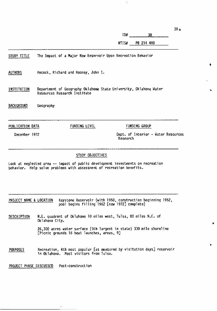
38a
ID# 38
NTIS# PB 214 480
STUDY TITLE The Impact of a Major New Reservoir Upon Recreation Behavior
AUTHORS Hecock, Richard and Rooney, John I.
INSTITUTION Department of Geography Oklahoma State University, Oklahoma Water Resources Research Institute
BACKGROUND Geography
PUBLICATION DATA FUNDING LEVEL
December 1972
FUNDING GROUP
Dept. of Interior - Water Resources Research
STUDY OBJECTIVES
Look at neglected area -- impact of public development investments on recreation behavior. Help solve problems with assessment of recreation benefits.
PROJECT NAME & LOCATION Keystone Reservoir (with 1950, construction beginning 1952, pool begins filling 1962 [now 1972] complete)
DESCRIPTION N.E. quadrant of Oklahoma 10 miles west, Tulsa, 80 miles N.E. of Oklahoma City.
26,300 acres water surface (5th largest in state) 330 mile shoreline [Picnic grounds 16 boat launches, areas, 9]
PURPOSES Recreation, 4th most popular [as measured by visitation days] reservoir in Oklahoma. Most visitors from Tulsa.
PROJECT PHASE DISCUSSED Post-construction

38b
METHODOLOGY
GENERAL: Field research
TECHNIQUES AND DATA USED: Interviews -- sampling Sampling done using geography-divide town into quadrants. Interview 6 within each quadrant + area adjacent to central business district. For Oklahoma City and Tulsa, quadrants are subdivided. Questions: Frequency of participation, most visited site, favorite area for recreation activities [also age, occupation, equipment, etc.].
I
IMPACTS DISCUSSED
A) Recreational participation affected
B) Loss of hunting and fishing streams
4

Only slight effect, no change in equipment ownership. Several types of changes possible:
1) Change location of recreation, no increase in participation
2) Decrease participation 3) Change location and increase participation 4) Initiate participation
This case mostly #1, some #2
EXTENT OF IMPACT:
38A
IMPACT A: Recreational participation affected.
GROUPS IMPACTED: Inhabitants of surrounding region negligible beyond 60 miles/ most within 30 mile radius. Strongest to the north and west where there are no comparable reservoirs.
PROJECT PHASE: Post construction
INDICATORS: Recreation behavior, equipment ownership and participation days
CAUSE AND PROCESS: Existence of a new reservoir
LINK TO OTHER IMPACTS:

CAUSE AND PROCESS:
r
38B I.. IMPAT B: Loss of hunting and fishing streams
GROUPS IMPACTED: Small fraction of recreationists
I
PROJECT PHASE: Post construction
0
INDICATORS: Responses to questionnaires.
EXTENT OF IMPACT: Of those interviewed, 14% report a decrease in water-based recreation. Keystone had a modest impact on that decrease -- primarily in the decrease of hunting and fishing opportunities.
The decrease in opportunities results from the innundation of streams and land used for hunting and fishing.
4
LINK TO OTHER IMPACTS:

• 39 a
ID# 39
NTIS# PB-224-536
STUDY TITLE The Effect of Landowner Attitude on the Financial and the Economic Costs of Acquiring Land for a Large Public Works Project
AUTHORS Higgins, John Malvern Jr.
INSTITUTION Kentucky Water Resources Institute, University of Kentucky
BACKGROUND
PUBLICATION DATA FUNDING LEVEL FUNDING GROUP
1967 Dept. of Interior - Office of Water Resources Research
STUDY OBJECTIVES
Examines financial and economic costs incurred in acquiring right of way for three Corps reservoirs and relates these costs to attitude characteristics of landowners and local publics. Considers extra-economic value placed on land by landowners and local publics. Helps guide the planner in estimating special personal "sentimental" [private] values placed on real estate.
PROJECT NAME & LOCATION 3 Reservoirs
1) Rough River Reservoir -- central Kentucky, 60 miles southwest of Louisville; between Grayson and Breckenridge Counties. Drainage area -- 454 square miles; surface area 10,260 square miles, constructed 1955-59. Cost $10 million. Area -- agricultural (hay, corn, tobacco)
2) Dewey Reservoir -- eastern Kentucky, midway between Ohio and Tennessee, borders on John's Creek in Floyd and Pike Counties. Drainage area 207 square miles, surface 3,125 acres. Poor area, subsistence farming, low grade timber, crops: corn, hay, and vegetables. Dam started 1946.
DESCRIPTION: 3) West Fork of Mill Creek Reservoir -- Hamilton County in southwest Ohio, 10 miles north of Cincinnati. Drainage area, 29.5 square miles, surface area -- 557 acres. Constructed 1949-1952, cost $3 million, encircled by suburban development.

PURPOSES: 1) a) reduce flood damages (Ohio River Basin); b) recreation 2) a) flood control; b) recreation; c) low flow augmentation 3) a) flood control; b) recreation
PROJECT PHASE DISCUSSED: Pre-construction
METHODOLOGY
GENERAL: Qualitatitively enumerate costs and factors affecting attitudes. Quantitative Analysis -- collect data on general method: costs, attitudes, and factors affecting attitudes. Look for correlations among costs (financial and economic). Look at attitudes of landowners and local public [reactions affect a project's implementation]. Test hypothesis -- the extent the cost deviates from cost under normal conditions depends on attitudes. Develop theory of correlation of cost and attitude and test.
39b
if
.4P
TECHNIQUES AND DATA USED:
i
#
Data collected from: Corps offices in Huntington, West Virginia, and Louisville, Kentucky, county coufthouses near projects, landowners selling, and local citizens. A questionnaire based on 30 design interviews focusing on reaction to project, estimates of impacts, recollection of selling of property. 450 property owners in 3 reservoir areas, 350 sent questionnaires, 100 responded. Post card questionnaires on reservoir benefits sent to people in local areas selected from voter registration lists -- 2 groups: 1) flood plain, 2) on both sides of the project (up and downstream). 450 sent 80 returned. Attempt to use regression analysis to predict which factors best predict attitudes [an aggregate measure based on responses to selected questions].

39A
IMPACTS DISCUSSED
A) The more a project affects the local landowners, the greater the reaction [both positive and negative].
B) The more knowledge held about the project the more favorable the attitude.
IMPACT A: The more a project affects the local landowners, the greater the reaction (positive and negative)
GROUPS IMPACTED: Landowners whose land is taken for the dam and local public.
PROJECT PHASE: Pre-construction
*
i
INDICATORS: Responses to questions or questionnaires and post cards. An aggregate of several questions to determine attitude, and data on land.
EXTENT OF IMPACT: Dewey residents consistently oppose dam and say they originally opposed it, while Rough River residents overwhelmingly favor their dam. Local publics: local public at Dewey more favorable to dam than local public at Rough River. Difference here not as great as between Dewey and Rough River landowners.
CAUSE AND PROCESS: Owners of property at Dewey Reservoir most affected by dam construction [most land lost, most cemeteries lost; and homes lost]. People had owned property longer-greater sentimental attachment. Comparable land hard to find in surrounding area. This is partly the result of the policy of buying the entire valley rather than only the tracts needed. The local public was benefitted more by the Dewey reservoir than other reservoirs studied. The
Fi.
I

39B IMPACT B:
Greater knowledge about project leads to more favorable attitudes by landowners.
GROUPS IMPACTED: Landowners and construction agency
PROJECT PHASE: Pre-construction
INDICATORS: General attitude scale based on a weighted aggregate of responses to selected questions and responses to other questions.
EXTENT OF IMPACT: The owner's knowledge about the project is a significant indicator of the variance in the owner's attitude.
CAUSE AND PROCESS: Somewhat the effect of the study design -- knowledge about project measured. by description of what is known about the project, which could have been influenced by other factors. Also, little knowledge about downstream benefits makes the necessity of giving up personal property even harder.
LINK TO OTHER IMPACTS:
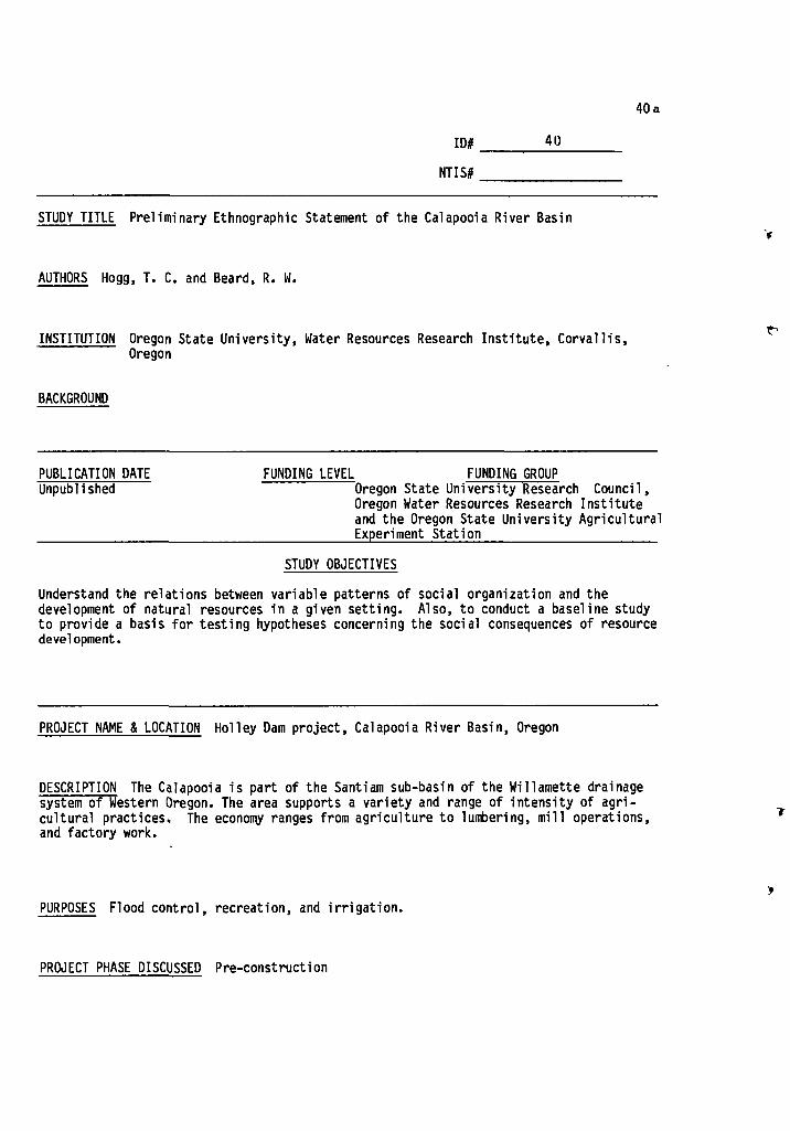
FUNDING LEVEL FUNDING GROUP Oregon State University Research Council, Oregon Water Resources Research Institute and the Oregon State University Agricultural Experiment Station
PUBLICATION DATE Unpublished
40a
ID# _ 40
NTIS#
STUDY TITLE Preliminary Ethnographic Statement of the Calapooia River Basin
AUTHORS Hogg, T. C. and Beard, R. W.
INSTITUTION Oregon State University, Water Resources Research Institute, Corvallis, Oregon
BACKGROUND
STUDY OBJECTIVES
Understand the relations between variable patterns of social organization and the development of natural resources in a given setting. Also, to conduct a baseline study to provide a basis for testing hypotheses concerning the social consequences of resource development.
PROJECT NAME & LOCATION Holley Dam project, Calapooia River Basin, Oregon
DESCRIPTION The Calapooia is part of the Santiam sub-basin of the Willamette drainage system of Western Oregon. The area supports a variety and range of intensity of agri-cultural practices. The economy ranges from agriculture to lumbering, mill operations, and factory work.
PURPOSES Flood control, recreation, and irrigation.
PROJECT PHASE DISCUSSED Pre-construction

40b
METHODOLOGY
GENERAL: The general design of the study: gain basic information about the region and provide data from which a number of hypotheses might be generated. Wanted to determine the range and availability of data to be encountered in the subsequent study phases.
TECHNIQUES AND DATA USED: Interviews were combined with questionnaires of the "open-ended" ethnographic type. Interviewer bias was checked by 1) debriefing by a reviewer 2) employing a three-sweep method in data collection, and 3) a weekly review session for research personnel orientation. The survey area included 4 towns - Holley, Crawfordsville, Brownsville, and Tangent and the rural areas adjacent to them. The sample area was located in Linn County, Oregon. 275 interviews were completed.
IMPACTS DISCUSSED
A) Many inhabitants of the river basin feel little need for the proposed benefits and object to the likely impacts of the project.

40A
IMPACT A: Many inhabitants of the river basin feel little need for the proposed benefits and object to the likely impacts of the project.
GROUPS IMPACTED: Residents, farmers and conservationists in or near the Calapooia River Basin.
PROJECT PHASE. Pre-construction
INDICATORS: Interviews, conversations, and questionnaires obtained from the rural and community areas in Linn County Oregon.
EXTENT OF IMPACT Many object to the fact that the reservoir will destroy land which it covers. Many object to living below the dam, while others voiced objections that the dam is simply another "stinging reminder" that the people of Calapooia have lost the power of "choice" in structuring their environs. Fish conservationists object to the dam's destroying one of the last remaining spawning grounds of the anadromous salmon and steelhead. There is only a limited "felt need" for flood control. Irrigation has mostly negative aspects for the residents, so its "benefits" are not completely acceptable to the people of the basin either. The "benefits" of the dam are seen largely as its recreational impact and the associated changes in property values.
CAUSE AND PROCESS: The power to develop the Holley reservoir and the associated irrigation canals lies outside the Calapooia valley. The prerogative is with the federal government agencies, Congress and State agencies. The farmers lack the requisite skills for irrigating, the region's climate is not suited for a great many crops, limited markets exist, and a geat deal of extra effort, energy, labor, and thought is required to use irrigable methods. There is also little significant interest shown in renovating or developing certain areas in the basin. There is a resistance to change, a lack of awareness, parochialism, and economic and educational underdevelopment in the area.
LINK TO OTHER IMPACTS:
:s.

FUNDING LEVEL FUNDING GROUP
Dept. of Interior - Office of Water Resources Research
PUBLICATION DATA
October 1970
-*
41a
ID# 41
NTIS#
STUDY TITLE Socio-Cultural Impacts of Water Resource Development in the Santiam River Basin
AUTHORS Hogg, Thomas C. and Smith, Courtland L.
INSTITUTION Water Resources Research Institute, Oregon State University, Corvallis, Oregon
BACKGROUND Anthropologists
STUDY OBJECTIVES
Assess the impacts of the construction of two dams on the behavorial and attitudinal patterns of Santiam Basin.
PROJECT NAME & LOCATION
DESCRIPTION
Two dams, Foster and Green Peter, on the middle and south Santiam River in Northwestern Oregon. Santiam is a tributary to the Williamette River Basin. Focus on adjacent communities of Foster and Sweet Home Oregon. Green Peter Dam is above the Foster Dam on the South Santiam. Heavily forested foothills and mountains. Rural, soil not particularly rich. Hay, grain, some fruits and vegetables grown.
PURPOSES Santiam is flash near Foster. Dams built for: 1) flood control; 2) irrigation; 3) downstream navigation; 4) on site power; 5) down-stream power; 6) recreation. Dams planned in the 1930's, authorized 1938. Construction begins 1961. Foster (the regulator) -- 4,565 feet long and 126 feet high. Storage area -- 61,000 acre feet -- 2 turbines -- total capacity 20 K-KW. Green Peter -- 1,500 feet long and 360 feet high; storage -- 430,000 acre feet, 2 turbines -- 80 K K-W.

41b
PROJECT PHASE DISCUSSED Pre-construction, construction, post-construction. [Dams 3 years into operation when research ended.]
METHODOLOGY
GENERAL: Historical perspective -- standard research methods with special anthropological techniques. Guided by a social systems model relating water resources and cultural dimensions of technology to human organization and changes in attitudes about water. Specifically, examine integrative actions of residents in response to massive technological change.
,s.
TECHNIQUES AND DATA USED: Historical baseline data on Sweet Home and Foster -- from the perspective of cultural adaptation. Sweet Home -- early agricultural -- WWII -- lumber boom by 1950 population begins to dwindle. Survey of Sweet Home residents, interviews, detailed observations interviews -- community leaders and people in every day walks of life. General questionnaire on benefits of reservoir with main emphasis on social organizations and religion also touched on problems of the reservoir and recreation behavior. Sample based on households. Life histories collected on influential and representative people. Team acts as participant observers.
IMPACTS DISCUSSED
A) Increased legalism and formalism in community government leading to conflict
B) Purchase of recreation equipment
C) Changing town social structure
D) Rapid growth and decline of community services
E) New town image

41A
IMPACT A: Increased legalism and formalism in community government.
GROUPS IMPACTED: People in service industry and their clients; total population of the area
PROJECT PHASE: Pre-construction, construction, post-construction
INDICATORS: Observations of behavior, crime statistics
EXTENT OF IMPACT: Formalizing previous informal procedures, establishing structures where none had existed, increased need for paperwork and official reports. Increase in the prestige of local government functions. In law enforcement, city manager and chief of police conflict over the personalized style of the police.
CAUSE AND PROCESS: New people with new requirements disagree with old fashioned style of government. Influx of workers puts a strain on the "personal" style of the government.
LINK TO OTHER IMPACTS:

/
IMPACT B: Purchasing of recreation equipment
GROUPS IMPACTED: Local merchants
PROJECT PHASE: Construction and post construction
INDICATORS: Number of recreation vehicles owned; amount of money per year spent on water recreation equipment
EXTENT OF IMPACT: Purchase of recreation equipment greater than money brought into region by recreationists in other ways. 25% of Sweet Home Residents own boats. Before dam very few owned boats. Recreation supplies did the best business in construction phase.
CAUSE AND PROCESS: Dam recreation increases interest in recreation leading to more recreation equipment buying.
LINK TO OTHER IMPACTS:
41B

41C IMPACT C: Changing town social structure.
GROUPS IMPACTED: Residents of Sweet Home, especially residents prior to construction
PROJECT PHASE: Construction -- Pot-construction -
INDICATORS: Behavior at traditional events, increased legalism and formalism
EXTENT OF IMPACT: Change from the articulation (specificity and interdependence) based on logging to more separation of functions, to an articulation based on a new concept of community based urban-suburban values. Chamber of Commerce Dinner, formerly the scene of practical jokes, now a well-run, formal coat and tie affair.
CAUSE AND PROCESS: Construction of the dam upset traditional logging based community integration. Now with return to logging, integration has changed to more urban-suburban context. Urban-suburban migrants key to shift.
LINK TO OTHER IMPACTS: A general statement of Impacts A, D, & E.

Improvements in municipal services spurred by anticipated influx of construction workers. After the workers left, taxpayers were left with better services and a greater tax burden.
CAUSE AND PROCESSES:
41D IMPACT D: Rapid growth and decline in community services.
GROUPS IMPACTED: Residents of Sweet Home, especially post-construction students. Employees of the city taxpayers.
PROJECT PHASE: Pre-construction, construction, post-construction
INDICATORS: Student-teacher ratio, dollars spent per student, revenue sources, municipal expenses per capita, revenues all compared with pattern of total man-hours worked in constructing the dam.
EXTENT OF IMPACT: Expansion and decline of school system. General rise in municipal service levels. Expansion of water system to accommodate influx of construction workers. End result -- improved per capita service with increased per capita taxes.
LINK TO OTHER IMPACTS:

41E
Is
IMPACT E: Change in town's image
GROUPS IMPACTED: Old residents, new immigrants to the town. (2nd) people of Portland and Salem (target of image)
PROJECT PHASE: Post-construction
INDICATORS: New zoning ordinance, improved main street, condeming . decaying buildings.
EXTENT OF IMPACT: Sweet Home originally regarded as dirty-logging town. People seeing recreational value of dams want to change the image to a neat, clean, and orderly town. This desire to project the image stimulated the development of the environment.
CAUSE AND PROCESS: Influx of urban and suburban oriented people with the expansion of services. This and the possibility of increasing realty values due to dam-related recreation. New residents become influential members (city manager, newspaper editor, superintendent of schools, President of Chamber of Commerce).
..,
LINK TO OTHER IMPACTS: Change in image has led to a greater willingness to spend money on good schools and adequate services.

FUNDING LEVEL FUNDING GROUP
Dept. of Interior - Office of Water Resources Research
PUBLICATION DATA
June 1973
ID# 42
NTIS# PB 231-485
STUDY TITLE Techniques for Identifying and Evaluating Market and Non-Market Benefits and Costs of Water Resource Systems
AUTHORS -- Milton Holloway, social aspects (Project Director), [Wade Andrews and Stanley Albrecht -- consultants], Randall Kamerbeek
INSTITUTION Systems Engineering Division, Texas Water Development Board
BACKGROUND Economics, Operations Research
STUDY OBJECTIVES
1) Provide a set of techniques for measuring market and non-market benefits and costs of water resource systems. Develop techniques and test them for economic, environmental, and social impacts specifically interested in computer oriented analytical techniques.
42a
lc
•
PROJECT NAME & LOCATION 3 Reservoir Projects in North Central Texas: 1) Belton Lake near Waco in Central Texas, 2) Lake Witney -- S.W. of Fort Worth, 3) Lake Lewisville -- North of Dallas in North Central Texas.
DESCRIPTION 1) Belton Dam on Leon River in Brazos River Basin completed 4/54. Drainage area of 3,5650 miles, surface area -- 7,400 acres in a rural area, primarily dryland crops. 2) Whitney Dam on Brazos River completed 12/51. Drainage area -- 26,120 square miles, surface area 15,760 acres. Rural, agricultural area -- located on border of two counties, Hill and Bosque. 3) Lewisville Dam on the Elm Fork of the Trinity River (within 35 miles of Dallas). It was a replacement for Lake Dallas which it inundated. City of Dallas is the major beneficiary. Surface area is 66,100 acres,
- drainage area -- 1,660 square miles.
•

42b
PURPOSES: 1) Belton water used mainly for municipal purposes, no irrigation
PROJECT PHASE DISCUSSED: Post-construction
METHODOLOGY
GENERAL: 1) Formulation of proposed techniques; 2) testing techniques' descriptive powers; 3) refinement of techniques; 4) test on constructed projects. Uses conceptual model linking economic, environmental, and social systems. Allows comparison of economic, environmental and social trade-offs associated with water resource policies -- the EES model. Works on social impacts as labelled experimental. Interested in quantitative, descriptive measures.
TECHNIQUES AND DATA USED: Economic simulation, eco-system simulation, social indicators -- social mobility, health and illness, public order safety, stability, democratic process, and access to public services. Measurements of real and perceived values. Emphasis on social impacts based on local impacts survey of a random sample of residents of the five counties surrounding the 3 reservoirs -- designed to provide information on attitudes about social indicators (education, health, stability, etc.). Lack of secondary data (measures of perceived impact from the survey data.
IMPACTS DISCUSSED
A) Enhance the beauty of the area
B) Increase job opportunities

42A
IMPACT A: Enhance the beauty of the area
GROUPS IMPACTED: Residents of area
PROJECT PHASE: Post-construction
1
INDICATORS: Responses to survey question
EXTENT OF IMPACT: 89% of respondents said reservoir enhanced the beauty of the area.
CAUSE AND PROCESS:
LINK TO OTHER IMPACTS:

IMPACT B: Increase job opportunities
* GROUPS IMPACTED: All residents of the area
PROJECT PHASE: Post-construction
INDICATORS: Responses to survey questionnaire
EXTENT OF IMPACT: Of 500 respondents, 245 say reservoirs increase business; therefore job opportunities increased. 117 say reservoir has no effect.
CAUSE AND PROCESS:
LINK TO OTHER IMPACTS:
42B

PUBLICATION DATE FUNDING LEVEL FUNDING GROUP
Water Resources Research USDI - in part 4(3) (June, 1968): 499-506
STUDY OBJECTIVES To illustrate how alternative goals of ranking investment projects might be explicitly weighted, the multidimensional problem is simplified to two dimensions-economic efficiency and income distribution evaluation in a case study.
ID# 43
NTIS#
STUDY TITLE A Case Study in Income Redistribution from Reservoir Construction
AUTHORS James, L. Douglas
INSTITUTION University of Kentucky, Lexington
BACKGROUND
PROJECT NAME & LOCATION Dewey Reservoir on John's Creek, a tributary of the Big Sandy River in Floyd and Pike counties of Eastern Kentucky.
DESCRIPTION Constructed in 1946-1949, dam controls 207 square miles of drainage area and provides 93,300 acre-feet of storage. Bulk of storage is for flood control, but a summer pool of 17,200 acre-feet is maintained for recreation. Low income area.
43a
PURPOSES Flood control and recreation.
PROJECT PHASE DISCUSSED Post-construction.

43b
METHODOLOGY
GENERAL: Primary data and federal agency reports used to weight the significance of efficiency and income distribution. Examined price index, cost and benefit data used, discount rate applied, income distribution of taxpayers, property assessment data, distribution of benefits, and income distribution of the recipients of project expenditures.
TECHNIQUES AND DATA USED: Examined types of costs and benefits included by COE in their original evaluation of the projects financial efficiency: price index, discount rate, construction costs, value of land, secondary costs, flood control benefits, economic development, and recreation benefits. In determining the distribution of costs and benefits to the affected interests, tax and cost distribution was examined for the federal, state, and local governments. Financial benefits were obtained via assessment data for relevant landowners and income class of recreational visitors to the projects. Examined taxes levied to pay project costs and analyzed project benefits realized by different income categories.
IMPACTS DISCUSSED
A) Redistribution of income and recreational benefits from high to low income groups.
1

43A
IMPACT A: Redistribution of income and recreational benefits from high to low income groups.
GROUPS IMPACTED: Residents of area affected by the project.
PROJECT PHASE: Post-construction
INDICATORS: Analysis of the primary and secondary cost, benefit, tax, and recreational data pertaining to the construction and effects of the project.
EXTENT OF IMPACT: Flood control benefits were found to be relatively greatest for the middle income group. The lower income groups received fewer benefits because they own less damageable real property. The upper income groups pay a large enough share of taxes to more than offset the larger share of flood benefits they realize by owning more property. Recreation benefits were greatest for the lowest income group. They use the reservoir the most, but pay a small share of taxes. As the income levels increased, the share of taxes increased much faster than the recreation visitation.
CAUSE AND PROCESS: The (re) distributive nature of water resource projects.
LINK TO OTHER IMPACTS:

44a
ID# 44
NTIS# ■■■■■■■■■■■■■■■•■■•■■■ ■7
STUDY TITLE An Analysis of Community and Individual Reactions to Forced Migration ------ ----- Due to Reservoir Construction '
AUTHORS Johnson, Sue and Burdge, Rabel J. ------
INSTITUTION University of Kentucky, Lexington ----- ---
BACKGROUND Sociology
PUBLICATION DATA
1974
FUNDING LEVEL FUNDING GROUP
Office of Water Resources Research
STUDY OBJECTIVES
Attempt to reveal the human meaning behind public policy. Focus on the negative aspects of forced migration by describing, longitudinally, the process of relocation from the first warning of impending migration to settlement in new homes.
PROJECT NAME & LOCATION Paintsville Reservoir, Johnson County: Taylorsville Reservoir FOT-VH-BUT817, -1Witagy; Cave Run and Carr Forks Reservoirs in Eastern Kentucky.
DESCRIPTION Primarily rural areas, often mountain people or rural people who tend firbi-oTUR than the population at large and who form a distinct subculture. They fall into the lower socio-economic status brackets. The population has values that are person-centered, traditional, fatalistic and familistic. Tend to have small farms, low incomes, little formal education, and are tradition directed.
PURPOSES Flood control, recreation, and economic development.
PROJECT PHASE DISCUSSED Pre-construction and construction.

METHODOLOGY
GENERAL: Underlying assumption; describe the clash of agents representing two alien social processes; those seeking to impose change and those passively or actively seeking to resist such change. It is also a clash between the efficiency minded, goal oriented behavior of the COE and the traditional isolated mountain culture of Appalachia.
44b
II
TECHNIQUES AND DATA USED: Utilized data from four reservoir studies. Personal interviews with people forced to relocate. Data is taken from 4 separate studies at four points in the migration process. Secondary data from Kentucky newspapers were used as supplements.
IMPACTS DISCUSSED
A) Lack of knowledge and poor awareness of the proposed project.
B) Opposition to reservoir construction directly linked to strong resistance to relocation.
C) A majority of families felt that they were in worse condition after location.
-4

IMPACT A: Lack of Knowledge and poor awareness of the proposed project.
GROUPS IMPACTED: Residents of the areas to be claimed for reservoir construction as well as general citizenry.
PROJECT PHASE: Pre-construction and construction
44A
•
-• INDICATORS: Random cluster sample of respondents in Paintsville and surrounding counties in 1970.
EXTENT OF IMPACT: Very little awareness was found in regard to the impending project. Even among the urban Paintsville residents, recognition of the impending project was poor. HoweVer, 75% or more of the county residents were in favor of the project (1971-72). But recently (1973), 1200 residents in the Paint Creek Valley signed a petition opposing the dam. This represents 95% of the valley's population.
CAUSE AND PROCESS: Lack of information transfer from Corp to area residents. One of the two main complaints of the area residents was that they felt that until last April (1973), they were inadequately informed about the specific details of the Paintsville proposal. The only two public hearings were obscured by the Kennedy assassination and a lack of publicity about the second meeting (the Corp forgot to notify the major newspaper in Morgan County). These were the only two meetings with the landowners before the process of land acquisition began.
LINK TO OTHER IMPACTS:

44B
IMPACT B: Opposition to reservoir construction linked to strong resistance to relocation.
GROUPS IMPACTED: Residents in the take-areas of the proposed projects.
PROJECT PHASE: Pre-construction and construction.
INDICATORS: Interviews performed at the Taylorsville, Cave Run, and Carr Fork reservoir areas.
EXTENT OF IMPACT: Those waiting to move were subject to considerable stress and anxiety -- it was as if they were mourning the loss of their homes, friends and familiar surroundings even before they had moved. People who were waiting to be relocated stopped maintaining their property. Van Buren, a town to be relocated, looked like a ghost town except people still lived there. People experienced physical and emotional problems as a result of the imminent relocation. People were strongly attached to their homes; "only place I can call home;" their ancestors had settled and lived in the area for a hundred years or more and "farming this valley all my life," etc. The 95% opposition ip the Paintsville project area can easily be understood in light of such deep-seated attachments to the homes that must be taken (see Impact A).
CAUSE AND PROCESS: Bureaucratic foot-dragging exacerbated the time lag between notice of relocation, the actual move and the apprehension over leaving. Rural dwellers have strong attachments to homes, neighbors, ways of life, and pace of doing things. Moving is bad enough, forced relocation makes it that much worse. The process of land acquisition, assistance in moving, finding jobs, etc. was handled poorly by the Corp. This did not help to smooth the process. The staff of the Kentucky Law Journal in viewing the Cave Run acquisition process, found that there was "horsetrading" towards comdemned property and that the bargaining process was an ' "unfair attempt to circumvent the constitutional requirement of just compensation." 49% of the sample felt they did worse than their neighbors, 7%, better, and 39% as good as their neighbors. 40% were paid less than their full moving expenses and 58% were adequately reimbursed. 51% said that the Corp had not offered to help or advise them in searching for a new home while 47% said they had.
LINK TO OTHER IMPACTS:

44C IMPACT C: A majority of families felt that they were in worse condition after the
relocation.
GROUPS IMPACTED: Residents forced to move because of relocation.
PROJECT PHASE: Construction, post-construction
INDICATORS: Interviews with Carr Forks migrants on a range of topics; from plumbing to adjustment of children.
EXTENT OF IMPACT: 55% felt the move was worse overall. 20% felt it was better. Of the families who had a garden before, 40% no longer did. 33% were in worse financial condition than before; 22% were in better condition; and 45% experienced no change. Friends were further away. . Some people were more isolated from major needs, and 60% visited less with friends. Families were scattered -- many had lived in the same hollow but after relocation, some families were spread out over 4 counties. 38% noted a change for the worse in family activities. 63% were satisfied with their new homes -- had better plumbing, gas as opposed to coal, and newer dwellings.
CAUSE AND PROCESS: The disruption of family groups, friendship ties and proximity to neighbors and family members helped destroy the well-established "communities" in the take-areas. Social relationships were rooted in tradition, ancestral lands and cemeteries, and interlocking personal relationships. The dam went a long way toward disrupting these bonds.
LINK TO OTHER IMPACTS:

45a ID# 45
NTI S #
STUDY TITLE Historical, Political, and Social Factors Affecting Public ------ Policy on River Diversion: Out-of-Basin Diversion of Connecticut
River Flood Waters to the Boston Metropolitan Area.
AUTHORS Kaynor, Edward R. Found in: "Formation of Public Policy on Issue of Out-of-Basin Diversion of Connecticut River Flood Waters to Boston Metropolitan Area," Bernard B. Berger, principal investigator.
INSTITUTION Water Resources Research Center, University of Massachusetts, Amherst. -----------
BACKGROUND
PUBLICATION DATA FUNDING LEVEL FUNDING GROUP
1973 USDI - Office of Water Resources Research Publication No. 28
STDDV-METTVES--- Determine how public policy evolves in respOT -75-fhis out-of-basin transfer of water: Subordinate questions are: 1) How did the various interested publicgroups form their opinions in this
controversial issue? 2) How did the attitudes of these public groups change in time and what factors accounted
for these changes? 3) How effective were public hearings in providing an opportunity for expression of
public opinion? 4) What factors most strongly influenced the attitudes of members of the special task
force assigned by the federal court to the study of the proposed legislation?
______________ ----------- ------- _______ --------- PROJECT NAME & LOCATION Turners Falls dam on the Connecticut River, Northfield REFITTM-TFET-VITIE-MBsachusetts, and Quabbin Reservoir
DESCRIPTION In 1965, Northeast Utilities, Inc. presented a plan to construct a 177:113-5i-a- Rorage facility from the pond above Turner's Falls dam on the Connecticut River to the top of Northfield Mountain. Four pump-generators would pump water to the top of the mountain during off-peak periods and this water would be released during peak load periods. Water flowing back down would provide hydro-electricity when system's demand was highest. Due to the heavy draw down of Turner's Falls pond during pumping, NEU would make major improvements in the dam to increase its retention capacity. The possible effects of this to the area and river would be significant. In addition, plans were authorized to divert Connecticut River water into the Quabbin Reservoir.
PURPOSES Hydro-electricity, flood control, recreation, and water supply. ---
PROJECT PHASE DISCUSSED Pre-construction

45b METHODOLOGY
GENERAL: The general thrust of the interviewing was to determine the state or status of opposition in the Connecticut River Valley in 1971. Had opposition really capitulated, or was opposition still extensive and strong? Was opposition or support related to extent of knowledge? Was opposition a rural or urban phenomenon? The reasons for opposition rationale? etc.
TECHNIQUES AND DATA USED: Examination of newspaper articles, public hearings testimony and interviews were conducted in the Springfield - Chicopee - Holyoke SMSA. A basic population of respondents was chosen from each of the 21 cities and towns in the SMSA. An initial sample of 40 people - 21 mayors or chairmen of Boards of Selectmen and 19 prominent members of local conservation commissions - were interviewed. These people, in addition to newspaper people, were asked to identify additional people who were involved in or knowledgeable about the project. These people were then asked to also submit names of people involved. From this process, a survey of attitudes towards the project was compiled.
IMPACTS DISCUSSED
A) Significant levels of opposition to the diversion project in the affected area.
B) Respondents favored the project 2 to 1.
C) Actual knowledge of the project was fairly high.
l

45A
IMPACT A: Significant levels of opposition to the diversion project in the affected area.
GROUPS IMPACTED: Residents of the counties, cities, and towns along the the Connecticut River in the project area, the residents of Western Massachusetts that rely on the electricity produced by the Turner's Falls Dam and the people who need the Quabbin reservoir for their water supply.
PROJECT PHASE: Pre-construction
INDICATORS: Responses to a series of questions covering geographical location, scope of knowledge about the project, reasons for support or opposition, attitudes towards government, age, education, etc. 116 people interviewed.
EXTENT OF IMPACT: While the opposition appeared to be broadly based, its actual extent was restricted to a relative few (27 opposed, 62 favoring, and 27, neutral). Those opposed were vigorous, dedicated and more knowledgeable than proponents. Opposition did not develop to a significant extent in the state of Connecticut. In Western Mass-achusetts, opposition centered in communities that are adjacent to the river downstream (in the 10 communities abutting the river -- 22 opposed, 38 favoring, 14 neutral; in the 11 communities not abutting the river - 5 opposed, 24 favoring, 13 neutral). Opponents appeared to be those who mistrust government and view any diversion as a first step toward total diversion. The oppostion delayed the approval of the proposal and would have been more effective had it adopted a more low-toned, factually based approach. Those in favor of the project tended to be acquiescent rather than positively motivated. Elected officials tended to favor the project but also were disproportionately "neutral." Public and official response outside the River Valley tended to favor the project. Those who expressed "neutrality" tended to lean toward opposition.
CAUSE AND PROCESS: a) Communication from the State House in Boston to Western Mass. was called poor to fair at best, b) the opposition may have been partly initiated by persons shown subsequently to have political ambition, c) Rising interest in conservation was partially responsible, d) Lack of safeguards, the carte blanche features of the bill may have touched off opposition to the project. DPITEifibfi—fended to be a "youth" movement and to occur among those with the most extensive formal education. The construction of a nuclear power station 13 miles upstream from the proposed divesion project and the feared possibility of a nuclear hazard was minor problem and was not used to any major extent as an argument by valley residents. The emergence in the late 60's of a group of citizens joined by a common concern for conserving, protecting and restoring resource values was a significant factor in the opposition to the project.
LINK TO OTHER IMPACTS:

45B
t
IMPACT B: Respondents favored the project by 2 to 1.
GROUPS IMPACTED: Residents of the affected counties, cities, and towns along the Connecticut River, the residents of Western Massachusetts that rely on the electricity produced by the Turner's Falls Dam, and the people who need the Quabbin reservoir for their water supply.
PROJECT PHASE: Pre-construction
INDICATORS: Response of 116 interested and involved participants in the issue in the project area when asked if they favored or opposed the project.
EXTENT OF IMPACT: In the urban sample, 31 favored the project, 10 were neutral, and 19 opposed it. In the rural or suburban sample, 31 favored it, 8 opposed and 17 were neutral. It is interesting to note that most of the opposition was centered in the urban areas and not in the rural or suburban areas. In those communities not abutting the river, 24 favored, 5 opposed, and 13 were neutral to the project. The proponents seemed to have less firm beliefs and tended to qualify their support. The opposition tended to give no quarter to the other side.
CAUSE AND PROCESS: The Connecticut River is not used for irrigation, is not depended on to grow crops, does not provide drinking water, has not been the source of a significant flood in generations and is not used as a commercial transpartation medium. In essence, for the suburban and rural residents of the river valley, the river does not provide a vital link to their livelihoods. In fact, the evidence indicated that the diversion of the Connecticut River out-of-basin transfer was a non-issue in 1971 outside of the urban centers. There was however significant opposition in the urban centers.
s
•1
LINK TO OTHER IMPACTS:

IMPACT C: Actual knowledge of the project's details was fairly high.
GROUPS IMPACTED: Residents, supporters, opponents, and other vested interests in the diversion project area.
PROJECT PHASE: Pre-construction
INDICATORS: Interviews with 116 involved and/or interested participants in the diversion project controversy. Asked if they thought they did or did not know the details of the proposal and follow-up discussions about the project.
EXTENT OF IMPACT: Fifty of 116 said they did not know the details, 39 claimed they did. However, the interviewers were impressed by the actual knowledge of the opposition, irrespective of what they said they knew. Most respondents were modest when rating themselves. A few claimed to know more than they actually did. The opponents also tended to have the most arguments against the project. They averaged 1.02 opposition statements per person as compared to .71 support statements per proponent.
CAUSE AND PROCESS: This is not a representative sample of knowledge levels since the respondents were taken from the groups most actively involved in the controversy. One would expect their knowledge levels to be fairly high. Most of the supportors tended to be moderate with ambivalent feelings about the project (see Impact B) and therefore one could assume that they expended less effort become informed. The opposite could be true for the bulk of the opposition.
45C
4
LINK TO OTHER IMPACTS:

46 a
ID# 46 _
NTIS#
STUDY TITLE Influence of Reservoir Projects on Land Values
AUTHORS Knetsch, Jack L.
INSTITUTION Resources for the Future
BACKGROUND
PUBLICATION DATE FUNDING LEVEL
Journal of Farm Economics 46 (Feb. 1964): 231-243
FUNDING GROUP
Tennessee Valley Authority
STUDY OBJECTIVES
Extend the appraisal of the economic consequences of water resource development projects and to estimate the impact of reservoirs on surrounding land values.
PROJECT NAME & LOCATION Proposed reservoir in the Tennessee Valley
DESCRIPTION
PURPOSES Flood control, navigation, recreation and hydroelectric
PROJECT PHASE DISCUSSED Pre-construction

B)
C)
D) 1
46b METHODOLOGY
GENERAL: Establishes a land value model to estimate the relationship between the values of land around existing reservoirs and factors observed to be associated with their particular values. The variables used ard dependent variable - value of land; independent variables - distance from reservoir, topography, urban proximity, leisure time, value of improvements per acre and cost of development per acre. The non-reservoir lands model was used as the comparison model to test the change in values of the reservoir affected lands. The dependent variable was sale value of the land per acre. The independent variables were: proportion of land cleared, road frontage in feet per acre, urban value, and value of improvements. These models were applied to the proposed reservoir site.
TECHNIQUES AND DATA USED: Multiple regression equations are used to express the relationships of values with and without the project. All values of land were expressed in 1961 constant dollars. The analysis is based on 519 separate sales of land on or near 11 TVA reservoirs. The transactions occurred between 1946-1962 with most of them occurring between 1953-1961. 50% of the properties front directly on the reservoirs, the rest are at varying distances from the lakes. Sales records, interviews with owners or sellers and land appraisers familiar with the properties were used to verify the data used. For the non-reservoir land values, 103 sales were examined and verified by field investigation and interviews with either buyers or sellers.
IMPACTS DISCUSSED
A) Estimated increase of certain land values due to reservoir construction is almost double the existing land values without the project.
*
P
E)

46A
IMPACT A: Estimated increase of certain land values due to reservoir construction is almost double the existing land values without the project
GROUPS IMPACTED: Land owners, renters, investors, residents and businessmen in the areas adjacent to or near the proposed project.
PROJECT PHASE: Pre-construction
INDICATORS: Estimates of the value of the land to be affected by the reservoir made for each tract and summed using the observed or projected values of each of the independent variables tested in the reservoir and non-reservoir land value models. Assuming project construction in 1963, two values were estimated: 1) land values expected if the project is constructed, and 2) values expected without a project. Location of the tracts relative to reservoirs, roads, and urban centers was used. Topographic characteristics, land cleared, and road frontage were also examined. In addition, other variables were used to test the value change due to the reservoir.
EXTENT OF IMPACT Using the above mentioned indicators as land value guides, the land is estimated to be worth $4,265,000. Without the reservoir, the value of the same land is estimated to $2,307,000. Most of the land experiencing this growth is located next to or near the the proposed project area. The land value increment was also proved to be greater in areas with increased proximity to large population centers and in areas with fewer reservoirs nearby. A much less dramatic effect will be realized outside the project areas or by those tracts with poor locational and/or site character-istics.
CAUSE AND PROCESS: The market evaluation of the land is due to a number of factors such as recreational, aesthetic and other amenity assets that are based on public and private assessments and perceptions of the lands' enhanced value after the completion of the dam. The land experiencing the greatest growth will reflect values due entirely to location on or near the reservoir project. The increased prices represent the capitalization of values derived from the vocational advantage. It must be noted that topography, proximity to large population centers, and areas with fewer reservoirs nearby will also have added effects on stimulating the market value of land on or near reservoir projects.
LINK TO OTHER IMPACTS:
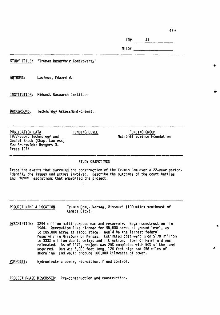
PUBLICATION DATA FUNDING LEVEL 1977-Book: Technology and Social Shock (Chap. Lawless) New Brunswick: Rutgers U. Press 1977
FUNDING GROUP National Science Foundation
ID# 47
NTIS#
STUDY TITLE: "Truman Reservoir Controversy"
AUTHORS: Lawless, Edward W.
INSTITUTION: Midwest Research Institute
BACKGROUND: Technology Assessment-chemist
STUDY OBJECTIVES
Trace the events that surround the construction of the Truman Dam over a 22-year period. Identify the issues and actors involved. Describe the outcomes of the court battles and usue resolutions that embroiled the project.
PROJECT NAME & LOCATION: Truman Dam,. Warsaw, Missouri (100 miles southeast of Kansas City).
DESCRIPTION: $294 million multi-purpose dam and reservoir. Began construction in 1964. Recreation lake planned for 55,600 acres at ground level, up to 209,000 acres at flood stage. Would be the largest federal reservoir in Missouri or Kansas. Estimated cost went from $179 million to $332 million due to delays and litigation. Town of Fairfield was relocated. As of 1972, project was 25% completed with 50% of the land acquired. Dam was 5,000 feet long, 126 feet high had 958 miles of shoreline, and would produce 160,000 kilowatts of power.
PURPOSES: Hydroelectric power, recreation, flood control.
47a
PROJECT PHASE DISCUSSED: Pre-construction and construction.

47b
METHODOLOGY
GENERAL: Examines actors, issues, and impacts involved in the development litigation, and constructionof the dam. Outlines the complaints leveled in court by the groups attempting to stop the dam: Environmental Defense Fund, Missouri Chapter of the Wildlife Society and 7 residents of Warsaw, Missouri. Illustrates the potential impacts, COE procedures, Congressional action and court orders invovled in keeping the project in motion.
TECHNIQUES AND DATA USED: Analysis of newspaper articles: Kansas City Times, Kansas City Star, and New York Times.
IMPACTS DISCUSSED
A) Strong initial local opposition to the project fades after project is redesigned.
B) Attempts to stop construction of the dam intensifies conflict between opposition and supporters of the project.
C) Slowed land acquisition seriously hurt those landowners waiting to be bought out.
-.4-

IMPACT A: A strong initial local opposition to the project fades after project is redesigned.
GROUPS IMPACTED: Residents of affected area
PROJECT PHASE: Pre-construction
47A
I'
..k,
INDICATORS: Newspaper articles
EXTENT OF IMPACT: There had been strong local opposition to the project at the time of its authorization. After it was redesigned to include a hydro-power plant and enlarge the recreation lake, resistance to the revised project gradually subsided. The project became western Missouri's hope for reversing population loss to cities and of building a new industry (tourism) to supply new jobs and income.
CAUSE AND PROCESS: Family farming is hard and except for fertile river bottoms, often financially unrewarding throughout much of the region. Many rural and small farm residents welcomed the prospect of new jobs provided by a resort boom and industrial growth.
J
LINK TO OTHER IMPACTS:

47B
IMPACT B: Attempts to stop construction of the dam, intensifies conflicts between opposition and supporters of the project.
GROUPS IMPACTED: Citizens of the project area, Missouri Chapter of the Wildlife Society, and the Environmental Defense Fund.
PROJECT PHASE: Constructon
INDICATORS: Newspaper articles
EXTENT OF IMPACT: The legal attempts by the plaintiffs (EDF, the 7 residents of Warsaw, Mo., and the Wildlife Society) to halt construction of the dam was met by strong opposition by the supporters. Both state senators-Symington and Eagleton came out strong for the project. Concerned local citizens began petition signing projects and made contributions toward legal defense to get the dam completed. Representatives from several communities in the area formed the Truman Reservoir Citizens Defense Fund. Resolutions by the Henry County court and city of Osceola were passed in support of the project.
CAUSE AND PROCESS: The opposition saw the project as threatening "irreversible environmental damage." The supporters felt that a slowdown or halt in work would have a serious adverse effect on the economy of the area. Thousands of tax dollars had already been lost from the government acquisition of homes, land and businesses. There was $999,000 worth of unfinished contracts that the city had in relation to the project. It was felt that only the expected commercialization and new jobs that the dam would bring would help recoup the significant financial losses received already. In addition, many people felt that since the project began six years before, and had progressed for so long, it should be completed.
LINK TO OTHER IMPACTS:

47C
IMPACT C: Slowed land acquisiton seriously hurt those landowners waiting to be bought out.
GROUPS IMPACTED: Landowners in areas to be acquired for project construction.
PROJECT PHASE: Construction
INDICATORS: Army Corps of Engineers claims
EXTENT OF IMPACT: Corp could not get appropriations fast enough to buy out the landowners that were ready to sell. This property deteriorated because maintenance and improvements seemed pointless. Owners were forced to live in suspended animation. .
CAUSE AND PROCESS: Litigation and uncertainty surrounding project induced a slowed down appropriation, hence acquisiton process. Property was of little use to owners yet unaffordable for Corp. of Engineers.
LINK TO OTHER IMPACTS: Result of conflict in Impact B.
t
„Jo.,
...

FUNDING LEVEL FUNDING GROUP
Dept. of Interior - Office of Water Research Technology
PUBLICATION DATA
July 1975
48a
.4
ID# 48 .
NTIS#
STUDY TITLE Sociological Impact of a Flood Control Reservoir: Howard Pennsylvania
AUTHORS Leadley, Samuel M.
INSTITUTION Institute for Research on Land and Water Resources, Pennsylvania State University
BACKGROUND Rural Sociology
STUDY OBJECTIVES
Focus on community organizational response to dam related social changes as evidenced by community influential's perceptions: 1) estimate nature of perceptions; 2) identify sociological variables related to perceptual error; 3) estimate effects of errors in perception on community organizations.
*
PROJECT NAME & LOCATION Sayers Reservoir -- Northern Pennsylvania (Howard Township) 20 miles from State College, 10 miles from Bellefonte, 12 miles from Lock Haven. Just outside the Borough of Howard -- 5 miles x 1 mile surface area.
ll
DESCRIPTION Foot of Allegheny Mountains. Began as a farming community. Local trade center now -- no appreciable local industry. 80% of labor force works outside the community. Mostly people are descendents of people there in the 1870's -- a stable community.
PURPOSES
PROJECT PHASE DISCUSSED Post-construction

I 48b
METHODOLOGY GENERAL: Sample community leaders, establish objective measures of reservoir initiated change. Select independent variables, identified in previous research as associated with perceptual accuracy. r
TECHNIQUES AND DATA USED: Focused interview technique -- open format fixed and open-ended questionnaire. Interviews completed in April 1969. Interview sample taken from officers of formal organizations and suggestions by interviewers. Final sample: 85 people, 12 organizations selected to test impact of community leaders' perceptions. Measurements of accuracy of perception: public lands acquired, jobs eliminated, families displaced, location of proposed parks, number of new jobs created by parks, Borough's share of cost of construction of new sanitary sewer system. Variables associated with perceptual accuracy: participation in voluntary associations involvement in local flood prevention society, actions taken to influence the decision, role in public meetings, holding public office, and settlement.
.1. / :
IMPACTS DISCUSSED
A) Residents perceive direction of change correctly but not the magnitude
8), Lack of community organizational response to reservoir induced changes
_...

48A
IMPACT A: Enhance the beauty of the area
GROUPS IMPACTED: Residents of area
PROJECT PHASE: Post-construction
INDICATORS: Responses to survey twestion
EXTENT OF IMPACT: 89% of respondents said reservoir enhanced the beauty of the area.
CAUSE AND PROCESS:
1
.4,
ii.
LINK TO OTHER IMPACTS:

48B
IMPACT 8: Increase job opportunities
GROUPS IMPACTED: All residents of the area r
PROJECT PHASE: Post-construction
INDICATORS: Responses to survey questionnaire
EXTENT OF IMPACT: Of 500 respondents, 245 say reservoirs increase business; therefore job opportunities increased. 117 say reservoir has no effect.
CAUSE AND PROCESS:
...
LINK TO OTHER IMPACTS:

49a
x
ID# 49
Nil S#
STUDY , TITLE: Community Development Benefits from Small Watershed Projects
AUTHORS: Lynch, Lawrence K.
INSTITUTION: Spindletop Research
BACKGROUND:
GROUP: Soil Conservation Service, U.S. Department of Agriculture
PUBLICATION DATE: January 1969
FUNDING LEVEL:
FUNDING DATE:
STUDY OBJECTIVES: Identify and evaluate the development benefits which have occurred as a result of small watershed projects in two case study areas and to project the additional benefits which are expected to occur. Also, to lay the foundation to create a methodology for estimating future development benefits in areas for which small watershed projects are being planned.
PROJECT NAME 81 LOCATION: Mud River Watershed in South Central Kentucky and Brush
Creek Watershed in Southwestern West Virginia.
DESCRIPTION: As of 1968, 18 of 32 planned floodwater retarding structures, 3 multi-purpose structures, and 16 of 21 miles of channel improvement had been completed on the Mud River project. Total cost to date: $6.1 million. On the Brush Creek Watershed, 6 floodwater retarding structures, 3 of 4 multi-purpose structures and one of 5.86 miles of scheduled channel improvement have been completed by 1968. Total cost to date (1968) $2.2 million.
PURPOSES: Multi-purpose
PROJECT PHASE DISCUSSED: Construction

METHODOLOGY 49b
GENERAL: The study wanted to measure development, or secondary benefits, but not primary benefits. It was the study's intent to examine benefits that resulted from induced investment and respending or multiple effects. The study designs also used the "bottleneck concept" to examine the area's economy and any impediments that might or did stand in the way of economic growth and development before the introduction of the dam project into the area. The bottleneck concept is limited, in this study, to those kinds of problems which public investments solve. Each necessary public investment is assumed to claim all the development benefits that result. The secondary purpose of the study was to provide a basis for the creation of a methodology for the a priori estimation of developmental benefits.
TECHNIQUES AND DATA USED: Examine 'primary and secondary economic and social data. Interviews. Analysis of secondary data-regional trends in employment, money income, recreation visits, etc. Projections and estimates are derived from this data and the primary data analysis. Analysis of primary data-historical employment, money income attributable to the project, determined through interviews with plant management personnel in study areas.
IMPACTS DISCUSSED
A) Additional jobs and wages made available as a result of watershed development.
B) Positive land value changes
C) Renewal of public health hazards
D) Stabilized towns' economic and social structure
E) Recreational and social benefits
F) Road improvements

IMPACT A: Additional jobs and wages made available as a result of watershed development.
GROUPS IMPACTED: Citizens adjacent to and near the two watershed project areas.
PROJECT PHASE: Construction
49A
INDICATORS: Secondary and primary data interviews
EXTENT OF IMPACT: In the Mud River project area there were approximately 1307 jobs added to the area. The estimated wage or salary increase was $2.5 million annually. The Brush Creek development has resulted in 1,303 jobs and a wage and/or salary increase of $6.7 million annually.
■ANI•
CAUSE AND PROCESS: The development of the water supplies helped draw manufactoring firms into the area; this was escpecially the case for the machinery and equipment industries that moved into the areas after adequate water supplies were developed. There was also rapid growth of construction, finance, insurance and real estate in the area. Recreation and tourist industries also added to the increase of jobs and wages in the areas.
LINK TO OTHER IMPACTS:

49B IMPACT B: Positive land value changes
GROUPS IMPACTED: Landowners in the affected areas.
PROJECT PHASE: Construction
INDICATORS: Primary and secondary data, interviews
EXTENT OF IMPACT: In the two project areas, the change in land value to the numerous owners was $7.9 million
CAUSE AND PROCESS: Increase-price may be due to 1) increase in agricultural productivity 2) flood protection 3) land being shifted from agricultural to residential or commercial use 4) proximity to recreation facilities 5) potential recreational use 6) aesthetic enhancement
LINK TO OTHER IMPACTS:
•
;IL

49C IMPACT C: Renewal of public health hazards
GROUPS IMPACTED: Citizens of the Brush Creek area
PROJECT PHASE: Construction
INDICATORS: Primary and secondary data, interviews.
EXTENT OF IMPACT: 12,000 of a total of 16,250 people were provided with plentiful, safe, clean water. Before the supply was often short or contaminated by pollutants in surface or groundwater. 8,600 people were provided with sanitary sewage disposal by the project. Stopped the severe health hazard of flooding- the raw sewage that is spread by flood waters over the flood plain.
CAUSE AND PROCESS: The dams and reservoirs stopped the flooding and provided clean and dependable water sources for the area residents.
LINK TO OTHER IMPACTS:

49D IMPACT D: Stablized area's economic and social structure.
GROUPS IMPACTED: Area's residents in general, Russelville and Princeton in particular.
PROJECT PHASE: Construction
INDICATORS: Interviews, primary and secondary data.
EXTENT OF IMPACT: Russelville began to retain its young people, maintained and/or continued its growth, became self-sustaining, and raised the educational and cultural level of the community. Princeton was a dying community before the watershed project. Since then, it has stabilized its population, embarked on numerous public and private building projects, and has attracted new industry to the area.
CAUSE AND PROCESS: The reduction of floods as a result of the Brush Creek project.
LINK TO OTHER IMPACTS:
A-
?if
4

4
IMPACT E: Recreational and Social Benefits
GROUPS IMPACTED: Citizens living in or near the watershed projects
PROJECT PHASE: Construction
INDICATORS: Interviews, primary and secondary data
EXTENT OF IMPACT: The recreation of the Brush Creek project was primarily locally oriented. It was estimated, using the .50 cents per visitor day standard, that the total recreation benefits were approximately $2,000 per year. Other structures in the area expected to have 15,000 visitor-days at the fishing and boat dock facilities when they were completed (1970) and approximately 4,800 visitor-days were realized at other structures in the project area that were already finished. In addition, a rest home is located on the shores of the reservoir created by structure 15. The 110 residents have the opportunity to fish and boat on the Lake. Using the same .50 cents per visitor day standard, the Mud River benefits have been calculated to be $215,000 for residents and $92,000 for residents of other regions. There is also a 1,000 acre reservation on Lake Herndon that serves 6,000 Boy Scouts from the surrounding areas.
CAUSE AND PROCESS: The dam and reservoir complexes and construction of boating, fishing, picnicking, and park facilities by the public and private organizations in the area.
LINK TO OTHER IMPACTS:
49E
i.

ID# 50
NTIS# PB 238 496
STUDY TITLE Criteria for Evaluation of Social Impacts of Flood Management Alternatives
AUTHORS Mack, Ruth
INSTITUTION Institute of Public Administration (N.Y., N.Y.)
BACKGROUND Political Science
SOa
.1,
.1')
PUBLICATION DATA FUNDING LEVEL FUNDING GROUP
March 1974 New England River Basin Commission (Boston)
STUDY OBJECTIVES
Desire to learn where social impacts occur and what they are. Interested in as wide a spectrum of impacts as possible. Intend to develop criteria against which specific flood management plans can be evaluated. 1) Detailed case studies --flood and dam social impacts. 2) Method for evaluating social impacts.
PROJECT NAME & LOCATION
DESCRIPTION
North Springfield Dam -- Black River in Vermont, near Springfield in Southeastern Vermont. Drainage area 158 square miles, capacity 49,500 acre feet. 2/58 construction begins. Operation 1960.
PURPOSES Flood control and recreation.
PROJECT PHASE DISCUSSED Pre-construction, construction, post-construction
A

METHODOLOGY
GENERAL: Exploratory. Use case studies to develop a method of evaluating social impacts in a coherent frame of reference.' Extreme cases used to flesh out the full range of impacts.
50b
TECHNIQUES AND DATA USED: 1) Detailed chronicles -- use existing information -- newspaper accounts, interviews, inspection, etc.
2) Evaluation model consists of a type of cost/benefit analysis using nine utility categories to evaluate impact significance. Use own judgement to fill out model categories -- based on narrative.
IMPACTS DISCUSSED
A) Anxiety resulting from delay and uncertainty
B) General animosity towards the Corps
C) Increased law enforcement problems
D) Loss of town development options

IMPACT A: Anxiety caused by delay and uncertainty
GROUPS IMPACTED: People to be dislocated
PROJECT PHASE: Pre-construction
50A
A
Ai
INDICATORS: Newspaper stories, evidence given to House Appropriations Committee by Senator Flanders describing hardships of people in the area.
EXTENT OF IMPACT: No overall quantitative measures -- 30 homes inundated -- 2 people lose job offers because of inability to settle with Corps. One person's settlement delayed 3 times: 2-3 months each time. Another is forced to maintain 3 residences.
CAUSE AND PROCESS: Uncertainty as to the compensation they will receive from the Corps. Also cannot count on Corps' promises regarding time or amount of settlement. Settlement funds are not available. People know they have to leave but cannot make the move until settlement is made and settlements seem arbitrarily delayed.
LINK TO OTHER IMPACTS: A cause of Impact B.
, ...
.,

50B IMPACT B: General animosity towards the corps
GROUPS IMPACTED: People in area where dam is to be built
PROJECT PHASE Pre-construction
INDICATORS. Comments, Congressional testimony, newspaper articles
EXTENT OF IMPACT: General agreement that the Corps has not acted with the best interests of the community at heart
CAUSE AND PROCESS: 1) Settlement -- delay with regard to dislocated families; 2) Lack of Corps' commitment to replace an important
section of road to be inundated by dam; 3) Corps' hedging on promise to relocate a historical
graveyard.
LINK TO OTHER IMPACTS: Impact A is one cause of Impact B.

General concern about the influx of undesirable people due to reservoir -- vandals, hippies, criminals, and increase in number of speeding and noise violations from cars of these undesirables.
EXTENT OF IMPACT:
50C IMPACT C: Increased law enforcement problems
GROUPS IMPACTED: Town government of Weathersfield and local residents
PROJECT PHASE: Post-construction
INDICATORS: Comments by officials and residents
CAUSE AND PROCESS: Area is not able to hire additional police. Local police not aware until too late of their responsibility or the extent of the problems. Large number of access roads to reservoir make it difficult to police.
LINK TO OTHER IMPACTS:

IMPACT D: Loss of town development options 50D
GROUPS IMPACTED: Town of Weathersfield -- near the dam site.
PROJECT PHASE: Post-construction
INDICATORS: Financial status, payments by the Connecticut Valley Flood Control Compact, comments of local officials
EXTENT OF IMPACT: Increased law enforcement costs, loss of farmland revenue -- purchased services and taxes, failure of Springfield industry to move north.
CAUSE AND PROCESSES: 1) Failure of Connecticut Valley Flood Control Compact to adequately reimburse the town for lost tax revenue;
2) Change in image of town to more recreational than industry;
3) Loss of opportunity to use land for residential development.
LINK TO OTHER IMPACTS:

ID# 51
NTIS# PB 214-540
51 a
STUDY TITLE Analyzing Organizational Conflicts in Water Resource Management: A Systematic Approach ,
AUTHORS Martel, Robert J. and McLaughlin, Dennis
INSTITUTION Analytical Sciences Corporation
BACKGROUND
A
PUBLICATION DATA
September 1, 1972
FUNDING LEVEL FUNDING GROUP
Dept. of Interior - Office of Water Resources Research
STUDY OBJECTIVES
Develop methods to enable planners to deal more effectively with socio-economic political issues involved in water resource management. Analyze, diagnose, and make predictions about political conflict.
PROJECT NAME & LOCATION
DESCRIPTION
Inter-basin diversion of water from the Connecticut River in Western Massachusetts to Boston. Specifically construction of a reservoir to Northfield Mountain in Western Massachusetts help keep Quabbin Reservoir full enough to meet Boston's water needs.
vi
A
PURPOSES Water supply and hydroelectric power
PROJECT PHASE DISCUSSED Pre-construction

51 b METHODOLOGY
GENERAL: Analytical approach focused on complexity inherent in political conflict. An analytical framework, field research, and direct contact with the issues. Focus on circumstantial elements and deterministic trends involved in such a situation in an effort to establish predictible elements.
TECHNIQUES AND DATA USED: Open-ended research. Participant observers -- good journalistic sense necessary. Secondary sources. 13 interviews during spring, summer, and fall of 1971.
IMPACTS DISCUSSED
A) Formation of a citizen's group in opposition to the project.
B) Blocking of the project.

Small group of young Springfield lawyers form the Connecticut River Information Clearinghouse (CRIC) to coordinate and distribute information on the project. Soon established local interest groups such as the League of Women Voters became interested.
EXTENT OF IMPACT:
51A
IMPACT A: Formation of a citizens' group in opposition to the project
GROUPS IMPACTED: Residents of Western Massachusetts
PROJECT PHASE: Pre-construction
INDICATORS: Interviews and secondary sources
CAUSE AND PROCESS: Opposition to the broadly written language of the Metropolitan District Commission (MDC). No limit on the number of diversion stations or amount to be diverted. No provisions for evaluation of environmental impacts.
LINK TO OTHER IMPACTS:

Project killed in the House when MDC recognized CRIC's strength in Western Massachusetts. Legislators made compromises to tighten up the bill, but CRIC launched a last minute telephone campaign and killed the bill.
EXTENT OF IMPACT:
IMPACT B: Blocking of the project 51B
GROUPS IMPACTED: Metropolitan District Commission, residents of Massachusetts, especially Western Massachusetts and Boston.
PROJECT PHASE: Pre-construction
INDICATORS: Interviews and secondary sources
CAUSE AND PROCESS: Particular aversion to the transfer of benefits from one region to another -- Western Massachusetts to Boston. Also growing environmental concern of the period (1968-1970). MDC was isolated and believed they could act with more autonomy than was possible.
LINK TO OTHER IMPACTS:

PUBLICATION DATE
Water Resources Bulletin 8(4) (August, 1972):784-794
FUNDING LEVEL FUNDING GROUP
STUDY OBJECTIVES
Analyze social psychological response to forced relocation due to externally imposed water resource development
ID#
NTIS#
52a
52
STUDY TITLE Social-Psychological Response to Forced Relocation Due to Watershed Development.
AUTHORS Napier, Ted L.
INSTITUTION Ohio Agricultural Research and Development Center and Ohio State University
BACKGROUND Agricultural Economics and Rural Sociology
PROJECT NAME & LOCATION Not identified - "Watershed Development"
DESCRIPTION Impacted areas decribed as small rural communities economically non- industrialy based. Two in central Ohio and two in Southwest W. Va.
PURPOSES Not identified.
PROJECT PHASE DISCUSSED Pre-construction and construction

52b METHODOLOGY
GENERAL: Test 3 hypotheses on relation of water resources developments to alienation:
1) Those directly affected will become alienated due to a) considerable population relations; b) outside interference in local affairs, c) fragmentation of local normative order, d) disruption of established interaction patterns.
2) Relocated will be more alienated than nonrelocated. 3) Alientation resulting from externally imposed change will decrease over
time as reintegration of the social system occurs. Alientation--estrangement from others, feeling of lack of influence in community, feeling lack of individual importance, perception that the community does not meet their need.
TECHNIQUES AND DATA USED: Measure alientation with a 21 point Likert type scale (pre-tested, high reliability). Interviews with random sample of six communities in Ohio and West Virginia - 2 contol (base), two initial phases of relocation, 2 completed relocation (post shock). Analysis of data uses one way analysis of variance and test for differences among sample means.
IMPACTS DISCUSSED
A) Alienation is not consistently related to forced relocation.
B) Negative attitudes toward forced relocation.

52A
IMPACT A: Alienation is not significantly related to forced relocation.
GROUPS IMPACTED: Residents of 6 selected communities
PROJECT PHASE: Pre-construction and construction
INDICATORS: Responses to questions on alienation scaled on a 21 point Lickert-type scale, and tests of difference of means, one way analysis of variance.
EXTENT OF IMPACT: None of the three hypotheses were supported. There was no significant differences among the mean alienation scores for the base groups and the groups in the initial phase of relation (hyp. 1). No difference among relocated and non-relocated members of same community (hyp. 2). Post-shock groups were no less alientated than initial shock groups, in fact in West Virginia they were more aliented.
CAUSE AND PROCESS: Displaced people tended to move or intend to move into the non-inundated portions of the same community;many established inter-action patterns and were not affected very much. West Virginia post-shock alienation resulted from a labor dispute with construction firms not hiring local labor.
LINK TO OTHER IMPACTS:

528 IMPACT B: Negative attitudes toward physical relocation
GROUPS IMPACTED: Residents of 4 communities (initial phases and post relocation)
PROJECT PHASE: Pre-construction and construction
INDICATORS: Open ended questions
EXTENT OF IMPACT: 75 of 115 respondents have very negative attitudes about being phsyically relocated. 64 of 112 respondents say the government treated them unfairly.
CAUSE AND PROCESS: Forced relocation leads to the development of negative attitudes and those attitudes are directed at the external change agent (the government) and the physical inconvenience.
LINK TO OTHER IMPACTS:

PUBLICATION DATE Western Sociological Review 8(1) 1977: 91-103
FUNDING LEVEL FUNDING GROUP
STUDY OBJECTIVES Evaluate the hypothesis that people affected by large scale development efforts would develop negative attitudes toward the changed community and would not be favorable toward the project or the use of eminent domain laws for development purposes.
ID# 53
NTIS#
STUDY TITLE The Social Impact of Forced Relocation of Rural Populations Due to Planned Environmental Modification
AUTHORS Napier, Ted L. and Moody, Cathy Wright.
INSTITUTION Ohio State University
BACKGROUND Agricultural Economics and Rural Sociology
PROJECT NAME & LOCATION Four communities were chosen; two in West Virginia and two in Ohio.
DESCRIPTION In 1970, these four communities were developed for watershed purposes. At the time of the study two of the communities were in the
initial stages of social disruption, while in the other two, the physical displacement of people had been completed.
53a
PURPOSES Watershed
PROJECT PHASE DISCUSSED Pre-construction, construction

53 b
METHODOLOGY
GENERAL: Employed a quasi-experimental design using cross-sectional data analysis. Used two base groups with similar social characteristics
as a reference point. Interviews and questionnaires used to collect data. Constructed measurement devices to determine attitude scales.
TECHNIQUES AND DATA USED: A total of 60 interviews taken from each affected group and approximately 50 each from the control groups. Analysis of variance regression and path analysis used to analyze data. Applied attitude measurement techniques to affected groups but not to control groups.
IMPACTS DISCUSSED
A) Acquisition of private property and resulting displacement of people did not produce a fragmented social group.
B) Disrupted residents did not exhibit negative attitudes toward changed community.
C) Negative attitudes toward the projects and land acquisition.
D) Change may have served to enhance the social cohesiveness of the affected groups. ,

53A
IMPACT A: Acquisition of private property and resulting displacement of people did not produce a fragmented social group.
GROUPS IMPACTED: Displaced residents of affected communities.
PROJECT PHASE: Pre-construction and construction
INDICATORS: Interviews, surveys and analysis of data.
EXTENT OF IMPACT: Affected people observed many negative factors operating within their changed community as a result of development and the external change agency's activities, but they maintained very positive attitudes toward the modified community. Basic conclusion from first study was that simulus did not result in the disintegration of the social relationships within the affected groups.
CAUSE AND PROCESS:
LINK TO OTHER IMPACTS: Related to all other impacts.
*
4
1

53B
IMPACT B: Disrupted residents did not exhibit negative attitudes toward changed community.
GROUPS IMPACTED: Citizens of affected areas.
PROJECT PHASE: Pre-construction, construction
INDICATORS: Interviews, surveys, analysis of data.
EXTENT OF IMPACT: The attitudes tended to be positive rather than basically polarized positive-negative positions on
the community related variables. The affected people exhibitied a positive orientation toward their respective communities while simultaneously voicing strong opposition and concern about the lake projects. (See Impact C.)
CAUSE AND PROCESS:
LINK TO OTHER IMPACTS: Related to all other impacts.
3

53C
IMPACT C: Negative attitudes toward the projects and land acquisition
GROUPS IMPACTED: Residents of affected areas, especially those that were affected.
PROJECT PHASE: Pre-construction and construction.
INDICATORS: Interviews and surveys
EXTENT OF IMPACT: Projects were perceived as having significant negative Impacts upon the residents.
k. -

53D
IMPACT D: Change may have served to enhance the social cohesiveness of the affected groups.
GROUPS IMPACTED: Residents of affected areas.
PROJECT PHASE: Pre-construction and construction.
INDICATORS: Interviews, surveys, analysis of data.
EXTENT OF IMPACT: The restructured group appeard to have stronger personal commitments to the other gorup members after the development activity had taken place. The group was more integrated and more satisfied with community services. The people within the affected groups still perceived the social relationships within the changed communities as being supportive and desirable.
CAUSE AND PROCESSES: "From a conflict perspective;...threat from outside forces could serve to bring the group closer together in terms of group cohesiveness and common identity."
LINK TO OTHER IMPACTS: Related to all other impacts.

PUBLICATION DATA Research Bulletin 1083 February, 1976
FUNDING LEVEL FUNDING GROUP
STUDY OBJECTIVES
Evaluate the social impact of a rural development project upon the resident population of a farming area in central Ohio. Determine attitudes toward the development project and what factors were predictive of positive and/or negative attitudes to the project.
54a
ID# 54 .
NTIS#
STUDY TITLE A Longitudinal Analysis of the Attitudinal Response of Rural People to Natural Resources Development: A Case Study of the Impact of Water Resources Development.
AUTHORS Napier, Ted L. and Wright, Cathy J.
INSTITUTION Ohio Agricultural Research and Development Center, Wooster, Ohio
BACKGROUND Agricultural Economics and Rural Sociology
PROJECT NAME & LOCATION Reservoir in central Ohio. Land procurement began in 1970. Dam completed in 1974. Required purchase of 8,800 acres and displacement of 90 families.
DESCRIPTION 3 small rural villages and surrounding farms in central Ohio. County in which towns are located beginning to experience the fringe of suburban development from nearby SMSA.
PURPOSES Water supply
PROJECT PHASE DISCUSSED Pre-construction, post-construction.

I
54b
METHODOLOGY
GENERAL: Examine the impact of exogenously induced change on rural social system in equilibrium to examine methods by which equilibrium is reestablished. The effects of the disruption of equilibrium are examined through the attitudes toward the community and the source of disruption. Attitudes should be most negative in the initial phases of disruption and less negative in the later periods.
TECHNIQUES AND DATA USED: Follow up interviews with respondents in previous study (Napier, 1972: R-52). Interviewed 19 of the 90 relocated families, the other 70 had moved out of the community and 70 non-relocated members of the original community. Initial shock (1972) sample had 30 non-relocated and 30 relocated families. Self-administered questionnaire and in-depth interviews vary questions on community identification, alienation from community, community satisfaction, value orientation (traditionalism), interaction with members of family, attitudes toward land acquisition, and attitudes toward development project. Lickert type attitudinal scales used for each variable. Regression analysis, analysis of variance, and multiple correlation techniques were applied to the results of the survey analysis.
IMPACTS DISCUSSED
A) Increase in satisfaction with community services between pre- and post-construction periods.
13) Increase in sense of community cohesion between pre- and post- construction periods.
C) Negative attitudes toward project largely a result of attitudes toward land acquisition for project.
1,

54A
IMPACT A: Increase in satisfaction with community services betwe2n pre- and post-construction periods.
GROUPS IMPACTED: Relocated and non-relocated respondents.
PROJECT PHASE: Pre-construction, post-construction.
INDICATORS: Response to questions On existing services and shipping facilities.
EXTENT OF IMPACT: The general attitude toward services was slightly negative to neutral. The post-construction sample was more favorable (neutral to slightly positive) than the pre-construction sample. Analyzing the specific groups (relocated and non-relocated), there is no significant difference among relocated between pre-and post-construction. There is a significant difference between non-relocated.
CAUSE AND PROCESS: The services were basically the same as they had been before with the exception of the new highways resulting from innundation of old roads. A possible explanation for the increase in satisfaction in the non-relocated group could be the failure of some of the anticipated adverse effects on services to materialize. The lack of significant difference in the relocated group is most likely a result of the small sample (n=19). .
I
I-
h
LINK TO OTHER IMPACTS: Linked to Impact B

54B
IMPACT B: Increase in sense of community cohesion between pre- and post-construction periods.
GROUPS IMPACTED: Relocated and Non-relocated respondents.
PROJECT PHASE: Pre- and post-construction
INDICATORS: Response to questions of personal adjustment and integration into the community (alienation) and the consciousness of unity or belongingness among the inhabitants (community identification).
EXTENT OF IMPACT: Both pre and post-construction samples were well integrated. The post-construction group was significantly more integrated than the pre-construction group. The same pattern exists for identification with the community. As in Impact A, differences for the non-relocated group between pre- and post-construction samples were significant while those of the relocated group were not. Another indicator of increased community cohesion is the formation after the completion of the reservoir of a citizen's group to oppose further recreational development of the lake where there had been no organized community action in the pre-construction period.
CAUSE AND PROCESS: There are two explanations for the increase in cohesion: 1) collective response to the threat necessitates formation of community feelings; 2) experience with project allays fears of adverse consequences; 3) out-migration of the dissatisfied families is judged to be an unlikely explanation. The non-relocated group's significant difference is most likely the result of their higher degree of anxiety about the project (having less freedom to cope with the change than the relocated) and the resulting greater relief when the adverse consequences failed to materialize.
LINK TO OTHER IMPACTS:

54C IMPACT C: Negative attitudes toward the project largely a result of attitudes
toward land acquisition for the project.
GROUPS IMPACTED: Relocated and non-relocated respondents.
PROJECT PHASE: Pre- and post-construction.
INDICATORS: Responses to questions on all seven variables - familism, value orientation, attitudes toward development project and land acquisition, community satisfaction, community alienation, and community identification - regression analysis. '
EXTENT OF IMPACT: Attitudes toward land acquisition explained 66% of the variance in attitudes toward the project in the post-construction phase. All 7 variables plus 3 additional demographic variables explained 76%. The next most important explanatory variable was value orientation which explained 6% of the variance. People who are negative on the land acquisition policies and high in traditionalisms are most likely to oppose the project. Age, length of residence, whether they were relocated, community identification, satisfction, and alienation are not strongly related to attitudes toward the project.
CAUSE AND PROCESS:
LINK TO OTHER IMPACTS:

55a
ID#
NTIS#
55
PUBLICATION DATE FUNDING LEVEL
Water Resources Bulletin 11 (3) June 1975
FUNDING GROUP
Dept. of Interior - Office of Water Resources Research, through the Iowa State Water Resources Research Inst.
STUDY OBJECTIVES
Perform an ex post evaluation of the agricultural benefits attributable to a flood control project and the analysis of the factors affecting agricultural land use change in relation to the Coralville Dam project.
STUDY TITLE Benefits and Land Use Change Connected with a Flood Control Project
AUTHORS Oyen, Duane B., and Barnard, Jerald R.
-. INSTITUTION University of Dayton, Dayton, Ohio and University of Iowa, Iowa City, Iowa, respectively.
BACKGROUND Economics
PROJECT NAME & LOCATION Coralvflle Dam on the Iowa River
DESCRIPTION
A
PURPOSES flood control
PROJECT PHASE DISCUSSED Pre-construction and post-construction

55b METHODOLOGY
GENERAL: Examines three questions: 1) What is the extent of land use change in the Iowa River flood plain? 2) What are the benefits from the observed land use change? 3) What factors explain land use change? Established and tested a regression model to explain the influence of certain variables in the decision to convert land. Variables used: 1) if land use change occurred, 2) distance from Coralville Dam, 3) acres available for conversion, 4) crop acreage prior to land use change, 5) years of education, 5) farmer's age.
TECHNIQUES AND DATA USED: Data from primary and secondary sources: uses - interviews with farmers; number of acres in production after project completion, date of this transfer, cost of clearing land, extent of previous flood damange, etc. Yearly average prices of agricultural commodities, yearly cost of production, discount rates used, etc. were examined to determine the actual vs. predicted benefits/costs of the project justification.
IMPACTS DISCUSSED
A) Increased number of agricultural acres converted to productive uses as a result of flood protection.
Ir`
a

55A
IMPACT A: Increased number of agricultural acres converted to productive uses as a result of flood protection.
GROUPS IMPACTED: Farmers in the flood plain area
PROJECT PHASE: Post-construction
INDICATORS: Interviews, number of acres converted to productive uses, level of production coming from the converted acres.
EXTENT OF IMPACT: Land use change had occurred on 30% of the farms in the sample. Farmers who did make land use changes converted an average of 26 acres from pasture or idle land to crop land. An estimated 938 acres of flood plain land was converted to crop land along the Iowa River below the dam. The actual agricultural benefits originating from the dam were found to be about 1/3 greater than the projected benefits made by the COE feasibility study.
CAUSE AND PROCESS: Peace of mind from the dam protection, or faith in its ability to control future flooding, allowed many farmers to make the investment to convert the land. Higher level of education, smaller number of acres in existing productive acreage, higher income of farmers, and increased age of farmers, all had positive effects on the decision to switch land uses.
-,.
A
LINK TO OTHER IMPACTS:

ID# 56
NTIS# PB 236 853
STUDY TITLE A Systematic Evaluation of Environmental Perceptions, Optimum Preferences, and Trade-off Values in Water Resource Analysis
AUTHORS Pendse, Dillip and Wycoff, J.B.
INSTITUTION Water Resources Institute, Oregon State University in concert with University of Massachusetts, Amherst
BACKGROUND Agricultural Economics
56a
4.-
PUBLICATION DATA
September 1974
FUNDING LEVEL FUNDING GROUP
Dept. of Interior - Office of Water Resources Research
STUDY OBJECTIVES
Ascertain trade-off values for five environmental features: floods, water recreation, scenic view, wilderness, and historical camping and recreation parts. Develop a methodology to value intangible benefits by determining intensity of satisfaction of users of water resources projects. 1) Identify opinions about reservoir; 2) determine relationship between demographic characteristics and environmental goods; 3) establish trade-off values for different environmental goods.
PROJECT NAME & LOCATION
DESCRIPTION
PURPOSES Flood control
Proposed Cascadia dam on South Santiam River in Western Oregon in Linn County. Rock fill dam: storage capacity -- 160,000 acre feet; estimated cost -- $58.4 million.
.A.
PROJECT PHASE DISCUSSED Pre-construction

METHODOLOGY
GENERAL: Priority evaluation technique to test allocation decisions when faced with limited resources and competing, costed alternatives. Apply technique to measure trade-offs of environmental goods.
56b
-4
TECHNIQUES AND DATA USED: Random sample of 300 residents of Willamette Basin interviewed in June and July 1973. Questionnaire on opinions of environmental conditions, optimum preferences and trade-off values. Use pictoral representations of three development scenarios to elicit trade-offs. Also, respondents asked to monetarily value the situations.
IMPACTS DISCUSSED
A) Widely varying perceptions of the value of the proposed project.
A

56A
IMPACT A: Widely varying perceptions of the benefits of the proposed project
GROUPS IMPACTED: Residents of the Willamette Basin
PROJECT PHASE: Pre-construction
INDICATORS: Responses to survey -- opinions about the dam/environmental trade-offs
).-
EXTENT OF IMPACT: Residents of the Santiam Valley much more skeptical about the benefits that could accrue. 60% of the Valley residents compared to 30% of Basin residents see possible negative impacts. 50% of Valley as opposed to 70% of Basin see an increase in recreation activities.
CAUSE AND PROCESS: 60% of Valley residents feel dam will reduce damages to life and property "Little or none at all." They value historical campground and recreation site over the prevention of floods. Also experience of Foster and Green Peter Dams show that economic benefits do not necessarily accrue.
,
LINK TO OTHER IMPACTS:

57a
ID#
NTIS#
57
STUDY TITLE Community Organization and Rural Water System Development
AUTHORS Peterson, John H., Jr.
INSTITUTION Social Science Research Center ----------- State University, State College, Mississippi
FUNDING LEVEL
BACKGROUND Social Science '
PUBLICATION DATE
1971
FUNDING GROUP
Water Resources Research Institute
STUDY OBJECTIVES
In general, to determine the influence of community organization on the organization and management of community water systems in selected rural areas. More specifically: 1) to examine the hypothesis that the level of effectiveness of rural water system
development and management is related positively to the degree of overall community organization, and 2) to utilize the above information to develop recommendations as to how water resources management programs might be oriented to derive maximum benefit from community leadership and organization variables.
PROJECT NAME & LOCATION Examines public water systems in Mississippi County, Mississippi. Examines th-13- countY W§ the case study area. Examines the different types and arrangements of rural community water system projects throughout the county.
DESCRIPTION Mississippi County is a rural area north of the coastal lowlands. 51%-bf-PPUlation (1970) lives in rural areas. 49% lives in the county seat. Some industrialization in the urban areas of the county with a good deal of the area devoted to agricultural purposes.
PURPOSE Water Supply Systems
PROJECT PHASE DISCUSSED Pre-construction and post-construction ---------- ----- --------

57b METHODOLOGY
GENERAL: The general assumption was that communities with a high level of existing community organization would be more effective in organizing rural water systems than communities with a low level of existing community organization. The basic strategy was to compare the water system development in selected rural communities. The level of effectiveness of rural water system development and management would be tested to determine if it related positively to the degree of overall community organization.
TECHNIQUES AND DATA USED: Data identifying the range of community experiences and accomplishments in developing water systems in rural areas was gathered from the state, district and County Community Services Branch of the Farmers' Home Administrtion. From this range of information, a single representative county - Mississippi County -- was chosen for the study out of the 52-county sample. Interviews were conducted with the individuals in the various communities in Mississippi County who were leaders in the initial organization of the system and in the subsequent operation of the system. Archival material in the FHA was used to confirm the interview data and to complete the history and status of the water systems.
IMPACTS DISCUSSED
A) Lower and middle income families able to afford reliable water sources as a result of the water system development
B) Water system perceived by local residents as increasing land values, stimulating growth, and stabilizing the community.
C) Local leadership strengthened in single community water systems.

57A
IMPACT A: Lower and middle income families able to afford reliable water sources as a result of the water system development.
GROUPS IMPACTED: Many of the low and middle income families living in the areas affected by the rural water systems development
PROJECT PHASE: Construction and post-construction
INDICATORS: Number of people hooking into the system, interviews with local leaders and, in rural areas, residents, and examination of FHA data for the different communities in the county.
EXTENT OF IMPACT: Families who could not afford new wells, both low income and many middle income families, who had to haul water during day periods and forego certain activities that required water usage, were able to afford the water system hookups and were supplied with adequate supplies of water. The interviews indicated that there was a great difference in water consumption between those having deep wells and those having less adequate wells, especially during the summer and early fall. The benefits of reliable water supplies also extended to the development and extension of farming operations -- especially poultry and dairy farms due to their demand for a constant, abundant water supply.
CAUSE AND PROCESS: Individual yells for small farmers or non-farm laborers are expensive. These people tended to do without new or adequate wells or delayed the construction of a well as long as possible, while trying to make do by hauling water during the dry periods. For larger farming operations, a loss of water for even a few days is a financial disaster and hauling water in sufficient quantities to fulfill . their needs is very difficult.
mw.16•■■••••
LINK TO OTHER IMPACTS:

57B IMPACT B: Water system perceived
stimulating growth and by local residents as increasing land values, stabilizing the community.
GROUPS IMPACTED: Residents, leaders in the water system
landowners, youth, businessmen, and community development areas.
PROJECT PHASE: Post-construction
INDICATORS: Interviews with landowners, residents, and community leaders in Mississippi County.
■In■
EXTENT OF IMPACT: Most rural residents mentioned the value of rural water systems in encouraging young people from the community to build new homes in the area and commute to nearby industrial jobs rather than building in the nearby towns. They also recognized the financial advantage of the water system for any builder and as a result, the cost of land for home sites had greatly increased in the area (increase was about half the cost of building a new well). Many individuals wanted to promote the growth of their community, their land for non-agricultural purposes, and see the community increase in size and be composed of rural non-farm workers. Some residents indicated a reluctance to sell land for individual homes even at higher prices, while others were involved in sub-division development.
CAUSE AND PROCESS: Presence of the water system has given many residents and local leaders the stimulus to go beyond stemming out-migration and to focus their resources on facilitating growth for their communities. Reliable water supplies add real and perceived benefits to present and potential residents.
LINK TO OTHER IMPACTS: Part of the process of Impact A and a contributor to the process of Impact C.
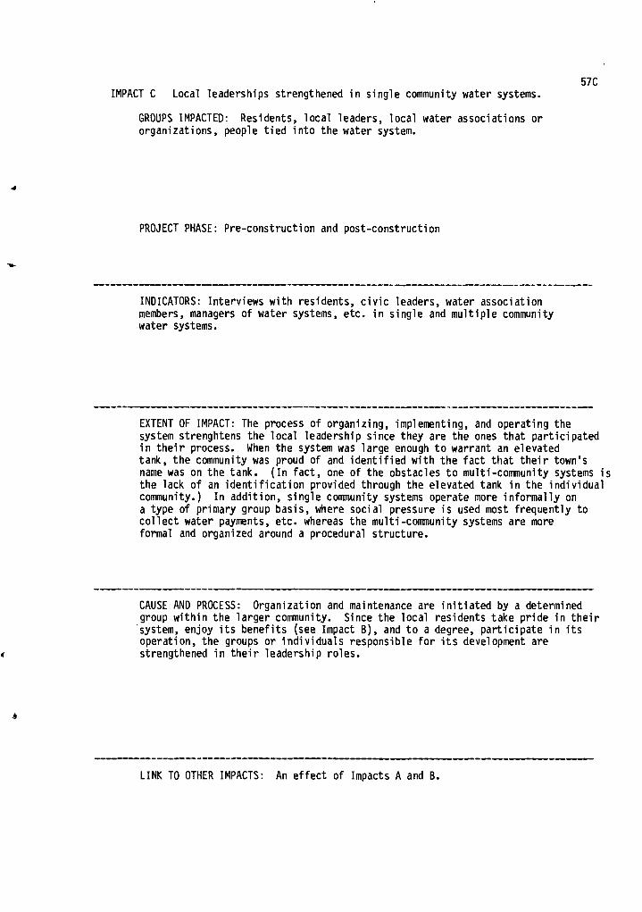
57C IMPACT C Local leaderships strengthened in single community water systems.
GROUPS IMPACTED: Residents, local leaders, local water associations or organizations, people tied into the water system.
PROJECT PHASE: Pre-construction and post-construction
INDICATORS: Interviews with residents, civic leaders, water association members, managers of water systems, etc. in single and multiple community water systems.
EXTENT OF IMPACT: The process of organizing, implementing, and operating the system strenghtens the local leadership since they are the ones that participated in their process. When the system was large enough to warrant an elevated tank, the community was proud of and identified with the fact that their town's name was on the tank. (In fact, one of the obstacles to multi-community systems is the lack of an identification provided through the elevated tank in the individual community.) In addition, single community systems operate more informally on a type of primary group basis, where social pressure is used most frequently to collect water payments, etc. whereas the multi-community systems are more formal and organized around a procedural structure.
CAUSE AND PROCESS: Organization and maintenance are initiated by a determined group within the larger community. Since the local residents take pride in their system, enjoy its benefits (see Impact B), and to a degree, participate in its operation, the groups or individuals responsible for its development are strengthened in their leadership roles.
LINK TO OTHER IMPACTS: An effect of Impacts A and B.

58a
ID# 58
NTIS#
STUDY TITLE Reservation, Reservoir and Self Determination: A Case Study of Reservoir Planning as It Affects an Indian Reservation .
AUTHORS Peterson, John H. Jr. _
INSTITUTION Water Resources Research Institute of Mississippi
BACKGROUND Anthropology
PUBLICATION DATA FUNDING LEVEL FUNDING GROUP
1975 Office of Water Resources Research Department of Interior
STUDY OBJECTIVES
Documentation of a single case study of reservation/reservoir planning.
PROJECT NAME & LOCATION Multipurpose reservoir (Edinburg Dam) proposed for the Pearl River in Vebosha County, Mississippi: 49,100 acres required for the project. (Choctaw own 2,700 within the boundary of the project) 16,000 acre surface area - 18 mi x 3.5 mi.
DESCRIPTION Basin is predominantly rural - City of Jackson is only Urban Center in the Pearl River Basin. Forest 6% of land in basic crops; 14% Pasture; 12% Urban; and other 7% population growing but mainly in Jackson.
e
PURPOSES Flood Control, Water Quality, Recreation, Navigation
PROJECT PHASE DISCUSSED Pre-Construction

METHODOLOGY
GENERAL: Documentation of a single case study - illustrate complexity of water resource development involving Indian tribes.
TECHNIQUES AND DATA USED: Secondary sources, Personal observation
58b
IMPACTS DISCUSSED
A) Lack of involvement of Indian tribe in Reservoir Planning

58A
IMPACT A: Lack of involvement of Indian Tribe in Reservoir Planning
GROUPS IMPACTED: Choctaw Indians, Army Corps, Bureau of Indian Affairs, Mississippi State Government
PROJECT PHASE: Pre-Construction
INDICATORS: Mention of tribe in Corps hearing Mention of Corps in tribe meeting minutes Separate plans for development
EXTENT OF IMPACT: Tribe interested in creating a tourism center allied to a reservoir since 1964. Corps involved in planning for Pearl river Basin Development including the Edinburg project since 1965. Hearings held 1965 and 1970-71. No formal contact between tribe and Corps until 1972.
CAUSE AND PROCESS: 1) Lack of centralized professional planning in tribe leading to only vague plans for developing tourism center. This changed in 1972 with tribal reorganization.
2) No iniatives taken by state agencies, B.I.A. or Corps to ensure involvement of tribe or discern their interest.
3) Corps' overemphasis on informal discussions with certain tribal leaders. Diffuses interest in making formal contact.
A
LINK TO OTHER IMPACTS:

FUNDING LEVEL FUNDING GROUP
Department of Interior - Office of Water Resources Research (in part)
PUBLICATION DATA
January 1973
5c: a
ID# 59
NTIS#
Al
*
STUDY TITLE The Impact of Institutional and Political Factors on Water Management in the Upper Wabash Basin
AUTHORS Quinn, M.C.
INSTITUTION Water Resources Research Center, Purdue University
BACKGROUND Political Scientist
STUDY OBJECTIVES
1) Identify relevant water institutions. 2) Evaluate impact of legal, administrative and political factors on water policy. 3) Assess capability of existing institutions to implement systems approach.
PROJECT NAME & LOCATION Numerous proposals to develop the Wabash River and its tributaries. A cross Wabash Canal linking the Ohio with The Great Lakes--more recreational opportunities and flood control reservoirs.
DESCRIPTION Upper Wabash River Basin of Indiana - much of the northern half of the state - highly mechanized grain farming. Majority of employment in manufacturing, trade and service industries.
PURPOSES Navigation, Flood Control, Water Quality, Recreation
PROJECT PHASE DISCUSSED Pre-Construction
i
4

METHODOLOGY
GENERAL: Exploratory - Description and assessment of application of analytical techniques
59b
•
41P
TECHNIQUES AND DATA USED: Review of public records, Open-ended interviews with 41 individuals highly visible in Wabash River Basin politics; Personal observation
IMPACTS DISCUSSED
A) Opposition to projects Irsed on sensitivity to potential future demands created by projects.
o
-■

59A
IMPACT A: Opposition to projects based on sensitivity to potential future demands created by projects
GROUPS IMPACTED: Businesses near reservoirs, residents of Wabash Basin
PROJECT PHASE: Pre-Construction
INDICATORS: Public statements, Responses to open-ended interview schedule
EXTENT OF IMPACT: People express opposition to various projects: a) Flood control reservoir -"You'll give people a false sense of security;"damage from flood will be greater than otherwise, b) Recreation - Businesses around reservoirs depending on recreation will be hurt when Department on Natural Resources take water away for municipal water supply; c) Water Quality - The reservoirs will merely allow industries a new option for dealing with increasing wastes instead of forcing them to cut down wastes.
CAUSE AND PROCESS: People fear options will be reduced and that unanticipated consequences will ensue, so they oppose development.
LINK TO OTHER IMPACTS:

ID# 60
NTIS# PB 205 248
STUDY TITLE Population Growth in Communities in Relation to Water Resources Policy
AUTHORS Rivkin/Carson, Inc.
INSTITUTION Rivkin/Carson, Inc.
BACKGROUND
60a
-1!
*
PUBLICATION DATA FUNDING LEVEL FUNDING GROUP
October 1971 National Water Commission
STUDY OBJECTIVES
1) Provide a basis for evaluating proposals aimed at influencing future population increases; 2) give a realistic assessment of the role which water resource development could play in creating new cities, spurring economic growth of small cities and improving the quality of life in rural communities.
PROJECT NAME & LOCATION All water resource development projects -- all areas of the country. More specific analysis (by county) of water resource developments, and population change in Georgia.
DESCRIPTION Oregon, Minnesota, and Pennsylvania
PURPOSES Multiple
PROJECT PHASE DISCUSSED Post-construction
l

60b
METHODOLOGY
GENERAL: Use relevant published and unpublished material. Draw on experience in urban and regional development. Selective interviews with federal and local officials and people in the development field. Original statistical analysis.
TECHNIQUES AND DATA USED: Statistical analysis:
a) Tabulation of 1950, 1960, 1970 population figures for 20,000 places and relation to location factors
b) Multiple regression analysis of water resource investment data and population data
c) Analysis of location of federal community oriented water investments
IMPACTS DISCUSSED
A) Water resources investments do not affect population growth
4

60A
IMPACT A: Water resources investments do not affect population growth
GROUPS IMPACTED: 4 states -- Georgia, Minnesota, Pennsylvania and Oregon •
PROJECT PHASE: Post-construction
INDICATORS: Population figures and expenditures of USDA, HUD, FWPCA, DOC, and Corps on water, sewer, waste, treatment, reservoir, channeling and harbor projects.
EXTENT OF IMPACT: Water resources project investment showed no correlation with population growth. Not by location or size of county. Neither SMSA nor least populous counties affected by water resources investment.
CAUSE AND PROCESS: Water resources investment usually comes after the need is recognized, not before. Investment may permit growth, it does not cause it. Growth seems most closely allied to proximity to metropolitan area.
LINK TO OTHER IMPACTS:

PUBLICATION DATE FUNDING LEVEL FUNDING GROUP
61a ID# 61
NTIS#
-11
STUDY TITLE Social Impacts of McClellan-Kerr Navigation System: A Study of Public Sector Response to Water Resource Development
AUTHORS Schaffer, Albert; Schaffer, Ruth C.; and Halter, Gary M.
INSTITUTION Texas A&M University
BACKGROUND
STUDY OBJECTIVES
Study those groups which may have an interest in growth, the relationship between them, the type and degree of growth that is preferred, and the measures taken to achieve these goals. Relate the consequences of the waterway development to the structure and functioning of each community's "growth apparatus."
PROJECT NAME & LOCATION McClellan - Kerr Navigation System, extends from the Mississippi RT70-1-5-Tusla, Oklahoma.
DESCRIPTION The project extends over most of central Arkansas and into eastern DETAW.-Frincipal cities along the river are Pine Bluff, Little Rock, Fort Smith in Arkansas and Muskogee and Tulsa in Oklahoma. Other towns along the system are: North Little Rock, Russellville, Dardanelle, Ozark, Merrilton, Conway, Van Buren and Sallisaw. There are 7 upstream dams and 4 main stem dams in the system. All dams provide hydroelectric power - 3 billion kilowatt hours when completed. Major recreation facilities have been provided at 5 of the 7 upstream lakes and at 9 of the locks and dams. Project authorized in 1946, funds allocated in 1952, and project was completed in 1970. Total cost, $2 billion.
PURPOSES Navigation, hydrolectric power, recreation, conservation, flood control, bank and channel stabilization.
PROJECT PHASE DISCUSSED Pre-construction, construction, and post-construction.

51b METHODOLOGY
GENERAL: The following dimensions are used to explore the relationship of the "growth apparatus" in the various communities for the navigation projects 1) local organizational apparatus, 2) growth strategy 3) type of community, and 4) situational factors. The area's temporal context -- its history, economy, cultural development, and political situation -- are used as backdrops for the project development. The data collection and interviews focused on the policies, decisions, groups, and leader interactions related to the communities' growth, or lack of growth. This process is used to isolate questions and data that might be useful for a predictive model of development for other long-term projects.
TECHNIQUES AND DATA USED: Examined the geographical area surrounding the McClellan-Kerr Navigation System. Towns over 10,000 population were selected for extensive examination: Catoosa/Tulsa, Muskogee (Oklahoma) and Fort Smith, Van Buren, Russelville, Dardanelle, Conway, North Little Rock, Little Rock, and Pine Bluff,(Arkansas). Four smaller towns were examined less extensively. Key leaders were identified via letters -- questionnaires were sent to local bank officials, Chamber of Commerce officials, and newspaper editors/publishers. 36 local/regional leaders were initially identified and interviewed (structured format, lasting 1-3 hours). Over 185 additional names were identified and interviewed during the course of the data collection. Questionnaires were sent to mayors, city managers, etc. to determine role/policies of government in the project development. Questionnaires sent to 169 companies of 30 employees or more to determine industrial growth/status in the area. Examined newspaper files/articles, and reviewed previous studies/reports on the various aspects of the project area. All codable and qualitative data from the interviews was prepared for computer analysis.
IMPACTS DISCUSSED
A) Strong local and state approval and support of the project and the project-induced opportunities.
B) Parochial attitudes of local communities change as new people and industries move in.
C) "Liveability" of areas increased.
D) Increased number of physicians attracted to some of the communities along the waterway .system.
E) Enhanced community and state/regional self-esteem.
F) Increased mobility and a decrease in isolation for some areas due to new bridges and highway access.
G) Helped increase economic stablility, job opportunities, and development options for many of the communities along the system.
H) Increased burden on local services in some communities along the system.
I) Modification and/or creation of local organizations to manage the effects of the waterway project.

61A
IMPACT A: Strong local and state approval and support of the project and the project-induced opportunities.
GROUPS IMPACTED: Residents, civic leaders, businesses, chamber of commerce groups, banks, civic development organizations in the affected towns, and state industrial and commercial recruitment committees.
PROJECT PHASE: Pre-construction, construction, and post-construction.
INDICATORS: Interviews with 250 local community leaders, newspaper editors, publishers, bank officials and civic organization leaders in Arkansas and Oklahoma. Survey of industries located in the affected areas and state activities directed towards attracting industry to the region.
EXTENT OF IMPACT Leaders in each community joined to form a collectivity of local, state, and regional support. Communities contributed written and organized moral support. The Arkansas Basin Development Association joined the interests of Arkansas and Oklahoma to push the project. The project became an official project of the two states. Both governors and the two states' Senators and Representatives supported the project. Monies were appropriated by the states and other public and private oganizations to push the project. The project and the interest groups also had the strong support of the local banks and civic organizations. Local communities and state organizations voted money - bond issues etc. - to build port facilities, set aside land for industrial growth, improved utilities, and established groups to recruit new industry to the areas affected by the water project.
CAUSE AND PROCESS: Citizens' strong desire to control the severe flooding, stop the draught periods, acquire a stable water supply, decrease dependency On agriculture, increase the industrial base, and acquire a navigational system. In addition, the system provided recreational benefits that were previously non-existent, improved the asethetic appeal of the area, stopped silting and bank erosion, and cleaned up the polluted water. Early organization and tenacious support in the face of initial skepticism forged the strong local organizations that fostered the state and regional advocates.
LINK TO OTHER IMPACTS:

61B IMPACT B: Parochial attitudes of local communities change as new people and
industries move in.
GROUPS IMPACTED: Local residents, "outsiders," civic organizations, businessmen, etc. in the affected areas.
PROJECT PHASE: Construction and post-construction
INDICATORS: Interviews with local community leaders, historical analysis of area's attitude towards "newcomers," access to and involvement of these "newcomers" in the local organizations and activities, attitudes of local residents toward them, etc.
EXTENT OF IMPACT: In all the communities studied, with the possible exception of Muskogee, a high level of openness toward and inclusion of newcomers was easily observable. Country clubs in all the smaller communities were open to newcomers. Newcomers opened up new life experiences for many of the local people -- gourmet cooking classes, new ideas, different experiences from having travelled, etc. One Chamber of Commerce had over half of its board consisting of newcomers. There a noticeable transition in some of the communities from a "closed" society to one that was fairly open.
CAUSE AND PROCESS: As new businesses moved people in and out, the communities became more cosmopolitan. The work force mixed; newcomers joined local organizations and clubs -- they "crashed" society and were welcomed. People, especially the young, were more mobile, more open to change. Some leaders in every community preferred that the town remain unchanged, but they were a very small minority. Muskogee tended to have some leaders that were a bit more resistant to change than those in some of the other areas.
LINK TO OTHER IMPACTS:

61C IMPACT C "Liveability" of area increased.
GROUPS IMPACTED: Residents, "newcomers," professionals, visitors, workers -- all those in the waterway project area from Pine Bluff to Tulsa.
PROJECT PHASE: Construction and especially post-construction
INDICATORS: Interviews with local and state leaders, business people and professionals. Survey of the educational, cultural, and recreational' assets of the various communities.
EXTENT OF IMPACT: Although some of the amenities cannot be attributed solely to the waterway project, it certainly played a significant part in stimulating the growth of a number of the "liveability" qualities in the communities along the project. Leaders in numerous communities boasted about their recreational facilities, lakes and riverside parks that had added to their community's assets. Respondents repeatedly stated their surprise at the heavy use of the recreational facilities. There are marinas and yacht clubs along the river (especially in Arkansas). Pine Bluff constructed a civic enter and convention hall on land that was previously flooded. In general, leaders spoke of the ease of leaving the office to hunt, fish, swim, or boat as being the reason for the community's being able to attract and hold industries, professionals, and young people who would previously have gone elsewhere.
CAUSE AND PROCESS: The waterway project helped stimulate and attract industry and industrial growth. Interposed in this cycle are the efforts of the community to bolster its amenities as additional factors in bringing new growth into the area. As a result, many of the added "liveability" factors, are direct results of the project while others may be indirect results of the stimulus that the waterway provided to the area. The small town atmosphere, the ease of moving about, the availability and relative ease of land and home ownership, a good place to raise the children, the nearness of the recreational facilities combined to create a "liveable" situation. Committed leaders with access to resources -- money, organizations, and support -- were also very significant in developing these community characteristics.
I
11.
LINK TO OTHER IMPACTS:

IMPACT D: Increased number of physicians attracted to some of the communities along the waterway system.
GROUPS IMPACTED: Residents, workers, visitors, businesses, other professionals and physicians in the affected areas.
PROJECT PHASE: Construction and post-construction
INDICATORS: Studies on physicians indicating their choices of location -- urban or small town, the facilities, other physicians, desire for amenities, etc.; examined the number and location of physicians for the years 1950-1974, using the AMA statistics and data from local sources.
EXTENT OF IMPACT: Once again, other factors are important in drawing a physician to an area, but the amenities and liveability factors provided or stimulated by the project are significant. The statistics: 1950-1973, 6 of 13 communities had better than an 80% increase in the number of physicians; 3 other towns had no change while 2 had a decrease of physicians. Examining the time period since the navigation system has been constructed, 1969-1973, there has been remarkable growth in 8 communities; 5 communities have shown no growth or a decline.
CAUSE AND PROCESSES: A general increase is due to a host of factors over the 1950-1973 span (see Impact C). But, as the 1969-1973 period indicates, the combination of the opportunities provided by, or indirectly influenced by, the navigation system has provided the type of cultural, economic, and aesthetic setting amenable to - physicians.
LINK TO OTHER IMPACTS: A partial result of Impact C.
61D

61E
IMPACT E: Enhanced community and state/regional self-esteem
GROUPS IMPACTED: Citizens of the project area, local and state leaders, political figures, civic organizations and civic leaders.
1
PROJECT PHASE: Construction and post-construction
INDICATORS: Survey of the community, business and "water" leaders -- about 250 interviews -- asking what they felt was the major social change resulting from the water project.
EXTENT OF IMPACT: 20% of the leaders listed as the primary change occurring as a result of the project, the development of a new esprit de corps toward change - it was a "psychological revitalization of the area." Before there was a willingness to "just survive," rather than encourage growth and an "influx of people creating problems." The development convinced many local leaders and citizens that their community now had certain assets which opened the possibility for a promising future. -
CAUSE AND PROCESS: All the communities had an image problem. Outsiders, corporations, etc. viewed them as "Okies," "hillbillies," or racists (school integration problems of the 1950's). "The way others view us affects the way they treat Us and the way we treat each other." The influx of construction workers, the exposure of the local resident to the "outsider" and the subsequent industrial and population growth did much to dispel the stereotypes held by both sides. The region opened up to new people, new ideas, and a new concept of the "world outside." Attitudes changed. (See Impact B)
4

IMPACT F: Mobility and a decrease in isolation for some areas due to new bridges 61F and highway access.
GROUPS IMPACTED: Residents of rural areas that lacked roads or bridges across the river. Residents, businessmen, local leaders, and civic organizations.
PROJECT PHASE: Construction and post-construction
INDICATORS: Interviews with local and civic leaders, newspaper editors/ publishers, and businessmen.
EXTENT OF IMPACT: Creation of new bridges opened up areas to cities where people had been previously isolated. Highway access to the interstate from some of these areas opened up new job opportunities, shopping, and other benefits of the surrounding cities and towns. In the other direction, some of these areas were opened up for non-farm or residential development. In Conway, Ark., no bridge existed before the project -- the new bridge opened up the isolated area across the river as a potential labor source and a new, quickly felt, marketing area.
CAUSE AND PROCESS: Local leaders in the communities along the project consulted with the COE, their congressmen, the highway department, and other federal agencies in Washington to plan bridges over the river. 23 highway bridges were completed -- 13 in Arkansas and 10 in Oklahoma. 3 new bridges are planned in Arkansas.
LINK TO OTHER IMPACTS:

IMPACT G: Helped increase economic stability, job opportunites, and development options for many of the communities along the system.
GROUPS IMPACTED: Young people, unemployed, businessmen, civic organizations, and community leaders, general population of the areas, and people moving into the area.
PROJECT PHASE: Construction and post-construction
INDICATORS: Survey of community and "water" leaders, Chamber of Commerce, leaders, bankers, businessmen, and industry leaders in the project area. Examination of past and present population, economic and industrial trends in the larger towns and communities along the waterway.
EXTENT OF IMPACT: The range and degree of port, recreational, or industrial development stimulated by the navigation system varies widely from city to city. 3 public ports and 2 private ports have been built in Arkansas. 2 public ports have been built in Oklahoma. Investment in the Tulsa port is about $70 million and employing almost 1000 people by 1977. A number of companies have located on or near the port facilities in order to make use of the navigation system. Confidence in the water system stimulated growth -- construction, new businesses, etc. in the area. Growth in the other major towns and cities, as a result of the project, has not been quite as dramatic, but from Tulsa to Pine Bluff, expansion or creation of port facilities, creation of industrial parks, recruitment of new industry to take advantage of the navigation system and development of recreational • facilities have created jobs, additional income for the communities, and population growth and/or stability for the areas adjacent to the system. In 1975, tourism added $121 million to the 7-county area adjacent to the system in Western Arkansas.
CAUSE AND PROCESS; The direct improvements that the system provided, a navigable river, asethetic appeal, recreation etc., fostered the confidence of the local and state leaders, industrial development agencies, committees, port authorities, local chamber of commerce groups and a host of other private and public organizations to actively recruit new industries, invest in building or upgrading port facilities, and in general, expand the commercial and industrial base to take advantage of the water system. Economic and growth policy concensus in most of the communities also allowed and fostered a coherent push for
- development, new jobs, etc. 30% of the leaders felt that there were differences of opinion over growth/ no growth issues among different civic groups or interests. Cheaper freight-shipping rates resulting from barge travel made transportation of goods significantly cheaper -- for steel at one plant (Whirlpool - Fortsmith) the saving was $1 million a year. This may also have acted as an inducement for growth near the port cities.
61G
LINK TO OTHER IMPACTS:

61H IMPACT H: Increased burden on local services in some communities along the
system.
GROUPS IMPACTED: Taxpayers, new industries, planners, city officials, businessmen, landowners, etc. in the affectd towns.
PROJECT PHASE: Construction and post-construction
INDICATORS: Interviews with city officials, examination of the state and local tax and financing structures and the expenditures generated or required by the system or the growth stimulated by the system.
EXTENT OF IMPACT: The extent of impact varies from city to city, depending upon the tax structures, financing mechanisms, private vs. public support of projects, etc. In general, cities in Oklahoma and Arkansas both have had difficulty in meeting the demands on the municipal services. Arkansas more so than Oklahoma. Many of the cities had to upgrade their sewage systems and water supply systems earlier and more extensively than would have otherwise been necessary. Secondary treatment facilities must be installed in Pine Bluff and Dardanelle. Water systems improvement and construction of the port facilities are added examples of demands on local governments as a result of the water system development. Increased fire protection for additional industrial growth was needed in Van Buren. Tulsa experienced the least difficulty in meeting the demands. The greatest relative burden seemed to fall on the smaller communities. Sallisaw did not want to hurt their bond rating by spending money to develop a port facility. Hard for smaller towns to spend money for such facilities when future benefits are speculative. Dardanelle has had to stop or withhold a number of applications for building permits -- it cannot supply water and sewer services to the new areas.
CAUSE AND PROCESS: The population, economic and industrial growth stimulated by the navigation system forced local governments into improving or adding on to their present services. In addition, federal regulations required treatment plants for the communities along the waterway. The added expenditures for meeting the services and standards have been, in many cases, far more than the property or franchise taxes taken in. Due to the restrictive nature of the Arkansas tax guidelines -- limiting expenditures for certain services and placing a ceiling on property tax rates -- and other funding problems, it was harder to raise the capital to meet demands for additional services.
qt.
i
LINK TO OTHER IMPACTS:

611 IMPACT I: Modification of and/or creation of local organizations to manage the effects
of the waterway project.
GROUPS IMPACTED: Civic organizations, businesses, local leaders, residents, and workers in the numerous communities, investors and industries.
s.
-A,
A
PROJECT PHASE: Pre-construction, construction, and post-construction
INDICATORS: Examination of the changes in the numerous communities over time -- interviews with "water" leaders, newspaper editors/publishers, businessmen, and civic organization leaders.
EXTENT OF IMPACT: Port authorities, international trade associations, port operators association, riverfront development organizations were formed to manage and stimulate the development of the navigation system and the related industrial growth. Organizations already existing in the communities were also affected -- Chamber of Commerce, the industrial development agencies, planning committees, etc., the influx of new people also effected change within the organization as newcomers joined and helped direct activities (see Impact B). In some communities, such as Muskogee, conflict resulted from disagreement over scale and scope of growth policies. The modification of the local organizations also included increased reliance on "specialists" to handle the problems and management of the development organizations.
CAUSE AND PROCESS: The strong desire in many of the communities along the system for economic and industrial growth caused the establishment of special groups to direct and recruit the desired industries, build the facilities, manage their operations, and coordinate the area's growth. In turn, long-standing organizations were also modified to manage the overall community response to population, economic, industrial and cultural growth, as well as increased demands for municipal services (see Impact H). The increasing complexity of these problems fostered the reliance on "experts" to manage many of these activities.
LINK TO OTHER IMPACTS:

STUDY TITLE Recreation Use Patterns
AUTHORS Shew, Richard L., and Werner, Michael P.
INSTITUTION Department of Forestry and Range Management, Washington State University, Pullman, Washington
BACKGROUND Forestry and Range Management
PUBLICATION DATE FUNDING LEVEL FUNDING GROUP
March 1976 Dept. of Interior - Office of Water Resources Research
STUDY OBJECTIVES
1) conduct a base study on the recreation uses and users 2) gather socio-economic data pertaining to the recreation users of the Snake River
Canyon within the study area 3) determine the recreational activities and use patterns within the defined study area 4) identify and describe the types of recreation users in the area based on their
attitudes towards recreation 5) correlate the activities and use patterns with the socio-economic data
62a /
ID# 62
NTIS#
PROJECT NAME & LOCATION Lower Granite Dam, lower Snake River, Washington
DESCRIPTION One of four dams on the lower Snake River. The Lower Granite Dam is the last ot the tour to be built. It will create a reservoir 39 miles up the Snake River and 5 miles up the Clearwater River at their confluence. The surface area will be 8,900 acres with a total of 12 public parks and lake access points on a total of 400 acres of recreation land. 43 miles of public road and 39 miles of railroad will have to be relocated. The area has traditionally been used by recreationists who seem to prefer undeveloped natural areas.
PURPOSES Provide slackwater navigation for ships and barges from the Pacific Ocean to rugrufi, Idaho; power and recreation.
PROJECT PHASE DISCUSSED Construction

METHODOLOGY 62b
GENERAL: Two general basic purposes: 1) provide a recreation data base that can serve as a basis for comparison
of future studies completed after the dam is finished, and 2) assist managers by providing current recreation data for the immediate
planning and administration of recreation in this area.
...
TECHNIQUES AND DATA USED: Traffic counters, personal interviews, observation and questionnaires were used. Mechanical traffic counters and personal interviews were performed at the seven main access routes into the area. A total of 123 study days were randomly selected from the various stations and the week days and weekends. At the access checkpoints, vehicles except for construction traffic, were briefly stopped and given questionnaires, etc. to mail back. A range of data from personal characteristics - age, education, etc. to level and type of recreational use of the area, to opinions was included in the packets. A total of 3,239 questionnaires were distributed. About 2,000 were returned for a return rate of 62-64%, The information was put on data cards for use in the TAXIR program along with a Fortran program that was developed for the study.
IMPACTS DISCUSSED
A) A majority of people feel that the project will produce a negative impact on their recreational enjoyment of the area.
A

62A
IMPACT A: A majority of people feel that the project will produce a negative impact on their recreational enjoyment of the area.
GROUPS IMPACTED: Recreational users of the area, visitors, sightseers, etc. and residents of the area.
PROJECT PHASE: Construction
INDICATORS: Questionnaires distributed to residents of the area, visitors, and recreationists using the area. Response to the question, "How do you feel the reservoir will affect your recreational enjoyment of the area?" Another question used was:"How would you rate the future recreation opportunities on portion of the Snake River?"
EXTENT OF IMPACT: 19.3% felt the project would detract from their recreational enjoyment of the area and 36.5% felt it would greatly detract from their enjoyment of the area. 15.8% felt there would be no ettect. Unly 14.5% felt it would improve their enjoyment while 9.7% felt it Ourd—Viatly improve their recreational enjoymentof the area. 52.1% thought that —TRUFe FEEFUNEinn opportunities would be good to excellent while 23.2% thought they would be poor to very poor. 17.6%—saw them as being fair.
CAUSE AND PROCESS: The sample population was well satisfied with the existing recreational opportunities. 50.6% of the sample felt that the present recreational opportunities were good to excellent while only 18.1% thought they were poor to very poor. 27%—feTf—they were fair. 36.9% of the sample felt the lack ot dEVETLIWER was the most important item for the enjoyment of the area. 57% felt that the scenery, wildlife and fish were the items most important to the area. It was felt that the dam would affect all of these things.
1.
LINK TO OTHER IMPACTS:

PUBLICATION DATA FUNDING LEVEL FUNDING GROUP
February 1975 Dept. of Interior (in part)
STUDY OBJECTIVES
Developing systematic procedures for assessing environmental impacts of a public project from a sociological perspective.
63a ID# 63
NTIS#
...
STUDY TITLE Kona Dam vs. Konatown: A Sociological Interpretation of Selected Impacts of Reservoir Development on a Community Field
AUTHORS Singh, Raghu N. (Kenneth Wilkinson -- Consultant)
INSTITUTION Department of Sociology and Anthropology, East Texas State University
BACKGROUND Sociology and Anthropology
PROJECT NAME & LOCATION Kona Dam -- one of the largest watershed development projects in Process in East Texas.
DESCRIPTION
Konatown -- pseudonym for a town 75 miles northeast of Dallas (population 2,000) in a county with no urban population.
Konatown is the biggest town. Median age 2 times U.S. average, economically poor, low education levels. Konatown formerly a trading center for local cotton planters. With mechanization many have left and gone to Dallas, A decaying rural town.
A
PURPOSES 1) Flood control; 2) municipal and industrial water supply; 3) water quality control; 4) recreation
PROJECT PHASE DISCUSSED Prior to final construction [hope to conduct another study in 5 years after dam is completed].
METHODOLOGY
GENERAL: 1) Systematic analysis of action process (Kona Dam) intended to alter or change environment
2) In depth study of selected aspects of community field (Konatown) that was to be most affected
3) Study interaction between action processes and community field and their impacts on each other.
A microscopic approach (qualitative, social field-community oriented analysis).
63b
l
TECHNIQUES AND DATA USED: 1) "Action Guide" -- questionnaire (open-ended) on initiation, implementation, and achievements -- submitted to 16 leaders
2) Content analysis of local newspaper 3) Official records 4) Delphi on goals, past and future impacts,
and alternatives submitted to selected "experts" -- influential leaders and professional experts on dam (technicians)
5) survey of Konatown residents [random sample] through interviews -- 166 people interviewed
IMPACTS DISCUSSED
A) Favorable public reaction
B) Limited community conflict
C) Increase in residential mobility
I

86% agree entire community will benefit, 90% agree that economic and other benefits are far greater than environmental consequences. 75% strongly favor the project, 12% moderately favor it.
EXTENT OF IMPACT:
63A
IMPACT A: Favorable public reaction
GROUPS IMPACTED: Impacts on individuls tied to following variables 1) large household; 2) male; 3) married; 4) in a high prestige occupation; 5) have belonged to high income bracket; 6) a highly valued home; 7) low use of community services; 8) active in community organizations; 9) high level of knowledge about project. Impact not related to age, race, education, attitude toward ecology movement, years in community, or level of satisfaction with services.
PROJECT PHASE: Pre-construction
INDICATORS: Responses to survey questions
CAUSE AND PROCESS: Primary emphasis of favorability is economic. More industry will come. Business opportunities, more jobs, and helping economy in general were frequently mentioned impacts. Most often people did not know the specific impacts of the dam; they felt though that they would be favorable. Most favorable people -- young whites in higher income brackets who are satisfied with community services.
LINK TO OTHER IMPACTS:

63B
4
IMPACT B: Limited community conflict
GROUPS IMPACTED: Knowtown ledership and residents
PROJECT PHASE: Pre-construction
INDICATORS: Responses to open-ended survey questions; hostility towards an influential figure identified with trying to stop the project.
EXTENT OF IMPACT: Several name banker "x" as conflict producing. Several label community organizations as incompetent. Many feel community leadership has failed. Asked to name organizations supporting the Dam, of the 13 named, only 4 were from Konatown.
CAUSE AND PROCESS: Project has been delayed by internal community conflicts; outside organizations have overshadowed local groups making local leadership look bad.
•
LINK TO OTHER IMPACTS: High favorability combined with delays heightens sense of alienation and dissatisfaction with community leadership.

Many people have moved to the west side of town. New housing development increasing desertion of central town residences. 68 families moved from reservoir area. 78% moved to Konatown. Most built on West Side in new housing development.
EXTENT OF IMPACT:
63C
IMPACT C: Increase in residential mobility [shift in residential patterns]
GROUPS IMPACTED: See Impact A
PROJECT PHASE: Pre-construction
INDICATORS: Official records
CAUSE AND PROCESS: Dam is on the west side [population in Konatown stabilizing while county population is decreasing].
LINK TO OTHER IMPACTS:

ID# 64
NTIS# PB 192 636
STUDY TITLE Anticipations of Change: A Socio-Economic Description of a Kentucky County Before Reservoir Construction
AUTHORS Smith, Charles Robert
INSTITUTION Water Resources institute, University of Kentucky
BACKGROUND Anthropologist
PUBLICATION DATA FUNDING LEVEL FUNDING GROUP
1970 Dept. of Interior -- Office of Water Resources Research
STUDY OBJECTIVES
Part of a larger study of three drainage areas in Kentucky now under consideration for stream control projects -- social benefits and costs of each phase of reservoir development. Specific study: baseline data on one of the areas and data on the incipient impact of the proposed reservoir.
PROJECT NAME & LOCATION Black River Reservoir -- in Walnut County in Central Kentucky. Study for dam proposed to Congress by the Corps in 1964. Idea around for 5 years.
DESCRIPTION Walnut County -- Rich bottom lands good for tobacco and corn. Hillsides good for cattle grazing. Predominantly an isolated farming community. Population decreasing and no direct access to interstate system. Small, well-integrated population. Most people born and raised there.
PURPOSES Flood control
PROJECT PHASE DISCUSSED Pre-construction

METHODOLOGY
GENERAL: Ethnographic analysis: informal discussions with local residents, review of secondary materials, participant observation
64b
)
lr
TECHNIQUES AND DATA USED:
IMPACTS DISCUSSED
A) Economic benefits foreseen
B) Limited expectation of flood control benefits
C) Anxiety over relocation
A D) Fear of undesirable changes
E) Perceived necessity for County initiative

Many believe that the reservoir is their only salvation. Business is not growing. Economic benefits most widely mentioned.
EXTENT OF IMPACT:
64A
IMPACT A: Economic Benefits foreseen
GROUPS IMPACTED: Local merchants of Walnut County
PROJECT PHASE: Pre-construction
INDICATORS: Comments made to researchers
CAUSE AND PROCESS: Reservoir will be in the midst of a triangle formed by three urban areas. Money brought in by tourists and new permanent residents will turn'over 7 times in the county and thereby help everyone.
LINK TO OTHER IMPACTS:

A few farmers mention the flood control benefits they will receive from reservoir construction. Flood control is mentioned primarily by farm people.
EXTENT OF IMPACT:
648
IMPACT B: Limited expectation of flood control benefits
GROUPS IMPACTED: Farmers of Walnut County
PROJECT PHASE: Pre-construction
INDICATORS: Comments to researchers
CAUSE AND PROCESS. Farmers favor project but are reluctant to be too vocal because some of their friends will be relocated by the project.
LINK TO OTHER IMPACTS:
1

Most are resigned to the fact that the dam will be built. Question is when and how much will they receive. General feeling of not being able to plan the future. Fear of not being able to purchase an equivalent piece of land. Older people have been particularly affected -- one man suffers a stress-related stroke, an elderly couple "loses the will to live" as a result of anxiety over the dam.
EXTENT OF IMPACT:
64C IMPACT C: Anxiety over relocation
GROUPS IMPACTED: 50 families to be relocated; their friends and relatives in the area
PROJECT PHASE: Pre-construction
INDICATORS: Comments of the people to be relocated: stress related health problems attributed to relocation
CAUSE AND PROCESS: Corps' procedures for acquiring land cause great uncertainty. Fear of rising land costs and housing shortage in Walnut County exacerbate the situation. Many people will have to give up homes they have lived in all their lives.
LINK TO OTHER IMPACTS:

64D IMPACT D: Fear of undesirable changes
GROUPS IMPACTED: Residents of Walnut County especially those to be relocated and older residents
•
PROJECT PHASE: Pre-construction
'0.
INDICATORS: Comments to researchers
EXTENT OF IMPACT: Wide range of fears: well integrated community life will suffer, county will go wet, little economic benefit, harm to agricultural productivity, destruction of natural beauty of area.
4
CAUSE AND PROCESSES: Several causes -- physical fact of the reservoir --
1) Will take away valuable farm land 2) Will attract undesirable elements of
neighboring urban 3) Land prices will rise, making it difficult
to relocate 4) Strain limited resources of the county --
little room to grow. .
LINK TO OTHER IMPACTS: Counter to Impact A

64E IMPACT E: Perceived necessity for county initiative
GROUPS IMPACTED: Residents of Walnut County
PROJECT PHASE: Pre-construction
INDICATORS: Comments to researchers
*
1r
EXTENT OF IMPACT: a) Need to expand school programs and possibly build a new school. b) Government structure will have to become more professional.
CAUSE AND PROCESS: a) Influx of students from urban areas as people are attracted by the dam.
b) Increased tax revenues and problems associated with migrants and tourists.
LINK TO OTHER IMPACTS: Outgrowth of Impact D.
a

FUNDING LEVEL FUNDING GROUP
Dept. of Interior -- Office of Water Resources Research (in part)
PUBLICATION DATA
January 1973
65a
ID# 65
NTIS# PB 224-833
STUDY TITLE Social and Cultural Impact of a Proposed Reservoir on a Rural Kentucky School District
AUTHORS Smith, Charles (Preface by Phillip Drucker)
INSTITUTION University of Kentucky Water Resources Institute
BACKGROUND Anthropology
STUDY OBJECTIVES
Project: The impact of a new reservoir on the public school system of an area-Spencer County. 1) Describe basic cultural and social differences between Spencer and Jefferson (Louisville) County schools; 2) define major differences; 3) make recommendations -- reduce or avert conflict likely to be created.
PROJECT NAME & LOCATION Taylorsville Reservoir proposed for the Salt River, 25 miles Southeast of Louisville, 60 miles West of Lexington. 300 acre multipurpose reservoir.
DESCRIPTION Taylorsville, predominantly rural and agricultural, some commuting for Louisville from other parts of Spencer County.
PURPOSES Flood control and recreation
PROJECT PHASE DISCUSSED Pre-construction

METHODOLOGY
GENERAL: Anthropological -- Malinowski's functional theory -- culture is an organized whole, institutions are the basic unit of organization. Focus on school's material apparatus, personnel organization, activities, linkages to the community charter, and perceptions of the purpose of education.
65b
A
TECHNIQUES AND DATA USED: Existing quantitative data from Kentucky Department of Education. Quantitative and subjective data from interviews with school administrators and teachers in Jefferson and Spencer Counties. Participant observation -- Smith lives in Spencer County and participates in local activities. Made numerous visits to observe schools in both counties.
IMPACTS DISCUSSED
A) Anxiety over impacts of construction on school districts.
•

During 1968 and 1969 several residents of the county expressed concern about the impact of the proposed reservoir on the local institutions -- especially the school district. Spencer County School Board authorized Smith to make the study, gave him full access to records and affording him extensive cooperation. Their condition -- . supply the Board with the results of his study.
EXTENT OF IMPACT:
65A
IMPACT A: Anxiety over impacts of construction on school district.
GROUPS IMPACTED: School board of Spencer County, teachers and residents of Spencer County
PROJECT PHASE: Pre-construction
INDICATORS: Comments made to researchers. Request for results of the study.
CAUSE AND PROCESS: Concern over the impact of the anticipated influx of new pupils from nearby Louisville as people move to be nearer the reservoir and within commuting
. distance of Louisville. Lack of knowledge about the nature of the urban school district from which many new pupils would be coming.
LINK TO OTHER IMPACTS:

STUDY TITLE Self Interest Groups and Human Emotion as Adaptive Mechanism
AUTHORS Smith, Courtland L.
INSTITUTION Oregon State University, Corvallis
BACKGROUND Anthropology
FUNDING LEVEL
ID#
NTIS#
66
PUBLICATION DATE
1974
FUNDING GROUP Office of-WITUMKTOces Research, U. S. Department of Interior
66a
STUDY OBJECTIVES
Examine the ideological and social factors, in the form of self-interest energized by emotional commitment, that were determinants of how technology of water development was employed.
PROJECT NAME & LOCATION Salt River Project in Arizona and Willamette Valley Project TrUllq-c5n.
DESCRIPTION The Salt River project was begun in 1903. The product of that program was TWATBM-elt Dam in the Tonto Basin. At the time, it was the largest stone masonry dam in the world. The Willamette project was developed between 1936 and 1970. The COE spent over a half billion dollars on flood control works. 13 major flood control dams, revetments, channel improvements, and other improvements were performed under the development plan. In 1920, the COE presented an updated plan for 14 multiple purpose projects costirig $268 million, plus another $100 million for flood control and navigation. Numerous other federal agencies and bureaus also submitted plans for the valley. A joint effort of $2 billion was proposed.
PURPOSES. Salt River - Irrigation. Willamette - Flood control
PROJECT PHASE DISCUSSED Pre-construction

4
661;: METHODOLOGY
GENERAL: Reviewed the adaptation to water development in two case study areas Emphasis on the social and ideological factors of self-interest with strong emotional commitments that are brought to bear through action-oriented self-interest as important elements in starting or planning water development projects.
TECHNIQUES AND DATA USED: Interviews, examination of: voting behavior, testimony at public meetings, attitudes, allocation of time and allocation of personal resources, etc. of the individuals that formed the interest groups in the two case study areas. Note: for the purposes of this review, we shall concentrate on the impacts examined for the Willamette project in Oregon.
IMPACTS DISCUSSED
A) A changing perception of water development "benefits" led to opposition to further development in the Valley.
B) Varying levels of activity among people opposing the proposed project.
..C) Citizens of the Valley generally apathetic towards the project issue.
D) Some residents were critical of the "outside" intervention in the issue.

66A
IMPACT A: A changing perception of Water Development "Benefits" led to opposition to further development in the valley.
GROUPS IMPACTED: Residents of the Willamette Valley, environmental groups, proponents, and opponents of the proposed river development plan.
PROJECT PHASE: Pre-construction
INDICATORS: Statements by proponents and opponents of the proposed plan, examination of the environmental movement and organizations involved in the development issue.
EXTENT OF IMPACT: The Willamette Valley Project committee had acted as the principal liason between the public and the water development agencies from 1935-70. Its base was a group of representatives from small communities who desired development in their areas. But it was not a broad representation of labor, business, industry, and the environmental interests, especially the last group. This group vigorously argued that the best use of the South Santiam River was as a free flowing stream. They contended that the proposed benefits were over enumerated, that there was strong public sentiment for no development, and that flood plain zoning provided sufficient protection. By May, 1970, it was clear that the basin developers were out of touch with the variety of self interests they had labeled "public interests." Furthermore, they had failed to include these interests in the decision-making process.
CAUSE AND PROCESS: The traditional community contact had not kept in touch with the shifting needs of the various interests it was supposed to represent and speak for. There was increased emphasis on concern for the environment; locally, state and nationwide. New environmentally oriented organizations were formed in the area. Three of these groups linked to stop construction of the Cascadia Dam on the South Santiam River, a tributary of the Willamette. Damming rivers was no longer viewed as the only or best way to enhance the value of an area by an active segment of the population. Surveys made in the valley (1968-72) showed a strong and growing anti-development sentiment among Valley residents. They also voted, in 1970, to support water pollution control bonds and a scenic waterways proposal.
LINK TO OTHER IMPACTS: Examine this impact in light of Impacts B, C, and D.

66B IMPACT B: Varying levels of activity among people opposing the proposed project.
GROUPS IMPACTED: Opposition forces, proponents, and all other residents and business, factories, etc. located in the affected area.
PROJECT PHASE: Pre-construction
INDICATORS: Interviews, analysis of the numbers of people involved in the opposition and to what degree they were active.
EXTENT OF IMPACT: The structure of the self-interest group, in this case an opposition group, consisted of three basic levels or major roles. There were the activists, those most strongly committed to the issue and most active in terms of time, energy, and resources for reaching success. Then came the legitimizers, those who acted like a policy making body. The largest group was the advocates. they gave their general support, and, at times, their money, to help the cause. !he Uregon Environmental Council, one of the opposition groups, had 8-10 activists, 30 legitimizers, and 1,800 advocates in 1972.
CAUSE AND PROCESS: Those whose self interests are threatened, or those who feel very strongly about an issue will become the emotionally committed actors that overcome the reasons for not acting. They recognize the problem and are willing to accept responsibility for dealing with the problem. The legitimizers are people whose roles are identifiable with the public at large and who will add prestige to the positions of the activisits. The advocates support the position of the group to the extent of passive assistance.
LINK TO OTHER IMPACTS: Related to Impacts A, C, and D.

66C IMPACT C: Citizens of the Valley generally apathetic towards the project issue.
GROUPS IMPACTED: Opponents, proponents, and general citizenry of the Willamette Valley. Civic leaders and water development agencies also affected.
PROJECT PHASE: Pre-construction
INDICATORS: Interviews with advocates and derogates (opponents) in the project conflict.
EXTENT OF IMPACT: The Oregon Environmental Council's membership was less than 1% of the state's population. Discussion of public apathy was common among the local environmental councils also. The general apathy was a problem that both sides had to confront. Note: this also illustrates the impact that a small group of committed individuals can have on the decision-making process and outcome.
CAUSE AND PROCESS:
LINK TO OTHER IMPACTS: Related to Impacts A, B, and D.

IMPACT D: Some residents were critical of the HoutsideH intervention in the issue. 66D
GROUPS IMPACTED: Extra-local interest groups, local residents, supporting and opposition groups.
PROJECT PHASE: Pre-construction
INDICATORS: Interviews with local citizens and officials of the agencies proposing the development plans.
EXTENT OF IMPACT: In 1970, the Willamette Valley electorate voted in a measure to provide water pollution control bonds and a scenic waterway proposal. This voting behavior was an indicator to decision makers of public sentiment regarding water development. The derogates, or opponents, of the development plan pointed to outsiders among the advocates. The mayor of Sweet Home, the town closest to the river, felt that the group advocating the scenic waterways designation was "made up almost entirely of persons who live outside Linn County . . . who don't understand the facts of the situation." Another local resident felt that, "we are being victimized by a bunch of professional protestors . .
CAUSE AND PROCESS: In the late 60's and early 70's, a national, state, and local awareness of and concern for the environment reached its peak. During this period, urban and suburban-oriented concern for the environment manifested itself in environmental groups. These groups formed active committed interest groups that injected themselves into a number of areas and concerns. The Willamette Valley development plan was one such area and concern.
LINK TO OTHER IMPACTS: Interesting impact when related to the other 3 impacts.

ID# 67
NTIS# PB 197-672
STUDY TITLE Socio-Economic Study of Multiple Use Water Supply Reservoirs
AUTHORS Ralph Stone and Company, Santa Monica, California
INSTITUTION Ralph Stone and Company, Santa Monica, California t
BACKGROUND Private contracting firm
67a
4 4
PUBLICATION DATA
January 2, 1971
FUNDING LEVEL FUNDING GROUP
Dept. of Interior -- Office of Water Resources Research
STUDY OBJECTIVES
1) Identify major incremental socio-economic costs and benefits. 2) Determine if costs related-to any use were inimical to water supply function. 3) Develop decision-making formulations based on socio-economic cost-benefit analysis. Better integrate recreation and water supply in multipurpose reservoir planning.
PROJECT NAME & LOCATION
DESCRIPTION
4 California Reservoirs: 1) Lake Berryessa -- between San Francisco and Sacremento -- finished 1957; owned by Bureau of Reclamation; 576 square miles drainage area; 20,700 acre area. 2) Lake Casitas -- northwest of Los Angeles; finished 1959; owned by Bureau of Reclamation; drainage area -- 39 miles; area 2,710 acres. 3) Lake Elsinore -- Southwest of Los Angeles; owned by public; 717 miles drainage area; area -- 2,000 acres; 8 1/4 miles perimeter. 4) Lake Matthews -- West of Los Angeles -- completed 1938; owned by Metropolitan Water District; 40 miles drainage area; area -- 2,750 acres; 17 miles perimeter.
.,..
PURPOSES a) Berryessa -- water supply and recreation -- uses including body contact b) Caistas -- water supply and recreation (no body contact) c) Elsinor -- recreation (aesthetic only) d) Matthews -- water supply only

67b
.f.
PROJECT PHASE DISCUSSED Post construction
METHODOLOGY
GENERAL: Develop a benefit/cost model pertinent to water supply/recreation regulatory decisions that includes appropriate weighing of social factors. Use comparison of 4 reservoirs with varying levels of recreation. Primarily economic cost/benefit relating to recreation benefits and costs and land values. Two tasks relate to social impact: social factor weighing in the model and a nationwide survey of experience relating to reservoir recreation.
TECHNIQUES AND DATA USED: 1) Social factor weighting: questionnaire given to principal officials of agencies concerned with management and regulation of the reservoirs (n=56). Asked to weight 15 beneficial uses of the reservoir on a scale from 1-10.
2) Nationwide survey -- Information Data Survey Form sent to sanitary engineers or environ-mental health offices of state health departments. Questions on state policies, experience with reservoir management, key problems, personal opinions on factors causing degradation of the reservoir.
IMPACTS DISCUSSED
A) Perceptions of benefits vary with reservoir type
B) Reservoir recreation does not cause major problems for management
C) Different activities perceived as having different effects on water quality
-4
t

6M IMPACT A: Perceptions of benefits vary with reservoir type
GROUPS IMPACTED: Principal officials of reservoir related agencies of 4 reservoirs studied
PROJECT PHASE: Post-construction
INDICATORS: Responses to questionnaire
EXTENT OF IMPACT: Respondents tended to weigh most highly those activities permitted at their reservoir.
CAUSE AND PROCESS:
.c.
,..._
A
.).
LINK TO OTHER IMPACTS:

67B IMPACT B: Reservoir recreation does not cause m4jor problems for management
GROUPS IMPACTED: Sanitary engineers/environmental health officers of the 50 states.
4
PROJECT PHASE: Post-construction
1'
INDICATORS: Responses to questionnaire on problems encountered.
EXTENT OF IMPACT: Of the 39 states permitting recreational reservoir uses, 21 report no or only few problems. Major problems cited: land pollution, management inadequacies, and conflicts of interest (fishing vs. potable water, controlled subdivisions vs. uncontrolled increasing use).
CAUSE AND PROCESS: Few problems because of complete treatment of water, good control of the reservoir area and large amount of surface water in the area.
i.
_.
LINK TO OTHER IMPACTS:

67C IMPACT C: Different activities perceived as having different effects on water
quality.
GROUPS IMPACTED: Sanitary engineers/environmental health officers of 50 states.
PROJECT PHASE: Post-construction
INDICATORS: Responses to question on what contributes most to degradation of water quality.
A-
it
EXTENT Of IMPACT: 75% judge hunting, fishing, and sailing having little or no impact, 53.7% put picnicking in the same category. 75-83% judge camping, motor boating, swimming, and waterskiing in the low to moderate range. Agreement stronger on effects of hunting, fishing, and sailing than on camping, boating and swimming.
CAUSE AND PROCESS:
4
..t.
LINK TO OTHER IMPACTS:

PUBLICATION DATE FUNDING LEVEL
Water Resources Research 5(6) December, 1969
FUNDING GROUP
Wisconsin Bureau of State Planning through a grant from HUD
STUDY OBJECTIVES Identify some of the effects of a small watershed work plan upon the Coon Creek watershed in Wisconsin. Focus on the response of farmers' land use practices to an actual and anticipated change in flood frequency.
4
68a
ID# 68
NTIS#
STUDY TITLE Effects of Flood Protection on Land Use in the Coon Creek, Wisconsin watershed
AUTHORS Theiler, Donald F
INSTITUTION Wisconsin Bureau of State Planning, Madison
BACKGROUND
PROJECT NAME & LOCATION Coon Creek Watershed, Southwestern Wisconsin
DESCRIPTION Watershed has an area of 92,589 acres, of which about 40,000 acres are included in the work plan area. The mean gradient is 17 feet per mile from its headwaters to the the Mississippi. The area is largely rural with 3 small villages located along the stream. Project consisted of 14 structures built between 1960 and 1963. Cost was estimated to be $701,127 total, with $679,184 covered by the government. Cost/benefit ratio was 1.18.
PURPOSES: Flood protection, Trout habitat protection
PROJECT PHASE DISCUSSED: Post-construction

68b
METHODOLOGY
GENERAL: Personal interviews with farm operators and interpretation of air photos.
TECHNIQUES AND DATA USED: 30 farmers holding land in protected bottom land areas were interviewed: 13 farmers located in various unprotected bottomland areas were also interviewed. Air photo analysis was done by comparing land use patterns on photos of 1958 and 1967 of two mile reaches of the stream.
IMPACTS DISCUSSED
A) Significant gap between expected and actual land use change due to watershed development.
B) Attitudes toward project changed from negative at the beginning to positive after it was built.
C) Increased feeling of investment security and perceived increase in land value prices.
•

68A
IMPACT A: Significant gap between expected and actual land use change due to watershed development
GROUPS IMPACTED: Farmers in protected bottomland
PROJECT PHASE: Post-construction
INDICATORS: Interviews, aerial surveys
EXTENT OF IMPACT: A total change of land use amounted to 52-56 acres. The Soil Conservation Service's estimate was about 190 acres.
CAUSE AND PROCESS: Factors unrelated to flooding seemed to account for this wide gap:
1) a changing agricultural economy within the area lessened demand for cropland, was an increasing number of part-time farmers and beef cattle operators.
2) increase in the number of retired and semi-retired operators who did not fully use their farm land.
• 3) feeling among some of the farmers in the area that they did not need additional cropland.
LINK TO OTHER IMPACTS:

68B
IMPACT B: Attitude toward project changed from negative at the beginning to positive after it was built.
GROUPS IMPACTED: Farmers in the affected area.
PROJECT PHASE: Pre-construction and post-construction
INDICATORS: Interviews
EXTENT OF IMPACT: At the inception of the project there was skepticism about the feasibility of the project and ability to get federal aid. Some of the landowners who were to have structures on their land opposed the project. After construction, 8 of the landowners who have 9 structures on their property were interviewed. Only one expressed dissatisfaction over the presence of the structure on his land. "All [farmers] stated that the program was a very good undertaking and well worth the money and effort put into it."
CAUSE AND PROCESS: Reduction of flood damage to crops and roads, and possibility of expanding the cropped acreage (only two listed their benefit. See impact A).
LINK TO OTHER IMPACTS:

68C
IMPACT C Increased feeling of investment security and perceived increase in land value prices.
GROUPS IMPACTED: Farmers in protected area
PROJECT PHASE: Post-construction
INDICATORS: Interviews, local property tax assessments.
EXTENT OF IMPACT: All but 3 of the interviewed farmers felt that the selling price of their farms had been enhanced by the project. One farmer indicated that he would not have purchased land in the bottoms if the structures had not been there. Another abandoned his farm due to marginal economic returns due to flooding, but returned after the dams were installed. But, local property tax assessments have not shown any change in land value attributable to flood protection.
CAUSE AND PROCESS: Presence of watershed structures and lack of flooding since their construction.
LINK TO OTHER IMPACTS:

PUBLICATION DATA
1972
69a
ID# 69
NTIS# PB 212 254
STUDY TITLE The Social Impact of the Libby Dam -- Lincoln County: The Case of Absentee or Extra-local Influence
AUTHORS Tureck, Hugo
INSTITUTION Joint Water Resources Research Center, Montana University
BACKGROUND Sociology
FUNDING LEVEL FUNDING GROUP
Dept. of Interior -- Office of Water Resources Research and Univ. of Montana Agricultural Experimental Station
STUDY OBJECTIVES
Set up parameters of local community versus outside control, stability vs. non-stability. Establish foundations for later studies using survey data.
PROJECT NAME & LOCATION Libby Dam -- Lincoln County, Montana, on the Kootenai River -- Northwestern corner of Montana bordering Canada.
DESCRIPTION
PURPOSES Flood control, recreation
PROJECT PHASE DISCUSSED Pre-construction, construction

METHODOLOGY
GENERAL: Baseline data generation using primarily secondary sources and participant observation. Setting up survey of local residents.
69b
TECHNIQUES AND DATA USED: Content analysis of local newspapers, preliminary informal interviews, random sample survey of local residents -- 643 people interviewed on background and attitudes toward the dam, rural vs. urban living, and the Corps. Some open-ended questions on dam's effect. Interviews on decision-making. Interviews with 79 people relocated -- focus on migration experience.
IMPACTS DISCUSSED
A) Apathy and alienation among local residents.
B) Lack of conflict over dam construction.

69A IMPACT A: Apathy and alienation among local residents
GROUPS IMPACTED: Local residents
PROJECT PHASE: Pre-construction
•
INDICATORS: Responses to informal interviews
EXTENT OF IMPACT: Everyone accepts that the little interest in it now Most view dam's coming as adapt to the dam by doing
dam is coming. Very -- lack of conflict. anti-climatic. Residents very little.
CAUSE AND PROCESS: People have known dam is coming for over 20 years. Big controversy arose in the 1950's over location. That was the last great issue. Corps' talk about large benefits probably arising alienates people who have come to see these statements as illusions. Changes will most likely be negative and out of their control. Also, area is accustomed to extra-local entities controlling the life of the area.
,
11,
LINK TO OTHER IMPACTS:

69B IMPACT B: Lack of conflict over dam construction
GROUPS IMPACTED: Local residents
PROJECT PHASE: Construction
INDICATORS: Responses to informal interviews
EXTENT OF IMPACT: No great issues or problems arise over the construction of the dam.
CAUSE AND PROCESS: People view construction as a passing phase that will leave a reservoir and little else. Have very few illusions about the dam or its benefits.
LINK TO OTHER IMPACTS: Part of apathy and alienation of Impact A.

PUBLICATION DATE
January, 1978
FUNDING LEVEL FUNDING GROUP
Institute for Water Resources
STUDY OBJECTIVES
Provide a case history documentation of impact problems and solutions from enrollment increases at local schools due to construction activities on Chief Joseph Dam.
ID# 70
NTIS#
STUDY TITLE Chief Joseph Dam, Columbia River, Washington - Community Impact Report: Update II, Impact on Local Schools
AUTHORS U.S. Corps of Engineers, Seattle, Washington District.
INSTITUTION
BACKGROUND
PROJECT NAME & LOCATION Chief Joseph Dam, located on the Columbia River in North Central Washington near Bridgeport and Brewster
DESCRIPTION One of the major projects of the Columbia River Basin Plan. There will be a total of 27 hydropower units in operation by 1980's. The 1977 population of Bridgeport was 1,623 and Brewster was 1,471. The peak work force of 900 occurred in the summer of 1977.
PURPOSES Hydro-electric power
7Ca
PROJECT PHASE DISCUSSED Pre-construction and constructoin

70b
METHODOLOGY
GENERAL: The scope of the study includes data on public school facilities prior to impact, projected enrollment increases, and additional physical facility and operating expense needs resulting from the influx of construction-related (impact) students.
TECHNIQUES AND DATA USED: Examined primary data supplied by contractors, school officials
and COE supervisors to determine levels of employment, student enrollment, grade distribution, school capacity figures and number of construction workers living or planning to live in the affected areas. Surveys, tax withholding statements and utility records used to document worker residential distribution. Student-to-employee ratios were confirmed by Update I (previous Seattle Corp. study) and other studies - Libby Dam, to be .82 to 1.0 at Bridgeport and 101 to 1.0 at Brewster. Yearly increases in enrollment were used to predict future growth in comparison to anticipated increase in construction activity.
IMPACTS DISCUSSED
A) Increase in new students in the two affected school districts
B) Income from property tax diluted due to influx construction workers

70A
IMPACT A: Increase in new students in the two affected school districts
GROUPS IMPACTED: Citizens and schools of Bridgeport and Brewster
PROJECT PHASE Construction
INDICATORS: Increased enrollment in the two school districts. Actual and predicted number of new families moving into the two areas.
EXTENT OF IMPACT: Over a 3-year period approximately 332 new students were added, or expected to be added, to the student population at the peak of the construction activity. Both districts had to increase their facilities and operation and maintenance capabilities. Impact was softened by federal subsidies that helped alleviate the added financial burdens created by the construction activity.
CAUSE AND PROCESS: Significant increase in worker population, relative to the population of the affected towns, added more children to the school system than the existing facilities could manage.
LINK TO OTHER IMPACTS: Related to Impact B

4.
70B
IMPACT B: Income from property tax diluted due to influx of construction workers
GROUPS IMPACTED: Permanent citizens of affected areas
PROJECT PHASE: Construction
INDICATORS: High percentage of workers who rented mobile homes, high degree of mobility and short-term employment of many workers, number of workers living in travel trailers that paid no property tax.
EXTENT OF IMPACT: Increased educational costs due to added number of students that had to be absorbed, to a large degree, by the permanent residents who owned property in the two communities. Property tax income had to be spread over a larger student population, resulting in a lower level of expenditures per pupil. Total impact was greatest at first, but was alleviated over time with the assistance of federal funds going to the school districts.
ir
)
CAUSE mobile homes. homes or that of taxes very
AND PROCESS: Federal workers lived in exempt federally owned Transitory nature of many workers who lived in rented mobile lived in travel trailers - made property assessment and/or collection difficult.
4
LINK TO OTHER IMPACTS: Linked to Impact A

STUDY TITLE Estimating the Differential Change in Land Use Associated with Reservoir Construction
AUTHORS Vandeveer, Lonnie R.,and Drummond, H. Evan
INSTITUTION Oklahoma Agricultural Experiment Station, Oklahoma State University
BACKGROUND Agricultural Economics
PUBLICATION DATE FUNDING LEVEL FUNDING GROUP
Southern Journal of Agricultural Economics July, 1976
STUDY OBJECTIVES
Develop a differential land use model to estimate the differential impact of reservoir construction on land use change within the immediate area.
71a
ID# 71
NTIS#
PROJECT NAME & LOCATION Keystone Reservoir in central Oklahoma
DESCRIPTION Located about 20 miles west of Tulsa, Oklahoma. Construction began in 1957—HU—Rs completed for flood control operation in 1965.
PURPOSES Multi-purpose
PROJECT PHASE DISCUSSED Pre-construction and post-construction

METHODOLOGY 71b
'GENERAL: The differential land use model was framed around the Markov simulation model. The differential land use model (DLUM) used by the authors, quantified and projected the land use trends by examining land use patterns before reservoir construction as compared to actual and projected land uses following the construction of the reservoir.
TECHNIQUES AND DATA USED: Land uses at approximately 3,000 sample points covering 91,000 acres were quantified for two study periods: 1948-1958 and 1964-1970 (represent pre-investment and post-investment periods). The study area included all land within approximately 4 miles of the lakeshore. Aerial photographs obtained from the Corp of Engineers were used to determine land use and land use change over time.
IMPACTS DISCUSSED
A) Non-agriculture land use increases as agriculture land use decreases as a result of reservoir construction.
1

71A
IMPACT A: Non-agricultural land use increases as agricultural land use decreases as a result of reservoir construction.
GROUPS IMPACTED: Farmers, residents, investors, local businessmen, landowners and local and state governments.
PROJECT PHASE: Pre-construction and post-construction
INDICATORS: Land use transitions in the vicinity of the reservoir. Measured land use changes from 1948 to 1958 and 1964 to 1970 for 10 categories of land use: commercial, extractive, transportation, utilities, institutional, impoundments, residential, cultivated land, pastureland, and woodlands.
EXTENT OF IMPACT: Residential uses accounted for more than 50% of the increase in agricultural uses. As expected, commercial and institutional land uses increased in the area as a result of the recreational and residential activities. Most of the facilitative or non-residential land use changes occurred in the initial phase, 1948-1958, of the project. From 1964-70, the only significant non-agricultural change occurs in the residential category. And although cultivated land and pastureland decreased somewhat from 1948 to 1970, from 40,889 (1948-58) to 35,729.9 acres (1964-70), OBUTNWal increased in total acreage in the same period, from 47,388 to 51,282 acres. ResidentiaT—UMMUcial and institutional land use changes went from 1022.8 acres (1948-58) to 2709.2 acres (1964-1970).
CAUSE AND PROCESS: Increases in acres devoted to transportation and utilities reflect the necessary rerouting of roads, highways, sewer lines and railroads in the affected area. The increase in acres devoted to woodlands suggests that increased emphasis was placed on the aesthetic attributes of the area as a complement to the newly created recreation and leisure opportunities. Reservoir construction immediately stimulated infrastructure or facilitative investments associated with land uses such as transportation and utilities. After the initial flurry of activity in these areas, little further land use changes occur. Later, land use patterns that would have existed had the reservoir not been constructed gradually catch up with the post-investment land use pattern. Residential land uses continue to rise steadily due to the increased aesthetic qualities of the reservoir area.
LINK TO OTHER IMPACTS:

ID# 72
NTIS#
72a
STUDY TITLE
AUTHORS
INSTITUTION
BACKGROUND
Reservoir Effects on Property Values According to Location and Rural Versus Urban Use
Vaughan, Claude M. and Soule Don M.
Kentucky State University, Frankfurt and University of Kentucky, Lexington
Public Affairs and Economics, respectively
PUBLICATION DATE
Water Resources Bulletin II(6) (December, 1975): 1103-1106
FUNDING LEVEL FUNDING GROUP
Dept. of Interior and Univ. of Kentucky Water Resources Institute
STUDY OBJECTIVES
Describe and interpret two studies dealing with the covariance analysis of annual property values regressed over time for rural and urban property and flood protected shoreline, and unaffected areas.
PROJECT NAME & LOCATION Lake Cumberland area in Kentucky's primary focus of both studies
DESCRIPTION
PURPOSES Flood control, recreation
PROJECT PHASE DISCUSSED Post-construction

72b METHODOLOGY
GENERAL: Examined two time series regressions of market values for urban and rural properties in areas protected and unaffected by flood control projects. Use covariance analysis for the period of time between 1950-1965.
TECHNIQUES AND DATA USED:
Use estimated market values of real property for 5 groups of 12 counties each to determine change in property values over 5-year periods (1950-1965). These values are compared to the 12 county group that is effected by Lake Cumberland. Similar estimates of real property values for seven counties each year over the period 1950-1964 are examined in relation to their use - rural or urban, and location-protected by dam, shoreline, or unaffected. Both approaches use covariance analysis and time regression to examine change and difference in property values.
IMPACTS DISCUSSED
A) Increase in property values as a result of flood protection
B) Owners of shoreline property realize an increase in market value of their property
•

72A
IMPACT A: Increase in property values as a result of flood protection
GROUPS IMPACTED: Businesses, farms, residences, people, etc. that are protected from flooding
PROJECT PHASE: Post-construction
INDICATORS: Change in property values measured over time in relation to property areas unaffected by dam protection.
EXTENT OF IMPACT: The increase for the 15-year period amounted to 121% for urban and 27% for rural property compared to a 74% for urban and 117% for rural in non-protected areas.
CAUSE AND PROCESS:
The suggested reasons for the large relative increase in protected land and small relative increase in rural land are:
1) pre-reservoir depression in values of urban property 2) early spring flooding did little damage to rural land
while urban property is damaged by flooding any time of year 3) property not experiencing change from rural to urban was
relatively inferior in the sense of being less suitable for urbanization before and after reservoir completion
LINK TO OTHER IMPACTS:
Part of same process as B

72B
IMPACT B: Owners of shoreline property realize a relative increase in property value compared to unaffected land
GROUPS IMPACTED: People owning land adjacent to reservoir project
PROJECT PHASE: Post-construction
INDICATORS: Change of shorelines property values over time in relation to property unaffected by dam
EXTENT OF IMPACT: Shoreline property value was measured to increase 94% for urban and 131% for rural in comparison to 74% for urban and 117% for rural in areas unaffected by dam
CAUSE AND PROCESS: The value-increasing effects of recreational benefits and the relocation of businesses, farms, and residences away from the inundated areas to the nearest suitable sites among a reduced number of spots.
LINK TO OTHER IMPACTS: Same process as A

ID#
NTIS#
73
73a
STUDY TITLE Forced Resettlement and Attitude Change: A Study of Cognitive Dissonance
AUTHORS Webb, Vincent Joel
INSTITUTION Department of Sociology, University of Nebraska -- Omaha
BACKGROUND Sociologist
PUBLICATION DATA
1969 [Master's Thesis]
FUNDING LEVEL FUNDING GROUP
Partly funded by an Army Corps Fellowship
STUDY OBJECTIVES
Study the relationship between attitude change and behavioral change in a forced resettlement situation. 1) Do attitudes change from negative to positive? 2) Any variations in change [degree and process]? 3) What are the bases for variation?
PROJECT NAME & LOCATION Tuttle Creek Reservoir -- 100 miles West of Kansas City, North of Manhattan, Kansas, in the Blue River Valley. Construction begun 1952, completed 1962 -- surface area 15,800 acres; cost -- $79,983,000. (Inundates parts of Marshall, Pottowatomie, and Riley Counties.
DESCRIPTION Blue River Valley -- one of earliest settled valleys in Kansas. Fertile bottom lands attract pioneers, particularly Swedes. Many communities over 100 years old. Rural -- 13 small communities.
PURPOSES Flobd control for Topeka, Manhattan, Lawrence and Kansas City
PROJECT PHASE DISCUSSED Post-construction

METHODOLOGY
GENERAL: Apply theories of cognitive dissonance to a water resources situation. Use a "non-experimental" case study to test theories' applicability. Test hypotheses about behavorial and attitudinal change. Measure attitude change and attitude intensity. Concentrates solely on those people who were relocated, attitudes before and after resettlement.
73b
TECHNIQUES AND DATA USED: Before -- existing documents -- letters of opposition, petitions, congressional testimony, articles -- focus on opposition, memberships, activities.
After -- survey questionnaire with Likert scaled items to measure anti-reservoir attitudes. Population -- all heads of households who opposed reservoir and were resettled because of it. Of the 558 resettled, 458 opposed it according to "historical" documents. Mail questionnaire: 54 questions -- personal characteristics, attitudes regarding reservoir, alienation. 287 responses (62.6% -- includes 31 interviews of non respondents).
IMPACTS DISCUSSED
A) Attitudes about reservoir change after resettlement
8) Opposition attitudes supported by high levels of alienation
•

73A
IMPACT A: Attitudes about reservoir change after resettlement
GROUPS IMPACTED: Heads of households who opposed project initially and were resettled
PROJECT PHASE: Post-construction
INDICATORS: Responses to questions on attitudes about reservoir and records of movement
EXTENT OF IMPACT: 42% change attitudes about reservoir/58% do not change
CAUSE AND PROCESS: 95% of those who re-settled in urban areas changed their attitudes. Only 18% of rural non-farm and 13% of rural farm resettlements changed attitudes. Change directly related to migratory decision. Not linked to income or amount received for resettlement.
LINK TO OTHER IMPACTS:

Of the 45% who were alienated 94% had not changed their attitude about the reservoir. Of the 55% who were not alienated, 75% had changed attitudes about the reservoir.
EXTENT OF IMPACT:
IMPACT B: Opposition supported by alienation 73B
GROUPS IMPACTED: Heads of households who opposed reservoir, were resettled, and continued to oppose project
PROJECT PHASE: Post-construction
INDICATORS: Responses to questions on attitudes and alienation
CAUSE AND PROCESS: Alienation is functional in reducing dissonance. Anti-reservoir attitudes plus alienation make previously dissonant relations consonant, -
LINK TO OTHER IMPACTS:

74a
ID#
NTIS#
74
1
STUDY TITLE Formulation on Techniques to Predict the Impact of Major Water Resource Construction Projects on Local Government Finances
AUTHORS Wicks, John H and Taylor, Alan H.
a INSTITUTION University of Montana: Montana University Joint Water Resources Research Center
BACKGROUND
PUBLICATION DATA FUNDING LEVEL FUNDING GROUP
1972 Dept. of Interior -- Office of Water Resources Research
STUDY OBJECTIVES
Provide guidelines for anticipating the impact of water resource construction projects on local government. Empirical estimation of predictors of change in expenditure levels of various government functions and tax base.
PROJECT NAME & LOCATION
DISCRIPTION
PURPOSES Not given
4 dams in Montana: Hungry Horse -- Flathead County -- Northwest Montana on
the Flathead River, S. Fork Tiber -- Liberty County -- North Central Montana on the
Marias River Yellow Tail -- Big Horn County -- Southeast Montana Libby -- Lincoln County -- Northwest corner of Montana
on Koonetenai River
4
PROJECT PHASE DISCUSSED Construction

74b METHODOLOGY
GENERAL: Two steps:
1) Base line evaluation of changes in local government expenditures. For 56 counties in Montana -- belief that water resource projects would affect local expenditures in a "normal" manner.
2) Case study approach. Look at effect on construction of 4 dams in Montana on local government expenditures.
TECHNIQUES AND DATA USED: Procedure for Part 2
1) Test for relation between changes in construction employment and effects on local government expenditures. Use Corps and recreation employment figures and county financial reports using multiple regression analysis.
2) Interview local government officials and others (especially newspaper editors) who were in the area at the time to determine whether expenditures reported in first step satisfied "normal" needs of the community.
IMPACTS DISCUSSED
A) Local government services not affected
4

74A
IMPACT A: Local government services not affected
GROUPS IMPACTED: Residents of Flathead,Lincoln, Bighorn, and Liberty Counties
PROJECT PHASE: Construction
1,
INDICATORS: Relationship between employment levels and government expenditure -- multiple comments by local officials and newspaper editors
*
EXTENT OF IMPACT: Tests for relationship between employment levels and government expenditures yield few statistically significant coefficients. Also no lead or lag pattern could be found. Local officials say few needs not met. School enrollments, law enforcement, traffic, and child support problems, mentioned but general consensus was that construction placed little strain on local government.
CAUSE AND PROCESS: Authors speculate that the reason for the failure of employment levels to predict expenditures is the statutory limits on expenditure and revenue powers of local governments in Montana. Thus the local governments generally do well enough to "get by."
4
LINK TO OTHER IMPACTS:

75a
ID#
NTIS#
75
FUNDING LEVEL FUNDING GROUP
National Science 'Foundation Research Applied to National Needs, Grant #61-29731
PUBLICATION DATE
Report # 11 - September 1973
STUDY TITLE Quality of Life in Kickapoo "alley Communities
AUTHORS Wilkening, E. A., Wopat; P.; Linn, J. G.; Geisler, C.; McGronahan, P.
INSTITUTION Institute for Environmental Studies, University of Wisconsin - Madison
BACKGROUND Rural Sociology (4), Anthropology
STUDY OBJECTIVES
Establish the socio-economic baseline information on communities to be affected by a reservoir project before that project is completed. Begin a continuous record of the socio-economic changes related to a flood control project. Provide a basis for assessing socio-economic changes so citizens and policy makers can take them into account in assessing future reservoir projects.
PROJECT NAME & LOCATION La Farge Dam on Kickapoo River in SW Wisconsin
DESCRIPTION To be built by Army Corps of Engineers - 103 ft. high - 1.790 acre feet of water - cost, $26 million
PURPOSES Flood control, recreation
PROJECT PHASE DISCUSSED Pre-construction (After most of the land purchased)

75b
METHODOLOGY
GENERAL: Comprehensive evaluation of quality of life perceptions in relevant areas using survey/research incorporating a test sample and a control sample. Focus on perceptions of community leaders on adequacy of services and potential impact of the dam.
TECHNIQUES AND DATA USED: Standardized questionnaire given to community leaders in 12 communities - 6 in valley (test) - 6 out of valley (control): total of 246 leaders interviewed between July and September, 1972. Factual data collected from documents, interviews, and Wisconsin State agencies.
IMPACTS DISCUSSED
A) Positive influences of dam most frequently cited.
B) Differences among communities on dam's impact on community cohesion.
C) Opposition to project not generalized - based on specific issues by specific groups and towns.
D) Little effect on property taxes anticipated.

75A
IMPACT A: Positive influences of dam most frequently cited.
GROUPS IMPACTED: Community leaders in in-valley and out-valley communities
PROJECT PHASE: Pre-construction
INDICATORS: Responses to open-ended question: "How much influence do you think the La Farge Dam will have on this community?"
EXTENT OF IMPACT: For all communities - 18 said there would be no impact, 60 said, very little, 99 said, some, and 70 said, quite a lot. Economic benefits from tourism and recreation and recreation opportunities were the second and third most commonly cited effects (53 and 49 respectively); citation of these effects come one-half from the valley communities and one-half from the out of valley. In-valley communities mentioned already having industries and flood control more than out-of-valley communities (23/13; 10/4). It is interesting that flood control -- a major purpose of the project received so few citations (20). The #1 cited effect was more people, traffic and tourists. That effect was classified as ambivalent as respondents did not classify it as good or bad.
CAUSE AND PROCESS: The major effect the dam will have will be drawing tourists who will spend money throughout the region - hence the even split on the positive effects of the dam. There is some feeling in the in-valley communities that the diversified recreation site will stimulate growth in general. One interesting part is that the La Farge respondents tended to cite increased population, not recreation business as the primary cause of the dam's beneficial effects.
LINK TO OTHER IMPACTS:

75B
IMPACT B: Differences among communities on dam's impact on community cohesion.
GROUPS IMPACTED: In-valley communities
PROJECT PHASE: Pre-construction
INDICATORS: Responses to open-ended questions of effect of dam on their community.
EXTENT OF IMPACT: Among the ambivalent effects mentioned was "changes in social outlook and life style." In La Farge, this was a positive effect; the same was true for Hillsboro. In Ontario, the effect had a negative context -- changing the established pattern.
CAUSE AND PROCESS: Benefits cited included influx of new ideas and people, decreased provincialism, and restructuring the local class system. Adverse consequences discussed were division of the community, loss of peace and quiet and familiarity with neighbors, and class distinctions between incoming city people and longtime residents. Ontario leaders expressed the most opposition to the dam on grounds of losing tax base.
LINK TO OTHER IMPACTS: Supports Impact C

75C
IMPACT C: Opposition to project not generalized - based on specific issues by specific groups and towns.
GROUPS IMPACTED: Residents of the Kickapoo Valley
PROJECT PHASE: Pre-construction
INDICATORS: Responses to questions on effect of dam on local community; activities related to dam construction.
EXTENT OF IMPACT: Ontario was the primary locus of opposition to the dam, citing loss of agricultural property, influx of undesirables, and strain on local services. These issues were much less pronounced in the other five in-valley towns. Legal action taken against the dam project by local Sierra Club chapter, first on environmental grounds and later on faulty cost-benefit analyses.
CAUSE AND PROCESS: The legal action was taken by groups whose specific concerns were threatened. The opposition among Ontario leaders has decreased as the fortunes of the town have waned but some still harbor resentment; most are ignoring the prospects of the dam. The dam will innundate parts of Ontario.
LINK TO OTHER IMPACTS:

75D IMPACT D: Little effect on property taxes anticipated
GROUPS IMPACTED: Community leaders in Kickapoo Valley
PROJECT PHASE: Pre-construction
INDICATORS: Responses to open-ended question, "Do you expect taxes in this community to increase, remain the same, or decrease when the dam is built?"
EXTENT OF IMPACT: Of the 225 responding, 127 saw no change in taxes; 62 felt taxes would increase whether the dam was built or not; 17 felt taxes would increase as a result of new services, 10 felt taking valuable land off the tax rolls would increase taxes.
CAUSE AND PROCESSES:
LINK TO OTHER IMPACTS:

ID# 76
NTIS#
STUDY TITLE Local Action and Acceptance of Watershed Development
AUTHORS Wilkinson, Kenneth P.
INSTITUTION Water Resources Research Institute, Mississippi State University
BACKGROUND Social Science
76a
..
PUBLICATION DATE FUNDING LEVEL July 1966
FUNDING GROUP U.S. Dept. of Interior - administered through Mississippi State Univ. of Water Resources Research Inst.
STUDY OBJECTIVES In general, to determine the effect of community structure on the cause and outcome of local watershed development projects. Specifically, to: 1) examine, in contrasting types of community settings, specific linkages between watershed development projects and community structural characteristics, and 2) elaborate theory and general hypotheses based on the empirical investigations to serve as foci for later explanatory studies.
PROJECT NAME & LOCATION Two communities, A and B, were used as case study subjects
DESCRIPTION Each community had a trade center of 20,000 population within a county of 40,000. The trade center was the county seat in both study areas. Both areas contained regional centers for several state agencies and served as headquarters for rural watershed development projects. Project A involved 70,000 acres, 10 floodwater retarding structures, 10 miles of primary channel and a cost of $2,000,000. Project B involved 250,000 acres, 35 structures, 180 miles of channel and a cost of $9,000,000.
PURPOSES Flood control
PROJECT PHASE DISCUSSED Pre-construction

r
76b
METHODOLOGY
GENERAL: Establishes a conceptual model from which they pursue empirical data and operational definitions to test their hypotheses. Use case study method to gather data. Employ interviews, questionnaires, and analysis of newspaper articles and primary data.
TECHNIQUES AND DATA USED: Data on community structure was collected via content analysis of local newspapers for a 5-year period, interviews with officials of local organizations, and questionnaires to civic club members. Data on projects was collected through structured in-depth interviews with 111 participants in community A and 122 in community B. 84 watershed landowners in community A and 182 in community B were also interviewed. In addition, watershed plans, committee lists, court records, etc. were examined.
IMPACTS DISCUSSED
A) Limited participation in project development
B) Poor knowledge of watershed projects among rural landowners
C) General attitudes toward project favorable
a'
4

76A
IMPACT A: Limited participation in project development
GROUPS IMPACTED: Residents of two case study areas
PROJECT PHASE: Pre-construction
INDICATORS: Analysis of data on actors and organizations and surveys
EXTENT OF IMPACT: Projects in both communities were conducted largely as special interest actions. There was limited contact with community processes through either actors or organizations. Community involvement was of greatest significance in recruitment of resources in community A and in initiation of the project in community B. Few landowners in either community reported any direct or indirect participation in the projects - 7 survey respondents in each community reported having played some role in planning or organizing the project. 5 respon-dents in community A had been involved in land easement suits. 72% of respondents in community B and 38% in A felt that landowners had little opportunity to express their opinions in planning watershed programs.
CAUSE AND PROCESS: 2 of 19 primary actors in project A and 7 of 24 in project B were classified as generalized community leaders. 62% of respondents in community A and 72% in B had not been contacted by agency personnel regarding the project.
LINK TO OTHER IMPACTS: Related to all other impacts
I.
...,

76B
4,
IMPACT B: Poor knowledge of watershed projects among rural landowners
GROUPS IMPACTED: Landowners of affected rural areas
PROJECT PHASE: Pre-construction
INDICATORS: Survey of rural landowners
EXTENT OF IMPACT: Although a majority of respondents had heard of the projects, they were unable to describe its objectives or name one or more of the agencies involved in it. 1/3 of respondents in community A and 1/5 in B were familiar with the program and were able to describe the role of one or more organizations involved. 29% in A and 19% in B were able to suggest a possible benefit to the landowners. 50% of respondents in B and 10% in A suggested that one effect of tne project would be the loss of valuable land.
CAUSE AND PROCESS: Poor communication between public and actors involved in planning the project (see impact A - cause and process) .
•
4
LINK TO OTHER IMPACTS: Related to all other impacts

76C
IMPACT C: General attitudes toward the project were favorable
GROUPS IMPACTED: Residents of affected areas
PROJEC1 PHASE: Pre-construction
INDICATORS: Surveys
EXTENT OF IMPACT: 55% of respondents in community A and 32% in community B rated the watershed project as "good" or "excellent." 40% of people in both communities expressed no opinion. 3 respondents in A and 52 respondents in B expressed unfavorable evaluations. 49% in A and 29% in B felt that conservation was a real, local problem and 83% in A and 37% in B felt that the area's future economy would depend in large part on conservation of water resources. 60% in A and 48% in B felt that the Federal Government should be involved in water conservation, etc.
CAUSE AND PROCESS: The previous impacts indicate a low level of knowledge about the project, poor citizen participation, and a low level of communication between the special interests and the total affected population, yet there seems to be a strong feeling among many of the respondents that the project is beneficial without knowing a great deal about the benefits involved in the projects see impact B).
LINK TO OTHER IMPACTS: Related to other impacts

FUNDING GROUP USDI - administered through Mississippi State University University Water Resources Research Institute.
PUBLICATION DATE FUNDING LEVEL August 1970
•
a,
ID# 77
NTIS#
STUDY TITLE Community Leadership and Watershed Development
AUTHORS Wilkenson, Kenneth P. and Singh, R.A.
INSTITUTION Water Resources Institute, Mississippi State University, State College
BACKGROUND Social Science
STUDY OBJECTIVES •
1) Gather more intensive and detailed information on actors and activities through personal interviews with participants. 2) Develop and utilize more valid and precise measures of participation through content analysis of project materials coupled with survey data. 3) Examine the roles and orientations of all major actors in selected watersheds, rather than only the board members as in the previous study, thus insuring comprehensiveness of coverage and providing for more heterogeneity in the levels of involvement represented in the sample. 4) Limit observations to completed projects, thus overcoming a source of possible bias in earlier studies which considered projects at various stages of completion.
POJECT NAME & LOCATION Study focused on 11 small watershed projects in Mississippi. All were completed before November 1, 1969.
DESCRIPTION All the projects were initiated in the late 1950s and early 1960s. All are in rural areas, each with a small town as its socio-economic center. All but two are single county projects.
77a
PURPOSES Watershed and flood prevention
PROJECT PHASE DISCUSSED Pre-construction, construction, and post-construction

77b
METHODOLOGY
GENERAL: The theory of "social field" was used to guide the selection of variables, formulation of assumptions, and interpretation of findings. Dependent variable and independent variables were used. The dependent variable: intensity of involvement in program leadership roles - leadership roles, sources of information and dimension of role were parameters of this variable. The independent variables, personal orientation of the actors: scope of involvement, commitment, service motivation, locality as a reference group, innovativeness, democratic outlook, voluntariness, attitude toward co-actors, self-confidence, knowledge, etc. were employed as measuring standards.
TECHNIQUES AND DATA USED: Interviews conducted in two phases; 1st -interviewed "key" actors- district conservationists reponsible for the projects, chairman of the board of commissioners of the water management district, and the secretary of the board of commissioners. 2nd phase-interview those people identified as primary actors in the project by people in phase one, a total of 144 potential respondents. 114 were interviewed from this number.
IMPACTS DISCUSSED
A) High level of involvement among watershed leaders.
B) Significant concern about external control resulting from federal or state assistance.
1
A

77A
4
IMPACT A: High Level of Involvement Among Watershed Leaders
GROUPS IMPACTED: Community Leaders of Watershed Projects
PROJECT PHASE: Pre-construction, construction, Post-construction.
INDICATORS: Responses to questions on activities, and personal characteristics of leaders.
EXTENT OF IMPACT: Of the 15 activities (publicizing, petitions arranging for attorney, court approval, etc.), the most leaders participated in 3-4, with 1/2 involved in 6 or more, 1/4 in 13 or more, and 1/10 in all 15. Of the five phases (initiation, organization, goal setting, implementation, and maintenance), goal setting and maintenance had the lowest rate of participation (54% and 56% respectively). Only one person limited involvement to one phase, 35% were involved in all phases.
CAUSE AND PROCESS: The watershed leaders have a vested interest; they are older (3/5 older than 50), more educated (4/5 high school graduate), long-term residents (less than 1/10 lived in the area less than 30 years), and larger landowners (mode 500-599 acres -state average 169.4 acres) than the general public. host important, they are extensively involved in community affairs (mode-5-6 organizations as a result of their high social status. However, they are not general community action leaders; 71% had not been involved in other water projects and 57% had not been involved in bringing in new industry. The community leaders feel water is an important community issue;72% agree that management of water resources is a key to the overall future of the area, 68.4% feel water is basic to the local economy.
•
LINK TO OTHER IMPACTS:

77B
IMPACT B: Significant concern About external control resulting from federal or state assistance
GROUPS IMPACTED: Community Leaders of Watershed Projects
PROJECT PHASE: Pre-construction, construction
INDICATORS: Reponses to questions on attitudes about federal and state assistance.
EXTENT OF IMPACT: Almost 90% of the leaders disagreed with the statement that the community should completely avoid using Federal funds. However, 38% felt the community should use Federal funds only when no strings are attached. In addition, 41.2% felt the community should not make adjustments to get Federal help. Similar percentages appeared in questions on state assistance.
CAUSE AND PROCESS: A majority expected strings and were not repulsed by them, reflecting a "fundamental reality orientation." It is not clear why a significant minority did not endorse the majority position. One reason might be the significant variety of conditions or requirements communicated by the term, 'strings.'
• LINK TO OTHER IMPACTS:

78a
ID# 78
NTIS#
■■■■•■..........I
STUDY TITLE The Impact of Reservoirs on Land Values: A Case Study
AUTHORS Williams, D. C. Jr., and Daniel, Donnie L.
INSTITUTION Water Resources Research Institute, Mississippi State University, ----------- State College, Mississippi.
BACKGROUND Business ----------
PUBLICATION 'DATE ------------ ---
June 1969
FUNDING LEVEL FUNDING GROUP
Dept. of Interior - Office of Water Resources Research
STUDY OBJECTIVES
Determine from a case study of one reservoir any general relationships between the construction of a reservoir and resulting changes in land values and to identify other factors which, when present, will influence the extent to which the reservoir construction will change land values.
PROJECT NAME & LOCATION Ross Barnett Reservoir, Pearl River Valley Water Supply District, NonfieagrorMagiiii7flississippi.
DESCRIPTION Reservoir was completed in 1964. There were five central counties adjoining TWTHZT-Voir -- Hinds, Leake, Madison, Rankin and Scott.
PURPOSES Water supply and recreation --------
PROJECT PHASE DISCUSSED Pre-construction, construction, and post-construction

78b
4
....
METHODOLOGY
GENERAL: Land prices are distinguished from land values. The- price is assumed to be the actual market price whereas the value is assumed to be the price at which land would sell if the net income stream from land were capitalized. The price of land, as they define it, is influenced by factors which play no role in determining the value of land. The value is primarily a function of the productivity of the land and prevailing prices, costs, and discount rates. Assuming relatively stable prices, costs and discount rates, then if a reservoir is to increase land values, it must either increase the productivity of the land by reducing flooding or providing additional water or cause a shift in land use to a more productive use, i.e. agriculture to intensive industrial use. In the short run, there need not be a close correlation between land prices and land values. However, in the long run if economic rationale is employed, land prices can not remain significantly out of line with land values
TECHNIQUES AND DATA USED: Analysis of land prices is based upon a statistical analysis of the correlation between land sales prices, the proximity of the land to the reservoir, and certain non-reservoir factors that could theoretically affect land sales prices. A multiple regression analysis is used to determine the correlation between several variables and the increases in land prices in the sample area. The analysis of land value changes is based on inspection and observation of changes in land use and land productivity stemming from the reservoir. The analysis was conducted from a more theoretical aspect than from empirical data. The investigation of the effects of the reservoir or land prices is empirical while the investigation of the effects on land values is theoretical. The area of study extends about six miles from the shoreline and is about 15 miles in length with the southern boundary being within the Jackson City limits. A total of 238 usable transactions were gathered and examined. The index of farm real estate values in Mississippi was determined from the Farm Real Estate Market Development - April, 1968 issue, as estimated by the Economic—nsearch Servial—DSDA:------
IMPACTS DISCUSSED
A) Land prices increase significantly around the time that the site of the reservoir was announced.
B) There were large differentials between the settlement values and market sales prices in the study area. A
C) Relatively little increases in land productivity or land use change occurred in the areas affected by the reservoir. x

78A
IMPACT A: Land prices increased significantly around the time that the site of the reservoir was announced.
GROUPS IMPACTED: Residents of the affected area, investors, businessmen, etc. in the project area.
PROJECT PHASE: Pre-construction and construction
INDICATORS: Examination of trends in land prices from 1950 to 1964. Median and mean per acre sale prices in reservoir area examined.
EXTENT OF IMPACT: In 1950, the median price of land per acre was $74. In 1955, it was $100. In 1959, a year before the announcement of the site, it was $212. The announcement of the site was made in 1960; the price per acre went to $405 and by 1964, the price was $695.
CAUSE AND PROCESS: Speculation could be cited for a portion of this increase. Other factors, though, contributed to this increase. The study area is in the growth path of Northeast Jackson. The existence of the reservoir might be enough to cause some speculation with respect to land prices; and a relatively large range between the high and the low price each year was found. Since there is no great difference in quality or a productivity which would explain large fluctuations in price for similar plots of land, it is difficult to determine if the prices are due to speculation or increases in value due to the reservoir.
LINK TO OTHER IMPACTS:

78B IMPACT B: There were large differentials between the settlement values and market sales prices in the study area.
GROUPS IMPACTED: Those who had land taken as a result of the reservoir construction.
PROJECT PHASE: Pre-construction and construction
INDICATORS: Average settlement prices for land taken were compared to market sales prices for the years 1960-62 when most of the land was acquired.
EXTENT OF IMPACT: The average per-acre settlement for "land minus improvement" in Madison County was $208. The average per-acre market sales price for land in the study area for the same period was $516. Although the differential seems large, the analysis indicated that the two figures were probably not comparable.
CAUSE AND PROCESS: Land taken for the reservoir was generally much less developed, almost entirely timberland, much less accessible than the land in the sample area. Most of it was further from Jackson and the Interstate Highway than the market sample area, and some of it was swamp land. All indications are that land taken for the reservoir should have had a significantly lower market price than the sample area.
..m.......1•••••••
LINK TO OTHER IMPACTS:
•••
...
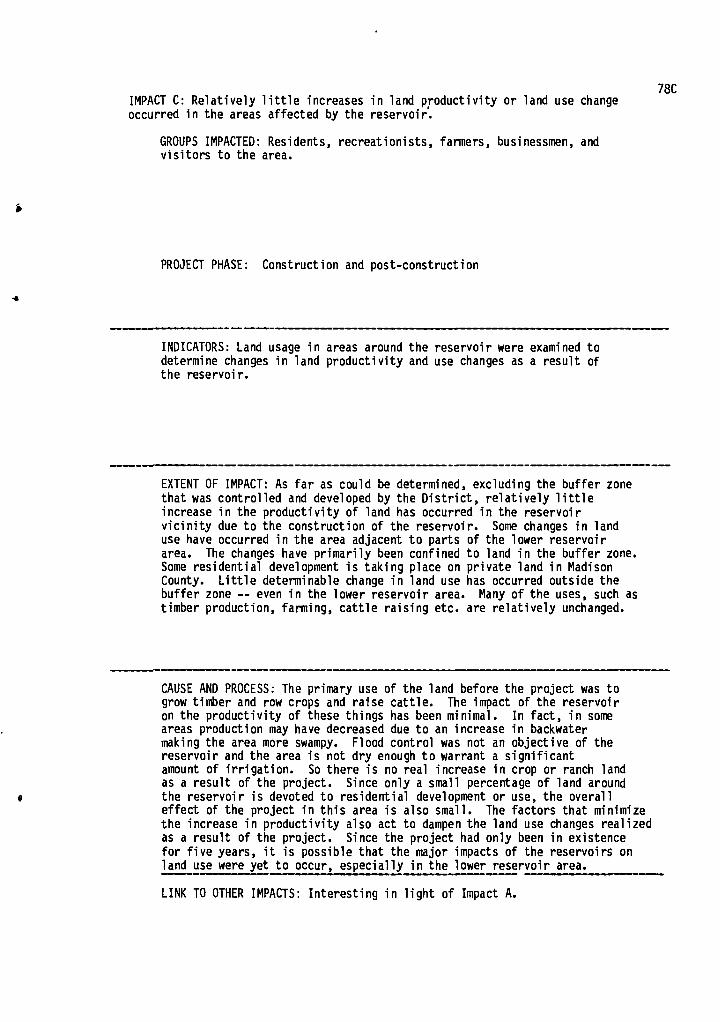
78C IMPACT C: Relatively little increases in land productivity or land use change occurred in the areas affected by the reservoir.
GROUPS IMPACTED: Residents, recreationists, farmers, businessmen, and visitors to the area.
PROJECT PHASE: Construction and post-construction
INDICATORS: Land usage in areas around the reservoir were examined to determine changes in land productivity and use changes as a result of the reservoir.
EXTENT OF IMPACT: As far as could be determined, excluding the buffer zone that was controlled and developed by the District, relatively little increase in the productivity of land has occurred in the reservoir vicinity due to the construction of the reservoir. Some changes in land use have occurred in the area adjacent to parts of the lower reservoir area. The changes have primarily been confined to land in the buffer zone. Some residential development is taking place on private land in Madison County. Little determinable change in land use has occurred outside the buffer zone -- even in the lower reservoir area. Many of the uses, such as timber production, farming, cattle raising etc. are relatively unchanged.
CAUSE AND PROCESS: The primary use of the land before the project was to grow timber and row crops and raise cattle. The impact of the reservoir on the productivity of these things has been minimal. In fact, in some areas production may have decreased due to an increase in backwater making the area more swampy. Flood control was not an objective of the reservoir and the area is not dry enough to warrant a significant amount of irrigation. So there is no real increase in crop or ranch land as a result of the project. Since only a small percentage of land around the reservoir is devoted to residential development or use, the overall effect of the project in this area is also small. The factors that minimize the increase in productivity also act to dampen the land use changes realized as a result of the project. Since the project had only been in existence for five years, it is possible that the major impacts of the reservoirs on land use were yet to occur, especially in the lower reservoir area.
LINK TO OTHER IMPACTS: Interesting in light of Impact A.

FUNDING LEVEL FUNDING GROUP
Dept. of Interior -- Office of Water Resources Research
PUBLICATION DATA
1974
ID# 79
NTIS# PB 236 034
STUDY TITLE Socio Economic Impact of Estuarine Thermal Pollution
AUTHORS Williams, John S. and Speigel, Stephen
INSTITUTION Metro Study Corporation (Washington, D.C.)
BACKGROUND
STUDY OBJECTIVES
Analyze the impact of thermal pollution on those inhabitants and visitors to the coastal areas adjoining Barnegat Bay most likely to be affected by the Oyster Creek nuclear station. Relationship of economic impact, recreational activity, and orientation of recreation to attitudes toward environment and the nuclear plant is examined.
79a
A
,,,-
PROJECT NAME & LOCATION Oyster Creek nuclear plant -- New Jersey. On boundary of Ocean and Lacey townships. (Ocean County) As of 1973 it had been in operation for 4 years. Provides substantial tax revenue and jobs to local community.
DESCRIPTION A
r• PURPOSES Power generation
PROJECT PHASE DISCUSSED Post-construction

METHODOLOGY
GENERAL: Field investigation -- Socio-economic survey of different user groups and local political leaders
79b
it
TECHNIQUES AND DATA USED: Questionnaire developed concerning recreation activities and attitudes, environmental attitudes, attitudes toward the power plant, economic consequences for specific groups, demographic characteristics. Interviews administered in summer of 1973 by 4 local interviewers. Only people between 20 and 65 and who had been in the area longer than 3 years were questioned. Every 10th house of 6,000 housing units in Ocean County was chosen (from aerial photographs)-- final N = 318 households. Interviews with local marina owners, commercial fishermen and clammers. Also in-depth interviews computed with local government officials.
IMPACTS DISCUSSED
A) Differing perceptions or direction of general plant impact
B) Unequal distribution of costs and benefits of plant
C) Feeling of powerless in local government
4

79A
IMPACT A: Differing perceptions of the direction of the general impact of the plant
GROUPS IMPACTED: Residents of Ocean County
PROJECT PHASE: Post-construction
INDICATORS: Responses to questions on view of plant's impact on the area
ti
1.-
EXTENT OF IMPACT: Most people are not only aware of the plant but are (within 1 year) accurate about how long it's been in operation. 39% say it is good, 18% say it's good and bad, 20% say it's bad.
CAUSE AND PROCESS: 1) Perceptions vary with proximity to plant. Benefits accrued from plant from taxes also affect view of plant impact. Lacey Township which gets substantial tax revenue 74% say good, Ocean and Union Townships -- 23% say the plant is good. Recreation enterprise owners and managers -- 32% say it is good.
LINK TO OTHER IMPACTS: Related to Impact B.
'4

79B
IMPACT B: Unequal distribution of costs and benefits
GROUPS IMPACTED: Residents of Ocean County
PROJECT PHASE: Post-construction
INDICATORS: Responses to survey questionnaire, Census data
•
EXTENT OF IMPACT: Overall benefits of the plant are overwhelming but not necessarily local. Power is consumed elsewhere. Nonetheless because of jobs and tax revenues, the cost/benefit ratio is good for the local area ($1.85/$1). But 2 groups -- shell fishermen and marina operators -- pay disproportionate amount of the cost.
CAUSE AND PROCESS: 1) Shellfish markets are losing business because of fear of contamination
2) Marinas are not gaining more business because of changes in water flow and water quality due to plant
LINK TO OTHER IMPACTS: Partial explanation for differing views on value of the area
4

IMPACT C: Feeling of powerlessness in local governments 79C
GROUPS IMPACTED: Local governments of Lacey, Ocean and Long Beach Townships
4
PROJECT PHASE: Post construction
JO
INDICATORS: Comments during in-depth interviews
EXTENT OF IMPACT: All three townships report a general feeling of powerlessness with regard to the power company and AEC. They complain that they do not get accurate or complete information.
CAUSE AND PROCESS: 1) Lack of local technical expertise in the area of nuclear power. "We aren't atomic scientists." General complaint about technical jargon and the confusion it creates.
2) Criticisms stronger in areas not receiving direct tax benefits from the plant.
1
t
LINK TO OTHER IMPACTS:

PUBLICATION DATE June, 1969, WRC Report
Report, No. 20
FUNDING LEVEL FUNDING GROUP U.S. Dept. of Interior
STUDY OBJECTIVES Collect and develop information to show the impact of a community water system on the community. Develop data to show the extent of impact that this type of investment had on the social and economic development of towns and farmers in the area surrounding the town where a system had become operational.
ID# 80
NTIS#
STUDY TITLE Impact of Community Water Systems in Small Towns
AUTHORS Wills, Walter J. and Osburn, Donald O.
INSTITUTION Dept. of Agricultural Industries, Southern Illinois University, Carbondale -
BACKGROUND
PROJECT NAME & LOCATION 18 community water systems financed by FHA in Illinois. 3 systems; Herrick, Stradburg and Liberty-Ledford were chosen as case study systems.
DESCRIPTION The total costs of the systems ranged from $660,000 to $266,000 with the average being $115,690. The systems' capacities ranged from 13,000 gallons to 250,000 gallons per day with the average being 86,000 gallons per day. The . purification facilities had a range of capacities from 86 to 343 gallons-per-capita-per-day. The average was 205 gallons-per-capita-per-day.
80a
PURPOSES Provide water to community residents and rural and/or farm residents
PROJECT PHASE DISCUSSED Post-construction

80b
METHODOLOGY
GENERAL Straightforward measurement of residents' attitudes towards the project and its effect on them and the community, case study areas' population characteristics, economic status of the individual and community, changes related or due to the water system, and trends in water usage before and after the system.
TECHNIQUES AND DATA USED Surveys, questionnaires, personal interviews, examination of primary data on employment, economy, demographics and social factors of the case study areas. Analysis of water usage patterns over time. Multiple regression of water use trends. Primary data gathered on 18 FHA financed water systems in state of Illinois. Random samples of 17 in-town residents and all known farmers who bought and/or hauled water were interviewed in the case study areas. Data was gathered on population, change in building activity before and after project, new business activity, employment, tax charges, number of people using the system, value judgments about system, water use trends, etc., in the case study areas.
IMPACTS DISCUSSED
A) Increased number of jobs
B) Improved sanitation conditions as a result of abandonment of private water supplies
C) Improved farming conditions
D) Personal convenience and aesthetic benefits from water supply
E) Increased housing opportunity and values
F) Positive attitudes about increased fire protection
m
!
4

80A
IMPACT A: Increased number of jobs
GROUPS IMPACTED: Residents of 18 communities surveyed
PROJECT PHASE: Post-construction
INDICATORS: Surveys
EXUT OF IMPACT: Unspecified number of jobs added to the affected areas
CAUSE AND PROCESS: Direct result of new businesses and water system development
LINK TO OTHER IMPACTS:

808
IMPACT B: Improved sanitation conditions as a result of abandonment of private water supplies
• GROUPS IMPACTED: Residents of 3 case study areas
PROJECT PHASE: Post-construction
INDICATORS: Surveys, interviews
EXTENT OF IMPACT: Decline of water supply pollution as a result of impure private water sources. Decrease in number of people sick from polluted private water sources. 16% of towns people had encountered pollution in their old water sources, 1 family reported sickness from drinking polluted water. Only 50% of people had had their water tested for purity. The farmers reported a 4.8% incidence of pollution problems with an identical 4.8% reporting of sickness as a result of water pollution. 54.6% had had their old system tested for purity. Most of the citizens surveyed felt that the improved sanitation conditions were a main benefit of the new water system.
CAUSE AND PROCESS: The new water systems allowed residents the opportunity to abandon their old private water systems.
LINK TO OTHER IMPACTS:

80C
IMPACT C: Improved farming conditions
GROUPS IMPACTED: Farmers in the 3 case study areas
PROJECT PHASE: Post construction
INDICATORS: Interviews
EXTENT OF IMPACT: Many of the farmers were able to hook up directly to the water systems or had water outlets much closer than before. No longer had to have water hauled or at least did not have to haul it as far as before if they weren't linked directly to the system (lower costs and shorter delivery time). The presence of dependable water supply led to: 1) increased spraying of herbicides 2) added number of automatic waterers in the livestock programs 3) increased number of beef cattle owned by 42 farmers interviewed -- an increase of 58.2% 4) increased number of swine per farmer - 5.3%, with greatest increase reported by farmers served directly by the water line 5) 25% of farmers interviewed stated that they had made improvements in their farming operations as a result of the water system.
CAUSE AND PROCESS: The availability, dependability, and accessibility of the water supply to the area's farmers
LINK TO OTHER IMPACTS:

80D
IMPACT D: Personal convenience and aesthetic benefits from water supply
GROUPS IMPACTED: Residents of 3 case study areas
PROJECT PHASE: Post-construction
INDICATORS: Interviews, surveys
EXTENT OF IMPACT: 82.4% of farms' residents have bathrooms as compared to 74.5% before the projects were built. Another 11.8% expect to add them. Hot water heaters: 92% after, 78.4% before. 6% expect to get one- automatic washers: 35% after, 27% before. 6% expect to get one.
Farmers living outside the system: - bathrooms: 95.2% after, 85.7% before. Hotwater heaters: 95.2% after, 73.8% before. Automatic washing machines: 10% increase. 9.5% of people expect to add a water using appliance in the future
Residents of the area also listed a laundry, a car wash, the convenience of the water supply, the ability to water the garden and lawn, the lack of pump problems and a dependable water source as primary benefits, of the water system.
CAUSE AND PROCESSES: The presence of an abundant dependable water source that is directly linked to the individual homes or within easy hauling distances.
LINK TO OTHER IMPACTS:

80E
IMPACT E: Increased housing opportunity and values
GROUPS IMPACTED: Residents of 18 communities surveyed in general, and the 3 case study areas specifically
PROJECT PHASE: Post-construction
INDICATORS: Surveys, interviews
EXTENT OF IMPACT:
- number of new housing starts after installation of the water system was almost double the number of starts before it
- people in towns: 1) 90% felt that property values had increased 2) 4% felt they stayed the same 3) 6% didn't know if there had been a change 4) of those stating increases, the average was 27% - with a range
from 5-100%
Rural areas: 1) 61% felt that the water system increased their property values --
some felt by as much as 50%
CAUSE AND PROCESS:
Positive attitude of residents toward water system, water system itself.
LINK TO OTHER IMPACTS:
.st

8OF
IMPACT F Positive Attitudes About Increased Fire Protection
GROUPS IMPACTED: Residents of 18 communities survey in general and 3 case study areas specifically.
PROJECT'PHASE: Post- Construction
INDICATORS: Surveys, interviews
EXTENT OF IMPACT: In the case study areas, the residents ranked increased fire protection as a primary benefit of the water system. One community added a fire department. But,. a majority of the residents surveyed (74%) did not feel that their fire insurance rates were lower as a result of the system. Only 6% thought they were cheaper. 20% didn't know.
CAUSE AND PROCESS: The availability of a dependable water supply. The lack of necessary fire fighting equipoment and six-inch main capacity of most of the towns was thought to be the cause of unchanged insurance rates after the systems were built.
LINK TO OTHER IMPACTS:
v
4
4
I

FUNDING LEVEL FUNDING GROUP
Dept. of Interior -- Office of Water Resources Research
PUBLICATION' DATA
July 1972
ii
... ..5- . '4 :A A
-a
‘
■
81 a
ID# 81
NTIS#
STUDY TITLE Water Quality vs. Residential Development: Political and Administrative Aspects of Water Quality Maintenance in Perry and Clinton Reservoirs
AUTHORS Wyman, Sherman
INSTITUTION Kansas Water Resources Research Institute
BACKGROUND
STUDY OBJECTIVES
1) Uncover variables important to policy formation in Perry and Clinton Reservoirs. 2) Better understanding of variables which are important to individual or collective behavior. Examine relationship between residential development and water quality.
PROJECT NAME & LOCATION
DESCRIPTION
Two reservoirs in Eastern Kansas -- near large urban areas: Perry Reservoir in Jefferson County 25 miles East of Topeka near Lawrence. Clinton Reservoir in Douglas County; 12,000 acre reservoir. Jefferson County -- rural, downward population trend since 1900. Douglas County primary urban though not metropolitan -- highest population growth rate in the state.
PURPOSES Not discussed
PROJECT PHASE DISCUSSED Perry: end construction (filling) Clinton: . just prior to construction

81 b METHODOLOGY
GENERAL: A systems approach to policy analysis; look at constraints that determine nature of inputs into the political system. Focus on local decision-makers -- local government, developers, and property buyers. Emphasis on the porcess of policy making. Survey local decision-makers to elicit their attitudes towards the relationship between development, water quality and policy process.
#
TECHNIQUES AND DATA USED: Three groups surveyed: 1) Property buyers -- mailed questionnaire
followed by random interviews 2) Local and state government officials --
questionnaire 3) Developers -- difficult to contact and
difficult to apply interview schedule
All data on Perry Reservoir; Clinton was just commencing.
1'
A' i,
IMPACTS DISCUSSED
A) Create concern for water quality, but not political activity
B) Desire on part of local residents to solve their own problems
C) Low local government interest in water quality
D) Low interest in water quality by larger developers A

Responses to questions regrding future action given decrease in water quality, and questions on water quality
INDICATORS:
Respondents want good water quality -- 63.5% won't build if water quality won't allow body contact. Yet won't try local political action if water quality deteriorates: 78% will sell, 71% will shift locus of recreation. Those most concerned with water pollution are least likely to build, stay after building, or use for recreation when water quality deteriorates.
EXTENT OF IMPACT:
81A
IMPACT A: Create concern for water quality, but not enough to create political activity
GROUPS IMPACTED: Property buyers around reservoir
PROJECT PHASE: Post-construction
CAUSE AND PROCESS: 1) Many are only weekend residents (47%) coming from metropolitan areas; 2) many nearby reservoirs with good water quality; 3) many bought for investment (38%) or recreation (27%). Investors will sell early to cut losses. Recreationists will go elsewhere and avoid unpleasant political process.
LINK TO OTHER IMPACTS:
ll

81B
IMPACT B: Desire on part of local residents to solve their own problems
GROUPS IMPACTED: Property buyers and developers
PROJECT PHASE: Post-construction
INDICATORS: Responses to questions on who should supply sewer service for reservoir area
V
Jo
EXTENT OF IMPACT: Developers, property owners association and special districts most preferred. Other government agencies rank low. Others can provide funds but control should be very local.
CAUSE AND PROCESS: Little thought given to long-term sewage needs. Naive reliance on developers after their business is done.
LINK TO OTHER IMPACTS: See Impact D.
A
-4
I

In general, water quality seen as important in general by equal proportions of state and local officials (66%). With specific regard to water quality in reservoirs in Kansas, 60% of state officials feel it's important, 33% of local officials feel it's important. Local officials most satisfied with government performance with regard to water quality.
EXTENT OF IMPACT:
81C IMPACT C: Lack of local government interest in water quality issues.
GROUPS IMPACTED: Local government, residents or reservoir area, state government
PROJECT PHASE: Post-construction
INDICATORS: Responses of government officials (state and local) to questions on water quality policy and maintenance. Is water quality a problem? Are you satisfied with government performance regarding water quality?
CAUSE AND PROCESS: Local officials feel a vigorous practice of water quality maintenance might discourage development. Little thought given to long-run implications of decreasing water quality.
LINK TO OTHER IMPACTS: Contributes to Impact B. Interest in very
local solutions/non-traditional.

81D
.4
IMPACT D: Large developers have little interest in water quality
GROUPS IMPACTED: Developers, local residents, local government
PROJECT PHASE: Post-construction
."
INDICATORS: Discussions in open-ended interviews with some of the developers around Perry. Their responses to questions about sewage service.
EXTENT OF IMPACT: Two types of developers: conservationists -- local tends to have small developments; exploitive outsiders -- more related to large developments. Most larger developers, despite capital advantages, offer very minimal sewage systems -- septic tanks.
CAUSE AND PROCESSES: 1) Sewage treatment does not sell, swimming pools do. 2) Large developer only concerned with area during land selling period. 3) Assumption that government will accept responsibility. 4) Small, local developer tends to view the area from a different time perspective; they were there before the reservoir. 5) Easy to create special districts and shift cost to property buyer.
0
A
LINK TO OTHER IMPACTS:
I

APPENDIX B: BIBLIOGRAPHY
4

4,
B-1
BIBLIOGRAPHY
Abbott, Henry E. Jr., Cook, Kenneth G. Sleight, Robert B. Sctcjal Aspects of Urban Water Conserv.ation, Arlington, Virginia: Century Research Corporation, August 1972.
Adler, Steven P. and Jansen, Edmund F., Jr. "Hill Reestablishment Retrospective Community Study of a Relocated New England Town " Durham, New Hampshire: Water Resources Research Center, University of New Hampshire, May 1978.
R-1 Albert, Harold E. and Hall, David. Private Sector Reaction to Normal Political Institutional Procedures and Outcomes When Water Is an Issue. South Carolina: Water Resources Institute, Clemson University, 1973.
Andrews, Richard H. L., Approaches to Impact Assessment Comparison and Critique. Ann Arbor, Michigan: School of Natural Resources, The University of Michigan May-June 1973.
Andrews, Wade H. Sociological and Social Psychological Factors Related to Metropolitan Water Resources Development. Logan, Utah: Institute for Social Science Research on Natural Resources Special Paper No. 2, Utah State University November 1968.
R-2 Andrews, Wade H. and Dunaway, William C. Social Effects of Changes in Uses of Bear Lake, an Interstate Body of Water. Logan, Utah: Institute for Social Science Research and Natural Resources Utah State University. November 1975.
R-3 Andrews, Wade H., Dunaway, William C., Geertsen, Dennis C Social Aspects of Flooding in the Urbanized East Salt Lake County . Area. Logan, Utah: Institute for Social Sciences Research on Natural Resources.
R-4 Andrews Wade H. and Geersten, Dennis C. Social Dimensions of Urban Flood Control Decisions. Logan, Utah: Institute for Social Science Research on Natural Resources, Utah State University. January 1974.
R-5 Andrews, Wade and Gersten, Dennis. The Function of Social Behavior in Water Resource Developmnt. Logan, Utah: Institute for Social Science Research on Natural Resources Utah State University 1970.
R-6 Andrews, Wade H., Madsen Gary E., Legaz, Gregor J. Social Impacts of Water Resource Developments and Their Implications for Urban and Rural Development A Post-Audit Analysis of The Weber Basin Project in Utah. Logan, Utah Institute for Social Science Research on Natural Resources, Utah State University. December 1974.

B-2
R-7 Andrews, Wade H., et al. Preliminary Model of the Hydrologic- Sociologic Flow System of an Urban Area. Logan, Utah: Institute for Social Science Research on Natural Resources, Utah State University. April 1973.
R-8 Andrews, Wade H. et al. Identification and Measurement of Quality of Life Elements in Planning For Water Resources Development An Exploratori Study. Logan, Utah: Institute for Social Science Research on Natural Resources, Utah State University. April 1972.
Andrews, Wade H. et al. The Social Well-being and Quality of Life Dimension in Water Resources Planning_ and Development. Logan, Utah: The University of Council on Water Resources, Institute for Social Science Research on Natural Resources, Utah State University. July 10-12, 1973
R-9 Arnett, V.E. and Johnson, S. Dams and People Geographic Impact Analysis Lexington, Kentucky: Water Resources Research Institute, September 1976.
Baker, J K. Finley, J.R. Measuring_ Impacts of Water Resources Develop-ments on the Human Environment. Columbus, Ohio: Battelle- Memorial Institution, February 1974
R-10 Bates, Clyde T. The Effects of a Large Reservoir on Local Government Revenue and Expenditure. Research Report #23. Lexington, Kentucky: Water Resources Institute, 1970.
Bates C.T. and Soule D.M. "Reservoirs and Local Government Finance," Growth and Change 2 (1971) 47-51.
Bauman, Duane D. The Recreational Use of Domestic Water Supply Reservoirs. Perception and Choice. Research Paper No. 121. Chicago, Illinois: University of Chicago, 1969.
Beardsley, Wendell G. "The Economic Impact of Recreation Development A Synopsis on Recreation Symposium Proceedius." Northeastern Forest Experiment Station, Forest Service, U.S. Dept. of Agriculture, Upper Darby, Pennsylvania, 1971: 28•32.
R-11 Becker, Catherine J. "Factors Associated With Attitudes Toward Reservoir Construction." Unpublished M.A thesis. Lexington, Kentucky: Dept. of Sociology, University of Kentucky, 1971.
Bishop, Bruce A. et al. Social, Economic, Environmental, and Technical Factors Influencing Water Reuse. Logan, Utah: Utah Water Research Laboratory, College of Engineering Utah State Univ.irsity December 1973.

B-3
Biswas Asit K. "Reservoirs and Recreation." Water and Water Eraineering 68 (July 1964): 263:268.
Biswas AlK. Dune, R.W. Sociological Aspects of Water Development. Ottawa, Ontario: Policy Research and Coordination Branch, Dept. of Environment, December 1971.
R-12 Blase, Melvin G., Green, Parman R., and Matson, Arthur. "Selected Impacts of Public Water SuPply Districts on Firpt, Households and Communi-ties." Journal of the Community Development Society 4 (1973):94-101.
Booth, Alan and Camp, Henry. "Housing Relocation and Family Social Integration Patterns," Journal of the American Institute of Planners 40 (March 1974): 124-28.
Borton, 1„ Warner, K., and Wenrich, W. The Susquehanna Communication - Participation Study - Selected Approaches to Public Involvement in Water Resource Plannira. IWR Report #70-6, 1970
Bowes J.E. Development Priorities in the West River Region, North Dakota. Fargo, North Dakota: Water Resources Research Institute, February 1976.
R-13 Bowes, J.E. and Stamm, K.R. Development Priorities in the West River Region, North Dakota; A Social Attitude and Communication Analysis. Grand Forks, North Dakota: Communication Research Center, North Kakota University October 1974.
Boyce, Ronald R. (ed.) Regional Development and the Wabash Basin, Urbana: University of Illinois Press.
Breese, Gerald and others. The Impact of Large Installations on Nearby Areas. Beverly Hills, Calif.: Sage Publications, Inc., 1965.
Bromley, Daniel W. and Arnold Victor L. "Social Goals Problem Perception and Public Intervention: The Fishery" San Diego Law Review 7 (July 1970): 469-487.
R-14 Bultena, Gordon L. Community Values and Collective Action in Reservoir Development. Ames, Iowa Iowa State Water Resources Research Institute, Iowa State University, September 1975.
R-15 Bultena, Gordon L. "Dynamics of Agency Public Relations in Water Resource Planning." Ames, Iowa Iowa State Water Resources 'Research Institute, Iowa State University 1974.

B-4
R-16 Bultena, Gordon L.; Rogers, David L.; and Conner, Karen A. Characteristics and Correlates of Public Knowledge About a Water Resource Development. Ames Iowa Iowa State Water Resources'Research Institute, Iowa State University 1973.
Burby, Raymond J. III. The Role of Reservoir Owner Policies in Guiding Reservoir Land Development. Report #29. Chapel Hill, North Carolina: Water Resources Research Institute University of North Carolina November 1969.
Burby, R.J., III, Donnelly, T.G., Weiss S.F. Multipurpose Reservoirs and Urban Development. Chapel Hill, North Carolina: Center for Urban and Regional Studies, North Carolina University September 21, 1972.
R-17 Burby, R. J., III and Weiss, S. F. Community Problems in Reservoir Recreation Areas. Chapel Hill, North Carolina Institute for Research in Social Science, North Carolina University, 1971.
Burdge, R. and Becker Cath2rine. The Effects of Familism, Traditionalism and Socio-Economic Status in Attitudes Toward Reservoir Construction in an Eastern Kentucky County. Paper presented at the Rural Sociological Society Meeting, Denver, Colorado, 1971.
R-18 Burdge, Rabel J. And Johnson.' Sue K. Social Costs and Benefits of Water Resource Construction. Lexington, Kentucky: Water Resources Research Institute ) University of Kentucky. 1973.
Burdge, R. and Ludtke, R. Evaluation of the Social Impact of Reservoir Construction on the Residential Plans of Displaced Persons - Kentucky and Ohio. Research Report #26. Lexington, Kentucky: Water Resources Institute 1970.
R-19 Burdge, R. and Ludtke, R. Factors Affecting Relocation & Response to Reservoir Development. Research Report #29. Lexington, Kentucky: Water Resources Institute, 1970.
Burdge, R. and Ludtke R. "Forced Migration Social Separation Among Displaced Rural Families." Presented at Annual,Meeting ,ofRural Sociological Society Washington D.C. Auguf-Tg70. '
Burdge, R. and Ludtke R. "Social Separation Among Displaced Rural Families." Presented at taual Meeting of Rural Sociolotcal Society, Washington •D.C. August 1970.

B-5
Burdge, R. and Ludtke, R. "Social Separation Among Displac ,d Rural Families The Case of Flood Control Reservoirs." In Social Behavior, Natural Resources, and the Environment. Edited by Burch Cheek & Taylor. Harper & Row, New York. 1972.
Busch J.R. Lindeborg, K.H. Socioeconomic Analysis of a Major Rehabilitation of Irrigation and Water Management Systems in Eastern Idaho'. Moscow Idaho: Idaho Water Resources Research Institute, University of Idaho, June 1975.
Byler, P.M. "Functional and Psychological Integration in a Rural Community." MSC Thesis, Department of Agricultural Economics and Rural Sociology, Pennsylvania State University, University Park, Pennsylvania, March 1973.
R-20 Bylund, H. Bruce. "The Human Factor and Changes in Water Usage Patterns Water Resources Research 2 (1966): 365-699.
Cain, Stanley A. "Ecological Impacts on Water Resources Developments." Water Resources Bulletin 4 (March 1968): 57-74.
R-21 Campbell, Rex R. Stangler, Gary J., Dailey George H. and McNamara, Robert L. Population Change, Migration and Displacement Along the McClellan-Kerr Arkansas River Navigation System. Columbia, Missouri: Department of Rural Sociology University of Missouri, December 15 1976.
Carlson, Dr. John E. Attitudes of Idaho Residents Toward Flowing Rivers as a Water Use in Idaho. Moscow, Idaho Water Resources Research Institute, Departments of Sociology Anthropology, and Agricultural Economics. University of Idaho. October 1974.
Carswell, K. Symans J. and Roleck, G. "Research on Recreational Uses of Watersheds & Reservoirs." American Water Works Association Journal 61 (June 1969): 297-304.
Chappell, V. G., Jr. A Factor Analysis of Socio-Economic Change in the Tennessee River Watershed. Richmond, Virginia: Tobacco Tax Council, June 1977.
Churchill, Constance L.;Brashier Clyde K.; and Limmer, Dan. Evaluation of a Recreational Lake Rehabilitation Project. Brookings, South Dakota: Water Resources Institute South Dakota State University, August 1975.
Cole. Lucy W. and Kaufman, Harold F. Factors in Rural Neighborhood Development-Alcorn County., Mississippi. Bulletin 625. State College, Mississippi:Mississippi Agricultural Experiment Station.

B-6
R-22 Cook, Earl. Reservoir Impact Study. College Station, Texas: Texas Water Resources Institute, Texas A&M University, November 1974.
Conner, Desmond M. and Bradley Keith T. "Public Participation in the St. John River Basin." From proceedings of the American Societi of Civil Engineers, Washington, D.C. 1972.
R-23 Coppedge, R. O. and Gray, J. R. Recreational Use and Value of Water at Elephant Butte and Navajo Reservoirs. Las Cruces New Mexico: Water Resources Research Institute, New Mexico State University, October 1968.
Cox, P. Thomas. "Success of Watershed Development in Local Communities." Natural Resources Journal 9 (January 1969): 23-24.
Craik, Kenneth H. and Zube, Ervin H. Issues in Perceived Environ-mental Quality Research. Amherst, Massachusetts: Institute for Man and Environment, University of Massachusetts, November 1975.
R-24 Dasgupti, Satadal. Attitudes of Local Residents Toward Watershed Development. Report #18. State College, Mississippi: Water Resources Research Center
) Mississippi State
University, May 1967.
Dasgupti, Satadal. "Man, Community and Water: A Study of Local Attitudes Toward Sunk River Development." P.E.I. Community Studies Report No. 3. Charlottetown: --Department of Sociology and Anthropology, University of Prince Edward Island, Sept.mber 1975.
Dasgupti, Satadal. "Sociology of Watershed Development." Paper presented at the Mississippi Water Resources Conference Jackson Mississippi, April 9-10, 1968.
Dasgupta, S. and Wilkenson, Kenneth "Local Participation and Watershed Development: A Comparative Study of Two Communities." In Proceedings of the Third Annual American Water Resources Conference, Urbana, Illinois, 1967: 396-404.

B-7
Analysis. Grand Forks, North Dakota. Communication Research Center, North Dakota University, October 1974.
I
4
It

B-8
• Davidson Jack R. Ditwil!er, Dirk C., and Shew ; Richard D. Social and Economic Impacts of Wildlife Enhancement by Irrigation Projects. Pullman, Washington: Water Research Center Washington State University, October 1977.
Davidson, P. Adams, G. and Seneca, J. The Social Value of Water Recreational Facilities Resulting from an Improvement in Water Quality: The Delaware Estuary. John Hopkins University, Baltimore, Maryland, 1966.
R-25 Day, J. C. and Gilpin J. R. "The Impact of Man-made Lakes on Residential Property Values: A Case Study and Methodological Exploration," Water Resources Research 10 (February 1974): 37-43.
R-26 Del Rio, Fernando. Human Factors Involved in the Development of a Watershed in Yabucoa. Mayaguez ) Puerto Rico: Water Resources Research Institute, School of Engineering, University of Puerto Rico, July 1970.
Dickerson Richard C. A Study of the Social and Economic_Impact of Odors, Phase II. LaJolla, California: Copley International Corporation, November 1971.
Dobyns, Henry F. Anthropological Analysis of Social and Cultural Benefits and Costs From Stream Control Measures: Phase One. Lexington, Kentucky: University of Kentucky, 1969.
R-27 Donnermeyer, Joseph F., Korsching, Peter F. and Burdge, Rabel J. "An Interpretative Analysis of Family and Individual Economic Costs Due to Water Resource Development," Water Resources Bulletin 10 (February 1974): 91-100.
R-28 Drucker, Phillip, Impact of a Proposed Reservoir on Local Land Values. Anthropological Analysis of Social and Cultural Benefits and Costs from Stream Control Measures -- Phase 3. Lexington, Kentucky: Water Resources Institute, University of Kentucky, 1972.
R-29 Drucker, Philip Clark, Jerry Eugene Smith, Diane Lesker, Socio- cultural Impact of Reservoirs on 'Local Government Institutions. Anthropological Analysis of Social and Cultural Benefits and Costs from Stream Control Measures -- Phase 4. Lexington, Kentucky: Water Resources Research Institute, University of Kentucky, 1973.

B-9
R -30 Drucker, Phillip; Smith, Charles Robert and Reeves, Edward B. Displacement of Persons by Major Public Works. Anthropological Analysis of Social and Cultural Benefits and Costs from Stream Control Measures -- Phase 5. Lexington, Kentucky: Water Resources Research Institute, University of Kentucky, 1974.
Dworsky, Leonard B., Allee, David J.; and Csallany, Sandor-C. Social and Economic Aspects of Water Resources Development. Ithaca New York: Water Resources and Marine Sciences Center, Cornell University. 1971.
R-31 Dwyer, John F.; Espeseth, Robert D. and McLaughlin, David L. "Expected and Actual Local Impacts of Resevoir Recreation." In Proceedings of National Symposium on Outdoor Recreation Research and Planning, Ohio State University, Columbus, Ohio, November 15-16, 1977.
Dynes, Russell R. A Model of Community Problem Solving and Selected Empirical Applications. Columbus, Ohio: Disaster Research Center, Ohio State University, December 31, 1971.
Dynes, Russell R. A Sociologist Looks at Water Resources Research. Reprint No. 48. Environmental Crisis Report No. 1. Columbus, Ohio: Disaster Research Center, The Ohio State University, N.D.
Dynes, Russell R. and Wenger, Dennis. Factors in the Community Perception of Water Resource Problems. DRC Paper No. 66. Environmental Crises Report No. 2. Columbus, Ohio: Disaster Research Center, Ohio State University, 1970.
Ellis, Harold H. "Legal Aspects of Rural-Urban Water Use Conflicts." Paper presented at the Annual Meeting of the Southern Agricul- tural Workers, Agricultural Economics and Rural Sociology Section, Louisville, Kentucky, February 1968.
• Feiss, Carl; McQuown, Ruth; Roberts, Paul and May, Rodney. The Demogra- phic, Political, and Administrative Setting. Environmental Planning Strategies for the Development of a Mangrove Shoreline Rookery Bay Land Use Studies. Tampa, Florida: Urban Studies Bureau, University of Florida, September 1973.
Field, Donald R. Sociological Dimensions of Leisure Involvement in Water Based Recreation. Seattle Washington: College of Forest Resources, University of Washington, July 1973.
Field, Donald R. and O'Leary, Joseph T. "Social Groups as a Basis for Assessing Participation in Selected Water Activities." Journal of Leisure Research, 1973.

B-10
Fitzsimmons, Stephen J. and Salama Ovadia. "The Relationship Between Social Psychological Systems and Water Resources Development." In Proceedings of Conference on the Social Well-Being--Quality of Life Dimension in Water Resources Development, Wade Andrews, et al Logan Utah:Institute for Social Science Research on Natural Resources, Utah State University, 1973.
R-32 Fliegel, Frederick C. and Kivlin, Joseph E. Fidelity of Information Transmission in Local Campaign on Water Issues. Urbana, Illinois: Water Resources Center, University of Illinois. March 1974.
Freeman, A. Myrick III. "Six Federal Reclamation Projects and the Distribution of Income." Water Resources Research 3 (1967): 319-332.
Fullerton, Avery. "Environmental, Economic and Social Aspects of the Cross Florida Barge-Canal." Social and Economic Aspects of Water Resources Development. pp 121-125. Edited by Leonard B. Dworsky. Urbana, Ill.: American Water Resources Association, 1972.
Gardner, J.S. and Hultquist, N.B. The Human Ecological Impact of Structural Flood Control on the Iowa Inver. Iowa City, Iowa: Institution of Urban and Rural Research, Iowa University. December 1973.
Gardner, Robert W. Social Impact Study of the Proposed Willow Creek Flood Control Project. Walla Walla, Wash.: U.S. Army Corps of Engineers, Seattle District, June 1973.
Garrison, C.B. Effects of Water Resources on Economic Growth in Tennessee Valley Regions." Knoxville, Tennessee: Dept. of Economics, College of Business Administration, University of Tennessee, (January 1971).
R-33 Garrison, Charles B. Local Economic Impact of Reservoir Recreation. Knoxville Tennessee: Center for Business and Economic Research, Water Resources Research Center, The University of Tennessee, July 1972.
Gauger, Stephen E. The Evaluation of Intangible Benefits of Water Resource Projects. Amherst, Massachusetts: Water Resources Research Center, University of Massachusetts, February 1972.
Gibbs, Kenneth C. and Cachman, Edna. Impacts of Watershed Projects. Economic Report #40. University of Florida and U.S. Department of Agriculture, 1972. .
4.
1..
A.

B-11
R-34 Gillings, James Lane. "Natural Resource Development, Use, and Control and the Rural-Urban Differential in the Bear River Basin." 'Unpublished Ph.D. dissertation, Logan Utah: Utah State University, 1969.
Goebal, E.R. et al. "Government Acquisition of Private Property in Rural Areas: The U.S. Army Corps of Engineers and the Cave Run Reservoir Project." Kentucky Law Journal 58 (1969-70).
R-35 Gunn, C.A. Reed, D.J. and Couch, R.E. Cultural Benefits From Metropolitan River Recreation - San Antonio Prototype. College Station, Texas Water Resources Institute, Texas A&M University, September 1972.
R-36 Hackbart, M. An Analysis of Social Well-being Change Associated with Resource Development Projects in Wyoming. Laramie, Wyoming: Water Resources Research Institute, University of Wyoming. June 1973.
Haith ) Douglas A. The Political Evaluation of Alternative Metropolitan Water-Resource Plans. Studies in the Analysis of Metropolitan Resource Systems, Vol. III. Ithaca, New York: Water Resources and Marine Sciences Center, Cornell University. July 1971.
Hamilton, Lawrence S. and Stein, Carlos D. A'Case Study of Water Resource Development - An Analysis of a Proposed Project on the Missouri River. Report #28. Ithaca, New York: Water Resources and Marine Sciences Center, Cornell University, April 1971.
Hampe, G. An Evaluation of Public Hearings on Water Development Projects - Mississippi. State College, Mississippi: Social Science Research Center, Mississippi State University, July 1976.
Hampe, Gary D., Smith, Verne E., and Mitchell, James P. Water-Related Aesthetic Preferences of Wyoming Residents. Laramie, Wyoming: Water Resources Research Institute, University of Wyoming, n.d.
Hannemann, W.M., and Bhotiwihok, S. The Relationship Between Housing and Water Resources Planning and Management. Cambridge, Massachusetts: Urban Systems Research and Engineering Incorporated March 1, 1972.
Hargrove, M.B. Economic Development of Areas Contiguous to Multi-Purpose Reservoirs: The Kentucky-Tennessee Experience. Research Report #21, Lexington, Kentucky: Kentucky Water Resources Institute, 1971.

B-12
Harr, R. G. Longitudinal Analysis of Change in Levels of Affiliation and Participation in Voluntary Formal Organizations. University Park, Pennsylvania: Pennsylvania State University, June 1973.
Hearney, J. P. and Huber, W. C. Socio-Economic Studies of the Upper St. Johns River Basin Central and Southern Florida Flood Control Central District. Gainesville, Florida: Department of Environmental Engineering Sciences, Florida University, July 1974.
Hecock, R. D. A New Reservoir and Recreational Behavior. Stillwater, Oklahoma: Water Resources Research Institute, Oklahoma State University, July 1974.
R-37 Hecock, Richard D. and Rooney, John F., Jr. Land Use Changes and Reservoir Development: Application of Land Use Information Systems. Stillwater, Oklahoma: Water Resources Research Institute, Oklahoma State University, n.d.
R-38 Hecock, Richard D. and Rooney, John F., Jr. The Impact of a Major New Reservoir Upon Recreation Behavior. Stillwater, Oklahoma: The Oklahoma Water Resources Research Institute, Department of Geography, Oklahoma State University, December 1972.
Henderson, James. Political and Environmental Attitudes of Voters and Public Officials Related to Alternative Levels of Manage-ment of the Penobscot River. Orono, Maine: Water Resources . Center, University of Maine, August 1973.
Hibdon, James E. "Flood Control Benefits and the Tennessee Valley Authority." The Southern Economic Journal (25 July 1965): 48•63.
R-39 Higgins, John Malvern Jr. The Effect of Landowner Attitudes on the Financial and the Economic Costs of Acquiring Land for a Large Public Works Project. Lexington, Kenucky: Water Resources Institute, University of Kentucky. 1967.
Hinman, Robert Charles. The Impact of Reservoir Recreation on the Whitney Point Microregion of New York State. Ithaca, New York. Agriculture Experiment Research Paper No. 295. Water Resources and Marine Science Center, Department of Agricultural Economics, Agricultural Experiment Station, Cornell University, August 1969.
Hogg, Thomas C. "Social and Cultural Impacts of Water Development on People and Water." Seminar Conducted at the Water Resources Institute. pp. 11-23 Edited by Emery A. Castle. Oregon State University, Corvallis, 1968.

at
i.
1
B-13
R-40 Hogg, T. and Beard, R.W. Preliminary Ethnographic Statement of the Calopooia River Basin. Corvallis, Oregon: Water Resources Research Institute, Oregon State University, 1968.
R-41 Hogg, Thomas C. and Smith, Courtland L. Socio-Cultural Impacts of Water Resource Development in the Santiam River Basin. Corvallis, Oregon: Water Resources Research Institute, Oregon State University, October 1970.
Hogg, Thomas C. et al. "Impact of Water Development on a Community." Proceedings of the Oregon Water Resources Congress. Portland, Oregon, (1970): 41-48.
R-42 Holloway, Milton L. Techniques for Identifying and Evaluating Market and Non-Market Benefits and Costs of Water Resource Systems. Austin, Texas: Texas Water Development Board, Systems Engineering Division, June 1973.
House, Peter W. and Patterson, Philip D. An Environmental Laboratory for the Social Sciences. Washington, D.C.: Environmental Studies Division, Washington Environmental Research Center OR&D, Environmental Protection Agency, May 1973.
Hubbock, Michael: "Alienation and Material Change: The Case of Flood Control Reservoirs," unpublished M.A. Thesis, Lexington, Kentucky: Dept of Sociology, University of Kentucky,
Hultquist J.F. People and the Reservoir. Iowa City, Iowa: Institution of Urban and Regional Research, Iowa University. 1973.
Ibsen, Charles A. and Ballweg, John A. Public Perceptions of Water Resource Problems. Bulletin 29, Blacksburg, Virginia: Water Resources Research Center, Virginia Polytechnic Institute, 1969.
Iowa State Water Resources Research Institute. Ames Reservoir Environmental Study; Appendix Two--Economic and Social Impact. Ames, Iowa: Iowa State Water Resources Research Institute, 1973.
R-43 James, L. Douglas. "A Case Study in Income Redistribution from Reservoir Construction." Water Resources Research 4 (June 1968): 449-506.
James, L. Douglas. "The Income Redistribution Effects of Reservoir Construction in Appalachia," pp. 641-650. In Proceedings of the Third Annual American Water Resources Conference. Urbana, Illinois, 1967.

B-14
James, L. Douglas, et al. The Peachtree Creek Watershed As a Case History in Urban Flood Plain Development. Atlanta, Georgia Environmental Resources Center, Georgia Institute of Technology, 1971.
Jansma, J. and Back, W L. Local Secondary Effects of Watershed Projects. A Case Study of Roger Mills County, Oklahoma. ERS No.178, Research Development Economics Division, Economic Research Service, U.S. Department of Agriculture, May 1964.
R-44 Johnson, Sue and Burdge, Rabel J An Analysis of Community and Individual Reactions to Forced Migration Due to Reservoir Construction. Lexington, Kentucky: University of Kentucky, 1974.
Johnson, Karen Sue, and Burdge, Rabel J. "Personal and Social Adjustment to Reservoir Development." Paper prepared for the Conference on Man and Water, University of Washington, Seattle, May 1973.
R-45 Kaynor, E.R. Historical, Political and Social Factors Affecting_ Public Policy on River Diversion: Out-of-Basin Diversion of Connecticut River Flood Waters to Boston Metropolitan Area. Publication #23. Amherst, Massachusetts: Water Resources Research Center, University of Massachusetts 1973.
Kite, Rodney C. "A Study of the Impact on Southwestern Wyoming of Recreationists Visiting Flaming Gorge Reservoir." M.S. Thesis Laramie, Wyoming:Agr 4.cultural Economics in Conjunction with Water Resources Research Institute, University of Wyoming, 1966.
Knetsch, Jack L. "The Influence of Reservoir Projects on Land Values." Journal of Farm Economics 46 (February 1964): 231-243.
Korsching, Peter F., and Burdge, Rabel J. "The Effects of Mass Media Exposure on Attitudes Towards Reservoir Development in a Low Income Eastern Kentucky County." In Rural Sociology in the South. Edited by Maurice E. Voland. Lexington, Kentuck_ y: Kentucky Agricultural Experiment Station, 1972.
Kim, Ungsoo. Measuring. and Analyzing. the Impact of Employment Generation Benefits of a Public Water Resource Development Project in Appalachia. Report No. IWR-72-5. Institute for Water Reservices, Fort Belvoir, Virginia, 1971.
Kraenzel, Carl F "The Social Consequences of River Basin Development." Law and Contemporary Problems 22 (Spring 1975): 221-236.
Kruzic, Pamela G. Cross-Impact Simulation in Water Resource Planning. Menlo Park, California: Stanford Research Institute, N.D.

B-15
Landry, Brenda M.; Cartee, Charles P. and Williams, D.C. Jr. Economic and Related Impacts of Rural Water Systems in Mississippi. State College, Mississippi: Mississippi State University: Water Resources Research Institute, July 1973.
Lansford, Robert R. et al. A Socio-Economic Evaluation of Alternative Water Management Policies on the Rio Grande in New Mexico. Las Cruces, New Mexico: Agricultural Economics Department, New Mexico State University. September 27, 1976.
R-47 Lawless, Edward W. "Truman Reservoir Controversy." In Technology and Social Shock. New Brunswick: Rutgers University Press, 1977.
R-48 Leadley, Samuel M. Sociological Impact of a Flood Control Reservoir. University Park, Pennsylvania: Institute for Research on Land and Water Resources, The Pennsylvania State University, July 1975.
Levin, Charles L. Development Benefits of Water Resource Investments. St. Louis, Mo.: Washington University. November 1969.
Little, Arthur.D. Federal Funding of Civilian Research and Development. Vol. II: Case Studies. Washington D.C.: Department of Commerce, National Bureau of Standards. February 1976.
R-49 Lynch, Lawrence K. Community Development Benefits from Small Watershed Projects. Report 228. Lexington, Kentucky: Spindletop Research, January 1969.
R-50 Mack, Ruth. Criteria for Evaluation of Social Impacts of Flood Management Alternatives. New York, New York: Institute of Public Administration, March 1974.
Malan, Vernon D. Dakota Indian Value Conflicts: Socialization, Social Change and Social Disorganization. South Dakota Rural Sociology Department, South Dakota State College.
R-51 Martel, R.J. et al. AnalyzinOrganizational Conflicts in Water Resource MangeinAnt: A Vstomatir ApdrnArh. Reading, MassachusAts: Analytic Sci,mces Corpordtion, September 1972.
Maston, Dr. Roger A. and Studer, Jeannette B Energy Resources Development in Wyoming's Powder River Basin, An Assessment of Potential Social and Economic Impacts. Denver, Colorado: Water Resources Research Institute, University of Wyoming in cooperation with Economic Research Service, U.S. Department of Agriculture, May 1974.

B-16
Maxwell, Philip A. "The Ex-Post Measurement of Benefits and Costs in Small Watershed Projects." PhD Thesis, Atlanta, Georgia: Environmental Resources Center, Georgia Institute of Technology', May 1973.
McPartland, Edward J. Measuring and Developing Methods of Attitude and Motivational Change in Implementing the Big Blue River Basin Water Plan. Crete, Nebraska: Doane College. 1973.
Milliken, J. Gordon, Mew, D.H.E., Jr. Recreational Impact of Reclamation Reservoirs. Denver, Colorado: Denver Research Institute., Colorado Industrial Economics Division, March 1969.
Minkus, A.J. Recreational Use of Reservoirs. Journal of New England Waterway Association 79 (1965).
Mitchell, James P. A Study of Aesthetic Preferences. Laramie, Wyoming: Department of Sociology, University of Wyoming, December 1974.
Muller, Thomas. Fiscal Impacts of Land Development, A Critique of Methods and Review of Issues. Washington, D.C.: The Urban Institute, 1975.
Napier, Ted L. An Analysis of the Social Impact of Water Resource Development and'Subsequent Forced Relocation of Population Upon Rural Community Groups: An Attitudinal Study. Wooster, Ohio: Agricultural Research and Development Center, October, 1975.
R-52 Napier, Ted L. "Social-Psychological Response to Forced Relocation Due to Watershed Development." Water Resources Bulletin (8 August 1972): 784-795.
Napier, Ted L. "The Impact of Water Resources Development Upon Local Rural Communities: Adjustment Factors to Rapid Change." PhD Dissertation, Columbus, Ohio: Ohio State University. 1971.
Napier, T.L. The Social-Psychological Impact of the Expansion of Water Impoundments and Subsequent Population Relocation Upon Rural Community Groups in Ohio and West Virginia. Wooster, Ohio: Ohio Agricultural Research and Development Center, 1973.
R-53 Napier, Ted L. and Moody, Cathy Wright. "The Social Impact of Forced Relocation of Rural Populations Due to Planned Vivironmental Modification." Western Sociological Review '{ 81977): 91-104.

B-17
R-54 Napier, Ted L. and Wright, Cathy J. A Longitudinal Analysis of the Attitudinal Response of Rural People to Natural Resource Development: A Case Study of the Impact of Water Resource Development. Research Report 1083. Wooster, Ohio: Agricultural Research and Development Center, February 1976.
New England Municipal Center. Impact of the Proposed Dickey-Lincoln Construction Work Force on Municipal Government Services. Pettee Brook Offices, May 1978 Durham, New Hampshire.
North, R. and Brannen, S. The Sociological and Economic Aspects of Water Resources and Water Resources Planning in Georgia. Atlanta, Georgia: Department of Agricultural Economics, Insti-tute of Community and Area Development in conjunction with Georgia State Planning Bureau, Georgia University, May 30, 1968.
R-55 Oyen, Duane B. and Barnard, Jerald R. "Benefits and Land Use Change Connected With a Flood Control Project." Water Resources Bulletin 11 (June 1975): 483-490.
Pankey, Victor S. and Johnson, Warren E. Analysis of Recreational Use of Selected Reservoirs in California. Davis, California: Department of Agricultural Economics, University of California, July 1969.
Pasternak, Burton. "Social Consequences of Equalizing Irrigation Access." Human Organization 27 (Winter 1968): 332-343.
R-56 Pendse, Dillip and Wycoff, J.B. A Systematic Evaluation of Environmental Perceptions, Optimum Preferences, and Trade-Off Values in Water Resource Analysis. Corvaillis, Oregon: Water Resources Institute, Oregon State University, 1974.
R-57 Peterson, John H. Jr. Community Organization and Rural Water System Development. State College, Mississippi: Water Resources Research Institute, Mississippi State University, 1970.
R-58 Peterson, John H. Jr. Reservation, Reservoir and Self Determination: A Case Study of Reservoir Planning as it Affects an Indian Reservation. State College, Mississippi: Water Resources Research Institute, Mississippi State University 1975.
Peterson, John H., Jr. and Ross, Peggy J. Changing Attitudes Toward Watershed Development. State College, Mississippi: Water Resources Research Institute, Mississippi State University, 1971.

B-18
Peterson, Russel W. An Evaluation of the Consideration Given to the Land Use and Environmental Impacts of the Sacramento Regional Wastewater Management Program. Berkeley California: Duncan & Jones and McDonald & Smart, October 1975.
Pierce, John C. and Doerksen, Harvey R. Public Attitudes Toward Water Allocation in the State of Washington: Citizens Interest Groups, and Agencies. Pullman, Washington: Washington State University and The University of Washington. November 1975.
Plock, Louis A. and LeRoy, Nelson L. Social and Economic Consequences of the Dickey-Lincoln School Hydro-Electric Power Development on the Upper St. John Valley, Maine: Phase I--Preconstruction. Miscellaneous Report No. 123. Orono, Maine: Maine Agricultural Experiment Station, University of Maine, March 1968.
Prebble, Billy R. Patterns of Land Use Change Around a Large Reservoir. Lexington, Kentucky: Water Resources Institute, University of Kentucky, 1969.
R-59 Quinn, M.C. The Impact of Institutional and Political Factors on Water Management in the Upper Wabash Basin. Lafayette, Indiana: Purdue University Water Resources Research Center, Department of Political Science, January 1973.
Rainer, Rex K. and White, Charles R. Identification and Interrelation-ships of Secondary Benefits in Waterways Development. Bulletin No. 711. Auburn, Alabama: Water Resources Research Institute, Auburn University.
Redding, Martin J. et al. Promoting Environmental Quality Through Urban Planning and Controls. Washington, D.C.: Environmental Studies Division, Washington Environmental Research Center, February 1974.
Reid, George W., Law Silas S.Y. A Methodology for Assessment of Water Resources Development: A Competitive Evaluation Model
for Water Resources Development Planning. Norman, Oklahoma: The Bureau of Water Resources Research, The University of Oklahoma, July 1973.
R-60 Rivkin/Carson, Inc. Population Growth in Communities in Relation to Water Resources Policy. Washington, D.C.: Rivkin/Carson, Inc., October 1971.
Roback Stefan T. "A Socio-Economic Evaluation of the TVA Experiment." In The Economic Impact of TVA. Edited by John R. Moore. Knoxville, Tennessee: University of Tennessee Press, 1967.

_.:
k,
,e
B-19
Rohdy, D D., Tanner, D.B., and Berkly, P.W. "Secondary Effects of Irrigation on the Colorado High Plains." gplor.ado AES Bulletin 5455. (June 1971).
Romm, J. The Value of Reservoir Recreation. Ithaca, New York Department of Agricultural Economics, Cornell University. August 1969.
Ross, Peggy J. Friery, Rodney N. and Peterson, John. A Study of Selected Aspects of Rural Water System Development in Mississippi, State College, Mississippi: Mississippi State University, 1973.
Salama, 0.A. et al. Planning and Human Values -- An Inquiry into the Phenomenon of Urban Growth and the Possibility of Its Control Through Water and Land Related Actions. Cambridge, Massachusetts: Abt Associates, Inc., 1974.
R-61 Schaffer, Albert, Schaffer, Ruth C. and Halter, Gary M. Social Impacts of McClellan-Kerr Navigation System: A Study of Public Sector Response to Water Resource Development. College
. Station, Texas: Texas A&M University (forthcoming).
Schaffer, R.C. Sociological Analysis of Dam Impact: A Study of Twenty Two Large Dams in Texas. College Station, Texas: Department of Sociology & Anthropology, Texas A & M University, November 1974.
Schriner, Eldon C.' Keogh, Faye, and Gallager, Thomas. Social Impact of the Coyote lElectrical Generating Plant, Mercer County, North Dakota. Department of Sociology, North Dakota State University, Fargo, 1976.
Schutjer, W.A. and Hallberg, M.C. "Impact of Water Recreational Development on Rural Property Values." American Journal of Agricultural Economics 50 (1968): 572-583.
Scott, K. and Ditwiler, C. The Redistributional Consequences of Public Recreation Provision at the Potholes Reservoir Columbia Basin Project, Washington. Pullman, Washington: Department of Economics, Washington State University, May 1976.
R-62 Shew, Richard J. Recreation Use Patterns and User Attitudes on the Snake River -- Almata Canyon to Clarkston, Washington. Pullman, Washington: Water Research Center, Washington State University, March 1976.
R-63 Singh, Raghu N. Kona Dam Vs. Konatown, A Sociological Interpretation of Selected Impacts of Reservoir Development on a Community Field. Commerce, Texas: Department of Sociology and Anthropology, East Texas State University, February 1975.

B-20
Singh, R.N. and Wilkenson, K.P. "The Measurement of Environmental Impacts of Public Projects from a Sociological Perspective." Water Resources Bulletin 10 (June 1974): 415-424.
Skjei, Stephen S. Socio-economic Aspects of Dredged Material Disposal: The Creation of Recreation Land in Urban Areas. Charlottesville, Virginia: University of Virginia, May 1976.
R-64 Smith, Charles Robert. Anticipations of Change A Socio-economic Description of a Kentucky County Before Reservoir Construction. Lexington, Kentucky: Water Resources Institute, University of Kentucky, 1970.
R-65 Smith Charles R. Social and Cultural Impact of a Proposed Reservoir on Rural Kentucky School District. Lexington, Kentucky: Water Resources Institute , University of Kentucky, 1973.
R-66 Smith, Courtland L. Self-Interest Groups and Human Emotion as Adaptive Mechanism. Corvallis, Oregon: Oregon State University, 1974.
Smith, Courtland L., and Hogg, Thomas C. "Cultural Aspects of Water Resource Development: Past, Present, and Future." Water Resources Bulletin 7 (August 1971): 652-660.
Smith, Courtland L. and Hogg, Thomas C., and Reagan, Michael J. "Economic Development: Panacea or Perplexity for Rural Areas?" Rural Sociology 36 (1971): 173-186.
Sparks, C. Assessment of Social Impacts Anticipated from the Proposed Project: Arkansas River -- Keystone Lake to Webber Falls Lock and Dam (Oklahoma). Dallas, Texas: U.S. Army Corps of Engineers Southwestern Division, November 15, 1973.
Stern, Carlos. Hydro-Power Vs. Wilderness Waterway: A Case Study of a Federal Water Resources Conflict on the Upper Missouri. Storrs, Connecticut: Department of Agricultural Economics, University of Connecticut: 1973.
Stevens, Thomas H. Equity and Water Resource Development. Ithaca, New York: Water Reosurces and Marine Center, Cornell University. March 1972.
Stevens, Thomas H., and Kalter, Robert J. Technological Externalities, Outdoor Recreation, and the Regional Economic Impact of Cayuga Lake. Agricultural Experiment Station Research Report 317. Ithaca, New York: Department of Agricultural Economics, Cornell University, May 1970.
S.
A
0,

B-21
R-67 Stone, Ralph and Company, Inc. Socio-Economic Study of Multiple-Use Water Supply Reservoirs. Los Angeles, California: Ralph Stone and Company, January 2, 1971.
Stone, Ralph and Company, Inc. Wastewater Reclamation: Socio-economics Technology, and Public Acceptance. Los Angeles, California: Ralph Stone and Company, May 1974.
Street, Donald R. Theoretical and Applied Concepts of Water Resources for Social Welfare. Auburn, Alabama: Water Resources Research Insttute, School of Business, Auburn University, November 1973.
Street, Donald R. Socio-Economic Problems in Water Resources Use and Control. Report Series 1 Auburn, Alabama: School of Business in Conjunction with the Water Resources Research Institute, Auburn University.
Stribling, J. et. al. An Evaluatiuon of Some Recreational, Demographic and Economic Impacts of Canyon Lake. College Station, Texas: Department of Recreation and Parks, Texas Agriculture Experiment Station, November 1974.
Struther, R.E. The Role of Irrigation Development in Community Economic Structure. Grand Valley Trade Area, Colorado: Bureau of Reclamation, GPO, 1962.
Sublette, W. and Martin, W. Outdoor Recreation: The Salt.-Verde Basin of Central Arizona: Demand & Value. Tucson, Arizona: Department of Agricultural Economics, Arizona University, June 1975.
Templer, Otis Wh Institutional Constraints and Conjunctive Management of Water Resources in West Texas. Lubbock, Texas: Department of Geography, Texas Tech University January 1976.
R-68 Theiler, Donald F. "Effects of Flood Protection on Land Use in the Coon Creek Watershed." Water Resources Research (6 Oecember, 1969): 1216-1222.
Thomas, Robert D. Water Problems in the Context of County Government Decision-Making. Boca Raton, Florida: Water Resources Research Center, Department of Political Science, Florida Atlantic University, October 1, 1975.
Theusen, Gerald J. A Study of Public Attitudes and Multiple Objectives Decision Criteria for Water Pollution Control Projects. Atlanta, Georgia: School of Industrial and Systems Engineering. Georgia Institute of Technology, October 1971.

B-22
R-69 Tureck, Hugo. Social Impact of the Libby Dam -- Lincoln County, The Case of Absentee or Extra-Local Influence. Bozeman, Montana: Water Resources Research Center, Department of Sociology, Montana State University, 1972.
Tussey, Robert C. Analysis of Reservoir Recreation Benefits. Report #2. Lexington, Kentucky: Water Resources Institute, University of Kentucky, n.d.
Ongsoo, Kim. Measuring and Analyzing the Impact of Employment Generation Benefits of a Public Water Resource Development Project in Appalacia. Fort Belvoir, Virginia: U.S. Army, Corps of Engineers Institute for Water Resources. 1971.
United States Army Corps of Engineers, Seattle District. Chief Joseph Dam, Community Impact Report. Columbia River, Washington: U.S. Army Corps of Engineers Seattle District, February 1974.
R-70 United States Army, Corps of Engineers, Seattle District. Chief Joseph Dam, Community Impact Report: Update II, Impact on Local Schools. Washington: U.S. Army Corps of Engineers, Institute for Water Resources, January 1978.
R-71 Vandeveer, Lonnie R. and Drummond, H. Evan. Estimating Differential Change in Land Use Asociated with Reservoir Construction. Stillwater, Oklahoma: Oklahoma Agricultural Experiment Station, Oklahoma State University, July 1976.
Vandeveer, Lonnie R. and Drummond, H. Evan. "Land Use Impacts - Associated with the Construction of the Keystone Lake." Southern Journal of Agriculture Economics (July 1976): 169-174.
R-72 Vaughan, Claude M. and Soule, Don M. "Reservoir Effects on Property Values According tolocation and Rural Versus Urban Use." Water Resources Bulletin (11 December 1975) 1103-1106.
Volk, Donald H. and O'Neill, Alan. An Investigation of Factors Affecting the Recreational Use of State Parks. College Park, Maryland: . Wat.y Resources Research Center, University of Maryland, N.D.
Walton, William C. Interest Groups with Water and Related Land Resources Programs in Minnesota. St. Paul, Minnesota: Water Resources Research Center, University of Minnnesota, 1971
R-73 Webb, Vincent Joel. Forced Resettlement and Attitude Change: A Study of Cognitive Dissonance. Omaha, Nebraska: Department of Sociology, University of Nebraska, October 1969.

B-23
Webb, Vince and Bultena, Gordon. "Attitudinal Change Toward Reservoir Construction: A Test of Reference Group Theory." Paper presented at the Rural Sociological Society Meetings, Denver, Colorado, 1971
Webber, Dale. "Community Builds New Irrigation Pipeline." Soil Conservation 31 (1965): 116.
R-74 Wicks, John and Taylor, Alan H. Formulation of Techniques to Predict the Impact of Major Water Resource Construction Projects on Local Government Finances. Missoula, Montana: Montana University Joint Water Resources Research Center, 1972.
R-75 Wilkening, E. A. et al. Quality of Life in Kickapoo Valley Communities. Madison, Wisconsin: Institute for Environmental Studies, University of Wisconsin, 1973.
R-76 Wilkenson, Kenneth P. Local Action and Acceptance of Watershed Development. State College, Mississippi: Water Resources Research Institute, Mississippi State University, 1966.
Wilkenson, Kenneth P. and Cole, Lucy W. Sociological Factors in Watershed Development. State College, Missippi: Water Resources Research Institute, Mississippi State University, August 1970.
R-77 Wilkenson, K.P. and Singh, R.N. Community Leadership and Watershed Development. State College, Mississippi: Water Resources Research Iastitute, Mississippi State University, August 1970.
Wilkenson, K.P. and Singh, R.N. Generalized Participation of Voluntary Leaders in Local Watershed Projects. State College, Mississippi Water Resources Research Institute, Missippi State University, July 1969.
Willeke, Gene E. Identification of Publics in Water Resources Planning. Atlanta, Georgia: Department of City Planning in cooperation with Environmental Resources Center, Georgia Institute of Technology, September 1974.
R-78 Williams, D.C. Jr. and Daniel, D. L. The Impact of Reservoirs on Land Values: A Case Study. State College, Mississippi: Water Resources Research Institute, Misssissippi State University, June 1969.
Williams, D. C., Jr. and Cartee, Charles P. "Socio-Economic Impacts of Rural Water Supplies." Water Resources Bulletin 10 (February 1974): 144-52.
R-79 Williams, John S. et al. Socio-Economic Impact of Estuarine Thermal Pollution. Washington, D.C.: Metro Study Corporation, 1974.

B-24
R-80 Wills, Walter J. and Osburn, Donald D. Impact of Community Water Systems in Small Towns. Carbondale, Illinois: Water Resources Center, Southern Illinois University, June 1969.
Wolff, Derish M. Methodology to Evaluate Socio-Economic Benefits of Urban Water Resources. East Orange, New Jersey: Louis Berger Incorporated, June 30, 1971.
Wolka, K.K., Toebes, G.H. Estimating Reservoir Recreational Visits in Indiana. West Lafayette, Indiana: Water Resources Research Center, Purdue University, June 1974.
Wright, Cathy J. "A Longitudinal Analysis of Social-Psychological Response to Watershed Development in a Rural Ohio Community." PhD dissertation, Colubmus, Ohio: Ohio State University 1974.
R-81 Wyman, S.M. The Political and Administrative Problems of Insuring Appropriate Services in the Perry and Clinton Reservoir Areas. Lawrence, Kansas: University of Kansas Graduate School, 1973.
Wyman, Sherman M. Water Quality Versus Residential Development: Political and Administrative Aspects of Water Quality Maintenance in Perry and Clinton Reservoirs. Lawrence, Kansas: Water Resources Research Institute, University of Kansas, July 1972.
Yoesting, Dean R. and Burkhead, Don L. Sociological Aspects of Water-Based Recreation in Iowa. Sociology Report #94. Ames, Iowa: Sociological Studies in Leisure and Environmental Resources, Iowa State University, 1971.
York, C. Michael. Attitudes and Attitude Change Relating to Water Resources. Atlanta, Georgia: Environmental Research Center, Georgia Institute of Technology, Spring 1970.
York, David W., Dysart, Benjamin C., mid Gahm.:Lawrence W. Multi-Objective Water Resources Planning: Methodology to Achieve Compatibility Between Environmental Amenities and Economic Development. Clemson, South Carolina: Water Resources Research Institute, Clemson University, June 30, 1974.

,
i.
c
APPENDIX C: "SOCIAL IMPACT ASSESSMENT: ON LEAVING THE CRADLE"
—4.

C-1 ABSTRACT
SOCIAL IMPACT ASSESSMENT: ON LEAVING THE CRADLE by
Henry H. Hitchcock Program of Policy Studies in Science and Technology
The George Washington University
Social impact assessment has had a prolonged infancy. Mutually reinforcing assumptions have prevented the field from progressing. A framework for arranging existing knowledge in social impacts is presented in the hopes that it will help move social impact assessment the first few steps beyond the cradle.
The three assumptions inhibiting the development of knowledge can be stated as follows:1) improved methods and techniques are the key to development in the field; 2) the empirical knowledge of social impacts in exploratory; and 3) knowledge of impacts of past projects has little utility for evaluating impacts of future projects. While there is a great deal of truth in each of these, their unquestioned acceptance has led to a technique-oriented, fragmented, shallow approach to social impacts and their emergence.
A first step toward moving beyond this state is to organize the existing knowledge of social impacts from past projects. Under a contract with the Institute of Water Resources of the U.S. , Army Corps of Engineers, an organizing framework was applied to over 240 studies of the social impacts of water resources development projects.
The purpose of the framework is to enhance the possibility that future research on social impacts will add to the development of knowledge. The goal is not to build predictive models of social impacts; rather it is to improve understanding of possible impacts and their processes of emergence.
The impacts identified as resulting from past water resources development projects can be categorized as impacts on distribution, opportunity, local services, and community response. Impacts on distribution include changes in population density and migration, land values and uses, and the distribution of costs and benefits. Opportunity impacts identified cover primarily community development, economic, and job opportunities impacts. Recreation related opportunities are also mentioned. Local services impacts focus on specific services such as roads, schools, water systems and law enforcement. They also cover impacts on local finances and local leadership (general and governmental). The largest category is the community response impacts covering impacts of a project and attitudes about the project, behavior related to the project, and effects on community inter-actions- community cohesion and community conflict.
The types of impacts identified are closely related to the types of people conducting the research. Sociologists, economists, and anthropologists dominate the field. As a result attitudinal and economic impacts are stressed. Relatively little research has been done on political impacts such as interest group behavior or on cultural and education related imnacts. Moreover, most
lo
studies have been of a narrow deciplinary character. Little interdisciplinary holistic (multi-phase, multi-impact) analysis has been done.
To improve the field of social impact assessment, researchers and sponsors must develop a greater appreciation for the range of possible impacts and the ways they can occur. Research on past social impacts is the only way to gain this appreciation. Such research should be directed towards the cumulative development of knowledge on social impacts. The framework and the results described in this paper are only the first steps.

C-2
SOCIAL IMPACT ASSESSMENT: ON LEAVING THE CRADLE
by
Henry H. Hitchcock Project Manager
Program of Policy Studies in Science and Technology The George Washington University
INTRODUCTION
Social impact assessment has had a prolonged infancy. Little effort has
been made to integrate the results of projecting and evaluating social impacts
into a well-ordered cumulative development. The following observations on the
state of development in the evaluation of social impacts resulting from water
resources development projects illustrates the fragmented nature of current
research. It also points to possible directions for future research which would
present social impact assessment with its first few steps beyond the cradle.
Merely exhorting researchers to build on one another's work is not sufficient
to spur the development of this field. The problem goes deeper than that. Re-
searchers and sponsors hold certain assumptions about social impact assessment
which have kept this field in infancy. By acknowledging these implicit assump-
tions and recognizing their detrimental aspects, researchers and sponsors alike
will be able to help the field develop.
ASSUMPTIONS
Three widely held assumptions underly the failure of social impact assessment
to progress beyond infancy.
1) Improved methods and techniques are the key to the development of social impact assessment. .
Improved methods and techniques are essential to progress in social impact
assessment. Equally important however, is an improved grounding in the specifics
-sr-
two
C-3
of social impacts- the knowledge of what constitutes a social impact and
by what processes they emerge.
The majority of the effort in social impact assessment research has been on
developing methods and techniques for projecting social impacts. 1 This is not
surprising given that most of the demand for SIA has come from government and
industry. They have been primarily interested in the potential effects of their
actions in areas such as energy and water resources this interest has been
spurred by legal requirements for such analyses.
The interest in evaluating social impacts that have occured in order to
provide better empirical knowledge on social impacts has not come from govern-
ment and industry. Almost all the studies I have reviewed in the water resources
area come from university groups using money from general institutional grants
from the Department of Interior. Where government and industry have been
interested in evaluating impacts of past projects, interest has been limited to
whether the project has met its goals; little effort has been made to explore
the unintended, unanticipated consequences of past project or program actions. 2
Maintaining this imbalance between projective techniques and post-audit
evaluation is likely to perpetuate what Lynn White calls the Hudson Institute
Syndrome--a lack of sense of depth in time leading to a flat, contemporary view
of societal processes. 3 Thus improved research on impacts that have occurred (in-
cluding development of methods for identifying and evaluating those impacts) is
equally, if not more important to the progress of social impact assessment than
developing better projective techniques.
2) The empirical research on social impacts is exploratory.:1 _sketchy, fragmented, and incommensurate.
This statement has a great deal of truth to it. Researchers in the field
have not built upon other researchers' work. The primary interest has been in

C-4
opening up new areas not on refining these areas that have already been opened.
Unless a concerted effort is made to break this pattern, social impact assess-
ment will not progress.
I would argue that the widespread perception of the field as exploratory
sets up expectations which make it difficult to move beyond the explora-
tory stage. Researchers expect to be able to use whatever methods they choose to
research whatever subject they choose. This results from the widespread belief
that the work of other scholars in the field has little direct bearing on the
individual researcher's subject of interest. Thus, while communications net-
works develop, they fail to lead to a systematic cumulative increase in know-
ledge of the subject.
Perception of a field as exploratory also sets up inhibiting expectations
in sponsors. Perceiving the research to be sketchy, fragmented, and incomplete
they do not put much reliance on its findings. Note that in the socio-economic
sections of environmental impact statements of the weight is invariably on the
economic, the social part is too uncertain, too exploratory to receive much
weight. Another effect of this perception is a reluctance to invest large
amounts of time and effort on the area. As a result the field remains poor, ex-
ploratory, and of limited utility.
It takes pioneering efforts on both sides to break the hold of these
expectations. Researchers must seek to build on the research of others in the
field. Sponsors need to encourage researchers to contribute to such cumula-
tive developments.
Dr Jerry Delli Priscoli of the Institute of Water Resources of the U.S. Army
Corps of Engineers is working to counteract these dynamics in the water resources
field. Believing social impact assessment needs better grounding in the specifics
of past impacts, he has funded two analytical reviews of research on the social
4
-I
..at

-9-
C-5
impacts of water resources development projects at Program of Policy Studies in
Science and Technology of The George Washington University. The purpose of these
reviews has been to codify the knowledge that exists about the social impacts of
water resources development projects in order that researchers and sponsors can
make better planning and research decisions. In short, the reviews are designed
to prevent continued reinvention of the wheel 4
The third assumption inhibiting the growth of social impact assessment is.
3) Knowledge of the impacts of past projects has little value for the projection of the impacts of future project areas.
If the measurement of value here is the accurate prediction of future social
impacts of specific projects from knowledge of past projects, I would
agree. However, I believe that this is not the only or even the most important
contribution knowledge of past impacts can make. Predictive models based on know-
ledge of past project actions are sure to be inaccurate. There are too many in-
tervening variables (physical, political, social, cultural) to make accuracy any
thing more than luck. Morever, the fact of prediction affects the impacts. In
a speech to Corps planners, Dr. Delli Priscoli stated, "The simple point is that
you are a part of the environment for which you plan. As soon as you start plan-
ning you are interacting with and changing that environment. Your planning it-
self becomes a change agent." 5
Continued expectations of predictive accuracy from understanding the social
impacts of past actions are likely to lead to disappointments and a loss of
the contribution such understanding can make to planning and research decisions.
A more appropriate goal for social impact assessment, and in particular the evalu-
ation of social impacts, is to focus on improving knowledge of the kinds of impacts
that can occur and how they have emerged and may emerge in the future. Lynn White
sums up the contribution knowledge of the past can make:

C-6
"Since history deals with non-repetitive events, historians can not help in specific ways to answer the questions concerning the assess-ment of technology in our time...History can offer no solutions, but it may help to guide an acute mind toward kinds of questions that in the present state of systems analysis tend to be overlooked."'
In summary these three widely held assumptions have led to a set of mu-
tually reinforcing expectations which have inhibited the growth of social impact
assessment. The result of this lack of growth is a highly technique oriented,
fragmented, superficial knowledge of social impacts and their process of emer-
gence.
Several steps can be taken to correct this situation. One is greater sup-
port for research on the social impacts of past projects and programs. At the
same time researchers and sponsors should lower their expectations about the
ultimate value of such research; predictive models of social impact are not
likely to evolve.
Preceding either of these steps is the development of a framework for
codifying knowledge about past social impacts. Such a framework can provide a
better overview of what is known about social impacts. It can also enhance
the potential for future research to add to rather than duplicate, knowledge
of social impacts.
FRAMEWORK
The need for an organizing framework for the information on social impacts
of water resources development projects has become acute with the proliferation
of requirements that social well being be considered in evaluation of project
actions. Two examples of this trend in water resources are the Water Resources
Council's Principles and Standards and the U. S. Army Corps of Engineers multi-
objective planning regulations. To meet this need Dr. Delli Priscoli and I de-
veloped a framework for orgaqizing the existing but disparate data on social im-
v-
ii
JR

-1-
i.-
q.t.
C-7
pacts of water resources development projects. The framework is based on the
"case survey method,u 7 a literature review technique which enables one to reli-
ably operationalize qualitative evidence found in a wide variety of case studies
The technique is based on the application of a pre-designed format to each
case study which ) rather than restate the conclusions of the case study,
focuses on the evidence the case study offers that is relevant to the pre-de-
signed categories. The case survey method is particularly useful in areas of
research such as that on social impacts of water resources development,
which do not follow an accepted paradigm.
The specific steps followed in the application of the case survey method
to research reports on the social impacts of water resources development
projects were: identification of relevant studies, selection of case studies
for review and application of a pre-designed format. The identification
of relevant studies was based on three types of sources: 1) existing bibliographies
on water r!sourcs, 2) a computer search at the Department of Interior's
Water Resources Scientific Information Center, and 3) individuals and institutions
involved in the water resources field. Table 1 lists the bibliographies
consulted and Table 2 presents the descriptors used in the DOI computer
search. Focusing on work done after 1961 these sources provided over 240
research reports dealing with the social aspects of water resources development
projects.
From these 240 reports 81 studies were chosen for review. The
criteria for selecting these 81 studies were: post-audit focus, social
impact emphasis, and specific projects discussed
Post-Audit Focus: Only studies which discussed impacts that had occurred, or were occurring, were included This eliminated many of the prospective studies that are connected with planning studies and environmental impact studies. The reason for excluding prospective studies was the desire to provide the planner with demonstrated impacts,not conjecture.

C-8
TABLE 1
Bibliographies Used to Identify Relevant Studies
Cooke, T.J., et al. Communications for Urban Water Resources Management -- A Review and Annotated Bibliography W.E. Gates Associations, Inc., , February, 1974.
Ditton, Robert Browning. The Identification and Critical Analysis of Selected Literature Dealing With the Recreational Aspects of Water Resources Use, Planning and Development. Research Report No. 23. Water Resources Center University of Illinois, Urbana, Illinois, 1969.
Economic Studies Section and Environmental Resources Branch Portland District Corps of Engineers. Bibliography of Social and Land-Use Impacts of Water Resource Developments, September, 1976.
Giefer, Gerald J. and Todd, David. Water Publications of State Agencies: A Bibliography of Publications on Water Resources and Their Management. Water Information Center, Inc. Huntington, New York, 1974.
Hamilton, H.R. et al. Bibliography on Socio-Economic Aspects of Water Resources U.S. Department of the Interior/Office of Water Resources Research, March, 1966.
Hornbeck, K., Morrision, D. and Warner, W., editors. Environment: A Bibliography of Social Science and Related Literature. Environmental Protection Agency. #600/5-54-011, February 1974.
James, L. Douglas, editor. Man and Water - The Social Sciences in Management of Water Resources. Center for Developmental Change, The Kentucky Water Resources Institute University of Kentucky 1974.
Lehmann, Edward J. Planning and Impact of Water Resource Programs, NTIS Biblio-graphy, April, 1975.
Lehmann, Edward J. Public Opinion and Sociology . of Water Resources Development, NTIS Bibliography, April, 1975.
Research Reports. Office of Water Resources Research, U.S. Department of Interior, 1971 to present.
Selected Water Resources Abstracts. Water Resources Scientific Information Center, Office of Water Research and Technology. U.S. Department of Interior, 1968 to present.
Shields, Mark. Social Impact Assessment Bibliography. Institute for Water Resources, Ft. Belvoir Virginia. I.W.R. Paper 74-P6, 1974.

C-9
TABLE 1 (cont.)
Singh R.A. and Wilkenson, Kenneth P. Social Science Studies of Water Resources Problems: Review of Literature and Annotated Bibliography. State College Mississippi: Water Resources Research Institute, Mississippi State University 1968.
Social Impact Assessment. Environmental Psychology Program, CUNY Graduate Center, New York, New York, 1974 to present.
Social Impact of Water Resource U.S. Department of the Interior/Office of Water Resources and Technology Bibliography, 1976.
Water Resources Scientific Information Center-Computer Search. WRSIC, U.S. Department of Interior, Washington, D.C., 1978.
Water Resources -- Social Impact, DDC Bibliography (April 15 1976).
iv

C-10
Table 2
Descriptors Used in Computer Search*
1. Social Aspects: Attitudes, Community Development, Rural Sociology, Social Adjustment Social Change Social Impact, Social Participation, Area Redevelopment, Local Government, Psychological Aspects, Water Resources Development.
2. Social Change: Social Impact
3. Social Function: Social Change, Social Participation.
4. Social Impact: Social Adjustment Social Change Social Mobility Social Values.
5. Social Needs: Social Participation Social Values.
6. Social Participation: Social Needs, Social Adjustment.
7. Social Mobility: Community Development Migration, Rural Sociology, Social Impact.
8. Social Values: Social Impact, Social Needs.
9. Additional Terms: Income Distribution, Recreation and Leisure, Community Cohesion, Population Density, Mobility Governments, and Education and/or Cultural Opportunities.
These categories were looked at singly and cross-matched. The areas or topics that had similar subheadings were matched against other areas to see if any additional studies would be identified as a result of a more specific group description.

C-11
Social Impact Focus: The exact composition of a social impact is not de-fined anywhere in literature. For the purposes of this review the guide-lines of the Principles and Standards and Corps Regulation ER-1105-2-240 were used. Impacts on income distribution population mobility population density emergency preparedness, community cohesion, local governments, recre-ation and leisure opportunities educational and cultural opportunities public health, community growth and stability and the displacement of people were the major types of impacts considered under the social impact category (see computer search descriptors: Table 2)
Specific Project(s) Mention: To be included in the review the research had to refer to specific water resource development projects. The projects did not have to be identified; a study of all the water resource projects in Wyoming was accepted. But, the projects did have to exist either physically or be in the planning process. Studies of attitudes about water or water resources in general were not included, nor were studies of specific events such as floods (unless some mention was made of a specific flood control project). The key concept in this selection criteria was that of imminence; the project had to exist in the minds of the people being impacted.
Once a study was selected for review, a pre-designed format was applied
to elicit the pertinent information relating to social impacts. The first
step was to record specific bibliographic data -- author title, place and
date of publication. Information was also collected (where available) on
disciplinary background of the author and the source of funding for the
research.
The objectives of the research were taken verbatim from the text of
reports. Very little attempt was made to interpret the researchers' intent.
The data discussed on the water resources development projects was limited to
that presented in the research report. In a few cases description of the
project -- size, storage capacity, drainage area and type of structure -- was
included. In some study reviews, descriptions of the local area's social
structure economy, and geography were presented. Most of the reports were
explicit about the purposes of the project they were studying and the project
phase with which they were concerned.

C-12
The next part of the format relates to the methodology employed by the
researcher. In the section on general method, the overall conceptual framework
of the research was reported. If a researcher tested a hypothesis, developed
a model defined variables, or applied a particular theory, this section noted
that fact. Specific techniques for measuring impacts and data sources used
in measuring impacts were reported under techniques and data used.
The remainder of the format focuses on the heart of the review: the impacts
of the water resource development projects. The impacts reported are
those identified as significant by the research report. In only a few cases
were impacts reported that were not recognized by researchers as significant.
The intent was to report what had been identified as social impacts, not to
interpolate what impacts should have been identified.
For each impact identified, several characteristics were discussed. First
the groups impacted were identified. In many cases the identification of
impacted groups was implicit in the measurement of the impact. Few researchers
were explicit about the range of groups affected by the identified impact. Next
the project phase in which the impact took place was reported. The format used
three project phases: pre-construction, construction, and post-construction.
The indicators used to measure the impact were reported where available.-few of
of the reports were explicit about which indicators or data sources were re-
lated to which impacts.
Most of the information on the impacts fall into in the next two sections
extent of impact and cause and process. The extent of impact refers to the ef-
forts the researchers made to gauge the magnitude and direction of the impact
on the impacted groups. The cause and process section discusses any attempt to
explain how the impact occurred and why it occurred. More often, the cause of the
impact received greater attention than the process whereby the impact actually
occurred.

*
C-13
STATE OF KNOWLEDGE
The results of the application of the format to the selected studies
provide information on the state of knowledge about the social impacts of
water resources development projects and on the state of the art in evalua-
ting these social impacts. The state of knowledge regarding the social
impacts of water resources development projects is uneven. Some categories
of impact have received a great amount of attention while others suffer
from relative neglect. Before discussing the patterns of impact cover-
age, it would be useful to summarize the types of impacts found in the
review of these 81 studies.
Each impact identified in the study reviews can be categorized along two
dimensions: project phase and impact category. Project phase refers to the
time during a project's lifetime at which the impact occurs. For the purposes
of this review a simple pre-construction, construction, post-construction typo-
logy is used. The reason for the lack of greater specificity regarding the
timing of impacts is the failure of the research reviewed to make clear distinc-
tions on this dimension.
Division of impacts into categories is more arbitrary than locating them
in project phases. There is no established set of social impact categories for
water resources development projects; there has not been enough interest in
organizing data on specific social impacts for such a set of categories to
emerge. This review takes a preliminary step towards developing a slt of
social impact categories for water resources development projects. The
categories are a combination of the Principles and Standards' social well-
being account, the items discussed in Corps regulation ER-1105-20-240, and
the impacts observed in the review of over 80 studies of social impacts of water
resources development projects. While they do not reflect the entire universe of

C-14
possible social impacts from such projects, these 'categories do cover the range
of impacts identified in the study reviews. The four impact categories are:
--Distribution --Opportunity --Local Services --Community Response
Distribution impacts refer to changes in the patterns of activity and status
resulting from project actions. Demographic impacts such as shifts in residential
patterns, population density, land use, and housing are considered distribution
impacts. Similarly changes in the distribution of income and land values are
considered distribution impacts. Rounding out the category are the general dis-
tribution of costs and benefits resulting from the project. The distribution
impacts identified in the 81 study reviews can be classified under the following
general headings:
POPULATION: Most of the impacts in this category focus on changes in population density and population migration. Varying impacts have been found in population density. Where some studies have shown shifts in distribution of density to areas near reservoirs, studies of changes over a number of states show little relation between water resources development and population density. In the few studies that discuss migration impacts the consensus seems to be that water projects from the extensive McClellan-Kerr Navigation System to community water systems increase in-migration.
LAND USE: The impacts in this area relate to changes in land uses and land values. The studies that discuss land value changes find, without exception, that land values rise as a result of water re-sources development projects. This is true of reservoirs as well as public water systems, in Mississippi as well as and Illinois. On a less optimistic note, one study also found that there was a wide diver-gence between the settlement price for land and its fair market value. With regard to land use, the results are more mixed. For the most
part the focus of these studies is on changes in agricultural land use. Some studies find a decrease in agricultural land use resulting from the taking of valuable farm land and from increased property taxes. In the construction period unstable land use expectations tend to lead to decrease in agricultural acreage. In one case, agri-cultural land use increased as a result of increased flood protection. In yet another case, no change was found in agricultural land use or productivity. Little wonder that one study found that there was a wide gap between expectations and reality of land use change result-ting from reservoir construction.
S-
41
fr.

•
4
C-15
DISTRIBUTION OF COSTS/BENEFITS: Most of the impacts in this category focus on the economic effects of water projects. Among the general publics affected, the tendency is for a redistribution of income or benefits from high income to middle or lower income groups. The dis- tribution of costs and benefits also differs among specific populations. One study found property owners at two reservoirs had markedly dif-ferent attitudes toward reservoir draw down; the difference was primarily a result of a recent draw down of one of the reservoirs during the re-creation season. Among people relocated by reservoir there is a slight tendency for these people to be hurt financially both before the move and after it. However, it should be noted that many relocated people are not economically burdened by relocation.
Opportunity impacts focus on the changes resulting from a project which
affect the ab?lity of a member of a community to satisfy a range of needs and de-
sires. This may refer to job opportunities or more generally economic or commu-
nity development opportunities. Opportunity impacts can also include impacts
on available recreational and aesthetic opportunities as well as educational
and cultural benefits.
COMMUNITY DEVELOPMENT: Studies of reservoirs and water systems have found that for the most part development projects enhance communi-ty development opportunities. The prime factor cited as a cause of these enhanced opportunities is the stabilization of the economic and social structure of the communities. Many of the impacted communities had previously been subjected to seasonal fluctuations in economic acti-vity, the projects increased the diversity of economic activity and thereby stablized the economy of the local area. In one case, however, a town felt its development options were constrained by water resources development projects because the project forced certain economic changes (such as growth of recreation) while eroding the town's tax base.
ECONOMIC OPPORTUNTIES: As in the case of community development in general, economic opportunities are generally found to increase as a result of water projects. More specifically, investment security farming conditions, and general economic growth were seen as being im-proved by the projects. Some communities studied, however, found pro-ject implentation has unimportant or insignificant effects on economic opportunties. The sole discussion of adverse effects on economic op- portunity focused on the problems of people relocated by reservoirs.
JOB OPPORTUNTIES: Where specific mention was made of a projects effects on job opportunties the impact was overwhelmingly positive. Reservoirs, water systems, navigation systems--they all enhanced job opportunties.
AMENITIES: There are mixed results regarding the recreation benefits of water projects. Many find recreation opportunities are enhanced. Certain types of receation, such as hunting and fishing may suffer as a result of- water projects. Local residents vary in their perceptions

C-16
of these opportunities. Some communities see no increase or even a decrease while others feel opportunities are greatly enhanced. Aes-sthetic quality of an area is generally found to be enhanced whether it is a water system, a reservoir, or a whole system of reservoir and canals.
Local services impacts include the range of effects on the delivery of com-
munity services resulting from actions at various project phases. These impacts
focus on the ability of local organizations to deliver services, effects on reve-
nue and expenditures, and effects on the structure and leadership of local service
organizations. They also refer to the Changes in the quality of the local ser-
vices resulting from projects actions. These effects are usually in the areas
of water services, health, schools, law enforcement, safety (fire protection and
flood protection), and local roads. While the major focus of this impact cate-
gory is on local government services, effects on local non-governmental services
are also considered. The impacts identified in the review which pertain to the
local services category can be summarjzed as follows
LOCAL FINANCES: In terms of local revenue the interest has centered around effects of projects on property taxes. The dominant finding is that projects have little effect on property taxes and are usually per-ceived as having little or no significant impact before project con-struction. In one case, it was found that the limited property tax benefits realized by a community as a result of a project were diluted by the costs of the influx of construction workers. In another study, a project was found to have no significant impact on expenditures for local governments and schools.
LOCAL SERVICES: Local services were found to be both improved and strained by water projects. Among those services improved by reser-voir construction are water systems, health services, general safety services (such as fire departments) and local roads. Local roads were also found to be strained by reservoir construction as were law en-forcement services, and schools. Surprisingly more strains on local services were found in post-construction period than in the construc-tion period; but the overall construction phase impacts are under re-presented in the selected studies. Only one study found local ser-vices unaffected by project construction.
LOCAL LEADERSHIP: Impacts in this area can be divided into impacts on general community leadership--business, social, and political--and im-pacts on local governmental leadership. General community leadership is often changed as a result of water projects. In some cases it is strengthened. In others it is modified by creation of new commercial

•
C-17
or development agencies. Some communities seek outside personnel and expertise to assist them in coping with project induced changes. The effects on local government leadership are mixed. In one case
local governments were seen as more responsive to citizens needs. In other cases there were calls for increased local initiatives, feel-ings of low efficacy in local government, and mention of admini-strative problems in local government handling of project impacts.
Community response impacts refer to the reactions of members of a community
to a project and its impacts and the effect of those reactions on the nature of
interactions among members of the community. Included in this category are the
wide range of perceptual impacts of a project ranging from simple awareness of
a project to a position of opposition or support for the project. These posi-
tions of opposition or support are often a result of differing views of the costs
and benefits resulting from a project. Opposition or support can be translated
into activities related to the project such as attendance at hearings or parti-
cipation in interest group activity. The range of attitudes and activities re-
sulting from a - project can , in turn effect the nature -of interactions among mem-
bers of a community. In some cases, the community becomes a more cohesive group;
in others, lasting conflicts develop. Community response impacts can be summa-
rized as impacts on:
AWARENESS: Most of the community response impacts deal with percep-tions of a project and the impacts of these perceptions on individual and community behavior. These perceptions begin with awareness of the project. Studies of individual's awareness of projects overwhelmingly focus on awareness in the pre-construction period. Here these studies find widely varying levels of awareness from highly informed accurate perceptions to almost total ignorance of the project, its sponsors, its benefits or costs. Also within project areas there are widely varying levels of knowledge of the project; often those who will be directly affected are the most aware.
PERCEPTION OF IMPACTS: Among those who are aware of a project, even at a low level, there are widely varying perceptions of the possible impacts of a project. Most of the studies on perceptions of impacts focus on pre-construction perceptions and emphasize concerns over reservoir or project construction. Topics of concern include community cohesion, land use change, recreation, restriction of development op-tions, uncertainty ) external control, school systems, aesthetics, and general social orOnization. Among relocated people there are intense concerns over the loss of homes and possible economic andemotional

C-18 I%
costs of relocating. A few studies indicate that after relocation much of this concern is dissipated aid lasting negative attitudes to-ward the project fail to develop. The discussion of benefits in the studies reviewed is limited, among those mentioned were reduction of economic anxiety, community pride, and safety.
ATTITUDES TOWARD PROJECTS: The distribution of attitudes on general issue of support and opposition to projects is relatively even. The key difference is that there seems to be a tendency for opposition to decrease and for support to increase over project lifetime. The im-pacts located in this category offer a variety of variables connected to levels of support or opposition; these include: level of knowledge, residential location, socio-economic status, whether the person is relocated, agency actions, stage of project development, and past land damage from floods.
LEVEL OF INVOLVEMENT: The dominant theme of the impacts of this cate-gory is that while people are aware of a project and have attitudes about project impacts and the project in general, they do very little in the way of becoming actively involved in the development process. One study indicates that this lack of involvement stems from a low sense of efficacy. Another study shows that where one's job is - in-volved there is a strong possibility of involvement. A by product of this high degree or apathy found in the study areas is a lack of im-pacts dealing specifically with interest group activity relating to project actions. The few studies which touch an interest group activity focus on pre-construction phase activities of both support-ing and opposing groups.
COMMUNITY INTERACTIONS: Impacts in this category fall into one of two opposing types: cohesion or conflict. Cohesion impacts are closely related to community development impacts many of them focus on in-crease in community cohesion from more diverse economy, greater pride in the local area, increased economic and social stability, and a de-sire for the community to solve its own problems. The conflict related impacts focus on the effects of opposition and
support for the project. In several instances, the result has been can-cellation of a project. In some areas where significant opposition arose and the project was implemented, one finds a lasting animosity be-tween those who opposed and those who supported the project. Community conflict or the reduction of cohesion also results from increased juvenile delinquency or changed community social patterns such as in-creased legalism or formalism in community government.
This brief overview of the impacts identified in retrospective evaluations
of the social impacts of water resources development projects does not define the
range of possible impacts. Instead it organizes what is known about the impacts
that have occurred. Moreover, due to the relatively undisciplined, or over-
disciplinary, nature of past research in this area, it is not at all clear that
•
i
op.

C-19
the range of impacts from even those projects that have been studied have been
identified.
STATE OF THE ART
The distribution of impacts identified in the 81 studies is shown in Table 3.
A brief review of this table reveals a great deal about the state of the art in
social impact assessment of water resources development projects. In terms of
project phases, most of the impacts fall in either the pre-construction or post-
construction period. Construction impacts total only half of either pre-
construction or post-construction impacts. One obvious reason for this im-
balance is the differences in duration of these phases. The pre- and post-
construction phases are quite long and somewhat indeterminate. The construction
phase, on the other hand, is sharply defined and of a limited.duration. Yet,
the very fact that the phase is sharply defined and the changes are directly
attributable to project actions should make this phase an ideal focus of impact
identification. In any case, it is clear that more research is needed on
construction phase impacts.
The distribution of impacts across impact categories is sharply skewed by
the large number of impacts categorized as community response. This category ac-
counts for more impacts that the other three categories combined. The distribution
of the impacts across the three remaining categories - opportunity, distribution,
and local services is about even. The unusually high number of community re-
sponse impacts is a function of the disciplinary backgrounds of the researchers
involved in this field (see below).
To summarize the patterns in Table 3, most of the impacts in the pre-con-
struction phase are related to perceptions of possible changes resulting from
the project. In the post-construction phases the emphasis is less on perceptual

C-20
Table 3 : Distribution of Impacts
CATEGORY DISTRIBUTION OPPORTUNITY LOCAL SERVICES COMMUNITY RESPONSE
PHASE ,
Pre-Construction 21A, 26D, 27A, 28A, 28B, 10C, 27C, 37B, 64A, 4A, 10A, 10B, 298, IA, 1B, IC, ID, 3A, 4B 28C, 46A, 47C, 470, 64C, 75A 29C, 54A, 57C, 611, 4C, 4D, 5A, 5B, 5C, 5D, 71A, 78A, 78B 648, 64E, 70A, 750 9A, 98, 9C, 9D, 9E, 11A,
11B, 13A, 13B, 13C, 130, 14A, 14B, 14C, 15A, 15B, 15C, 150, 15E, 15F, 16A, I6B, I6C, 160, 18A, 18C, 19A, 19B, 19C, 19D, 20A, 208, 22A, 24A, 248, 26A, 26B, 26C, 28D, 30A, 32A, 34A, 39A, 398, 40A, 44A, 44B, 45A, 45B, 45C, 47A, 50A, 51A, 51B, 52A, 528, 538, 53C, 530, 54C, 56A, 58A, 59A, 64A, 648, 64C, 640, 65A, 66A, 668, 66C, 660, 67C, 69A, 69B, 75B, 75C, 76A, 76B, 76C, 77A, 81A
Construction 2C, 27A, 27B, 37A, 378, 10C, 25A, 27C, 378, 10A, 10B, 418, 410, 24A, 248, 24C, 240, 37A, 44A, 370, 47C, 498, 63C, 78A, 44C, 49A, 490, 49E, 49C, 49F, 57A, 610, 448, 478, 508, 52A, 528, 53A, 788, 78C 61C, 6IF, 61G, 62A 6IH, 611, 7013, 74A 538, 53C, 530, 61A, 618, 61E,
63A, 63B, 698, 77A, 77B
Post-Construction 2C, 2E, 12A, 12B, VA, 6B, 88, 80, 22B, 2A, 2D, 6C, 60, 2B, 20, 6A, 7A, 8C, 8E, 17C, 188, 18C, 21A, 31A, 22D, 23A, 31A, 318, 8A, 10A, 12C, 17B, 170, 18C, 21B, 21C, 308, 36A, 43A, 55A, 60A, 68A, 33A, 33B, 35B, 35D, 22C, 29A, 298, 29C, 35A, 35E, 368, 41A, 418, 68C, 71A, 72A, 72B, 798, 38A, 388, 41C, 42A, 31C, 35C, 41A, 418, 41C, 48A, 548, 54C, 61A, 80E 428, 44C, 500, 578, 48B, 50C, 54A, 57A, 618, 61E, 67A, 68B, 68C,
61C, 61F, 610, 67A, 57C, 610, 61H, 611, 73A, 738, 77A, 79A, 81A, 678, 67C, 68A, 68C, 79C, 808, 80F, 81C, 81B 80A, 80C, 80D 810
01
V-

a
0
C-21
impacts and more on the actual changes brought about by the physical presence
of the reservoir. There has been too little interest in the construction
phase impacts for any pattern to develop.
There are also gaps in the coverage of these impact categories. In
the community response area there is a need for more research on the political
involvement resulting from responses to the project. Further, there should
be more analysis of the attitudes towards projects and involvement in the
post-construction period. In the local services category more work is needed
on all the services especially the schools; the impacts on local expenditures
generally need to receive more attention. The major problem with the opportu-
nity category is too much concentration on economic or recreational opportuni-
ties. Very little has been done on the relationship of cultural or educational
opportunities to the existence of a project. The distribution category also
suffers from a lack of elaboration of the limited categories noted; population
density appears to the most in need of greater attention.
Several features of the research on the social impacts of past projects
are important to understanding these patterns of impact identification and
neglect. These features include when the study was done, the projects studied
(type and purpose), the disciplines involved in the research, and the objectives,
methods, and data sources used.
DATE OF PUBLICATION: Most of the studies reviewed were published after 1970 (see Table 4). This rather recent interest in the topic is largely a result of the increasing importance of social variables in water resources planning. While the interest in the subject has been increasing there does appear to have been some falling off of interest leading to a decline in publications in 1975 and 1976. Given the extensive coverage of a variety of sources it seems unlikely that relevant studies published in those years would not have appeared. The same cannot be said for 1977 and 1978 where there may be studies not yet noted by existing bibliographies or computer data bases.
PROJECT - TYPE, PURPOSE: The overwhelming number of projects discussed in these research reports are reservoirs; of the 81 studies, 51 discuss

Table 4: DISTRIBUTION OF STUDIES BY YEAR
L____ 1964 1965 1966 1967 1968 1969 1970 1971 1972 1973 1974 1975 1976 - 1977 - 1978
16
15
14
13
12
11
10
9
8
7
6
5
4
3
2
1
0
• 0- r

•
.t;
C-23
the impacts of reservoirs. The next largest class of projects is watershed projects with six studies discussing their impacts. A few of the studies discuss the impacts from large multi-project developments such as the Garrison Diversion Unit or the McClellan-Kerr Project. Less than four of the studies discuss projects such as canals, channelization and stream lining, water systems, sewage systems, irrigation systems, and chemical plants. Some studies fail to make a distinction among the projects being discussed; they focus on water resources development pro-jects in general.
Specific data on the projects discussed in the research on social impacts is sorely lacking. Most of the studies mention the name of the reservoir and its approximate location. Very few give specific information on storage capacity, dam type, cost, estimated or actual construction period, or surface acreage of the pool. Admittedly, some of the difficulty is the fact that many of the the studies are discussing proposed reservoirs; yet even when post-construction phase impacts are discussed, few details are given.
The purposes of the projects mentioned in the individual study reviews are summarized in Table 5. Recreation and flood control were the major purposes cited in the studies. They totalled more than all the other categories combined. The preponderance of these purposes reflect the overwhelming emphasis on reservoirs. This affects the types of impacts that have been identified. For instance, the lack of work on navigation projects means that those social impacts that are particular to those projects such as redistribtuion of income or health effects are relatively untouched.
DISCIPLINES: The disciplinary background of the researchers involved in social impacts of water resource developments has a great deal to do with what areas are studied and how they are approached. Table 6 gives the distribution of disciplines mentioned in the studies reviewed. The graph does not represent the actual number of sociologists, geographers, or economists who have worked on this type of research; the data was too incomplete to provide that information. Instead it represents disciplines employed in a research project. For instance, though a study has three sociologists, an economist, and a political scientists, on the graph each discipline gets only one mention. In a case where a researcher has two disciplines (e.g. sociology and anthropology) each discipline gets a mention.
The distribution of disciplines is heavily skewed towards sociologists and economists; of the two, sociology is clearly predominant with over one and one half times the number of mentions as economics (including .
agricultural economics). One should be aware that the high score for sociology is largely the result of the work of Wade Andrews and Ted Napier. The large number of anthropology mentions reflects the work in this area by Phillip Drucker and his associates.
OBJECTIVES/METHODS/DATA SOURCES: The variety and general tone of the objectives and methods of the studies reflects the overwhelmingly academic nature of the research done on social impacts. Many of the objectives cited involved developing models, testing hypotheses, and exploring relationships among variables. This is expected, given the relatively uncharted nature of the field. There is some interest in helping the planner evaluate what the impacts of a project action

48
40
21
17
10
7
Flood Recreation Water Supply Power Irrigation Water Quality Navigation Control and Storage Generation
7 5
Economics
Fish & Wild-life Cons.-3 Poll. Cont-2 Indust. Use-
1
Other
Stu
dies
in
Whi
ch
Purp
ose
Is
Men
tion
ed
50
45
40
35
30
25
20
15
10
Table 5 ' PROJECT PURPOSES MENTIONED IN STUDIES*
Project Purpose
*12 studies do not mention specific purposes.
8 11r. .•

6 6
24
15
12
4 I
1 3
3
Num
ber
of
Stu
die
s in
W
hich
Disc
ipli
ne
Is U
sed*
24
22
.6)
18
16
14
12
10
8
6
4
2
0
Sociology Anthropology Political. Science
Recreation Geography Agriculture St4dies
Economics Other
II( III
Table 6: DISTRIBUTION OF DISCIPLINES BY STUDY
Disciplies
*Twenty studies did not mention any disciplines

C-26
will be, but that mainly comes as a natural result of increasing the general knowledge about the social impacts of water resource developments; very few studies have as their main objective assisting the planner in making decisions about project actions.
The methods employed by the researchers follow, as we might expect, the pattern of objectives. Many call their research exploratory. Several try to define variables, test hypotheses, or develop models. A few admit to using their case study as a purely exploratory, inductive exercise. The disciplinary biases of the researchers are also evident in the methods employed. Many of the studies use survey research common to sociolgical and political science research. The anthropologists stand out with their emphasis on culture systems, ethnographic analysis, and holistic approaches to the problem. Vey few discuss the charac- ter and special problems of post-audit analysis of large public works projects.
The data sources used in the social impact research on water resource development projects are common across disciplinary boundaries. Almost every study uses some type of survey. The sociologists tend to use more random sample surveys of residents though they put some weight on tnterviews with local officials and opinion leaders. The anthropologists are strong on informal interviews using an open-ended format. This also leads them to use the participant observer technique quite often. The political scientists use surveys and participant observers, but seem to rely most heavily on analysis of secondary sources as do the economists. Sociologists and anthropologists do not ignore these secondary sources; they merely put less emphasis on them than do political scientists and economists.
There are definitely gaps in the coverage of the range of social impacts by
the studies reviewed for this report. The relative lack of attention to construc-
tion phase impacts and the overwhelming concentration in pre-const .rcution communi-
ty response impacts suggests the need for a more balanced, holistic approach
to the retrospective identification of social impacts.
Many of the shortcomings of the current knowledge of the social impacts of
water resources development projects are a result of the patterns of study charac-
teristics. The large number of sociologists and anthropologists involved in
the field resulted in a natural focusing on areas such as perceptions and
attitudes towards projects and community cohesion. The general lack of political
scientists may partially explain the small amount of research on political
involvement, interest group activity, and community conflict. The overwhelming
preponderance of reservoirs as a focus for research has also affected the
-4c
it

C-27
nature of the impacts identified. There may be distinct types of impacts re-
lated to other types of projects that have not appeared in these studies of
the impacts of reservoirs. Given the small number of new reservoirs being
built, there is urgent need to move research away from reservoirs and toward
projects more congruent with current policies. One area of future significance
may be the social impacts of the planning and implementation of non-structural
measures.
A major failing of the current research on the social impacts of water
resources development projects is the lack of truly interdisciplinary research
on the problem. For the most part, the research is done within the academic
community, often within one department. This has meant a relatively narrow,
discipline bound approach to the identification of social impacts. This divi-
sion of labor becomes even more apparent when one looks at the distribution
of impacts within individual studies. Only a few studies have impacts spreading
over the range of impact types; most concentrate on one or two impact
types- The divison is particularly marked in terms of project phases;
very few studies discuss impacts in more than one project phase. These
patterns lead one to conclude that little good, holistic (multi-phase/multi-
impact) work has been done on the social impacts of water resources develop-
- ment projects.
The news is not all bad, however. There have been several excellent
analyses of the social impacts of water resources development projects. These
studies have increased the understanding of the process by which a large public
works project affects society. In addition, quite a lot has been learned about
the perceptions of individuals prior to the construction of a project and their
formation of attitudes about the project. The effects of projects on the co-
hesion of communities has also been well covered.

C-28
CONCLUSION
The problems of social impact assessment are difficult but not insurmount-
able. The key to progress in the field is to break the hold of the inhibiting
assumptions. Researchers must see the value in investigating impacts of past
projects and use the work of others in the field to make sure their research
adds to rather than duplicates the current body of knowledge. Reviews of exist-
ing research, such as the one described here, are essential to that process.
Moreover, researchers should attempt to create truly interdisciplinary efforts
so that a wider range of impacts and impact processes can be identified. Spon-
sors should press for cumulative development of knowledge on social impacts
both by increasing support for retrospective analyses and by maintaining current,
easily-used descriptions of the current state of knowledge.
In order for any of these recommendations to be effective both researchers
and planners must recognize the proper role of.social impact assessment. The
development of models that will provide accurate predictions of social impacts
of projects in 20 to 25 years is clearly infeasible. A more realistic goal is
to increase our understanding of the causes and processes of impact so that we
will be in a better position to act to mitigate the effects of possible adverse
impacts. Machiavelli offers some useful advice on this topic in The Prince when
he writes:
I would compare fortune to a river in flood, which when it breaks its bonds, deluges the surrounding plains, tears up trees and dwellings, here washing away the land and there building up new deposits. All flee before it, everyone must bow before the fury of the flood, for there is no checking it. Yet though this be so it does not signify that in quiet times men cannot make some provision against it, building levees and dikes so that when the river rises it may follow a channel prepared for it or at least have its first onrush rendered less impetuous and harmful. In like fashion for-tune displays her greatest effect where there is no organiz-ed ability to resist and hence she directs her bolts where there have been no defenses or bulwarks prepared against her.'

-41
C-29
FOOTNOTES
1Madelyn Glickfeld Tom Whiney, and T. Eugene Grigsby III, A Selective Analytical Bibliography for Social Impact Assessment. Palo Alto, Calif. Department of Civil Engineering, Stanford University, November 1977: 5.
2 Ibid. 7. There are exceptions to this general trend, note the work of the U.S. Federal Highway Administration on the social and economic effects of highways and the Institute of Water Resources (U.S. Army Corps of Engineers) sponsored research on McClellan-Kerr, Chief Joseph Dam (with the Seattle District) and the relocation of Hill, New Hampshire. The U.S. Nuclear Regulatory Commission has recently awarded a contract to Mountain West Research Inc. and the Institute for Socio-Economic Studies, University of Kansas to study the socio-economic impacts that have resulted from the construction and operation of selected nuclear power plants; the contract runs for the next two years..
3Lynn White, Jr., "Technology Assessment from the Stance of a Medieval Historian," Technological Forecasting and Social Change, (1974): 360.
4Glickfeld, Analytical Bibliography, 7.
5Jerry Delli Priscoli, "Anticipatory Thinking- Why Think About the Future?" (1978) mimeo: 6.
6White, "Technology Assessment", 7.
7Robert Yin and Karen Heald, Evaluating Policy Studies By Using the Case Survey Method. (Santa Monica, Calif.: Rand Corp., March 1975).
3Niccolo Machiavelli, The Prince, trans. T.G. Bergin, (New York: Appleton-Century-Crofts, 1947): 73.
IL,

Hitchcock, Henry H. Analytical review of research reports on the social impacts of
water resources development projects Henry H. Hitchcock, principal investigator, R. Chester Strobel, research assistant. -- Fort Belvoir, Va. : U.S. Army Engineer Institute for Water Resources ; Springfield, Va. : available from National Technical Information Service, 19791
p. ; 27 cm. -- (IWR Contract report ; 79-1) Contract DACW-72-78-M-0290. Bibliography: p. B-1 - B-24. 1. Water resources development - Social aspects. I. Title. II. Strobel,
R. Chester, joint author. III. Series: United States. Institute for Water Resources. Contract report no. 79-1.
HD1694 .A42 11584 no.79-1
_a
•
II
1 3 4 - 90,301— AG —Ft Belvoir