anglo-american cataloguing rules, 2nd ed. 2001 changes area 1 general material designation list 2...
TRANSCRIPT


Anglo-American Cataloguing Rules, 2nd ed.
2001 CHANGESArea 1
General Material Designation
List 2activity card flash card pictureart original game realiaart reproduction kit slidebraille manuscript sound
recordingcartographic materials microform technical
drawingchart microscope slide textdiorama model toyelectronic resources motion picture transparencyfilmstrip music videorecording
Reproduced by permission of the American Library Association from Anglo-American Cataloguing Rules, 2nd ed., 2002 revision

3.3B4. If the description is of a multipart item with two scales, give both. Give the larger scale first.
Scale 1:100,000 and 1:200,000.
3.3B5. If the description is of a multipart item with three or more scales, give Scales vary.
3.3B6. In describing a cartographic item in which all the main maps are of one or two scales, give the scale or both scales (in the latter case give the larger scale first). If the main maps are of three or more scales, give Scales vary.
Scale 1:100,000. — Scale 1:200,000.
Anglo-American Cataloguing Rules, 2nd ed.
Prior to 2002 revisionArea 3
More than one scale (rule of 2)
Reproduced by permission of the American Library Association from Anglo-American Cataloguing Rules, 2nd ed., 2002 revision
Anglo-American Cataloguing Rules, 2nd ed.
2002 CHANGESArea 3
More than one scale
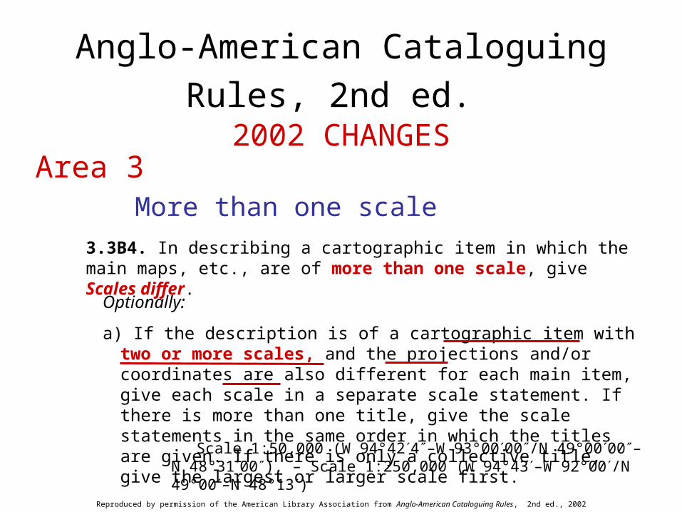
3.3B4. In describing a cartographic item in which the main maps, etc., are of more than one scale, give Scales differ.
Optionally:
a) If the description is of a cartographic item with two or more scales, and the projections and/or coordinates are also different for each main item, give each scale in a separate scale statement. If there is more than one title, give the scale statements in the same order in which the titles are given. If there is only a collective title, give the largest or larger scale first.
Scale 1:50,000 (W 94°424–W 93°0000/N 49°0000–N 48°3100). – Scale 1:250,000 (W 94°43–W 92°00/N 49°00–N 48°13)
Reproduced by permission of the American Library Association from Anglo-American Cataloguing Rules, 2nd ed., 2002 revision

Anglo-American Cataloguing Rules, 2nd ed.
2002 CHANGESArea 3
More than one scale (cont’d)
3.3B4. (cont’d)
b) If the description is of a cartographic item with two or more scales, and the projection and coordinates are the same for each main item, give the scales in one scale statement. If there is more than one title, give the scales in the same order in which the titles are given. If there is only a collective title, give the largest or larger scale first.
Scale 1:7,819,000 and [ca. 1:15,000,000] (E 66°–E 138°/N 54°–N 18°)
Optionally, give each scale with its associated mathematical data in separate scale statements.
Scale 1:7,819,000 (E 66°–E 138°/N 54°–N 18°). – Scale [ca. 1:15,000,000](E 66°–E 138°/N 54°–N 18°)
Reproduced by permission of the American Library Association from Anglo-American Cataloguing Rules, 2nd ed., 2002 revision
Anglo-American Cataloguing Rules, 2nd ed.
2002 CHANGESArea 3
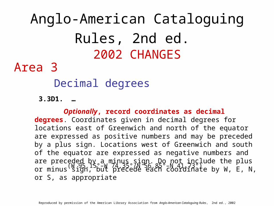
Decimal degrees 3.3D1. …
Optionally, record coordinates as decimal degrees. Coordinates given in decimal degrees for locations east of Greenwich and north of the equator are expressed as positive numbers and may be preceded by a plus sign. Locations west of Greenwich and south of the equator are expressed as negative numbers and are preceded by a minus sign. Do not include the plus or minus sign, but precede each coordinate by W, E, N, or S, as appropriate
(W 95.15°–W 74.35°/N 56.85°–N 41.73°)
Reproduced by permission of the American Library Association from Anglo-American Cataloguing Rules, 2nd ed., 2002 revision
Anglo-American Cataloguing Rules, 2nd ed.
2002 CHANGESArea 3
Decimal degrees (cont’d)
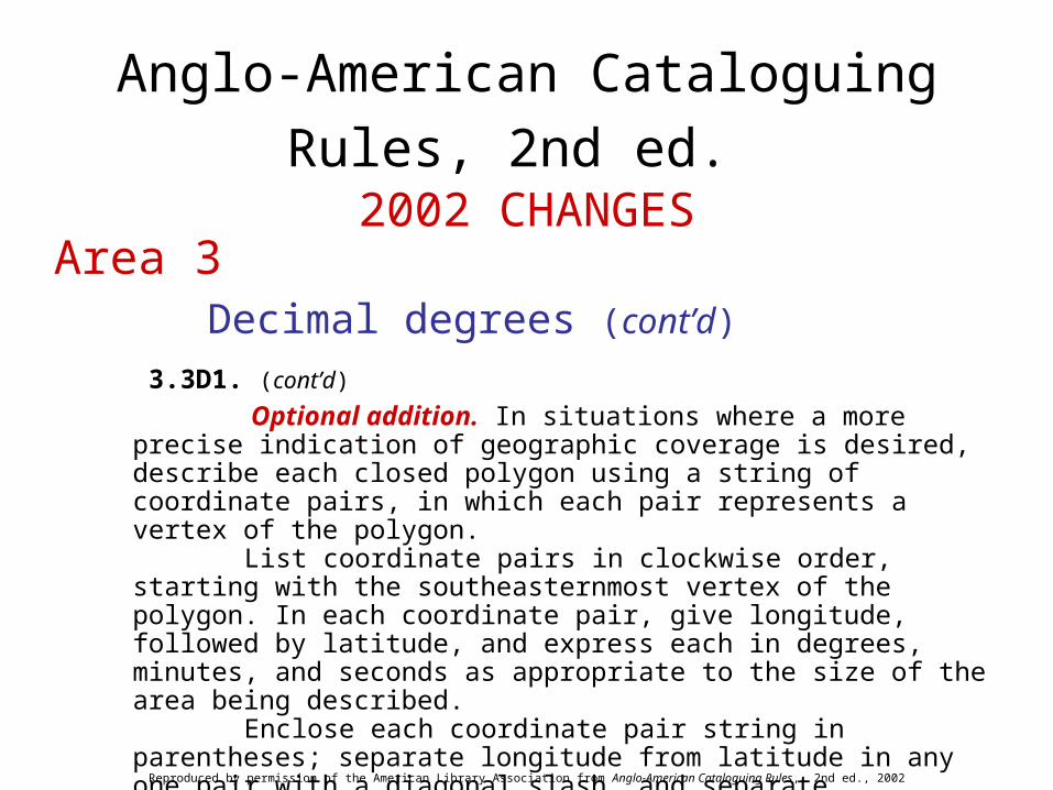
3.3D1. (cont’d)
Optional addition. In situations where a more precise indication of geographic coverage is desired, describe each closed polygon using a string of coordinate pairs, in which each pair represents a vertex of the polygon.
List coordinate pairs in clockwise order, starting with the southeasternmost vertex of the polygon. In each coordinate pair, give longitude, followed by latitude, and express each in degrees, minutes, and seconds as appropriate to the size of the area being described.
Enclose each coordinate pair string in parentheses; separate longitude from latitude in any one pair with a diagonal slash, and separate coordinate pairs within a string with space, semicolon, space.
Polygons have non-intersecting boundaries. The first and last coordinate pairs are the same.
Reproduced by permission of the American Library Association from Anglo-American Cataloguing Rules, 2nd ed., 2002 revision

Anglo-American Cataloguing Rules, 2nd ed.
2002 CHANGESArea 3
Decimal degrees (cont’d)
3.3D1. (cont’d)
For situations in which an area or areas within a given polygon are excluded, list the coordinate pairs for any excluded area as given above, but in counterclockwise order.
(W 114°/N 32° ; W 117°/N 33° ; W 121°/N 35° ; W 125°/N 43° ; W 120°/N 42° ; W 120°/N 39° ; W 115°/N 34° ; W 114°/N 32°)
(W 115°40’/N 33°15’ ; W 115°35’/N 33°20’ ; W 115°55’/N 33°32’ ; W 116°5’/N 33°32’ ; W 116°10’/N 33°30’ ; W 115°50’/N 33°20’ ; W 115°40’/N 33°15’)
Reproduced by permission of the American Library Association from Anglo-American Cataloguing Rules, 2nd ed., 2002 revision

Anglo-American Cataloguing Rules, 2nd ed.
2002 CHANGESArea 3
Type and extent of resource 3.3E1. Give the type and extent of resource for the item as instructed in 9.3.
Scale not given (W 138°59–W 93°47/N 74°25–N 69°16). – Electronic data
Reproduced by permission of the American Library Association from Anglo-American Cataloguing Rules, 2nd ed., 2002 revision
Anglo-American Cataloguing Rules, 2nd ed.
2002 CHANGESArea 3
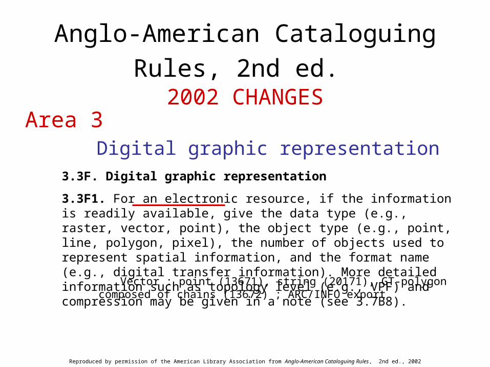
Digital graphic representation3.3F. Digital graphic representation
3.3F1. For an electronic resource, if the information is readily available, give the data type (e.g., raster, vector, point), the object type (e.g., point, line, polygon, pixel), the number of objects used to represent spatial information, and the format name (e.g., digital transfer information). More detailed information such as topology level (e.g., VPF) and compression may be given in a note (see 3.7B8).
Vector : point (13671), string (20171), GT-polygon composed of chains (13672) ; ARC/INFO export
Reproduced by permission of the American Library Association from Anglo-American Cataloguing Rules, 2nd ed., 2002 revision

Anglo-American Cataloguing Rules, 2nd ed.
2002 CHANGESArea 3
Numbering related to serials3.3G. Numbering related to serials
3.3G1. Give the numbering for the item as instructed in 12.3.
Scale 1:3,000,000 at 45° N ; polar stereographic proj. (W 140°–W 52°/N 78°–N 41°). – 1st ed. (1976)-
Reproduced by permission of the American Library Association from Anglo-American Cataloguing Rules, 2nd ed., 2002 revision

Anglo-American Cataloguing Rules, 2nd ed.
2002 CHANGESArea 5
Extent of item3.5B1. Give the extent of a cartographic item. In the case of atlases and globes, give the number of physical units. In the case of other cartographic items, give the number of maps, etc. Use arabic numerals and one of the following terms. If the item is a manuscript, precede the term by ms.
atlasdiagramglobemapmodelprofileremote-sensing imagesectionview
Reproduced by permission of the American Library Association from Anglo-American Cataloguing Rules, 2nd ed., 2002 revision

Anglo-American Cataloguing Rules, 2nd ed.
2002 CHANGESArea 5
Extent of item (cont’d) 3.5B1. (cont’d)
If a cartographic item is not comprehended by one of the above terms, use an appropriate term preferably taken from subrule .5B of one of the chapters of part I.
If the sheets or parts of an item are very numerous and the exact number cannot be readily ascertained, give an approximate number.
If a cartographic item contains, or consists of, tactile data, follow the instructions in 3.5B4.
Reproduced by permission of the American Library Association from Anglo-American Cataloguing Rules, 2nd ed., 2002 revision
Anglo-American Cataloguing Rules, 2nd ed.
2002 CHANGESArea 5
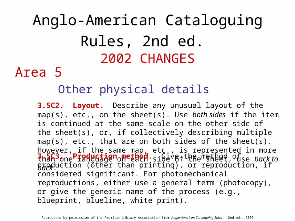
Other physical details 3.5C2. Layout. Describe any unusual layout of the map(s), etc., on the sheet(s).
Use both sides if the item is continued at the same scale on the other side of the sheet(s), or, if collectively describing multiple map(s), etc., that are on both sides of the sheet(s). However, if the same map, etc., is represented in more than one language on each side of the sheet, use back to back.
Reproduced by permission of the American Library Association from Anglo-American Cataloguing Rules, 2nd ed., 2002 revision
3.5C3. Production method. Give the method of production (other than printing), or reproduction, if considered significant. For photomechanical reproductions, either use a general term (photocopy), or give the generic name of the process (e.g., blueprint, blueline, white print).
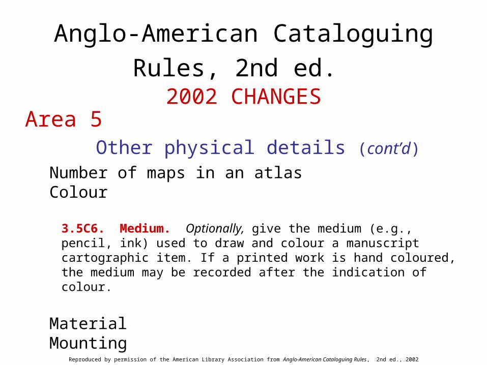
Number of maps in an atlasColour
3.5C6. Medium. Optionally, give the medium (e.g., pencil, ink) used to draw and colour a manuscript cartographic item. If a printed work is hand coloured, the medium may be recorded after the indication of colour.
MaterialMounting
Anglo-American Cataloguing Rules, 2nd ed.
2002 CHANGESArea 5
Other physical details (cont’d)
Reproduced by permission of the American Library Association from Anglo-American Cataloguing Rules, 2nd ed., 2002 revision

Anglo-American Cataloguing Rules, 2nd ed.
2002 CHANGESArea 7
Source of title proper
3.7B3. Make notes on the source of the title proper if it is other than the chief source of information or if considered important.
Title from panel
Reproduced by permission of the American Library Association from Anglo-American Cataloguing Rules, 2nd ed., 2002 revision
Anglo-American Cataloguing Rules, 2nd ed.
2002 CHANGESArea 7
Mathematical data, etc.
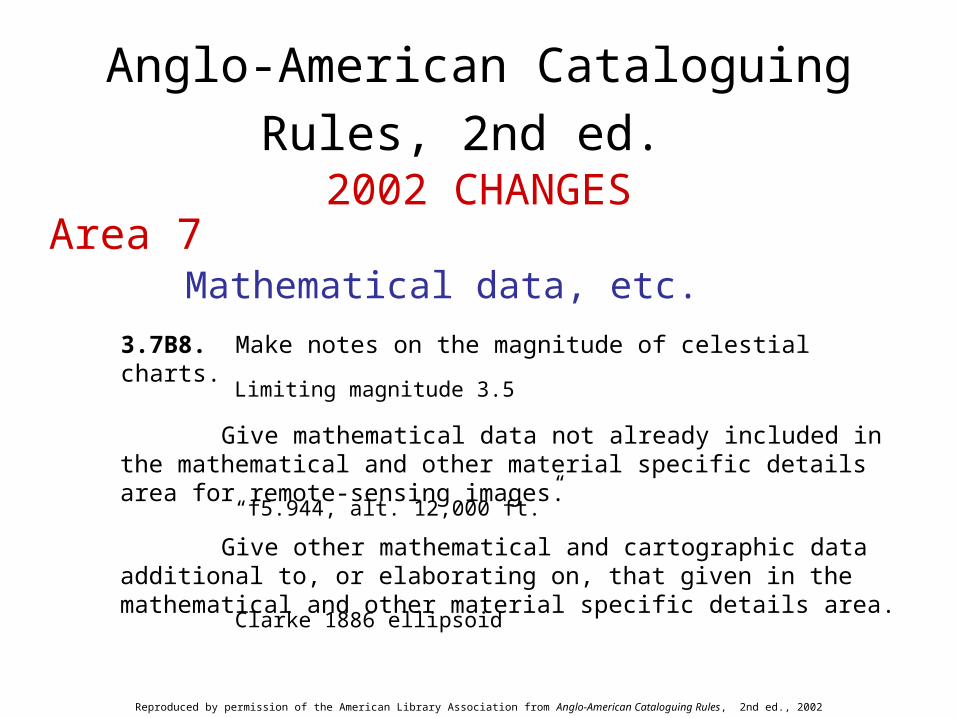
3.7B8. Make notes on the magnitude of celestial charts.
Limiting magnitude 3.5
Give mathematical data not already included in the mathematical and other material specific details area for remote-sensing images.
“f5.944, alt. 12,000 ft.”
Give other mathematical and cartographic data additional to, or elaborating on, that given in the mathematical and other material specific details area.
Clarke 1886 ellipsoid
Reproduced by permission of the American Library Association from Anglo-American Cataloguing Rules, 2nd ed., 2002 revision

Anglo-American Cataloguing Rules, 2nd ed.
2002 CHANGESArea 7
Mathematical data, etc. (cont’d)
3.7B8. (cont’d)
If the information is readily available, give the horizontal coordinate system (geographic system or map projection or grid coordinate system) and the name of the geodetic datum, and, if applicable, the vertical coordinate system (e.g., for digital elevation models). Enclose each set of projection or ellipsoid parameters in parentheses; separate the multiple parameters by a space, semicolon, space; and precede the secondary/related reference method by a colon, space.
Horizontal datum name: North American datum of 1927 ; ellipsoid name: Clarke 1866 (semi-major axis: 6378206.4 ; flattening ratio: 294.98)
Reproduced by permission of the American Library Association from Anglo-American Cataloguing Rules, 2nd ed., 2002 revision

Anglo-American Cataloguing Rules, 2nd ed.
2002 CHANGESArea 7
Mathematical data, etc. (cont’d)
3.7B8. (cont’d)
Altitude datum name: National Geodetic Vertical Datum of 1929 ; altitude resolution: not given ; units of measurement: feet ; vertical encoding method: explicit elevation coordinate included with horizontal coordinates
Geographic system: coordinates ; longitude resolution: 0.0004 ; latitude resolution: 0.0004 ; unit of measure: decimal degrees
Projection: Lambert conformal conic (standard parallels: 38.3 ; 39.4 ; longitude of central meridian: -77 ; latitude of projection origin: 37.8333 ; false easting: 800000 ; false northing 0)
Reproduced by permission of the American Library Association from Anglo-American Cataloguing Rules, 2nd ed., 2002 revision
Anglo-American Cataloguing Rules, 2nd ed.
2002 CHANGESArea 7
Mathematical data, etc. (cont’d)
3.7B8. (cont’d)
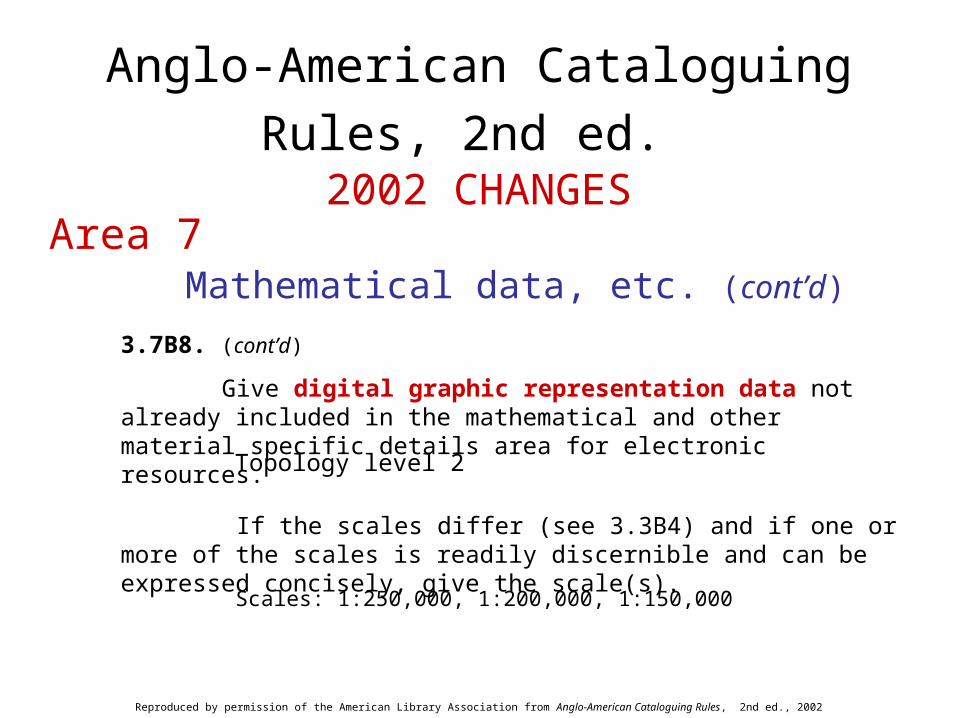
Give digital graphic representation data not already included in the mathematical and other material specific details area for electronic resources.
Topology level 2
If the scales differ (see 3.3B4) and if one or more of the scales is readily discernible and can be expressed concisely, give the scale(s).
Scales: 1:250,000, 1:200,000, 1:150,000
Reproduced by permission of the American Library Association from Anglo-American Cataloguing Rules, 2nd ed., 2002 revision


Cartographic Materials, 2nd ed.
Includes current AACR2 rules
Cartographic Materials, 2nd ed.
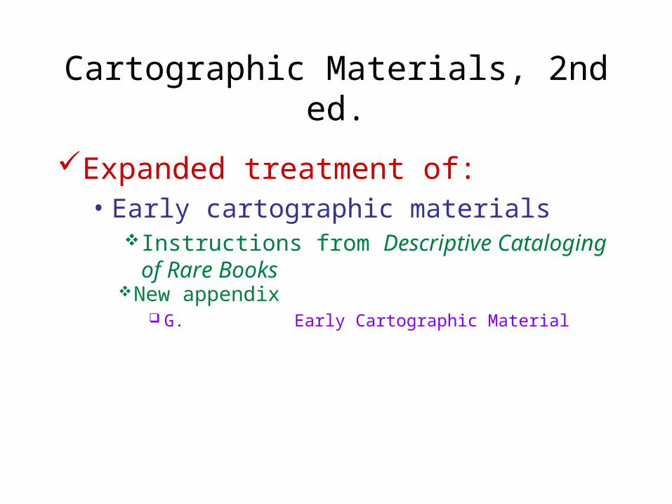
Expanded treatment of:• Early cartographic materials
Instructions from Descriptive Cataloging of Rare Books
New appendix G. Early Cartographic Material

Cartographic Materials, 2nd ed.
Treatment of:• Cartographic electronic resources
Includes appropriate rules from AACR2 chapter 9Accommodates geospatial standards:
Content Standard for Digital Geospatial Metadata / Federal Geographic Data Committee
Geomatic Data Sets Cataloguing Rules / prepared by the Canadian General Standards Board
New appendices H. Cartographic Electronic Resources J. Remote-Sensing Images
Cartographic Materials, 2nd ed.
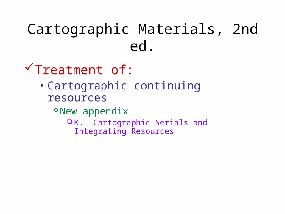
Treatment of:• Cartographic continuing resources
New appendix K. Cartographic Serials and Integrating Resources
Cartographic Materials, 2nd ed.
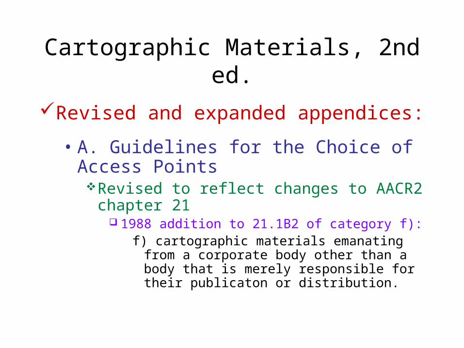
Revised and expanded appendices:
• A. Guidelines for the Choice of Access PointsRevised to reflect changes to AACR2 chapter 21
1988 addition to 21.1B2 of category f):f) cartographic materials emanating from a corporate
body other than a body that is merely responsible for their publicaton or distribution.
Cartographic Materials, 2nd ed.
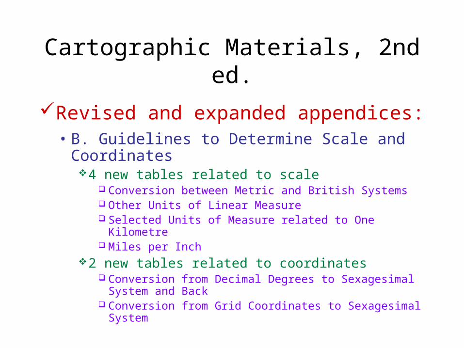
Revised and expanded appendices:• B. Guidelines to Determine Scale and
Coordinates4 new tables related to scale
Conversion between Metric and British Systems Other Units of Linear Measure Selected Units of Measure related to One Kilometre Miles per Inch
2 new tables related to coordinates Conversion from Decimal Degrees to Sexagesimal System
and Back Conversion from Grid Coordinates to Sexagesimal System

Cartographic Materials, 2nd ed.
Revised and expanded appendices:
• C. Date of Situation• D. Series and Sets
Previously D. Series• E. Treatment of Cartographic Series and Sets
Previously E. Treatment of Map Series • F. Geographic Atlases

Cartographic Materials, 2nd ed.
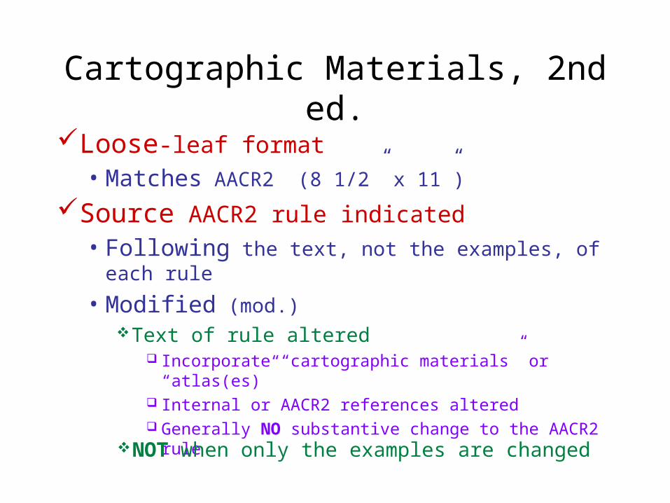
Loose-leaf format• Matches AACR2 (8 1/2” x 11”)
Source AACR2 rule identified• Following the text, not the final examples, of
each rule
Cartographic Materials, 2nd ed.
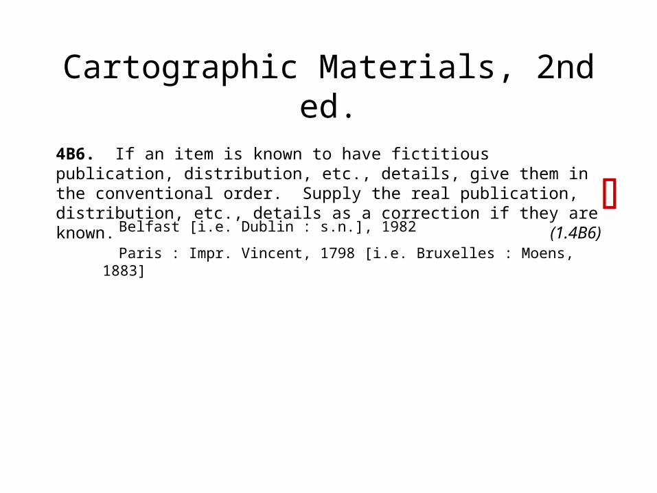
4B6. If an item is known to have fictitious publication, distribution, etc., details, give them in the conventional order. Supply the real publication, distribution, etc., details as a correction if they are known. (1.4B6)
Belfast [i.e. Dublin : s.n.], 1982
Paris : Impr. Vincent, 1798 [i.e. Bruxelles : Moens, 1883]

Cartographic Materials, 2nd ed.
Loose-leaf format• Matches AACR2 (8 1/2” x 11”)
Source AACR2 rule indicated
• Following the text, not the final examples, of each rule
• Modified (mod.)Text of rule altered
Incorporate “cartographic materials” or “atlas(es)” Internal or AACR2 references altered Generally NO substantive change to the AACR2 rule
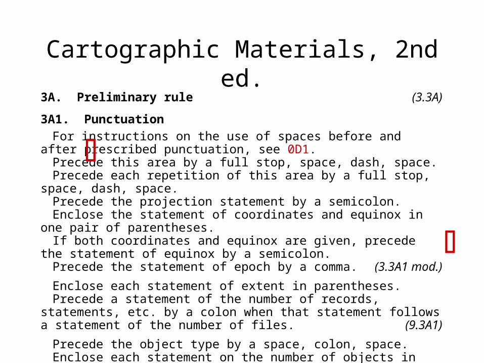
Cartographic Materials, 2nd ed.3A. Preliminary rule (3.3A)
3A1. Punctuation
For instructions on the use of spaces before and after prescribed punctuation, see 0D1.
Precede this area by a full stop, space, dash, space.Precede each repetition of this area by a full stop, space, dash, space.Precede the projection statement by a semicolon.Enclose the statement of coordinates and equinox in one pair of parentheses.If both coordinates and equinox are given, precede the statement of equinox by
a semicolon.Precede the statement of epoch by a comma. (3.3A1 mod.)
Enclose each statement of extent in parentheses.Precede a statement of the number of records, statements, etc. by a colon when
that statement follows a statement of the number of files. (9.3A1)
Precede the object type by a space, colon, space.Enclose each statement on the number of objects in parentheses after the object
type. Precede the format name by a space, semicolon, space. (3.3A1)
Cartographic Materials, 2nd ed.
Loose-leaf format• Matches AACR2 (8 1/2” x 11”)
Source AACR2 rule indicated
• Following the text, not the examples, of each rule
• Modified (mod.)Text of rule altered
Incorporate “cartographic materials” or “atlas(es)” Internal or AACR2 references altered Generally NO substantive change to the AACR2 rule
NOT when only the examples are changed

Cartographic Materials, 2nd ed.
1B2. If the title proper includes a statement of responsibility or the name of a publisher, distributor, etc., and the statement or name is an integral part of the title proper (i.e., connected by a case ending or other grammatical construction), transcribe it as part of the title proper. (1.1B2)
Philip’s new practical atlas
Champion map of greater Knoxville, Tennessee
Dolph’s map of Cape Coral, Florida
The Grosset world atlas(Published by Hammond Incorporated; distributed by Grosset & Dunlap)
La route Shell
Cartographic Materials, 2nd ed.
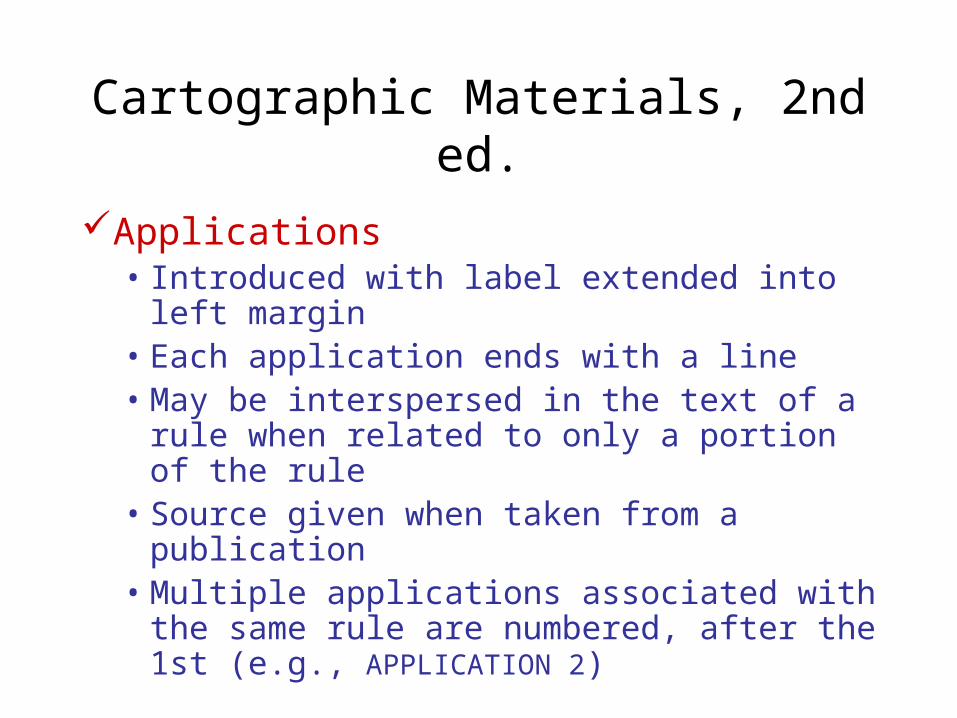
Applications• Introduced with label extended into left margin• Each application ends with a line• May be interspersed in the text of a rule when
related to only a portion of the rule• Source given when taken from a publication• Multiple applications associated with the same
rule are numbered, after the 1st (e.g., APPLICATION 2)
Cartographic Materials, 2nd ed.
If a printed item is hand coloured, state this as "hand col." Do not differentiate between colour and partial colour. Details on the amount of colour, or number of colours used,
etc., may be recorded in a note (see 7B10). Monochromatic items are not considered coloured
regardless of the colour of ink or paper used. If the colour of ink used on monochromatic items is other than black, or if the paper is other than white, this may be recorded in a note.
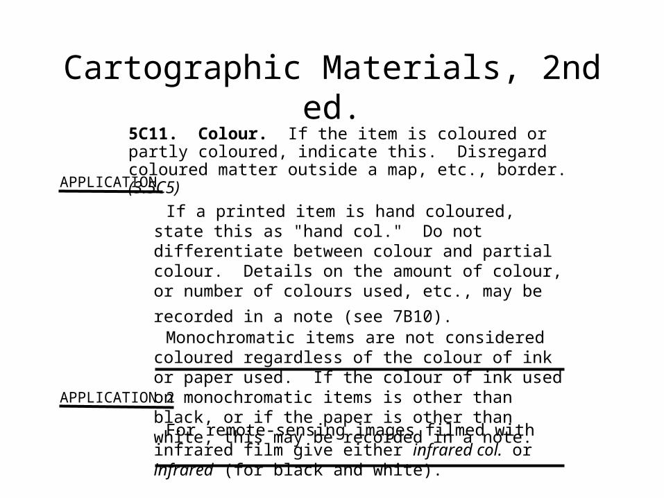
APPLICATION
5C11. Colour. If the item is coloured or partly coloured, indicate this. Disregard coloured matter outside a map, etc., border. (3.5C5)
APPLICATION 2
For remote-sensing images filmed with infrared film give either infrared col. or infrared (for black and white).
Cartographic Materials, 2nd ed.
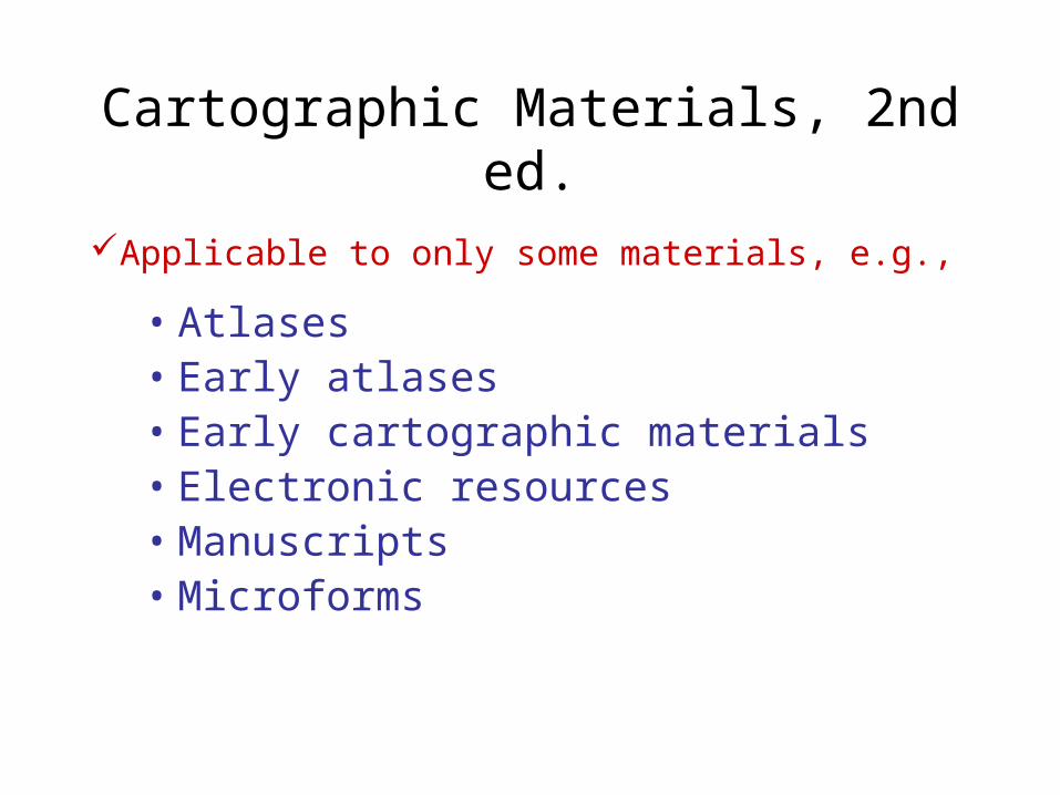
Applicable to only some materials, e.g.,• Atlases• Early atlases• Early cartographic materials• Electronic resources• Manuscripts• Microforms

Cartographic Materials, 2nd ed.
Applicable to only some materials
• Rules Incorporated in the text of the rule
For electronic resources …Incorporated as the label of the rule
4F10. Manuscripts and unpublished …
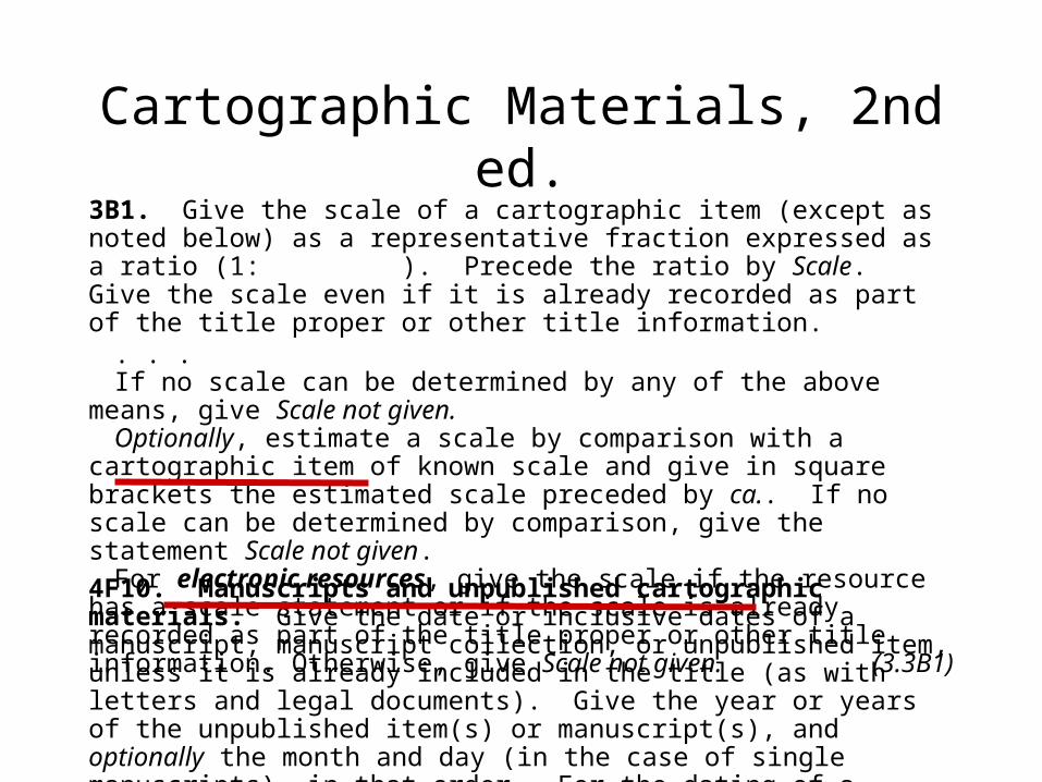
Cartographic Materials, 2nd ed.3B1. Give the scale of a cartographic item (except as noted below) as a representative fraction expressed as a ratio (1: ). Precede the ratio by Scale. Give the scale even if it is already recorded as part of the title proper or other title information.
. . .If no scale can be determined by any of the above means, give Scale not given.Optionally, estimate a scale by comparison with a cartographic item of known
scale and give in square brackets the estimated scale preceded by ca.. If no scale can be determined by comparison, give the statement Scale not given.
For electronic resources, give the scale if the resource has a scale statement or if the scale is already recorded as part of the title proper or other title information. Otherwise, give Scale not given. (3.3B1)
4F10. Manuscripts and unpublished cartographic materials. Give the date or inclusive dates of a manuscript, manuscript collection, or unpublished item, unless it is already included in the title (as with letters and legal documents). Give the year or years of the unpublished item(s) or manuscript(s), and optionally the month and day (in the case of single manuscripts), in that order. For the dating of a collection, see 4F11. (4.4B1 mod.)
Cartographic Materials, 2nd ed.
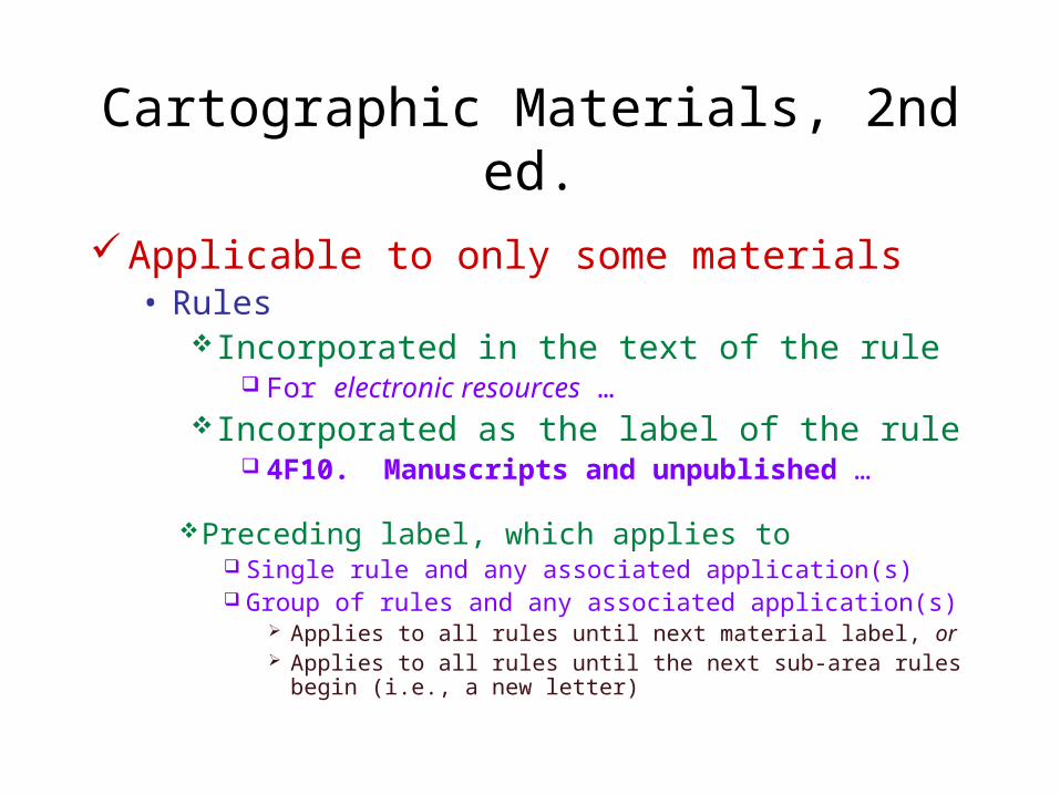
Applicable to only some materials • Rules
Incorporated in the text of the rule For electronic resources …
Incorporated as the label of the rule 4F10. Manuscripts and unpublished …
Preceding label, which applies to Single rule and any associated application(s) Group of rules and any associated application(s)
Applies to all rules until next material label, or Applies to all rules until the next sub-area rules begin (i.e.,
a new letter)

Cartographic Materials, 2nd ed.
APPLICATION
If the item lacks a publisher statement, give the details of the printer, bookseller-printer, or bookseller as a publisher statement if it appears that this person acted as publisher, seller, or distributor of the item.
Early cartographic materials
4B7. A publisher statement may refer to one or more publishers, distributors, booksellers, or printers. (2.16A)
Electronic resources
4B8. Consider all remote access electronic resources to be published.(9.4B2)

Cartographic Materials, 2nd ed.
Applicable to only some materials• Applications
Label precedes text of application

Cartographic Materials, 2nd ed.
APPLICATION
When the name of the place of publication appears in more than one language or script, give the statement in the language or script of the title proper, or if that criterion does not apply, give the statement that appears first. Use the mark of omission for statements omitted. Give the parallel statements in a note, if desired.
(Rare 4B13)
Early cartographic materials
If the name of a place appears in more than one language or script, give the form in the language or script of the title proper. If this criterion does not apply, give the form that appears first. (1.4C1)
4C1. Transcribe a place of publication, etc., in the form and the grammatical case in which it appears.

Cartographic Materials, 2nd ed.
Applicable to only some materials• Applications
Label precedes text of applicationIncorporated in the text
For early cartographic materials …

Cartographic Materials, 2nd ed.
If a printed item is hand coloured, state this as "hand col." Do not differentiate between colour and partial colour. Details on the amount of colour, or number of colours used,
etc., may be recorded in a note (see 7B10). Monochromatic items are not considered coloured
regardless of the colour of ink or paper used. If the colour of ink used on monochromatic items is other than black, or if the paper is other than white, this may be recorded in a note.
APPLICATION
5C11. Colour. If the item is coloured or partly coloured, indicate this. Disregard coloured matter outside a map, etc., border. (3.5C5)
APPLICATION 2
For remote-sensing images filmed with infrared film give either infrared col. or infrared (for black and white).

Cartographic Materials, 2nd ed.
Policies• Follows option addition or optionally statement
in a rule or applicationone option within a rule or application
Policies follow the rule or application
multiple options within a rule or application Policies follow the paragraph containing optionally or
optional addition
• Documents national agency policy (no option)e.g., punctuation used in scale statements

Cartographic Materials, 2nd ed.
Policies• Includes policies from
British LibraryLibrary of CongressNational Archives of Canada
Cartographic Materials, 2nd ed.
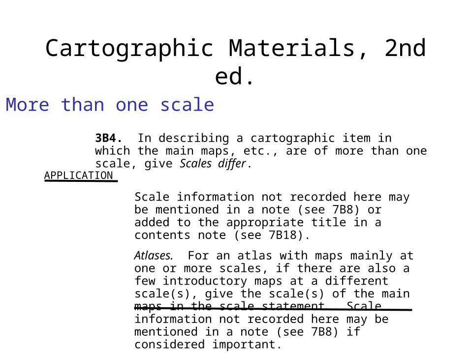
3B4. In describing a cartographic item in which the main maps, etc., are of more than one scale, give Scales differ.
APPLICATION
Scale information not recorded here may be mentioned in a note (see 7B8) or added to the appropriate title in a contents note (see 7B18).
Atlases. For an atlas with maps mainly at one or more scales, if there are also a few introductory maps at a different scale(s), give the scale(s) of the main maps in the scale statement. Scale information not recorded here may be mentioned in a note (see 7B8) if considered important.
More than one scale

Cartographic Materials, 2nd ed.
More than one scale (cont’d)
Scale 1:50 000 (W 94°424—W 93°0000/N 49°0000–N 48°3100). – Scale 1:250 000 (W 94°43–W 92°00/N 49°00–N 48°13)
a) If the description is of a cartographic item with two or more scales, and the projections and/or coordinates are also different for each main item, give each scale in a separate scale statement. If there is more than one title, give the scale statements in the same order in which the titles are given. If there is only a collective title, give the largest or larger scale first.
Optionally:

Cartographic Materials, 2nd ed.
More than one scale (cont’d)
Scale 1:7 819 000 and [ca. 1:15 000
000] (E 66°–E 138°/N 54°–N 18°)
b) If the description is of a cartographic item with two or more scales, and the projection and coordinates are the same for each main item, give the scales in one scale statement. If there is more than one title, give the scales in the same order in which the titles are given. If there is only a collective title, give the largest or larger scale first.
Optionally, give each scale with its associated mathematical data in separate scale statements.
(3.3B4)Scale 1:7 819 000 (E 66°–E 138°/N
54°–N 18°). – Scale [ca. 1:15 000 000]
(E 66°–E 138°/N 54°–N 18°)

Cartographic Materials, 2nd ed.
More than one scale (cont’d)
POLICIES
Library of CongressIn describing a cartographic item in which all of the
main maps, etc., are of two scales, give both scales in separate scale statements. If there are more than two scales, give Scales differ.
National Archives of CanadaThe “optionally” provision is applied (i.e., a or b is
applied as the situation warrants). The “optionally” provision within part b is not applied.

Cartographic Materials, 2nd ed.
Concordance• Relates
AACR2 rule to Cartographic Materials rule
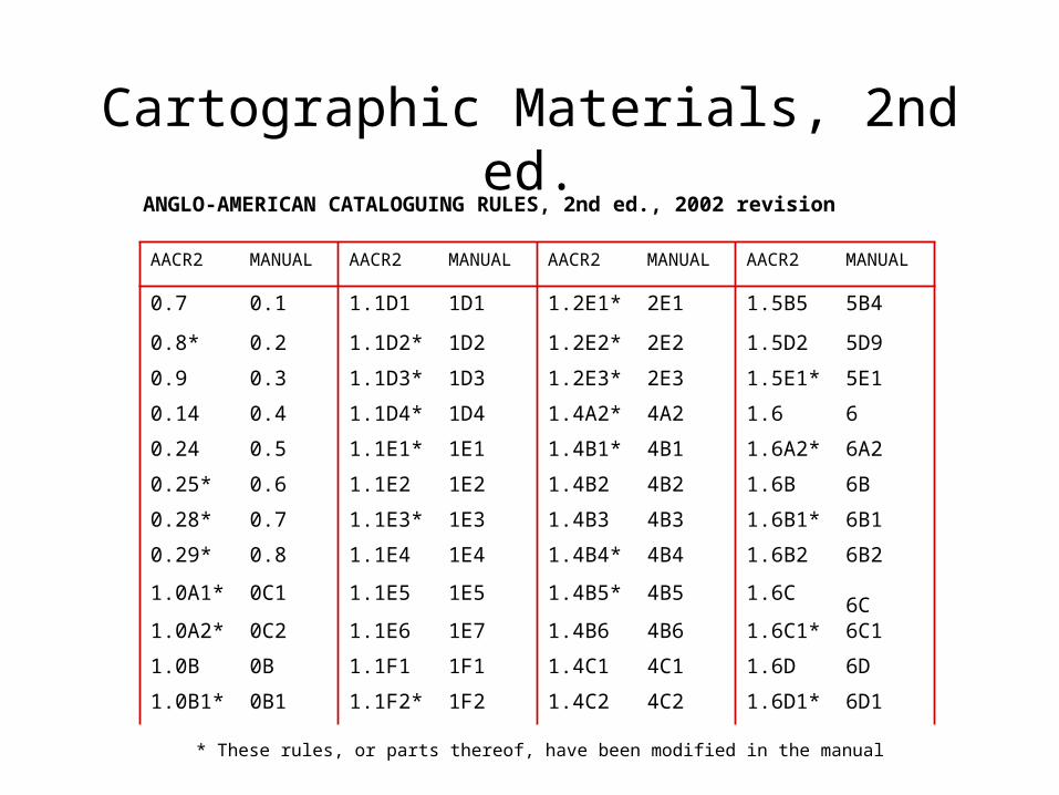
Cartographic Materials, 2nd ed.
AACR2 MANUAL AACR2 MANUAL AACR2 MANUAL AACR2 MANUAL
0.7 0.1 1.1D1 1D1 1.2E1* 2E1 1.5B5 5B4
0.8* 0.2 1.1D2* 1D2 1.2E2* 2E2 1.5D2 5D9
0.9 0.3 1.1D3* 1D3 1.2E3* 2E3 1.5E1* 5E1
0.14 0.4 1.1D4* 1D4 1.4A2* 4A2 1.6 6
0.24 0.5 1.1E1* 1E1 1.4B1* 4B1 1.6A2* 6A2
0.25* 0.6 1.1E2 1E2 1.4B2 4B2 1.6B 6B
0.28* 0.7 1.1E3* 1E3 1.4B3 4B3 1.6B1* 6B1
0.29* 0.8 1.1E4 1E4 1.4B4* 4B4 1.6B2 6B2
1.0A1* 0C1 1.1E5 1E5 1.4B5* 4B5 1.6C6C
1.0A2* 0C2 1.1E6 1E7 1.4B6 4B6 1.6C1* 6C1
1.0B 0B 1.1F1 1F1 1.4C1 4C1 1.6D 6D
1.0B1* 0B1 1.1F2* 1F2 1.4C2 4C2 1.6D1* 6D1
* These rules, or parts thereof, have been modified in the manual
ANGLO-AMERICAN CATALOGUING RULES, 2nd ed., 2002 revision

Cartographic Materials, 2nd ed.
Concordance• Relates
AACR2 rule to Cartographic Materials ruleDescriptive Cataloging of Rare Books information
to Cartographic Materials application
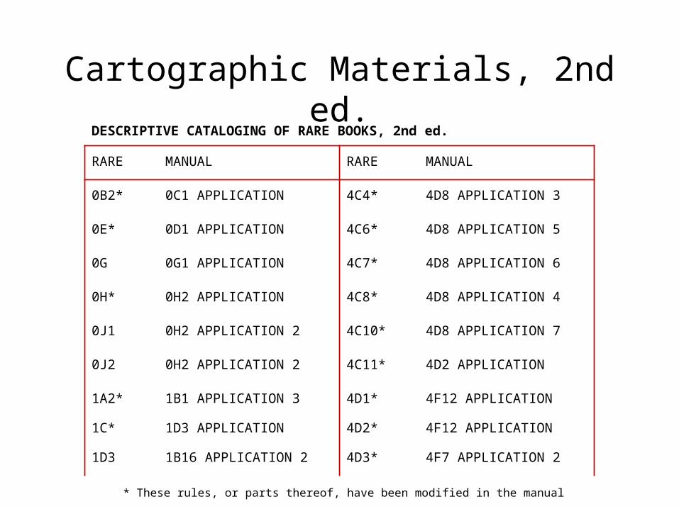
RARE MANUAL RARE MANUAL
0B2* 0C1 APPLICATION 4C4* 4D8 APPLICATION 3
0E* 0D1 APPLICATION 4C6* 4D8 APPLICATION 5
0G 0G1 APPLICATION 4C7* 4D8 APPLICATION 6
0H* 0H2 APPLICATION 4C8* 4D8 APPLICATION 4
0J1 0H2 APPLICATION 2 4C10* 4D8 APPLICATION 7
0J2 0H2 APPLICATION 2 4C11* 4D2 APPLICATION
1A2* 1B1 APPLICATION 3 4D1* 4F12 APPLICATION
1C* 1D3 APPLICATION 4D2* 4F12 APPLICATION
1D3 1B16 APPLICATION 2 4D3* 4F7 APPLICATION 2
Cartographic Materials, 2nd ed.
* These rules, or parts thereof, have been modified in the manual
DESCRIPTIVE CATALOGING OF RARE BOOKS, 2nd ed.
