annual report - trussville
TRANSCRIPT

STORM WATER MANAGEMENT AUTHORITY,
INC.
2015-2016
ANNUAL REPORT

2

3
Table of Contents Table of Contents ...............................................................................................................................3
Table of Appendices (See enclosed compact disc) ...............................................................................6
1 General Information ...................................................................................................................9
1.1 Introduction .................................................................................................................................. 9
1.2 SWMA Area Description ............................................................................................................. 10
Table 1: 2010 Census Member Information ....................................................................................... 11
1.3 Known or Suspected Water Quality Issues ................................................................................. 12
1.4 Responsible Party ........................................................................................................................ 15
1.5 SWMA and Member Fiscal Analysis ............................................................................................ 15
2 Storm Water Management Program Components ..................................................................... 16
2.1 Public Education and Outreach ................................................................................................... 16
2.1.1 Outreach Publications ......................................................................................................... 16
2.1.2 Website ............................................................................................................................... 18
2.1.3 Public Presentations............................................................................................................ 19
2.1.4 Erosion and Sedimentation Control Workshops ................................................................. 20
2.1.5 Recycling Trailer Grant Proposal and Implementation ....................................................... 20
2.1.6 Grease Control Program ..................................................................................................... 21
2.1.7 Rain Barrel Project .............................................................................................................. 21
2.1.8 Pet Waste Disposal Promotion ........................................................................................... 22
2.1.9 Public Service Announcement ............................................................................................ 22
2.1.10 Household Hazardous Waste Day ....................................................................................... 22
2.1.11 JCDH Storm Water Hotline and Complaint Website ........................................................... 23
2.1.12 JCDH Environmental Quality and Assessment Meetings .................................................... 23
2.1.13 Valley Creek Cleanup 2016 ................................................................................................. 23
2.1.14 Grant’s Mill Cleanup 2015 ................................................................................................... 24
2.2 Illicit Discharge Detection and Elimination ................................................................................. 24
2.2.1 Illicit Discharge Ordinance .................................................................................................. 24
2.2.2 Sanitary Sewer Overflow Mapping ..................................................................................... 24
2.2.3 Stormwater Outfall Inventory Mapping.............................................................................. 25
2.2.4 Illicit Discharge Hotline and Online Reporting Form ........................................................... 25
2.2.5 Roadside Trash Assessment: The 2011 Litter Survey .......................................................... 26
2.2.6 Inspection of Drainage Systems .......................................................................................... 26
2.2.7 Standard Operating Procedures (SOP) and Guidelines (“The Manual”) ............................. 26
2.2.8 People Against A Littered State (PALS) Cleanups................................................................ 27
2.3 Stormwater Monitoring Program ............................................................................................... 27

4
2.3.1 Dry Weather Monitoring ..................................................................................................... 29
2.3.2 Monthly Monitoring ............................................................................................................ 29
2.3.3 Characterization Monitoring ............................................................................................... 29
2.3.4 Investigation Monitoring .................................................................................................... 29
2.3.5 Complaint Investigations .................................................................................................... 29
2.3.6 Bioassessments ................................................................................................................... 30
2.4 Structural Controls and Storm Water Collection System Operations ......................................... 30
2.4.1 Storm Sewer (MS4) Mapping .............................................................................................. 30
2.4.2 SOP Manual ......................................................................................................................... 31
2.4.3 Stormwater Online Activity Record (SOAR) Forms ............................................................. 31
2.5 New Development and Significant Redevelopment ................................................................... 32
2.5.1 Mapping of New Development ........................................................................................... 32
2.5.2 Alabama Low Impact Development (LID) Handbook .......................................................... 32
2.5.3 Comprehensive Planning .................................................................................................... 32
2.6 Roadways .................................................................................................................................... 33
2.6.1 SOP Manual ......................................................................................................................... 33
2.6.2 SOAR Municipal Forms ........................................................................................................ 33
2.7 Flood Control Projects................................................................................................................. 33
2.8 Spill Response and Prevention .................................................................................................... 34
2.8.1 Hazardous Waste Emergency Response ............................................................................. 34
2.8.2 SOP Manual ......................................................................................................................... 34
2.8.3 SOAR Municipal Forms ........................................................................................................ 34
2.9 Pesticides, Herbicides, and Fertilizers (PHF) Application ............................................................ 35
2.9.1 SOP Manual ......................................................................................................................... 35
2.9.2 SOAR Municipal Forms ........................................................................................................ 35
2.10 Industrial and High Risk Runoff ................................................................................................... 35
2.10.1 ADEM NPDES Permitted Facilities ....................................................................................... 35
2.10.2 Land Use Mapping .............................................................................................................. 36
2.10.3 Priority Area Mapping ......................................................................................................... 36
2.10.4 Landfill Monitoring .............................................................................................................. 36
2.10.5 HHW Brochure .................................................................................................................... 37
2.10.6 Industrial Ordinance............................................................................................................ 37
2.11 Construction Site Runoff Program .............................................................................................. 37
2.11.1 Erosion and Sedimentation Control Ordinance .................................................................. 37
2.11.2 Erosion and Sedimentation Control Permitting Software .................................................. 37

5
2.11.3 Erosion and Sedimentation Control Inspection Checklist ................................................... 38
2.11.4 Erosion and Sedimentation Control Inspections ................................................................ 38
3 Program Summary .................................................................................................................... 39
3.1 Program Strengths ...................................................................................................................... 39
3.2 Program Weaknesses .................................................................................................................. 40
6
Table of Appendices (See enclosed compact disc)
Appendix A: 303(d) and TMDL Lists for Jefferson County .................................................................. 43
Appendix B: Inter-jurisdictional Agreements and Contracts and Roles ............................................... 49
Roles of Members and SWMA ................................................................................................................ 51
SWMA Legislative Act ............................................................................................................................. 53
SWMA Bylaws ......................................................................................................................................... 79
JCDH contract with SWMA ...................................................................................................................... 95
SWMA Fiscal Analysis ............................................................................................................................ 109
Standard Operating Procedure (SOP) Passage ..................................................................................... 115
Appendix C: Public Education and Outreach .................................................................................... 117
Storm Water Outreach Report 2015-2016 ........................................................................................... 119
Valley Creek Clean-Up Final Report ..................................................................................................... 123
2016 Household Hazardous Waste Day Flyer ...................................................................................... 129
2016 Household Hazardous Waste Day Survey Results ....................................................................... 131
Appendix D: Illicit Discharge Detection and Elimination .................................................................. 141
Sanitary Sewer Overflows Eliminated for 2015-2016 ........................................................................... 143
Storm Water Outfall Inventory ............................................................................................................. 145
Municipal Separate Storm Sewer System (MS4) Data Dictionaries ...................................................... 149
Appendix E: Monitoring ................................................................................................................. 155
Sampling Schedule ................................................................................................................................ 157
Sampling Parameters and Packages ..................................................................................................... 159
Sampling Field Data Dictionary ............................................................................................................. 161
Main Channel and Impaired Tributary Sampling Sites .......................................................................... 171
Tributary Sampling Sites ....................................................................................................................... 173
Monthly Monitoring Results ................................................................................................................. 175
Sampling Dates and Frequencies .......................................................................................................... 229
Sample Results for 2015-2016 .............................................................................................................. 235
Complaint and Investigations Worked for Permit Year 2015-2016 ...................................................... 375

7
Bioassessments ..................................................................................................................................... 377
Bioassessments’ Data Analysis .............................................................................................................. 385
Appendix F: Storm Water Controls and Storm Water Collection System .......................................... 393
Storm Drain Mapping Program ............................................................................................................. 395
Stormwater System Work ..................................................................................................................... 417
Structural Infrastructure Inventory ....................................................................................................... 505
Appendix G: Municipal Roadway Forms .......................................................................................... 507
Deicing Application and Disposal .......................................................................................................... 509
Deicing Storage Inventory ..................................................................................................................... 511
Street Sweeping, Litter Collection and Leaf Collection ......................................................................... 513
Asphalt Patching ................................................................................................................................... 559
Roadway Projects .................................................................................................................................. 567
Appendix H: Member’s Spill Response and Prevention .................................................................... 569
Spill Cleanup Procedure ........................................................................................................................ 571
Jefferson County Emergency Management Agency Incident Log ........................................................ 573
Appendix I: Municipal Pesticide, Herbicide, and Fertilizer Forms ..................................................... 579
PHF Application ..................................................................................................................................... 581
PHF Storage Inventory .......................................................................................................................... 629
Appendix J: Industrial and High Risk Runoff .................................................................................... 635
NPDES Permitted Sites .......................................................................................................................... 637
Fire Department NPDES Responses ...................................................................................................... 639
Jefferson County Land Use Map .......................................................................................................... 659
Watershed Priority Area Mapping ........................................................................................................ 661
Landfill Monitoring GIS Map ................................................................................................................. 667
Appendix K: Erosion and Sedimentation Control ............................................................................. 669

8

9
1 General Information
1.1 Introduction
The passage of Legislative Act 95-775 in 1997 enabled the mayors of cities within Jefferson County establish Storm Water Management Authority, Inc. (SWMA). The requirements of the National Pollution Discharge Elimination System (NPDES) permit # ALS000001, issued by Alabama Department of Environmental Management (ADEM), and the United States Environmental Protection Agency’s (EPA) Title 40 Code of Federal Regulations Part 122 (40 CFR 122), charge that SWMA in coordination with all co-permittees of the permit, work to meet the obligations of the approved Storm Water Management Program (SWMP). SWMA functions on behalf of all the co-permittees listed above to meet the compliance requirements of the NPDES permit. SWMA has subcontracted with the Watershed Protection Program (WPP) of the Jefferson County Department of Health (JCDH) to perform certain responsibilities. SWMA members, the Board of Directors, and mayors are aware that the ultimate responsibility toward permit compliance lies with the municipality. The following is a list of specific responsibilities according to the permit for all co-permittees individually and jointly:
Compliance with permit conditions relating to the discharges from portions of the Municipal Separate Storm Sewer System (MS4) where the permittee is the operator;
SWMP implementation on portions of the MS4 where the permittee is the operator; Compliance with annual reporting requirements; according to 40 CFR 122.42(c)((1)-(7)
these must include: 1. Status of storm water management program components that are permit
conditions, 2. Proposed changes to the program permit conditions, 3. Revisions, if necessary, to the assessment of controls and the fiscal analysis
reported in the original permit application, 4. Summary of data accumulated throughout the year, 5. Annual expenditures and budget for the past, current, and next calendar year, 6. Summary describing the number and nature of enforcement actions,
inspections, and public education programs, 7. Identification of water quality improvements or degradations throughout the
SWMA area. Collection of representative monitoring data, according to such agreements as may be
established between co-permittees; A plan of action to assume responsibility for implementation of the SWMP should inter-
jurisdictional agreements allocating responsibility be dissolved or in default.

10
Therefore, the primary objective of SWMA, JCDH, and all co-permittees under the NPDES permit ALS000001 (hereinafter referred to as “Program”) is to implement the SWMP in such a manner as to effectively prohibit the discharge of non-storm water into the MS4 and to reduce the discharge of pollutants from the MS4 to Maximum Extent Practicable (MEP). The 2015-2016 annual report is the fifteenth report since the permit was issued in October 2001 and covers the reporting period from October 1st, 2015 through September 30th, 2016. The program outlined in this report is patterned to fit the requirements given by ADEM and EPA in the permit given on October 15, 2001. The five year permit cycle expired in October 2006. At ADEM’s direction SWMA has continued to operate under the 2001 permit until the renewed Phase I permits are issued. SWMA reapplied for its NPDES permit in October 2006. ADEM is expected to issue a new individual permit to each member city in 2016-2017. This report is being submitted to the ADEM pursuant to Part V; paragraph B of the NPDES permit ALS000001 that expired in October 2006.
1.2 SWMA Area Description
The area encompassed by SWMA is composed of 20 Phase I municipalities and one Phase II municipality (Graysville) within Jefferson County. The 20 Phase I member cities listed below are contracted with SWMA as well as JCDH to perform key storm water services related to monitoring and water quality: Adamsville Brighton Brookside Center Point Clay
Fairfield Gardendale Homewood Hueytown Irondale
Lipscomb Maytown Midfield Mulga Mountain Brook
Pinson Pleasant Grove Tarrant Trussville Vestavia Hills
The land area encompassed by SWMA’s Phase I members totals an estimated 137,791 acres with an approximate population of 231,162 people served in 98,009 housing structures according to the 2010 U.S. Census (Table 1).

11
Table 1: 2010 Census Member Information
Municipalities Acres 2010 Census Populations
Housing Structures
ADAMSVILLE 17,139.3 10,762 4780
BRIGHTON 787.4 2,945 1360
BROOKSIDE 5,411.7 1,363 577
CENTER POINT 3,730.0 16,921 7221
CLAY 7,170.4 13,695 5,252
FAIRFIELD 2,062.8 11,117 4,935
GARDENDALE 13,766.5 13,893 6040
HOMEWOOD 5,272.9 25,167 11,385
HUEYTOWN 13,168.5 16,105 6,998
IRONDALE 11,340.9 12,349 5,495
LIPSCOMB 721.8 2,210 950
MAYTOWN 1,740.1 385 189
MIDFIELD 1,551.9 5,365 2,330
MOUNTAIN BROOK 8,058.2 20,413 8,266
MULGA 373.9 836 411
PINSON 4,028.2 7,163 2,948
PLEASANT GROVE 6,146.5 10,110 3,946
TARRANT 4,070.0 6,397 2,307
TRUSSVILLE 18,822.0 19,933 7,667
VESTAVIA HILLS 12,428.1 34,033 14,952
TOTAL 137,791.1 231,162 98,009

12
1.3 Known or Suspected Water Quality Issues
The area of responsibility for SWMA and JCDH discharges into six watersheds (Hydrologic Unit Code (HUC) – 10) including the Headwaters of the Cahaba River, Lower Locust Fork, Valley Creek, Shades Creek, Middle Locust Fork, and Cahaba River-Buck Creek. See Figure 1.
Figure 1 HUC 10 Watersheds in Jefferson County
The 2016 water quality 303(d) list prepared by ADEM and EPA shows three waterways within, or flowing through, the SWMA jurisdiction that are designated as impaired by not meeting their usage category designated by ADEM. The 303(d) characterizations are performed under a federal mandate by ADEM on a biennial basis to evaluate all waterbodies within the state of Alabama. The water’s ability to meet its usage standard must be supported by the best existing data or the waterbody will be listed as 303(d) Impaired. The ADEM usage standards are listed below:
1. Outstanding Alabama Water (OAW) 2. Public Water Supply (PWS) 3. Swimming and Other Whole Body Water-Contact Sports (S) 4. Fish and Wildlife (F&W) 5. Limited Warmwater Fishery (LWF) 6. Agricultural and Industrial Water Supply ( A&I)

13
Village Creek was placed on the 303(d) List for known contamination from Nutrients, Pathogens and Pesticides (Dieldrin) starting in 2006. The creek has an intended ADEM designation as a LWF and F&W; however, contributing pollution sources such as surrounding municipalities, industry, urban runoff/storm sewers, and collection system failures have designated this waterbody as impaired.
Newfound Creek was placed on the 303(d) List for known contamination from siltation in 1998. The creek has an intended ADEM designation as F&W; however, contributing pollution sources such as urban runoff/storm sewers have designated this waterbody as impaired.

14
Black Creek was placed on the 303(d) List for low pH levels in 2014. The creek has an intended ADEM designation as F&W; however, contributing pollution sources such as abandoned surface mining has designated this waterbody as impaired.
A waterbody on the 303(d) list is removed only when it has either 1) a Total Maximum Daily Load (TMDL) approved by EPA that allocates the pollutant reductions to the responsible parties, or 2) has improved in water quality as determined by further data. SWMA currently has 6 waterbodies with EPA-approved TMDLs within the MS4 area*.
Patton Creek for Organic Enrichment/Dissolved Oxygen Shades Creek for Pathogens, Siltation, Turbidity and Other Habitat Alteration Village Creek for Metals, Siltation, pH, and Pathogens Village Creek (Bayview Lake) for Siltation Camp Branch for Siltation, pH, and Other Habitat Alterations Cahaba River for Nutrients, Siltation and Pathogens
*Note: Many of these streams have more than one TMDL for a particular stretch. See Appendix A for the EPA-approved TMDL list and ADEM’s list of impaired waterways in Jefferson County.

15
1.4 Responsible Party
The duties of each organization are summarized below: SWMA - provides the overall framework for a storm water program to be conducted
within all member cities by receiving storm water fees and prioritizing allocations, performing managerial and administrative control over budgets and expenditures, conducting board meetings, providing maintenance and integration of SWMA’s servers, hosting databases and Geographic Information System (GIS) datasets for various storm water functions, serving as a liaison to members, and providing contractual oversight.
SWMA Members- provide all maintenance services such as Pesticides, Herbicides, and Fertilizers (PHFs); Roadway and Stormwater infrastructure maintenance and repair; maintenance of best management practices (BMPs), and erosion and sedimentation control (ESC) services.
JCDH-WPP- provides water quality monitoring and analysis to all SWMA members, Geographic Information System (GIS) watershed mapping such as outfalls and MS4s, public outreach, erosion and sedimentation control services, and any additional services needed by SWMA.
The SWMP is a cooperative effort from all parties to ensure that every component is met and that the plan is updated as needed. The SWMP is a living document that has components that are constantly changing to help the Storm Water Program achieve ADEM and EPA compliance. This document is currently under evaluation and will be held to make sure it meets the requirements of the new ADEM NPDES permit. For all contractual documents and roles refer to Appendix B.
1.5 SWMA and Member Fiscal Analysis
For the Permit year 2015-2016 SWMA was paid based on a $5.00 per residence and $15.00 per commercial rate by each member according to land usage. The revenue from the storm water fee for the permit year was $705,859.63. In accordance with Act 2014-439, Alabama Department of Revenue received 5% or $35,292.98 of the storm water fee. The money collected by SWMA was used to help complement existing municipal programs as well as conduct certain programs for each member. The fiscal information is included in Appendix B with the roles of each member.

16
2 Storm Water Management Program Components The Phase I storm water permit requires that operators of large MS4s in urbanized areas develop and implement storm water management programs that consist of the following 11 components:
Public Education and Outreach Illicit Discharge Detection and Elimination Storm Water Monitoring Programs Structural Controls and Storm Water Collection System Operations Areas of New Development and Significant Redevelopment Roadways Flood Control Projects Pesticide, Herbicide and Fertilizer Application Spill Prevention and Response Industrial and High Risk Runoff Program Construction Erosion and Sedimentation Control Program
The components above are addressed in some manner by SWMA and JCDH. The implementation schedule for different parts will be contingent upon guidance by ADEM. The components will continue to be updated on an annual basis as the Storm Water Program progresses.
2.1 Public Education and Outreach
2.1.1 Outreach Publications The Program employs a brochure campaign to educate citizens on the importance of proper storm water pollution prevention. The use of pamphlets and brochures is an effective way to reach people that visit JCDH, SWMA, or the various member cities. Brochure holders have been dispensed to allow members the capability to distribute all materials published by SWMA and JCDH. This will allow for the distribution of brochures covering a wide variety of topics.
SWMA and JCDH have developed eight brochures since 2010 covering the following issues: Storm Water Fees, Household Hazardous Waste, Pet Waste Disposal, Fertilizers, Pesticides, Watershed Protection, and Erosion and Sedimentation Control.

17

18
Education and outreach materials have been developed in an effort to reach primary and secondary school students. Topics presented include: watershed protection, safety tips to reduce and/or eliminate litter, excess stormwater runoff and household chemicals’ entry into storm drains within SWMA member cities. The formats that have been distributed include stickers, bookmarks and coloring books.
2.1.2 Website Citizens often use web-based material to get relevant information on a program’s effectiveness. Such information can be easily accessed via the JCDH-WPP website in a format that is instantly updated. This allows for citizens who do not have the time or transportation to meet with SWMA or JCDH employees during regular business hours to express their concerns and to get information on watershed management in their local area.

19
The goal of JCDH’s website is to provide citizens with interactive storm water quality information, current program updates, publications, and outreach programs. The website can be reached at www.jcdh.org/wpd or by navigating to JCDH’s website www.jcdh.org and clicking on Watershed Protection Program. The website contains over 40 pages of information on storm water and JCDH Procedures. A screen shot of the homepage is displayed below.
2.1.3 Public Presentations
The Storm Water program promoted by SWMA and JCDH conducts a variety of public presentations to students, contractors, businesses, local government employees, community organizations and neighborhood organizations. The presentations range from public speeches to hands on demonstrations; all of which are tailored to the specific audience. Some of the groups presented to this year include:
Various Elementary Schools within
SWMA Cities- Water Cycle and Nonpoint Source Pollution Presentations
Public Works, Inspections & Park & Rec. Divisions within SWMA Cities-Stormwater Permit Meetings
Turkey Creek Nature Preserve – Turkey Creek Water Quality and Bioassessment Presentation
Birmingham Alabama Municipal Administrators Association-Stormwater Permit Requirements Presentation

20
2.1.4 Erosion and Sedimentation Control Workshops In an effort to educate contractors, developers, engineers, and staff, JCDH provided a series of workshops. The workshops discussed erosion and sedimentation control as well as best management practices. The workshops were offered in a cooperative effort with the Home Builders Association of Alabama, the City of Birmingham, the City of Bessemer, SWMA members, and Unincorporated Jefferson County. Erosion and Sedimentation Control Workshop (October 7th, 2015) was hosted by the city of Birmingham at the Shields Conference Center. There were 22 participants including homebuilders, county and municipal officials who attended the workshop. Erosion and Sedimentation Control Workshop (May 5th, 2016) was hosted by the city of Bessemer at the Bessemer Civic Center. There were 30 participants including homebuilders, county and municipal officials who attended the workshop.
2.1.5 Recycling Trailer Grant Proposal and Implementation In 2015-2016, JCDH in partnership with the Alabama Environmental Council (AEC) requested funding to expand the existing recycling program in Jefferson County. JCDH and The Health Action Partnership from the Environmental Committee received an Alabama Recycling Fund grant in 2015 to accomplish this goal. Funding from the present ADEM Recycling Grant allowed AEC to purchase recycling bins and carts for primary and secondary schools.
21
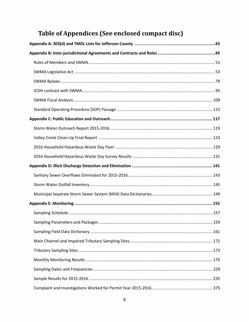
2.1.6 Grease Control Program The Watershed Protection Program is working with the Jefferson County Environmental Services Department Grease Control Program to inform citizens of the hazards of improper grease disposal and to reduce the instances of sanitary sewer overflows due to improper grease disposal. The Jefferson County Grease Control Program has an awareness campaign with grease recycling containers stations across Jefferson County for residents to access empty jugs and fill the containers with used household cooking grease. Brochures and/or flyers, located on the container stations, describe the impacts of improper grease disposal and the effects it can have on sanitary sewers and local waterways throughout Jefferson County. There are 9 locations of Household Cooking Oil & Grease Recycling Centers disbursed throughout SWMA member cities: Adamsville, Center Point, Gardendale, Homewood, Hueytown, Midfield, Pinson, Tarrant and Trussville
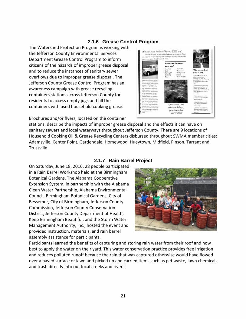
2.1.7 Rain Barrel Project On Saturday, June 18, 2016, 28 people participated in a Rain Barrel Workshop held at the Birmingham Botanical Gardens. The Alabama Cooperative Extension System, in partnership with the Alabama Clean Water Partnership, Alabama Environmental Council, Birmingham Botanical Gardens, City of Bessemer, City of Birmingham, Jefferson County Commission, Jefferson County Conservation District, Jefferson County Department of Health, Keep Birmingham Beautiful, and the Storm Water Management Authority, Inc., hosted the event and provided instruction, materials, and rain barrel assembly assistance for participants. Participants learned the benefits of capturing and storing rain water from their roof and how best to apply the water on their yard. This water conservation practice provides free irrigation and reduces polluted runoff because the rain that was captured otherwise would have flowed over a paved surface or lawn and picked up and carried items such as pet waste, lawn chemicals and trash directly into our local creeks and rivers.

22
2.1.8 Pet Waste Disposal Promotion The Program has distributed nine doggy stations within the member cities. The stations have been placed in various parks and along walking trails. Additionally, educational campaigns on proper pet waste disposal have been launched at various community events and schools throughout SWMA Cities.
2.1.9 Public Service Announcement SWMA and JCDH has worked over the past several years with member cities that provide utility services to their citizens to include educational information about stormwater in the bill. The cities that received this type of public service announcement this permit year include Adamsville, Brookside and Graysville.
2.1.10 Household Hazardous Waste Day
The Jefferson County Department of Health, the Jefferson County Commission of Alabama, the cities of Birmingham and Bessemer, and the Alabama Environmental Council hosted a Household Hazardous Waste (HHW) Collection Day on March 19th, 2016. Take back items during the event included appliances, motor oil, paint, paper shredding, household cooking grease, and batteries and electronics. There were 51 volunteers and vendors and 366 HHW surveys collected during the collection day. Please review the HHW Collection Day Event report found in Appendix C.

23
2.1.11 JCDH Storm Water Hotline and Complaint Website The information provided by the general public to SWMA and JCDH allows for a more effective program due to the empowering of citizens to report illicit discharges, clogged storm drains, incorrect installation of BMPs on active construction sites, and various environmental hazards that can affect the local waterbodies via the MS4. The Storm Water Hotline, (205) 930-1999, provides citizens the option to report their complaint with a live representative during business hours or to leave a compliant to be addressed the following business day. Citizens can also email in complaints through JCDH‘s Website (www.jcdh.org/misc/ContactUs.aspx). These complaints are entered into JCDH’s complaint system and then worked promptly by SWMA and JCDH inspectors until a resolution has been achieved. All complaints are tracked and available to citizens for review.
2.1.12 JCDH Environmental Quality and Assessment Meetings Environmental quality meetings are held at JCDH on a monthly basis to discuss various issues including but not limited to recycling, litter campaign initiatives, and household hazardous waste day. Attendees include a diverse representation of governing and non-governing agencies identifying environmental hazards within Jefferson County and devising action plans to alleviate a potential public health hazard.
2.1.13 Valley Creek Cleanup 2016 The 6th Annual Valley Creek Cleanup was held Thursday through Saturday, August 17th-20th, 2016. The Cleanup was focused on public awareness in and trash removal from the Valley Creek watershed. The Valley Creek Cleanup Committee is community-wide and includes the following partners: JCDH-WPP, SWMA, City of Birmingham’s Stormwater Program, City of Bessemer’s Stormwater Program, Jefferson County Stormwater Program, Fresh Water Land Trust, Boat Alabama, and Jefferson County Sherriff’s Office Reserves and Marine Division, Alabama Power’s Renew Our Rivers Program, and the Cities of Birmingham, Midfield, Pleasant Grove, Hueytown, Brighton, Bessemer and Jefferson County.

24
There were 31.9 tons of trash, scrap metal, tires and miscellaneous items removed from the watershed during the cleanup. Over the course of the cleanup there were 172 participants. The final report on the activities of the cleanup can be found in Appendix C.
2.1.14 Grant’s Mill Cleanup 2015
On November 15th, 2015, the Alabama Clean Water Partnership sponsored a cleanup project along Grant’s Mill Road. Partners for the event included Jefferson County Stormwater Program, Birmingham Stormwater Program, and JCDH’s Watershed Protection Program, the city of Irondale. Volunteer workers included coworkers from St. Vincent’s Orthopedics as well as a local cycling team. The event received publicity from WIAT 42, a local TV channel. For a summary of all educational activities and select reports please see Appendix C.
2.2 Illicit Discharge Detection and Elimination
2.2.1 Illicit Discharge Ordinance
EPA recommends municipalities adopt and implement an ordinance that provides a way to identify, enforce, and correct illicit discharges. In 1999 the member cities of SWMA approved an Erosion and Sedimentation Control Ordinance template that was then adopted by each member with minimal changes. This ordinance covered any illicit discharge in relation to erosion. Other illicit discharges are addressed through JCDH’s health code enforcement.
2.2.2 Sanitary Sewer Overflow Mapping The Program works with Jefferson County Environmental Services to monitor all sanitary sewer overflows throughout Jefferson County. When an overflow occurs, Jefferson County Environmental Services faxes JCDH an advisory, a 24-hour report, and a 72-hour report. The Program’s usage of a GIS-based mapping system allows for the illustration of overflow locations and helps identify if sanitary sewer overflows could affect water samples collected by JCDH. GIS mapping increases the Program’s efficiency in locating and abating illicit sources. A map of the location of sanitary sewer overflows during the permit 2015-2016 can be found in Appendix D. All sanitary sewer overflows are categorized as a water quality complaint and worked accordingly.

25
2.2.3 Stormwater Outfall Inventory Mapping Prior to 2009, SWMA had mapped the outfalls of the member cites. When JCDH started working with SWMA, the Program began a stormwater outfall inventory mapping program to update the data of all storm water outfalls entering into each basin within the SWMA member’s municipal boundary. The Program mapped over 900 outfalls. With the combination of Outfall mapping with the MS4 mapping, the Program plans to have a complete map of the path of stormwater from member cities to adjacent waterbodies. The Global Positioning System (GPS) units used allow for a picture, type of pipe, size of pipe, flow, temperature, dissolved oxygen (D.O.), conductivity, pH, temperature, ammonia, copper, nitrate, chlorine, and given physical description when inspections are conducted. The data allows JCDH to map the major stormwater inflows and their impacts in the various watersheds. This program is designed with the recommendations presented in Illicit Discharge Detection and Elimination: A Guidance Manual for Program Development and Technical Assessments (Center for Watershed Protection & Dr. Robert Pitt, October 2004).
The goal of the Program is to update this map as construction is added during the permitting process. This allows for a comprehensive map of the watershed for use with different projects. Maps of the outfalls as well as the data dictionaries used during the mapping process can be found in Appendix D.
2.2.4 Illicit Discharge Hotline and Online Reporting Form
Citizens may report complaints directly to the municipality or report complaints on the JCDH website and/or hotline number. The online complaint system (www.jcdh.org/misc/ContactUs.aspx) gives citizens the ability to contact JCDH at anytime for illicit discharge reporting. The complaint form is complimented by a hotline number (205-930-1999) as well as the general complaint number (205-930-1230) for citizens that do not have internet access. Any form or call is then uploaded to JCDH’s complaint system to be worked by JCDH employees.

26
2.2.5 Roadside Trash Assessment: The 2011 Litter Survey Roadside trash can cause problems for municipal storm water systems as well as pollute our waterways. In 2011, The Community Assessment Division of JCDH with the help of Action Environmental, Inc. conducted a survey at different sites across Jefferson County on the types of litter found. The 2011 litter survey was conducted as a follow-up to a 2006 litter survey. The conclusions found in the 2012 Litter Survey Report have helped SWMA and JCDH shape its awareness campaigns culminating in less litter pollution in our storm water systems and waterways. Citizens can receive a copy of the survey by request or by downloading the survey report online. JCDH plans to conduct a follow-up survey in the near future.
2.2.6 Inspection of Drainage Systems SWMA and JCDH rely on the members’ public works departments to conduct regular drainage inspections in order to maintain free-flowing conditions. Areas identified as problems are prioritized by the necessary agency to be corrected as funds become available. JCDH also provides information obtained during outfall monitoring and MS4 mapping concerning infrastructure failures. Infrastructure condition questions are included in the outfall inventory data dictionary and stormdrain inventory data dictionary found in Appendix D. A system to track inspections of drainage systems was included in the SOP Manual. All municipal members that adopted the SOP Manual have been educated on the procedures as of January of 2012.
2.2.7 Standard Operating Procedures (SOP) and Guidelines (“The Manual”) The SOP Manual was approved by SWMA on August 18, 2010 and helps provide a uniform framework for illicit discharge monitoring, procedures, and reporting. The Manual also provides contact numbers that could lead to more timely responses to illicit discharges by all members. Members who have passed this SOP document are included in Appendix B.

27
2.2.8 People Against A Littered State (PALS) Cleanups Jefferson County Department of Health’s Watershed Protection Program collaborated with PALS in distributing free cleanup materials and trash bags to SWMA cities launching their spring and fall community cleanups events held in 2015-2016. PALS is a non-profit organization dedicated to working with communities to promote a cleaner and healthier Alabama. PALS statewide “Don’t Drop It on Alabama” anti-litter campaigns were able to assist in the collection of litter off the roadways and waterways in communities throughout SWMA cities. There were over 896 volunteers and 29.40 tons of litter and miscellaneous debris items removed during the cleanup events within in Jefferson County. See Appendix D for all maps and data pertaining to Illicit Discharge Detection and Elimination.
2.3 Stormwater Monitoring Program In 2009, SWMA contracted with JCDH to provide storm water sampling throughout the SWMA members. The sampling program implemented by JCDH encompasses many different components such as; the effectiveness of construction BMPs on active construction sites, illicit discharge detection, 303(d) impaired stream monitoring, and sampling strategic sites on local streams. There are a total of 73 sampling sites; 26 sites are designated Main Channel sites, eight sites are Impaired Tributary sites, and 39 sites are considered Tributary sites. The Main Channel sites are located on the major streams of Jefferson County that include Shades Creek, Cahaba River, Village Creek, Valley Creek, Turkey Creek, and Five Mile Creek. The Main Channel sample sites were chosen based on a member city approach so as to allow water quality to be evaluated entering and leaving a member’s municipal boundary. JCDH made the decision in 2010-2011 to also sample any tributaries that are considered 303(d) impaired streams or waterways with the same frequency as the Main Channel sites. This would increase the frequency and accrual of data for these impaired waterways. The waterways included in this sampling regime were Little Shades Creek, Patton Creek, Newfound Creek, and Opossum Creek. The Tributary sites are located on smaller waterbodies or tributaries of these major streams. The sample sites were chosen based on illicit discharge potential.

28
Water quality trending is performed on the data by software used at JCDH. The trending data is then used to determine if there are localized areas within the watersheds in which pollution and contamination pose a threat. Excessive pollutant loading can lead to a loss of fish and wildlife habitat, loss of recreational water use, human health hazards, and higher water treatment costs. Grab samples are the predominant method being used by JCDH at the present time but the monitoring program is considering obtaining real-time monitoring capabilities to provide better data on river and creek trending.
A total of 504 samples were completed in Permit Year 2015-2016. A sample was not taken if the stream was not flowing or dry. See Appendix E for all the sampling data that has been collected through all monitoring programs deployed by SWMA and JCDH. The parameters monitored for all samples include these parameters as per recommended by EPA and ADEM:
ARSENIC DISSOLVED OXYGEN NICKEL CHEMICAL OXYGEN DEMAND
CALCIUM NITROGEN, AMMONIA SILVER CHROMIUM (HEXAVALENT)
COPPER NITROGEN, NITIRITE TEMPERATURE BIOLOGICAL OXYGEN DEMAND
CYANIDE NITROGEN, NITRATE TURBIDITY CHROMIUM (TRIVALENT)
LEAD PHOSPHATE, DISSOLVED MERCURY NITROGEN, TOTAL KJELDAHL
PH TOTAL DISSOLVED SOLIDS MAGNESIUM SPECIFIC CONDUCTANCE
ZINC TOTAL SUSPENDED SOLIDS E-COLI BACTERIA FECAL COLIFORM BACTERIA
HARDNESS PHOSPHATE AS P OIL AND GREASE

29
2.3.1 Dry Weather Monitoring It is the goal of JCDH to sample the Main Channel sites and Impaired Tributary sites three times a year and to sample Tributary sites two times a year. Dry weather conditions are defined as over 72 hours of dry weather after a significant rain event of over 0.1 inch. The data collected should represent a stream’s natural condition without any runoff pollutants. If the data shows irregular parameter values, this can signify an illicit discharge somewhere within the drainage area. The Tributary samples help increase the chance of detecting illicit discharges. A total of 174 dry samples were completed in 2015-2016.
2.3.2 Monthly Monitoring Sedimentation is one of the major contributing factors to stream impairment within Jefferson County. In the past, JCDH sampled for turbidity (an indicator of sediment load) on a monthly basis at the 25 Main Channel sites and 8 Impaired Tributary sites. During 2013-2014, SWMA and JCDH added pH, dissolved oxygen, temperature, conductivity and gage height to the monthly sampling regime. This increased sampling allows the Program additional opportunities to evaluate the waterbodies. Dry weather monitoring fulfilled the monthly requirement in some instances. A total of 330 monthly samples were completed during the permit year 2015-2016.
2.3.3 Characterization Monitoring SWMA collected this data for ten years. Modeling data from other cities is also available. For these reasons, this sampling type has been discontinued.
2.3.4 Investigation Monitoring Investigation monitoring is a cooperative effort between the Program and the municipal members. Investigation monitoring is triggered by either high monitoring results or complaints. If an investigation reveals an abnormality that is outside of JCDH’s own scope, the authority to enforce penalties, fines, or actions lies with the municipal member’s area in which the infraction occurred. The investigation monitoring procedures are listed in the SOP Manual.
2.3.5 Complaint Investigations
SWMA and JCDH have a complaint call-in system in which all complaints are initially worked within five to ten business days. The complaints are then evaluated for validity. If the complaint is deemed valid it is investigated until a resolution is obtained through the cooperative between SWMA, JCDH, and the municipal member. The Program worked a total of 441 complaints for the permit year 2015-2016. For a more detailed summary see Appendix E.

30
2.3.6 Bioassessments In 2010, SWMA and JCDH decided to expand the sphere of the monitoring program by incorporating biological characteristics to compliment water quality sampling. A cooperative effort was formed between the University of Alabama Birmingham Biology Department and JCDH to conduct fish bioassessments on the waterways throughout Jefferson County. The method used is a modified EPA-approved method and the results will help to form a better overall strategy for watershed protection. The streams on which bioassessments are performed are Village Creek, Valley Creek, Cahaba River, Shades Creek, Five Mile Creek, Patton Creek and Little Shades Creek. Two bioassessments are completed on the larger streams while smaller waterbodies such as Patton Creek and Little Shades Creek have one bioassessment each. This annual report contains the bioassessments completed during the fall of 2015. In review of all the data for the sites over the past five years, the streams scores seem to be staying steady or improving. A summary of the data and statistical findings can be found in Appendix E. See Appendix E for all maps and data pertaining to the Stormwater Monitoring Program.
2.4 Structural Controls and Storm Water Collection System Operations
2.4.1 Storm Sewer (MS4) Mapping The Program is currently mapping the storm drain system infrastructure in the member cities. The mapping is maintained in a GIS Database that will allow for integration with the outfall inventory mapping data performed by JCDH. The integration of maps will lead to a “storm drain to outfall” approach. Pictures for each inlet in the GIS database can be easily viewed for quality assurance and reference. These maps, once finished, will be continuously updated by the member cities so as to keep up with new infrastructure development for each city. SWMA and JCDH have completed its first effort of mapping the

31
“point” structures for all of the cities. Over the last five years, more than 25,000 storm drains have been mapped within the member cities. Currently the mapping program is “connecting the dots” with information about the infrastructure such as pipe size, approximate length, and pipe material. This phase of the program has additionally found “hidden” inlets not found originally. The areas that receive priority for completion are the watersheds that include an established TMDL or a 303(d) listed waterbody.
2.4.2 SOP Manual
The SOP Manual provides procedures for inspecting, maintaining and servicing storm water controls and collection systems.
2.4.3 Stormwater Online Activity Record (SOAR) Forms JCDH developed an online program called Stormwater Activity Online Record (SOAR). The program has taken the SOP manual’s work forms, edited them and published them in an online format. All cities can now enter their activities on the SOAR program as well as review their actions. In relation to Structural Controls, the cities have been asked to identify new features such as detention ponds, retention ponds and other storm water structures. The forms provide the number and location of new structural controls as well as inspections performed on existing structures. The forms are attached in Appendix F with an overall summary from each city on the specifics of their programs. SWMA and JCDH have conducted training to municipal members on how to track these types of structural controls and the reporting required in the permit. The forms for tracking were implemented in January of 2012. See Appendix F for data pertaining to Structural Controls and Storm Water Collection System Operations.

32
2.5 New Development and Significant Redevelopment
2.5.1 Mapping of New Development All erosion control permits for participating cities are entered into a permitting program that will allow for geocoding. The sites can then be used to determine a correlation between samples taken by JCDH and development occurring in certain areas. Currently JCDH and SWMA have a remote access program that allows for the permitting process to be completed at the member city and received by JCDH immediately therefore decreasing the “turnaround” time in the permitting process.
2.5.2 Alabama Low Impact Development (LID) Handbook The Alabama Cooperative Extension Service has developed a LID handbook as a resource for all professionals who plan, construct and maintain best management practices for new developments as well as redevelopments. This resource is comprehensive and assists the professional in all aspects of implementing LID practices. The handbook can be found at www.aces.edu/natural-resources/water-resources/watershed-planning/stormwater-management/LID.php#.
2.5.3 Comprehensive Planning Currently many member cities have initiated a master plan that includes development and redevelopment. SWMA and JCDH plan to initiate more current watershed studies for Shades Creek and the Cahaba River in the near future. A new watershed plan for Village Creek was developed this year by the city of Birmingham. See Appendix G for all maps and data pertaining to New Development and Significant Redevelopment.

33
2.6 Roadways
2.6.1 SOP Manual The SOP Manual provides procedures on sand/salt storage, trash and litter collection, maintenance of grassy areas, weed control, and roadway repair. Street cleaning procedures after sand or salt usage are also included.
2.6.2 SOAR Municipal Forms The Program has trained municipal members on reporting procedures for roadways. These forms include sand/deicing storage, roadway projects, street sweeping, and trash collection completed by each individual municipality. All of these forms are found in SOAR. See Appendix G for all forms pertaining to Roadways.
2.7 Flood Control Projects
Flood control projects in Jefferson County are performed through an interagency cooperative effort. Jefferson County Department of Land Planning and Development Services, the Army Corp of Engineers, and the SWMA members all provide input into flood control projects.

34
2.8 Spill Response and Prevention
2.8.1 Hazardous Waste Emergency Response SWMA and JCDH work in cooperation with the Jefferson County Emergency Management Agency to provide responses to hazardous waste spills. The role of SWMA and JCDH is to confirm that contamination from hazardous waste spills does not enter the MS4s of SWMA members. JCDH also offers stormwater mapping information upon request. EMA had 17 incidents within the boundaries of SWMA member cities during the 2015-2016 permit year. Summary details can be found in Appendix H.
2.8.2 SOP Manual The SOP Manual provides instruction for managing hazardous spills along with contact numbers for all appropriate agencies.
2.8.3 SOAR Municipal Forms
Forms that allow the cities to report any spill can be found in SOAR. Spill date, cleanup date, responsible party, and spill responder, and comments can be entered into the program. See Appendix H for all municipal forms and data pertaining to Spill Response and Prevention.

35
2.9 Pesticides, Herbicides, and Fertilizers (PHF) Application
2.9.1 SOP Manual The SOP Manual provides procedures on the storage, application, and disposal of PHFs. Future SOPs will be added to the Manual describing BMPs and Integrated Pest Management approaches in using PHFs.
2.9.2 SOAR Municipal Forms Forms showing the PHF programs for application rates, chemical inventories and application areas can be found in SOAR. The Program has trained municipal members on the reporting procedures for PHF application. See Appendix I for all municipal forms and data pertaining to PHF Application.
2.10 Industrial and High Risk Runoff
2.10.1 ADEM NPDES Permitted Facilities SWMA and JCDH have been in communication with ADEM regarding the responsibilities of industrial NPDES permitted facilities in Jefferson County. In reaction to ADEM’s audit comments, SWMA asked all applicable cities to report their inspection activities. These responses are found in Appendix J. All NPDES sites have been GIS mapped by JCDH using data from EPA. The map is used to determine areas of focus for storm water runoff. A larger map is attached in Appendix J for this section. The Program will cooperate with the local ADEM office on sites that are found to be out of compliance during normal

36
storm water inspections. JCDH will also work with facilities on any storm water issues that are encountered.
2.10.2 Land Use Mapping
Land Use maps are used to determine areas of concentrated runoff from developments. The areas with dense development are considered as being a high risk pollution contributor and require an adequate sampling strategy to combat this potential.
2.10.3 Priority Area Mapping Data from Outfall mapping, sewer overflow potential, land use and NPDES permitting are used by JCDH to map priority sampling areas. After an area of priority has been identified, the area is labeled as an area that may have a higher potential to contribute to water pollution than more undeveloped areas within Jefferson County. The Program’s identification of areas of priority helps improve the focus of the watershed program and allow for more efficient use of available resources.
2.10.4 Landfill Monitoring
Tributaries located downstream from landfills are sampled at least twice a year. JCDH also investigates any reports of illegal landfills within the greater Jefferson County area. Adamsville is the only SWMA member city that contains a landfill.
37
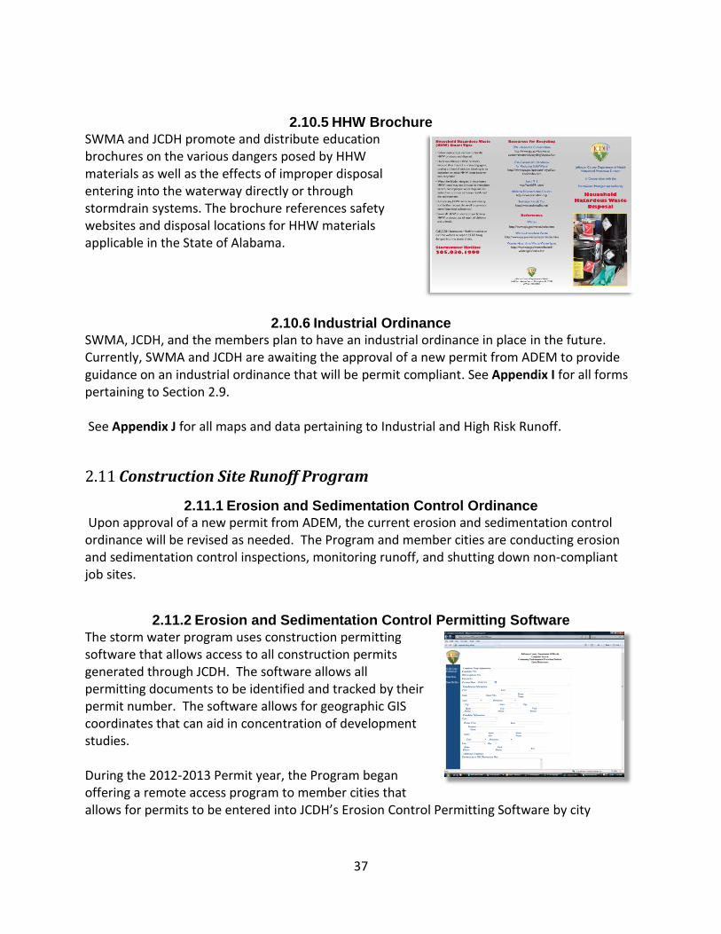
2.10.5 HHW Brochure SWMA and JCDH promote and distribute education brochures on the various dangers posed by HHW materials as well as the effects of improper disposal entering into the waterway directly or through stormdrain systems. The brochure references safety websites and disposal locations for HHW materials applicable in the State of Alabama.
2.10.6 Industrial Ordinance SWMA, JCDH, and the members plan to have an industrial ordinance in place in the future. Currently, SWMA and JCDH are awaiting the approval of a new permit from ADEM to provide guidance on an industrial ordinance that will be permit compliant. See Appendix I for all forms pertaining to Section 2.9. See Appendix J for all maps and data pertaining to Industrial and High Risk Runoff.
2.11 Construction Site Runoff Program
2.11.1 Erosion and Sedimentation Control Ordinance Upon approval of a new permit from ADEM, the current erosion and sedimentation control ordinance will be revised as needed. The Program and member cities are conducting erosion and sedimentation control inspections, monitoring runoff, and shutting down non-compliant job sites.
2.11.2 Erosion and Sedimentation Control Permitting Software
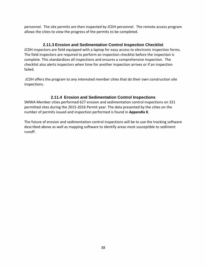
The storm water program uses construction permitting software that allows access to all construction permits generated through JCDH. The software allows all permitting documents to be identified and tracked by their permit number. The software allows for geographic GIS coordinates that can aid in concentration of development studies. During the 2012-2013 Permit year, the Program began offering a remote access program to member cities that allows for permits to be entered into JCDH’s Erosion Control Permitting Software by city
38
personnel. The site permits are then inspected by JCDH personnel. The remote access program allows the cities to view the progress of the permits to be completed.
2.11.3 Erosion and Sedimentation Control Inspection Checklist
JCDH inspectors are field equipped with a laptop for easy access to electronic inspection forms. The field inspectors are required to perform an inspection checklist before the inspection is complete. This standardizes all inspections and ensures a comprehensive inspection. The checklist also alerts inspectors when time for another inspection arrives or if an inspection failed. JCDH offers the program to any interested member cities that do their own construction site inspections.
2.11.4 Erosion and Sedimentation Control Inspections SMWA Member cities performed 627 erosion and sedimentation control inspections on 331 permitted sites during the 2015-2016 Permit year. The data presented by the cities on the number of permits issued and inspection performed is found in Appendix K. The future of erosion and sedimentation control inspections will be to use the tracking software described above as well as mapping software to identify areas most susceptible to sediment runoff.

39
3 Program Summary The Storm Water Program is in its seventh year under the SWMA and JCDH cooperative effort. Program strengths and weaknesses are listed below.
3.1 Program Strengths
1. Water quality monitoring and data analysis - The majority of testing is completed in the field allowing for immediate water quality assessment. Water quality data is stored in a database allowing for the compilation of customizable reports and data analysis. The database also contains quality control and quality assurance standards. Bioassessments are also completed to help determine how successful the Program’s efforts are in improving the health of stream ecosystems.
2. Public Education - The Education Program has provided a variety of storm water topics
to a wide range of age groups. The importance of maintaining water quality has been presented through activities such as “The Water Festival” for elementary school students. Also, an outdoor class at Turkey Creek on macro invertebrates was offered to a group of high school students. A focal point of the Education Program is to connect the students with how their actions can impact their watershed.
3. Complaints and Investigations - The complaint system used by JCDH allows inspectors
to efficiently investigate and resolve violations. The system also provides useful documentation of the number and types of complaints received.
4. Member Reporting - The online program called Stormwater Online Activity Report
(SOAR) allows standardized reporting of stormwater related activities from member cities. Activity information is submitted remotely by member city personnel directly into a centralized database at any time instead of being submitted quarterly in excel or on handwritten sheets. Standardization of the data allows for better reporting and statistical information. This year SOAR 2.0 was developed in preparation for the receipt of new permits for SWMA member cities.
5. GIS Mapping of Storm Drains and Outfalls - Preliminary mapping of all 20 member
cities’ storm drain system infrastructure has been completed. Final mapping of the storm drain systems has begun based on watershed impairment. This provides a structural inventory allowing for better maintenance and fiscal planning. The mapping will also allow for future modeling of the watersheds.

40
3.2 Program Weaknesses
1. Ordinances - EPA recommended several ordinance revisions that will help to strengthen
the Program for subsequent permit years. These included New and Significant Redevelopment, Industrial and High Risk Runoff, Erosion and Sedimentation Control, and Illicit Discharges. Ordinances that will strengthen the Program will be developed upon issuance of a new ADEM Permit.
2. Erosion and Sedimentation Control (ESC) Program - The Program allows for each
member to conduct their own ESC program if they choose. Online permitting and free erosion control inspections are offered to all cities. The Program offers to pay for ADEM‘s Qualified Credentialed Inspector (QCI) training for an inspector from each city annually. While the cities are diligent in reporting their erosion control permits, issues continue to surface due to the varying formats used to gather the information.
3. Industrial and High Risk Runoff – In reaction to the audits by ADEM, SWMA and JCDH
reviewed the member cities’ examination of NPDES permitted sites in regards to their complaint stormwater practices. After the review and in reaction to the upcoming permit regulations, SWMA and JCDH decided to develop an inspection program worked by JCDH personnel that will help standardize the review of industrial and high risk runoff areas and ensure they are compliant with ADEM regulations.
4. Standard Operating Procedure Manual- In 2010, JCDH and SWMA developed and approved a Standard Operating Procedure (SOP) Manual that covered many aspects of the permit’s requirements. The manual was developed in response to EPA’s 2010 audit comments. While the SOP Manual is informative and contains helpful procedures, many of the forms for reporting stormwater-related activities have since been updated and published online in the Stormwater Online Activity Record (SOAR) Program. When the cities receive their new NPDES permits, the SOP Manual will be updated with any permit changes as well as with the new forms.

41
42