appendix a: san francisco river photos – gila national
TRANSCRIPT
Appendix A. SF River Photos – Gila NF 1
Appendix A: San Francisco River Photos – Gila National Forest These photos accompany our request for closure to demonstrate both the the outstanding ecological values associated with this area, as well as the ongoing damage due to ORV use in riparian areas. All photos were taken October 6 or 7, 2007 by Chris Kassar and all GPS points were taken using NAD 27 Datum. The photo point numbers match up with the red triangles found on the associated map of the area (Appendix C: Map #3- Gila NF Photo Points).
Appendix A. SF River Photos – Gila NF 2
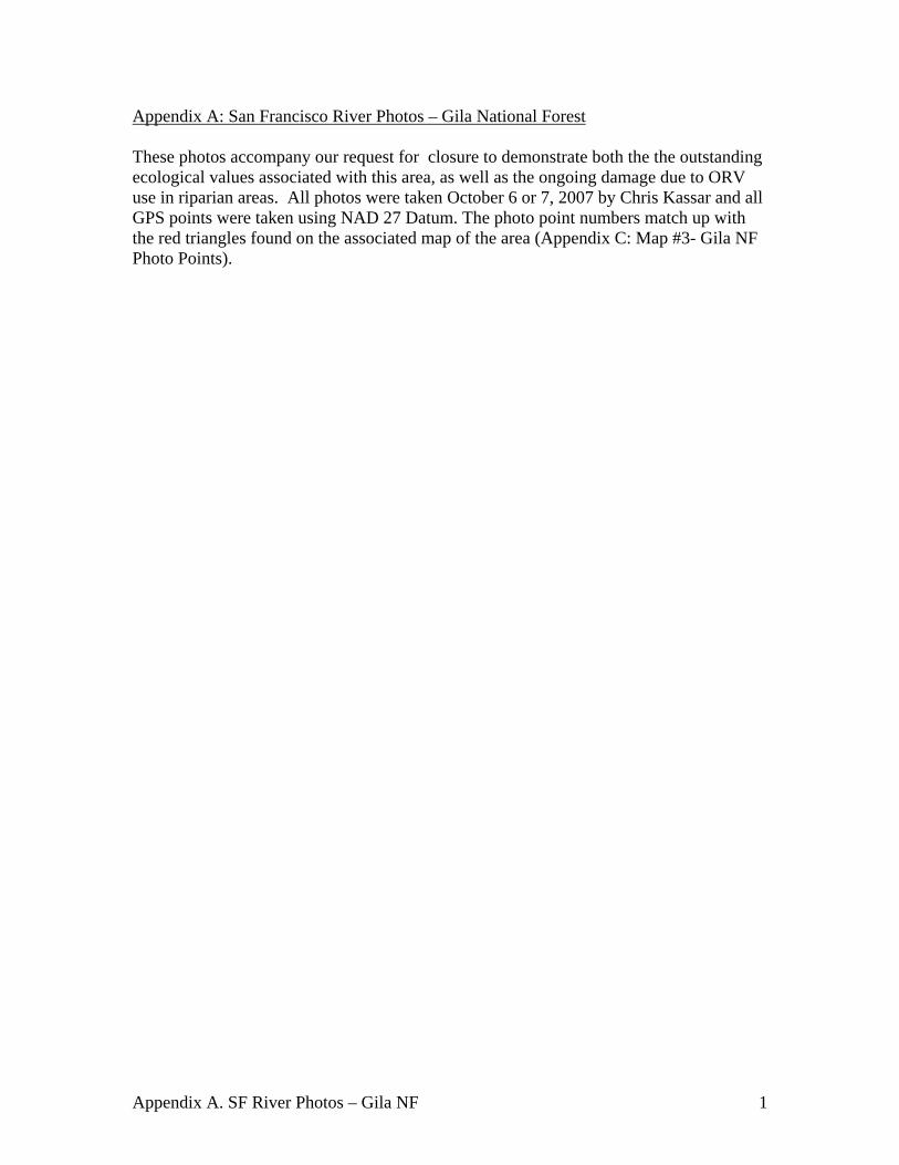
Photo 1.12S 0702273//UTM 3674742 - FR 68 heading west toward Big Dry Creek from intersection with Hwy 180.
Appendix A. SF River Photos – Gila NF 3
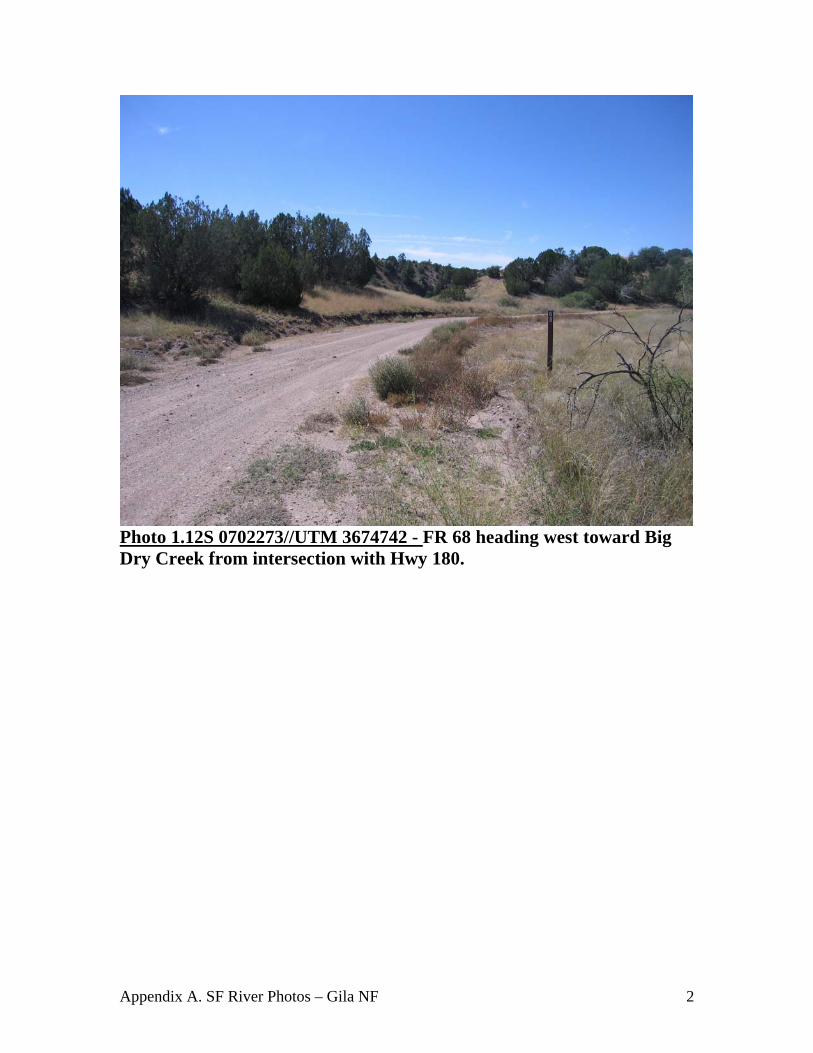
Photo 2. 12S 0701434//UTM 3674384 - Gate on FR 68 separating Gila National Forest property from private property. Route travels into and becomes Big Dry Creek.
Appendix A. SF River Photos – Gila NF 4
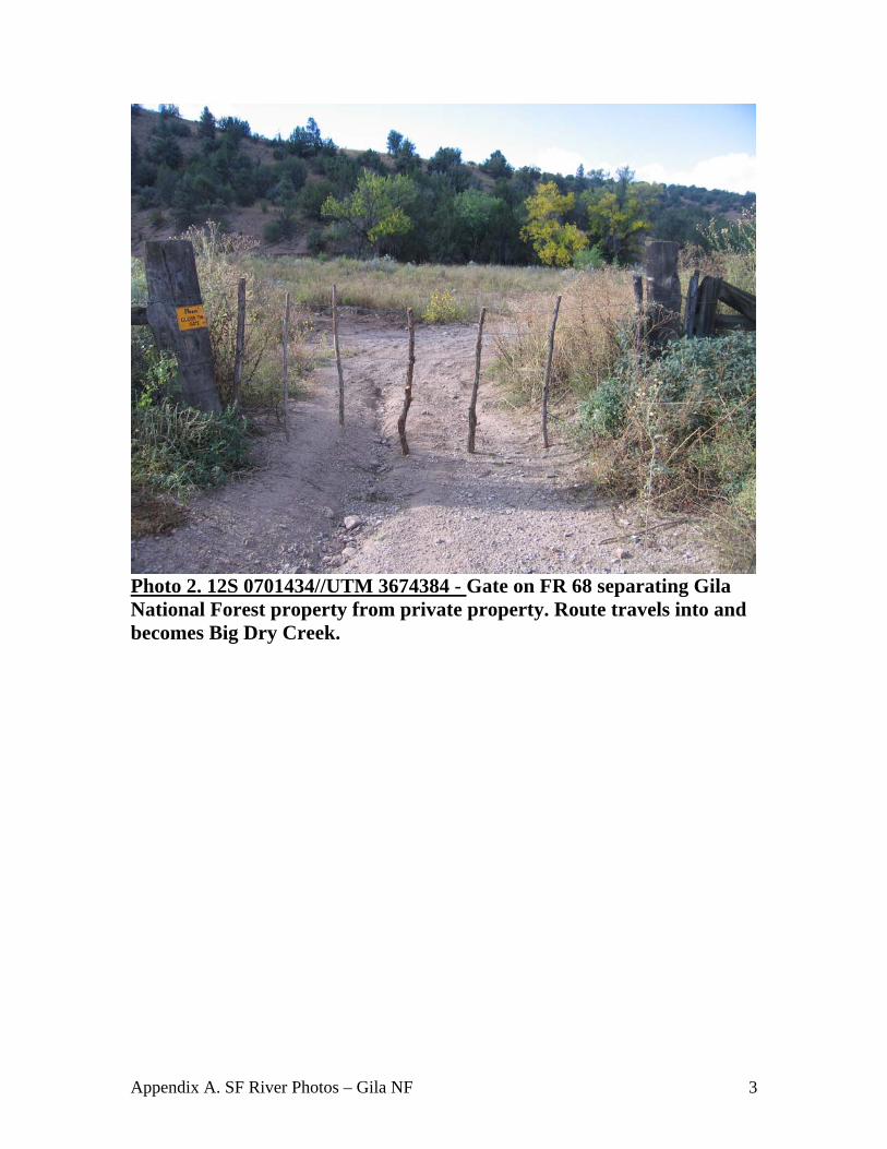
Photo 3. 12S 0701227//UTM 3674354 – Further down Big Dry Creek where road and the creek are the same . Signs of recent use, including quad tracks, cow prints and scat.
Appendix A. SF River Photos – Gila NF 5
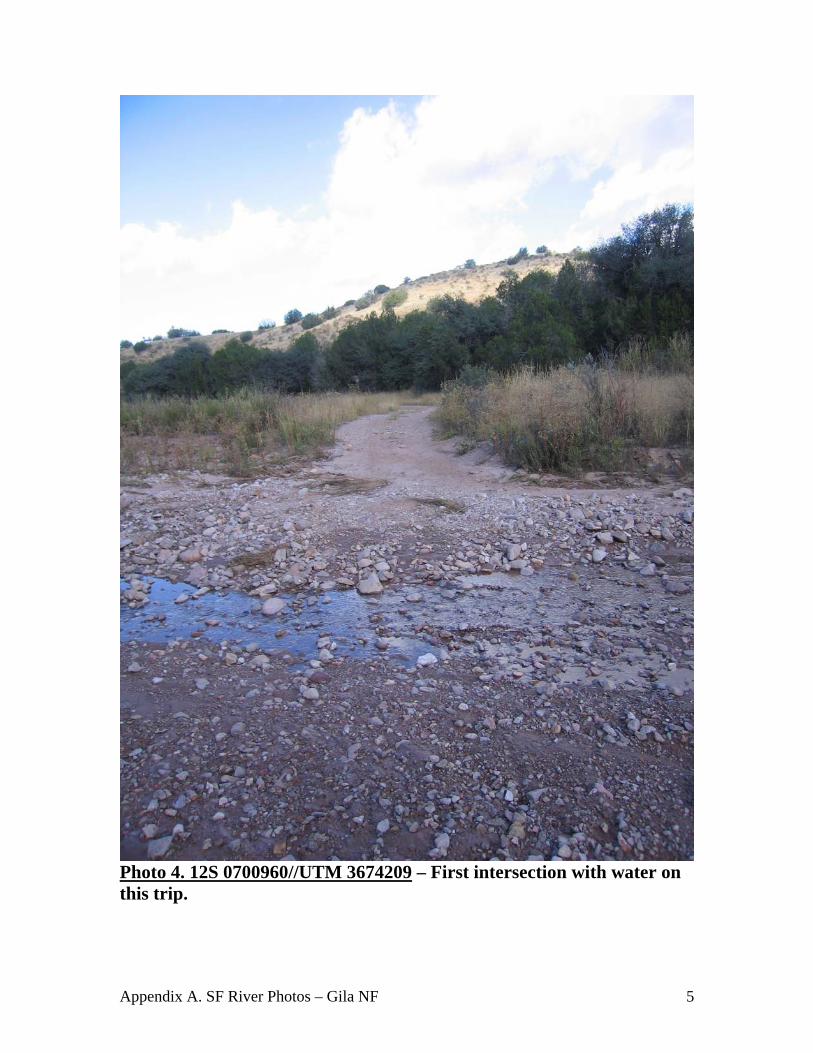
Photo 4. 12S 0700960//UTM 3674209 – First intersection with water on this trip.
Appendix A. SF River Photos – Gila NF 6
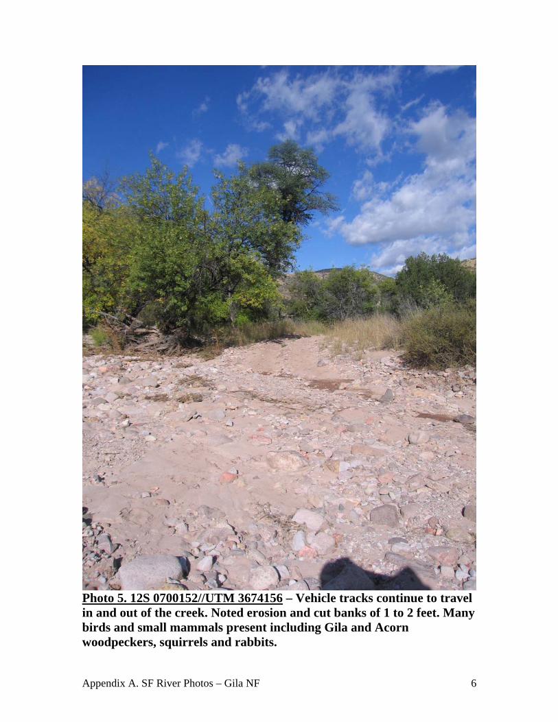
Photo 5. 12S 0700152//UTM 3674156 – Vehicle tracks continue to travel in and out of the creek. Noted erosion and cut banks of 1 to 2 feet. Many birds and small mammals present including Gila and Acorn woodpeckers, squirrels and rabbits.
Appendix A. SF River Photos – Gila NF 7
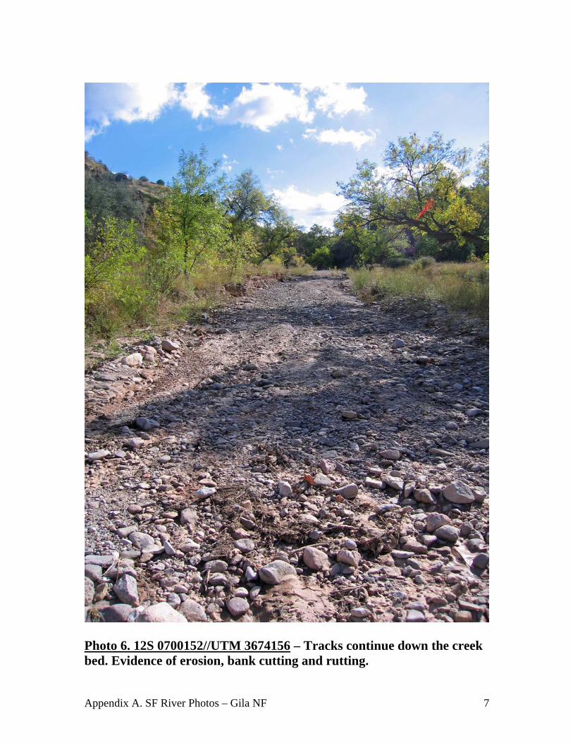
Photo 6. 12S 0700152//UTM 3674156 – Tracks continue down the creek bed. Evidence of erosion, bank cutting and rutting.

Appendix A. SF River Photos – Gila NF 8
Photo 7. 12S 0699939//UTM 3674252 - Tracks continue down wash. Note erosion and sedimentation when route enters the creek.
Appendix A. SF River Photos – Gila NF 9
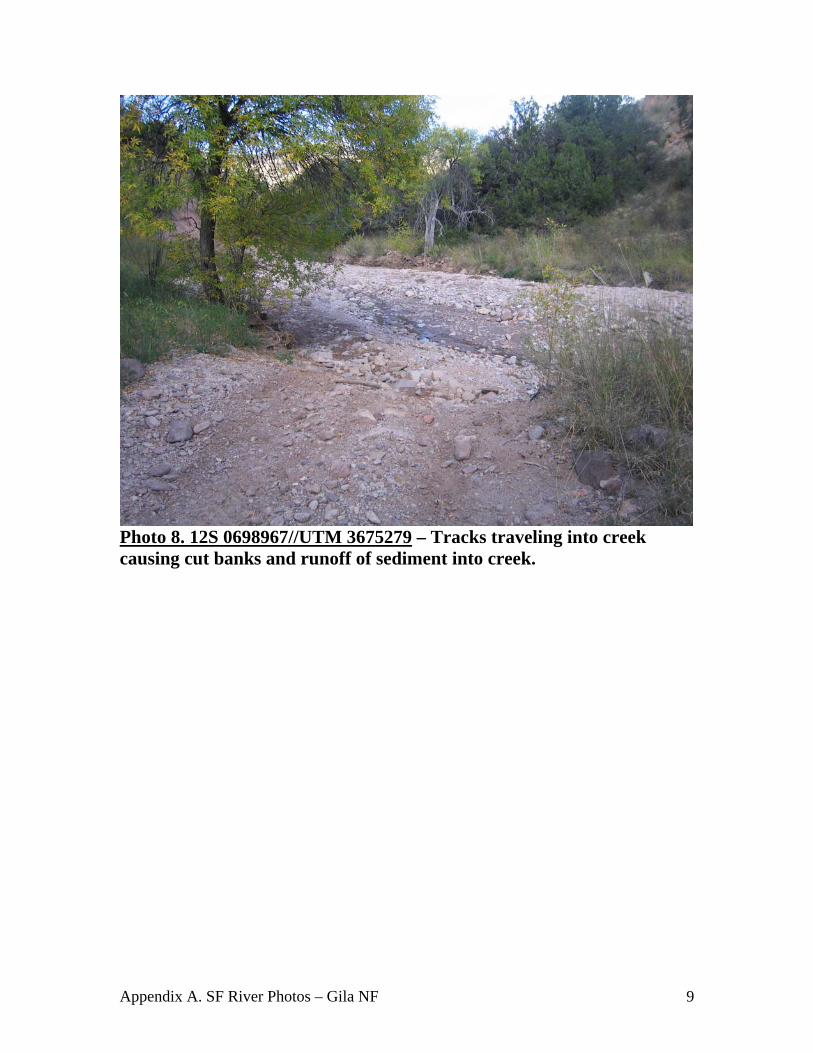
Photo 8. 12S 0698967//UTM 3675279 – Tracks traveling into creek causing cut banks and runoff of sediment into creek.
Appendix A. SF River Photos – Gila NF 10
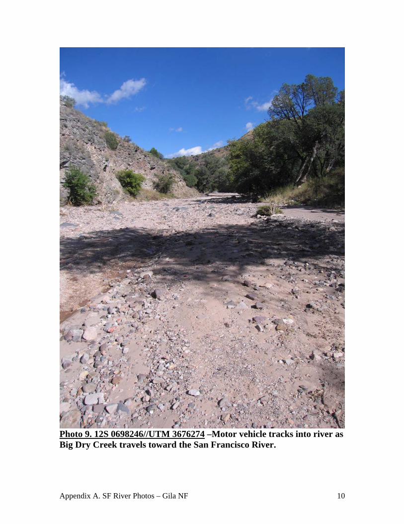
Photo 9. 12S 0698246//UTM 3676274 –Motor vehicle tracks into river as Big Dry Creek travels toward the San Francisco River.

Appendix A. SF River Photos – Gila NF 11
Photo 10. 12S 0698246//UTM 3676274 – Multiple tracks into creek causing rutting and stirring up rocks.

Appendix A. SF River Photos – Gila NF 12
Photo 11. 12S 0698246//UTM 3676274 – Man on ATV after having driven down and in the creek for a ½ mile or more. .
Appendix A. SF River Photos – Gila NF 13
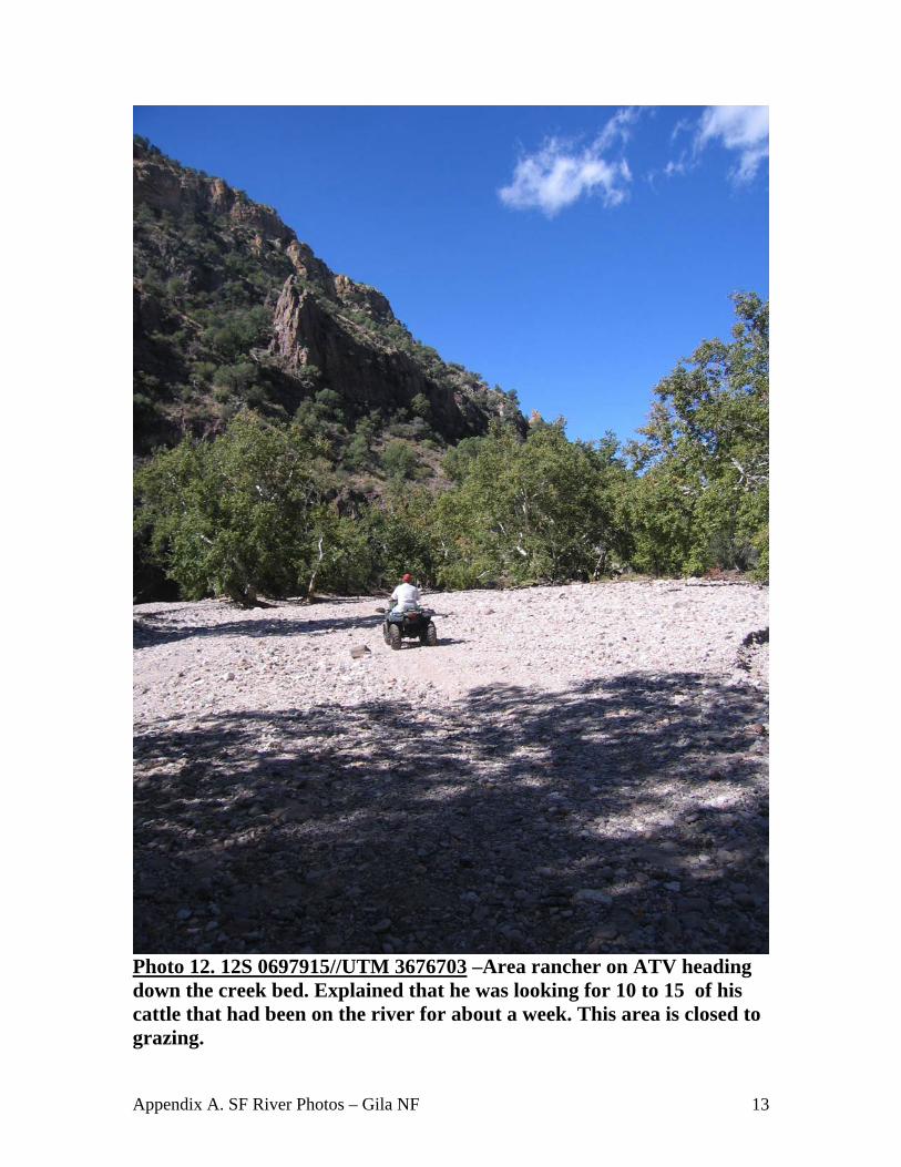
Photo 12. 12S 0697915//UTM 3676703 –Area rancher on ATV heading down the creek bed. Explained that he was looking for 10 to 15 of his cattle that had been on the river for about a week. This area is closed to grazing.
Appendix A. SF River Photos – Gila NF 14
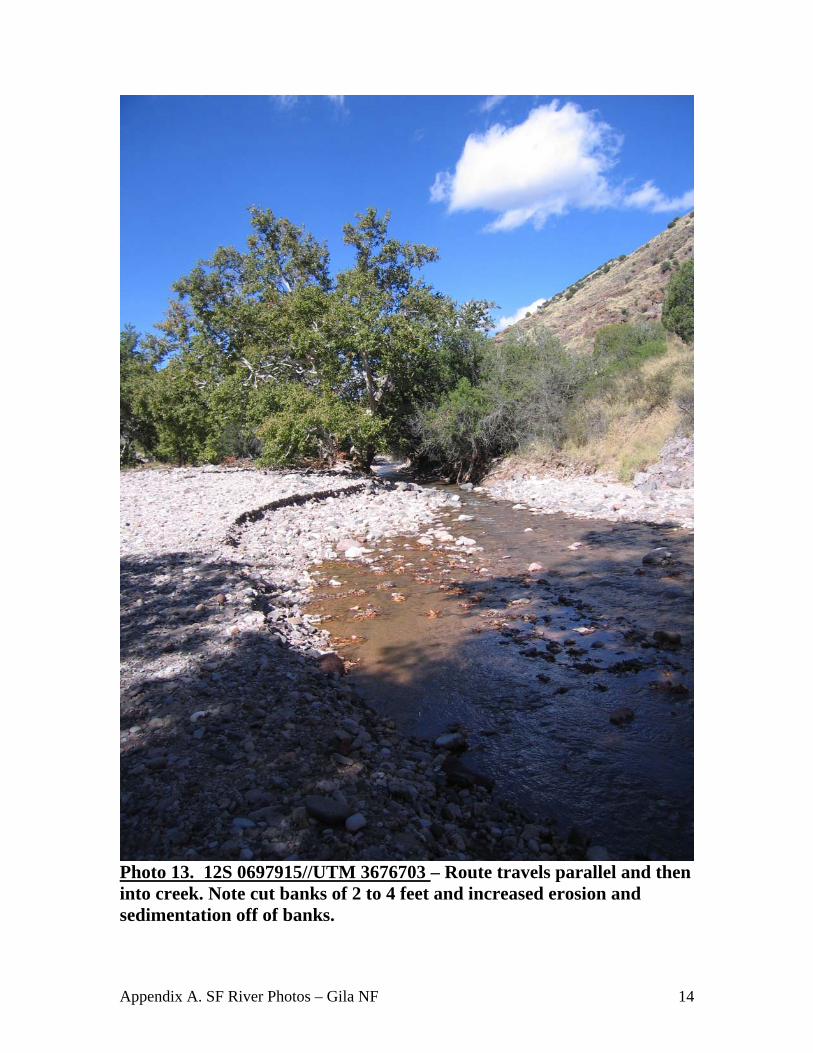
Photo 13. 12S 0697915//UTM 3676703 – Route travels parallel and then into creek. Note cut banks of 2 to 4 feet and increased erosion and sedimentation off of banks.

Appendix A. SF River Photos – Gila NF 15
Photo 14. 12S 0698022//UTM 3676580 – Beautiful scenery of the area and the creek. Note vehicle tracks paralleling and then entering the water.
Appendix A. SF River Photos – Gila NF 16
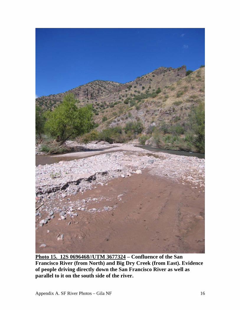
Photo 15. 12S 0696468//UTM 3677324 – Confluence of the San Francisco River (from North) and Big Dry Creek (from East). Evidence of people driving directly down the San Francisco River as well as parallel to it on the south side of the river.
Appendix A. SF River Photos – Gila NF 17
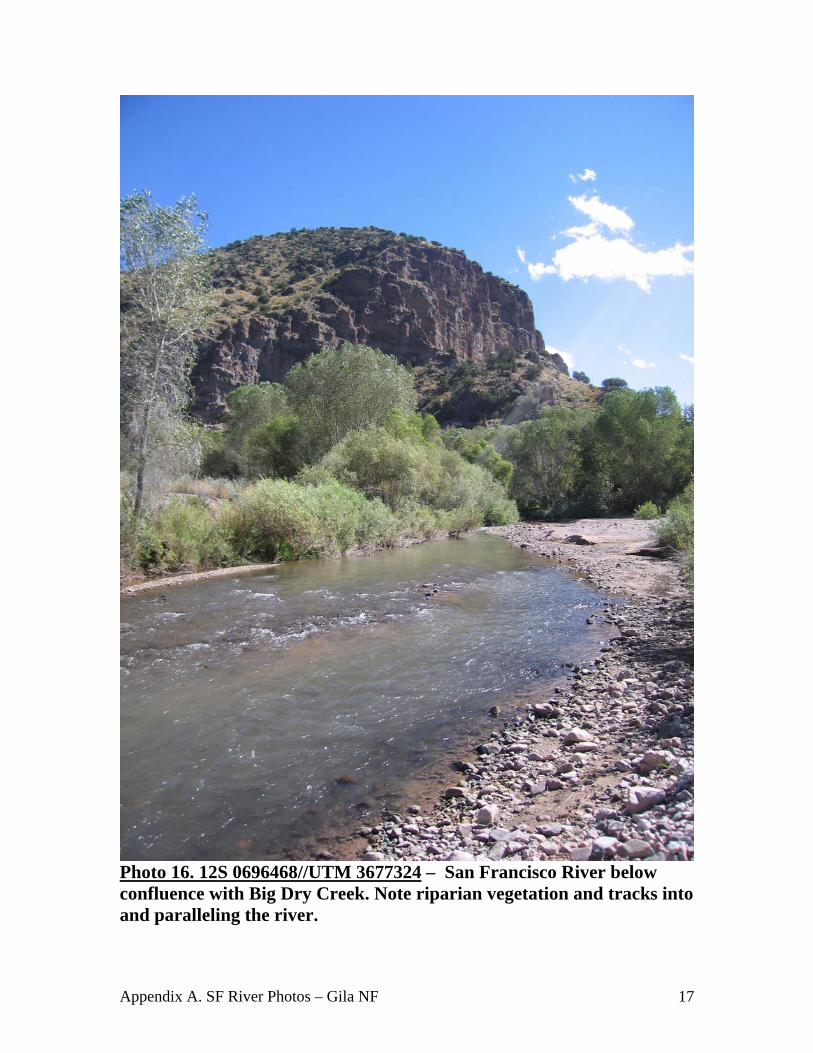
Photo 16. 12S 0696468//UTM 3677324 – San Francisco River below confluence with Big Dry Creek. Note riparian vegetation and tracks into and paralleling the river.
Appendix A. SF River Photos – Gila NF 18
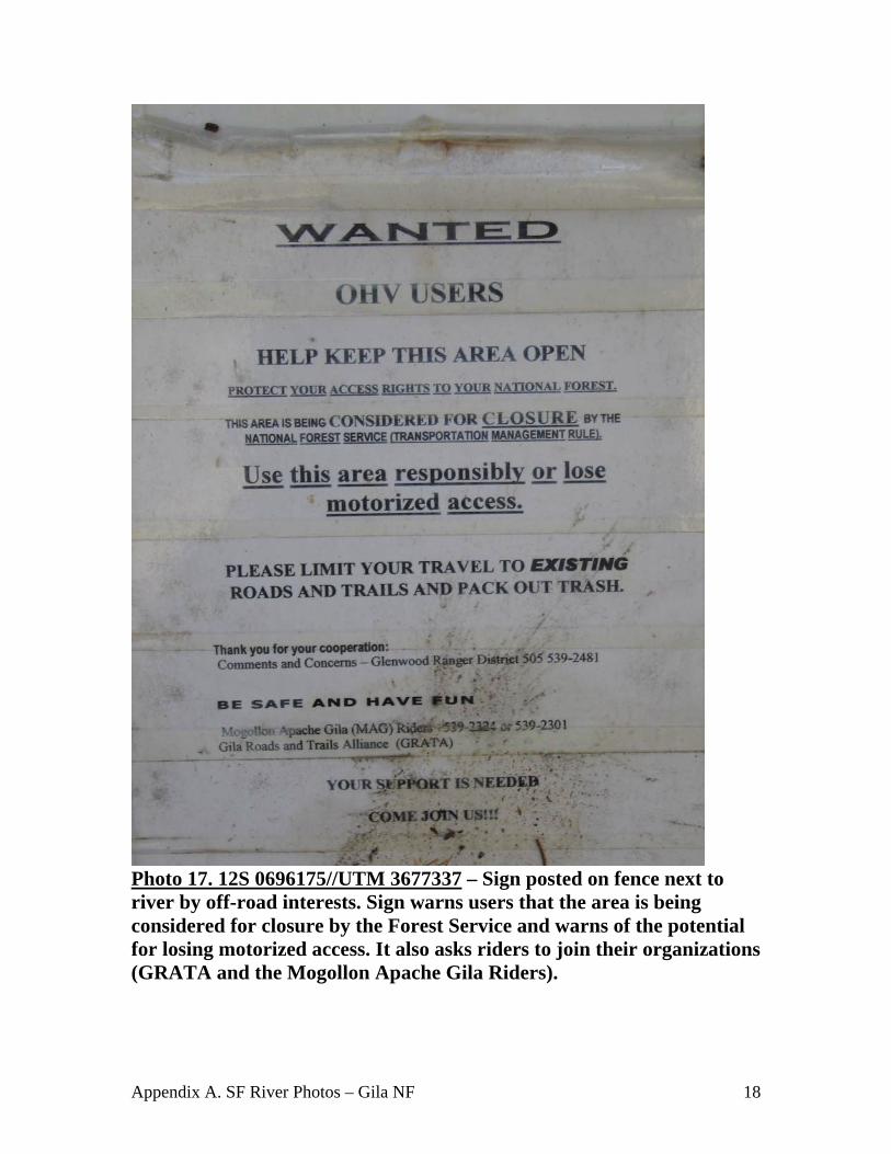
Photo 17. 12S 0696175//UTM 3677337 – Sign posted on fence next to river by off-road interests. Sign warns users that the area is being considered for closure by the Forest Service and warns of the potential for losing motorized access. It also asks riders to join their organizations (GRATA and the Mogollon Apache Gila Riders).
Appendix A. SF River Photos – Gila NF 19
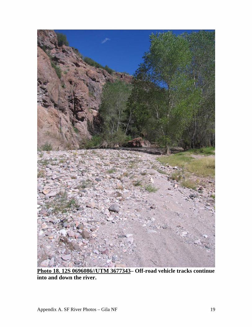
Photo 18. 12S 0696086//UTM 3677343– Off-road vehicle tracks continue into and down the river.

Appendix A. SF River Photos – Gila NF 20
Photo 19. 12S 0696027//UTM 3677226– Tracks across the first large crossing of the San Francisco River. Significant amount of mud, bank cuts, obvious sedimentation and increased turbidity that could potentially negatively impact fish and other aquatic organisms.

Appendix A. SF River Photos – Gila NF 21
Photo 20. 12S 0696027//UTM 3677226 – Same as photo 19, different view.
Appendix A. SF River Photos – Gila NF 22
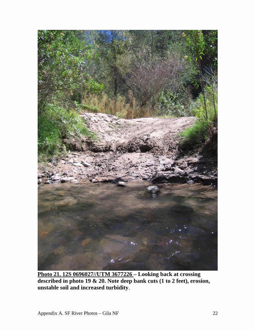
Photo 21. 12S 0696027//UTM 3677226 – Looking back at crossing described in photo 19 & 20. Note deep bank cuts (1 to 2 feet), erosion, unstable soil and increased turbidity.

Appendix A. SF River Photos – Gila NF 23
Photo 22. 12S 0695981//UTM 3677189 – Redundant crossing just downstream of previous crossing (Photos 19-21). Evidence of users continuing to drive down the river and to drive wherever they want on the banks of the river.
Appendix A. SF River Photos – Gila NF 24
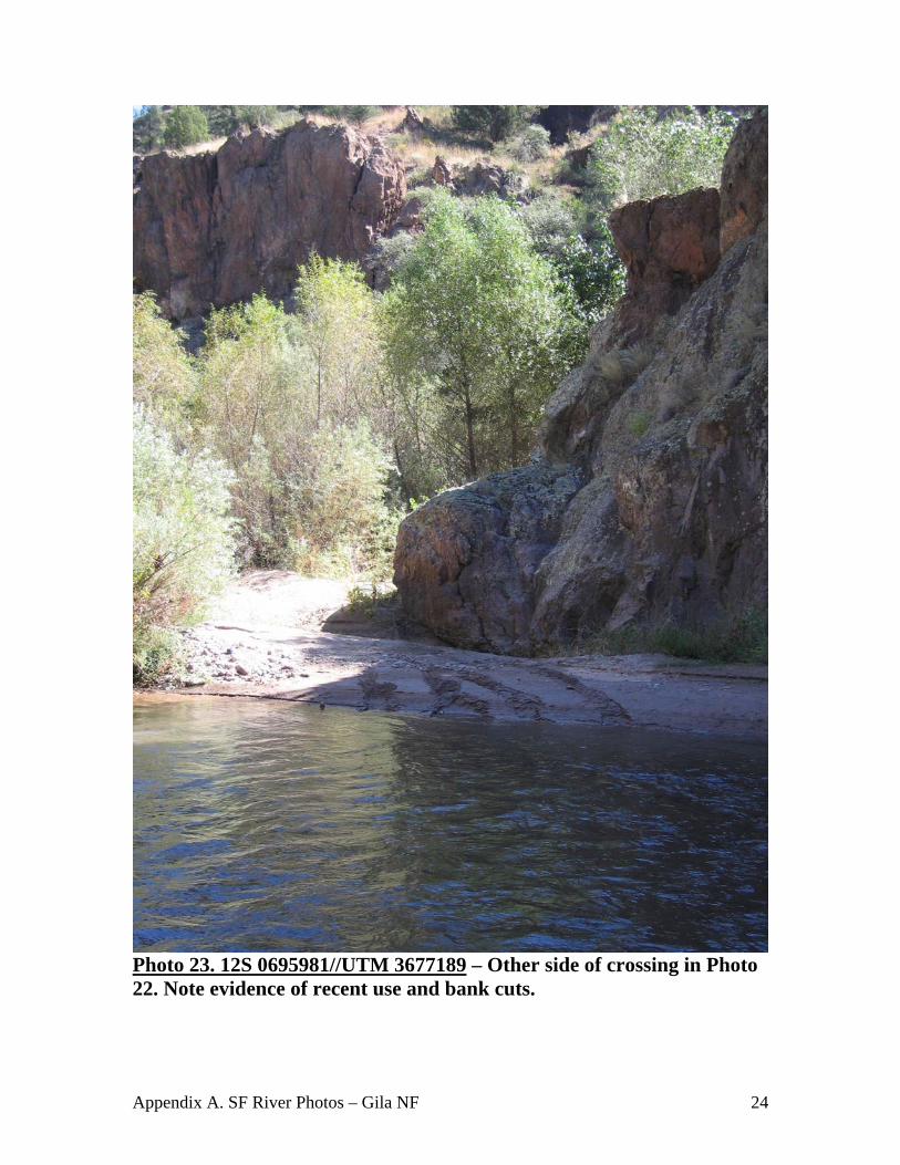
Photo 23. 12S 0695981//UTM 3677189 – Other side of crossing in Photo 22. Note evidence of recent use and bank cuts.
Appendix A. SF River Photos – Gila NF 25
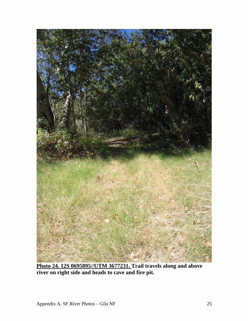
Photo 24. 12S 0695895//UTM 3677231. Trail travels along and above river on right side and heads to cave and fire pit.
Appendix A. SF River Photos – Gila NF 26
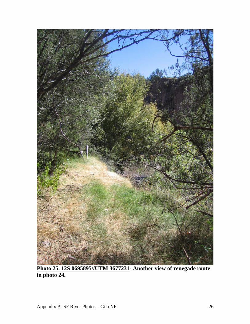
Photo 25. 12S 0695895//UTM 3677231- Another view of renegade route in photo 24.
Appendix A. SF River Photos – Gila NF 27
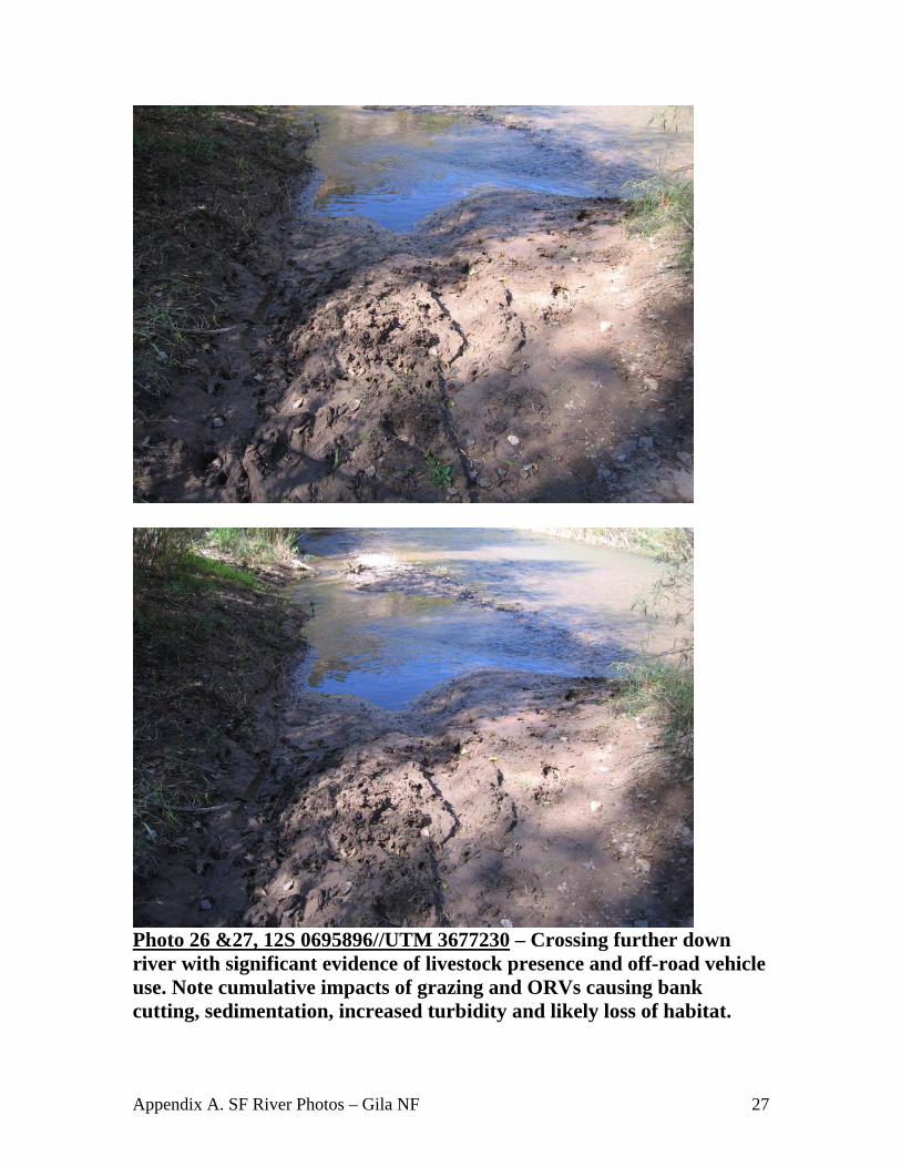
Photo 26 &27, 12S 0695896//UTM 3677230 – Crossing further down river with significant evidence of livestock presence and off-road vehicle use. Note cumulative impacts of grazing and ORVs causing bank cutting, sedimentation, increased turbidity and likely loss of habitat.

Appendix A. SF River Photos – Gila NF 28
Photo 28 & 29. 12S 0695896//UTM 3677230 – Twenty feet downstream of 26 &27 showing multiple tracks into river, cut banks, increased erosion & sedimentation due to livestock and off-road vehicles
Appendix A. SF River Photos – Gila NF 29
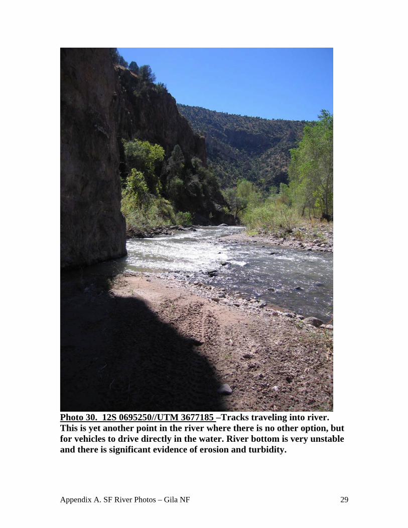
Photo 30. 12S 0695250//UTM 3677185 –Tracks traveling into river. This is yet another point in the river where there is no other option, but for vehicles to drive directly in the water. River bottom is very unstable and there is significant evidence of erosion and turbidity.
Appendix A. SF River Photos – Gila NF 30
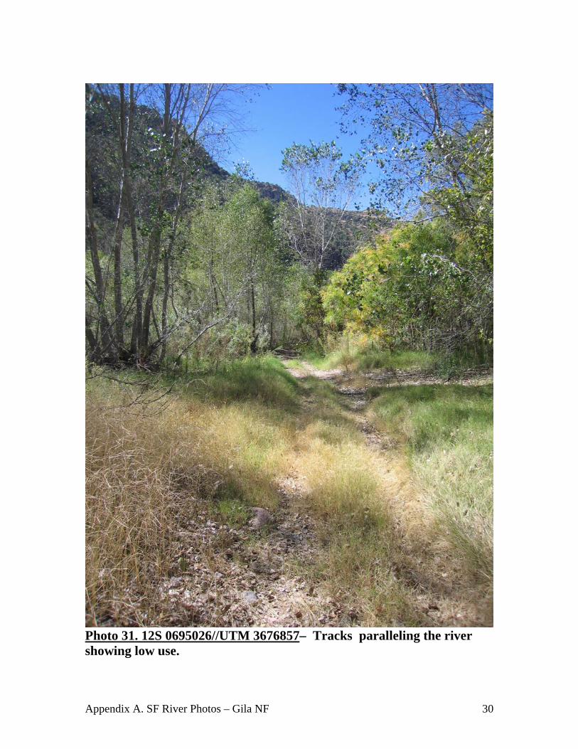
Photo 31. 12S 0695026//UTM 3676857– Tracks paralleling the river showing low use.
Appendix A. SF River Photos – Gila NF 31
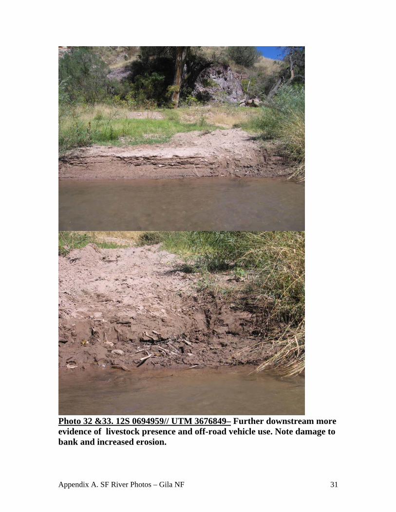
Photo 32 &33. 12S 0694959// UTM 3676849– Further downstream more evidence of livestock presence and off-road vehicle use. Note damage to bank and increased erosion.
Appendix A. SF River Photos – Gila NF 32
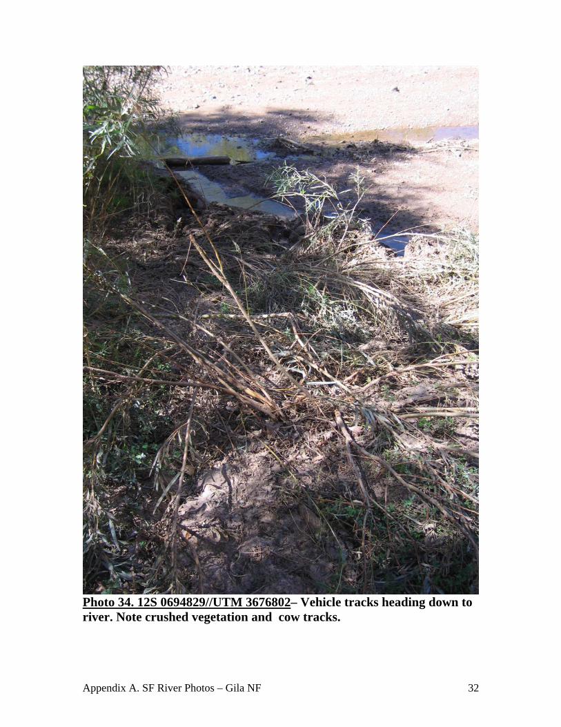
Photo 34. 12S 0694829//UTM 3676802– Vehicle tracks heading down to river. Note crushed vegetation and cow tracks.
Appendix A. SF River Photos – Gila NF 33
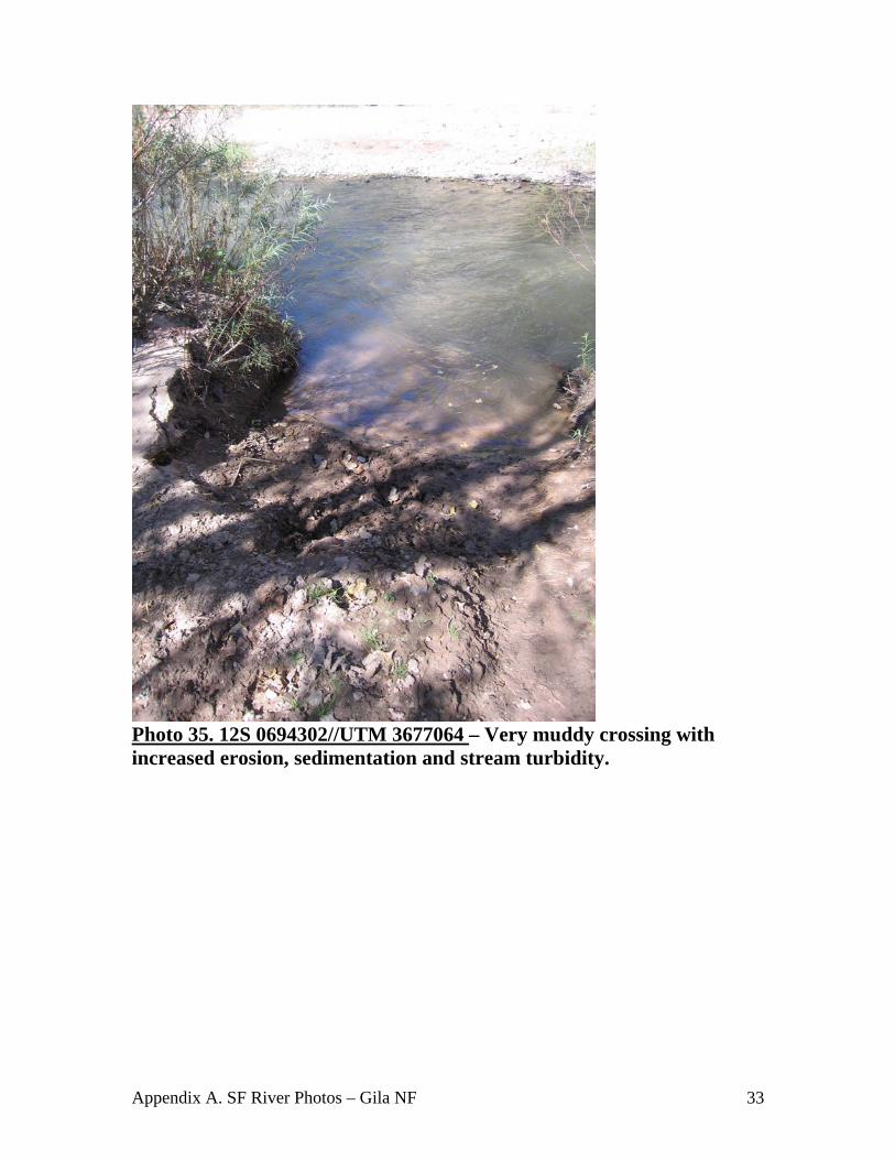
Photo 35. 12S 0694302//UTM 3677064 – Very muddy crossing with increased erosion, sedimentation and stream turbidity.
Appendix A. SF River Photos – Gila NF 34
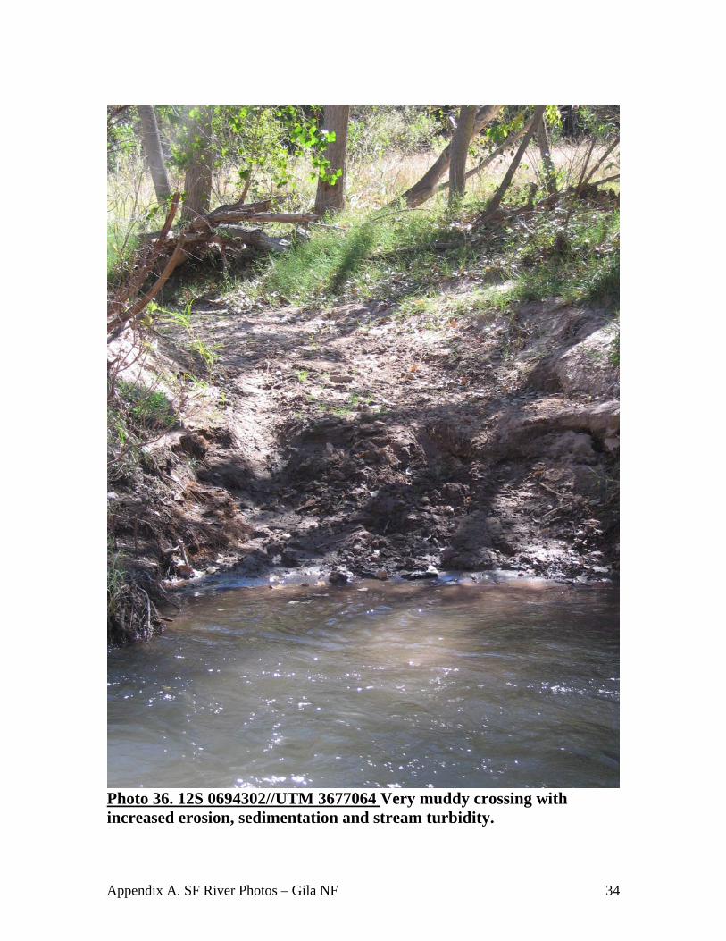
Photo 36. 12S 0694302//UTM 3677064 Very muddy crossing with increased erosion, sedimentation and stream turbidity.
Appendix A. SF River Photos – Gila NF 35
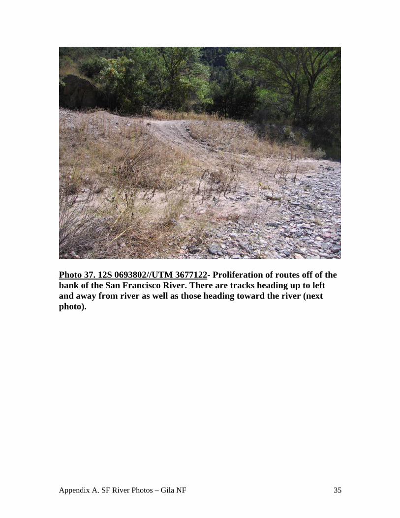
Photo 37. 12S 0693802//UTM 3677122- Proliferation of routes off of the bank of the San Francisco River. There are tracks heading up to left and away from river as well as those heading toward the river (next photo).
Appendix A. SF River Photos – Gila NF 36
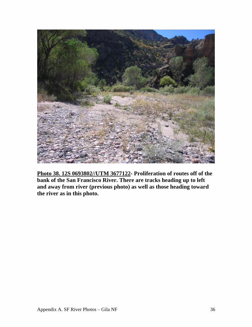
Photo 38. 12S 0693802//UTM 3677122- Proliferation of routes off of the bank of the San Francisco River. There are tracks heading up to left and away from river (previous photo) as well as those heading toward the river as in this photo.

Appendix A. SF River Photos – Gila NF 37
Photo 39. 12S 0693012//UTM 3677021 – Vehicle tracks adjacent to river. Note extreme ruts (1 to 1.5 feet in depth) and muddiness, as well as livestock tracks.
Appendix A. SF River Photos – Gila NF 38
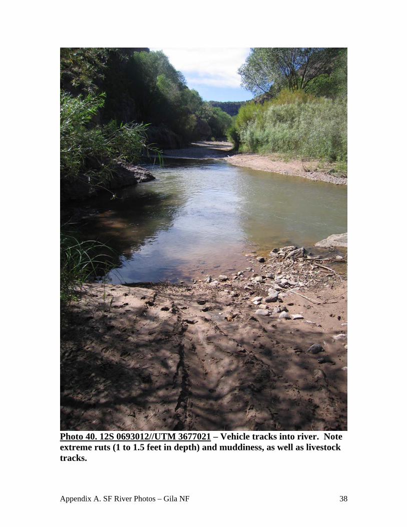
Photo 40. 12S 0693012//UTM 3677021 – Vehicle tracks into river. Note extreme ruts (1 to 1.5 feet in depth) and muddiness, as well as livestock tracks.
Appendix A. SF River Photos – Gila NF 39
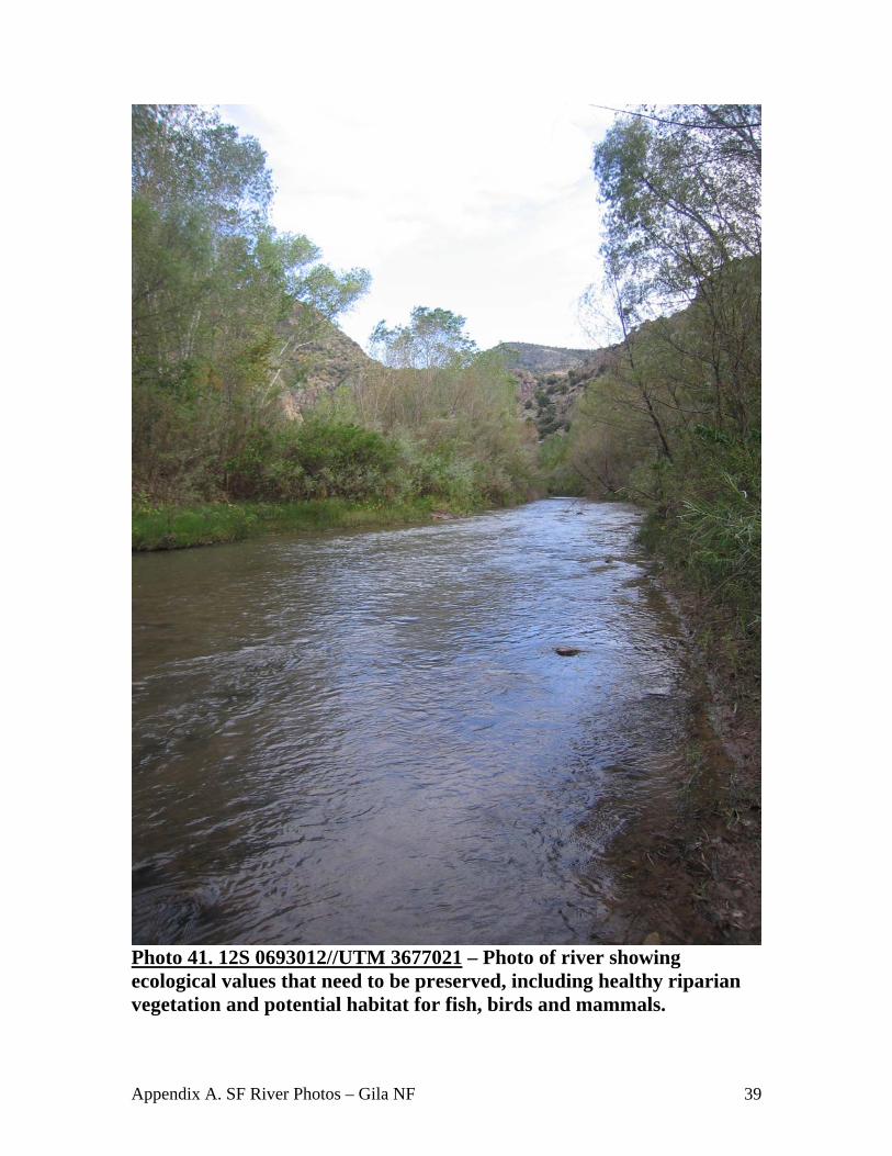
Photo 41. 12S 0693012//UTM 3677021 – Photo of river showing ecological values that need to be preserved, including healthy riparian vegetation and potential habitat for fish, birds and mammals.