application of geographical information systems for the
TRANSCRIPT
Application of geographicalinformation systems forthe optimal location of acommercial network
Vicente RodríguezFacultad de Empresa y Comunicación,
Universidad Internacional de la Rioja (UNIR), Madrid, SpainCristina Olarte-Pascual
Facultad de Ciencias Empresariales, Universidad de La Rioja, Logroño, Spain, andManuela Saco
Facultad de Ciencias Económicas y Empresariales,Universidad San Pablo CEU, Madrid, Spain
AbstractPurpose – The purpose of this paper is to study the optimization of the geographical location of a network ofpoints of sale, so that each retailer can have access to a potential geographic market. In addition, the authorsstudy the importance of the distance variable in the commercial viability of a point of sale and a network ofpoints of sale, analysing if the best location for each point (local optimum) is always the best location for thewhole (global optimum).Design/methodology/approach – Location-allocation models are applied using p-median algorithms andspatial competition maximization to analyse the actual journeys of 64,740 car buyers in 1240 postal codesusing a geographic information system (GIS) and geomarketing techniques.Findings – The models show that the pursuit of individual objectives by each concessionaire over thecollective provides poorer results for the whole network of points of sale when compared to coordinatedcompetition. The solutions provided by the models considering geographic and marketing criteria permit areduction in the length of journeys made by the buyers. GIS allows the optimal control of market demandcoverage through the collaborative strategies of the supplying retailers, in this case, car dealerships.Originality/value – The paper contributes to the joint research of geography and marketing from atheoretical and practical point of view. The main contribution is the use of information on actual buyerjourneys for the optimal location of a network of points of sale. This research also contributes to the analysisof the correlation between the optimum local and optimum global locations of a commercial network and is apioneering work in the application of these models to the automotive sector in the territorial area of the study.Keywords Geomarketing, Automotive, Geographical information system (GIS), Location-allocation model,Zip codePaper type Research paper
European Journal of Managementand Business EconomicsVol. 26 No. 2, 2017pp. 220-237Emerald Publishing Limited2444-8451DOI 10.1108/EJMBE-07-2017-013
Received 30 June 2016Revised 1 November 20164 November 201621 November 201613 December 201625 February 2017Accepted 15 April 2017
The current issue and full text archive of this journal is available on Emerald Insight at:www.emeraldinsight.com/2444-8451.htm
JEL Classification — M31, M10, R11© Vicente Rodríguez, Cristina Olarte-Pascual and Manuela Saco. Published in the European Journal
of Management and Business Economics. Published by Emerald Publishing Limited. This article ispublished under the Creative Commons Attribution (CC BY 4.0) licence. Anyone may reproduce, distribute,translate and create derivative works of this article (for both commercial and non-commercial purposes),subject to full attribution to the original publication and authors. The full terms of this licence may be seenat http://creativecommons.org/licences/by/4.0/legalcode
This research was funded by the Spanish Ministry of Economy and Competitiveness (ResearchProject reference: ECO2014-59688-R, National Program for Research, Development and InnovationAimed at the Challenges of Society, National Plan of Scientific and Technical Research and Innovation2013-2016). Moreover, a version of this work has been previously published as Working Paper No.DOCFRADIS1602 of the Working Documents Collection of the Ramón Areces Foundation ofCommercial Distribution (http:catedrafundacionarecesdc.uniovi.es).
220
EJMBE26,2
1. IntroductionThere is increasing interest in the potential opportunities arising from extracting spatialinformation from large data sets (Comber et al., 2016). Approximately 75 per cent of the dataused by business decision makers include at least one spatial component, such as customeraddress, geographic distribution of population, market coverage or commercial area(Ozimec et al., 2010).
Geomarketing is a discipline that has been developed to make decisions according togeographical and marketing criteria (Rodríguez et al., 2015). Geomarketing uses statisticalgeometry, defined by Goodchild (2008) as the application of probabilistic methods togeometric forms. For any geomarketing study, a geographic information system (GIS) isneeded: “a computer application capable of creating, storing, manipulating, visualizing andanalysing geographic information” (Goodchild, 2000, p. 6). This link between attributes andgeography is a distinctive feature of GIS (Goodchild, 1991). GISs are widely applied indeveloped countries, such as the USA or Great Britain (Allo, 2014). Their widespread usehas made them a tool for sharing and communicating knowledge about the earth’s surface(Sui and Goodchild, 2011). Although geolocation systems are highly developed, scarcely anywork on geomarketing has been done, creating an opportunity for research in this area(e.g. Ozimec et al., 2010; Comber et al., 2016). There is also an increasing interest invisualizing and analysing spatio-temporal data through geo-intelligence tools (Bozkaya andSingh, 2015; Altshuler et al., 2015; Lucas et al., 2015).
In this context, the present work aims to contribute to the joint research of geographyand marketing from a theoretical and practical standpoint. To this end, the main objective isto study the optimization of the geographical locations of a network of points of sale, so thateach retailer can have access to a potential geographic market. From the main goal,the following secondary objectives can be derived:
• to detect the impact of the distance variable in the commercial viability of a point ofsale and a network of points of sale, analysing if the best location of each point (localoptimum) is always the best location for the entire network (global optimum); and
• to evaluate the usefulness of geomarketing and GIS in the development ofcommercial networks and analyse whether their application improves access topotential markets.
This paper shows in a theoretical and practical way the importance of analysing economicand geographic variables together for the optimization of a commercial network, applyinggeomarketing techniques through the use of GIS. For this, we study the actual journeys of64,740 car buyers, and the number of points of sale and their locations are optimized. Themain contribution of this paper is the use of real journey information to evaluate the locationof a network of points of sale. While most studies use statistical estimates of buyer journeys(e.g. Cardozo et al., 2010; Buzai, 2011; Casado and Palacios, 2012), this research also providesan analysis of the correlation between the optimum local and optimum overall locations in acommercial network. This paper is also a pioneer in the application of these models in theindustry and in the territorial area of study.
2. Theoretical frameworkThe social sciences, especially geography, make a profound re-evaluation of the concept ofterritory based on their multiple manifestations (Fonseca et al., 2016). It should be noted that inthe field of geography “there is a long tradition of finding the optimal solutions to designproblems in the research domain known as spatial optimization” (Goodchild, 2010, p. 10). Spatialdependence has already been defined through Tobler’s (1970) first law: all things are related, butcloser things are more closely related than distant things. Although the nature of spatialmobility is obvious, it has often not been considered for the design of journeys (Loidl et al., 2016).
221
Geographicalinformation
systems
Since the 1960s, various studies have been conducted to assess the influence ofgeographic distance on buyers. One of the pioneering studies was by Bishop and Brown(1969) on food buying habits in the year 1966. These authors concluded that a significantnumber of clients are subject, for one reason or another, to some form of spatial monopoly.
Recently, other authors have re-emphasized the importance of considering geographicalcriteria in organizational decisions (e.g. Chasco, 2003; Ozimec et al., 2010; Buzai, 2011;Gutiérrez-Gallego et al., 2012; Allo, 2014; Altshuler et al., 2015), and different GISs have beendeveloped for spatial behavioural analysis (e.g. Loidl et al., 2016; Fonseca et al., 2016).
For business decision makers, the location of facilities to achieve the greatest coveragehas long been a major concern (Tong, 2012). One approach is to use location-allocationmodels that optimally locate facilities and allocate demand to each of the points of sale(Zeng et al., 2009). In this way, location-allocation models investigate the need for additionalservice centres, the optimal relocation of existing service centres or the effects of a reductionin the number of centres ( Jong de and Tilema, 2005). Geomarketing has entailed theapplication of these techniques to identify “hot” areas with greater commercialattractiveness for companies (Cardozo et al., 2010). The competitive advantages of goodlocations for a network of points of sale are obvious, since, from these locations, a spatialdependence with the environment is created (López and Chasco, 2007).
Table I presents a synthesis of research in the field of geomarketing.The theoretical framework highlights the importance of spatial attributes, since
geographical proximity facilitates the formation of important links with suppliers(e.g. Ganesan et al., 2005). However, even though the automotive sector is strategic withinthe aggregate of the Spanish economy (Moral-Rincón, 2004; Levy Mangin et al., 2007;Moyano-Fuentes and Martínez-Jurado, 2012; Makarova et al., 2012; González et al., 2013;Busse et al., 2016), there has been a lack of research into the spatial relationship betweendealer networks and vehicle buyers. Therefore, from an economic-geographical conception,the following hypotheses are proposed for the automotive sector:
H1. The application of location-allocation models allows the optimal location of anetwork of points of sale.
H2. Consumer journeys affect the optimal location of a network of points of sale.
There exist numerous academic works based on competition between various points of sale(Bigné and Vila, 2000; Altshuler et al., 2015; Bucklin et al., 2008; Buzai, 2011; Calero, 2004;Flaherty and Pappas, 2002; Chan et al., 2007; Díez and Escalona, 2001; Donthu and Rust, 1989;Drezner, 1994; Mittal et al., 2004; Moreno, 2003; Rodríguez et al., 2015; Yasenkovsky andHodgson, 2007; Zeng et al., 2009), but it is the research of Chan et al. (2007) which highlights aninteresting aspect based on the competition model of Bertrand. In this competitive model:
• companies do not cooperate;
• firms compete on the basis of their distance from the buyer (in this study, price is notconsidered a determinant variable but distance is considered so); and
• consumers purchase products at the nearest point of sale.
Academic works have been conducted in which location-allocation models and spatialcompetition maximization models have been applied. In these models, priority was given tothe interests of each individual bidder-competitor over the collective (Moreno and Buzai, 2008).In this paper, we analyse whether the location of each dealership should be considered inrelation to the other points of the sale in the network (Chan et al., 2007), so the followinghypothesis is proposed:
H3. The optimal solution for each point of sale (local optimum) is optimal for the entirenetwork (global optimum).
222
EJMBE26,2

Research objective Methodology Conclusions Source
GeomarketingTo analyse the utility ofgeomarketing techniques
Theoretical review Geomarketing aids rational decisionmaking in developing countries
Allo (2014)
To demonstrate theimportance of geomarketingin commercial distribution
Gravity model andMultinomial Logit
The location of “shadow zones” incommercial networks can be solved byGIS
Calero (2004)
To analyse the utility of thevariogram function
Variogram function Development of a spatial instrumentcombining analytical and graphicalanalysis
Chica Olmoand LuqueMartínez(1992)
To analyse the cost of landin the City of Granada
Residual IterativeKriging Method
Development of a methodology forestimating the price and value of houses
Chica Olmo(1995)
Eliminate the uncertainty inspatial analysis
GIS GIS are geographical decision-makingtools in environments with a degree ofuncertainty
Goodchild(2008)
Analyse the utility of GIS inGeo-design.
GISs are valid tools for geo-design ofcommercial networks
Goodchild(2010)
Spatial problemsAllocation of individuals todifferent geographicalcentres
Inner group ofcentrality
The allocation of clients and costs toeach regional unit providesimprovements in marketingmanagement and returns
Altshuler et al.(2015)
Location-allocationmodel
Optimization of the allocation ofindividuals to primary health carecentres in Lujan (Argentina)
Buzai (2011)
GISs reduce the journey length forcitizens to electoral modules inChihuahua (México)
Casado andPalacios(2012)
GISs allow the analysis of access tosocial services by the different socialstrata in the Republic of Philippines
Delgado andCanters (2011)
GISs allow analysis of the differencesin land use by the different socialstrata in Montevideo (Uruguay)
Fonseca et al.(2016)
GISs allow the analysis of land useplanning and the spread of land pricesin Montevideo
Lozano-Botache (2016)
Design of a location-price model of anetwork of petrol stations in Singapore
Chan et al.(2007)
Maximization of the coverage of anetwork of acoustic warning stationsin Dublin (Ohio)
Tong (2012)
Huff Model Utility of the Huff Model in theanalysis of the attraction capacity ofshopping centres
Díez andEscalona(2001)
Undesirable installations Location-allocationmodels
Models for the identification ofundesirable installations
Bosque andFranco (1995)
Distribution intensity andits effect on purchasing
Gini coefficient Importance of spatial proximity ofclients in the automotive sector
Bucklin et al.(2008)
Nakanishi and Coopermodel
Shows the utility of these models in theinstallation of a new point of sale in analready existing network
Drezner (1994)
(continued )
Table I.Principal results of
studies ongeomarketing and GIS
223
Geographicalinformation
systems

Research objective Methodology Conclusions Source
Variance analysis Relationship between long journeysand purchase of durable goods
Hyman (1987)
Regression model Demonstrates the importance ofgeographical distance in commercialrelations
Ganesan et al.(2005)
Weighted geographicregression models
Displays different patterns ofsatisfaction with a network of points ofsale depending on the physical andpsychological factors of their clientsby virtue of their geographic location
Mittal et al.(2004)
Location-allocationmodel. GIS
Models and maps spatial competitionand its impact on trade
Moreno (2003)
Reduction of urban and rural journeysfor the purchase of durable goods
Rodríguezet al. (2015)
Territorial analysis Kernel Estimator andweighted geographicregression models
Analysis of the land cover generatedby Geo-Wiki project on a 50 kilometresgrid
Comber et al.(2016)
Kernel Estimator Optimization of location of hospitals Donthu andRust (1989)
P-Median hierarchicalmodels and SILA
Demonstrates unequal access to healthservices in Ghana
Yasenovskiyand Hodgson(2007)
Design of journey flows andtransport
GIS Demonstrates the validity of GIS forthe design of transport flows
Loidl et al.(2016)
Pickup and interceptflow models
The application of these models in theanalysis of buyer journeys
Zeng et al.(2009)
Theoretical problemsModel design Minsum and Minmax Demonstrates when to apply each
developed modelCarrizosa andRomero (2001)
Utility of geographicanalysis
Exploratory analysisof spatial data
Applications of geomarketing in thedistribution sector
Chasco (2003)
GIS, Huff Model andLISA
Demonstrates the usefulness of theapplication of geomarketing inmarketing departments
Chasco (2012)
Location-allocationmodel. GIS
Pioneering work demonstrating theprogress in marketing decisionsdue to GIS
García-Palomo(1997)
GIS Shows the business benefits ofgeographic analysis
Goodchild(1991)
Analyses the importance ofsymbolization for geographicinformation users
Ozimec et al.(2010)
Extends the validity of GIS fortemporal and geographical analysis
Goodchild(2013)
Theoretical review Retrospective analysis of the creationand evolution of GIS.
Goodchild(2000)
Demonstrates opportunities offered bygeographical research techniques (GRT)
Moreno (2004)
First order spatialautoregressive model
Demonstrates existence of a delaybetween the variation ofmacroeconomic variables and itsgeographic implications
López andChasco (2007)
Table I.
224
EJMBE26,2
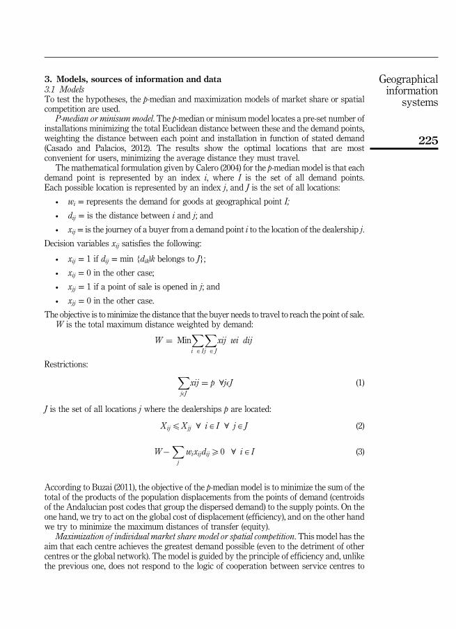
3. Models, sources of information and data3.1 ModelsTo test the hypotheses, the p-median and maximization models of market share or spatialcompetition are used.
P-median or minisummodel. The p-median or minisum model locates a pre-set number ofinstallations minimizing the total Euclidean distance between these and the demand points,weighting the distance between each point and installation in function of stated demand(Casado and Palacios, 2012). The results show the optimal locations that are mostconvenient for users, minimizing the average distance they must travel.
The mathematical formulation given by Calero (2004) for the p-median model is that eachdemand point is represented by an index i, where I is the set of all demand points.Each possible location is represented by an index j, and J is the set of all locations:
• wi = represents the demand for goods at geographical point I;
• dij = is the distance between i and j; and
• xij = is the journey of a buyer from a demand point i to the location of the dealership j.
Decision variables xij satisfies the following:
• xij = 1 if dij = min {dik|k belongs to J};
• xij = 0 in the other case;
• xjj = 1 if a point of sale is opened in j; and
• xjj = 0 in the other case.
The objective is to minimize the distance that the buyer needs to travel to reach the point of sale.W is the total maximum distance weighted by demand:
W ¼ MinX
i A I
X
j A J
xij wi dij
Restrictions:X
jEJ
xij ¼ p 8jEJ (1)
J is the set of all locations j where the dealerships p are located:
XijpXjj 8 iA I 8 jA J (2)
W�X
j
wixijdijX0 8 iA I (3)
According to Buzai (2011), the objective of the p-median model is to minimize the sum of thetotal of the products of the population displacements from the points of demand (centroidsof the Andalucian post codes that group the dispersed demand) to the supply points. On theone hand, we try to act on the global cost of displacement (efficiency), and on the other handwe try to minimize the maximum distances of transfer (equity).
Maximization of individual market share model or spatial competition. This model has theaim that each centre achieves the greatest demand possible (even to the detriment of othercentres or the global network). The model is guided by the principle of efficiency and, unlikethe previous one, does not respond to the logic of cooperation between service centres to
225
Geographicalinformation
systems

achieve a global solution that prioritizes interests to demand, but privileges those of eachindividual bidder-competitor (Moreno and Buzai, 2008). The model seeks to maximizethe selfish behaviour of each of the sales agents, giving priority to individual benefit overthe collective. As defined by Carrizosa (2013):
MaxPif i d xi;Xð Þð Þ;
1X iXn
where d is the captured demand at each point xi of the total set (X), i¼ 1, 2,…, n are thecandidate locations of each point of sale, fi the function that maximizes the captured demandat point of sale i:
f x Xð Þ ¼ wxe�X2
where wX is a decreasing function.Market competitive services exist at points of sale p1,…, pn.The demand captured at each point xi is as follows:
FX Xð Þ ¼ wX
1d xi ;Xð Þ2
1d xi ;Xð Þ2þ
1d xi ;P1ð Þ2þ . . .þ 1
d xi ;Pnð Þ2
3.2 Sources of information and dataThe sources of information used in this study are the following:
• Institute of Automotive Studies of the National Association of Automobile and TruckManufacturers for registration data from 2007 to 2011.
• Andalucian Institute of Statistics and Cartography, web page on International PostalCodes and the web page Geopostcodes.com have been used for the geographiclocation for the centroids of each of the postal codes collected.
• Automobiles Citroën Spain provided the sales data for each establishment and thepostal codes of the customers.
The information being obtained, we began with geocoding, defined as a process of assigningmap coordinates to an entity (Calero, 2004). As part of this process, the centroids of all postalcodes in Andalucia were located. Subsequently, the dealerships of the base network werelocated geographically (Table II).
The GIS Flowmap was used for the digital representation of 64,740 actual trips of buyersto the 25 points of sale of the base network. The distance used is Euclidean. Flowmap is aprogramme created by the Faculty of Geographical Sciences of the University of Utrecht,which “is specialized in the visualization of data interaction, such as migration paths andflows, interaction analysis such as accessibility analysis, network analysis, and models ofinteraction” (Breukelman et al., 2009, p. 7).
Flowmap is a spatial analysis-oriented programme that incorporates a set of tools toaddress various analyses, mainly the following (e.g. Maarten, 2002; Moreno and Buzai, 2008;Delgado and Canters, 2011; Buzai, 2011):
• analysis of flows between places (of goods, people or information);
• models of spatial interaction, spatial accessibility and network analysis; and
• models of optimal location.
226
EJMBE26,2

The result of the analysis carried out is shown in Figure 1. Here, thick and thinner lines areseen. The thicker lines correspond to a greater flow of journeys to that dealership.
Although the number of points of sale has remained stable, the average marketper dealership has shifted from 7,406.48 private vehicles registered in 2006 to 2,589.60 in2011 (Table III).
“Market potential” is defined as the area of average registrations that a dealer must beable to access to be commercially viable. This potential market must be large enough tomake the necessary sales to cover internal expenses. It should be noted that neither thedemand at the points of sale nor their internal costs are uniform, so it is necessary to applyan average covering the generality of the cases. For this average, account was taken that theyear 2007 was a record year in sales at the national level and that 2008 was the first year ofstrong decline in vehicle registrations and, in consequence, a reduction in dealer networks(Navas, 2014; Blanchar, 2013). Due to the foregoing, we estimate what the minimumpotential market volume for the viability of a dealer in Andalucia may be on averagebetween 2007 and 2008 (see Table IV), years in which the points of sale still had access tosufficient markets.
From the minimum potential market of 5,842 vehicles, the threshold of average trips todealers is calculated to determine the geographic area of influence that they must coverto achieve this. In this regard, the area that a network of 25 dealers in Andalucia must cover toopt for an average potential market of 5,842 vehicles in 2011 is within a radius of57.81 kilometres on average around each dealership. If we consider that the number of pointsof sale of the base network is 25, by necessity some will have to “cannibalize” the areas ofinfluence of others in the same network. To make the network viable and cover the samemarket, the solution would be to reduce the number of dealerships offering the selectedmodels.
Post code Municipality Longitude Latitude
11011 Cádiz −625.054 36.479.67811205 Algeciras −545.781 36.160.76211407 Jerez de la Frontera −613.679 36.704.79014013 Córdoba −481.052 37.759.90114014 Córdoba −468.526 37.967.29214400 Pozoblanco −475.872 38.278.04114900 Lucena −453.285 37.368.21218015 Granada −366.193 37.193.62518600 Motril −349.061 36.748.67421007 Huelva −690.005 37.298.01823009 Jaén −370.429 37.856.36823400 Úbeda −335.994 38.014.37423650 Torredonjimeno −395.926 37.765.43029004 Málaga −448.319 36.681.66129006 Málaga −449.800 36.710.68029200 Antequera −457.907 36.998.43229603 Marbella −488.635 36.509.94029640 Fuengirola −461.738 36.558.55229700 Vélez-Málaga −412.054 36.757.44241007 Sevilla −595.645 37.396.38941015 Sevilla −597.338 37.435.39641410 Carmona −557.559 37.457.56441560 Estepa −489.833 37.300.08494230 Huércal de Almería −246.901 36.886.22394710 El Ejido −277.546 36.783.396Note: Geographical location of dealers in 2011
Table II.Base network
227
Geographicalinformation
systems

From the abovementioned, we proceed to calculate what would be the viable number ofdealerships in this environment. To do this, the market for private vehicles in the year 2011must be divided between the number of dealerships and the result must be as close as possibleto those 5,842 vehicles considered as the average potential market which provides access tominimum potential market share, as shown in Table V.
2006 2007 2008 2009 2010 2011
Number of registrations 185,162 175,735 116,391 111,102 101,553 64,740Dealerships in the network 25 25 25 25 25 25Average of dealer market 7,406.48 7,029.40 4,655.64 4,444.08 4,062.12 2,589.60Source: Own design based on data from Institute of Automotive Studies
Table III.Evolution of thepotential market forcar dealerships inAndalucia
2007 2008
Registrations made in Andalucia 175,735 116,391Number of dealerships in the network 25 25Market share per dealership 7,029.4 4,655.64Estimate of minimum potential market 5,842.52Source: Own design based on data from the Institute of Automotive Studies
Table IV.Calculation ofminimum potentialmarket for dealerships
Postal codes with a Citroen dealership in 2011
Car buyer journeys in 2011
Total Andalucian post codes
Figure 1.Flowmap of thejourneys of car buyersin Andalucia in 2011
Registrations made in Andalucia 64,740Optimum number of dealerships 11Market per dealership 5,885.45
Table V.Adjustment ofpoints of sale
228
EJMBE26,2

These calculations suggest that a network of 11 dealerships in Andalucia would be theappropriate number to reach the estimated potential market and would allow more viablemarket coverage for this commercial network.
4. ResultsThe model begins with a set of 25 points of sale locations. The application of the reductionmodels allows, at each stage, the progressive elimination of the locations with less influenceon the market share of the network ( Jong de and Tilema, 2005; Breukelman et al., 2009).
Given that both the market volume and the location of the dealerships are relevantvariables, the algorithm of average distance travelled by customers ( p-median) and thealgorithm of elimination of locations with poor results are applied through the reductionmodel (maximization of the individual quota) depending on the volume of registrations.Moreno and Buzai (2008, p. 136) recommend “to test the application of various algorithms,independently or combined, and compare the obtained solutions, so that the suboptimalones can be discarded and the most successful to be accepted as the optimal one”.
4.1 Selection of the eleven dealershipsTo begin the process of deciding the best solution among the proposals, a comparison mustbe made between the solutions of the average distance algorithms and the maximization ofthe individual quota. In Table VI, the surviving dealerships are arrived at after bothalgorithms are applied (surviving dealerships are those that have not been eliminated afterapplication of the models).
The best solution must take into account the average distances that car buyers travel ineach case. In the average distance solution, the point of sale with the greatest journey is41.14 kilometres’ radius around the dealership. Meanwhile, in the solution for maximizingthe individual quota, the average distance travelled by customers, in the case of the longestjourney, is 35.58 kilometres’ radius around the dealership. From all the above, the optimalsolution is the one that eliminates the worst market results (maximization of the individualquota). The cartographic representations of the discarded dealerships, their disposalorder according to their potential market share (the number that accompanies them between1 and 14) and the surviving dealers marked with a blue dot are shown in Figure 2.
4.2 Dealership relocation modelThe relocation model is applied for the optimal cartographic location of a predeterminednumber of installations of a given network (Breukelman et al., 2009). Table VII shows theresults of the different algorithms applied.
Average distance Maximization of individual quotaPost code Municipality Post code Municipality
11205 Algeciras 11205 Algeciras11407 Jerez de la Frontera 11407 Jerez de la Frontera14014 Córdoba 14013 Córdoba18015 Granada 18015 Granada21007 Huelva 21007 Huelva23650 Torredonjimeno 23009 Jaén29006 Málaga 29006 Málaga41015 Sevilla 29603 Marbella41560 Estepa 41007 Sevilla94230 Huércal de Almería 41015 Sevilla94710 El Ejido 94230 Huércal de Almería
Table VI.Surviving
points of sale
229
Geographicalinformation
systems

The interpretation of the results ordered from the most to the least favourable is as follows:
(1) Maximization of competition over the best markets: the most unfavourable case ofpotential market for a dealership is 4,660 vehicles. If the target that has beendetermined for a point of sale is access to a potential market of 5,842 vehicles, thisresult assumes that the point of sale has access to only 80 per cent of that potential.
(2) Maximization of competition over average distance: the most unfavourable case ofpotential market is 4,619 vehicles. This result represents 79 per cent of the potentialfixed market.
(3) Average distance over better market results: the most unfavourable case of potentialmarket is 3,416 vehicles. This result represents 58 per cent of the potentialfixed market.
Flowmap 7.3 Legend
Supply LocationsRanking
StudyareaRemoved Locations
StudyareaLatest candidate for closure
StudyareaRemaining Locations
StudyareaOriginal locations
StudyareaNo demand
StudyareaCatchment Areas
StudyareaBoundaries
StudyareaCurrently in reach but affected
StudyareaCurrently in reach and unaffected
StudyareaOriginally in Reach
StudyareaOriginally out of Reach
Figure 2.Dealerships eliminatedby maximization ofindividual quotamethod
Maximization of competitionover the average distance
Average distance over the bestmarket results
Maximization of competition overbest markets
Post code Municipality Post code Municipality Post code Municipality
11401 Jerez de la Frontera 11202 Algeciras 11404 Jerez de la Frontera14002 Córdoba 11500 El Puerto de Santa María 11518 Puerto Real18014 Granada 14004 Córdoba 14013 Córdoba18200 Maracena 18004 Granada 18012 Granada29006 Málaga 21004 Huelva 18200 Maracena29015 Málaga 23630 Villatorres 29006 Málaga29692 Manilva 29007 Málaga 29603 Marbella41003 Sevilla 29601 Marbella 41005 Sevilla41006 Sevilla 41007 Sevilla 41007 Sevilla41806 Umbrete 41930 Bormujos 41808 Villanueva del Ariscal94230 Huércal de Almería 94003 Almería 94230 Huércal de Almería
Table VII.Relocation modelsolutions
230
EJMBE26,2

It has become clear that dealers cannot cover market areas in a radius of 57.81 kilometresaround the dealership. Therefore, it can be inferred that customer journeys affect the optimallocation of a network of points of sale. In conclusion, it can be affirmed that H2 is accepted.The first thing highlighted in the three proposals is that the optimal solutions in which thealgorithm of the maximization of spatial competition has been applied do not locate points ofsale in the provinces of Huelva or Jaén. Continuing with this observation, the shortest distancethat the buyers of vehicles from the municipality of Huelva, the main market of this province,will have to travel to the nearest dealer (located in postal code 41806 in the municipality ofHumbrete) is 82 kilometres. The shortest distance that the buyers of vehicles from themunicipality of Jaén, main market of this province, will have to travel to the nearest dealership(located in postal code 18200 in the municipality of Maracena) is 88 kilometres. Therefore, thesolutions given by the algorithm of maximization of spatial competition cannot be consideredoptimal because they leave important potential markets without coverage. In this regard,it can be affirmed that the application of the location models has allowed for the optimallocating of a network of points of sale; therefore, H1 is accepted. The optimal solution for theplacement of a generalist dealer network in Andalucia is presented in Table VIII.
As a result of these findings, one can begin to relocate the dealerships (Figure 3).The longest average distance that buyers will have to travel according to this model is34.47 kilometres’ radius around the dealer.
The analysis to determine the optimal solution for a network of points of sale bringsforth the following paradox: the optimal solution for individual dealerships does notcoincide with the optimal solution for the whole network.
Table IX shows the results of applying the dealership relocation model and the spatialcompetition maximization algorithm. These locations optimize the potential markets for the
Postal code Municipality
11202 Algeciras11500 El Puerto de Santa María14004 Córdoba18004 Granada21004 Huelva23630 Villatorres29007 Málaga29601 Marbella41007 Sevilla41930 Bormujos94003 Almería
Table VIII.Global optimumsolution for the
location of dealerships
Flowmap 7.3 Legend
StudyareaProposed Optimised SitesStudyareaOriginal Sites
StudyareaCatchment AreasStudyareaNo demand
StudyareaBoundaries
StudyareaIn Reach
Figure 3.Relocation of
dealerships applyingthe algorithm ofminimization ofaverage distance
231
Geographicalinformation
systems

individual dealerships but not for the total network. Therefore, we have a local optimum.This model aims to achieve the greatest amount of demand for each centre (even to thedetriment of other centres or the global network). That is to say, the optimal solution of thisalgorithm will geographically locate the dealers in their optimal individual location, whichwill be the one that allows the largest market capture. This statement is consistent with theprevious literature: “retail establishments polarize towards the major urban centres”(Chica Olmo and Luque Martínez, 1992, p. 127). In this case, the local optimum does not leadto a global optimum, and therefore, it can be affirmed that H3 is rejected.
5. ConclusionsIn this work, we have analysed the real journeys of buyers with the aim of optimizing thelocation of a network of points of sale, to contribute to the joint research of geography andmarketing from the theoretical and practical point of view. Many authors have highlightedthe importance of considering geographical criteria in business decisions (e.g. Ozimec et al.,2010; Buzai, 2011; Allo, 2014; Altshuler et al., 2015; Loidl et al., 2016; Fonseca et al., 2016).The optimal location of points of sale is a relevant problem within business strategy(e.g. Tong, 2012; Zeng et al., 2009). The definition of a commercial network supposes a formof spatial monopoly based on the strong relations generated between suppliers and clientsaccording to their geographical proximity (Ganesan et al., 2005). In this context, previousliterature has demonstrated the importance of segmenting markets based on geographicvariables (e.g. Chasco, 2012; Casado and Palacios, 2012; Tong, 2012) and the usefulness ofeconometric analysis in the locating of points of sale (Mittal et al., 2004). This work allows usto draw the following conclusions:
• The impact of the distance variable on the commercial viability of a dealership andthe network to which it belongs is crucial in the optimization of the placement of thepoint of sale. Through GIS one arrives at the solution that maximizes the market areacovered with the least points of sale. At the beginning of the study, vehicle buyersmade average trips of less than 57.81 kilometres to purchase a vehicle. Knowledge ofthe habits of buyers when travelling to points of sale has allowed us to discard two ofthe three proposed solutions provided by the application of the location-allocationmodels, because they left areas of more than 80 kilometres uncovered.
• The algorithm of maximization of spatial competition relocation model increasesrivalry between points of sale. With this function, there are locations for points of salewith access to greater potential markets than those points of sale located in the smallercommercial areas. These results were more balanced than those obtained withalgorithms with cooperative strategies ( p-median or minimization of mean distance).
Postal code Municipality
11404 Jerez de la Frontera11518 Puerto Real14013 Córdoba18012 Granada18200 Maracena29006 Málaga29603 Marbella41005 Sevilla41007 Sevilla41808 Villanueva del Ariscal94230 Huércal de Almería
Table IX.Optimal locationsolution for individualdealerships inAndalucia
232
EJMBE26,2
• The optimum solution obtained for the whole network of points of sale (global optimum)is not the best for each point of sale (local optimum). The pursuit of individual objectivesby each dealership, over the collective, provides poorer results for the whole networkthan with coordinated competition. These results complete the work of Chan et al. (2007).Nonetheless, this research demonstrates another solution that individually offers eachpoint of sale access to more viable potential markets vs the global solution and that alsomakes these markets more balanced among them. It should be noted that the authors donot find any scientific documents in this line of research.
• The following conclusion is aligned with the final objective of this research: todemonstrate the usefulness of geomarketing in the development of commercialnetworks using real consumer journeys. From the analysis of each of the dealer’smarket areas, it is corroborated that knowledge of the journeys to the network of pointsof sale is fundamental for their optimal location, minimizing the buyers’ journeys. Thatis to say, the joint application of the p-median algorithms and the maximization of theindividual quota allow better access to larger potential markets by identifyinggeographic areas with greater commercial interest for the company. These conclusionsare consistent with previous research by Bosque and García (1995), García-Palomo(1997), Goodchild (1991), Moreno (2004), Goodchild (2008) and Ozimec et al. (2010).
• As a final conclusion, the results show that GIS can optimally control the marketdemand coverage through retailers’ collaborative strategies (in this case, car dealerships).
5.1 Managerial implicationsThe development of strategies of collaboration vs competition in the network of points ofsale involves convincing the management of each point of the premise that collaborationprovides the best overall solution. It is essential for the optimal location of a network ofpoints of sale to consider the network as a whole, and not each one of the points in isolation,and that the parent company promotes actions that lead to a coordinated competition.The use of GIS is recommended with its integration into the marketing information systemto anticipate the evolution of macroenvironments and microenvironments. Distance is aphysical variable, known and controllable, that should be considered key in any marketingplan. Therefore, it can be concluded that location-allocation models can be of very great useto managers, and that the p-median model can strengthen commercial networks throughtheir optimal positioning, while achieving major benefits for the network of dealers and fortheir customers.
5.2 Limitations and future lines of researchThe main limitation of this investigation is that in the calculation of the results of the modelsthe only variables considered are geographical location of the points of sale and the distancetravelled by buyers. In Lozano-Botache’s (2016) words “a model is only a representation ofreality explained geometrically and with mathematical support, which can result in trueeconomic terms within the ceteris paribus framework” (p. 692). This decision was taken bythe researchers to assess the influence of the location of every point of sale in a commercialnetwork and their access to minimum potential geographic markets. Thus, for future works,we suggest study of the effect of other variables such as brand image, price, manufactureradvertising investment or advertising at the point of sale. Other variables may be the effectof the type of vehicle (product), since it has been considered to have the same degree ofacceptance throughout the study area. Lack of information regarding the internal costs ofeach point of sale opens a new line of research. The second limitation comes from theinvestigation period. As has been indicated, the study interval 2007-2011 allowed us to
233
Geographicalinformation
systems

obtain and analyse results in an economic context of special interest. It is recognized that thedata become outdated quickly and, therefore, it is recommended that the study be replicatedin the future. Another limitation has been the restriction on access to registrationinformation (vehicle sales), since the Organic Law on Data Protection does not allow thedissemination of personal information that may lead to the identification of the individual(or a specific vehicle). Therefore, the postal code of the buyer is the highest level of detail forthe registration data. Future work could introduce the influence of gender or the age of thevehicle buyer. Another aspect to be considered in the interpretation of the results is that thisresearch has been carried out in a specific area and has been limited to the movementswithin it. It is possible that the behaviours are different in other autonomous communities orother countries.
References
Allo, N. (2014), “A challenge for geomarketing in developing countries”, International Journal of MarketResearch, Vol. 56 No. 3, pp. 297-316.
Altshuler, Y., Shmueli, E., Zyskind, G., Lederman, O., Oliver, N. and Pentland, A.S. (2015), “Campaignoptimization through mobility network analysis”, Geo-intelligence and Visualization throughBig Data Trends, IGI Global, pp. 33-74, doi: 10.4018/978-1-4666-8465-2.
Bigné, J.E. and Vila, N. (2000), “Estrategia de empresa y posicionamiento de producto en la industria delautomóvil”, Economía Industrial, Vol. 2 No. 332, pp. 29-42.
Bishop, W.R.J.R. and Brown, E.H. (1969), “An analysis of spatial shopping behavior”, Journal ofRetailing, Vol. 45 No. 2, pp. 23-30.
Blanchar, C. (2013), “Concesionarios menguantes”, El País, available at: http://economia.elpais.com/economia/2013/03/28/actualidad/1364470099_473270.htmlm/economia/2013/03/28/actualidad/1364470099_473270.html (accessed April 2016).
Bosque, J. and Franco, S. (1995), “Modelos de localización – asignación y evaluación multicriterio parala localización de instalaciones no deseables”, Serie Geográfica, No. 5, pp. 97-112.
Bosque, J. and García, R.C. (1995), “La información geográfica humana. Algunos problemas de sutratamiento con un sistema de información geográfica (SIG)”, Anales de Geografía de laUniversidad Complutense, No. 15, pp. 141-155.
Bozkaya, B. and Singh, V.K. (2015), “Geo-intelligence and visualization through big data trends”,Geo-Intelligence and Visualization through Big Data Trends, IGI Global, pp. 1-348, doi: 10.4018/978-1-4666-8465-2.
Breukelman, J., Brink, G., Jong, T. and Floor, H. (2009), Manual Flowmap 7.3, Faculty of GeographicSciences Utrech University, Utrech, available at: http://flowmap.geo.uu.nl/download.php(accessed February 2012).
Bucklin, R.E., Siddarth, S. and Silva-Risso, J.M. (2008), “Distribution intensity and new car choice”,Journal of Marketing Research, Vol. 45 No. 4, pp. 473-486.
Busse, M.R., Knittel, C.R., Silva-Risso, J. and Zettelmeyer, F. (2016), “Who is exposed to gas prices?How gasoline prices affect automobile manufacturers and dealerships”, Quantitative Marketingand Economics, Vol. 14 No. 1, pp. 41-95.
Buzai, G.D. (2011), “Modelos de localización-asignación aplicados a servicios públicos urbanos: análisisespacial de Centros de Atención Primariade Salud (CAPS) en la ciudad de Luján, Argentina”,Cuadernos de Geografía, Revista Colombiana de Geografía, Vol. 20 No. 2, pp. 111-123.
Calero, R. (2004), “Diseño de un sistema de Geomarketing para la localización de establecimientoscomerciales”, doctoral thesis, Universidad Rey Juan Carlos, Madrid.
Cardozo, O.D., Gutierrez, J. and García-Palomares, J.C. (2010), “Influencia de la morfología urbana en lademanda de transporte público: análisis mediante SIG y modelos de regresión múltiple”,Geofocus, Revista internacional de Ciencia y Tecnología de la información geográfica, No. 10,pp. 82-102.
234
EJMBE26,2

Carrizosa, E. (2013), “Documentación en el curso: TIG y planificación de equipamientos y servicios”,Programa de Doctorado: El Análisis Geográfico en la Ordenación del Territorio, pp. 1-19.
Carrizosa, E. and Romero, D. (2001), “Combining minsum and minmax: a goal programming approach”,Journal of Operations Research, Vol. 49 No. 1, pp. 169-174.
Casado, J.M. and Palacios, C. (2012), “Ubicación óptima de módulos electorales en el estado dechihuahua (Méjico) utilizando modelos de localización – asignación mediante un SIG”, Boletin dela Asociación de Geógrafos Españoles, Vol. 60, pp. 227-251.
Chan, T., Padmanabhan, V. and Seetharaman, P.B. (2007), “An econometric model of location andpricing in the gasoline market”, Journal of Marketing Research, Vol. 44 No. 4, pp. 622-635.
Chasco, C. (2003), “El geomarketing y la distribucion comercial”, Revista Investigacion y Marketing,No. 79, pp. 6-13.
Chasco, C. (2012), “El test scan y otros métodos de geomarketing”,Harvard Deusto Marketing y Ventas,No. 113, pp. 50-54.
Chica Olmo, J.M. (1995), “Spatial estimation of housing prices and locational rents”, Urban Studies,Vol. 32 No. 8, pp. 1331-1344.
Chica Olmo, J.M. and Luque Martínez, T. (1992), “Aplicación de la teoría de las variables regionalizadasen la investigación de marketing”, Revista europea de Dirección y Economía de la Empresa, Vol. 1No. 1, pp. 125-132.
Comber, A., Fonte, C., Foody, G., Fritz, S., Harris, P., Olteanu-Raimond, A.M. and See, L. (2016),“Geographically weighted evidence combination approaches for combining discordant andinconsistent volunteered geographical information”, Geoinformática, Vol. 20 No. 3, pp. 503-527.
Delgado, M.E.M. and Canters, F. (2011), “Measuring the accessibility of different household incomegroups to basic community services in upland Misamis Oriental, Northern Mindanao,Philippines”, Singapore Journal of Tropical Geography, Vol. 32 No. 7, pp. 168-184.
Díez, C. and Escalona, A.I. (2001), “Areas de influencia y competencia espacial de grandes superficiescomerciales: una aproximación en el caso de Zaragoza”, Geographicalia, Vol. 39 No. 1, pp. 61-79.
Donthu, N. and Rust, R.T. (1989), “Estimating geographic customer densities using kernel densityestimation”, Marketing Science, Vol. 8 No. 2, pp. 191-203.
Drezner, T. (1994), “Optimal continuous location of a retail facility, facility attractiveness, and marketshare: an interactive model”, Journal of Retailing, Vol. 70 No. 1, pp. 49-64.
Flaherty, K.E. and Pappas, J.M. (2002), “Using career stage theory to predict turnover intentions amongsales people”, Journal of Marketing. Theory and Practice, Vol. 10 No. 3, pp. 48-57.
Fonseca, A., Schon, F. and Domínguez, A. (2016), “Territorio estratégico y segregación: la regiónnoreste del Área Metropolitana de Montevideo Strategic territory and segregation”, Economía,Sociedad y Territorio, Vol. XVI No. 51, pp. 1-28.
Ganesan, S., Malter, A.J. and Rindfleisch, A. (2005), “Does distance still matter? Geographic proximityand new product development”, Journal of Marketing, Vol. 69 No. 10, pp. 44-60.
García-Palomo, J.P. (1997), “Geomarketing. Los sistemas de información geográfica aplicados a laplanificación comercial”, Revista Distribución y Consumo, Vol. 31 No. 1, pp. 99-107.
Geopostcodes.com. available at: www.geopostcodes.com/ (accessed June 2013).
González, E., Ventura, J. and Cárcaba, A. (2013), “Product efficiency in the Spanish automobile market”,Investigaciones Europeas de Dirección y Economía de la empresa, Vol. 19 No. 1, pp. 1-7.
Goodchild, M.F. (1991), “Geographic information systems”, Journal of Retailing, Vol. 67 No. 1, pp. 3-15.
Goodchild, M.F. (2000), “Part 1. Spatial analysts and GIS practitioners”, Journal of Geographical Systems,Vol. 2 No. 1, pp. 5-10.
Goodchild, M.F. (2008), “Statistical perspectives on geographic information science”, GeographicalAnalysis., Vol. 40 No. 3, pp. 310-325.
Goodchild, M.F. (2010), “Towards geodesign: repurposing cartography and GIS?”, CartographicPerspectives, No. 66, pp. 7-21.
235
Geographicalinformation
systems

Goodchild, M.F. (2013), “Prospect for a space – time GIS”, Annals of the Association of AmericanGeographers, Vol. 103 No. 5, pp. 1072-1077.
Gutiérrez-Gallego., J.A., Ruiz-Labrador, E.E., Jaraiz, F.J. and Pérez-Pintor, J.M. (2012), “Diseño de unmodelo de asignación de viajes con aplicaciones SIG para la gestión de planes de movilidadurbana sostenibles en ciudades medias”, GeoFocus, Vol. 13 No. 1, pp. 1-21.
Hyman, M.R. (1987), “Long distance geographic mobility and retailing attitudes and behavior:an update”, Journal of Retailing, Vol. 63 No. 2, pp. 187-204.
Jong de, T. and Tilema, T. (2005), “Transport network extensions for accessibility analysis ingeographic information systems”, Africa GIS Conference in Tshwane, pp. 1-12.
Levy Mangin, J.P., Apaolaza Ibañez, V. and Hartmann, P. (2007), “Determinantes del éxtio de lasrelaciones fabricante – distribuidor: el caso de los concesionarios de automóvilesestadounidenses en España”, Ciencia Ergo Sum, Vol. 14 No. 2, pp. 125-134.
Loidl, M., Wallentin, G., Cyganski, R., Graser, A., Scholz, J. and Hauslauer, E. (2016), “GIS and transportmodeling-strengthening the spatial perspective”, International Journal of Geo-Information, Vol. 5No. 84, pp. 1-23.
López, F.A. and Chasco, C. (2007), “Time trend in spatial dependence. Specification strategy in the first –order spatial autoregressive model”, Estudios de Economía Aplicada, Vol. 25 No. 2, pp. 631-650.
Lozano-Botache, R. (2016), “Seguimiento al comportamiento del mercado de tierras rurales a través deun GIS, Santander Colombia”, Economia, Sociedad y Territorio, Vol. XVI No. 52, pp. 675-696.
Lucas, B., Arefin, A.S., De Vries, N.J., Berretta, R., Carlson, J. and Moscato, P. (2015), “Engagement inmotion: exploring short term dynamics in page-level social media metrics”, paper presented atthe Proceedings – 4th IEEE International Conference on Big Data and Cloud Computing,BDCloud 2014 with the 7th IEEE International Conference on Social Computing andNetworking, SocialCom 2014 and the 4th International Conference on Sustainable Computingand Communications, SustainCom 2014, pp. 334-341.
Maarten, V.H. (2002), Job Access, Work Place Mobility and Occupational Achievement, EburonPublishers, Chicago, IL.
Makarova, I., Khabibullin, R., Belyaev, A. and Belyaev, E. (2012), “Dealer – service centercompetitiveness increase using modern management methods”, Transport Problems, Vol. 7No. 2, pp. 53-59.
Mittal, V., Kamakura, W.A. and Govind, R. (2004), “Geographic patterns in customer service andsatisfaction: an empirical investigation”, Journal of Marketing, Vol. 68 No. 7, pp. 48-62.
Moral-Rincón, M.J. (2004), “Luces y sombras en el sector de automoción español”, Economistas, No. 100,pp. 112-118.
Moreno, A. (2003), “Modelado y representación cartográfica de la competencia espacial entreestablecimientos minoristas”, Boletín de la Asociación de Geógrafos Españoles, No. 35, pp. 55-78.
Moreno, A. (2004), “Nuevas tecnologías de la información y revalorización del conocimientogeográfico”, Scripta Nova, Revista Electrónica de Geografía y Ciencias Sociales, Vol. 7 No. 170,pp. 1-15.
Moreno, A. and Buzai, G.D. (2008), “Análisis y planificación de servicios colectivos con sistemas deinformación geográfica”, Universidad Autónoma de Madrid y Universidad de Luján, ISBN:978-84-691-7877-5, Madrid.
Moyano-Fuentes, J. and Martínez-Jurado, P.J. (2012), Determinantes de la competitividad de losconcesionarios de automoción en España, Septem ediciones, Oviedo.
Navas, N. (2014), “La mitad de los concesionarios que más venden ya son rentables”, CincoDías,available at: http://cincodias.com/cincodias/2014/04/08/empresas/1396966251_643124.html(accessed June 2016).
Ozimec, A.M., Natter, M. and Reutterer, T.K. (2010), “Geographical information systems-basedmarketing decisions: effects of alternative visualizations on decision quality”, Journal ofMarketing, Vol. 74 No. 11, pp. 94-110.
236
EJMBE26,2

Rodríguez, V., Saco, M. and Olarte, C. (2015), “Application of information and communicationtechnologies for the optimization of a net of concessionaires in Andalucia”, ARETHUSE,Scientific Journal of Economics and Business Management, Vols 1/2, pp. 129-151.
Sui, D. and Goodchild, M. (2011), “The convergence of GIS and social media: challenges for GIScience”,International Journal of Geographical Information Science, Vol. 25 No. 11, pp. 1737-1748.
Tobler, W. (1970), “A computer model simulation of urban growth in the Detroit region”, EconomicGeography, Vol. 46 No. 2, pp. 234-240.
Tong, D. (2012), “Regional coverage maximization: a new model to account implicity forcomplementary coverage”, Geographical Analysis, Vol. 44, pp. 1-14.
Yasenovskiy, V. and Hodgson, J. (2007), “Hierarchical location-allocation with spatial choice interactionmodeling”, Annals of the Association of American Geographers, Vol. 97 No. 3, pp. 496-511.
Zeng, W., Hodgson, M.J. and Castillo, I. (2009), “The pickup problem consumers’ locational preferencesin flow interception”, Geographical Analysis, Vol. 41, pp. 149-168.
Further reading
ANFAC (2008-2012), “Memorias anuales 2008-2012”, ANFAC, Madrid.
Códigos postales internacionales. available at: http://codigospostalesinternacionales.blogspot.com.es/2012/02/codigos-postales-de-espana-con.html (accessed June 2013).
Instituto de Estadística and Cartografía de Andalucia (2015), available at: www.juntadeandalucia.es/institutodeestadisticaycartografia/ (accessed February 2012).
Corresponding authorVicente Rodríguez can be contacted at: [email protected]
For instructions on how to order reprints of this article, please visit our website:www.emeraldgrouppublishing.com/licensing/reprints.htmOr contact us for further details: [email protected]
237
Geographicalinformation
systems