applications of integrated surface water groundwater modelling techniques and perspectives
TRANSCRIPT

Applications of Integrated Surface Water/Groundwater Modelling
Techniques and Perspectives
P.J. Thompson, M.A. Marchildon, E.J. Wexler, J.D.C. Kassenaar Earthfx Incorporated
GeoMontréal 2013
October 2, 2013
Introduction
…demonstrate that integrated modelling is a practical solution to complex water management problems…
Case Studies: 1. Large Scale Urban Development
2. Assessment of Municipal Well System in contact with nearby surface water features
3. Eco-hydrology study of linkages between groundwater recharge and significant surface water features
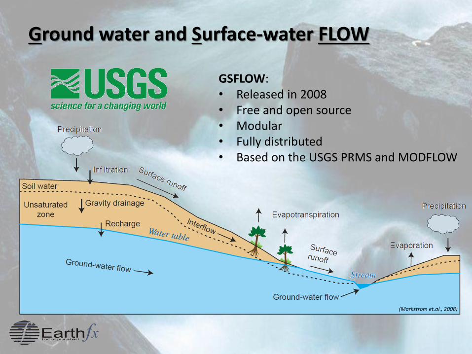
Ground water and Surface-water FLOW
GSFLOW: • Released in 2008 • Free and open source • Modular • Fully distributed • Based on the USGS PRMS and MODFLOW
(Markstrom et.al., 2008)
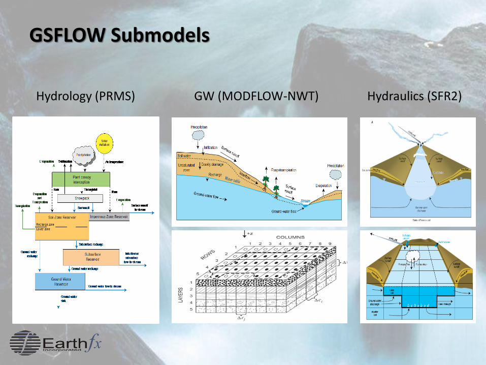
GSFLOW Submodels
Hydrology (PRMS) GW (MODFLOW-NWT) Hydraulics (SFR2)
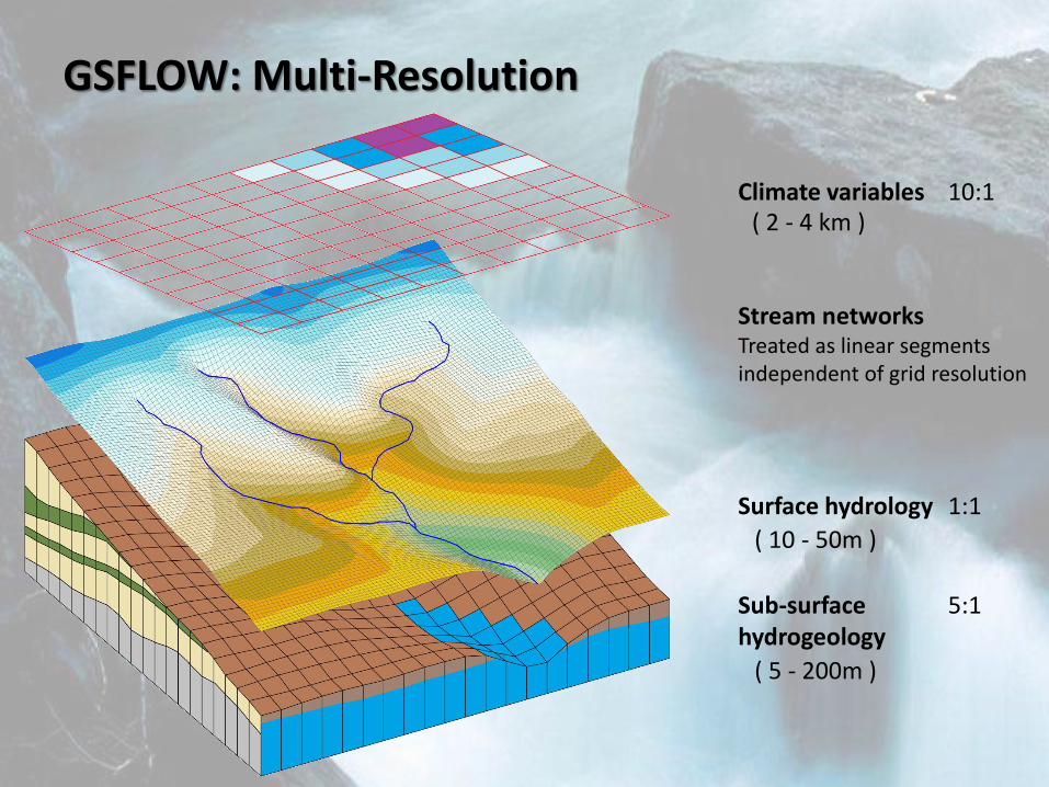
GSFLOW: Multi-Resolution
Climate variables 10:1
Surface hydrology 1:1
Sub-surface 5:1 hydrogeology
Stream networks Treated as linear segments independent of grid resolution
( 5 - 200m )
( 10 - 50m )
( 2 - 4 km )
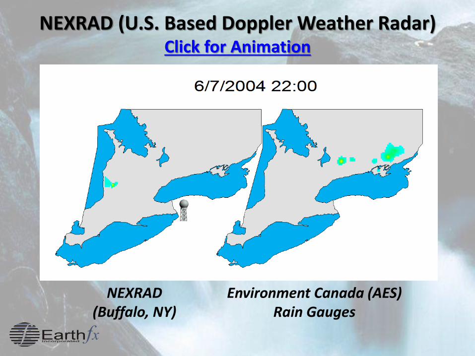
NEXRAD (U.S. Based Doppler Weather Radar) Click for Animation
Environment Canada (AES) Rain Gauges
NEXRAD (Buffalo, NY)
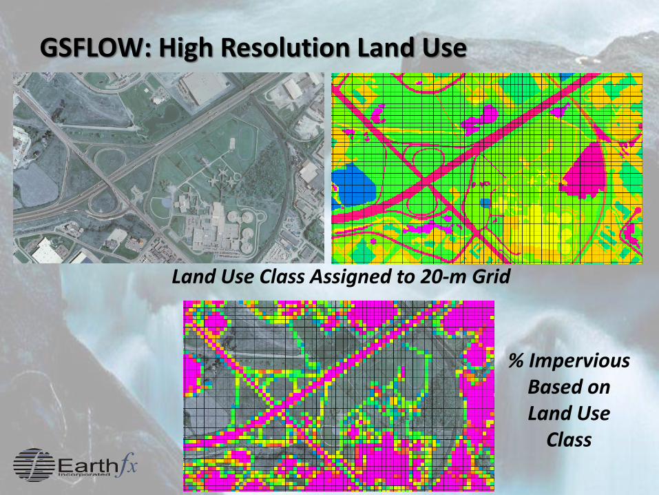
GSFLOW: High Resolution Land Use
Land Use Class Assigned to 20-m Grid
% Impervious Based on Land Use
Class
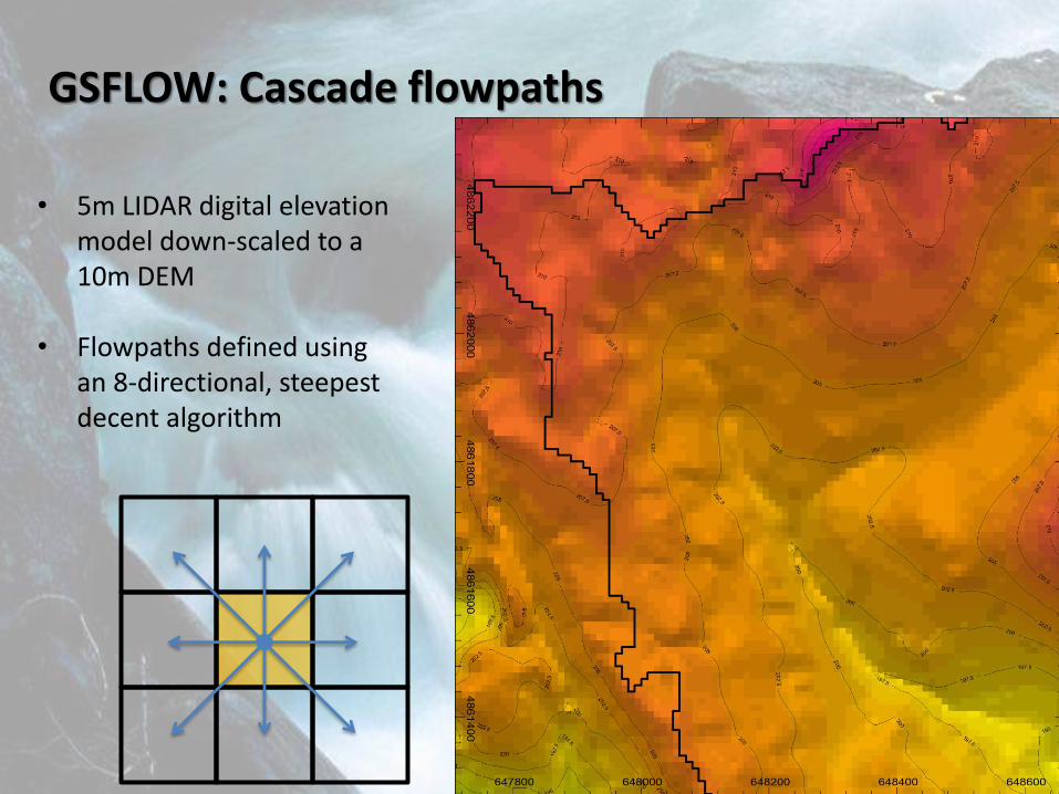
GSFLOW: Cascade flowpaths
• 5m LIDAR digital elevation
model down-scaled to a 10m DEM
• Flowpaths defined using an 8-directional, steepest decent algorithm
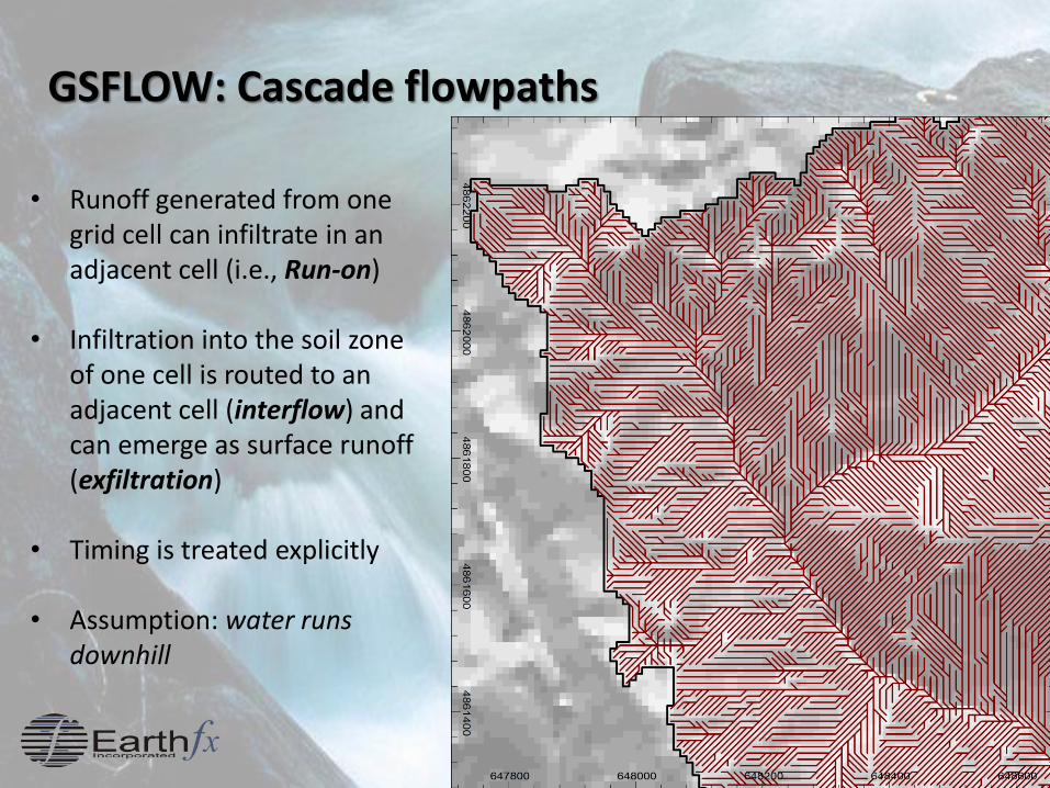
GSFLOW: Cascade flowpaths
• Runoff generated from one
grid cell can infiltrate in an adjacent cell (i.e., Run-on)
• Infiltration into the soil zone of one cell is routed to an adjacent cell (interflow) and can emerge as surface runoff (exfiltration)
• Timing is treated explicitly
• Assumption: water runs downhill
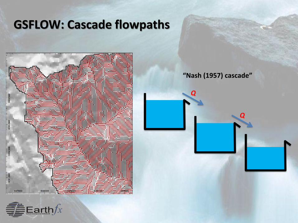
GSFLOW: Cascade flowpaths
Q
Q
“Nash (1957) cascade”
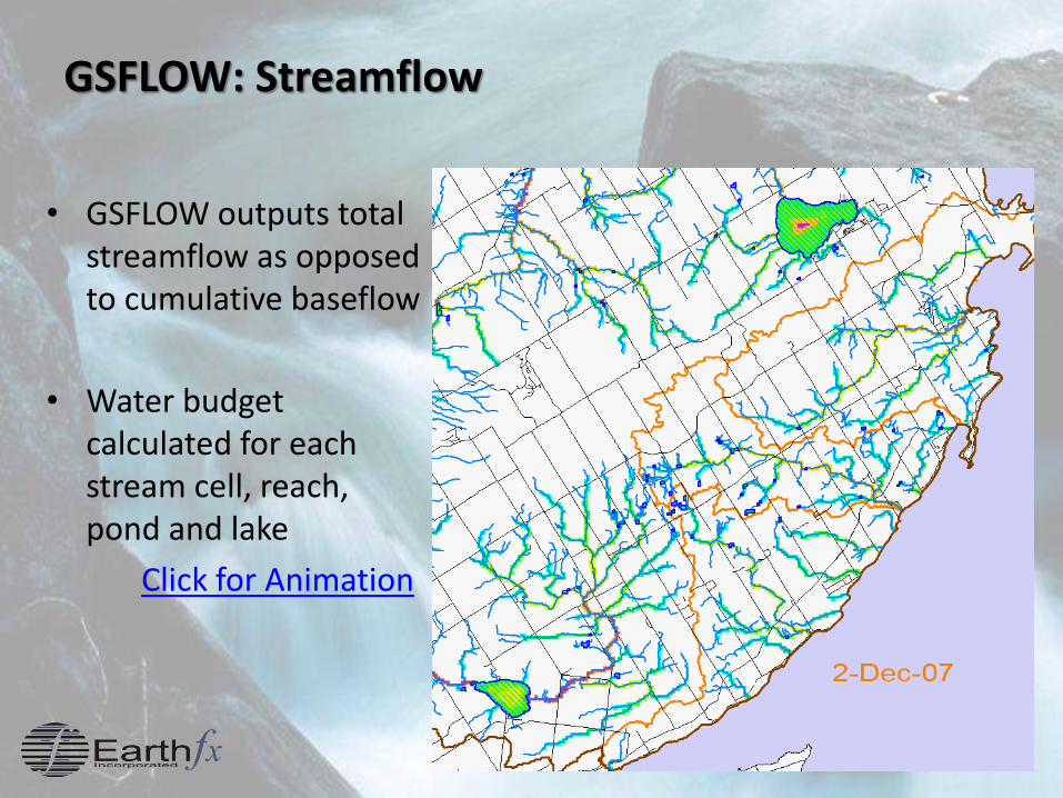
GSFLOW: Streamflow
• GSFLOW outputs total streamflow as opposed to cumulative baseflow
• Water budget calculated for each stream cell, reach, pond and lake
Click for Animation
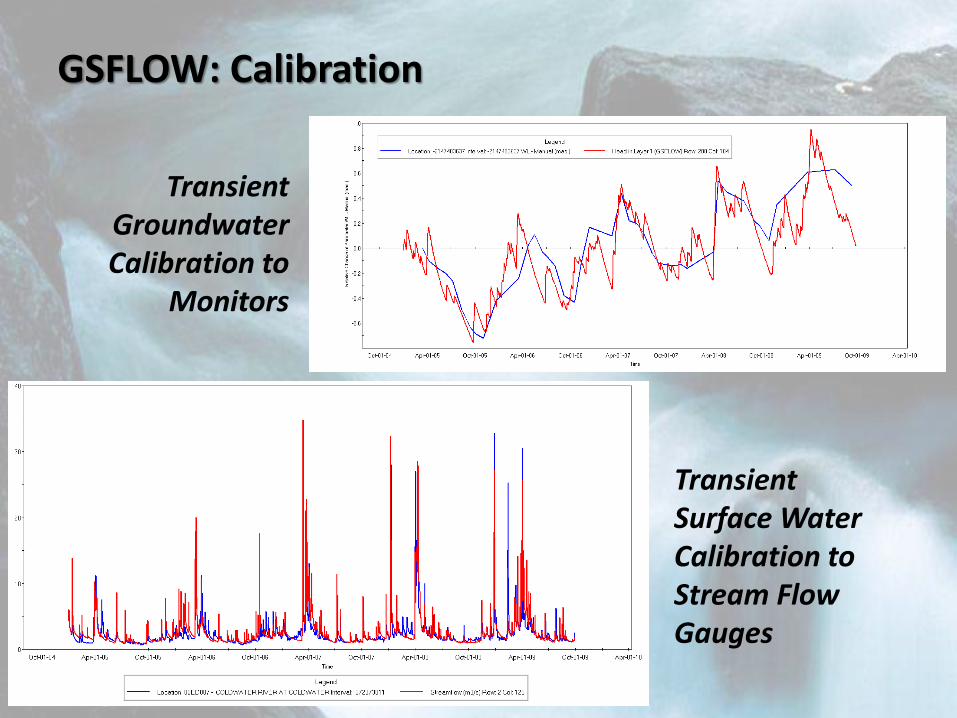
GSFLOW: Calibration
Transient Groundwater Calibration to
Monitors
Transient Surface Water Calibration to Stream Flow Gauges
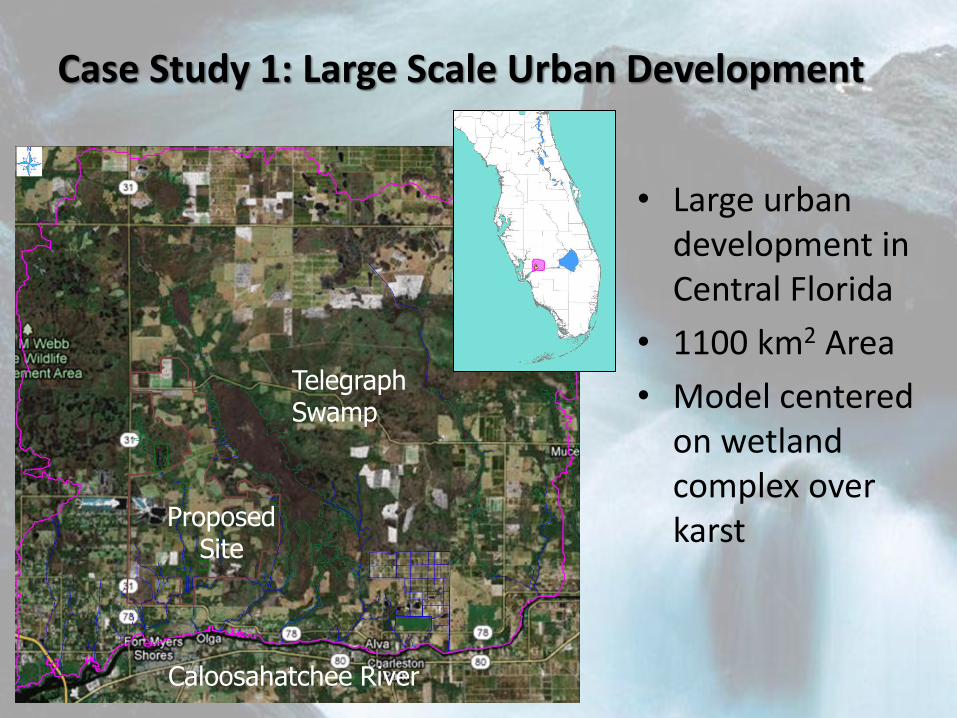
Case Study 1: Large Scale Urban Development
• Large urban development in Central Florida
• 1100 km2 Area
• Model centered on wetland complex over karst
Caloosahatchee River
Telegraph Swamp
Proposed Site
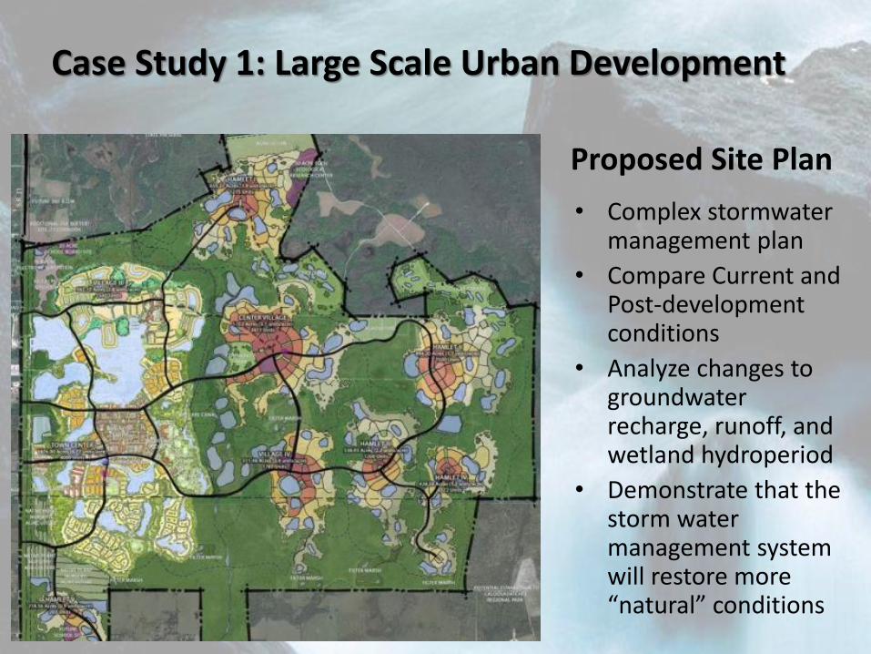
Case Study 1: Large Scale Urban Development
• Complex stormwater management plan
• Compare Current and Post-development conditions
• Analyze changes to groundwater recharge, runoff, and wetland hydroperiod
• Demonstrate that the storm water management system will restore more “natural” conditions
Proposed Site Plan

Case Study 1: Large Scale Urban Development
• Transient Model Results
• Current conditions
• Precipitation
• Groundwater heads
• Streamflow
• Lake & Wetland Stage
Click for Animation
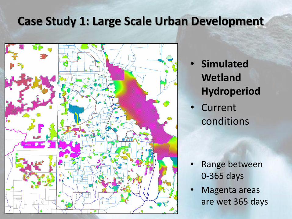
Case Study 1: Large Scale Urban Development
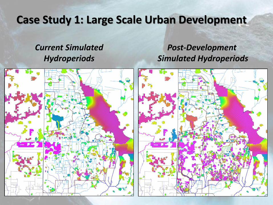
• Simulated Wetland Hydroperiod
• Current conditions
• Range between 0-365 days
• Magenta areas are wet 365 days
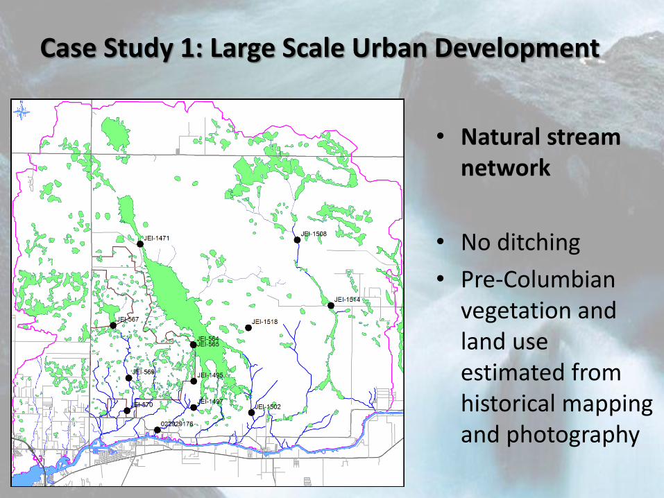
Case Study 1: Large Scale Urban Development
• Natural stream network
• No ditching
• Pre-Columbian vegetation and land use estimated from historical mapping and photography
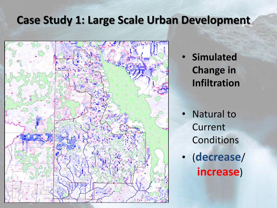
Case Study 1: Large Scale Urban Development
• Simulated Change in Infiltration
• Natural to Current Conditions
• (decrease/
increase)
Case Study 1: Large Scale Urban Development
Current Simulated Hydroperiods
Post-Development Simulated Hydroperiods
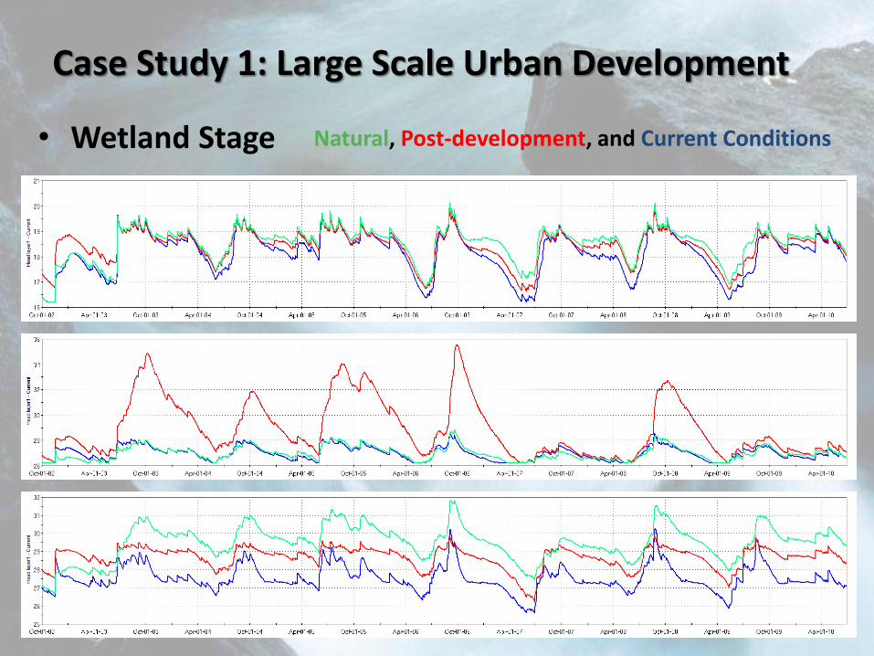
Case Study 1: Large Scale Urban Development
Natural, Post-development, and Current Conditions
• Wetland Stage
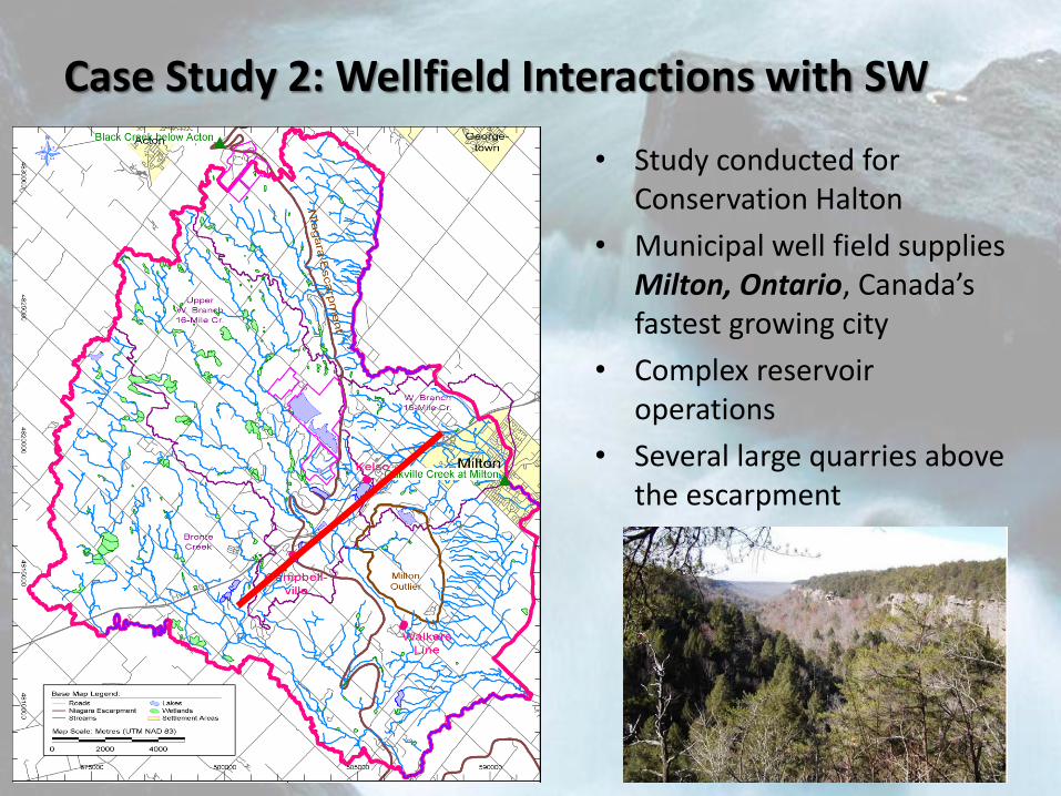
Case Study 2: Wellfield Interactions with SW
• Study conducted for Conservation Halton
• Municipal well field supplies Milton, Ontario, Canada’s fastest growing city
• Complex reservoir operations
• Several large quarries above the escarpment
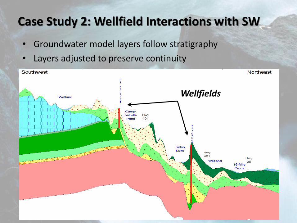
Case Study 2: Wellfield Interactions with SW
• Groundwater model layers follow stratigraphy
• Layers adjusted to preserve continuity
Wellfields
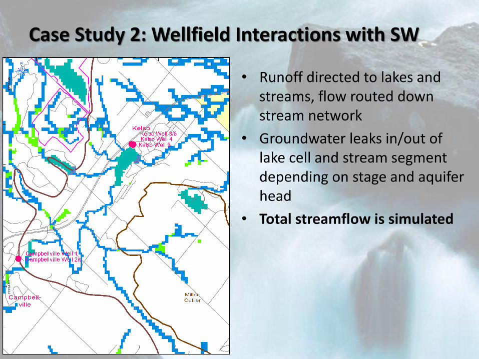
Case Study 2: Wellfield Interactions with SW
• Runoff directed to lakes and streams, flow routed down stream network
• Groundwater leaks in/out of lake cell and stream segment depending on stage and aquifer head
• Total streamflow is simulated
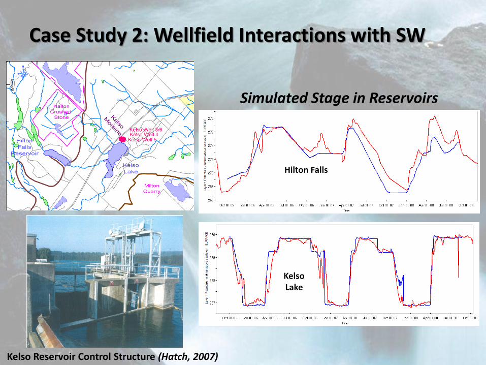
Case Study 2: Wellfield Interactions with SW
OBSERVED PREDICTED
Simulated Stage in Reservoirs
Kelso Lake
Hilton Falls
Kelso Reservoir Control Structure (Hatch, 2007)
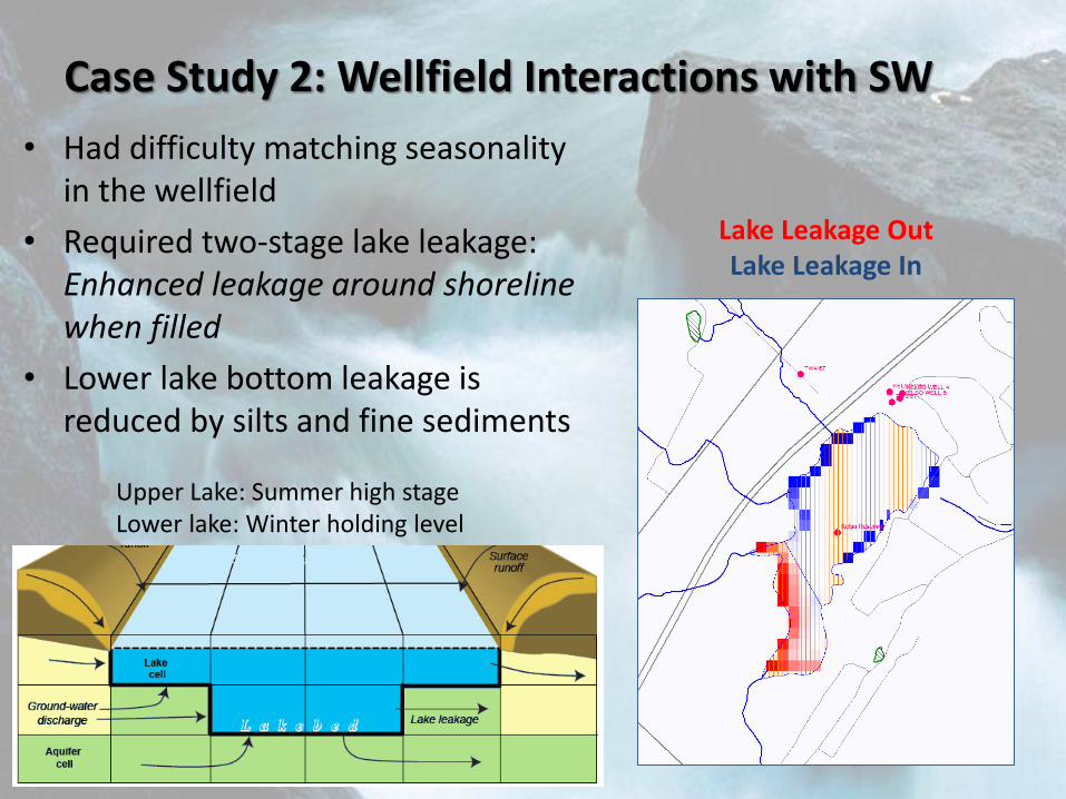
Case Study 2: Wellfield Interactions with SW
• Had difficulty matching seasonality in the wellfield
• Required two-stage lake leakage: Enhanced leakage around shoreline when filled
• Lower lake bottom leakage is reduced by silts and fine sediments
Upper Lake: Summer high stage Lower lake: Winter holding level
Lake Leakage Out Lake Leakage In
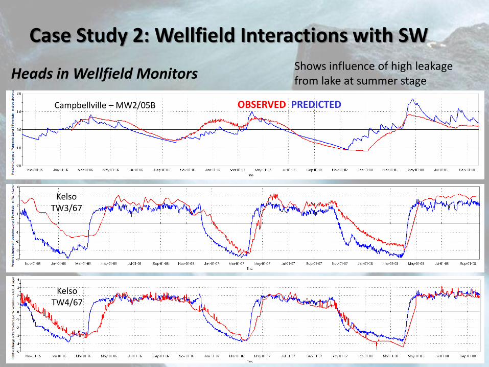
Case Study 2: Wellfield Interactions with SW
OBSERVED PREDICTED Campbellville – MW2/05B
Kelso TW3/67
Kelso TW4/67
Shows influence of high leakage from lake at summer stage Heads in Wellfield Monitors
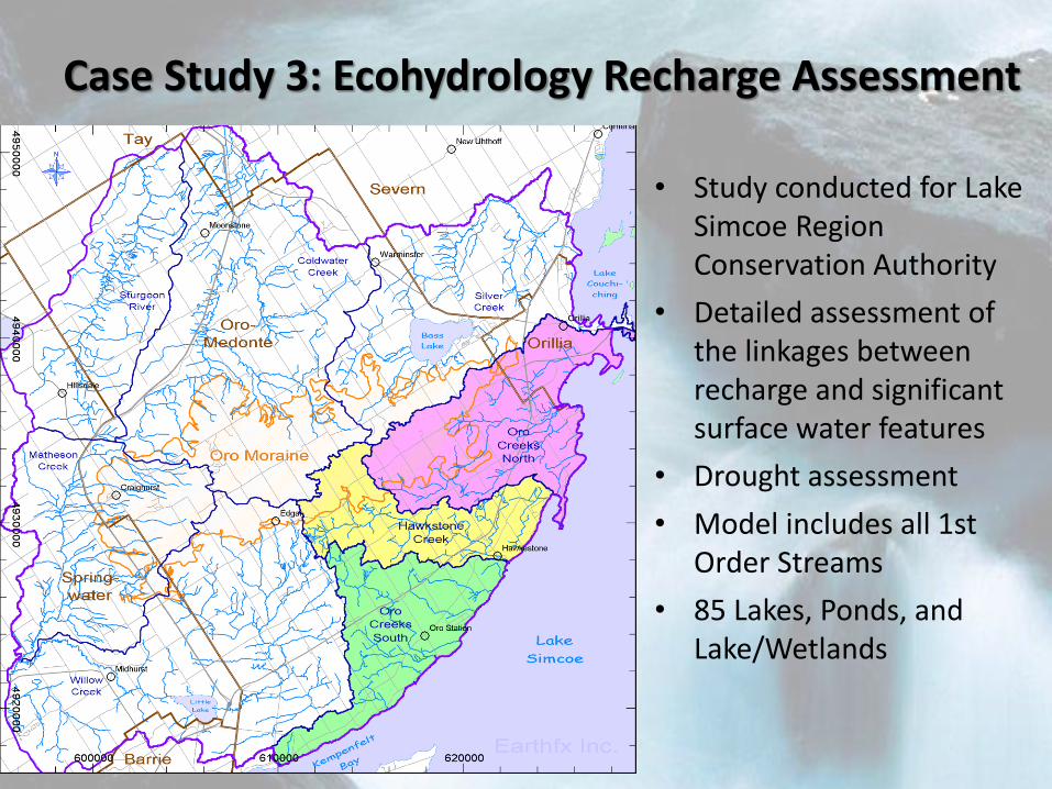
Case Study 3: Ecohydrology Recharge Assessment
• Study conducted for Lake Simcoe Region Conservation Authority
• Detailed assessment of the linkages between recharge and significant surface water features
• Drought assessment
• Model includes all 1st Order Streams
• 85 Lakes, Ponds, and Lake/Wetlands
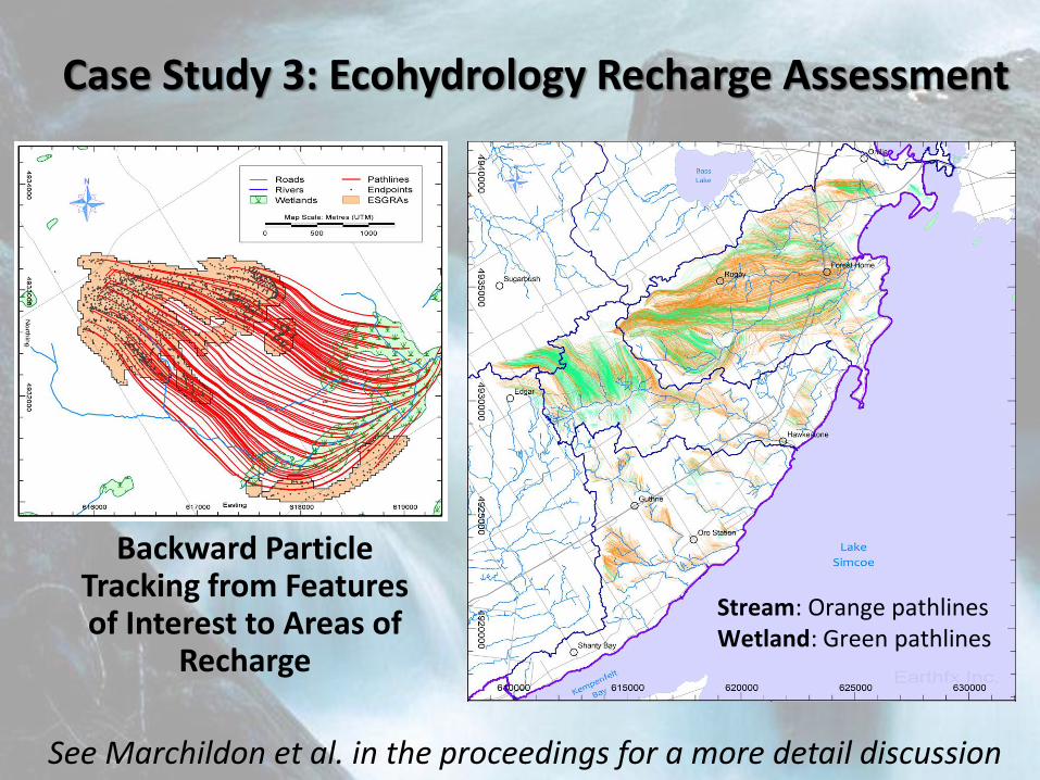
Case Study 3: Ecohydrology Recharge Assessment
Backward Particle Tracking from Features of Interest to Areas of
Recharge
See Marchildon et al. in the proceedings for a more detail discussion
Stream: Orange pathlines Wetland: Green pathlines
In Summary
• Integrated modelling is rapidly becoming an accepted strategy to assess complex challenging problems
• Integrated models can assess practical problems
• GSFLOW represents a practical, scalable tool, capable of solving real-world engineering problems
• Demonstrated application in multidisciplinary projects
Thanks to:
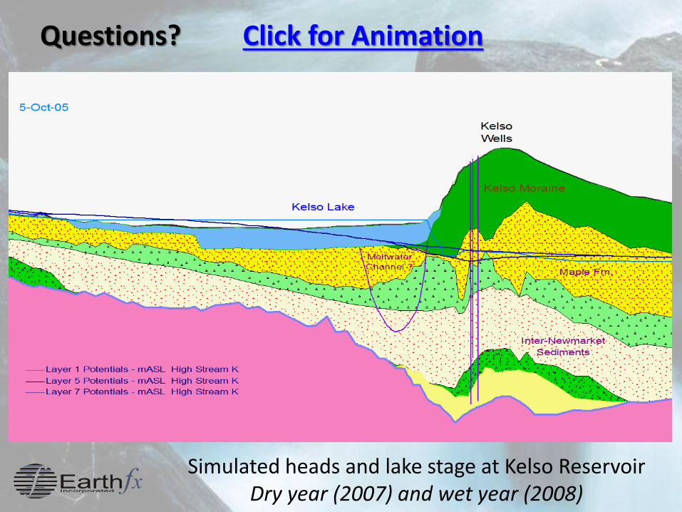
Questions? Click for Animation
Simulated heads and lake stage at Kelso Reservoir Dry year (2007) and wet year (2008)