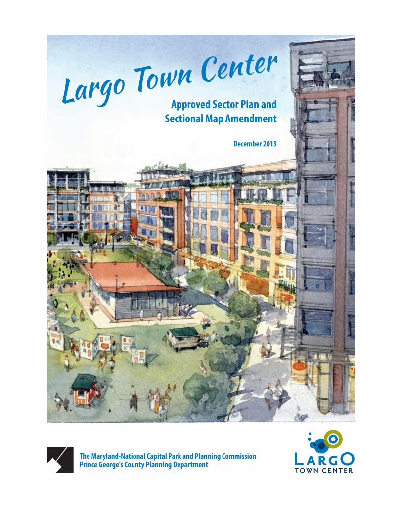
approved sector plan and sectional map amendment cover page.… · development district overlay...
TRANSCRIPT
The Maryland-National Capital Park and Planning Commission Prince George's County Planning Department
Largo Town CenterApproved Sector Plan and
Sectional Map Amendment
December 2013

ii
Approved Largo Town Center Sector Plan and SMA
The Maryland‑National Capital Park and Planning Commission
Elizabeth M. Hewlett, Chairman Officers: Françoise Carrier, Vice Chairman Patricia Colihan Barney, Executive Director Joseph Zimmerman, Secretary-Treasurer Adrian R. Gardner, Esq., General Counsel
The Maryland-National Capital Park and Planning Commission is a bicounty agency, created by the General Assembly of Maryland in 1927. The Commission’s geographic authority extends to the great majority of Montgomery and Prince George’s Counties: the Maryland-Washington Regional District (M-NCPPC planning jurisdiction) comprises 1,001 square miles, while the Metropolitan District (parks) comprises 919 square miles, in the two counties.
The Commission has three major functions:
• The preparation, adoption, and, from time to time, amendment or extension of the General Plan for the physical development of the Maryland-Washington Regional District.
• The acquisition, development, operation, and maintenance of a public park system.
• In Prince George’s County only, the operation of the entire county public recreation program.
The Commission operates in each county through a Planning Board appointed by and responsible to the county government. All local plans, recommendations on zoning amendments, administration of subdivision regulations, and general administration of parks are responsibilities of the Planning Boards.
The Prince George’s County Department of Planning (M-NCPPC):
• Our mission is to help preserve, protect, and manage the county’s resources by providing the highest quality planning services and growth management guidance and by facilitating effective intergovernmental and citizen involvement through education and technical assistance.
• Our vision is to be a model planning department of responsive and respected staff who provide superior planning and technical services and work cooperatively with decision-makers, citizens, and other agencies to continuously improve development quality and the environment and act as a catalyst for positive change.
Prince George’s County Planning Board Montgomery County Planning Board Elizabeth M. Hewlett, Chairman Françoise Carrier, Chairman Dorothy F. Bailey Casey AndersonManuel R. Geraldo Norman DreyfussJohn P. Shoaff Amy PresleyA. Shuanise Washington Marye Wells-Harley

iii
Prince George’s County
Rushern L. Baker, III, County Executive
County Council
The County Council has three main responsibilities in the planning process: (1) setting policy, (2) plan approval, and (3) plan implementation. Applicable policies are incorporated into area plans, functional plans, and the Prince George’s County Approved General Plan. The County Council, after holding a hearing on the plan adopted by the Planning Board, may approve the plan as adopted, approve the plan with amendments based on the public record, or disapprove the plan and return it to the Planning Board for revision. Implementation is primarily through adoption of the annual Capital Improvement Program, the annual budget, the water and sewer plan, and adoption of zoning map amendments.
Council Members
Mary A. Lehman, 1st District Will Campos, 2nd District Eric Olson, 3rd District, Council Vice Chair Ingrid M. Turner, 4th District Andrea Harrison, 5th District, Council Chair Derrick Leon Davis, 6th District Karen R. Toles, 7th District Obie Patterson, 8th District Mel Franklin, 9th District
Clerk of the Council
Redis C. Floyd

iv
Approved Largo Town Center Sector Plan and SMA
ContentsPlan Highlights ................................................................ ix
Plan Vision .................................................................... ixVision Elements ............................................................ ixKey Planning and Zoning Recommendations ................ x
Chapter 1: Introduction ....................................................3Sector Plan Area Boundary ............................................3Regional Setting .............................................................3Plan Purpose..................................................................7Relationship to Other Plans ..........................................82002 Prince George’s County Approved General Plan ...81990 Largo-Lottsford Approved Master Plan and
Adopted Sectional Map Amendment ....................92004 Approved Sector Plan and Sectional Map
Amendment for the Morgan Boulevard and Largo Town Center Metro Areas (MorLar) ...........10
2009 Approved Countywide Master Plan of Transportation (MPOT) ........................................10
2008 Approved Public Safety Facilities Master Plan ....102005 Approved Countywide Green
Infrastructure Plan .............................................112009 Smart, Green, and Growing Legislation ..............11Maryland's Stormwater Management Act of 2007 .....111997 Smart Growth and Neighborhood
Conservation Initiative .........................................11Subregion 4 (Central Avenue-Metro Blue Line
Corridor) Transit-Oriented Development Implementation Project .......................................11
Background ....................................................................12Demographic Profile ....................................................12Development Pattern ..................................................12Development Potential ................................................13Community Engagement .............................................15
Chapter 2: The Vision for Largo Town Center Metro Station and Beyond ....................................................21
Vision Elements ...........................................................21Chapter 3: Largo Town Center Today—
Existing Conditions .....................................................29Economic-Market Forecast ..........................................29Environment ................................................................34Public Facilities ............................................................41Connectivity ................................................................44Historic Resources, Culture, and Entertainment .........46Town Center Design Assessment .................................46
Chapter 4: Recommendations for Future Development ..63Transforming Largo Town Center .................................63Goal: TOD-Compatible Development beyond the
TOD Core ..............................................................70
Urban Design and Planning Objectives .......................70Transit-Oriented Development Core ...........................71Development District Standards ..................................71Street Network ............................................................71Street Types .................................................................72Open Space .................................................................73Development Tiers ......................................................80Environmental Recommendations ..............................80Public Facilities ............................................................82Transportation Demand Management ........................86
Chapter 5: Implementation .............................................91Intergovernmental Coordination .................................91Public-Private Partnerships .........................................91Regulatory Improvements, Development, and
Incentives .............................................................93Density.........................................................................93Mixed-Use ...................................................................94Design ..........................................................................94Applicable Program and Funding Sources ...................95Implementation Matrix ...............................................96
Chapter 6: Overview of Development District Zoning Recommendations ....................................................101
Development District Overlay Zone Area—Zoning Recommendations ............................................101
Chapter 7: Largo Town Center Sectional Map Amendment .............................................................109
Sectional Map Amendment .......................................109Comprehensive Rezoning Implementation Policies...109Comprehensive Rezoning Changes ............................110
Proposed Rezoning .......................................................114
Chapter 8: Largo Town Center Development District Standards .................................................................127
Intent .........................................................................127Definitions .................................................................127Subareas ....................................................................127Development District Overlay Zone Applicability ......127Exemptions from the Development District
Standards ...........................................................129Public Improvements .................................................130Site Plan Submittal Requirements .............................130Permitted and Prohibited Uses..................................131Modifications of the Development District
Standards ...........................................................132Development District Standards ................................132
Prince George's County, Maryland ................................177Updated November 2010 .........................................177

v
List of TablesTable 1: Existing Retail Demand for Largo
Town Center ................................................30Table 2: Largo Town Center’s Incremental Growth
Retail Demand Potential .............................31Table 3: Watershed Information .................................34Table 4: Impervious Surfaces and Water
Quality Ratings ...........................................34Table 5: Plan Area Forest Canopy Comparison—
1938 to 2009 ...............................................35Table 6: Known Streams and Wetlands ......................35Table 7: Projected 65 dBA Noise Contours,
Measured from the Centerline ...................40Table 8: School Facility Conditions: 2008 Parsons
3DI Study .....................................................41Table 9: School Facility Conditions ..............................43Table 10: Pupil Yield Rates (2008) ...............................82Table 11: School Enrollment and Capacity ..................82Table 12: Projected Enrollment Capacity at Buildout
for Single-Family Attached Units .................83Table 13: Projected Enrollment Capacity at Buildout
for Multifamily Units ...................................83Table 14: Cumulative Zoning Inventory .....................112Table 15: Building Face to Building Face Street Type
Components ................................................144Table 16: Parking Space Requirement .......................167
List of MapsMap 1: Sector Plan Area Boundary ...............................4Map 2: Largo Town Center DDOZ Boundaries ...............5Map 3: Location of Largo Town Center DDOZ ...............6Map 4: Largo Town Center—General Plan
Tier Update ....................................................9Map 5: Largo Town Center Existing Land Use .............14Map 6: Recommended Building Heights Plan .............23Map 7: Illustrative TOD Core Concept Plan .................24Map 8: Largo Town Center Trade Areas ......................33Map 9: Watersheds .....................................................37Map 10: Watersheds and Known Streams and
Wetlands ......................................................38Map 11: Countywide and Local Green
Infrastructure Network ................................39Map 12: 65 dBA Ldn Noise Contours ..........................42Map 13: Existing Vehicular Access ..............................48Map 14: Largo Town Area Subarea .............................49Map 15: Existing Metro Station Approach ..................51Map 16: Illustrative Planned Metro
Station Approach .........................................52Map 17: Existing Open Space ......................................53Map 18: Illustrative Retail Plan ...................................65Map 19: Illustrative Arena Drive/Harry S Truman
Drive Retail Node ........................................67Map 20: Illustrative Metro Retail Node ......................69Map 21: Existing Street Network ................................77Map 22: Illustrative Street Network ............................78Map 23: Illustrative Potential Buildout
Street Network ............................................79Map 24: Illustrative Community Open Space and
Bicycle Path Plan ..........................................85Map 25: Preferred Land Use Plan .............................103Map 26: Existing Zoning Plan ....................................104Map 27: Rezoning Plan .............................................105Map 28: Zoning Change Overview ............................113Map 29: Sector Plan Subareas ..................................128Map 30: Illustrative TOD Core Concept Plan .............134Map 31: Building Heights ..........................................142

vi
Approved Largo Town Center Sector Plan and SMA
List of FiguresFigure 1: Community Meeting Ballot Results .......16Figure 2: Illustrative Station Square Perspective
Rendering ...............................................76Figure 3: Illustrative Arena Drive Green
Perspective Rendering ...........................77Figure 4: Illustrative Harry S Truman Gateway
Rendering ...............................................78Figure 5: Ashton South End ..................................94Figure 6: Block Lengths .......................................135Figure 7: Build-to Line Diagram for Existing
Redevelopment ....................................137Figure 8: Plan View of Build-to Line Placements 138Figure 9: TOD Core Setback ................................141Figure 10: SE, NE, NW Quad Setback ....................141Figure 11: Complete Streets Diagram ...................145Figure 12: Street Type—Arterial (Boulevard) ........147Figure 13: Street Type—Common Access
Easement .............................................148Figure 14: Street Type—Neighborhood Street A,
2-Way ...................................................149Figure 15: Street Type—Neighborhood Street B,
2-Way ...................................................149Figure 16: Street Type—Neighborhood Street C,
1-Way ...................................................150Figure 17: Rainwater Tree Pits ..............................151Figure 18: Rainwater Gardens ..............................152Figure 19: Rainwater Planters,
Street Edge ...........................................153
List of Figure-GroundsFigure-Ground 1: Largo, Maryland ..............................58Figure-Ground 2: Clarendon, Virginia ..........................59Figure-Ground 3: Courthouse, Arlington, Virginia .......60Figure-Ground 4: Rockville, Maryland .........................61

vii

viii
Approved Largo Town Center Sector Plan and SMA
ForewordThe Prince George’s County Planning Board of The Maryland-National Capital Park and Planning Commission (M-NCPPC) is pleased to make available the Approved Largo Town Center Sector Plan and Sectional Map Amendment (SMA). This community-based plan and SMA provide a clear vision for the future of the Largo Town Center Metro Station Metropolitan Center. The approved sector plan contains recommendations for future transit-oriented development. The approved sectional map amendment expands the 2004 Largo Town Center Development District Overlay Zone to include the entire Largo Town Center area along with selected properties east of Landover Road (MD 202).
On July 16, 2013, the District Council and the Planning Board held a joint public hearing on the preliminary sector plan and proposed sectional map amendment. The Planning Board adopted the plan with modifications per PGCPB Resolution No. 13-96 in October 2013. The District Council approved the sector plan and sectional map amendment with additional modifications per CR-137-2013 and CR-138-2013, respectively, in November 2013. M-NCPPC, comprised of the Planning Boards of Prince George's and Montgomery Counties, certified the approved plan and sectional map amendment per M-NCPPC Resolution No. 13-29 in December 2013.
Policy guidance for this plan came from the 2002 Prince George’s County Approved General Plan and county functional area master plans, including the 2005 Approved Countywide Green Infrastructure Plan, 2008 Approved Public Safety Facilities Master Plan, and 2009 Approved Countywide Master Plan of Transportation. The approved sector plan also reflects the Largo Town Center area’s designation as a priority investment area and new “downtown” by the 2014 Adopted Plan Prince George’s 2035.
Community participation and input took place throughout 2012, culminating in a series of intensive community workshops held in the fall of 2012. Additional community input was solicited through a series of civic association and small stakeholder group meetings, worksessions with Prince George’s County agency staff, briefings of county elected officials, and information gathering sessions.
This plan reflects the county’s vision to transform the Largo Town Center Metro station area into a major destination for employment and mixed-use development drawing from the metropolitan Washington, D.C. area. Largo Town Center presents a unique opportunity to create a new walkable, bikable, and transit-friendly community at the Metro station while simultaneously revitalizing and redeveloping existing office and retail development. The transit-oriented community at Largo Town Center will incorporate natural features, active and passive open spaces, innovative energy and water conservation techniques, and high density mixed-use development in a form intended to enhance the quality of life for residents, workers, and visitors to Largo Town Center.
The August 2013 decision by County Executive Rushern L. Baker III to locate the new Regional Medical Center at Largo Town Center represents the “game changer” major institutional use that could potentially add thousands of jobs to the local economy and foster demand for supporting development and services such as new housing, retail, and office opportunities.
The Planning Board greatly appreciates the contributions of the community and all stakeholders throughout the development of the plan. Because of the community’s participation and commitment, the approved Largo Town Center Sector Plan provides the foundation for the development of a vibrant, mixed use, transit-oriented community around the Largo Town Center Metro Station that will benefit Prince George’s County citizens and residents for years to come.
Sincerely,
Elizabeth M. Hewlett Chairman, Prince George's County Planning Board

ix
Plan HighlightsPlan Vision
The Largo Town Center Sector Plan envisions the transformation of the Largo Town Center Metro Station Area into one of Prince George’s County’s premiere mixed-used “downtowns” and 24-hour activity centers by 2035. The core area is anchored by a major new institutional use—a Regional Medical Center, satellite university campus, or U.S. General Services Administration tenant—and features a mixed-use retail district along an extended Harry S Truman Drive. Largo Town Center offers a variety of retail offerings, business services, and cultural attractions for county residents and businesses.
The transit-oriented development (TOD) core contains the tallest buildings with 6- to 10-story office, institutional, and residential towers surrounding the Largo Town Center Metro Station. The TOD core transitions into outer neighborhoods with a range of high- and moderate-density civic/institutional, commercial office, and residential mixed-use development. Buildings in these areas range from 4–10 stories in height. East of Landover Road, a new community of three-story townhomes has been built.
Vision Elements
New Mixed-Use TOD Core
The mixed-use TOD core features a new Regional Medical Center on a site south of Arena Drive and within convenient walking distance of the Metro station. Along with the new institutional use, a complementary mix of residential and commercial uses fosters round-the-clock activity and a genuine sense of place. The TOD core functions as a place to live, work, play, and visit with its interrelated uses and built environment forming a cohesive, vibrant whole community.
Expanded Primary Civic Center
The consolidation of a variety of county services at a single location has resulted in an expanded civic center north of the TOD core. The expanded government services center is an employment and cultural destination with a mix of government, cultural, educational, office, and hotel uses.
Regional Medical Center
The new Regional Medical Center features a 10-story main hospital tower with two helipads on a site near the Largo Town Center Metro Station. It also features a central green street leading to the hospital and clear entry and drop-off areas. The building is designed to meet Leadership in Energy and Environmental Design (LEED) building standards.
A Variety of Neighborhoods with a Range of Housing Types
Largo Town Center includes mixed-income and workforce housing in a variety of housing types, which range from single-family attached townhomes to higher-density, mid- to high-rise apartment buildings containing units of various sizes.
Fully-Integrated, Multimodal Transportation System
Largo Town Center provides a comprehensive, multimodal transportation network that fully accommodates public transit, automobiles, pedestrians, and bicyclists through the application of "Complete Street" principles.
Environmentally Sensitive and Security-Conscious Site Design
Largo Town Center incorporates environmental sensitive design and stormwater management practices that (1) minimize and manage stormwater at its sources, thereby protecting local and regional watersheds from harmful runoff; and (2) counteract the “urban heat island effect” through a reduction in heat-retaining impervious surfaces (i.e., building roofs, paved surface parking lots, and too-wide streets).
All new public buildings and most new privately built buildings are designed to qualify for LEED certification. Crime prevention through environmental design principles are also to be incorporated into the design of buildings and public spaces throughout the sector plan to minimize or eliminate opportunities for crime.
Economic Development
The area offers a variety of economic development and employment opportunities that generate substantial tax-based revenue for the county, especially with the addition

x
Approved Largo Town Center Sector Plan and SMA
of the Regional Medical Center plus complementary or affiliated uses. The new Largo Town Center is an 18- to 24-hour-a-day regional destination where residents and visitors patronize local and national businesses; major employers provide a daytime and, in the case of a regional hospital, nighttime population to support businesses; and cultural uses enliven the TOD core and civic center.
Key Planning and Zoning Recommendations
• Move the Largo Town Center Sector Plan/ Development District Overlay Zone (DDOZ) area from the Developing Tier to the Developed Tier so that new mixed-use development can take advantage of available county and state TOD resources.
• Expand the 2004 Largo Town Center DDOZ to cover the entire sector plan area to ensure that new development complies with the plan vision and requirements.
• Rezone the R-R (Rural Residential), C-O (Commercial Office), and M-A-C (Major Activity Center) zoned properties within the TOD core to M-X-T (Mixed Use- Transportation Oriented) to facilitate mixed-use development in the vicinity of the Largo Town Center Metro Station.
• Rezone the I-3 (Planned Industrial/Employment Park) zoned properties in the northwest quadrant to C-O to facilitate office and institutional uses.
• Rezone the I-3 zoned properties in the northeast quadrant to M-U-I (Mixed-Use Infill) to facilitate mixed office and institutional uses with a focus on healthcare services.
• Rezone the M-A-C zoned property at 401-701 Largo Center Drive to M-U-I to facilitate mixed-use residential development on this site.

Chapter 1
