april 28, 2014sacramento gis user group giscorps & california sar pilot project by lorri...
TRANSCRIPT

April 28, 2014 Sacramento GIS User Group
GISCorps & California SAR Pilot Project
GISCorps & California SAR Pilot Project
By Lorri Peltz-Lewis916-995-3107; [email protected]
For the GISCorps Volunteers
By Lorri Peltz-Lewis916-995-3107; [email protected]
For the GISCorps Volunteers

Associated Professional Association –
Urban Regional Information System Association (URISA)• 50 years• GIS Professionals – chapters nationally, • Education and Outreach• Certification
GISCorps – URISA Initiative (www.giscorps.org)• Started in 2003• ~2,800 Volunteers, ~1,750 Friends• Coordinate Volunteers, Define Needs, Find Sponsors• Volunteers have GT 8 years GIS experience• Volunteers GT 40% teach GIS
What is GISCorps?What is GISCorps?

GISCorps – www.giscorps.orgGISCorps – www.giscorps.org
What is GISCorps?What is GISCorps?

GISCorps VolunteersGISCorps VolunteersMost in the US – ~2,800 in 94 countries, 76% in US & Canada – all work for FREE
Most in the US – ~2,800 in 94 countries, 76% in US & Canada – all work for FREE
Volunteering your time to help others!Volunteering your time to help others!
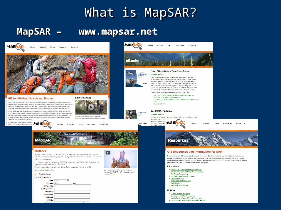
What is MapSAR?What is MapSAR?
MapSAR – www.mapsar.netMapSAR – www.mapsar.net

GISCorps MapSAR SupportGISCorps MapSAR SupportCall for ArcGIS support, including GPS, open source, data transfer, etc. Using existing tools, methods, & training -
Call for ArcGIS support, including GPS, open source, data transfer, etc. Using existing tools, methods, & training -
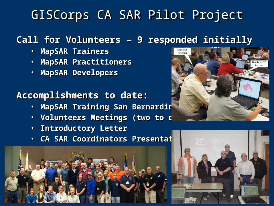
Call for Volunteers – 9 responded initially• MapSAR Trainers• MapSAR Practitioners• MapSAR Developers
Accomplishments to date:• MapSAR Training San Bernardino• Volunteers Meetings (two to date)• Introductory Letter• CA SAR Coordinators Presentation
Call for Volunteers – 9 responded initially• MapSAR Trainers• MapSAR Practitioners• MapSAR Developers
Accomplishments to date:• MapSAR Training San Bernardino• Volunteers Meetings (two to date)• Introductory Letter• CA SAR Coordinators Presentation
GISCorps CA SAR Pilot ProjectGISCorps CA SAR Pilot Project

GISCorps CA SAR Pilot ProjectGISCorps CA SAR Pilot Project
Project Plan**:
• Phase I – GIS Team Initialization – • GIS practitioners training, learning interface, • Learning SAR methods, • Integration into Law Enforcement Mutual Aid (LEMA) –
Matt Scharper• Develop relationships, • Outreach –
• Additional GISCorps Volunteers• SAR Teams
• Providing training to SAR teams
**Project Plan available for review & input – contact Lorri

GISCorps CA SAR Pilot ProjectGISCorps CA SAR Pilot Project
Project Plan (continued):
• Phase II – GIS/SAR Team Integration – • Identify teams to support, • Pair up GIS staff (primary & backups), • Identify needs, • Define commitment levels, • Other items?
Project Plan (continued):
• Phase II – GIS/SAR Team Integration – • Identify teams to support, • Pair up GIS staff (primary & backups), • Identify needs, • Define commitment levels, • Other items?

GISCorps CA SAR Pilot ProjectGISCorps CA SAR Pilot Project
Project Plan (continued):
• Phase III – • Recommendations to GISCorps,• National roll out• Expand support in California
Project Plan (continued):
• Phase III – • Recommendations to GISCorps,• National roll out• Expand support in California

Other Involved GroupsOther Involved Groups
WiSAR (Wilderness Search & Rescue) - https://groups.google.com/forum/#!forum/sar-and-gis
WiSAR and GIS Blog - http://wisarandgis.blogspot.com/SARGIS6 Conference – June 19-22 - http://wisarandgis.blogspot.com/2014/04/sargis6-west-june-19th-22nd.html
Esri – Emergency/Disaster Management – • http
://www.esri.com/industries/public-safety/emergency-disaster-management/
• http://solutions.arcgis.com/emergency-management/
WiSAR Wiki (BYU) - not affiliated, doing UAV analysis https://facwiki.cs.byu.edu/WiSAR/index.php/Main_Page

National Alliance for Public Safety GIS (NAPSG) - http://napsgfoundation.org/
NAPSG sponsored MapSAR Training Videos - https://www.youtube.com/user/napsggis?feature=watch
Sponsored MapSAR Classes:• San Jose, CA – Mar 2013• Bellingham, WA – Apr 2013• Las Cruces, NM – Jan 2014• Missouri/Alabama – May 2014
Other Involved Groups (cont)Other Involved Groups (cont)

GISCorps CA SAR Pilot ProjectGISCorps CA SAR Pilot Project
Questions/Comments
Lorri Peltz-Lewis916-995-3107
Questions/Comments
Lorri Peltz-Lewis916-995-3107

CA SAR Coordinators MeetingJanuary 13, 2013