arcgis for emergency management: an overview · data reviewer for parcels . data reviewer for...
TRANSCRIPT
Esri UC2013 . Technical Workshop .
Technical Workshop
2013 Esri International User Conference July 8–12, 2013 | San Diego, California
ArcGIS for Emergency Management: An Overview
Jeff Baranyi Lindsay Thomas
Esri UC2013 . Technical Workshop .
Agenda
• Local Government Context • Program Update • ArcGIS for Emergency Management re-launch • Demonstrations • What's next • Feedback / Questions
ArcGIS for Emergency Management: An Overview
Esri UC2013 . Technical Workshop .
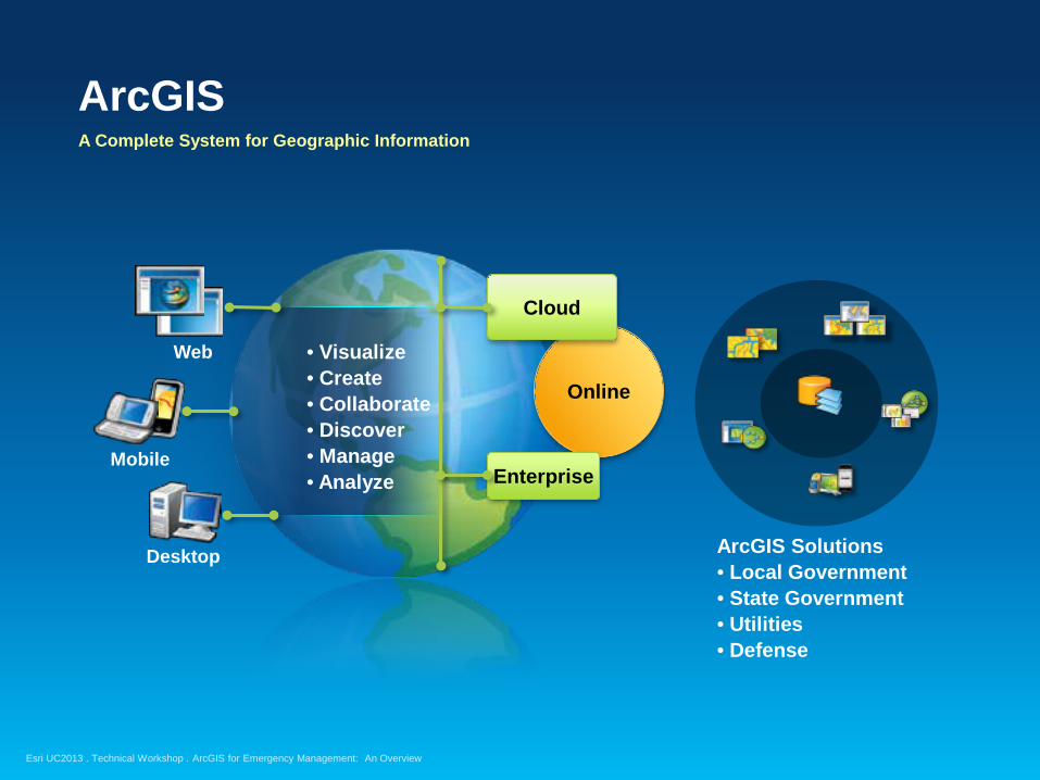
ArcGIS A Complete System for Geographic Information
Online
Cloud
Enterprise Mobile
Desktop
Web • Visualize • Create • Collaborate • Discover • Manage • Analyze
ArcGIS Solutions • Local Government • State Government • Utilities • Defense
ArcGIS for Emergency Management: An Overview
Esri UC2013 . Technical Workshop .
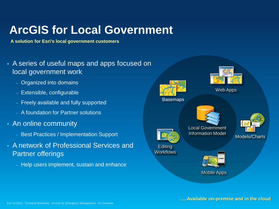
ArcGIS for Local Government
• A series of useful maps and apps focused on local government work
– Organized into domains
– Extensible, configurable
– Freely available and fully supported
– A foundation for Partner solutions
• An online community – Best Practices / Implementation Support
• A network of Professional Services and Partner offerings
– Help users implement, sustain and enhance
Web Apps
Editing Workflows
Mobile Apps
Basemaps
Models/Charts
Local Government Information Model
A solution for Esri’s local government customers
…..Available on-premise and in the cloud ArcGIS for Emergency Management: An Overview

Esri UC2013 . Technical Workshop .
Why are we doing it?
Esri UC2013 . Technical Workshop .
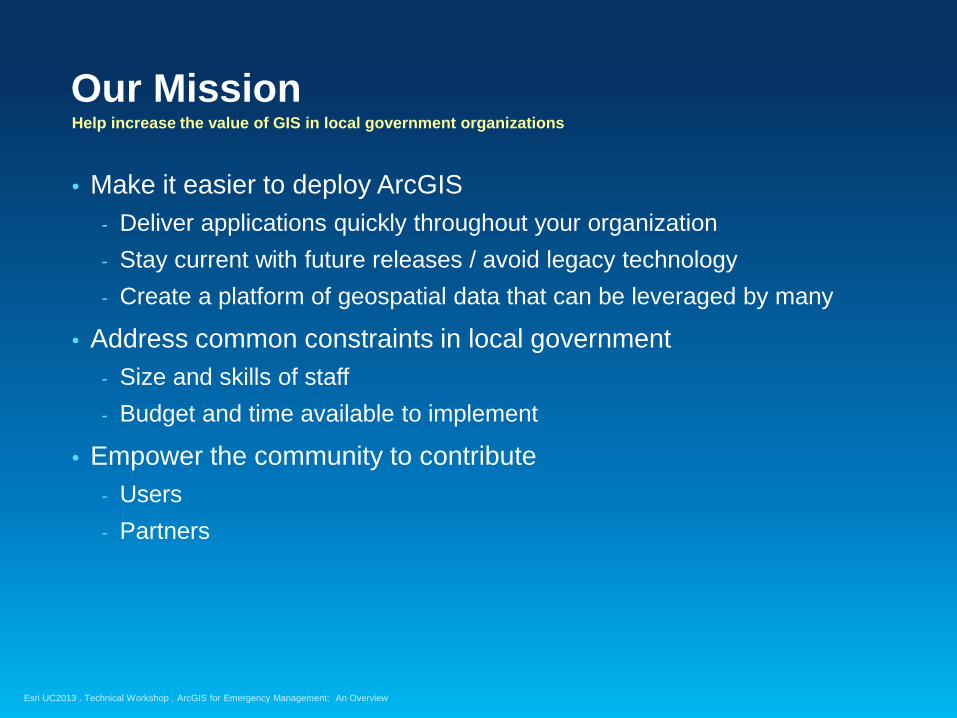
Our Mission Help increase the value of GIS in local government organizations
• Make it easier to deploy ArcGIS - Deliver applications quickly throughout your organization - Stay current with future releases / avoid legacy technology - Create a platform of geospatial data that can be leveraged by many
• Address common constraints in local government - Size and skills of staff - Budget and time available to implement
• Empower the community to contribute - Users - Partners
ArcGIS for Emergency Management: An Overview
Esri UC2013 . Technical Workshop .
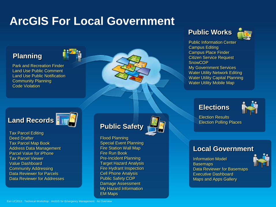
ArcGIS For Local Government
Park and Recreation Finder Land Use Public Comment Land Use Public Notification Community Planning Code Violation
Tax Parcel Editing Deed Drafter Tax Parcel Map Book Address Data Management Parcel Value for iPhone Tax Parcel Viewer Value Dashboard Community Addressing Data Reviewer for Parcels Data Reviewer for Addresses
Flood Planning Special Event Planning Fire Station Wall Map Fire Run Book Pre-Incident Planning Target Hazard Analysis Fire Hydrant Inspection Cell Phone Analysis Public Safety COP Damage Assessment My Hazard Information EM Maps
Election Results Election Polling Places
Public Safety Land Records
Planning
Elections
Public Works Public Information Center Campus Editing Campus Place Finder Citizen Service Request SnowCOP My Government Services Water Utility Network Editing Water Utility Capital Planning Water Utility Mobile Map
Local Government Information Model Basemaps Data Reviewer for Basemaps Executive Dashboard Maps and Apps Gallery
ArcGIS for Emergency Management: An Overview
Esri UC2013 . Technical Workshop .
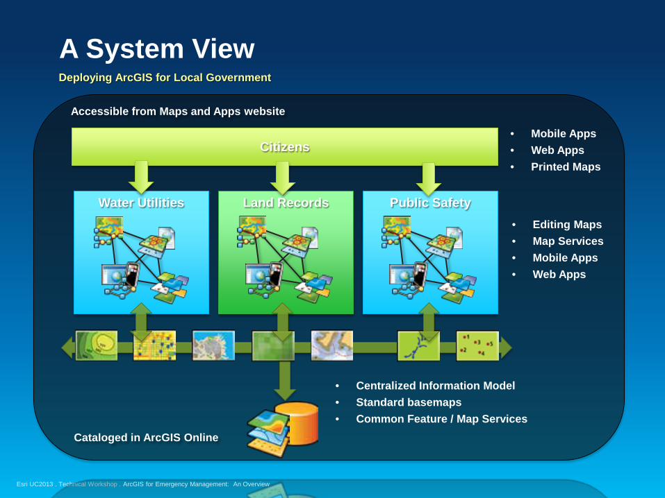
A System View
• Centralized Information Model • Standard basemaps • Common Feature / Map Services
Land Records Water Utilities Public Safety • Editing Maps • Map Services • Mobile Apps • Web Apps
Cataloged in ArcGIS Online
Citizens • Mobile Apps • Web Apps • Printed Maps
Accessible from Maps and Apps website
Deploying ArcGIS for Local Government
ArcGIS for Emergency Management: An Overview
Esri UC2013 . Technical Workshop .
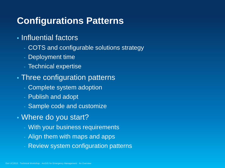
Configurations Patterns
ArcGIS for Emergency Management: An Overview
• Influential factors - COTS and configurable solutions strategy - Deployment time - Technical expertise
• Three configuration patterns - Complete system adoption - Publish and adopt - Sample code and customize
• Where do you start? - With your business requirements - Align them with maps and apps - Review system configuration patterns
Esri UC2013 . Technical Workshop .
The Community
Esri UC2013 . Technical Workshop .
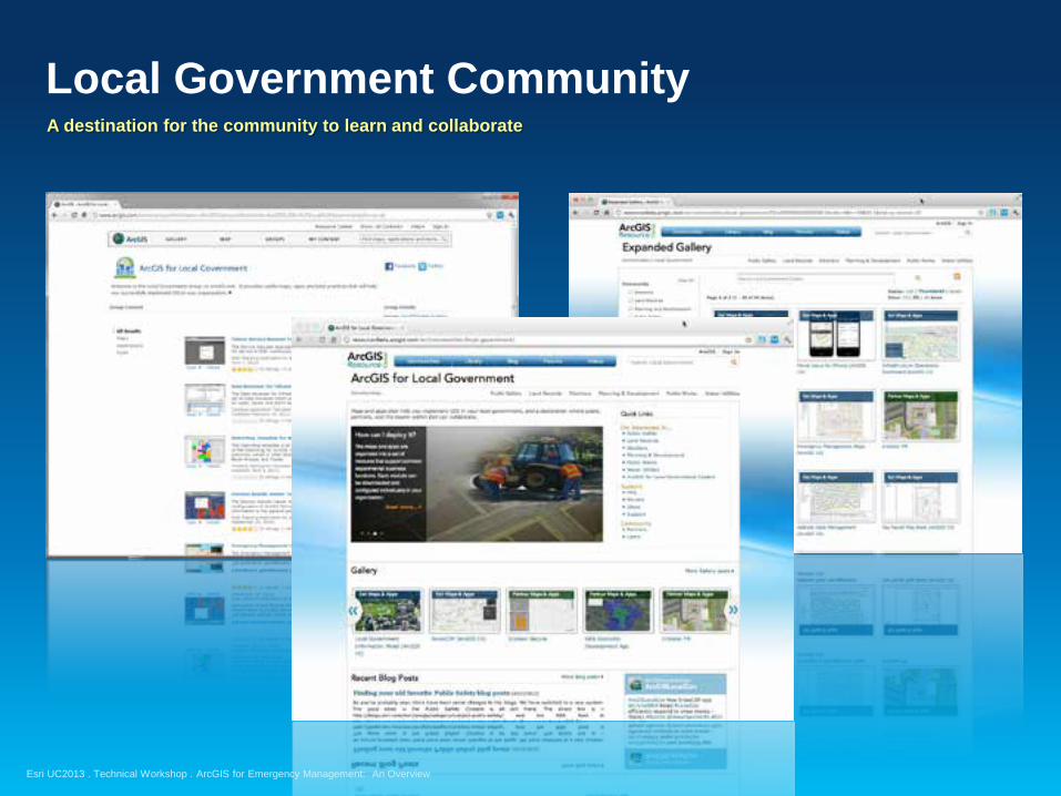
Local Government Community
A destination for the community to learn and collaborate
ArcGIS for Emergency Management: An Overview
Esri UC2013 . Technical Workshop .
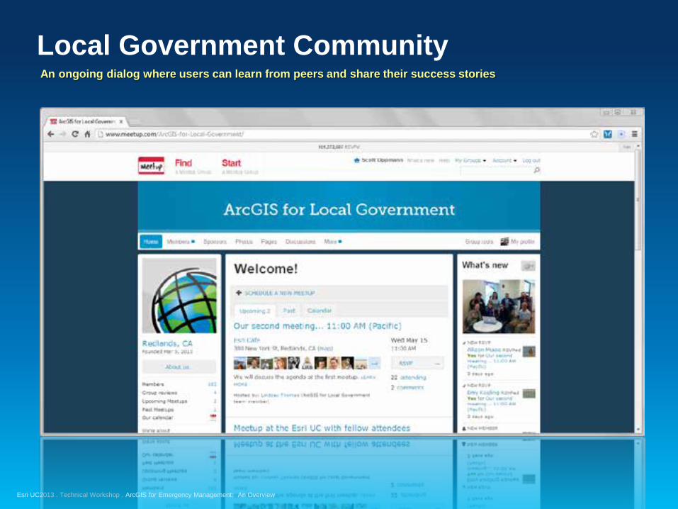
Local Government Community
An ongoing dialog where users can learn from peers and share their success stories
ArcGIS for Emergency Management: An Overview
Esri UC2013 . Technical Workshop .
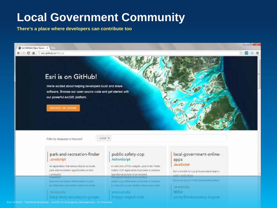
Local Government Community
There’s a place where developers can contribute too
ArcGIS for Emergency Management: An Overview
Esri UC2013 . Technical Workshop .
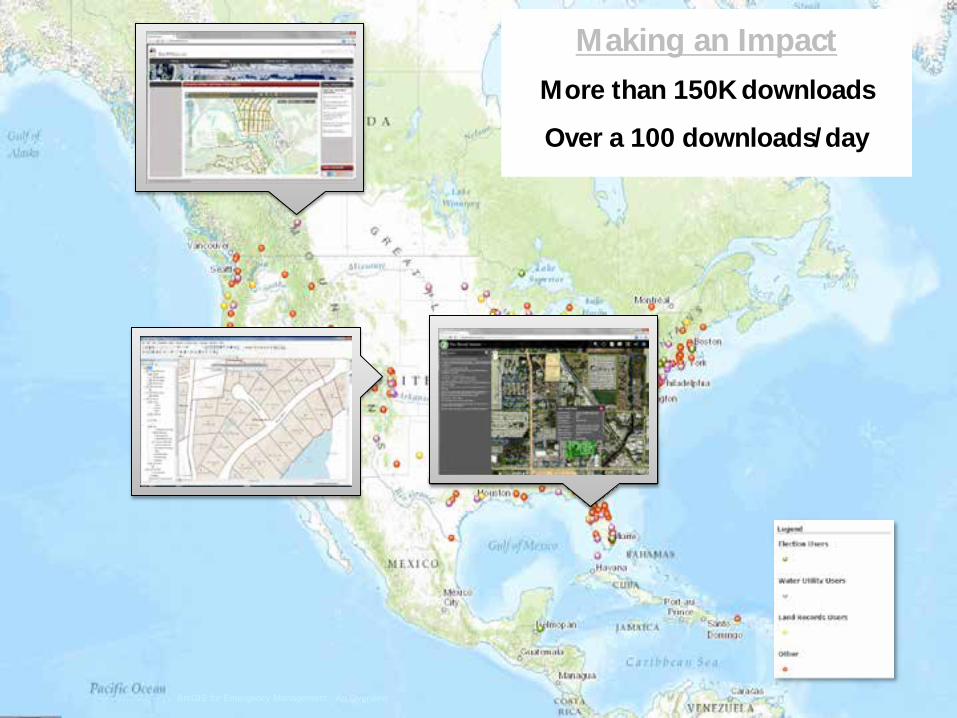
Making an Impact
More than 150K downloads
Over a 100 downloads/day
ArcGIS for Emergency Management: An Overview
Esri UC2013 . Technical Workshop .
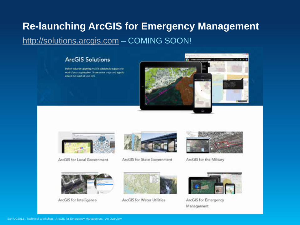
Re-launching ArcGIS for Emergency Management
http://solutions.arcgis.com – COMING SOON!
ArcGIS for Emergency Management: An Overview
Esri UC2013 . Technical Workshop .
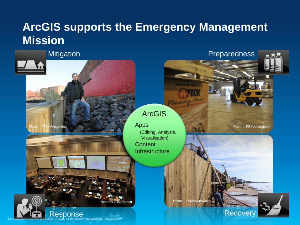
ArcGIS supports the Emergency Management Mission
Response Recovery
Mitigation
ArcGIS Apps (Editing, Analysis, Visualization) Content Infrastructure
Preparedness
Photo – FEMA/Augustino
Photo – FEMA/Burkitt
Photo – FEMA/Llarguest
Photo – FEMA/Zumwaltt
ArcGIS for Emergency Management: An Overview
Esri UC2013 . Technical Workshop . ArcGIS for Emergency Management: An Overview

Esri UC2013 . Technical Workshop . ArcGIS for Emergency Management: An Overview

Esri UC2013 . Technical Workshop .
• “If this seems like hard work, you are being astute and realistic. This is the mental heavy lifting necessary to create well-defined specifications for the information products you’re ultimately going to build.”
Information Products
Roger Tomlinson, Chapter 6 – Describe the Information Products, Thinking about GIS
Esri UC2013 . Technical Workshop .
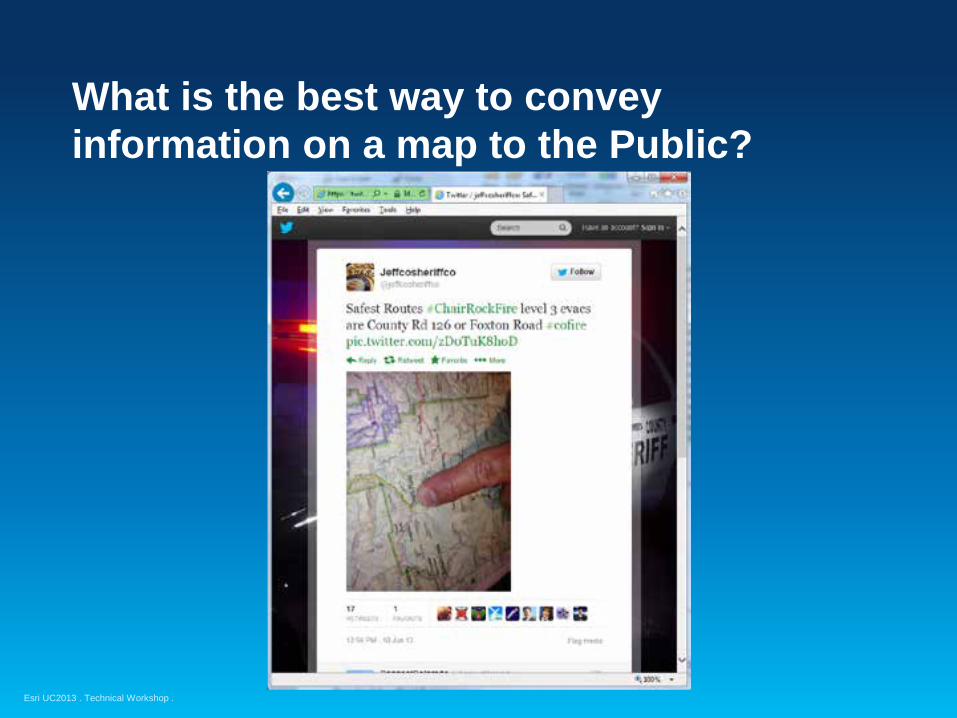
What is the best way to convey information on a map to the Public?
Esri UC2013 . Technical Workshop .
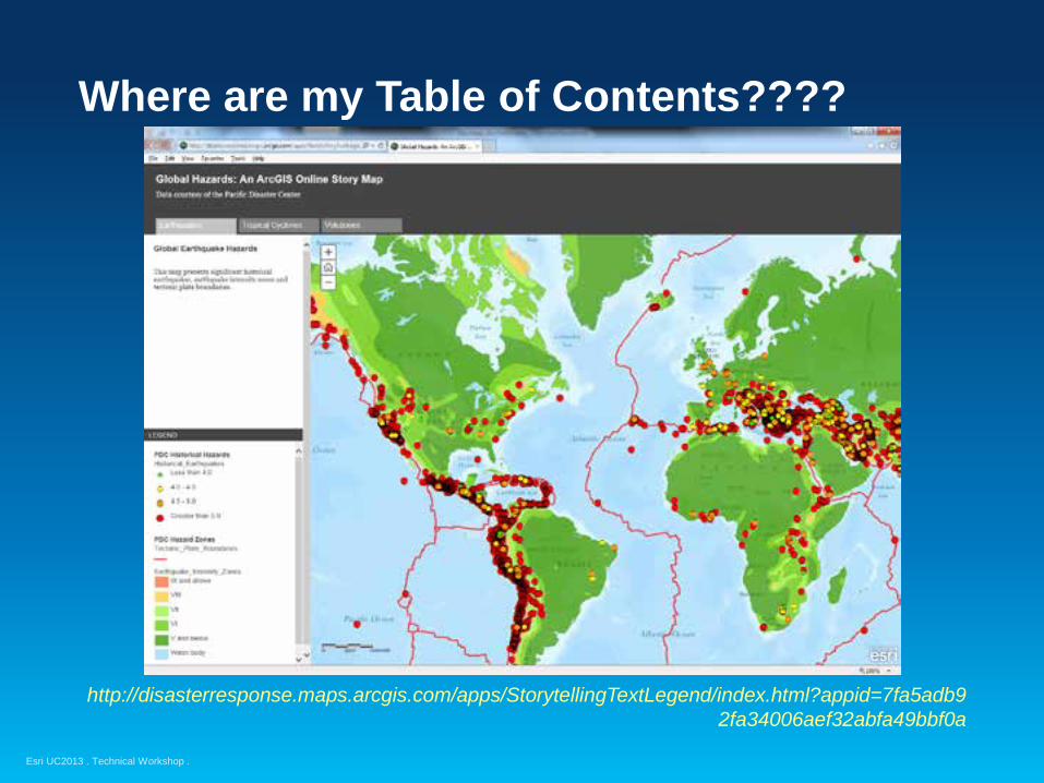
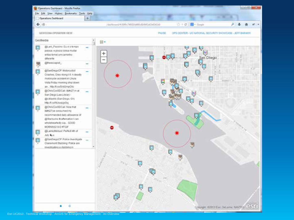
Where are my Table of Contents????
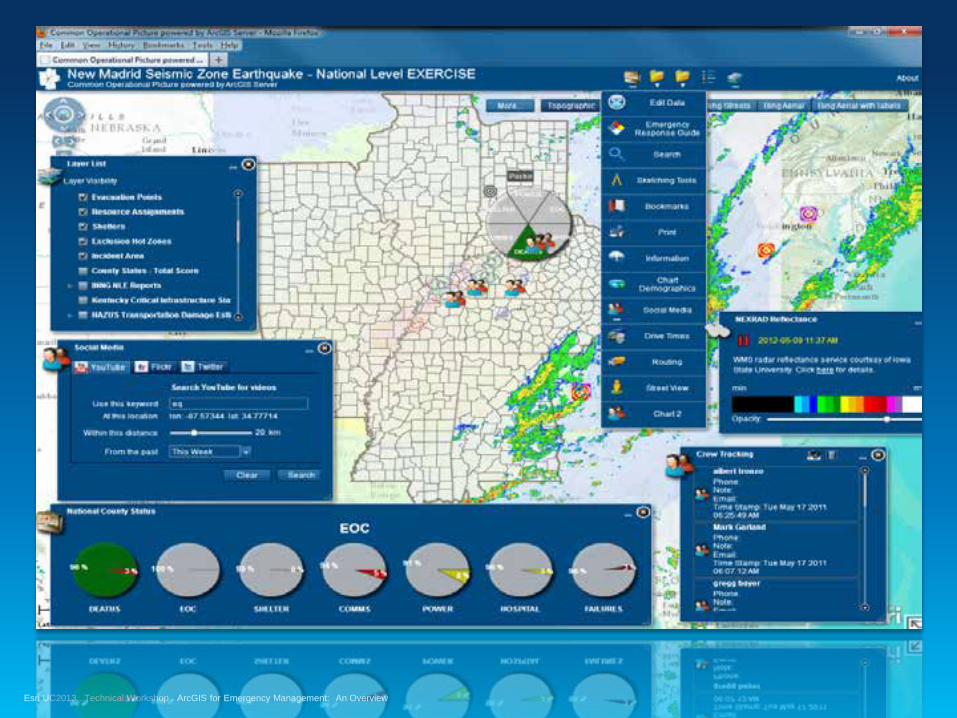
http://disasterresponse.maps.arcgis.com/apps/StorytellingTextLegend/index.html?appid=7fa5adb92fa34006aef32abfa49bbf0a
Esri UC2013 . Technical Workshop .
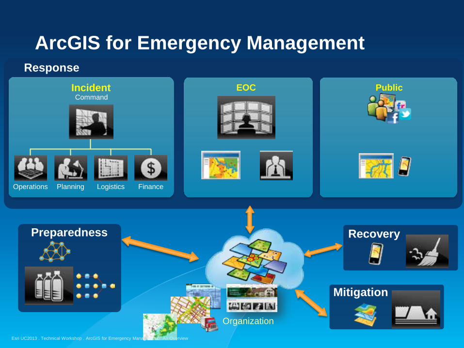
ArcGIS for Emergency Management
Organization
Response
Finance Logistics Planning Operations
Command Incident EOC
Public
Preparedness
Mitigation
Recovery
ArcGIS for Emergency Management: An Overview
Esri UC2013 . Technical Workshop .
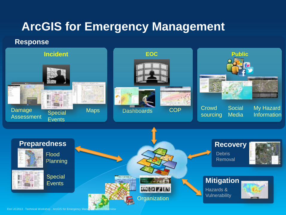
ArcGIS for Emergency Management
Incident EOC Public
Preparedness Flood
Planning
Recovery Debris Removal
Mitigation Hazards & Vulnerability
Response
Crowd sourcing
COP Dashboards Damage Assessment
Special Events
Maps Social Media
Organization
My Hazard Information
Special Events
ArcGIS for Emergency Management: An Overview
Esri UC2013 . Technical Workshop .
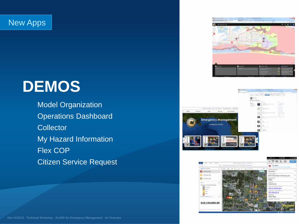
Model Organization Operations Dashboard Collector My Hazard Information Flex COP Citizen Service Request
DEMOS
New Apps
Esri UC2013 . Technical Workshop .
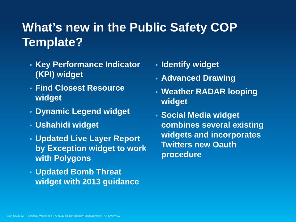
• Key Performance Indicator (KPI) widget
• Find Closest Resource widget
• Dynamic Legend widget • Ushahidi widget • Updated Live Layer Report
by Exception widget to work with Polygons
• Updated Bomb Threat widget with 2013 guidance
What’s new in the Public Safety COP Template?
• Identify widget • Advanced Drawing • Weather RADAR looping
widget • Social Media widget
combines several existing widgets and incorporates Twitters new Oauth procedure
ArcGIS for Emergency Management: An Overview
Esri UC2013 . Technical Workshop .
ArcGIS for Emergency Management What will ship with the ArcGIS 10.2 release?
• ArcGIS Online Model Organization for Emergency Management
• Emergency Management Operations Dashboard Configurations – (Hurricanes and Earthquakes)
- Damage Assessment Configuration - Watch Officer Configuration - Operations Section Chief Configuration - Custom widgets – Emergency Response Guide (ERG), Bomb Threat, Find
Closest Resource - GeoEvent Processor configurations for live feeds and alerting
• Damage Assessment for Smartphones based on Collector
• My Hazard Information– based on My Gov Services
• Last release of Flex-based COP - Synced with National Guard Minuteman Viewer
ArcGIS for Emergency Management: An Overview
Esri UC2013 . Technical Workshop .
• Support Public Information Officer workflows (provide examples)
• Additional Operations Dashboard Configurations – focus on smaller natural and manmade events
- Logistics Dashboard - Shelter Status Dashboard - Transportation Dashboard - Additional GeoEvent Processor configurations
• Hazard and Vulnerability Analysis • Operations Planning • Debris Removal Monitoring • Leverage new applications – Explorer, Briefing book, etc.
What’s next – post UC
ArcGIS for Emergency Management: An Overview
Esri UC2013 . Technical Workshop . ArcGIS for Emergency Management: An Overview
Esri UC2013 . Technical Workshop .
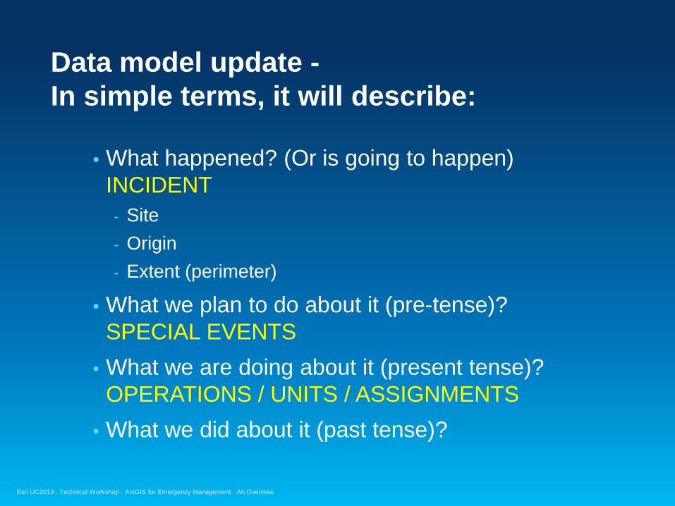
Data model update - In simple terms, it will describe:
• What happened? (Or is going to happen) INCIDENT - Site - Origin - Extent (perimeter)
• What we plan to do about it (pre-tense)? SPECIAL EVENTS
• What we are doing about it (present tense)? OPERATIONS / UNITS / ASSIGNMENTS
• What we did about it (past tense)?
ArcGIS for Emergency Management: An Overview

Esri UC2013 . Technical Workshop .
Symbology
• Continue the path of creating a simple set of symbols
• Work with the user community on common initiatives where possible - NAPSG
• Focus on presentation in all parts of the platform (desktop, paper maps, Web, Mobile) so the symbols remain consistent
• Deliver an ArcGIS for Emergency Management Style
ArcGIS for Emergency Management: An Overview
Esri UC2013 . Technical Workshop .
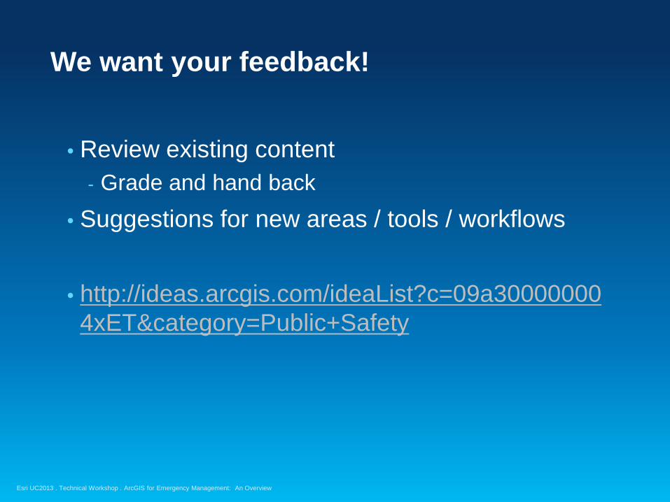
We want your feedback!
• Review existing content - Grade and hand back
• Suggestions for new areas / tools / workflows • http://ideas.arcgis.com/ideaList?c=09a300000004xET&category=Public+Safety
ArcGIS for Emergency Management: An Overview
Esri UC2013 . Technical Workshop .
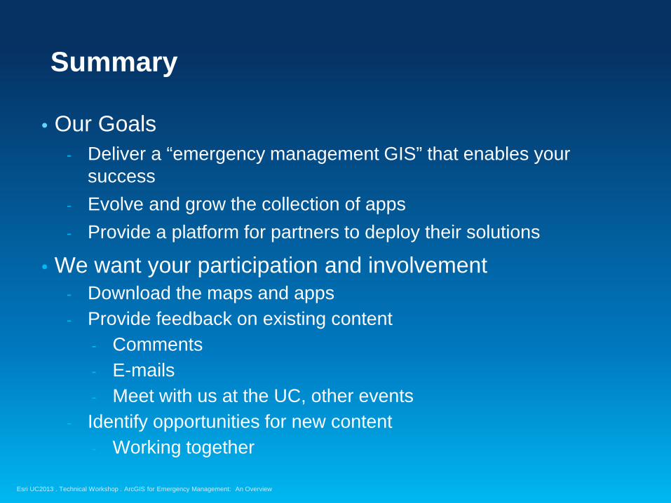
Summary
• Our Goals - Deliver a “emergency management GIS” that enables your
success - Evolve and grow the collection of apps - Provide a platform for partners to deploy their solutions
• We want your participation and involvement - Download the maps and apps - Provide feedback on existing content
- Comments - E-mails - Meet with us at the UC, other events
- Identify opportunities for new content - Working together
ArcGIS for Emergency Management: An Overview
Esri UC2013 . Technical Workshop .
Please fill out the session evaluation
Offering ID: 1366
Online – www.esri.com/ucsessionsurveys Paper – pick up and put in drop box
Questions
Thank you…
@GISPublicSafety & @ArcGISLocalGov
http://www.meetup.com/ArcGIS-for-Local-Government/
ArcGIS for Emergency Management: An Overview

Esri UC2013 . Technical Workshop . ArcGIS for Emergency Management: An Overview