ariadne services
TRANSCRIPT
ARIADNE is funded by the European Commission's Seventh Framework Programme
ARIADNE services
Holly Wright, ADSKate Fernie, 2Culture Associates
Overview• Portal• Visual Media Services• Landscape Services• Call for applications

Portal demo
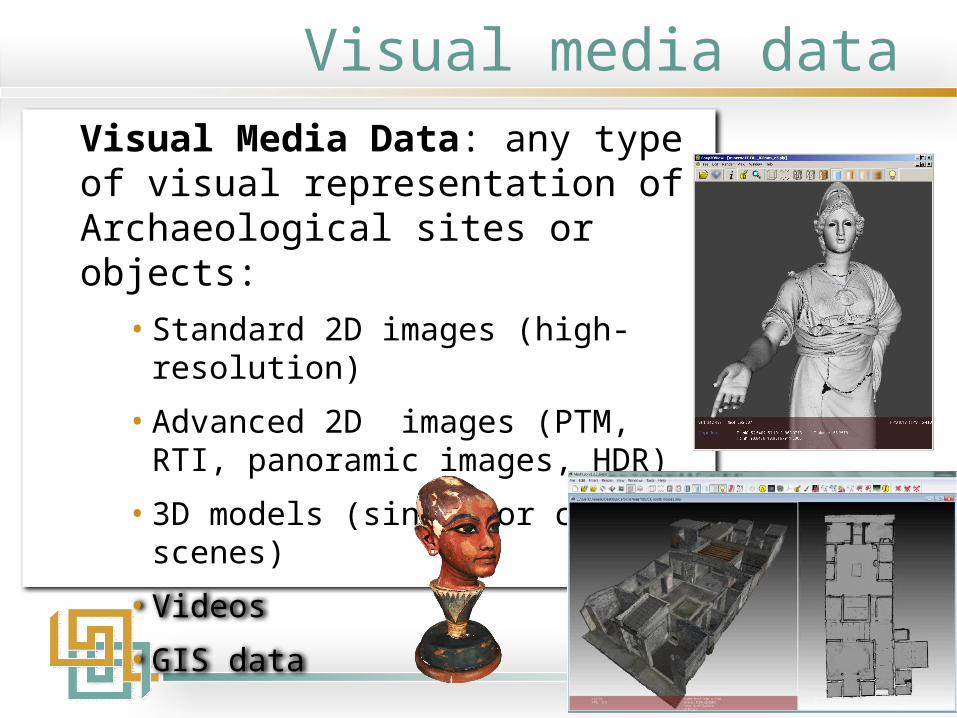
Visual media dataVisual Media Data: any type of visual representation of Archaeological sites or objects:
• Standard 2D images (high-resolution)
• Advanced 2D images (PTM, RTI, panoramic images, HDR)
• 3D models (single or complex scenes)
• Videos
• GIS data
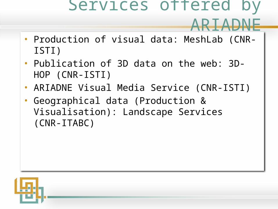
Services offered by ARIADNE• Production of visual data: MeshLab (CNR-ISTI)• Publication of 3D data on the web: 3D-HOP (CNR-ISTI)• ARIADNE Visual Media Service (CNR-ISTI)• Geographical data (Production & Visualisation): Landscape
Services (CNR-ITABC)

MeshLab• OpenSource tool (GPL) supporting
mesh processing and visualisation of triangle meshes
• Started as an academic project• Evolved to a complete and
sophisticated system • Downloaded by >350,000 users by
2013, worldwide • Leading open platform for mesh
editing of sampled 3D datahttp://meshlab.sourceforge.net/
CNR-ISTI

MeshLab: training and support• ARIADNE partners have good experience of the production of visual
media (2D and 3)• CNR-ISTI supports this activity (TNA, summer schools and training)
– http://www.ariadne-infrastructure.eu/Services/Transnational-Access/2016-TNA-Call/TNA-school-3D-Pisa
• Video tutorials are available for MeshLab:– A series of short videos, each dedicated to a specific functionality– Delivered via YouTube for free:
http://www.youtube.com/user/MrPMeshLabTutorials?feature=mhee

3DHOP: Visual data on the web• 3D visualization on web pages is now possible with
WebGL & SpiderGL• CNR’s “3DHOP” (3D Heritage Online Presenter) can
be used to simplify the production of web-based presentations or installations: http://vcg.isti.cnr.it/3dhop/

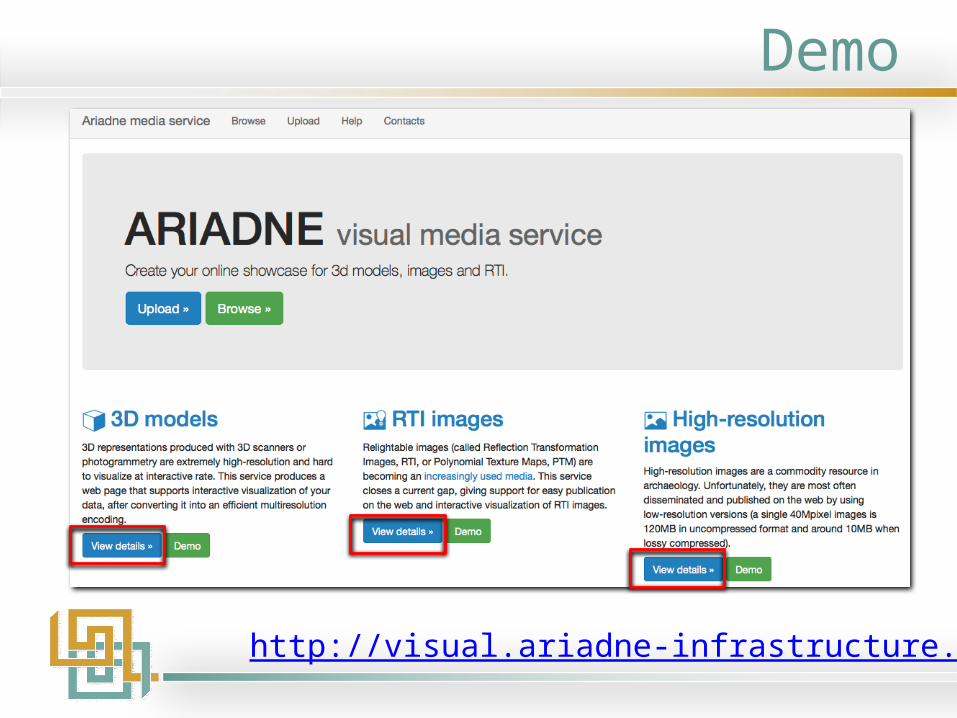
Visual media service
http://visual.ariadne-infrastructure.eu/

Visual media service
Conversion of data assets to a web-compliant format, thus supporting easy publication and visualization on the web• 3D models• Reflection Transformation Images (RTI)• High Resolution 2D images• High Dynamic Range (HDR) images
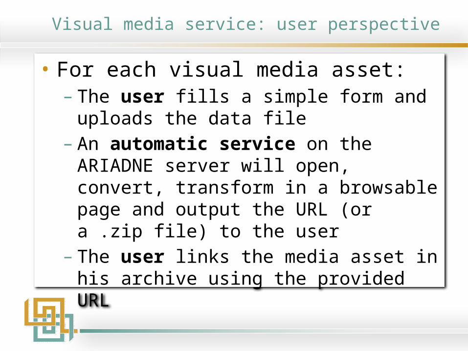
Visual media service: user perspective
• For each visual media asset:– The user fills a simple form and uploads the data
file– An automatic service on the ARIADNE server will
open, convert, transform in a browsable page and output the URL (or a .zip file) to the user
– The user links the media asset in his archive using the provided URL
Demo
http://visual.ariadne-infrastructure.eu/
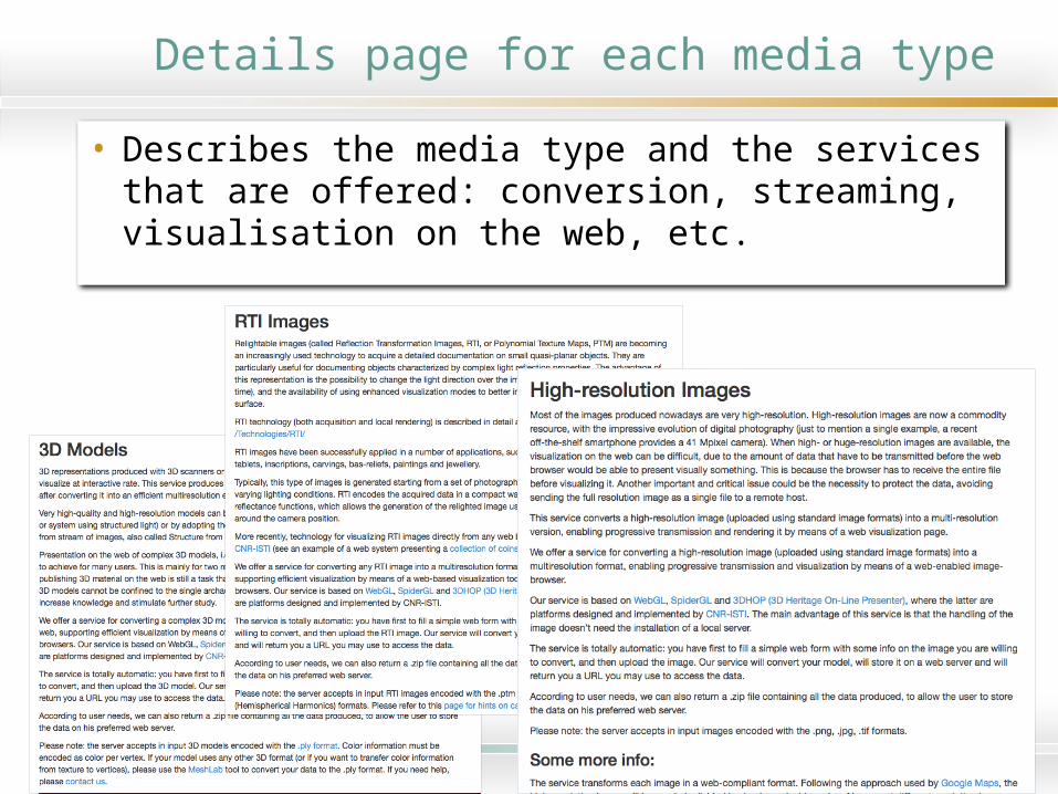
Details page for each media type
• Describes the media type and the services that are offered: conversion, streaming, visualisation on the web, etc.

Browse
http://visual.ariadne-infrastructure.eu/browse
• Users can search and browse the content that has already been uploaded

Uploading your media• For each media asset the
user fills in a simple form:– Email, name institution– Label, title, description, tabs,
url for a page describing the asset
– Copyright owner– Collection (optional) – You can ask to keep the object
private• Select file to upload• Accept terms and conditions• And upload!

Viewing results – 3D
http://visual.ariadne-infrastructure.eu/3d/arringatore
80.23 MB
3D model of the Arringatore produced by 3D laser scanning
National Archaeological Museum and CNR-ISTI

Viewing results – RTI
http://visual.ariadne-infrastructure.eu/rti/mediallion_hadrian_reverse
199.4 mb
Reverse, Medallion, Rome, Hadrian
Palazzo Blu, ISTI-CNR, Simoneschi collection

Viewing results – HRI12.29 mb
Capsella Samagher, a reliquary in carved ivory
National Archaeological Museum in Venice and CNR-ISTI
http://visual.ariadne-infrastructure.eu/img/capsella_samagher_photo

Visual media service: Help
http://visual.ariadne-infrastructure.eu/help

ARIADNE landscape services
http://landscape.ariadne-infrastructure.eu/

Landscape services• These online services focus on the generation and
management of 2D / 3D interactive WebGIS environments in a collaborative way, through open-source frameworks.
• Web services include: – Cloud services– 3D Terrain Services– Tools for visualization, interaction and editing– Distributed composing services– 2D services
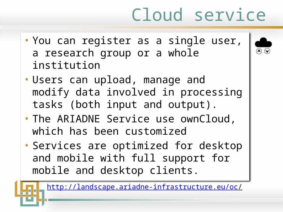
Cloud service• You can register as a single user, a research
group or a whole institution• Users can upload, manage and modify data
involved in processing tasks (both input and output).
• The ARIADNE Service use ownCloud, which has been customized
• Services are optimized for desktop and mobile with full support for mobile and desktop clients.
http://landscape.ariadne-infrastructure.eu/oc/

3D Terrain Service: registering• To start a 3D Terrain project you first need to
register and log in to the Cloud service

3D Terrain Service: upload• Data (DTMs/DEMs, Geo-images, ESRI shape files) for
your 3D terrain project is uploaded to the Cloud service
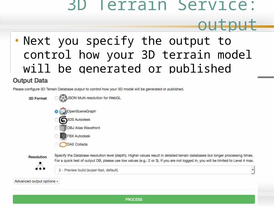
3D Terrain Service: output• Next you specify the output to control how your
3D terrain model will be generated or published

3D Terrain Service: processing• The services will list your available input data • Responsive web interfaces for user tasks
– customization of different parameters (database resolution, extents, imagery attributes, etc.).
• Web servers then process the data and alert you once 3D terrain data processing has completed

Landscape services: Terrain Gallery
• Browse sample datasets• View your own datasets (when logged in)
http://landscape.ariadne-infrastructure.eu/gallery.php
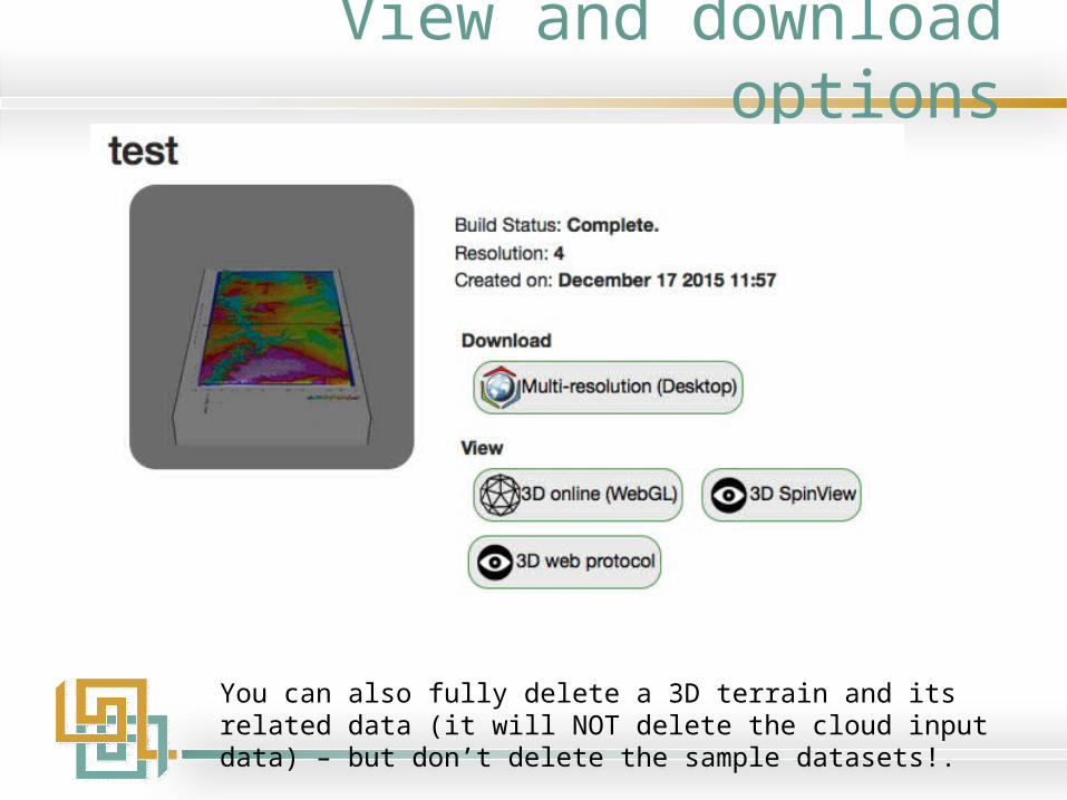
View and download options
You can also fully delete a 3D terrain and its related data (it will NOT delete the cloud input data) – but don’t delete the sample datasets!.
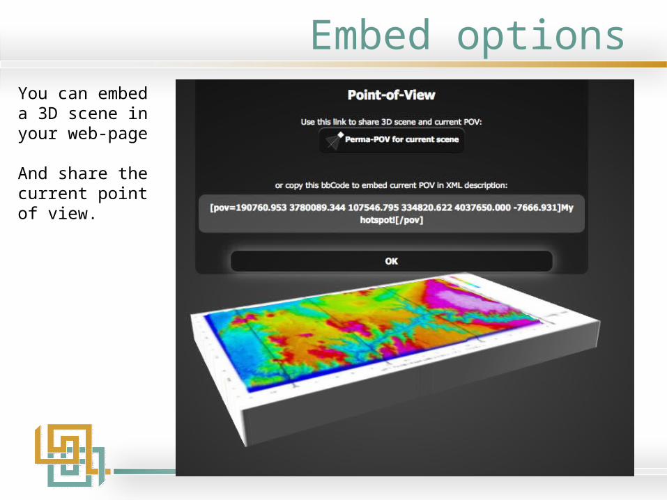
Embed optionsYou can embed a 3D scene in your web-page
And share the current point of view.
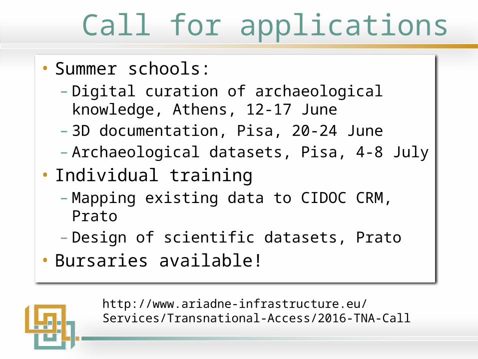
Call for applications• Summer schools:
– Digital curation of archaeological knowledge, Athens, 12-17 June
– 3D documentation, Pisa, 20-24 June– Archaeological datasets, Pisa, 4-8 July
• Individual training– Mapping existing data to CIDOC CRM, Prato– Design of scientific datasets, Prato
• Bursaries available!
http://www.ariadne-infrastructure.eu/Services/Transnational-Access/2016-TNA-Call
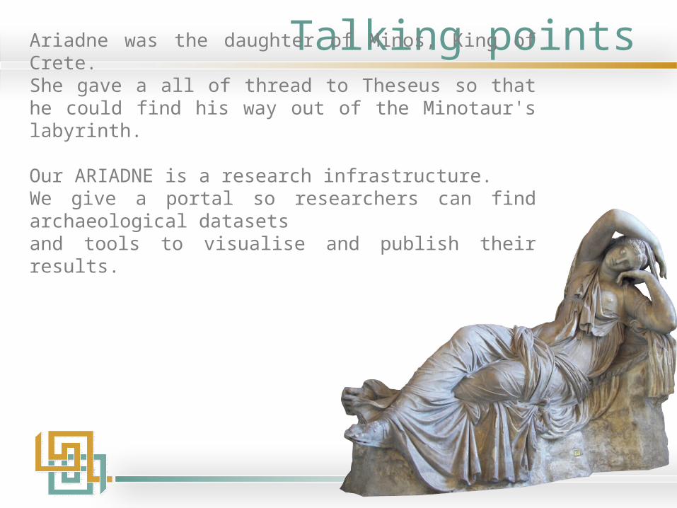
Talking pointsAriadne was the daughter of Minos, King of Crete.She gave a all of thread to Theseus so that he could find his way out of the Minotaur's labyrinth.
Our ARIADNE is a research infrastructure.We give a portal so researchers can find archaeological datasetsand tools to visualise and publish their results.

Acknowledgements• ARIADNE portal developed by • Visual Media Services developed by Roberto Scopigno et al, Visual Computing
Lab - ISTI - CNR• Landscape Services developed by Bruno Fanini, Sofia Pescarin and Augusto
Palombini, VHLab - CNR ITABC
ARIADNE is a project funded by the European Commission under the Community’s Seventh Framework Programme, contract no. FP7-INFRASTRUCTURES-2012-1-
313193.