armidale regional airport - master plan
TRANSCRIPT

CREATE2350.com.au

key initiatives that will inform our strategic plans and direct the energy and resources of
Council to build a modern, connected city and region; that caters for the needs of our
community, drives sustainable growth and meets the aspirations contained within our
Community Strategic Plan.
The objective of the Armidale Regional Council Regional Master Plan is to identify the

Table of Contents
Table of Contents ............................................................................................................ 3
Introduction .................................................................................................................... 1
The Opportunity ............................................................................................................. 2
Stakeholder and Community Consultation ...................................................................... 4
Positioning as a Regional Hub ......................................................................................... 5
Commercial (Land) Development .................................................................................... 9
Airport Site Development .................................................................................................................... 10
Existing General Aviation Land ............................................................................................................ 11
Rural Fire Service ................................................................................................................................. 12
Residential (Airpark) Development...................................................................................................... 13
FBO Facilities, Fuel Services ............................................................................................................. 14
Airport East Development ................................................................................................................... 14
Zoning of Land ...................................................................................................................................... 15
Project Management and Marketing................................................................................................... 16
Land Purchase and Financing ............................................................................................................... 16
Financing .......................................................................................................................................... 16
Future Growth ...................................................................................................................................... 17
Land Acquisition ............................................................................................................................... 18
Tourism, Recreational and Support Facilities ................................................................ 18
Highway Service Centre ................................................................................................................... 18
Airport Hotel .................................................................................................................................... 20
Car Museum ..................................................................................................................................... 20
Air Museum ...................................................................................................................................... 21
Parks and Gardens ........................................................................................................................... 21
Terminal Upgrade ......................................................................................................... 22
Terminal Requirements ....................................................................................................................... 22
Upgraded Terminal Concept (Terminal 2) ........................................................................................... 23
Food and Beverage .............................................................................................................................. 25
Exhibition and Retail Areas .................................................................................................................. 25
Facility Services (Cleaning) ................................................................................................................... 25
Further Terminal Expansion (Terminal 3) ............................................................................................ 26
Apron, Taxiways and Runway works ............................................................................. 27
Apron.................................................................................................................................................... 27
New 45M wide 05/23 Runway ............................................................................................................. 27
Precision Approach .............................................................................................................................. 28
Ground Transport, Parking and Airport Access ............................................................. 28
Access Roads, Parking, Security and Signage....................................................................................... 28
Security ............................................................................................................................................ 29
Road Naming/Signage ...................................................................................................................... 29
Ground Transportation .................................................................................................................... 29
Economic Development and The Visitor Economy ........................................................ 30
Economic Development ....................................................................................................................... 30
Industrial Land Development ........................................................................................................... 30
Residential (Airpark) Land ................................................................................................................ 31
Tourism Opportunities ......................................................................................................................... 31
Air Charter ........................................................................................................................................ 31
Joy Flights, Sightseeing .................................................................................................................... 32
Air and Transport Museums ............................................................................................................ 32
Saumarez Homestead ...................................................................................................................... 34
Implementation Timetable (Stage 1)............................................................................. 35
Financial Performance .................................................................................................. 36
APPENDIX ..................................................................................................................... 37
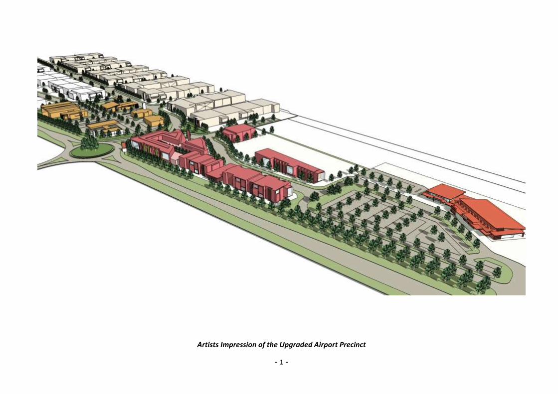
- 1 -
Artists Impression of the Upgraded Airport Precinct

- 1 -
Introduction
The Armidale Regional Airport is a curfew free, domestic airport located mid-way between Sydney
and Brisbane serving the City of Armidale and the towns, villages and rural communities of the New
England Region.
Located 6kms south west of the Armidale CBD, alongside the New England Highway, the airport
occupies a 262 hectare site owned by Armidale Regional Council. The airport is at an elevation of
3,556 feet (1,084 metres) AMSL and has two non-intersecting runways in a ‘V’ configuration. The
passenger terminal, car park and general aviation zones are currently sited in a wedge-shaped area
located between the main (05/23) runway and the New England Highway.
With excellent highway access, close proximity to the services of the City of Armidale and offering
excellent infrastructure, Armidale Regional Airport is ideally positioned as part of the State’s air
transportation network, with the aim of further positioning the airport as a growing hub for air travel
within NSW and the eastern states. Available land within the airport precinct presents an excellent
opportunity to grow general aviation, the visitor economy and to drive economic development,
addressing needs identified within the Economic and Tourism Development Strategy (AECgroup, May
2011)
This Airport Master Plan is the product of consultation with a broad range of stakeholders, desktop
research and a review of prior reports, to identify future needs and to ensure longer term flexibility of
the airport precinct. The key aims of this master plan are to:
Position Armidale Regional Airport as a growing hub for RPT services
Support and grow existing general aviation and aviation related business activity
Diversify current airport income through expansion of the airport’s property portfolio and
Upgrade and expand current airport infrastructure, capabilities and services.
Figure 1 – Location of Armidale Regional Airport

- 2 -
The Opportunity
Armidale Regional Airport is a significant asset serving the region through the provision of aviation
related services for passenger flights, air freight, aircraft maintenance, emergency services, general
and private aviation.
The airport also supports established and growing sectors within the regional economy; including
education, the visitor economy, agriculture, business development, sporting and leisure activities
and has significant potential for further diversification of its property portfolio to attract new income
generating activities.
Education represents the largest sector within the Armidale economy (22% (AECgroup, May 2011))
and includes many non-local, interstate and overseas students. The availability of scheduled
passenger flights is key to interstate and overseas students being able to access both the
University and local boarding schools. Air services from Armidale to Sydney and onward on
international flights, serve students, visiting academics, occupational trainees, technicians and
support staff providing travel both to and from interstate and overseas destinations.
Armidale Regional Airport provides air services essential for support of the visitor economy,
sporting and leisure events and for visits to friends and relatives. Additionally, the airport
enables a range of sightseeing tours and adventures from scenic flights in fixed wing aircraft or
helicopters, day trips to out-of-the-way pubs and wineries, heli-fishing and wilderness adventures
- in the heart of the New England gorge country.
The visitor economy represents a significant and growing component of the regional economy
(5% (AECgroup, May 2011)) and it’s planned that airport based tourism will be further enhanced with
a major upgrade to the terminal building which will include display facilities and a combined
visitor information centre and retail outlet. Two new museums are proposed, featuring vintage
automobiles and historic aircraft and a highway service centre will further increase airport
visitation while serving both air travellers and motorists travelling on the New England Highway.
To date the airport precinct has focussed on aviation related activities, however available land
‘outside’ the airspace protection zone, offers major development potential for tourism, civil
buildings, residential and commercial development – including an airport hotel and highway
service centre. Approximately 14 hectares of land zoned IN2, is available in Stage 1, for aviation
related activities and commercial development and a further 5.5 hectares of land zoned B6 will
allow development that includes an airport hotel, museums, highway service centre, visitor
information centre and civil buildings.
A further 8.5 hectares is proposed for development of a residential air-park, offering combined
residential housing and aircraft storage. These development options are shown on the Airport
Master Plan, page 8.
Armidale and the broader New England North West region, represent highly productive
agricultural enterprises, built upon wool, beef cattle and fat lambs, with increasing horticultural
activity offering export potential. The airport supports these activities and enables Armidale City
to be a major agricultural service centre through the support of the University, CSIRO and other
providers, meeting the growing global demand for food and food technology.

- 3 -
The availability of the NBN and direct and inexpensive air travel to Sydney and other capital
cities supports the continuing growth in professional services and information technology. These
capabilities enable the potential re-location to Armidale of Sydney and nationally based
government departments and other non-government service providers – taking advantage of the
quality of life, health services, accessibility and communications of this region.
With the recent addition of a second carrier, Regional Express, and their planned introduction of
scheduled services between Armidale and Brisbane, growth in passenger numbers is forecast to
increase from the current level of ~120,000pa to ~175,000pa in ten years.
The development and promotion of Armidale Regional Airport as a ‘regional hub’ for flights
feeding the east coast cities of Sydney, Newcastle, Brisbane and Melbourne, will drive further
growth in passenger numbers and enhance the visitor economy and business activity. Much of
the new and upgraded infrastructure set-out in this plan is to support the positioning the Armidale
Regional Airport as such a ‘hub’, offering competitive services and excellent facilities.
Overall, the airport precinct offers significant opportunity for growth and diversification of income
through commercial development while providing a modern airport that supports education, the
expansion of tourism and professional services and a push to establish an air-transportation hub.
These activities will combine to make Armidale Regional Airport a strategic and growing component
of the regional economy and a driver of further business and tourism growth.
Source: (Airplan, May 2014)
Figure 2 – Annual Passenger Movement Growth Scenarios to 2035

- 4 -
Stakeholder and Community Consultation
During the preparation of this plan, Council has undertaken consultation with government agencies,
airlines, general aviation operators, airport businesses, private aviators, the general public,
community groups and land owners to identify key issues and propose viable solutions.
Throughout the master planning process, for both this Airport Master Plan and for other planned
projects, stakeholder awareness, project information and community feedback have been facilitated
through the availability of the Master Plan website (armidaleregional.nsw.gov.au), popular social
media channels and where appropriate through newsletters, flyers, surveys and the media. In
addition, interested stakeholders can subscribe to receive regular e-mail updates.
Figure 3, below, shows a ‘three-step’ community consultation process, by which initial input - ideas,
options and issues, can be canvassed and used to frame a ‘concept plan’ which can be discussed
with stakeholders and the community through formal meetings and via the online channels
described above. With appropriate revision, the initial concept plan will be endorsed during a
Council workshop for further Community engagement prior to adoption by Council for Public
Exhibition. Prior to formal adoption by Council, feedback will be considered and included in the final
Master Plan as appropriate. Implementation of the adopted Master Plan will be planned and
included in Council’s LTFP, Delivery and Operational plans (see separate Implementation Report).
Figure 3 - Stakeholder and Community Consultation Process
Stakeholders consulted in the development of the concept plan included:
Avis Car Rental
Edwards Aviation
Fleet Helicopters, Fleet Adventures
QANTAS Link
Regional Express Airlines
Saumarez Homestead
Council’s Planning, Engineering, Economic Development, Tourism and Finance staff
1 2 3

- 5 -
Positioning as a Regional Hub
Common practice in Australian air travel is ‘point-to-point’ flight routing. The diagram below, Figure
4, shows traditional point-to-point flights that take passengers directly from their starting point to their
final destination. This is commonly seen with direct flights to and between Australian capital cities
where it is unusual for passengers to make flight connections (other than via regional feeder airlines
at capital cities).
Figure 4 - Point to Point Flight Routing
Within regional Australia, every city or larger town cannot offer direct flights to, say, Sydney,
Newcastle, Brisbane or Melbourne, because of relatively low passenger numbers and higher
operating costs. If affordable air travel is to be available from these smaller centres, an alternative
approach is required.
The diagram below shows a typical ‘hub and spoke’ model, where travellers change planes/flights
en route to reach a destination not served by direct flights. This routing structure offers airlines
reduced operating costs, higher passenger numbers and provides smaller centres with an air travel
option that was previously unavailable.
Figure 5 - Hub and Spoke Flight Routing

- 6 -
Figure 6 - Map showing Passenger Catchment for Armidale Regional Airport
During the period of this plan, it is proposed that Armidale Regional Airport be positioned as a
‘regional hub’, serving the cities and larger centres located in north western NSW. Many of the
infrastructure proposals and upgraded facilities set-out in this plan are to support the positioning of
Armidale airport as such a regional hub.
New infrastructure proposed for the Airport includes a new and upgraded runway, apron expansion
and new taxiways, security screening, a precision [navigation] approach for all weather operation,
upgraded terminal facilities and support services - including an airport hotel, highway [fuel] service
centre, short, long term and secure parking.
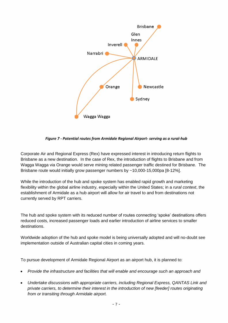
Figure 6 shows the Catchment Area for passengers travelling through Armidale Regional Airport.
Over the plan period, the Airport can be developed to become a regional hub; serving such centres
as Glen Innes, Inverell, Orange and Narrabri with direct flights to Sydney, Brisbane and Newcastle
and connecting flights through either Sydney or Wagga Wagga to Melbourne and Adelaide.
Figure 7 depicts a possible route structure operating through Armidale Airport.
- 7 -
Figure 7 - Potential routes from Armidale Regional Airport- serving as a rural-hub
Corporate Air and Regional Express (Rex) have expressed interest in introducing return flights to
Brisbane as a new destination. In the case of Rex, the introduction of flights to Brisbane and from
Wagga Wagga via Orange would serve mining related passenger traffic destined for Brisbane. The
Brisbane route would initially grow passenger numbers by ~10,000-15,000pa [8-12%].
While the introduction of the hub and spoke system has enabled rapid growth and marketing
flexibility within the global airline industry, especially within the United States; in a rural context, the
establishment of Armidale as a hub airport will allow for air travel to and from destinations not
currently served by RPT carriers.
The hub and spoke system with its reduced number of routes connecting ‘spoke’ destinations offers
reduced costs, increased passenger loads and earlier introduction of airline services to smaller
destinations.
Worldwide adoption of the hub and spoke model is being universally adopted and will no-doubt see
implementation outside of Australian capital cities in coming years.
To pursue development of Armidale Regional Airport as an airport hub, it is planned to:
Provide the infrastructure and facilities that will enable and encourage such an approach and
Undertake discussions with appropriate carriers, including Regional Express, QANTAS Link and
private carriers, to determine their interest in the introduction of new [feeder] routes originating
from or transiting through Armidale airport.

- 8 -
Figure 8 - Airport Master Plan

- 9 -
Commercial (Land) Development
An analysis of the industrial land market in Armidale indicates there is strong demand for industrial
land, based on community aspirations/economic growth targets, pent-up demand and a lack of
current supply (AECgroup, May 2013). Armidale currently has 146.9ha of land zoned for industrial use
of which 130ha is occupied. It is estimated that of the 17.5ha of vacant land potentially suitable for
development, the majority of which is located within the Acacia Park precinct, much of this stock
does not meet customer (pricing) requirements.
The Airport Site is the only area currently zoned for future industrial development, comprising 70ha
in total. There is a further 55ha of industrial land potentially available if the Airport East Site is
rezoned. To date, these land parcels have not been available for development because of a lack of
the necessary infrastructure (water, sewerage and NBN); which is currently being made available.
The following chart shows the forecast demand for industrial land over the next 25 years, where the
existing under supply of industrial land is projected to further increase to between 33ha to 69ha by
2036:
Source: (AECgroup, May 2013)
Figure 9 – Demand for Industrial Land
This Airport Site represents a major land asset of Armidale Regional Council, from which Council
derives minimal non-RPT revenue. Outside the area identified as the ‘airspace protection zone’, 70ha
of land is zoned and available for development following the provision of services - increasing the
supply of land available in the development pipeline and fostering business growth.
- 10 -
This plan proposes that the Airport (West) Site be developed to include a mix of industrial lots ranging
in size from small to medium (1,500 to 5,000sqm), with larger lots (5,000 to 15,000sqm) potentially
available through a combination of smaller lot sizes.
The shortage of competitively priced industrial land in Armidale is constraining economic growth and
new, appropriately zoned land is required to drive investment by either new or established
businesses (AECgroup, May 2013).
Figure 10 - Potential Land for Industrial Development
The potential land identified in the above chart, will meet the projected demand for up to 90ha of
industrial land over the next 25 years. It should be noted that the Airport precinct itself offers some
very considerable advantages to prospective purchasers and lessees, including location alongside
the New England Highway, proximity to a regional airport with multiple daily flights to Sydney, full
services including water, sewerage and NBN fibre to the premises and flexible development and
financing options managed by ADC.
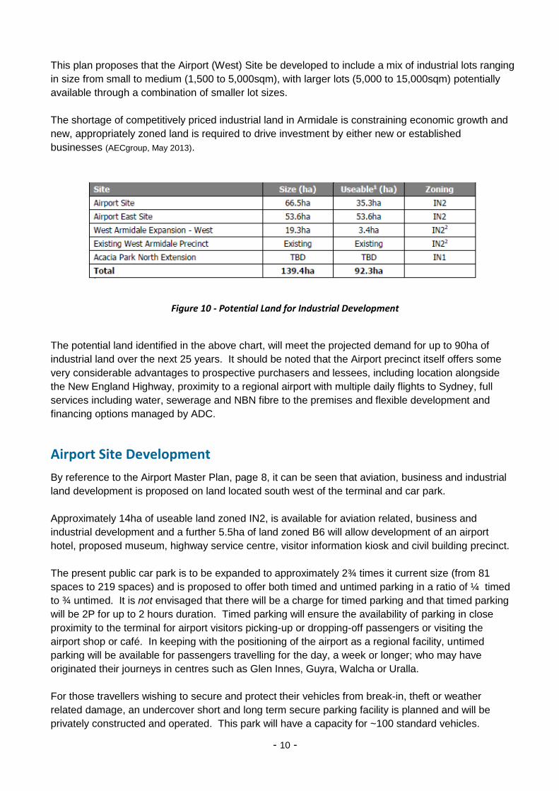
Airport Site Development
By reference to the Airport Master Plan, page 8, it can be seen that aviation, business and industrial
land development is proposed on land located south west of the terminal and car park.
Approximately 14ha of useable land zoned IN2, is available for aviation related, business and
industrial development and a further 5.5ha of land zoned B6 will allow development of an airport
hotel, proposed museum, highway service centre, visitor information kiosk and civil building precinct.
The present public car park is to be expanded to approximately 2¾ times it current size (from 81
spaces to 219 spaces) and is proposed to offer both timed and untimed parking in a ratio of ¼ timed
to ¾ untimed. It is not envisaged that there will be a charge for timed parking and that timed parking
will be 2P for up to 2 hours duration. Timed parking will ensure the availability of parking in close
proximity to the terminal for airport visitors picking-up or dropping-off passengers or visiting the
airport shop or café. In keeping with the positioning of the airport as a regional facility, untimed
parking will be available for passengers travelling for the day, a week or longer; who may have
originated their journeys in centres such as Glen Innes, Guyra, Walcha or Uralla.
For those travellers wishing to secure and protect their vehicles from break-in, theft or weather
related damage, an undercover short and long term secure parking facility is planned and will be
privately constructed and operated. This park will have a capacity for ~100 standard vehicles.
- 11 -
North of the relocated and upgraded Saumarez Road, 40 ‘aviation-related’ industrial lots are to be
developed. Each of these lots will have both road and airside/taxiway access. These lots have
been designed to accommodate aviation businesses who need access to the taxiways and to the
main runway. In addition to aircraft operators, these businesses may include aircraft and engine
maintenance, avionics, ramp services, fuel sales, aircraft sales/acquisition and painting and
upholstery. Lots 33 to 37 have been identified as suitable for airfreight operations requiring both
road and apron access. The growth in regional horticulture may see the export of such products as
mushrooms, tomatoes and chillies directly into Asia. It is recognised that all lots in this ‘specialist’
area may not be initially leased or sold to aviation related companies; however, flexibility and long
term priority must be focussed upon general aviation.
South of the relocated Saumarez Road will be a further 20 industrial lots ranging in size from
1,540sqm to 5,420sqm with larger lots achievable by the merger of smaller lot sizes. Six of these
lots will ‘front’ the New England Highway; however, access will be via the proposed roundabout.
These lots will suit any commercial or light industrial business. The approximate total land value of
all lots in the Airport Site development is $21M with a potential rateable income of $150,000pa, if all
lots were to be sold (at current rates).
Lots 1B, 1C, 1D and 57 to 62, cover land identified as a specialist ‘business park’; providing office
accommodation and civil buildings, offering a more visually attractive entry to the Airport Terminal
area. It is planned that the Business Park design includes energy efficient and sustainable design
principles as a demonstration precinct located at the airborne entrance to the New England.
Proposed road access to all sites and to Saumarez Homestead will be suitable for articulated
vehicles, B-doubles and coaches and the relocated Saumarez road will provide improved access to
Saumarez Homestead from the New England Highway roundabout.
Existing General Aviation Land
Future development of the existing general aviation land is constrained by the physical boundaries of
the runway/taxiways to the north and the New England Highway to the south.
Armidale Regional Airport is fortunate to have a number of established and successful general
aviation operators, offering jet and helicopter charter, fixed wing and helicopter maintenance, flight
training, aerial spraying, fire fighting and a range of sightseeing tours and adventures. It’s proposed
that future development of this General Aviation area is limited to business/professional operators and
that the ‘private aviation’ facilities currently in this zone be re-located to a new, private aviation precinct
to be established on the western boundary of the airport.
While there is little scope for the creation of additional leasehold or freehold lots, two (2) new lots have
been identified between Super Air and the new RFS facility - to be constructed to the North East of the
GA area. The re-location of private aviation away from this area will also allow for the ‘cleaning-up’ of
a number of randomly positioned smaller hangers, which will enable four (4) further general aviation
lots to be identified. The creation of the private aviation area will include re-location of the existing
aero club.
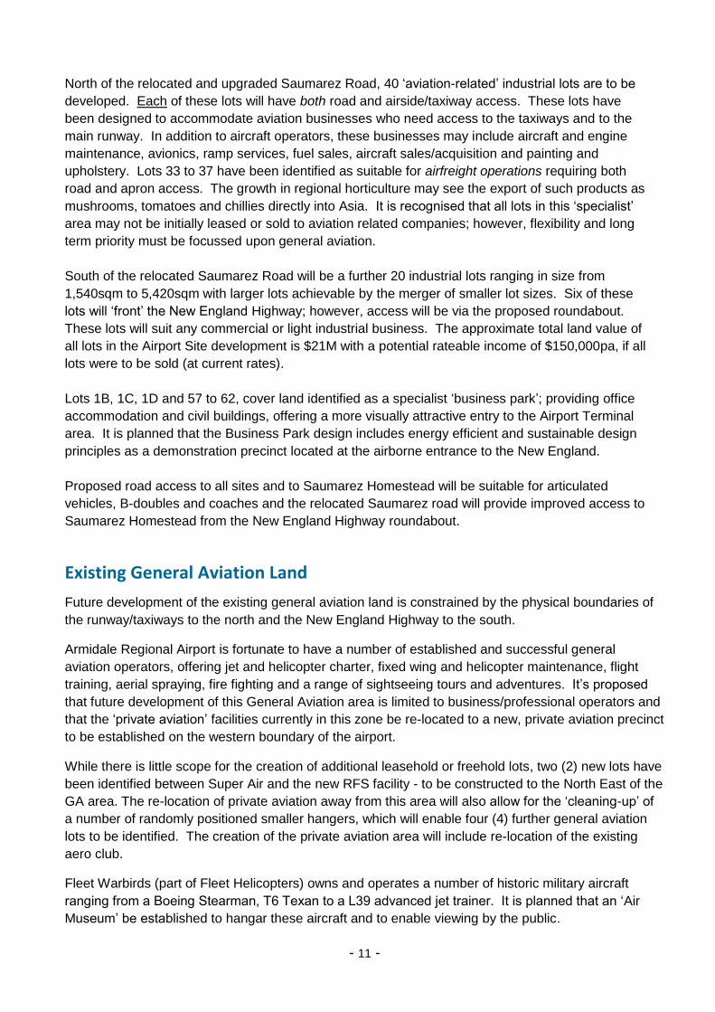
Fleet Warbirds (part of Fleet Helicopters) owns and operates a number of historic military aircraft
ranging from a Boeing Stearman, T6 Texan to a L39 advanced jet trainer. It is planned that an ‘Air
Museum’ be established to hangar these aircraft and to enable viewing by the public.
- 12 -
Figure 11 – Two of Fleet Adventure’s War birds
The identified site characteristics required for the air museum include visibility from the New England
Highway and direct access to taxiways and the active runway. For this reason a potential museum
site has been identified immediately North East of the current Shell fuel facility and the future site of
the proposed airport hotel.
To provide improved access and to allow both Edwards Aviation and Fleet Helicopters to better serve
their tourism related customers, it is proposed that a new taxiway and apron be constructed from the
access road to the new Code C taxiway. This taxiway will greatly enhance the customer experience
when passengers are boarding and alighting or undertaking an extended pre-flight briefing.
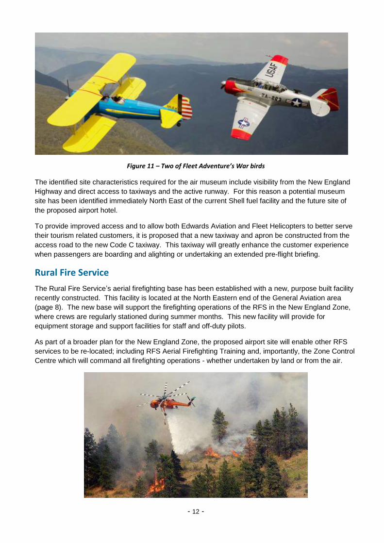
Rural Fire Service
The Rural Fire Service’s aerial firefighting base has been established with a new, purpose built facility
recently constructed. This facility is located at the North Eastern end of the General Aviation area
(page 8). The new base will support the firefighting operations of the RFS in the New England Zone,
where crews are regularly stationed during summer months. This new facility will provide for
equipment storage and support facilities for staff and off-duty pilots.
As part of a broader plan for the New England Zone, the proposed airport site will enable other RFS
services to be re-located; including RFS Aerial Firefighting Training and, importantly, the Zone Control
Centre which will command all firefighting operations - whether undertaken by land or from the air.

- 13 -
Residential (Airpark) Development
Residential airparks allow people to both live in close proximity to an airfield and keep an aircraft in a
hangar at their home; either as a separate building or integrated within the house design. Aircraft
have either direct taxiway access to the runway or, as it is proposed for the Armidale Airpark; access
will be through a security gate to the airside/secured area.
Airparks have operated successfully in the United States for over 30 years, with well over 150 airparks
now established; some accommodating upward of 1500 homes. A growing number of airparks are
emerging on the east coast of Australia. To date many have typically developed in rural or peripheral
locations on private or remote airstrips with few facilities or amenities. In contrast, Armidale Airpark is
to be located in close proximity to a major rural city, adjoining a substantial regional airport offering
excellent aviation facilities, runway lighting, navigation, maintenance and support services.
It is planned that the airpark be a ‘gated’ and secure community with combined road and taxiway
access constructed on private land and offering excellent community facilities including an active aero-
club, F&B and FBO services (fuel and maintenance).
In addition to residential homes, accommodation may also be provided for visiting aviation specialists,
flight training students and for transiting or emergency service pilots.
Figure 12 – A typical Residential Airpark development
It is planned that following the establishment of the Private Aviation precinct, a number of additional
facilities could also be established:
These will include the Aero Club and clubhouse. The clubhouse will be the focal point of the private
aviation community, with the potential to support private aviation, gliding and sky-diving. With growth
in the number of residential blocks within the air-park, the clubhouse will be increasingly popular as a
social gathering venue with increased use of catering, BBQ, lounge and bar facilities. Other facilities
to be established may include ‘budget’ accommodation for flight training students and for transiting
pilots overnighting at the airport. This accommodation can be simple and inexpensive.

- 14 -
FBO Facilities, Fuel Services
There also exists the opportunity for the Aero Club to become a Fixed Base Operator (FBO), offering a
range of services to private aviation - including fuel purchase, aircraft hire/rental, food and beverage,
transportation, tie-downs, hangers and a pilot lounge.
These services could provide the Club with a growing income stream following growth in private
aviation. It is suggested that aviation fuel (Av-gas) be made available at this location, recognising that
this class of fuel is sold predominantly to smaller fixed wing and rotor aircraft.
The availability of a quality, service-orientated FBO facility will be a key driver of interest in private
aviation and visitation to the airport.
Airport East Development
In addition to the Airport [West] Site, it is proposed that the owner of private land held on the eastern
side of the New England Highway be encouraged to develop this 56½ha site to provide an additional
50ha of useable industrial land. Like the Airport Site, the availability of infrastructure services
currently being installed will further support such a development.
Potential interest in this land includes a freight distribution operator, a small and a large animal
abattoir and cold store. It is proposed that a truck [fuel] stop, diner and associated facilities also be
considered, to compliment the Highway Service Centre on the western side of the Highway.
Together with water and sewerage, the availability of NBN with fibre to the premises will be an
attractive service for attracting businesses using modern technology and communications.
Design of the ‘new’ roundabout, required for access to the Airport precinct, will also provide safe
entry to and exit from this proposed industrial development. Other roads which access the New
England Highway (including Kia Ora and Mills roads) will be closed following construction of the
roundabout, providing a single point for highway access - required by the RMS.
It is envisaged that this development will offer larger lot sizes than those available within the Airport
Site, accommodating larger scale developments with competitively priced land (AECgroup, May 2011).

- 15 -
Zoning of Land
Figure 13, below, shows the location of the proposed development lots associated with Stage 1 (P16)
of the Industrial Land development. These lots have been identified to maximise access while
minimising infrastructure costs through the adoption of a ‘staged’ development approach.
Figure 13 - Location of Proposed Development Lots to allow for Staged Development
In order to achieve a visually attractive entry to the Airport precinct, it is planned that lots 1B to 1D and
57 to 62, be zoned as a ‘Business Park’, comprising office accommodation and civic buildings.
The proposed Airport Master Plan will require certain lots to be re-zoned. A separate (confidential)
report has been prepared detailing the issues and recommendations associated with the re-zoning of
airport-related land.

- 16 -
Project Management and Marketing
Given the specialised nature of any airport-based industrial land development, it is envisaged that a
multi-staged development will be undertaken over a 10 to 20 year period. This approach, however, will
not provide the more immediate investment returns normally associated with a residential or
commercial development and will, therefore, be less attractive to property developers.
While there are several options available to Council for development and marketing of airport land,
each with financial and risk advantages and disadvantages, it is proposed that Council manage both
the development and marketing of the Airport Site. Council may choose to sub-contract the design
and development works and outsource the marketing and sale of land; the approach that offers
Council the greatest control and flexibility is for Council to assume the role of Developer. This
approach enables Council to target preferred tenants and to offer financial and other incentives to
attract key businesses. Competition to attract investment, particularly aviation-related businesses, is
significant and the attracting of keystone tenants will be important to the overall success of the airport
project. Success in attracting key tenants will drive further investment in the industrial park and the
residential housing precinct.
Land Purchase and Financing
At present, airport land is only made available on a leased basis, upon which tenants construct their
own facilities in the form of hangars, workshops, aprons, car parks and/or offices. These
improvements can often represent a substantial investment on the part of the tenant - totalling millions
of dollars. Accordingly, there can be a natural desire to own the land on which such significant
investments are being made. Land ownership also assists the owner with financing both the business
and any associated improvements. Land ownership allows the businesses to establish bricks and
mortar equity. The ability to purchase land can be a major attraction in the promotion of industrial land
for sale. It is proposed that currently leased land be available for purchase by the tenant.
Financing
The 262ha airport precinct represents a major land asset of Council which, importantly, provides
Council with the ability to offer ‘vendor financing’ for the purchase of industrial land or residential lots.
While not the major consideration, vendor financing will enable Council to derive additional [interest]
income from the airport asset, adding to RPT revenues, fees and traditional lease income.
More importantly, the ability to offer vendor financing will provide greater flexibility when marketing
development land and, following the sale of land, will enable council to generate rates income.
This additional rates income will grow and further diversify council’s overall revenues. As the
mortgagor, council would hold security over the property, protecting against any default in payment.
The interest rate offered could be targeted to attract and drive land sales.
Consideration should also be given to not selling aviation-related lots, located to the North West of the
relocated Saumarez Road, to non-aviation businesses; in order to maintain this section of the
development as a true ‘aviation precinct’.

- 17 -
Future Growth
The current proposal details only the initial stage (Stage 1) of the proposed aviation and commercial
land development at the Airport Site. As can be seen from the following diagram, Figure 14, there
exists further opportunity for the development of the land to the south west of The Croft. This is shown
diagrammatically as Stages 2 and 3.
It should be noted that there is a section of land located between the Stage 1 and Stage 3 sites that is
undulating and generally not suited to traditional industrial land development. It is suggest that this
land only be considered for a ‘specialist’ purpose(s) not requiring more level land or construction using
common cut and fill techniques.
The timing of future development of the Airport Site is dependent upon the take-up of the 25
commercial lots in Stage 1. Commencement of Stage 2 would not be anticipated before about year 10
(2025).
It is not anticipated that aviation related land development would be extended beyond The Croft due to
accessibility to the main runway. Because of its specialist nature, this land may be developed more
slowly than the commercial land located on the eastern side of the relocated Saumarez Road. Upon
lease or sale of the majority of the 25 ‘commercial’ lots, it would be envisaged that development of
Stage 2, would be commenced and the same approach would be similarly be applied to the
development of Stage 3.
By adopting this ‘staged’ approach, the infrastructure costs to develop this industrial land would be
kept to a minimum. Within the 3 major stages of development, road construction and other
infrastructure would only be undertaken as and when required. This would particularly apply to the
aviation related lots where parcels of 8 lots at a time could be developed (minimising the infrastructure
costs for both roads and taxiways).
Figure 14 - Staged Development of the Airport Site

- 18 -
In a similar way to that of the industrial park, development of the proposed residential air park would
be staged to avoid significant up-front investment in infrastructure. As with the industrial land, funds
from the sale of initial lots would finance further development of the air-park.
While the number of lots within the air-park development may be limited, additional ‘residential’ or
‘rural residential’ lots may continue to be developed in this area to the North West, taking advantage of
the available infrastructure services and road access.
Land Acquisition
Development of the Airport Precinct may require acquisition of some adjoining portions of land. Once
the location of the upgraded 05/23 runway has been identified, a separate (confidential) report will be
prepared providing details of proposed land acquisition and zoning.
Tourism, Recreational and Support Facilities
Highway Service Centre
It is proposed that a Highway Service Centre be developed on Lot 3 of the Airport Master Plan shown
on Page 8. Lot 3 is a large 2.2ha site which includes land identified for the construction of a 5,000sqm
veteran and vintage car museum. As the new roundabout will impact the current level of fuel sales at
the existing service station site, it is proposed that the option be given to the current service station
operator to develop and/or manage the fuel component of the proposed Service Centre.
Shown below, is an artist’s impression of a typical Service Centre, which features a service station
(fuel), an express market, fast food outlets (2), toilet facilities and parking for cars, buses, RV vehicles
and caravans.
Figure 15 - Artist Impression of Kempsey Service Centre (Pacific Highway)

- 19 -
It is also proposed that a Visitor Information Kiosk (VIC), be located at the northern corner of this lot to
take advantage of the large number of visitors to the service centre and to the proposed car museum.
There are currently in excess of 3 million vehicles annually travelling the New England Highway and it
would be expected that 300,000+ travellers would take advantage of the planned service centre
facilities. In addition, it is estimated that 250,000+ passengers and friends visit or travel via the airport
terminal each year.
Within the service centre precinct, space has been made available for the construction of a car
museum which will be able to take advantage of the added security offered by the 24 hour operation of
the service centre. The museum will also be able to take advantage of the restaurant, fuel, parking
and toilet facilities provided within the service centre.
The diagram below, Figure 16, shows the layout of the above Kempsey Service Centre, which is
typical for such a facility on a major highway. This layout caters predominantly for motor vehicles;
however, a truck refuelling facility and diner are planned for construction within the Airport East
development.
Figure 16 - Typical layout of a Highway Service Centre (South Kempsey)
- 20 -
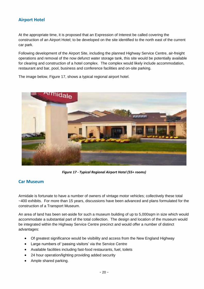
Airport Hotel
At the appropriate time, it is proposed that an Expression of Interest be called covering the
construction of an Airport Hotel; to be developed on the site identified to the north east of the current
car park.
Following development of the Airport Site, including the planned Highway Service Centre, air-freight
operations and removal of the now defunct water storage tank, this site would be potentially available
for clearing and construction of a hotel complex. The complex would likely include accommodation,
restaurant and bar, pool, business and conference facilities and on-site parking.
The image below, Figure 17, shows a typical regional airport hotel.
Figure 17 - Typical Regional Airport Hotel (55+ rooms)
Car Museum
Armidale is fortunate to have a number of owners of vintage motor vehicles; collectively these total
~400 exhibits. For more than 15 years, discussions have been advanced and plans formulated for the
construction of a Transport Museum.
An area of land has been set-aside for such a museum building of up to 5,000sqm in size which would
accommodate a substantial part of the total collection. The design and location of the museum would
be integrated within the Highway Service Centre precinct and would offer a number of distinct
advantages:
Of greatest significance would be visibility and access from the New England Highway
Large numbers of ‘passing visitors’ via the Service Centre
Available facilities including fast-food restaurants, fuel, toilets
24 hour operation/lighting providing added security
Ample shared parking.

- 21 -
Air Museum
Fleet Adventures owns and operates a number of ‘war birds’ and historic aircraft which include a L39
jet trainer and light attack fighter, a Boeing Stearman, T6 “Texan”, de Havilland Canada DHC-2
Beaver and a Bell Helicopter “Huey” UH-1A. It is proposed to locate these in an air museum where
exhibits can be viewed by the general public.
These aircraft are used daily to provide sightseeing and aerobatic adventure tours of the gorges and
waterfalls of the Oxley Wild Rivers National Park. Regular use of these aircraft creates some specific
requirements when considering their location within a historic aircraft museum. In addition to visibility
from the New England Highway, ease of access and parking; access to the main airport runway is
critical. For these reasons, it is planned that the proposed museum be located at the entrance/south
western end of the current General Aviation area. A potential site has been identified at this location
meeting the required criteria and with sufficient space to build an appropriately sized hangar. Parking
facilities will be provided around the hangar.
Together with the proposed airport hotel and park area (see below), the air museum will complete an
attractive visitor destination.
Parks and Gardens
To provide a public space, where members of the public can walk, relax, picnic, exercise dogs and
view airport activities/aircraft, it is proposed that a small park and garden be established as part of the
airport hotel/air museum and car park layout.
The proposed park would be adjacent to the airside boundary fence, offering clear visibility to the
apron and runway and adjoining the north east end of the current terminal and the proposed airport
hotel.
Figure 18 - Typical Airport Garden
- 22 -
Terminal Upgrade
The current terminal, constructed in the mid 1990s, was designed to initially handle 35,000 passenger
movements with capacity to grow to 50,000 movements. In the past 10 years, passenger numbers
have increased to ~120,000, with Regional Express joining QANTAS Link on the Sydney route, further
increasing check-in and baggage handling demands on the terminal.
In addition to this doubling of passenger numbers, potential upgrades of aircraft type serving Armidale
and the likely future requirement for passenger and baggage screening is driving the need for an
upgrade to the current terminal facilities.
Terminal Requirements
Below is a summarised list of facilities proposed for consideration in the planned Terminal 2 and
possible future Terminal 3 upgrade as follows:
Departures –
Check-in facilities for 3 airlines, each with counters, baggage scales/conveyors and customer
service capability
Baggage make-up facilities/conveyor, with undercover storage and loading
Provision for unattended check-in kiosks and baggage tag printers
Security screening for passengers, their carry-on baggage, checked-baggage and air-freight
Departure lounge for screened passengers
Toilet facilities within (screened) departure lounge
Modest café facilities within departure lounge
Airline/Club members lounge(s) with business facilities
3 Departure gates, each with computer/card-reader stand or counter with data and power
Arrivals –
Hire car counters – serving Avis, Hertz, Budget, Thrifty, a local operator and charter
groups/ground handling services etc.
Baggage break-down carousel with undercover unloading and storage of baggage
Baggage cart storage for use by passengers
Display/exhibition space (car size), for product promotion and events, with appropriate access.
Common Service Area -
Arrival/Departure flight displays/screens
Toilet facilities, disability access.
Licensed café with both indoor and outdoor seating
Seating area(s)
Combined Retail/News/VIC/Local Produce outlet
Shared office space for 5 (non-airline) personnel
Meeting/Conference/Training room
Public pay-phone, taxi phone, Wi-Fi access, USB charging facilities etc.
Media and Advertising displays

- 23 -
Airport Operator Facilities –
Separate airline offices for 3 carriers (can be located behind check-in counters) – each to
accommodate 3 staff members
Staff lunchroom/kitchen facilities (with some overnight /flight catering - hot water/fridge/freezer)
Staff change-room/locker facilities (10 users - shared)
GSE equipment storage/charging/maintenance/supplies (de-icing fluid).
Storage for Airline stationery – destination labels, baggage tags, boarding passes etc.
Shared Communications (‘Comms’) room for servers, switches, UPS etc.
Apron
Apron upgrade to provide for Q400 Dash 8 sized aircraft (74Y), B717, A320, B737-800.
Passenger airside/terminal access that does not conflict with baggage handling, refuelling etc.
Provision for use of a ‘QANTAS Ramp’ for passenger boarding, disembarkation.
Safety, Emergency –
CCTV
Standby Power
PA/Emergency Communications, IT infrastructure
Fire fighting, review of emergency exits to meet current requirements
Upgraded Terminal Concept (Terminal 2)
Rehbein Airport Consulting has been engaged to develop a Terminal Concept that addresses the
future requirements for an upgraded Terminal serving Armidale Region Airport. A detailed report,
technical strategy and plans have been provided by Rehbein Consulting.
Figure 19, page 23 shows a concept plan for the proposed terminal upgrade. This plan addresses the
identified requirements and accommodates significant growth in passenger numbers (to 200,000+), as
well as providing for the introduction of passenger and baggage screening. The plan as shown
assumes passenger screening is in place. Until this time, while the terminal design would remain the
same, the screening facilities would not be installed and the terminal would operate as an unscreened
facility.
Check-in Counters – for 3 airlines are to be provided with conveyor belts, incorporating scales, taking
passenger bags through the checked-bag screening unit. Oversized baggage would be passed to the
screening unit or manually scanned via the doors to the left of the check-in counters.
Check-in Kiosks – have been provided in the event that QANTAS Link or another carrier wishes to
implement unattended check-in, boarding pass printing and tagging of baggage. This capability would
be equivalent to the QANTAS Q-check in. Once tagged, checked baggage would be passed onto the
baggage conveyor for screening before being consolidated for loading on aircraft..
Passenger Screening – would then be undertaken before entering the ‘screened’ lounge. This is a
sterile area where passengers await boarding of their aircraft through one of the three boarding gates.
Toilet facilities, a child’s play area and a snack and beverage bar are proposed for inclusion in the
screened lounge area.

- 24 -
Figure 19 - Concept Plan for Upgraded Terminal Facilities

- 25 -
Baggage Hall – Upon arrival, passengers would enter the baggage claim area via a glazed entry air-
lock where they can be identified by family and friends. Baggage would be unloaded from the aircraft
and placed on the baggage carousel entering the baggage hall. Checked bags would be claimed by
passengers and pay-for-use baggage carts will be available to transport baggage to the transportation
zone/parking area.
Hire Car Counters – will be provided for booking or collecting of rental cars from one of the half dozen
providers. Rental cars would be parked in an area located in close proximity to the terminal – see
Figure 20.
Other facilities – would include male, female and disabled access toilets, storage, lockers, lunchroom
and offices for airline staff, a conference/training room and private offices for council staff.
Food and Beverage
Food and beverage is an important component of the Terminal design. Being a Regional airport,
many passengers will be either seen-off or greeted by family, friends or business colleagues. There
are also a growing number of GA operators located within the airport precinct who may wish to use the
terminal facilities for business meetings and/or meals and the airport is a destination in itself where
people simply choose to go for a coffee!
To accommodate these visitors to the airport, a mid-range restaurant and licensed bar are proposed to
be centrally located in the terminal. Visitors can have a coffee and watch in comfort while awaiting the
arrival of passengers, or have a meal or snack before a flight.
Critical to the success of the F&B offering will be the level of service and opening hours, which need to
match the airlines’ flight schedules as an absolute minimum.
Exhibition and Retail Areas
It is important that Armidale Region Airport, as the gateway to Armidale city and to the towns, villages
and communities of the North West, has an exhibition area and retail sales space that is able to
promote the region, its produce and events.
The exhibition space can promote upcoming events, local businesses and regional sights and
experiences such a vineyards, adventure tours and National Parks. The retail space [shop] can be
used to promote local produce, crafts and wares and also offer books, magazines and ‘double’ as a
Visitor Information Centre (VIC).
Facility Services (Cleaning)
There are currently a number of airline agents and support organisations operating at the airport and
within the Terminal building in particular. In addition, Council regularly attends the terminal to
undertake cleaning activities, security checks, emptying of waste and a host of other smaller
caretaking activities.
It is suggested that an Expression of Interest be called for covering the provision of these services by
one of the private operators already at the airport with the intention that Council could obtain these
services at a reduced cost; while enabling an operator to ‘smooth-out’ the peaks and troughs of their
daily schedule and better recover costs.

- 26 -
Further Terminal Expansion (Terminal 3)
Anticipated passenger growth (see Figure 2, page 3), suggests that by the year 2024-2025, annual
passenger movements through the upgraded terminal will exceed 200,000.
At this time, planning will need to be commenced for a further upgrade and expansion of the Terminal
Building (Terminal 3 upgrade).
Figure 20 - Car Park area preserving land for potential Terminal Expansion
To ‘quarantine’ adjacent land for this further terminal upgrade, a staff car park and parking for rental cars is proposed to the south west of the planned terminal building.
A covered walkway will provide access for both the collection of rental vehicles, staff parking and for access to and from the proposed secure car park (located further to the South West).
Rental Car and Staff parking will need to be relocated to the expanded general parking area (219 available spaces), following this further extension to the terminal building (Terminal 3).

- 27 -
Apron, Taxiways and Runway works
With a planning horizon of 20 years, consideration has been given to future requirements of the airport
in terms of runways, aprons and taxiways. These future needs will be driven primarily by increases in
passenger numbers, changes in the size and type of aircraft being operated and potential introduction
of air-freight services shipping nationally and internationally.
Apron
The most immediate need is for an upgrade to the existing apron being used by the RPT carriers
(Rex, Fly Corporate and QANTAS Link); to enable greater flexibility, ease of movement and
importantly the use of larger sized aircraft (including the Q400 Dash 8 sized aircraft [74Y]).
Following construction of the new entry roundabout and initial road infrastructure, it is proposed that a
new heliport be constructed to meet the needs of emergency services and, in particular, Westpac
Helicopters. The new helipad will have excellent and quick access to ambulances travelling on the
New England Highway. Future planning also includes a new apron for use by air ambulances; also
taking advantage of the improved highway access.
An upgraded apron/taxiway is proposed to be constructed between the hangers of Edwards Aviation
and Fleet Helicopters. This apron will offer improved comfort for customers of these two tourism
operators and provide greater ease of movement. This upgraded taxiway will connect from the
access road gateway to the new Code C parallel taxiway (taxiway ‘B’).
Rehbein Airport Consulting has undertaken the design for the initial apron upgrade. The proposed
design is included on page 39.
New 45M wide 05/23 Runway
It was initially planned to upgrade the current 05/23 runway (1,738m in length), with a 362m extension
to the runway length and installation of Runway End Safety Areas (RESAs) at each end; together with
other minor improvements. A review of works required, cost to complete and, most importantly, the
period of time that the runway would be out-of-action were undertaken. In addition, any significant
runway works would require the existing runway to be brought up to current standards, requiring the
‘uneven’ sections of the runway to be addressed.
These factors combined to make the runway upgrade both costly and impractical, due to the runway
being out-of-action for an extended period of months. The proposal, therefore, is to plan and construct
a new runway to be located northwest of the existing 05/23 strip and at the minimum separation
distance required for construction. The new runway will be a minimum of 2,120m in length, 45m in
width and accommodate aircraft including the Dash 8-400 (Q400) and current B737-800, A320 and
B717-200 jet aircraft.
While the new runway is being constructed, the existing runway can remain in use and subsequently
be used as both a taxiway and back-up runway when future maintenance is required. Construction of
the new runway is not planned for several years and design and final location is yet to be determined.
It is possible that the position of the new runway will intersect the current 1,139m [09/27] grass
runway. This may require the ‘repositioning’ of this runway and for additional land to be acquired to
enable their construction.
- 28 -
Precision Approach
It is proposed that a ‘precision approach’ be installed at or before the time of construction of the new
runway. A precision approach is an instrument approach and landing system that uses precise lateral
and vertical guidance with a minimal clearance distance above the ground. A CAT-IIIA approach
allows a pilot to fly ‘blind’ to within 30m of the ground before requiring visual sight of the runway and
200m visibility along the runway.
Such an approach would greatly assist current RPT carriers and GA operators and avoid the
expensive and disruptive diversions to an alternate airport at times of poor weather/visibility. The type
of aircraft that would use the proposed new runway would expect such navigation aids and the
availability of a precision approach would greatly enhance Armidale Airport’s attractiveness as a
training airfield. Such facilities are limited throughout this region and training operations at Glen Innes
and Tamworth would regularly use such an approach for training.
Ground Transport, Parking and Airport Access
The new roundabout proposed for the New England Highway will redefine access to the Airport and
make accessible industrial and commercial land to the east and west of the highway for development.
With construction of the new roundabout, it is anticipated that the current access opposite the terminal
will be limited to left-hand-in and left-hand-out for traffic travelling north [only] on the New England
Highway. Southbound traffic travelling on the New England Highway will not be able to turn across
the highway to enter or to exit the airport. Instead, southbound traffic will need to enter and to leave
the airport via the newly constructed roundabout. This may adversely impact the sales of the current
service station, to be offset by the opportunity to relocate to the proposed service centre.
The main entry to the airport will be via the new roundabout, with the initial entry road branching
northeast and serving the Airport, carpark and GA operators and southeast to the Aviation and
Industrial Parks and on to Saumarez Homestead. To accommodate the aviation related businesses
located to the north west of the relocated Saumarez road, both road and airside/taxiway access will be
provided at the front and to the rear of their premises.
Access Roads, Parking, Security and Signage
A car park extension is planned to coincide with the terminal upgrade. The existing car park will be
enlarged with expansion to the southwest. The car parks capacity will be increased to 2¾ times its
current size (from 81 to 219 spaces) and it is proposed that both timed and untimed parking be
made available. While timed parking is to be provided, it is not planned that this will be on a paid
basis. Parking will continue to be free-of-charge but for a limited time period (2P - for up to 2 hours
duration). The ratio of ¼ timed to ¾ untimed parking is proposed to ensure that there is always
drive-up, short term parking in close proximity to the terminal and longer term (unlimited) parking for
local and regional visitors to the airport.
The current access road surrounding the car park will be lengthened to incorporate the expanded
car parking area. It is proposed that this road be one-way (clockwise) as it passes the terminal to
minimise traffic congestion and to simplify directional signage. Traffic attending the GA operators
will pass to the south-east of the expanded car park via a two-way road. It is anticipated, however,
that the majority of these drivers will continue to entre the airport via the current entrance.
- 29 -
This Master Plan makes allowance for either the new roundabout not being constructed promptly or
for the existing entrance not being maintained in the future (by decree of the RMS). In either case,
the airport will continue to function with adequate access available to all areas.
Security
Security at the airport has been an issue. The provision of CCTV cameras at the terminal and
covering the car park will assist in improving security. The proposed secure car park to be privately
constructed will also provide airport users with an alternative should they wish to secure their vehicles.
The 24 hour operation of the Highway Service Centre will also provide lighting and increase visibility in
the car park areas. While acknowledging the lighting restrictions imposed at any airport, it is important
that car parks and streets are well lit for safety and security. The need for improved street lighting also
applies to the current GA area and it is proposed that lighting be reviewed and lighting upgraded/
installed as required.
Road Naming/Signage
There are currently a number of roads and access ways within the airport precinct that are unnamed
and the proposed industrial land, Business Park and residential air-park development will add further
to these naming requirements.
It is therefore suggested that all unnamed roads, access ways, taxiways and lanes be identified and
appropriate names selected, simplifying reference and documentation going forward.
In selecting suitable names for this purpose, it is proposed that individuals with a close connection to
aviation and the Armidale Airport be selected. For example, the airport once part of Saumarez Station
and its owner, FJ White, was a founding shareholder of QANTAS, was very involved in the early days
of aviation in Armidale. Similarly, Donald (Don) Munroe Shad was the founding Chairman of East
West Airlines and John Henry Ford, of Armidale, was the first pilot based in Armidale to continue the
Airline Service of East-West Airlines Pty Ltd.
.
Ground Transportation
Ground transportation is to be covered as part of a separate Master Plan project, under the
Transportation theme. This will include the role of taxis, buses and private vehicle usage.
Facilities for the pick-up, drop-off and parking of ground transport has been be included as part of the
consultancy work for the Terminal and Apron design and a concept plan is included in the Appendix,
Page 41.

- 30 -
Economic Development and the Visitor Economy
Implementation of this airport master plan will offer significant benefits to both economic development
and growth of the visitor economy, through increased business employment and tourism travel,
increased visitor activity and, most importantly, the creation of industrial and residential development
land.
Economic Development
Acknowledging the significance of airport infrastructure and the proposed terminal upgrade to both
support and grow visitor and business travel, the greater economic benefit resulting from
implementation of this Master Plan will be the creation of employment land. The availability of
competitively priced commercial and industrial land will drive employment growth with associated
benefits to housing, education and the economy as a whole.
While a niche opportunity, the release of residential land within the proposed air park will similarly offer
economic benefits, albeit of a lesser magnitude.
Industrial Land Development
There exists a strong demand for competitively priced industrial land to meet community needs,
drive economic growth and to satisfy pent-up demand. The current lack of development land is
forecast to grow to 90ha over the coming 25 years (to 2035) and the 35ha available within the
Airport Site and 54ha within the Airport East Development will address this need (AECgroup, May 2013).
It is critical that industrial land be competitively priced if prospective business owners are to consider
Armidale as a viable business location. In this regard, competition locations include Tamworth,
Toowoomba, Orange, Bathurst and other larger rural centres.
Reference to the Airport Master Plan, page 8, shows the potential development of 75 commercial
lots in the initial stage of this development. Stages 2 and 3 of the industrial land development would
contain a further 70 to 75 lots (design to be finalised). The total land value created under Stage, 1 is
in excess of $36M with an annual potential rate income of $240,000 (if all lots were to be sold).
Stages 2 and 3 would increase land value to $57M and rate income would increase to $388,000pa.
While the sale of all lots is unlikely in the foreseeable future, this does provide an ‘order of
magnitude’ for ongoing capital sales, lease revenues and rate income to be generated over the 20
year Master Plan period.
Included within the industrial land to be developed and benefiting from the investment in the new
highway roundabout, is a Highway Service Centre. Such a centre will be a major economic driver
providing both employment opportunities and injecting income into the local economy.
An assessment of the economic benefit to be derived from implementation of the Airport Master
Plan, upgrades to airport infrastructure and development of industrial land and service centre, has
been prepared by AEC Group and is available upon request.

- 31 -
Residential (Airpark) Land
The proposed ‘air park’ development offers residents the ability to both live in close proximity to an
airfield and to keep an aircraft in a hangar at or near their home. In addition, private hangars can be
provided for those owners not wishing to reside at the airport. Aircraft will have direct taxiway access
to the runway(s) at a major regional airport will be provided with support facilities including flight
training, aircraft maintenance, recreational facilities and, in time, a FBO serving private aviation needs.
Development of a ‘niche’ air park will occur over time and forms part of an overall strategy to create a
private aviation ‘precinct’ adjacent to but separate from commercial aviation activities. Facilities with
be developed for aircraft, their maintenance, provision of fuel and flight training and residential
accommodation, a clubhouse, bar and other recreational facilities will be developed. Air parks are well
established in the United States and rapidly growing in number in Australia. Considerable community
spirit is developed amongst air park residents – with the benefit of added security for aircraft and for
their owners while living within a gated community.
It is proposed that the air park be initially designed for ~30 residential/air-park lots, with a land value of
$10M and an annual rate income of ~$57,000.
Tourism Opportunities
Air Charter
Edwards Aviation is a private charter organisation offering both jet and premium air charter services.
Recognising the need for more efficient private jet hire and travel services, Edwards Aviation provides
an alternative to the challenges and limitations associated with traditional, commercial air travel when
serving clients ranging from dignitaries, government officials, high profile executives, professional
athletes, entertainers and mining companies to medical and human repatriation agencies.
With all aircraft based at Armidale airport, the proposed upgrades to the runway, apron and taxiways
will greatly enhance the services being offered by Edwards; both in terms of passenger comfort and
the efficiency and quality of their charter operation. Armidale has proved a strategic location for
charter operations because its convenient access to all major and most regional centres in Australia;
as well as the opportunity to operate with lower overheads from a curfew free airport. Flight
operations will benefit from implementation of a precision approach, enabling virtually all weather
access to the airfield. Should passenger screening be required for access to or connection at major
airports, check-in and screening facilities will be available within the public terminal.
Figure 21 – Two Cessna Citation Aircraft, as used in Edwards Air Charter fleet

- 32 -
Joy Flights, Sightseeing
Fleet Adventures offer both mild or wild joy flights and sightseeing adventures to the New England
gorge country and National Parks. Offering scenic flights to day trips to out of the way pubs and
wineries or wilderness adventures for heli-fishing, Fleet is a true tourism focussed aviation business.
Proposed upgrades to the runway, apron and taxiways will greatly enhance the tourism experiences
offered by Fleet Adventures; in terms of both passenger comfort and operational efficiency.
Flight operations will benefit from implementation of a precision approach enabling virtually all weather
access to the airfield.
Figure 22 - Fleet Adventures, Heli-tour of the 7 Georges
Air and Transport Museums
Fleet Adventures, a GA operator based at Armidale Airport, has a growing collection of War birds,
historic aircraft and a range of Bell and Robertson helicopters.
Figure 23 - Czechoslovakian L39 attack fighter, part of Fleet War birds Historic Collection
- 33 -
These historic aircraft are used daily to provide sightseeing and aerobatic adventure tours in the
gorges and waterfalls of the Oxley Wild Rivers National Park. Fleet Warbirds offer a world renowned
tourism experience that takes visitors back to a bygone era in aircraft including a Boeing Stearman
and the fast and powerful T6 Texan, for a fast and furious or nostalgic cruise adventure.
It is planned that an interpretative Air Museum be constructed to house these aircraft enabling a
hands-on experience for visitors to Armidale. Already an established and growing tourism operator,
the business of Fleet Adventures will benefit greatly from such a museum, the planned infrastructure
upgrades, the terminal upgrade and the proposed airport hotel.
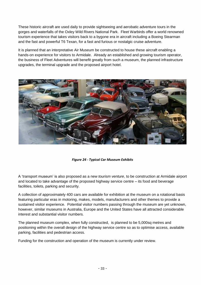
Figure 24 - Typical Car Museum Exhibits
A ‘transport museum’ is also proposed as a new tourism venture, to be construction at Armidale airport
and located to take advantage of the proposed highway service centre – its food and beverage
facilities, toilets, parking and security.
A collection of approximately 400 cars are available for exhibition at the museum on a rotational basis
featuring particular eras in motoring, makes, models, manufacturers and other themes to provide a
sustained visitor experience. Potential visitor numbers passing through the museum are yet unknown,
however, similar museums in Australia, Europe and the United States have all attracted considerable
interest and substantial visitor numbers.
The planned museum complex, when fully constructed, is planned to be 5,000sq metres and
positioning within the overall design of the highway service centre so as to optimise access, available
parking, facilities and pedestrian access.
Funding for the construction and operation of the museum is currently under review.

- 34 -
Saumarez Homestead
This 10 hectare grazing property, named after the Dumaresq Estate in the Channel Islands, was first
inhabited by Henry Dumaresq in the 1830’s. With its well supplied store, tools, clothing and basic
foods, Saumarez in its early years was the last stopping point for settlers before they moved north. A
Now Saumarez is a historic country homestead with gardens, farm buildings and a café; providing an
interesting insight into rural life in the late 1800’s.
Figure 25 - Saumarez Homestead, South West of Armidale Regional Airport
Saumarez Homestead is an elegant, 30 room, fully furnished Edwardian homestead that was further
extended between 1888 and 1910. Available for both guided tours for casual visitors, coach tours,
weddings, celebrations and conferences; lunch and other refreshments are available from the café
and the homestead includes a National Trust gift shop and ample parking.
To date, access to and from the homestead has been by unsealed road, linking the homestead to the
airport entrance. This has been a particular issue for bus and coach tours who have been unwilling
and unenthusiastic to expose their vehicles to this road. This airport master plan proposes a well
formed and sealed road providing access to Saumarez Homestead from the new roundabout to be
constructed on the New England Highway.
The improved access to Saumarez Homestead will further grow visitation to this historic building and
expand its use as a tourism and cultural venue.

- 35 -
Implementation Timetable (Stage 1)

- 36 -
Financial Performance
Implementation of the Airport Master Plan will enable diversification away from what are currently
aviation related revenues, to a broader range of income producing activities. This diversification will
reduce council’s exposure to the cyclical nature of the aviation industry, with broader and more stable
revenues including rates and lease income.
The chart below, Figure 26, is based on 2015 passenger movements and current charges (fees, rates
and leases) and assumes that 60% of land available for development as part of Stage 1 has been
purchased. It is readily acknowledged that this scenario will not occur in the first few years following
development; however, it does show that a more balanced revenue stream can be achieved over the
longer Plan period.
In addition, this scenario would generate approximately $20M in land sales, growing to $35M (at
current pricing), if all properties available under Stage 1 were to be sold.
Implementation of Stages 2 and 3 would further diversify income to a point where aviation and non-
aviation related revenues would be roughly equal.
A separate (confidential) report has been prepared providing forecasts of financial performance over
the timeframe of the airport master plan.
Figure 26 – Potential to Diversify Airport Revenues (at 2015 prices)

- 37 -
APPENDIX
Bibliography
Armidale Airport Infrastructure Business Case [Report] / auth. Group AEC. - Sydney : [s.n.], March 2015.
Armidale Economic Development & Tourism Strategy [Report] / auth. AECgroup. - Sydney : [s.n.], May 2011.
Armidale Industrial Land Study [Report] / auth. AECgroup. - May 2013.
Armidale Regional Airport Industrial Lands Vehicle Access Management Strategy and Traffic Study [Report] / auth. Consultants GTA. - 2014.
Armidale Regional Airport Master Plan [Report] / auth. Airplan. - May 2014.
Figures
Figure 1 – Location of Armidale Regional Airport ...................................................................................... 1
Figure 2 – Annual Passenger Movement Growth Scenarios to 2035......................................................... 3
Figure 3 - Stakeholder and Community Consultation Process ................................................................... 4
Figure 4 - Point to Point Flight Routing ...................................................................................................... 5
Figure 5 - Hub and Spoke Flight Routing .................................................................................................... 5
Figure 6 - Map showing Passenger Catchment for Armidale Regional Airport ......................................... 6
Figure 7 - Potential routes from NE Regional Airport- serving as a rural-hub ........................................... 7
Figure 8 - Airport Master Plan ................................................................................................................... 8
Figure 9 – Demand for Industrial Land ...................................................................................................... 9
Figure 10 - Potential Land for Industrial Development ............................................................................ 10
Figure 11 – Two of Fleet Adventure’s War birds ...................................................................................... 12
Figure 12 – A typical Residential Airpark development ........................................................................... 13
Figure 13 - Location of Proposed Development Lots to allow for Staged Development ......................... 15
Figure 14 - Staged Development of the Airport Site ................................................................................ 17
Figure 15 - Artist Impression of Kempsey Service Centre (Pacific Highway) ............................................ 18
Figure 16 - Typical layout of a Highway Service Centre (South Kempsey) ............................................... 19
Figure 17 - Typical Regional Airport Hotel (55 rooms) ............................................................................. 20
Figure 18 - Typical Airport Garden ........................................................................................................... 21
Figure 19 - Concept Plan for Upgraded Terminal Facilities ..................................................................... 24
Figure 20 - Car Park area preserving land for potential Terminal Expansion .......................................... 26
Figure 21 – Two Cessna Citation Aircraft, as used in Edwards Air Charter fleet ..................................... 31
Figure 22 - Fleet Adventures, Heli-tour of the 7 Georges ........................................................................ 32
Figure 23 - Czechoslovakian L39 attack fighter, part of Fleet War birds Historic Collection ................... 32
Figure 24 - Typical Car Museum Exhibits ................................................................................................. 33
Figure 25 - Saumarez Homestead, South West of Armidale Regional Airport ........................................ 34
Figure 26 – Potential to Diversify Airport Revenues (at 2015 prices) ...................................................... 36

- 38 -
Attached Plans
Airport Master Plan (A3)
Airport Terminal Upgrade (A3)
Proposed Apron Extension (A3)
Proposed [Expanded] Car Park (A3)
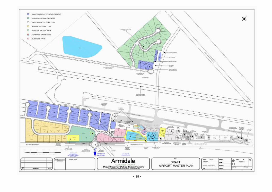
- 39 -
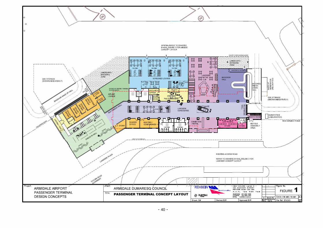
- 40 -

- 41 -

- 42 -

- 43 -
Notes:

- 44 -
Notes: